Perry-Castañeda Library
Map Collection
Country and Regional Map Sites
Click on letter to select a country, continent, region, ocean or sea:
A, B, C, D, E, F, G, H, I, J, K, L, M, N, O, P, Q, R, S, T, U, V, W, X, Y, ZU.S. Maps and World Maps
The following are links to maps of continents, countries, territories, regions, oceans and seas. Most links are to maps on other web sites. For the convenience of users, we include links to country map collections on our own University of Texas at Austin Map Collection web site.
Updated 6/19/19
- Bing Maps
- Google Maps
- HRW World Atlas
- National Geographic Society - MapMaker Interactive
- OnTheWorldMap
- Pat Open Source Atlas
- Reference Maps (Atlas of Canada)
- ReliefWeb - Maps
- United Nations Cartographic Section - Maps
- World Sites Atlas
- Adriatic Sea (Wikipedia) Afghanistan
- Afghanistan Maps (University of Texas at Austin Map Collection)
- Afghanistan Maps on other web sites Our extensive collection of links
- Afghanistan (Lonely Planet)
- Afghanistan (United Nations) [PDF]
- Afghanistan - Election Maps [2009] (New York Times)
- Afghanistan - Mineral Industry (USGS) and Map Key Africa
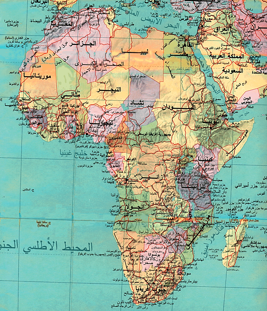
- Africa Maps (University of Texas at Austin Map Collection)
- Africa (Natural Resources Canada) [PDF]
- Africa [in French] (Natural Resources Canada) [PDF]
- Africa (United Nations) [PDF]
- Africa - Arabic Map (University of Pennsylvania)
- Africa - East (United Nations) [PDF]
- Africa - Economic Commission for Africa (United Nations) [PDF]
- Africa - Environmental Atlas - Africa's Lakes: Atlas of Our Changing Environment (UNEP) [PDF]
- Africa - Geology, Oil and Gas Fields - Clickable Map (USGS)
- Africa - Great Lakes Region (United Nations) [PDF]
- Africa - HIV/AIDS Maps (U.S. Bureau of the Census)
- Africa - Horn of Africa - Political Map (United Nations) [PDF]
- Africa - Horn of Africa - Shaded Relief Map (United Nations) [PDF]
- Africa - Okavango River Basin (United Nations) [PDF]
- Africa - Oil and Gas Fields and Geological Provinces - Clickable Map (USGS)
- Africa - Political (Graphic Maps)
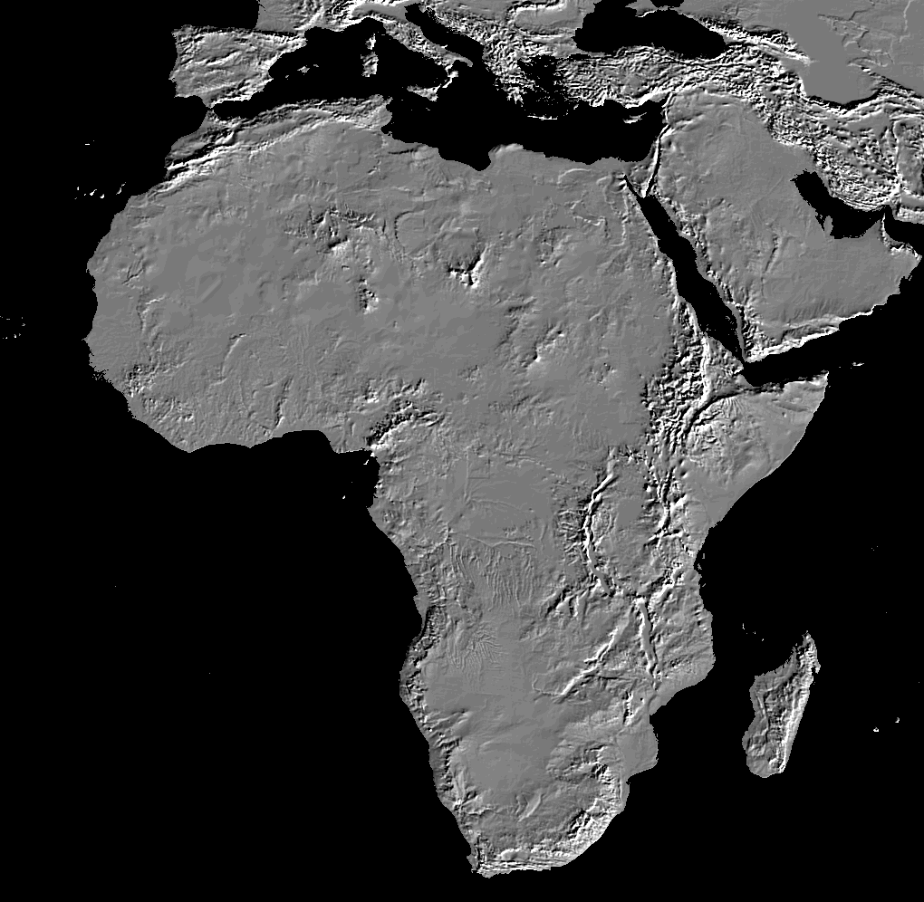
- Africa - Shaded Relief (National Geophysical Data Center)
- Africa - South East Africa Drainage Map (United Nations) [PDF]
- Africa - Topographic Maps (University of Texas at Austin Map Collection) Series 2201, U.S. Army Map Service. Original scale 1:2,000,000.
- Africa - Vegetation and Plant Distribution Maps (Claire Englander and Philip Hoehn)
- Africa - West (United Nations) [PDF]
- Africa - Yellow Fever Zone (WHO) Albania
- Albania Maps (University of Texas at Austin Map Collection)
- Albania (Lonely Planet)
- Albania (United Nations) [PDF]
- Albania - Maps (ReliefWeb)
- Albania - Mineral Industry (USGS) and Map Key
- Albania - Political (United Nations) [PDF]
- Albania-Yugoslavia Border Map (Mario Profaca) Algeria
- Algeria Maps (University of Texas at Austin Map Collection)
- Algeria (Lonely Planet)
- Algeria - North and West (Oran2) Amazon
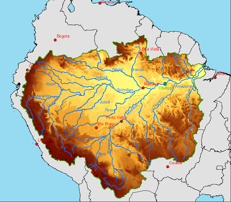
- Amazon - Rain Forests (Mongabay)
- Amazon River Basin (Clim-Amazon) Andorra
- Andorra (HRW)
- Andorra (Ezilon)
- Andorra (Lonely Planet) Angola
- Angola Maps (University of Texas at Austin Map Collection)
- Angola (Lonely Planet)
- Angola (United Nations) [PDF]
- Angola - Uige Province - Site of Marburg Outbreak (WHO) Anguilla
- Anguilla (Caribbean-on-line) Antarctica
- Antarctica Maps (University of Texas at Austin Map Collection)
- Antarctica (Natural Resources Canada) [PDF]
- Antarctica - Atlas of Antarctic Research (USGS/NSF)
- Antarctica - Topographic Maps (U.S. Antarctic Resource Center) Antigua and Barbuda
- Antigua Map (Caribbean-On-Line)
- Barbuda Map (Caribbean-On-Line) Arab World
- Arab World (ArabBay)
- Arab World - in French (Le Monde Diplomatique) Arctic Ocean
- Arctic Maps (University of Texas at Austin Map Collection)
- Arctic - Maritime Jurisdiction and Boundaries in the Arctic Region (Durham University) [PDF] Argentina
- Argentina Maps (University of Texas at Austin Map Collection)
- Argentina (Lonely Planet)
- Argentina - Language Map (Ethnologue)
- Argentina - Tierra del Fuego (Ushuaia Internet) Armenia
- Armenia Maps (University of Texas at Austin Map Collection)
- Armenia (Armenian Assembly of America)
- Armenia (Lonely Planet)
- Armenia (United Nations) [PDF] Aruba
- Aruba Maps (Netherlands Antilles) (Caribbean-On-Line)
- Aruba - Vegetation Map (USGS Caribbean Vegetation Mapping Project/Web Archive) Ascension
- Ascension Island (Wikipedia)
- Ascension Island - Topographic (WorldAtlas.com) Asia
- Asia Maps (University of Texas at Austin Map Collection)
- Asia (Natural Resources Canada) [PDF]
- Asia - Asian Highway Route Map (UN ESCAP)
- Asian Highway Route Map (Wikipedia)
- Asia - Central (United Nations) [PDF]
- Asia - East - Geology, Oil and Gas Fields - Clickable Map (USGS)
- Asia - Physical Map (JohoMaps)
- Asia - South (United Nations) [PDF]
- Asia - South - Geology, Oil and Gas Fields - Clickable Map (USGS)
- Asia - Southeast - "Greater Mekong Subregion" (United Nations) [PDF]
- Asia - Southeast - Geology, Oil and Gas Fields - Clickable Map (USGS)
- Asia - Southwest, Clickable Map (IRIRW)
- Asia - Vegetation and Plant Distribution Maps (Claire Englander and Philip Hoehn)
- Asia - West (United Nations/Internet Archive) [PDF] Atlantic Ocean
- Atlantic Ocean Maps (University of Texas at Austin Map Collection)
- Atlantic Ocean (National Geographic)
- Atlantic Ocean - North (HRW World Atlas)
- Atlantic Ocean - South (HRW World Atlas) Australia
- Australia Maps (University of Texas at Austin Map Collection)
- Australia (Lonely Planet)
- Australia - Geology, Oil and Gas Fields - Clickable Map (USGS)
- Australia - Gold Coast [Queensland]
- Australia - Great Barrier Reef (Arta.com.au)
- Australia - Great Barrier Reef (Dive the World)
- Australia - Great Barrier Reef (GoFishAustralia) [PDF]
- Australia - Interactive Atlas (Whereis.com)
- Australia - Language Maps (Ethnologue)
- Australia - Oceania (Graphic Maps)
- Australia - Route Planning (Travelmate)
- Australia - Thematic Maps (Geoscience Australia)
- Australia - Torres Strait Islands (Wikipedia) Austria
- Austria Maps (University of Texas at Austin Map Collection)
- Austria (Lonely Planet)
- Austria - Interactive Map (Austria Map Online)
- Austria - Railways (Trainspotting B�kkes) Azerbaijan
- Azerbaijan Maps (University of Texas at Austin Map Collection)
- Azerbaijan (Lonely Planet)
- Azerbaijan (United Nations) [PDF]
- Azerbaijan - Maps (ReliefWeb)
- Azerbaijan - Nagorno Karabakh Location Map (BBC News) Azores
- Azores Map (University of Texas at Austin Map Collection)
- Azores - Terceira Island (Angrajazz.com) Bahamas
- Bahamas (Guides Ulysse)
- Bahamas - Abaco Islands - Central (DataFile, Inc.)
- Bahamas - Abaco Islands - North (DataFile, Inc.)
- Bahamas - Abaco Islands - Satellite Map (DataFile, Inc.)
- Bahamas - Abaco Islands - South (DataFile, Inc.)
- Bahamas - Eleuthera - North (DataFile, Inc.)
- Bahamas - Eleuthera - Central (DataFile, Inc.)
- Bahamas - Eleuthera - North-Central (DataFile, Inc.)
- Bahamas - Eleuthera - Satellite Map (DataFile, Inc.)
- Bahamas - Eleuthera - South (DataFile, Inc.)
- Bahamas - Great Exuma (DataFile, Inc.)
- Bahamas - Great Exuma - Satellite Map (DataFile, Inc.)
- Bahamas - Harbour Island (DataFile, Inc.)
- Bahamas - Harbour Island - Satellite Map (DataFile, Inc.)
- Bahamas Maps (Bahamas-On-Line)
- Bahamas Maps (Peter Loud) Bahrain
- Bahrain (Lonely Planet)
- Bahrain (United Nations) [PDF] Baltic States
- Baltic States (United Nations) [PDF] Bangladesh
- Bangladesh Maps (University of Texas at Austin Map Collection)
- Bangladesh (Lonely Planet)
- Bangladesh (United Nations) [PDF]
- Bangladesh - Mineral Industry (USGS) and Map Key Barbados
- Barbados Maps (Caribbean-On-Line)
- Barbados - Topographic (Ontheworldmap) Barents Sea
- Barnets Sea (UNEP/GRID) [PDF]
- Barents Sea (Wikipedia)
- Barents Sea - Atlas (GRID/Arendal) Belarus
- Belarus Maps (University of Texas at Austin Map Collection)
- Belarus (Friends and Partners)
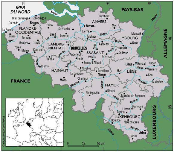
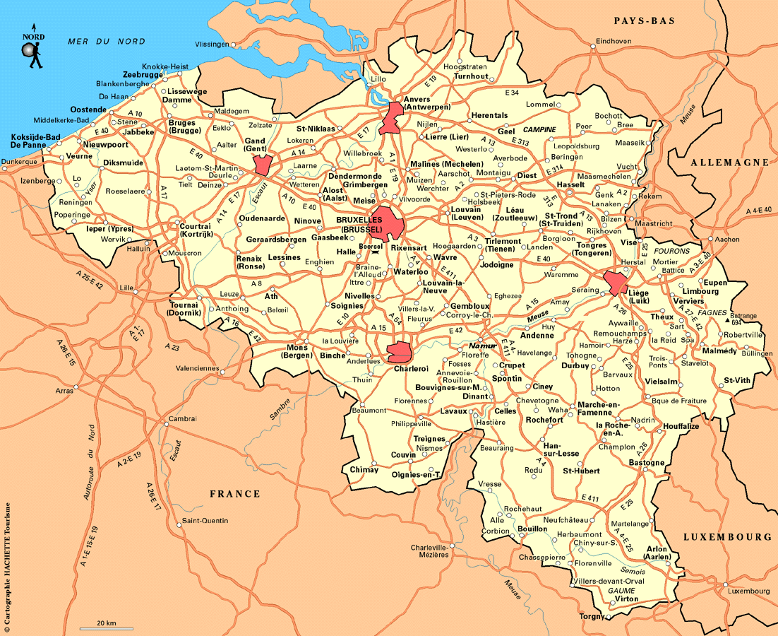
- Belarus (United Nations) [PDF] Belgium
- Belgium Maps (University of Texas at Austin Map Collection)
- Belgium (Lonely Planet)
- Belgium (Ouellette001)
- Belgium (Routard.com) Belize
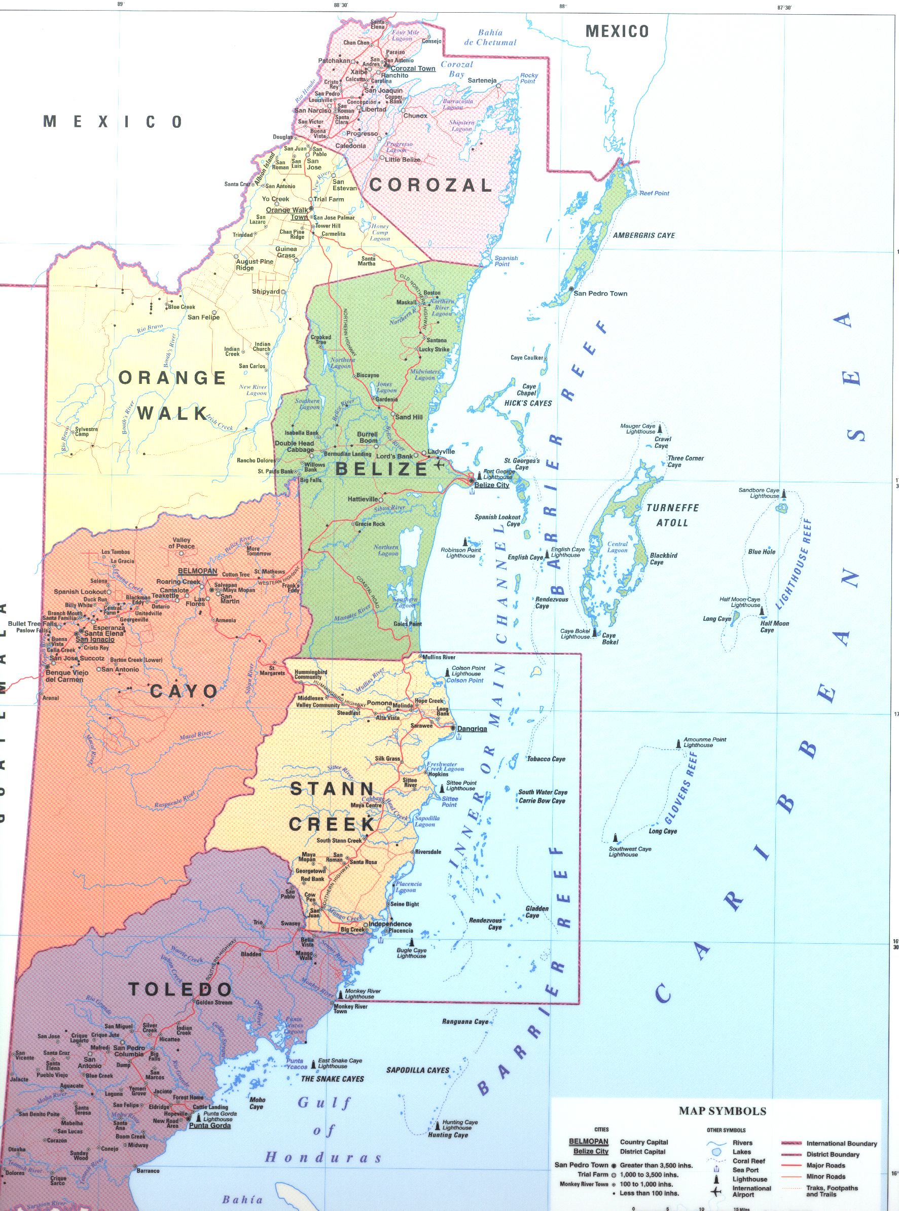
- Belize Maps (University of Texas at Austin Map Collection)
- Belize (Lonely Planet)
- Belize - Maps (Belize.Net)
- Belize (Progresso Heights)
- Belize - Maps (Don Moore) Benin
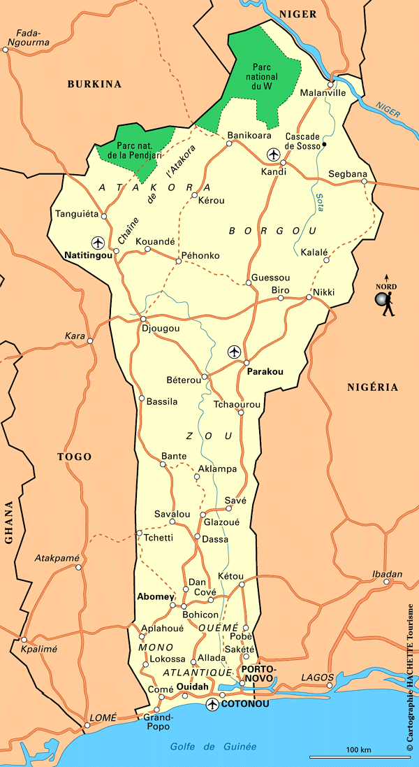
- Benin Maps (University of Texas at Austin Map Collection)
- Benin (Lonely Planet)
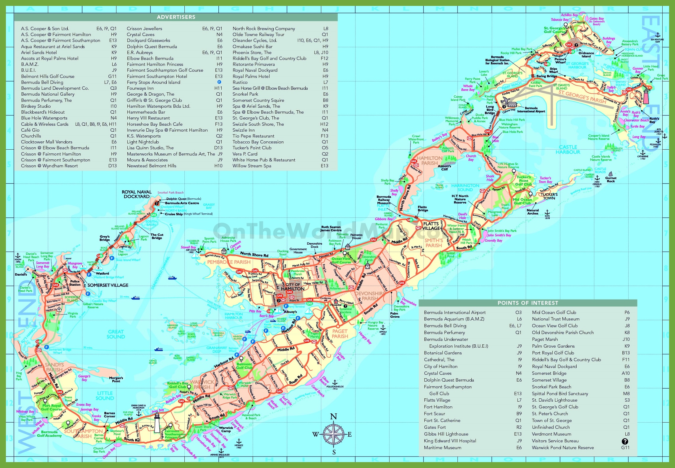
- Benin (Routard.com) Bermuda
- Bermuda (New York Times)
- Bermuda (OnTheWorldMap) Bhutan
- Bhutan Maps (University of Texas at Austin Map Collection)
- Bhutan (Nations Online)
- Bhutan - Maps (Windhorse Tours) Bolivia
- Bolivia Maps (University of Texas at Austin Map Collection)
- Bolivia (Lonely Planet)
- Bolivia (United Nations) [PDF]
- Bolivia - Lake Titicaca (Lonely Planet) Bonaire
- Bonaire - Maps (Floribbeandivers.com) Bosnia
- Bosnia Maps (University of Texas at Austin Map Collection)
- Bosnia (Lonely Planet)
- Bosnia (United Nations) [PDF]
- Bosnia - Maps (ReliefWeb) Botswana
- Botswana Maps (University of Texas at Austin Map Collection)
- Botswana (Lonely Planet)
- Botswana - National Parks (Africa Odyssey)
- Botswana - Okavango River Basin (United Nations) [PDF] Bougainville Island
- Bougainville Island (United Nations) [PDF] Bouvet Island
- Bouvet (Norsk Polarinstitutt)
- Bouvet Island (Paul Carroll/Internet Archive) [PDF] Brazil
- Brazil Maps (University of Texas at Austin Map Collection)
- Brazil (Guia Geografico)
- Brazil (Lonely Planet)
- Brazil - Geology (About.com)
- Brazil - Interactive Road/Street Map (Map24.com)
- Brazil - Languages (Ethnologue)
- Brazil - Vegetation Map (Guianet) British Indian Ocean Territory
- British Indian Ocean Territory (WorldAtlas.com) British Virgin Islands
- British Virgin Islands - Maps (Caribbean-On-Line) Brunei
- Brunei (Lonely Planet)
- Brunei - Mineral Industry (USGS) and Map Key Bulgaria
- Bulgaria Maps (University of Texas at Austin Map Collection)
- Bulgaria (Lonely Planet) Burkina Faso
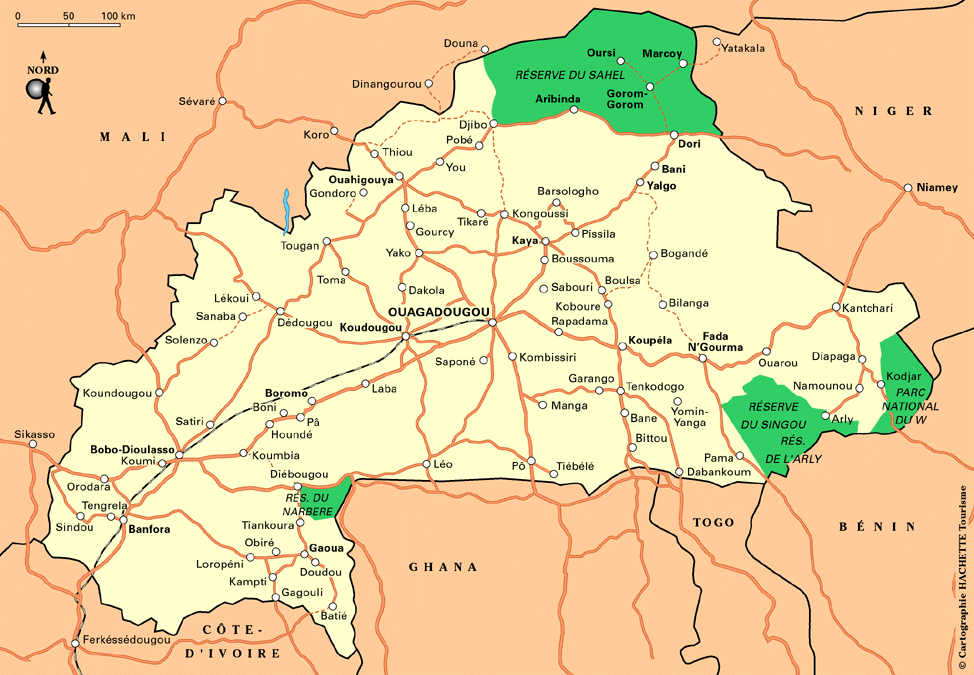
- Burkina Faso Maps (University of Texas at Austin Map Collection)
- Burkina Faso (Lonely Planet)
- Burkina Faso (Routard.com)
- Burkina Faso (United Nations) [PDF]
- Burkina Faso - Language Map (Ethnologue) Burma
- Burma Maps (University of Texas at Austin Map Collection)
- Myanmar (International Labor Organization)
- Myanmar (Lonely Planet)
- Myanmar (United Nations) [PDF]
- Burma - Opium Poppy Growing Areas (PBS)
- Burma - Mineral Industry (USGS) and Map Key
- Burma/Thailand Border - Refugee Camps 2000 (Le Monde Diplomatique) Burundi
- Burundi Maps (University of Texas at Austin Map Collection)
- Burundi (Lonely Planet)
- Burundi (United Nations) [PDF]
- Burundi (worldatlas.com) Cambodia
- Cambodia Maps (University of Texas at Austin Map Collection)
- Cambodia (Lonely Planet)
- Cambodia (United Nations) [PDF]
- Cambodia - Mineral Industry (USGS) and Map Key
- Cambodia - Tourist Map (Asia Travel) Cameroon
- Cameroon Maps (University of Texas at Austin Map Collection)
- Cameroon (Lonely Planet)
- Cameroon - Area of Bakassi (United Nations) [PDF] Canada
- Canada Maps (University of Texas at Austin Map Collection) Extensive collection of maps and off-site links
- Canada - Atlas of Canada (Natural Resources Canada) Canary Islands
- Canary Islands Maps (University of Texas at Austin Map Collection)
- Canary Islands (Lonely Planet)
- Canary Islands - Gran Canaria/Grand Canary (VRCanaries) Cape Verde
- Cape Verde Maps (University of Texas at Austin Map Collection)
- Cape Verde (BBC News)
- Cape Verde (HRW)
- Cape Verde (Lonely Planet) Caribbean Sea
- Caribbean (CNN)
- Caribbean (Holt, Rinehart and Winston)
- Caribbean (Jamaicans.com) Caspian Sea
- Caspian Region Oil Pipelines (PCL Map Collection) (CIA) April 2002 [PDF]
- Caspian Sea Region (Owl and Mouse) Cayman Islands
- Cayman Islands Maps (Caribbean-On-Line) Central African Republic
- Central African Republic Maps (University of Texas at Austin Map Collection)
- Central African Republic (Lonely Planet)
- Central African Republic (United Nations) [PDF] Central America
- Central America - Shaded Relief Map (National Geographic) Chad
- Chad Maps (University of Texas at Austin Map Collection)
- Chad (United Nations) [PDF]
- Chad - Nilo-Saharan Languages (Library of Congress) [PDF] Chechnya
- Chechnya Maps (University of Texas at Austin Map Collection)
- Chechnya - Location (Guardian Unlimited) Chile
- Chile Maps (University of Texas at Austin Map Collection)
- Chile (Lonely Planet)
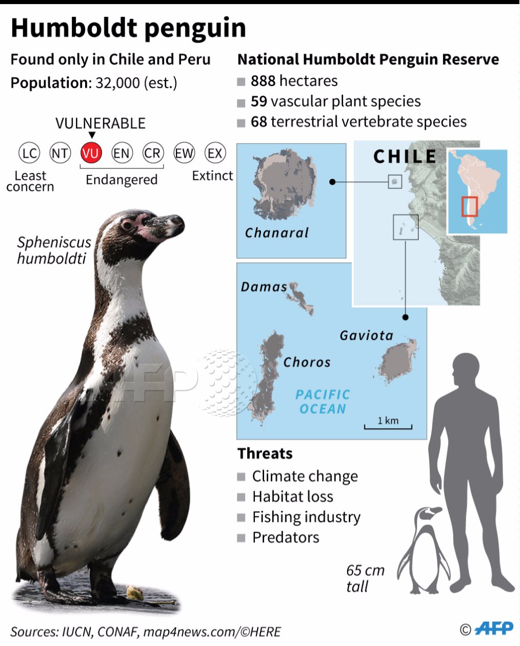
- Chile - National Humboldt Penguin Reserve (AFP) China
- China Maps (University of Texas at Austin Map Collection)
- China (Lonely Planet)
- China - Administrative Map (JohoMaps)
- China - Geology, Oil and Gas Fields - Clickable Map (USGS)
- China - Guangdong Province (Maps-of-China.com)
- China - Interactive Maps in Chinese (Ditu.com/Google Maps)
- China - Karakoram Highway (Johnthemap)
- China - Maps (China Tourist Maps)
- China - Maps (maps-of-china.com)
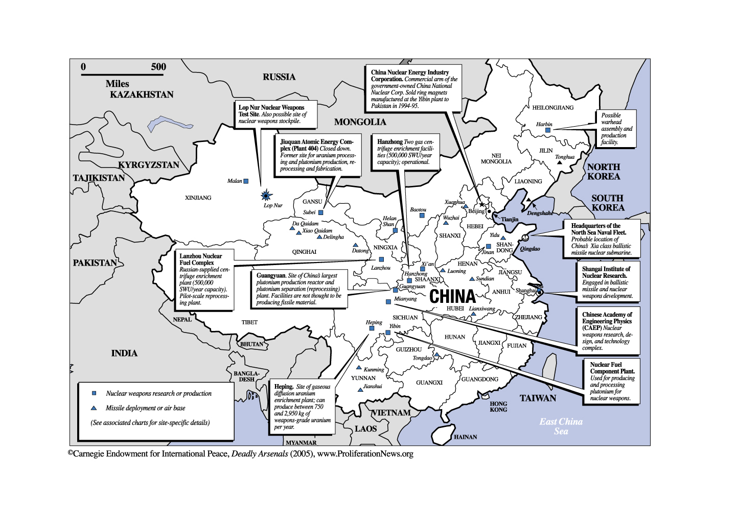
- China - Nuclear Facilities (Carnegie Endowment)
- China - Physical Map (JohoMaps)
- China - Railway Map (JohoMaps)
- China - Senkaku/Diaoyutai Islands Dispute (GlobalSecurity.org)
- China - Silk Road (China Tourist Maps)
- China - Tibet (Lonely Planet)
- China - Tibet Maps (T. Matthew Ciolek)
- China - Topographic Maps - U.S. Army Map Service, Series L500 (China Series), original scale 1:250,000 (University of Texas at Austin Map Collection)
- China - Topographic Maps - U.S. Army Map Service, Series L542 (Manchuria Series), original scale 1:250,000 (University of Texas at Austin Map Collection)
- China - Xinjiang Uygur Province (Maps-of-China.com)
- China - Yunnan Province (Chinaplanner.com) Christmas Island [Indian Ocean]
- Christmas Island (Australia) - Mineral Industry (USGS) and Map Key Colombia
- Colombia Maps (University of Texas at Austin Map Collection)
- Colombia (HRW)
- Colombia (Lonely Planet)
- Colombia - Guerrillas and Paramilitary Forces (Le Monde Diplomatique)
- Colombia - Major Volcanoes (USGS) Comoros
- Comoros Maps (University of Texas at Austin Map Collection)
- Comoros (United Nations) [PDF]
- Comoros (WorldAtlas.com) Congo, Democratic Republic
- Congo, Democratic Republic Maps (University of Texas at Austin Map Collection)
- Congo, Democratic Republic (United Nations) [PDF]
- Congo, Democratic Republic - Areas Held by MLC and RCD, 10 February 2003 (BBC)
- Congo, Democratic Republic - Areas Held by MLC and RCD, 14 May 2003 (BBC)
- Congo, Democratic Republic - Maps (UNOSAT)
- Congo, Democratic Republic - Mineral Industry (USGS) and Key to Map Congo, Republic
- Congo Republic Maps (University of Texas at Austin Map Collection)
- Congo, Republic (United Nations) [PDF] Cook Islands
- Cook Islands (Lonely Planet)
- Cook Islands (Map South Pacific)
- Cook Islands Maps (Jarvy Web)
- Cook Islands Maps (Jim Bruce)
- Cook Islands - Rarotonga (Lonely Planet) Costa Rica
- Costa Rica Maps (University of Texas at Austin Map Collection)
- Costa Rica (Guides Ulyssee)
- Costa Rica (Lonely Planet)
- Costa Rica - Cocos Island (PBS) Select "Explore the Island" for map
- Costa Rica Maps (Costa Rica's TravelNet)
- Costa Rica (Guides Ulysse)
- Costa Rica Maps (Maptak)
- Costa Rica Maps (Moon Publications/web Travel Review) Cote d'Ivoire
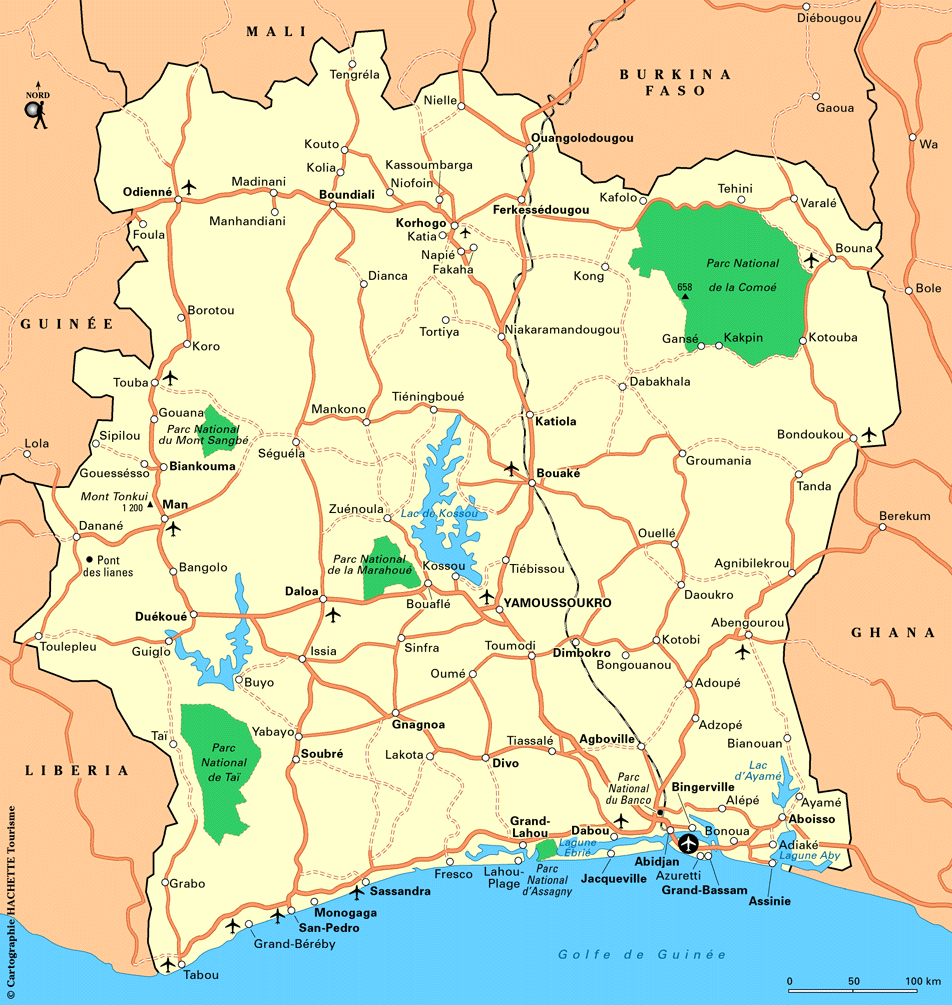
- Cote d'Ivoire Maps (University of Texas at Austin Map Collection)
- Cote d'Ivoire (Lonely Planet)
- Cote d'Ivoire (Routard.com)
- Cote d'Ivoire (United Nations) [PDF]
- Cote d'Ivoire - Rebel-dominated Areas December 2002 (BBC News)
- Cote d'Ivoire - Rebel-dominated Areas May 2003 (BBC News)
- Cote d'Ivoire - Rebel-dominated Areas December 2003 (BBC News)
- Cote d'Ivoire - UNOCI (United Nations Operation in C�te d'Ivoire) Deployment, 2008 [PDF]
- Ivory Coast - Situation Map [March 31, 2011] (BBC News) Croatia
- Croatia Maps (University of Texas at Austin Map Collection)
- Croatia (United Nations) [PDF]
- Croatia - Eastern (United Nations) [PDF]
- Croatia - Interactive Map (Cromaps) Crozet Islands
- Crozet Islands (NDSU)
- Crozet Islands - Interactive Atlas (G�oPortail) Cuba
- Cuba Maps (University of Texas at Austin Map Collection)
- Cuba (Guides Ulyssee)
- Cuba (Lonely Planet)
- Cuba (WorldAtlas.com) Curacao
- Curacao Maps (Netherlands Antilles) (Caribbean-On-Line) Cyprus
- Cyprus Maps (University of Texas at Austin Map Collection)
- Cyprus (United Nations) [PDF]
- Cyprus - U.N. Peace-keeping Force in Cyprus - UNFICYP (United Nations) [PDF] Czech Republic
- Czech Republic Maps (University of Texas at Austin Map Collection)
- Czech Republic (Lonely Planet)
- Czech Republic (United Nations) [PDF] Dagestan
- Dagestan Maps (University of Texas at Austin Map Collection)
- Dagestan (Wikipedia)
- Dagestan - Russia - Geology, Oil and Gas Fields - Clickable Map (USGS) Denmark
- Denmark Maps (University of Texas at Austin Map Collection)
- Denmark (Lonely Planet)
- Denmark - Interactive Maps and Aerial Photography (Denmark, Ministry of Culture) Note: Select pull-down menu "Sogning", then select "Geografisk" Dominica
- Dominica (HRW)
- Dominica - Maps (Caribbean-On-Line) Dominican Republic
- Dominican Republic Maps (University of Texas at Austin Map Collection)
- Dominican Republic (Guides Ulysse)
- Dominican Republic (Routard.com)
- Dominican Republic - Maps (Caribbean-On-Line)
- Dominican Republic - Maps (Hispaniola.com) Djibouti
- Djibouti Maps (University of Texas at Austin Map Collection)
- Djibouti (HRW)
- Djibouti (Mappery)
- Djibouti - Geological Map (JPB-Imagine) East Timor
- East Timor Maps (University of Texas at Austin Map Collection)
- East Timor (ETAN/US)
- East Timor (National Geographic)
- East Timor (United Nations) [PDF] Easter Island
- Easter Island (Map South Pacific)
- Easter Island (PBS) Ecuador
- Ecuador Maps (University of Texas at Austin Map Collection)
- Ecuador (Lonely Planet)
- Ecuador (United Nations) [PDF]
- Ecuador - Galapagos Islands (Ecuador Explorer)
- Ecuador - Galapagos Islands - Geology - Clickable Map (W.M. White) Egypt
- Egypt Maps (University of Texas at Austin Map Collection)
- Egypt (United Nations) [PDF]
- Egypt - Multinational Force Observers (MFO) in the Sinai [August 2015] (Stratfor)
- Egypt - Nile River Basin (World Bank) El Salvador
- El Salvador Maps (University of Texas at Austin Map Collection)
- El Salvador (Lonely Planet)
- El Salvador (United Nations) [PDF] England
- England - see also United Kingdom
- England (Europe-Map)
- England - Maps (TravelUK.co.uk) Equatorial Guinea
- Equatorial Guinea Maps (University of Texas at Austin Map Collection)
- Equatorial Guinea (United Nations) [PDF] Eritrea
- Eritrea Maps (University of Texas at Austin Map Collection)
- Eritrea (United Nations) [PDF]
- Eritrea and Ethiopia - Disputed Border Areas January 2000 (Le Monde Diplomatique) Estonia
- Estonia Maps (University of Texas at Austin Map Collection)
- Estonia (United Nations) [PDF]
- Estonia - Searchable Atlas (Institute of Baltic Studies) Ethiopia
- Ethiopia Maps (University of Texas at Austin Map Collection)
- Ethiopia - Maps (ReliefWeb)
- Ethiopia - Oromia [Anti-Government Web Site] (Oromo Liberation Front)
- Ethiopia - Regions (UN OCHA Ethiopia) Europe
- Europe Maps (University of Texas at Austin Map Collection)
- Europe (Natural Resources Canada) [PDF]
- Europe - Central and Eastern (United Nations) [PDF]
- Europe - Culture Maps (Eupedia)
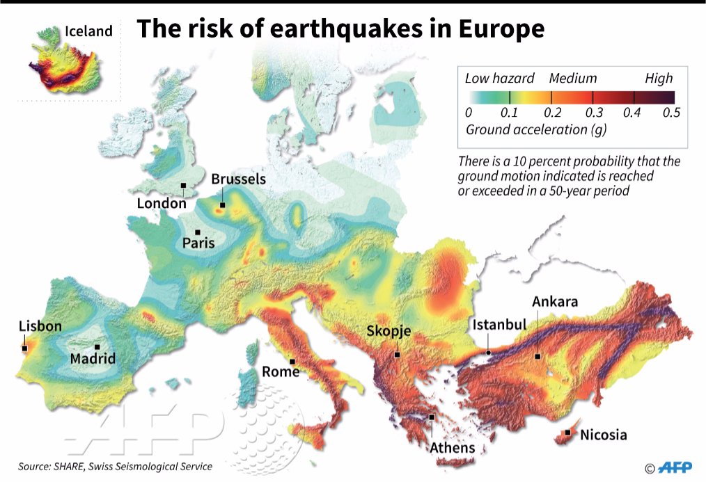
- Europe - Earthquake Risk (AFP)
- Europe - Economic Commission for Europe (United Nations) [PDF]
- Europe - Environmental Impact of Chernobyl (BBC News)
- Europe - European Union Member States (Nations Online)
- Europe - Gas Pipelines - From Russia to Europe: Natural Gas Pipelines (NPR)
- Europe - Immigration - Principal Spaces of Detention (EPIM)
- Europe - Migrant Crisis Map [August 2015] (The Independent)
- Europe - NATO Countries Map (NATO)
- Europe - Political (Graphic Maps)
- Europe - Railways (Trainspotting B�kkes)
- Europe - Routes of African Immigration to Europe, 2004 (Le Monde)
- Europe - Spanish Language Map (HRW World Atlas)
- Europe - World Heritage Sites[JAVA virtual machine required] Falkland Islands
- Falkland Islands (Lonely Planet)
- Falkland Islands - Falklands War (BBC)
- Islas Malvinas (Zonu) Faroe Islands
- Faroe Islands (Lonely Planet)
- Faroe Islands (PlanetWare) Fiji
- Fiji Maps (University of Texas at Austin Map Collection)
- Fiji (Lonely Planet)
- Fiji (Map South Pacific)
- Fiji (Wikipedia)
- Fiji - Mineral Industry (USGS) and Map Key Finland
- Finland Maps (University of Texas at Austin Map Collection)
- Finland (Lonely Planet)
- Finland - Interactive Map (Map Site) France
- France Maps (University of Texas at Austin Map Collection)
- France (Lonely Planet)
- France - Alps (Routard.com)
- France - Alsace (Routard.com)
- France - Interactive Maps/Images [includes French overseas territories] (Geoportail)
- France - Maps (About-France.com)
- France - Maps (French Property, Services and Information Ltd.)
- France - Railways (Trainspotting B�kkes)
- France - Thematic and Electoral Maps (Documentation Française) French Guiana
- French Guiana Maps (University of Texas at Austin Map Collection)
- French Guiana (Lonely Planet)
- French Guiana (Routard.com)
- French Guiana (Guyane) - Interactive Atlas (G�oPortail) French Polynesia
- French Polynesia (HRW)
- French Polynesia (Map South Pacific)
- French Polynesia (Wikimedia) Gabon
- Gabon Maps (University of Texas at Austin Map Collection)
- Gabon (MBendi) Galapagos Islands
- Galapagos Islands [Ecuador] (Ecuador Explorer)
- Galapagos Islands [Ecuador] Geology - Clickable Map (W.M. White) The Gambia
- Gambia Maps (University of Texas at Austin Map Collection)
- Gambia (HRW)
- Gambia (Lonely Planet)
- Gambia - Maps (Access Gambia) Gaza
- Gaza Maps (University of Texas at Austin Map Collection)
- Gaza (Reliefweb)
- Gaza - Israeli Security Zone 1994-2007 (Applied Research Institute, Jerusalem)
- Gaza - Israeli Settlements in Gaza, 2005 (BBC News)
- Gaza - Israel's Disengagement Plan, 2005 (BBC News)
- Gaza - West Bank and Gaza Governorates 1995 (Applied Research Institute, Jerusalem) Georgia
- Georgia Maps (University of Texas at Austin Map Collection)
- Georgia (BBC News)
- Georgia (Lonely Planet)
- Georgia (Nations Online)
- Georgia (United Nations) [PDF]
- Georgia - Abkhazia (Vidiani)
- Georgia - Regions (About Georgia)
- Georgia - South Ossetia - Location Map (BBC News) Germany
- Germany Maps (University of Texas at Austin Map Collection)
- Germany (airline-reservation.com)
- Germany (Lonely Planet)
- Germany - City Maps (Stadtplandienst)
- Germany - Railways (European Rail Guide)
- Germany - Railways (Trainspotting B�kkes)
- Germany - U.S. Military Bases (Globemaster) Ghana
- Ghana Maps (University of Texas at Austin Map Collection)
- Ghana (Lonely Planet) Gibraltar
- Gibraltar (GeoAtlas)
- Gibraltar (Lonely Planet) Great Britain
- Great Britain - see United Kingdom Greece
- Greece Maps (University of Texas at Austin Map Collection)
- Greece (Lonely Planet)
- Greece (United Nations) [PDF]
- Greece - Sailing Maps (sailingissues.com) Greenland
- Greenland (Lonely Planet)
- Greenland - Maps (NunaGIS) Grenada
- Grenada (PlanetWare)
- Grenada (Weltrekordreise.ch) Guadeloupe
- Guadeloupe (Guides Ulysse)
- Guadaloupe - East (Routard.com)
- Guadaloupe - West (Routard.com)
- Guadeloupe - Iles des Saintes (French Caribbean International)
- Guadeloupe - Interactive Atlas (G�oPortail)
- Guadeloupe - Marie Galante (French Caribbean International) Guam
- Guam Maps (University of Texas at Austin Map Collection)
- Guam (Lonely Planet)
- Guam - Interactive Map (CCCarto)
- Guam - Central Section (Guam Visitor's Bureau) Guatemala
- Guatemala Maps (University of Texas at Austin Map Collection)
- Guatemala (Guides Ulyssee)
- Guatemala (Lonely Planet)
- Guatemala (United Nations) [PDF]
- Guatemala - Maps (Larutamayaonline.com)
- Guatemala - Major Volcanoes Guinea
- Guinea Maps (University of Texas at Austin Map Collection) Guinea-Bissau
- Guinea Bissau Maps (University of Texas at Austin Map Collection)
- Guinea-Bissau (United Nations) [PDF] Gulf of Mexico
- Gulf of Mexico - Geology, Oil and Gas Fields and Geologic Provinces (USGS)
- Gulf of Mexico - Sea Floor (Port Publishing) Guyana
- Guyana Maps (University of Texas at Austin Map Collection)
- Guyana (Lonely Planet)
- Guyana (Mappery) Haiti
- Haiti Maps (University of Texas at Austin Map Collection)
- Haiti (Haiticulture.ch)
- Haiti (Lonely Planet)
- Haiti (United Nations) [PDF]
- Haiti - Maps (ReliefWeb)
- Haiti - MINUSTAH Deployment (United Nations) [PDF] Heard Island
- Heard Island Maps (Australian Antarctic Data Centre/Internet Archive) Honduras
- Honduras Maps (University of Texas at Austin Map Collection)
- Honduras (Lonely Planet)
- Honduras (United Nations) [PDF]
- Honduras - Clickable Map (Honduras Digital)
- Honduras - National Parks (Honduras Digital) Hong Kong
- Hong Kong (Lonely Planet)
- Hong Kong - Interactive Map (Centamap)
- Hong Kong - Mineral Industry (USGS) and Map Key Hungary
- Hungary Maps (University of Texas at Austin Map Collection)
- Hungary (Lonely Planet)
- Hungary - Maps (Zentai L�szl�) Iceland
- Iceland Maps (University of Texas at Austin Map Collection)
- Iceland (Lonely Planet)
- Iceland - Interactive Road/Street Map (Map24.com) India
- India Maps (University of Texas at Austin Map Collection)
- India (Lonely Planet)
- India - Maps (MapsofIndia.com)
- India - Andaman and Nicobar Islands (MapsofIndia.com)
- India - Border Disputes (The Economist)
- India - Chhattisgarh State - Maps (MapsofIndia.com)
- India - Daman and Diu (MapsofIndia.com)
- India - Geology, Oil and Gas Fields - Clickable Map (USGS)
- India - Goa (Johnthemap)
- India - Gujarat - Area around Bhuj (MapsofIndia.com)
- India - Gujarat Earthquake Location Jan. 26, 2001 (MapsofIndia.com)
- India - Gujarat Maps (MapsofIndia.com)
- India - Hill Stations (MapsofIndia.com)
- Himalaya - Maps
- India - Interactive Map (MapmyIndia.com)
- India - Languages (Jost Gippert)
- India - Languages (Dr. Stephen Huffman) [large PDF]
- India - Mineral Industry (USGS) and Map Key
- India - Naxal Affected Areas "Red Corridor" (IBN Live)
- India - Naxalite Affected Areas (SATP)
- India - Naxalites (Economist.com)
- India - Nuclear Facilities (Monterey Institute of International Studies) [PDF]
- India - Nuclear Related Sites (Carnegie Endowment)
- India - Physical Features (United Nations) [PDF]
- India - Rajasthan - Railway Map (MapsofIndia.com)
- India - State District Maps (Census of India)
- India - Tamil Nadu - Interactive GIS Map (Government of Tamil Nadu)
- India - Topographic Maps, Series U502, 1:250,000, U.S. Army Map Service
- India - Topography (MapsofIndia.com)
- India - Travel Advice Map (Australia Department of Foreign Affairs and Trade)
- India - Wildlife Sanctuaries (MapsofIndia.com)
- Kashmir Maps (University of Texas at Austin Map Collection)
- Jammu and Kashmir (Government of India, Planning Commission)
- Jammu and Kashmir (United Nations) [PDF]
- Jammu and Kashmir Maps (MapsofIndia)
- Kashmir Earthquake - October 8, 2005 (BBC News)
- Kashmir - Future of Kashmir Maps (BBC News)
- Kashmir - Mountain War (Le Monde Diplomatique)
- Kashmir - U.N. Military Observer Group in India and Pakistan (United Nations) [PDF] Indian Ocean
- Indian Ocean Maps (University of Texas at Austin Map Collection)
- Indian Ocean (HRW World Atlas) Indonesia
- Indonesia Maps (University of Texas at Austin Map Collection) Our own maps and extensive links to maps on other sites
- Indonesia (Lonely Planet)
- Indonesia - Topographic Maps - Indonesia Series (T503) - U.S. Army Map Service, 1:250,000 (University of Texas at Austin Map Collection)
- Indonesia - Topographic Maps - New Guinea Series (T504) [includes parts of Irian Jaya] - U.S. Army Map Service, 1:250,000 (University of Texas at Austin Map Collection) Iran
- Iran Maps (University of Texas at Austin Map Collection)
- Iran (Lonely Planet)
- Iran (United Nations) [pdf format]
- Iran - Aeronautical - Series 1501, Joint Operations Graphic (University of Texas at Austin Map Collection)
- Iran - Iranian Missiles, Ranges (Federation of American Scientists)
- Iran in Maps (BBC News)
- Iran - Nuclear Sites (BBC News)
- Iran - Provinces (Iransaga)
- Iran - Railway Maps (IRIRW)
- Iran - Railways (MSEDV)
- Iran - Railways Clickable Map (Raja/Internet Archive)
- Iran - Special Weapons Facilities Maps (Federation of American Scientists)
- Iran - Special Weapons Facilities (GlobalSecurity.org) Iraq
- Iraq Maps (University of Texas at Austin Map Collection)
- Iraq Maps on Other Web Sites (University of Texas at Austin Map Collection)
- Iraq (Ezilon)
- Iraq (hot-maps.de)
- Iraq (United Nations) [PDF] Ireland
- Ireland Maps (University of Texas at Austin Map Collection)
- Ireland (Killamaster House)
- Ireland (Lonely Planet) Israel
- Israel Maps (University of Texas at Austin Map Collection)
- Israel (Lonely Planet)
- Israel (United Nations) [PDF]
- Israel - Clickable Map (GovMap)
- Israel - Golan - UNDOF Deployment (United Nations) [PDF]
- Israel - Interactive Map (EyeonIsrael)
- Israel - Road Map
- Israel - Southeastern Mediterranean (United Nations) [PDF]
- Israel - Water Systems (Global Education Project)
- West Bank (Le Monde Diplomatique)
- West Bank and Gaza Governorates 1995 (Applied Research Institute, Jerusalem)
- West Bank - Map of Security Fence Project 2007 (Israel Ministry of Defence/Internet Archive)
- West Bank - Maps of the Wall in the West Bank (Anti-Wall Campaign)
- West Bank Geopolitical Maps (Applied Research Institute, Jerusalem) Italy
- Italy Maps (University of Texas at Austin Map Collection)
- Italy (Lonely Planet)
- Italy - Central Italy Maps (toscane.pagina.nl)
- Italy - Interactive Atlas (Discover Italia)
- Italy - Interactive Atlas (Virgilio Mappe)
- Italy - Maps (Geoplan)
- Italy - Major Volcanoes (USGS)
- Italy - Opera Map (Operabase)
- Italy - Railways (Trainspotting B�kkes)
- Italy - Sicily Maps (Ragusa OnLine)
- Italy - Sicily Maps (SicilyWeb) Jamaica
- Jamaica Maps (University of Texas at Austin Map Collection)
- Jamaica (Caribbean-On-Line)
- Jamaica (JamaicanCaves) Japan
- Japan Maps (University of Texas at Austin Map Collection)
- Japan (Magellan)
- Japan - Interactive Atlas [in Japanese] (Mapion)
- Japan - Kuril Islands (Magellan)
- Japan - Major Volcanoes (USGS)
- Japan - Mineral Industry (USGS) and Map Key
- Japan - Okinawa - U.S. Military Bases [maps at bottom of page] (GlobalSecurity.org)
- Japan - Senkaku/Diaoyutai Islands Dispute (GlobalSecurity.org)
- Japan - Topographic Maps - U.S. Army Map Service, Series L506, original scale 1:250,000 (University of Texas at Austin Map Collection) Johnston Atoll
- Johnston Atoll (Livingmoon) Jordan
- Jordan Maps (University of Texas at Austin Map Collection)
- Jordan (Lonely Planet) Kashmir
- Kashmir Maps (University of Texas at Austin Map Collection)
- Jammu and Kashmir (United Nations) [PDF]
- Jammu and Kashmir Maps (MapsofIndia)
- Kashmir (Washington Post)
- Kashmir Earthquake - October 8, 2005: BBC News
- Kashmir - Future of Kashmir Maps (BBC News)
- Kashmir - Mountain War (Le Monde Diplomatique)
- Kashmir - U.N. Military Observer Group in India and Pakistan - UNMOGIP (United Nations) [PDF] Kazakhstan
- Kazakhstan Maps (University of Texas at Austin Map Collection)
- Kazakstan (Lonely Planet)
- Kazakhstan (United Nations) [PDF] Kenya
- Kenya Maps (University of Texas at Austin Map Collection)
- Kenya (Vidiani)
- Kenya - Languages (Ethnologue)
- Kenya - National Parks (Africa Odyssey) Kerguelen
- Kerguelen (Paul Carroll/Internet Archive)
- Kerguelen - Interactive Atlas (G�oPortail)
- Kerguelen - Satellite Image (www.univ-st-etienne.fr) Kiribati
- Kiribati (Lonely Planet)
- Kiribati Maps (Kiritours) Korea
- Korea Maps (University of Texas at Austin Map Collection)
- Korea - Interactive Map [In Korean] (Daum)
- Korea - Topographic Maps U.S. Army Map Service, Series L552, original scale 1:250,000 (University of Texas at Austin Map Collection)
- Korea, North (Lonely Planet)
- Korea, North - Mineral Industry (USGS) and Map Key
- Korea Maps (University of Texas at Austin Map Collection)
- Korea - Interactive Map [In Korean] (Daum)
- Korea, South (Geology.com)
- Korea, South (Lonely Planet)
- Korea, South - Mineral Industry (USGS) and Map Key Kosovo
- Kosovo Maps (University of Texas at Austin Map Collection) Our extensive collection of maps and off-site links
- Kosovo (United Nations/Internet Archive) [PDF]
- Kosovo - Distribution of Ethnic Albanians and Serbs (BBC News)
- Kosovo - Kosovo's Road to Independence (Washington Post)
- Kosovo - UNMIK (United Nations) [PDF] Kurdistan Region
- Kurdish Seams in the Middle East (ISW)
- Kurdistan Region - Distribution of Kurds (GlobalSecurity.org)
- Kurdistan Region - Maps (GlobalSecurity.org) Kuwait
- Kuwait Maps (University of Texas at Austin Map Collection)
- Kuwait (Lonely Planet)
- Kuwait (United Nations) [PDF]
- Kuwait - U.N. Iraq-Kuwait Observation Mission/UNIKOM (United Nations) [PDF] Kyrgyzstan
- Kyrgyzstan Maps (University of Texas at Austin Map Collection)
- Kyrgyzstan (Lonely Planet)
- Kyrgyzstan (United Nations) [PDF] Laos
- Laos Maps (University of Texas at Austin Map Collection)
- Laos (Lonely Planet)
- Laos (United Nations) [PDF]
- Laos - Mineral Industry (USGS) and Map Key
- Laos - Socio-Economic Atlas of the Lao PDR Latvia
- Latvia Maps (University of Texas at Austin Map Collection)
- Latvia (Lonely Planet)
- Latvia (United Nations) [PDF]
- Latvia - Clickable Map (Viss.lv) Lebanon
- Lebanon Maps (University of Texas at Austin Map Collection)
- Lebanon (DiscoverLebanon)
- Lebanon (WorldAtlas.com)
- Lebanon - Bekaa Valley Roads (Lebanon.com)
- Lebanon - Clickable Maps in Arabic and English (AUB)
- Lebanon - [Former] Israeli Occupation Zone 1998 (Al Mashriq)
- Lebanon - South - U.N. Interim Force in Lebanon (United Nations) [PDF] Lesotho
- Lesotho Republic Maps (University of Texas at Austin Map Collection)
- Lesotho (Lonely Planet)
- Lesotho (WorldAtlas.com) Liberia
- Liberia Maps (University of Texas at Austin Map Collection)
- Liberia (United Nations) [PDF]
- Liberia - Rebel Held Territory, August 2003 (BBC News)
- Liberia - UNMIL Deployment (United Nations) [PDF] Libya
- Libya Maps (University of Texas at Austin Map Collection)
- Libya (Nations Online)
- Libya (United Nations/Internet Archive) [PDF]
- Libya - Clickable Maps in English and Arabic (Libyana)
- Libya - Foreign Energy in Libya (Makanaka) Liechtenstein
- Liechtenstein (Lonely Planet)
- Liechtenstein (Wikimedia) Lithuania
- Lithuania Maps (University of Texas at Austin Map Collection)
- Lithuania (United Nations) [PDF] Luxembourg
- Luxembourg (Magellan)
Macedonia
- Macedonia Maps (University of Texas at Austin Map Collection)
- Macedonia (Lonely Planet)
- Macedonia (UNet)
- Macedonia - Ethnic Groups (Le Monde Diplomatique)
- Macedonia, FYR - Maps (ReliefWeb) Macquarie Island
- Macquarie Island (Ultima-Thule) Madagascar
- Madagascar Maps (University of Texas at Austin Map Collection)
- Madagascar (Lonely Planet)
- Madagascar (Routard.com)
- Madagascar (Visite Virtuelle) Madeira
- Madeira Maps (University of Texas at Austin Map Collection)
- Madeira
- Madeira (CFN) Malawi
- Malawi Republic Maps (University of Texas at Austin Map Collection)
- Malawi (United Nations) [PDF]
- Malawi (WorldAtlas.com) Malaysia
- Malaysia Maps (University of Texas at Austin Map Collection)
- Malaysia (Lonely Planet)
- Malaysia - Mineral Industry (USGS) and Map Key
- Malaysia - Sabah (Geostef.de)
- Malaysia - Sarawak (Geostef.de) Maldives
- Maldives Maps (University of Texas at Austin Map Collection)
- Maldives (Lonely Planet)
- Maldives - Maps (Peter Loud) Mali
- Mali Maps (University of Texas at Austin Map Collection)
- Mali (Routard.com)
- Mali - Dogon Villages (Yahodeville)
- Mali - Maps (ReliefWeb)
- Mali - War in Northern Mali - February 2013 (BBC News)
- Mali - Situation Map, May 2013 (Political Geography Now) Malta
- Malta (Lonely Planet)
- Malta - Maps (Destination Malta) Marion Island
- Marion Island (Paul Carroll/Internet Archive) Marshall Islands
- Marshall Islands Maps (University of Texas at Austin Map Collection)
- Marshall Islands (Lonely Planet)
- Marshall Islands - Kwajalein Atoll (Williamson Labs) Martinique
- Martinique (Guides Ulysse)
- Martinique (Lonely Planet)
- Martinique (Routard.com)
- Martinique - Interactive Atlas (G�oPortail) Mauritania
- Mauritania Maps (University of Texas at Austin Map Collection)
- Mauritania (Lonely Planet)
- Mauritania (Routard.com) Mauritius
- Mauritius Maps (University of Texas at Austin Map Collection)
- Mauritius (Routard.com) Mayotte
- Mayotte (Wikimedia)
- Mayotte - Interactive Atlas (G�oPortail) Mediterranean Sea
- Mediterranean Region - Seismicity Map (NOAA)
- Mediterranean Sea (Owl and Mouse) Mexico
- Mexico Maps (University of Texas at Austin Map Collection) Our extensive collection of maps and off-site links
- Mexico - Topographic Maps - 1:250,000 (INEGI)
- Mexico - Travel Advice Map (Australia Department of Foreign Affairs and Trade) Micronesia (Region)
- Micronesia (Map South Pacific) Micronesia, Federated States of
- Micronesia, Federated States of - Maps (University of Texas at Austin Map Collection)
- Micronesia, Federated States of (Lonely Planet)
- Micronesia, Federated States of - Pohnpei (Wikimedia Commons)
- Micronesia, Federated States of - Yap (Lonely Planet)
- Micronesia, Federated States of - Yap Islands Municipalities (Wikimedia) Middle East
- Middle East Maps (University of Texas at Austin Map Collection)
- Middle East Maps (Gulf/2000 Project)
- Middle East (JohoMaps)
- Middle East (United Nations)
- Middle East (SMPP)
- Middle East (World Sites Atlas)
- Middle East - Atlas of the Orient
- Middle East - Economic and Social Commission for Western Asia (United Nations) [PDF]
- Middle East - ISIS Caliphate Map [2014] (Independent Journal Review)
- Middle East - Sunnis and Shiites Maps (New York Times) Midway Atoll
- Midway Atoll (National Park Service)
- Midway Atoll (Papahanaumokuakea Marine National Monument) Moldova
- Moldova Maps (University of Texas at Austin Map Collection)
- Moldova (United Nations) [PDF] Monaco
- Monaco (Lonely Planet) Mongolia
- Mongolia Maps (University of Texas at Austin Map Collection)
- Mongolia (Nations Online)
- Mongolia (United Nations) [PDF]
- Mongolia - Maps (Boojum Expeditions)
- Mongolia - Mineral Industry and Map Key Montenegro
- Montenegro Maps (University of Texas at Austin Map Collection)
- Montenegro (Lonely Planet)
- Montenegro (United Nations) [PDF]
- Montenegro (Visit Montenegro) Montserrat
- Montserrat (Lonely Planet)
- Montserrat - Pyroclastic Flow Map 1997-1998 Morocco
- Morocco Maps (University of Texas at Austin Map Collection)
- Morocco (Ezilon)
- Morocco (Lonely Planet)
- Morocco (Routard.com)
- Morocco (United Nations) [PDF]
- Morocco - Spanish Territories and Enclaves (BBC) Mozambique
- Mozambique Maps (University of Texas at Austin Map Collection)
- Mozambique (Lonely Planet)
- Mozambique (United Nations) [PDF]
- Mozambique Maps (ReliefWeb)
- Mozambique - National Parks (Africa Odyssey) Myanmar
- Myanmar (see Burma) Namibia
- Namibia Maps (University of Texas at Austin Map Collection)
- Namibia (Lonely Planet) Nauru
- Nauru (Lonely Planet)
- Nauru (Magellan)
- Nauru - Mineral Industry (USGS) and Map Key Navassa Island
- Navassa Island Maps (University of Texas at Austin Map Collection) Nepal
- Nepal Maps (University of Texas at Austin Map Collection)
- Nepal (Lonely Planet)
- Nepal (Schema-root.org)
- Nepal (Stan Armington)
- Nepal - Maps (N.C. Thakur)
- Nepal - Maps (UN Nepal Information Platform) Netherlands
- Netherlands Maps (University of Texas at Austin Map Collection)
- Netherlands (Lonely Planet)
- Netherlands - Interactive Atlas (Andes VSP) Nevis
- Nevis (Skyviews.com) New Caledonia
- New Caledonia (Le Monde diplomatique)
- New Caledonia (Lonely Planet)
- New Caledonia (Map South Pacific)
- New Caledonia - Interactive Atlas (G�oPortail) New Zealand
- New Zealand Maps (University of Texas at Austin Map Collection)
- New Zealand (Lonely Planet)
- New Zealand (and Australia) - Geology, Oil and Gas Fields - Clickable Map (USGS)
- New Zealand - Maps (NZTourMaps)
- New Zealand - Chatham Islands (SLL)
- New Zealand - Interactive Atlas (Wises Maps)
- New Zealand - Offshore Islands (New Zealand Government)
- New Zealand - Topographic Maps (NZTopoOnline) Nicaragua
- Nicaragua Maps (University of Texas at Austin Map Collection)
- Nicaragua (Guides Ulyssee)
- Nicaragua (Lonely Planet)
- Nicaragua (United Nations) [PDF]
- Nicaragua - Volcanoes (USGS) Niger
- Niger Maps (University of Texas at Austin Map Collection)
- Niger (Routard.com) Nigeria
- Nigeria Maps (University of Texas at Austin Map Collection)
- Nigeria - Battle for Oil in Nigeria (Le Monde diplomatique)
- Nigeria - Boko Haram 2011-2016 (Washington Post)
- Nigeria (IZF) [pdf]
- Nigeria - Niger Delta Petroleum Map (Waado.org)
- Nigeria - Travel Advice Map (Australia Department of Foreign Affairs and Trade) Niue
- Niue (Map South Pacific) Norfolk Island
- Norfolk Island (Australia) (Norfolk Island: The Website)
- Norfolk Island (Google Maps)
- Norfolk Island (Pacific Union College) North America
- North America Maps (University of Texas at Austin Map Collection)
- North America (Graphic Maps)
- North America (HRW World Atlas)
- North America - Shaded Relief (National Geophysical Data Center)
- North America - Spanish Language Map (HRW World Atlas) Northern Mariana Islands
- Northern Mariana Islands Maps (University of Texas at Austin Map Collection)
- Northern Mariana Islands (Lonely Planet) Norway
- Norway Maps (University of Texas at Austin Map Collection)
- Norway (Lonely Planet) Oceania
- Oceania Maps (University of Texas at Austin Map Collection)
- Oceania (World Atlas)
- Oceania (HRW World Atlas) Oman
- Oman Maps (University of Texas at Austin Map Collection)
- Oman (Magellan)
- Oman (United Nations) [PDF] Pacific Ocean
- Pacific Ocean Maps (University of Texas at Austin Map Collection)
- Pacific Ocean - North (HRW World Atlas)
- Pacific Ocean - South (HRW World Atlas) Pakistan
- Pakistan Maps (University of Texas at Austin Map Collection)
- Pakistan (Lonely Planet)
- Pakistan - Afghanistan Supply Routes and Convoy Attacks [October 2010] (BBC News)
- Pakistan - Agro-Ecological Regions (Arif Hasan and Amenah Azam Ali/Univ. of Toronto)
- Pakistan - Air Force Bases [map at bottom of page] (Federation of American Scientists)
- Pakistan Army Moves on Taliban Stronghold [October 2009] (BBC News)
- Pakistan - Baluchistan (Columbia University)
- Pakistan Conflict Map [2009] (BBC News)
- Pakistan - Hunza Valley Region (Johnthemap)
- Pakistan - Karakoram Highway (Johnthemap)
- Pakistan - Maps (Khyber.org)
- Pakistan - Maps (UNOSAT)
- Pakistan - North West Frontier Provinces (Khyber.org)
- Pakistan - South Waziristan [Feb. 20, 2010] (BBC News)
- Pakistan - South Waziristan Location Map (BBC News)
- Pakistan - Southern (United Nations) [PDF]
- Pakistan - Special Weapons Facilities [maps at bottom of page] (Federation of American Scientists)
- Pakistan - Taliban in Pakistan Maps [2009] (Long War Journal/Map Room)
- Pakistan - Topographic Maps, Series U502, 1:250,000, U.S. Army Map Service
- Pakistan - Travel Advice Map (Australia Department of Foreign Affairs and Trade)
- Pakistan - Waziristan Map (Khyber.org)
- Jammu and Kashmir (United Nations) [PDF]
- Jammu and Kashmir Maps (MapsofIndia)
- Kashmir (Washington Post) Registration required
- Kashmir Earthquake - October 8, 2005: BBC News
- Kashmir - Future of Kashmir Maps (BBC News)
- Kashmir Maps (University of Texas at Austin Map Collection)
- Kashmir - Mountain War (Le Monde Diplomatique)
- Kashmir - U.N. Military Observer Group in India and Pakistan (United Nations) [PDF] Palau
- Palau Maps (University of Texas at Austin Map Collection)
- Palau (Magellan)
- Palau (Lonely Planet)
- Palau - Dive Sites Map (Neco Marine) Palestinian Authority
- see West Bank and Gaza Panama
- Panama Maps (University of Texas at Austin Map Collection)
- Panama (Guides Ulyssee)
- Panama (Lonely Planet)
- Panama Canal (BBC Mundo) Papua New Guinea
- Papua New Guinea Maps (University of Texas at Austin Map Collection)
- Papua New Guinea (Lonely Planet)
- Papua New Guinea (United Nations) [PDF]
- Papua New Guinea - Bougainville Island (United Nations) [PDF]
- Papua New Guinea - Language Maps (Ethnologue)
- Papua New Guinea - Major Volcanoes (USGS)
- Papua New Guinea - Mineral Industry (USGS) and Map Key
- Papua New Guinea - Topographic Maps (T504) - New Guinea Series - U.S. Army Map Service, 1:250,000 (University of Texas at Austin Map Collection) Paraguay
- Paraguay Maps (University of Texas at Austin Map Collection)
- Paraguay (Lonely Planet)
- Paraguay (United Nations) [PDF] Peru
- Peru Maps (University of Texas at Austin Map Collection)
- Peru (Guides Ulyssee)
- Peru (Lonely Planet)
- Peru (United Nations) [PDF] Philippines
- Philippines Maps (University of Texas at Austin Map Collection)
- Philippines (Lonely Planet)
- Philippines - Language Maps (Ethnologue)
- Philippines Maps (Open Street Map)
- Philippines - Maps (Peter Loud)
- Philippines - Maps (UNOSAT) Pitcairn Island
- Pitcairn Island (BBC)
- Pitcairn Islands (Lonely Planet)
- Pitcairn Islands (Map South Pacific) Poland
- Poland Maps (University of Texas at Austin Map Collection)
- Poland (Eurofresh)
- Poland (Lonely Planet)
- Poland (United Nations) [PDF]
- Poland - Interactive Map (Pilot.pl)
- Poland - Interactive Topographic Map (IGiPZ Map Server) Portugal
- Portugal Maps (University of Texas at Austin Map Collection)
- Portugal (Guides Ulysse)
- Portugal (Lonely Planet)
- Portugal - Clickable Map (PortugalInfo) Puerto Rico
- Puerto Rico Maps (University of Texas at Austin Map Collection)
- Puerto Rico (Lonely Planet)
- Puerto Rico Maps (Travelmaps.com) Qatar
- Qatar Maps (University of Texas at Austin Map Collection)
- Qatar (Lonely Planet)
- Qatar (Magellan)
- Qatar (United Nations) [PDF] Reunion
- Reunion (Cilaosguide)
- Reunion (Routard.com)
- Reunion - Interactive Atlas (G�oPortail) Romania
- Romania Maps (University of Texas at Austin Map Collection)
- Romania (United Nations) [PDF]
- Romania - Maps (AboutRomania.com) Russia
- Russia Maps (University of Texas at Austin Map Collection)
- Russia (Lonely Planet)
- Russia (United Nations) [PDF]
- Russia - Geology, Oil and Gas Fields - Clickable Map (USGS)
- Russia - Languages - European Russia (Ethnologue)
- Russia - Languages - Russia in Asia (Ethnologue)
- Russia - Military Facilities (Carnegie Endowment)
- Russia - Mineral Industry (USGS) and Map Key
- Russia - Trans-Siberian Express Map (TEI Tours and Travel)
- Russia - Yakutia Administrative Map
- Russia - Yakutia Mineral Resources Map
- Russia - Yakutia Nature and Natural Resources Map
- Russia - Yakutia Transport Map Rwanda
- Rwanda Maps (University of Texas at Austin Map Collection)
- Rwanda (United Nations) [PDF]
- Rwanda (WorldAtlas.com) Saba
- Saba Island (Turquoise.Net) Saint Barthelemy
- Saint Barthelemy (French Caribbean International)
- Saint Barthelemy (Routard.com)
- Saint Barthelemy - Interactive Atlas (G�oPortail) Saint Eustatius
- Saint Eustatius (Turquoise.Net) Saint Helena
- Saint Helena (Wikipedia)
- Saint Helena Island (Barry Weaver) Saint Kitts and Nevis
- Saint Kitts and Nevis (Caribbean-On-Line)
- St. Kitts and Nevis (Ezilon) Saint Lucia
- Saint Lucia (Caribbean-On-Line) Saint Martin/Sint Maarten
- Saint Martin/Sint Maarten (Caribbean-On-Line)
- Saint Martin/Sint Maarten (Guides Ulysse)
- Saint Martin/Sint Maarten (Routard.com)
- Saint Martin/Sint Maarten (WorldAtlas.com)
- Saint Martin - Interactive Atlas (G�oPortail) Saint Paul and Amsterdam Islands
- Saint Paul and Amsterdam Islands (Splaf.free.fr) Saint Pierre and Miquelon
- St. Pierre and Miquelon (Chiefacoins)
- Saint Pierre and Miquelon - Interactive Atlas (G�oPortail) Saint Vincent and the Grenadines
- Saint Vincent (PlanetWare) Samoa
- Samoa Maps (University of Texas at Austin Map Collection)
- Samoa (Lonely Planet)
- Samoa (Magellan) Samoa, American
- American Samoa Maps (University of Texas at Austin Map Collection)
- American Samoa (Lonely Planet) Sao Tome and Principe
- Sao Tome and Principe Maps (University of Texas at Austin Map Collection)
- Sao Tome and Principe (HRW) Saudi Arabia
- Saudi Arabia Maps (University of Texas at Austin Map Collection)
- Saudi Arabia - Arabian Peninsula Geology, Oil and Gas Fields - Clickable Map (USGS) Scandinavia
- Scandinavia (Geographic Guide)
- Scandinavia (Owl and Mouse) Scotland
- Scotland - see United Kingdom
- Scotland (Lonely Planet)
- Scotland (TravelUK.co.uk) Senegal
- Senegal Maps (University of Texas at Austin Map Collection)
- Senegal (Lonely Planet)
- Senegal (Routard.com) Serbia
- Serbia Maps (University of Texas at Austin Map Collection)
- Serbia - Interactive Map (Serbiamap)
- Yugoslavia, Former (United Nations) [PDF]
- Yugoslavia - Kumanovo-Vranje Corridor 2001 (United Nations) [PDF]
- Yugoslavia - Mineral Industry (USGS) and Map Key Seychelles
- Seychelles Maps (University of Texas at Austin Map Collection)
- Seychelles (Magellan) Sierra Leone
- Sierra Leone Maps (University of Texas at Austin Map Collection)
- Sierra Leone (United Nations) [PDF]
- Sierra Leone - Maps (ReliefWeb) Sikkim
- Sikkim Map (University of Texas at Austin Map Collection)
- Sikkim (Himalayan Eco-Trekking)
- Sikkim - Roads (mapsofindia.com) Singapore
- Singapore Maps (University of Texas at Austin Map Collection)
- Singapore (Ezilon)
- Singapore - Central Street Map (Vidiani)
- Singapore - Clickable Map (World Executive) Slovakia
- Slovakia (Lonely Planet)
- Slovakia (United Nations) [PDF] Slovenia
- Slovenia Maps (University of Texas at Austin Map Collection)
- Slovenia (Burger)
- Slovenia (HRW)
- Slovenia (United Nations) [PDF] Solomon Islands
- Solomon Islands Maps (University of Texas at Austin Map Collection)
- Solomon Islands (Lonely Planet)
- Solomon Islands (Magellan)
- Solomon Islands (Map South Pacific) Somalia
- Somalia Maps (University of Texas at Austin Map Collection)
- Somalia (United Nations) [PDF]
- Somalia - Ethnic Groups (Magellan)
- Somalia - Live Piracy Map (ICC)
- Somalia - Maps (ReliefWeb)
- Somalia - Maps (UNOSAT)
- Somalia - Northern (Peter Loud)
- Somalia - Southern (Peter Loud)
- Somalia and Ethiopia - Refugee Camp Maps (ZKI)
- [2013] Who Runs Somalia? (BBC News)
- [2012] Somaliland [Northern Somalia] (BBC News)
- [2011 July] Somalia - Current Political Situation (Wikipedia)
- [2010 April] Somalia - Political Situation Map (Wikipedia)
- [2009] Live Piracy Map (International Maritime Bureau)
- [2009] Piracy Attacks off Somalia [April 2009] (BBC News)
- [2009] Somalia - Political Situation Map (Wikipedia)
- [2009] Puntland [Northern Somalia] (Puntland State of Somalia/Internet Archive)
- [2008] Somalia - Piracy Map (BBC News)
- [2007] Somaliland Border Dispute (Wikipedia)
- [2007] Ras Kamboni Area, Satellite Image [Site of battle, January 2007] (Google Maps)
- [2007] Somalia - U.S. Navy Patrols and Air Strikes [January 2007] (BBC News)
- [2006] Somalia - Ethiopian Troop Movements Map [December 30, 2006] (The Fourth Rail/Magellan)
- [2006] Somalia - Offshore Pirate Attacks (UNOSAT)
- [2002] Puntland [Northern Somalia] (BBC News) South Africa
- South Africa Maps (University of Texas at Austin Map Collection)
- South Africa (Hot-Maps)
- South Africa (Lonely Planet)
- South Africa (United Nations) [PDF]
- South Africa - Maps (SA-venues.com) South America
- South America Maps (University of Texas at Austin Map Collection)
- South America (HRW World Atlas)
- South America (Natural Resources Canada) [PDF]
- South America - Economic Commission for Latin America and The Caribbean (United Nations) [PDF]
- South America - Elections [2006] (BBC News)
- South America - Physical (JohoMaps)
- South America - Political (Graphic Maps)
- South America - Shaded Relief (National Geophysical Data Center)
- South America - Vegetation and Plant Distribution Maps (Claire Englander and Philip Hoehn)
- South America - Yellow Fever Zone (UK Government) South Georgia
- South Georgia Island (Paul Carroll/Internet Archive) South Sudan
- South Sudan Maps (University of Texas at Austin Map Collection)
- South Sudan - Distribution of Ethnic Groups (BBC News)
- South Sudan - Food Insecurity [2017] (Washington Post)
- South Sudan Reference Map (OCHA/ReliefWeb) Southern Ocean
- Southern Ocean (HRW) Spain
- Spain Maps (University of Texas at Austin Map Collection)
- Spain (Lonely Planet)
- Spain - Balearic Islands (Lonely Planet)
- Spain - Languages (Ethnologue)
- Spain - Mallorca (Lonely Planet)
- Spain - Canary Islands (Lonely Planet)
- Spain - Geology (Bernd Andeweg)
- Spain - Interactive Map (SigPac)
- Spain - Places of Interest (World Sites Atlas)
- Spain - Railways (Trainspotting B�kkes)
- Spain - La Rioja region Maps (Gobierno de La Rioja) Spratly Islands
- Spratly Islands Maps (University of Texas at Austin Map Collection) Sri Lanka
- Sri Lanka Maps (University of Texas at Austin Map Collection)
- Sri Lanka (Lonely Planet)
- Sri Lanka - Maps (GlobalSecurity.org)
- Sri Lanka - Northern (BBC News) [February 2009] Sudan
- Sudan Maps (University of Texas at Austin Map Collection)
- Sudan (United Nations) [PDF]
- Sudan (WorldAtlas.com)
- Sudan - Languages (Dr. Walter Huffman) [large PDF]
- Sudan Maps (ReliefWeb)
- Sudan Maps (World Health Organization)
- Darfur Conflict Map [2007] (BBC News) Suriname
- Suriname Maps (University of Texas at Austin Map Collection)
- Suriname (Lonely Planet)
- Suriname (Suriname.nu) Swaziland
- Swaziland Maps (University of Texas at Austin Map Collection)
- Swaziland (Lonely Planet)
- Swaziland (Meatnpotatoes.com/Internet Archive) Sweden
- Sweden Maps (University of Texas at Austin Map Collection)
- Sweden (Lonely Planet)
- Sweden - Interactive Map (Eniro)
- Sweden - Interactive Map (Hitta)
- Sweden - Interactive Map (InfoDirekt)
- Sweden - Road Map (Sverige Turism) Switzerland
- Switzerland Maps (University of Texas at Austin Map Collection)
- Switzerland (Lonely Planet)
- Switzerland - Interactive Atlas (Map.search.ch)
- Switzerland - Points of Interest (World Sites Atlas)
- Switzerland - Railways (Trainspotting B�kkes) Syria
- Syria Maps (University of Texas at Austin Map Collection)
- Syria (Lonely Planet)
- Syria (United Nations)
- Syria - Golan - UNDOF - U.N. Disengagement Observer Force (United Nations) [PDF]
- Syria - Pilgrimage Sites (Al-Islam.org)
- Syria - Uprising [March 2013] (Political Geography Now) Taiwan
- Taiwan Maps (University of Texas at Austin Map Collection)
- Taiwan (Lonely Planet)
- Taiwan (Magellan)
- Taiwan Language Mapping (ECAI) Tajikistan
- Tajikistan Maps (University of Texas at Austin Map Collection)
- Tajikistan (Lonely Planet)
- Tajikistan (United Nations) [PDF] Tanzania
- Tanzania Maps (University of Texas at Austin Map Collection)
- Tanzania (Lonely Planet)
- Tanzania - Maps (Tanzania Tourist Board)
- Tanzania - National Parks (Africa Odyssey) Thailand
- Thailand Maps (University of Texas at Austin Map Collection)
- Thailand (Ezilon)
- Thailand (Lonely Planet)
- Thailand - Clickable Map with National Street Map (Multimap)
- Thailand - Maps (Maps Thailand.com) Tibet
- Tibet (Lonely Planet)
- Tibet - Central Tibet Map (Tibet Map Institute)
- Tibet - Key Places and Events in Tibet Unrest [March 2008] (BBC News)
- Tibet - Maps (Tibet Map Institute)
- Tibet - Satellite Map (Tsering Shawa) Togo
- Togo Maps (University of Texas at Austin Map Collection)
- Togo (Routard.com) Tokelau
- Tokelau (Lonely Planet)
- Tokelau (Map South Pacific) Tonga
- Tonga (Lonely Planet)
- Tonga (Map South Pacific)
- Tonga (World Travel Guide) Trinidad and Tobago
- Tobago (Villaeasytimes.com)
- Trinidad (Interzone) Tristan da Cunha
- Tristan da Cunha (BBC)
- Tristan da Cunha (Jean-Pierre Langer)
- Tristan da Cunha and Neighboring Islands (Jean-Pierre Langer/Internet Archive) Tunisia
- Tunisia Maps (University of Texas at Austin Map Collection)
- Tunisia (Guides Ulysse)
- Tunisia (Lonely Planet)
- Tunisia (Routard.com) Turkey
- Turkey Maps (University of Texas at Austin Map Collection)
- Turkey - Clickable Road Map (Nezihi Ozduzen)
- Turkey - Highway Map (Antalya.org)
- Turkey - Pictorial Map (Tatilajans)
- Turkey - Railways (Trainspotting B�kkes) Turkmenistan
- Turkmenistan Maps (University of Texas at Austin Map Collection)
- Turkmenistan (Lonely Planet)
- Turkmenistan (United Nations) [PDF] Turks and Caicos
- Turks and Caicos (Wikipedia) Tuvalu
- Tuvalu (Lonely Planet)
- Tuvalu (Magellan)
- Tuvalu (Map South Pacific) Uganda
- Uganda Maps (University of Texas at Austin Map Collection)
- Uganda (Meatnpotatoes.com/Internet Archive)
- Uganda (United Nations) [PDF] Ukraine
- Ukraine Maps (University of Texas at Austin Map Collection)
- Ukraine (United Nations) [PDF]
- Ukraine - Crimea Map (Ukraine-Travels)
- Ukraine - Eastern (Burkonews)
- Ukraine - Environmental Impact of Chernobyl (BBC News)
- Ukraine - Railways (Trainspotting B�kkes)
- Ukraine - Roads [clickable] (Ukranian Map Server) United Arab Emirates
- United Arab Emirates Maps (University of Texas at Austin Map Collection)
- United Arab Emirates (Lonely Planet)
- United Arab Emirates - Arabian Peninsula Geology, Oil and Gas Fields - Clickable Map (USGS) United Kingdom
- United Kingdom Maps (University of Texas at Austin Map Collection)
- United Kingdom - EU Referendum Maps, June 2016 (BBC News)
- United Kingdom - Geological Maps (British Geological Survey)
- United Kingdom - Immigration Maps (BBC)
- United Kingdom - Interactive Atlas (Google Maps UK)
- United Kingdom - Mineral Industry (USGS) and Map Key
- United Kingdom - Old Maps (Old-maps.co.uk)
- United Kingdom - Railways (Trainspotting B�kkes)
- United Kingdom - Route Planner (Automobile Association)
- United Kingdom - Searchable Road Map of England, Scotland and Wales (UK Street Map)
- United Kingdom - Topographic Map Series (NLS) United States
- United States Maps (University of Texas at Austin Map Collection)
- United States - African-American Population (CensusScope)
- United States - Air Quality Map (U.S. Environmental Protection Agency)
- United States - Air Traffic Hubs, 2011 (Department of Transportation, RITA/Internet Archive)
- United States - Airline Flight Maps (FlightAware)
- United States - Ancestry Maps, 2015 (Washington Post)
- United States - Ancestry, Top Cities by Ethnic Group (Epodunk)
- United States - Area Code Maps (NANPA)
- United States - Atlas of United States Mortality (NCHS)
- United States - Avian Influenza Map (WATTAGNet)
- United States - Biomass Maps (NREL)
- United States - Border Patrol Sector Map (Honorfirst)
- United States - Climate Map (NOAA)
- United States - Climate Maps (Printable-Maps)
- United States - Disaster Relief Maps (American Red Cross)
- United States - Drones (Electronic Frontier Foundation)
- United States - Drought Map (U.S. Drought Monitor)
- United States - Drought Maps (Drought.gov)
- United States - 2004 Election Map (BBC News)
- United States - 2004 Election Map (CNN)
- United States - 2004 Election Map (Electoral-Vote.com)
- United States - 2004 Election Map (Jeff Culver, BoingBoing.net)
- United States - 2004 Election Maps (New York Times)
- United States - 2004 Election Map - Popular Vote by County (Cox Newspapers) [PDF]
- United States - 2004 Election Map - Popular Vote by County (Robert Vanderbei, Princeton University)
- United States - 2004 Elections - U.S. Senate Map (CNN)
- United States - 2004 Elections - U.S. House of Representatives Map (CNN)
- United States - 2006 Election Maps - Senate, House, Governors (CNN)
- United States - 2006 Election Results Maps (New York Times)
- United States - 2008 Election Maps - President, Senate, House, and Governors (CNN)
- United States - 2008 Election Map (New York Times)
- United States - 2008 Election Map (Fox)
- United States - 2008 Elections - Electoral Shifts (New York Times)
- United States - 2008 Elections - Presidential Election: Winners by County (Washington Post)
- United States - 2010 Elections (CNN)
- United States - 2010 Elections (Fox News)
- United States - 2010 Elections (New York Times)
- United States - 2010 Elections (Washington Post)
- United States - 2012 Elections (ABC News)
- United States - 2012 Elections (Politico)
- United States - 2014 Elections (Politico)
- United States - 2016 Elections (Politico)
- United States - 2016 Elections (ABC News)
- United States - 2016 Elections (NBC News)
- United States - 2016 Elections (New York Times)
- United States - 2016 Elections (Washington Post)
- United States - Electric Grid, Existing and Proposed (National Public Radio)
- United States - Energy - Solar Energy Maps (NREL)
- United States - EnviroMapper (EPA)
- United States - Environmental Health Maps [ToxMap] (NLM)
- United States - Federal Courts Map (USCourts.gov)
- United States - Flood Maps (FEMA)
- United States - Gasoline Price Map (Gasbuddy.com)
- United States - Geologic Atlas (USGS/Texas A&M University)
- United States - Geologic Map Database (USGS)
- United States - Geothermal Potential Map (Southern Methodist University)
- United States - Graphical Locator (Montana State University)
- United States - Ground Water Atlas (USGS)
- United States - Groundwater and Soil Moisture Maps (UNL)
- United States - Gulf of Mexico Region Low-Lying Areas U.S. Geological Survey, 2008 (3.8 MB)
- United States - Hispanic Population 2000 (CensusScope)
- United States - Historic Trails System Map U.S. Forest Service, 2007 (2.3 MB) [PDF]
- United States - HIV/AIDS Maps (Frontline/PBS)
- United States - Hurricane Landfalls 1950-2004 (NOAA)
- United States - Immigration Explorer - Interactive Map (New York Times)
- United States - Immigrants - Where America's Newest Citizens Come From, By State (MarketWatch)
- United States - Influenza Map, Weekly (U.S. Centers for Disease Control)
- United States - Internet Connection Speeds (Washington Post)
- United States - Landforms (David Rumsey Collection)
- United States - Landforms - Color Landform Atlas of the U.S. (Ray Sterner)
- United States - Language Spoken at Home Maps (Valparaiso University/Internet Archive)
- United States-Mexico Border Wall Maps (TexasLaw)
- United States - Military Bases in U.S., Clickable Map (Military.com)
- United States - Military Bases Overseas, Clickable Map (Military.com/Internett Archive)
- United States - Monarch Butterfly Migration
- United States - Mortality (Atlas of United States Mortality)
- United States - Murders (CPRC)
- United States - National Parks Clickable Map (National Park Service)
- United States - Oil and Gas Wells (Washington Post)
- United States - Pacific Territories (University of Texas at Austin Map Collection)
- United States - Pesticide Maps (USGS)
- United States - Plague Cases 1980-2002 (EOM/Internet Archive)
- United States - Plant Hardiness Zone Map (PlantMaps)
- United States - Plant Hardiness Zone Maps (U.S. National Arboretum)
- United States - Political Maps (Politicalmaps.org)
- United States - Primary Elections 2004 (Scholastic.com)
- United States - Primary Elections 2016 (New York Times)
- United States - Primary Elections 2016 (Washington Post)
- United States - Recreation Maps Interactive Atlas (Recreationmaps.gov)
- United States - Relief Maps (3-D shaded relief) (Andrew Birrell)
- United States - School District Map Viewer (NCES)
- United States - Segregation Maps (CensusScope)
- United States - Solar Energy Maps (NREL)
- United States - Telephone Area Code Maps - By State (NANPA)
- United States - Time Zones (Time.gov)
- United States - Topographic Maps (ACME Mapper)
- United States - Topographic Maps (MyTopo.com)
- United States - Topographic Maps (Terra Server)
- United States - Vegetation and Plant Distribution Maps (Claire Englander and Philip Hoehn)
- United States - Voting Maps 1840-2008 (University of Richmond)
- United States - Walkable Neighborhoods (Walk Score)
- United States - Water Use Maps (U.S. Geological Survey)
- World - West Nile Virus (CDC)
- United States - West Nile Virus Map Sites (links from PCL Map Collection)
- United States - Wildland Fires - Clickable Map (USDA National Interagency Fire Center)
- United States - Wind Energy Resource Atlas (RREDC)
- United States - Wind Maps (NREL)
- United States - Zip Code Mapper [for individual Zip Codes] (John Coryat Systems) Universe
- Universe - First Detailed Full Sky Picture of the Oldest Light in the Universe (NASA/WMAP) Uruguay
- Uruguay (Ezilon)
- Uruguay (Lonely Planet) Uzbekistan
- Uzbekistan Maps (University of Texas at Austin Map Collection)
- Uzbekistan (Consulate General of Uzbekistan, New York)
- Uzbekistan (Lonely Planet)
- Uzbekistan (United Nations) [PDF]
- Uzbekistan - Languages (Enthologue) Vanuatu
- Vanuatu (Lonely Planet)
- Vanuatu (Magellan)
- Vanuatu (Map South Pacific) Vatican
- Vatican (Holt, Rinehart and Winston) Venezuela
- Venezuela Maps (University of Texas at Austin Map Collection)
- Venezuela (Lonely Planet)
- Venezuela - Geology (About.com)
- Venezuela - Clickable Map (a-venezuela.com)
- Venezuela - Maps (Venezuela-Online.net)
- Venezuela - Margarita Island (Holt, Rinehart and Winston)
- Venezuela - Minerals Industry (USGS) and Map Key
- Venezuela - Morrocoy National Park (Venezuelatuya) Vietnam
- Vietnam Maps (University of Texas at Austin Map Collection)
- Vietnam (Ezilon)
- Vietnam (Lonely Planet) Virgin Islands, U.S.
- Virgin Islands, U.S. Maps (University of Texas at Austin Map Collection)
- Virgin Islands, U.S. - St. Croix Maps (Virgin Islands Online)
- Virgin Islands, U.S. - St. John Maps (Virgin Islands Online)
- Virgin Islands, U.S. - St. Thomas Maps (Virgin Islands Online)
- Virgin Islands, U.S. - Interactive Maps (CCCarto)
- Virgin Islands, U.S. - Topographic Maps (Island News) Wales
- Wales - see United Kingdom
- Wales (Data Wales)
- Wales (Lonely Planet)
- Wales (TravelUK.co.uk)
- Wales - Celebrity Map (Data Wales)
- Wales - Maps (Data Wales) Wallis and Futuna
- Wallis and Futuna (Lonely Planet)
- Wallis and Futuna (Map South Pacific)
- Wallis and Futuna - Interactive Atlas (G�oPortail) West Bank
- West Bank Maps (University of Texas at Austin Map Collection)
- West Bank (Le Monde Diplomatique)
- West Bank - Interactive Map (APN Map Project)
- West Bank - Map of Seperation Barrier (Btselem 2008)
- West Bank - Maps of the Wall in the West Bank (Anti-Wall Campaign)
- West Bank and Gaza - West Bank and Gaza Governorates 1995 (Applied Research Institute, Jerusalem) Western Sahara
- Western Sahara Maps (University of Texas at Austin Map Collection)
- Western Sahara (Lonely Planet)
- Western Sahara - MINURSO Deployment (United Nations) [PDF] World
- World Maps (University of Texas at Austin Map Collection)
- World - Atlas (National Geographic Society Map Machine)
- World - Avian Influenza (Bird Flu) Maps (Links from PCL Map Collection)
- World - Cancer Causes by Country and Gender (Washington Post)
- World - Climatic Zones (Maps.com)
- World Currency Changes Map (OANDA)
- World - Desertification (Maps.com)
- World - Earthquakes - Current Map (Google Maps)
- World - Earthquakes - Seismic Monitor Map (IRIS)
- World - Electricity - 1.3 Billion People are Living in the Dark (Washington Post)
- World - Energy Consumption Per Capita (Maps.com)
- World - G8 [Group of 8] Countries (Worldatlas.com)
- World - GNP Per Capita (Maps.com)
- World Heritage Map (UNESCO)
- World - HIV/AIDS Map (Mappingworlds)
- World - HIV/AIDS Maps (Frontline/PBS)
- World - HIV/AIDS Maps [2003] (BBC News)
- World - Islamic State Attacks Around the World [November 2015](New York Times)
- World - Language Families (Maps.com)
- World - Language Families (Sci.lang)
- World - Life Expectancy (Maps.com)
- World - Lightning Map (Geology.com/NASA)
- World - Lion Range, Current and Historic (Washington Post)
- World - Literacy (Maps.com)
- World - Malaria Map (Malaria Atlas Project)
- World - Migration (MigrationsMap.net)
- World - Mineral Resources (Maps.com)
- World - NATO Map (NATO)
- World - Opera Maps (Operabase)
- World - Physical Map (hot-maps.de)
- World - Physical Map (ShadedRelief.com)
- World - Piracy Map (ICC)
- World - Plate Tectonics - Animated Maps (Museum of Paleontology, Berkeley)
- World - Population (Maps.com)
- World - Population Density 1994 (NASA)
- World - Religions (Prentice-Hall)
- World - SARS Maps (links from PCL Map Collection)
- World - Seafloor Topography - Clickable Map (David T. Sandwell/Scripps Institution)
- World - Sea Level Rise Interactive Map (Geology.com)
- World - Seismic Hazard Maps (About.com)
- World - Smoking Map (Washington Post)
- World - Spanish Language Map (HRW World Atlas)
- World - Submarine Cable Map (TeleGeography)
- World - Tectonic Plates (Maps.com)
- World - Thematic Maps [in French] (Documentation Française)
- World - Time - Current Areas of Day/Night (John Walker)
- World - Time Zone Map (U.S. Naval Observatory)
- World - Trade Disputes (WTO)
- World - Tuberculosis - Incidence per 100,000 people (World Bank)
- World - Undersea Cables [The Internet's Undersea World] (Guardian Unlimited)
- World - Uranium Resources (WISE Uranium Project)
- World - Urban Growth 1955-2015 (BBC News) [Flash]
- World - Vegetation (Maps.com)
- World - Vegetation and Plant Distribution Maps (Claire Englander and Philip Hoehn)
- World - Volcanoes (Maps.com) Yemen
- Yemen Maps (University of Texas at Austin Map Collection)
- Yemen (Ezilon)
- Yemen (Lonely Planet)
- Yemen (United Nations) [PDF]
- Yemen - Conflict Map [click to enlarge] (CriticalThreats.org)
- Yemen - A Decade of Violence in Yemen (BBC News) Yugoslavia
- Yugoslavia, Former - Maps (University of Texas at Austin Map Collection) Zambia
- Zambia Maps (University of Texas at Austin Map Collection)
- Zambia (Lonely Planet)
- Zambia (United Nations) [PDF]
- Zambia (Zambia Tourism)
- Zambia - National Parks (Africa Odyssey) Zimbabwe
- Zimbabwe Maps (University of Texas at Austin Map Collection)
- Zimbabwe (Ezilon)
- Zimbabwe - National Parks (Africa Odyssey)
Adriatic Sea
![Ivory Coast - Situation Map [March 31, 2011] (BBC News)](http://news.bbcimg.co.uk/media/images/51939000/gif/_51939800_ivory_coast_304x170_7.gif)
![Egypt - Multinational Force Observers (MFO) in the Sinai [August 2015] (Stratfor)](https://www.stratfor.com/sites/default/files/styles/stratfor_full/public/main/images/sinai-2015-v2_0.jpg?itok=7JXd2-Ui)
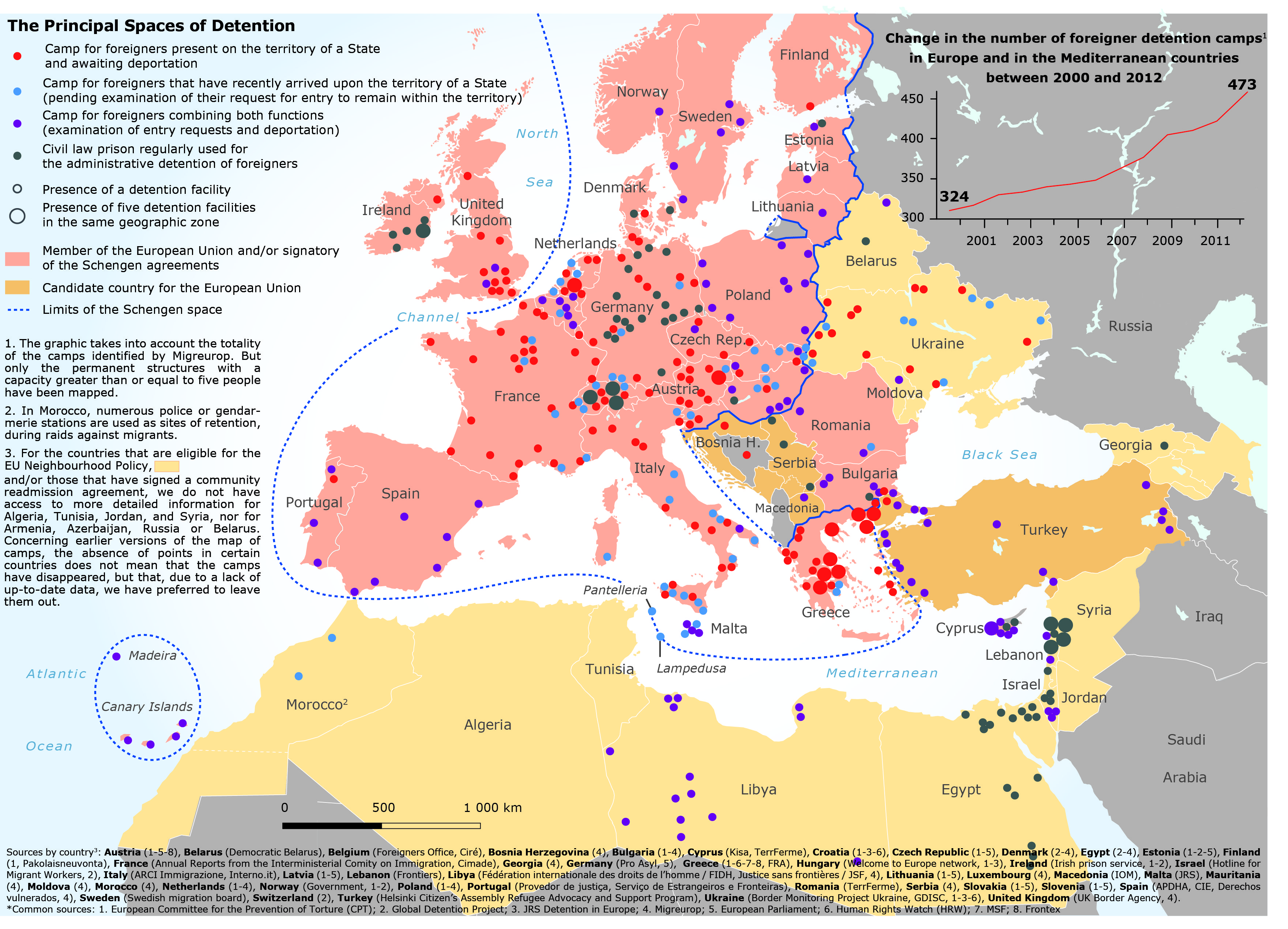
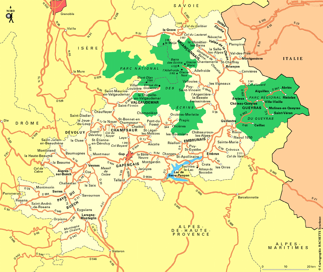
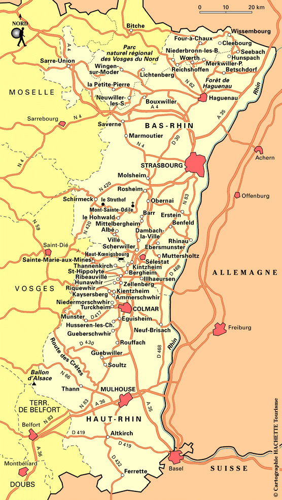
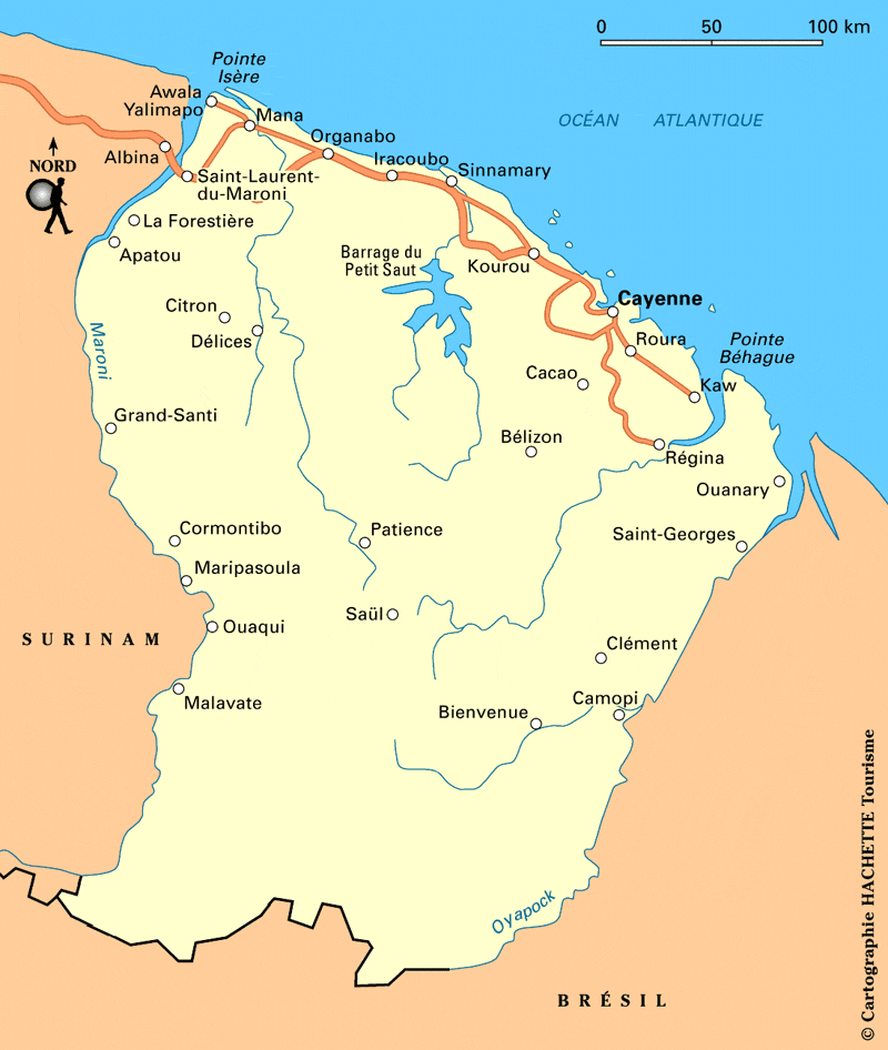
.jpg)
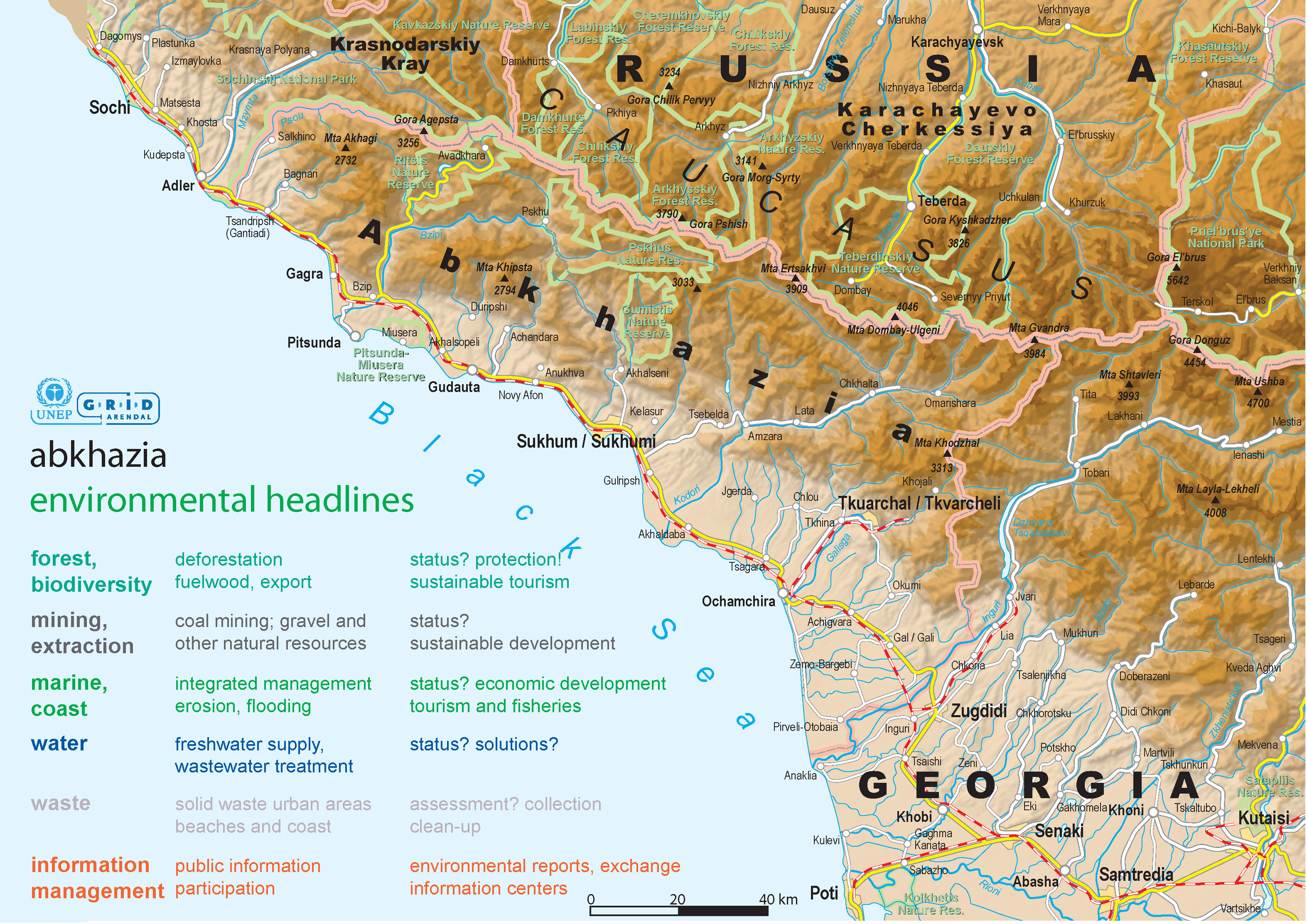
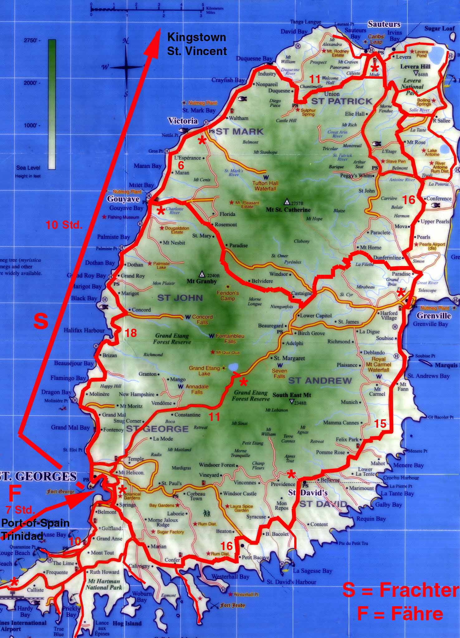
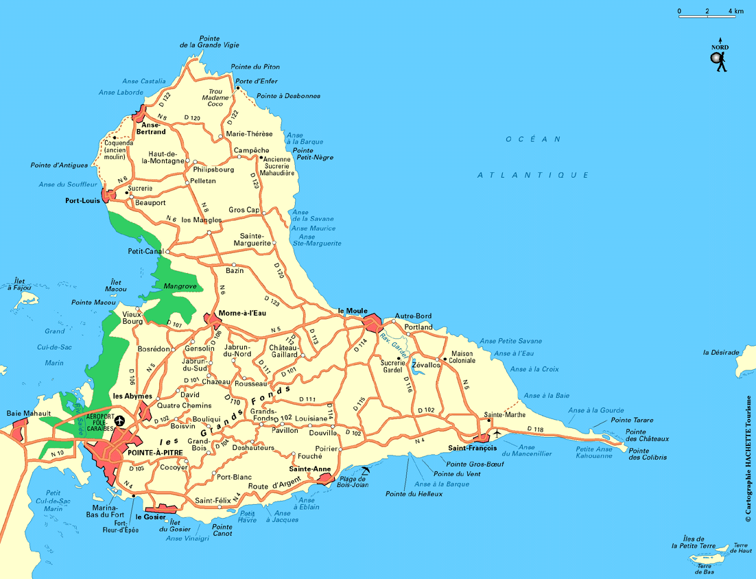
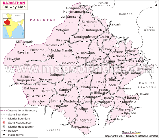
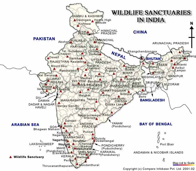
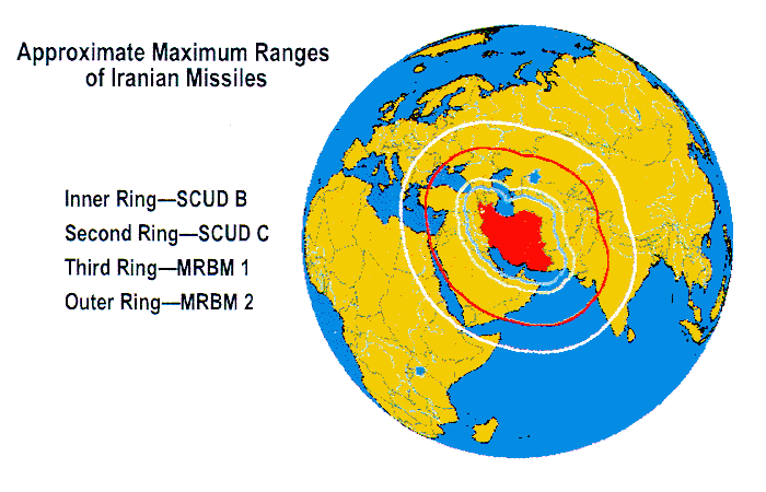
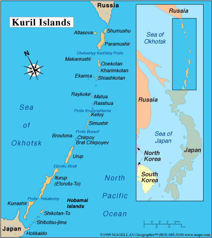
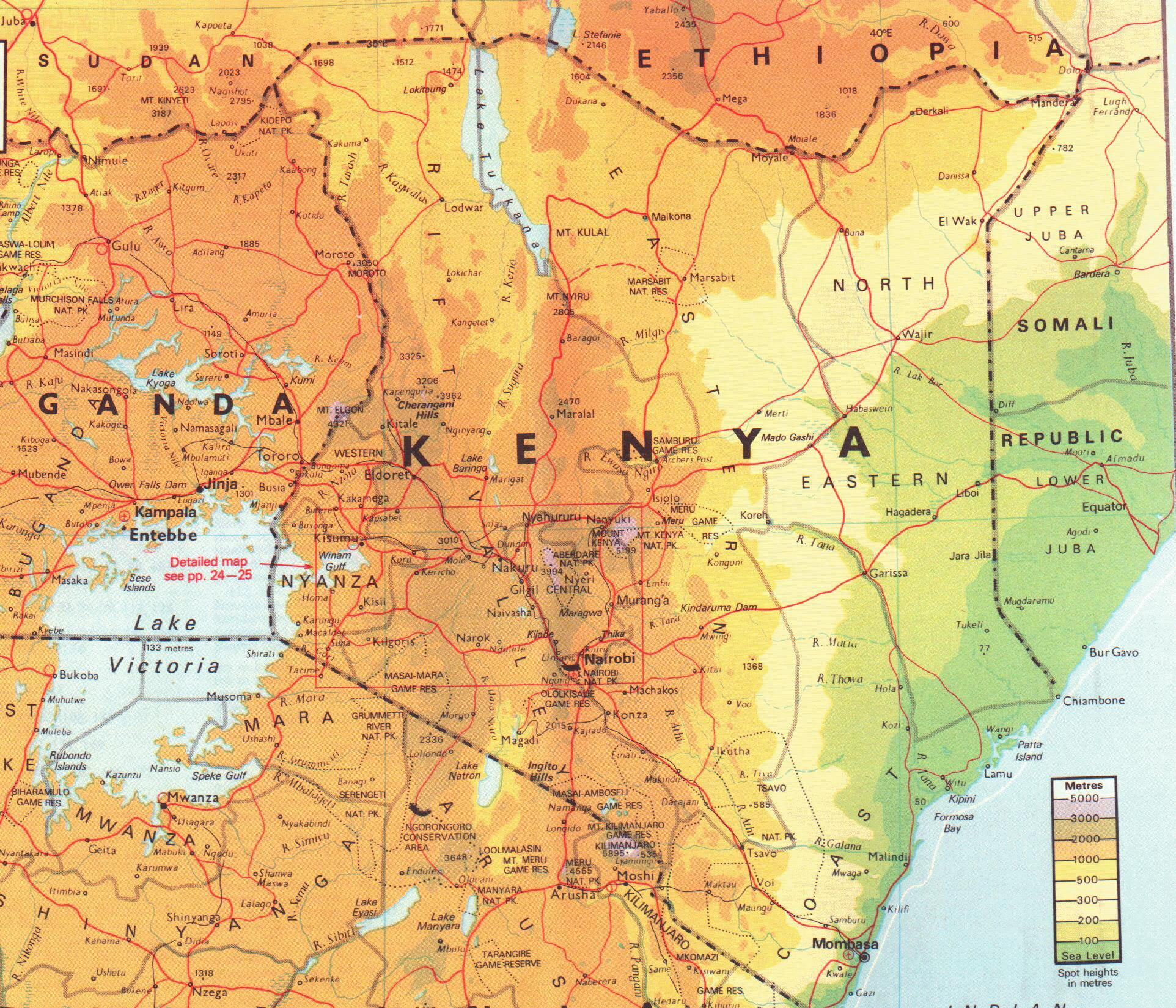
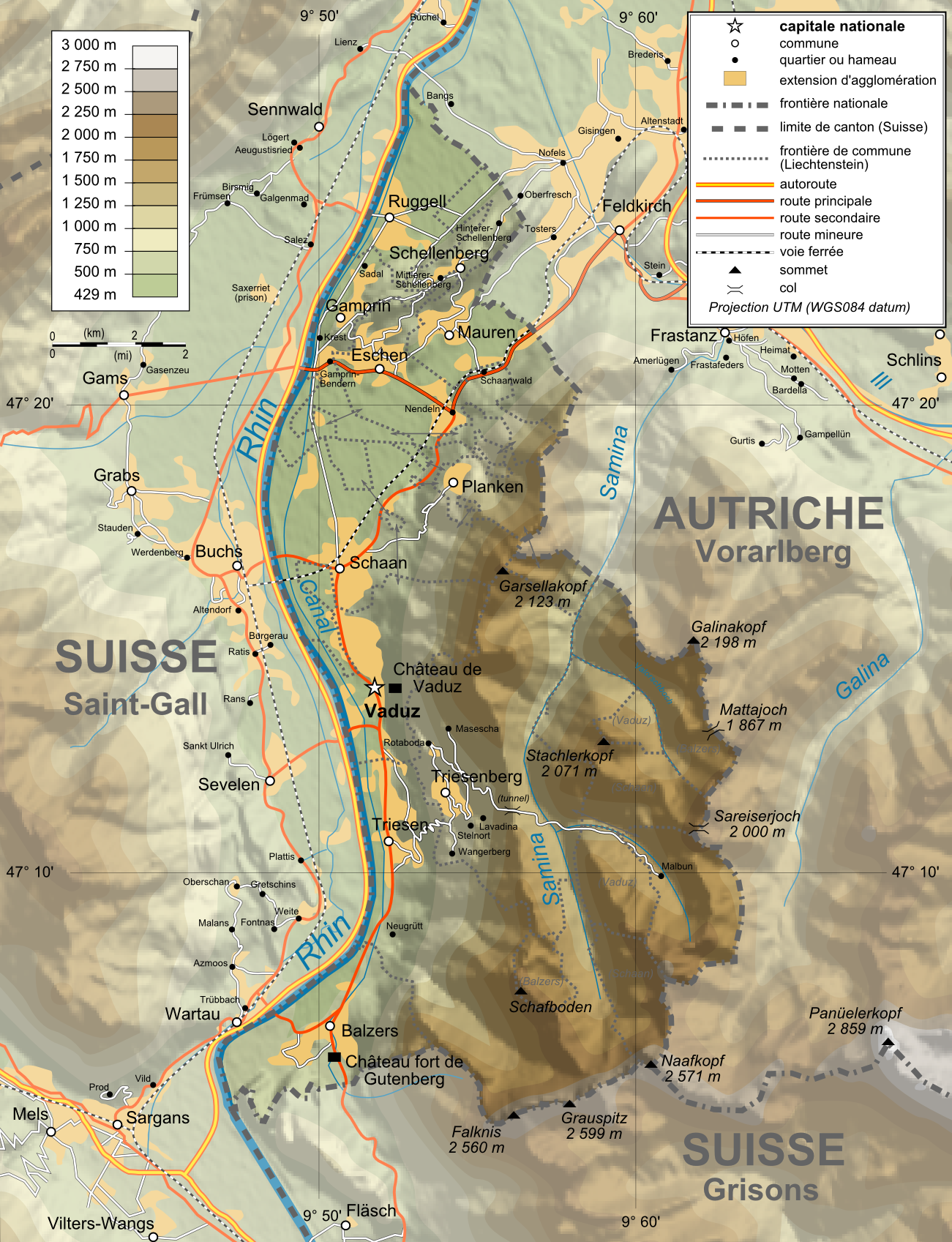
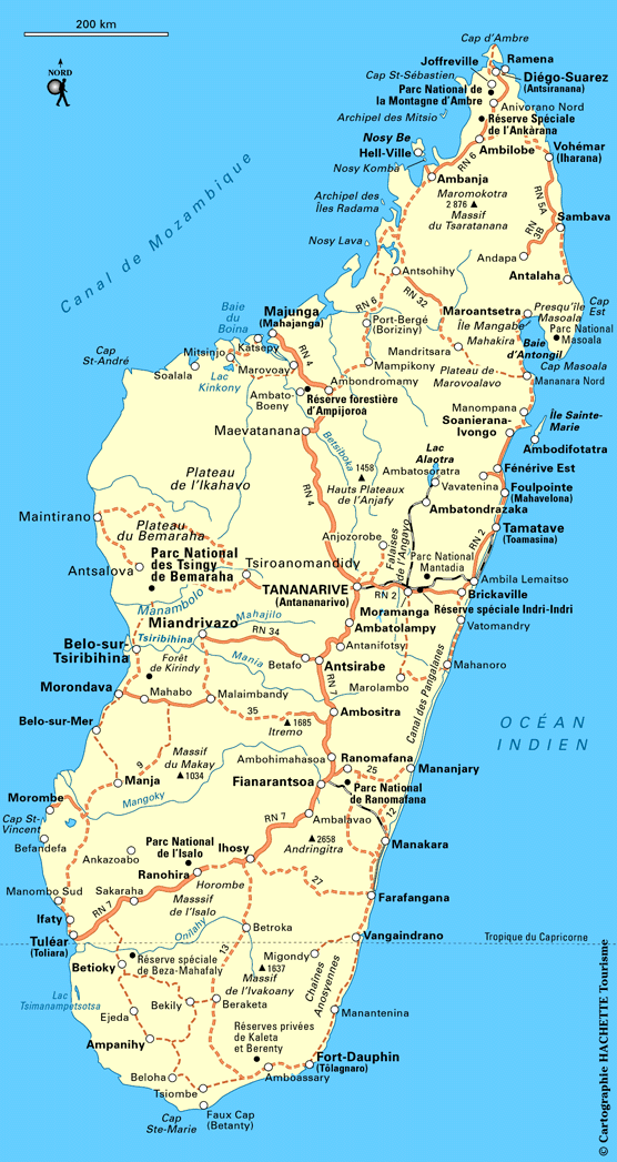
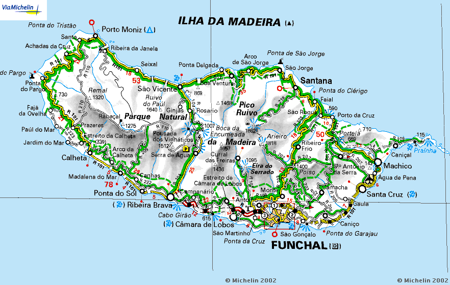
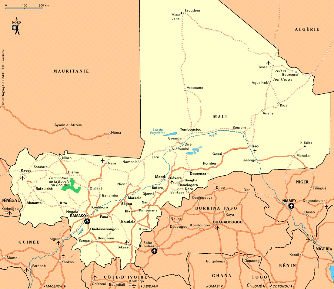
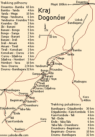
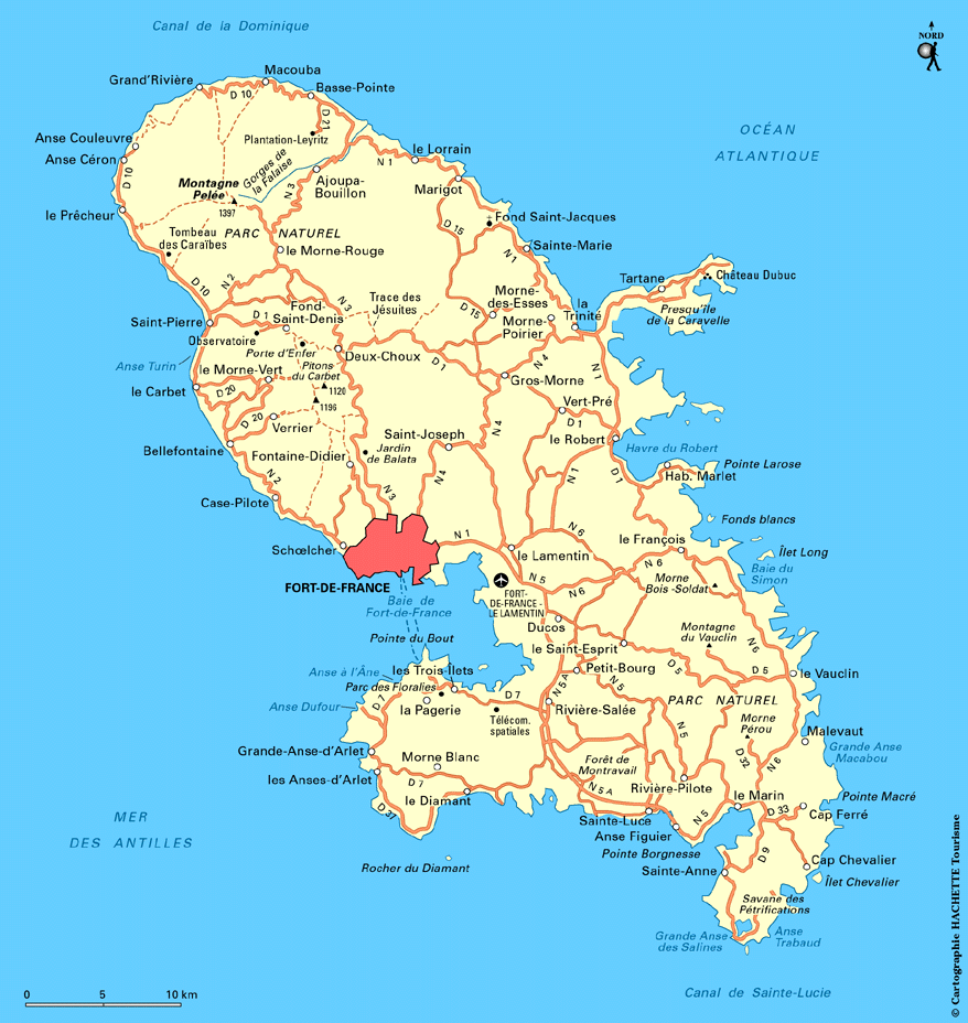
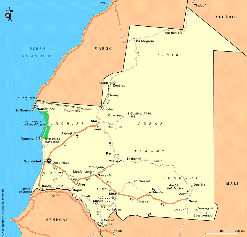
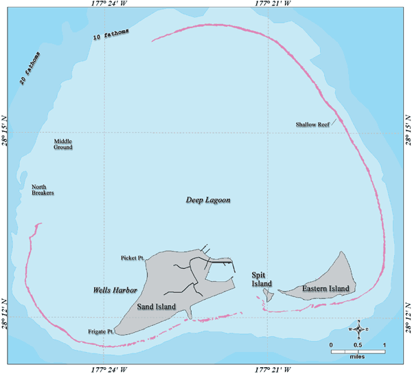
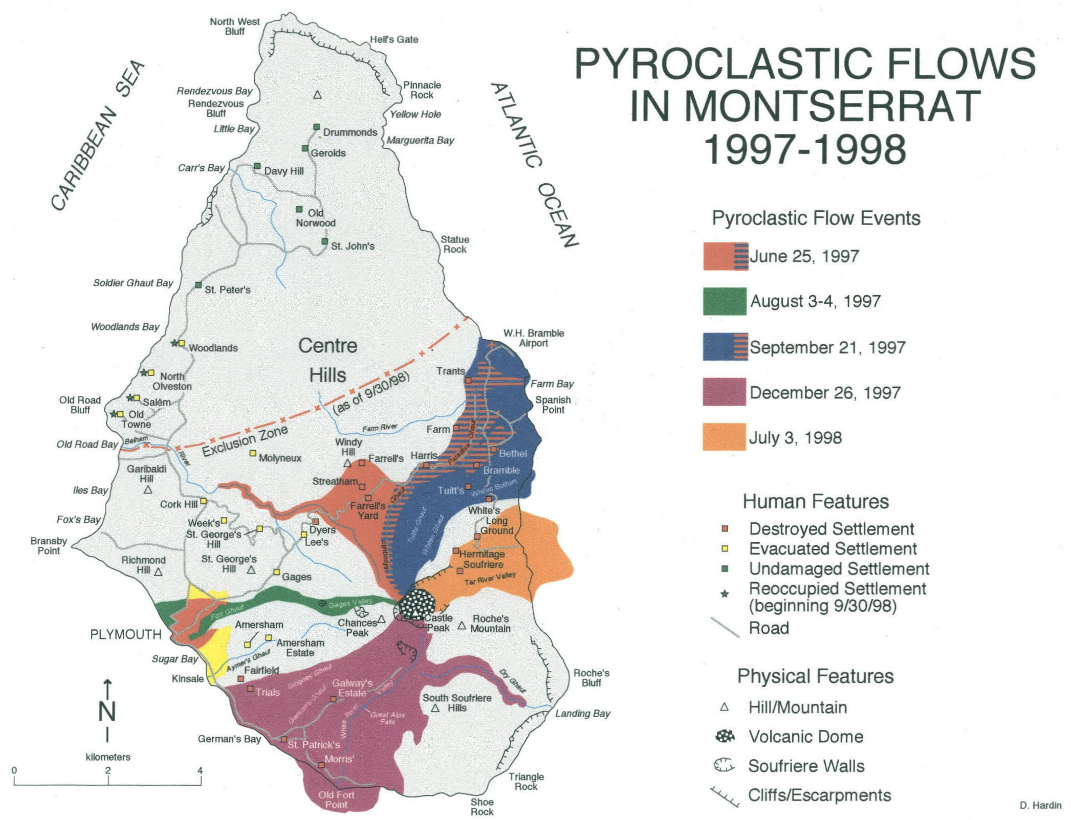
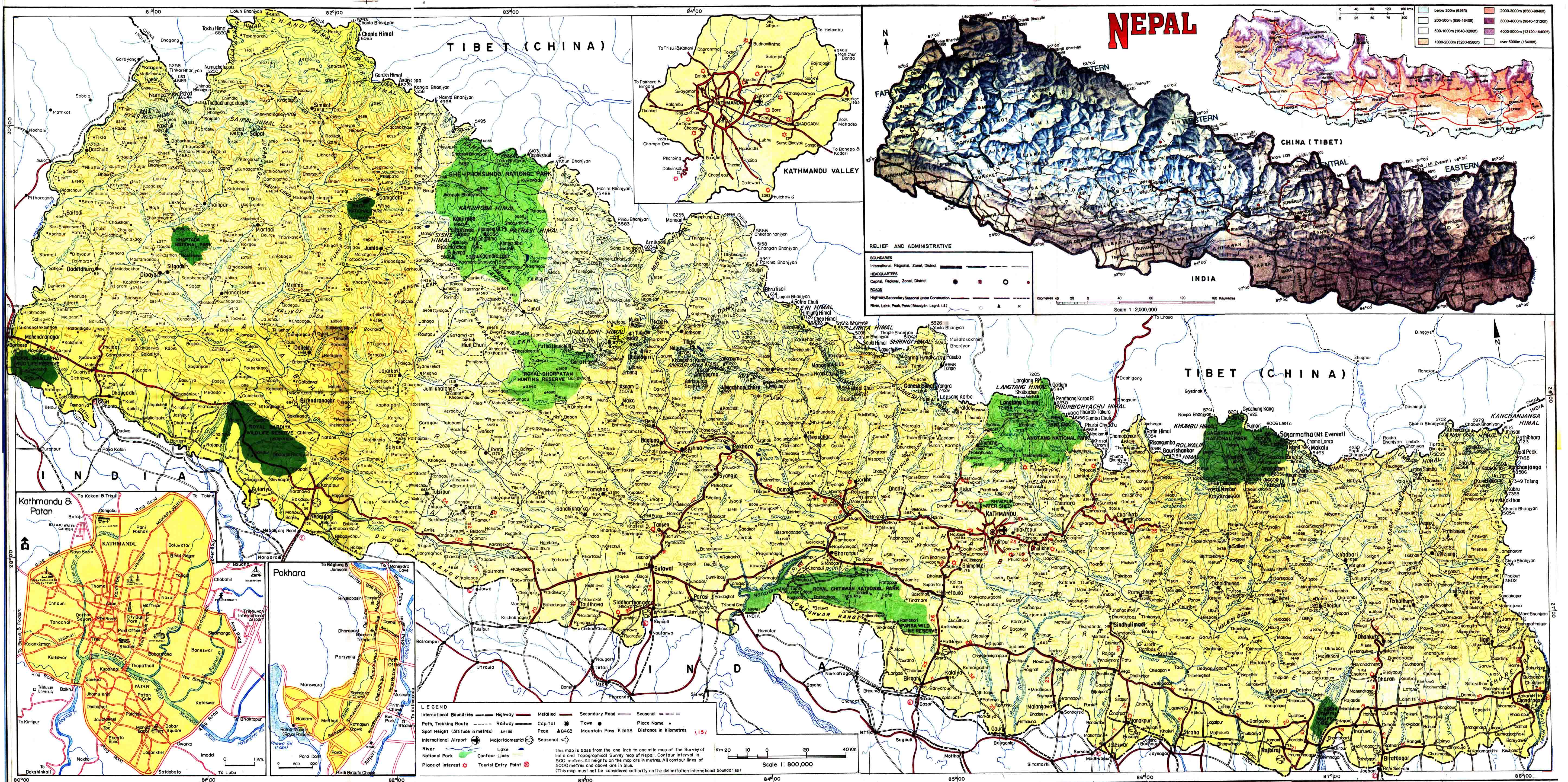
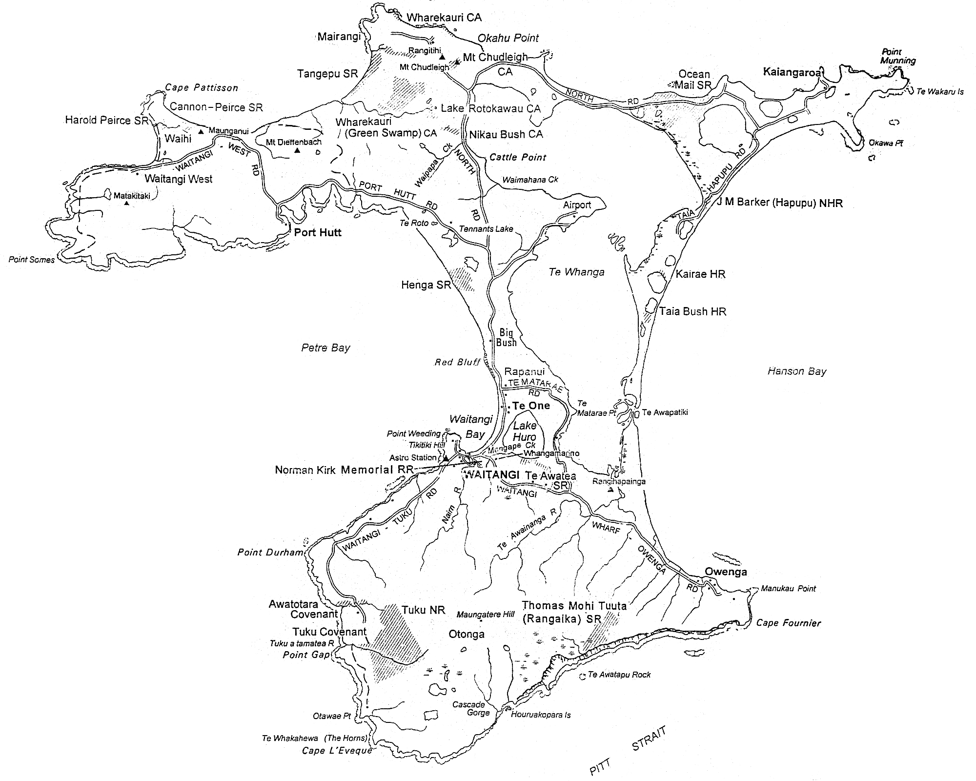
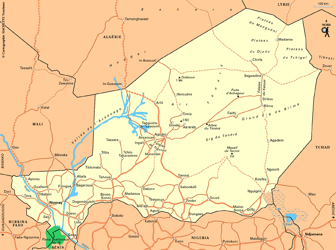
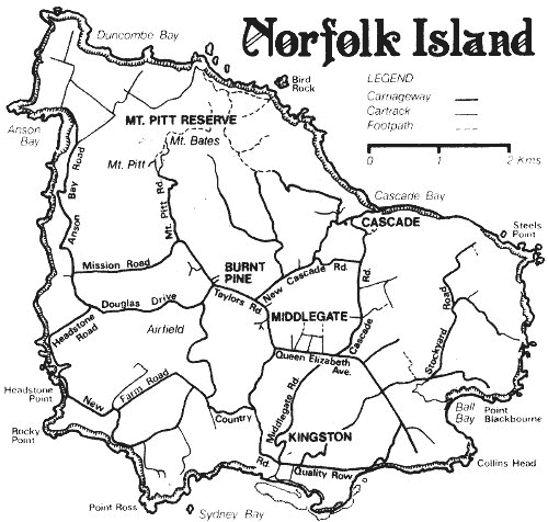
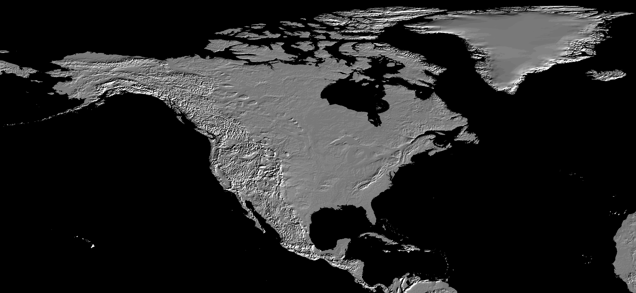
![Pakistan - Afghanistan Supply Routes and Convoy Attacks [October 2010] (BBC News)](http://news.bbcimg.co.uk/media/images/49347000/gif/_49347055_pak_afgh_convoy464.gif)
![Pakistan Army Moves on Taliban Stronghold [October 2009] (BBC News)](http://newsimg.bbc.co.uk/media/images/46586000/gif/_46586548_pak_waziristan466x533.gif)
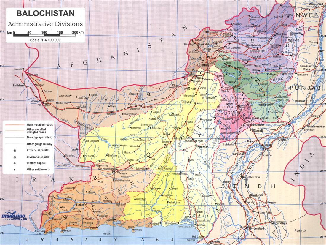
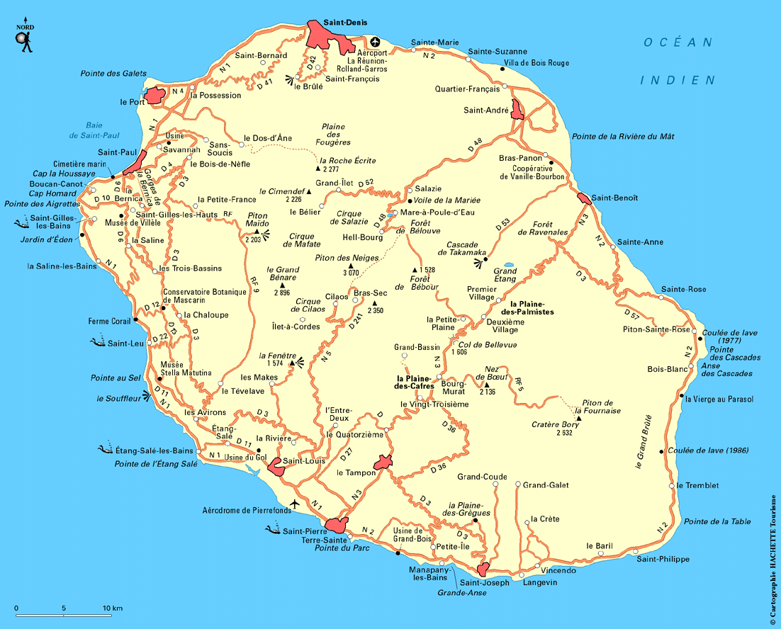
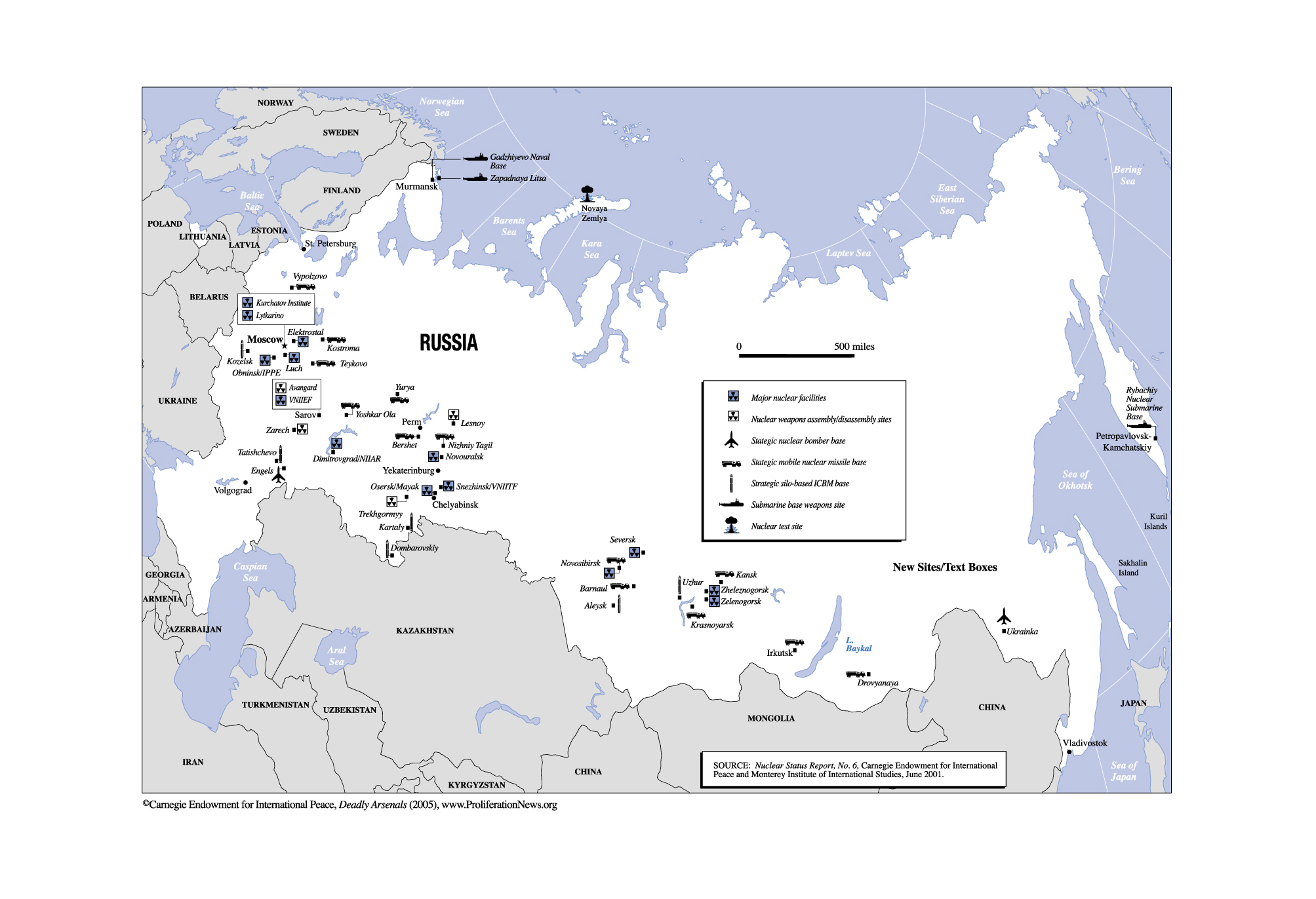
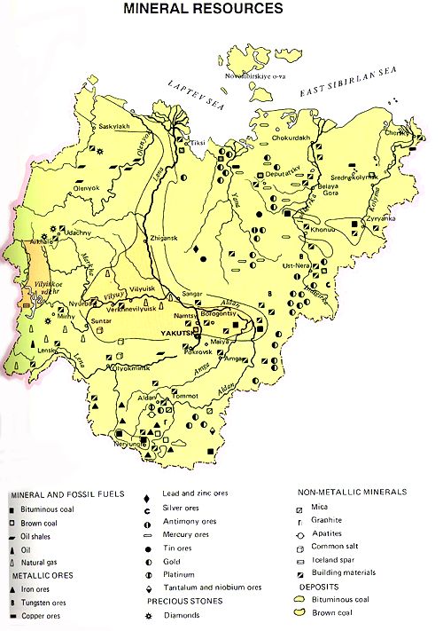
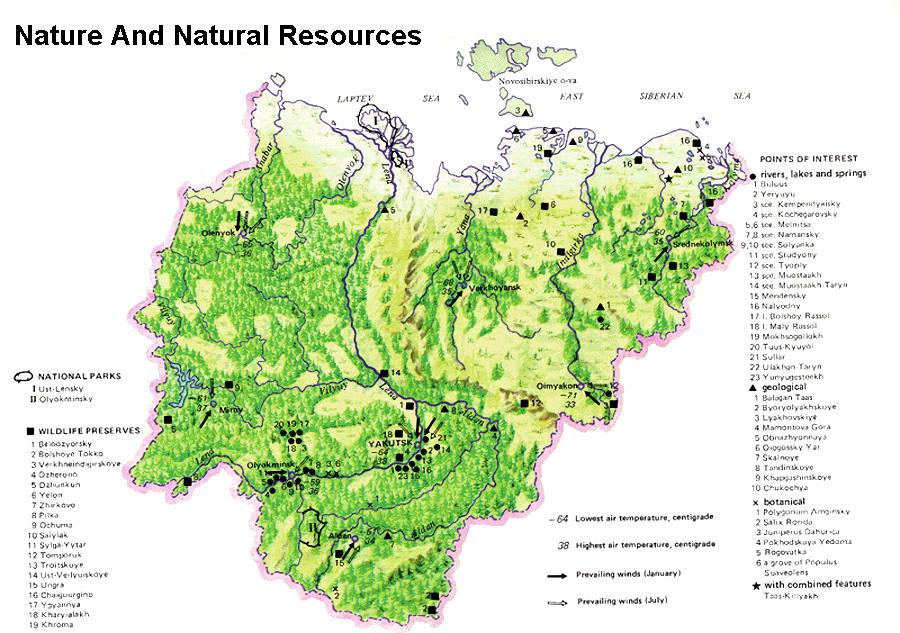
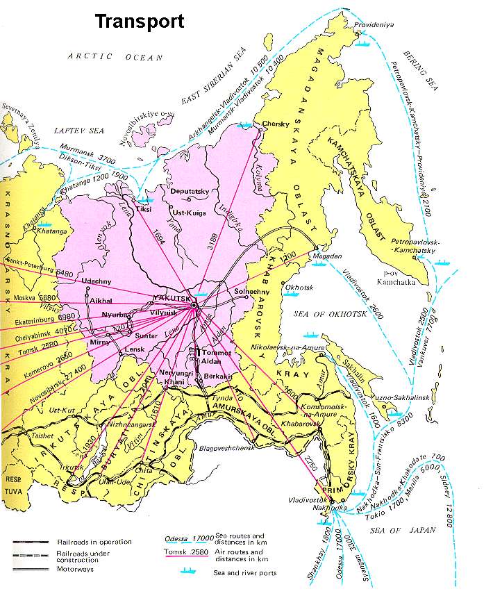
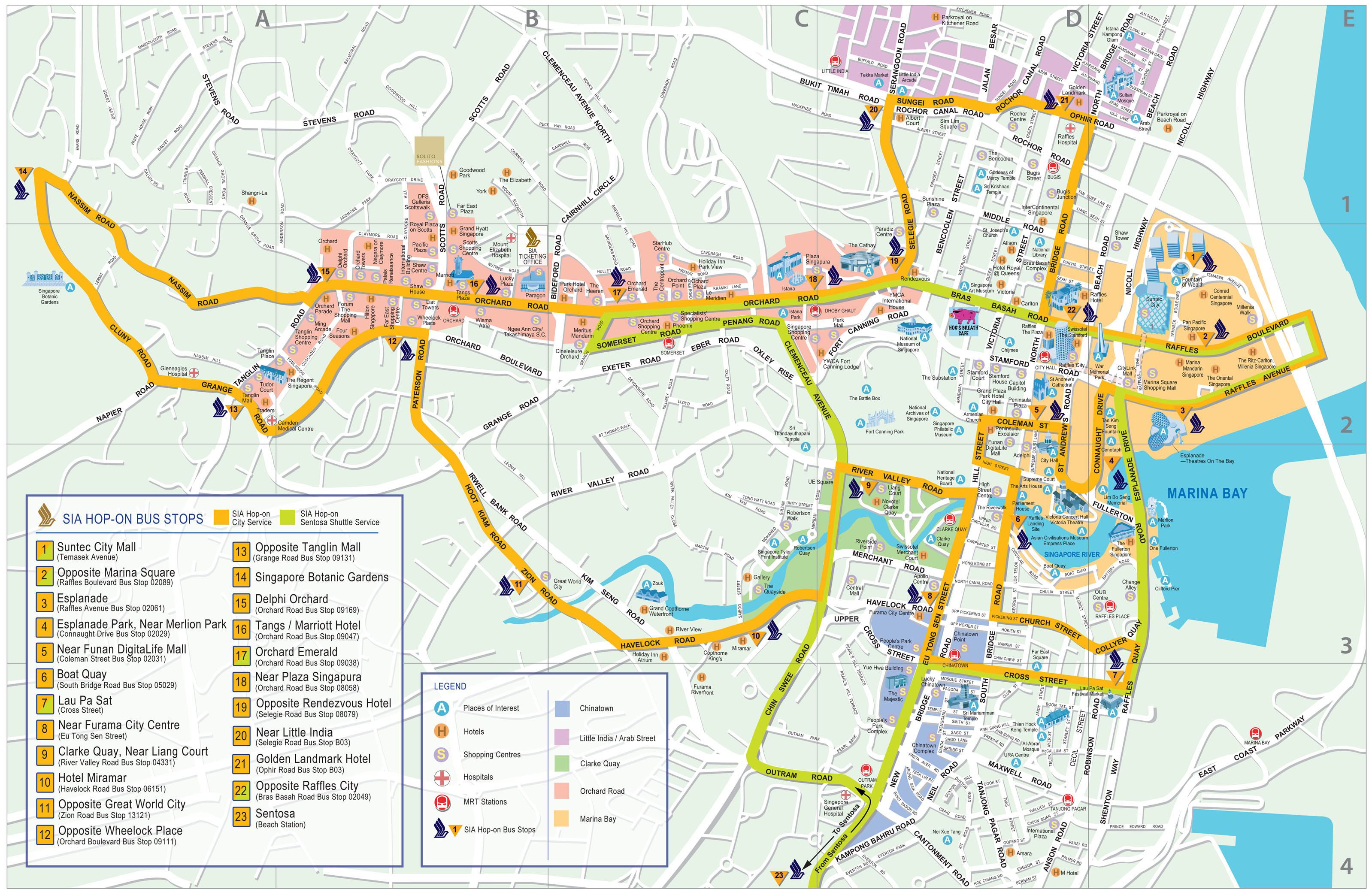
![[2011 July] Somalia - Current Political Situation (Wikipedia)](http://en.wikipedia.org/wiki/File:Fedmap4.png)
![[2010 April] Somalia - Political Situation Map (Wikipedia)](http://en.wikipedia.org/wiki/Image:Somalia_map_states_regions_districts.png)
![[2009] Piracy Attacks off Somalia [April 2009] (BBC News)](http://newsimg.bbc.co.uk/media/images/45647000/gif/_45647302_africa_piracy_maersk_226.gif)
![[2008] Somalia - Piracy Map (BBC News)](http://newsimg.bbc.co.uk/media/images/45217000/gif/_45217511_africa_piracy_map226_3.gif)
![[2007] Somaliland Border Dispute (Wikipedia)](http://en.wikipedia.org/wiki/File:Map_of_somaliland_border_claims.jpg)
![[2007] Somalia - U.S. Navy Patrols and Air Strikes [January 2007] (BBC News)](http://newsimg.bbc.co.uk/media/images/42429000/gif/_42429309_somalia_hayo_map416.gif)
![[2006] Somalia - Ethiopian Troop Movements Map [December 30, 2006] (The Fourth Rail/Magellan)](http://billroggio.com/maps/Somalia-battle-12302006.jpg)
![[2006] Somalia - Offshore Pirate Attacks (UNOSAT)](http://web.archive.org/web/20090310220054/http://unosat.web.cern.ch/unosat/freeproducts/east_and_horn_of_africa/UNOSAT_horn_piracy28mar06_small.jpg)
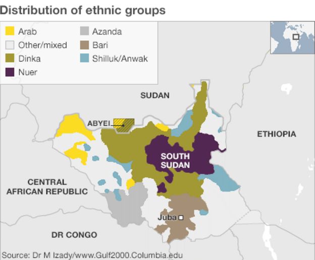
![South Sudan - Food Insecurity [2017] (Washington Post)](https://img.washingtonpost.com/rf/image_1484w/2010-2019/WashingtonPost/2017/03/30/Foreign/Graphics/wSsudanSief2300.jpg?uuid=GBalvBWKEee7FiaZNBhBaA)
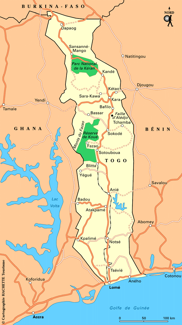
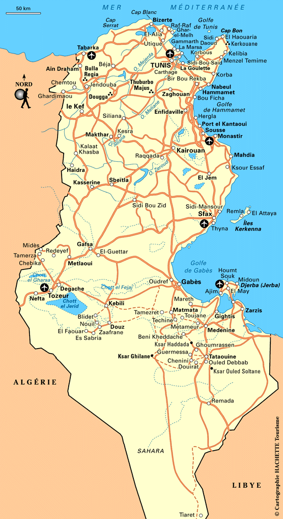
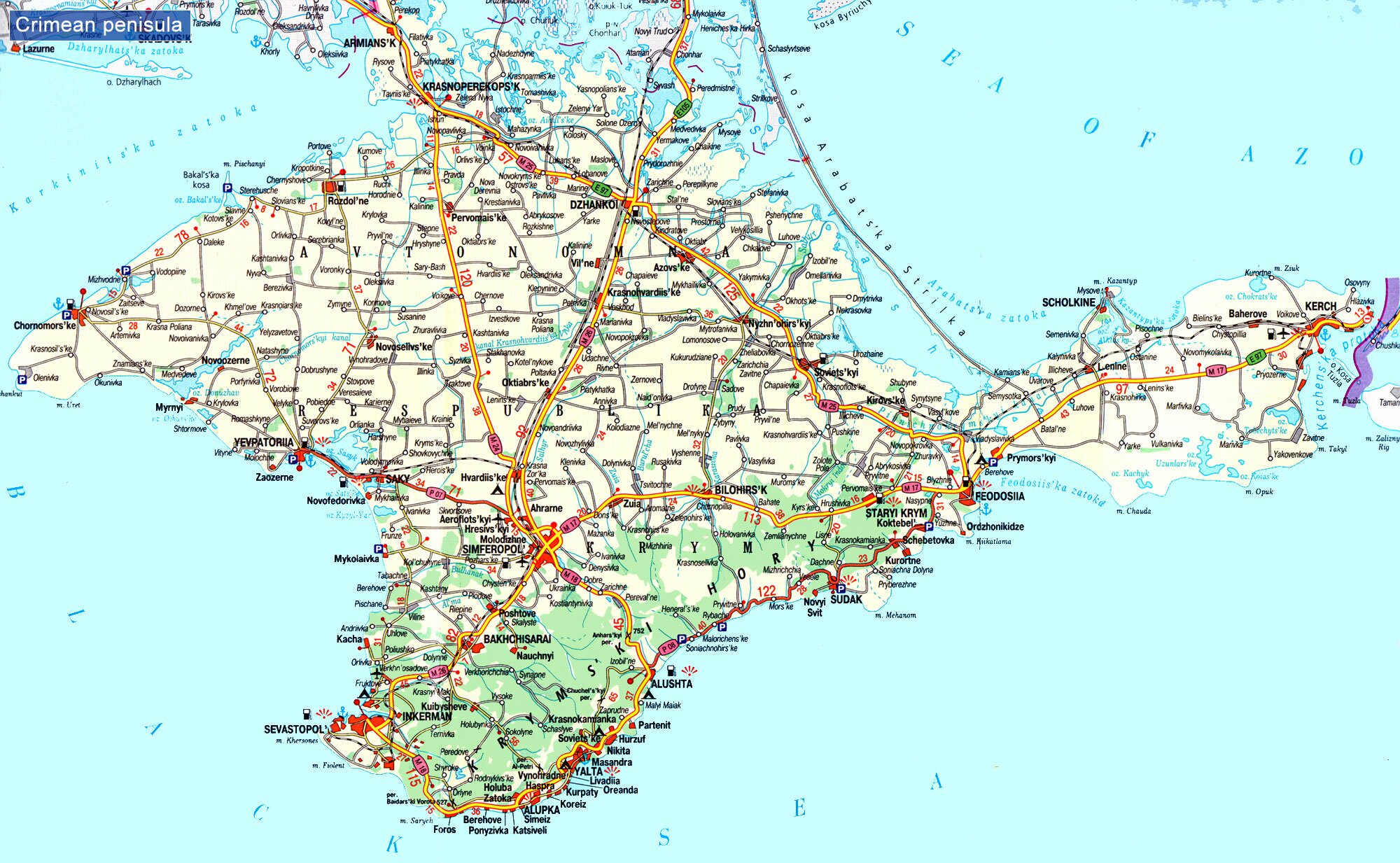
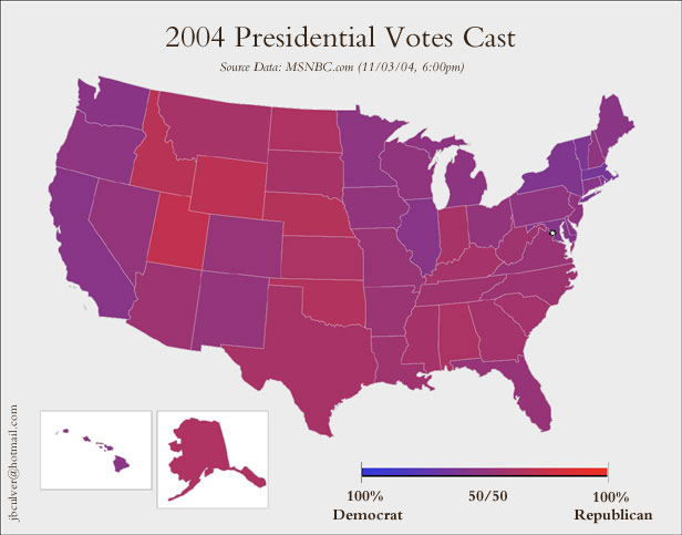
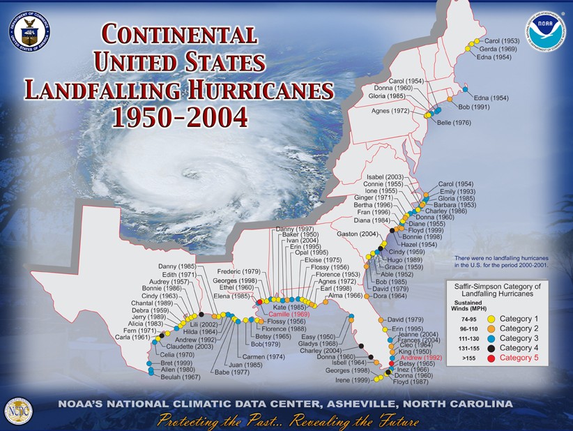
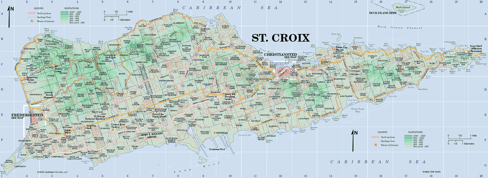
![World - G8 [Group of 8] Countries (Worldatlas.com)](http://www.worldatlas.com/aatlas/infopage/g8countries.gif)
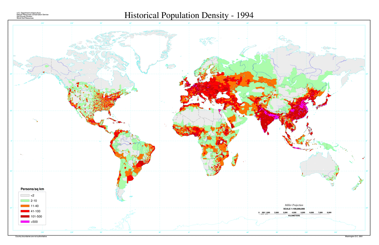
![World - Undersea Cables [The Internet's Undersea World] (Guardian Unlimited)](http://image.guardian.co.uk/sys-images/Technology/Pix/pictures/2008/02/01/SeaCableHi.jpg)