Perry-Castañeda Library
Map Collection
Kuwait Maps
The following maps were produced by the U.S. Central Intelligence Agency, unless otherwise indicated.
Country Maps
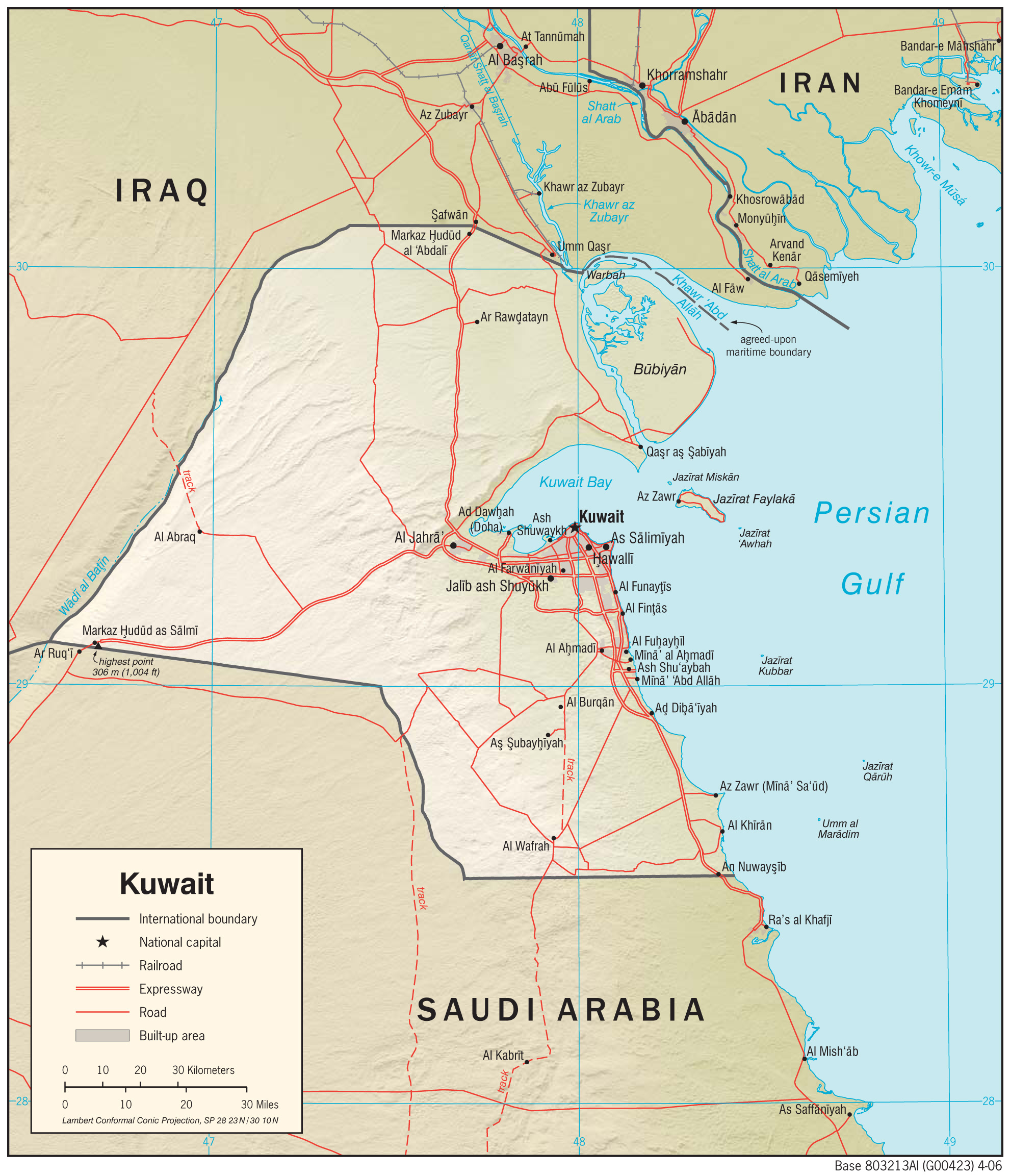
- Kuwait (Physiography) 2006 (1.1MB) and pdf format (364K)
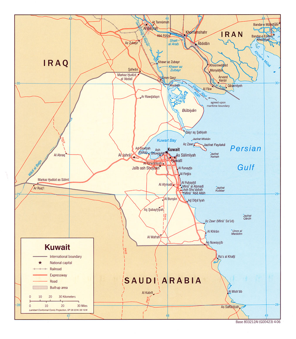
- Kuwait (Political) 2006 (428K) and pdf format (531K)
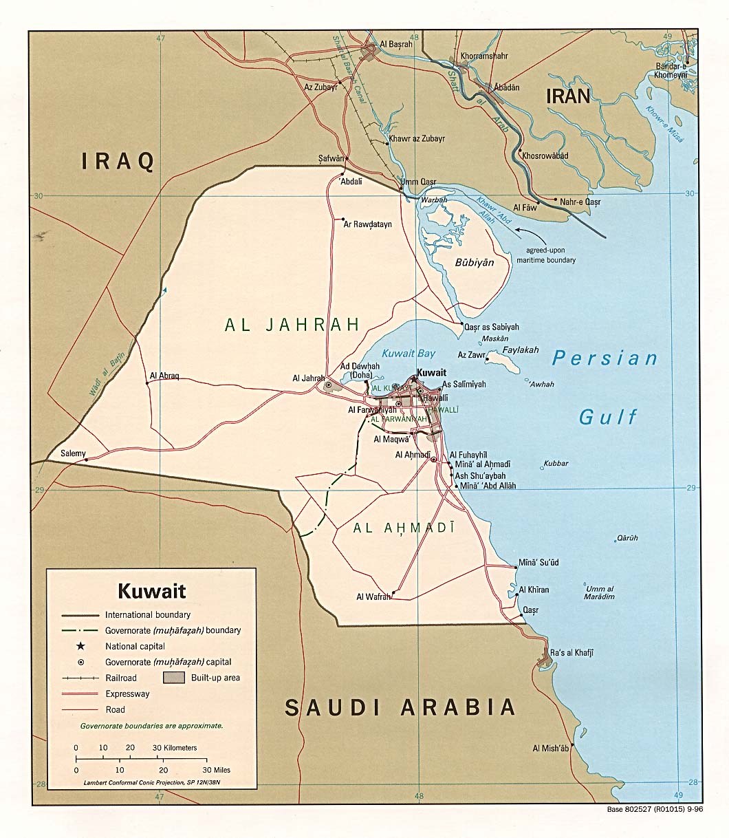
- Kuwait (Political) 1996 (234K) and pdf format (237K)
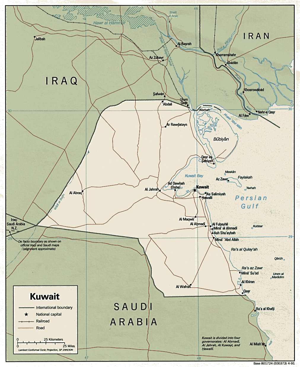
- Kuwait (Political) 1991 (229K) and pdf format (254K)
- Kuwait (Shaded Relief) 1996 (234K) and pdf format (251K)
- Kuwait (Small Map) 2016 (21.2K)
- Kuwait (Transportation) 2006 (981K) and pdf format (363K)
Detailed Maps
- Al Basrah Region [Iraq] Including Northern Kuwait original scale 1:670,000 From Iraq-Iran: Central and Southern Border Areas CIA 1980 (400K)
- 1:1,000,000 - Operational Navigation Chart, Sheet H-6 U.S. Defense Mapping Agency Aerospace Center. This sheet includes Kuwait. Not for navigational use
- 1:500,000 - Tactical Pilotage Charts U.S. National Imagery and Mapping Agency. Not for navigational use
- This series covers all of Kuwait
- 1:500,000 - World Series 1404, Great Britain. War Office and Air Ministry. 1958-
- This series covers all of Kuwait
- This series covers all of Kuwait
![Al Basrah Region [Iraq] Including Northern Kuwait](middle_east_and_asia/al_basrah_iraq_80.jpg)
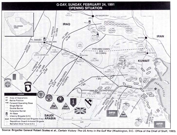
- G-Day, Sunday, February 24, 1991 Opening Situation (86K)
- From "Lucky War": Third Army in Desert Storm by Richard M. Swain. U.S. Army Command and General Staff College Press, Fort Leavenworth, Kansas, 1997.
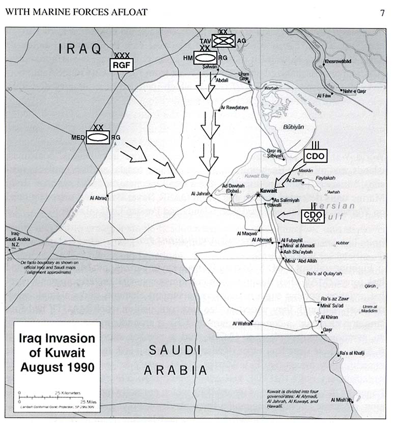
- Iraq Invasion of Kuwait August 1990 (102K)
- From U.S. Marines in the Persian Gulf, 1990-1991: With Marine Forces Afloat in Desert Shield and Desert Storm by Ronald J. Brown. U.S. Marine Corps, History and Museums Division, Washington, D.C. 1998.
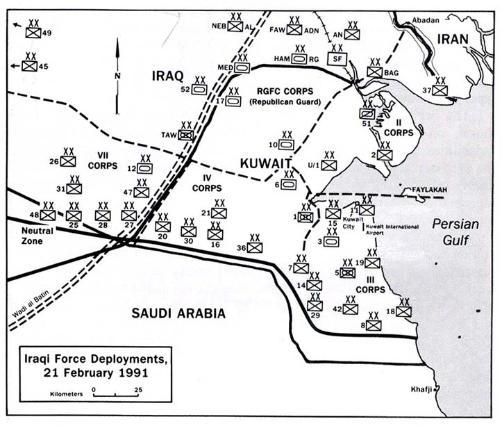
- Iraqi Force Deployments, 21 February 1991 (88K)
- From U.S. Marines in the Persian Gulf, 1990-1991: With the 2nd Marine Division in Desert Shield and Desert Storm by Dennis P. Mroczkowski. U.S. Marine Corps, History and Museums Division, Washington, D.C. 1993.
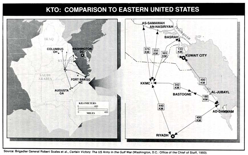
- KTO: Comparison to Eastern United States (82K)
- From "Lucky War": Third Army in Desert Storm by Richard M. Swain. U.S. Army Command and General Staff College Press, Fort Leavenworth, Kansas, 1997.
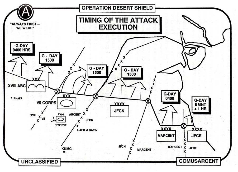
- Operation Desert Shield Timing of Attack Execution (112K)
- From U.S. Marines in the Persian Gulf, 1990-1991: With the 2nd Marine Division in Desert Shield and Desert Storm by Dennis P. Mroczkowski. U.S. Marine Corps, History and Museums Division, Washington, D.C. 1993.
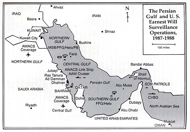
- The Persian Gulf and U.S. Earnest Will Surveillance Operations, 1987-1988 (61K)
- From On Course to Desert Storm: The United States Navy and the Persian Gulf by Michael A. Palmer. Naval Historical Center, Washington, D.C. 1992.
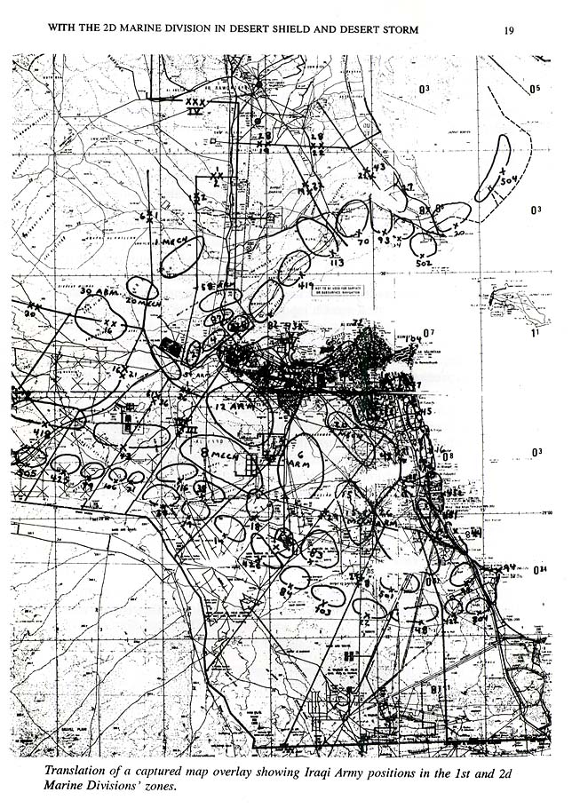
- Translation of a Captured Map Overlay Showing Iraqi Army Positions in The 1st and 2nd Marine Divisions' Zones (234K)
- From U.S. Marines in the Persian Gulf, 1990-1991: With the 2nd Marine Division in Desert Shield and Desert Storm by Dennis P. Mroczkowski. U.S. Marine Corps, History and Museums Division, Washington, D.C. 1993.
- From "Lucky War": Third Army in Desert Storm by Richard M. Swain. U.S. Army Command and General Staff College Press, Fort Leavenworth, Kansas, 1997.
Maps on Other Web Sites