Perry-Castañeda Library
Map Collection
Federated States of Micronesia Maps
The following maps were produced by the U.S. Central Intelligence Agency, unless otherwise indicated.
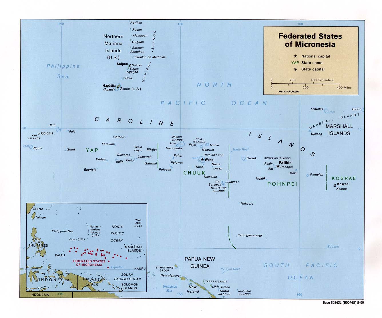
Country Maps- Federated States of Micronesia (Political) 1999 (141K) and pdf format (174K)
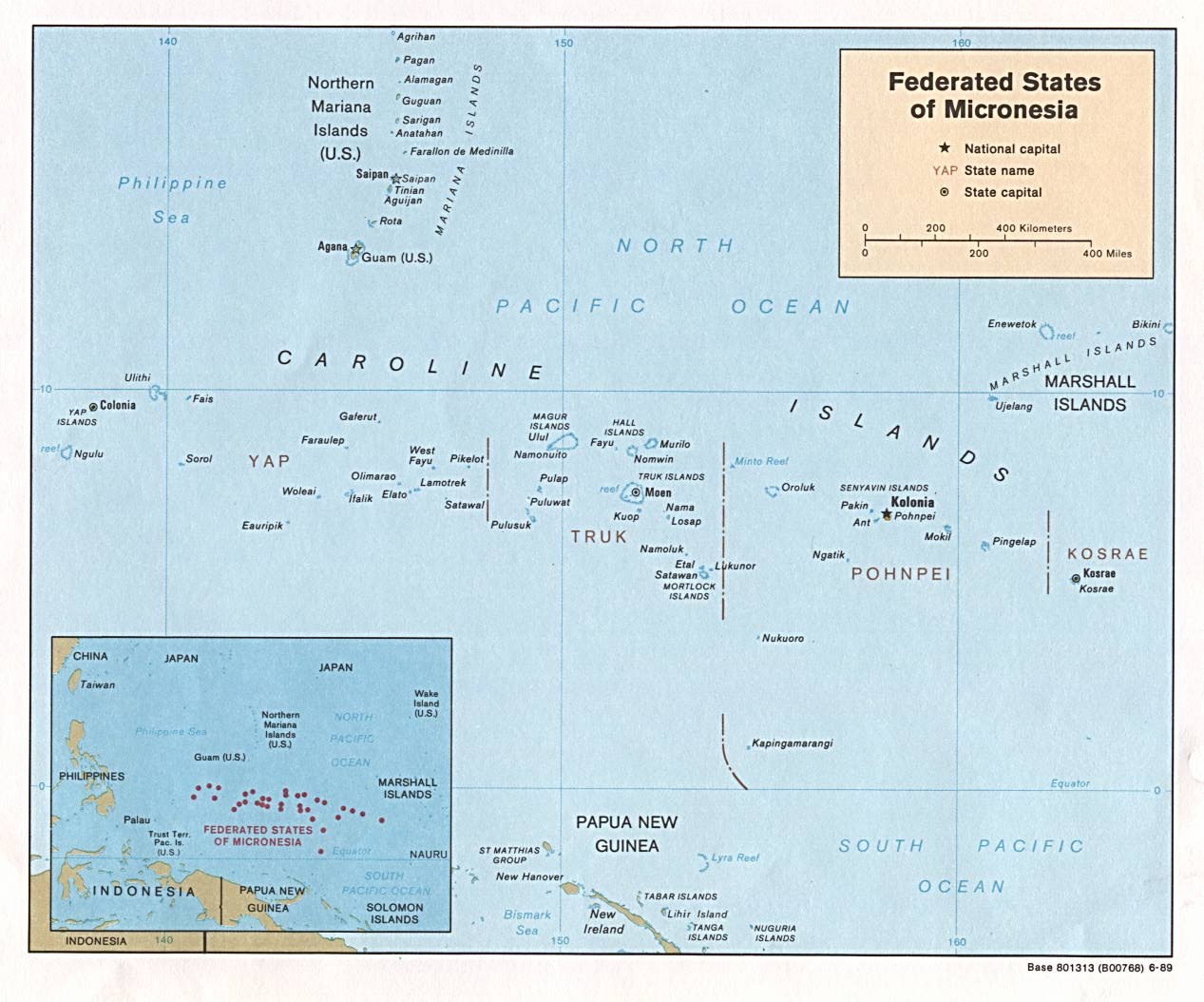
- Federated States of Micronesia (Political) 1989 (171K) and pdf format (146K)
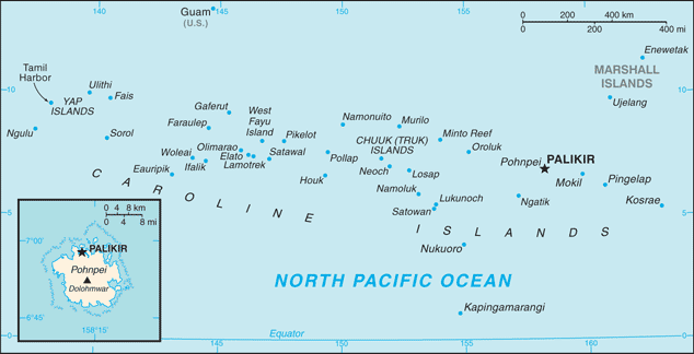
- Federated States of Micronesia (Small Map) 2016 (25.1K)
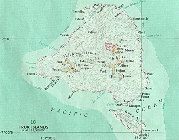
- Truk (Chuuk) U.S. National Atlas 1970 (68K)
- Truk (Chuuk) Fefan, Param and Uman Islands (General Soil Map) From Soil Survey of Islands of Truk, Federated States of Micronesia, United States Department of Agriculture, Soil Conservation Service. 1983 (map compiled in 1981) (194K)
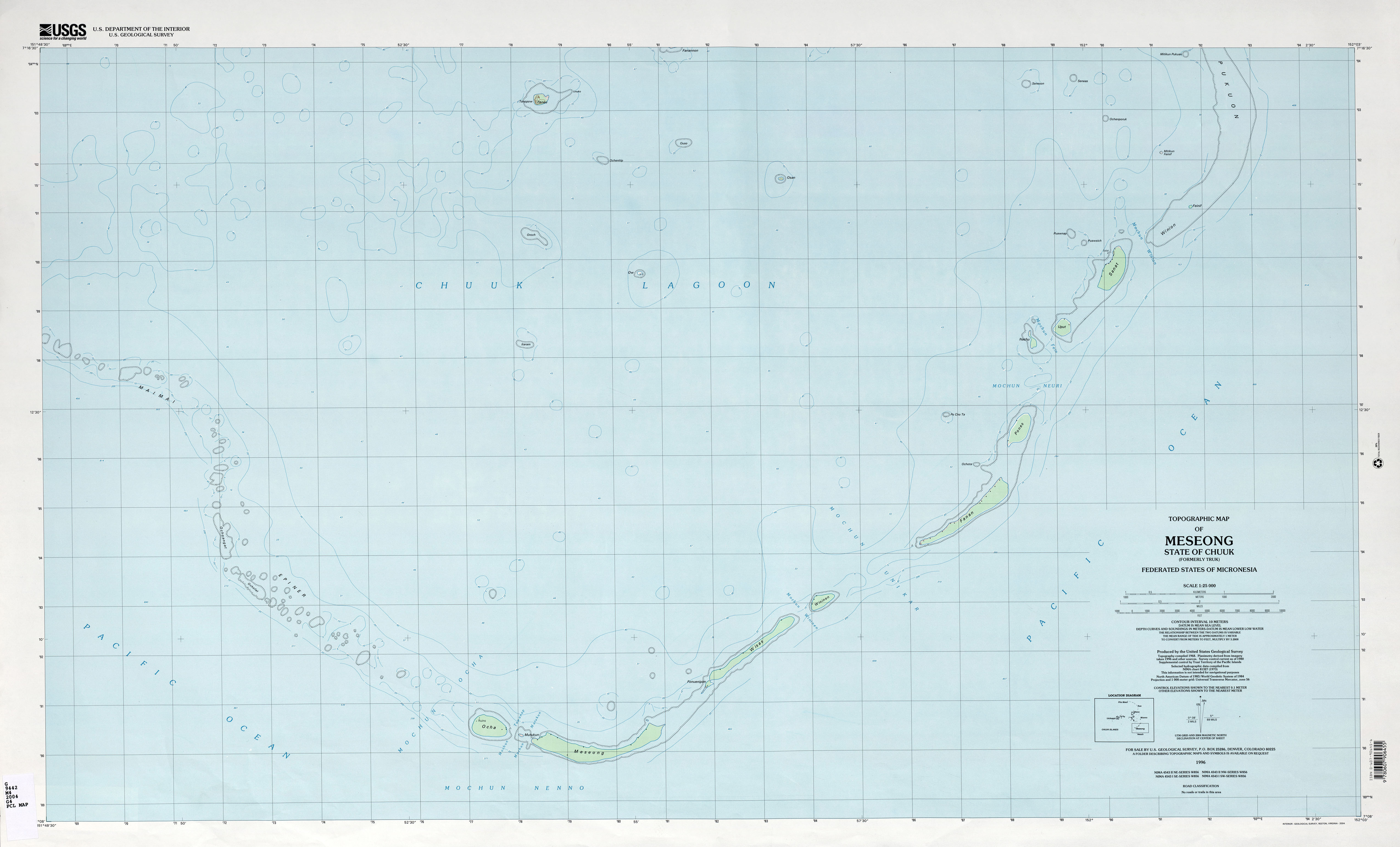
- Chuuk (Truk) Meseong (Topographic) 1:25,000 U.S. Geological Survey, 1996 (1.6MB)
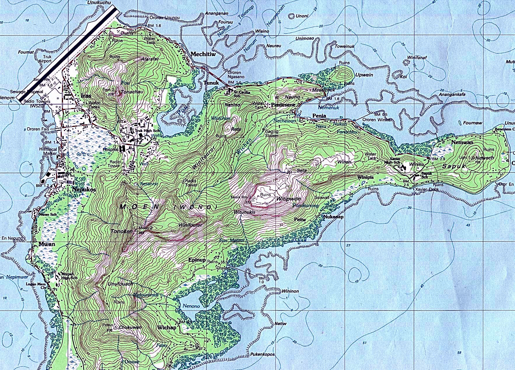
- Chuuk (Truk) Moen Island (Topographic) 1:25,000 [Portion of map] U.S. Geological Survey, 1983 (1,080K)
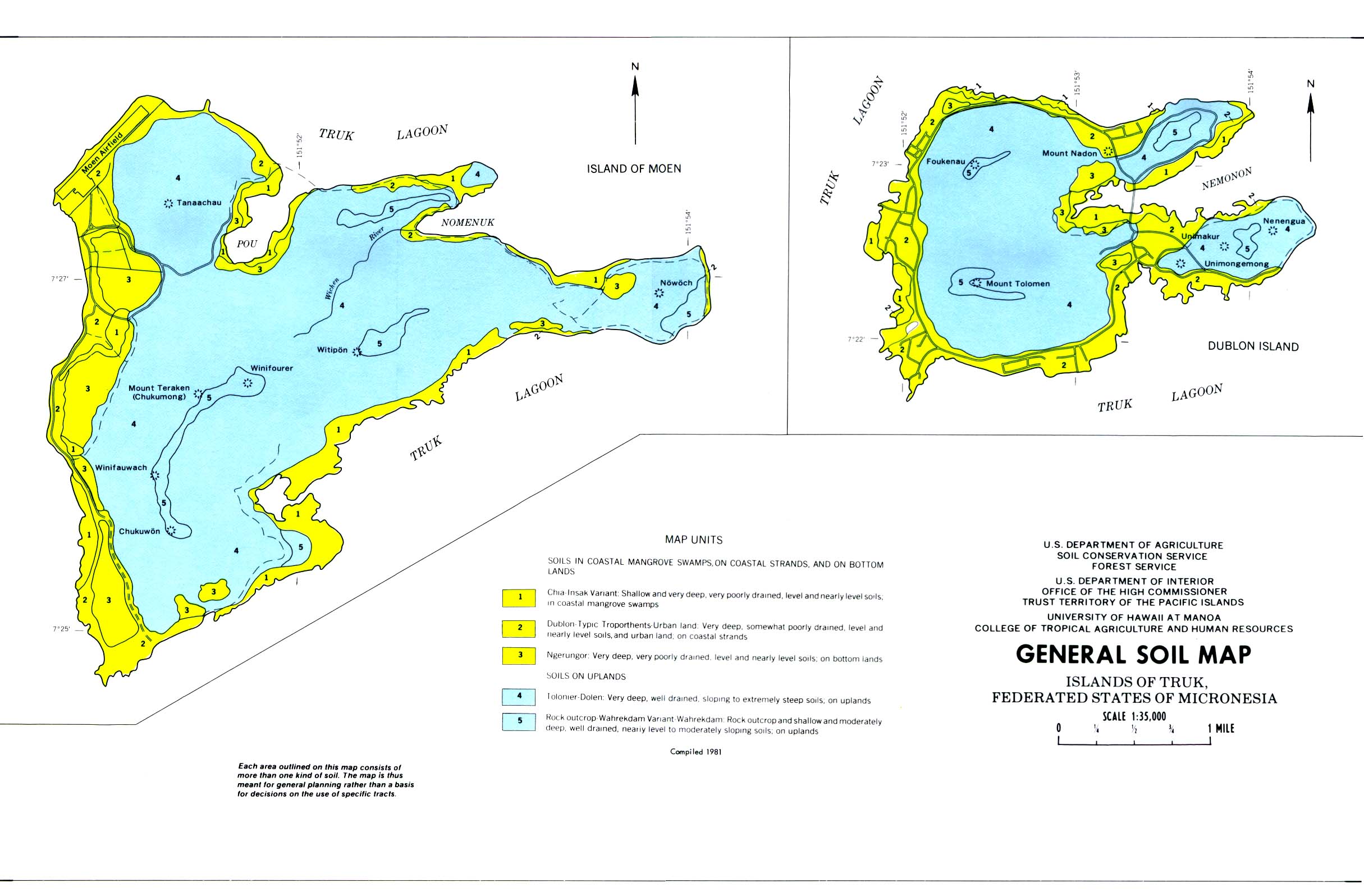
- Chuuk (Truk) Moen and Dublon Islands (General Soil Map) From Soil Survey of Islands of Truk, Federated States of Micronesia, United States Department of Agriculture, Soil Conservation Service. 1983 (map compiled in 1981) (336K)
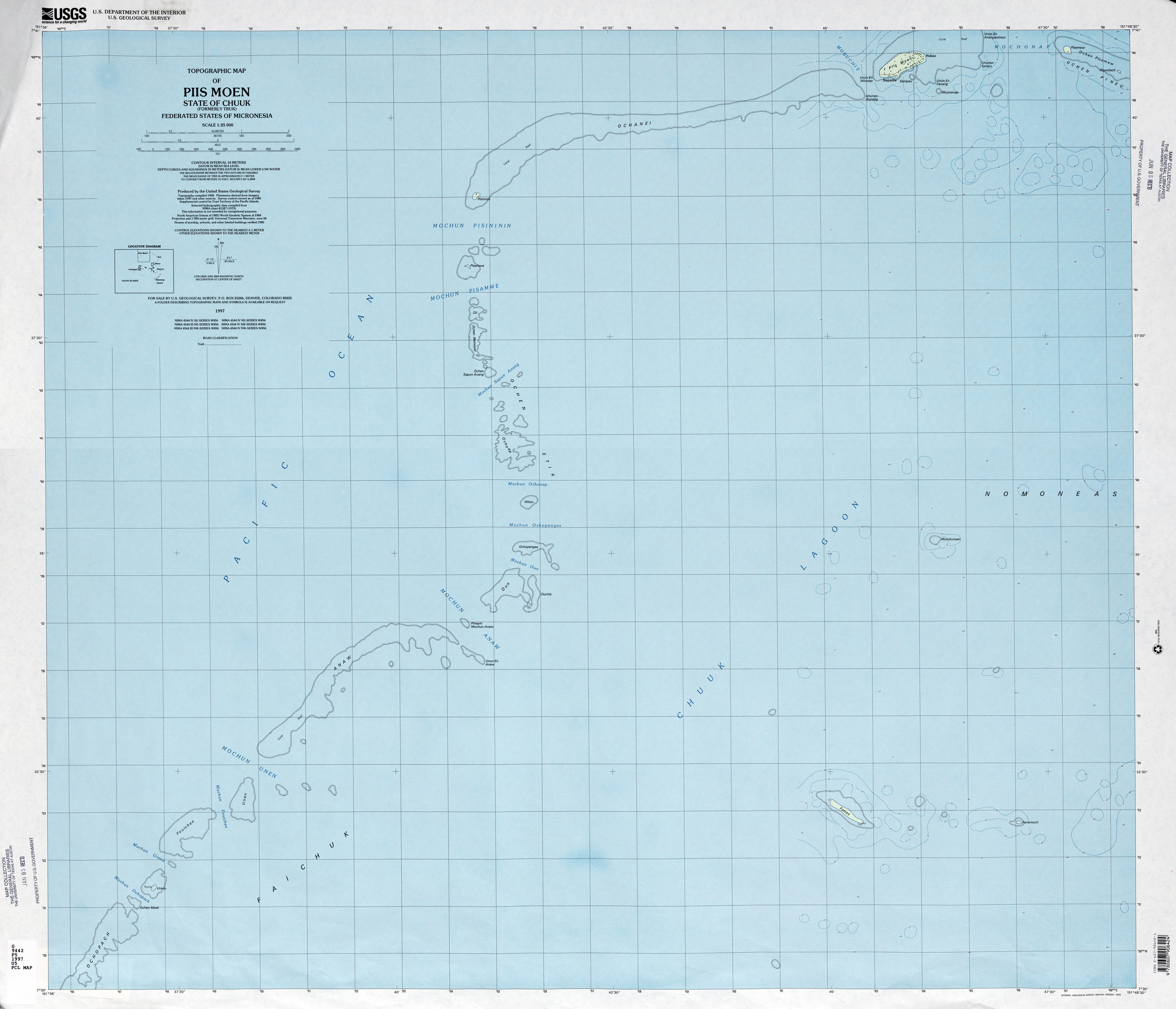
- Chuuk (Truk) Piis Moen (Topographic) 1:25,000 U.S. Geological Survey, 1997 (2.2MB)
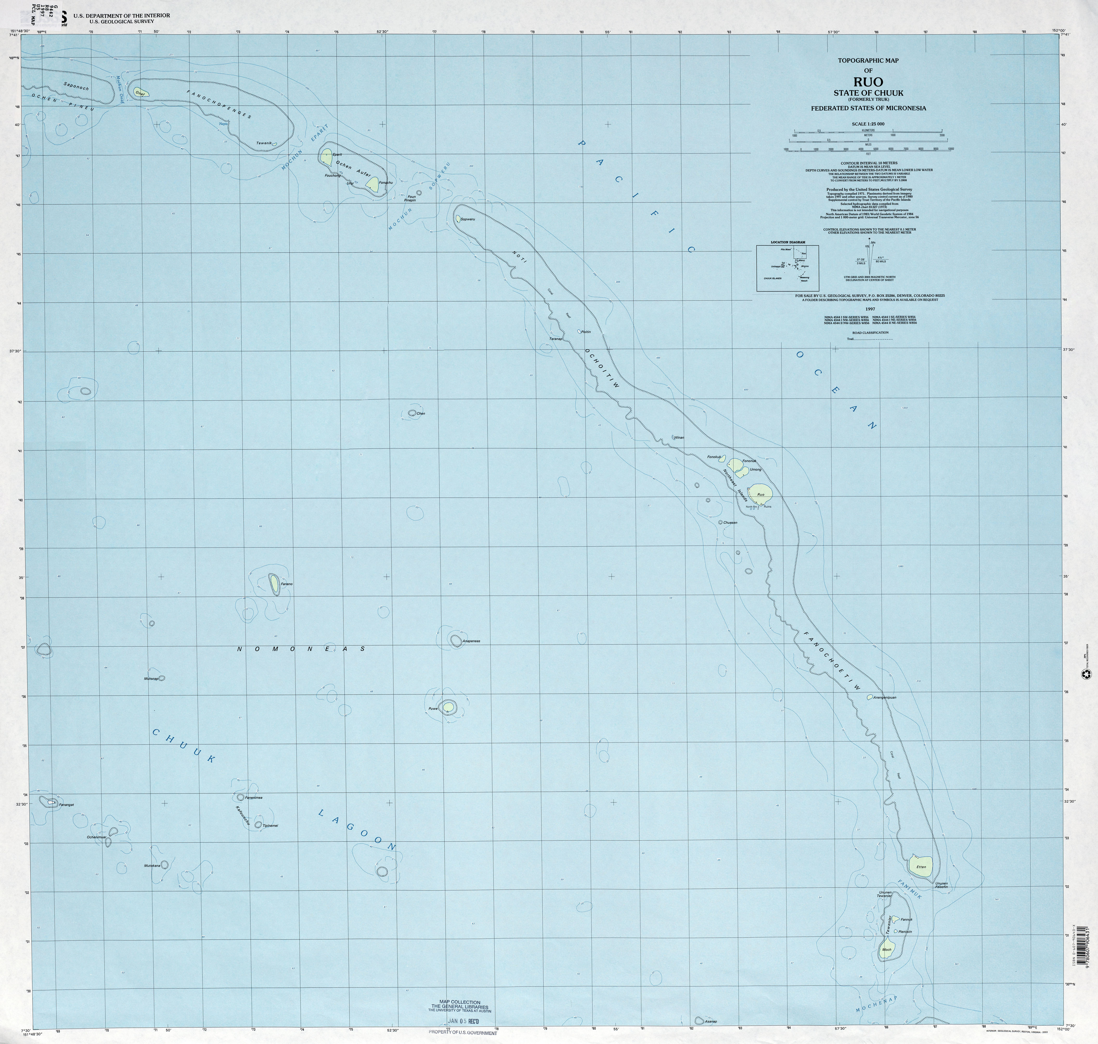
- Chuuk (Truk) Ruo (Topographic) 1:25,000 U.S. Geological Survey, 1997 (2.0MB)
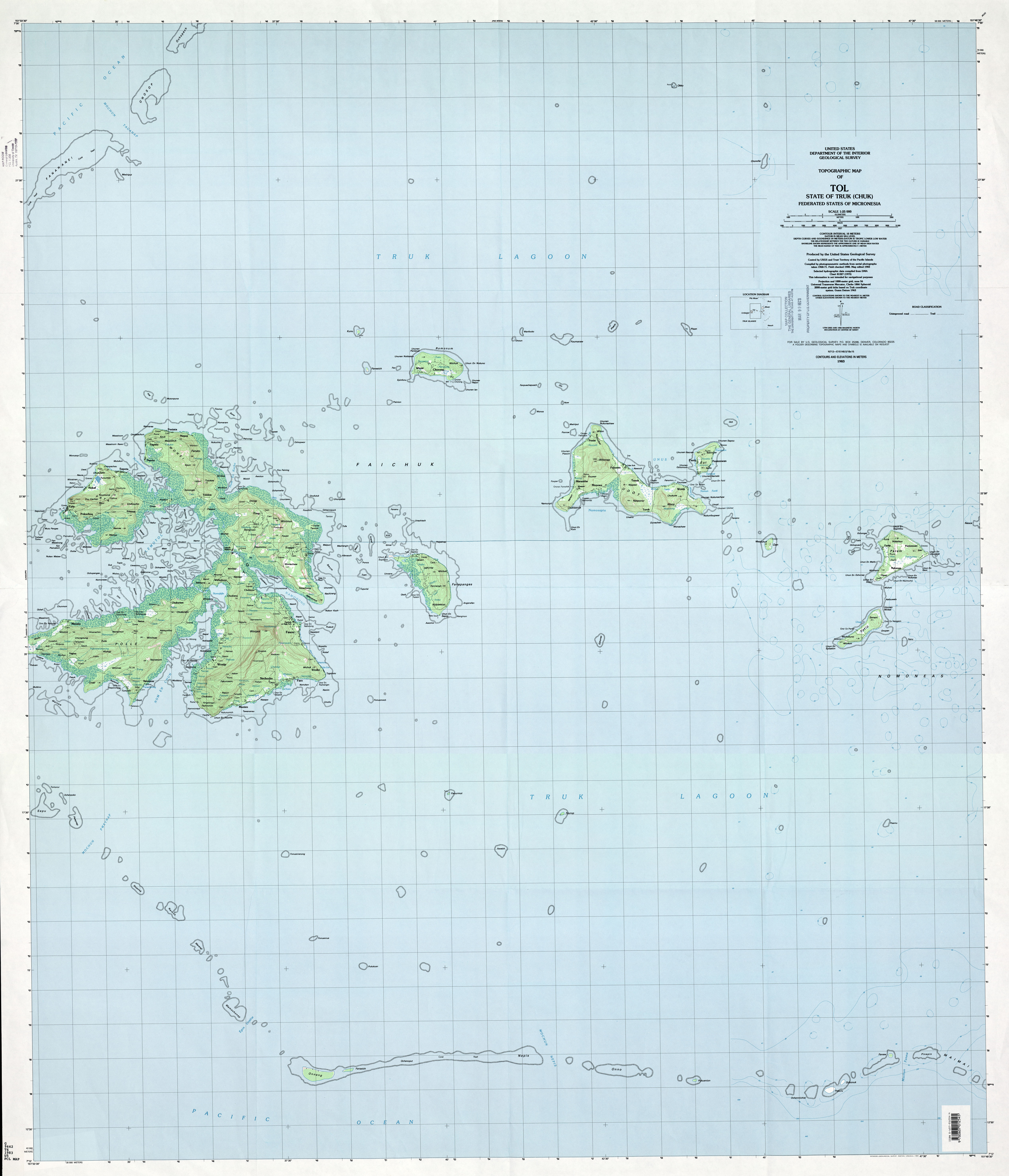
- Chuuk (Truk) Tol (Topographic) 1:25,000 U.S. Geological Survey, 1983 (4.6MB)
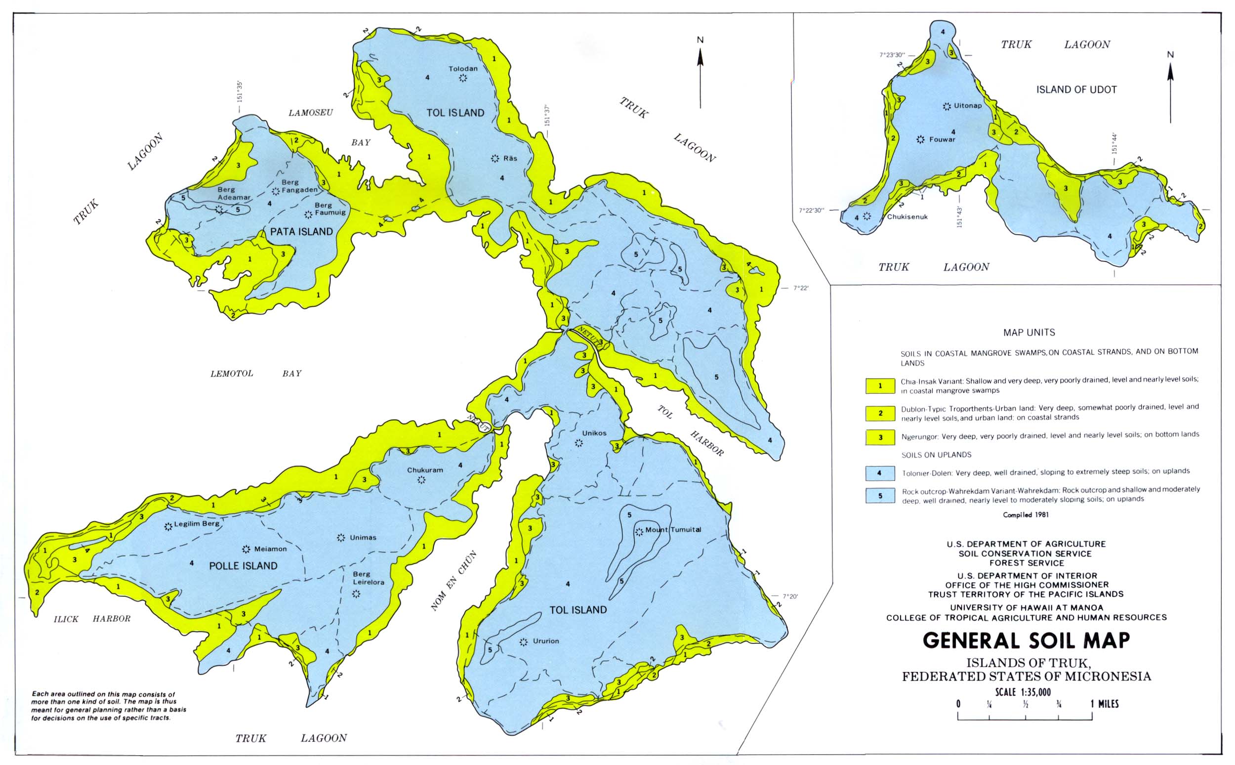
- Chuuk (Truk) Tol, Pata, Polle and Udot Islands (General Soil Map) From Soil Survey of Islands of Truk, Federated States of Micronesia, United States Department of Agriculture, Soil Conservation Service. 1983 (map compiled in 1981) (343K)
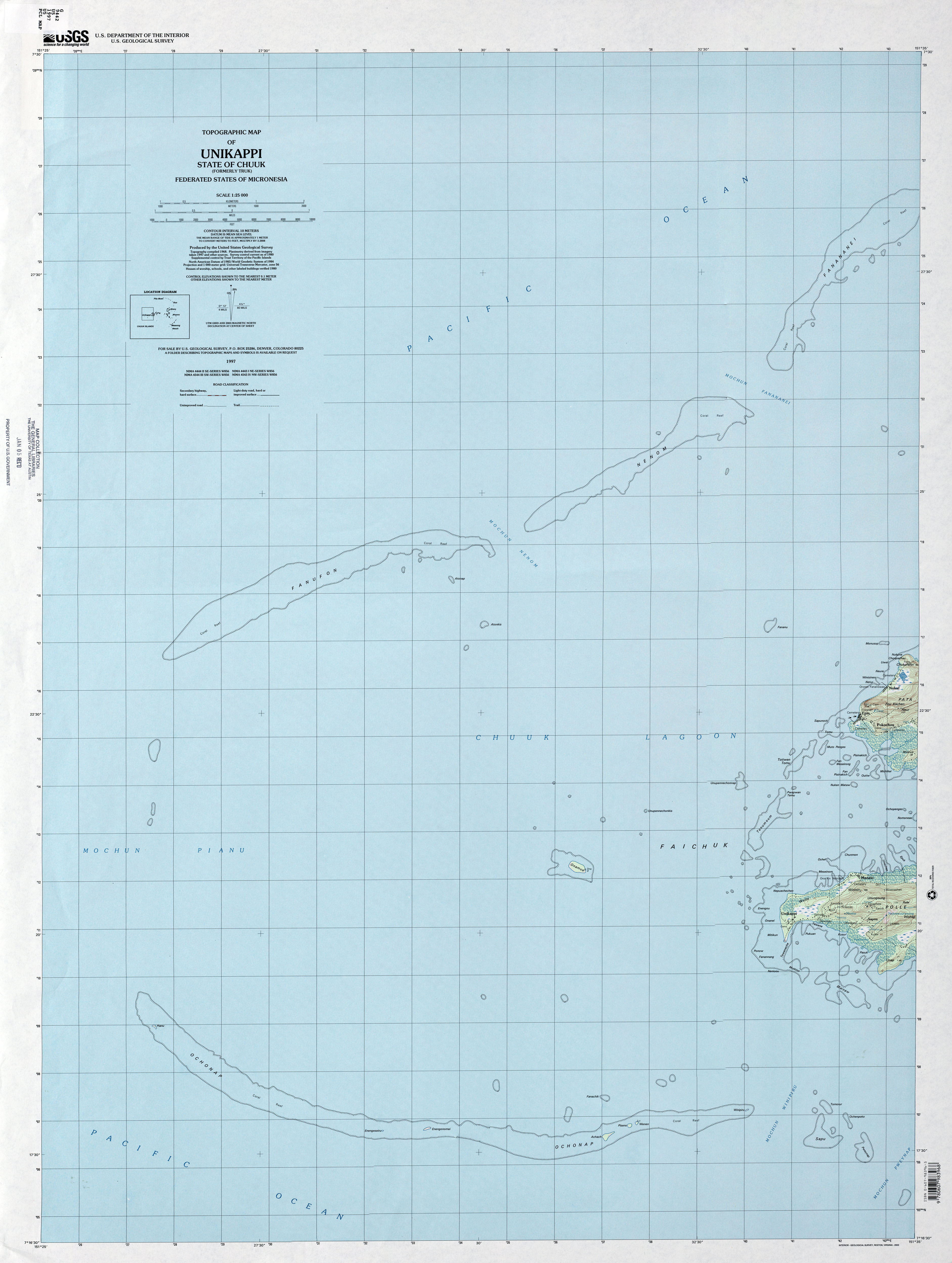
- Chuuk (Truk) Unikappi (Topographic) 1:25,000 U.S. Geological Survey, 1997 (2.2MB)
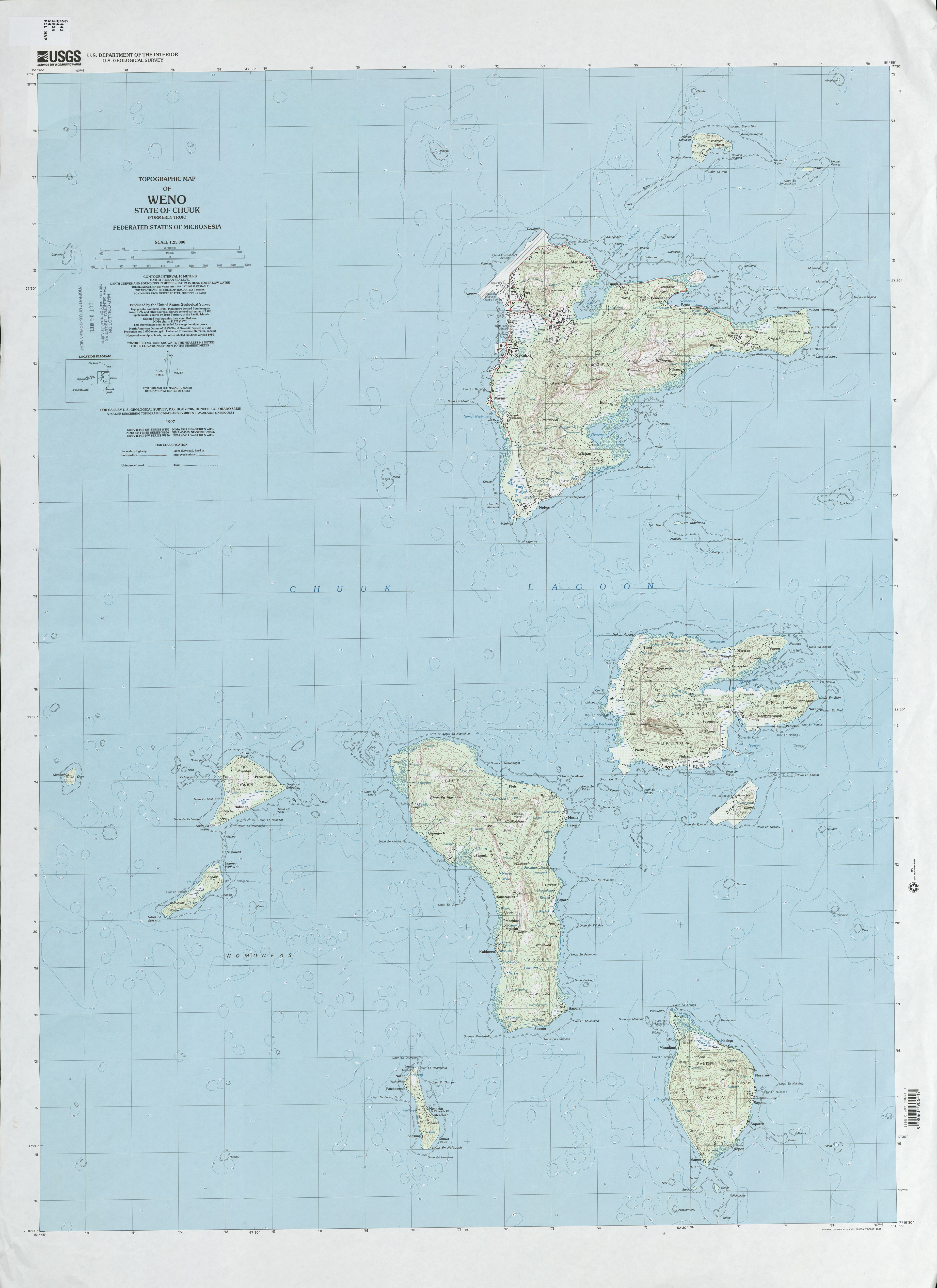
- Chuuk (Truk) Weno (Topographic) 1:25,000 U.S. Geological Survey, 1997 (2.7MB)
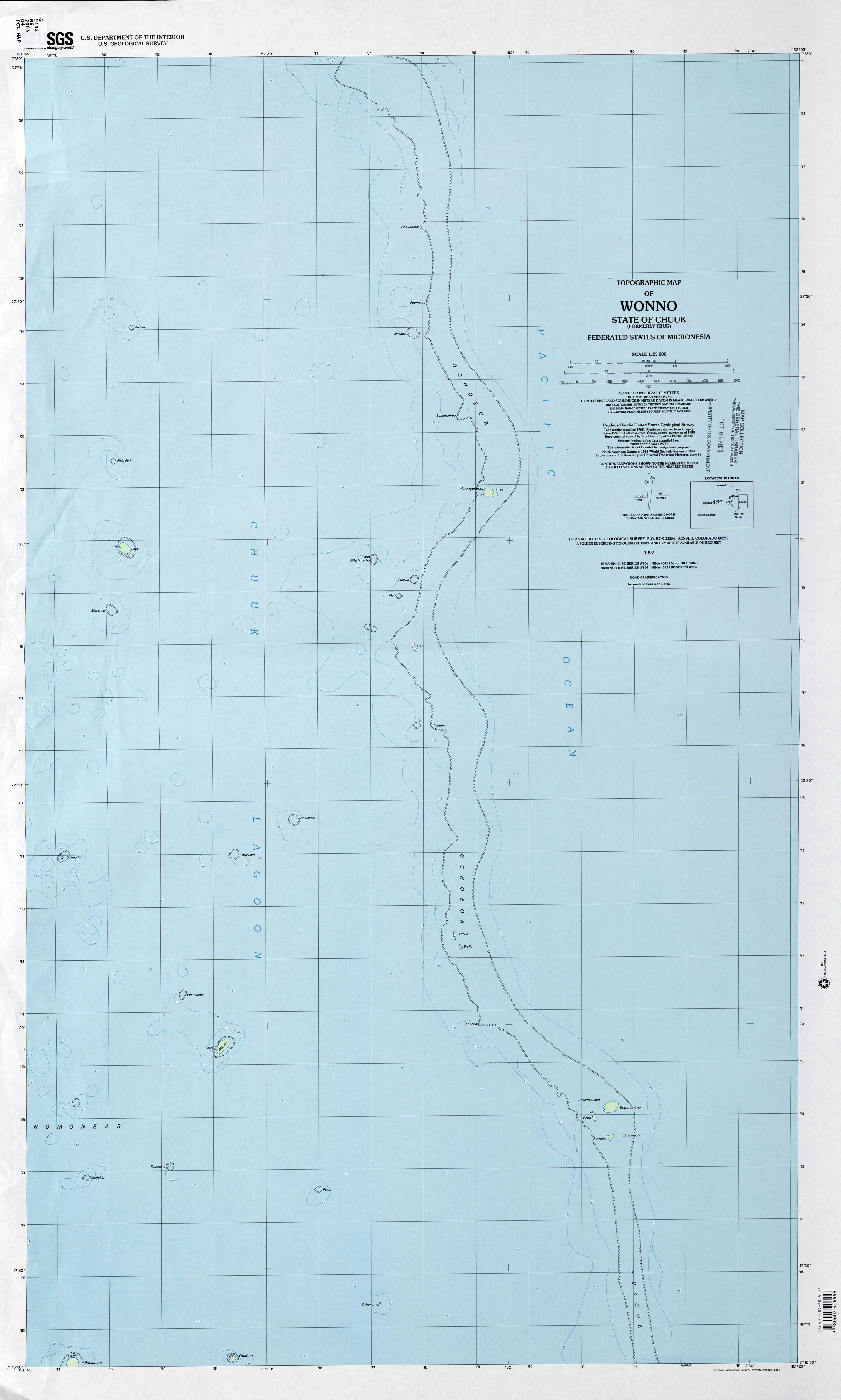
- Chuuk (Truk) Wonno (Topographic) 1:25,000 U.S. Geological Survey, 1997 (1.7MB)
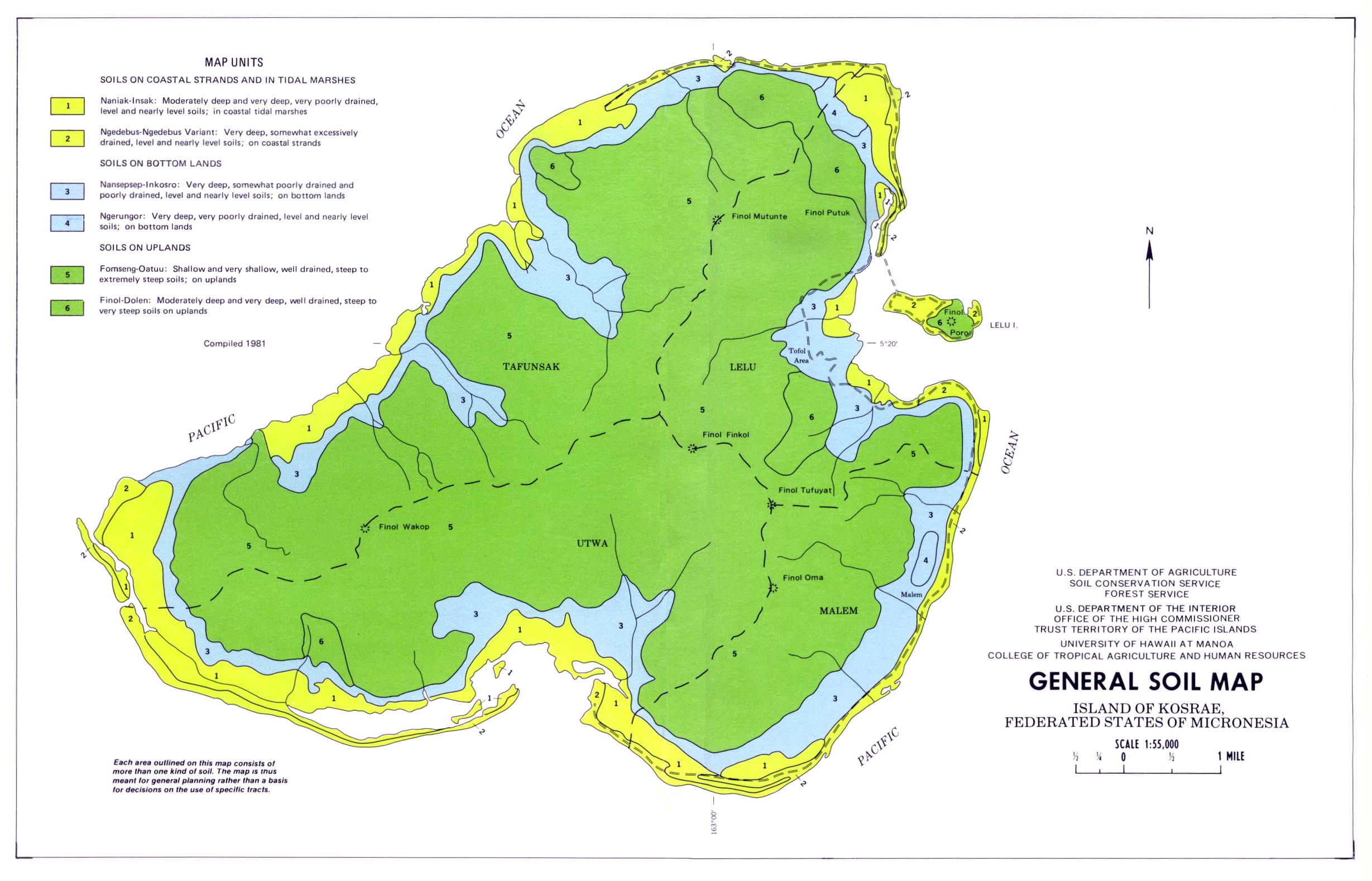
- Kosrae Island (General Soil Map) United States Department of Agriculture, Soil Conservation Service. 1983 (Map compiled in 1981) (298K)
- Island of Kosrae (Topographic) 1:25,000 U.S. Geological Survey, 2001 (3.1 MB)
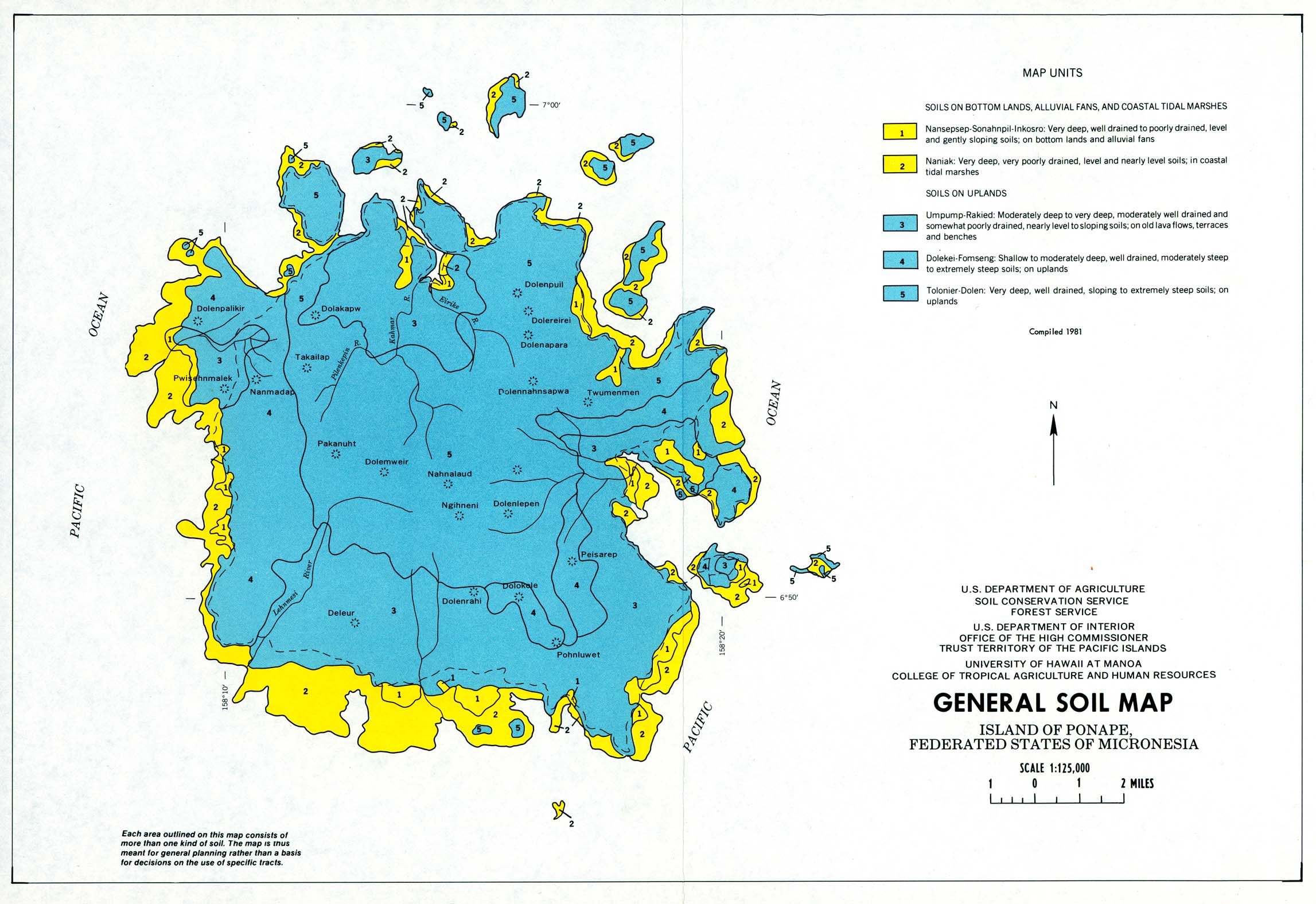
- Ponape Island (General Soil Map) United States Department of Agriculture, Soil Conservation Service. (Map compiled in 1981) (379K)
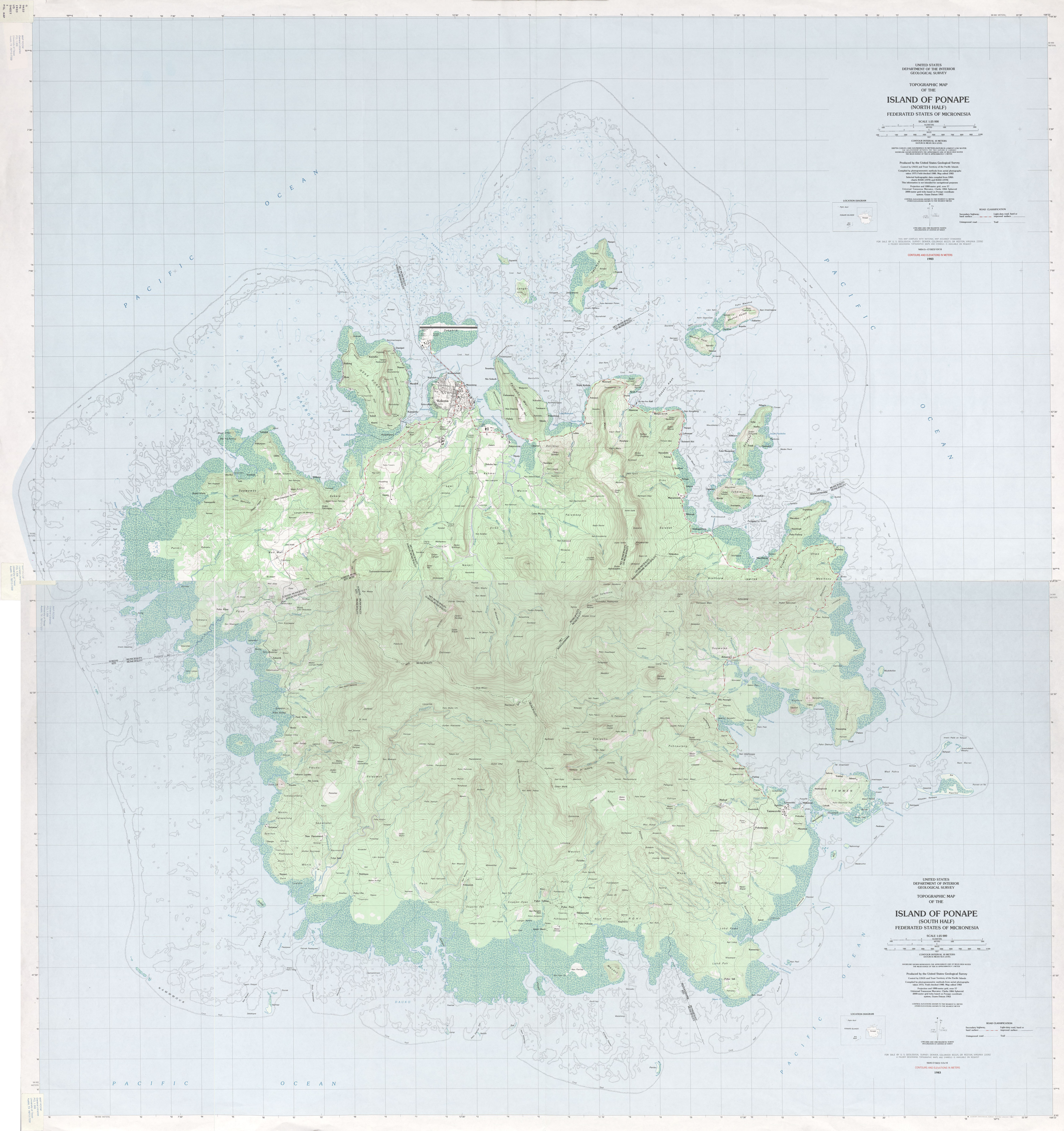
- Ponape - North and South Sheets (Topographic) 1:25,000 U.S. Geological Survey, 1983 (7.1 MB)
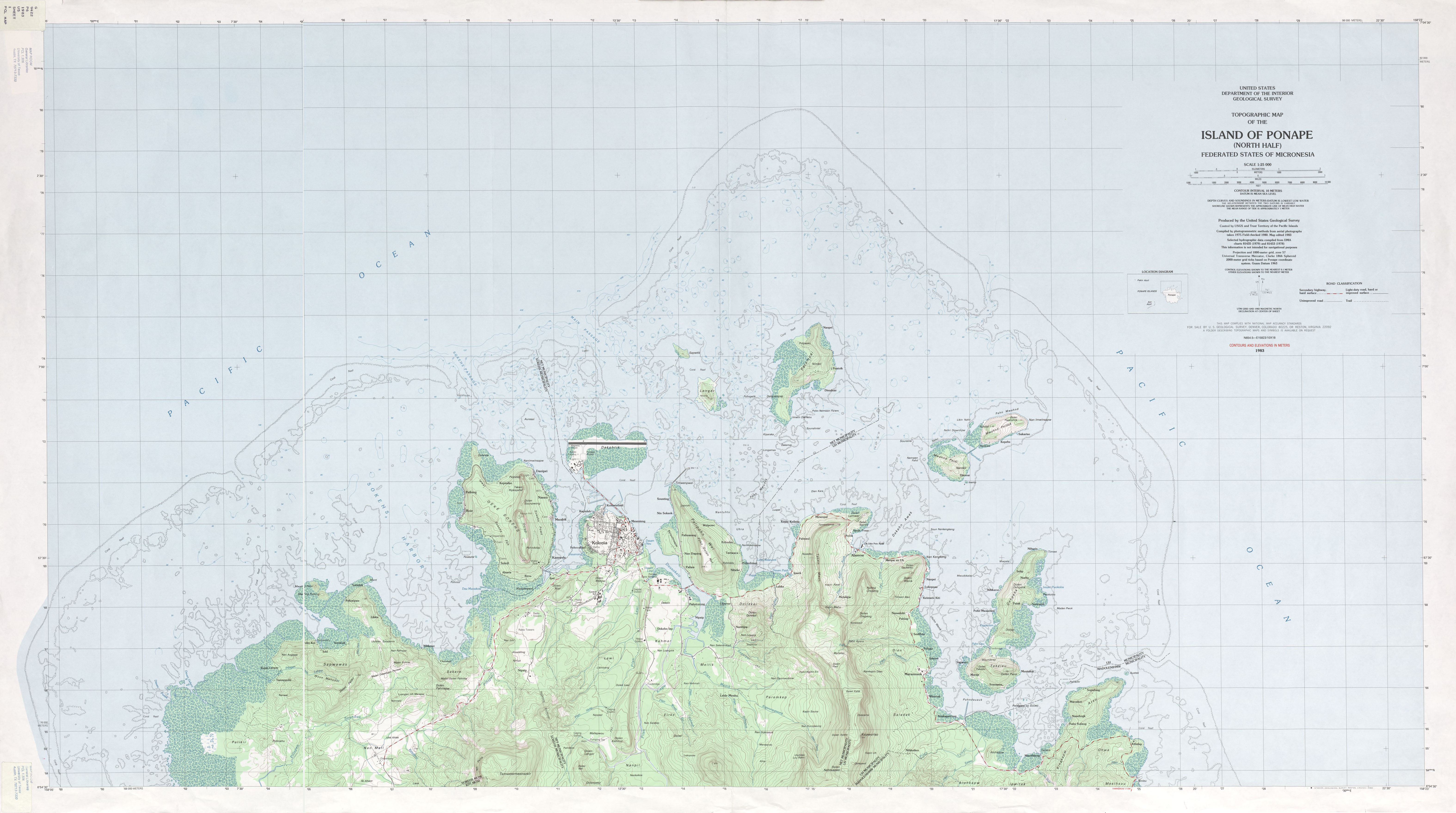
- Ponape North (Topographic) 1:25,000 U.S. Geological Survey, 1983 (3.3 MB)
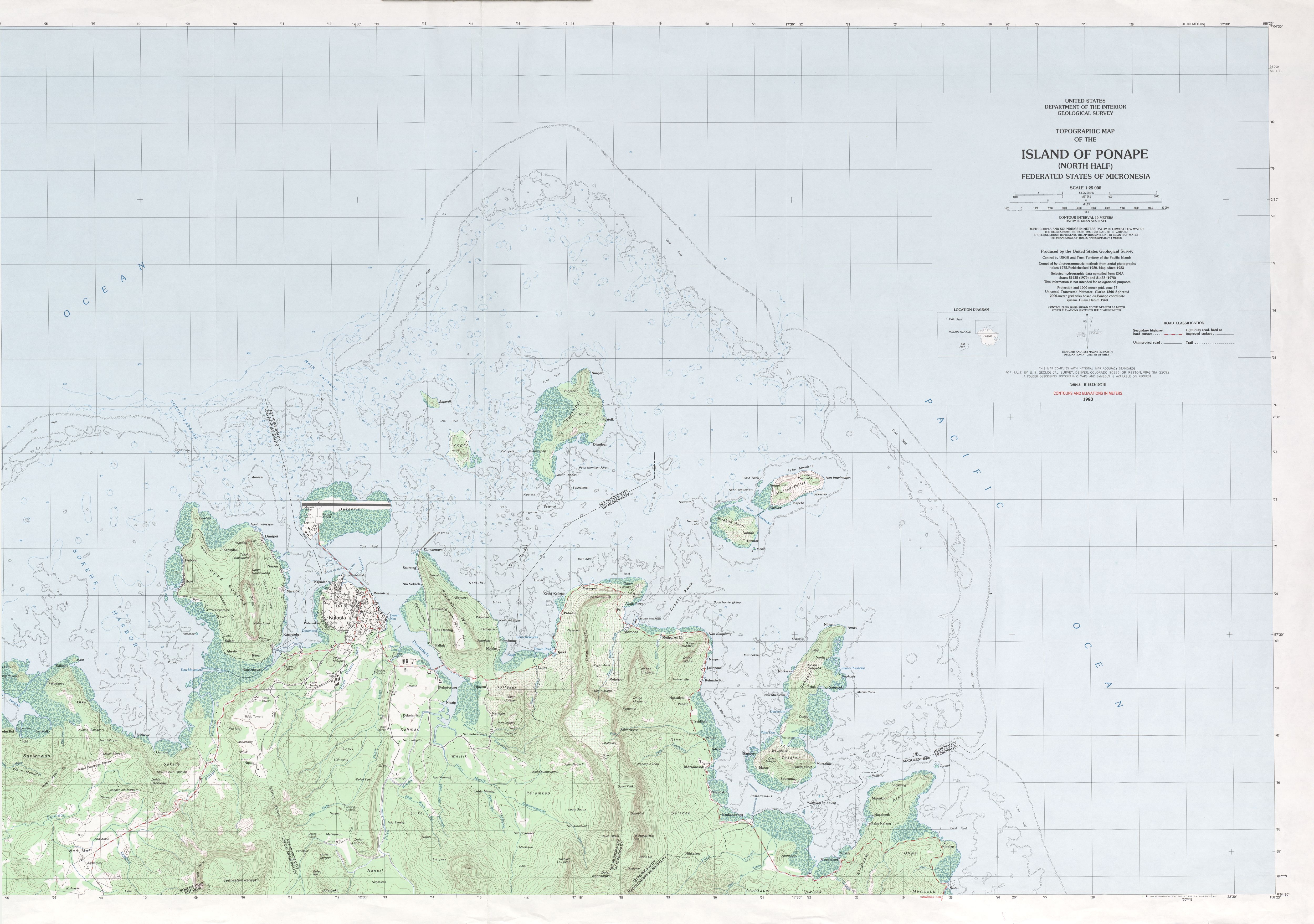
- Ponape - Northeast (Topographic) 1:25,000 U.S. Geological Survey, 1983 (2.5 MB)
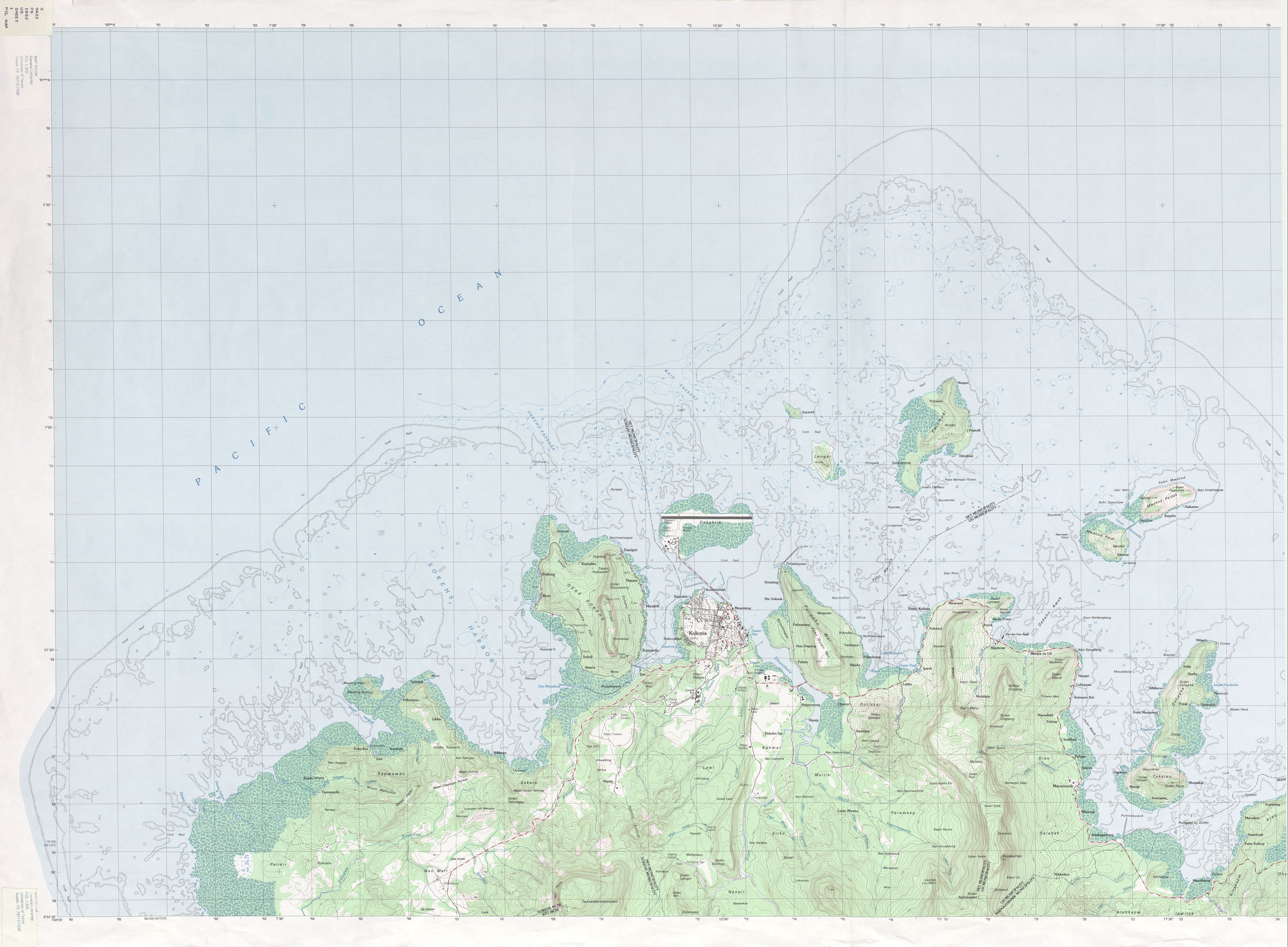
- Ponape - Northwest (Topographic) 1:25,000 U.S. Geological Survey, 1983 (2.8 MB)
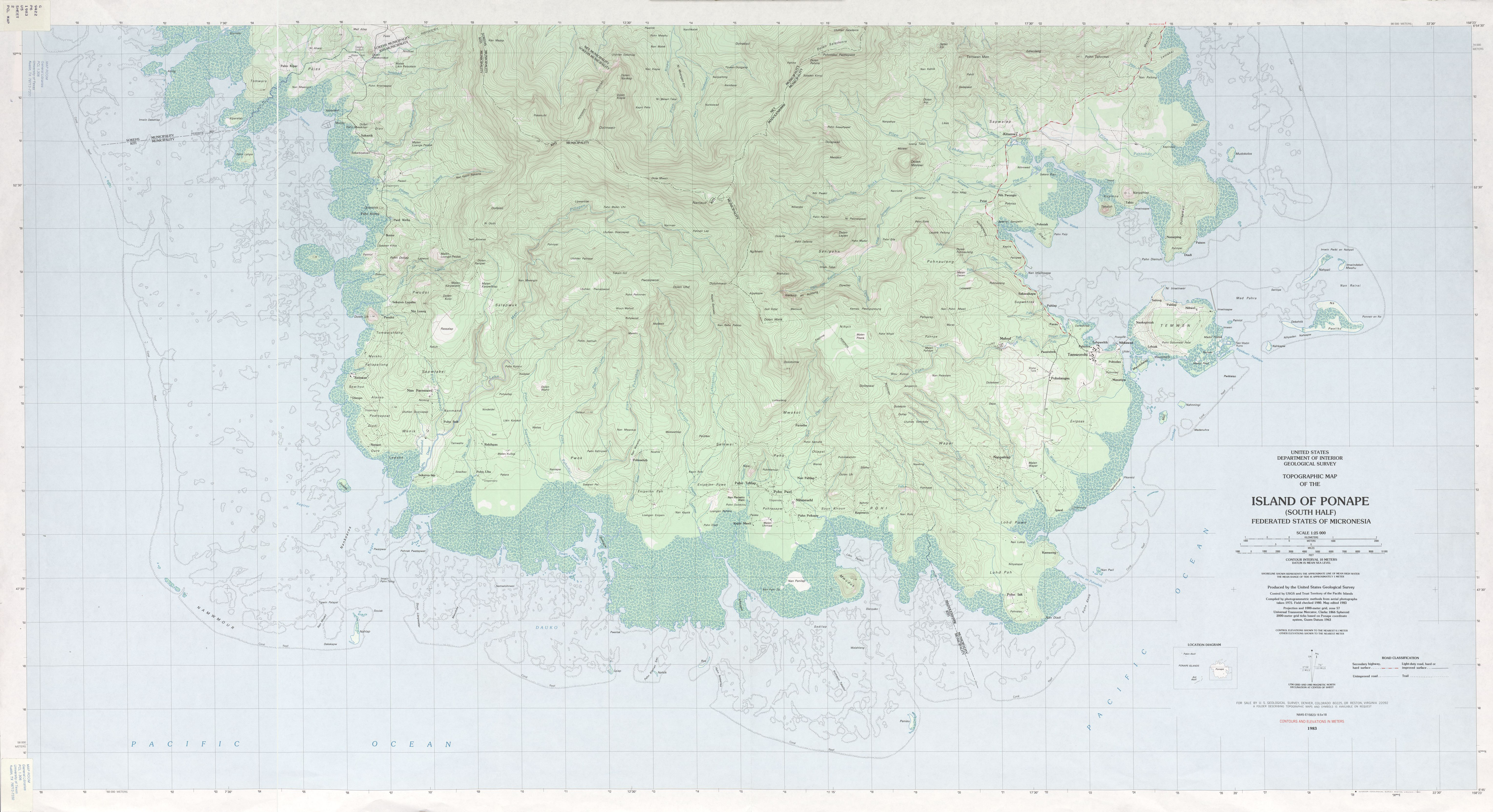
- Ponape South (Topographic) 1:25,000 U.S. Geological Survey, 1983 (3.9 MB)
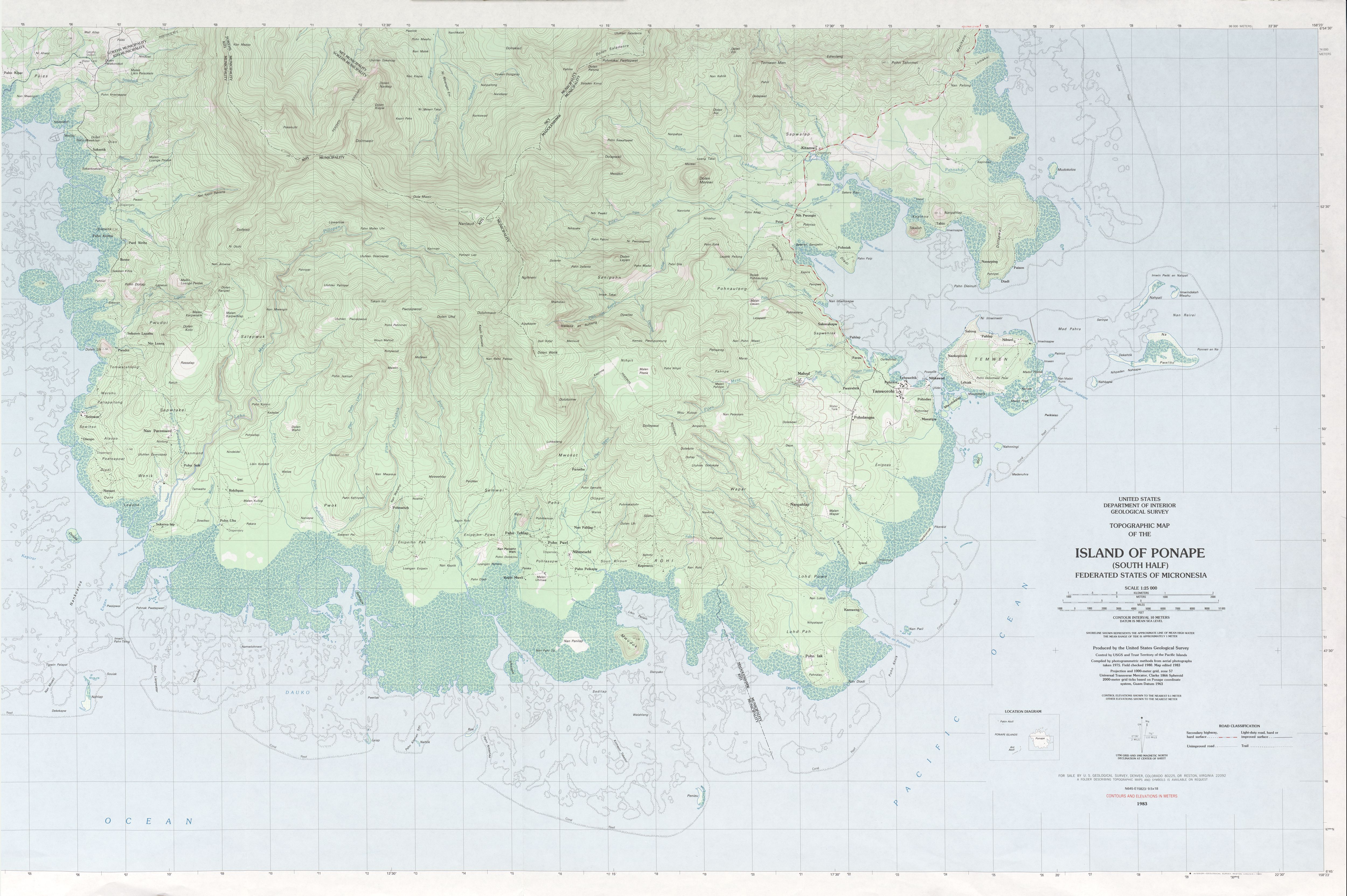
- Ponape - Southeast (Topographic) 1:25,000 U.S. Geological Survey, 1983 (3.2 MB)
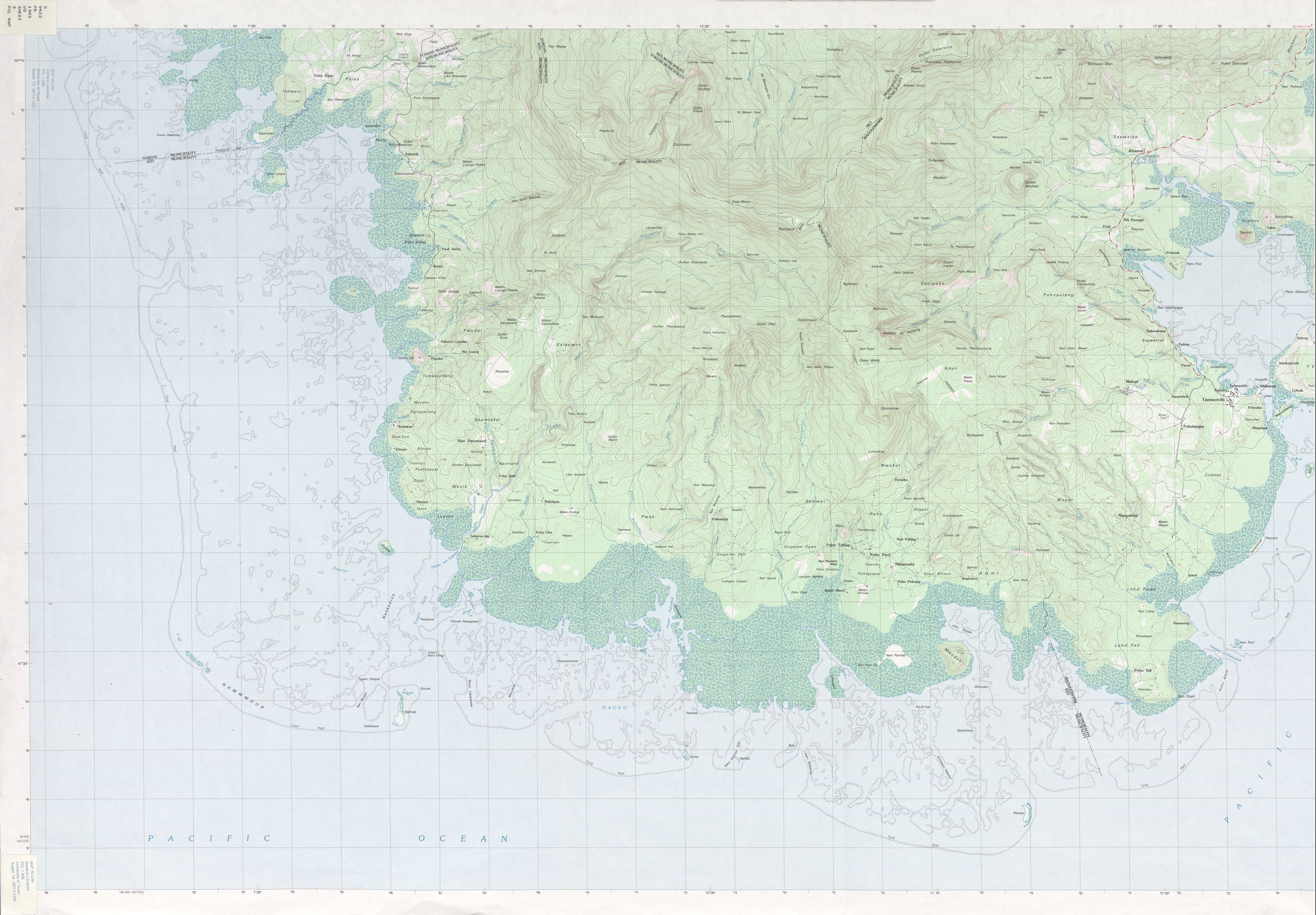
- Ponape - Southwest (Topographic) 1:25,000 U.S. Geological Survey, 1983 (3.3 MB)
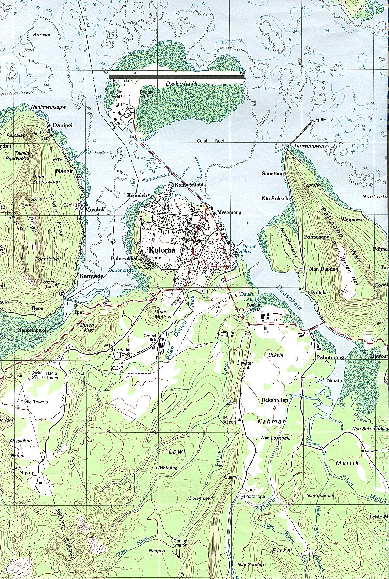
- Ponape (detail of Kolonia Area) (Topographic) 1:25,000 U.S. Geological Survey, 1983 (935K)
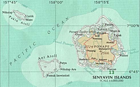
- Senyavin Islands (Ponape) U.S. National Atlas 1970 (35K)
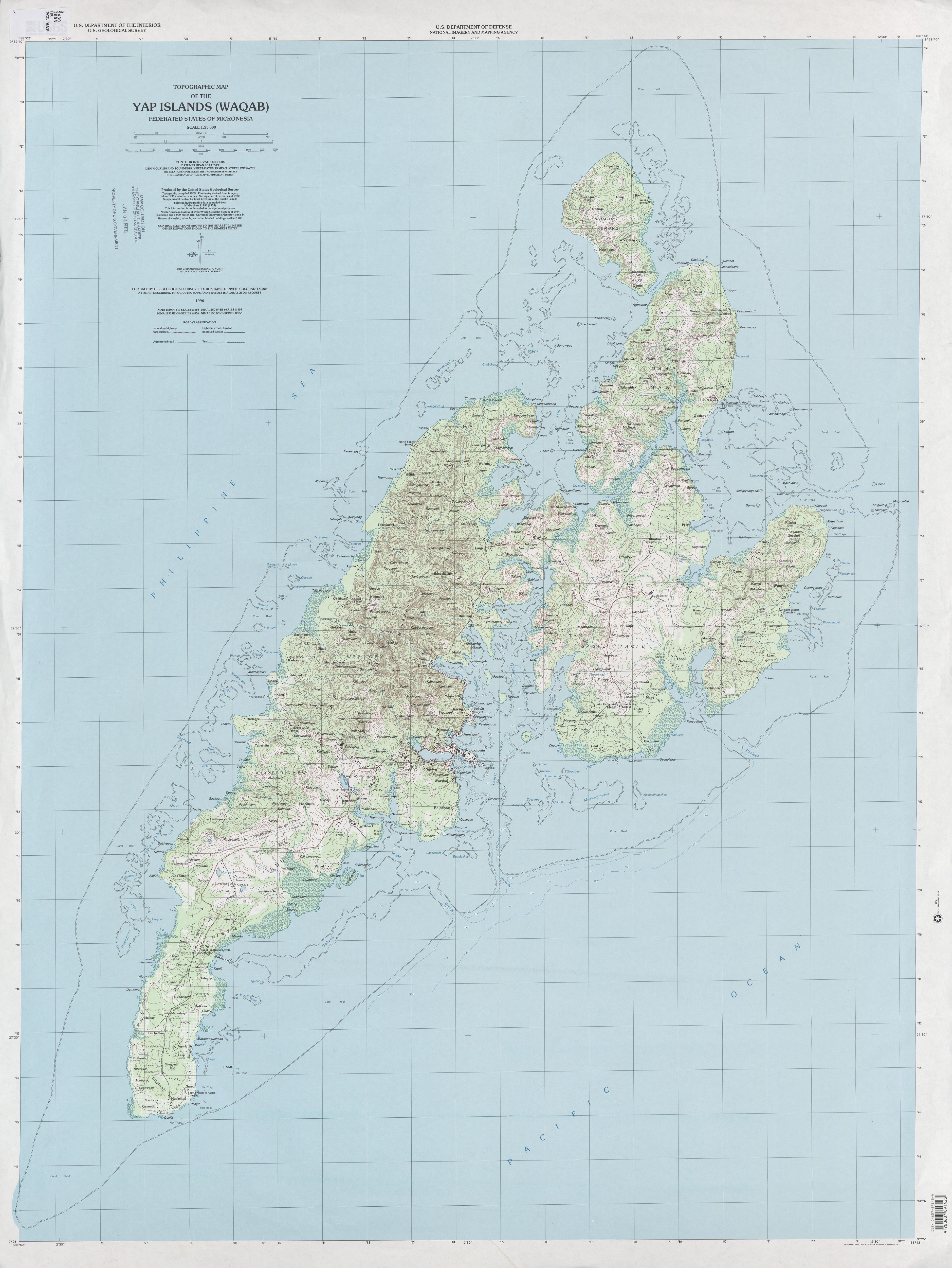
- Yap Islands (Waqab) (Topographic) 1:25,000 U.S. Geological Survey, 2003 (2.7 MB)
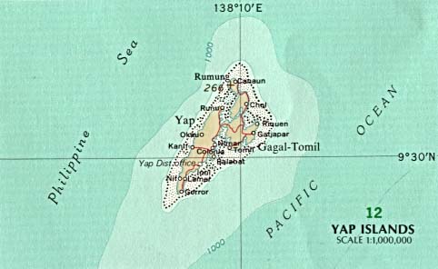
- Yap Islands U.S. National Atlas 1970 (23K)
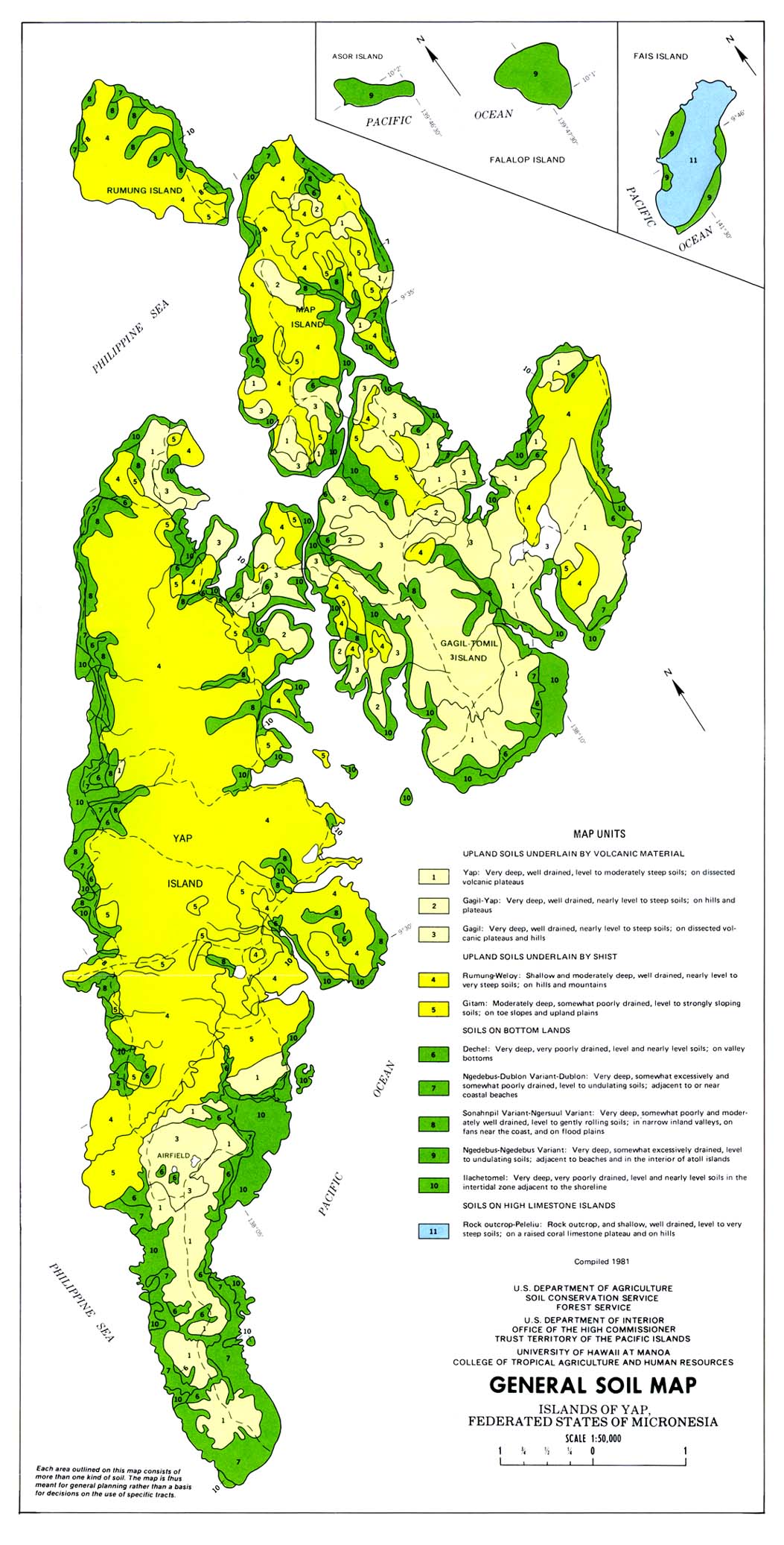
- Yap Islands (General Soil Map) From Soil Survey of Islands of Yap, Federated States of Micronesia, United States Department of Agriculture, Soil Conservation Service. 1983 (Map compiled in 1981) (315K)
- Operational Navigation Chart Series 1:1,000,000. U.S. Defense Mapping Agency Aerospace Center
- This series includes Micronesia. Not for navigational use
- 1:500,000 - Tactical Pilotage Charts U.S. National Imagery and Mapping Agency. Not for navigational use
- This series covers most of Micronesia
- This series includes Micronesia. Not for navigational use
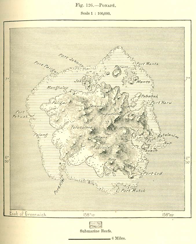
- Ponape Island 1890 From "The Earth and Its Inhabitants, Oceania" by Elisee Reclus, Edited by A.H. Keane, New York: D. Appleton and Company, 1890 (129K)
- Ruk Island [Truk] 1890 From "The Earth and Its Inhabitants, Oceania" by Elisee Reclus, Edited by A.H. Keane, New York: D. Appleton and Company, 1890 (170K)
- Yap Island 1890 From "The Earth and Its Inhabitants, Oceania" by Elisee Reclus, Edited by A.H. Keane, New York: D. Appleton and Company, 1890 (150K)
- Pacific Islands 1943-1945 Maps from "Pacific Islands" [Geographical Handbook Series]. Great Britain. Admiralty. Naval Intelligence Division, 1943-1945. Volume IV includes the Caroline Islands.
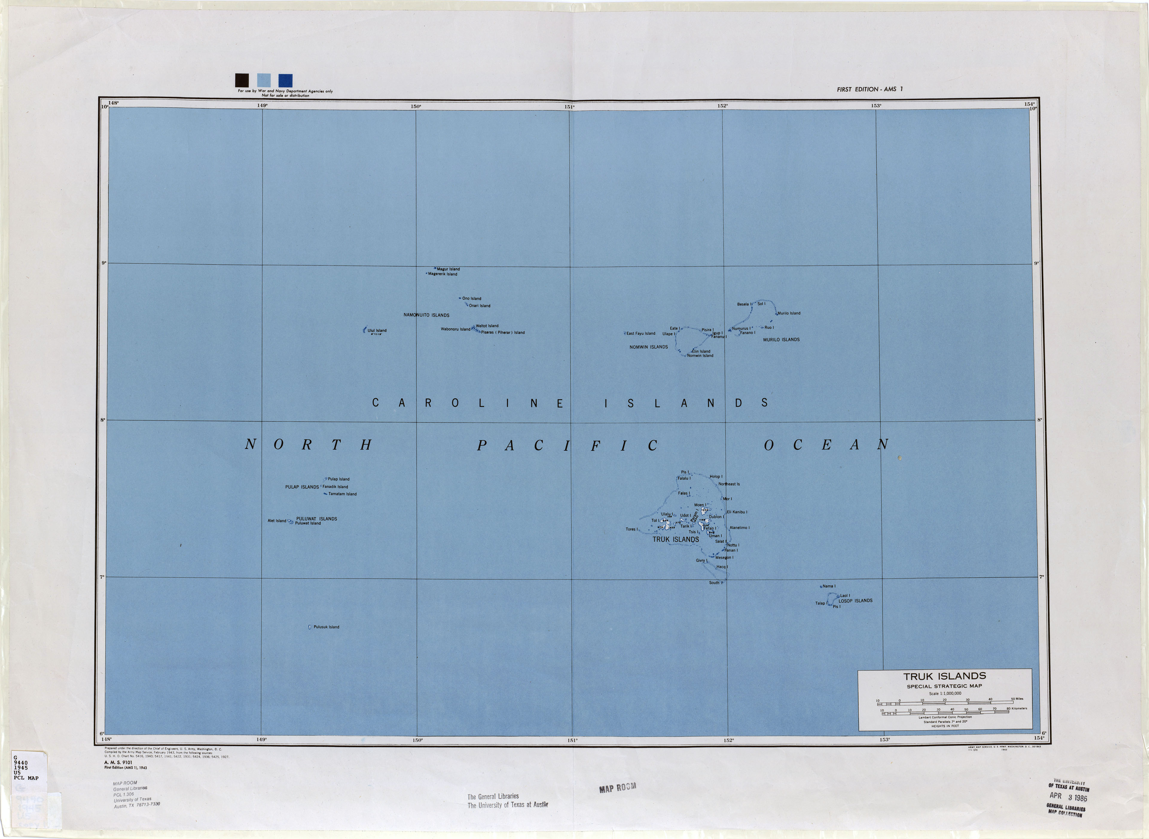
- Truk Islands (Topographic) 1:1,000,000 U.S. Geological Survey, 1945 (1.1MB)
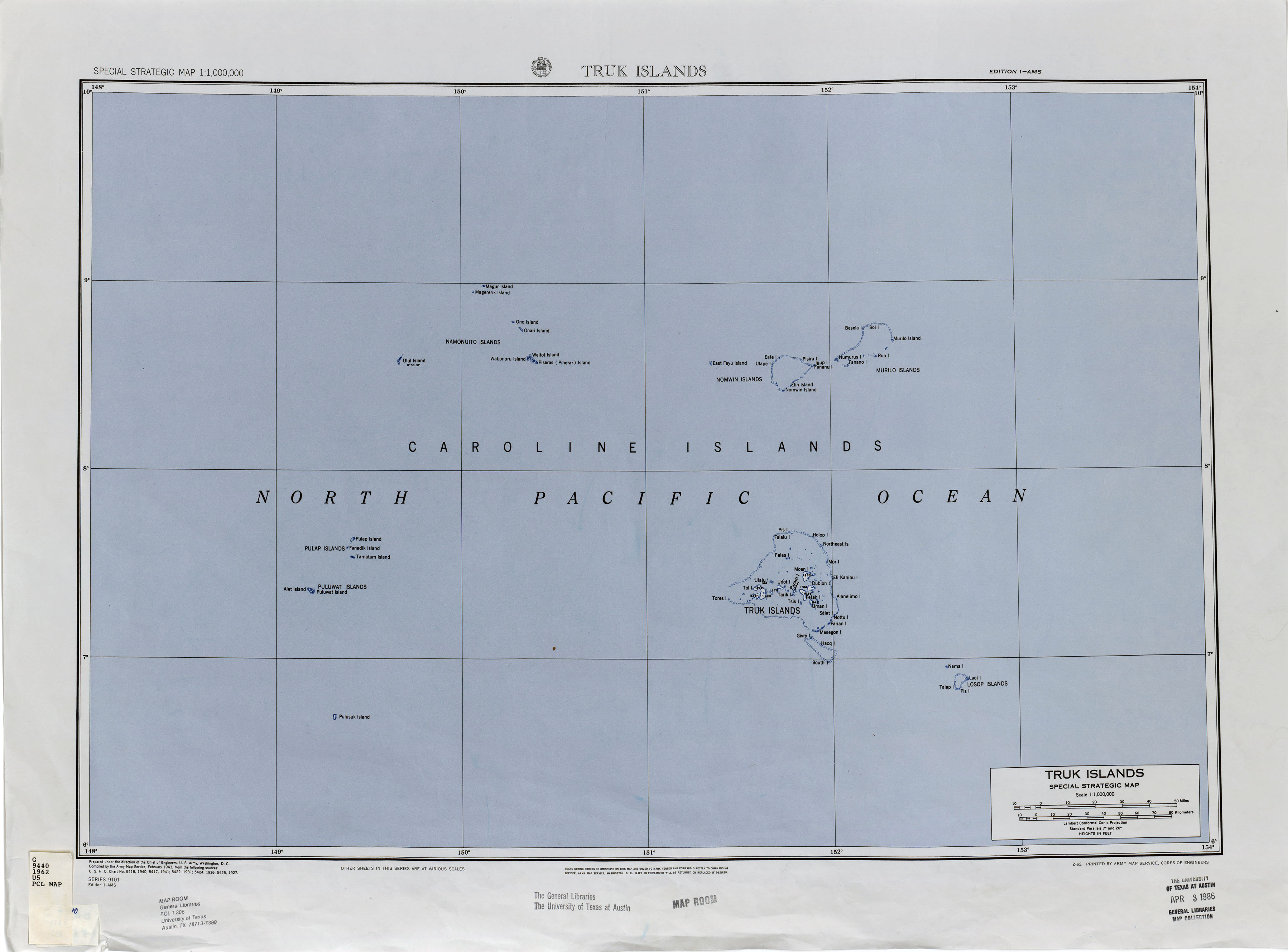
- Truk Islands (Topographic) 1:1,000,000 U.S. Geological Survey, 1962 (938.3KB)
![Ruk Island [Truk] 1890](historical/ruk_islands_1890.jpg)
Maps on Other Web Sites