Perry-Castañeda Library
Map Collection
South Africa Maps
The following maps were produced by the U.S. Central Intelligence Agency, unless otherwise indicated.
Country Maps- South Africa (Physiography) 2005 (1.8MB) and pdf format (1.0MB)
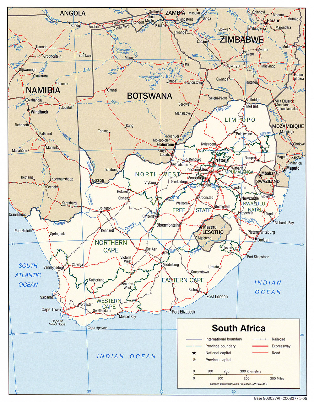
- South Africa (Political) 2005 (701K) and pdf format (703K)
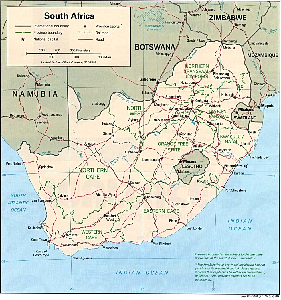
- South Africa (Political) 1995 (238K) and pdf format (241K)
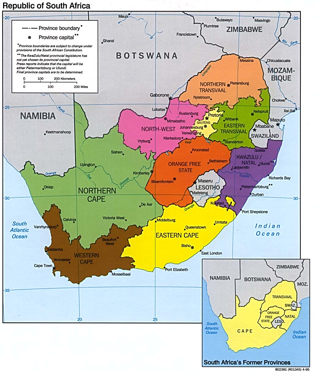
- South Africa (Provinces) 1995 (214K)
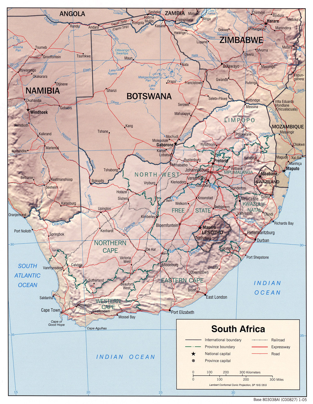
- South Africa (Shaded Relief) 2005 (609K) and pdf format (611K)
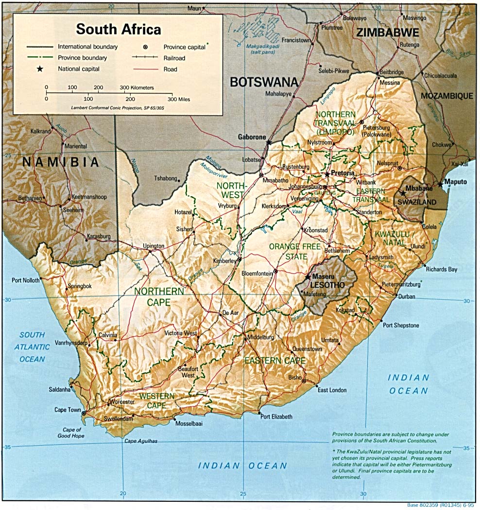
- South Africa (Shaded Relief) 1995 (282K) and pdf format (285K)
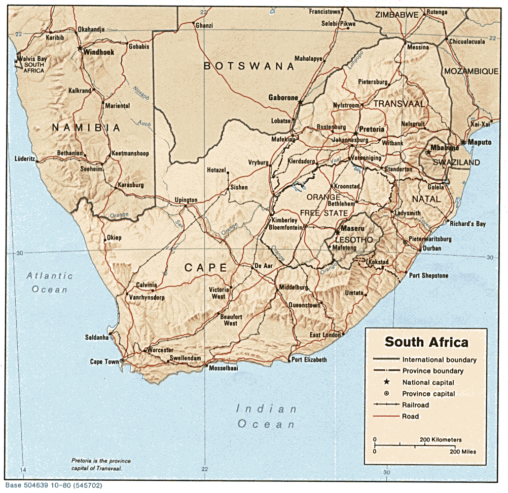
- South Africa (Shaded Relief) 1980 (221K)
- South Africa (Small Map) 2016 (12.3K)
- South Africa (Transportation) 2005 (1.6MB) and pdf format (446KB)
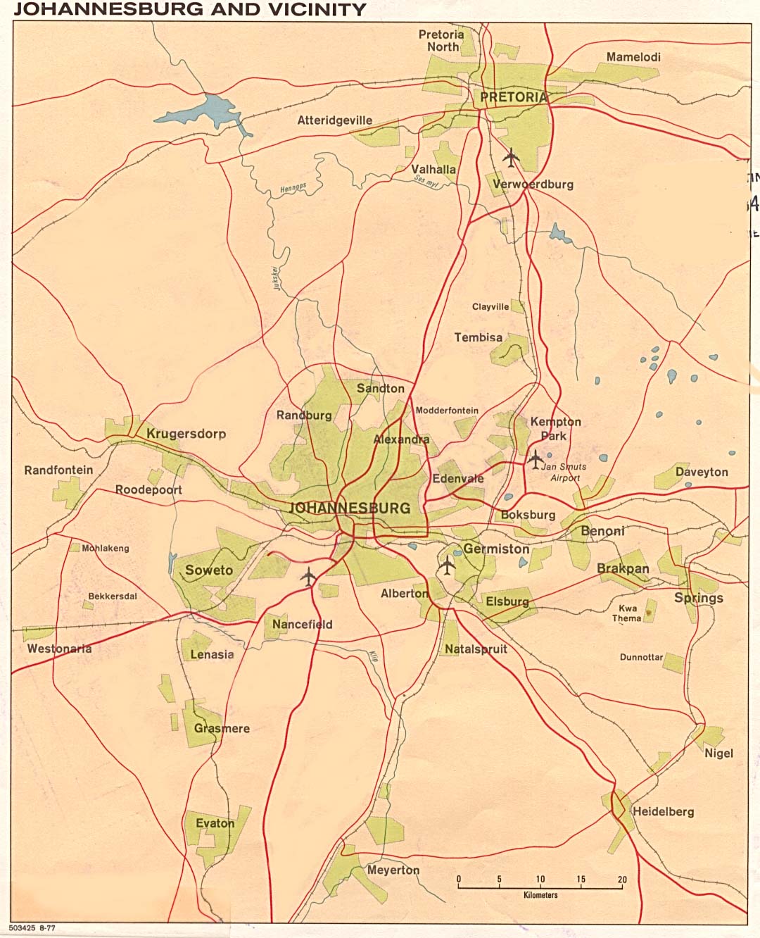
- Johannesburg 1977 (217K)
- South Africa - Prince Edward Island [Indian Ocean] from The Indian Ocean Atlas, published by the C.I.A. 1976 (45K)
![South Africa - Prince Edward Island [Indian Ocean]](islands_oceans_poles/prince_edward_island.jpg)
- 1:2,000,000 - Africa Topographic Maps U.S. Army Topographic Command, Series 2201
- Sheets 33, 34, 35 and 36 cover all of South Africa
- 1:1,000,000 - International Map of the World U.S. Army Map Service
- This series covers most of South Africa. Clickable map
- 1:250,000 - South Africa Topographic Maps U.S. Army Map Service, Series Z501
- This series covers large parts of South Africa
- 1:250,000 - Joint Operations Graphic Aeronautical charts. U.S. National Imagery and Mapping Agency Not for navigational use
- Covers Pretoria, Johannesburg and Cape Town areas only
- Sheets 33, 34, 35 and 36 cover all of South Africa
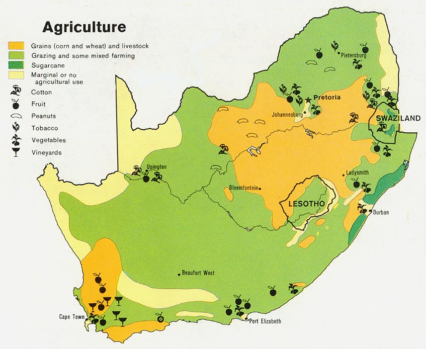
- South Africa - Agriculture from Map No. 503971 1979 (140K)
- South Africa - Industry and Mining from Map No. 503971 1979 (149K)
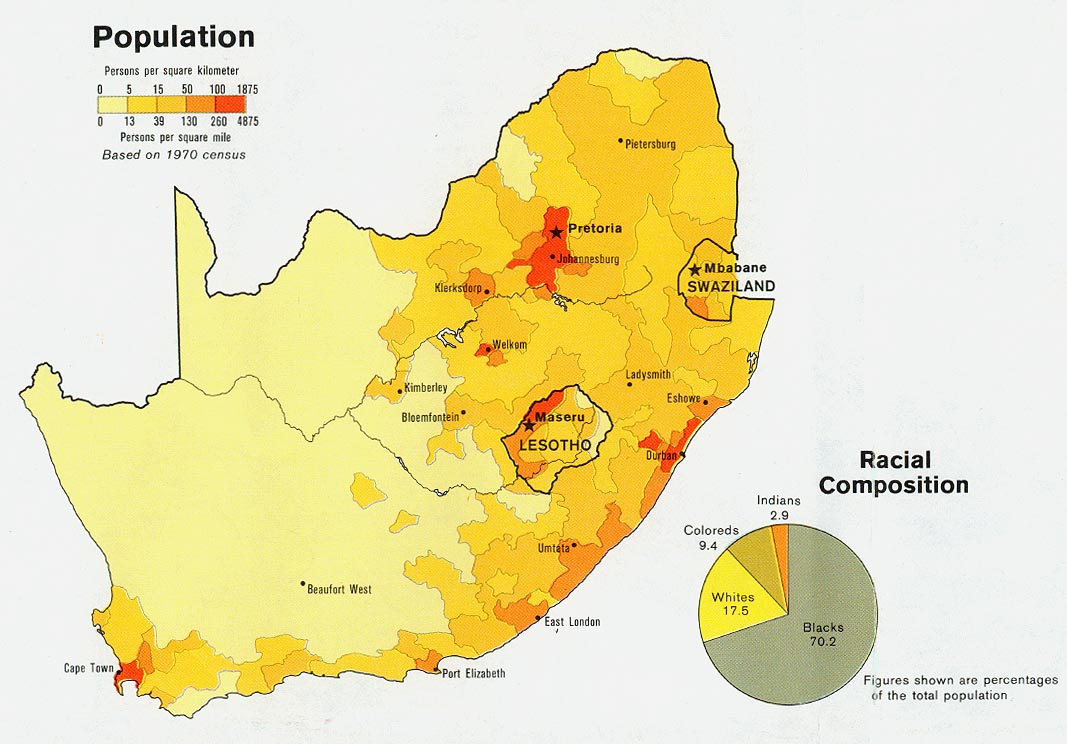
- South Africa - Population from Map No. 503971 1979 (140K)
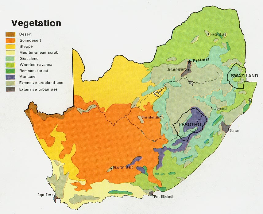
- South Africa - Vegetation from Map No. 503971 1979 (153K)
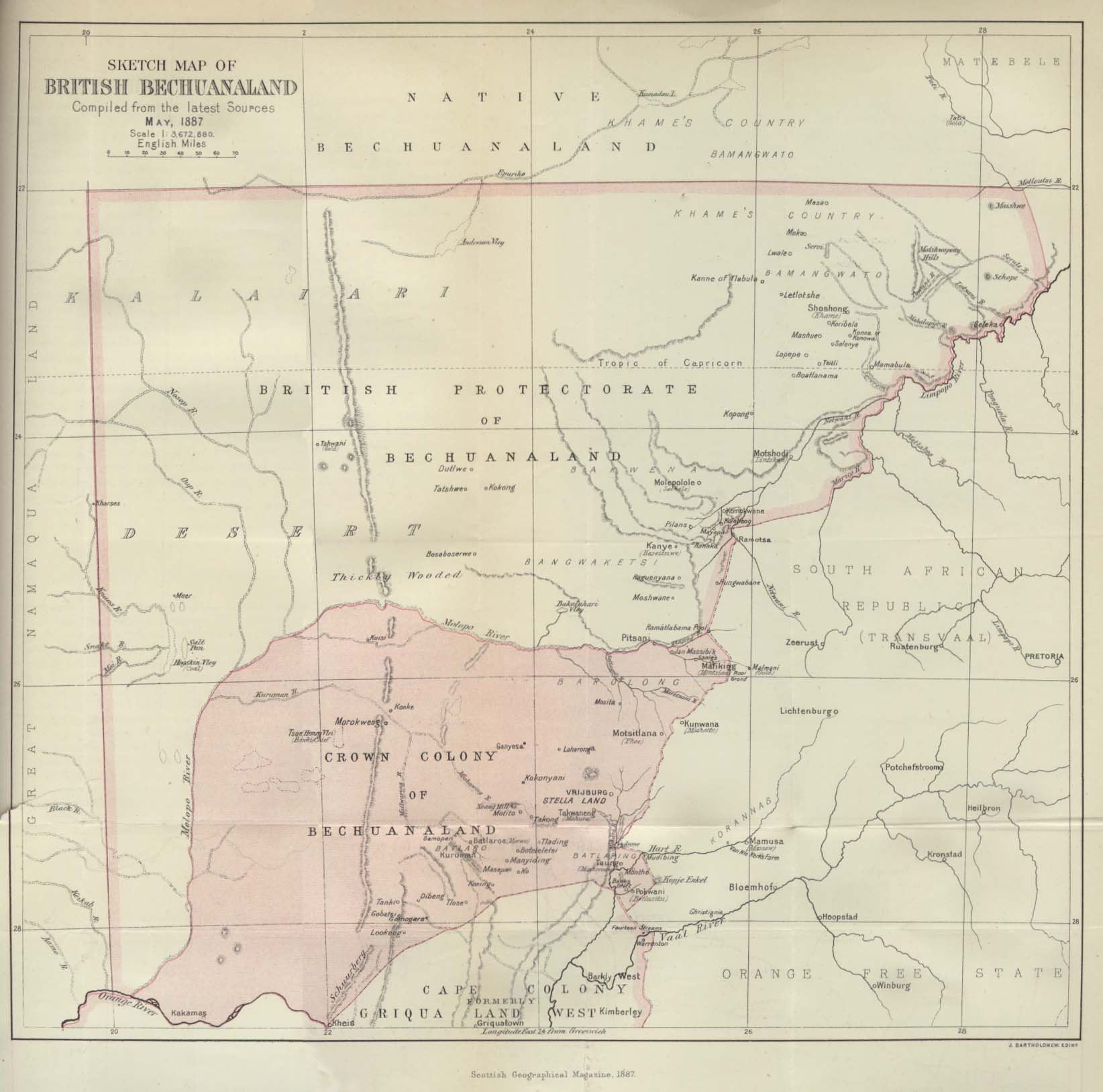
- Bechuanaland 1887 "Sketch Map of British Bechuanaland, May 1887" from the Scottish Geographical Magazine. Published by the Scottish Geographical Society and edited by Arthur Silva White. Volume III, 1887. (181K)
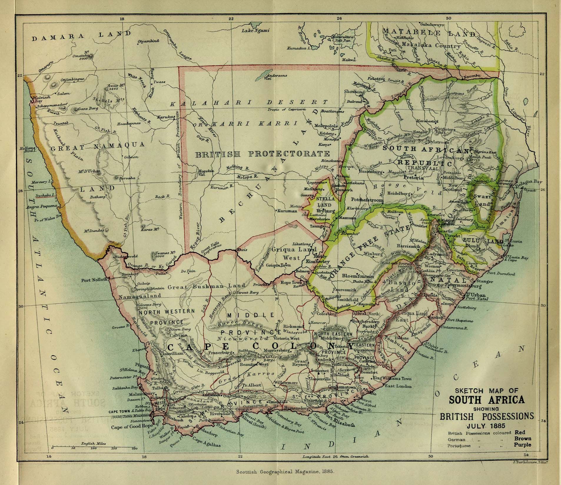
- South Africa 1885 "Sketch Map of South Africa showing British Possessions July 1885" from the Scottish Geographical Magazine. Published by the Scottish Geographical Society and edited by Hugh A. Webster and Arthur Silva White. Volume I, 1885. (531K)
- South Africa - Topographic Maps 1954- Series Z501, 1:250,000, U.S. Army Map Service
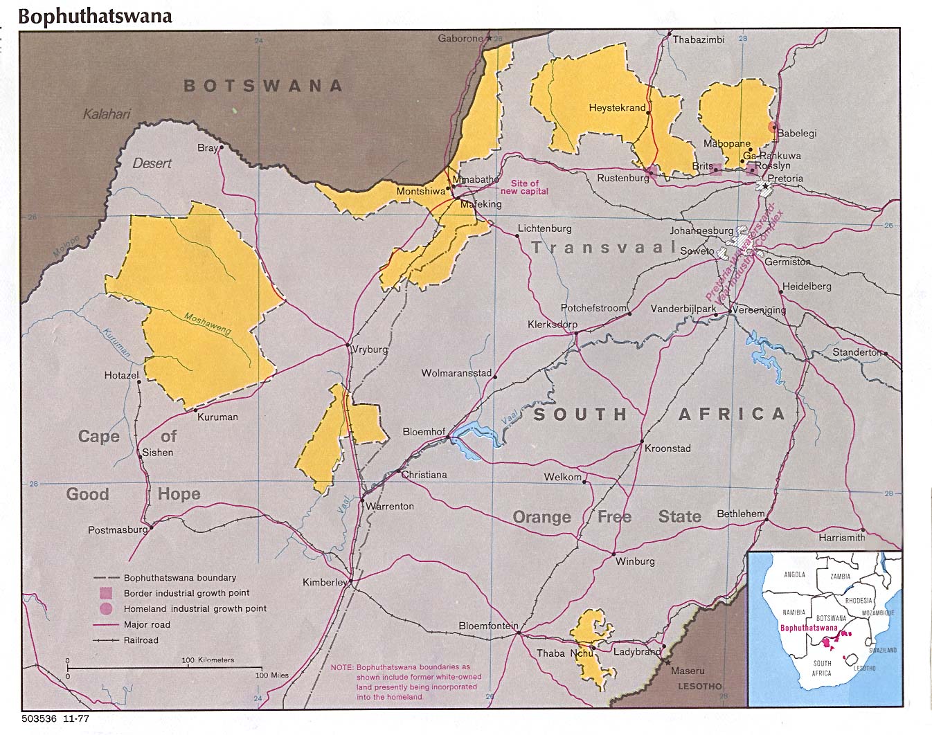
- Bophuthatswana 1977 (259K)
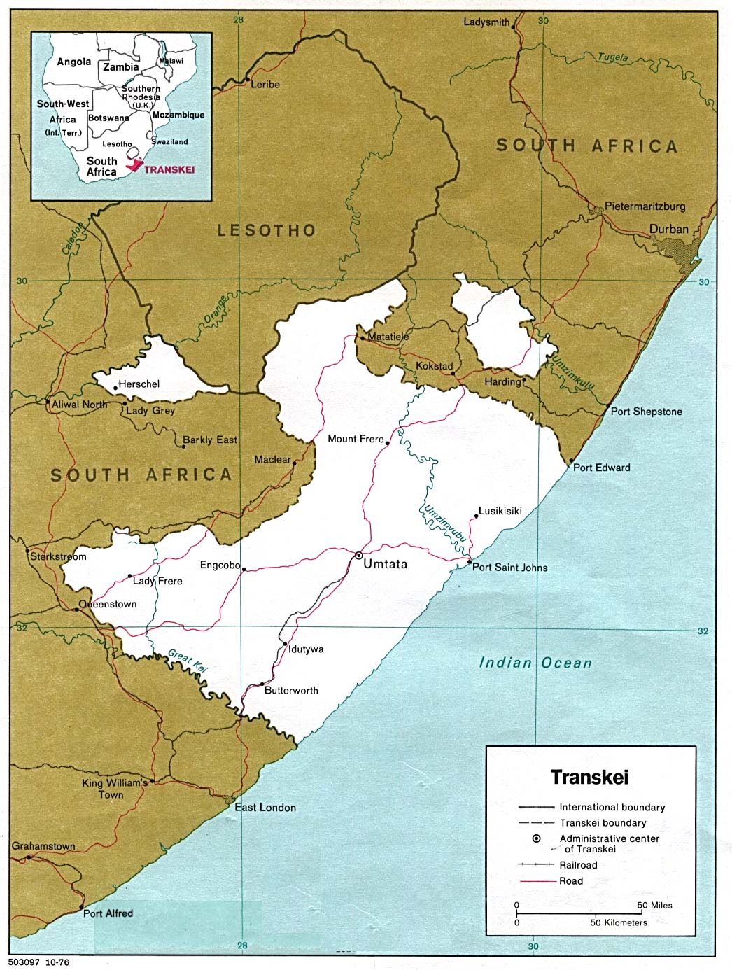
- Transkei 1978 (266K)
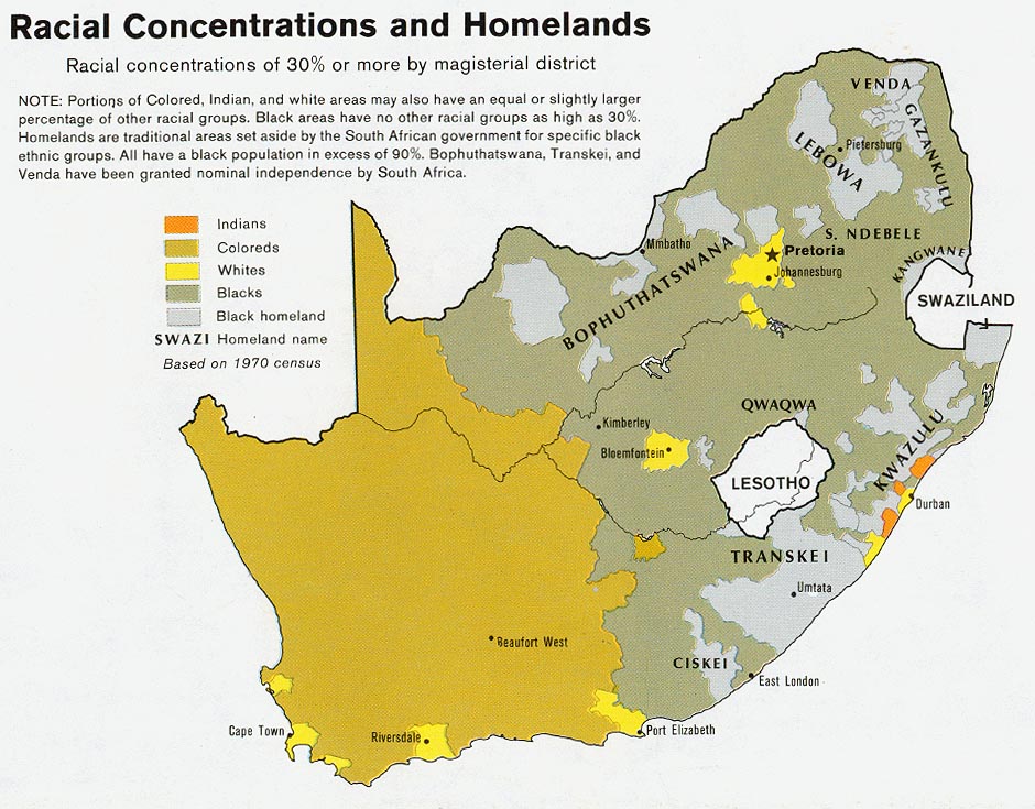
- South Africa - Racial Concentrations and Homelands 1979 from Map No. 503971 1979 (177K)
- South Africa: Black Homelands 1986 (225K)
Maps on Other Web Sites