Perry-Castañeda Library
Map Collection
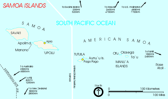
American Samoa (U.S. External Territory) Maps
American Samoa Maps
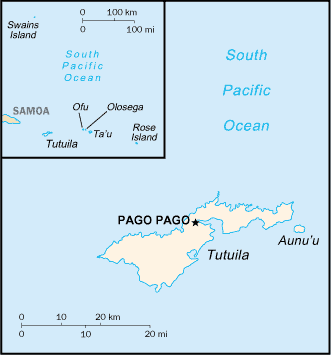
- American Samoa (Small Map) 2016 (6.3K)
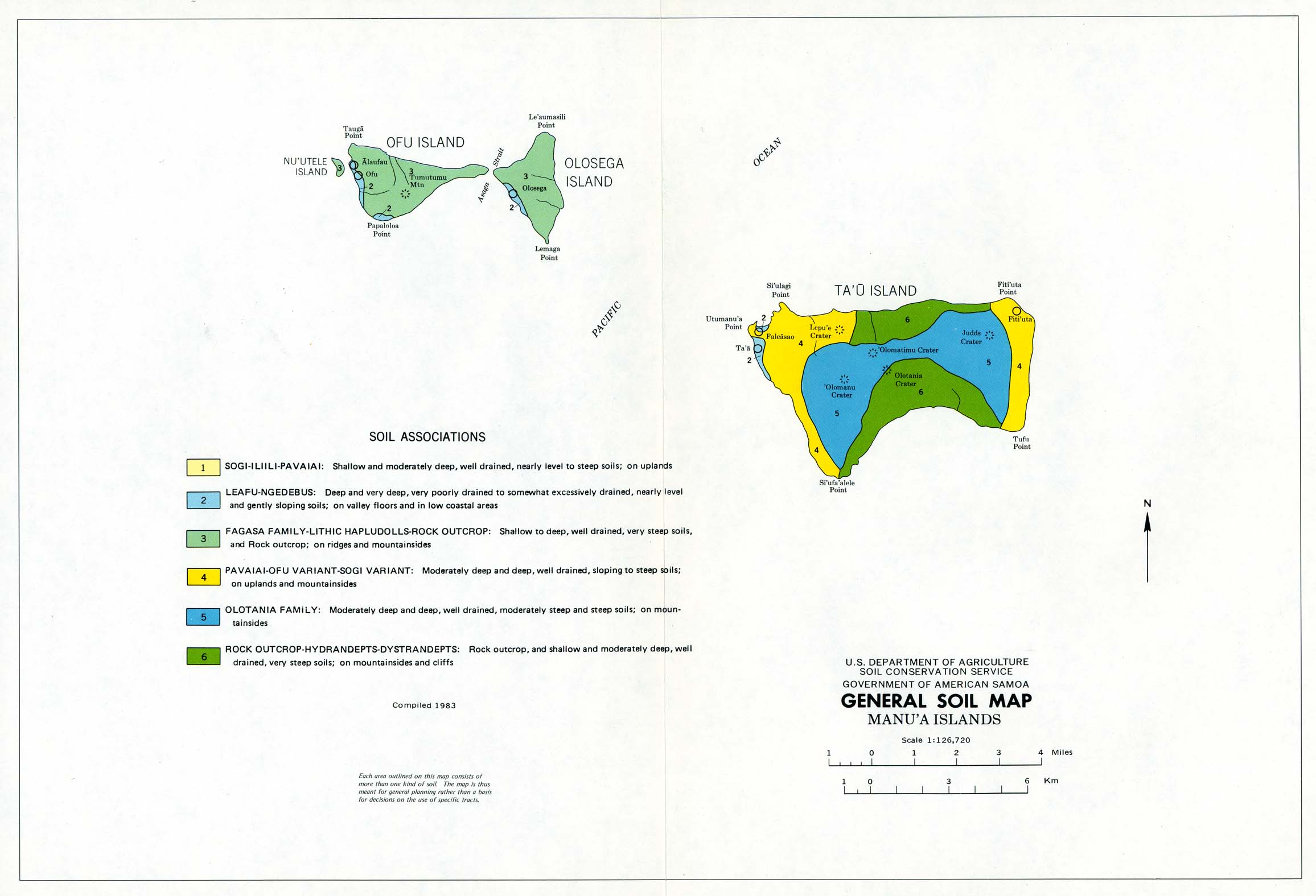
- Manu'a Islands (General Soil Map) United States Department of Agriculture, Soil Conservation Service. Compiled in 1983 (223K)
- Manua Islands (Topographic Map) American Samoa 1:24,000, USGS, 1963 (3.6MB)
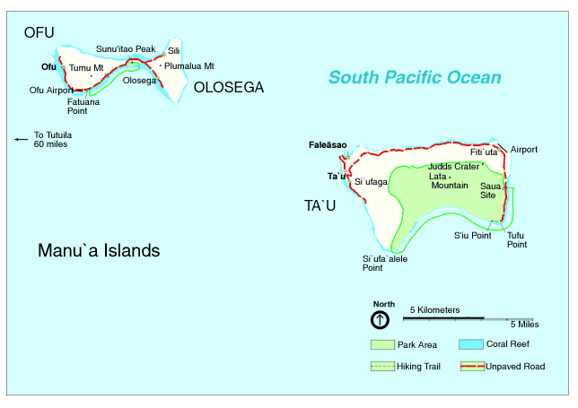
- Manu'a Islands U.S. National Park Service circa 2002 [gif format] (16K)
- Manu'a Islands U.S. National Park Service circa 2002 [pdf format] (70K)
- Manu'a Islands U.S. National Park Service 1997 [pdf format] (129K)
- Manu'a Islands U.S. National Park Service 1997 [jpg format] (315K)
- Manua Islands (Nautical Chart) original scale 1:80,000, U.S. Department of Commerce, NOAA 2006 (383KB) Not for navigational use
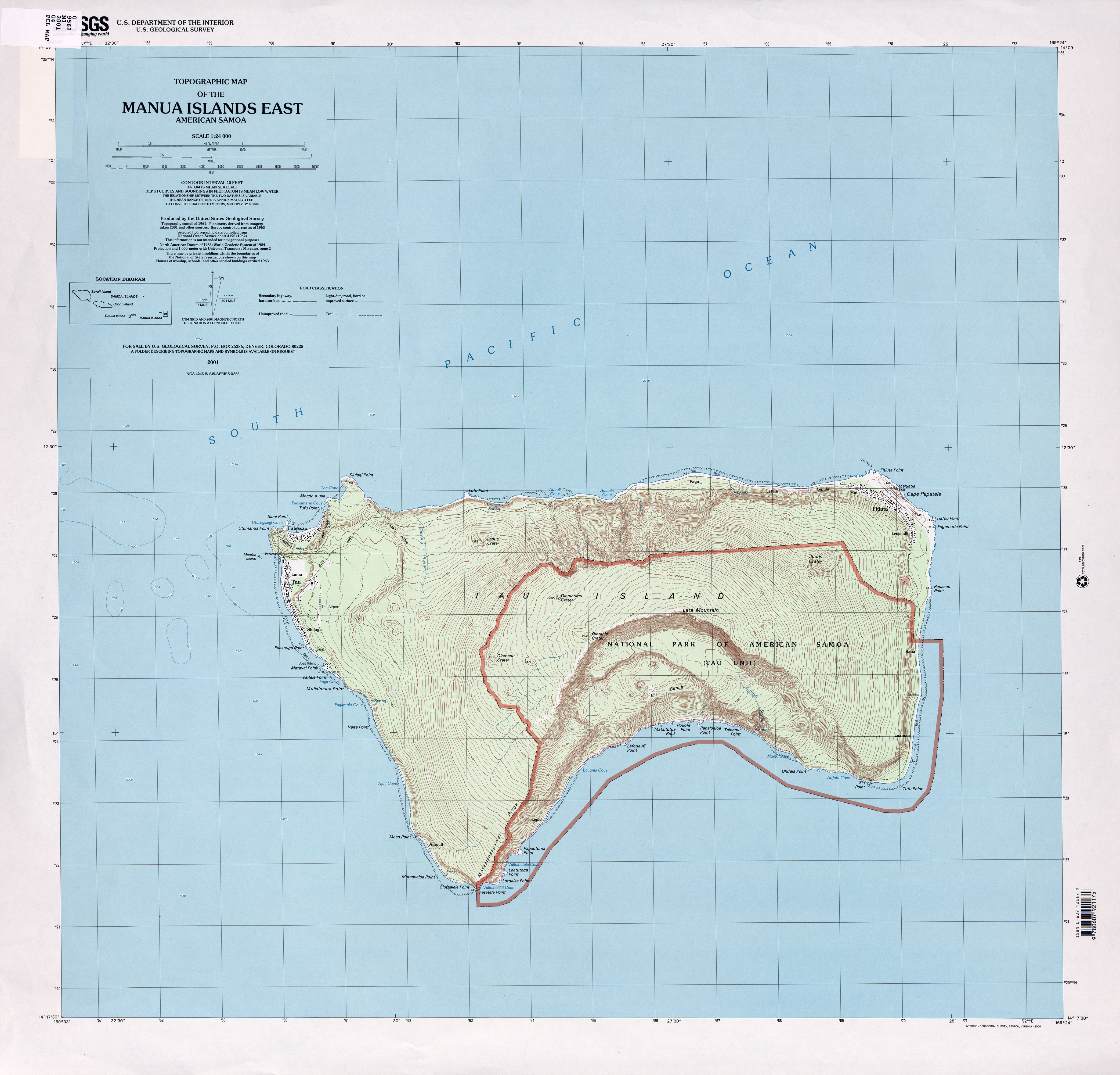
- Manua Islands East (Topographic Map) American Samoa 1:24,000, USGS, 2001 (2.8MB)
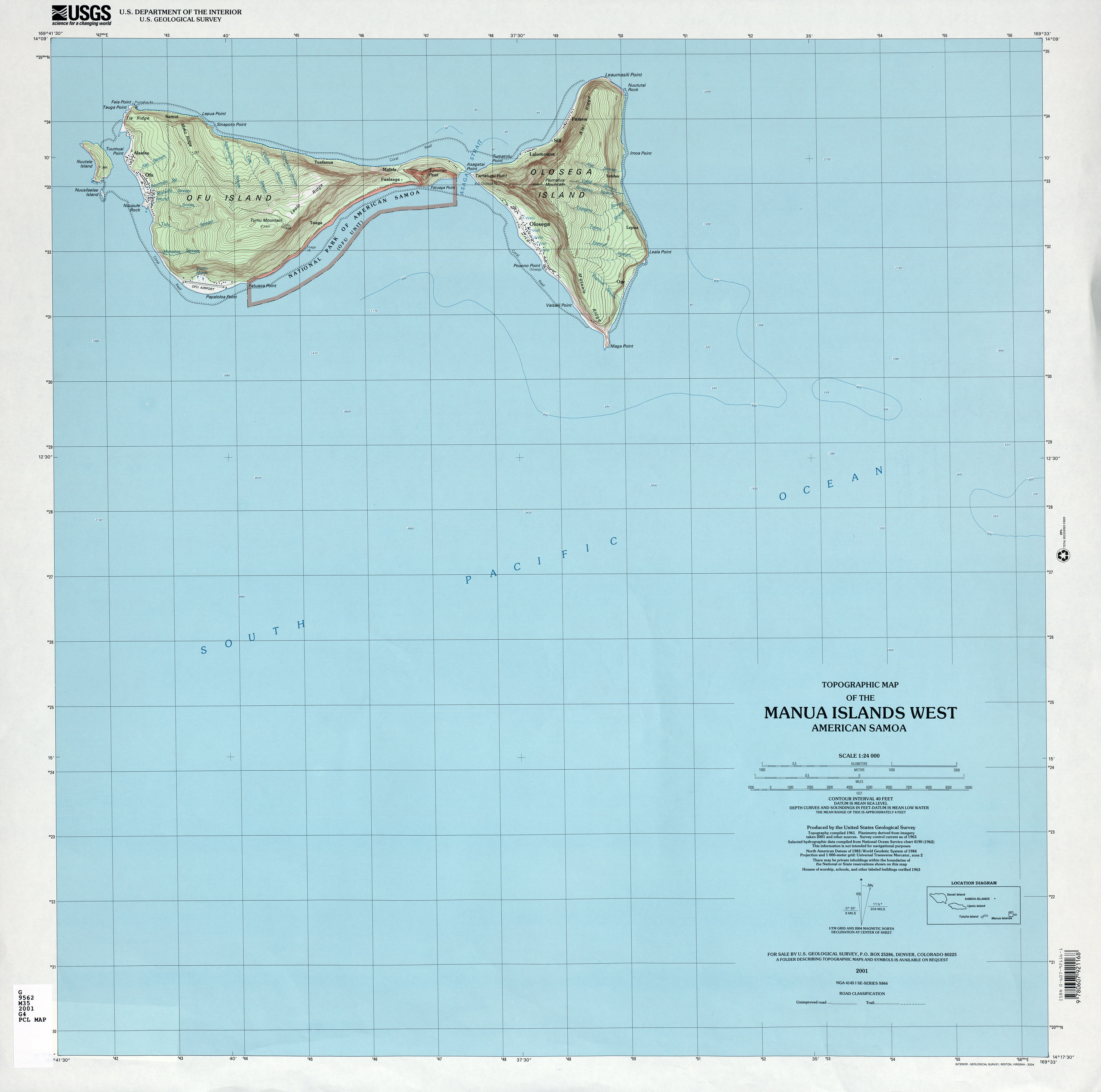
- Manua Islands West American Samoa 1:24,000, USGS, 2001 (2.2MB)
- Manu'a Islands: Ofu and Olosega U.S. National Park Service circa 2002 (11K)
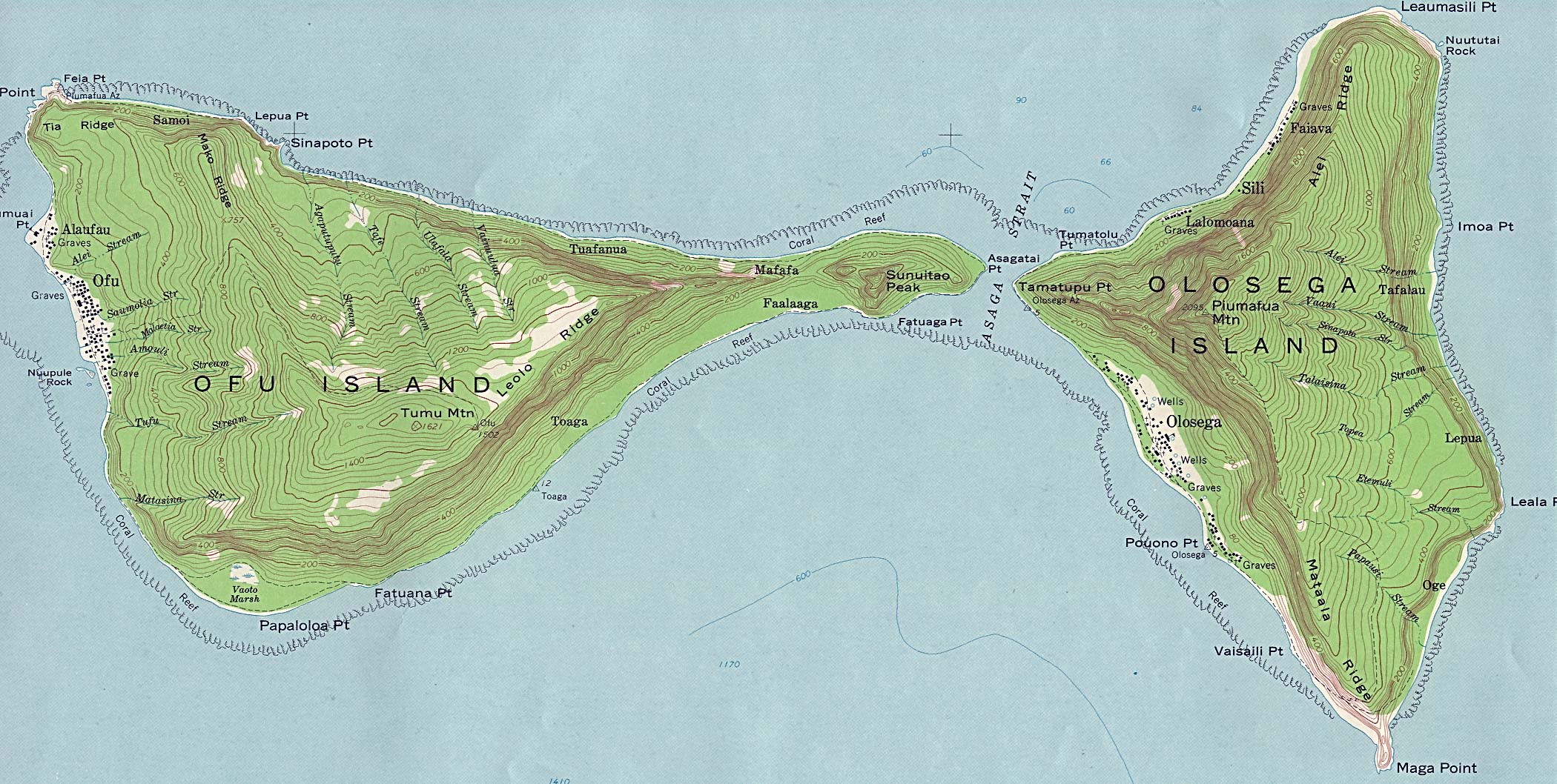
- Manu'a Islands: Ofu and Olosega (Topographic Map excerpt) original scale 1:24,000 U.S. Geological Survey 1963 (833K)
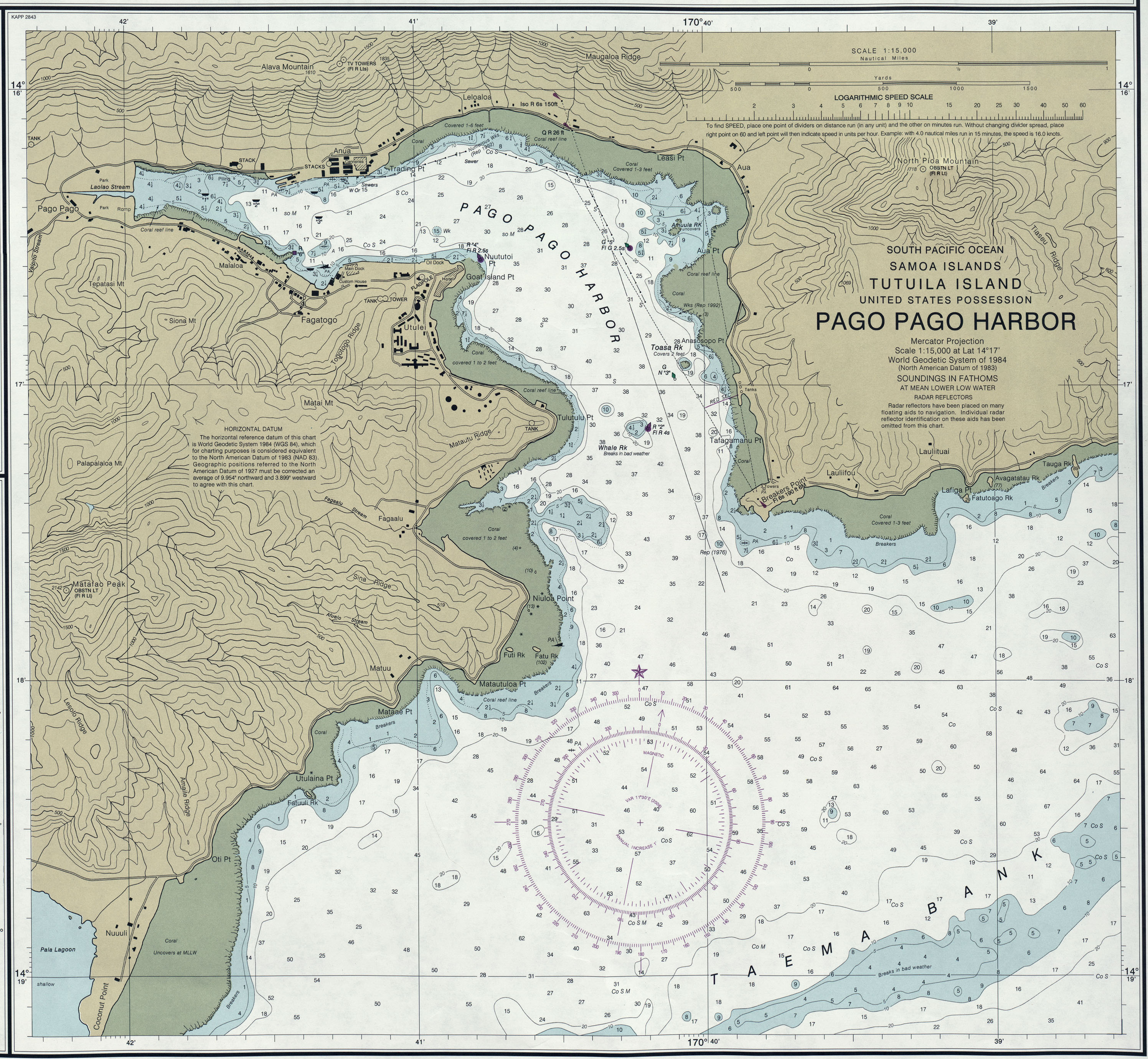
- Pago Pago Harbor (Nautical Chart) original scale 1:15,000, U.S. Department of Commerce, NOAA 2006 (939KB) Not for navigational use
- Rose Atoll (Nautical Chart) original scale 1:80,000, U.S. Department of Commerce, NOAA 2006 (461KB) Not for navigational use
- Rose Atoll National Marine Monument NOAA and Department of the Interior 2009 (179K)
- Samoa Islands U.S. National Park Service circa 2002 [gif format] (15K)
- Samoa Islands U.S. National Park Service circa 2002 [pdf format] (26K)
- Samoa Islands U.S. National Park Service 1997 [pdf format] (65K)
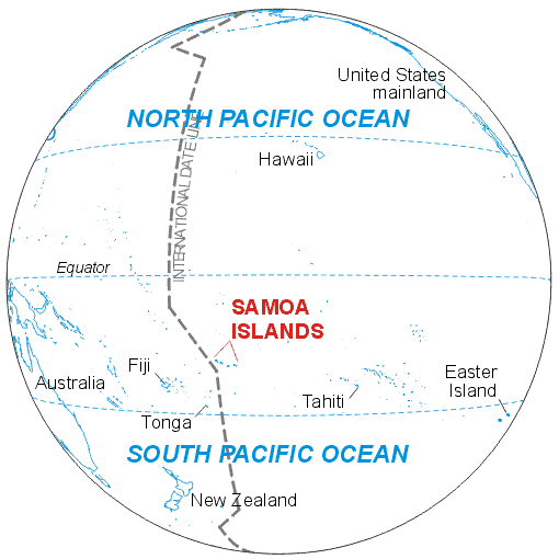
- Samoa Islands, Global View U.S. National Park Service circa 2002 [gif format] (17K)
- Samoa Islands, Global View U.S. National Park Service circa 2002 [pdf format] (54K)
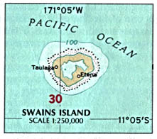
- Swains Island U.S. National Atlas 1970 (43K)
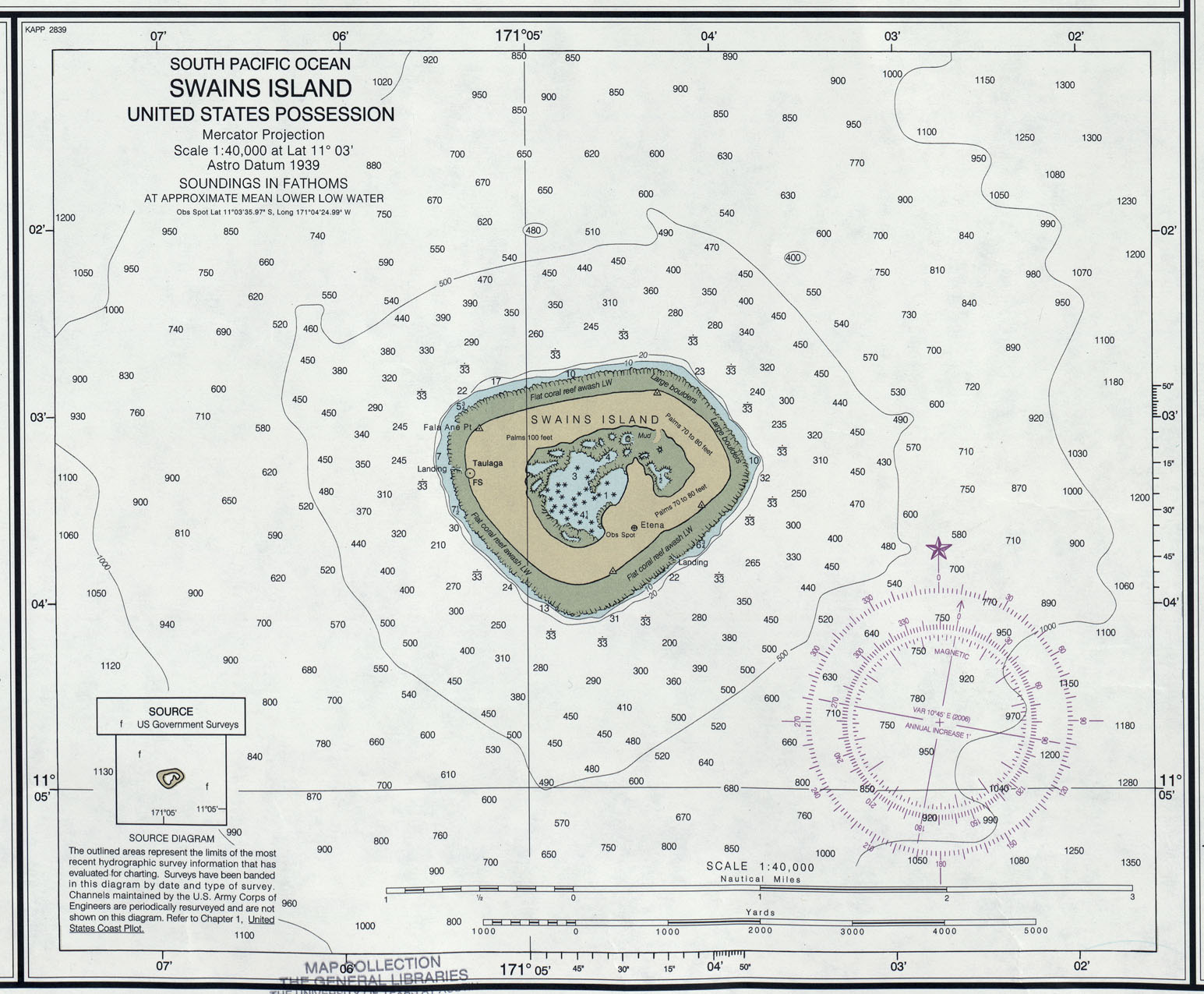
- Swains Island (Nautical Chart) original scale 1:40,000, U.S. Department of Commerce, NOAA 2006 (459KB) Not for navigational use
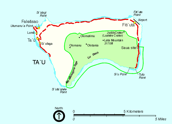
- Ta'u Island U.S. National Park Service circa 2002 (14K)
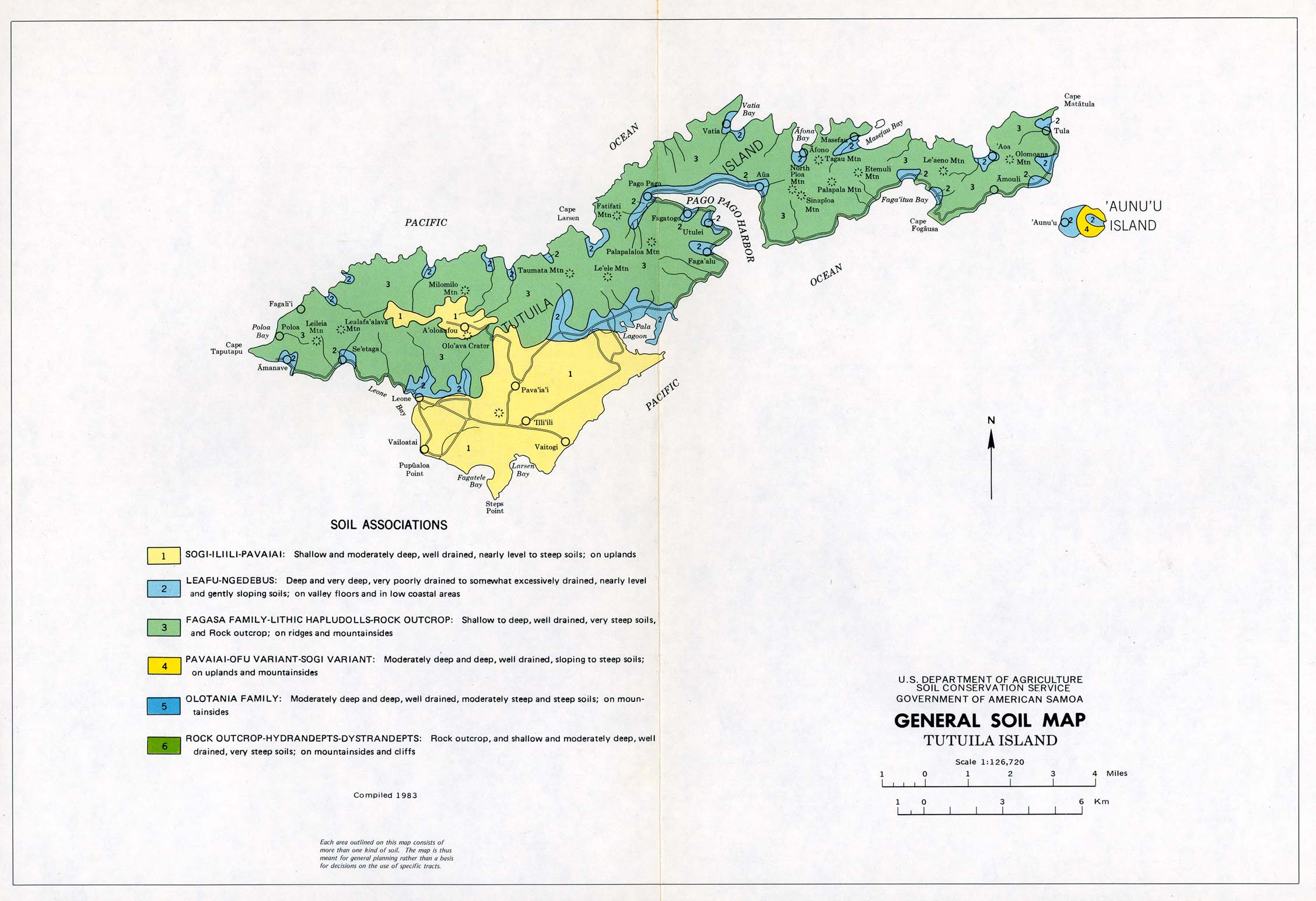
- Tutuila Island (General Soil Map) United States Department of Agriculture, Soil Conservation Service. Compiled 1983 (286K)
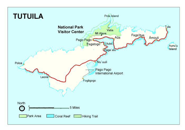
- Tutuila Island U.S. National Park Service circa 2002 (20K)
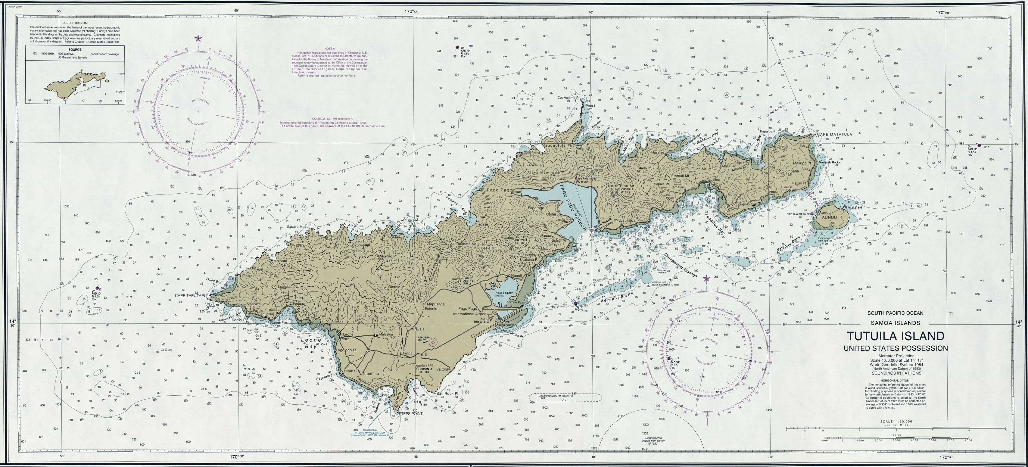
- Tutuila Island (Nautical Chart) original scale 1:60,000, U.S. Department of Commerce, NOAA 2006 (1.1MB) Not for navigational use
- Tutuila Island U.S. National Park Service 1997 [jpg format] (315K)
- Tutuila Island U.S. National Park Service 1997 [pdf format] (194K)
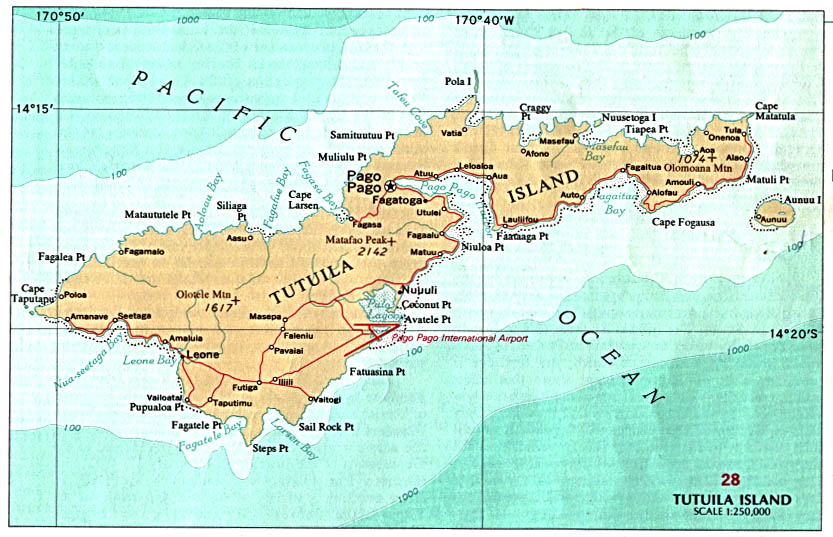
- Tutuila Island U.S. National Atlas 1970 (128K)
- Tutuila Island (Topographic Map) American Samoa 1:24,000, USGS, 1963 (4.9MB)
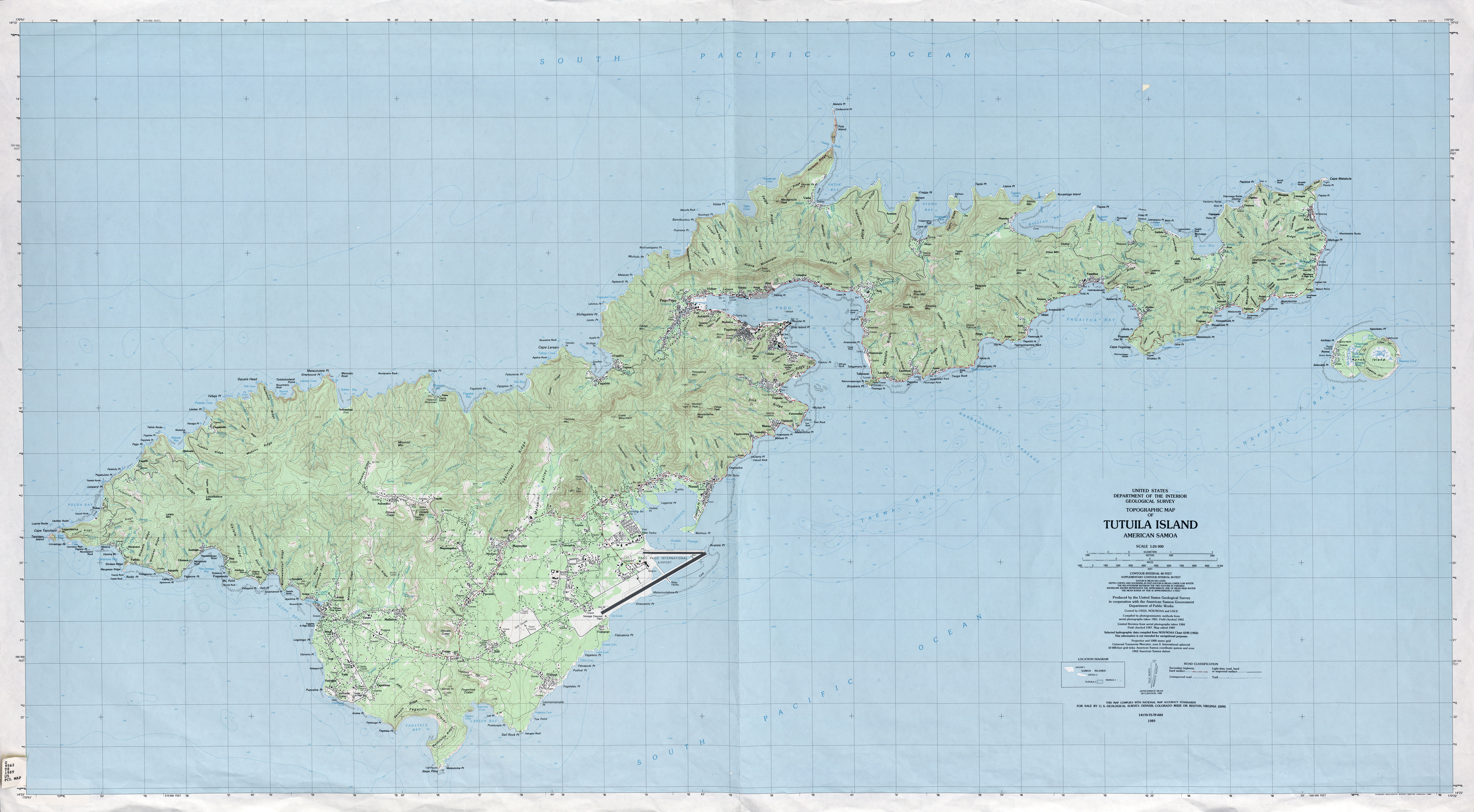
- Tutuila Island (Topographic Map) American Samoa 1:24,000, USGS, 1989 (5.4MB)
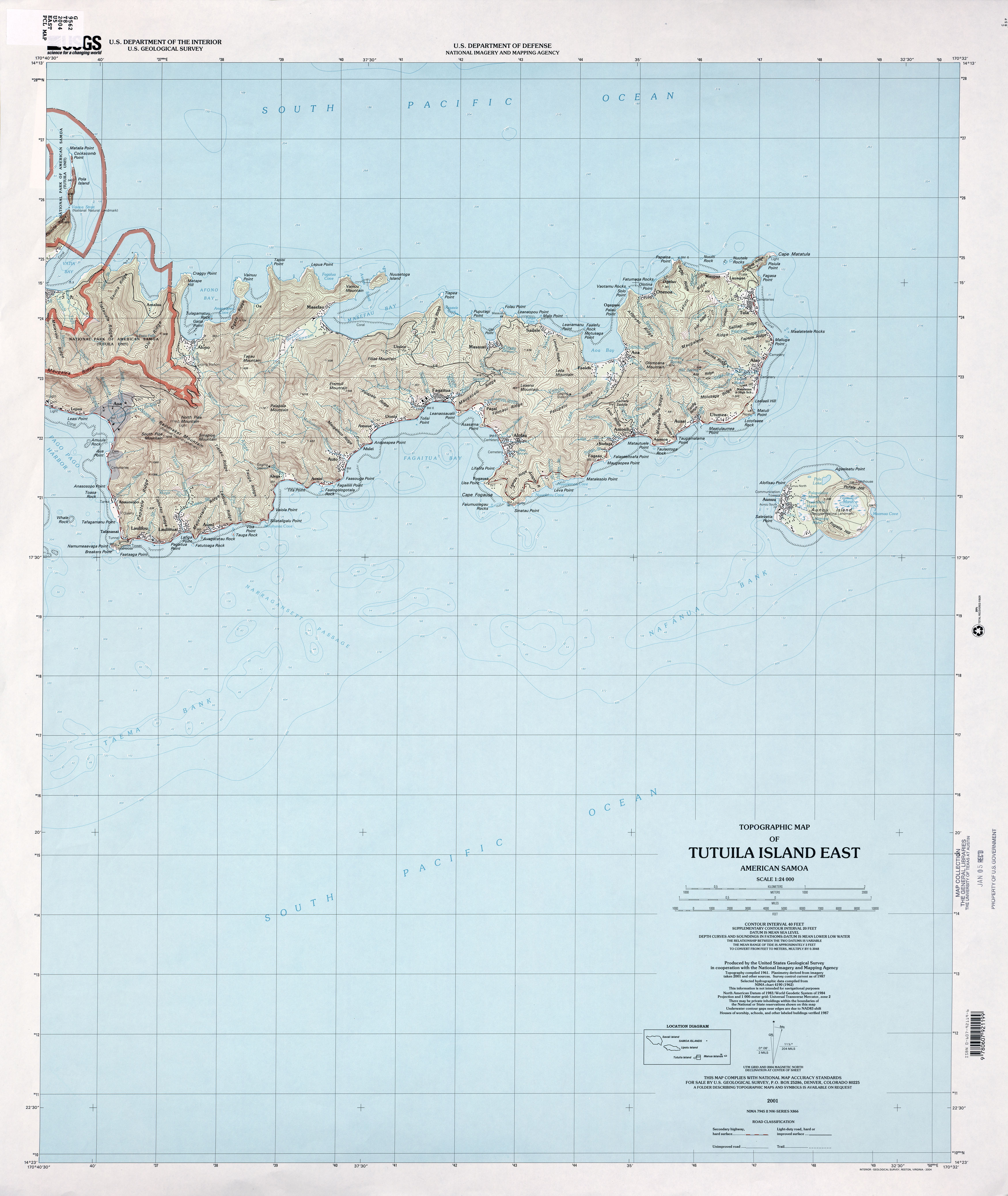
- Tutuila Island East (Topographic Map) American Samoa 1:24,000, USGS, 2001 (2.5MB)
- Tutuila Island West (Topographic Map) American Samoa 1:24,000, USGS, 2001 (2.9MB)
- 1:1,000,000 - Operational Navigation Chart Series (Aeronautical Charts) U.S. Defense Mapping Agency Aerospace Center Not for navigational use
- Sheet N-18 includes American Samoa
City Maps
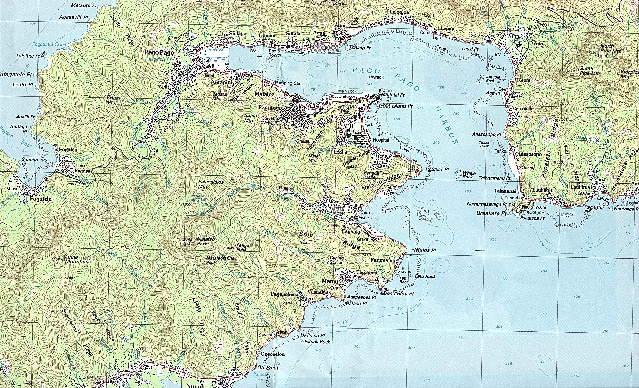
- American Samoa (U.S. External Territory) - Pago Pago (Topographic Map excerpt) U.S.G.S. 1989 (1,173K)
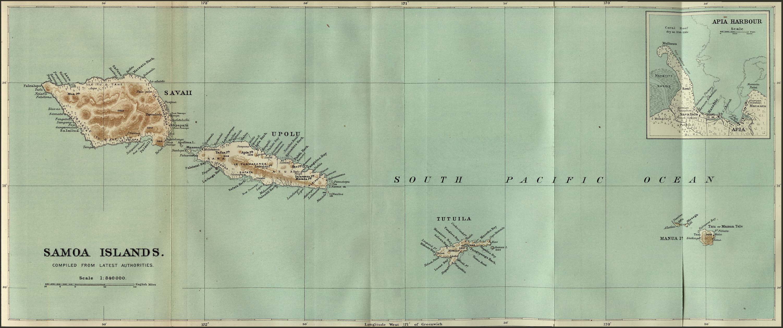
- Samoa Islands 1889 from the Scottish Geographical Magazine. Published by the Scottish Geographical Society and edited by James Geikie and Arthur Silva White. Volume V: 1889. (349K)
Maps on Other Web Sites