Perry-Castañeda Library
Map Collection
Cameroon Maps
The following maps were produced by the U.S. Central Intelligence Agency, unless otherwise indicated.
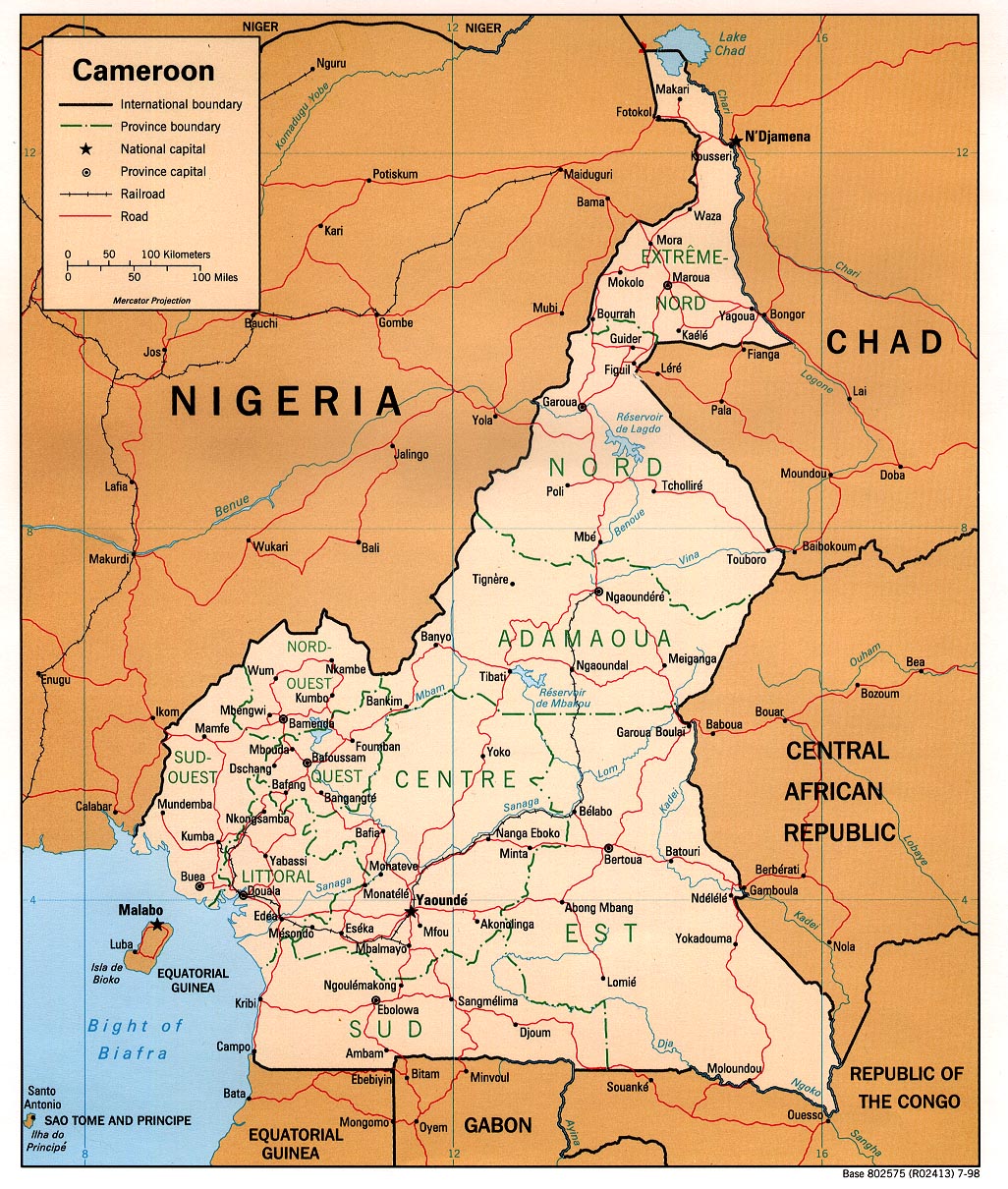
Country Maps- Cameroon (Political) 1998 (542K) and pdf format (382K)
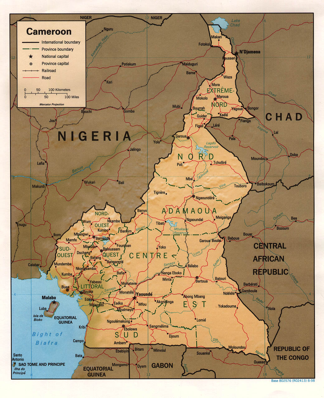
- Cameroon (Shaded Relief) 1998 (542K) and pdf format (372K)
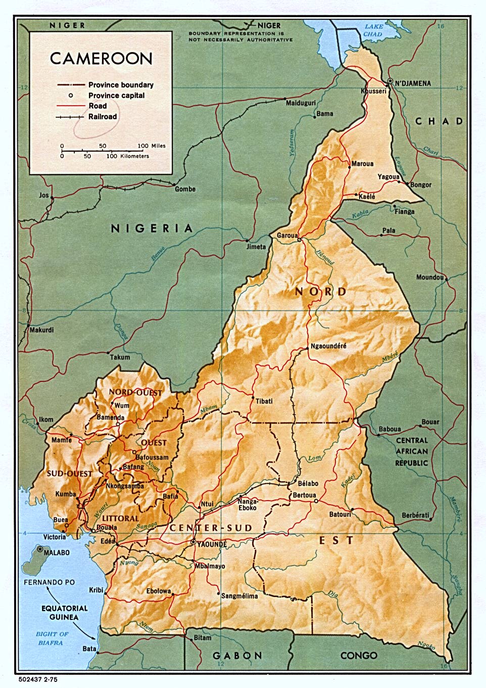
- Cameroon (Shaded Relief) 1975 (292K) and pdf format (295K)
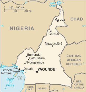
- Cameroon (Small Map) 2016 (11.1K)
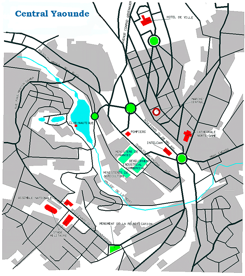
- Yaounde Kenny Hopper, University of Texas 1998 (907K)
- 1:2,000,000 - Africa Topographic Maps U.S. Army Map Service, Series 2201
- Sheets 18, 19 and 22 cover includes of Cameroon
- 1:1,000,000 - Operational Navigation Chart Series U.S. Defense Mapping Agency Aerospace Center. Not for navigational use
- Sheets L-3 and K-3 include all of Cameroon
- 1:1,000,000 - International Map of the World U.S. Army Map Service.
- This series includes all of Cameroon
- 1:500,000 - Tactical Pilotage Chart Series U.S. National Imagery and Mapping Agency. Not for navigational use
- This series covers most of Cameroon
- 1:500,000 - Calabar, Nigeria Region [includes Mount Cameroon] (Tactical Pilotage Chart) Portion of Defense Mapping Agency Series TPC, Sheet L-3A, Edition 1, 1996 [Compiled April 1995, air information current through 20 October 1995] (682K) Not for navigational use
- 1:250,000 - West Africa Topographic Maps U.S. Army Map Service, Series G504
- This series includes part of Cameroon
- 1:250,000 - Joint Operations Graphic U.S. Defense Mapping Agency Aerospace Center. Not for navigational use
- Includes 17 sheets covering parts of Cameroon
- 1:250,000 - Edea (Joint Operations Graphic) Defense Mapping Agency, Sheet NA 32-3, 1975 [GeoPDF] (10.5MB) Not for navigational use
- 1:250,000 - Kribi (Joint Operations Graphic) Defense Mapping Agency, Sheet NA 32-7, 1975 [GeoPDF] (11.1MB) Not for navigational use
- Sheets 18, 19 and 22 cover includes of Cameroon
![1:500,000 - Calabar, Nigeria Region [includes Mount Cameroon]](africa/calabar_tpc_1996.jpg)
Maps on Other Web Sites