Perry-Castañeda Library
Map Collection
Tanzania Maps
The following maps were produced by the U.S. Central Intelligence Agency, unless otherwise indicated.
Tanzania Maps- Tanzania (Political) 2003 (407K) and pdf format (211K)
- Tanzania (Political) 1989 (211K)and pdf format (218K)
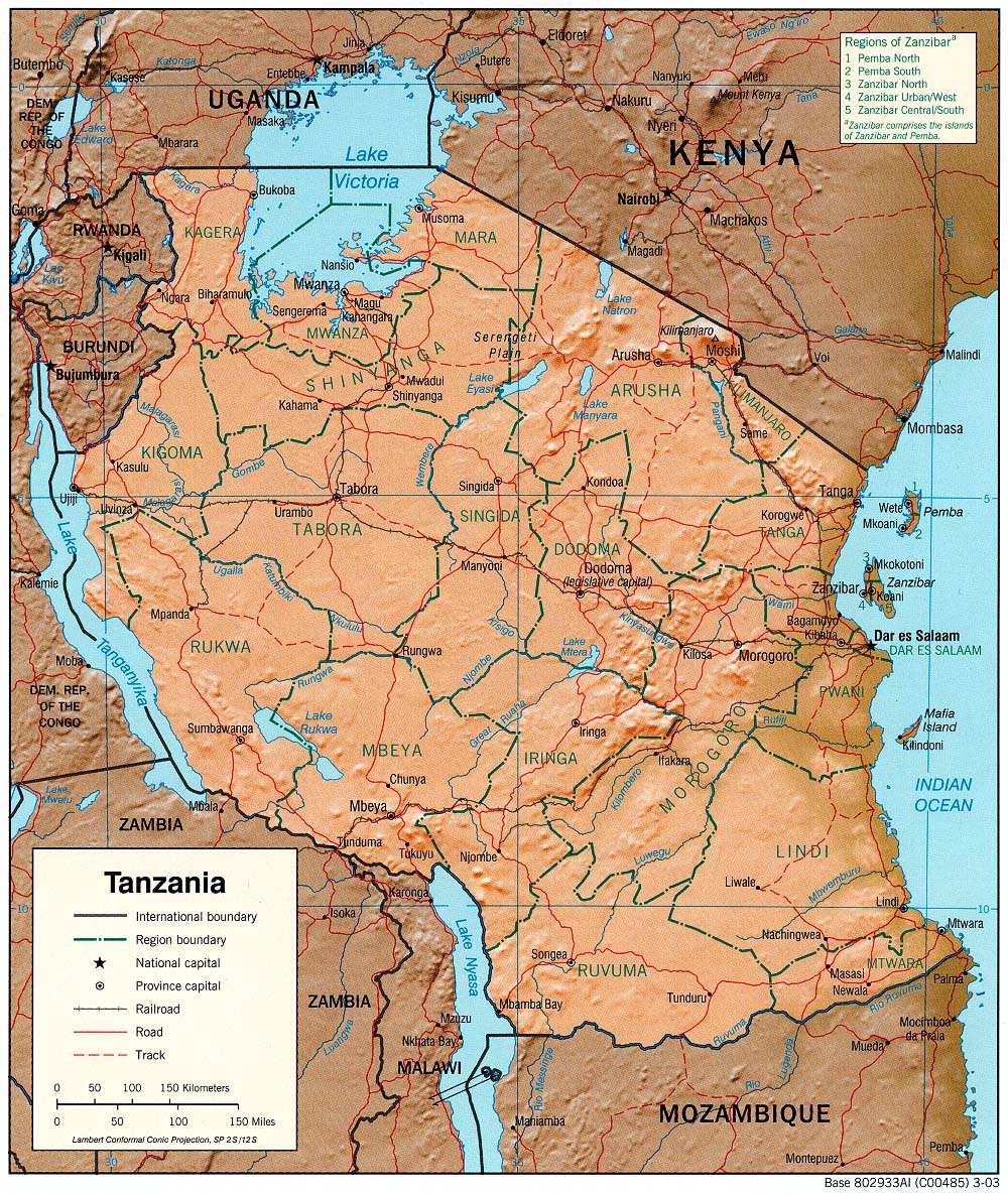
- Tanzania (Shaded Relief) 2003 (475K) and pdf format (466K)
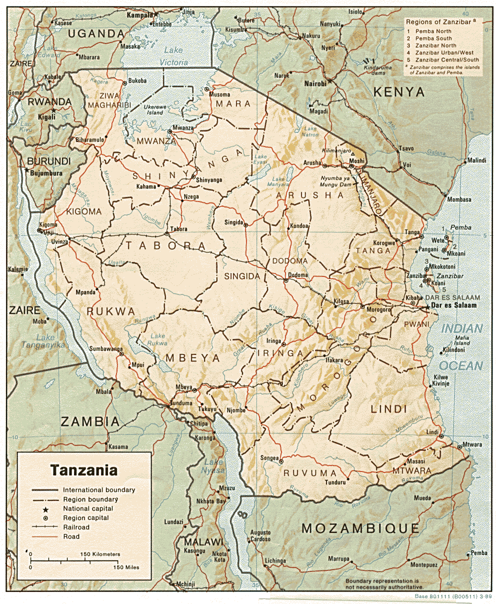
- Tanzania (Shaded Relief) 1989 (352K)and pdf format (374K)
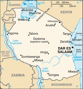
- Tanzania (Small Map) 2016 (26.1K)
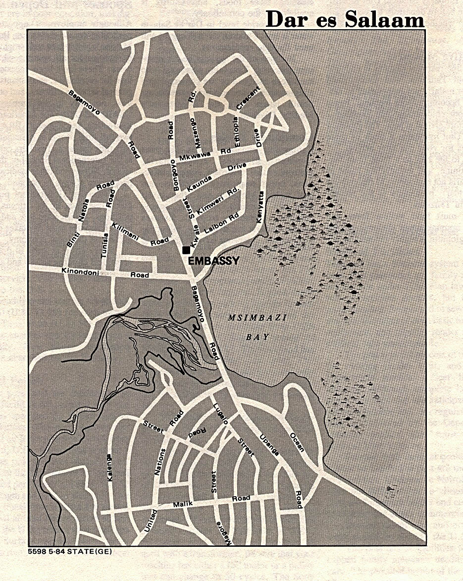
- Dar es Salaam U.S. Dept. of State 1984 (469K) (Showing location of U.S. Embassy)
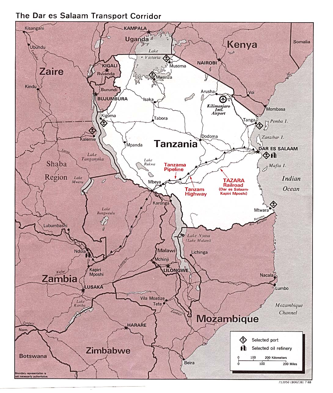
- Dar es Salaam Transport Corridor 1988 (402K)
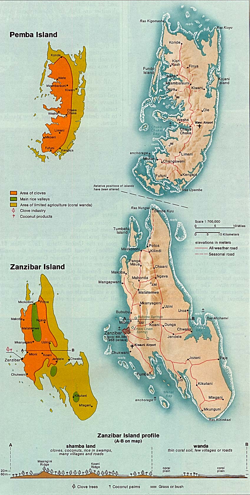
- Zanzibar and Pemba Islands (Political) 1977 (193K)
- Zanzibar and Pemba Islands From Indian Ocean Atlas, CIA 1976 (322K)
- 1:2,000,000 - Africa Topographic Maps U.S. Army Map Service
- Sheets 24, 27, 28 and 31 cover all of Tanzania
- 1:1,000,000 - International Map of the World U.S. Army Map Service
- This map series covers western Tanzania
- 1:500,000 - Tactical Pilotage Charts U.S. National Imagery and Mapping Agency. Not for navigational use
- This series covers most of Tanzania
- 1:500,000 - East Africa Topographic Maps Series Y401 (GSGS 4335), U.S. Army Map Service, 1958-
- This series covers most of Tanzania (Tanganyika)
- 1:250,000 - Joint Operations Graphic - East Africa Series 1501, U.S. Defense Intelligence Agency Not for navigational use
- Covers limited areas of Tanzania
- 1:250,000 - East Africa Series Y503, U.S. Army Map Service, 1958-
- This series covers parts of Tanzania.
- Sheets 24, 27, 28 and 31 cover all of Tanzania
Maps on Other Web Sites