Perry-Castañeda Library
Map Collection
Seychelles Maps
The following maps were produced by the U.S. Central Intelligence Agency, unless otherwise indicated.
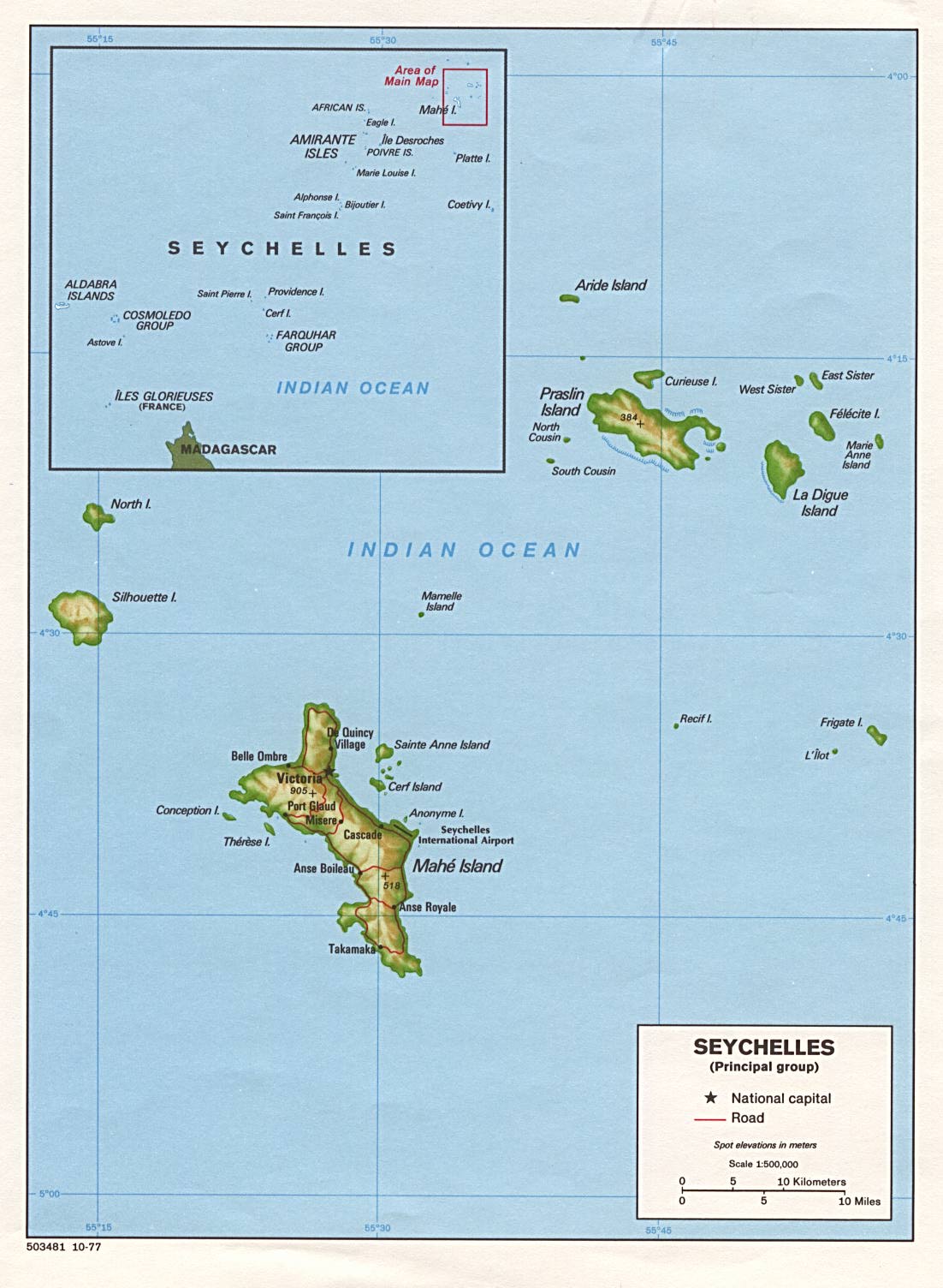
Country Maps- Seychelles (Shaded Relief) 1977 (190K) and pdf format (176K)
- Seychelles (Small Map) 2016 (9.5K)
- 1:2,000,000 - Seychelles (Topographic Map) 1967 (3.2 MB)
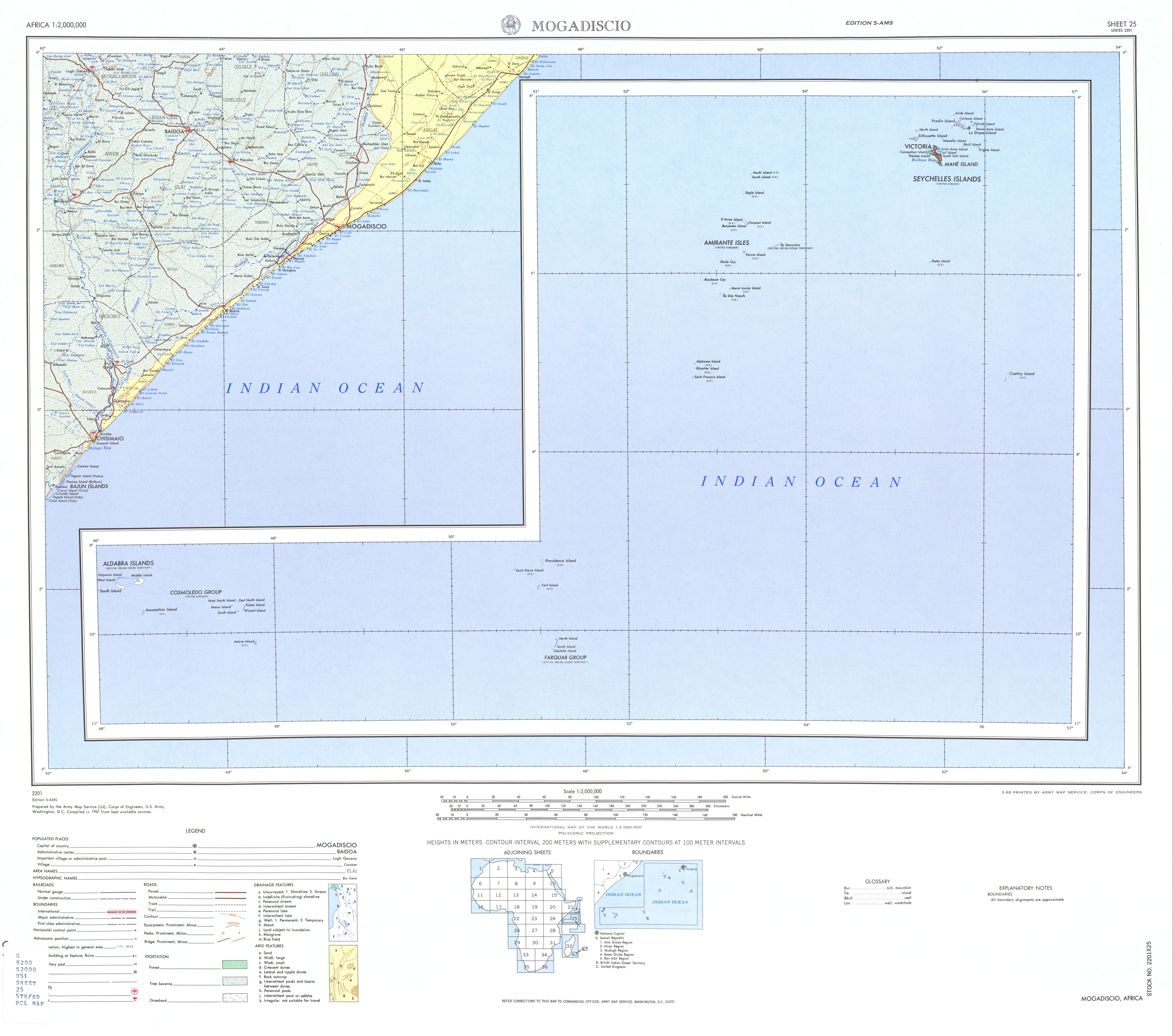
Mogadiscio Sheet 25, Edition 5, U.S. Army Map Service
- This map includes all of Seychelles
- 1:1,000,000 - Operational Navigation Chart Series U.S. Defense Mapping Agency Aerospace Center. Not for navigational use
- Sheets M-6, M-7 and N-6 include all of Seychelles
- 1:500,000 - Tactical Pilotage Charts U.S. National Imagery and Mapping Agency. Not for navigational use
- This series covers Seychelles
- This map includes all of Seychelles
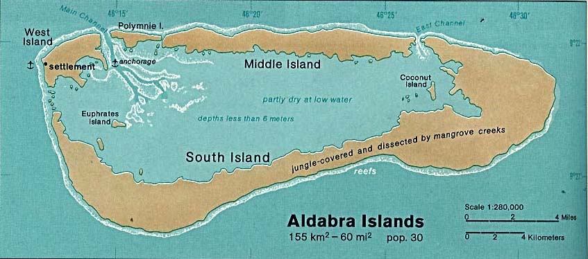
- Seychelles - Aldabra Islands 1976 (71K)
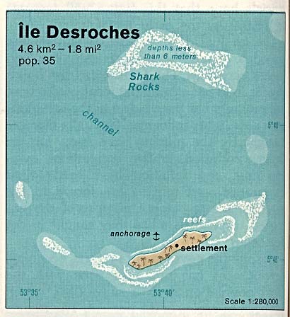
- Seychelles - Desroches,Ile 1976 (38K)
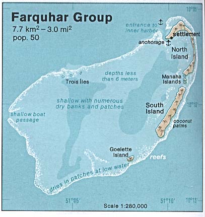
- Seychelles - Farquhar Group 1976 (38K)
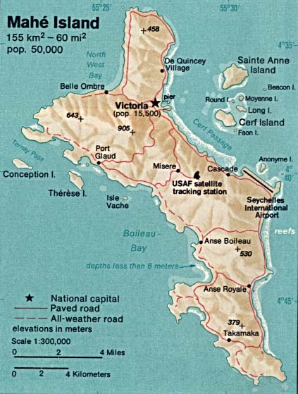
- Seychelles - Mahe Island 1976 (56K)
Maps on Other Web Sites