Perry-Castañeda Library
Map Collection
Lebanon Maps
The following maps were produced by the U.S. Central Intelligence Agency, unless otherwise indicated.
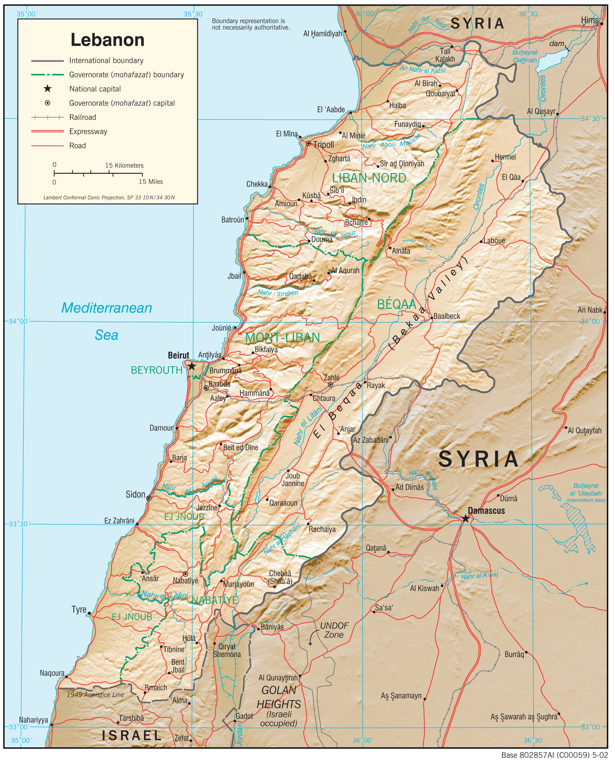
Country Maps- Lebanon (Physiography) 2002 (1.6MB) and pdf format (1.3MB)
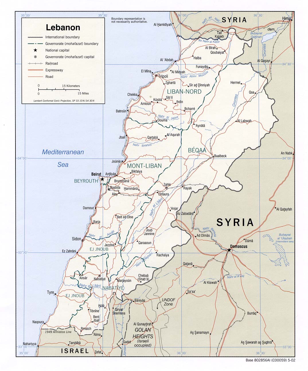
- Lebanon (Political) 2002 (208K) and pdf format (258K)
- Lebanon (Political) 2000 (235K)
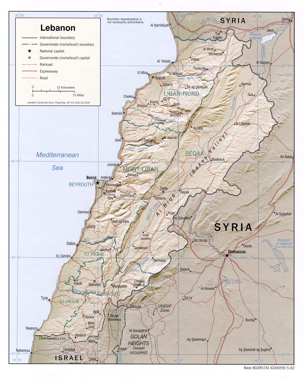
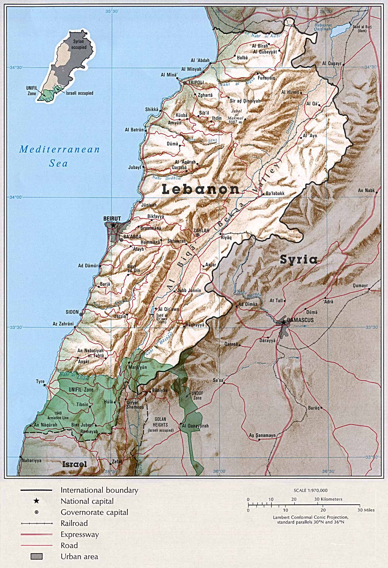
- Lebanon (Shaded Relief) 2002 (191K) and pdf format (208K)
- Lebanon (Shaded Relief) 2000 (269K)
- Lebanon (Shaded Relief) From Atlas of the Middle East 1993 (604k)
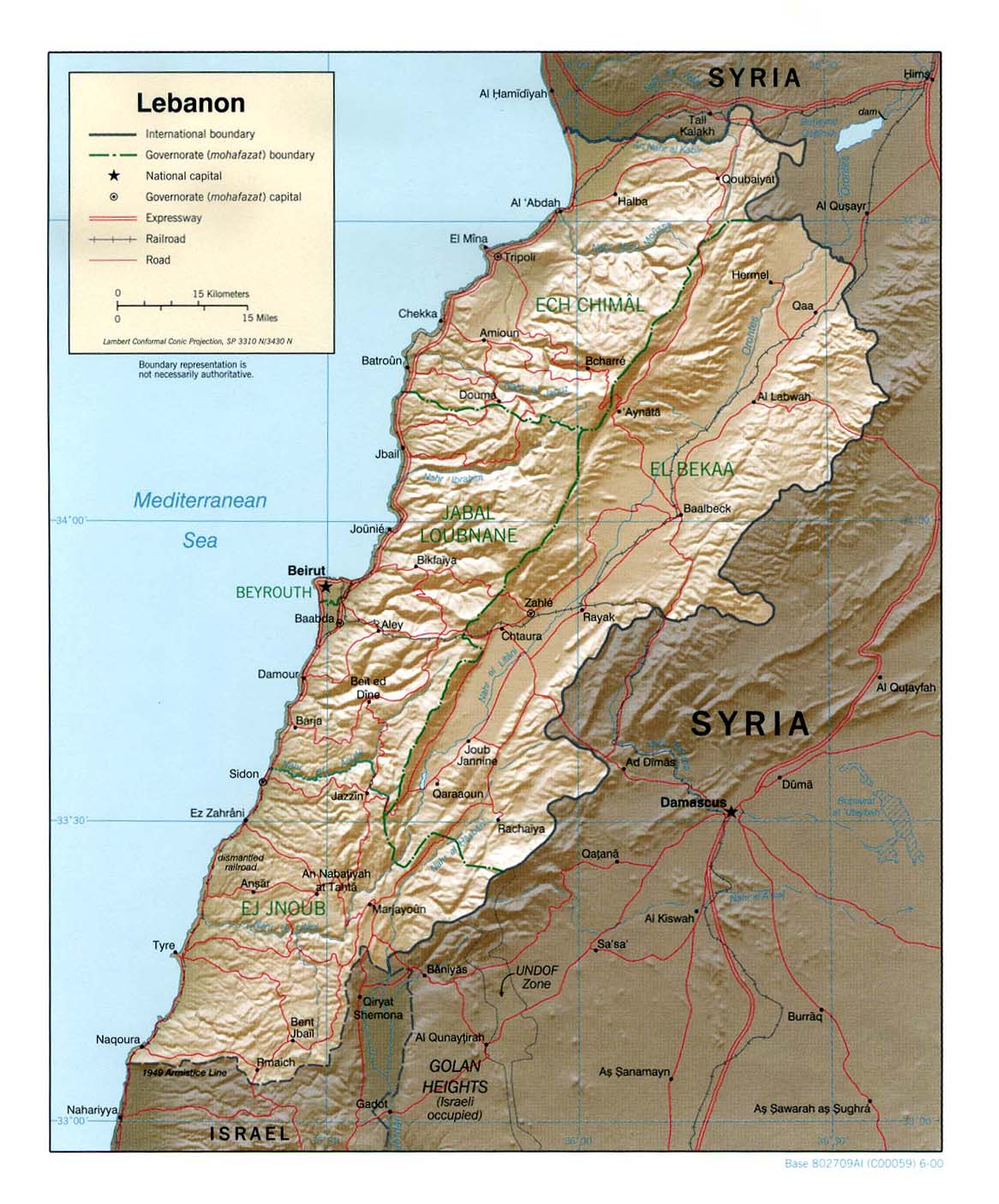
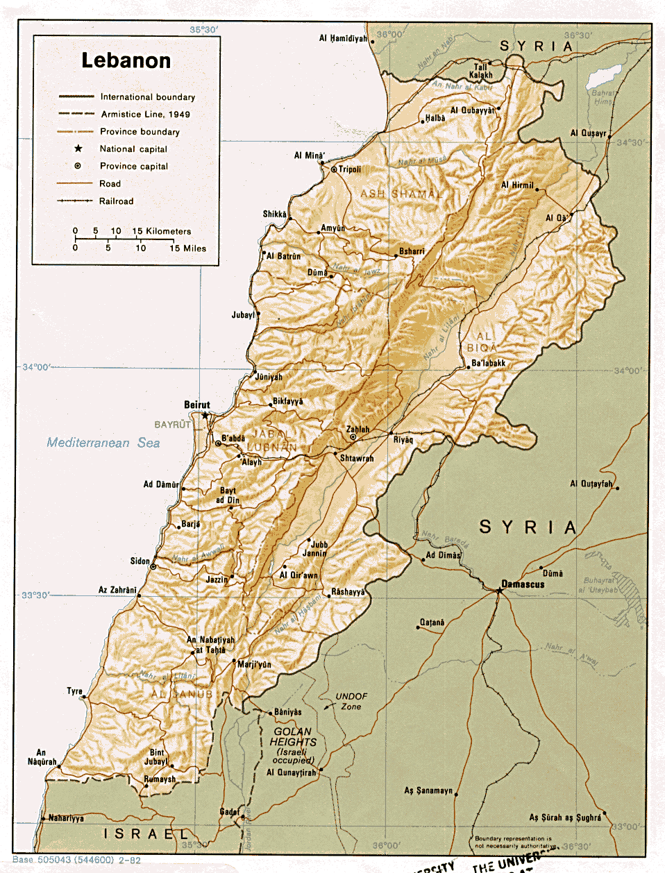
- Lebanon (Shaded Relief) 1982 (283K) and pdf format (412K)
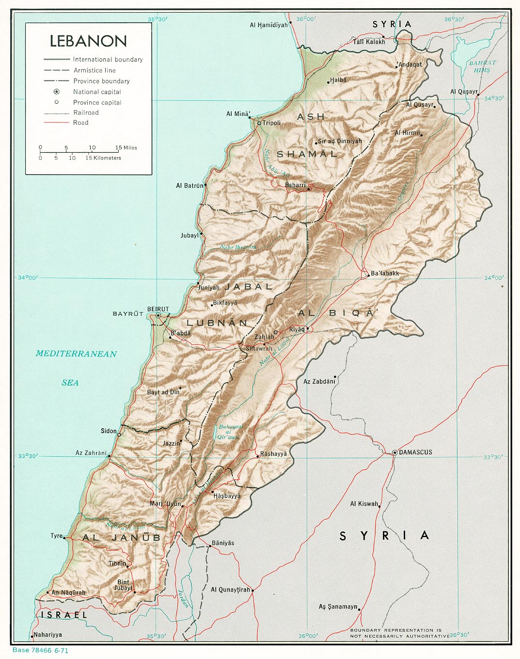
- Lebanon (Shaded Relief) 1971 (400K) and pdf format (412K)
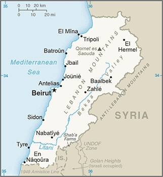
- Lebanon (Small Map) 2016 (19.8K)
- Lebanon (Transportation) 2002 (1.2MB) and pdf format (268K)
- Beirut 1980 (249K)
- 1:1,000,000 - International Map of the World U.S. Army Map Service
- This series covers parts of Lebanon
- 1:1,000,000 - Operational Navigation Chart Sheet G-4, U.S. Defense Mapping Agency Aerospace Center (17.1MB) Not for navigational use
- This map includes all of Lebanon
- 1:500,000 - Tactical Pilotage Chart Sheet G-4D, U.S. National Imagery and Mapping Agency (14.7MB) Not for Navigational use
- This map includes all of Lebanon
- 1:250,000 - Southwestern Asia Series K502, U.S. Army Map Service, 1953-
- This series includes northern Lebanon
- 1:150,000 - South Lebanon and Vicinity 1976 Central Intelligence Agency (5.2 MB)
- 1:150,000 - Southern Lebanon Border Area 1986 Central Intelligence Agency (2.9 MB)
- This series covers parts of Lebanon
- Israel-Lebanon War Maps, July 2006
- Beirut [Beyrout] 1912 (737K) From Palestine and Syria...Handbook for Travellers by Karl Baedeker, 5th Edition, 1912
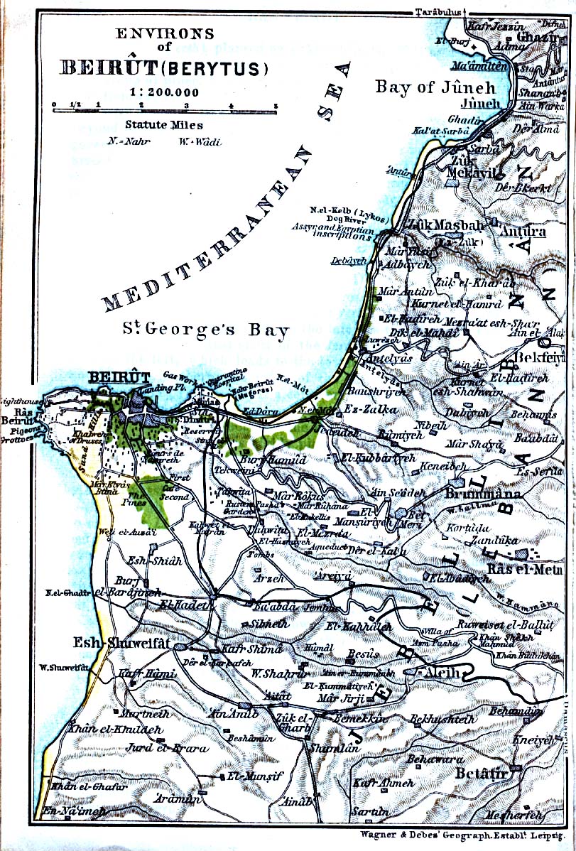
- Beirut Environs 1912 (346K) From Palestine and Syria...Handbook for Travellers by Karl Baedeker, 5th Edition, 1912
- [Beirut] Beyrouth 1:12,500, Edition 6-AMS, Series K921. U.S. Army Map Service, 1961 (6.9MB)
- Sidon [Saida] Environs 1912 (290K) From Palestine and Syria. Handbook for Travellers by Karl Baedeker, 5th Edition, 1912
- Tyre [Sur] Environs 1912 (240K) From Palestine and Syria. Handbook for Travellers by Karl Baedeker, 5th Edition, 1912
![Beirut [Beyrout] 1912](historical/beirut2_1912.jpg)
![[Beirut] Beyrouth](world_cities/txu-oclc-46881713-beyrouth-1961.jpg)
![Sidon [Saida] Environs 1912](historical/sidon_1912.jpg)
![Tyre [Sur] Environs 1912](historical/tyre_1912.jpg)
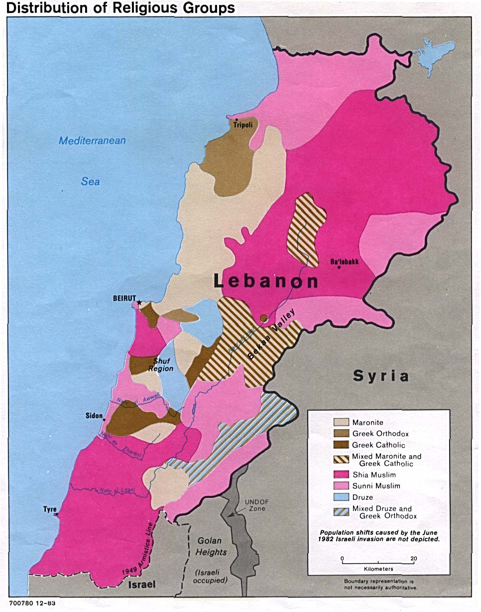
- Lebanon - Distribution of Religious Groups 1983 (190K)
- Lebanon - Administrative Divisions From Atlas of the Middle East 1993 (64k)
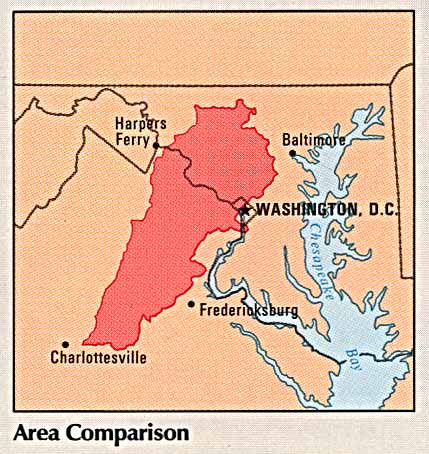
- Lebanon - Area Comparison From Atlas of the Middle East 1993 (50k)
- Lebanon - Country Information From Atlas of the Middle East 1993 (93k)
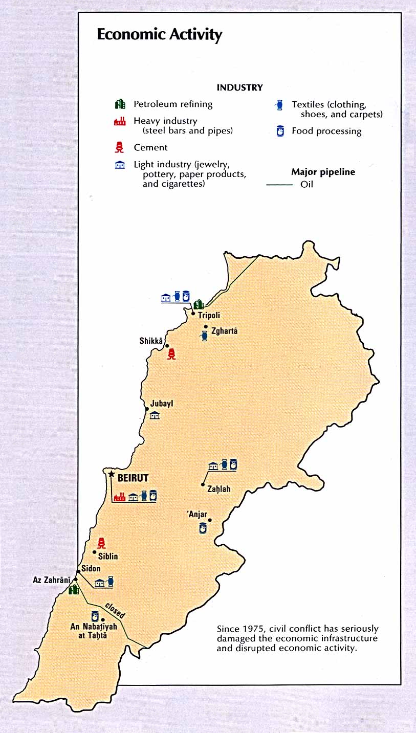
- Lebanon - Economic Activity From Atlas of the Middle East 1993 (148k)
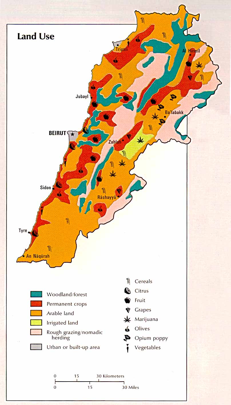
- Lebanon - Land Use From Atlas of the Middle East 1993 (126k)
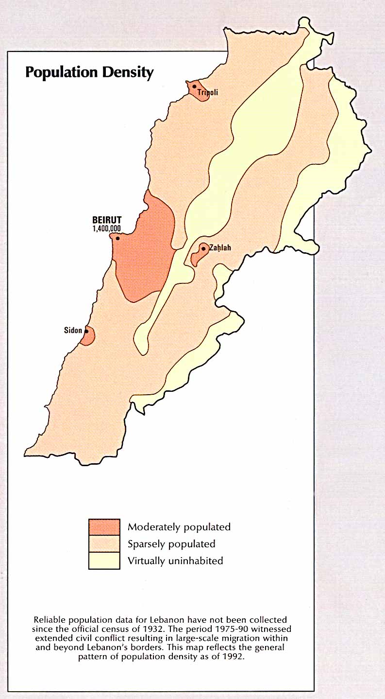
- Lebanon - Population Density From Atlas of the Middle East 1993 (119k)
Maps on Other Web Sites