Perry-Castañeda Library
Map Collection
Guinea Maps
The following maps were produced by the U.S. Central Intelligence Agency, unless otherwise indicated.
Country Maps- Guinea (Physiography) 2002 (254K) and pdf format (1.7MB)
- Guinea (Political) 2002 (254K) and pdf format (239K)
- Guinea (Political) 1985 (239K)and pdf format (249K)
- Guinea (Shaded Relief) 2002 (240K) and pdf format (250K)
- Guinea (Transportation) 2002 (254K) and pdf format (1.9MB)
- Guinea (Small Map) 2016 (9.5K)
- 1:2,000,000 - Topographic Maps - Africa U.S. Army Map Service, Series 2201
- Sheets 11 and 16 include Guinea
- 1:1,000,000 - Operational Navigation Chart Series [aeronautical charts] U.S. Defense Mapping Agency Aerospace Center Not for navigational use
- This series covers all of Guinea on sheets K-1 and L-1 (Far South)
- 1:1,000,000 - International Map of the World U.S. Army Map Service
- This series covers most of Guinea. Clickable map. The map below is a detail from this series.
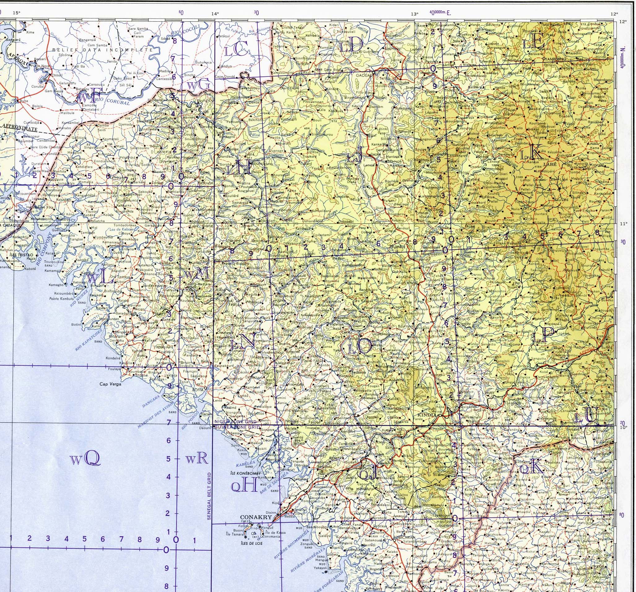
- 1:1,000,000 - Guinea - Central and West Portion of Conakry sheet. Topographic Map NC 28, Series 1301. U.S. Army Map Service, Corps of Engineers, 1964 (1.2MB)
- 1:500,000 [Guinea] Carta da Provincia da Guine Centro de Geografia do Ultramar 1961 (6.5MB)
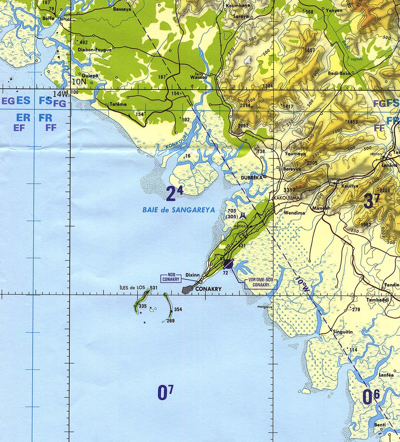
- 1:500,000 - Conakry Area (tactical pilotage chart) Portion of Defense Mapping Agency TPC K-1D 1995 (581K) Not for navigational use
- 1:500,000 - Tactical Pilotage Charts U.S. National Imagery and Mapping Agency. Not for navigational use
- This series covers all of Guinea
- 1:250,000 - Joint Operations Graphic U.S. National Imagery and Mapping Agency, Series 1501 Air Not for navigational use
- This series covers limited areas of Guinea
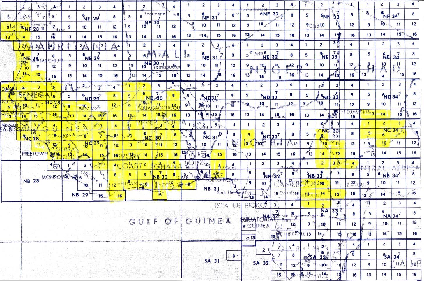
- 1:250,000 - Topographic Maps West Africa U.S. Army Map Service, Series G504. Index Map (3.0 MB)
This series covers most of Guinea - Sheets 11 and 16 include Guinea
![1:500,000 [Guinea] Carta da Provincia da Guine](africa/txu-pclmaps-oclc-53894328-carta-da-provincia-da-guine-1961.jpg)
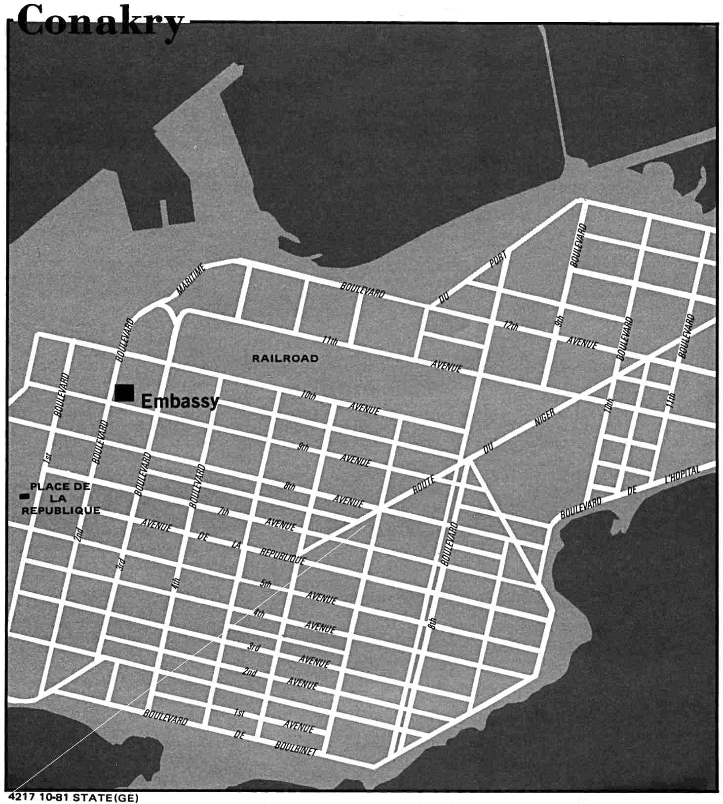
- Conakry 1981 U.S. Department of State(126K)
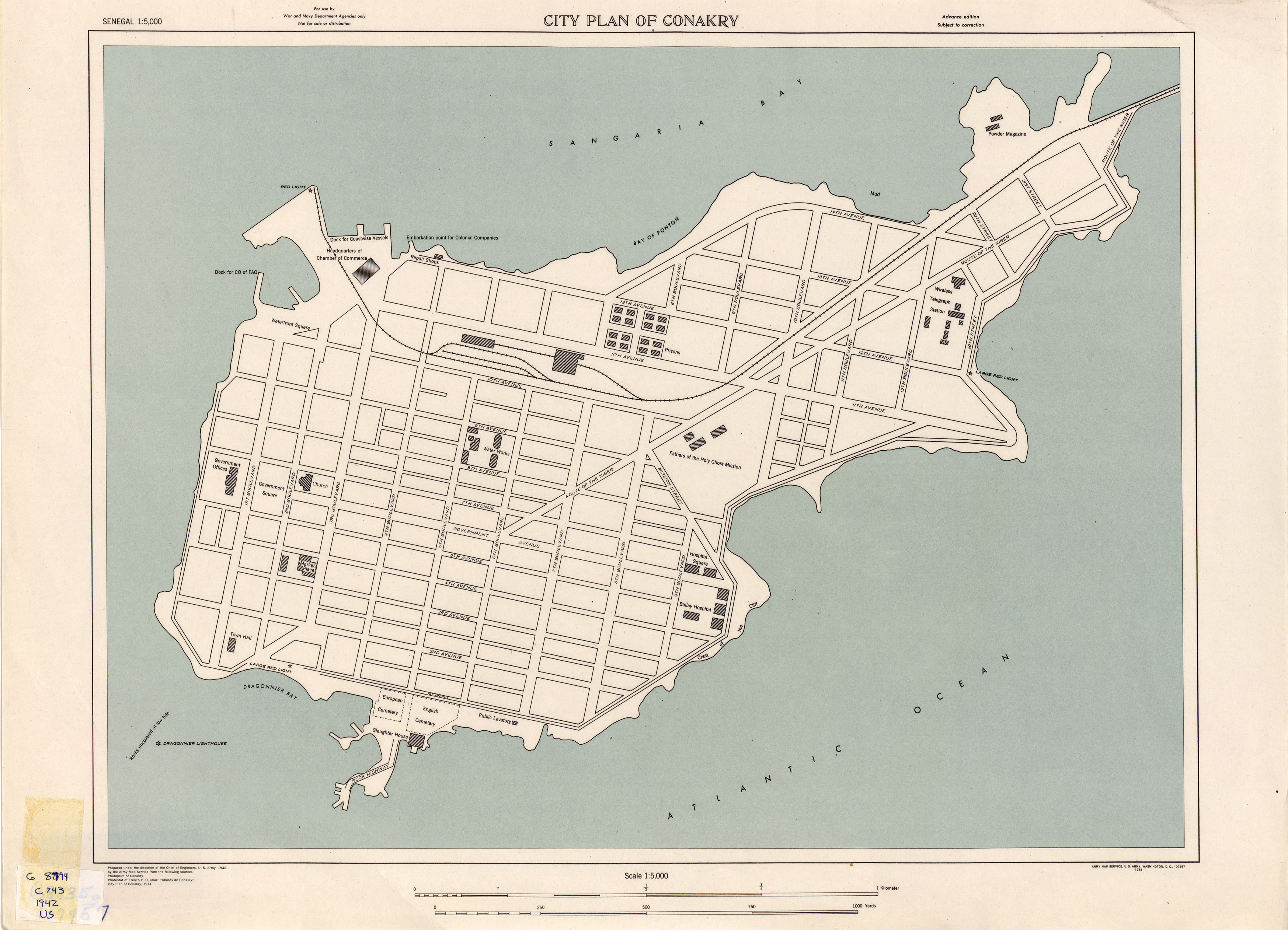
- Conakry 1942 1:5,000 U.S. Army Map Service (1.3MB)
- Guinea - Economic Activity from Map No. 501172 1973 (107K)
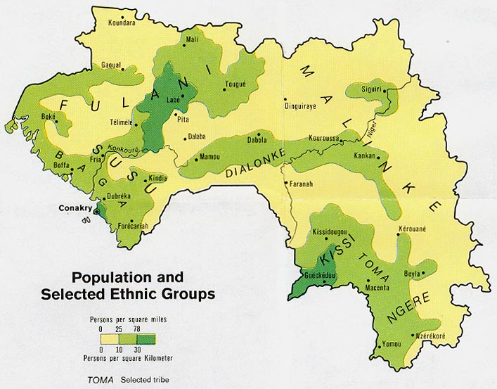
- Guinea - Population and Selected Ethnic Groups from Map No. 501172 1973 (111K)
- Guinea - Vegetation from Map No. 501172 1973 (128K)
Maps on Other Web Sites