Perry-Castañeda Library
Map Collection
Chad Maps
The following maps were produced by the U.S. Central Intelligence Agency, unless otherwise indicated.
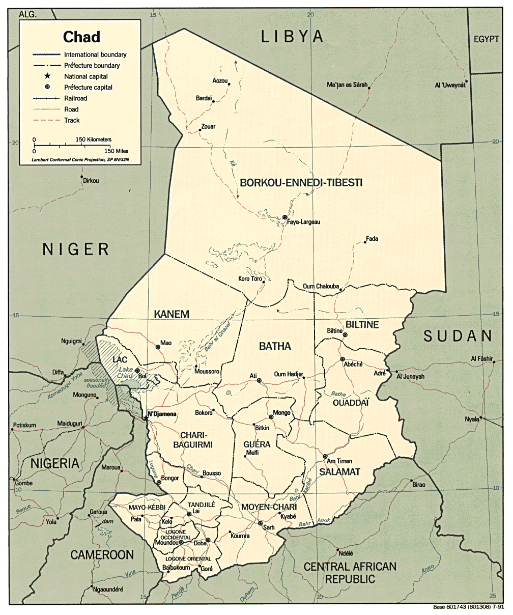
Country Maps- Chad (Political) 1991 (300K) and pdf format (311K)
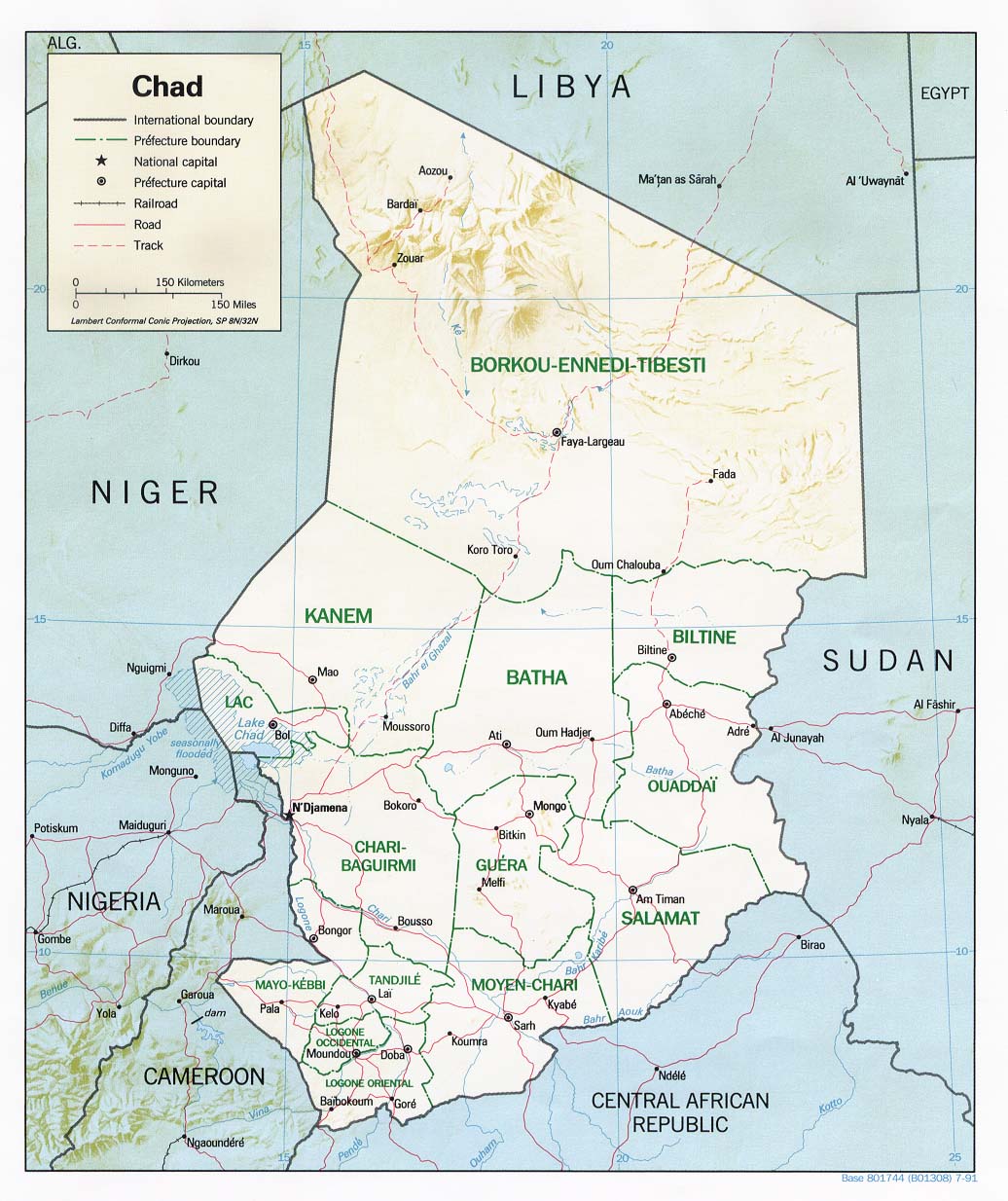
- Chad (Shaded Relief) 1991 (196K) and pdf format (203K)
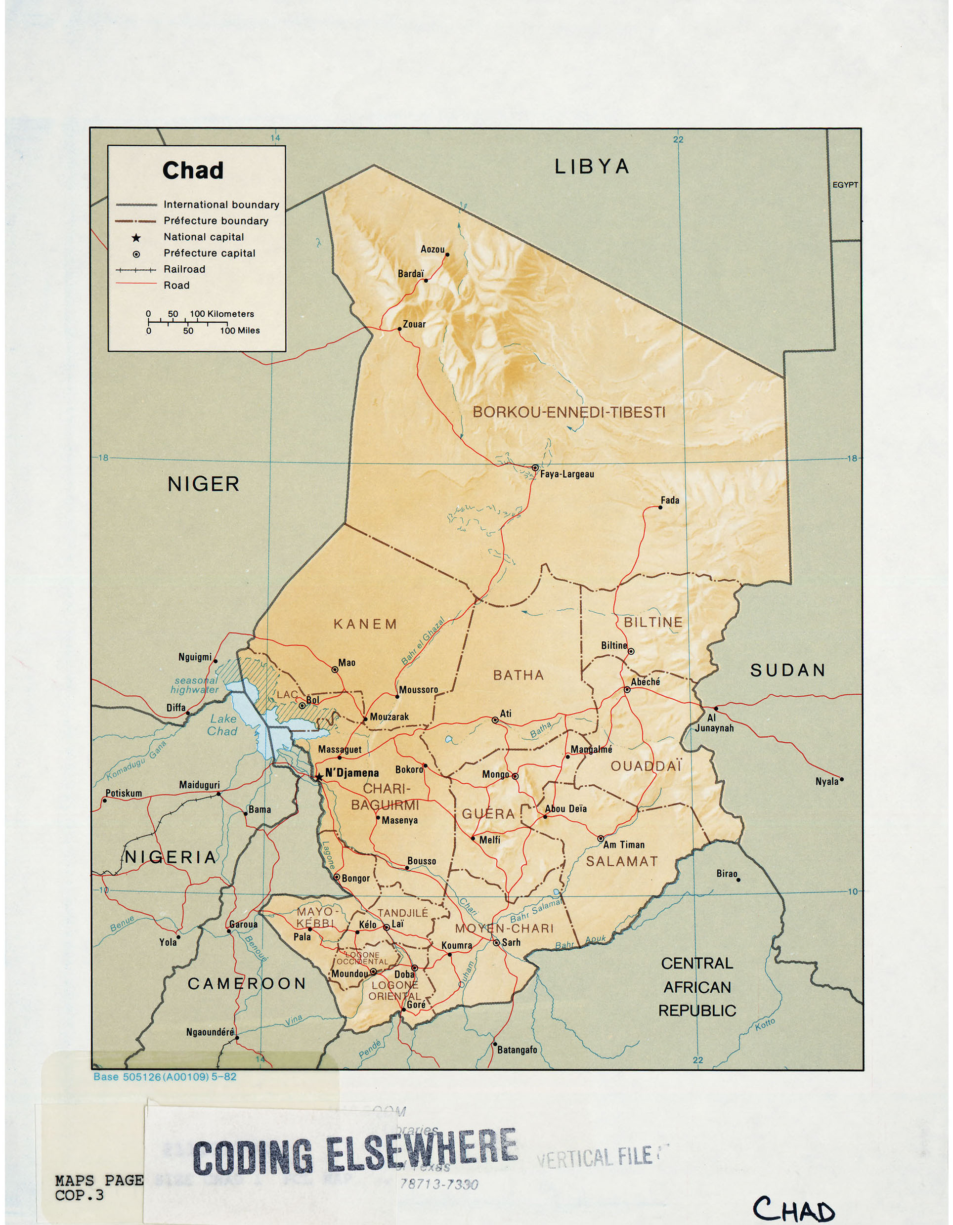
- Chad (Shaded Relief) 1982 (1MB)
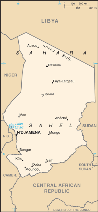
- Chad (Small Map) 2016 (25.5K)
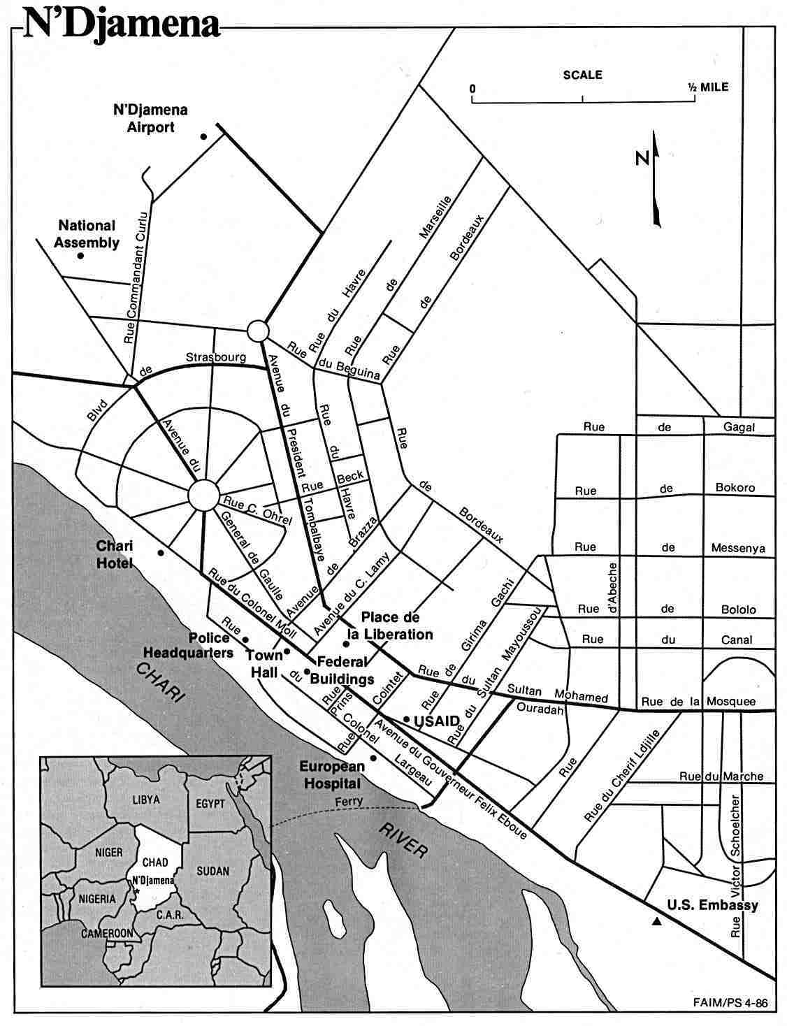
- N'Djamena U.S. Dept. of State 1986 (101K)
- 1:2,000,000 - Africa Topographic Maps Army Map Service, Series 2201
- This series covers all of Chad
- 1:1,000,000 - Operational Navigation Chart Series U.S. Defense Mapping Agency Aerospace Center. Not for navigational use
- Sheets J-4, K-3 and K-4 cover all of Chad
- 1:1,000,000 - International Map of the World U.S. Army Map Service
- This series covers part of southwest Chad
- 1:500,000 - Tactical Pilotage Charts U.S. National Imagery and Mapping Agency. Not for navigational use
- This series covers Chad
- 1:250,000 - Chad - Joint Operations Graphic Not for navigational use
- 39 sheets cover parts of Chad
- 1:250,000 - West Africa Topographic Maps U.S. Army Map Service, Series G504
- This series covers parts of southern Chad
- This series covers all of Chad
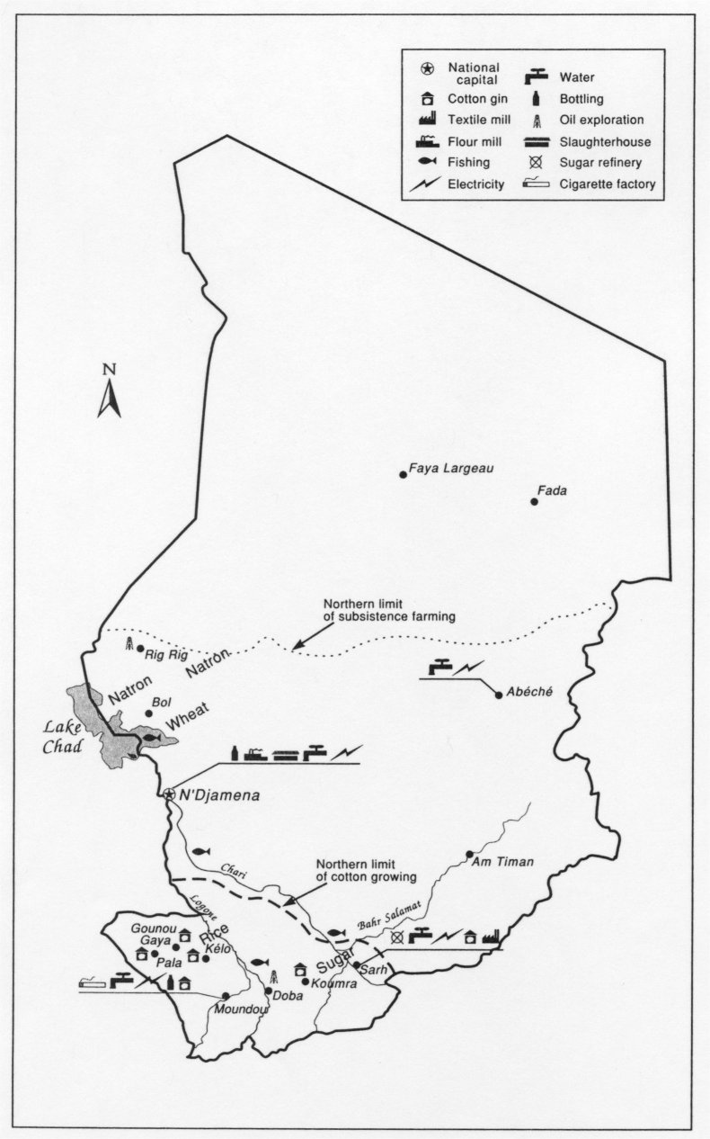
- Chad - Economic Activity U.S. Foreign Agricultural Service 2002 (120K)
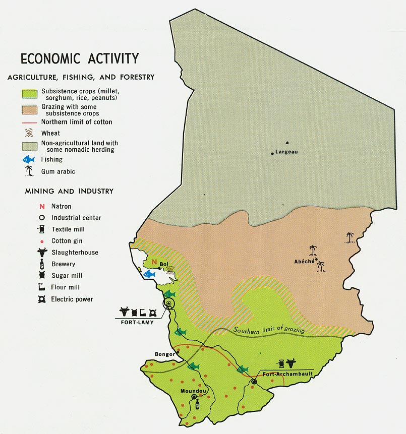
- Chad - Economic Activity from Map No. 59886 1969 (158K)
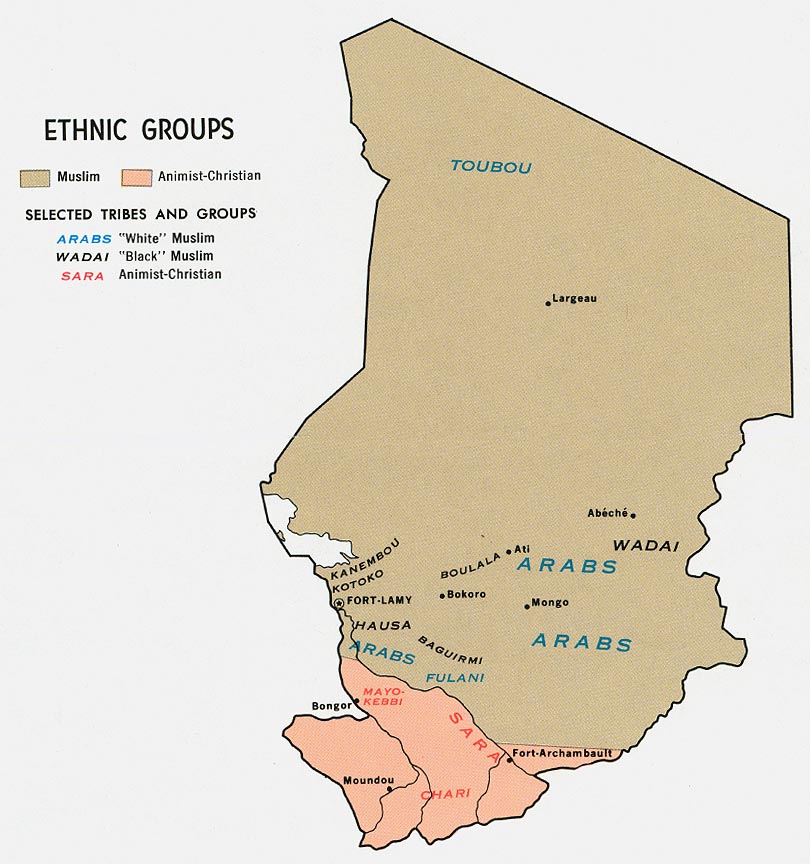
- Chad - Ethnic Groups from Map No. 59886 1969 (131K)
- Chad - Population from Map No. 59886 1969 (98K)
Maps on Other Web Sites