Perry-Castañeda Library
Map Collection
Egypt Maps
The following maps were produced by the U.S. Central Intelligence Agency, unless otherwise indicated.
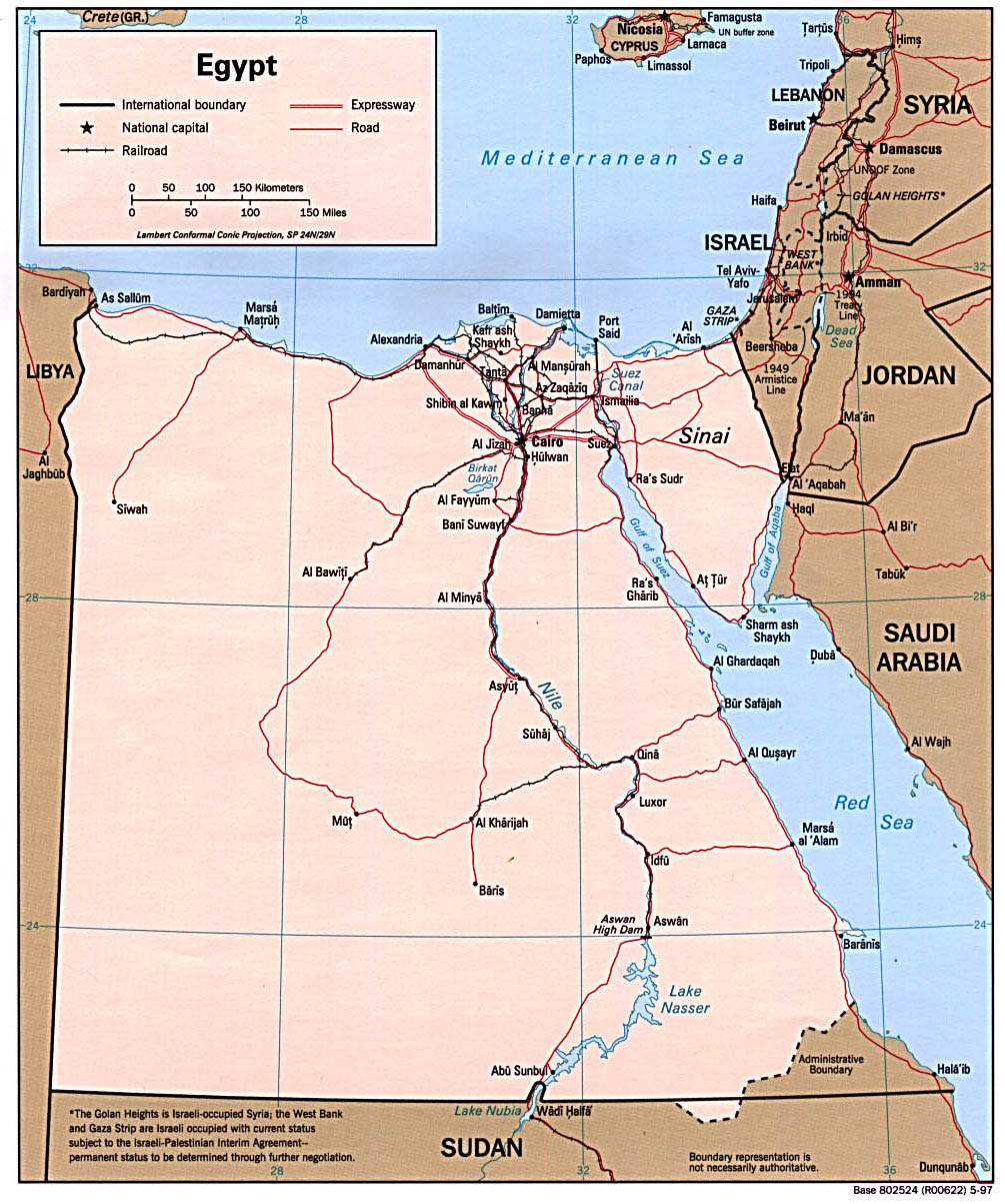
Country Maps- Egypt (Political) 1997 (264K) and pdf format (276K)
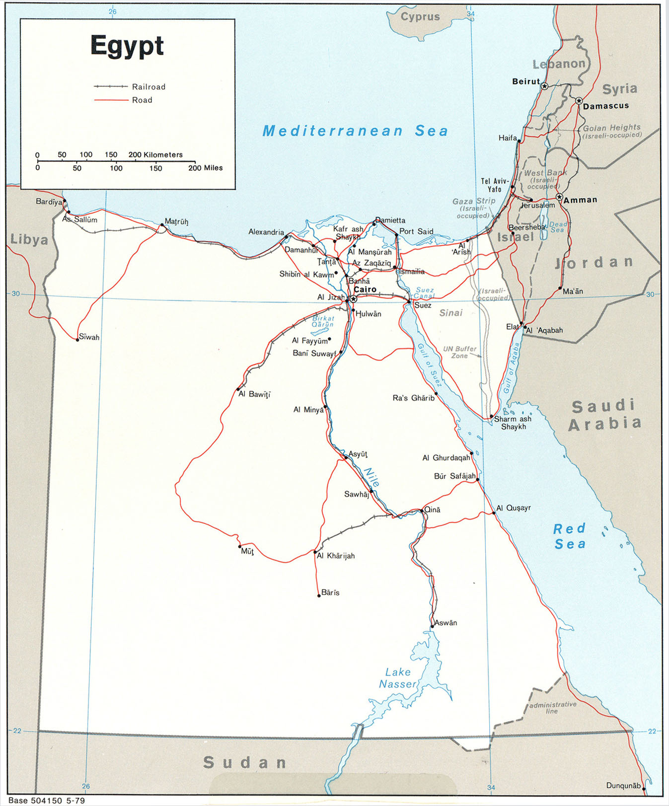
- Egypt (Political) 1979 (524K)
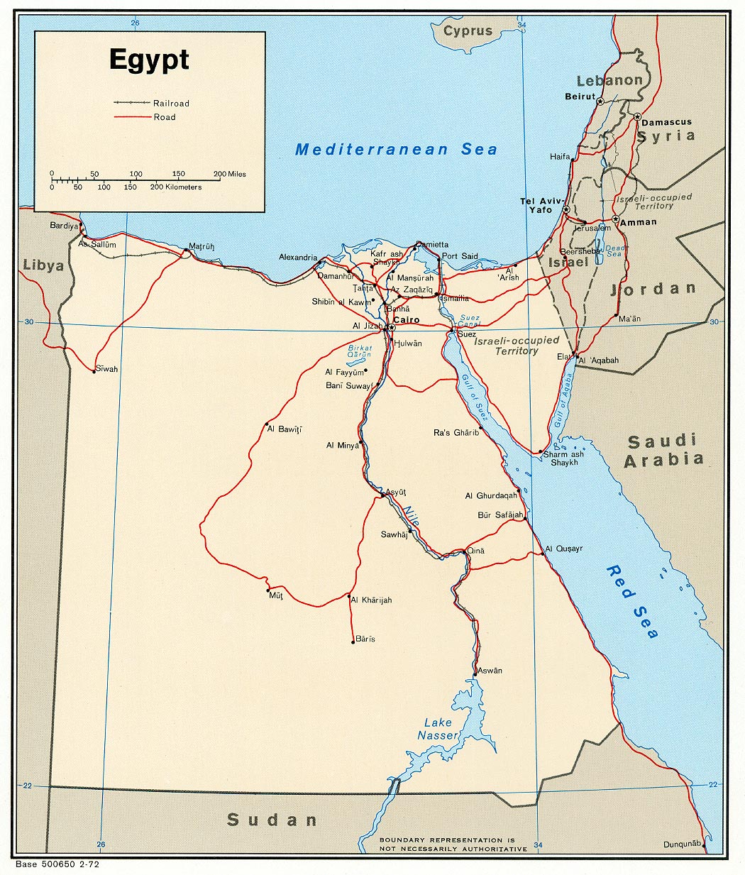
- Egypt (Political) 1972 (345K) and pdf format (356K)
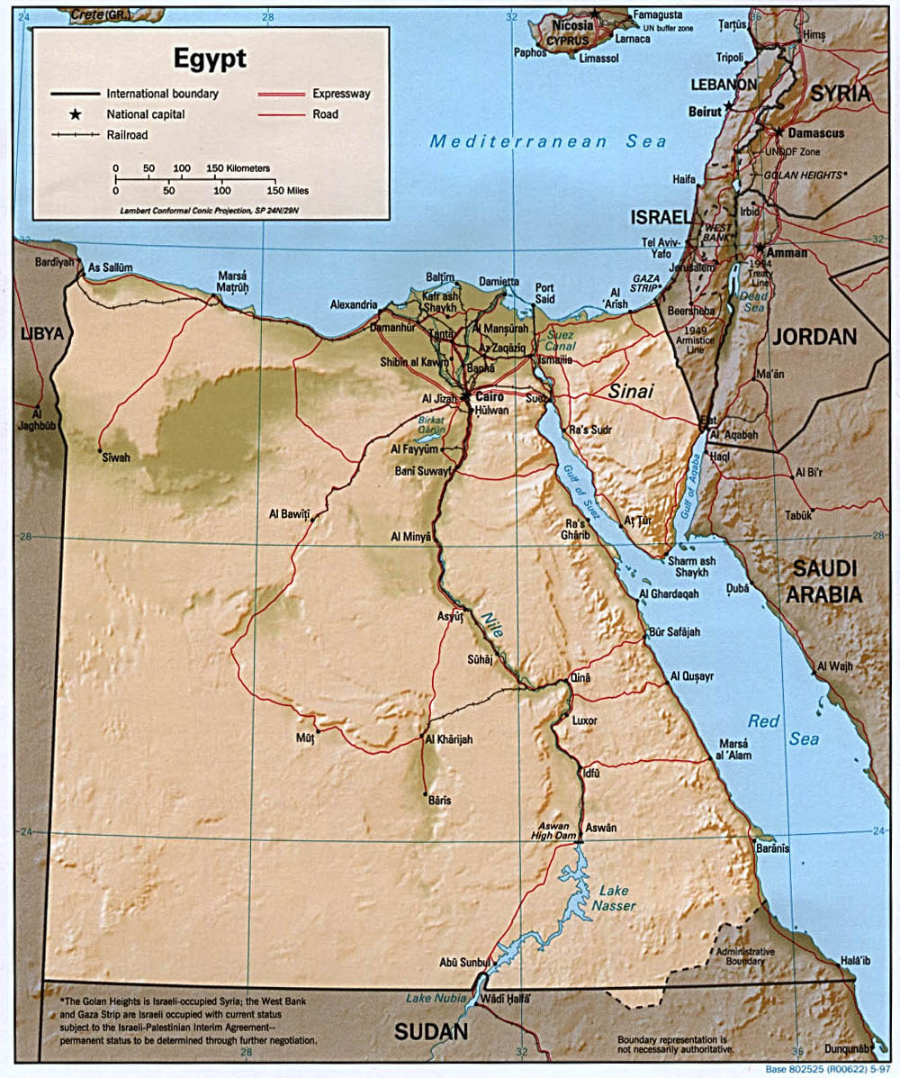
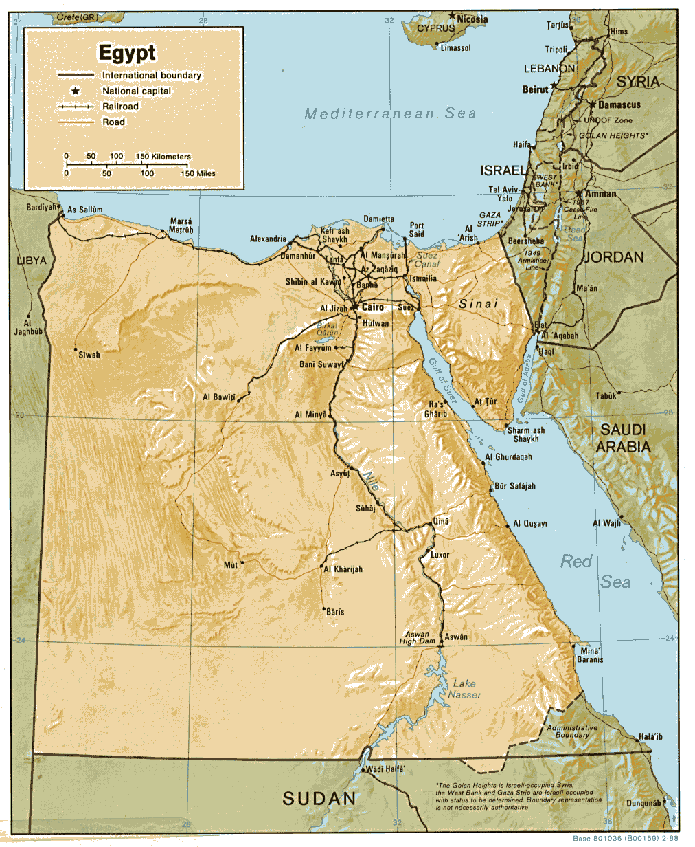
- Egypt (Shaded Relief) 1997 (289K) and pdf format (295K)
- Egypt (Shaded Relief) 1988 (216K) and pdf format (228K)
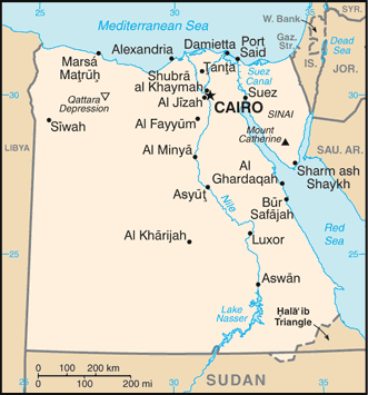
- Egypt (Small Map) 2016 (23.6K)
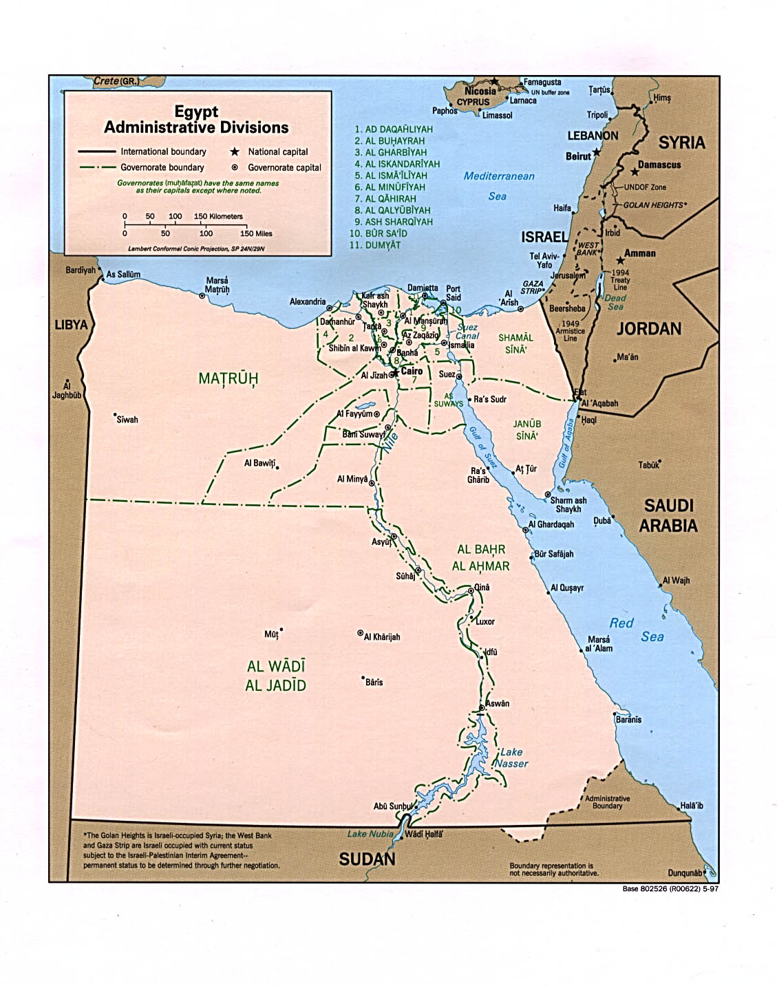
- Egypt (Administrative Divisions) 1997 (255K) and pdf format (238K)
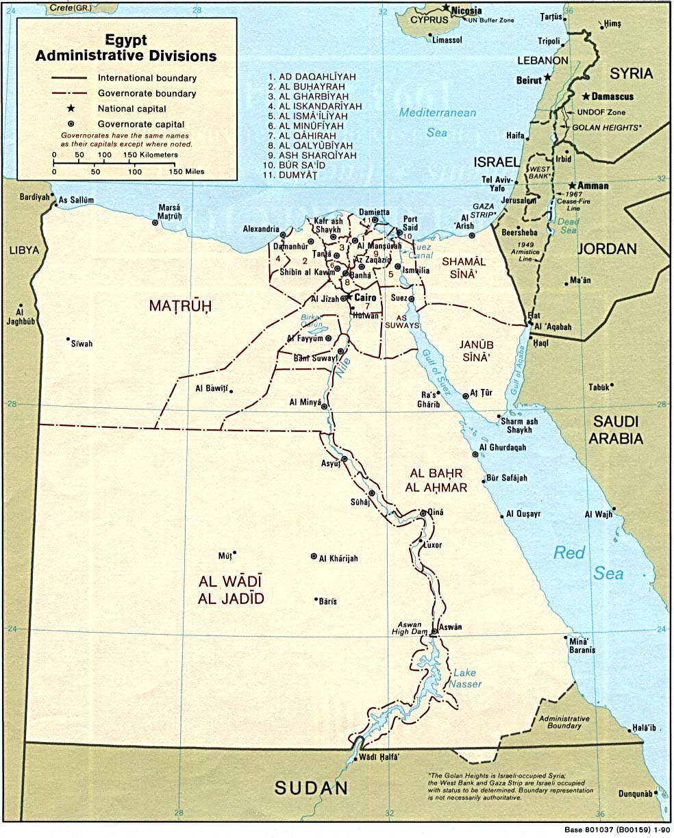
- Egypt (Administrative Divisions) 1990 (229K) and pdf format (233K)
- Egypt (8 maps) Published by the CIA January, 1993
- Alexandria - West Alexandria No. 1, 1:10,000, Edition 2-AMS, Series P971. U.S. Army Map Service, 1959 (7.1MB)
- Alexandria - West Central Alexandria No. 2, 1:10,000, Edition 2-AMS, Series P971. U.S. Army Map Service, 1959 (8.1MB)
- Alexandria - East Central Alexandria No. 3, 1:10,000, Edition 2-AMS, Series P971. U.S. Army Map Service, 1959 (7.3MB)
- Alexandria - East Alexandria No. 4, 1:10,000, Edition 2-AMS, Series P971. U.S. Army Map Service, 1959 (5MB)
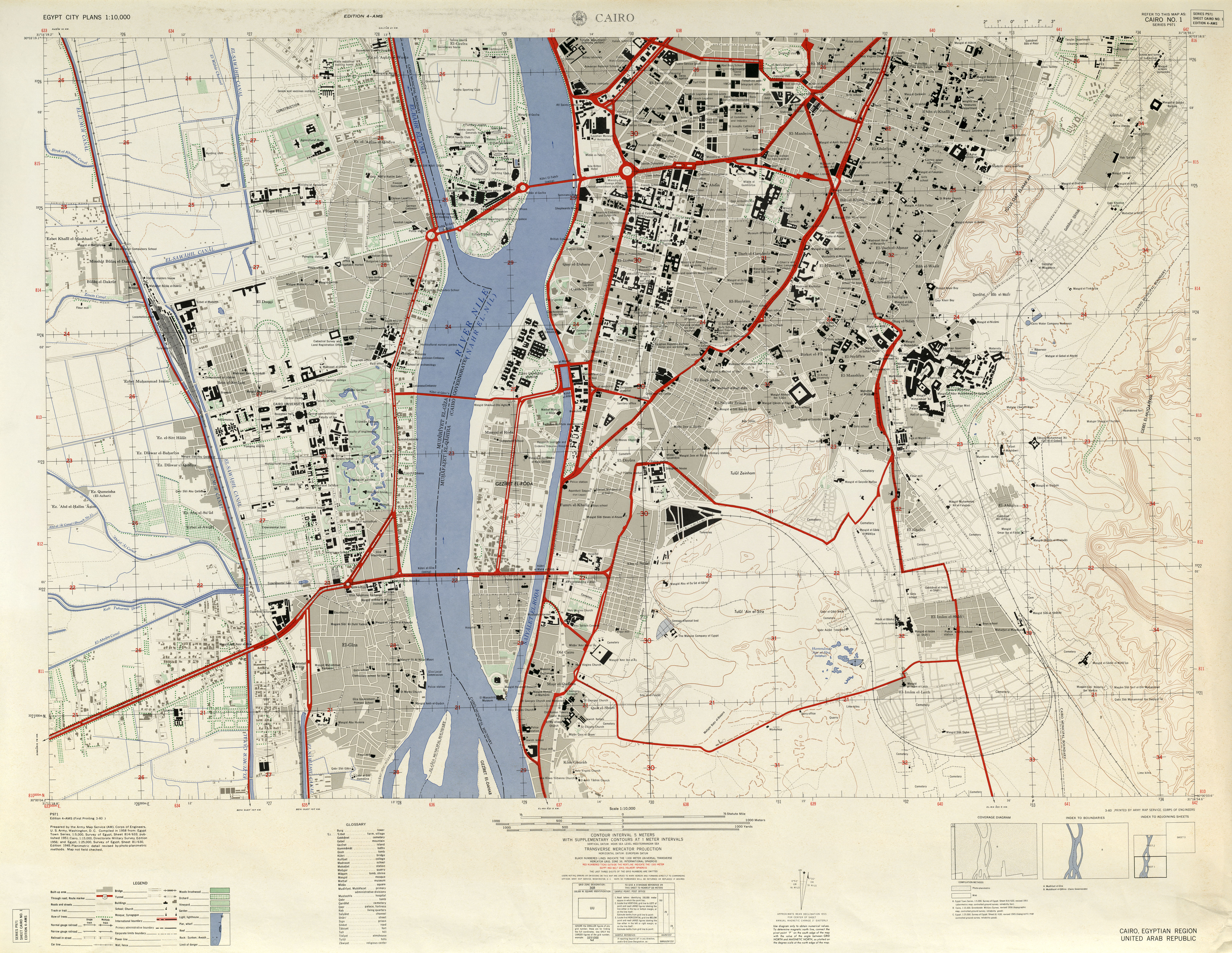
- Cairo - South Cairo No. 1, 1:10,000, Edition 4-AMS, Series P971. U.S. Army Map Service, 1958 (6.9MB)
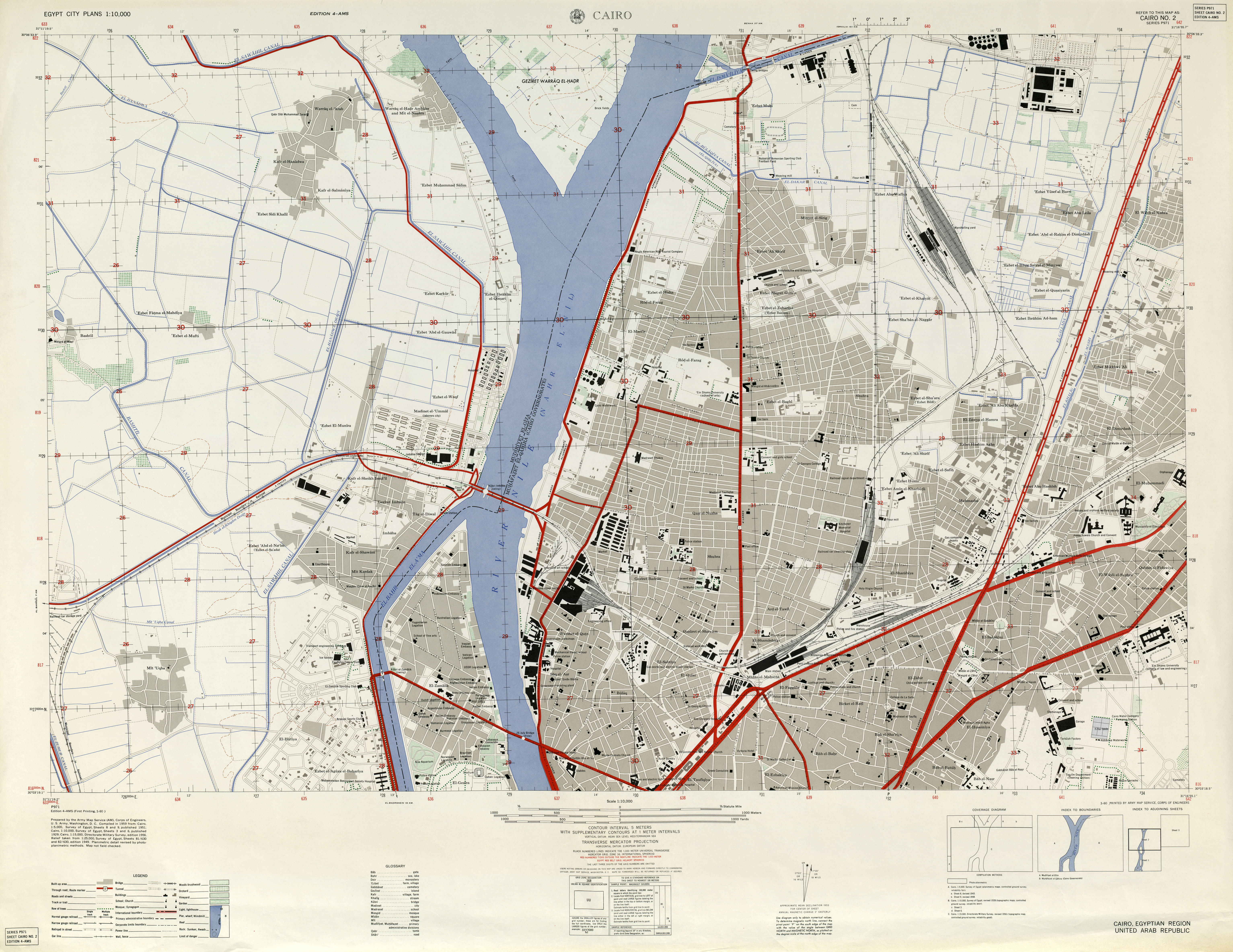
- Cairo - North Cairo No. 2, 1:10,000, Edition 4-AMS, Series P971. U.S. Army Map Service, 1958 (5.8MB)
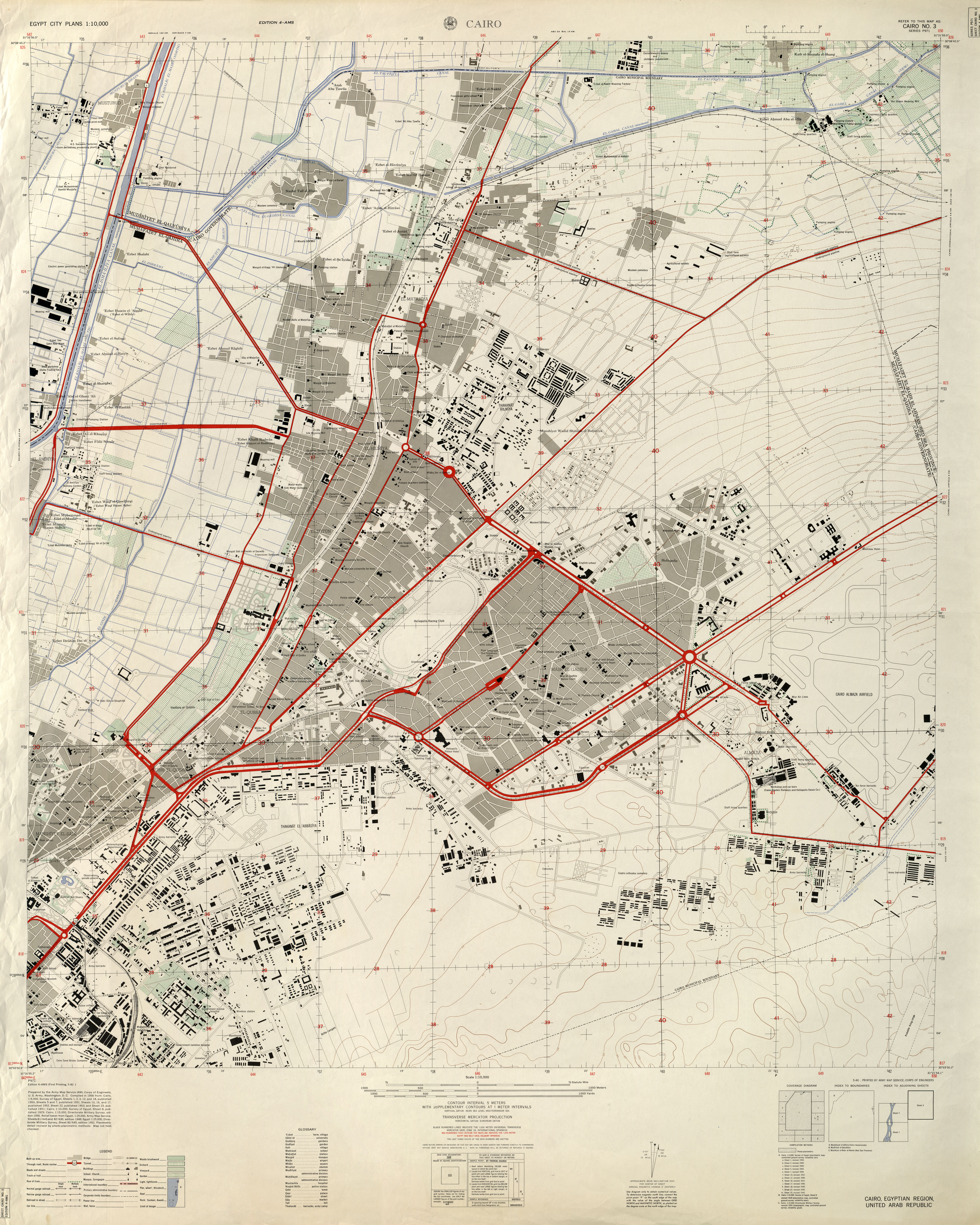
- Cairo - Northeast Cairo No. 3, 1:10,000, Edition 4-AMS, Series P971. U.S. Army Map Service, 1958 (8MB)
- Hurghada U.S. Naval Forces Europe 1999 (45K)
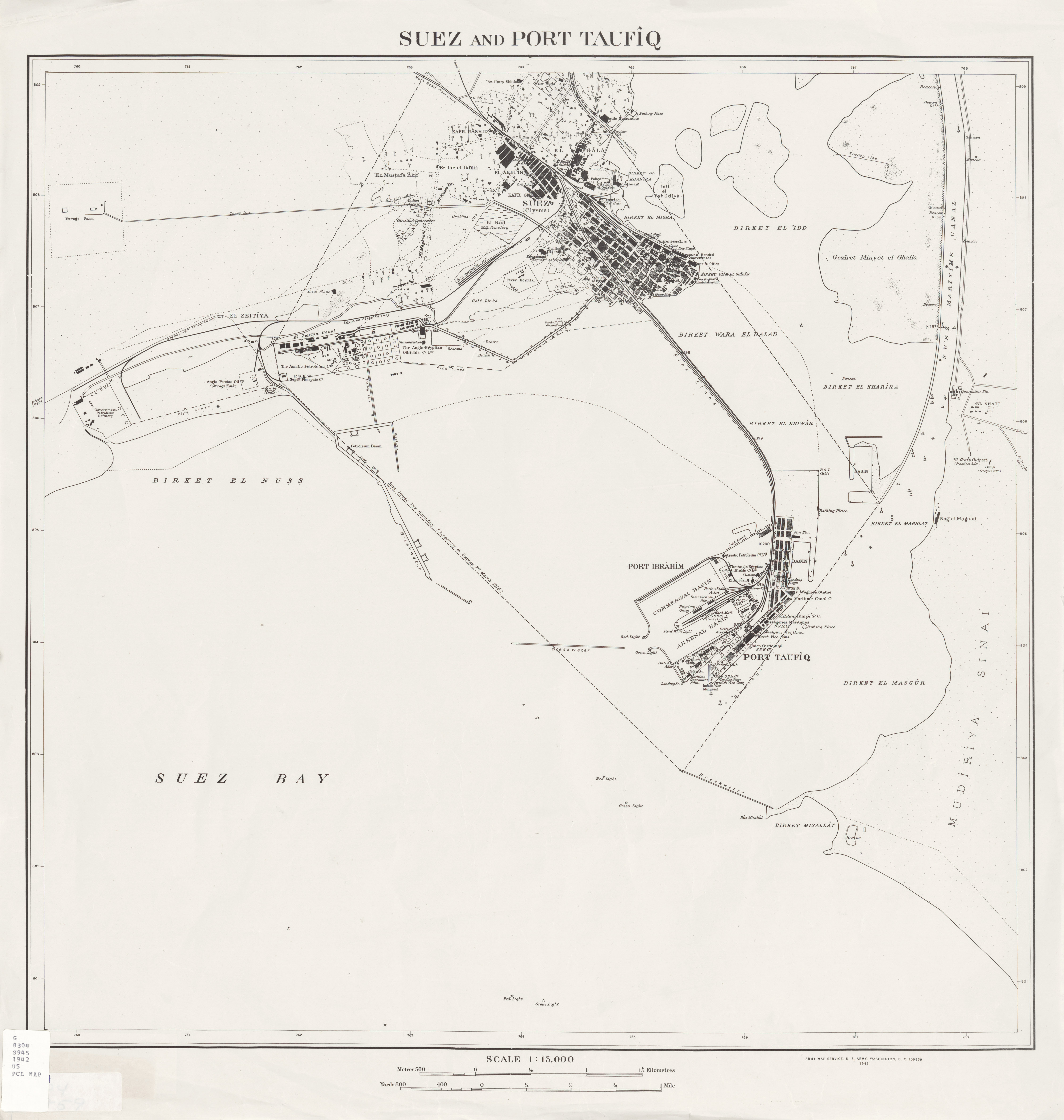
- Suez and Port Taufiq 1:15,000, Series P971, U.S. Army Map Service, 1942 (2.3MB)
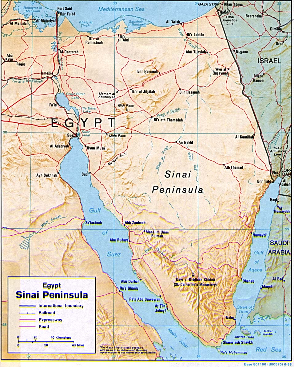
- Egypt - Sinai Peninsula (Shaded Relief) 1992 (242K)
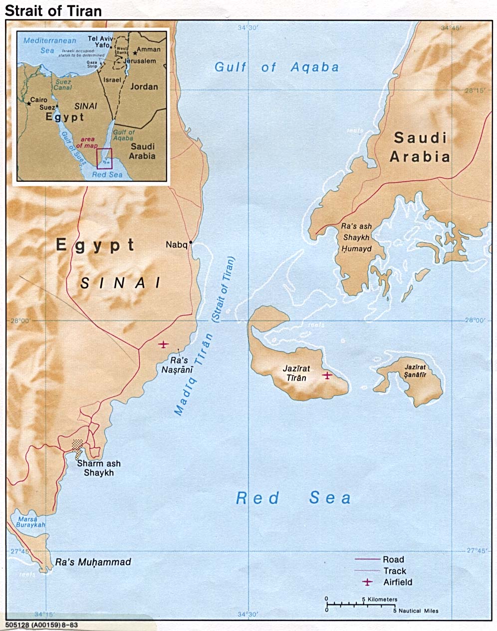
- Strait of Tiran 1983 (203K)
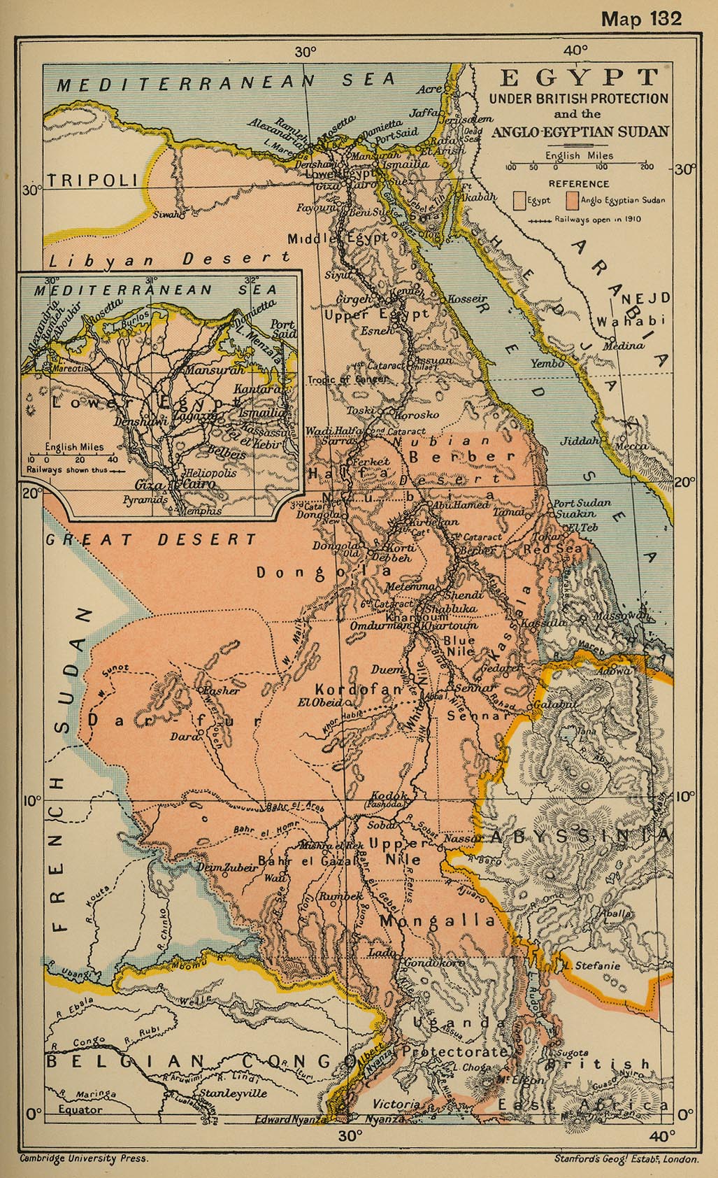
- Egypt Under British Protection and the Anglo-Egyptian Sudan From "The Cambridge Modern History Atlas" edited by Sir Adolphus William Ward, G.W. Prothero, Sir Stanley Mordaunt Leathes, and E.A. Benians. Cambridge University Press; London. 1912.
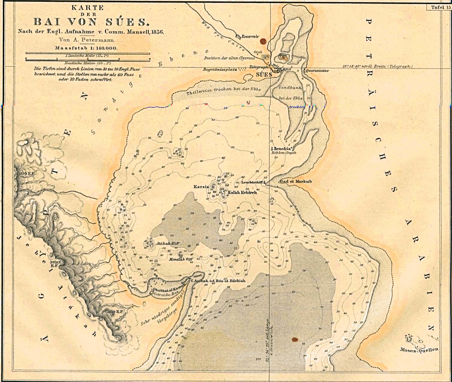
- Suez Bay, Egypt 1856 (351K) "Karte der Bai von Sues" From Mittheilungen aus Justus Perthes' Geographischer Anstalt uber Wichtige Neue Erforschungen auf dem Gesammtgebiete der Geographie von Dr. A. Petermann. Volume 7, 1861.
- 1:1,000,000 - Operational Navigation Chart Series U.S. Defense Mapping Agency Aerospace Center Not for navigational use
- This series includes all of Egypt
- 1:1,000,000 - International Map of the World U.S. Army Map Service
- This series includes all of Egypt
- 1:2,000,000 - Africa Topographic Maps U.S. Army Map Service
- This series includes all of Egypt
- 1:500,000 - Tactical Pilotage Chart Series U.S. National Imagery and Mapping Agency. Not for navigational use
- This series includes all of Egypt
- 1:500,000 - World Series 1404, Great Britain. War Office and Air Ministry. 1958-
- This series includes all of Egypt
- 1:250,000 - North Africa Topographic Maps U.S. Army Map Service, Series P502
- This series includes much of Egypt
- 1:250,000 - Suez Canal U.S. Army Map Service, Series 3753
- 1:250,000 - East Africa Series Y502, U.S. Army Map Service. Not for navigational use
- This series includes all of Egypt.
- 1:100,000 - Egypt Great Britain War Office/U.S. Army Map Service, Series 4085
- This series mainly covers parts of the Nile Delta and Nile River
- This series includes all of Egypt
Maps on Other Web Sites