Perry-Castañeda Library
Map Collection
China Maps
| China Country Maps | China City Maps | China Detailed Maps | China Thematic Maps | China Historical Maps | Other City Map Sites | Other Country Map Sites |
|---|
The following maps were produced by the U.S. Central Intelligence Agency, unless otherwise indicated.
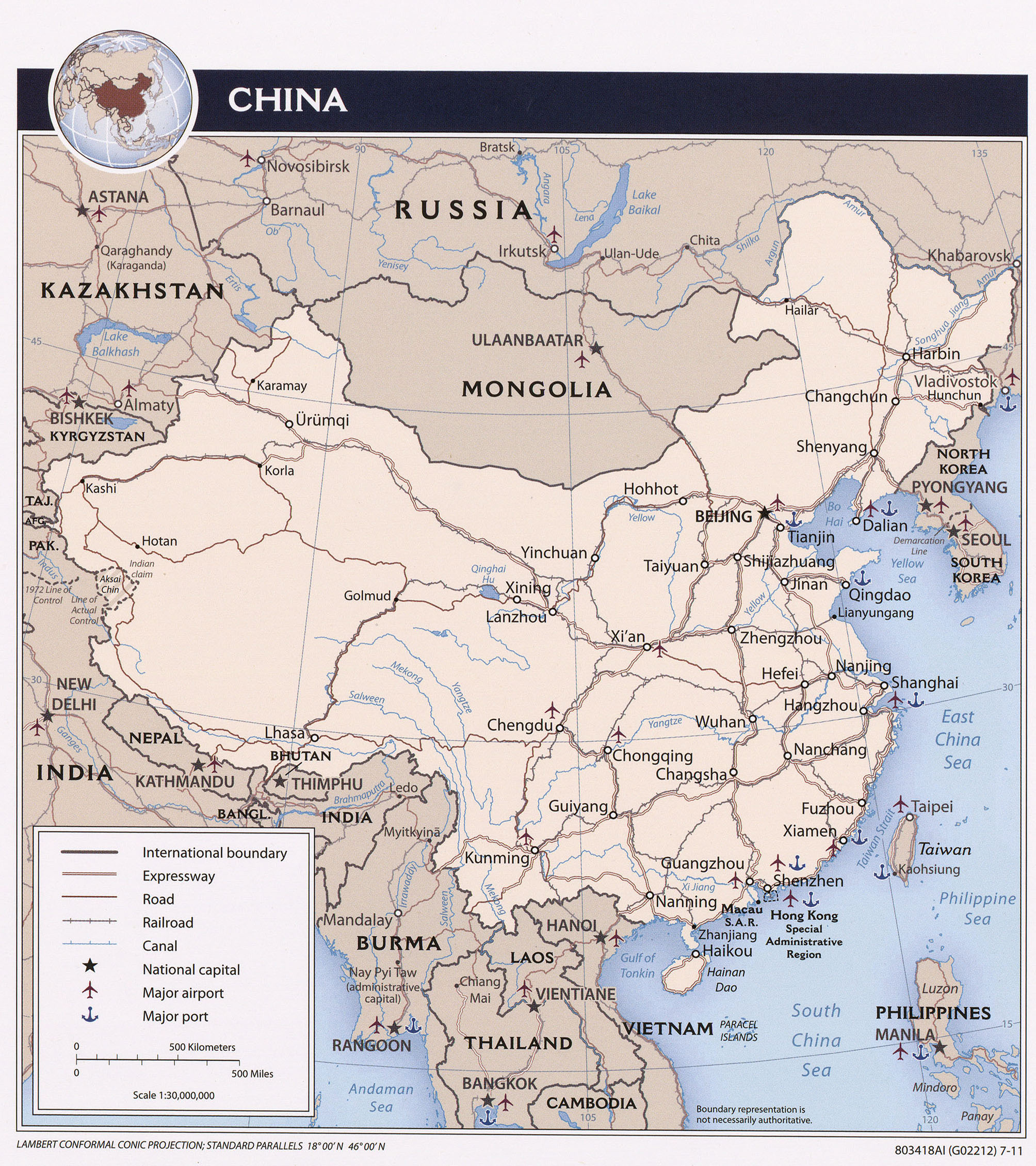
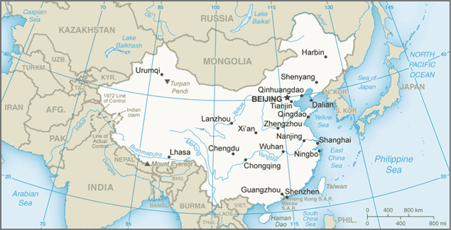
Country Maps- China (Political) 2011 (1.2MB) and pdf format (2.7MB)
- China (Political) 2001 (285K) and pdf format (269K)
- China (Political) 1996 (291K) and pdf format (294K)
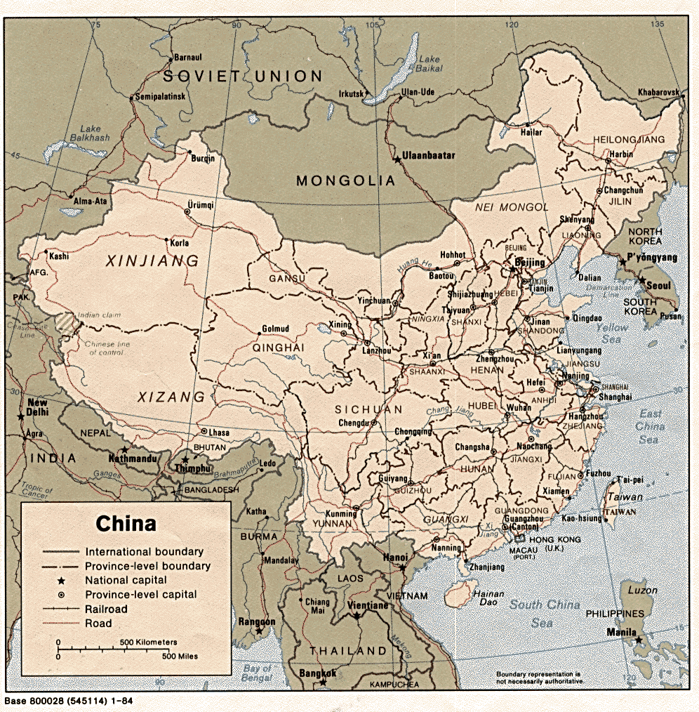
- China (Political) 1984 (339K) and pdf format (353K)
- China (Physiography) 2011 (1.2MB) and pdf format (1.5MB)
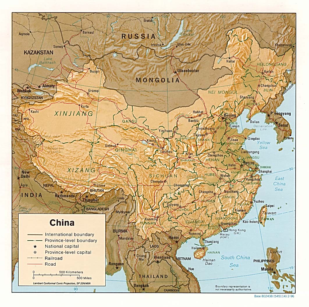
- China (Shaded Relief) 2001 (261K) and pdf format (278K)
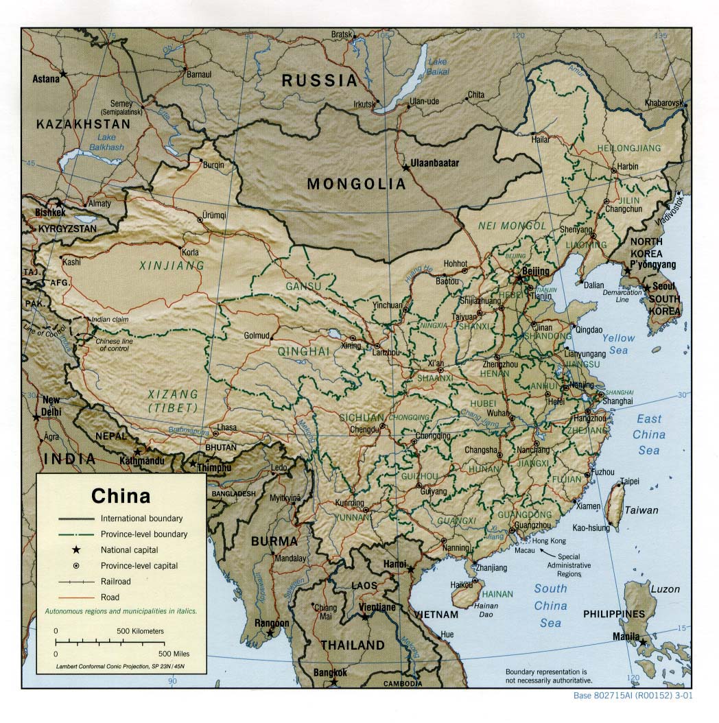
- China (Shaded Relief) 1996 (323K) and pdf format (326K)
- China (Small Map) 2016 (21.8K)
- China (Transportation) 2011 (1.2MB) and pdf format (2.8MB)
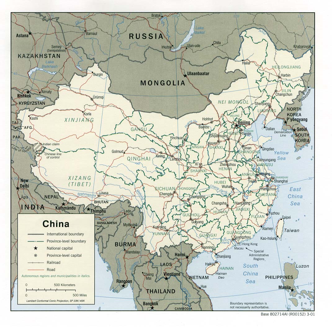
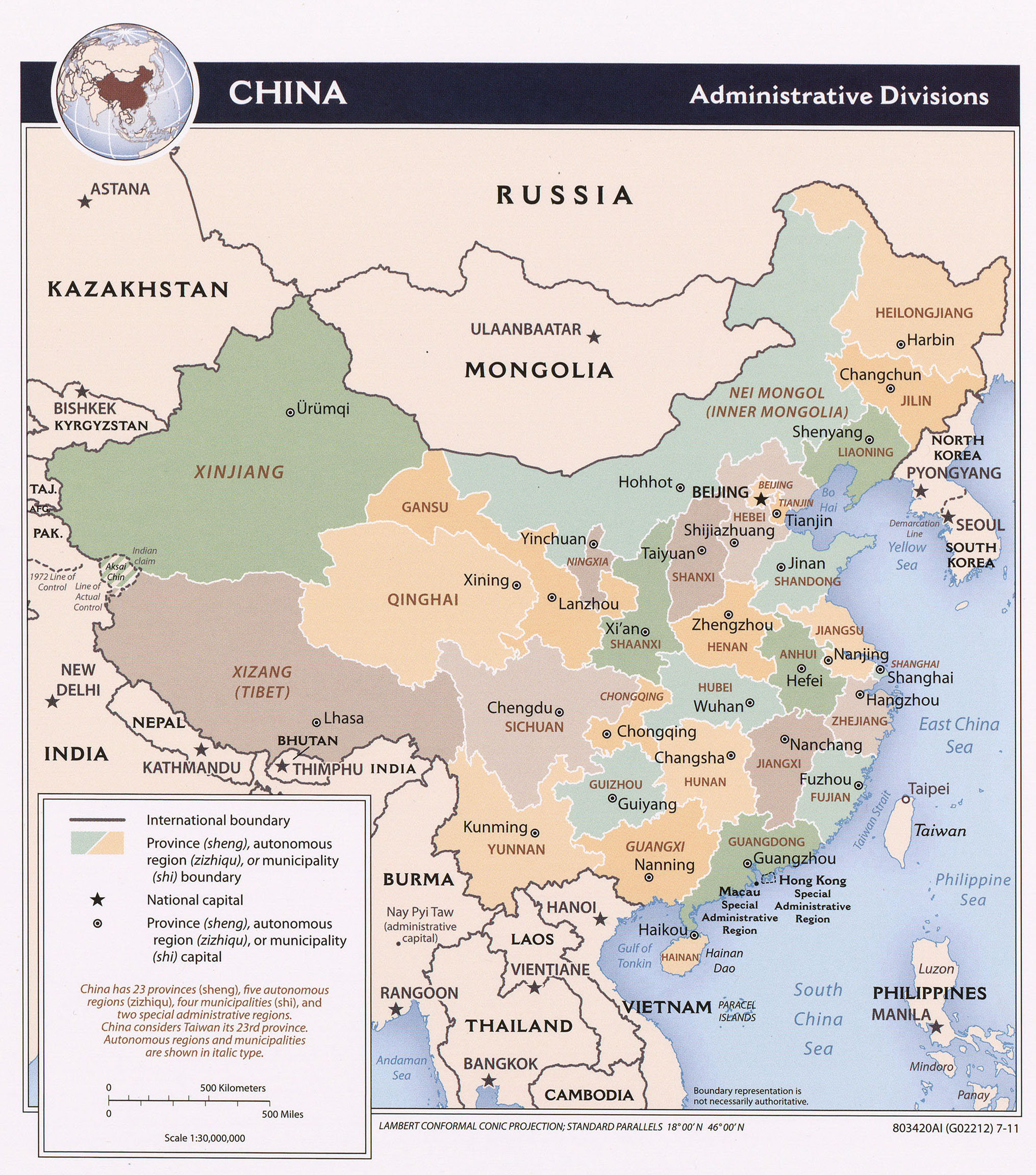
- China (Administrative Divisions) 2011 (1.0MB) and pdf format (2.8MB)
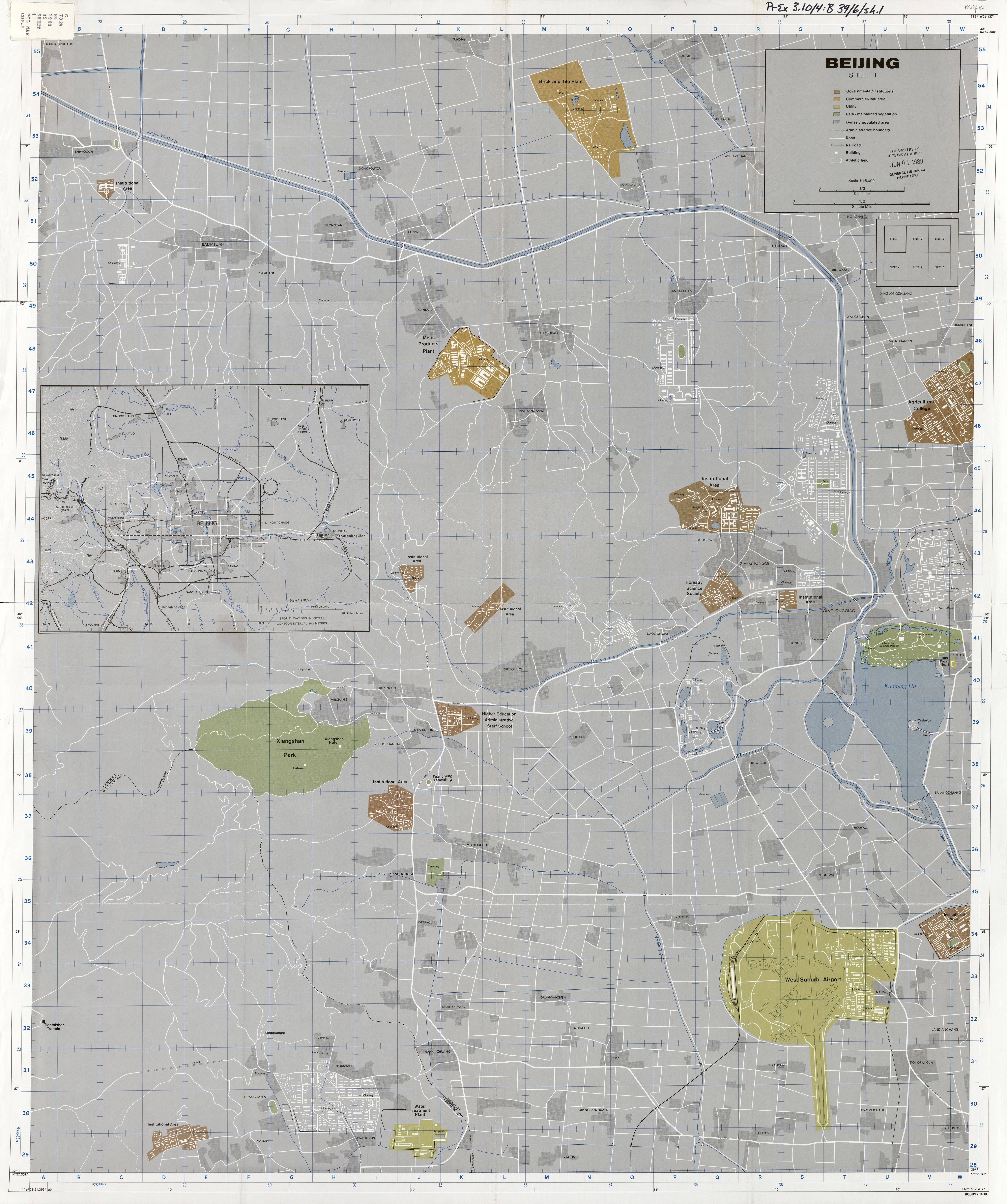
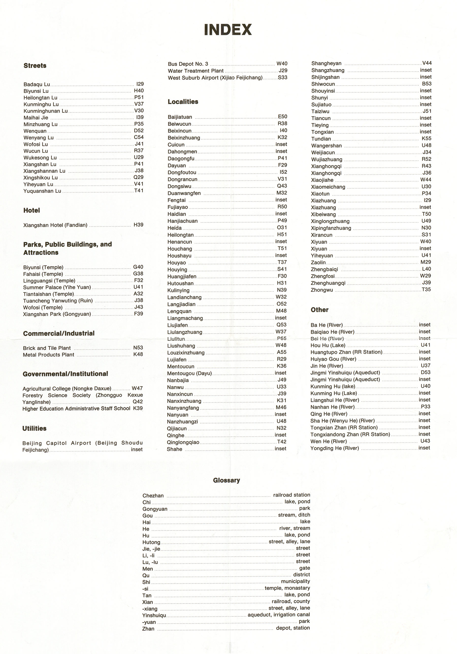
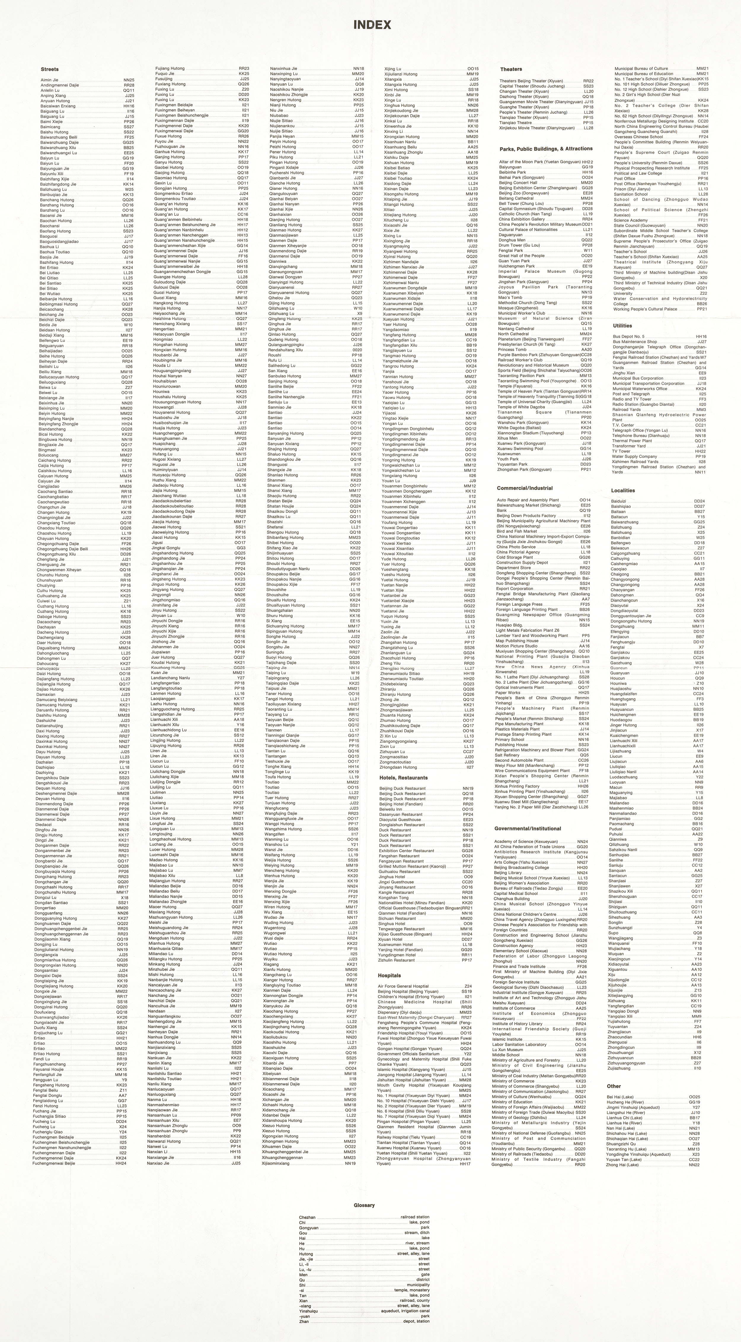
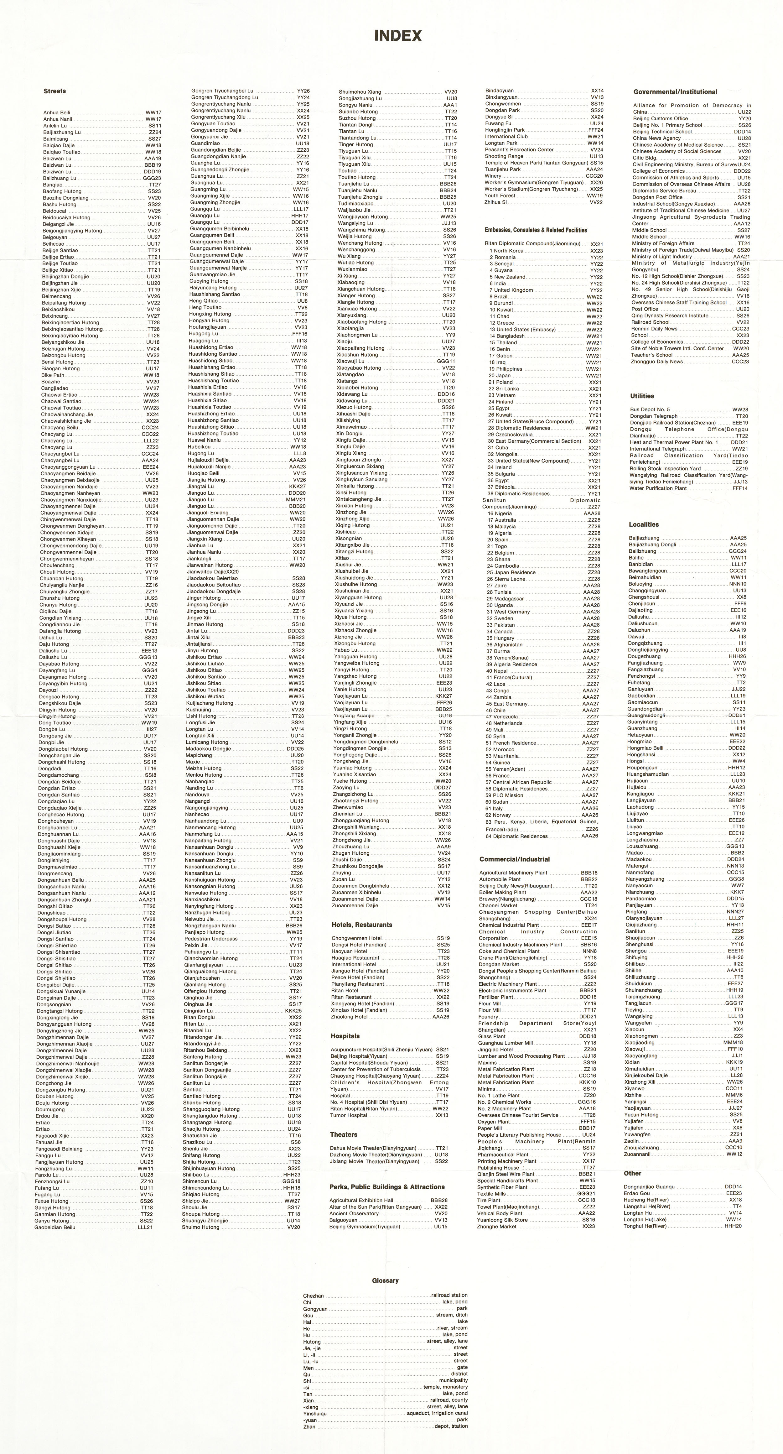
- Beijing - Sheet 1 1:15,000 1988 (5.1 MB) and verso Beijing - Sheet 1 Index (703 KB)
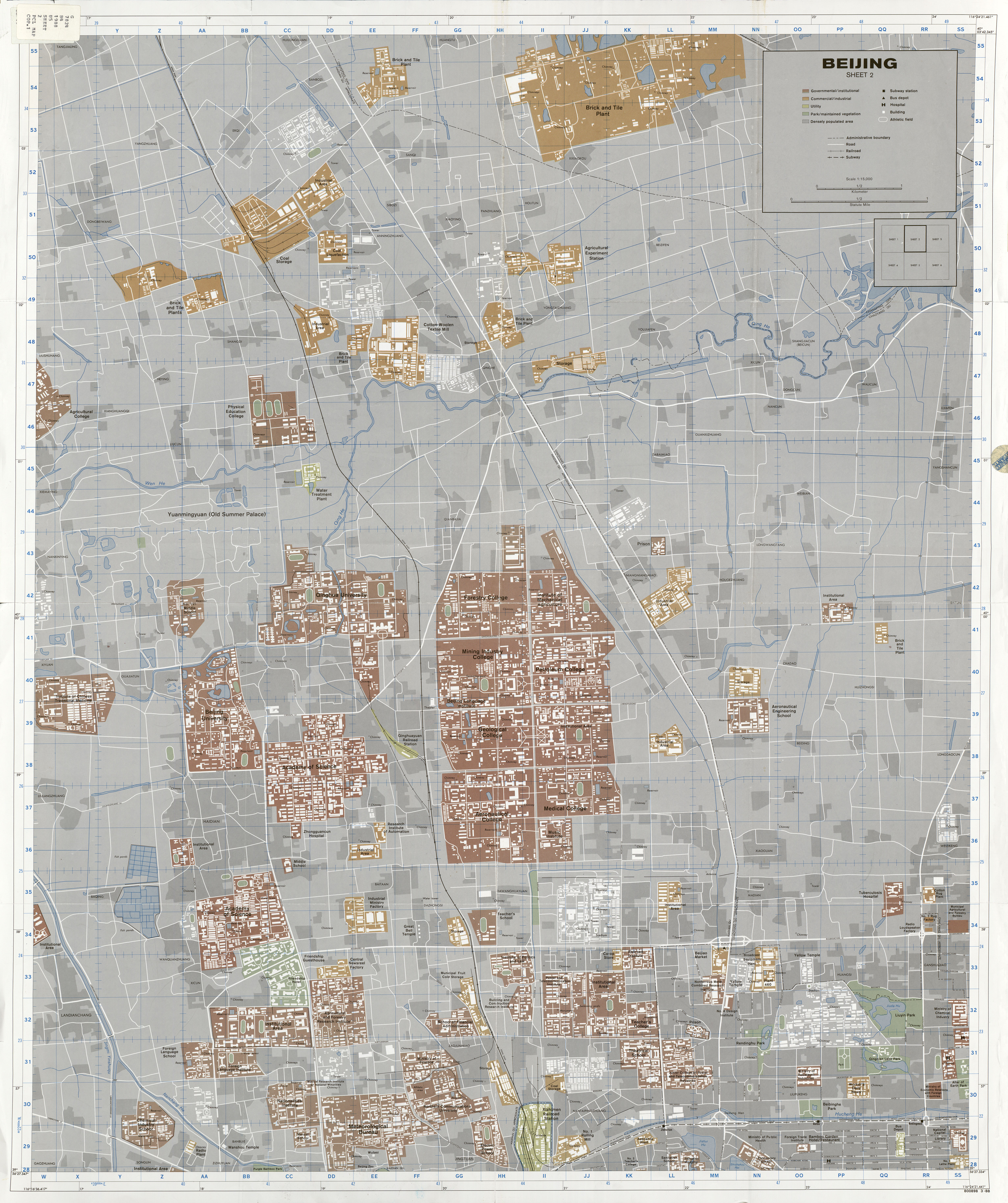
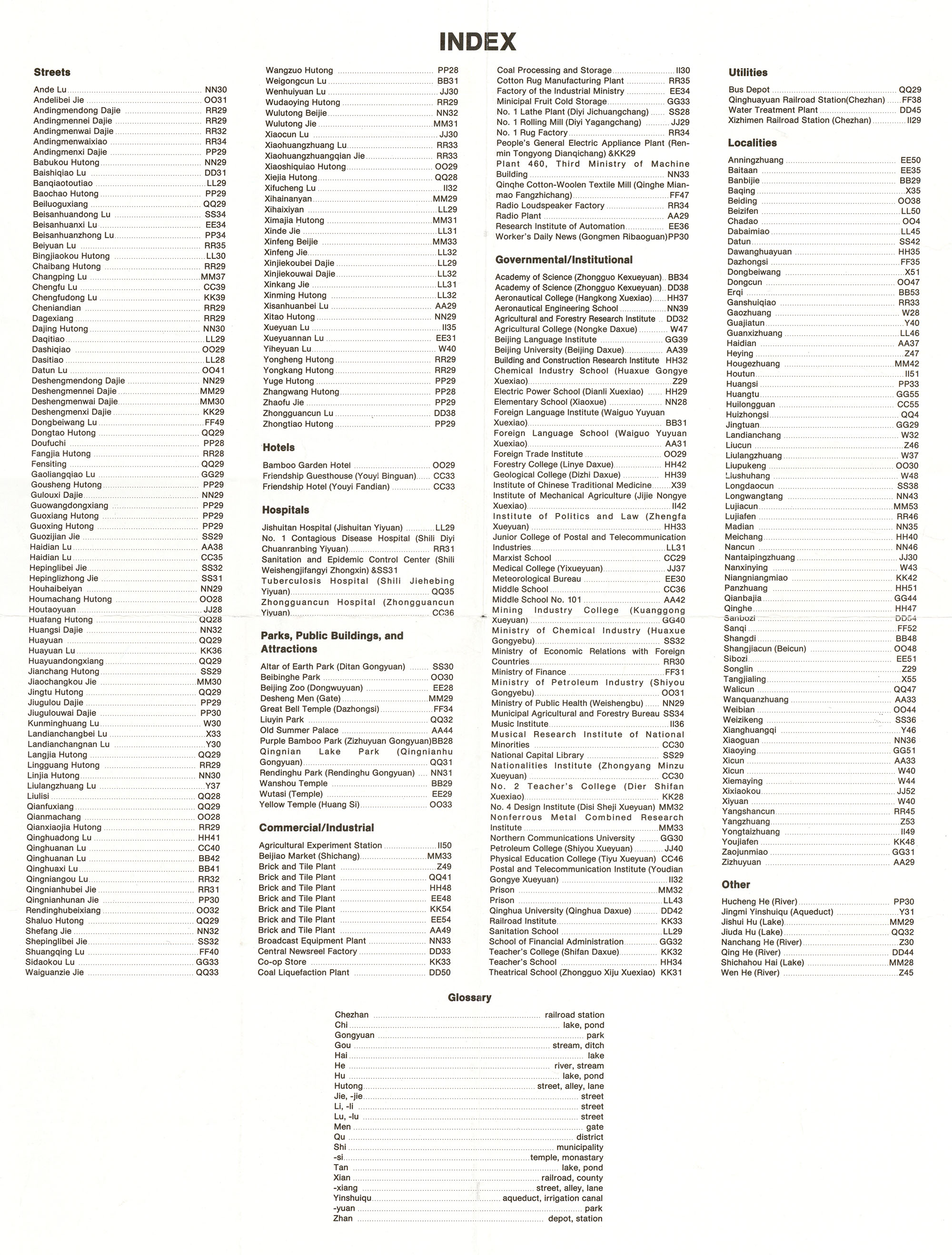
- Beijing - Sheet 2 1:15,000 1988 (6.4 MB) and verso Beijing - Sheet 2 Index (1.1 MB)
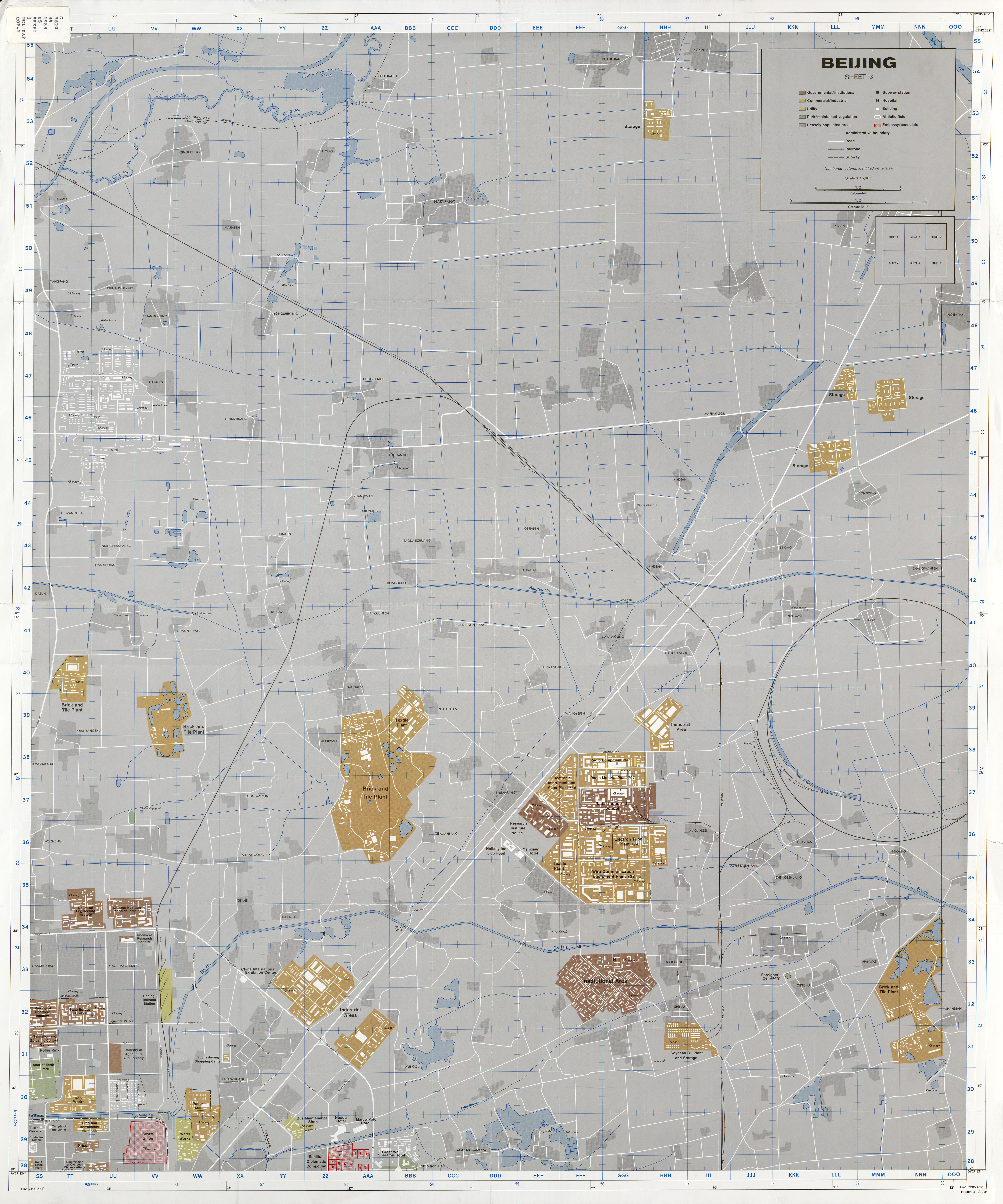
- Beijing - Sheet 3 1:15,000 1988 (5.1 MB) and verso Beijing - Sheet 3 Index (748 KB)
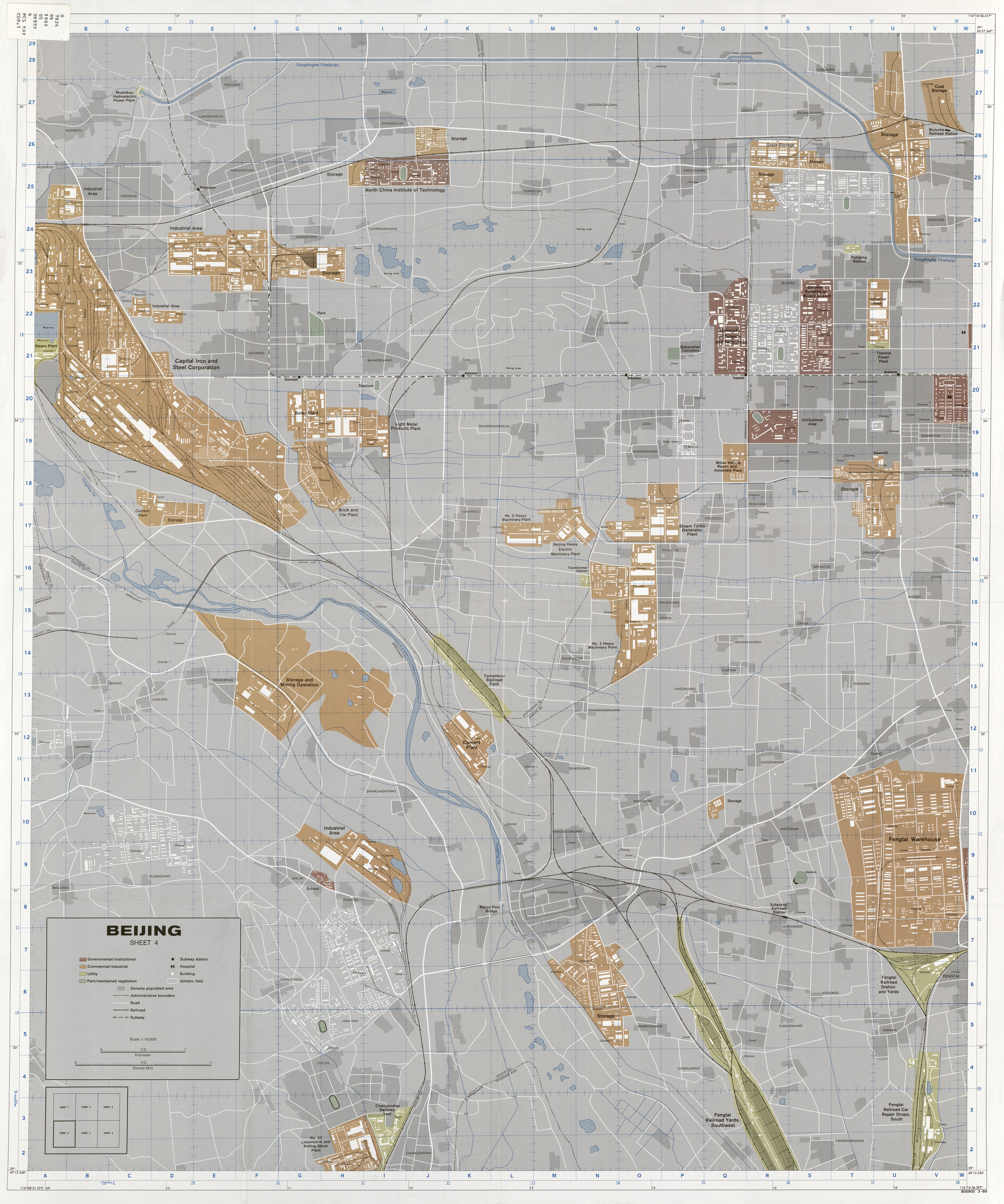
- Beijing - Sheet 4 1:15,000 1988 (5.6 MB) and verso Beijing - Sheet 4 Index (563 KB)
- Beijing - Sheet 5 1:15,000 1988 (6.7 MB) and verso Beijing - Sheet 5 Index (2.5 MB)
- Beijing - Sheet 5 [north and south sections] 1988
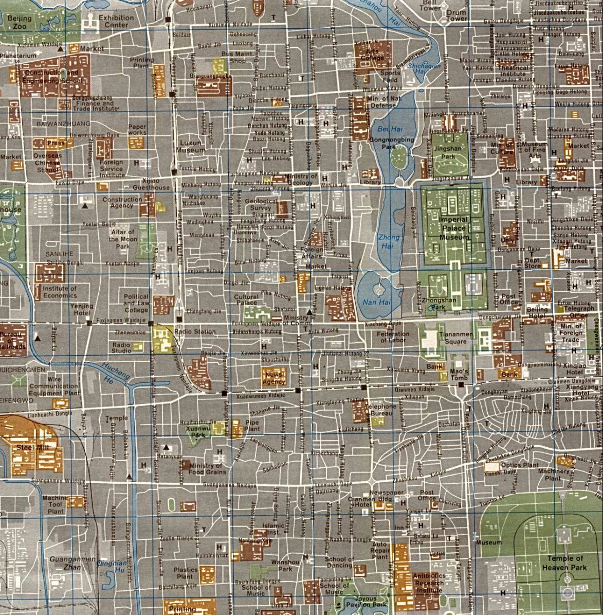
- Beijing - Sheet 5 [detail of central area] 1988 (507K)
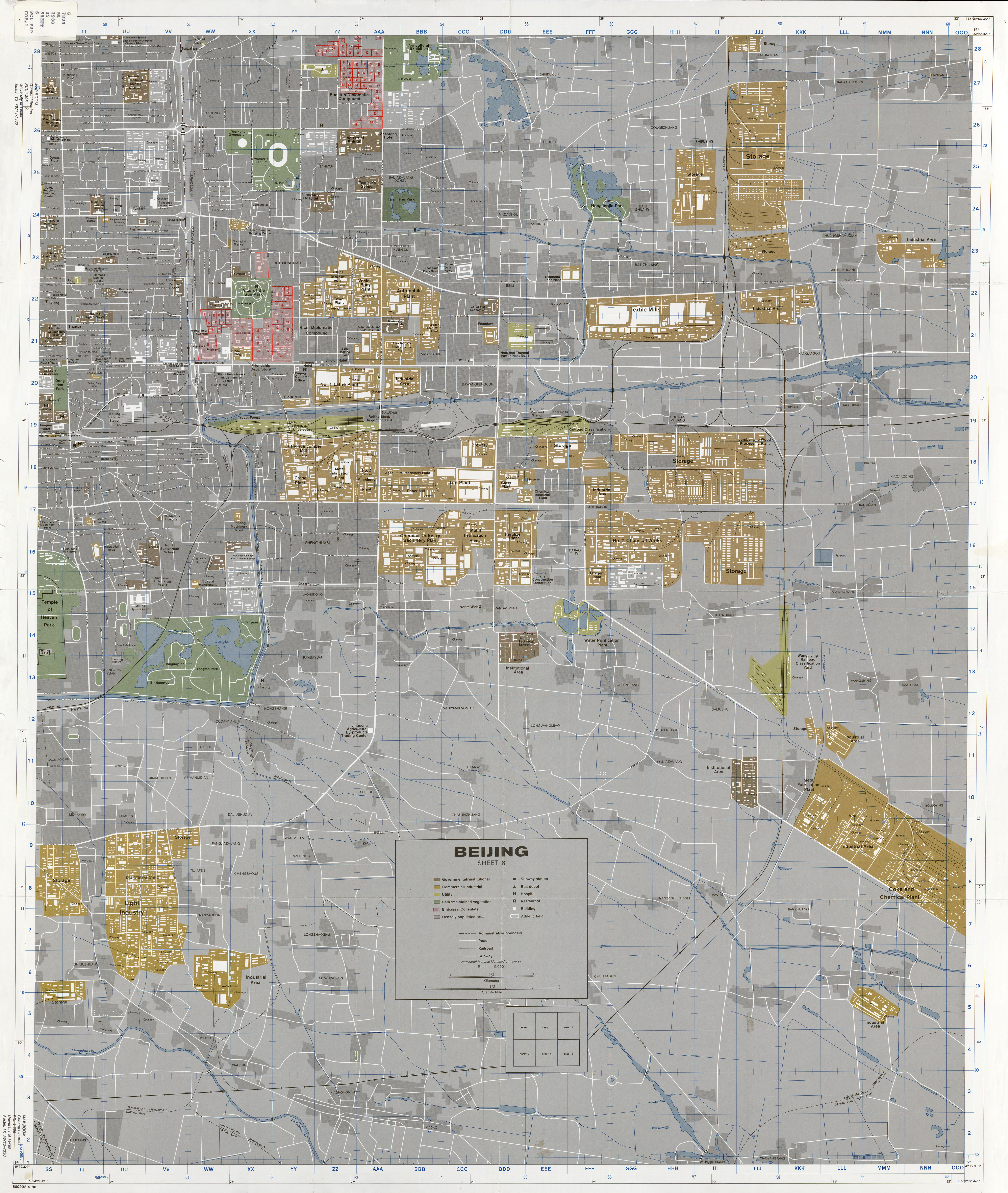
- Beijing - Sheet 6 1:15,000 1988 (6.3 MB) and verso Beijing - Sheet 6 Index (2.4 MB)
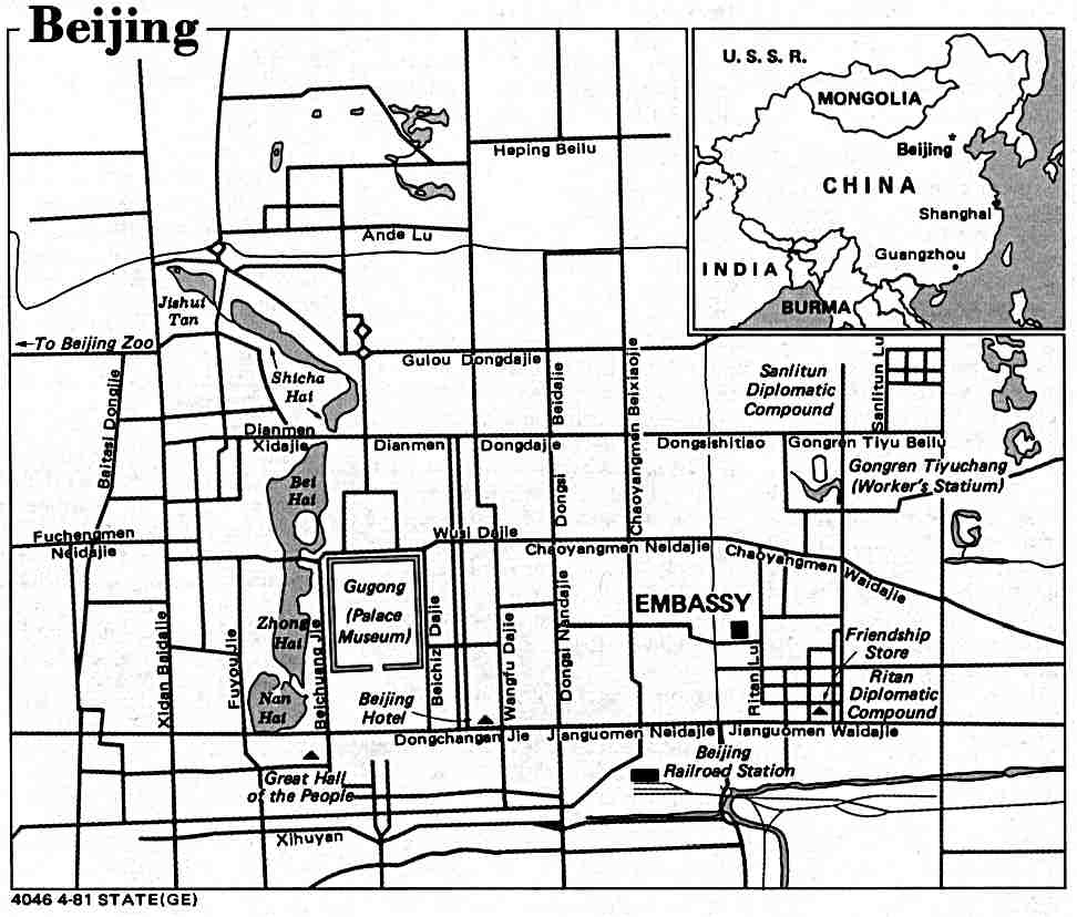
- Beijing U.S. Dept. of State 1981 (73K)
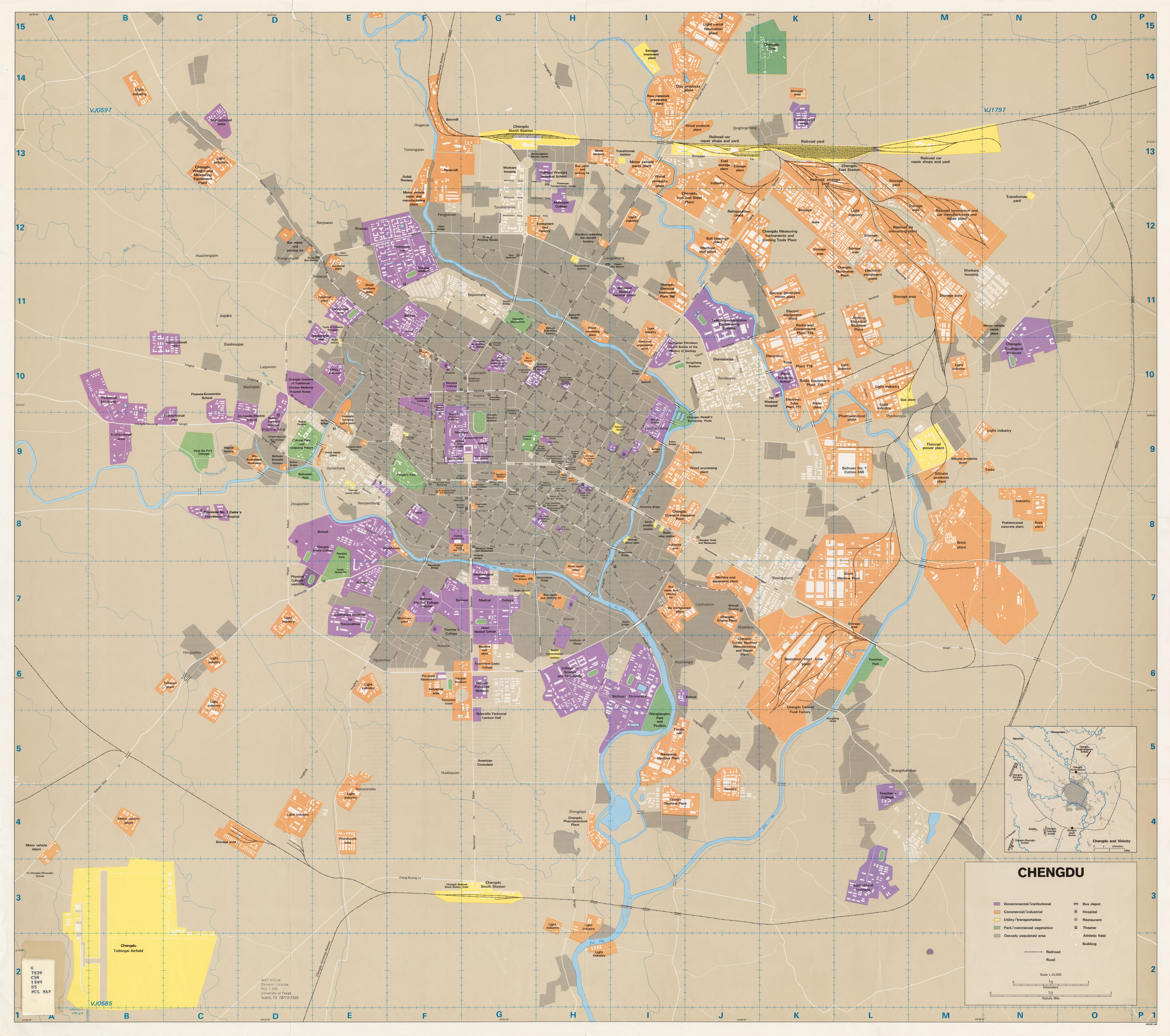
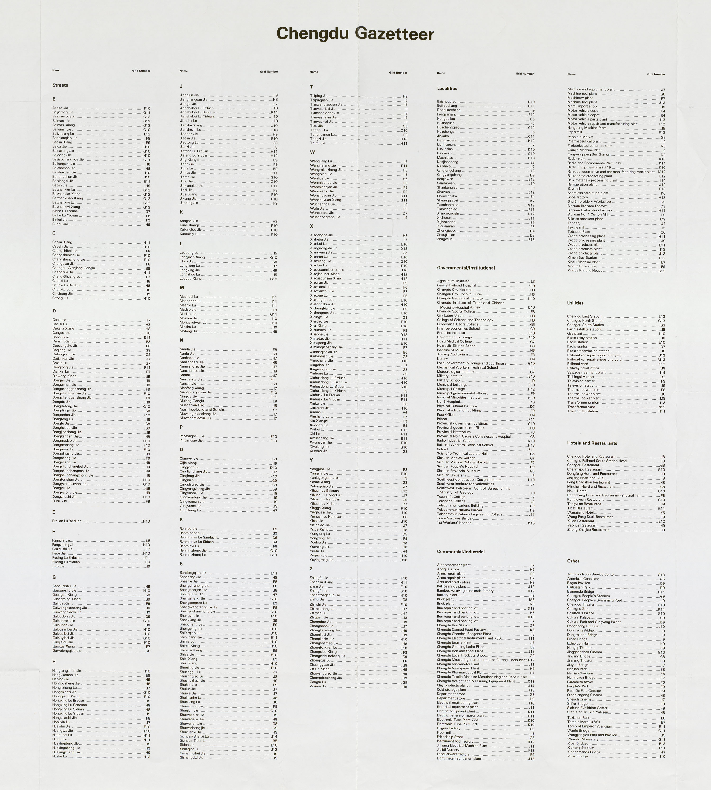
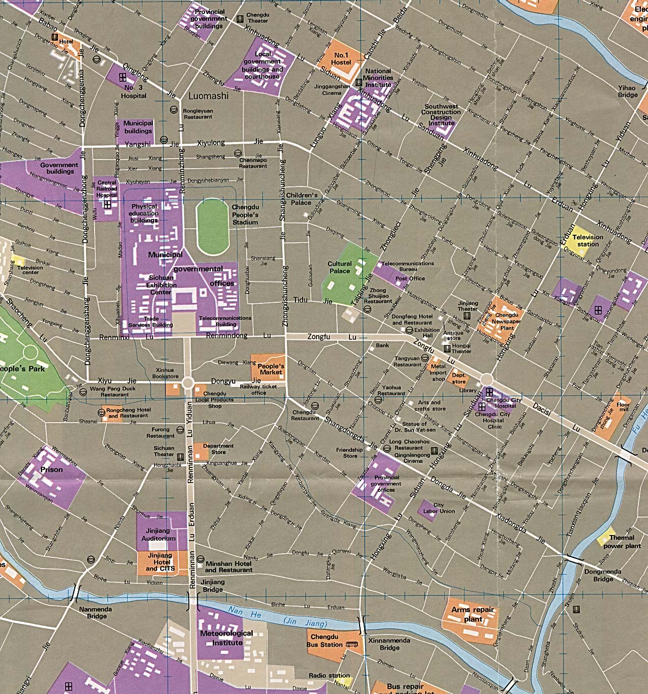
- Chengdu 1:15,000 1989 (4.3 MB) and verso Chengdu Gazetteer (1.8 MB)
- Chengdu 1:15,000 1989 [detail of central area] (502K)
- Guangzhou 1:12,500 1984 (3.9 MB) and verso Guangzhou Index (3.6 MB)
- Guangzhou [detail of central area] 1:12,500 1984 (757K)
- Guangzhou (Canton) U.S. Dept. of State 1981 (96K)
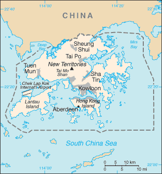
- Hong Kong (Small Map) 2014 (15.3K)
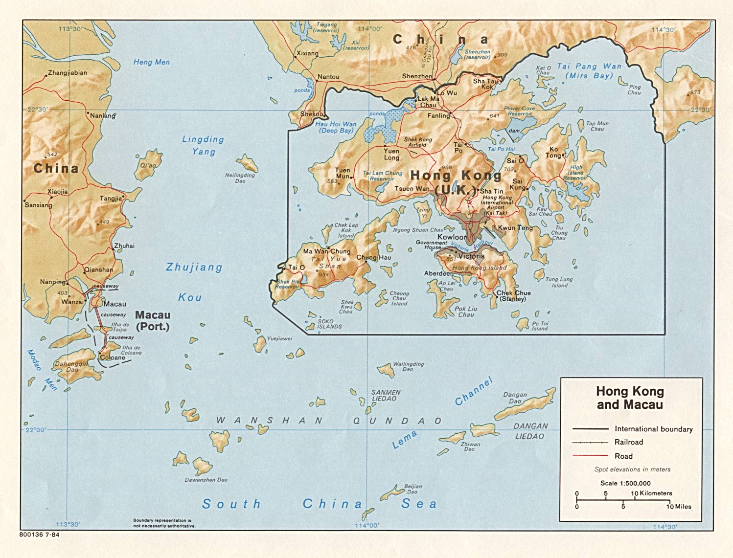
- Hong Kong and Macau (Shaded Relief) 1984 (273K) and pdf format (278K)
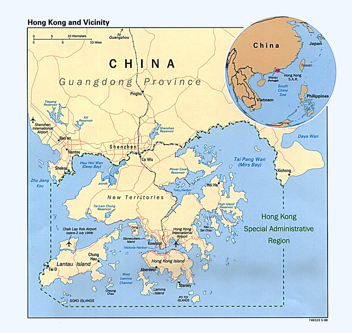
- Hong Kong and Vicinity (Political) 1998 (315K) and pdf format (303K)
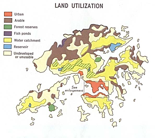
- Hong Kong: Land Utilization 1970 (56K)
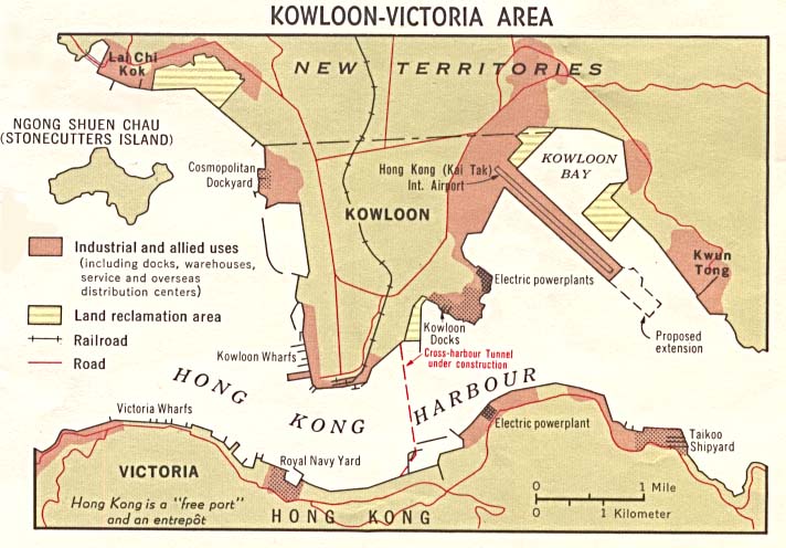
- Hong Kong: Land Utilization, Kowloon-Victoria Area 1970 (76K)
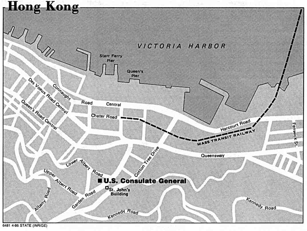
- Hong Kong - U.S. Consulate General Location Map U.S. Dept. of State 1986 (63K)
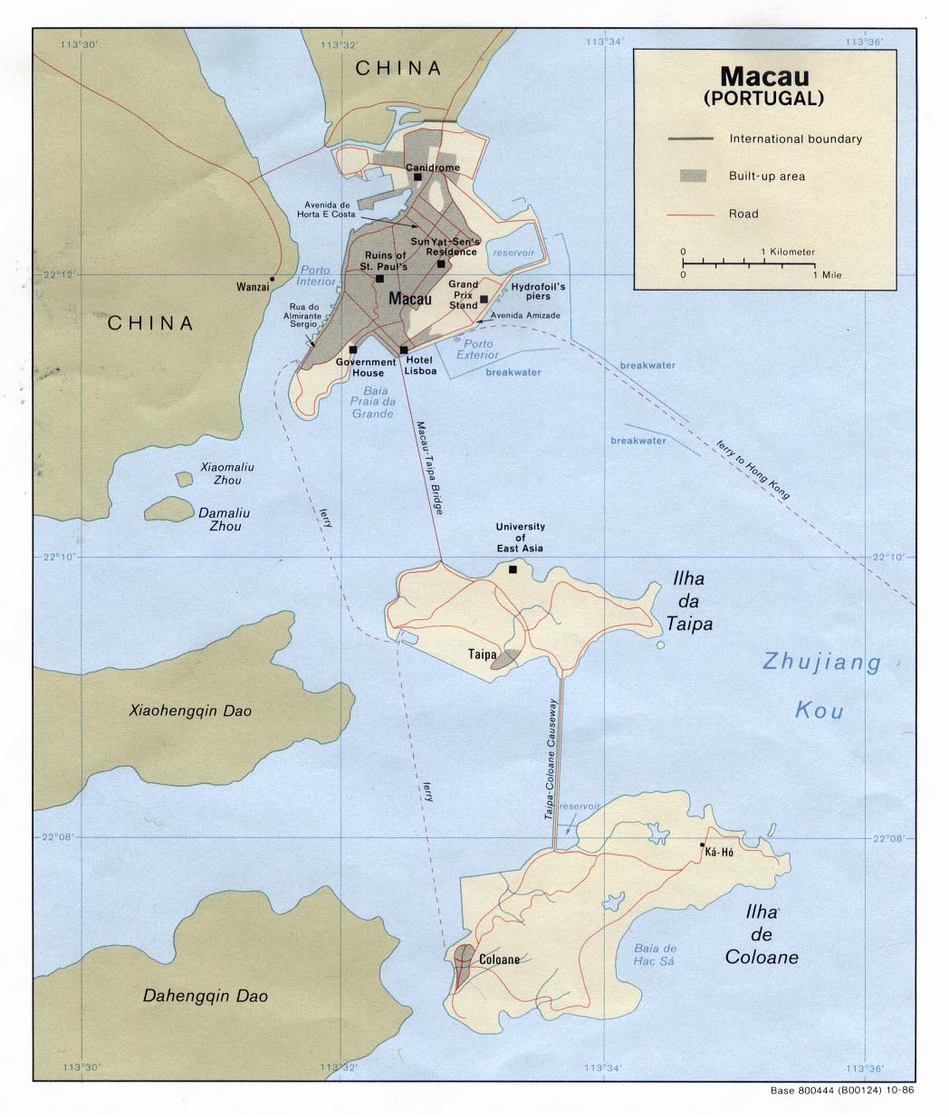
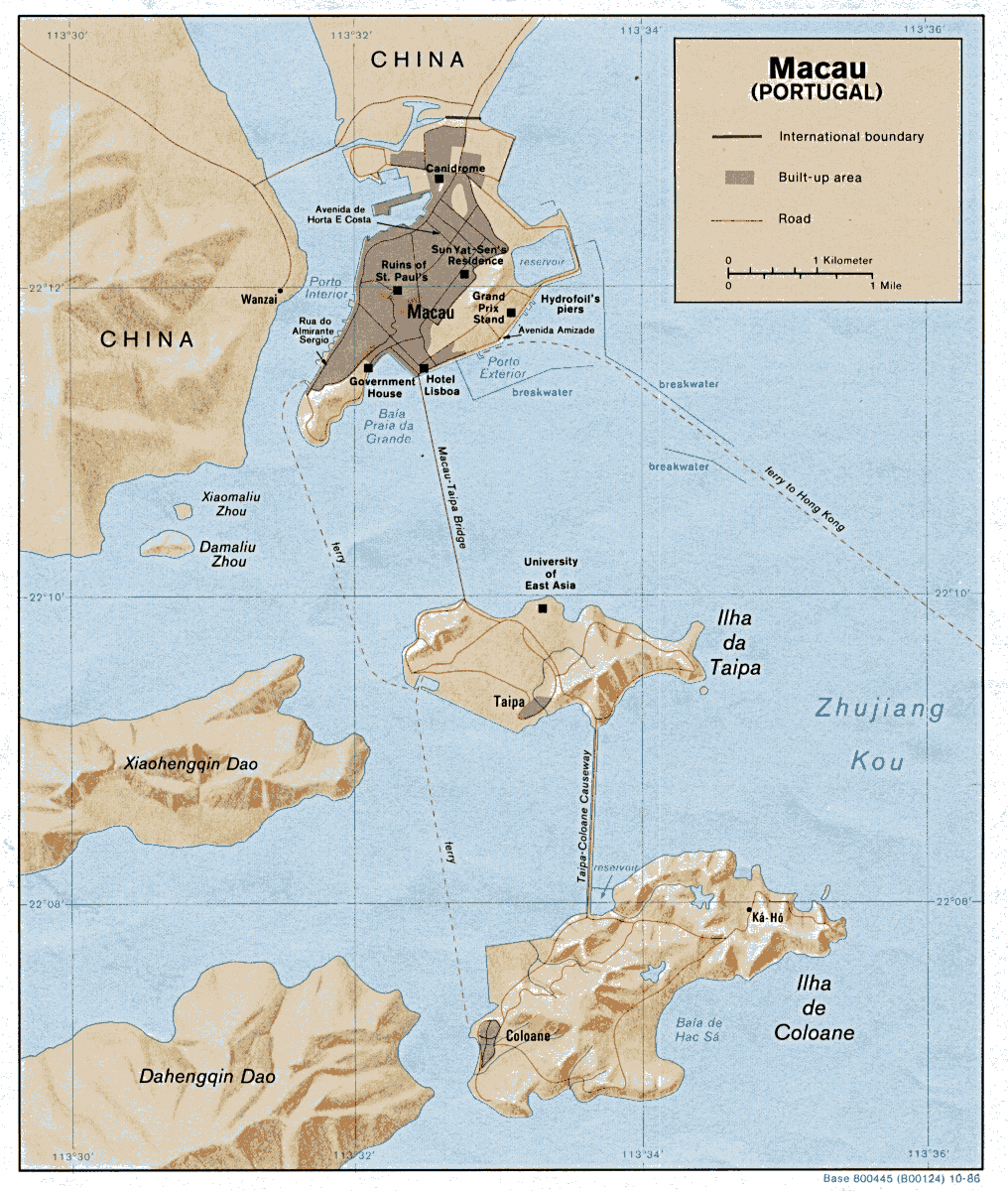
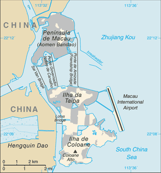
- Macau (Political) 1986 (161K) and pdf format (167K)
- Macau (Shaded Relief) 1986 (282K) and pdf format (301K)
- Macau (Small Map) 2014 (21K)
- Shanghai 1:30,000 1982 (11.9 MB) and verso Shanghai Street Index 1:30,000 1982 (3.1 MB)
- Shanghai 1:30,000 1982 [detail of central area] (1,012K)
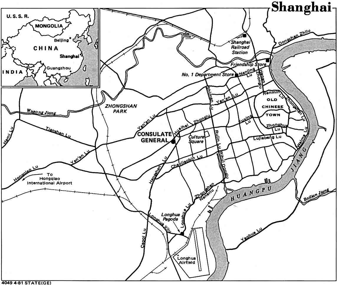
- Shanghai U.S. Dept. of State 1981 (82K)
- Shanghai - Central Shanghai 1:12,500 1991 (5.7 MB) and verso Shanghai - Central Shanghai Index (3.0 MB)
- Shanghai - Central 1:12,500 1991 [detail] (578K)
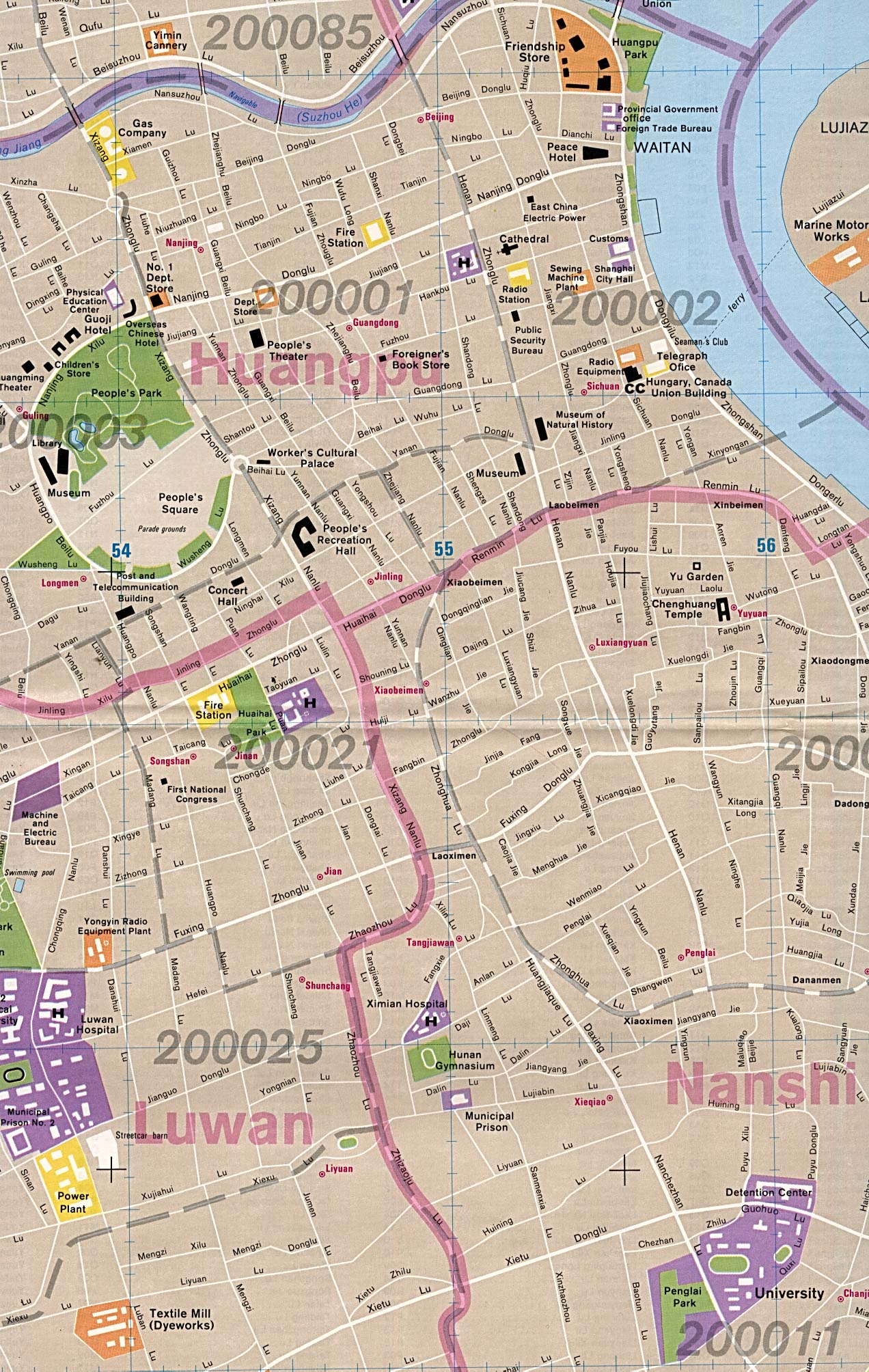
- Shanghai (Downtown) 1984 (671K)
- Historical City Maps - China
- 1:2,000,000 - Southern Asia (topographic maps) Series 5208, U.S. Army Map Service, 1945-
- Yunnan and Rangoon sheets.
- 1:1,000,000 - China - Operational Navigation Charts U.S. Defense Mapping Agency Aerospace Center [1960s - 1980s] [Not for navigational use]
- This series includes all of China.
- 1:1,000,000 - China - Topographic Maps (International Map of The World) U.S. Army Map Service [1950s]
- This series includes most of China.
- 1:500,000 - Tactical Pilotage Charts U.S. National Imagery and Mapping Agency [Not for navigational use]
- This series includes all of China. Clickable Index Map (China)
- 1:500,000 - East Central Asia - Topographic Maps Great Britain. War Office / U.S. Army Map Service, Series 4222, 1941-
- This series includes parts of Eastern China.
- 1:250,000 - China Proper, Southwest - Topographic Maps U.S. Army Map Service, Series L531, 1944-
- 1:250,000 - China - Topographic Maps (China Series) U.S. Army Map Service, Series L500, 1954-
- This series includes Eastern China and a few other areas. Also see the Manchuria Series below for maps of that area.
- 1:250,000 - Manchuria - Topographic Maps U.S. Army Map Service, Series L542, 1950-
- 1:250,000 - Manchuria - Topographic Maps U.S. Army Map Service, Series L541, 1945-
- 1:50,000 - Eastern China - Topographic Maps U.S. Army Map Service, Series 3789, 1926-
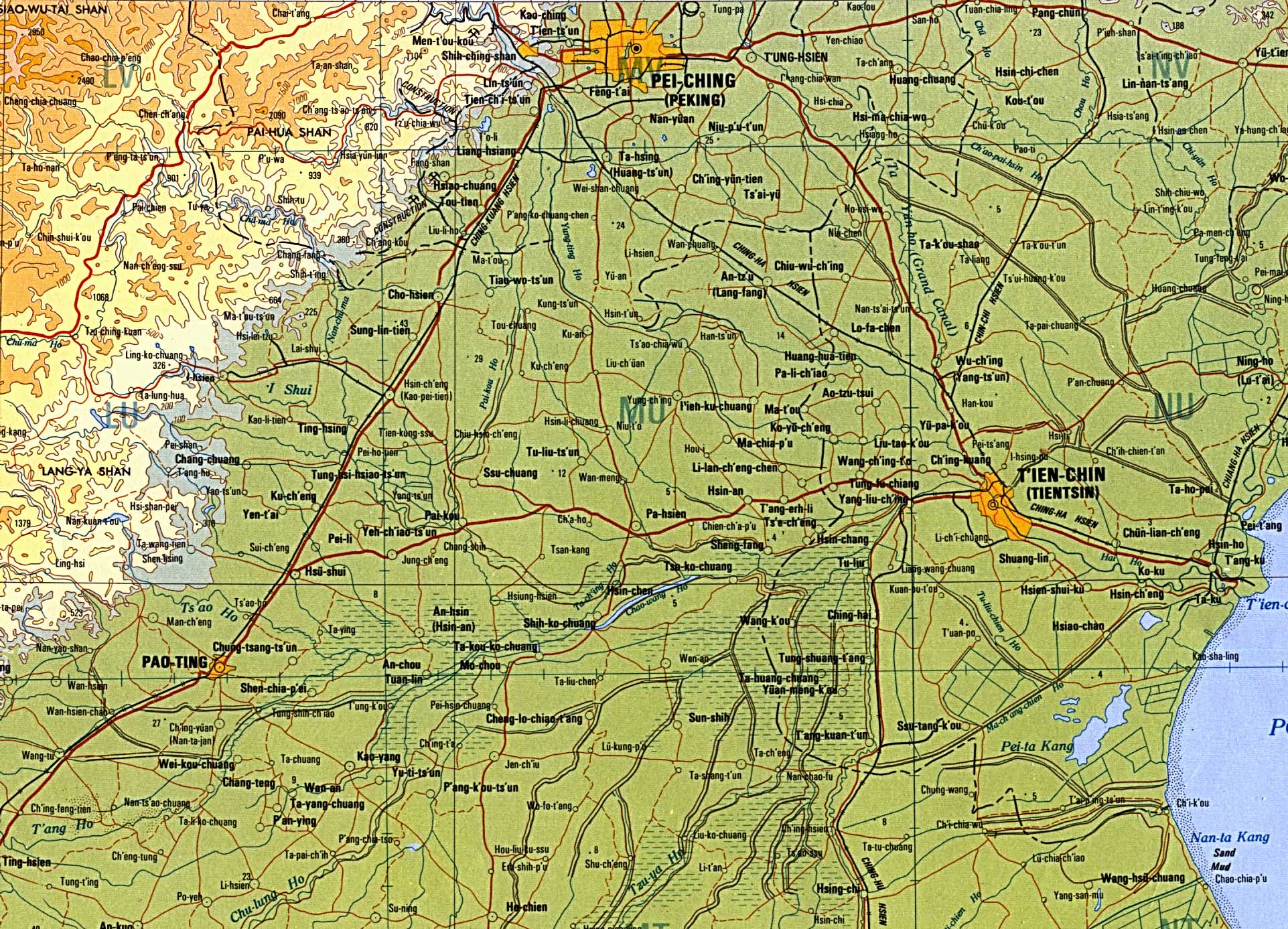
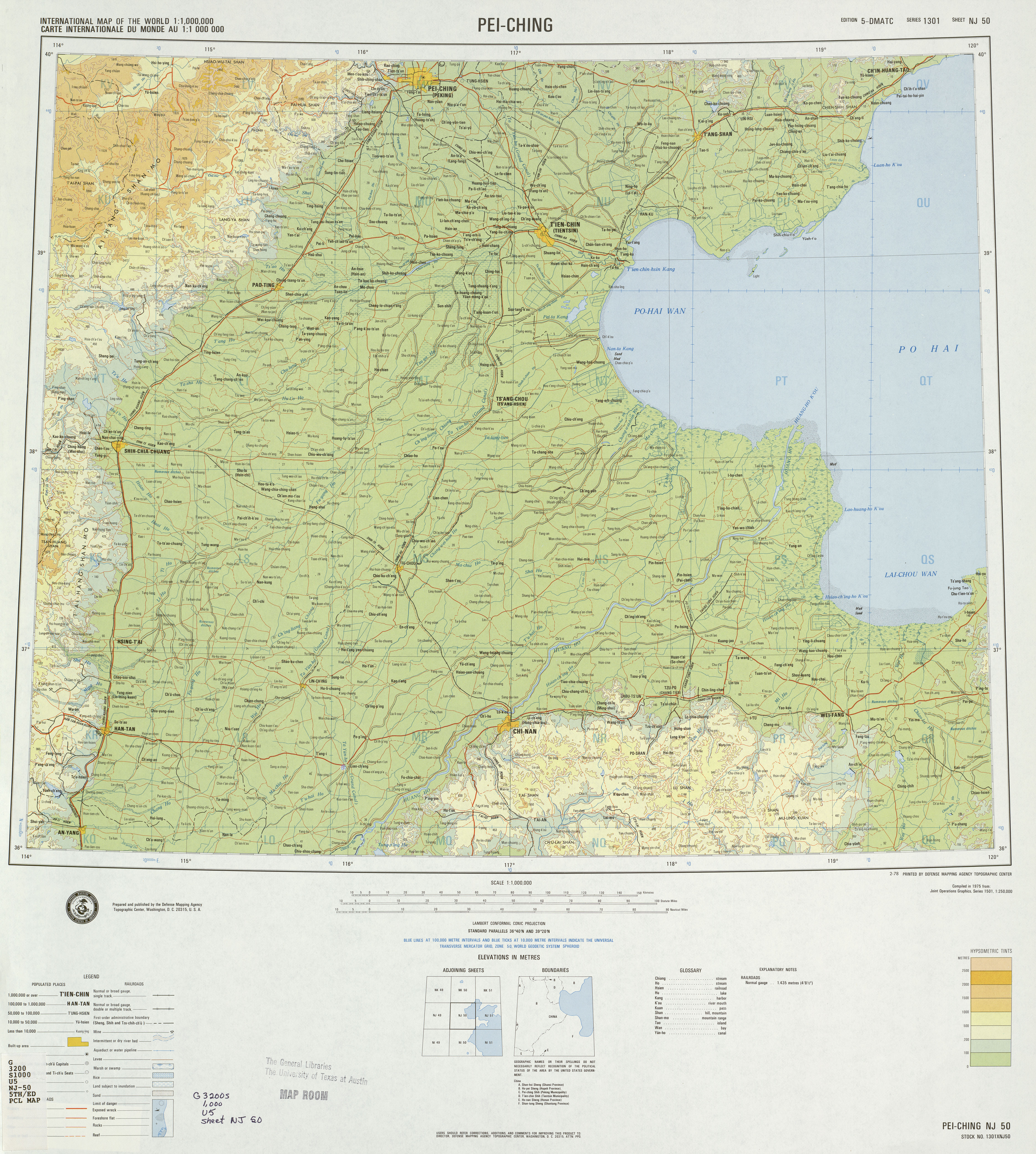
- Beijing (Pei-Ching) - Tianjin (T'ien-Chin) Region (Detail from Topographic Map) Original scale 1:1,000,000. Portion of International Map of the World sheet NJ-50, U.S. Defense Mapping Agency, 1978. (812K) and Complete map
- China-India Border 1988 (387K)
- China-India Border: Eastern Sector 1988 (452K)
- China-India Border: Western Sector 1988 (319K)
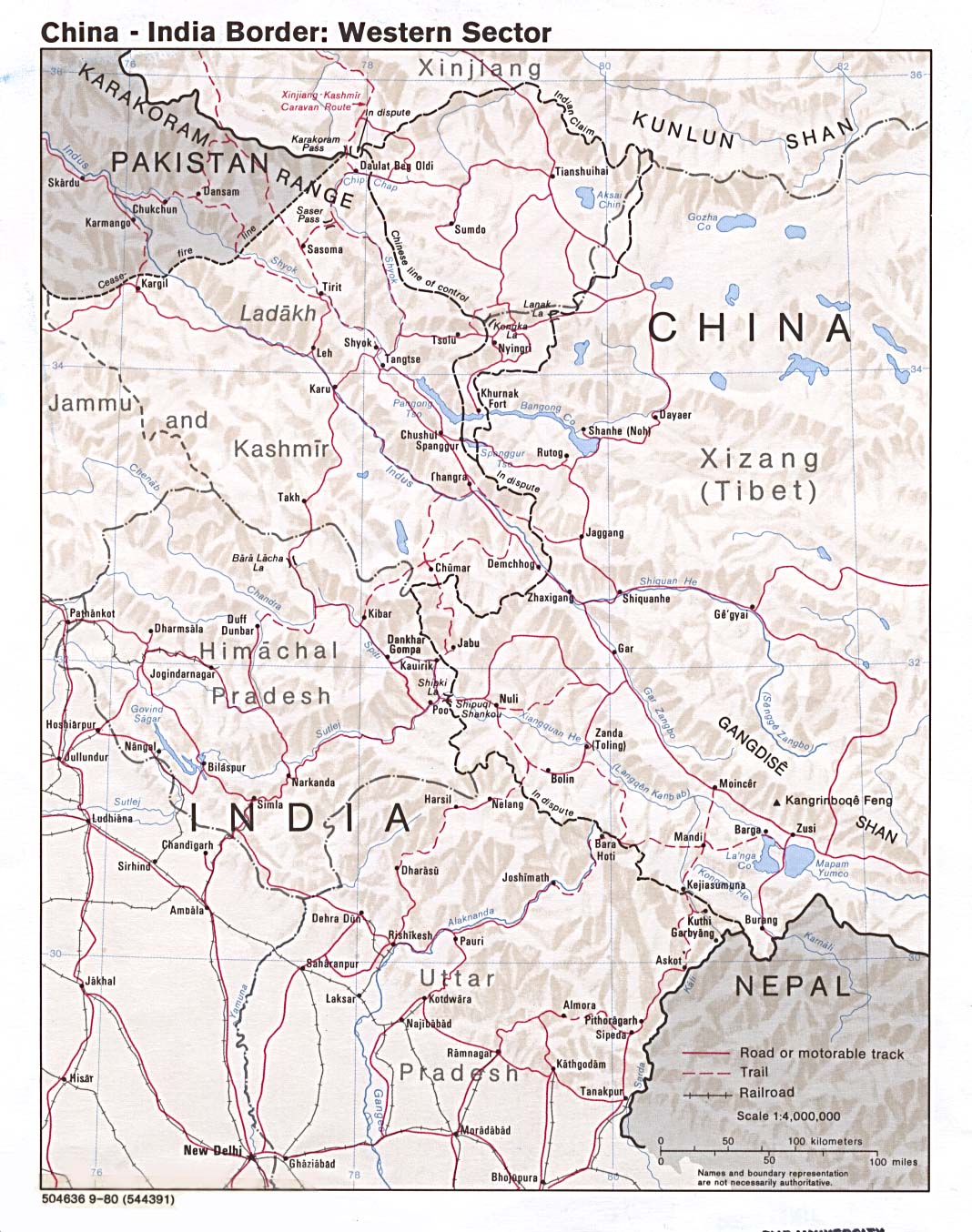
- China-India Border: Western Sector 1980 (297K)
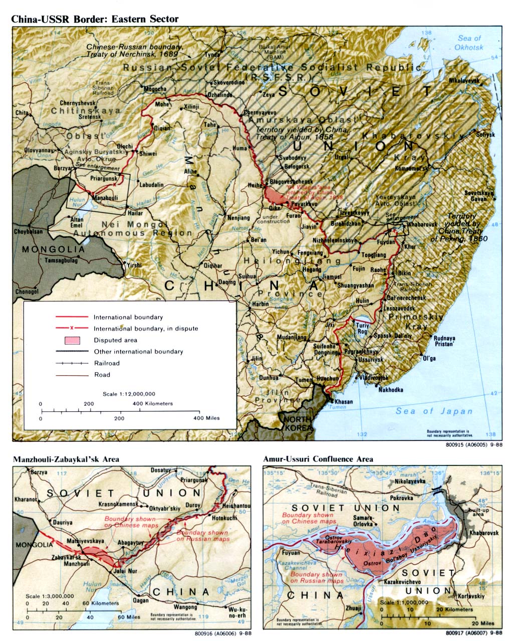
- China-USSR Border: Eastern Sector 1988 (452K)
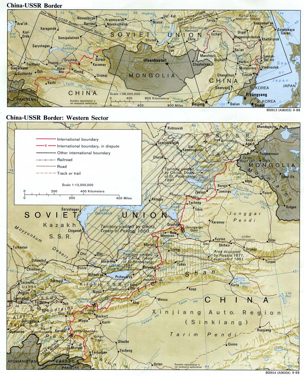
- China-USSR Border: Western Sector 1988 (387K)
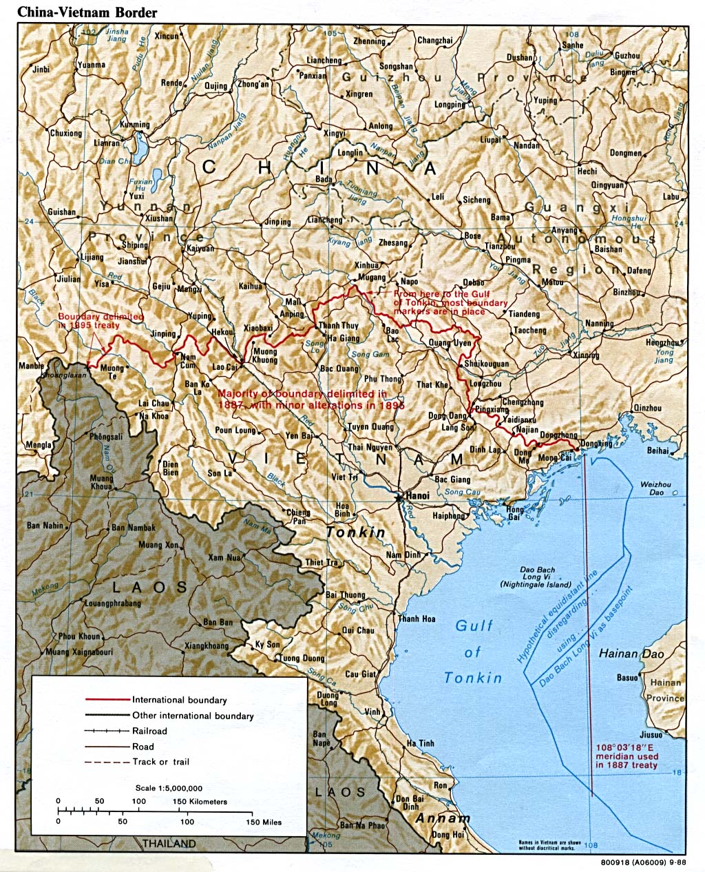
- China-Vietnam Border 1988 (387K)
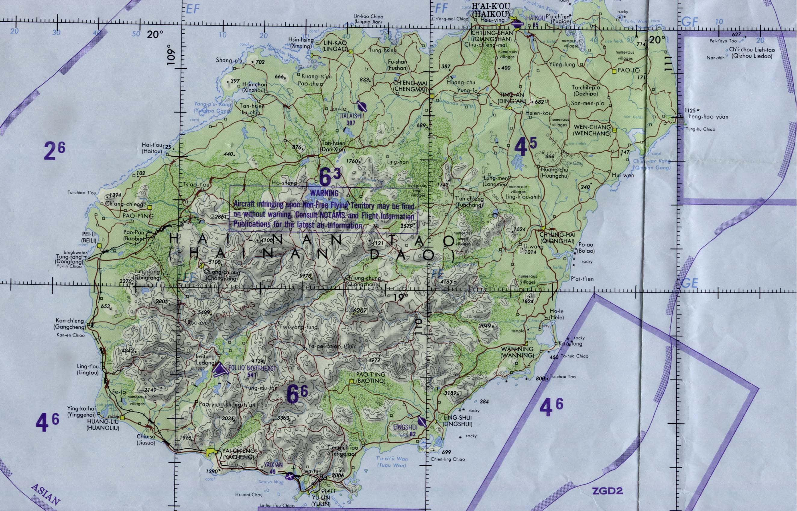
- Hainan Island Original scale 1:1,000,000. Portion of Operational Navigation Chart sheet ONC J-11, U.S. Defense Mapping Agency 1984 (678K) Not for navigational use
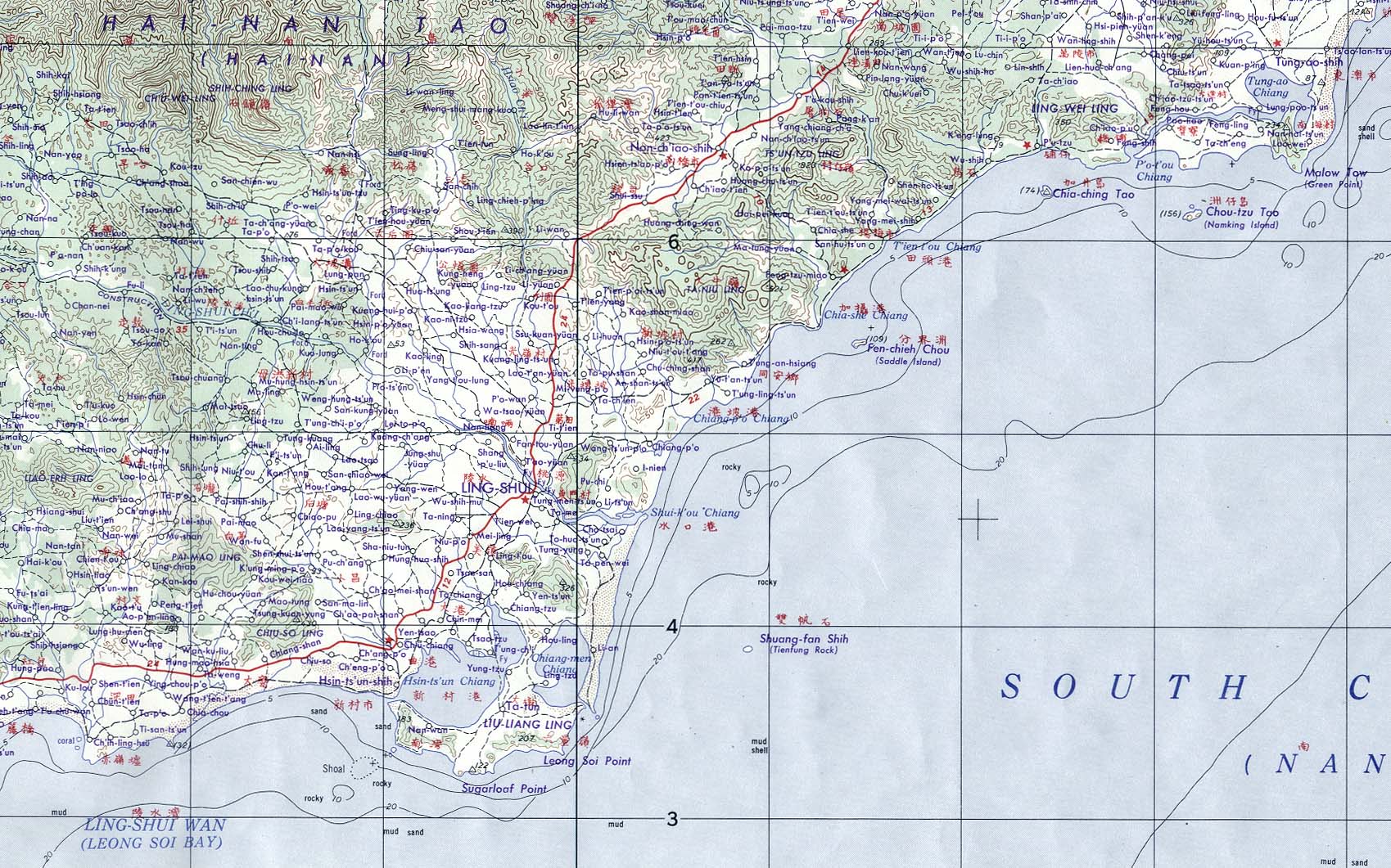
- Hainan Island - Lingshui Area (Topographic Map) Original scale 1:250,000. Portion of AMS series L500, sheet NE 49-6, U.S. Army Map Service, 1961. (474K)
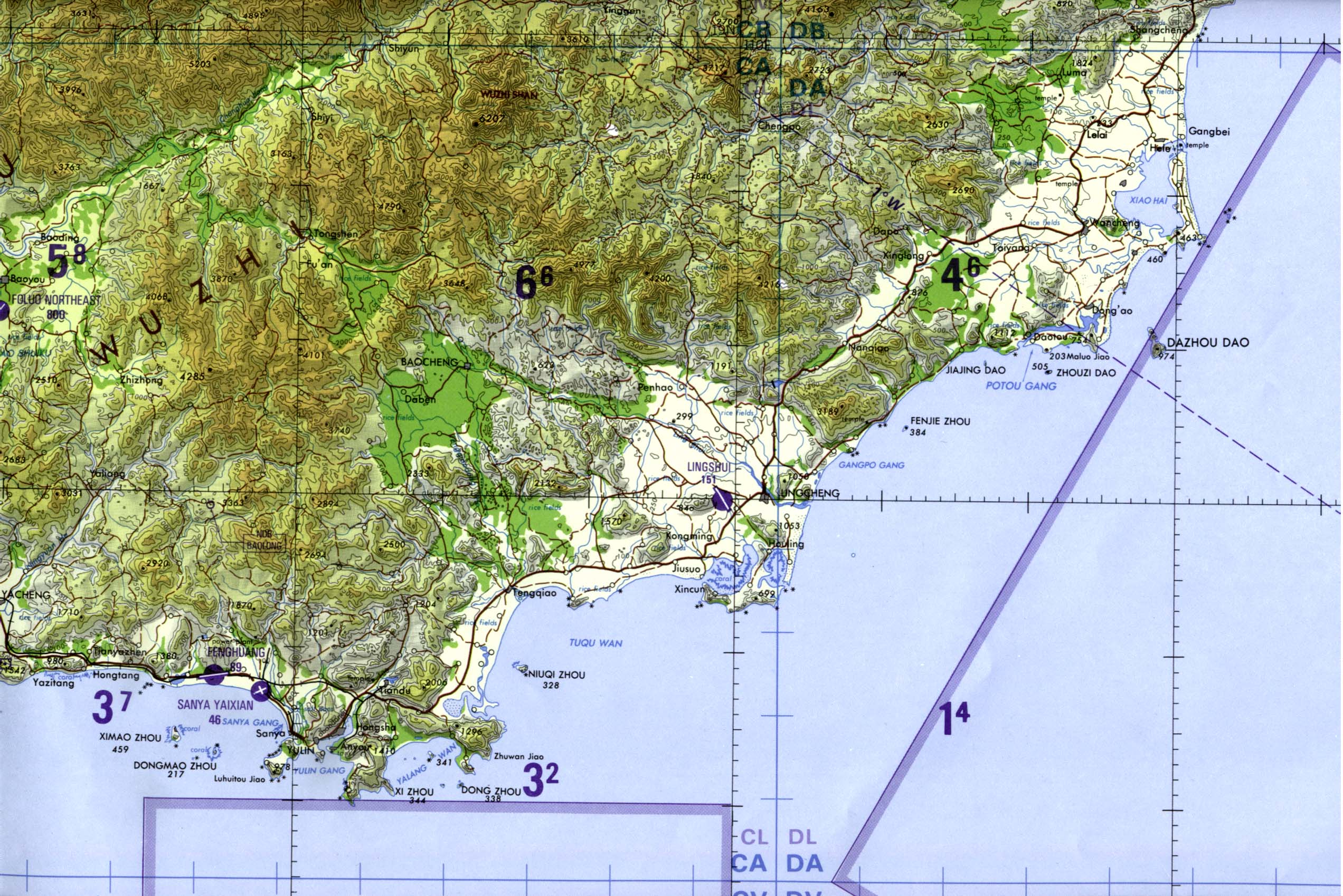
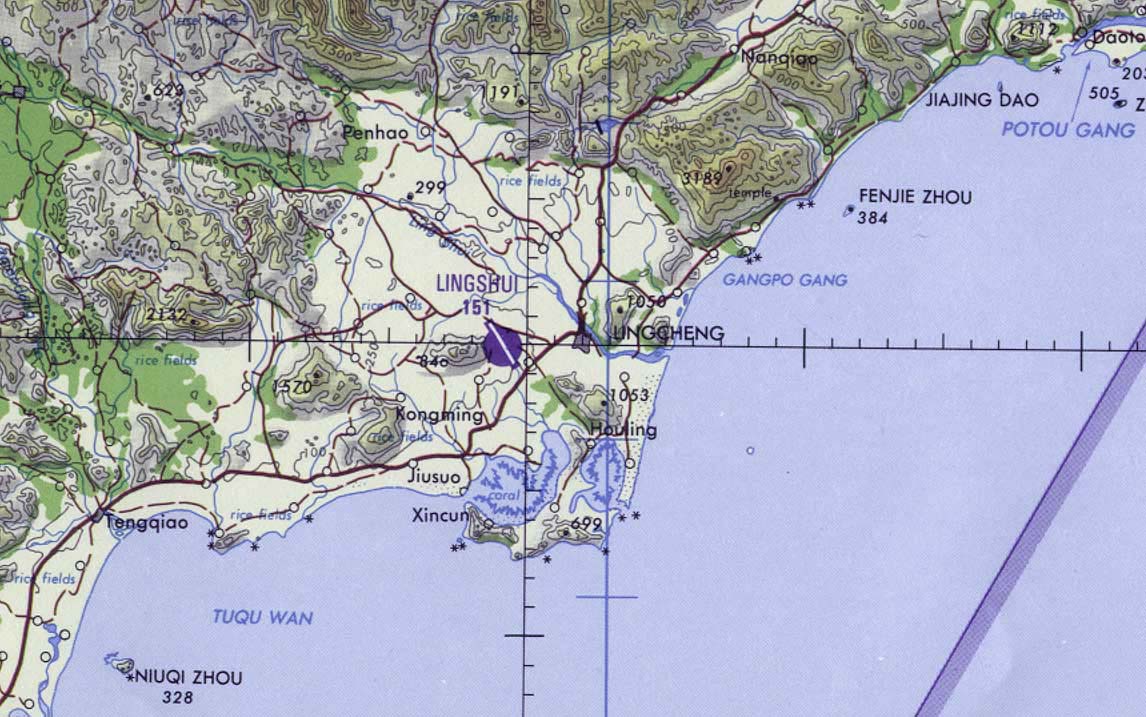
- Hainan Island - Southeast Original scale 1:500,000. Portion of Tactical Pilotage Chart sheet TPC J-11C, U.S. Defense Mapping Agency 1996 (583K) Not for navigational use Portion of this map showing Lingshui Air Base
- Shen-Yang Region (Topographic Map) Original Scale 1:1,000,000. Portion of Shen-Yang sheet. NK 51, Series 1301. U.S. Defense Mapping Agency Hydrographic/Topographic Center, 1979 (276K) and Complete map
- Spratly Islands Maps
- Taiwan Maps
- Yunnan and Rangoon sheets.
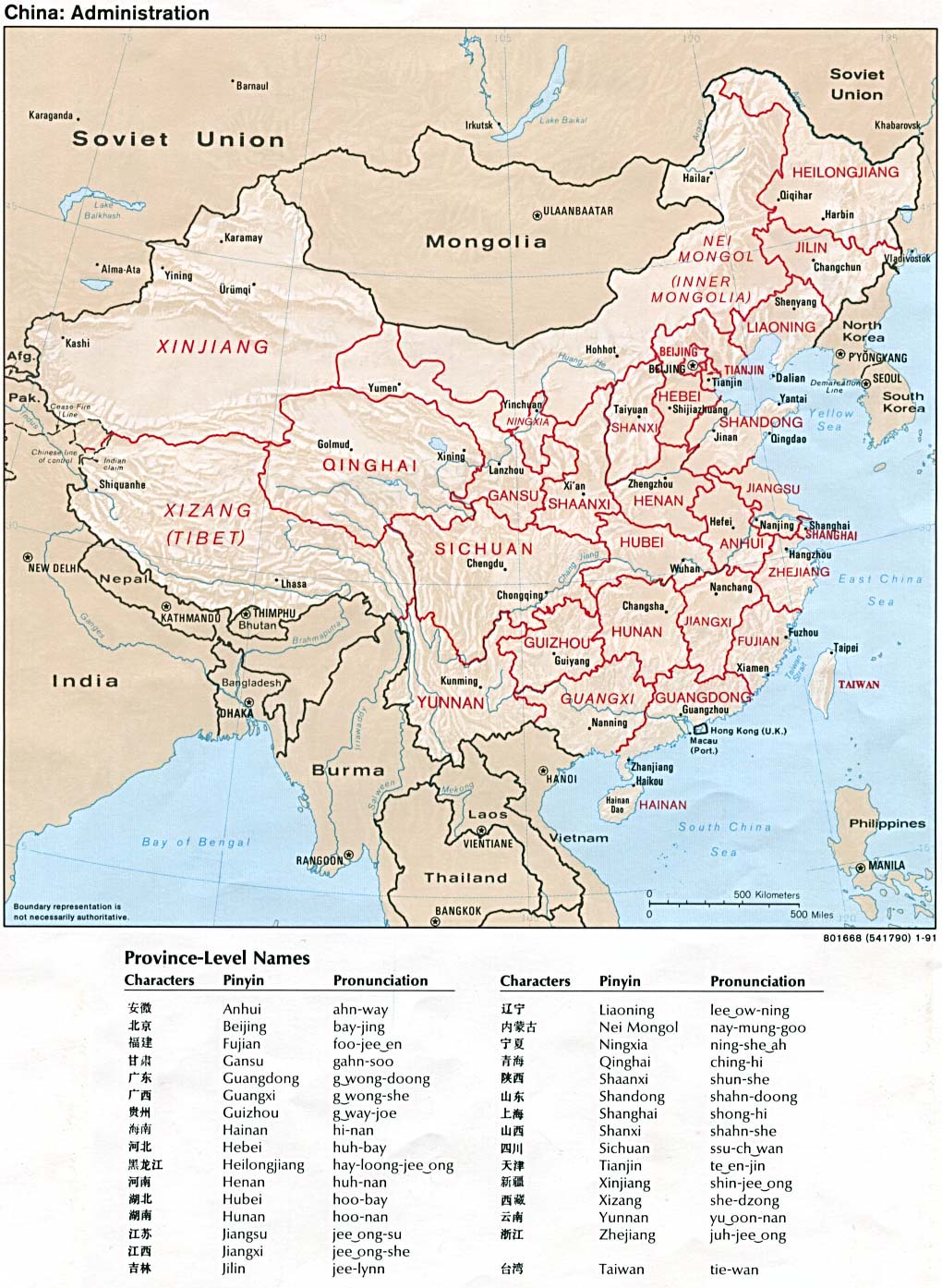
- China - Administration 1991 (278K)
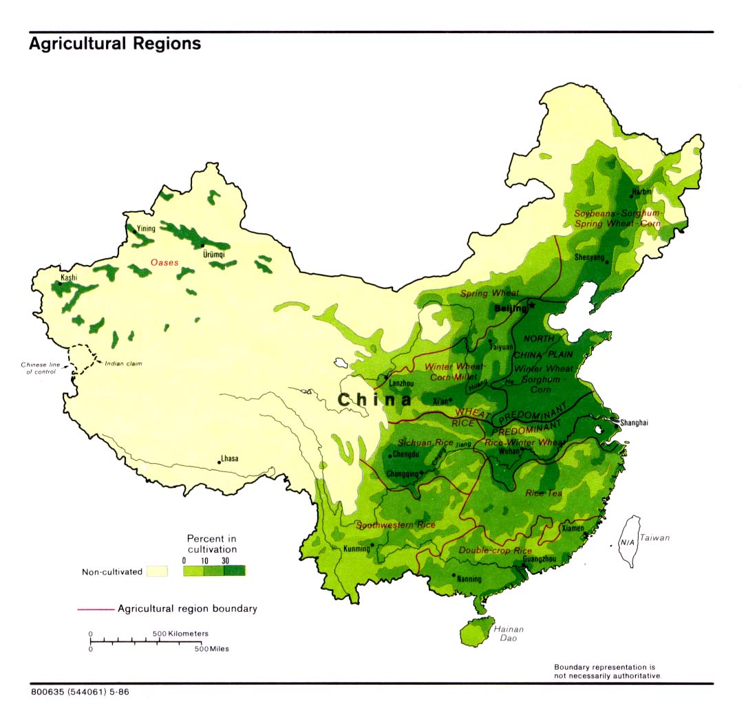
- China - Agricultural Regions 1986 (194K)
- China - Clothing Recommendations for Travel 1984 (249K)
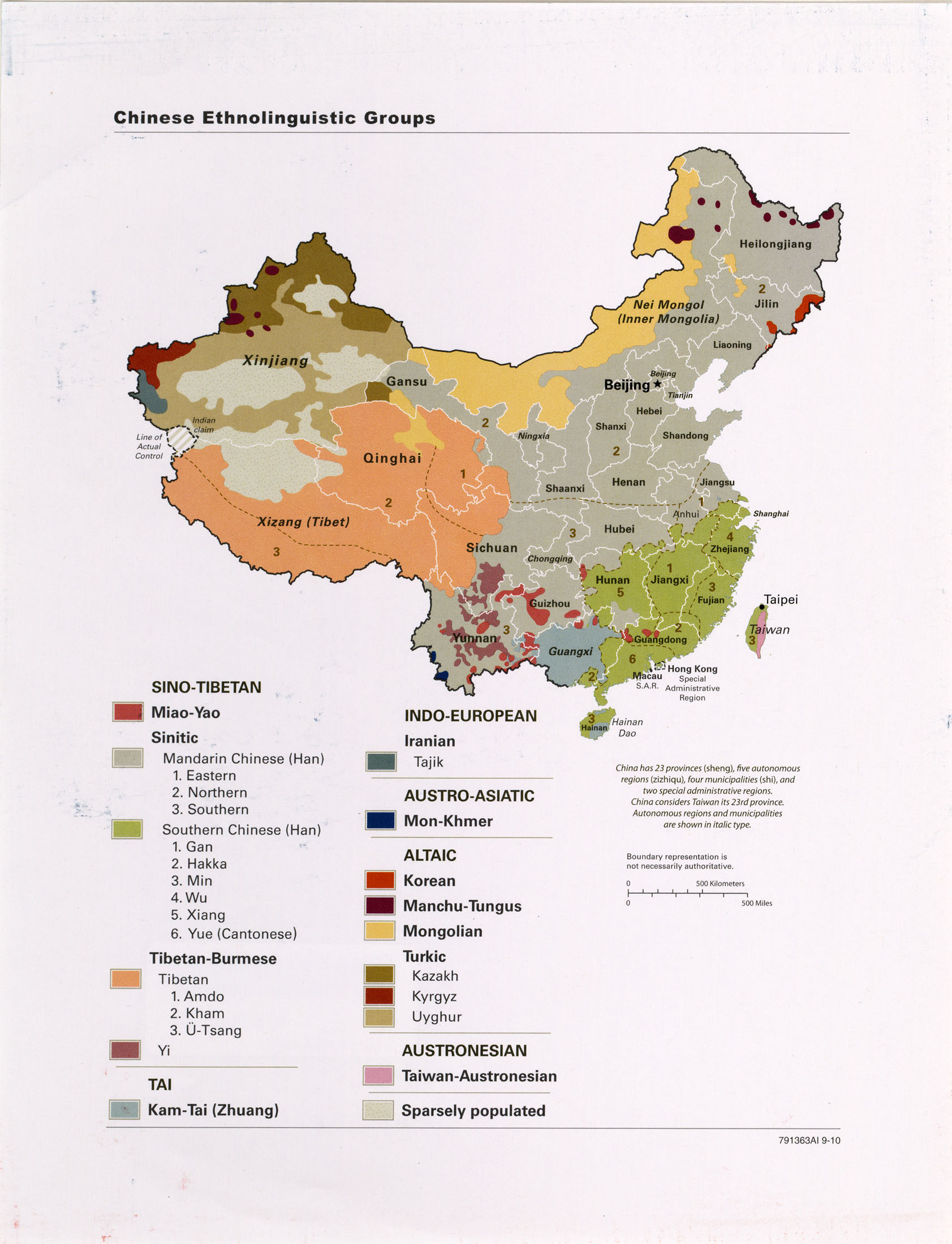
- China - Ethnolinguistic Groups 2010 (461K)
- China - Ethnolinguistic Groups 1983 (258K)
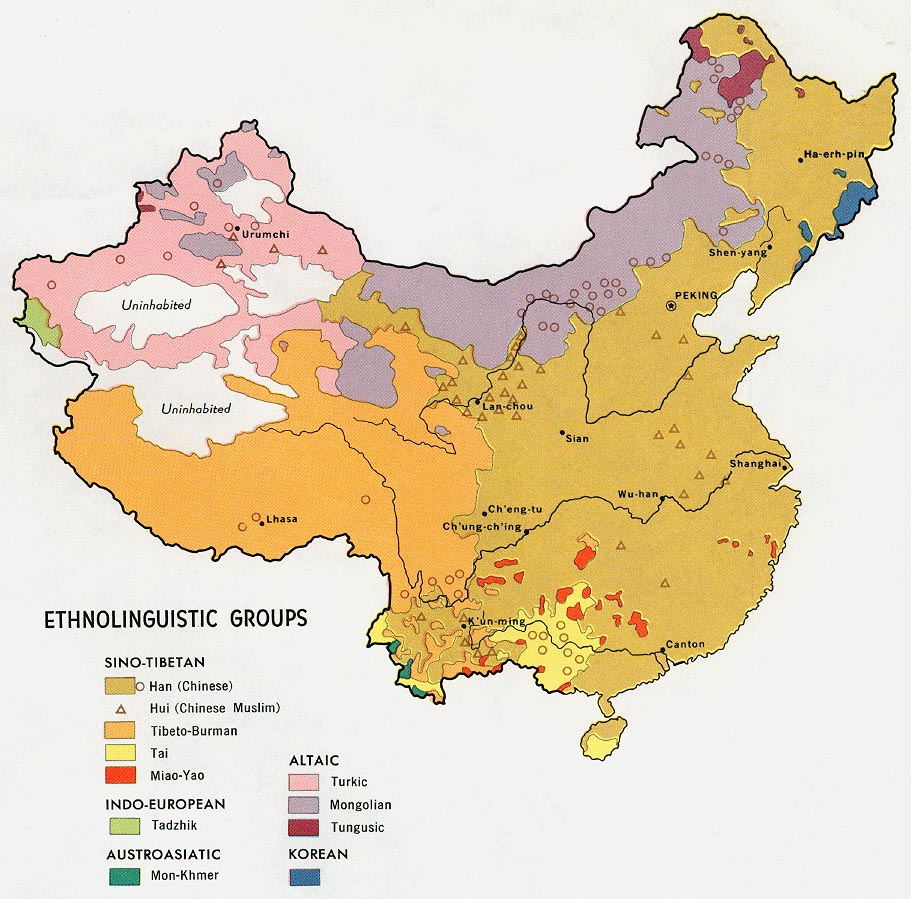
- China - Ethnolinguistic Groups from Map No. 500410 1971 (194K)
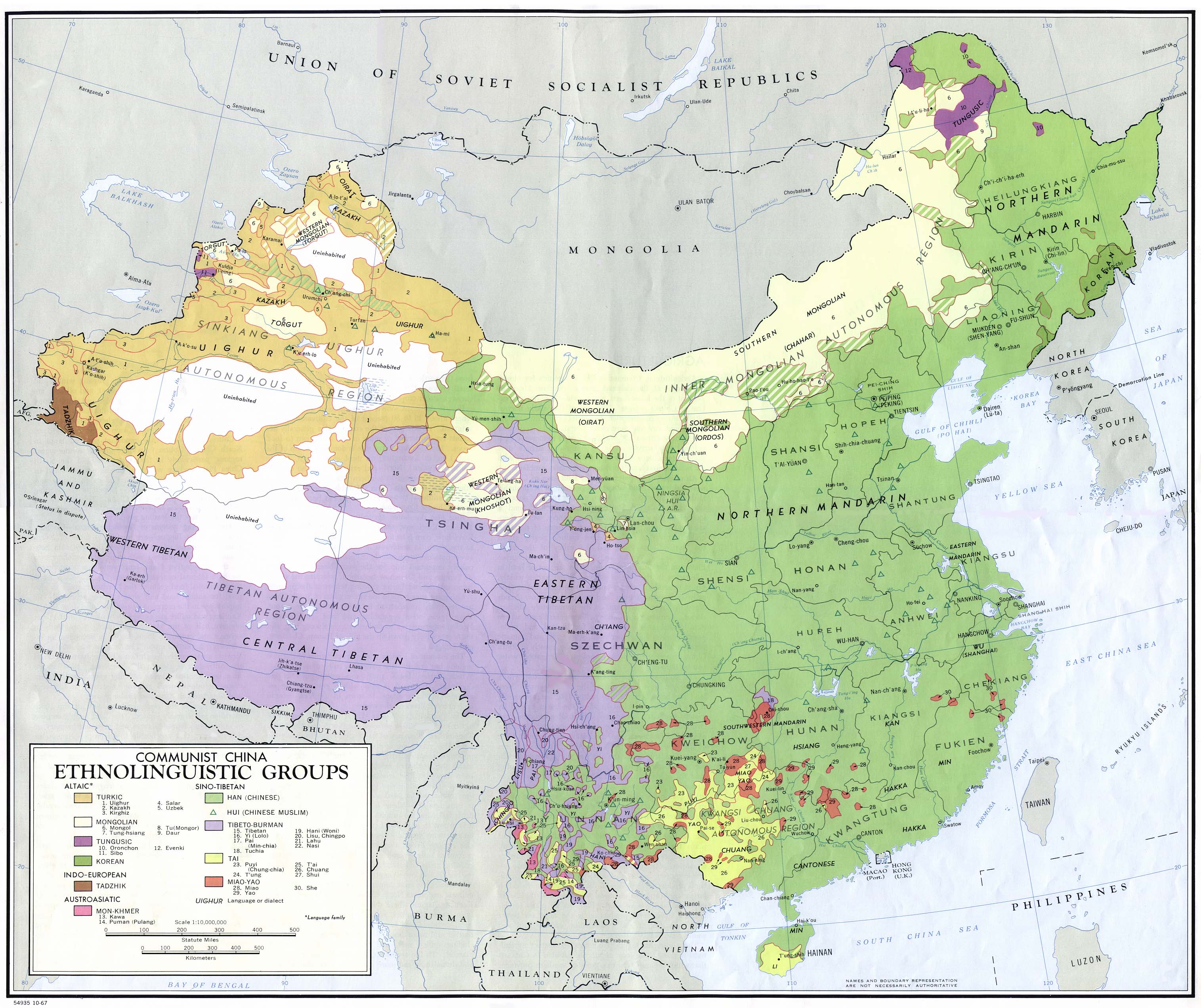
- China - Ethnolinguistic Groups from Communist China Map Folio. U.S. Central Intelligence Agency, Directorate of Intelligence, Office of Basic Geographic Intelligence, 1967. (960K)
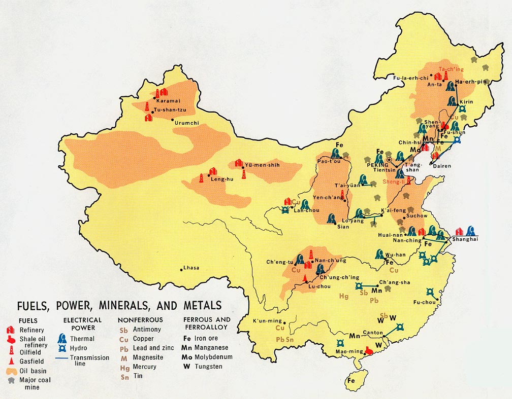
- China - Fuels, Power, Minerals, and Metals 1983 (258K)
- China - Fuels, Power, Minerals, and Metals from Map No. 500410 1971 (183K)
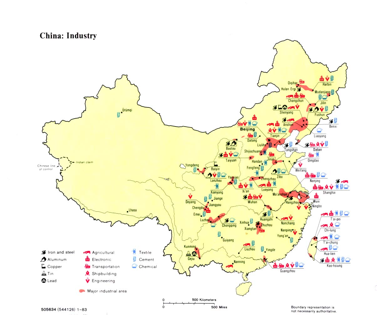
- China - Industry 1983 (258K)
- China - Industry from Map No. 500410 1971 (182K)
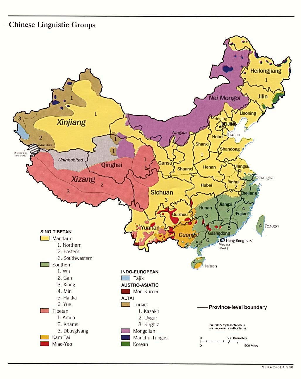
- Chinese Linguistic Groups 1990 (165K)
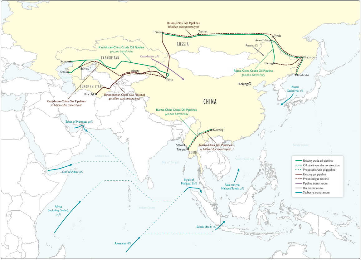
- China - Military - China's Import Transit Routes and Proposed Routes for Bypassing SLOCs [International Pipelines, Sea and Rail Transit Routes] (332K) From Military and Security Developments Regarding the People's Republic of China 2012 [Annual Report to Congress] U.S. Department of Defense
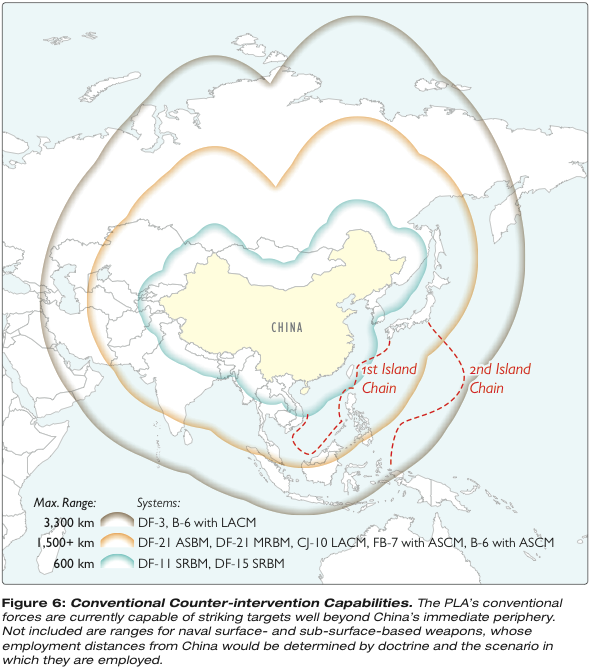
- China - Military - Conventional Counter-Intervention Capabilities 2012 (207K) From Military and Security Developments Regarding the People's Republic of China 2012 [Annual Report to Congress] U.S. Department of Defense
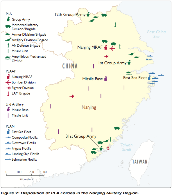
- China - Military - Disposition of PLA Forces in Nanjing Military Region 2012 (123K) From Military and Security Developments Regarding the People's Republic of China 2012 [Annual Report to Congress] U.S. Department of Defense
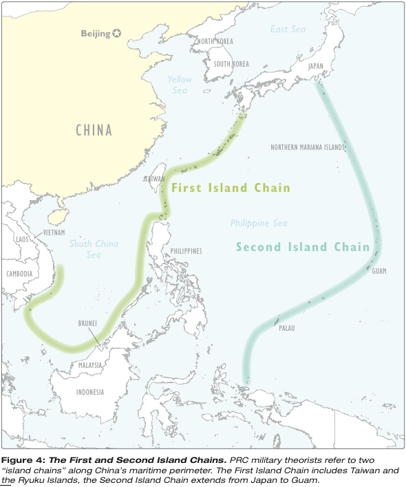
- China - Military - First and Second Island Chains 2012 (168K) From Military and Security Developments Regarding the People's Republic of China 2012 [Annual Report to Congress] U.S. Department of Defense
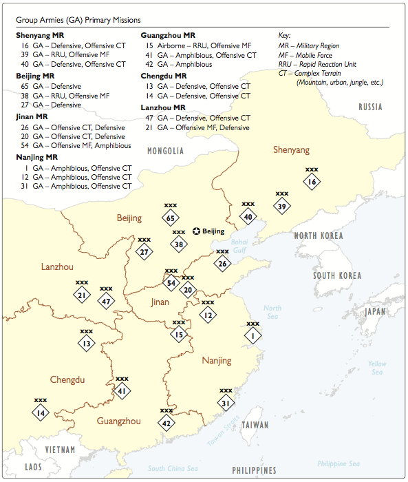
- China - Military - Group Armies Primary Missions 2012 (156K) From Military and Security Developments Regarding the People's Republic of China 2012 [Annual Report to Congress] U.S. Department of Defense
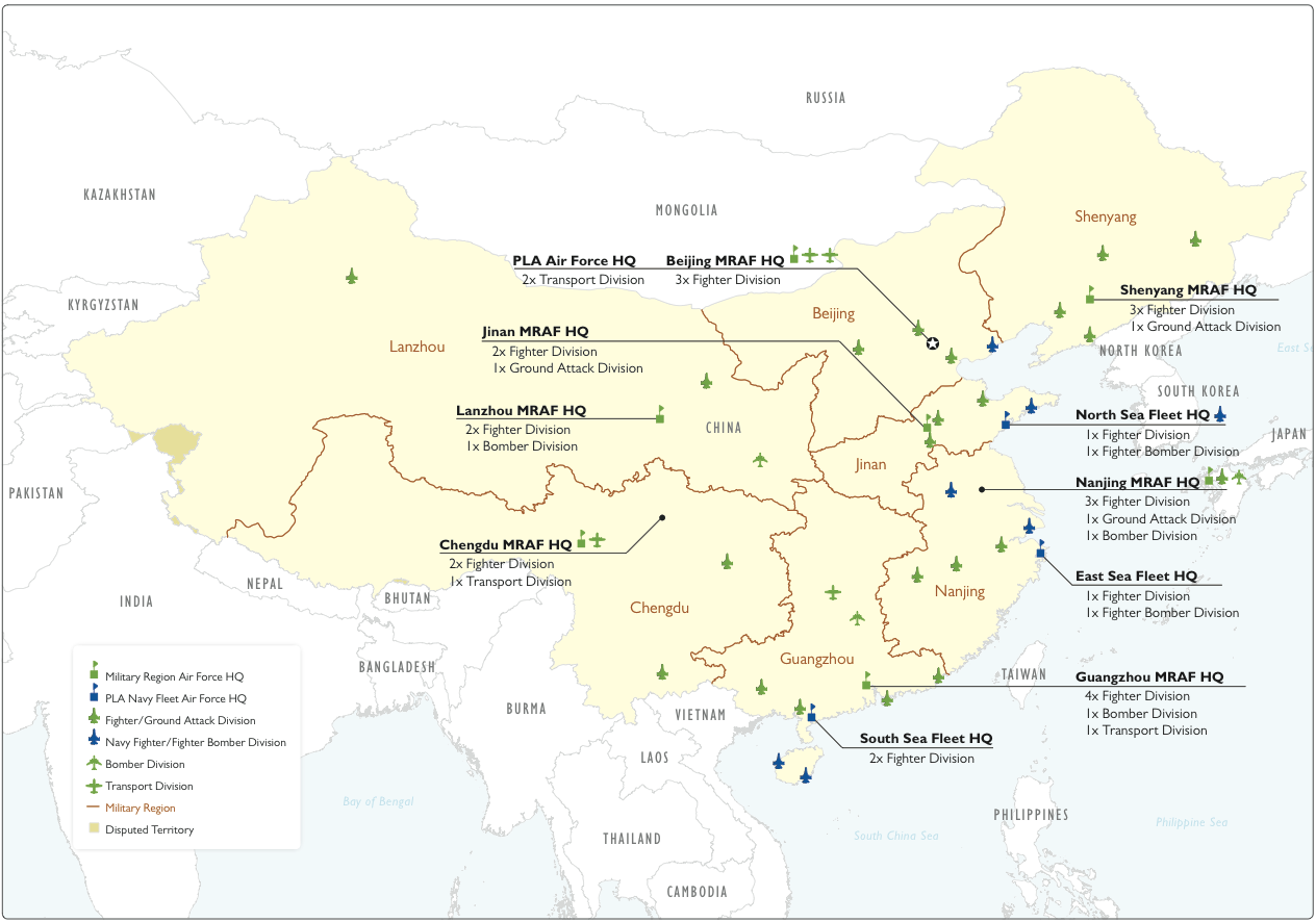
- China - Military - Major Air and Naval Units 2012 (298K) From Military and Security Developments Regarding the People's Republic of China 2012 [Annual Report to Congress] U.S. Department of Defense
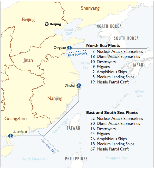
- China - Military - Major Naval Units 2012 (149K) From Military and Security Developments Regarding the People's Republic of China 2012 [Annual Report to Congress] U.S. Department of Defense
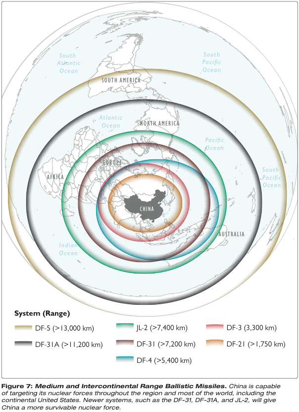
- China - Military - Medium and Intercontinental Range Ballistic Missiles 2012 (307K) From Military and Security Developments Regarding the People's Republic of China 2012 [Annual Report to Congress] U.S. Department of Defense
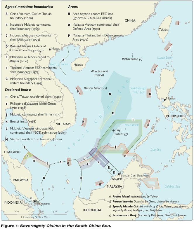
- China - Military - Sovereignty Claims in the South China Sea 2012 (257K) From Military and Security Developments Regarding the People's Republic of China 2012 [Annual Report to Congress] U.S. Department of Defense
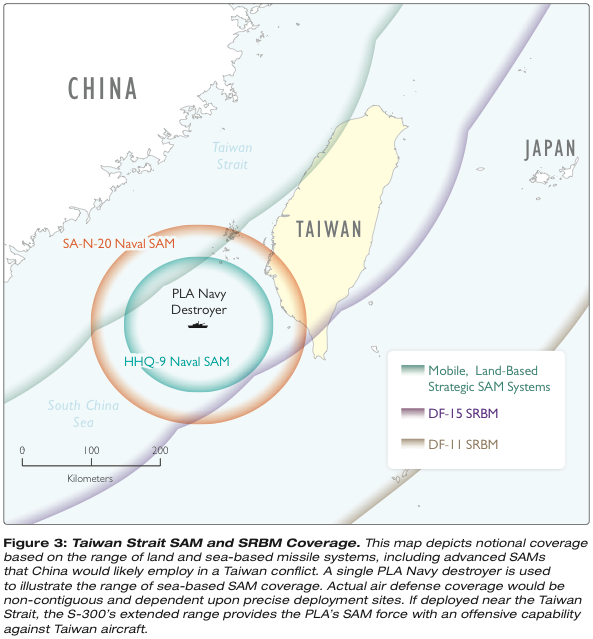
- China - Military - Taiwan Strait SMA & SRBM Coverage 2012 (138K) From Military and Security Developments Regarding the People's Republic of China 2012 [Annual Report to Congress] U.S. Department of Defense
- China - Military - Maps from Military and Security Developments Involving the People's Republic of China 2012 [Annual Report to Congress] U.S. Department of Defense
- China - Military - Maps from Military and Security Developments Involving the People's Republic of China 2011 [Annual Report to Congress] U.S. Department of Defense
- China - Military - Maps from Military Power of the People's Republic of China 2009 [Annual Report to Congress] U.S. Department of Defense
- China - Military - Maps from Military Power of the People's Republic of China 2008 [Annual Report to Congress] U.S. Department of Defense
- China - Military - Maps from Military Power of the People's Republic of China 2007 [Annual Report to Congress] U.S. Department of Defense
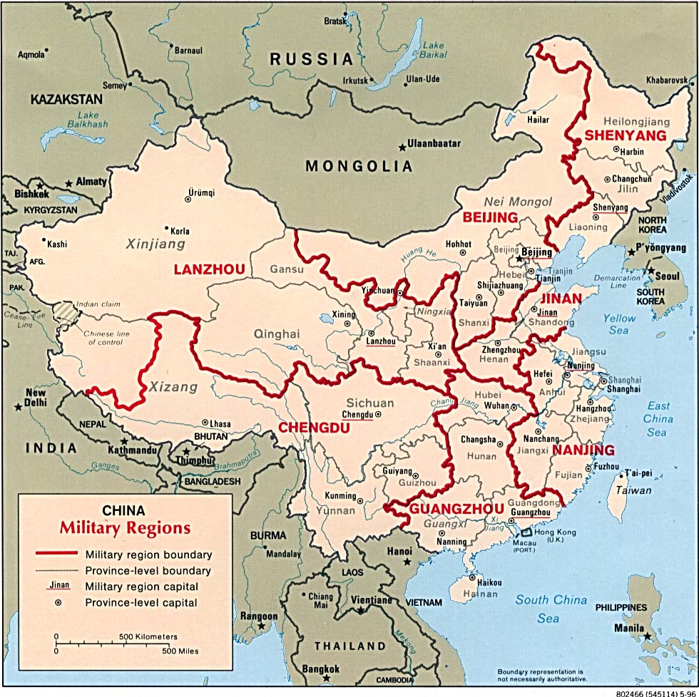
- China - Military Regions 1996 (221K)
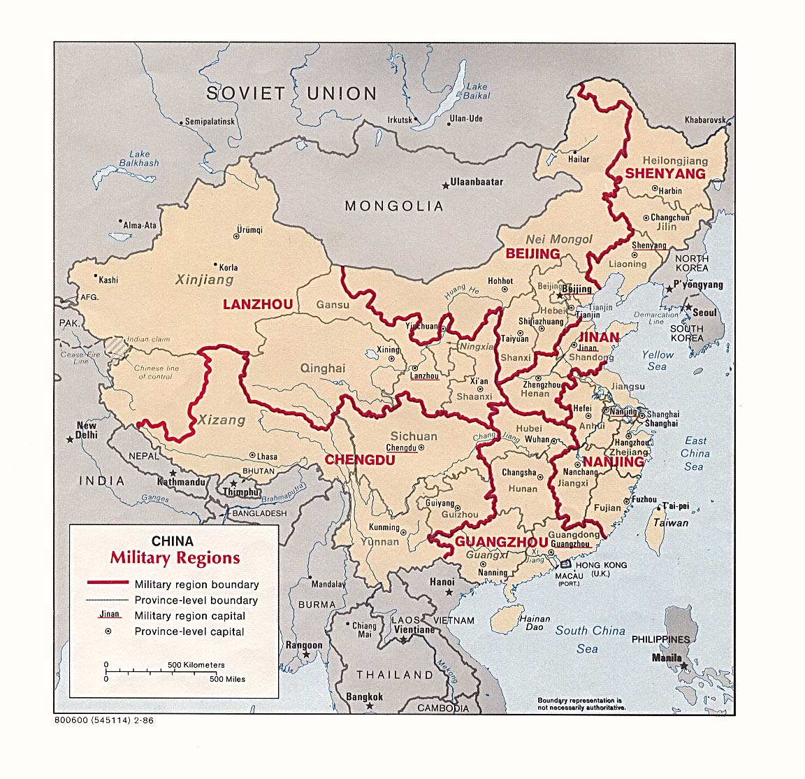
- China - Military Regions 1986 (284K)
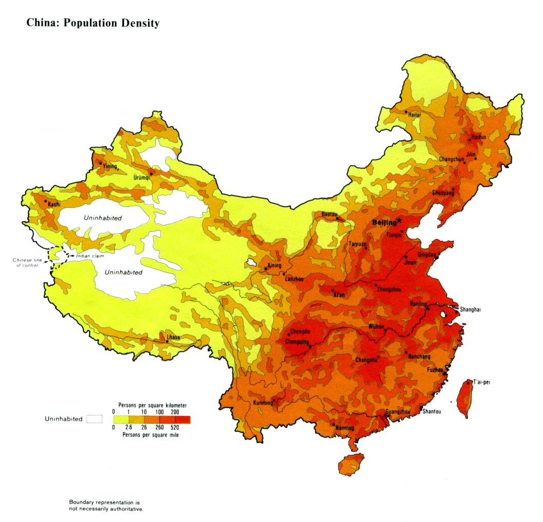
- China - Population Density 1983 (194K)
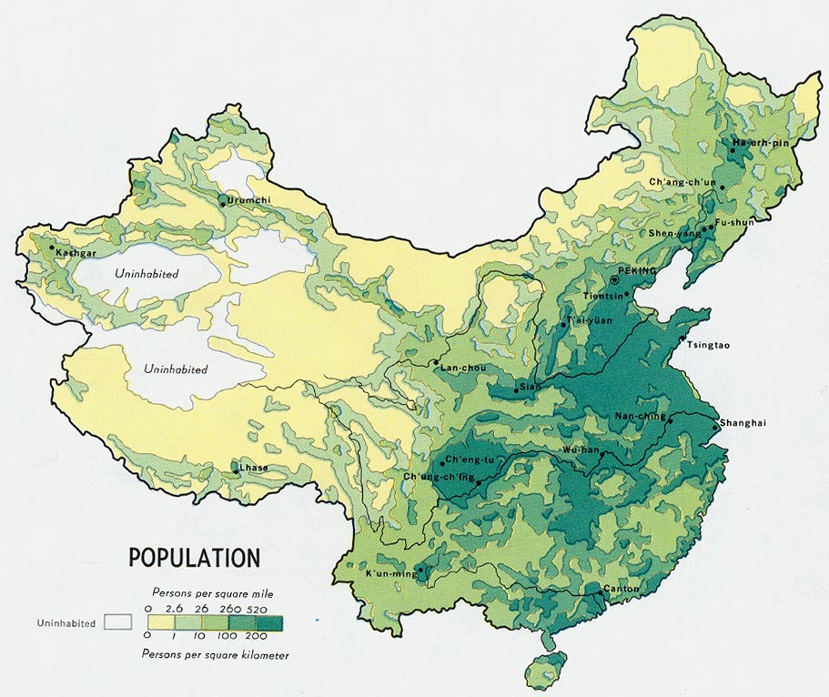
- China - Population from Map No. 500410 1971 (177K)
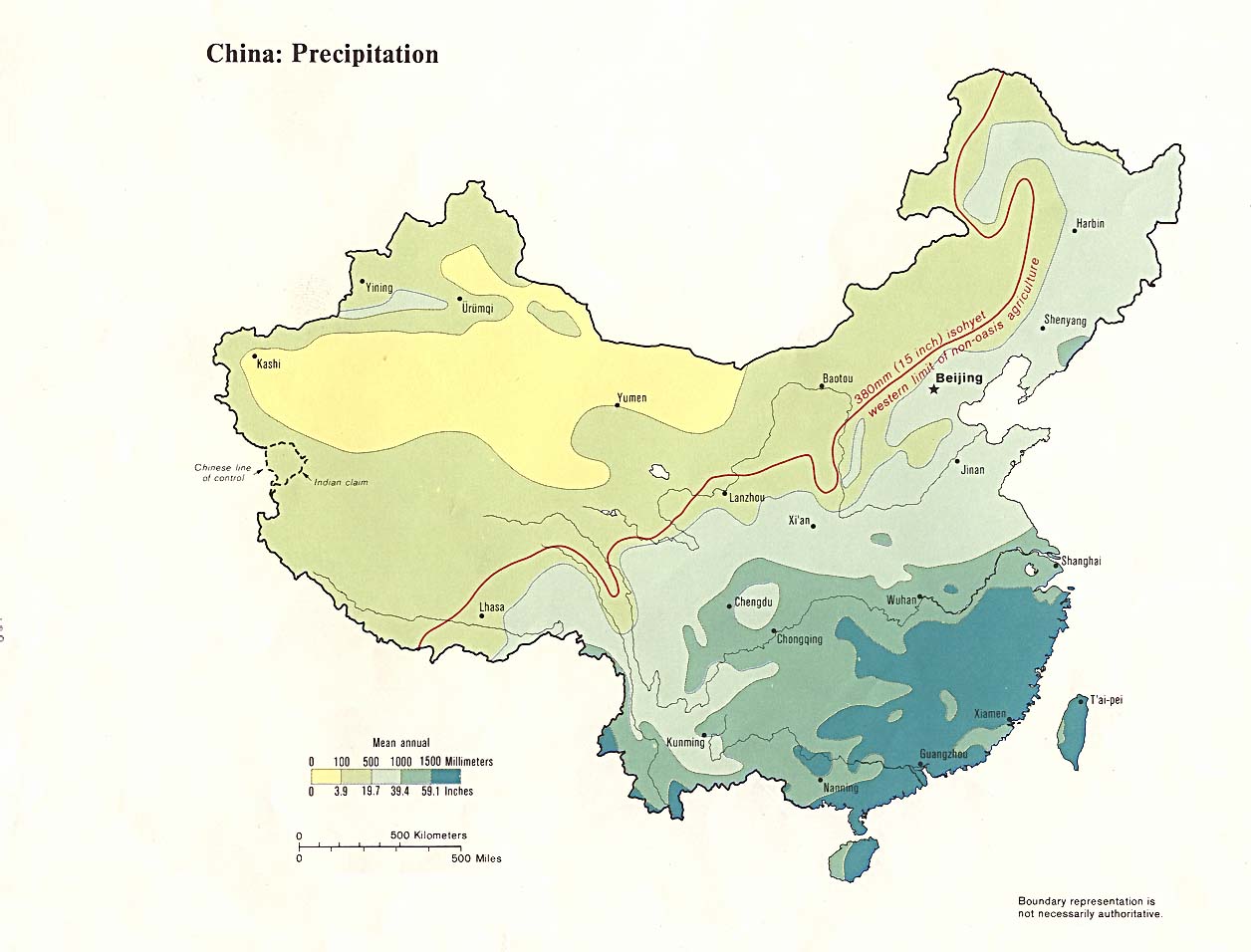
- China - Precipitation 1983 (117K)
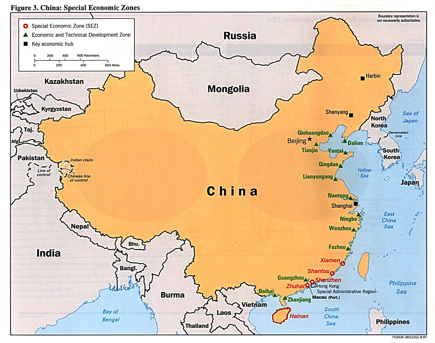
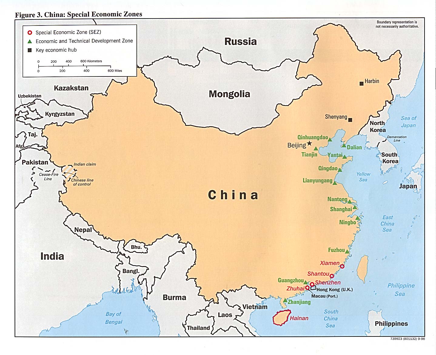
- China - Special Economic Zones 1997 (272K) from the Handbook of International Economic Statistics
- China - Special Economic Zones 1996 (254K) from the Handbook of International Economic Statistics
- Hong Kong - Land Utilization 1970 (56K)
- Hong Kong - Land Utilization, Kowloon-Victoria Area 1970 (76K)
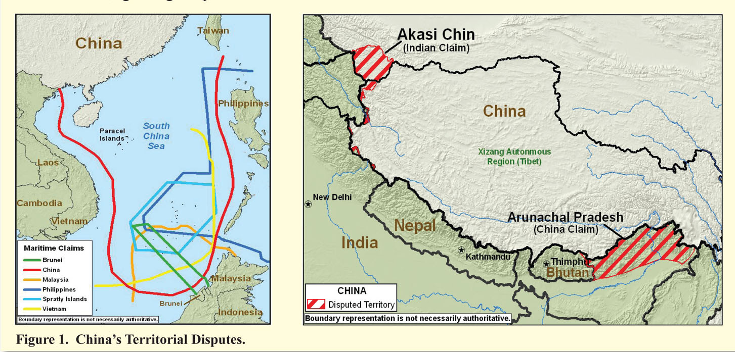
- China - Territorial Disputes 2008 (281K) from Military Power of the People's Republic of China 2008 [Annual Report to Congress] U.S. Department of Defense
Maps on Other Web Sites