Perry-Castañeda Library
Map Collection
Brazil Maps
The following maps were produced by the U.S. Central Intelligence Agency, unless otherwise indicated.
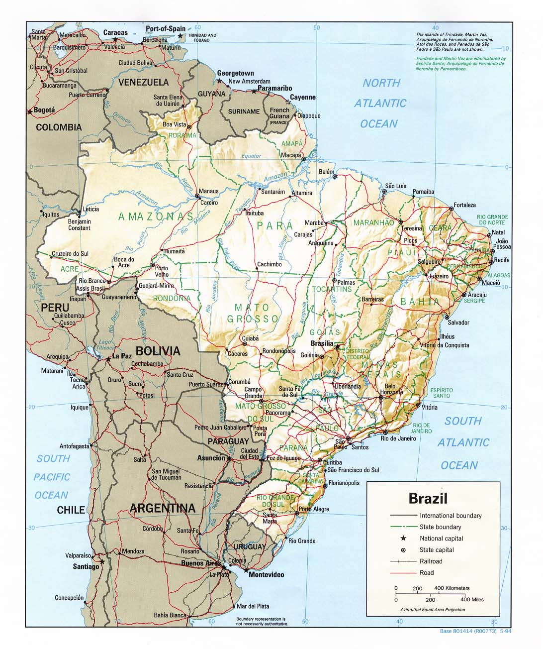
Country Maps- Brazil (Political) 1994 (360K) and pdf format (236K)
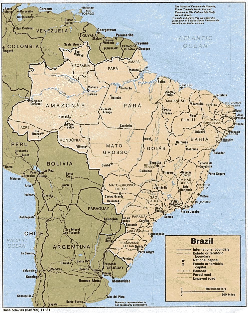
- Brazil (Political) 1981 (359K)
- Brazil (Shaded Relief) 1994 (264K) and pdf format (295K)
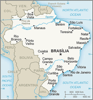
- Brazil (Small Map) 2016 (30.3K)
- Brasilia U.S. Dept. of State 1982 (78K)
- Porto Alegre U.S. Dept. of State 1982 (102K)
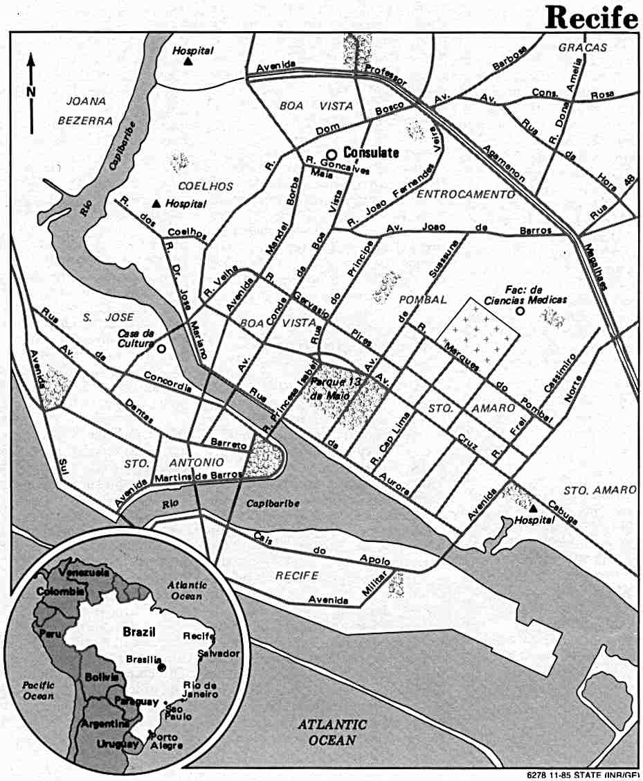
- Recife U.S. Dept. of State 1985 (88K)
- Rio de Janeiro U.S. Dept. of State 1982 (114K)
- Sao Paulo U.S. Dept. of State 1982 (134K)
- Tabatinga [with Leticia, Colombia] original scale 1:17,500, Edition 1-NIMA, Series E973. National Imagery and Mapping Agency, 1995 (7.7MB)
![Tabatinga [with Leticia, Colombia]](americas/txu-oclc-232610622-leticia-1995.jpg)
- 1:1,000,000 - Operational Navigation Charts, U.S. Defense Mapping Agency. See Index Map. [Not for navigational use]
- This series covers all of Brazil
- 1:1,000,000 - International Map of the World, U.S. Army Map Service. See Index Map.
- This series includes parts of Brazil.
- 1:500,000 - Tactical Pilotage Charts U.S. National Imagery and Mapping Agency. See Index Map. [Not for navigational use]
- This series covers parts of Brazil.
- 1:250,000 - Latin America - Joint Operations Graphic Series, U.S. National Imagery and Mapping Agency [Not for navigational use]
- This series covers parts of Brazil
- Islands Off Brazil Nautical chart. U.S. National Imagery and Mapping Agency, Chart 24521, 1998. [Not for Navigational Use]
- Includes: Approaches to Atol das Rocas, 1:100,000; Penedos de Sao Pedro e Sao Paulo, 1:10,000; Atol das Rocas, 1:20,000; Approaches to Penedos de Sao Pedro e Sao Paulo, 1:30,000 (2.1 MB)
- St. Peter and St. Paul Rocks (Penedos De Sao Pedro e Sao Paulo) Nautical chart. U.S. National Imagery and Mapping Agency, Portion of Chart 24521, 1998 (288K) [Not for Navigational Use]
- Original scale 1:10,000.
- This series covers all of Brazil
- Rio de Janeiro 1928 - Sheet 1 (19.1MB),
Sheet 2 (18.5MB) and Both Sheets (37.4MB)
- Planta da Cidade do Rio de Janeiro. Organisada na Carta Cadastral. [Rio de Janeiro] : Directoria Geral de Obras y Viação, Prefeitura do Districto Federal, 1928
- Brazil - Economic Activity from Map No. 503241 1977 (210K)
- Brazil - Land Use from Map No. 503241 1977 (133K)
- Brazil - Natural Vegetation 1977 (166K) from Map No. 503241
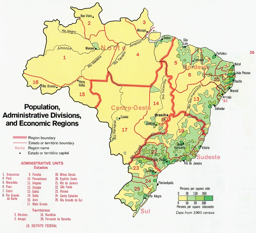
- Brazil - Population, Administrative Divisions and Economic Regions from Map No. 503241 1977 (182K)
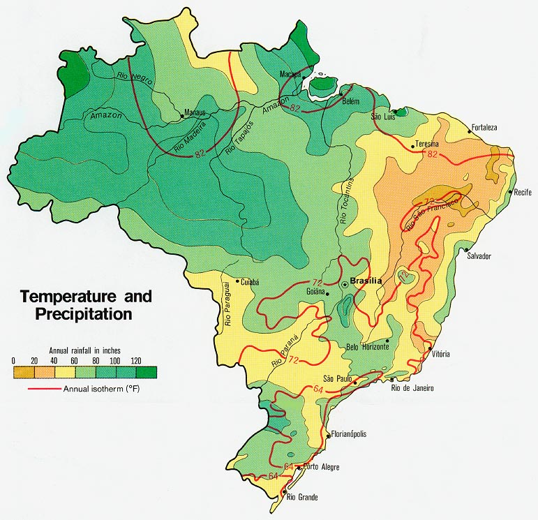
- Brazil - Temperature and Precipitation from Map No. 503241 1977 (157K)
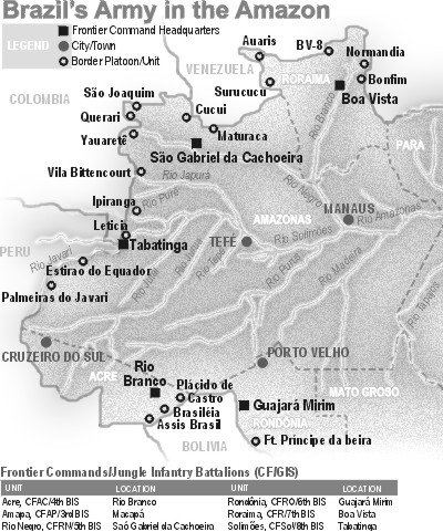
- Brazil's Army in the Amazon From "The Brazilian Amazon: Controlling the Hydra" by Mr. William W. Mendel, Military Review, July/August 1999 (67K)
Maps on Other Web Sites