Perry-Castañeda Library
Map Collection
Sri Lanka Maps
The following maps were produced by the U.S. Central Intelligence Agency, unless otherwise indicated.
Country Maps- Sri Lanka (Physiography) 2001 (1.2MB) and pdf format (450K)
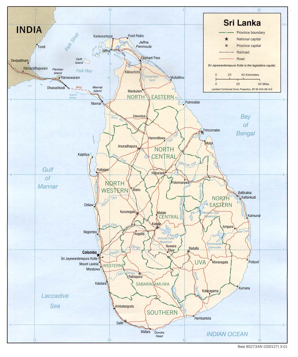
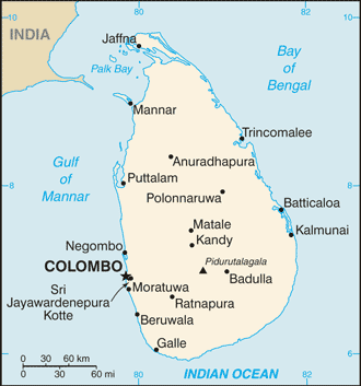
- Sri Lanka (Political) 2001 (209K) and pdf format (224K)
- Sri Lanka (Political) 2000 (177K) and pdf format (184K)
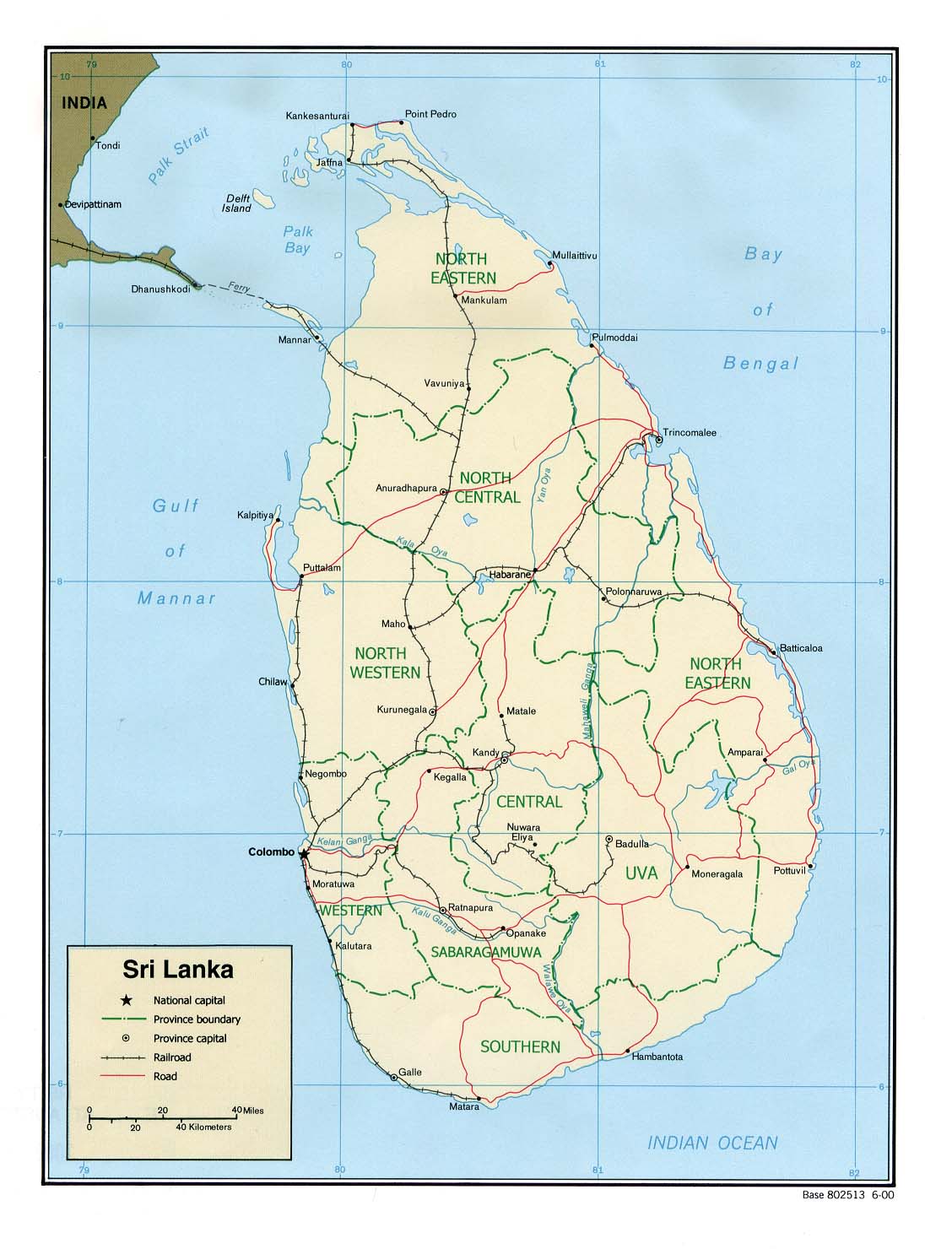
- Sri Lanka (Shaded Relief) 2000 (180K) and pdf format (179K)
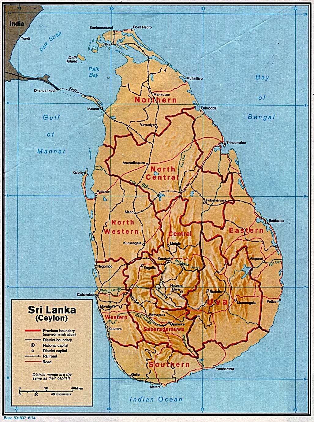
- Sri Lanka (Shaded Relief) 1974 (382K)
- Sri Lanka (Small Map) 2016 (16.1K)
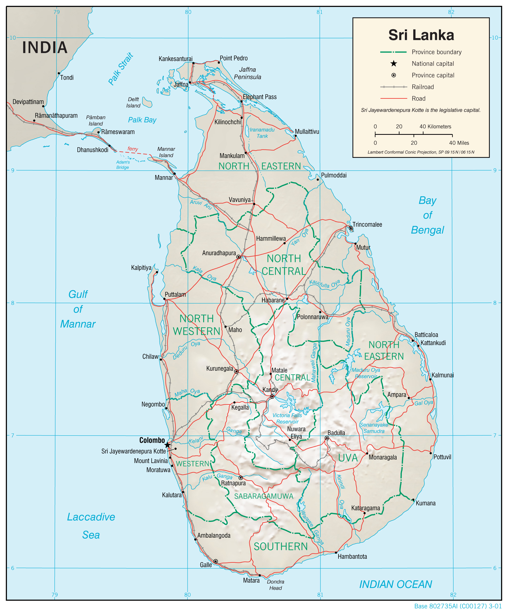
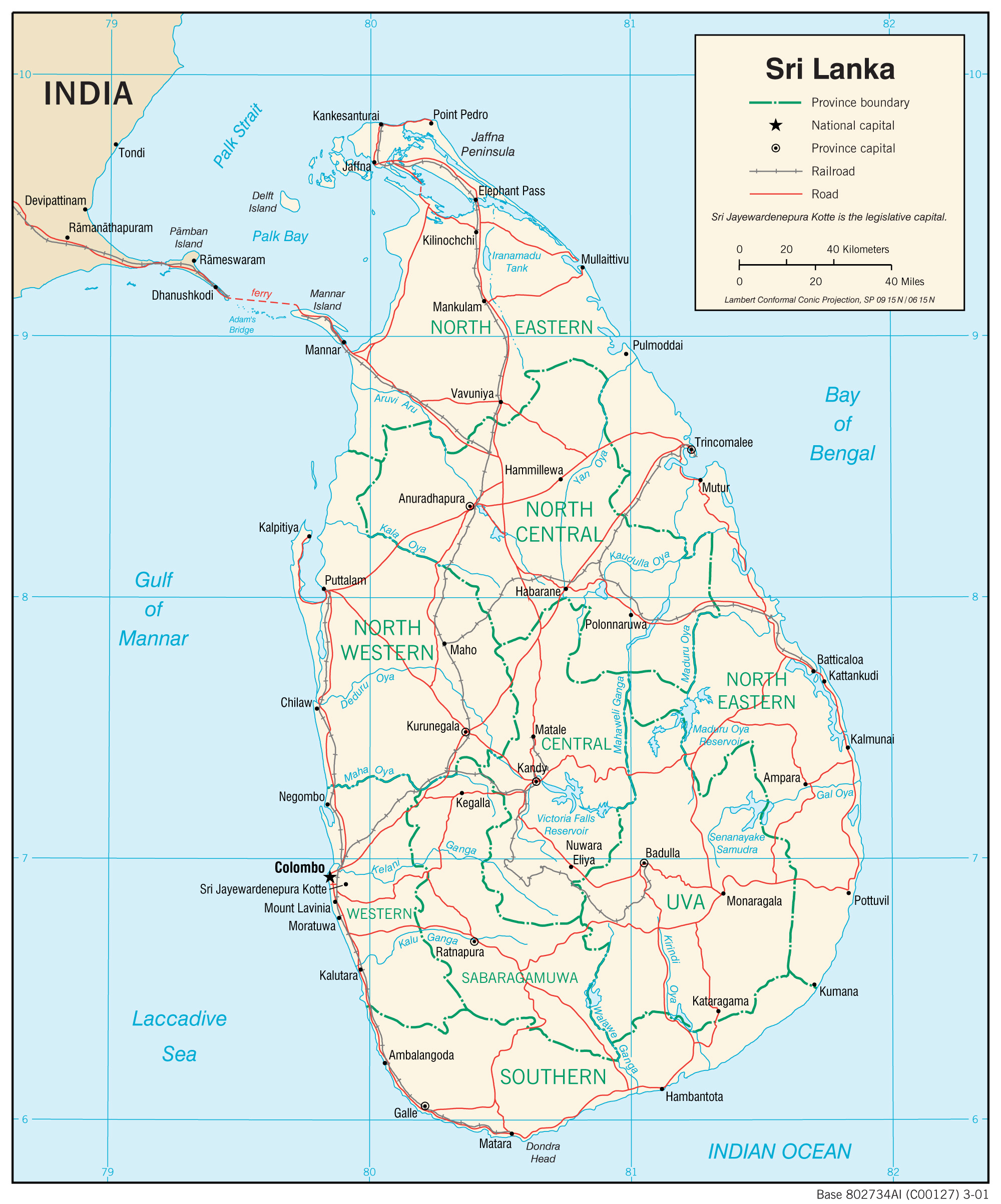
- Sri Lanka (Transportation) 2001 (1.1MB) and pdf format (370K)
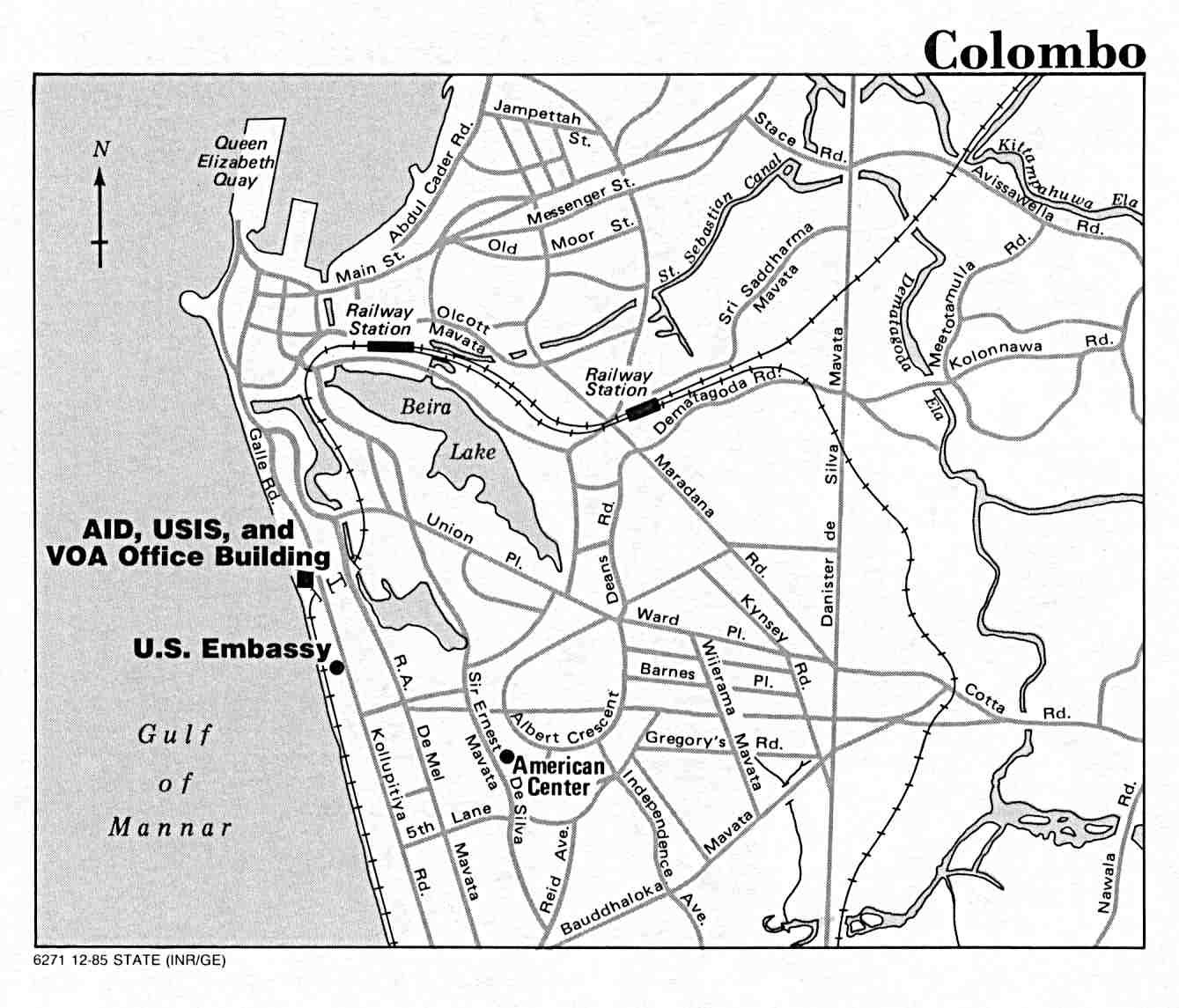
- Colombo U.S. Dept. of State 1985 (98K)
- Jaffna Peninsula Original scale 1:500,000 Portion of Defense Mapping Agency TPC K-8C 1983 (191K) Not for navigational use
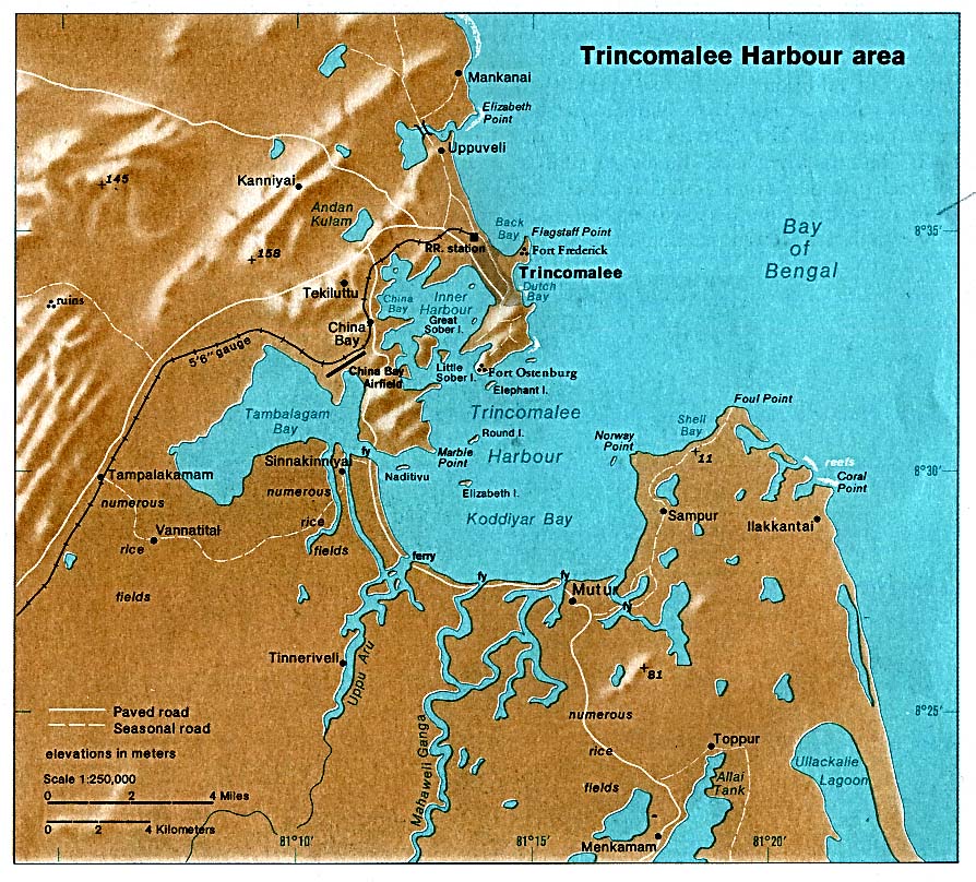
- Trincomalee Harbour area from The Indian Ocean Atlas, published by the C.I.A. 1976 (223K)
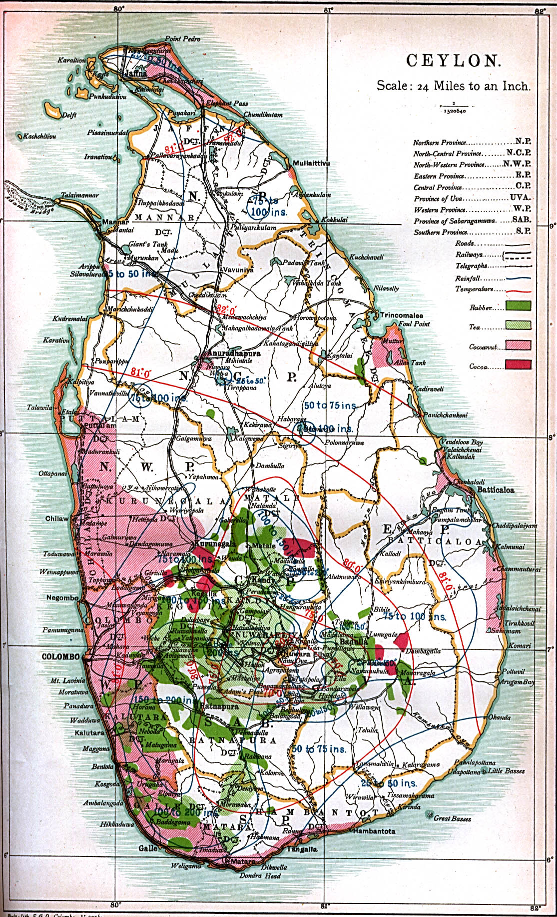
- Ceylon 1914 "Ceylon" from Great Britain Parliament House of Commons Sessional Papers, Colonial Reports - Annual. No. 797. Ceylon. Report (Supplementary) for 1912. (774K)
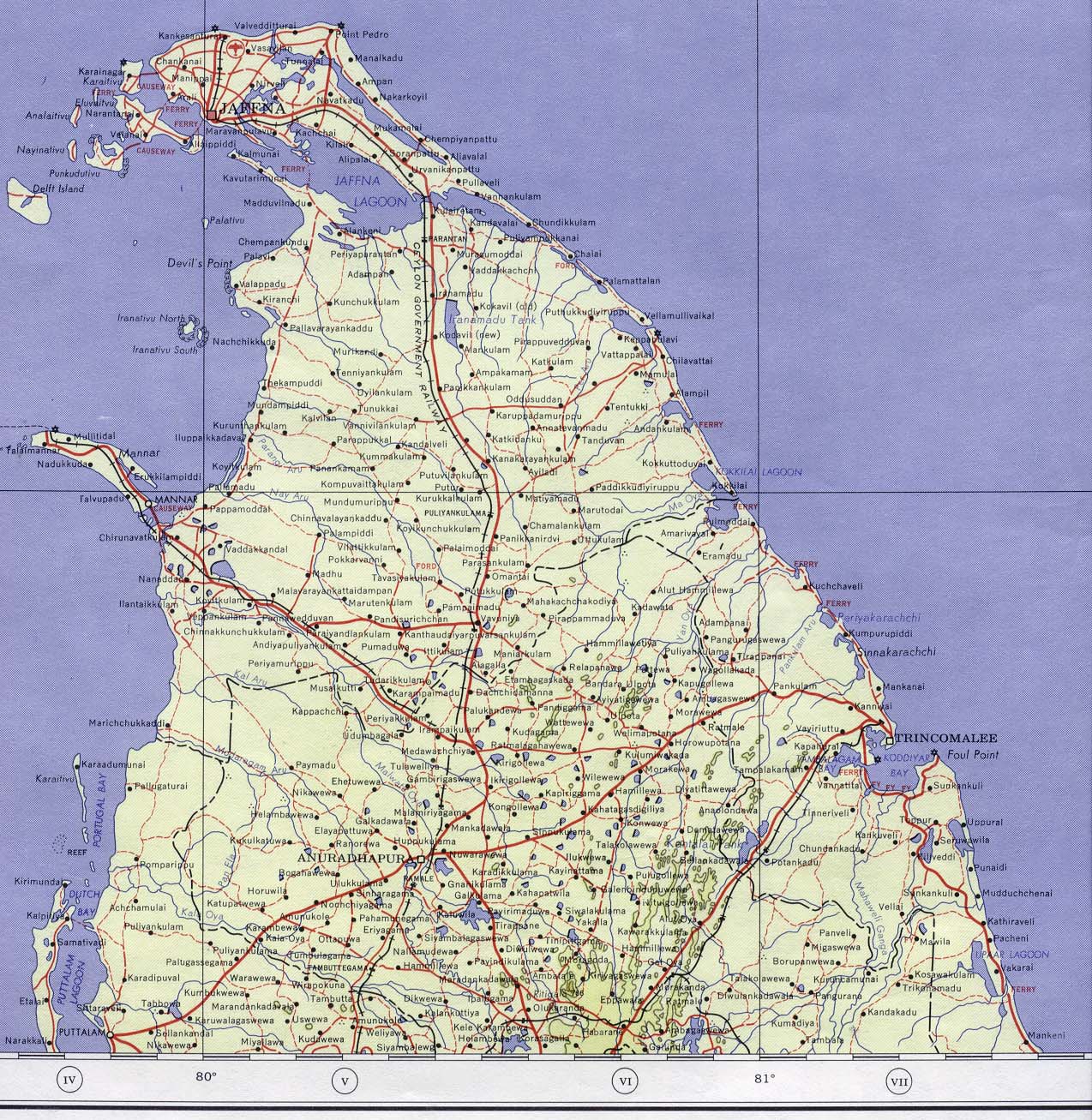
- Ceylon - North 1959 (Topographic Map) Portion of Madura sheet. NC 44, Series 1301. Original Scale 1:1,000,000. Printed by U.S. Army Map Service, Corps of Engineers, 1959. (496K)
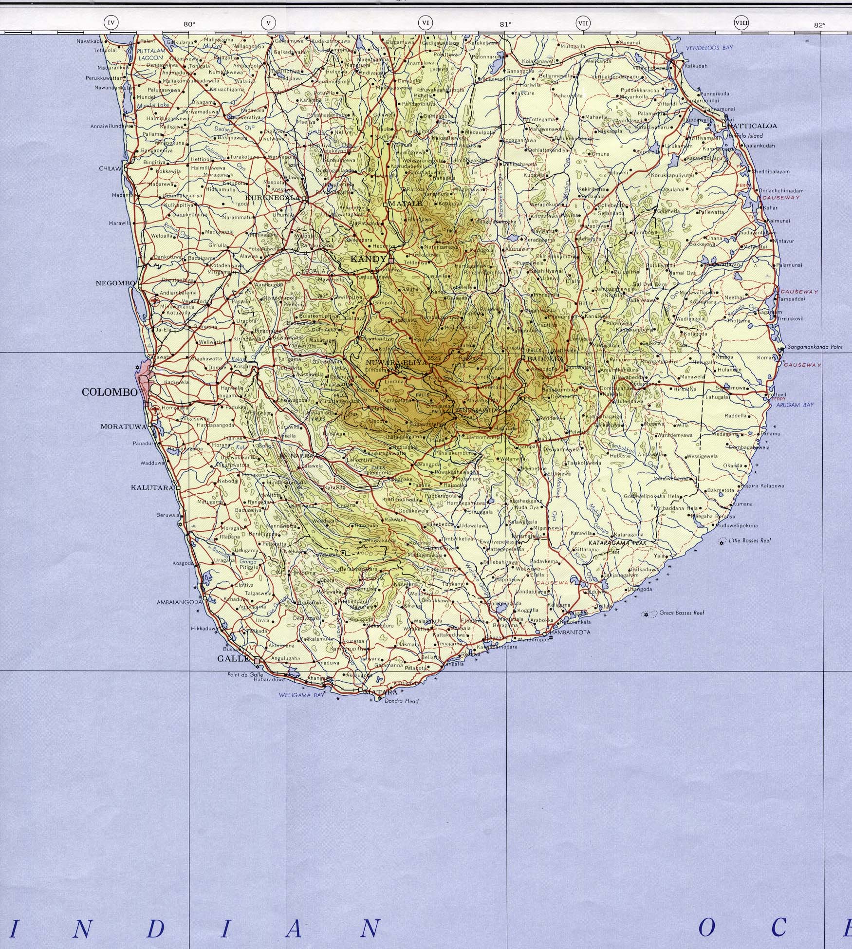
- Ceylon - South 1964 (Topographic Map) Portion of Colombo sheet. NB 44, Series 1301. Original Scale 1:1,000,000. Printed by U.S. Army Map Service, Corps of Engineers, 1964. (800K)
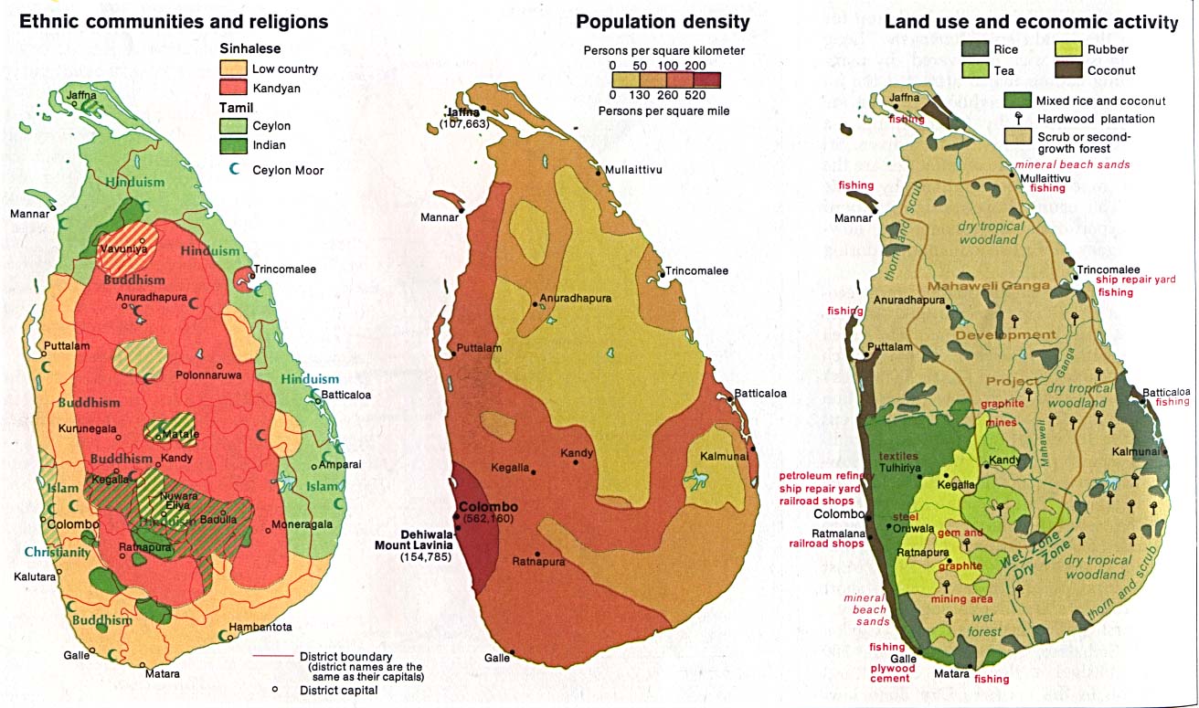
- Sri Lanka (Ethnic communities and religions, Population density, Land use and economic activity) 1976 (188K)
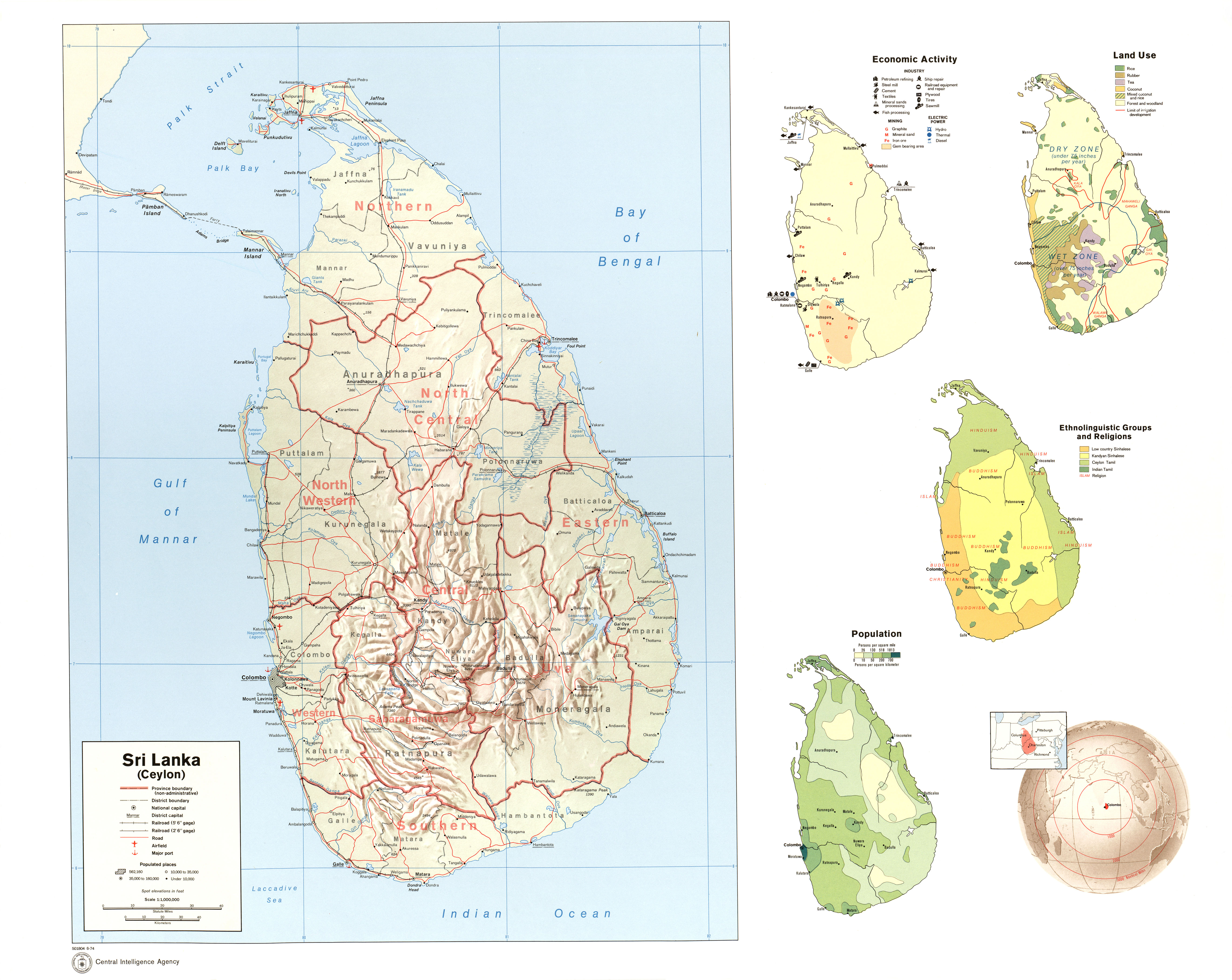
- Sri Lanka (Shaded Relief, Economic Activity, Land Use, Ethnolinguistic Groups and Religions, Population, Location) Map No. 501804 1974 (3.2MB)
- 1:1,000,000 - Operational Navigation Chart Series U.S. Defense Mapping Agency Aerospace Center Not for navigational use
- This series covers all of Sri Lanka on sheets K-8 and L-8
- 1:1,000,000 - International Map of the World
- This series covers all of Sri Lanka on sheets NC44 and NB44
- 1:500,000 - Tactical Pilotage Charts U.S. National Imagery and Mapping Agency. Not for navigational use
- This series covers Sri Lanka
- 1:250,000 - India Joint Operations Graphic Series U.S. National Imagery and Mapping Agency, 1981- Not for navigational use
- This series covers the south west part of Sri Lanka
- This series covers all of Sri Lanka on sheets K-8 and L-8
Maps on Other Web Sites