Perry-Castañeda Library
Map Collection
Nepal Maps
The following maps were produced by the U.S. Central Intelligence Agency, unless otherwise indicated.
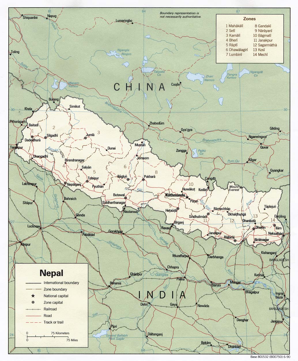
Country Maps- Nepal (Political) 1990 (265K) and pdf format (277K)
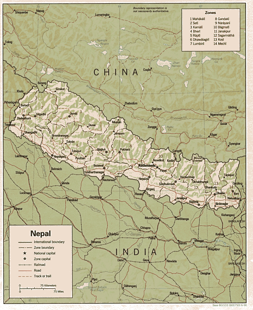
- Nepal (Shaded Relief) 1990 (357K) and pdf format (382K)
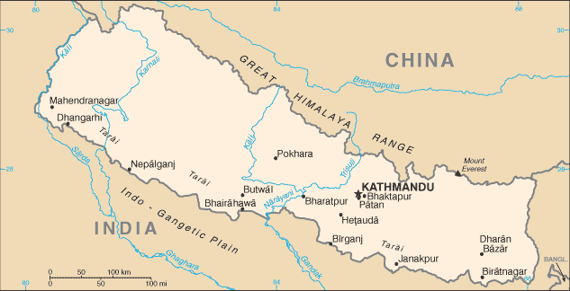
- Nepal (Small Map) 2016 (16.8K)
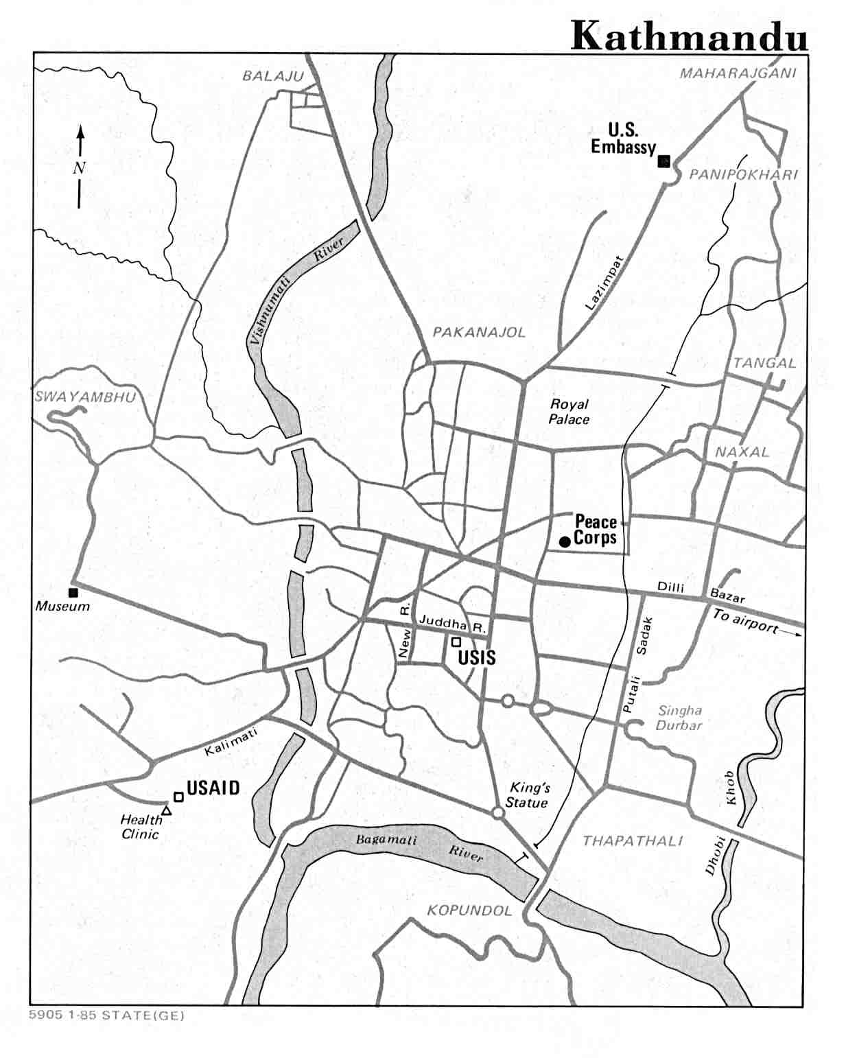
- Kathmandu U.S. Dept. of State 1985 (80K)
- 1:1,000,000 - Operational Navigation Chart Series U.S. Defense Mapping Agency Aerospace Center Not for navigational use
- Sheet H-9 includes all of Nepal
- 1:1,000,000 - International Map of the World
- This series includes parts of Nepal
- 1:500,000 - Tactical Pilotage Charts U.S. National Imagery and Mapping Agency. Not for navigational use
- This series covers the northern part of Nepal
- 1:250,000 - India and Pakistan - Topographic Maps Series U502, U.S. Army Map Service, 1955-
- This map series includes most of Nepal
- 1:250,000 - India Joint Operations Graphic Series U.S. National Imagery and Mapping Agency, 1981- Not for navigational use
- Three sheets include small parts of Nepal
- Sheet H-9 includes all of Nepal
- 1:1,000,000 - India and Adjacent Countries Topographic Maps (Survey of India)
- This series covers all of Nepal
- 1:253,440 - India Topographic Maps (Great Britain. War Office) Series 3919 & 4218
- This series covers part of Nepal
- This series covers all of Nepal
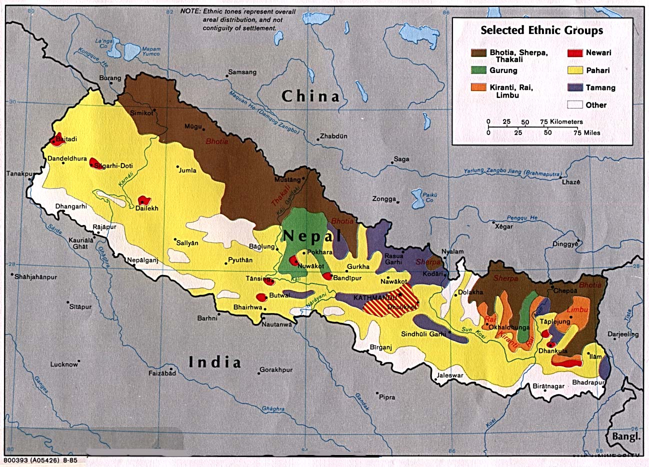
- Nepal (Selected Ethnic Groups) 1980 (297K)
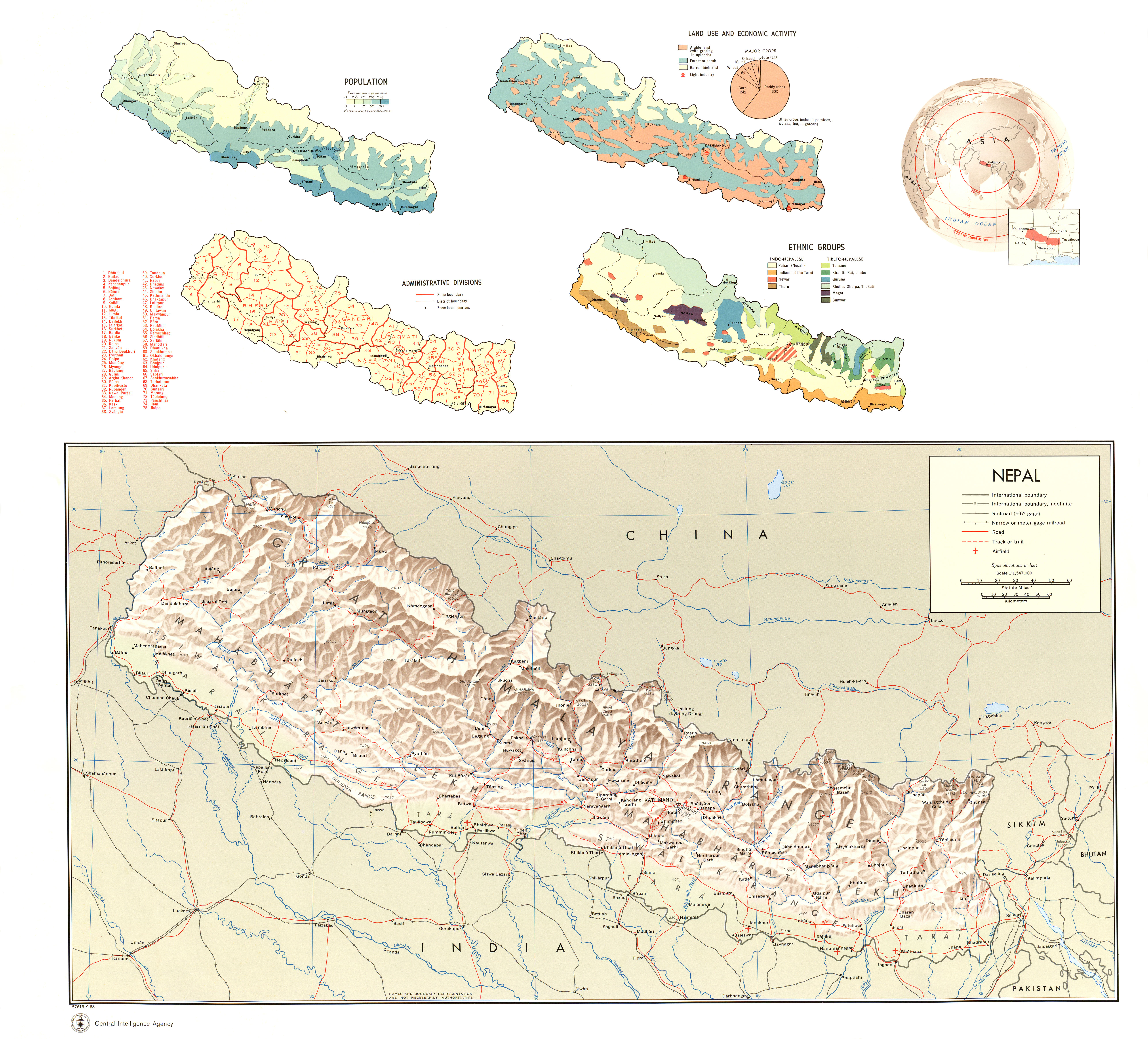
- Nepal (Population, Land Use and Economic Activity, Administrative Divisions, Location, Ethnic Groups, Shaded Relief) Map No. 57613 1968 (4.5MB)
Maps at Other Web Sites
- Country Map Sites
- Nepal Earthquake - Live Map (GDACS/UNOSAT)
- Nepal Earthquake (OpenStreetMap)
- Nepal - Maps (Digital Himalaya)
- Nepal - Maps (Lirung.com)
- Nepal - Maps (OCHA)
- Nepal - Maps (PAHAR)
- Nepal - Maps (ReliefWeb)
- Nepal - Maps, GIS Layers (GDACS)
- Nepal - Satellite Image Maps and Topographic Maps 1:250,000 (AMS and Nepal Remote Sensing Center/PAHAR)
- Nepal - Topographic Maps 1:25,000 (Government of Nepal Survey Department/PAHAR)