Perry-Castañeda Library
Map Collection
Turkmenistan Maps
The following maps were produced by the U.S. Central Intelligence Agency, unless otherwise indicated.
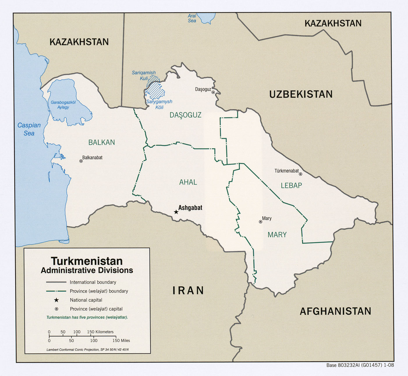
Turkmenistan Maps- Turkmenistan (Administrative Divisions) 2008 (326KB)
- Turkmenistan (Physiography) 2008 (1.3MB) and pdf format (1MB)
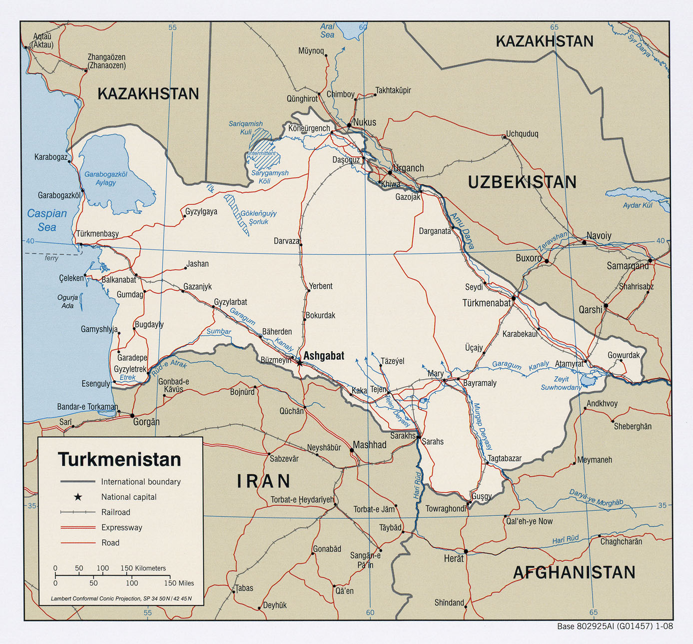
- Turkmenistan (Political) 2008 (545KB)
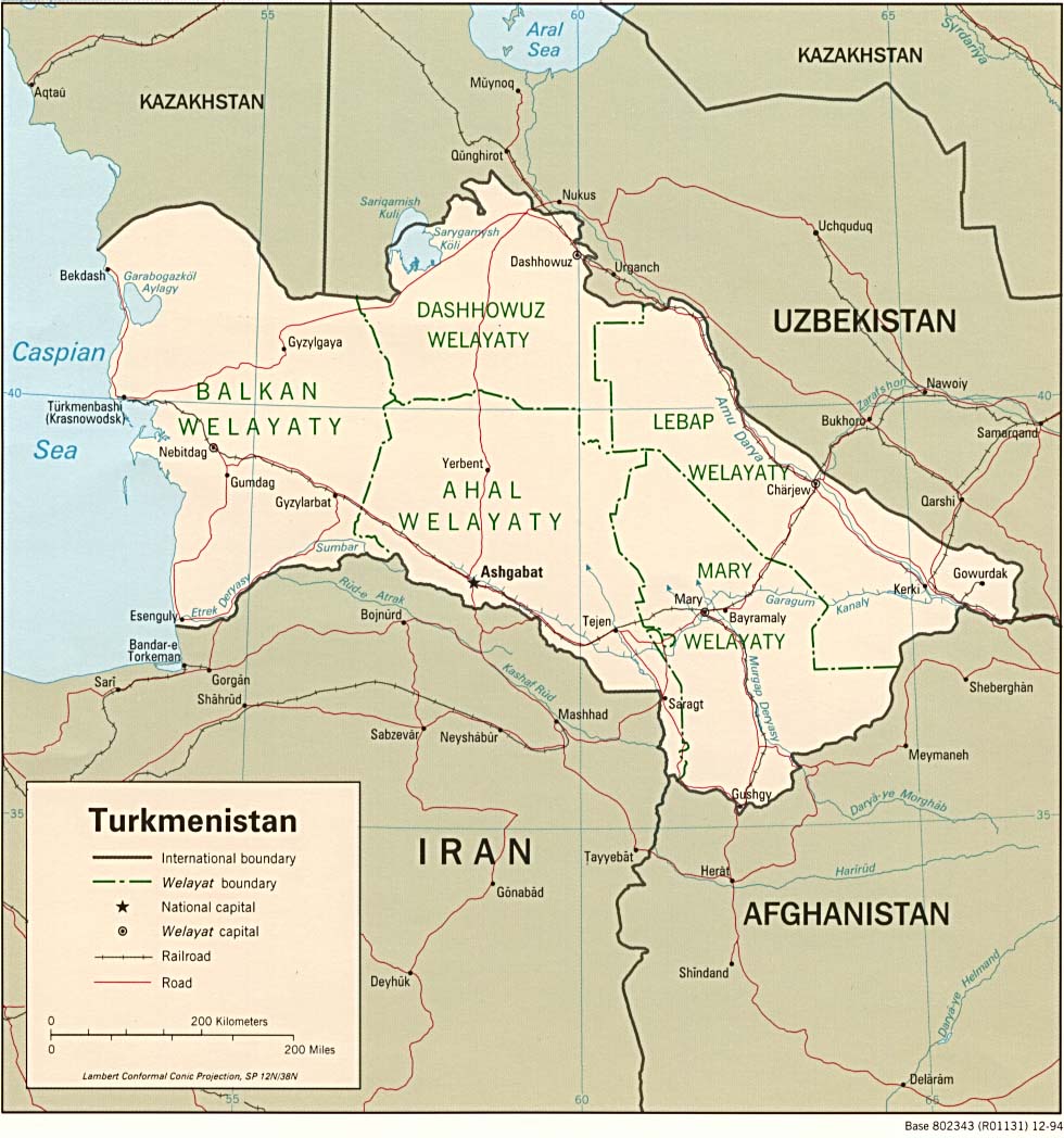
- Turkmenistan (Political) 1994 (167K) and pdf format (199K)
- Turkmenistan (Shaded Relief) 2008 (614KB)
- Turkmenistan (Shaded Relief) 1994 (243K) and pdf format (284K)
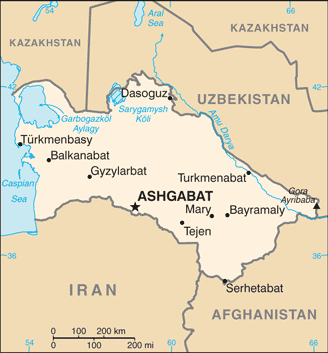
- Turkmenistan (Small Map) 2016 (20.1K)
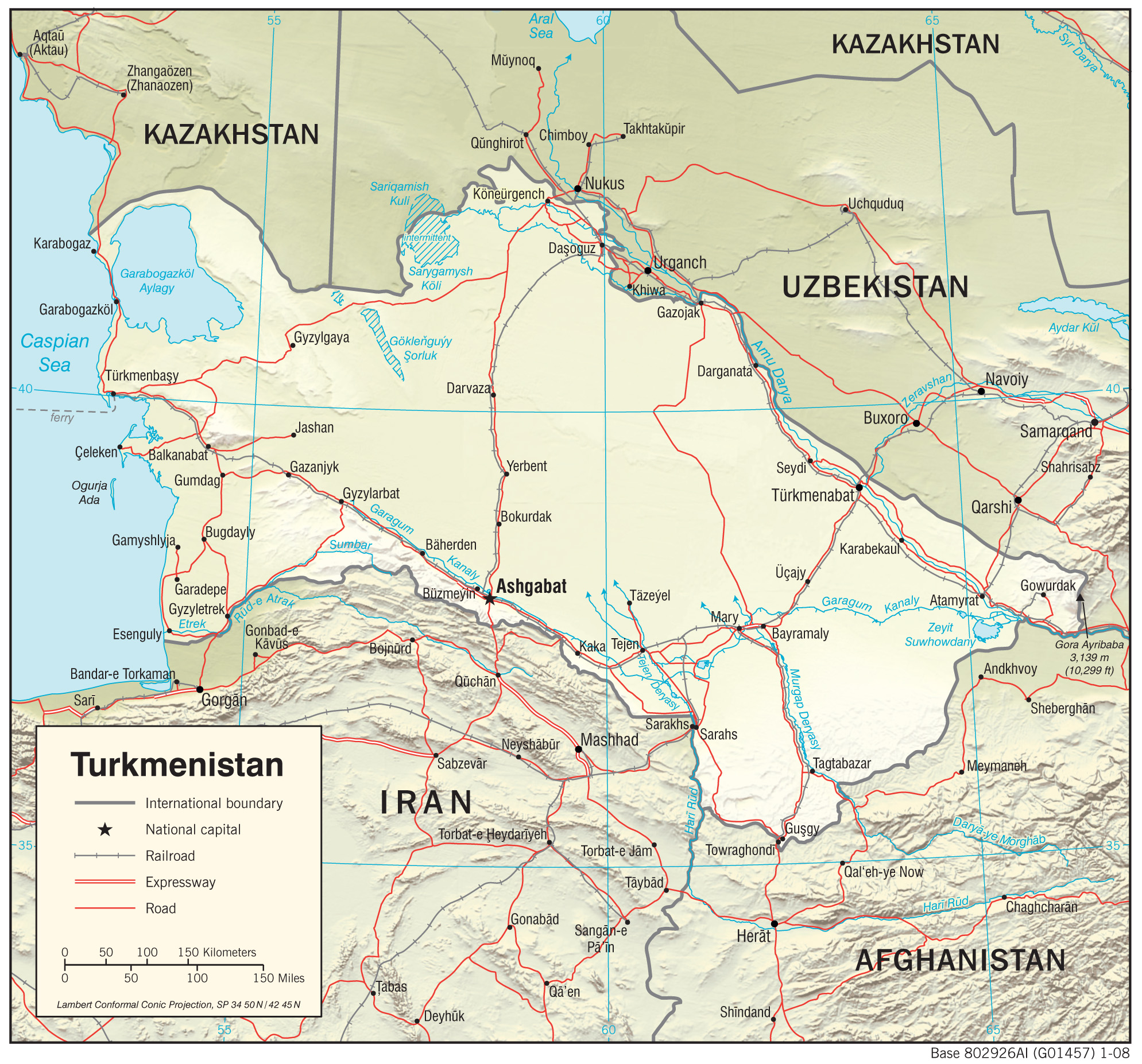
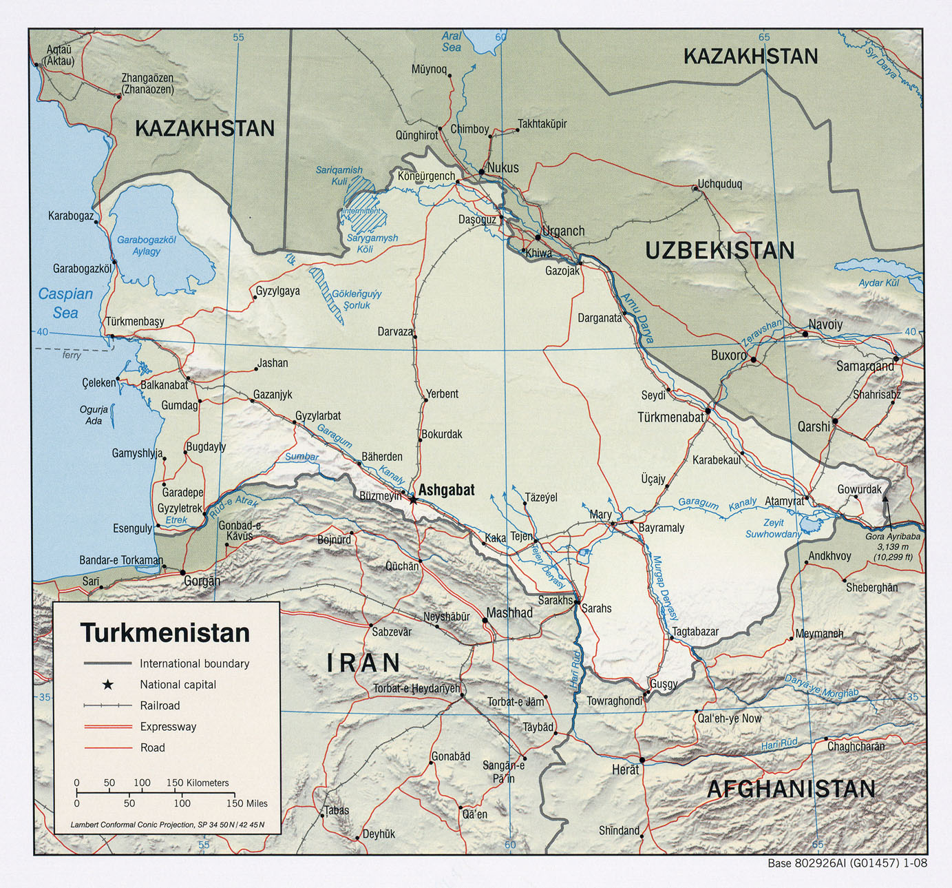
- Turkmenistan (Transportation) 2008 (1.0MB) and pdf format (220K)
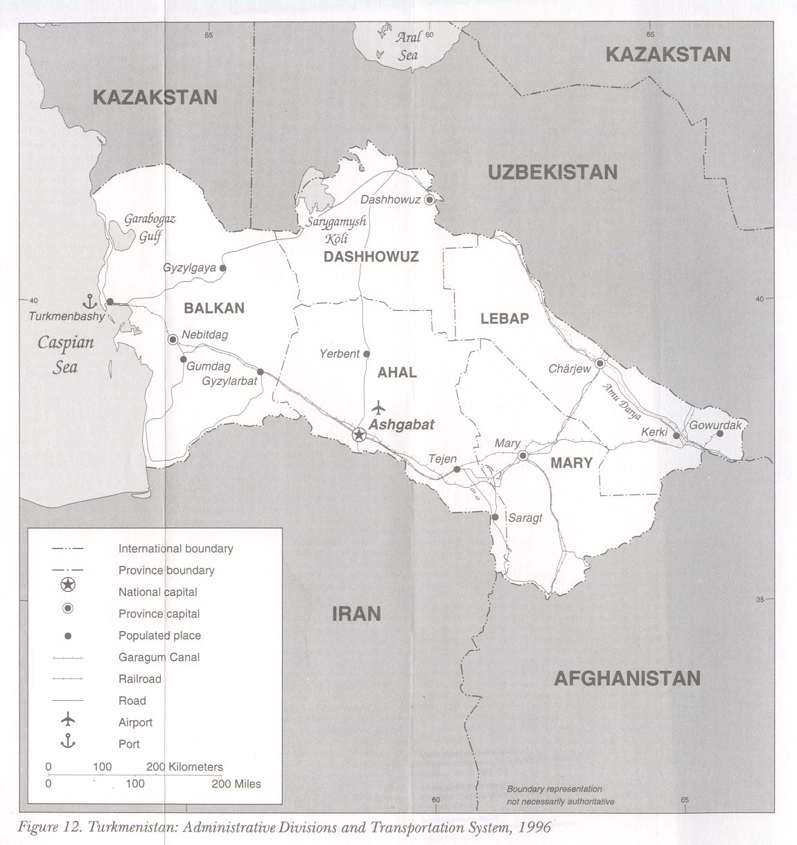
- Turkmenistan: Administrative Divisions and Transportation System 1996 from Kazakstan, Kyrgyzstan, Tajikistan, Turkmenistan, and Uzbekistan: Country Studies. 1997 (261K)
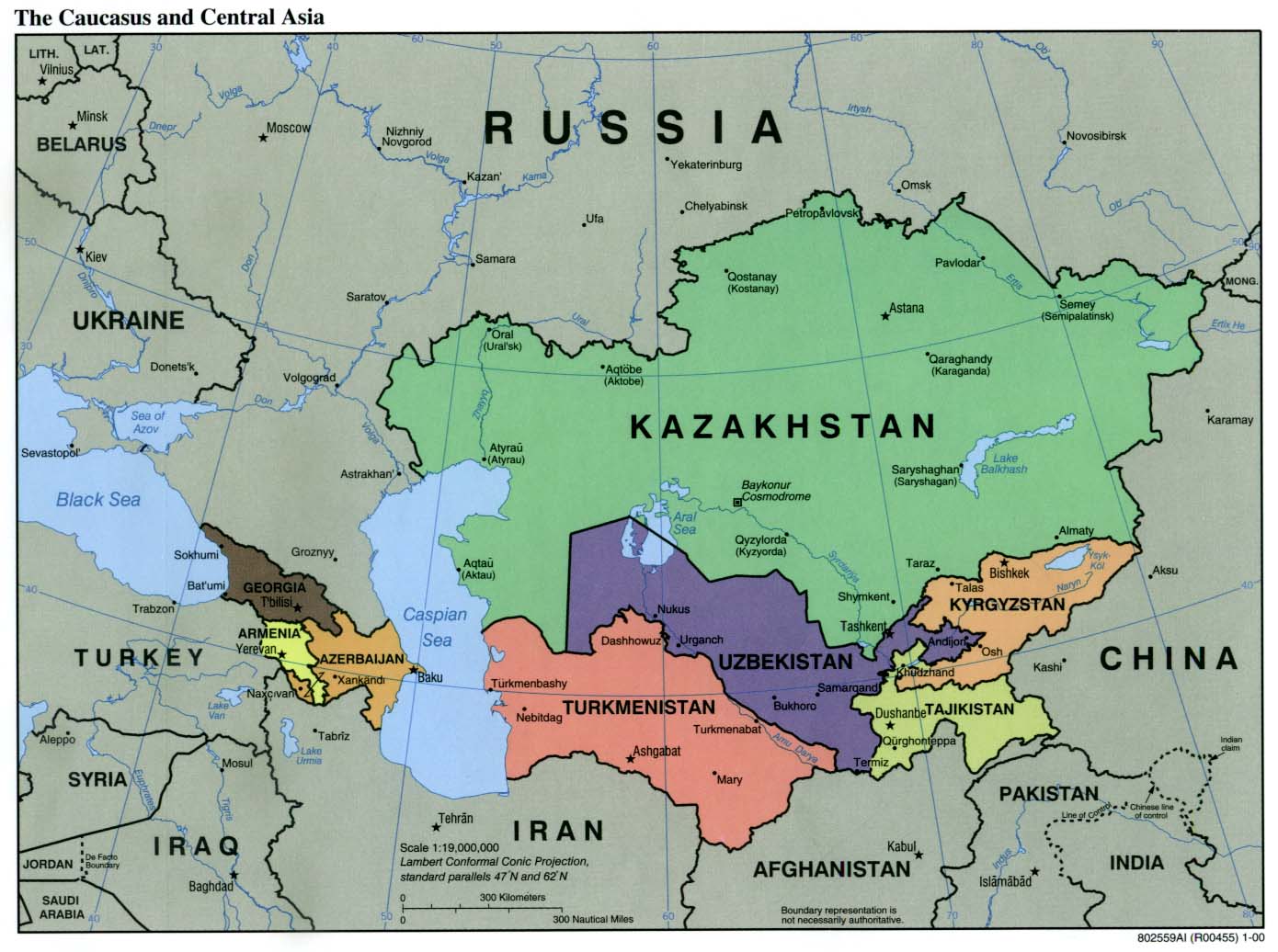
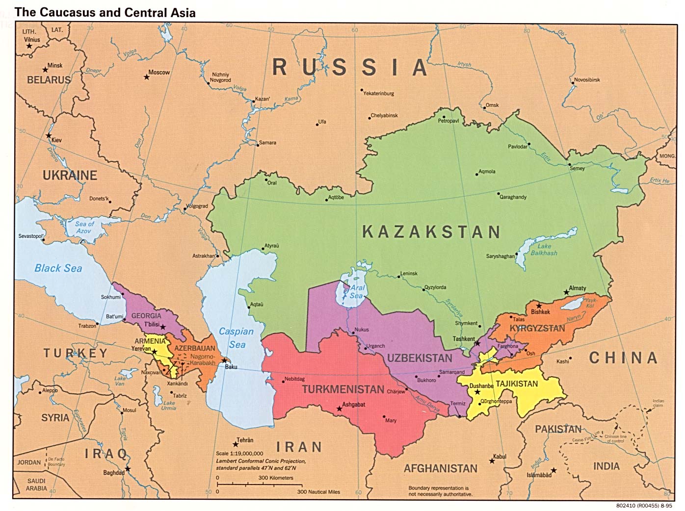
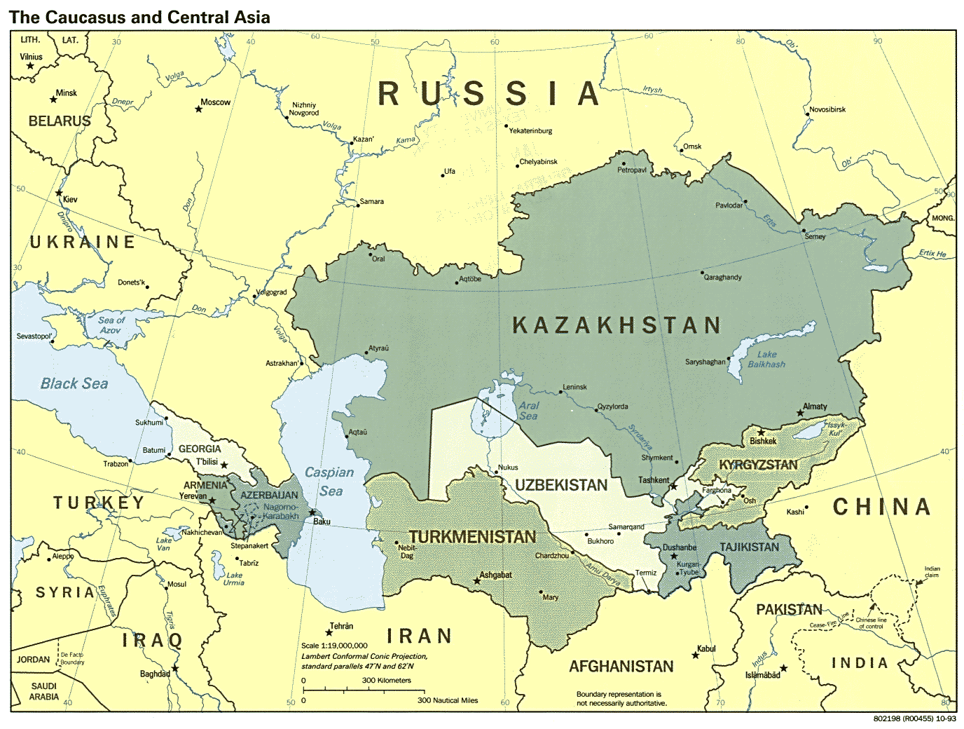
- Caucasus and Central Asia (Political) 2000 (171K)
- Caucasus and Central Asia (Political) 1995 (231K)
- Caucasus and Central Asia (Political) 1993 (223K)
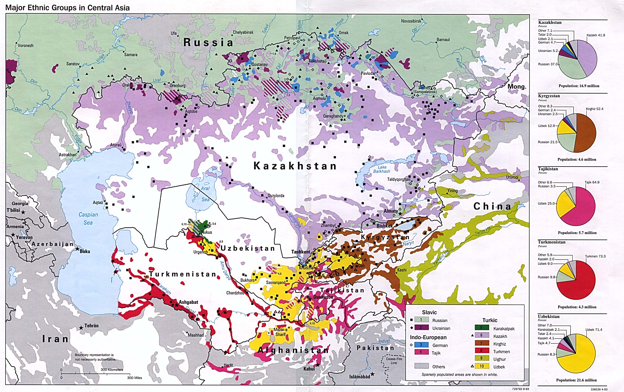
- Major Ethnic Groups in Central Asia 1993 (694K)
- [Caspian Region] Oil and Gas Infrastructure in the Caspian Sea Region 2012 (6.9MB)
- [Caspian Region] Oil and Gas Infrastructure in the Caspian Sea Region 2001 (2.5 MB)
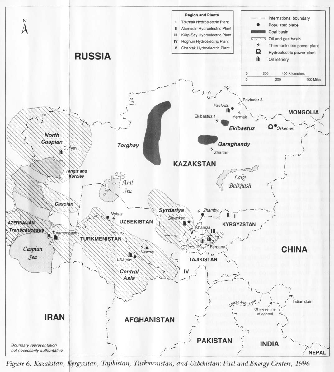
- Kazakstan, Kyrgyzstan, Tajikistan, Turkmenistan, and Uzbekistan: Fuel and Energy Centers 1996 from Kazakstan, Kyrgyzstan, Tajikistan, Turkmenistan, and Uzbekistan: Country Studies. 1997 (142K)
- Kazakstan, Kyrgyzstan, Tajikistan, Turkmenistan, and Uzbekistan: Industrial Activity 1996 from Kazakstan, Kyrgyzstan, Tajikistan, Turkmenistan, and Uzbekistan: Country Studies. 1997 (151K)
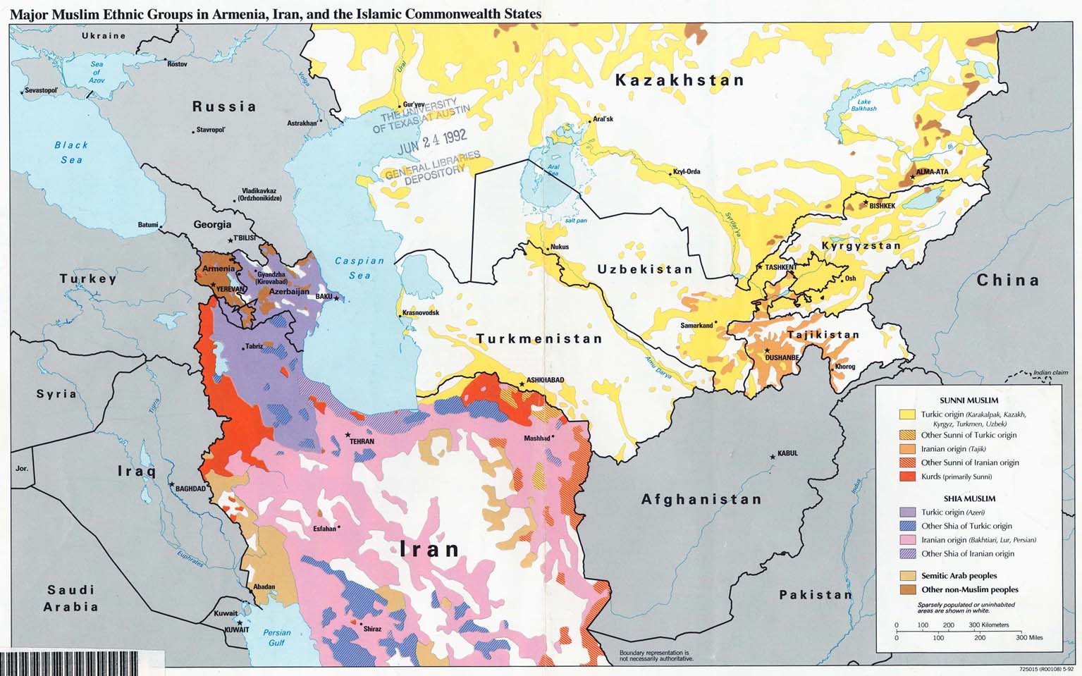
- Major Muslim Ethnic Groups in Armenia, Iran, and the Islamic Commonwealth States 1992 (203K)
![[Caspian Region] Oil and Gas Infrastructure in the Caspian Sea Region](middle_east_and_asia/txu-pclmaps-oclc-785323952-caspian_sea_oil_and_gas.jpg)
![[Caspian Region] Oil and Gas Infrastructure in the Caspian Sea Region](middle_east_and_asia/caspian_sea_oil_gas-2001.jpg)
- 1:1,000,000 - Operational Navigation Chart Series U.S. Defense Mapping Agency Aerospace Center. This series covers all of Turkmenistan. Not for navigational use
- 1:1,000,000 - International Map of the World
- This series covers parts of northern and eastern Turkmenistan
- 1:500,000 - Tactical Pilotage Charts U.S. National Imagery and Mapping Agency. Not for navigational use
- This series covers Turkmenistan
- 1:250,000 - Russia - Joint Operations Graphic (Air), Series 1501 [Not for navigational use] U.S. National Imagery and Mapping Agency. Earlier sheets were produced by the U.S. Defense Mapping Agency.
- This series covers most of Turkmenistan
- This series covers parts of northern and eastern Turkmenistan
Maps on Other Web Sites