Perry-Castañeda Library
Map Collection
Algeria Maps
The following maps were produced by the U.S. Central Intelligence Agency, unless otherwise indicated.
Country Maps- Algeria (Administrative) 2001 (218K) and pdf format (1.5MB)
- Algeria (Physiography) 2001 (1.4MB) and pdf format (2.2MB)
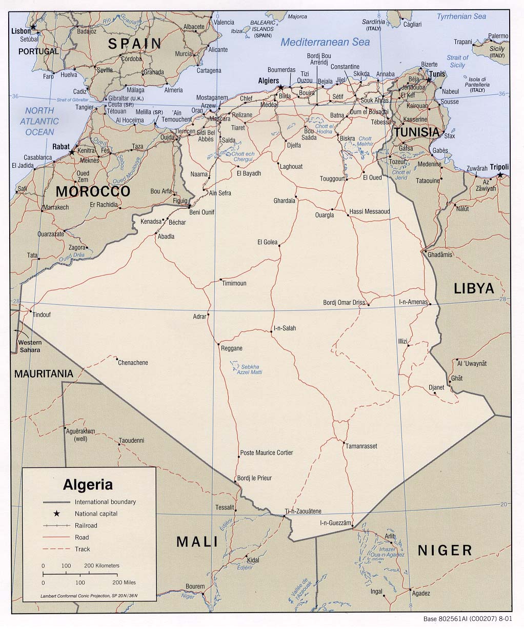
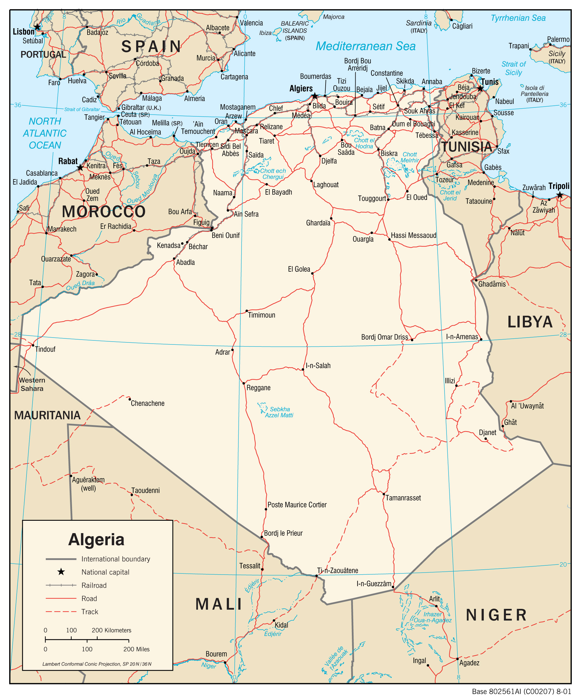
- Algeria (Political) 2001 (218K) and pdf format (2.4MB)
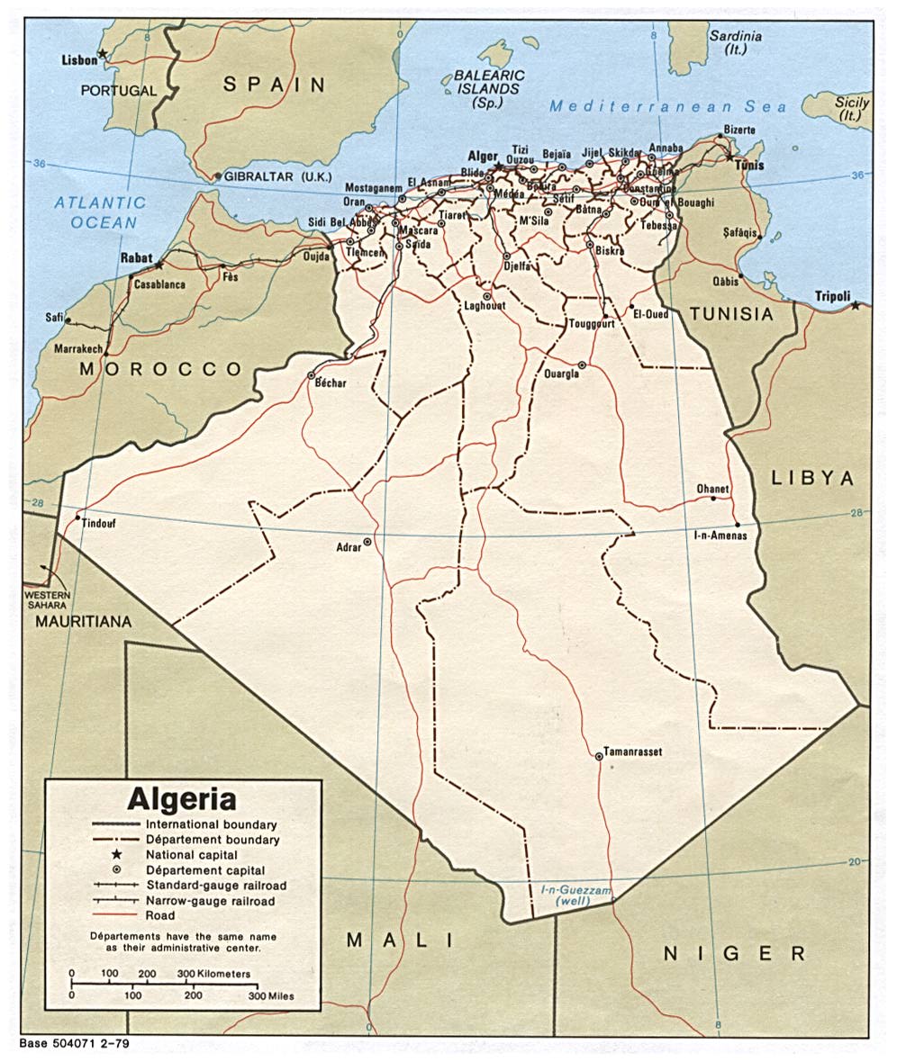
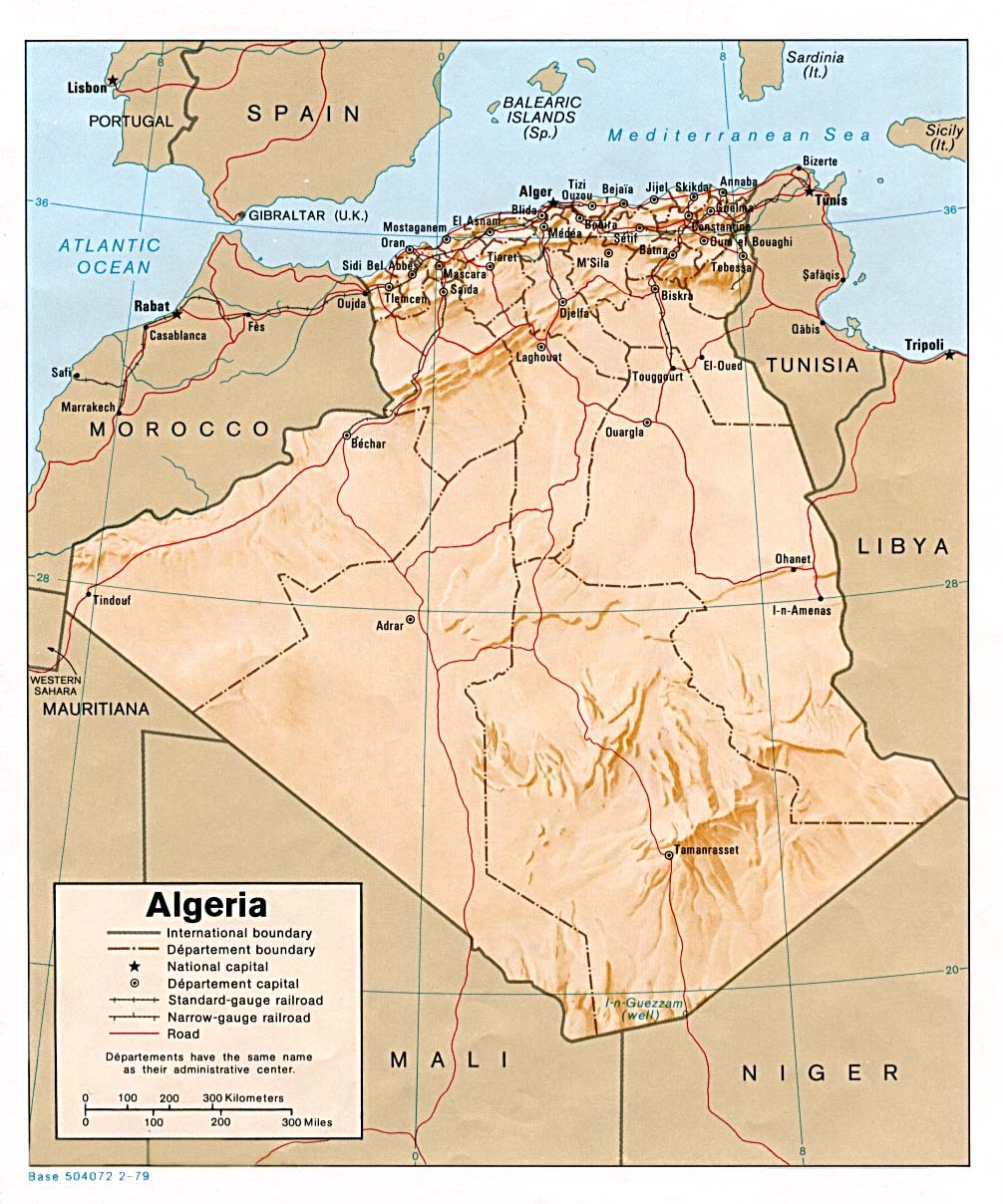
- Algeria (Political) 1979 (194K) and pdf format (197K)
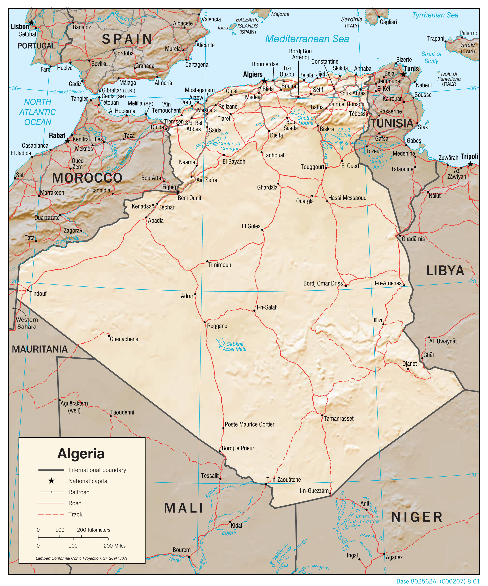
- Algeria (Shaded Relief) 2001 (240K) and pdf format (2.1MB)
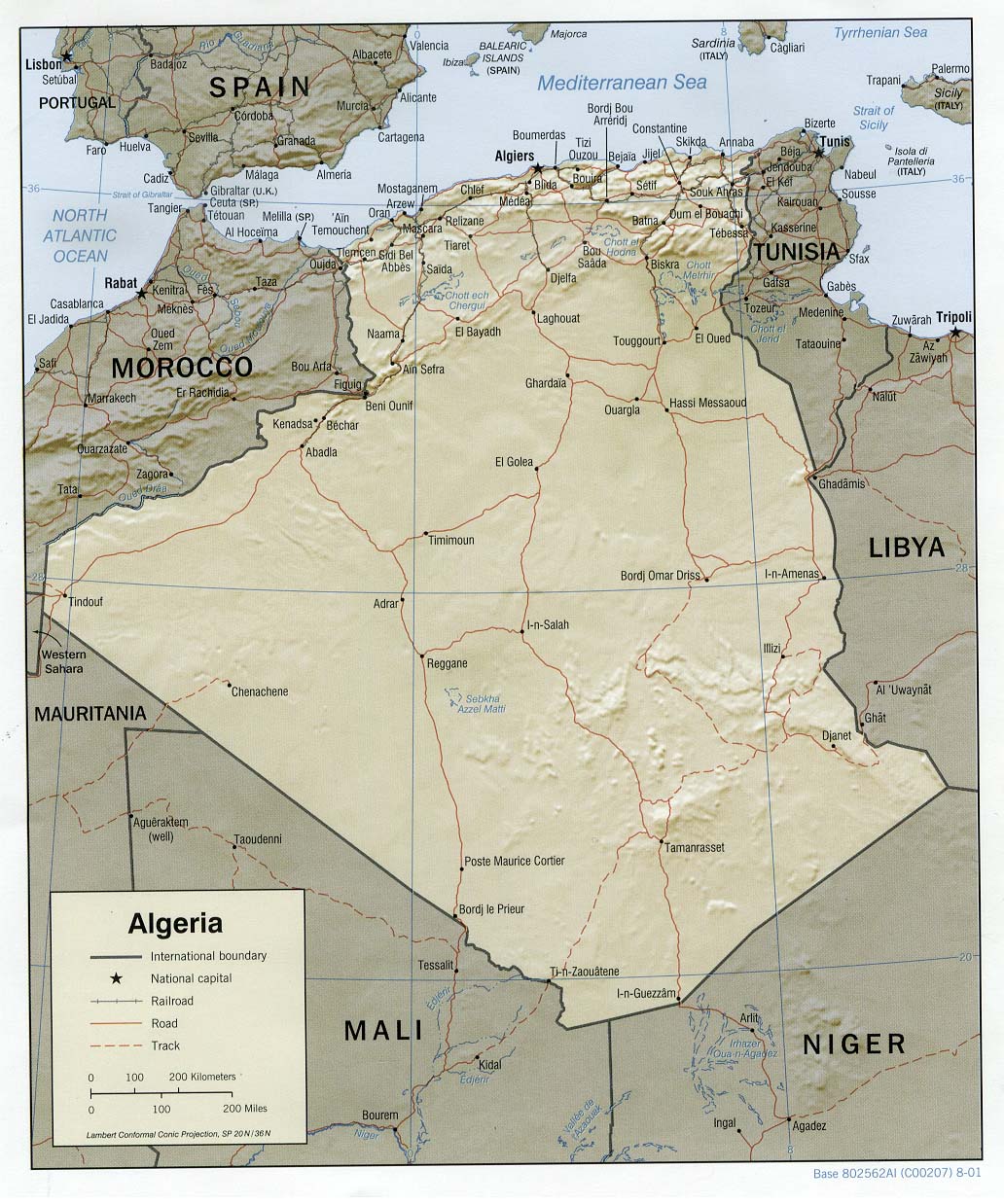
- Algeria (Shaded Relief) 1979 (216K) and pdf format (219K)
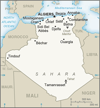
- Algeria (Small Map) 2016 (22.4K)
- Algeria (Transportation) 2001 (1.3MB) and pdf format (2.4MB)
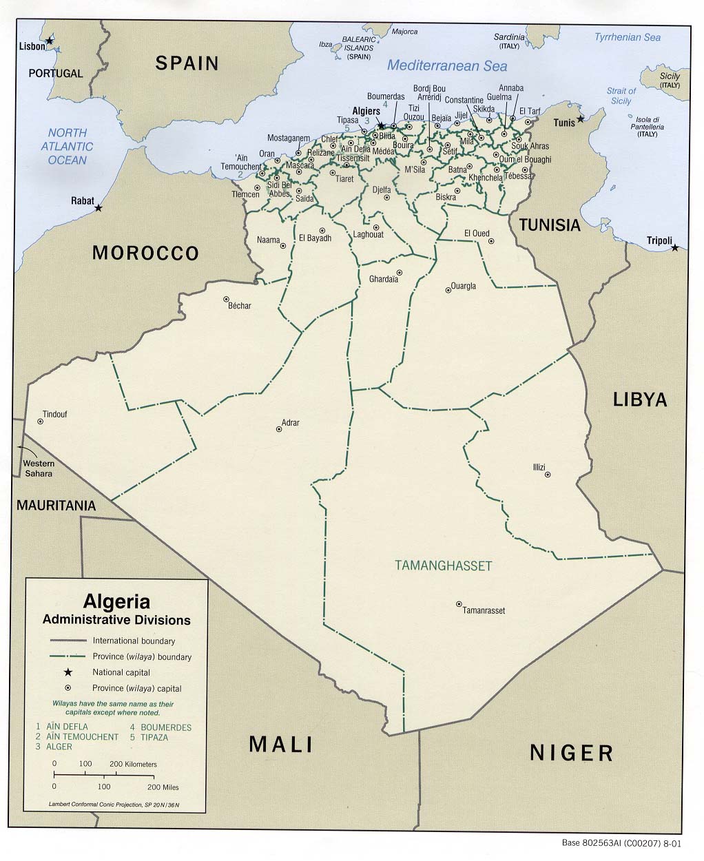
- Algeria: Administrative Divisions 2001 (159K) and pdf format (1.4MB)
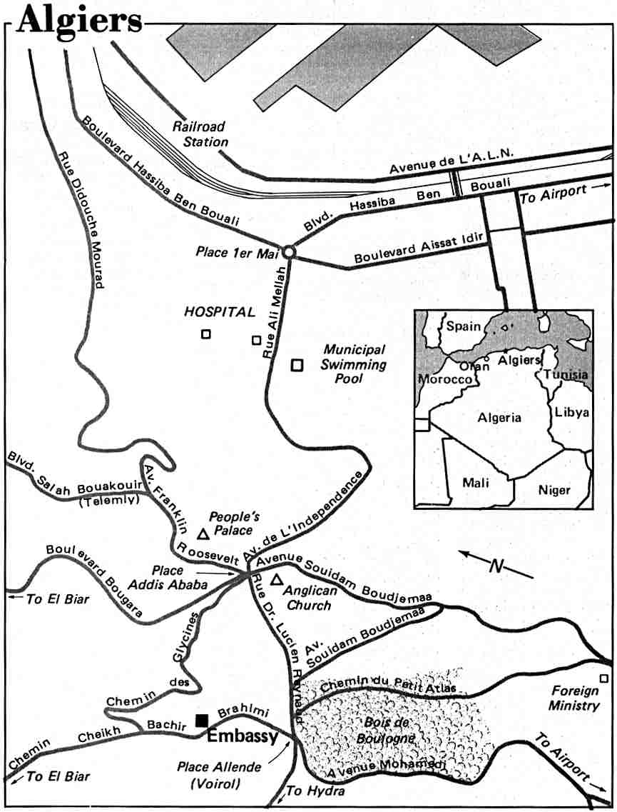
- Algiers U.S. Dept. of State 1984 (66K)
- Algiers original scale 1:25,000 U.S. Army Map Service 1965 (422K)
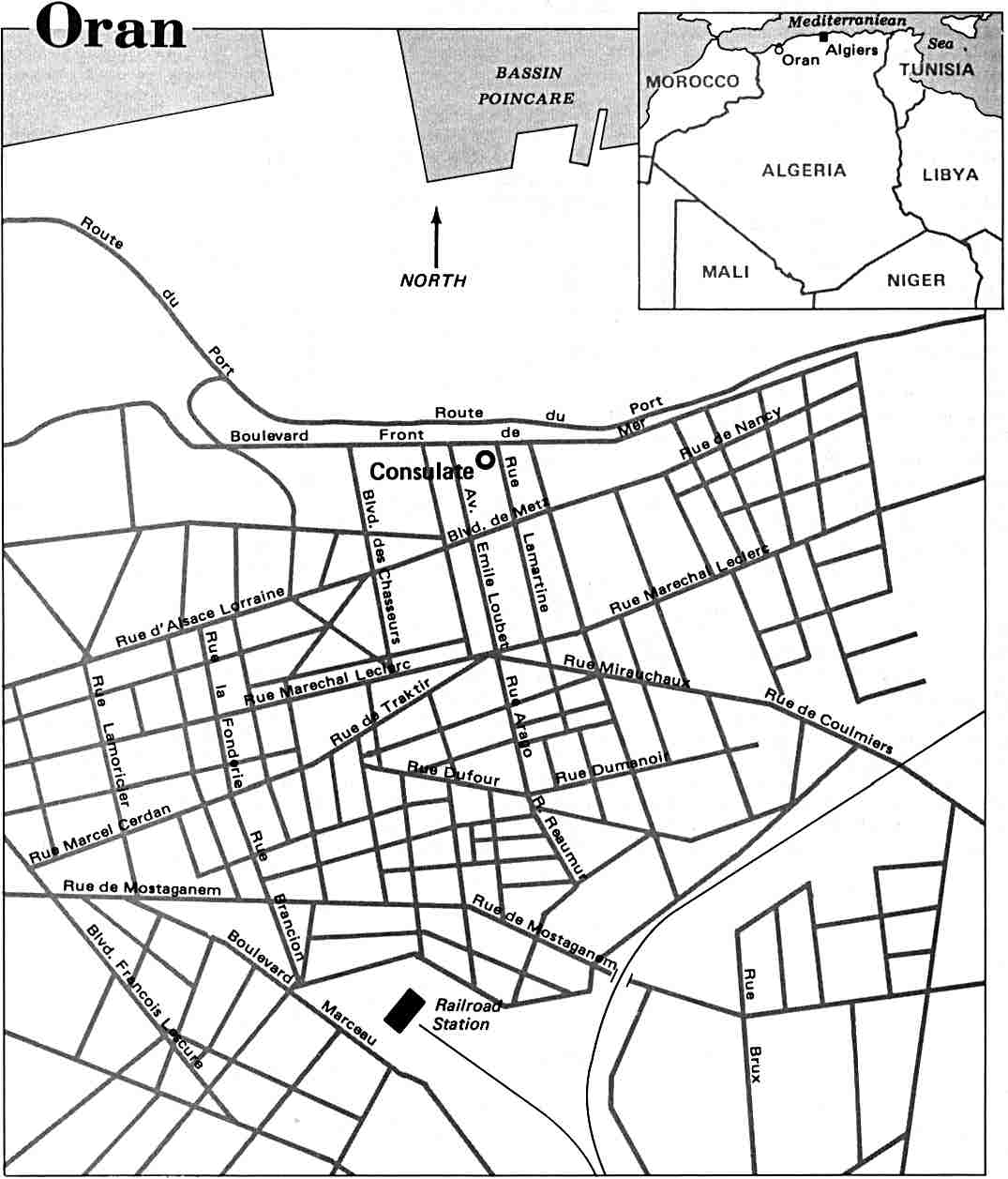
- Oran U.S. Dept. of State 1984 (86K)
- Algeria City Plans U.S. Army Map Service, 1942-1943
- 1:2,000,000 - Africa Topographic Maps
- This series covers all of Algeria
- 1:1,000,000 - Operational Navigation Chart Series U.S. Defense Mapping Agency Aerospace Center. Not for navigational use
- This series covers most of Algeria
- 1:1,000,000 - International Map of the World U.S. Army Map Service.
- This older series has partial coverage of Algeria
- 1:500,000 - French North Africa Series 4175, Great Britain War Office, 1941
- This series covers parts of Algeria
- 1:500,000 - Tactical Pilotage Charts U.S. National Imagery and Mapping Agency. Not for navigational use
- This series covers most of Algeria
- 1:500,000 - World Series 1404, Great Britain. War Office and Air Ministry. 1958-
- This series covers parts of Algeria
- 1:250,000 - North Africa Joint Operations Graphic Aeronautical charts. U.S. National Imagery and Mapping Agency. Not for navigational use
- Covers most of Northern Algeria and some other areas
- 1:250,000 - North Africa Topographic Maps, Series P502 U.S. Army Map Service, 1954-
- This series covers most of northern and eastern Algeria
- 1:200,000 - Algeria Topographic Maps, Series P541 (GSGS 4180) U.S. Army Map Service, 1941
- 1:50,000 - Algeria Topographic Maps, Series P741 U.S. Army Map Service, 1941
- This series covers all of Algeria
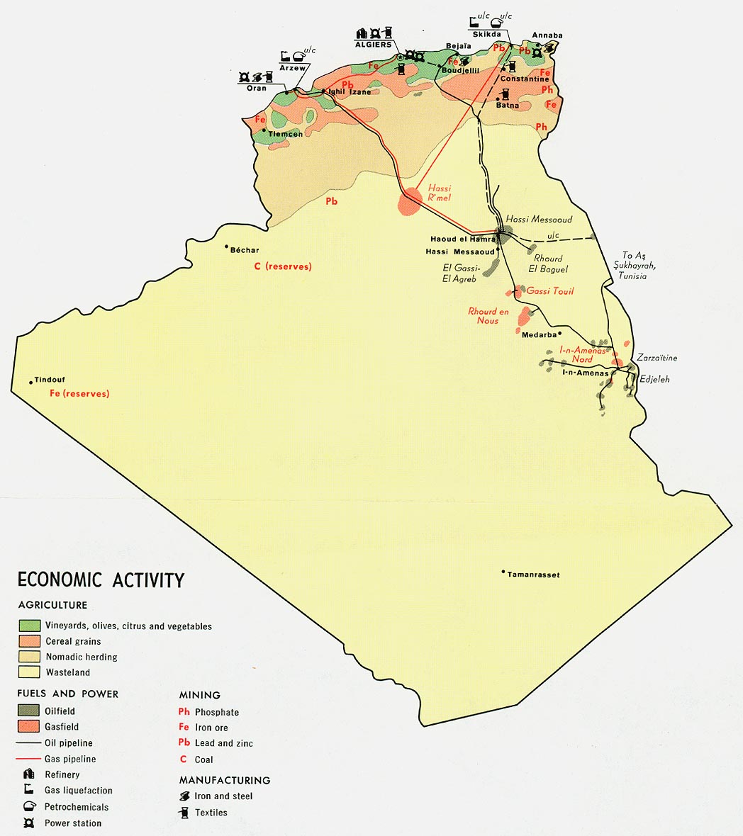
- Algeria - Economic Activity from Map No. 78692 1971 (154K)
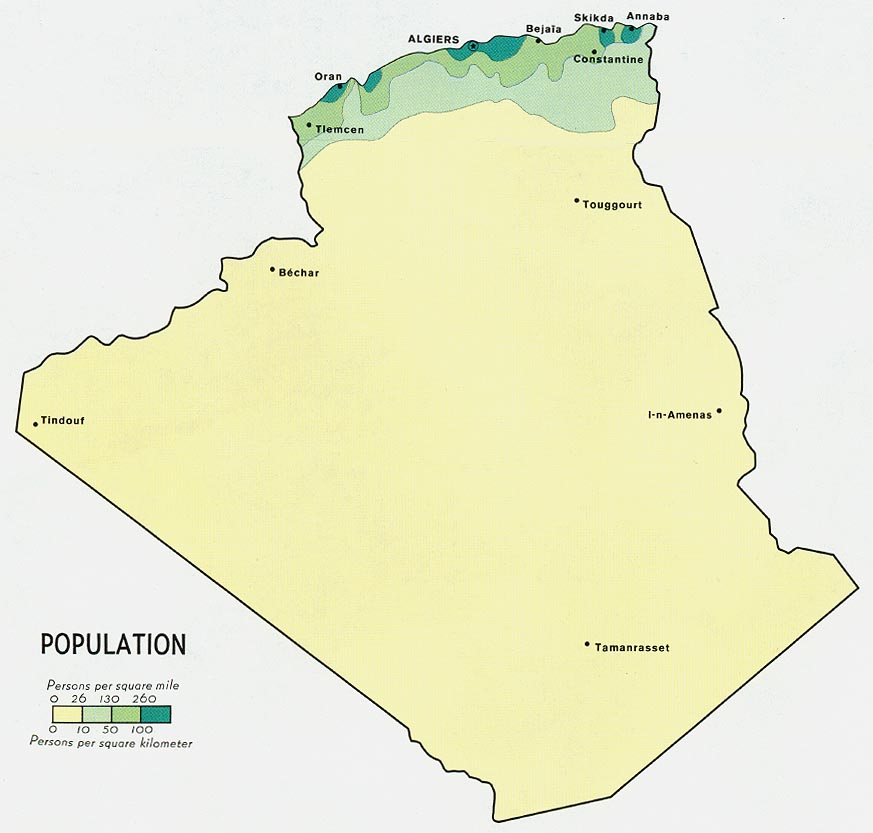
- Algeria - Population from Map No. 78692 1971 (82K)
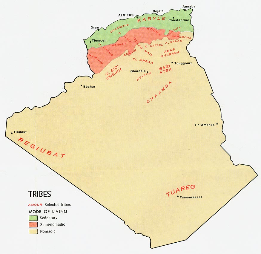
- Algeria - Tribes from Map No. 78692 1971 (113K)
Maps on Other Web Sites