Perry-Castañeda Library
Map Collection
Cuba Maps
The following maps were produced by the U.S. Central Intelligence Agency, unless otherwise indicated.
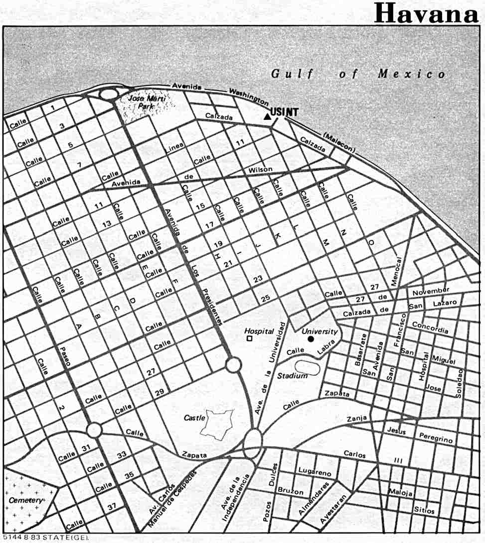
Country Maps- Cuba (Political) 1994 (532K) and pdf format (518K)
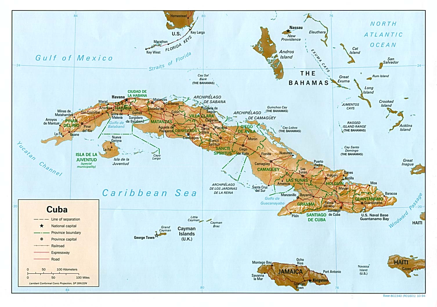
- Cuba (Shaded Relief) 1994 (236K) and pdf format (231K)
- Cuba (Small Map) 2016 (15.6K)
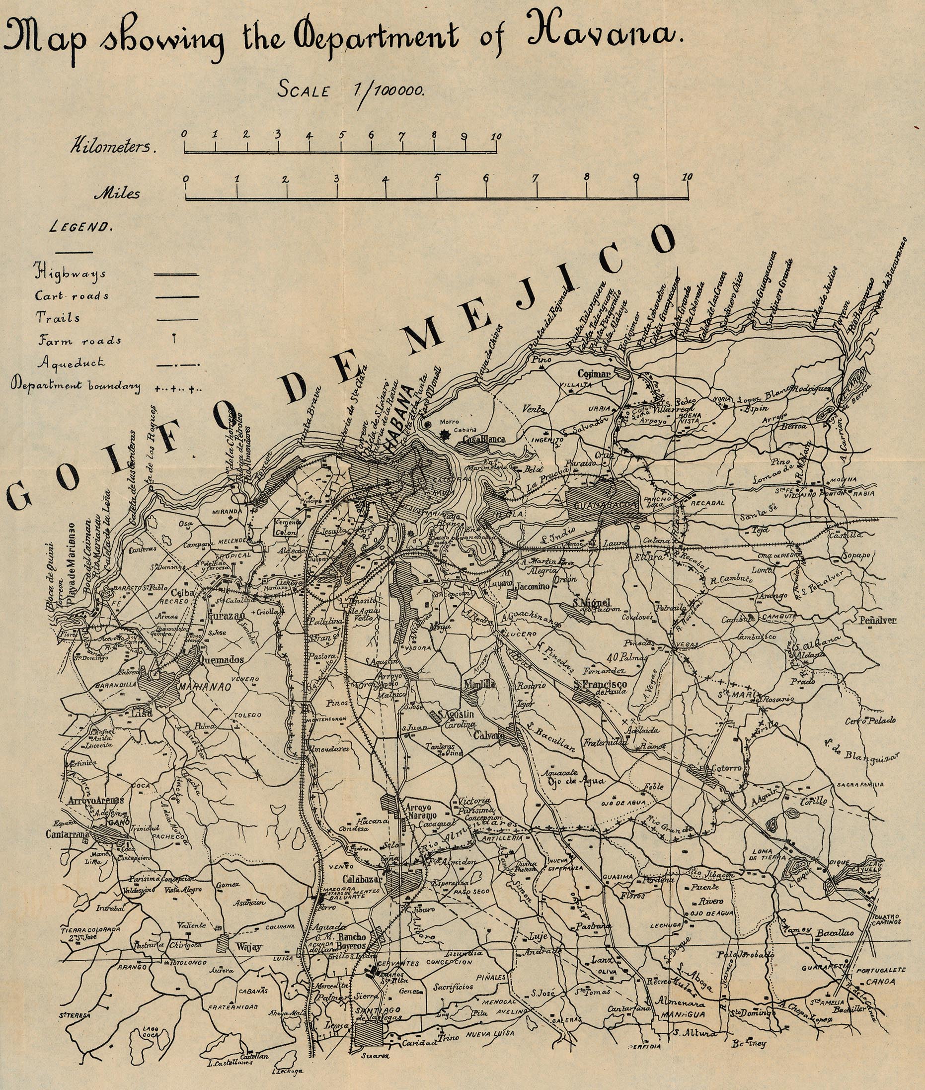
- Havana - Map Showing the Department of Havana 1899 From 56th Congress, 1st Session. House of Representatives. Document No. 2. Annual Reports of the War Department for the Fiscal Year Ended June 30, 1899. Washington: Government Printing Office. 1899. (940K)
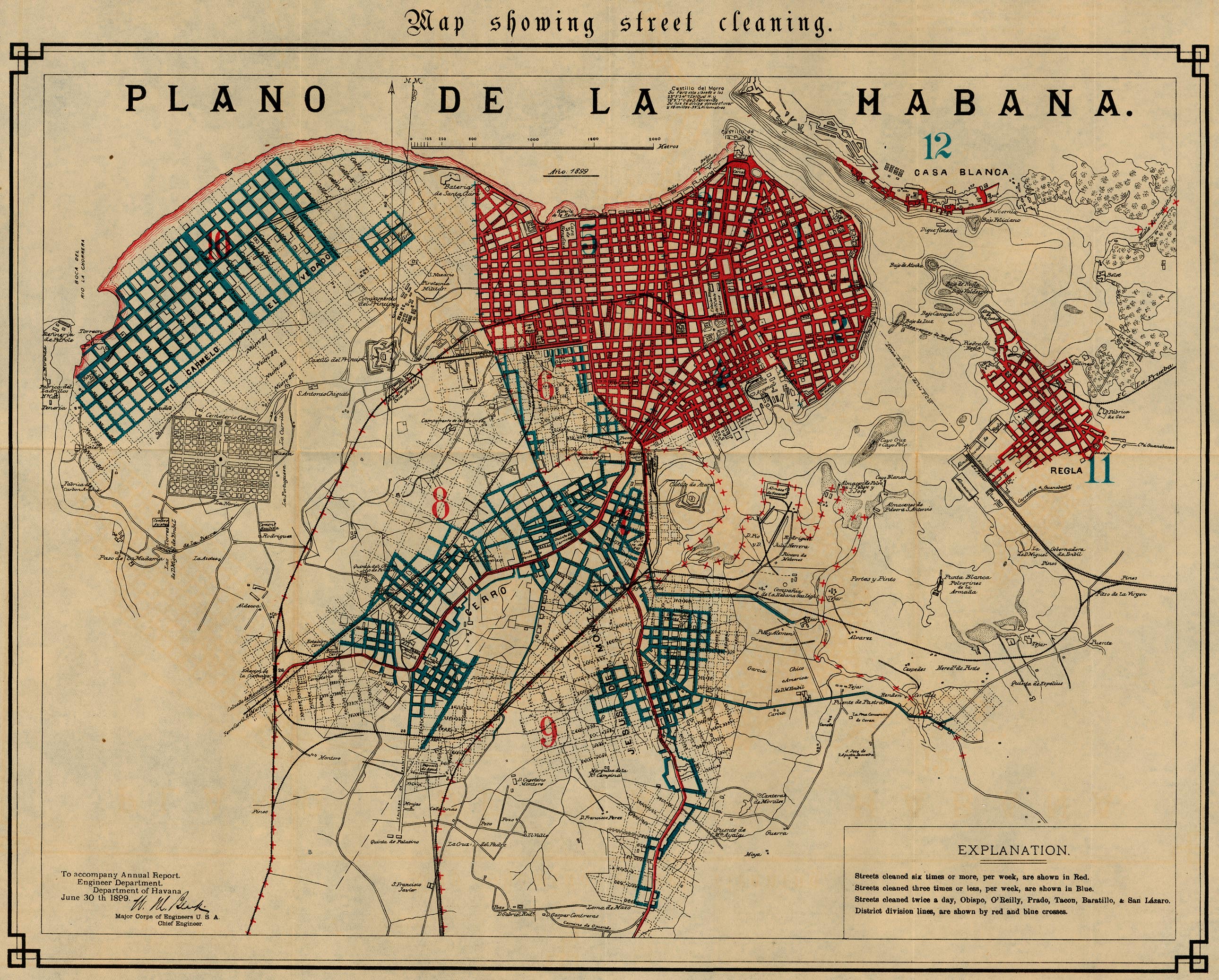
- Havana - Map Showing Street Cleaning 1899 From 56th Congress, 1st Session. House of Representatives. Document No. 2. Annual Reports of the War Department for the Fiscal Year Ended June 30, 1899. Washington: Government Printing Office. 1899. (1.3MB)
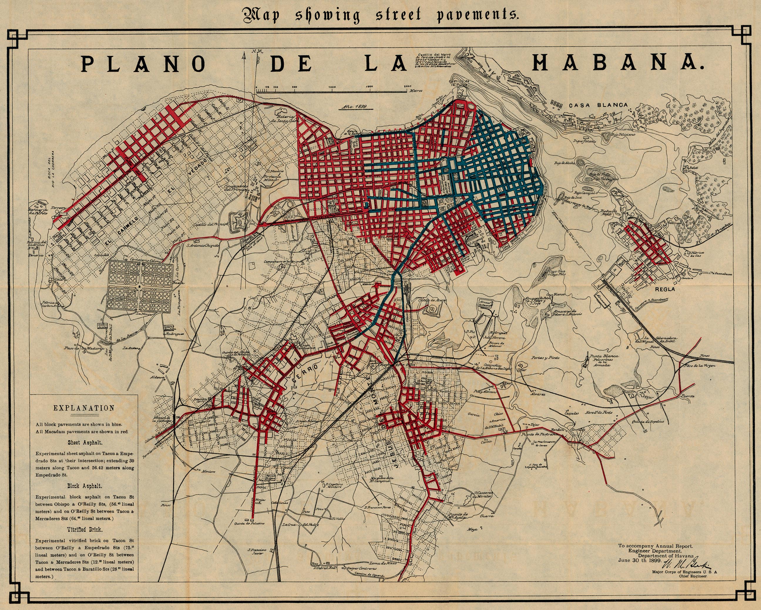
- Havana - Map Showing Street Pavements 1899 From 56th Congress, 1st Session. House of Representatives. Document No. 2. Annual Reports of the War Department for the Fiscal Year Ended June 30, 1899. Washington: Government Printing Office. 1899. (1.3MB)
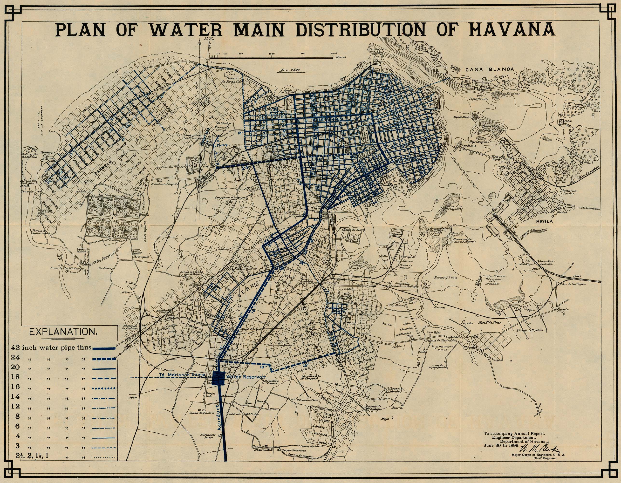
- Havana - Plan of Water Main Distribution 1899 From 56th Congress, 1st Session. House of Representatives. Document No. 2. Annual Reports of the War Department for the Fiscal Year Ended June 30, 1899. Washington: Government Printing Office. 1899. (1.1MB)
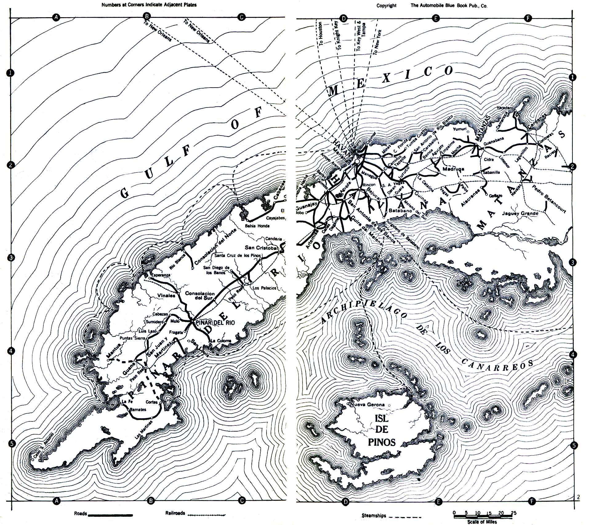
- Cuba - 1919 Automobile Blue Book, Volume Six, 1919 (323K)
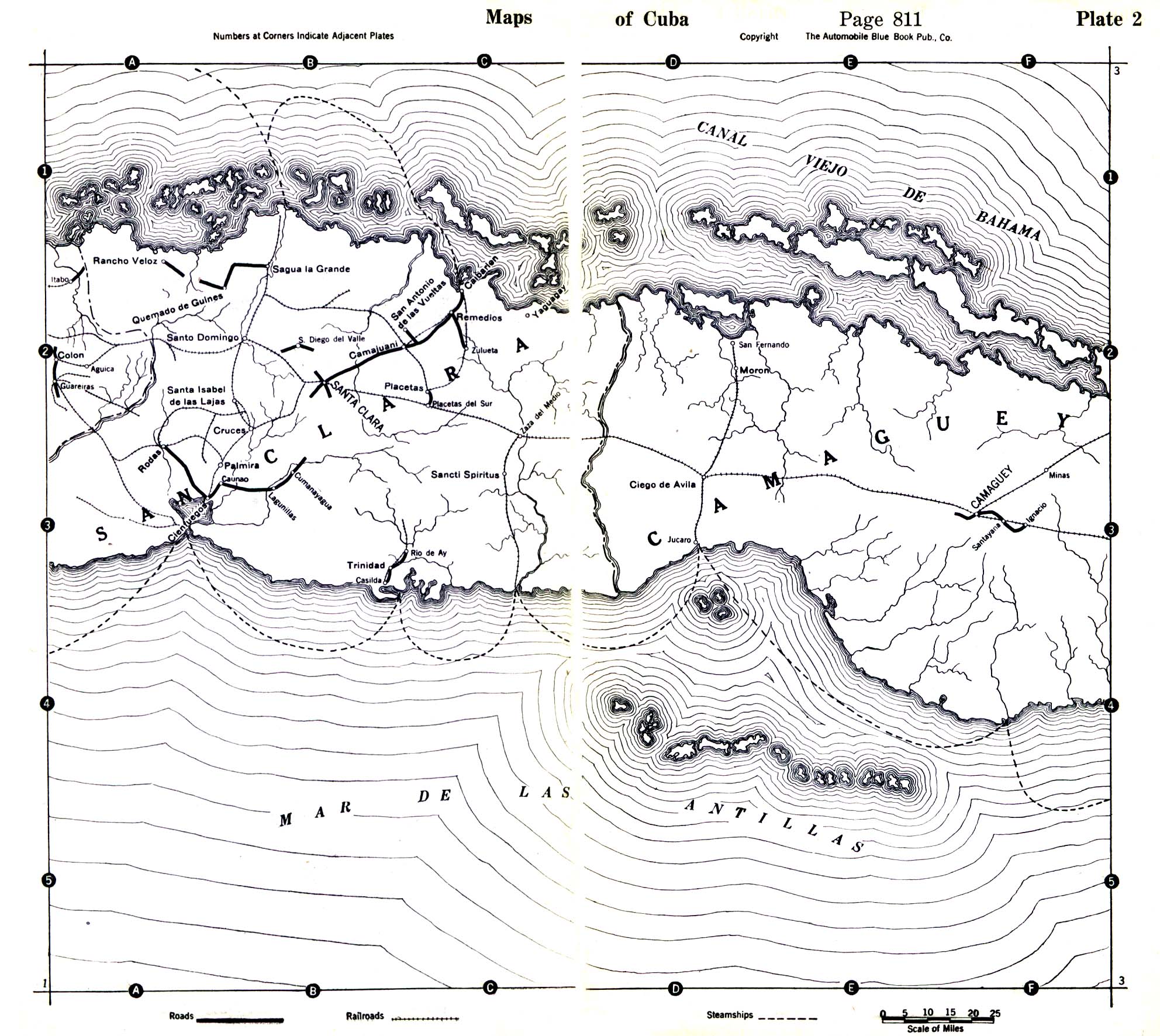
- Cuba - Central Cuba 1919 Automobile Blue Book, Volume Six, 1919 (645K)
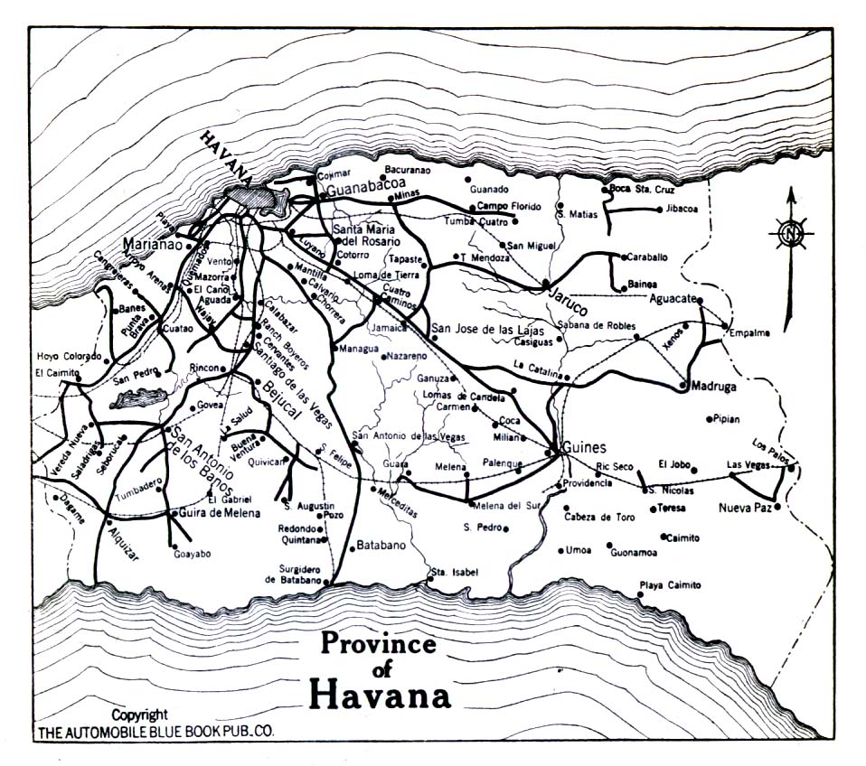
- Cuba - Province of Havana 1919 Automobile Blue Book, Volume Six, 1919. (323K)
- Cuba - Missile Activity in Cuba From President's Intelligence Checklist, 11 October 1962 (1811K)
- Cuba - Locations of Offensive Missile Sites in Cuba From President's Intelligence Checklist, 26 October 1962 (1854K)
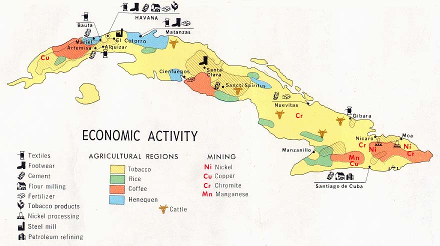
- Cuba - Economic Activity from Map No. 502988 1977 (84K)
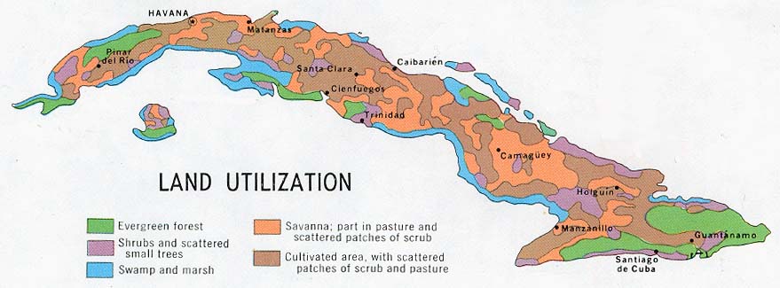
- Cuba - Land Utilization from Map No. 502988 1977 (70K)
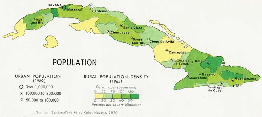
- Cuba - Population from Map No. 502988 1977 (63K)
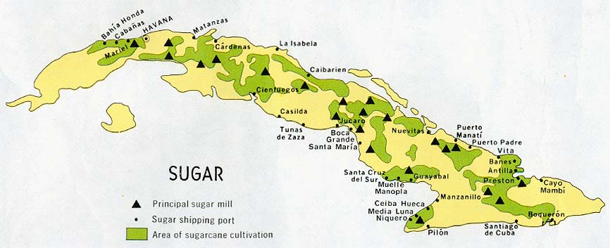
- Cuba - Sugar from Map No. 502988 1977 (72K)
- 1:1,000,000 - Latin America (aeronautical charts) Operational Navigation Chart Series, U.S. Defense Mapping Agency (dates vary) clickable index map for this series Not for navigational use
- Sheet J-26 covers all of Cuba
- 1:500,000 - Tactical Pilotage Charts U.S. National Imagery and Mapping Agency. Not for navigational use
- This series covers Cuba
- 1:250,000 - Latin America (aeronautical charts) Joint Operations Graphic, U.S. National Imagery and Mapping Agency (dates vary) Not for navigational use
- This series covers all of Cuba
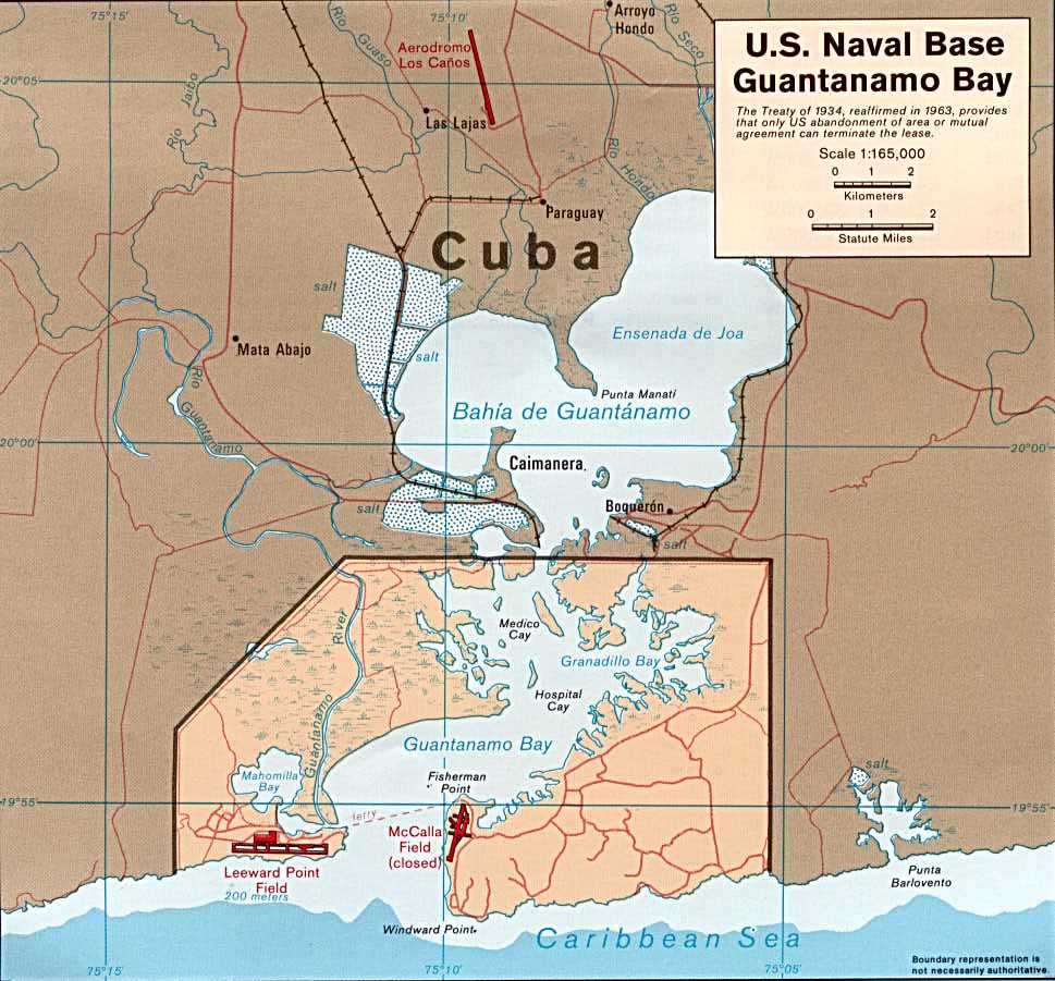
- Guantanamo Bay 1985 (120K)
- Guantanamo (Joint Operations Graphic) 1996 (1.6MB) Portion of Santiago De Cuba, Cuba, Joint Operations Graphic (AIR), Series 1501 AIR, Sheet NF 18-14, Edition 5. Original scale 1:250,000. U.S. National Imagery and Mapping Agency, compiled April 1988, revised July 1995, air information current through 27 July 1996. Not for navigational use
- Camp Delta [Guantanamo] From "Camp Delta Standard Operating Procedures", U.S. Department of Defense, Joint Task Force-Guantanamo, March 28, 2003 (402K)
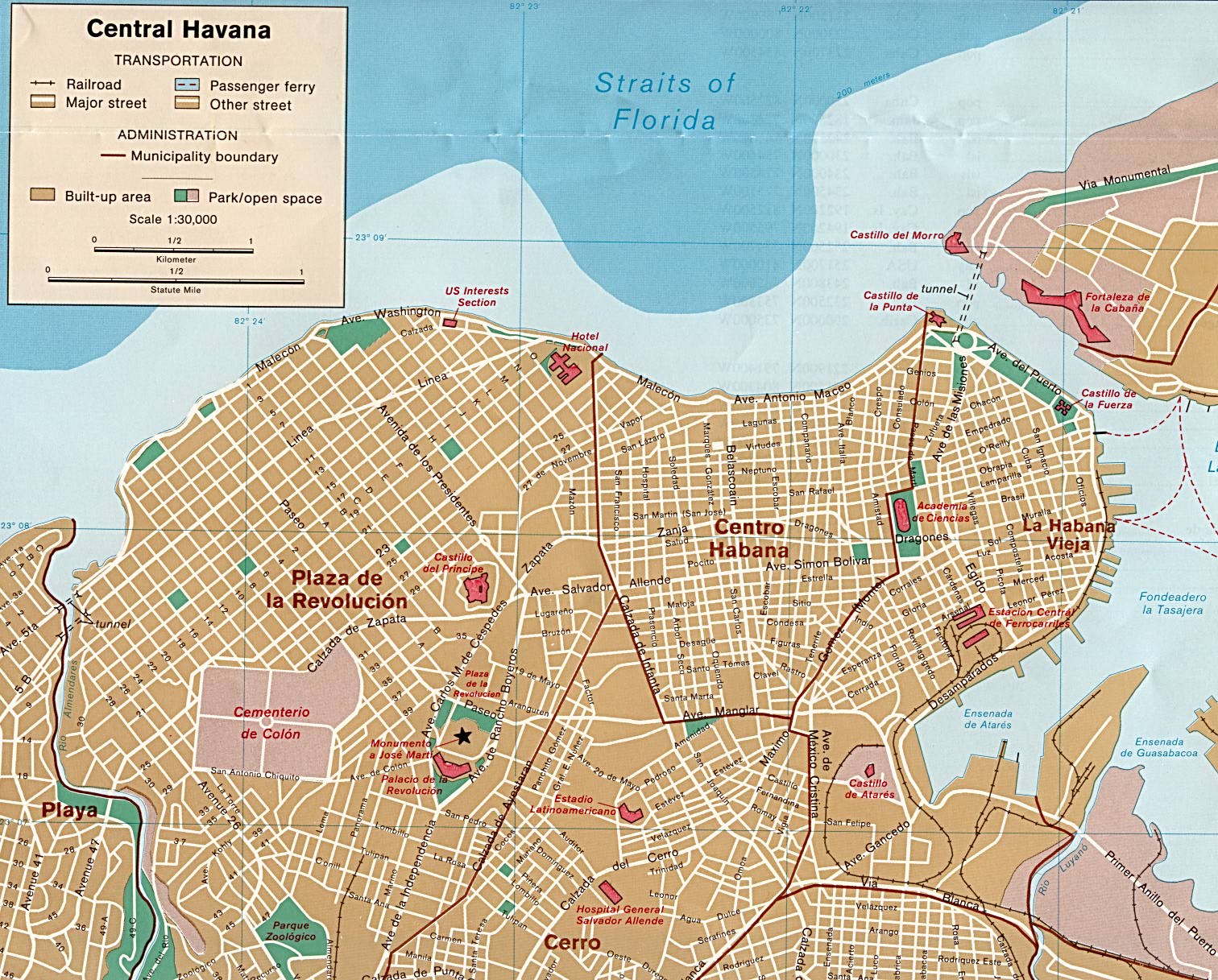
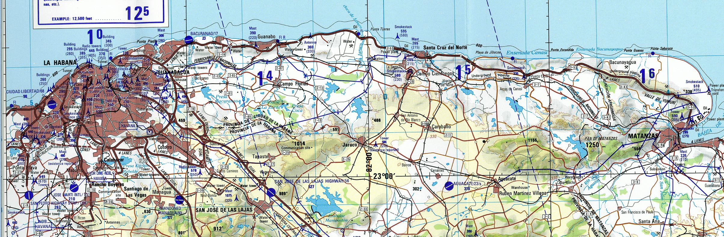
- Havana (Joint Operations Graphic) 1997 (869K) Portion of La Habana (Havana), Cuba, Joint Operations Graphic (AIR), Series 1501 AIR, Sheet NF 17-6, Edition 6. Original scale 1:250,000. U.S. National Imagery and Mapping Agency, compiled 1978, revised July 1995, air information current through 30 July 1997. Not for navigational use
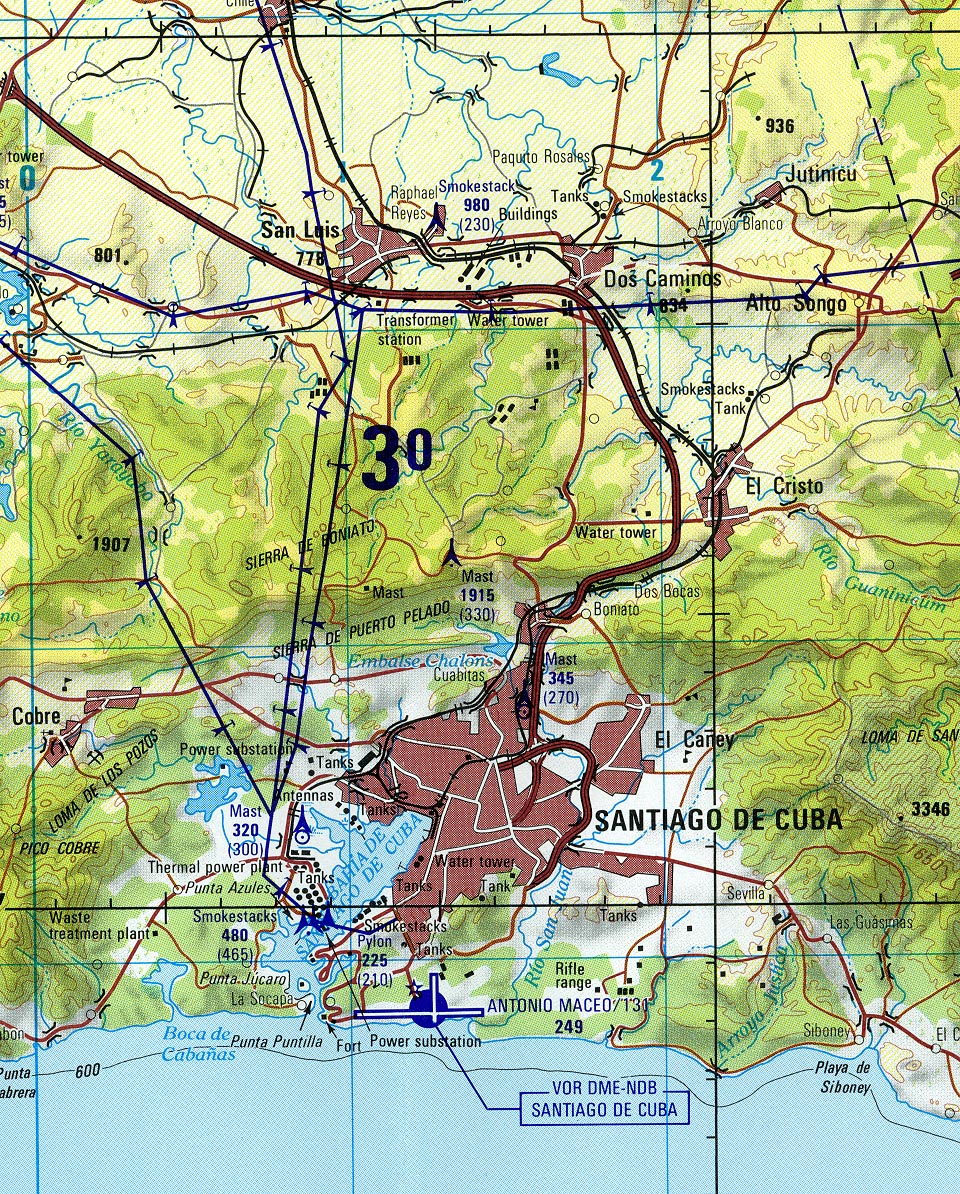
- Santiago De Cuba (Joint Operations Graphic) 1996 (705K) Portion of Santiago De Cuba, Cuba, Joint Operations Graphic (AIR), Series 1501 AIR, Sheet NF 18-14, Edition 5. Original scale 1:250,000. U.S. National Imagery and Mapping Agency, compiled April 1988, revised July 1995, air information current through 27 July 1996. Not for navigational use
- Sheet J-26 covers all of Cuba
![Camp Delta [Guantanamo]](americas/camp_delta_assembly_areas_2003.jpg)
Maps on Other Web Sites