Perry-Castañeda Library
Map Collection
Finland Maps
The following maps were produced by the U.S. Central Intelligence Agency, unless otherwise indicated.
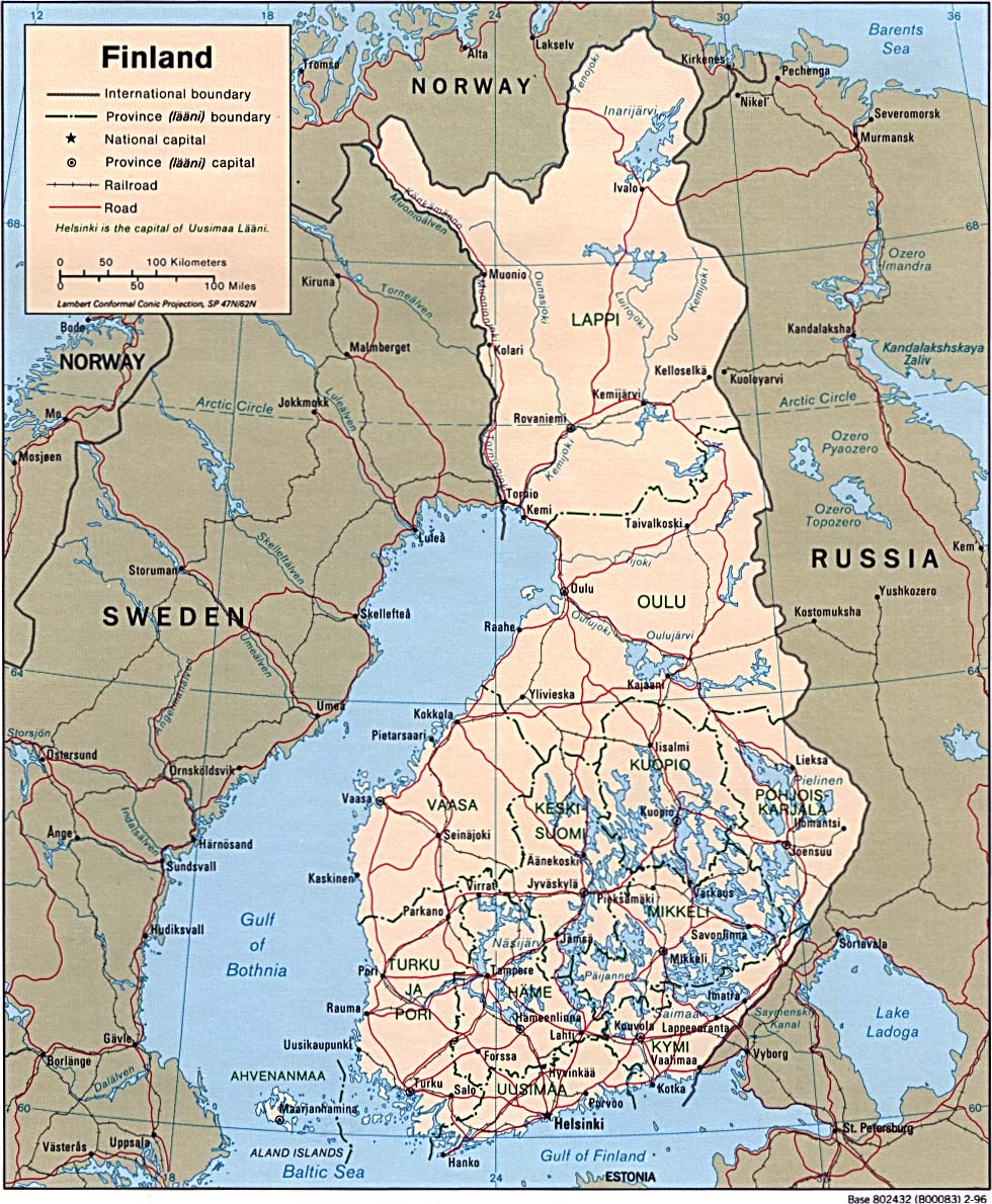
Country Maps- Finland (Political) 1996 (300K) and pdf format (350K)
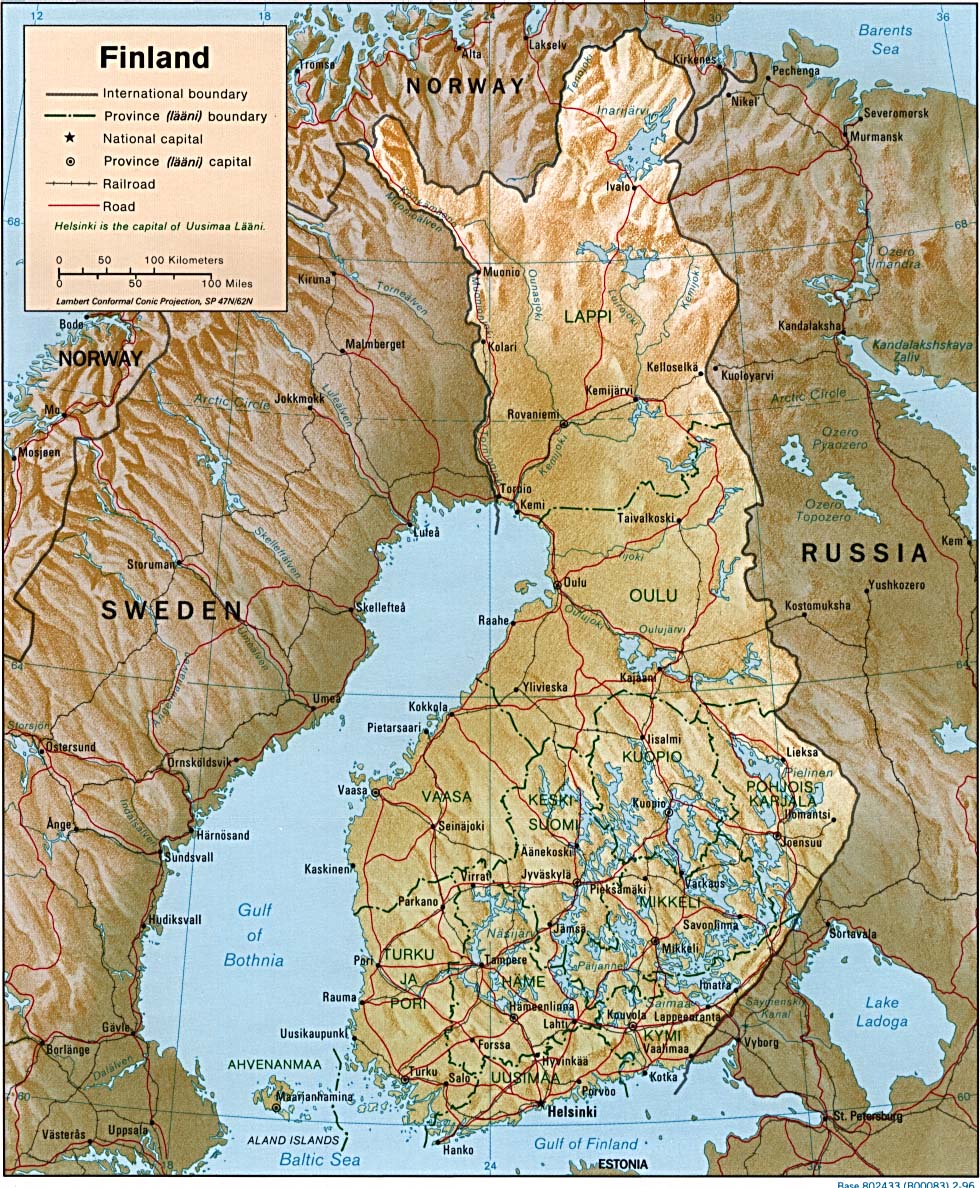
- Finland (Shaded Relief) 1996 (371K) and pdf format (426K)
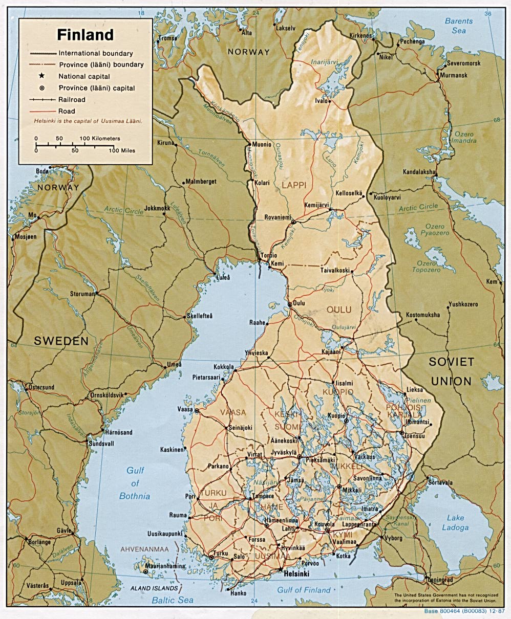
- Finland (Shaded Relief) 1987 (285K) and pdf format (287K)
- Finland (Small Map) 2016 (25.2K)
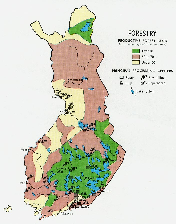
- Finland - Forestry from Map No. 58419 1969 (140K)
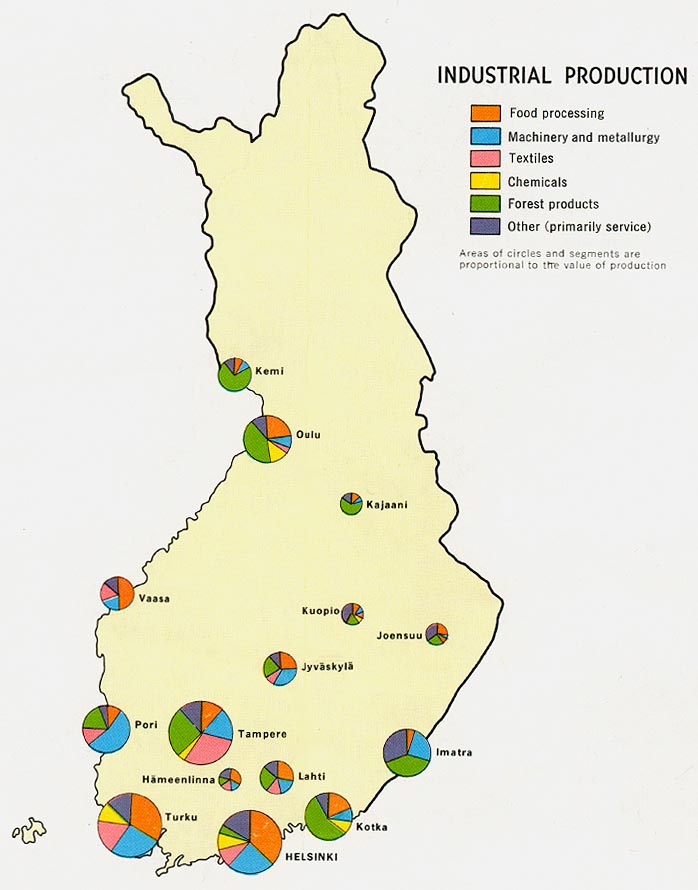
- Finland - Industry from Map No. 58419 1969 (89K)
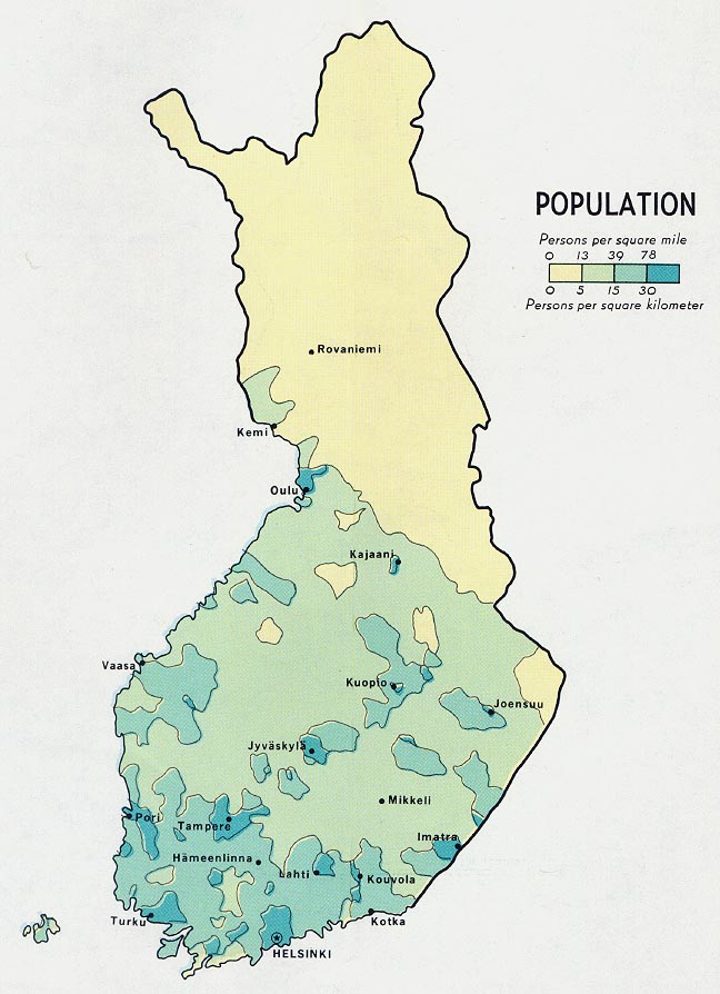
- Finland - Population from Map No. 58419 1969 (113K)
- 1:1,000,000 - Operational Navigation Chart Series [aeronautical charts] U.S. Defense Mapping Agency Aerospace Center Not for navigational use
- This series covers all of Finland on sheets C-2, D-2 and D-3
- 1:1,000,000 - International Map of the World
- This series covers the far north of Finland. Clickable map
- 1:500,000 - Tactical Pilotage Charts U.S. National Imagery and Mapping Agency. Not for navigational use
- This series covers all of Finland
- 1:500,000 - World Series 1404, Great Britain. War Office and Air Ministry. 1958-
- This series covers all of Finland
- 1:250,000 - Northern Europe Series M515, U.S. Army Map Service. 1951-
- This series covers most of Finland
- 1:250,000 - Eastern Europe Series N501, U.S. Army Map Service, 1954-
- This series covers parts of Finland
- 1:200,000 - Finland Series M513 (4093), Great Britain War Office, 1941-
- This series covers some of Finland
- This series covers all of Finland on sheets C-2, D-2 and D-3
Maps on Other Web Sites