Perry-Castañeda Library
Map Collection
Tajikistan Maps
The following maps were produced by the U.S. Central Intelligence Agency, unless otherwise indicated.
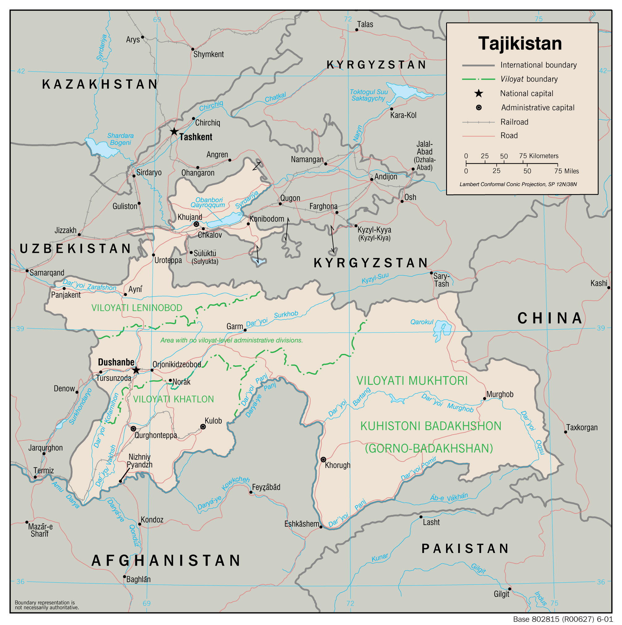
Tajikistan Maps- Tajikistan (Political) 2001 (215K) and pdf format (230K)
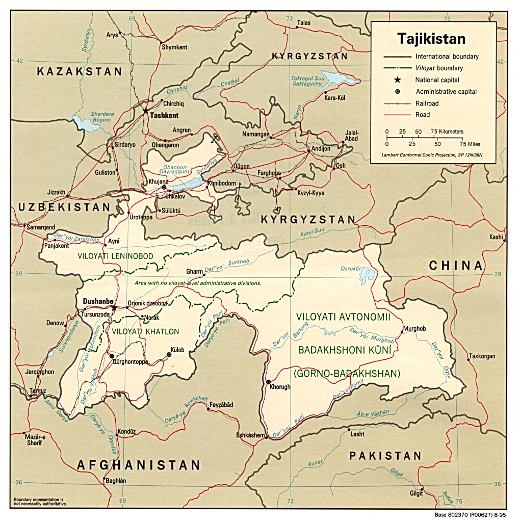
- Tajikistan (Political) 1995 (215K) and pdf format (218K)
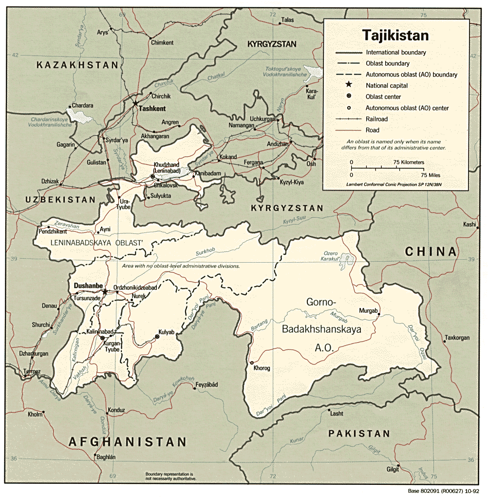
- Tajikistan (Political) 1992 (225K) and pdf format (269K)
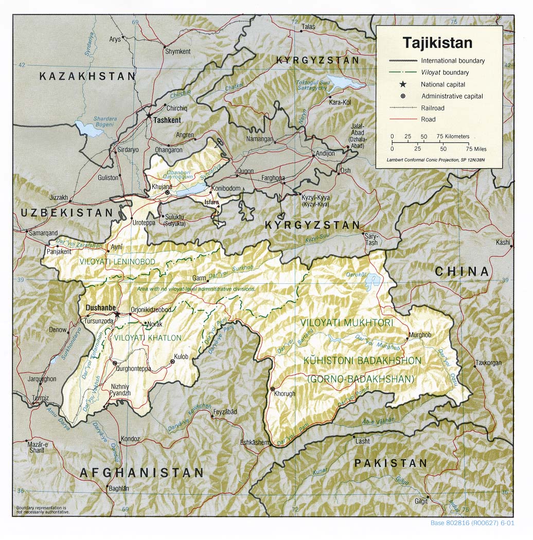
- Tajikistan (Shaded Relief) 2001 (277K) and pdf format (299K)
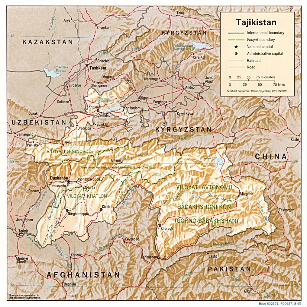
- Tajikistan (Shaded Relief) 1995 (287K) and pdf format (290K)
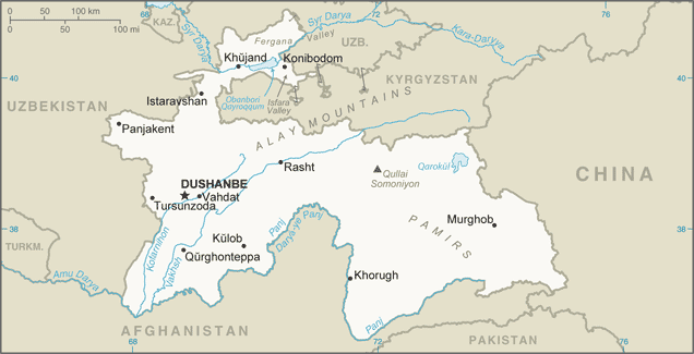
- Tajikistan (Small Map) 2016 (28.5K)
- Tajikistan (Transportation) 2007 (966K) and pdf format (769K)
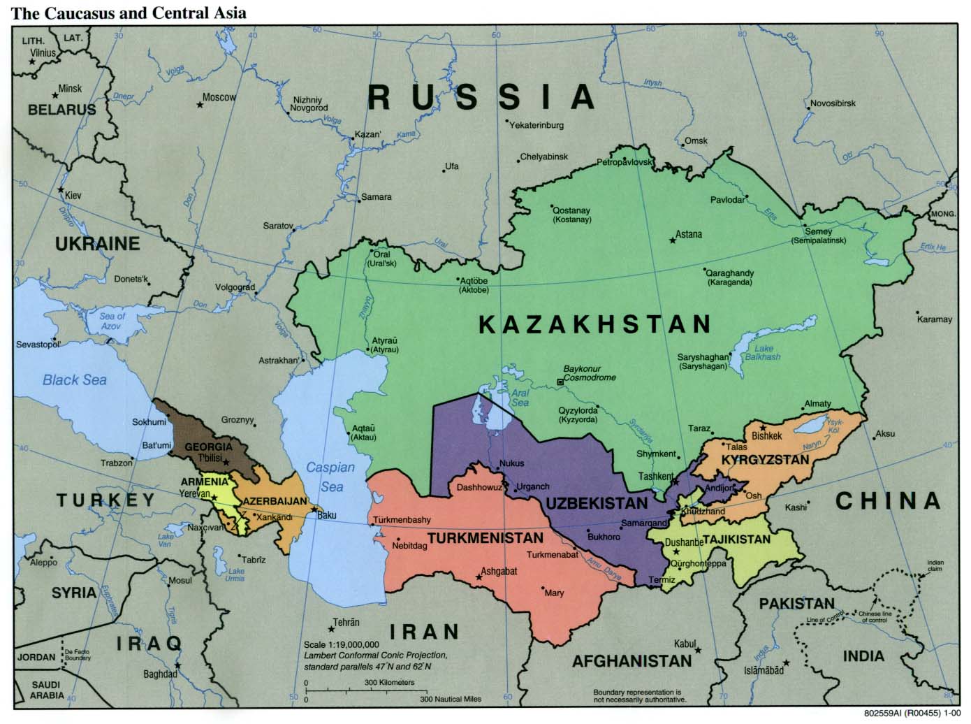
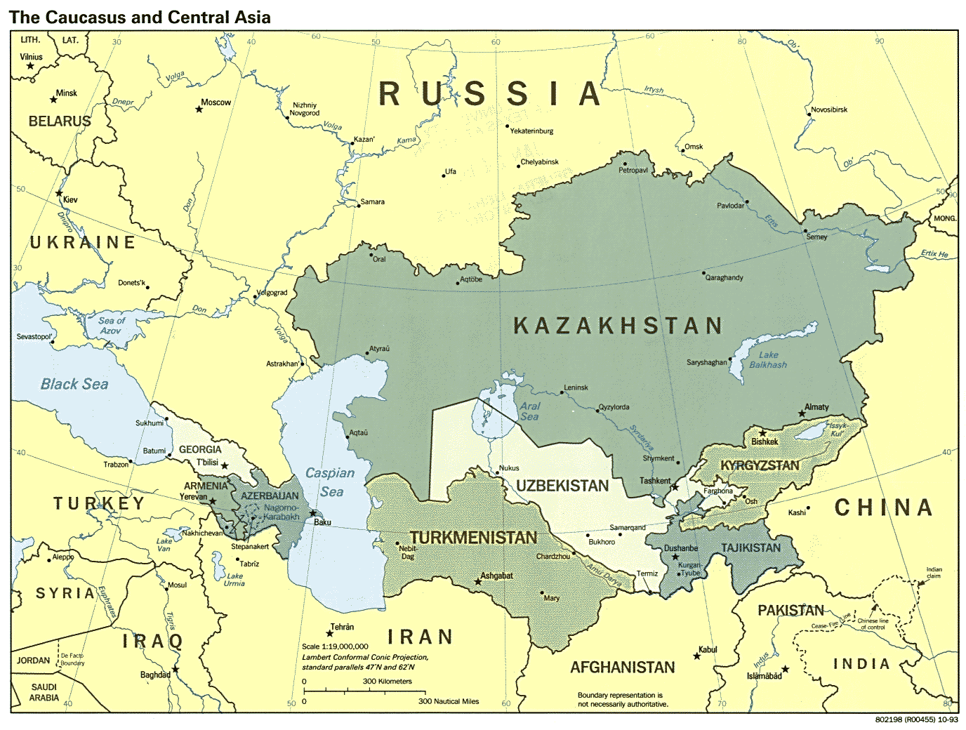
- Caucasus and Central Asia (Political) 2000 (171K)
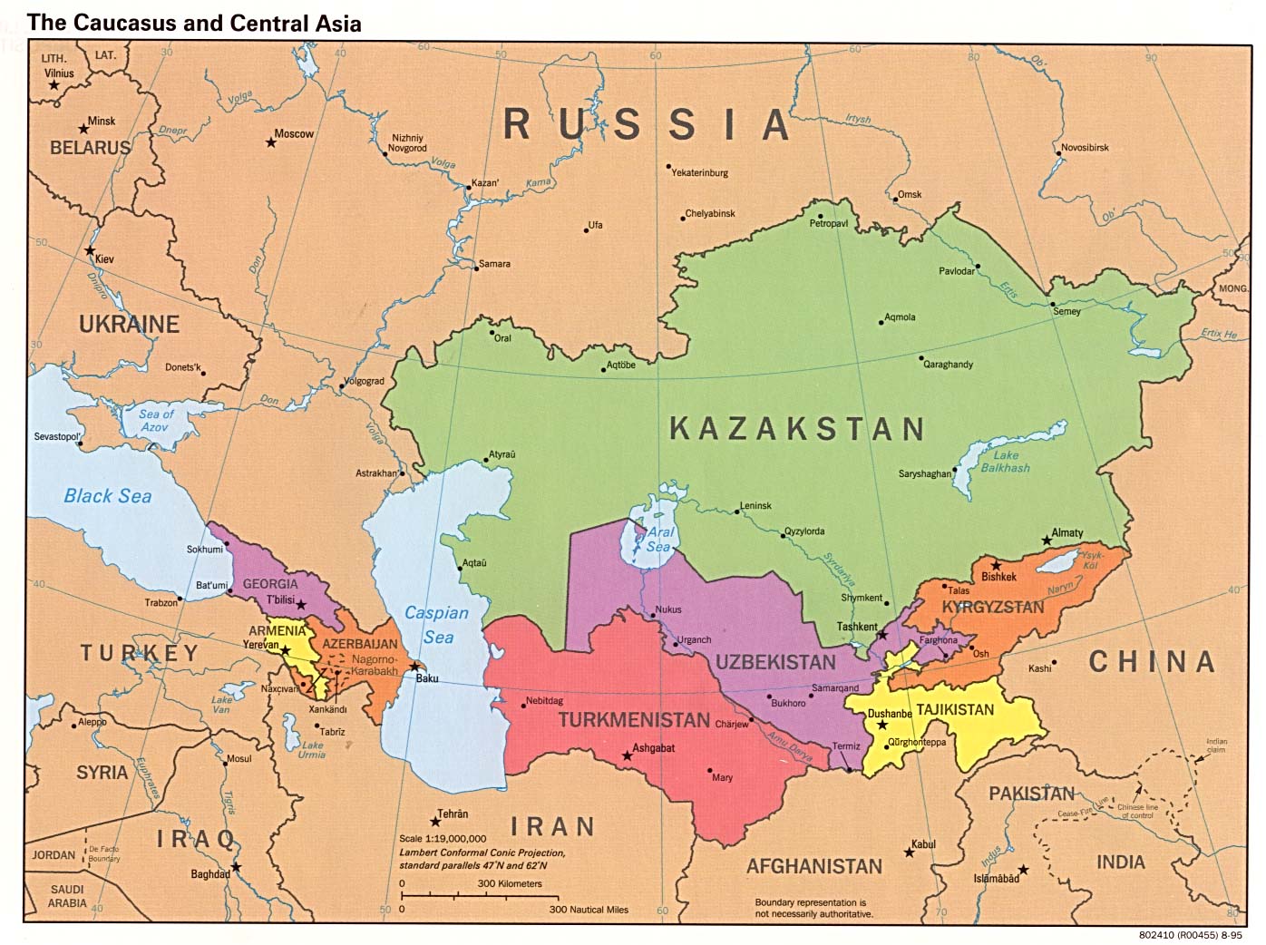
- Caucasus and Central Asia (Political) 1995 (231K)
- Caucasus and Central Asia (Political) 1993 (223K)
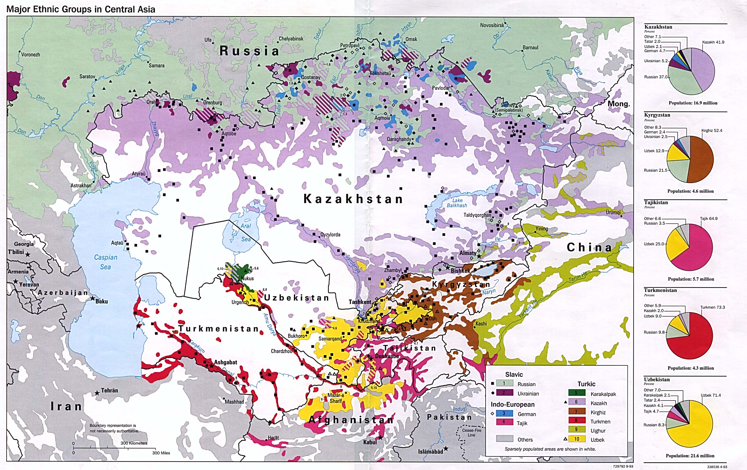
- Major Ethnic Groups in Central Asia 1993 (694K)
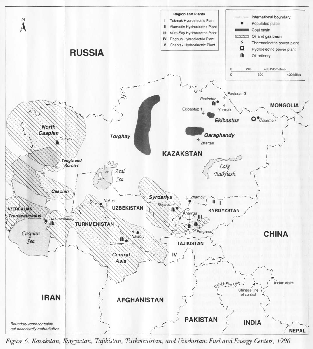
- Kazakstan, Kyrgyzstan, Tajikistan, Turkmenistan, and Uzbekistan: Fuel and Energy Centers 1996 from Kazakstan, Kyrgyzstan, Tajikistan, Turkmenistan, and Uzbekistan: Country Studies. 1997 (142K)
- Kazakstan, Kyrgyzstan, Tajikistan, Turkmenistan, and Uzbekistan: Industrial Activity 1996 from Kazakstan, Kyrgyzstan, Tajikistan, Turkmenistan, and Uzbekistan: Country Studies. 1997 (151K)
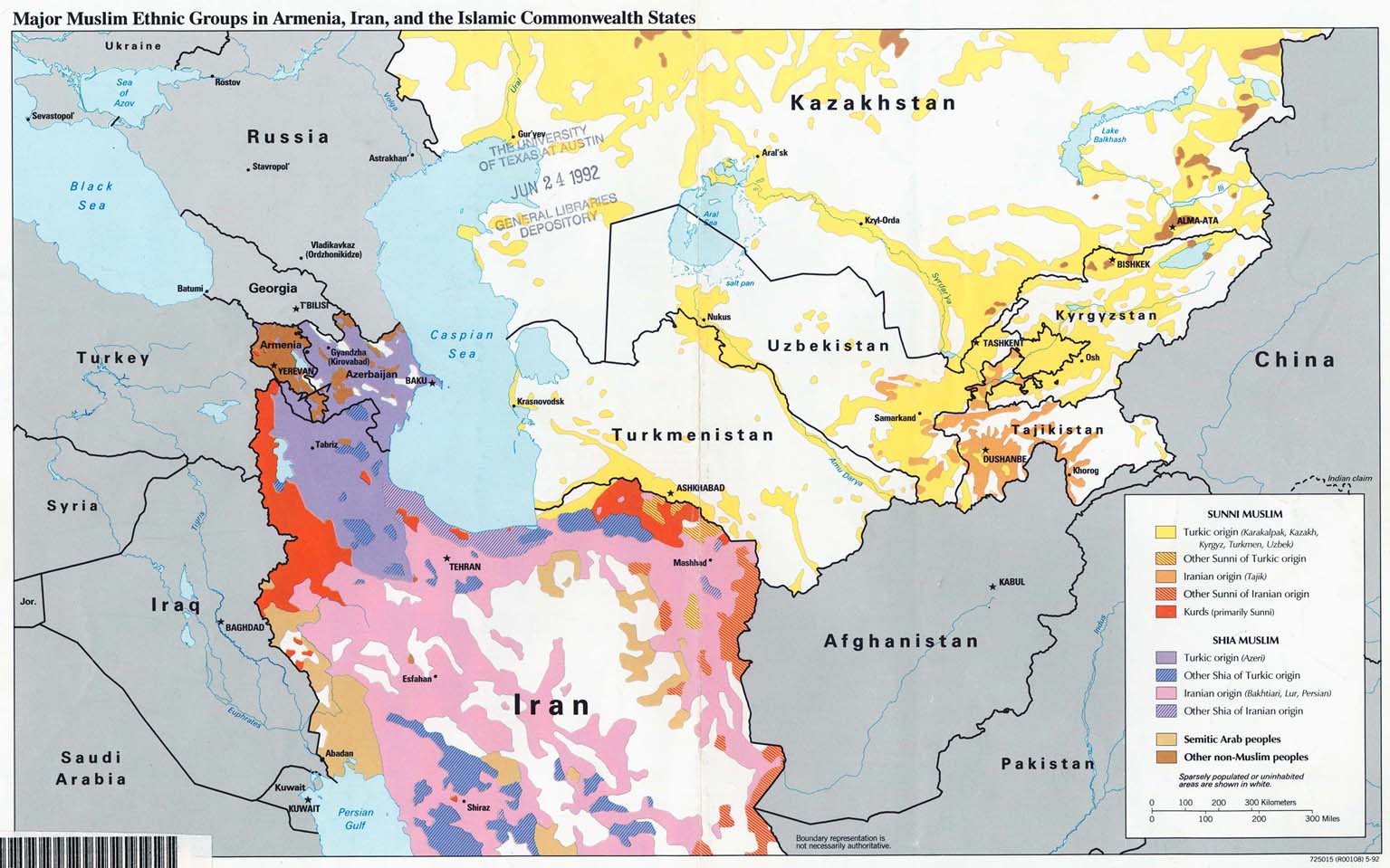
- Major Muslim Ethnic Groups in Armenia, Iran, and the Islamic Commonwealth States 1992 (203K)
- Tajikistan: Major Defense Industries from Defense Industries of the Newly Independent States of Eurasia. 1993 (164K)
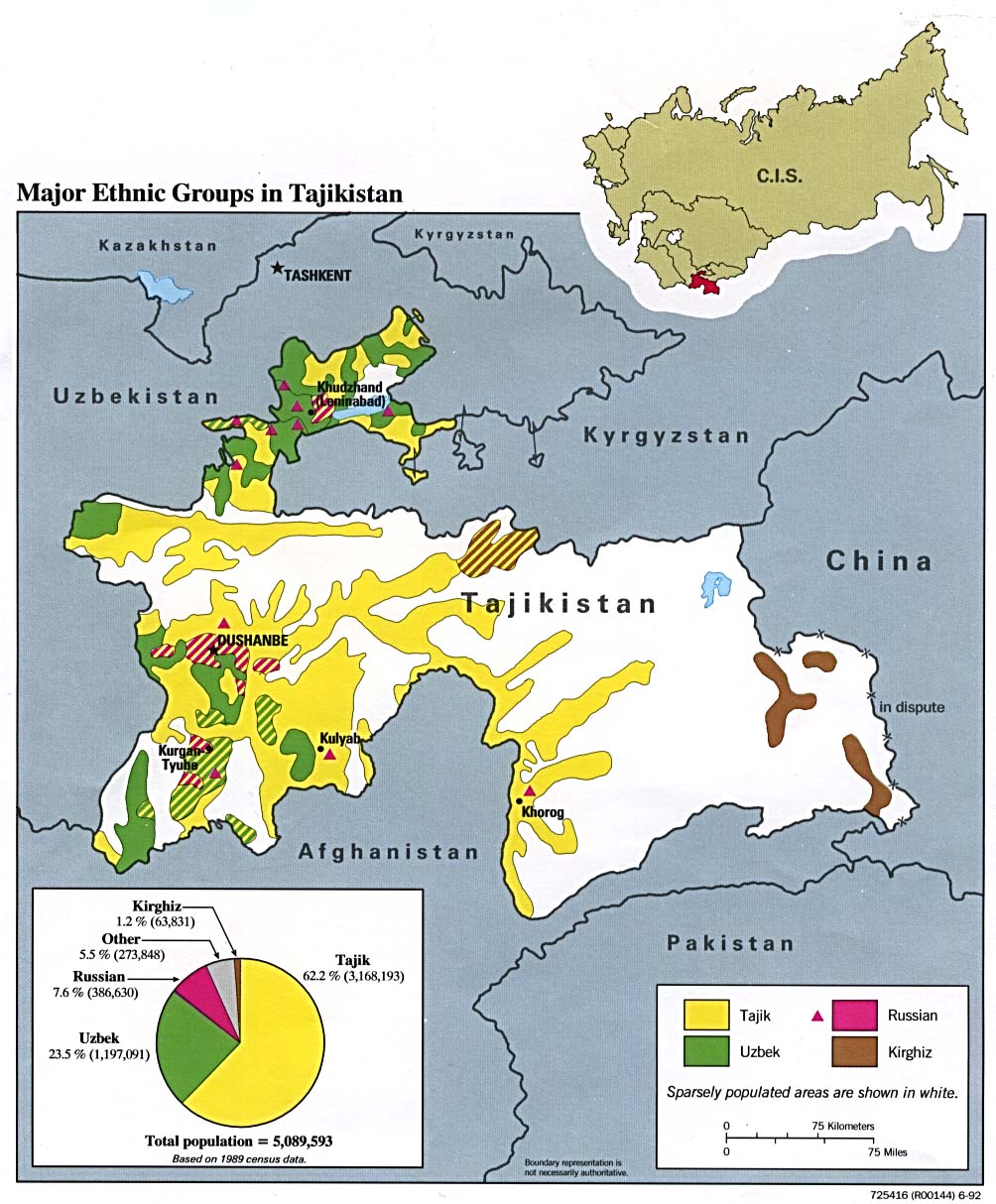
- Tajikistan: Major Ethnic Groups 1992 (211K)
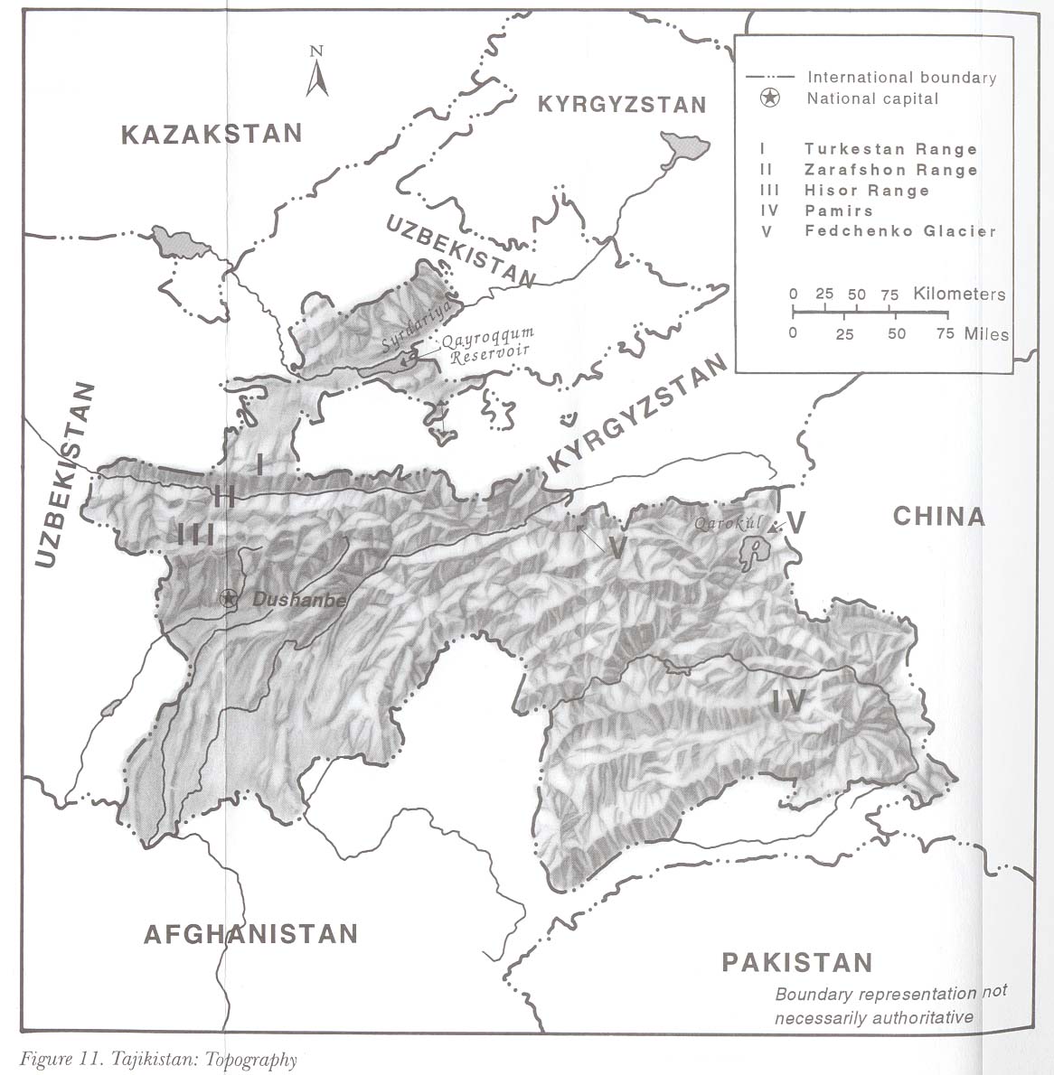
- Tajikistan: Topography from Kazakstan, Kyrgyzstan, Tajikistan, Turkmenistan, and Uzbekistan: Country Studies. 1997 (159K)
- 1:1,000,000 - Operational Navigation Chart Series U.S. Defense Mapping Agency Aerospace Center. This series covers all of Tajikistan. Not for navigational use
- 1:1,000,000 - International Map of the World This series dates from the Soviet period and covers all of Tajikistan. Clickable Index Map
- 1:500,000 - Tactical Pilotage Charts U.S. National Imagery and Mapping Agency. Not for navigational use
- This series covers Tajikistan
- 1:250,000 - Joint Operations Graphic Series U.S. National Imagery and Mapping Agency. This series covers parts of Tajikistan. Not for navigational use
- This series covers Tajikistan
- Stalinabad, U.S.S.R. [Current: Dushanbe, Tajikistan] 1956 Scale 1:250,000 U.S. Army Map Service (First Printing) (850K)
![Stalinabad, U.S.S.R. [Current: Dushanbe, Tajikistan] 1956](historical/stalinabad_56.jpg)
Maps on Other Web Sites