Perry-Castañeda Library
Map Collection
Kenya Maps
The following maps were produced by the U.S. Central Intelligence Agency, unless otherwise indicated.
Country Maps- Kenya (Political) 1988 (188K) and pdf format (194K)
- Kenya (Shaded Relief) 1988 (261K) and pdf format (268K)
- Kenya (Small Map) 2016 (21.6K)
- 1:2,000,000 - Africa Topographic Maps U.S. Army Map Service
- Sheets 20, 24 and 28 cover all of Kenya
- 1:1,000,000 - Operational Navigation Chart Series U.S. Defense Mapping Agency Aerospace Center. Sheets L-5 (North) and M-5 (South) cover all of Kenya. Not for navigational use
- 1:1,000,000 - International Map of the World U.S. Army Map Service
- This series covers most of Kenya. Clickable map
- 1:500,000 - Tactical Pilotage Charts U.S. National Imagery and Mapping Agency. Not for navigational use
- This series covers Kenya
- 1:500,000 - East Africa Topographic Maps Series Y401 (GSGS 4335), U.S. Army Map Service, 1958-
- This series covers parts of Kenya
- 1:250,000 - East Africa Series Y503, U.S. Army Map Service, 1958-
- This series covers parts of Kenya
- 1:250,000 - Joint Operations Graphic - East Africa Series 1501, U.S. Defense Intelligence Agency Not for navigational use
- Covers limited areas of Kenya. Clickable map
- Sheets 20, 24 and 28 cover all of Kenya
- Kenya - Economic Activity from Map No. 501721 1974 (137K)
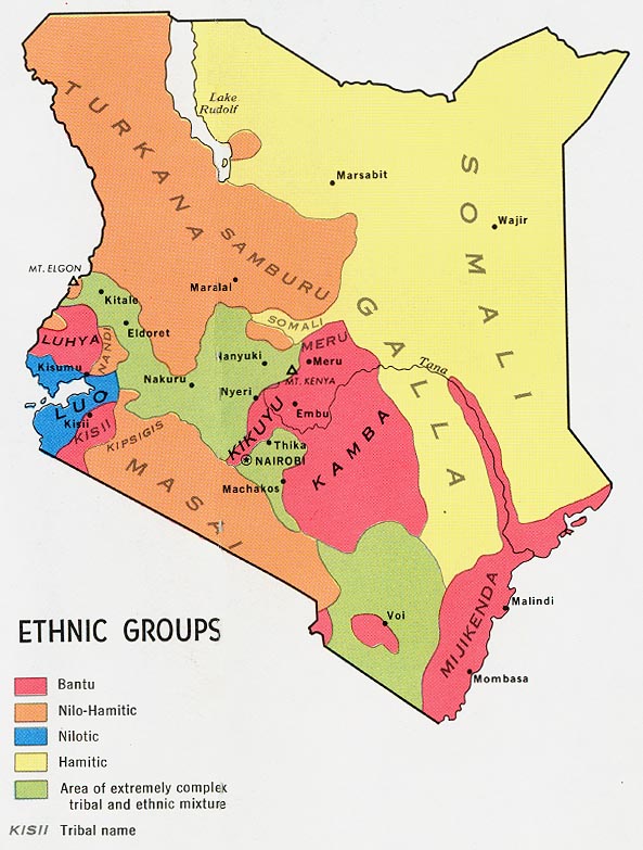
- Kenya - Ethnic Groups from Map No. 501721 1974 (116K)
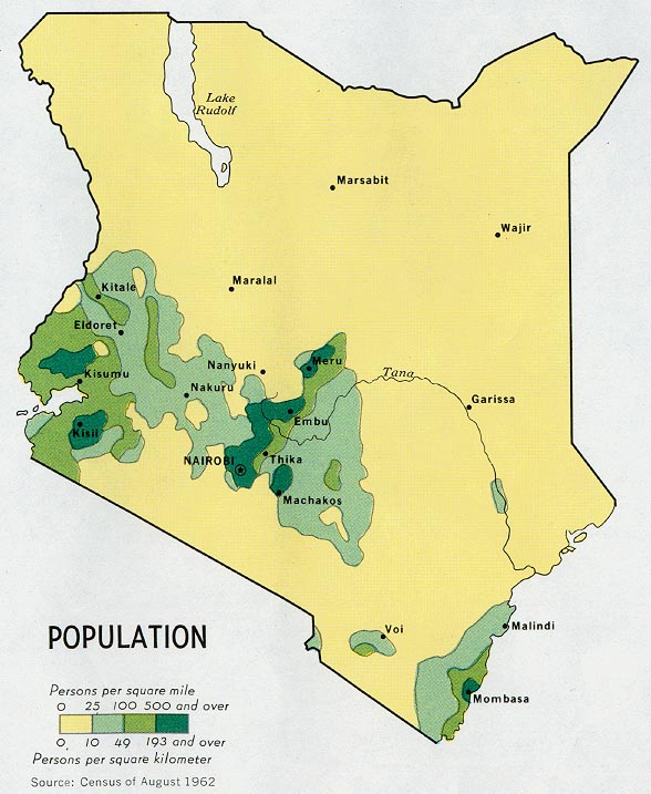
- Kenya - Population from Map No. 501721 1974 (158K)
- Kenya - Vegetation and Agricultural Cash Crops from Map No. 501721 1974 (158K)
Maps on Other Web Sites