Perry-Castañeda Library
Map Collection
Korea Maps
| Korea Country Maps | Korea Detailed Maps | Korea Thematic Maps | Korea Historical Maps | Korea Maps on Other Web Sites |
|---|
The following maps were produced by the U.S. Central Intelligence Agency unless otherwise indicated.
- Korean Peninsula (Political) 1993 (262K) and pdf format (272K)
- Korean Peninsula Government of The Republic of Korea. Ministry of Foreign Affairs and Trade. 2001 (73K)
- Korean Peninsula (Location Map) Government of The Republic of Korea. Ministry of Foreign Affairs and Trade. 2001 (71K)
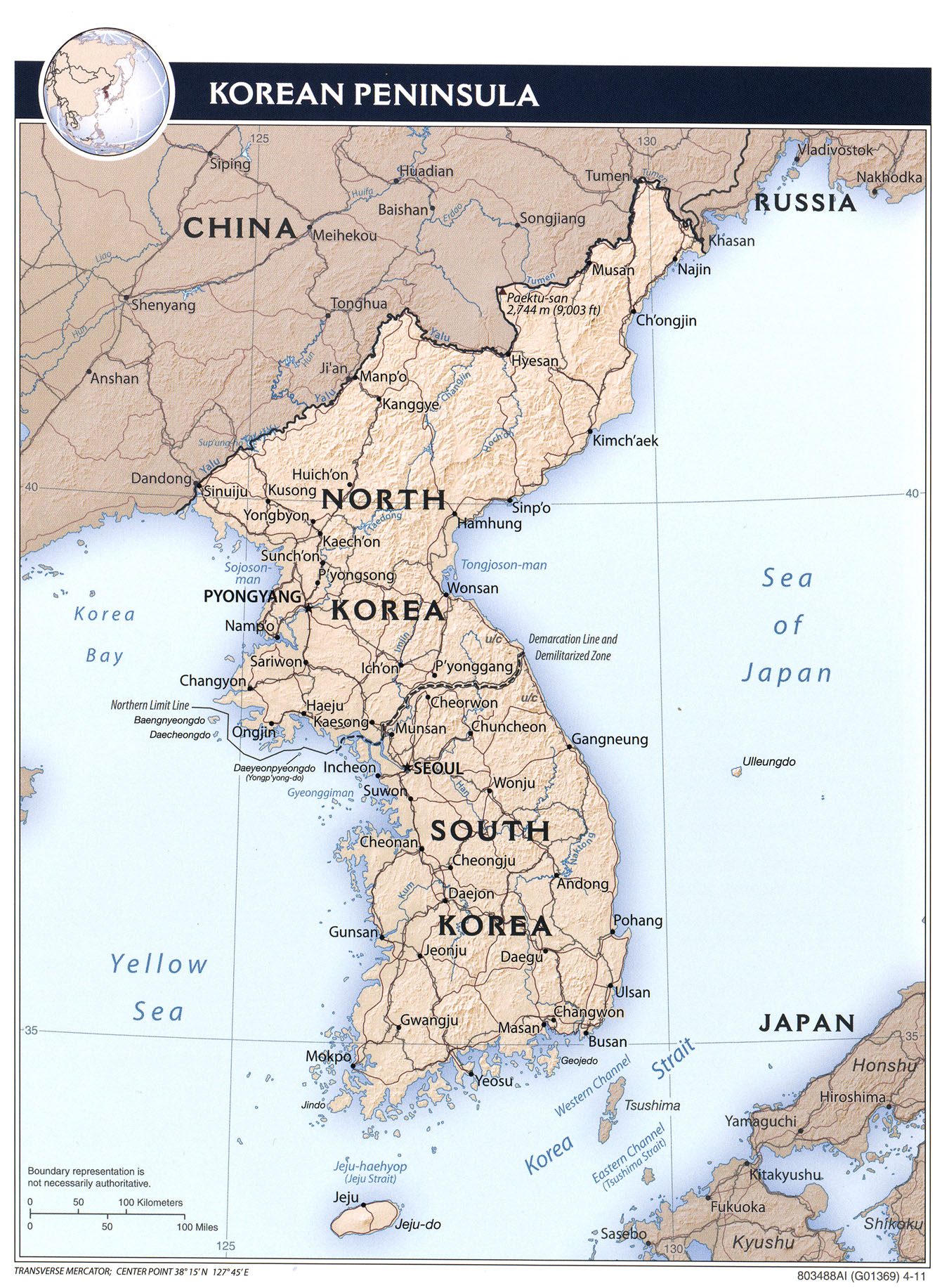
- Korean Peninsula (Shaded Relief) 2011 (734K)
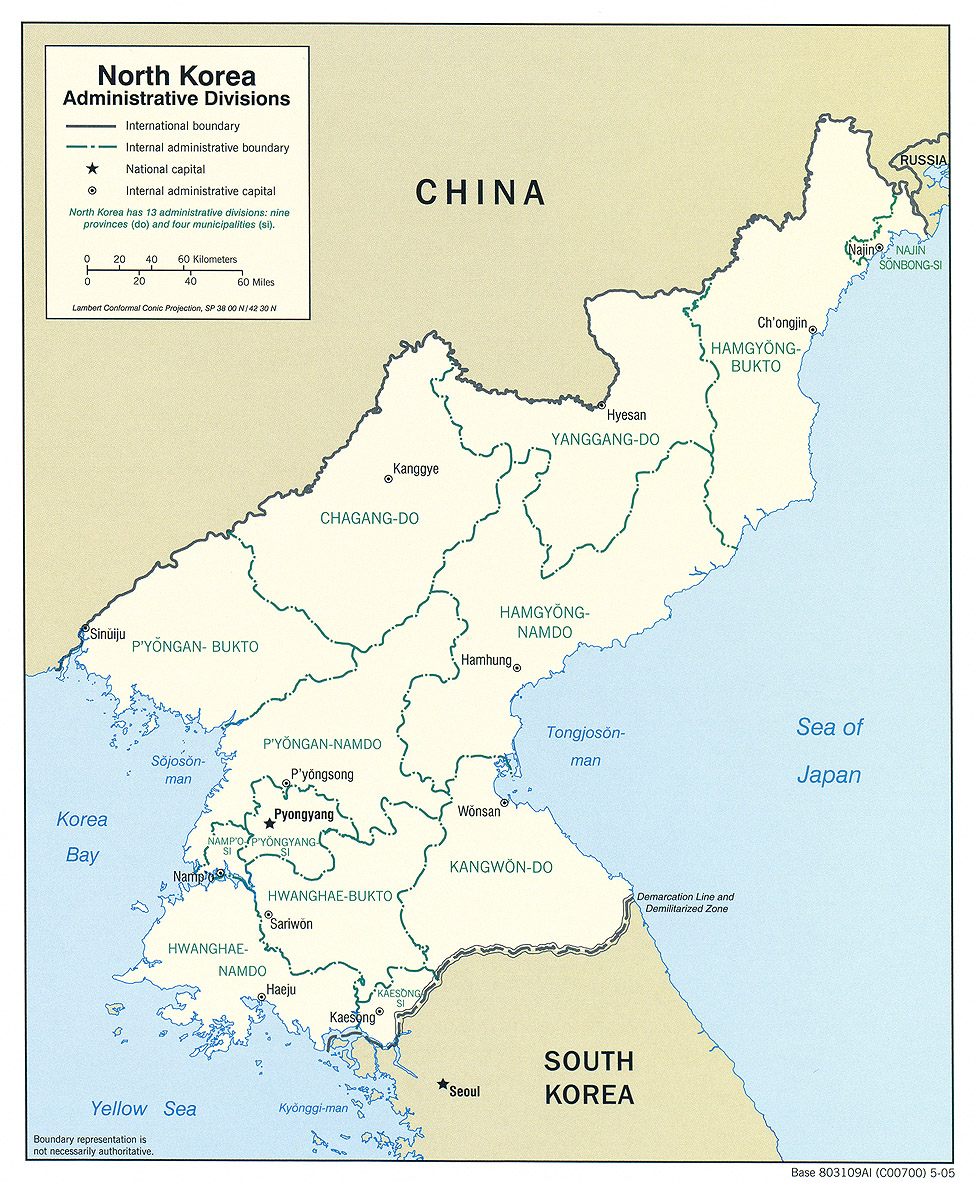
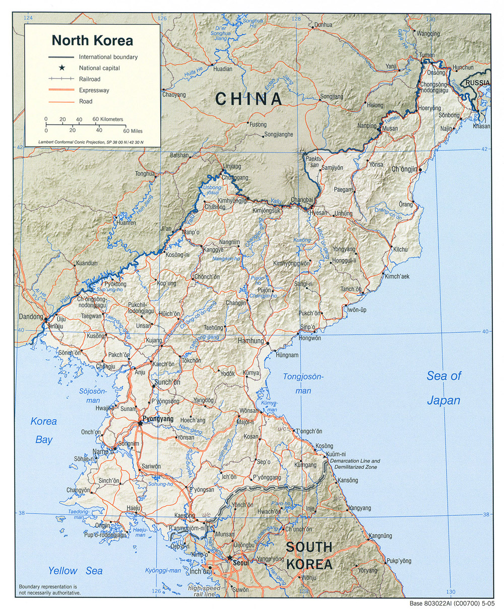
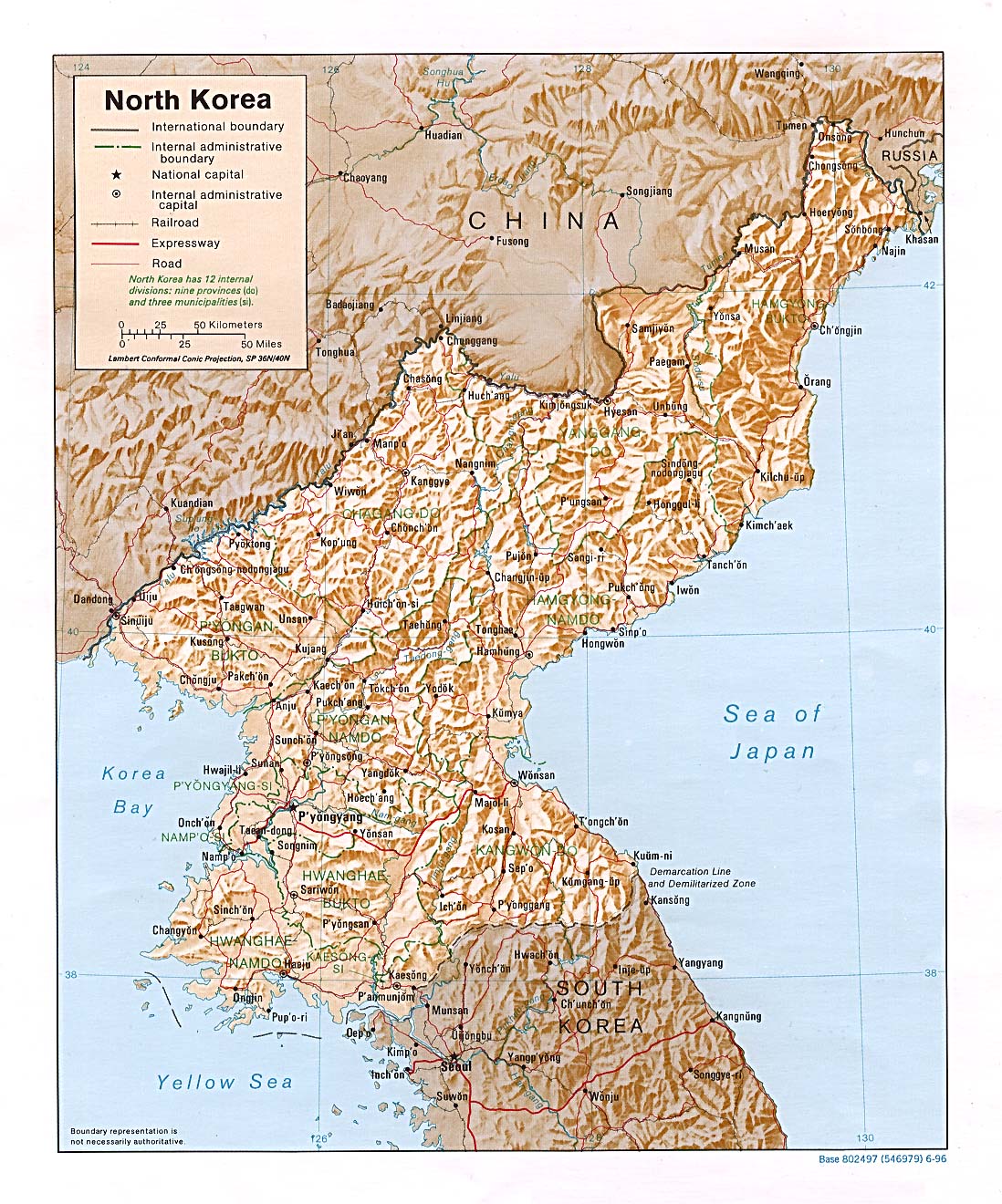
- North Korea (Administrative Divisions) 2005 (700K)and pdf format (712K)
- North Korea (Political) 2005 (728K)and pdf format (712K)
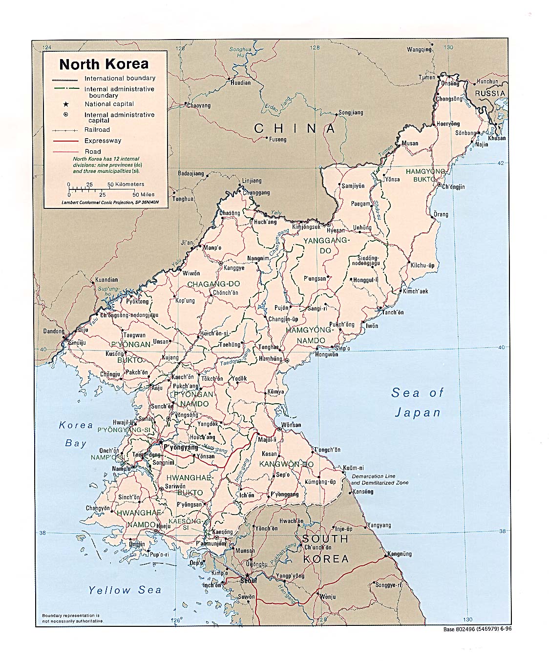
- North Korea (Political) 1996 (355K) and pdf format (365K)
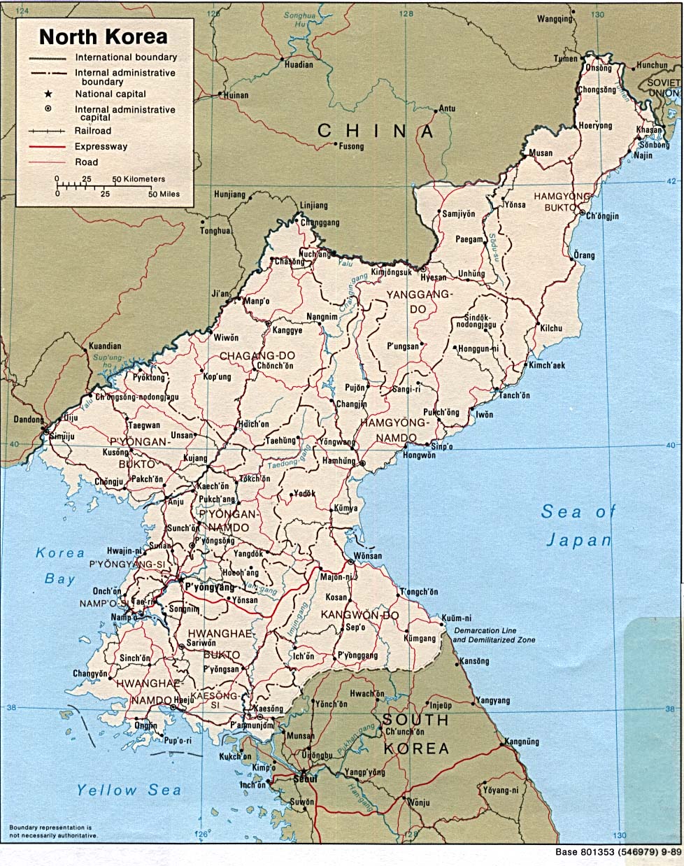
- North Korea (Political) 1989 (311K) and pdf format (315K)
- North Korea (Shaded Relief) 2005 (713K)and pdf format (712K)
- North Korea (Shaded Relief) 1996 (395K) and pdf format (423K)
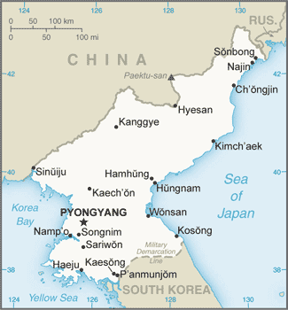
- North Korea (Small Map) 2016 (21.8K)
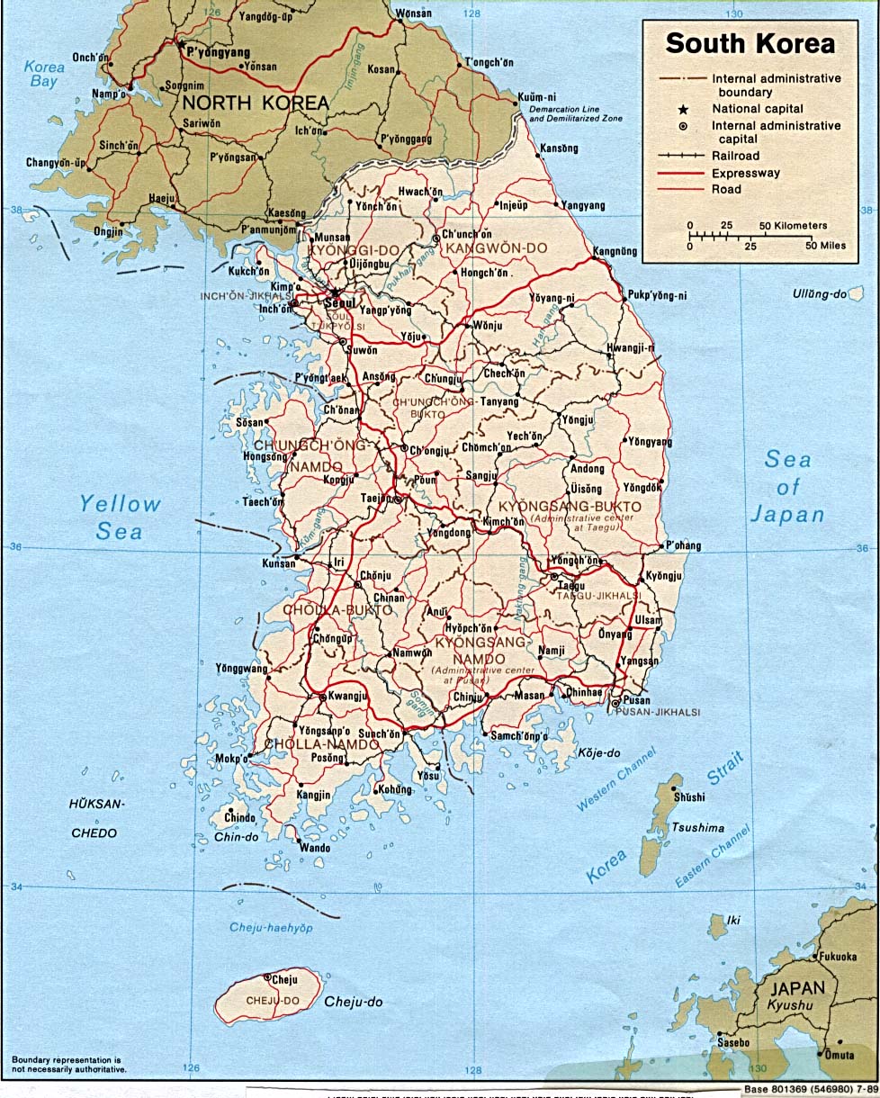
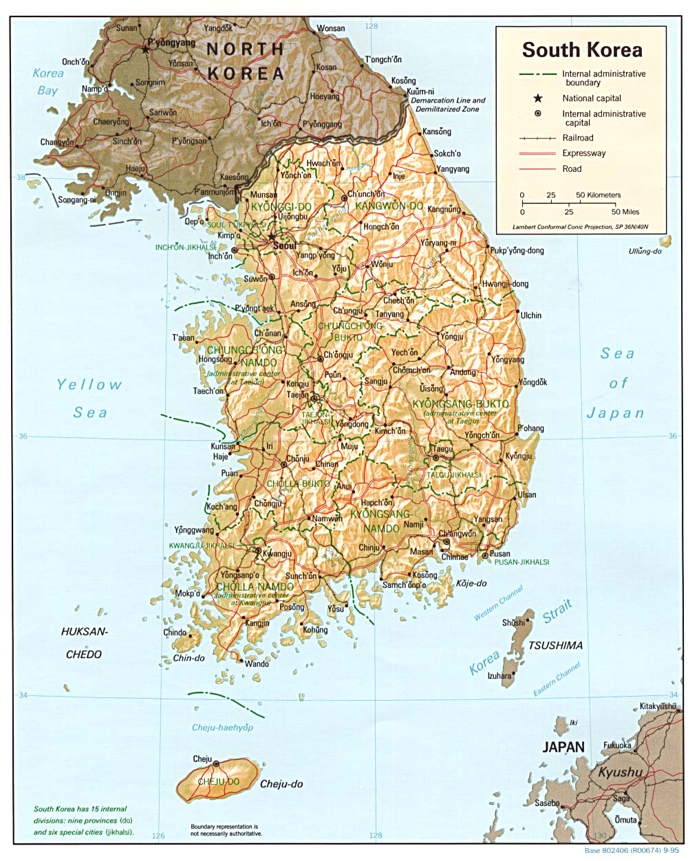
- South Korea (Political) 1995 (246K) and pdf format (275K)
- South Korea (Political) 1989 (295K) and pdf format (306K)
- South Korea (Shaded Relief) 1995 (257K) and pdf format (287K)
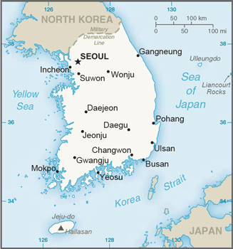
- South Korea (Small Map) 2016 (47.5K)
- 1:1,000,000 - Operational Navigation Chart Series U.S. Defense Mapping Agency Aerospace Center. Not for navigational use
- This series covers all of Korea.
- 1:1,000,000 - International Map of the World
- This series covers all of Korea.
- 1:500,000 - Tactical Pilotage Charts U.S. National Imagery and Mapping Agency Not for navigational use
- This series covers all of Korea.
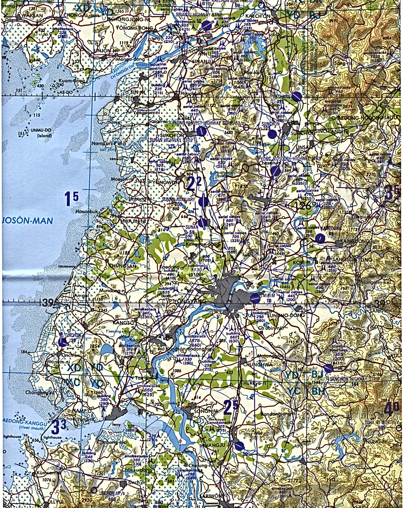
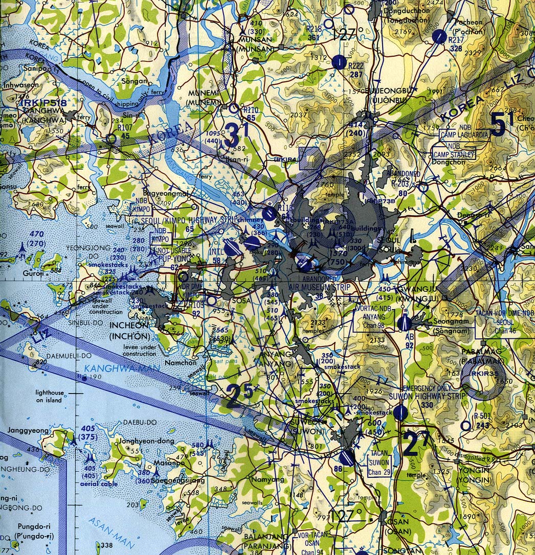
- 1:50,000 - Korea - Topographic Maps U.S. Army Map Service, Series L751
- 1:250,000 - Korea - Topographic Maps U.S. Army Map Service, Series L551
- 1:250,000 - Korea - Topographic Maps U.S. Army Map Service, Series L552, original scale 1:250,000.
- This series covers all of South Korea and most of North Korea. See Series L542 for the remaining sheets covering the North Korea-China border area.
- 1:500,000 - Pyongyang (portion of tactical pilotage chart) original scale 1:500,000. Portion of National Imagery and Mapping Agency TPC G-10B 1998 (793K) Not for navigational use
- 1:500,000 - Seoul (portion of tactical pilotage chart) original scale 1:500,000. Portion of Defense Mapping Agency TPC G-10B 1987 (645K) Not for navigational use
- This series covers all of Korea.
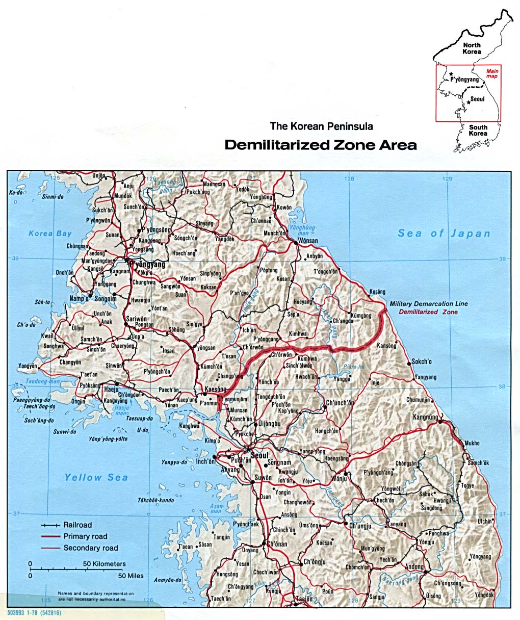
- Demilitarized Zone (Shaded Relief) Central Intelligence Agency, 1978 (267K)
- Korea [North] - Economic Activity from Map No. 500773 1972 (140K)
- Korea [North] - Land Utilization from Map No. 500773 1972 (149K)
- Korea [North] - Population from Map No. 500773 1972 (107K)
- Korea [South] - Economic Activity from Map No. 501879 1973 (149K)
- Korea [South] - Population from Map No. 501879 1973 (146K)
- Korea [South] - Vegetation and Land Utilization from Map No. 501879 1973 (165K)
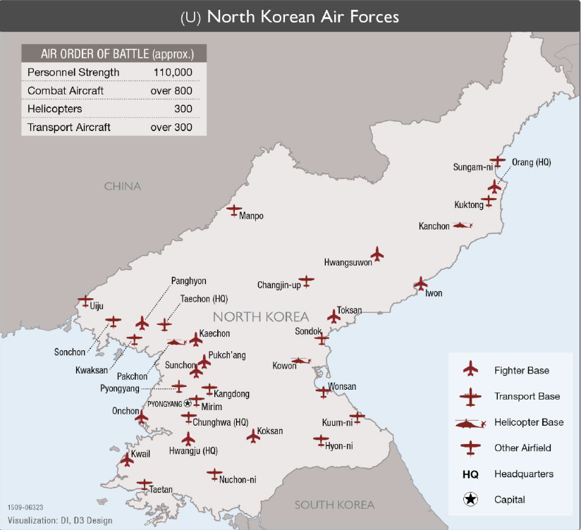
- North Korean Air Forces 2015 (358K) From "Military and Security Developments Involving the Democratic People's Republic of Korea" issued by the Office of the Secretary of Defense.
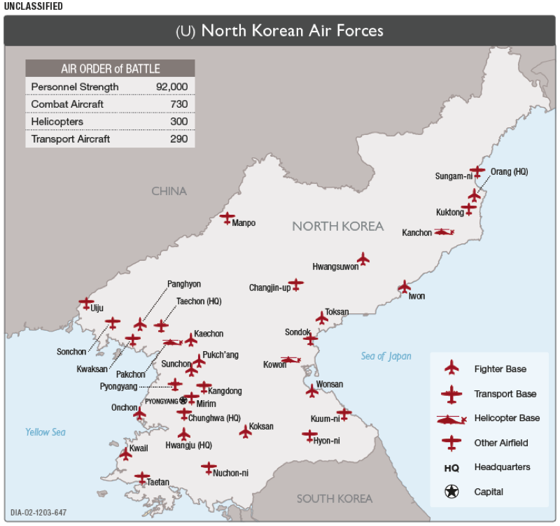
- North Korean Air Forces 2012 (181K) From "Military and Security Developments Involving the Democratic People's Republic of Korea" issued by the Office of the Secretary of Defense.
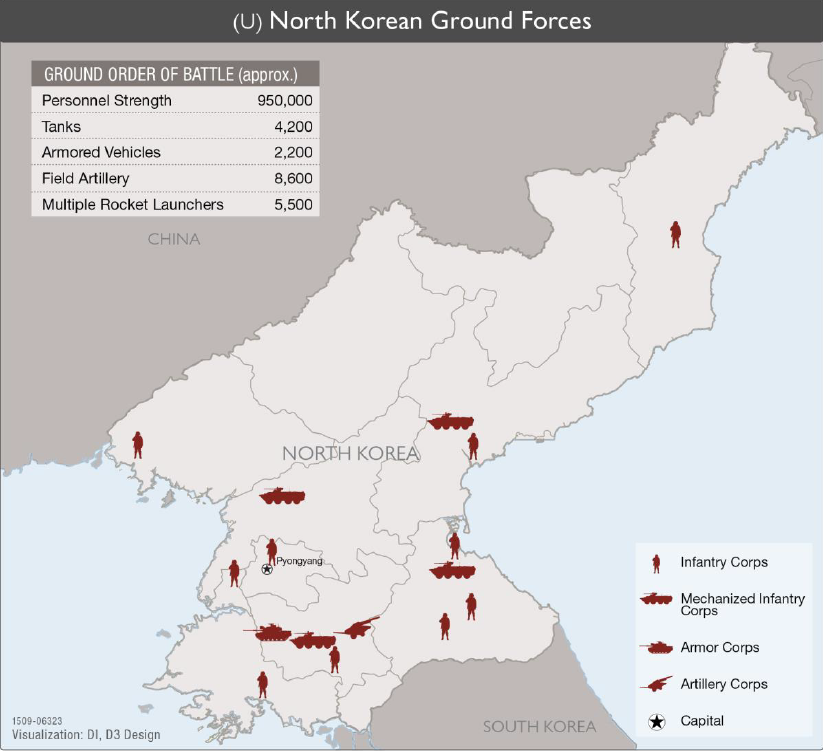
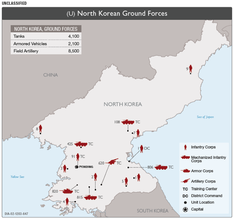
- North Korean Ground Forces 2015 (330K) From "Military and Security Developments Involving the Democratic People's Republic of Korea" issued by the Office of the Secretary of Defense.
- North Korean Ground Forces 2012 (146K) From "Military and Security Developments Involving the Democratic People's Republic of Korea" issued by the Office of the Secretary of Defense.
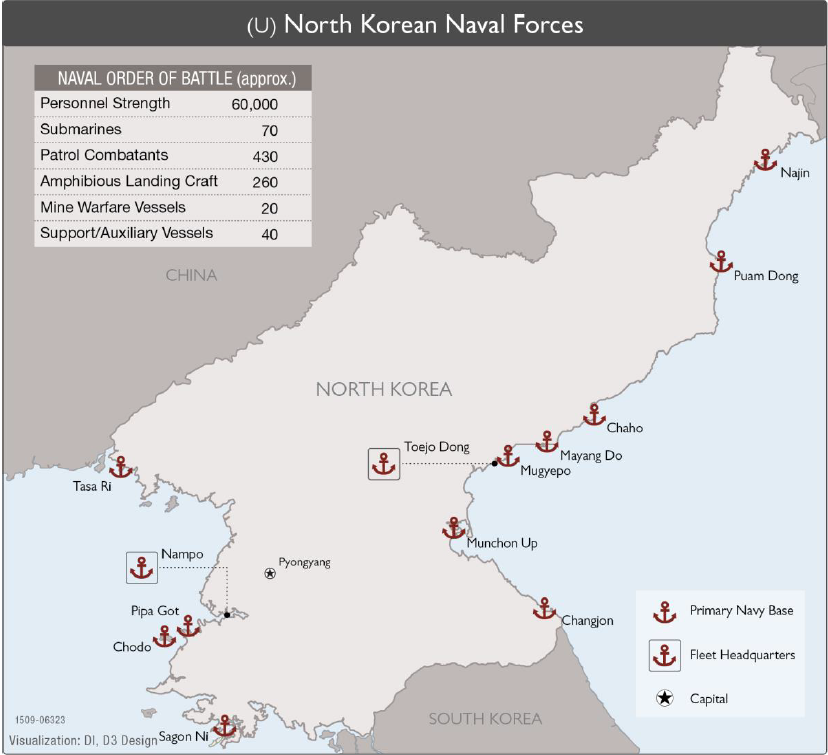
- North Korean Naval Forces 2015 (300K) From "Military and Security Developments Involving the Democratic People's Republic of Korea" issued by the Office of the Secretary of Defense.
- North Korean Naval Forces 2012 (152K) From "Military and Security Developments Involving the Democratic People's Republic of Korea" issued by the Office of the Secretary of Defense.
![Korea [North] - Economic Activity](middle_east_and_asia/north_korea_econ_1972.jpg)
![Korea [North] - Land Utilization](middle_east_and_asia/north_korea_land_1972.jpg)
![Korea [North] - Population](middle_east_and_asia/north_korea_pop_1972.jpg)
![Korea [South] - Economic Activity](middle_east_and_asia/south_korea_econ_1973.jpg)
![Korea [South] - Population](middle_east_and_asia/south_korea_pop_1973.jpg)
![Korea [South] - Vegetation and Land Utilization](middle_east_and_asia/south_korea_veg_1973.jpg)
- Korea - Topographic Maps U.S. Army Map Service, Series L552, original scale 1:250,000.
- Korea - City Plans U.S. Army Map Service, 1944-1946.
- [Pusan] Fusan 1912 from Northern China, The Valley of the Blue River, Korea. Hachette & Company, 1912. (92K)
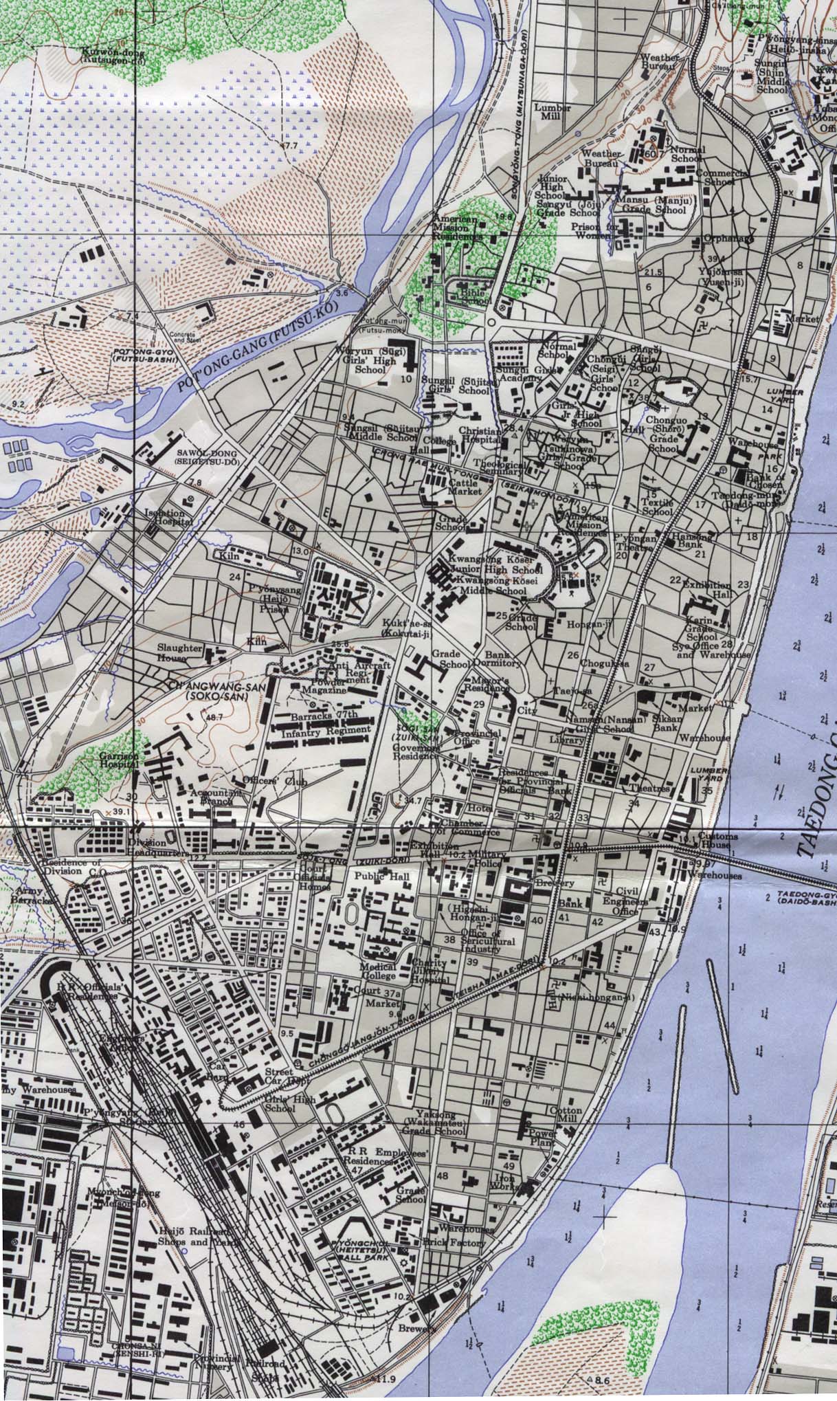
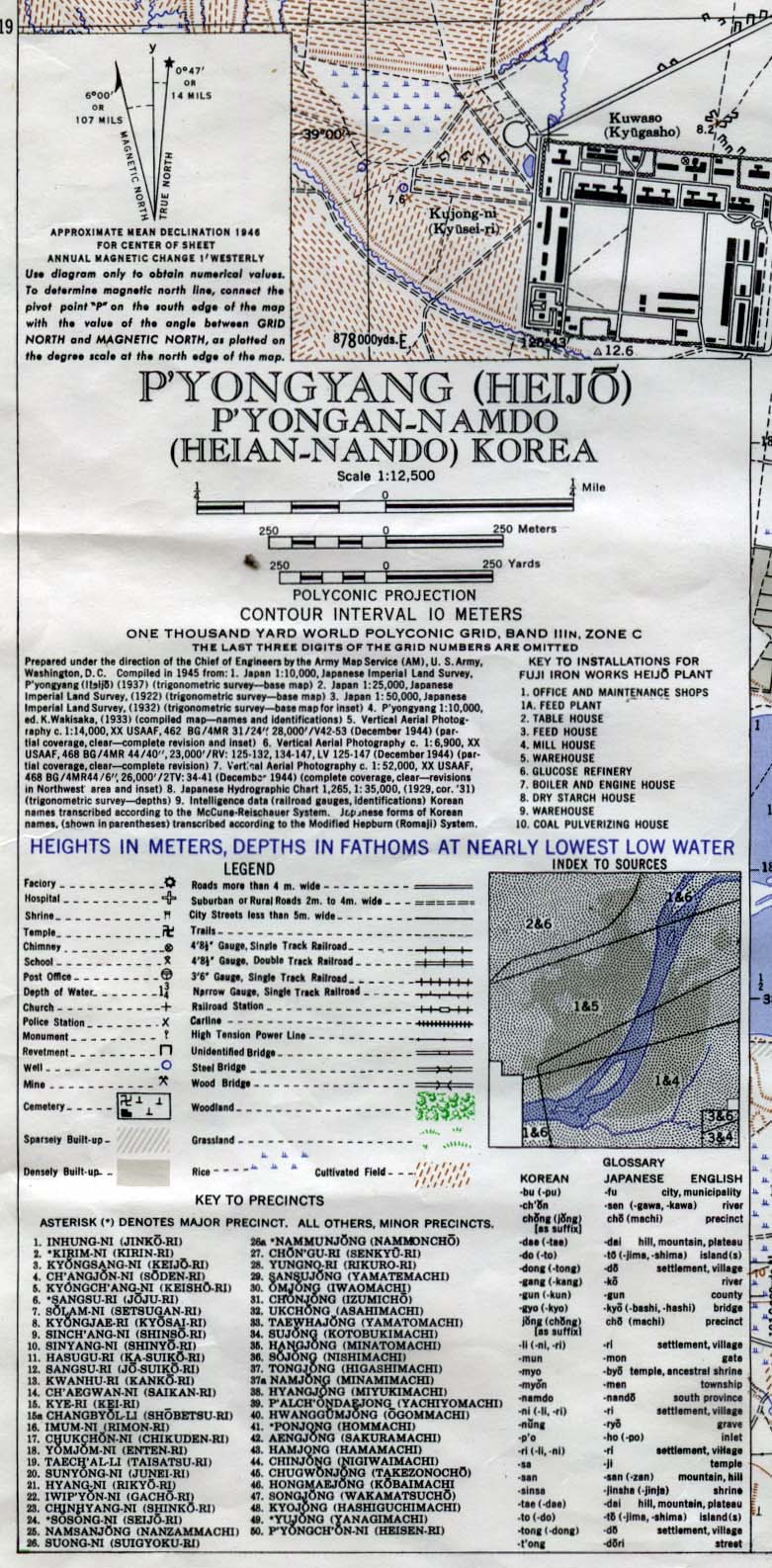
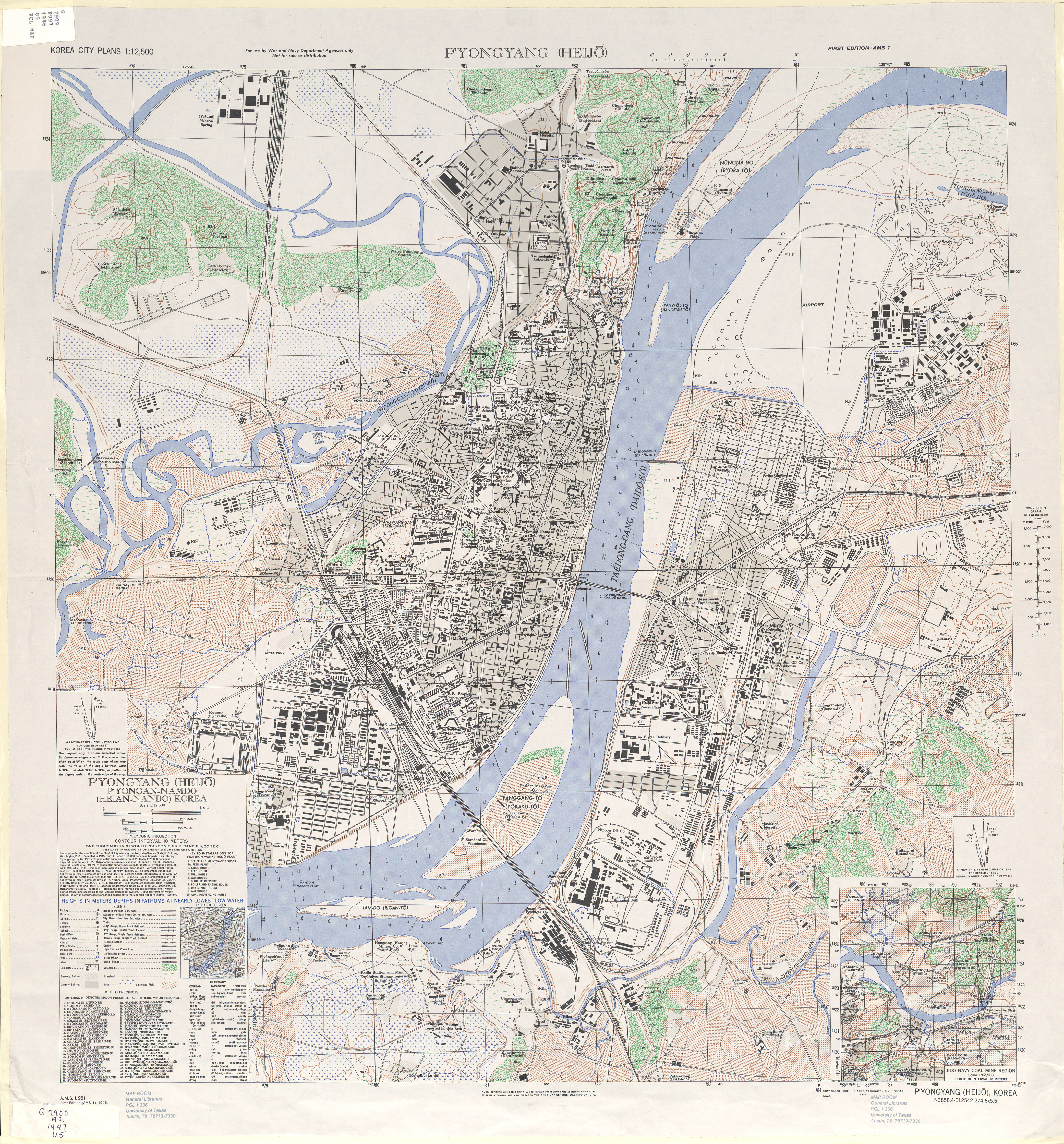
- Pyongyang 1946 (549K) Map Key (277K) or Entire Map (8.1 MB) Original scale 1:12,500. Army Map Service L951 1946.
- [Seoul] Seul and Environs 1912 from Northern China, The Valley of the Blue River, Korea. Hachette & Company, 1912. (251K)
- [Seoul to Eui-chu] Se-ul to Eui-chu 1912 from Northern China, The Valley of the Blue River, Korea. Hachette & Company, 1912. (96K)
- [Seoul to Pusan] Se-ul to Pu-san 1912 from Northern China, The Valley of the Blue River, Korea. Hachette & Company, 1912. (106K)
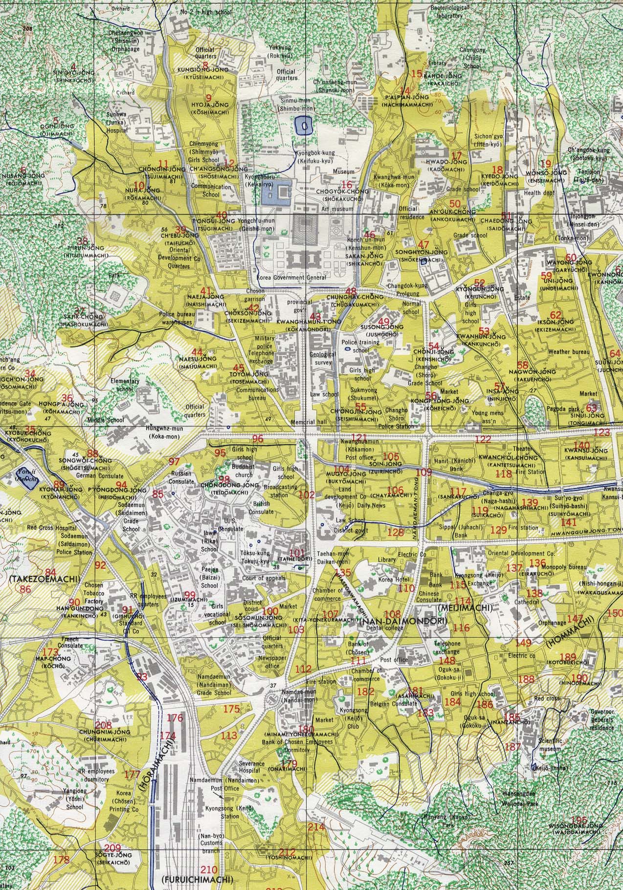
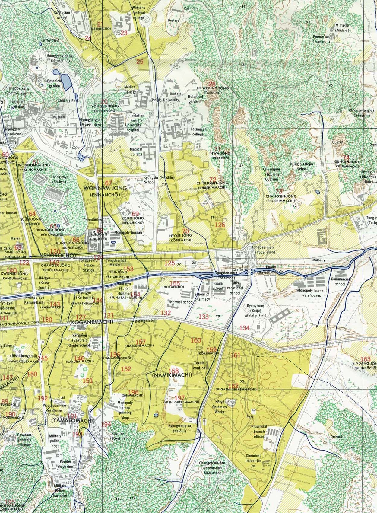
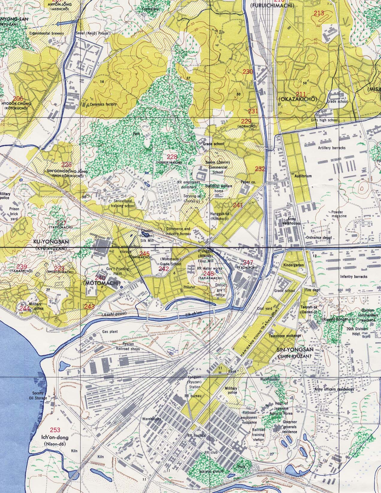
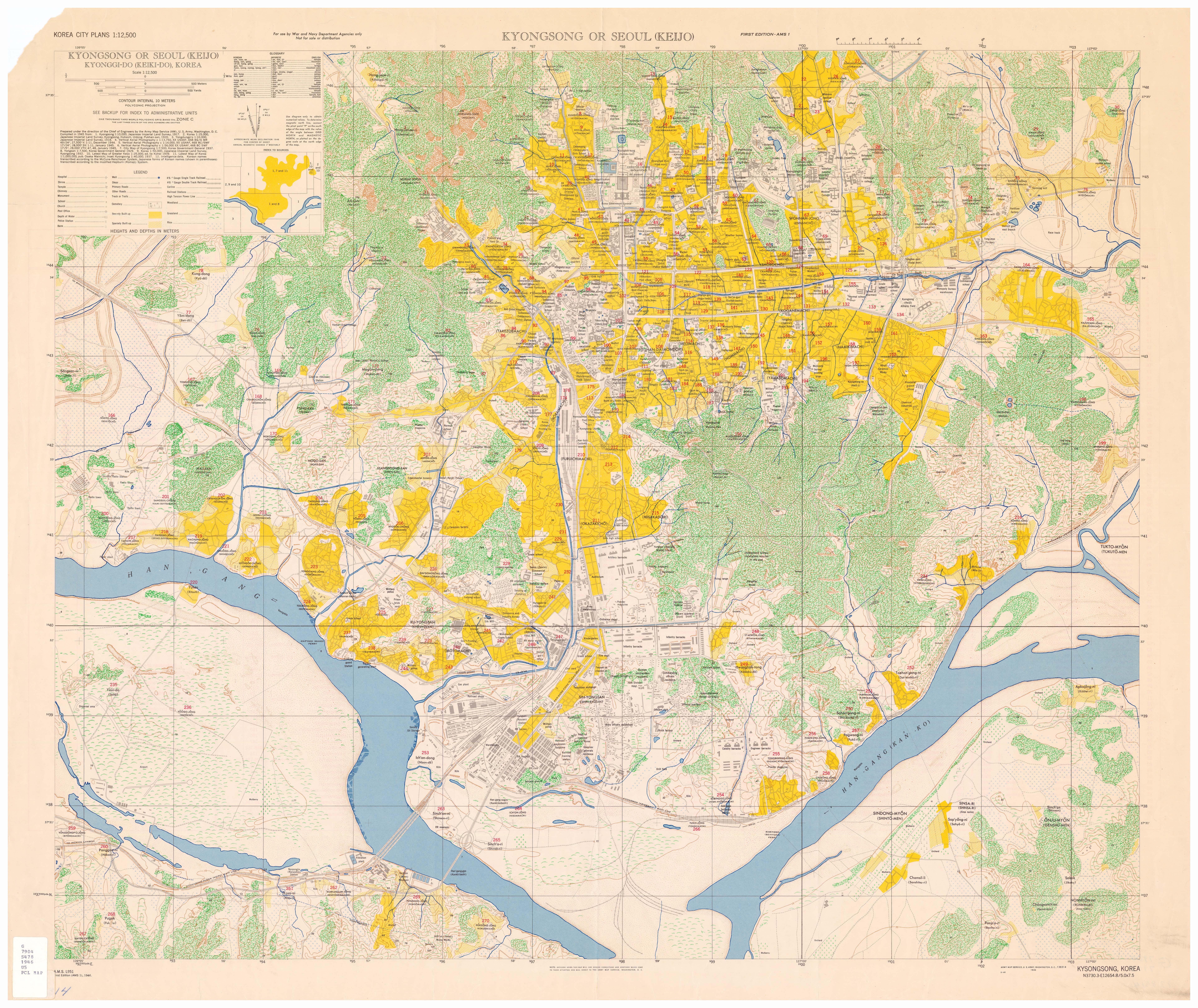
- Seoul 1946: Central (628K), East (509K), South (555K), or Entire Map (7.6MB) from "Kyongsong or Seoul (Keijo) Kyonggi-do (Keiki-do), Korea", original scale 1:12,500 U.S. Army Map Service, 1946.
![[Pusan] Fusan 1912](historical/fusan_1912.jpg)
![[Seoul] Seul and Environs 1912](historical/se_ul_environs_1912.jpg)
![[Seoul to Eui-chu] Se-ul to Eui-chu 1912](historical/se_ul_to_ei_chu_1912.jpg)
![[Seoul to Pusan] Se-ul to Pu-san 1912](historical/se_ul_to_fu_san_1912.jpg)
Korea Maps on Other Web Sites
Korea - 2009-2018
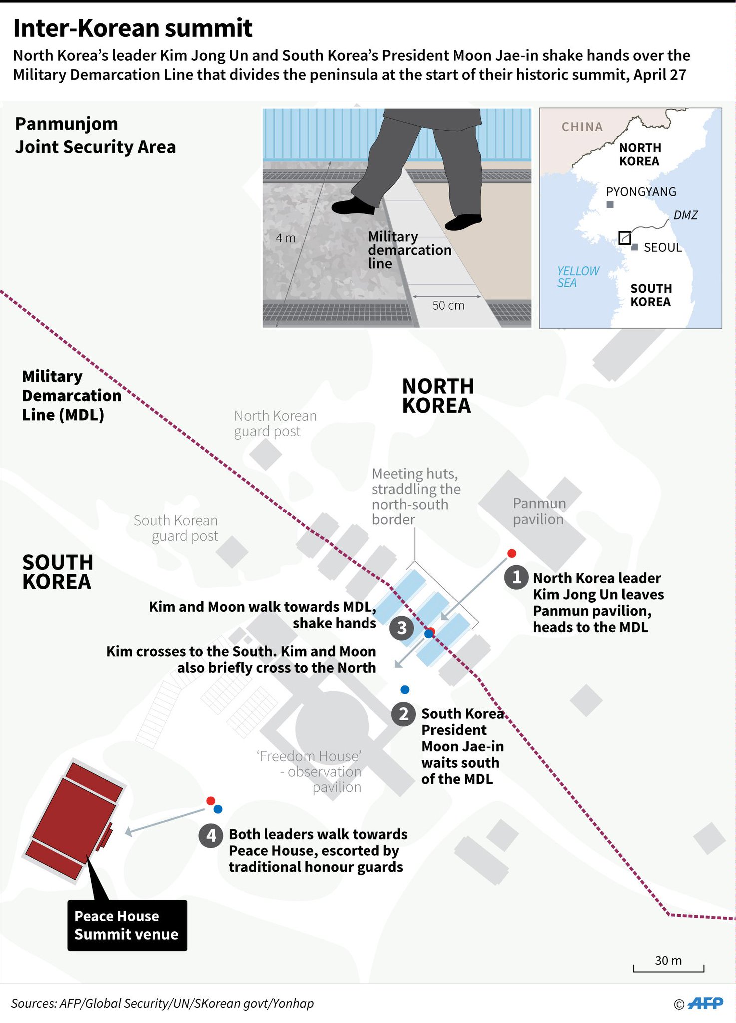
- April 27, 2018 - Inter-Korean Summit at Military Demarcation Line (AFP)
- November 13, 2017 - Korea Demilitarized Zone (Washington Post)
- October 10,2017 - Wonsan: Where Tourism Meets Tanks (Reuters)
- August 12, 2017 - Anatomy of a Crisis: The North Korea Threat (includes maps)
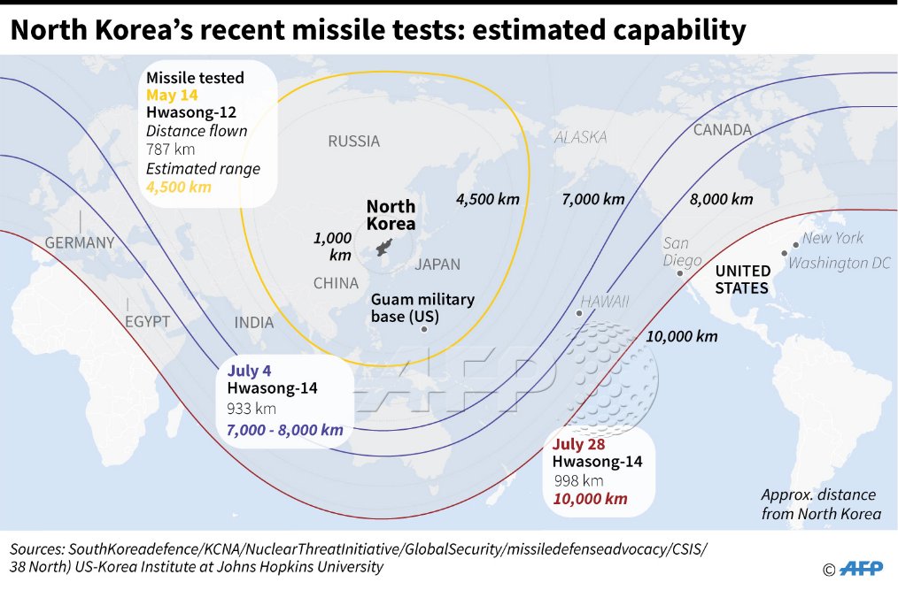
- August 9, 2017 - Recent Missile Tests, Estimated Capability (AFP)
- July 4, 2017 - North Korea - Missile Launch (Washington Post)
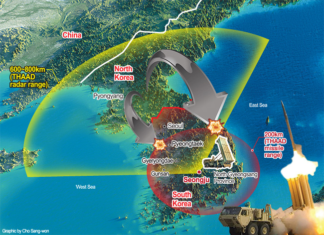
- 2017 - Terminal High Altitude Aerial Defense (THAAD) Map (Korea Times)
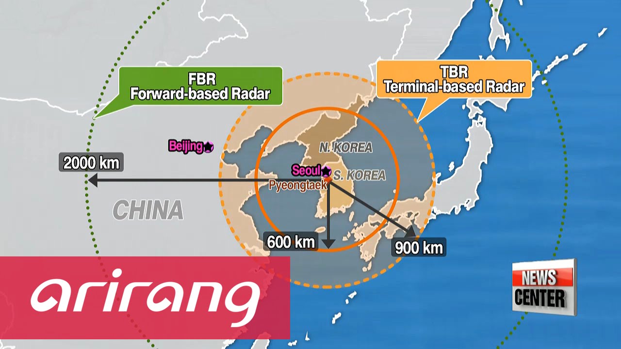
- 2017 - Range of South Korean Radars (Arirang)
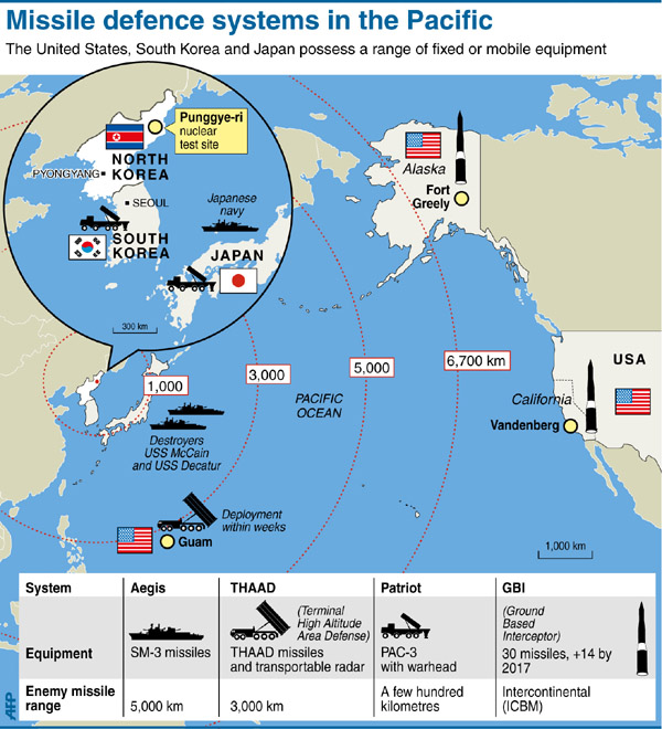
- 2017 - Missile Defense Systems in the Pacific (1.bp.blogspot)
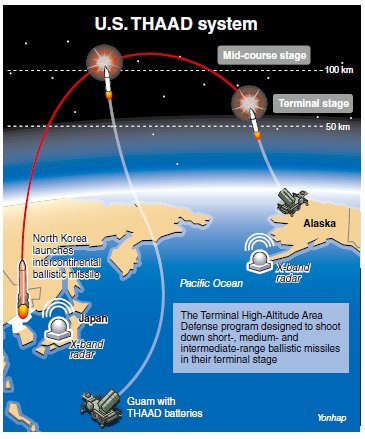
- 2017 - U.S. THAAD Systen (Yonhap)
- April 12, 2017 - North Korea’s Punggye-ri Nuclear Test Site (38 North)
- April 6, 2017 - North Korea - Punggye-ri Nuclear Test Site (38North)
- February 13, 2017 - Korea, North - Missiles/Military Bases (BBC News)
- October 1, 2016 - New THAAD Site (Korea Times)
- August 10, 2016">August 10, 2016 - Missile Bases in Northeastern China (Korea JoongAng Daily)
- February 12, 2013 - North Korea - Punggye-ri Nuclear Test Site (BBC News)
- November 24, 2010 - Map of the Shelling of Yeonpyeong (Wikipedia)
- November 23, 2010 - Military Strike in the Waters Between North and South Korea (New York Times)
- May 25, 2009 - North Korea - Missile Launches and Underground Nuclear Test (BBC News)
- 2009 - North Korea - Tongch'ang-dong Missile and Space Launch Facility (GlobalSecurity.org)
North Korea Maps on Other Sites
- Korea, North (Lonely Planet)
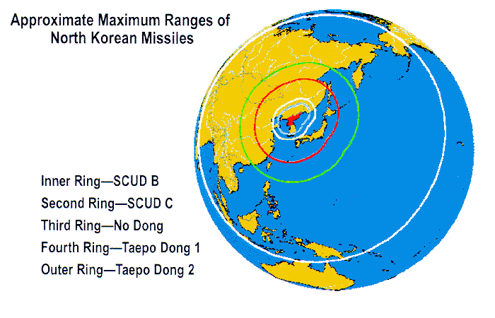
- Korea, North - Range of North Korean Missiles (FAS)
- Korea, North - Range of North Korean Missiles (Voice of America)
- Korea, North - Range of North Korean Missiles (BBC News)
- Korea, North - Range of North Korean Missiles (CNN)
- Korea, North - Google Earth Layer (38 North)
- Korea, North - Industrial and Mining Activity, 1992 from North Korea: A Country Study (GlobalSecurity.org) [PDF]
- Korea, North - Interactive North Korea Facilities Map (Center for Nonproliferation Studies)
- Korea, North - Key Nuclear Sites (BBC News)
- Korea, North - Mapping Crimes Against Humanity [July 2017] (Transitional Justice Working Group)
- Korea, North - Military Facilities (Globalsecurity.org) [PDF]
- Korea, North - Mineral Industry (USGS) and Map Key
- Korea, North - Missiles/Military Bases [February 14, 2017] (BBC News)
- Korea, North - Musudan-ri Missile Test Facility (GlobalSecurity.org)
- Korea, North - New Islands [Sohae Area] [May 1, 2017] (The Diplomat)
- Korea, North - North Korea Uncovered (via North Korean Economy Watch) [Requires Google Earth]
- Mapping of North Korea’s economic, cultural, political, and military infrastructures
- Korea, North - Nuclear Facilities (Carnegie Endowment)
- Korea, North - Nuclear Facilities [links to maps for each facility] (GlobalSecurity.org)
- Korea, North - Nuclear Facilities (NTI)
- Korea, North - Special Weapons Facilities - Maps (GlobalSecurity.org)
- Korea, North - Taechon Reactor Construction Site - Images and Maps (GlobalSecurity.org)
- Korea, North - Topographic Maps, AMS Series L751, 1:50,000 (Korean War Project)
- Korea, North - Yongbyon Nuclear Complex - Images and Maps (GlobalSecurity.org)
- Mapping of North Korea’s economic, cultural, political, and military infrastructures
South Korea Maps on Other Sites
- Korea, South (Lonely Planet)
- Korea, South - Mineral Industry (USGS) and Map Key
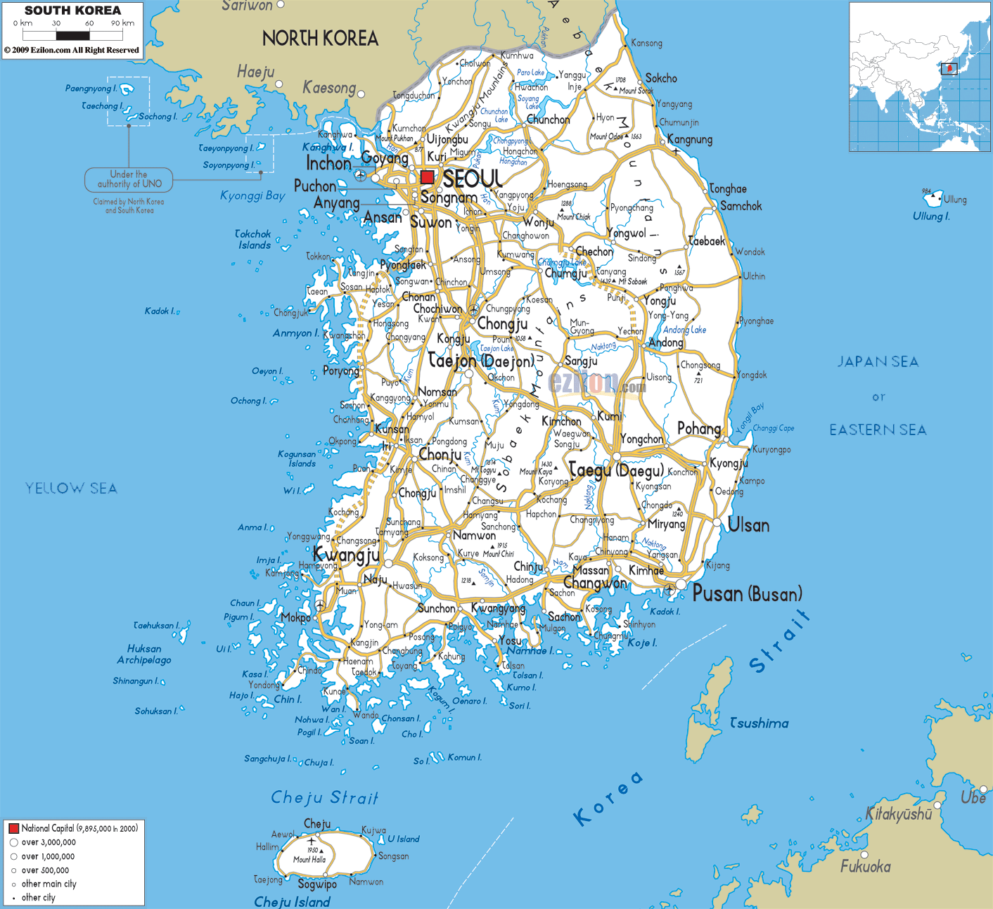
- Korea, South - Road Map (Ezilon)
- Korea, South - Topographic Maps, AMS Series L751, 1:50,000 (Korean War Project)
Korea City Maps on Other Sites
- Busan (Seoulkoreaasia.com)
- Pyongyang (Don Parrish)
- Pyongyang (Pyongyang-Metro)
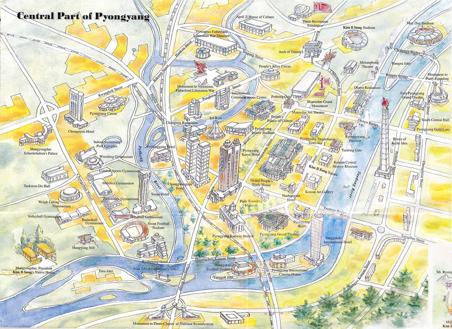
- Pyongyang - Central (Korea-Konsult)
- Pyongyang - Maps (GlobalSecurity.org)
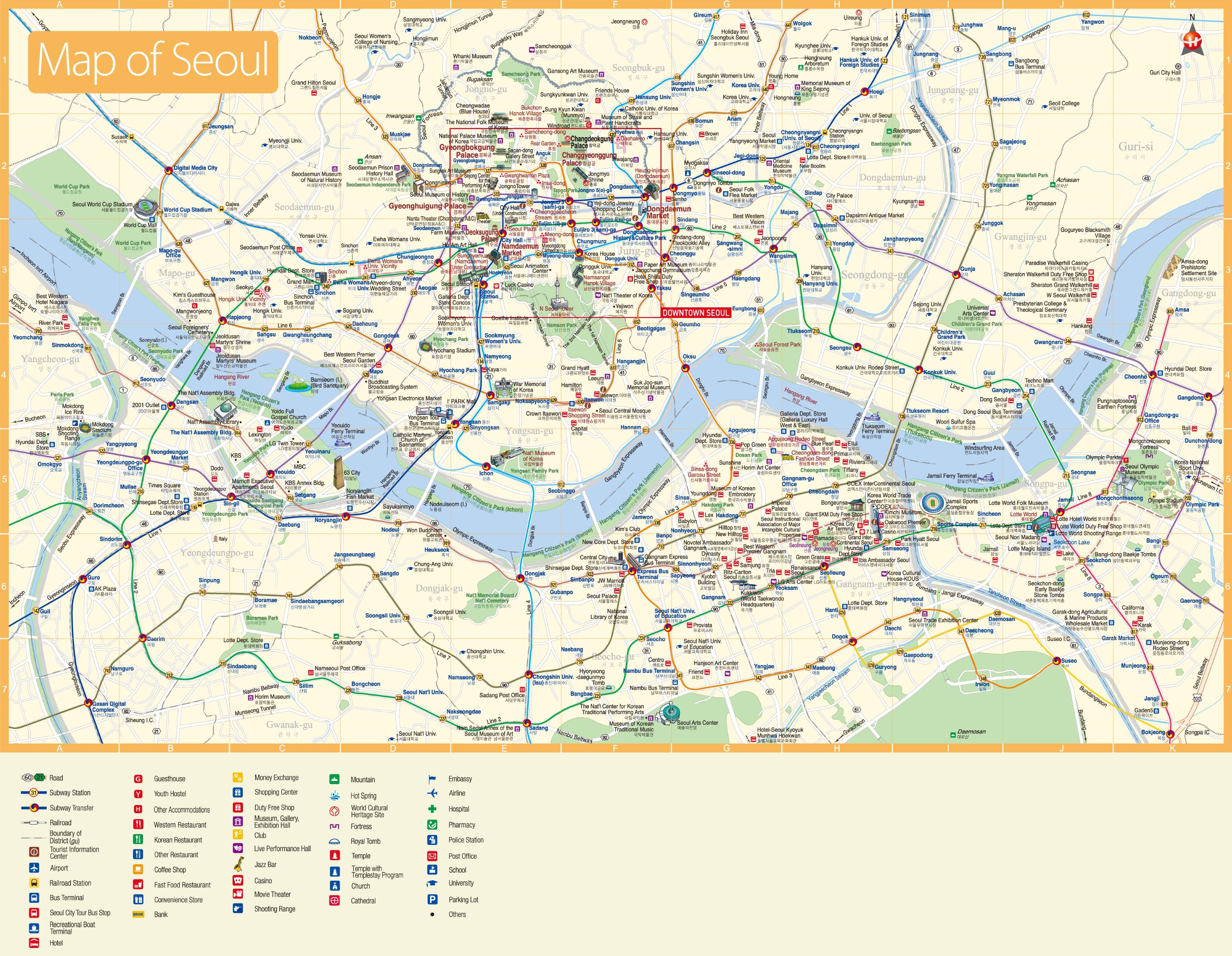
- Seoul (Johomaps)
- Seoul (Lonely Planet)
- Seoul (Mappery.com)
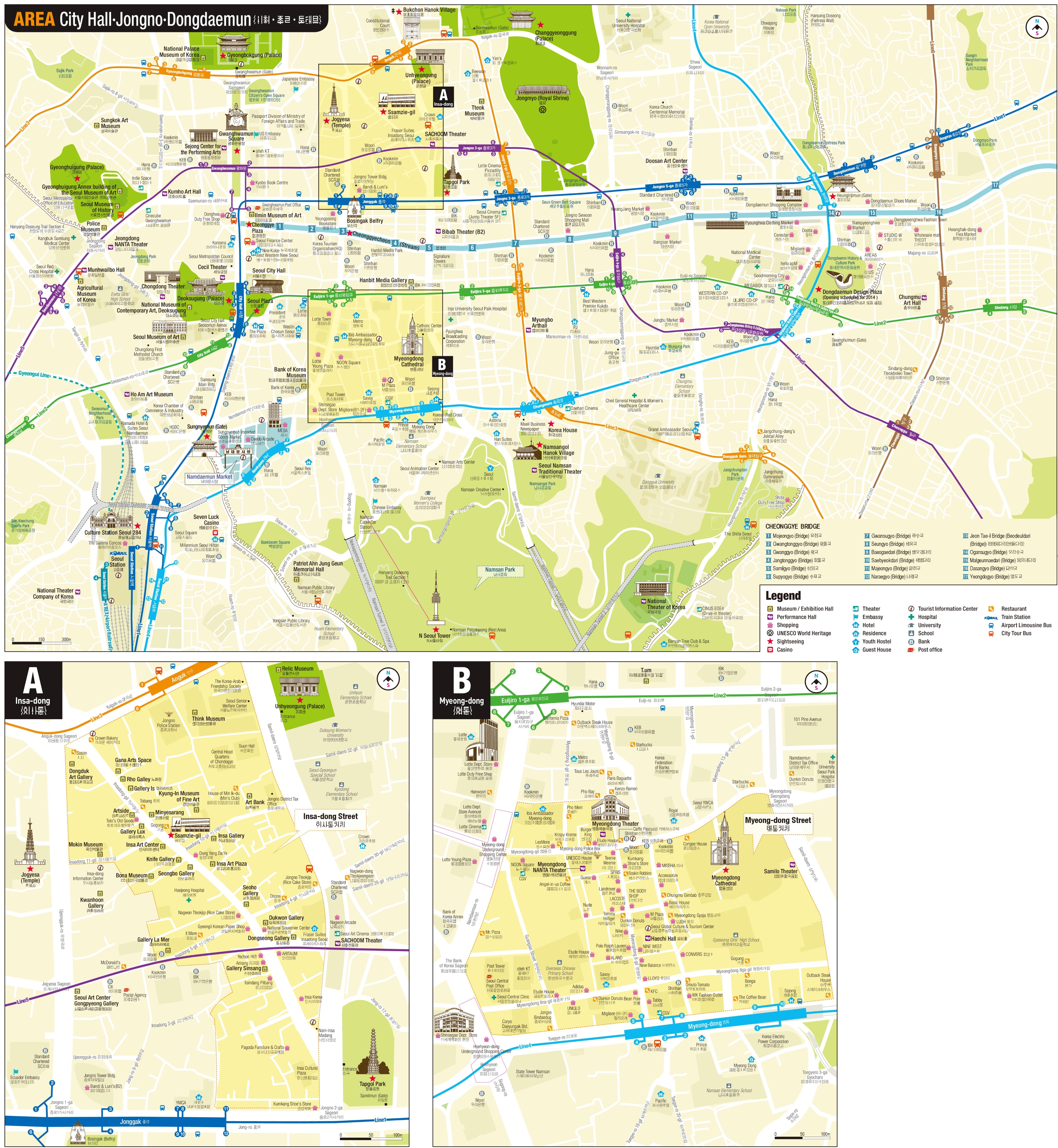
- Seoul - Central (OnTheWorldMap)
- Seoul - Hotels (OnTheWorldMap)
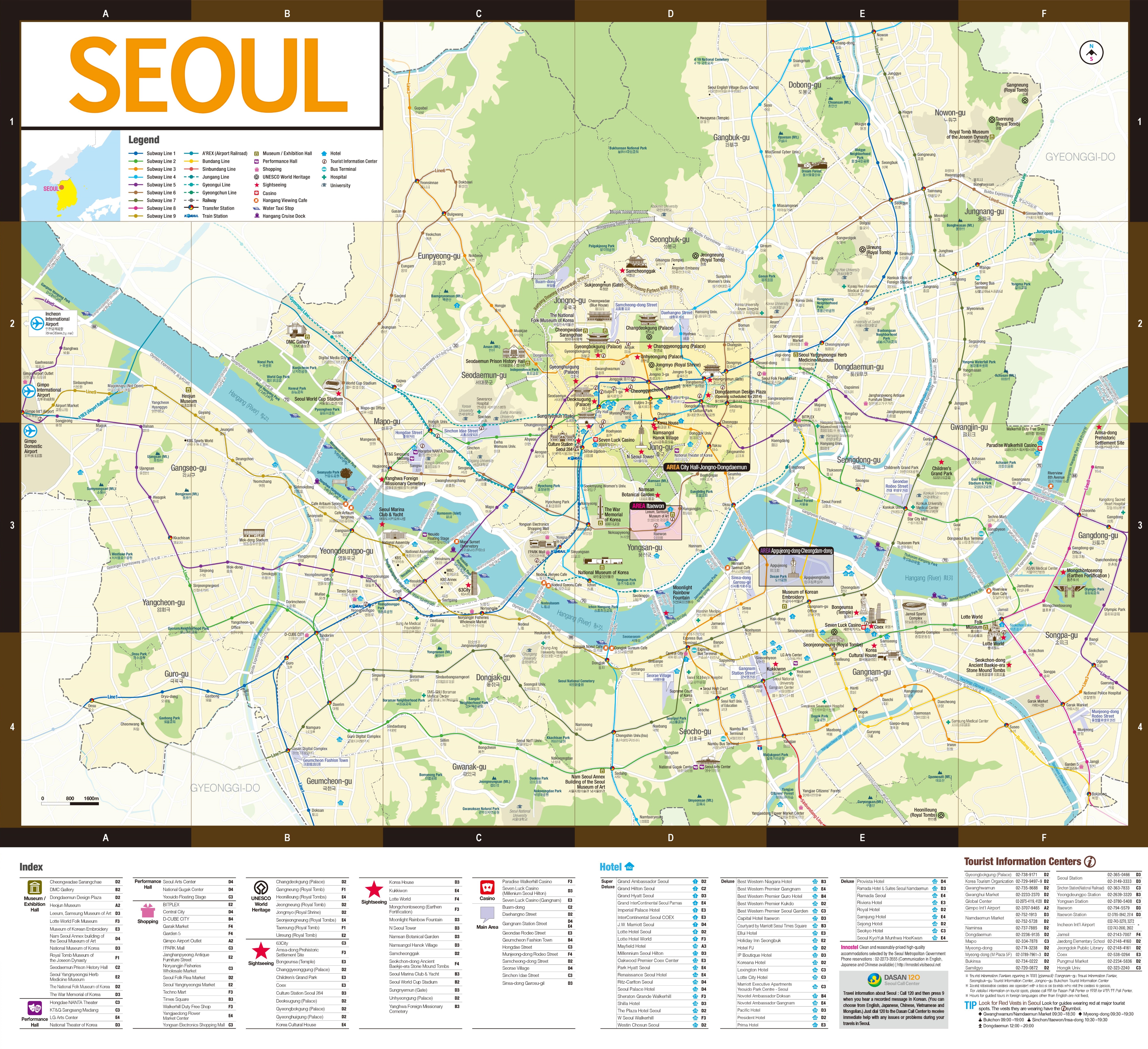
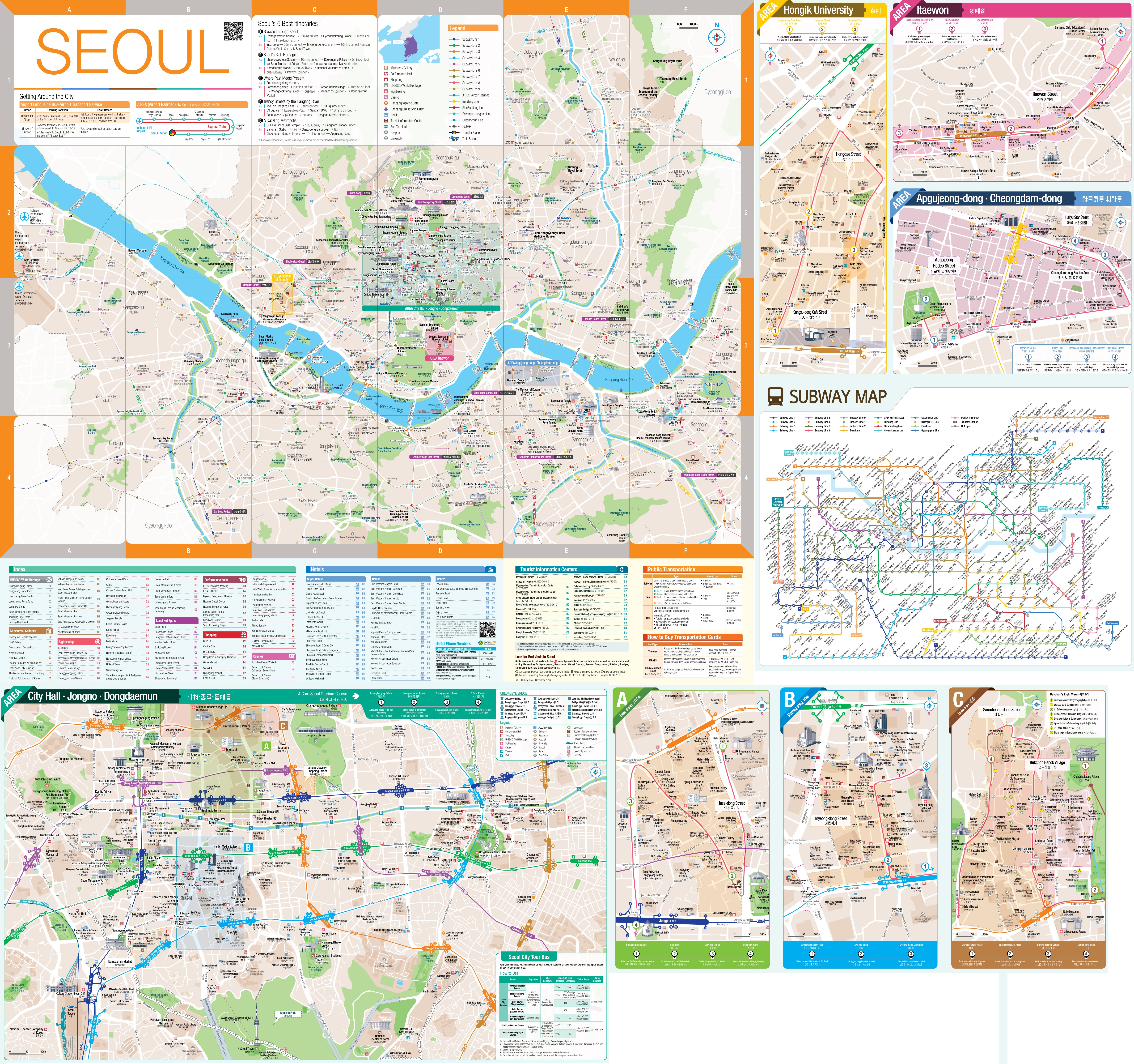
- Seoul - Large Tourist Map (OnTheWorldMap)
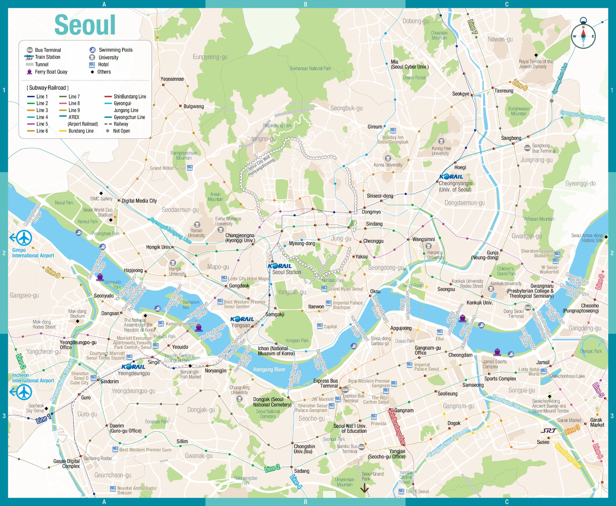
- Seoul - Metro (OnTheWorldMap)
- Seoul - Subway/Rail Map (OnTheWorldMap)
- Seoul (New York Times)
Korea Historical Maps on Other Sites