Perry-Castañeda Library
Map Collection
Chile Maps
The following maps were produced by the U.S. Central Intelligence Agency, unless otherwise indicated.
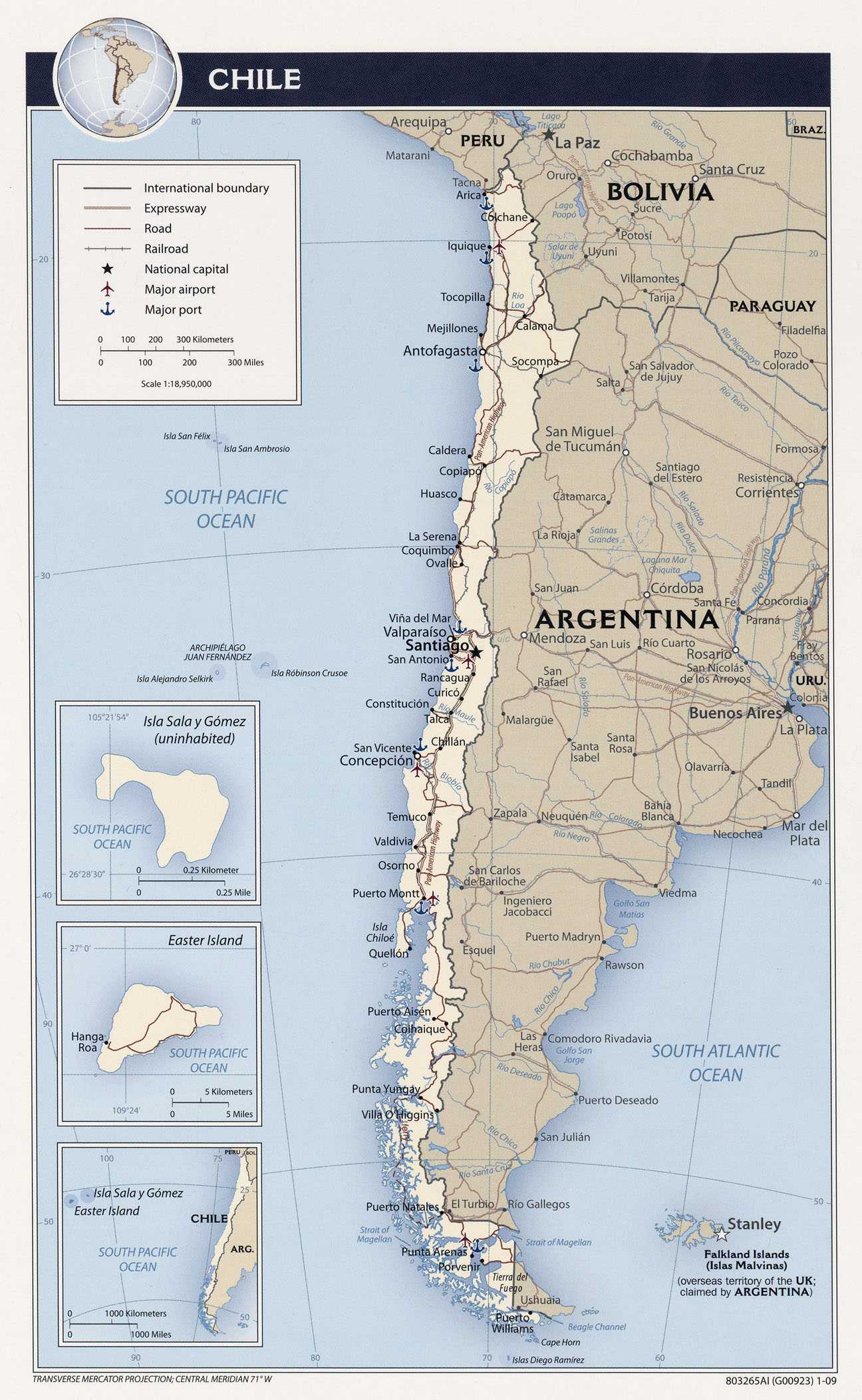
Country Maps- Chile (Political) 2009 (633KB)
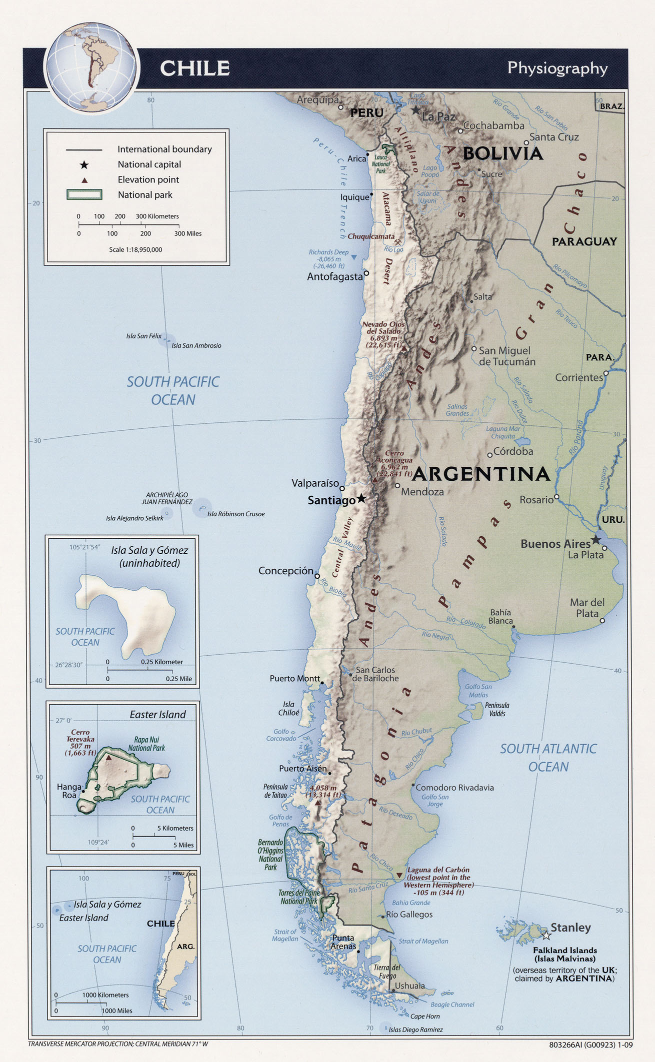
- Chile (Physiography) 2009 (607KB) and pdf format (7.5MB)
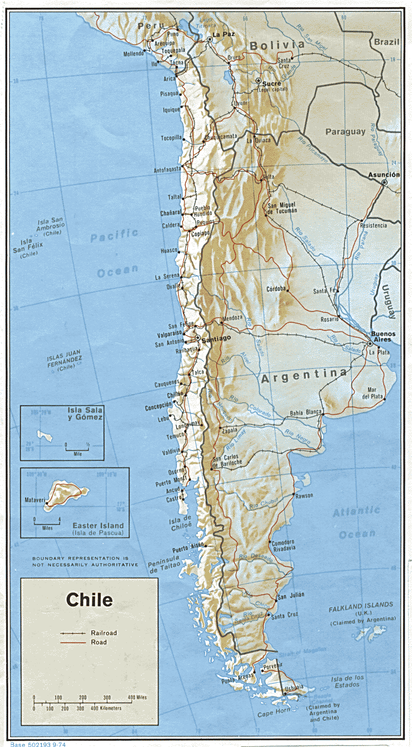
- Chile (Shaded Relief) 1974 (306K) and pdf format (313K)
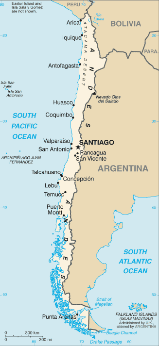
- Chile (Small Map) 2016 (21.8K)
- Chile (Transportation) 2009 (607KB) and pdf format (4.6MB)
- Chile (Administrative Divisions) 2009 (452KB) and pdf format (3.2MB)
- Santiago 1969 1:12,500, U.S. Army Topographic Command, Series J901, Sheet 2 (11.7MB)
- Santiago 1969 1:12,500, U.S. Army Topographic Command, Series J901, Sheet 3 (13.5MB)
- Chile - Economic Activity from Map No. 500814 1972 (114K)
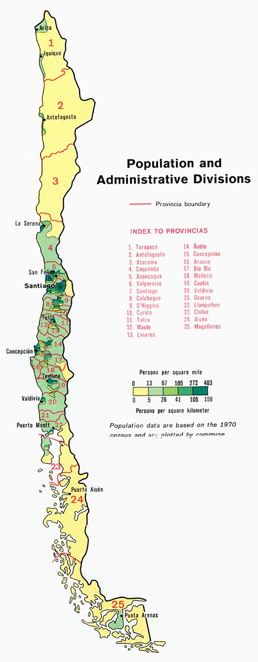
- Chile - Population and Administrative Divisions from Map No. 500814 1972 (98K)
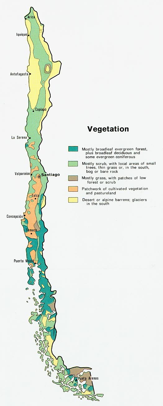
- Chile - Vegetation from Map No. 500814 1972 (98K)
- 1:1,000,000 - Latin America (aeronautical charts) Operational Navigation Chart Series, U.S. Defense Mapping Agency (dates vary) clickable index map for this series Not for navigational use
- This series covers all of Chile
- 1:500,000 - Tactical Pilotage Charts U.S. National Imagery and Mapping Agency. Not for navigational use
- This series covers the northern part of Chile
- 1:250,000 - Latin America (aeronautical charts) Joint Operations Graphic, U.S. National Imagery and Mapping Agency Not for navigational use
- This series covers parts of northern and central of Chile
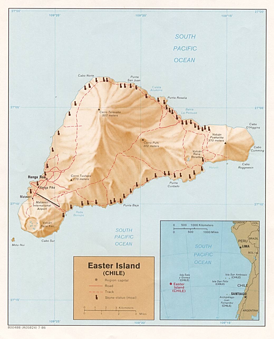
- Easter Island (Shaded Relief) 1986 (156K)
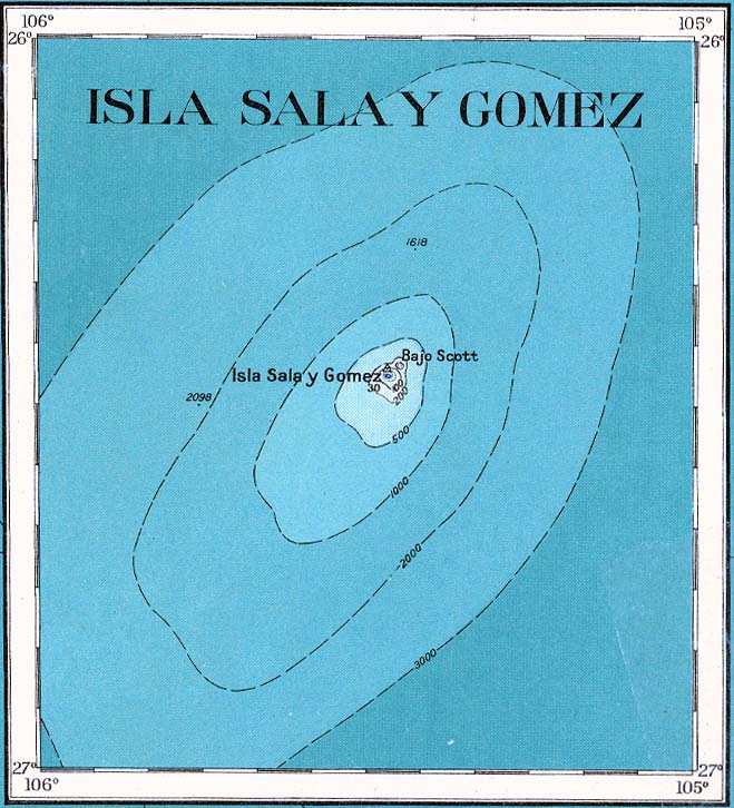
- Sala y Gomez (Topographic) 1927 (110K) From Cauquenes y Islas Esporadicas, Provisional Edition S. I-18, original scale 1:1,000,000, American Geographical Society, 1927
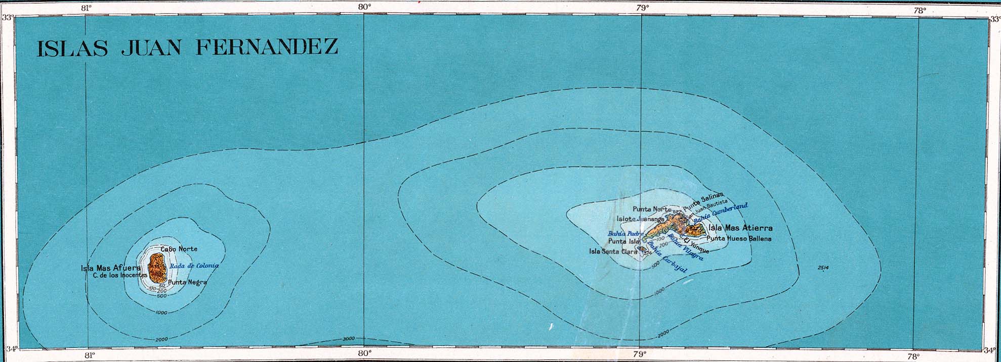
- Juan Fernandez Islands (Topographic) 1927 (170K) From Cauquenes y Islas Esporadicas, Provisional Edition S. I-18, original scale 1:1,000,000, American Geographical Society, 1927
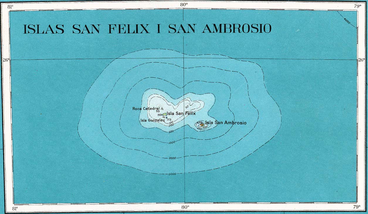
- San Felix and San Ambrosio Islands (Topographic) 1927 (160K) From Cauquenes y Islas Esporadicas, Provisional Edition S. I-18, original scale 1:1,000,000, American Geographical Society, 1927
- This series covers all of Chile
Maps on Other Web Sites