Perry-Castañeda Library
Map Collection
Malaysia Maps
The following maps were produced by the U.S. Central Intelligence Agency, unless otherwise indicated.
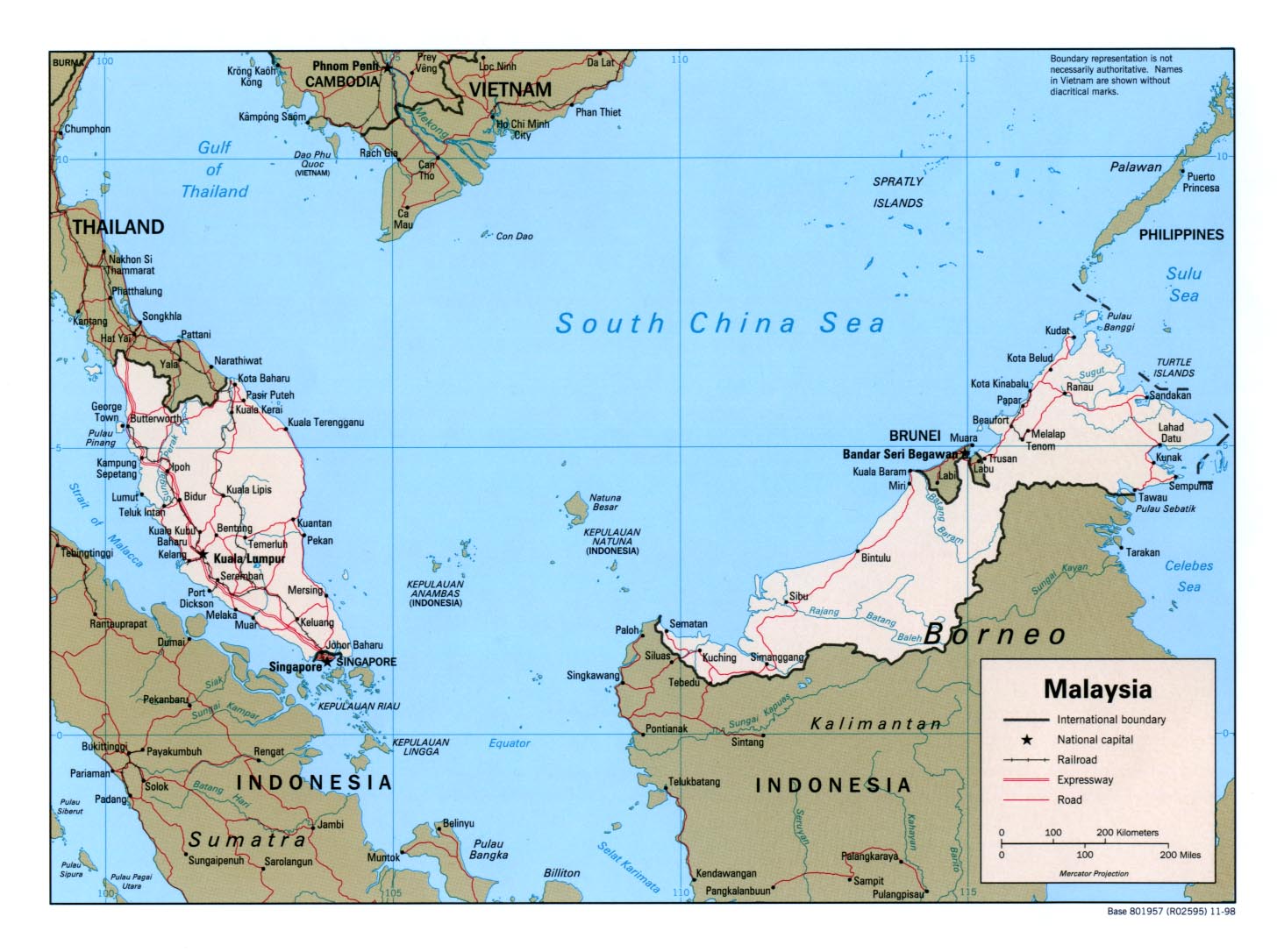
Country Maps- Malaysia (Political) 1998 (258K) and pdf format (171K)
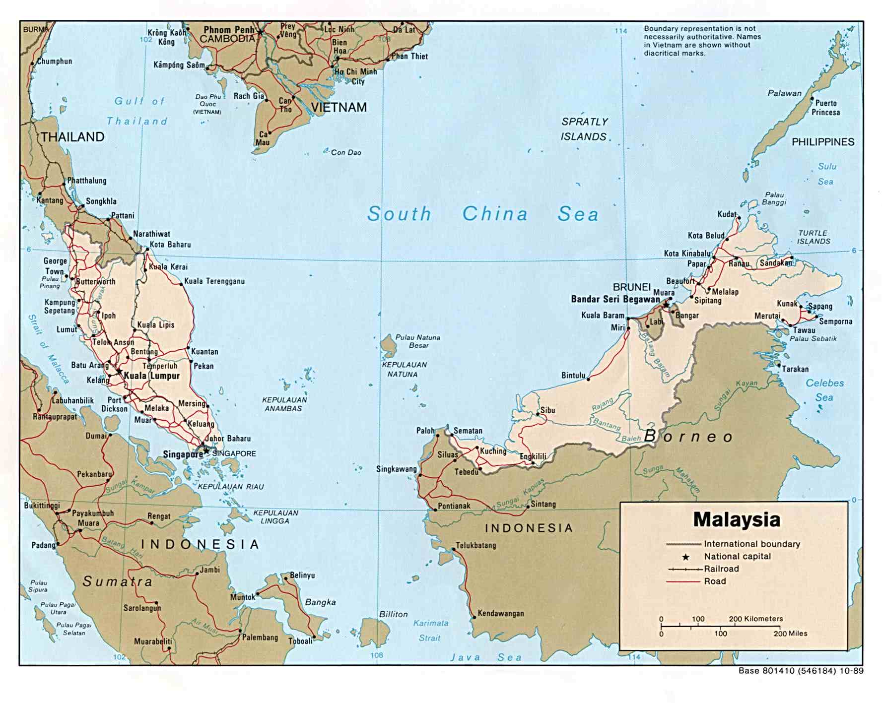
- Malaysia (Political) 1989 (168K)
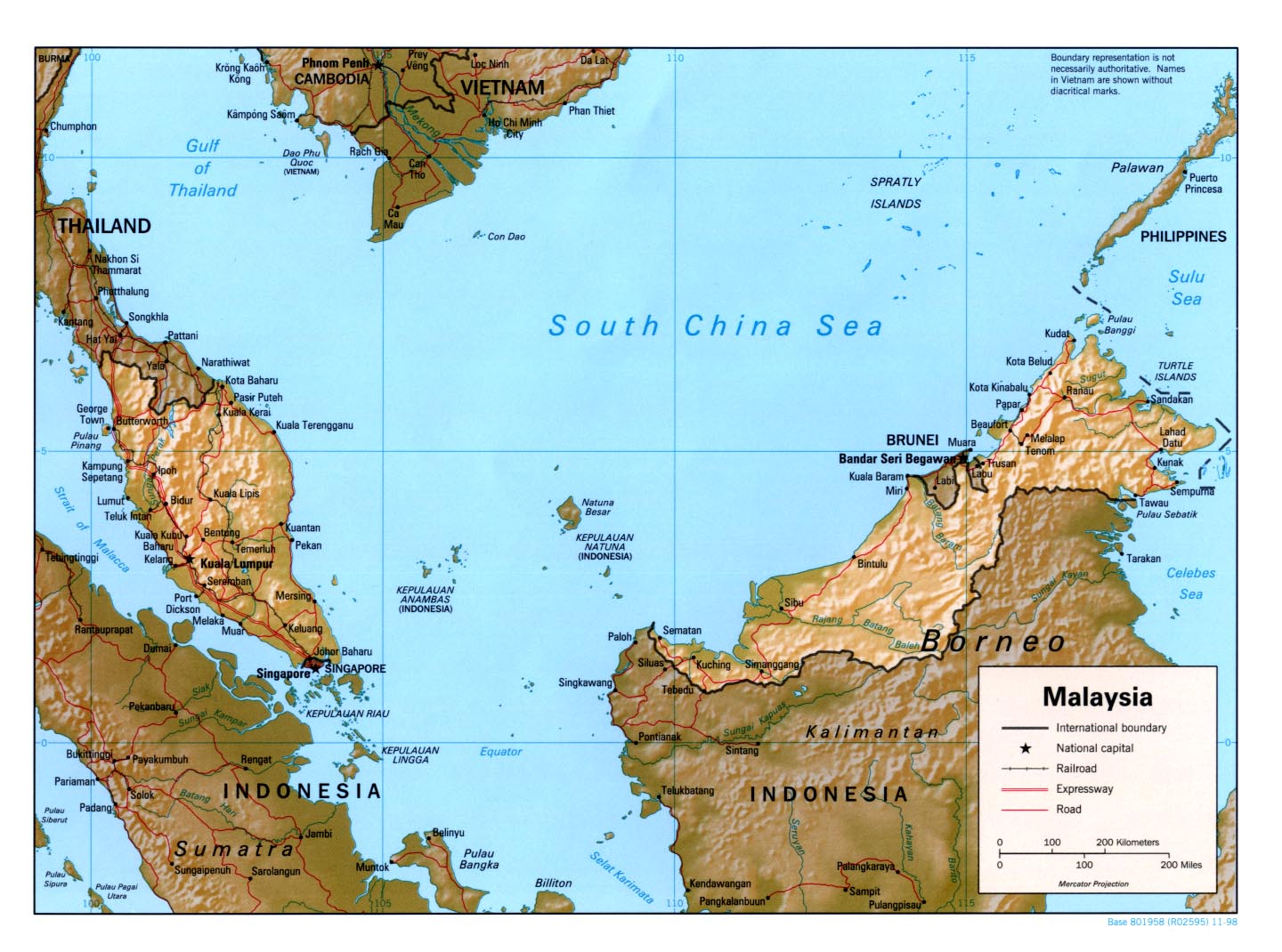
- Malaysia (Shaded Relief) 1998 (323K) and pdf format (240K)
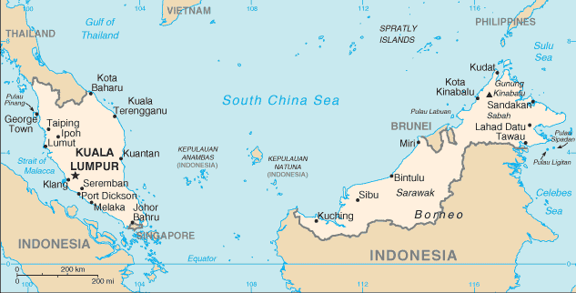
- Malaysia (Small Map) 2016 (20.5K)
- Malaysia: Administrative Divisions 1998 (323K) and pdf format (174K)
- Malacca [Melaka] 1854 (563K)
- "British Territory of Malacca" from An Atlas of the Southern Part of India. Pharoah and Co., Madras 1854.
- Borneo - Topographic Maps U.S. Army Map Service, Series T531, original scale 1:200,000
- "British Territory of Malacca" from An Atlas of the Southern Part of India. Pharoah and Co., Madras 1854.
![Malacca [Melaka] 1854](historical/malacca_1854.jpg)
- 1:1,000,000 - Operational Navigation Chart Sheet L-10, U.S. Defense Mapping Agency Aerospace Center. (14.0MB) Not for navigational use
- This map includes all of Malaysia
- 1:500,000 - Tactical Pilotage Charts U.S. National Imagery and Mapping Agency. Not for navigational use
- This series covers all of Malaysia
- 1:200,000 - Borneo Topographic Maps U.S. Army Map Service, Series T531, 1944-
- This series includes parts of Sarawak and neighboring Kalimantan
- 1:253,440 - Malaya U.S. Army Map Service, Series 4253, 1941-
- This historical series covers Pahang State
- 1:63,360 - Malaya U.S. Army Map Service, Series L705
- This series covers scattered parts of Malaysia
- This map includes all of Malaysia
Maps on Other Web Sites