Perry-Castañeda Library
Map Collection
Burkina Faso Maps
The following maps were produced by the U.S. Central Intelligence Agency, unless otherwise indicated.
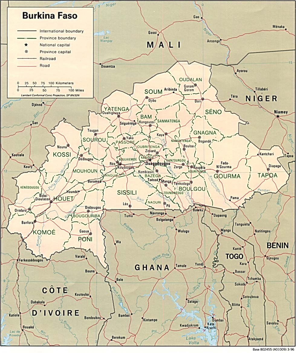
Country Maps- Burkina Faso (Political) 1996 (238K) and pdf format (241K)
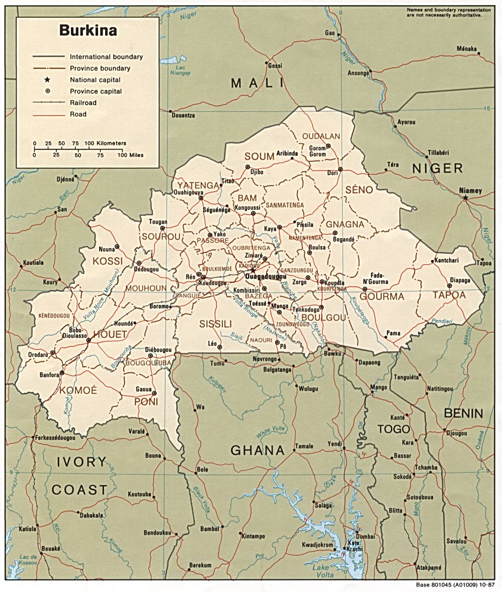
- Burkina Faso (Political) 1987 (237K) and pdf format (241K)
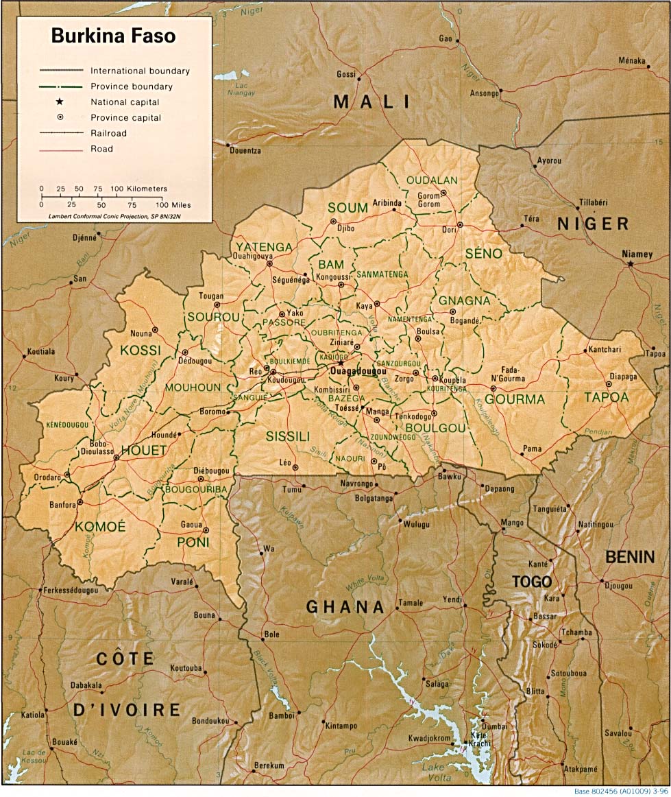
- Burkina Faso (Shaded Relief) 1996 (264K) and pdf format (268K)
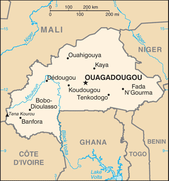
- Burkina Faso (Small Map) 2016 (21.4K)
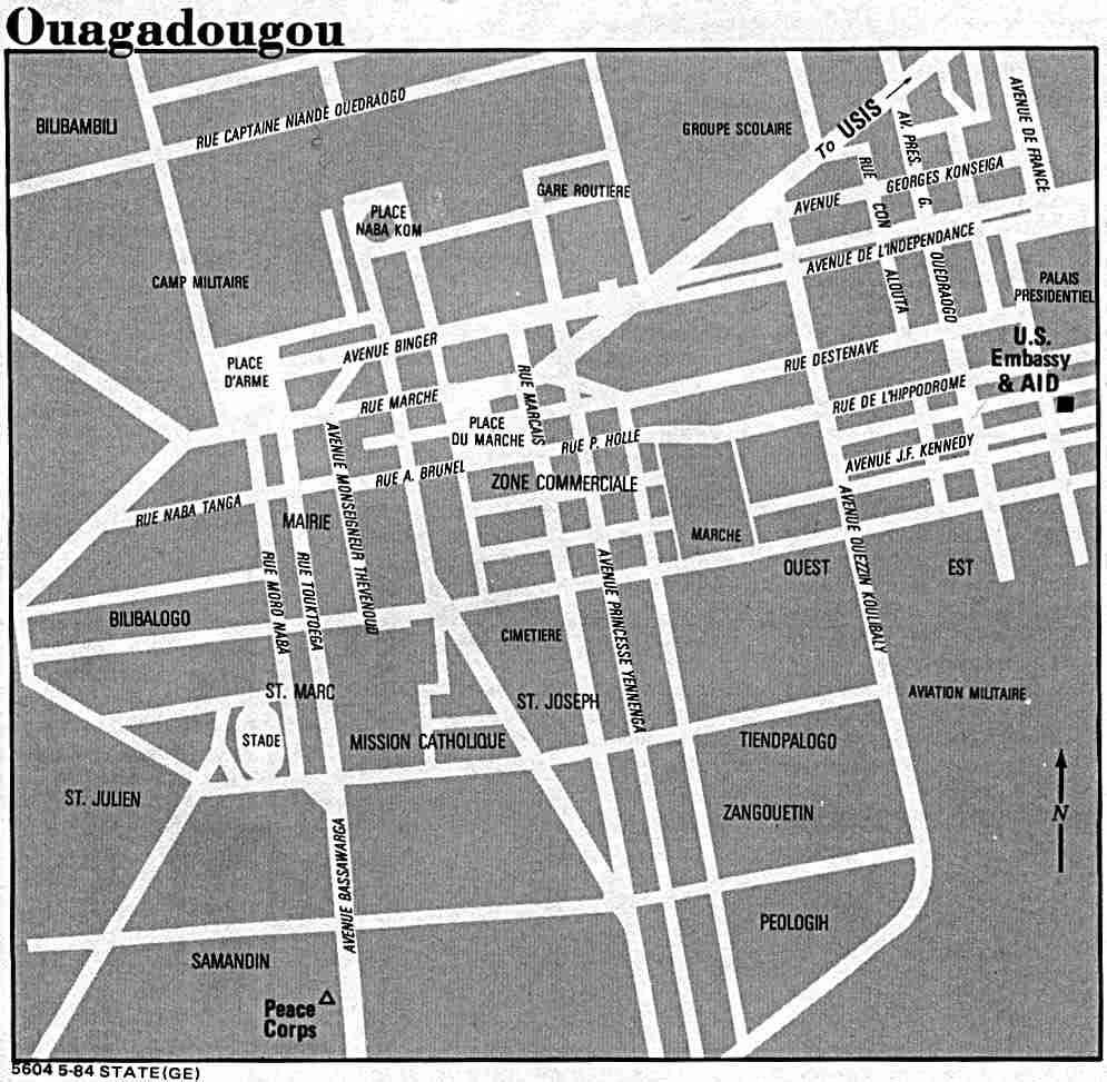
- Ouagadougou U.S. Dept. of State 1984 (78K)
- 1:2,000,000 - Africa Topographic Maps
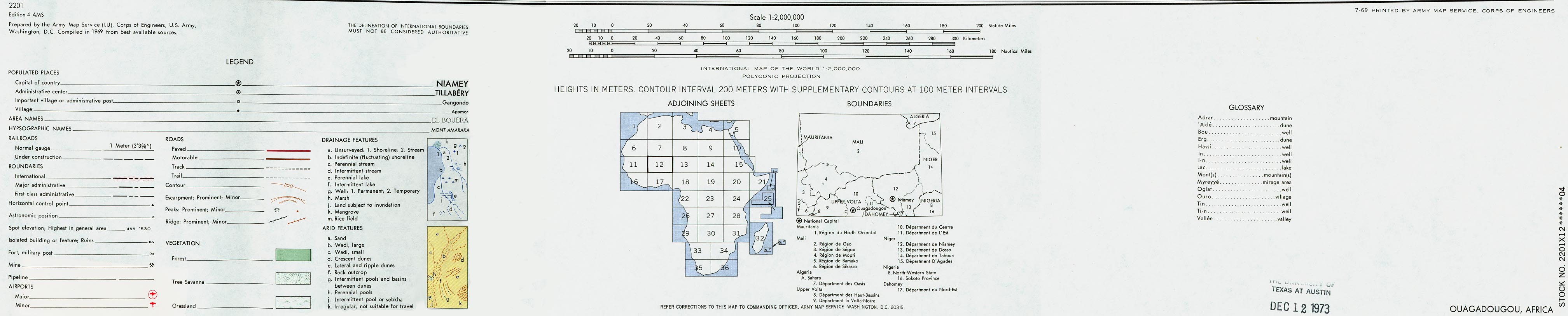
Series 2201, U.S. Army Map Service
- Sheets 12 and 17 cover Upper Volta (Burkina Faso). A scan of part of sheet 12 is listed below.
- North and East Upper Volta [Burkina Faso]/Western Niger/Eastern Mali (1.72MB) and map key and scale (393K)
- Portion of AMS Series 2201, Sheet 12 "Ouagadougou", original scale 1:2,000,000. Published by the U.S. Army Map Service, 1969. The area covered by this map includes the cities of Ouagadougou, Upper Volta [now Burkina Faso]; Niamey, Niger; Gao, Mali and Sokoto, Nigeria.
- 1:1,000,000 - International Map of the World U.S. Army Map Service
- This series covers most of wester and central Upper Volta [now Burkina Faso]. Clickable map
- 1:1,000,000 - Operational Navigation Chart Series U.S. Defense Mapping Agency Aerospace Center
- This series includes all of Burkina Faso. Not for navigational use
- 1:500,000 - Tactical Pilotage Charts U.S. National Imagery and Mapping Agency. Not for navigational use
- This series covers Burkina Faso
- 1:250,000 - West Africa Topographic Maps Series N504, U.S. Army Map Service, 1955-
- This series covers most of western and central Upper Volta [now Burkina Faso]
- Sheets 12 and 17 cover Upper Volta (Burkina Faso). A scan of part of sheet 12 is listed below.
![North and East Upper Volta [Burkina Faso]/Western Niger/Eastern Mali](africa/ouagadougou_1969.jpg)
- [Burkina Faso] Upper Volta - Economic Activity from Map No. 58207 1968 (94K)
- [Burkina Faso] Upper Volta - Ethnic Groups from Map No. 58207 1968 (125K)
- [Burkina Faso] Upper Volta - Population from Map No. 58207 1968 (107K)
- [Burkina Faso] Upper Volta - Vegetation from Map No. 58207 1968 (136K)
![[Burkina Faso] Upper Volta - Economic Activity](africa/upper_volta_econ_1968.jpg)
![[Burkina Faso] Upper Volta - Ethnic Groups](africa/upper_volta_ethnic_1968.jpg)
![[Burkina Faso] Upper Volta - Population](africa/upper_volta_pop_1968.jpg)
![[Burkina Faso] Upper Volta - Vegetation](africa/upper_volta_veg_1968.jpg)
Maps on Other Web Sites