Perry-Castañeda Library
Map Collection
Nigeria Maps
The following maps were produced by the U.S. Central Intelligence Agency, unless otherwise indicated.
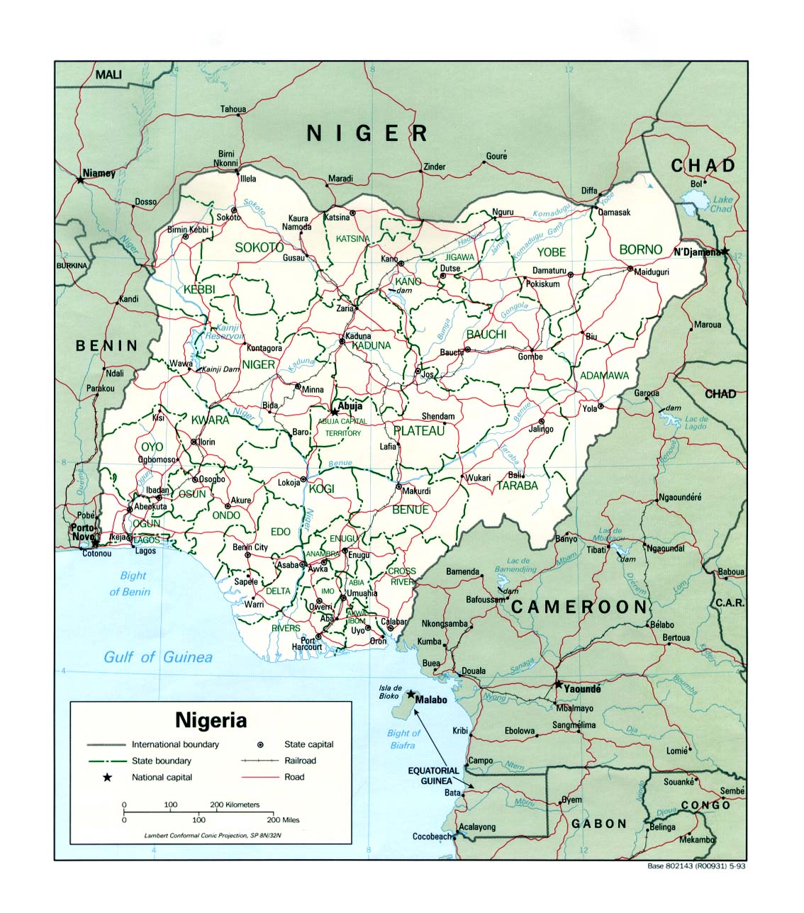
Country Maps- Nigeria (Political) 1993 (265K)and pdf format (273K)
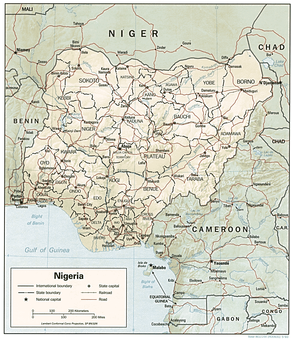
- Nigeria (Shaded Relief) 1993 (339K)and pdf format (348K)
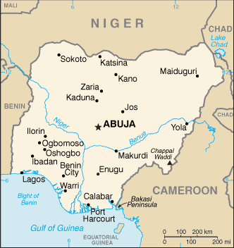
- Nigeria (Small Map) 2016 (14.9K)
- 1:2,000,000 - Africa Topographic Maps U.S. Army Map Service, Series 2201
- Sheets 12, 13, 17 and 18 cover all of Nigeria
- 1:1,000,000 - International Map of the World U.S. Army Map Service
- This series covers most of Nigeria. Clickable map
- 1:1,000,000 - Operational Navigation Chart Series U.S. Defense Mapping Agency Aerospace Center. Not for navigational use
- This series covers all of Nigeria
- 1:500,000 - Tactical Pilotage Charts U.S. National Imagery and Mapping Agency. Not for navigational use
- This series covers Nigeria
- 1:250,000 - Joint Operations Graphic (Air), Series 1501 Not for navigational use Original scale 1:250,000. U.S. National Imagery and Mapping Agency. Earlier sheets produced by the U.S. Defense Mapping Agency.
- This series covers parts of Nigeria
- 1:250,000 - West Africa Topographic Maps U.S. Army Map Service, Series G504
- This series covers very few parts of Nigeria, but does include Lagos
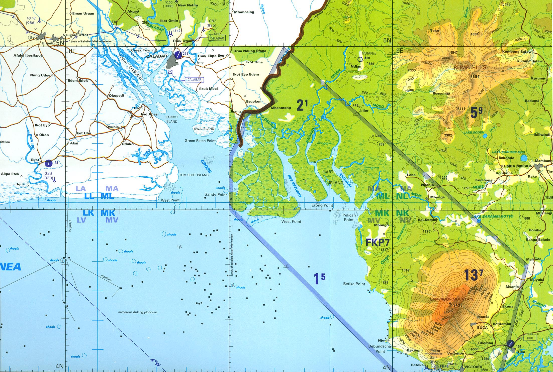
- Calabar (Tactical Pilotage Chart) original scale 1:500,000 Portion of Defense Mapping Agency Series TPC, Sheet L-3A, Edition 1, 1996 [Compiled April 1995, air information current through 20 October 1995] (682K) Not for navigational use
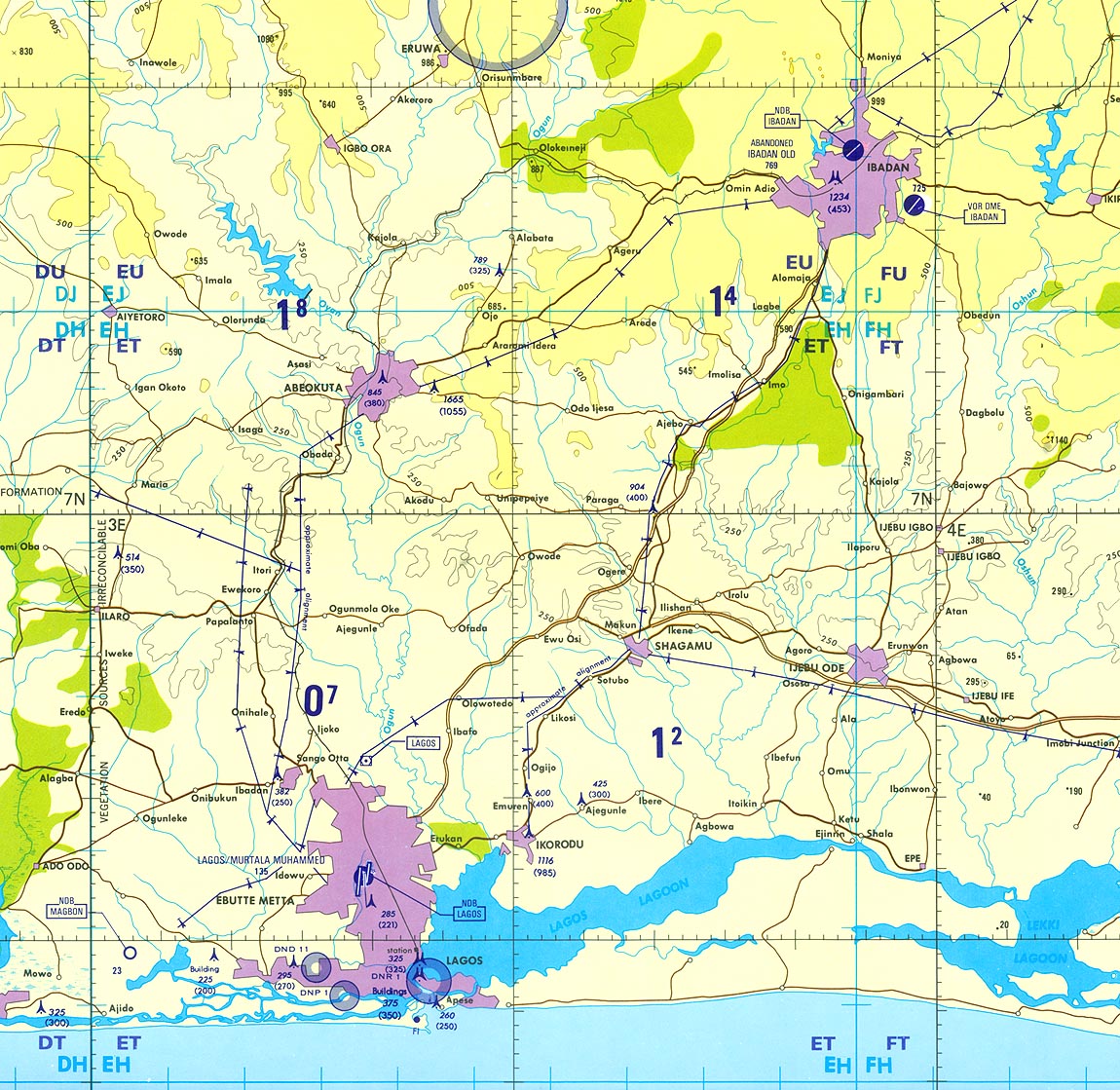
- Lagos/Ibadan Region (Tactical Pilotage Chart) original scale 1:500,000 Portion of National Imagery and Mapping Agency Series TPC, Sheet L-2B, Edition 2, 1997 [Compiled July 1985, revised March 1995, air information current through 17 July 1996] (417K) Not for navigational use
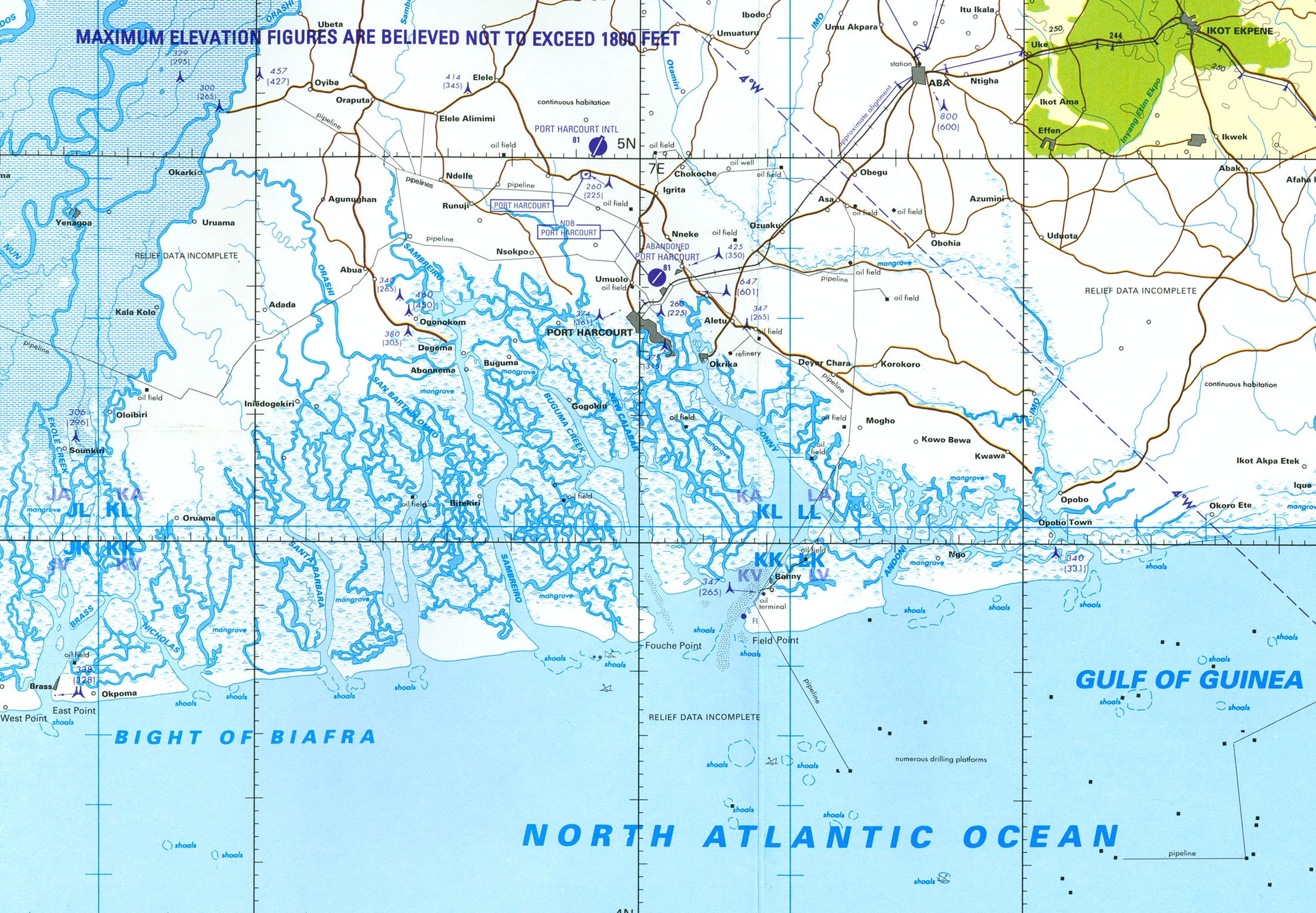
- Port Harcourt (Joint Operations Graphic) original scale 1:250,000 Portion of Defense Mapping Agency Series 1501 AIR, Sheet NB 32-13, Edition 2, 2000 [Compiled 1972, air information current through 19 March 1973, reprinted by NIMA, 2000] (2.1MB) Not for navigational use See Series 1501 page for complete map
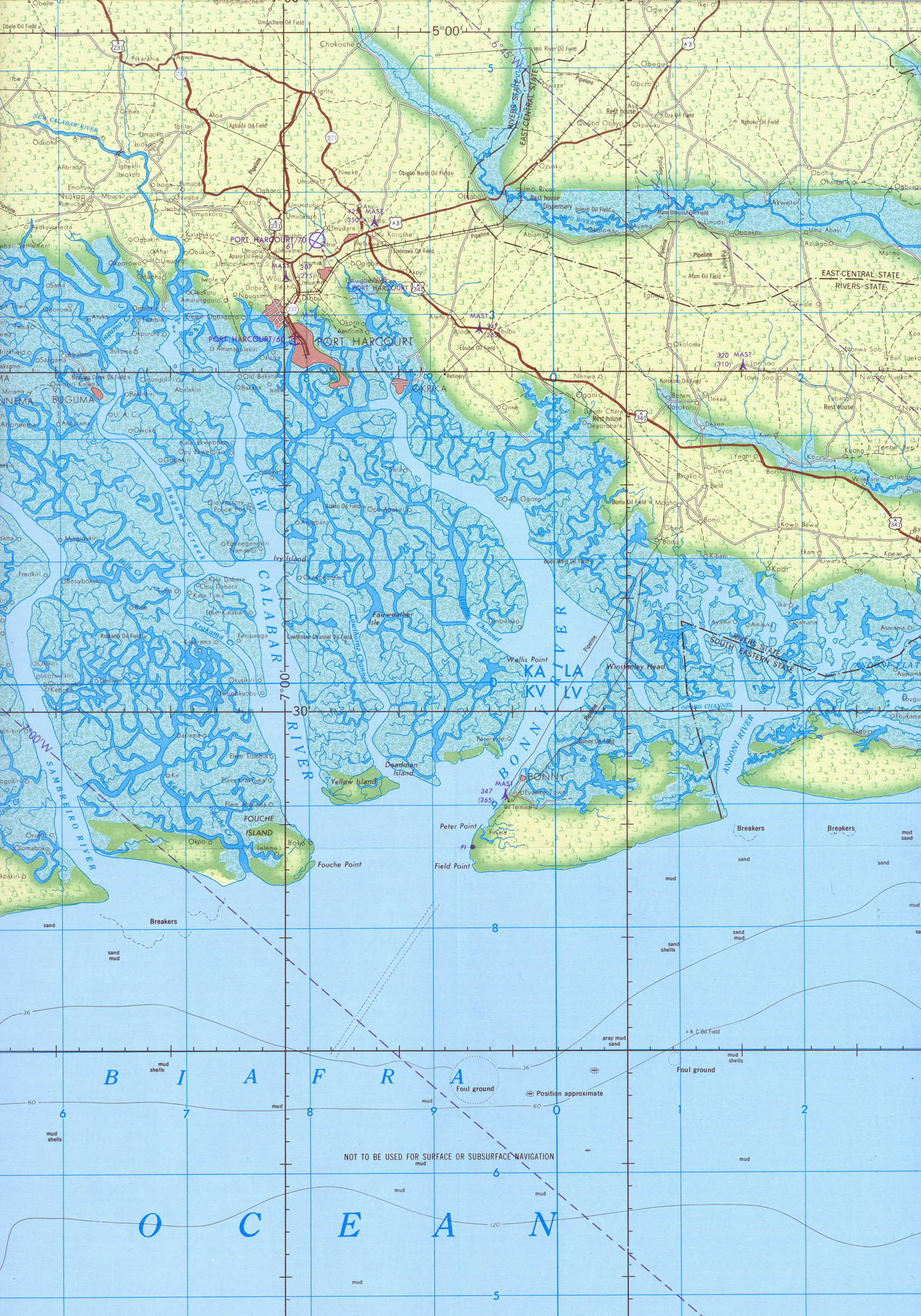
- Port Harcourt (Tactical Pilotage Chart) original scale 1:500,000 Portion of Defense Mapping Agency Series TPC, Sheet L-3A, Edition 1, 1996 [Compiled April 1995, air information current through 20 October 1995] (724K) Not for navigational use
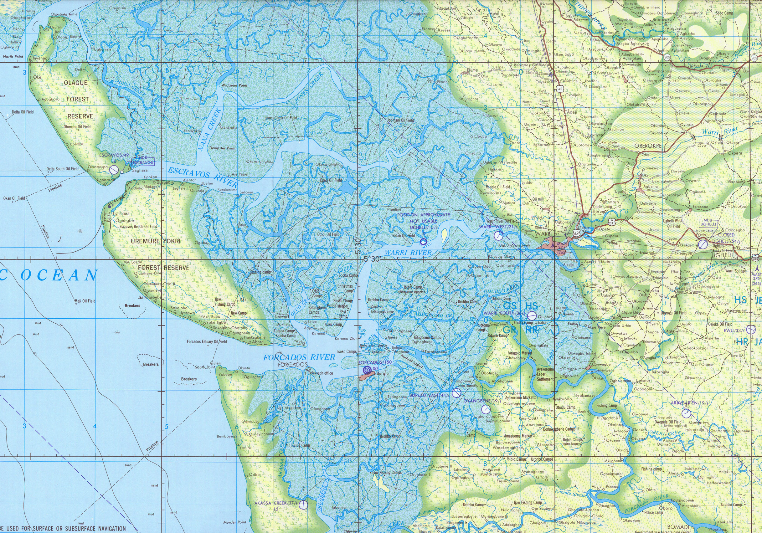
- Warri (Joint Operations Graphic) original scale 1:250,000 Portion of Defense Mapping Agency Series 1501 AIR, Sheet NB 31-12, Edition 2, 2000 [Compiled 1972, air information current through 19 March 1973, reprinted by NIMA, 2000] (2.6MB) Not for navigational use See Series 1501 page for complete map
- Sheets 12, 13, 17 and 18 cover all of Nigeria
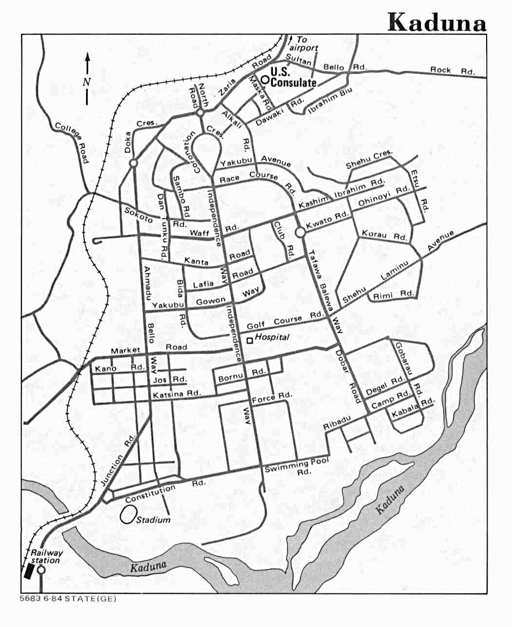
- Kaduna U.S. Dept. of State 1984 (72K)
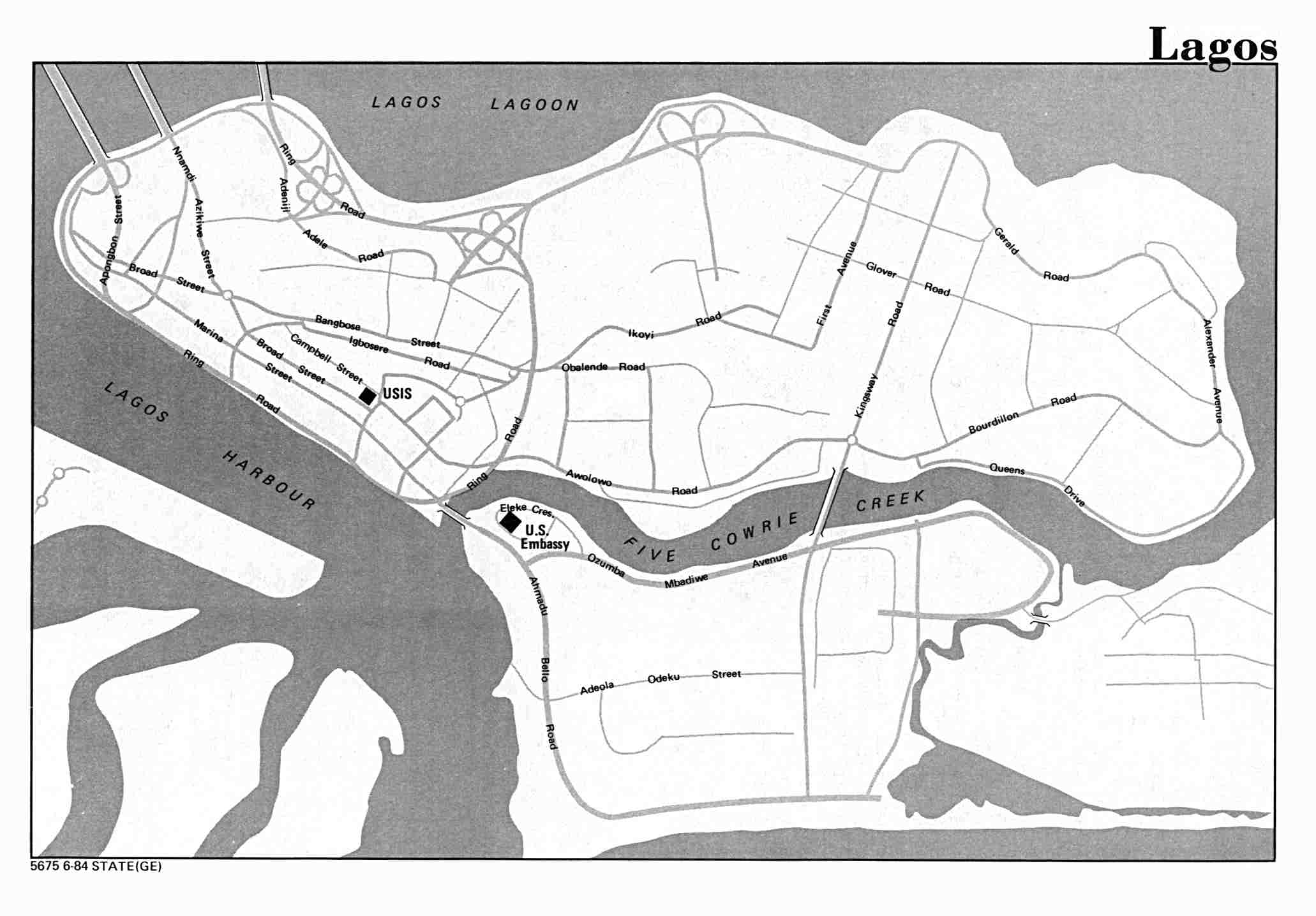
- Lagos U.S. Dept. of State 1984 (110K)
- Lagos 1:12,500, Edition 1-AMS, Series G961. U.S. Army Map Service, 1962 (12MB)
- Nigeria - Commerical Crops and Ecological Zones U.S. Foreign Agricultural Service 2002 (187K)
- Nigeria - Economic Activity from Map No. 504014 1979 (163K)
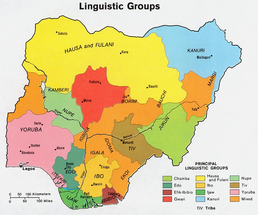
- Nigeria - Ethnolinguistic Groups from Map No. 504014 1979 (144K)
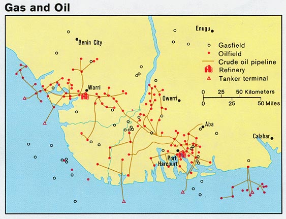
- Nigeria - Gas and Oil from Map No. 504014 1979 (80K)
- Nigeria - Population from Map No. 504014 1979 (112K)
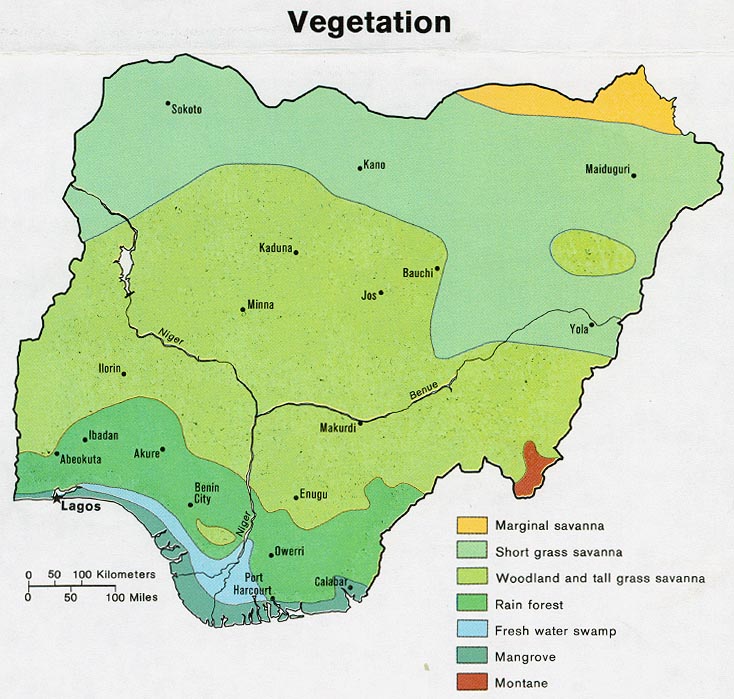
- Nigeria - Vegetation from Map No. 504014 1979 (129K)
Maps on Other Web Sites