Perry-Castañeda Library
Map Collection
Pakistan Maps
The following maps were produced by the U.S. Central Intelligence Agency, unless otherwise indicated.
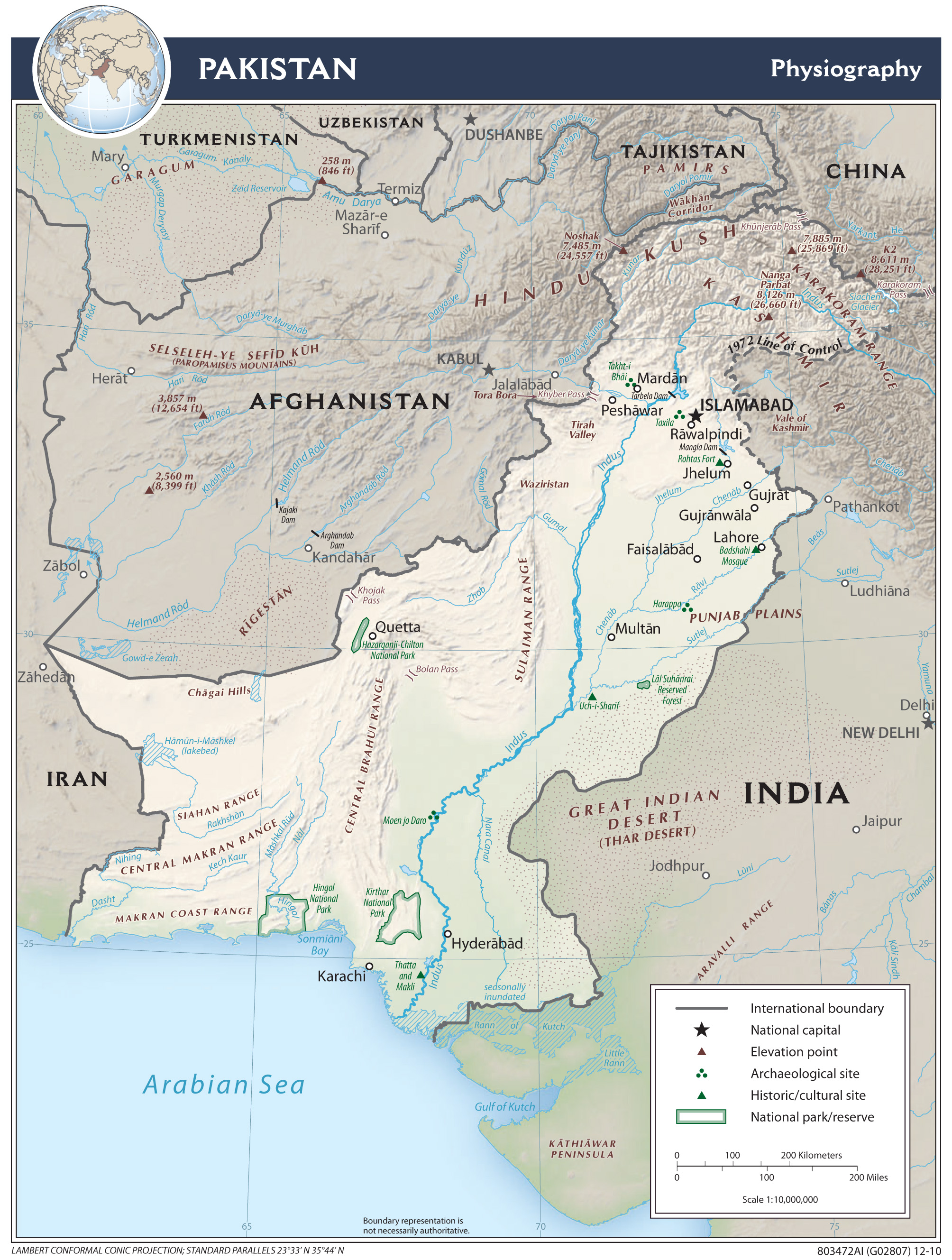
Country Maps- Pakistan (Physiography) 2010 (1.6MB) and pdf format (842K)
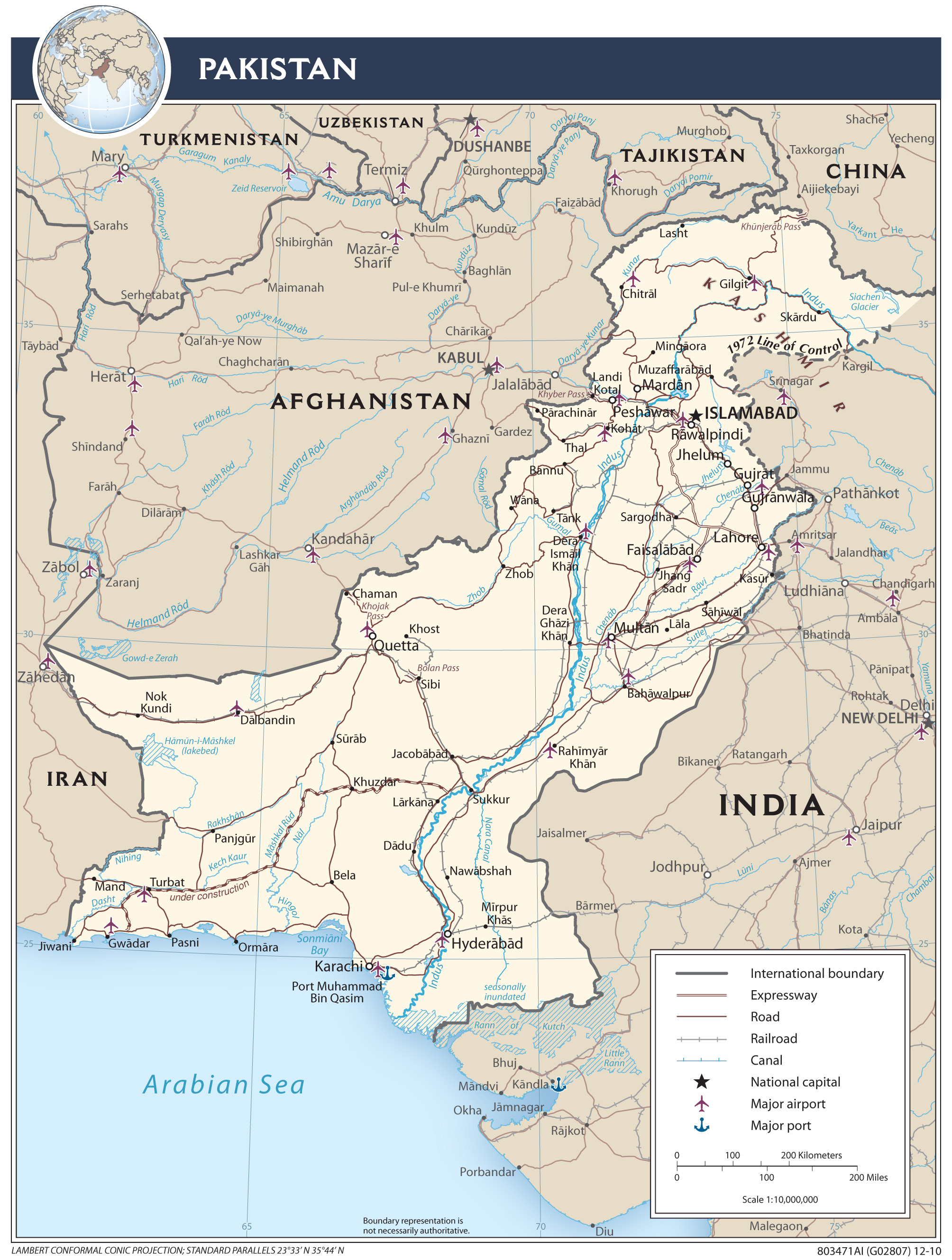
- Pakistan (Political) 2010 (783K)
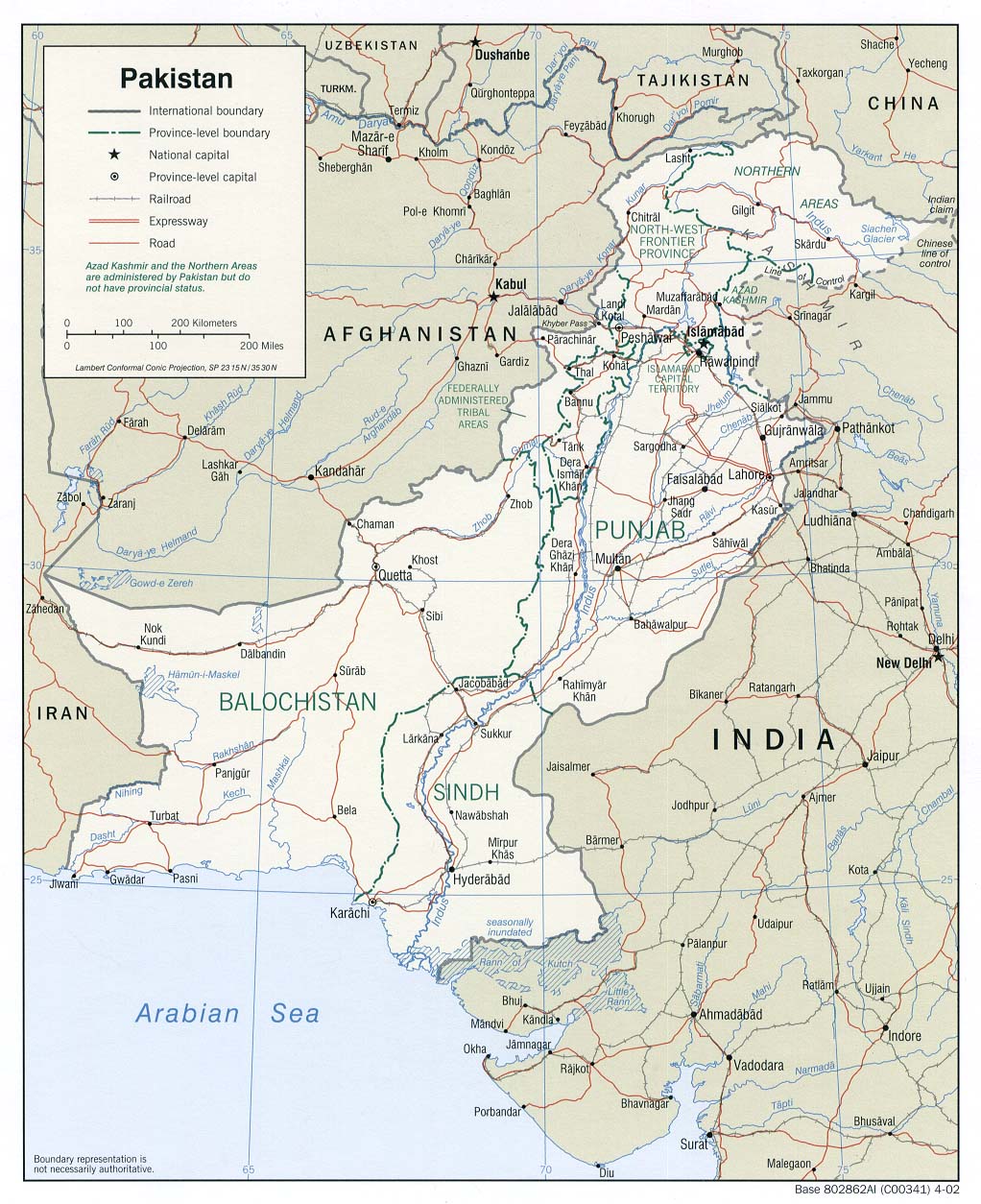
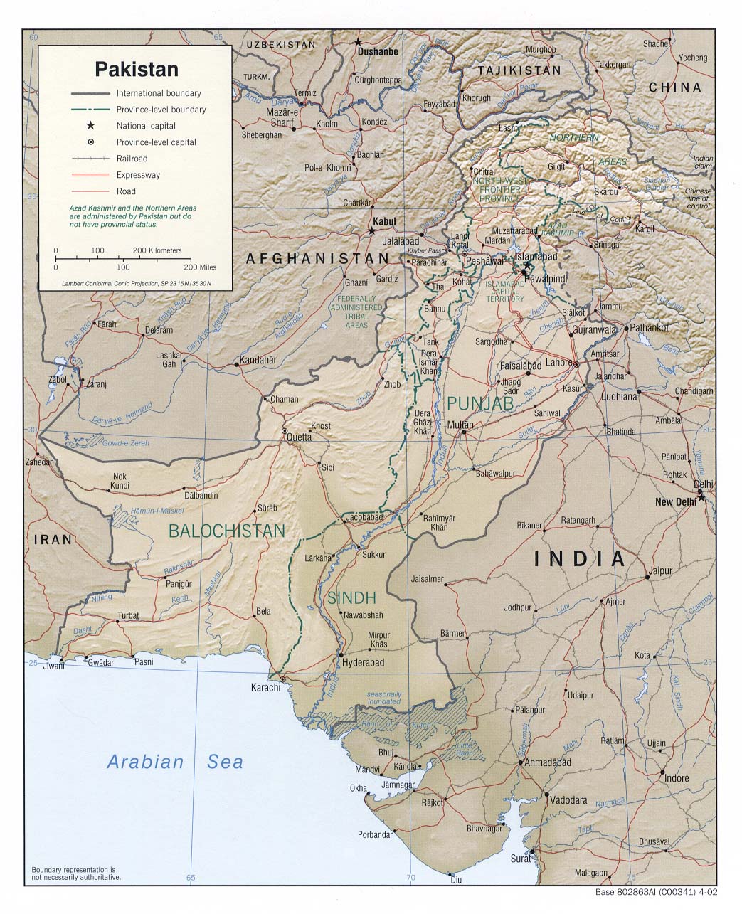
- Pakistan (Political) 2002 (272K) and pdf format (288K)
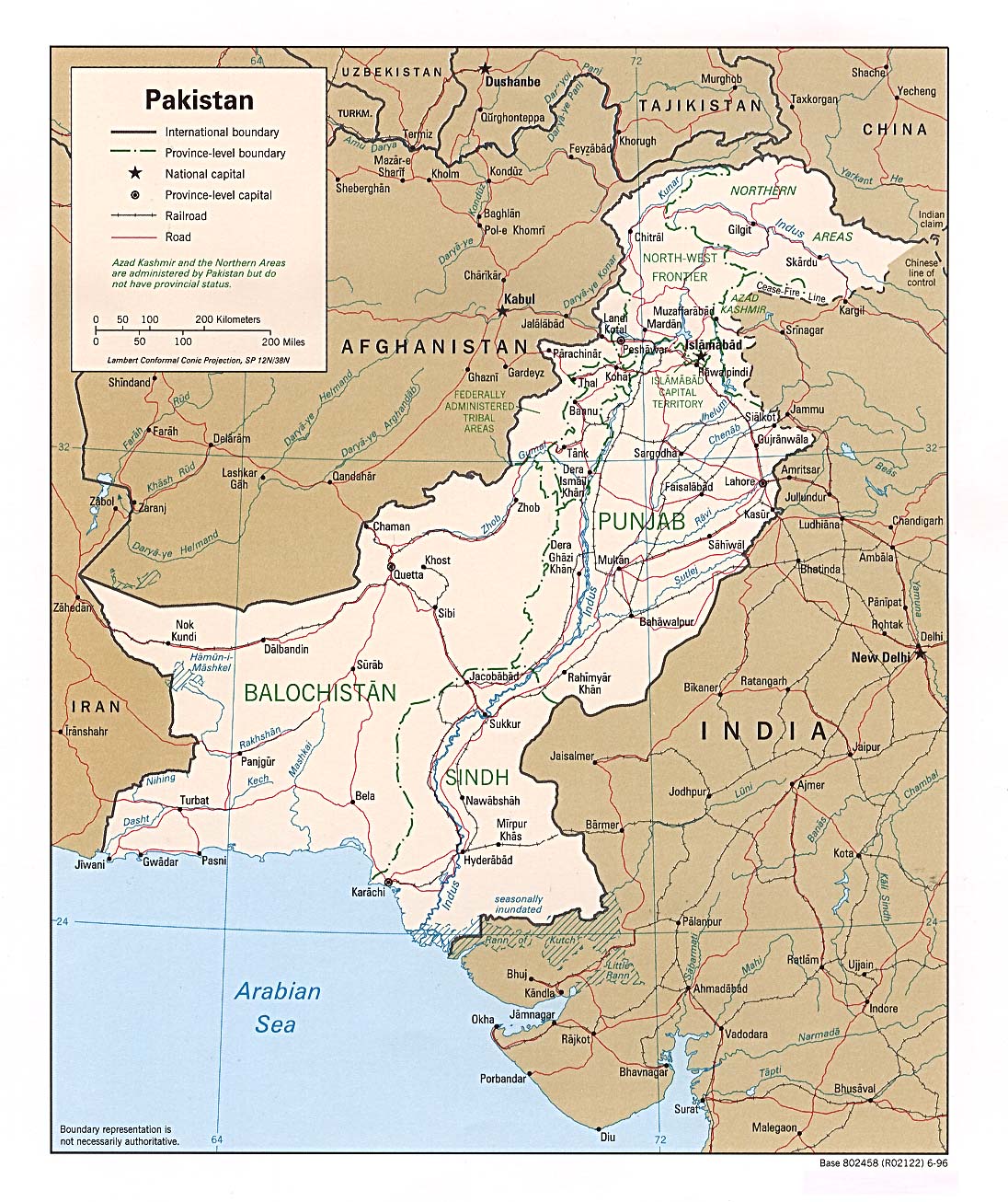
- Pakistan (Political) 1996 (344K) and pdf format (348K)
- Pakistan (Shaded Relief) 2009 (2.0MB)
- Pakistan (Shaded Relief) 2002 (286K) and pdf format (291K)
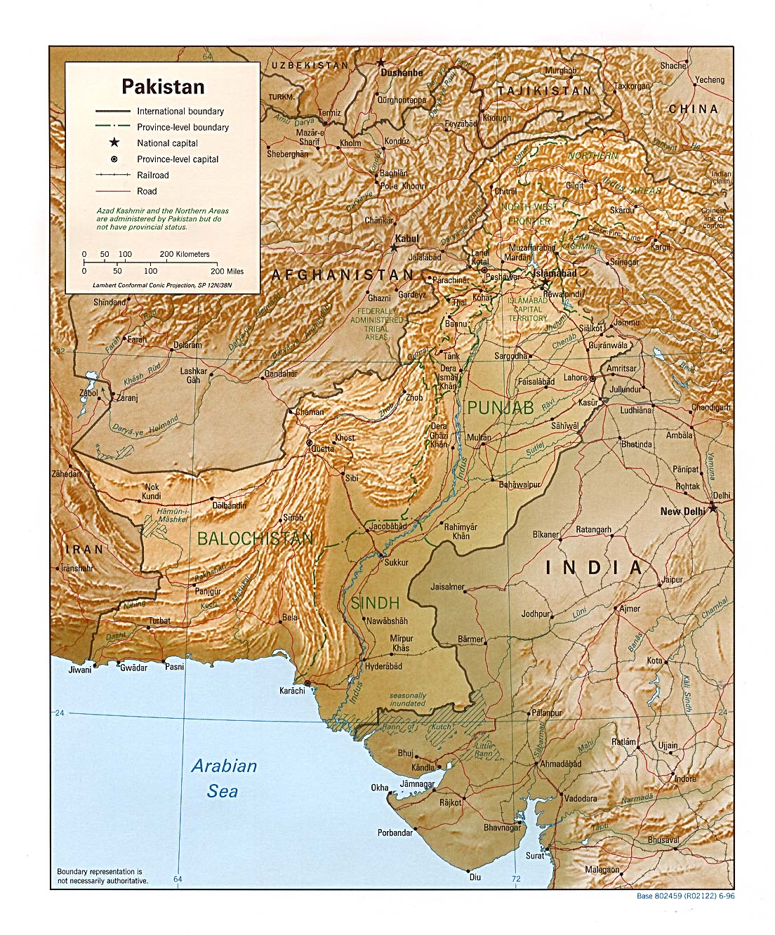
- Pakistan (Shaded Relief) 1996 (411K)and pdf format (348K)
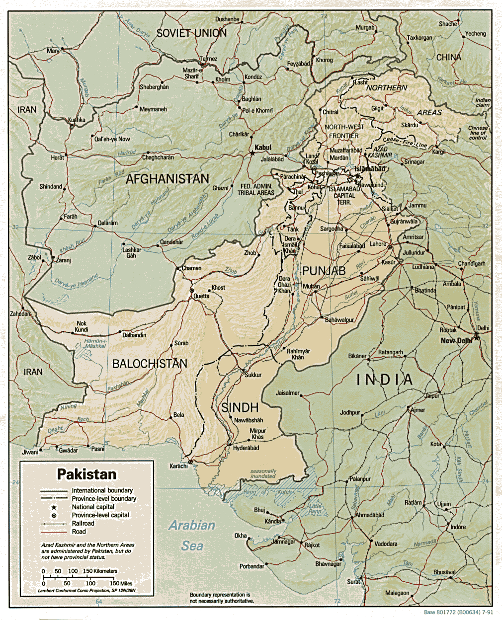
- Pakistan (Shaded Relief) 1991 (337K) and pdf format (351K)
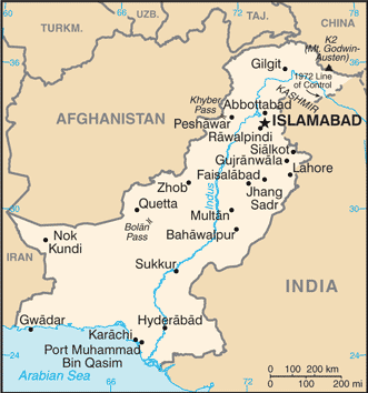
- Pakistan (Small Map) 2016 (25.2K)
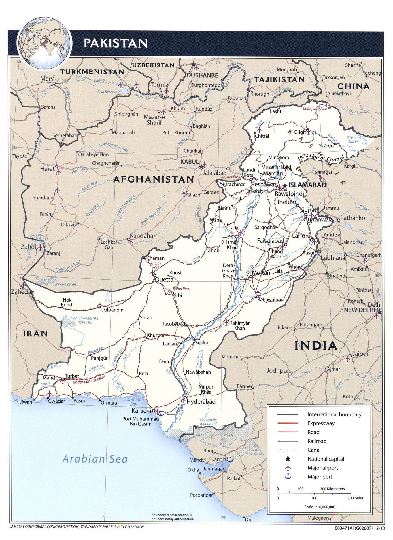
- Pakistan (Transportation) 2010 (1.5MB) and pdf format (1.0MB)
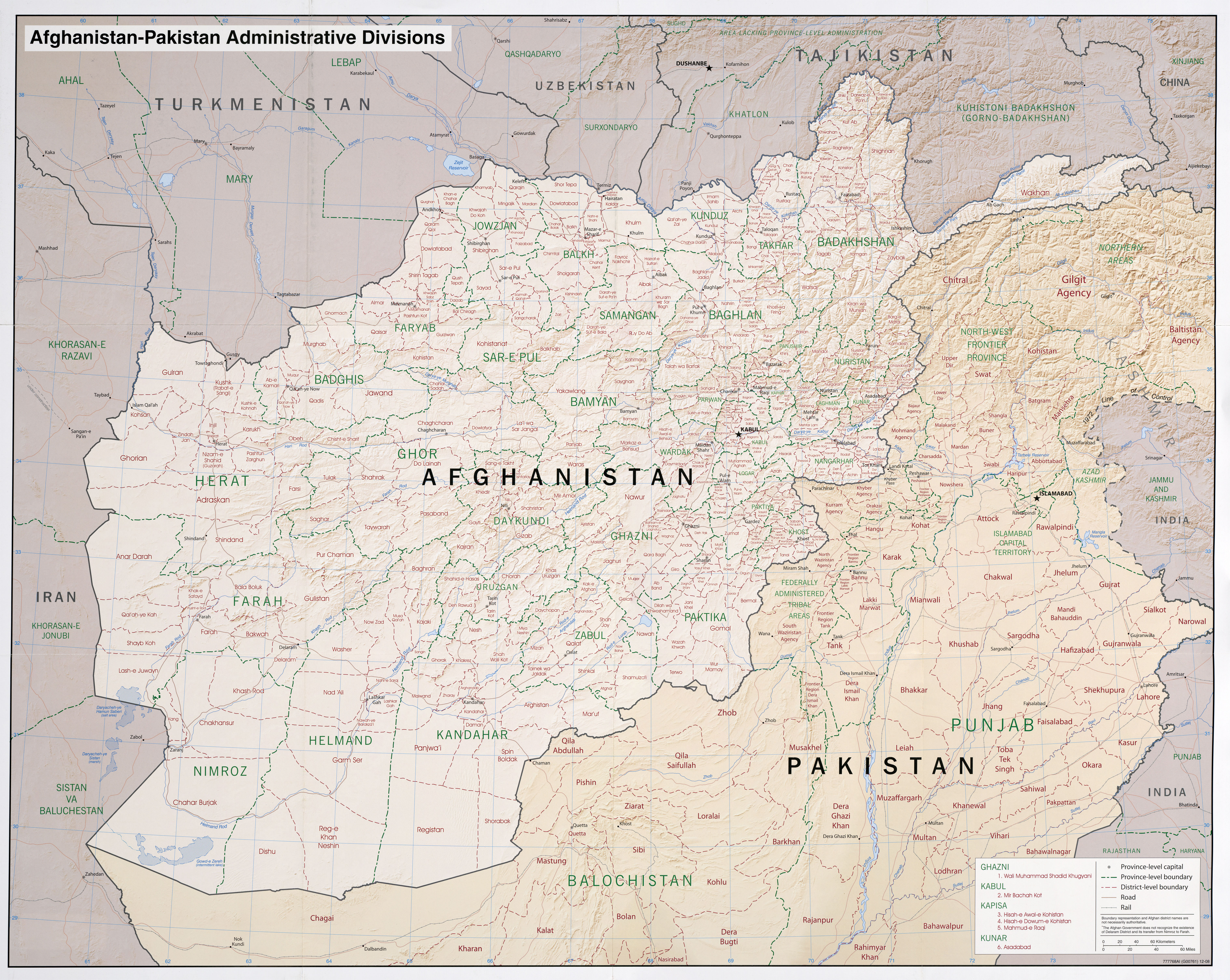
- Afghanistan-Pakistan (Administrative Divisions) 2012 (10.9MB)
- Afghanistan-Pakistan (Administrative Divisions) 2008 (6.2MB)
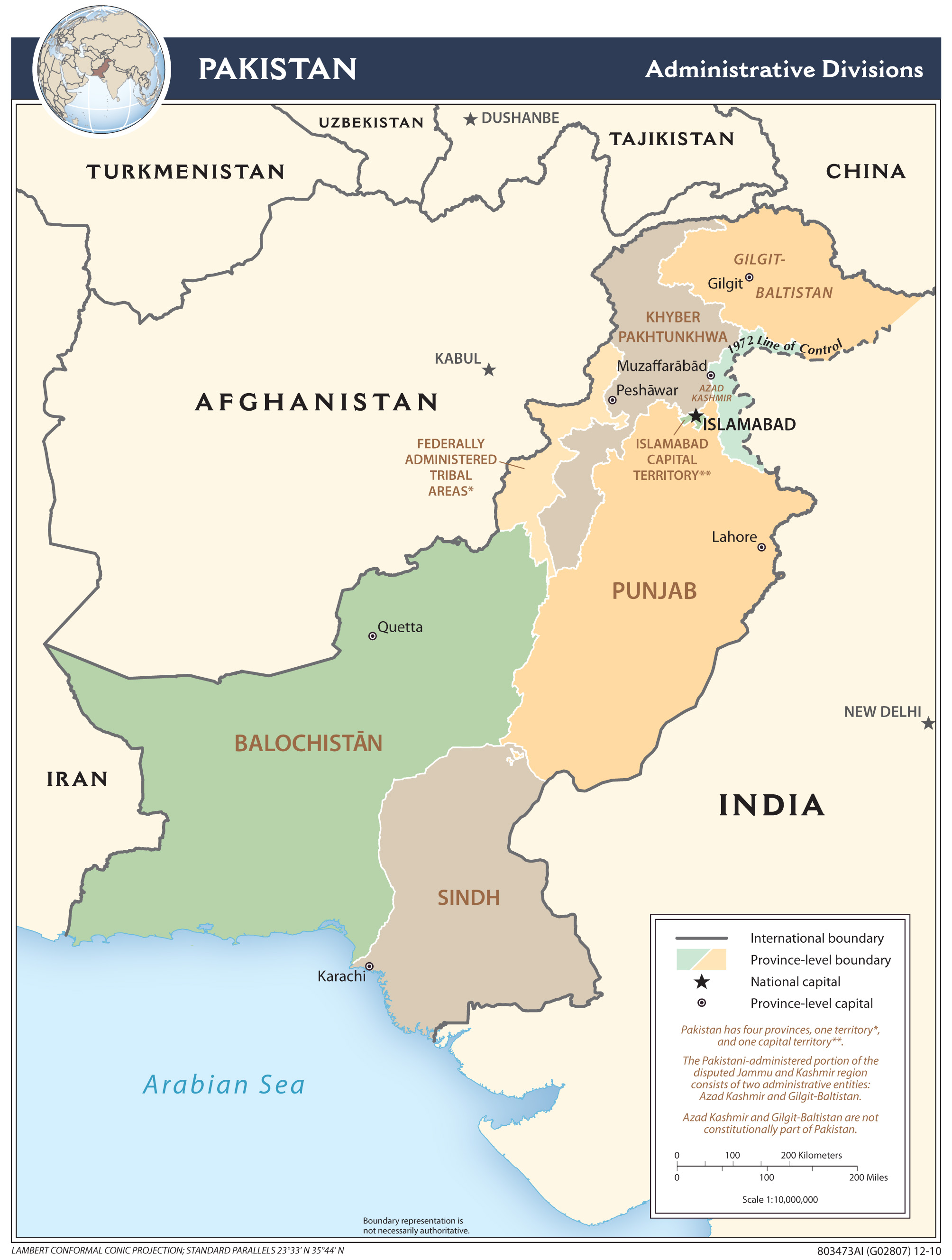
- Pakistan (Administrative Divisions) 2010 (721K) and pdf format (933K)
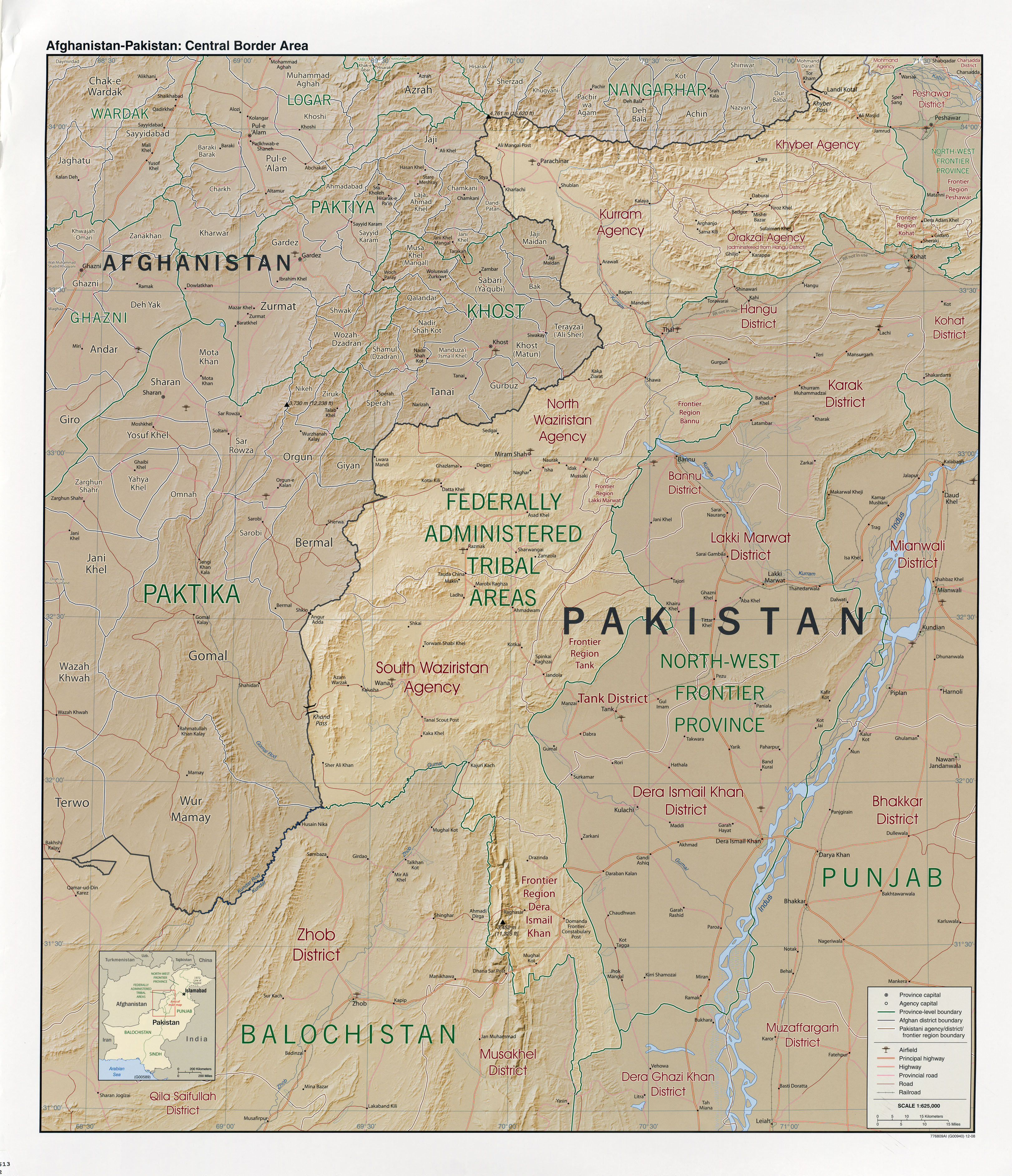
- Afghanistan-Pakistan: Central Border Area 2008 (2.9MB)
- Pakistan (Physiography) 2010 (823K)
- Kashmir Maps Page
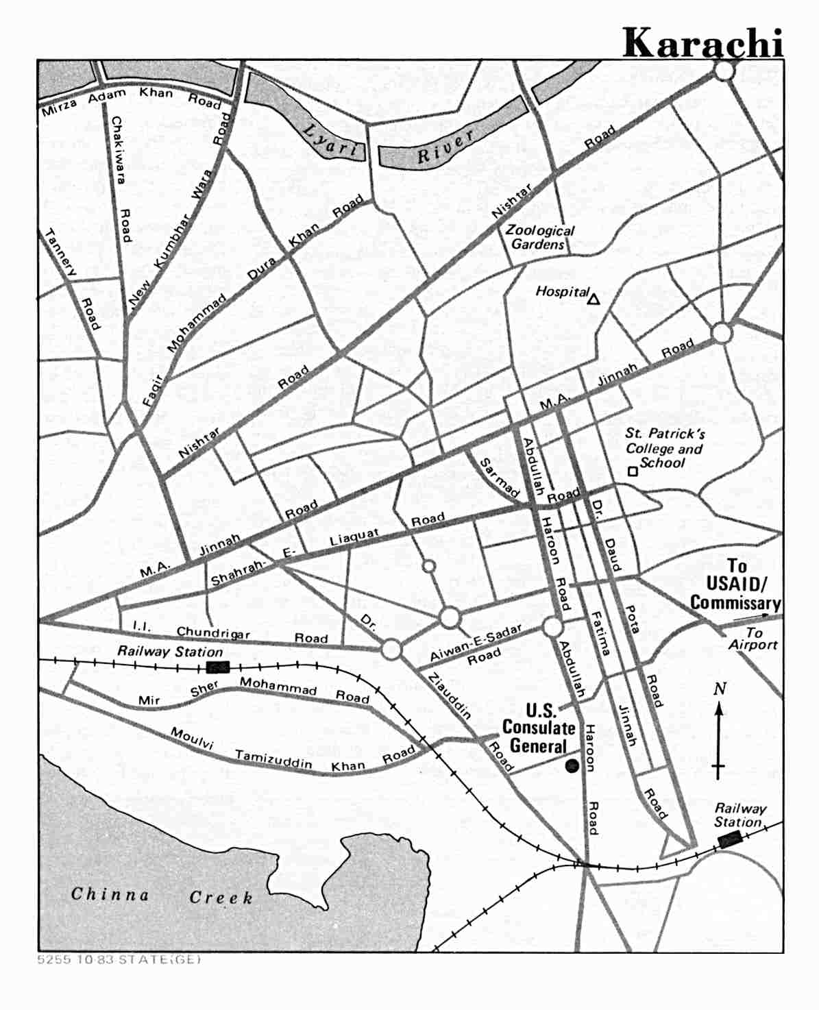
- Karachi U.S. Department of State 1983 (91K)
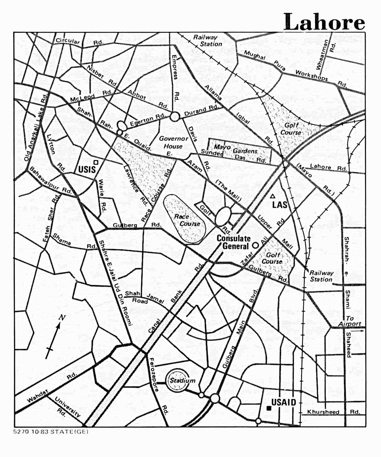
- Lahore U.S. Department of State 1983 (115K)
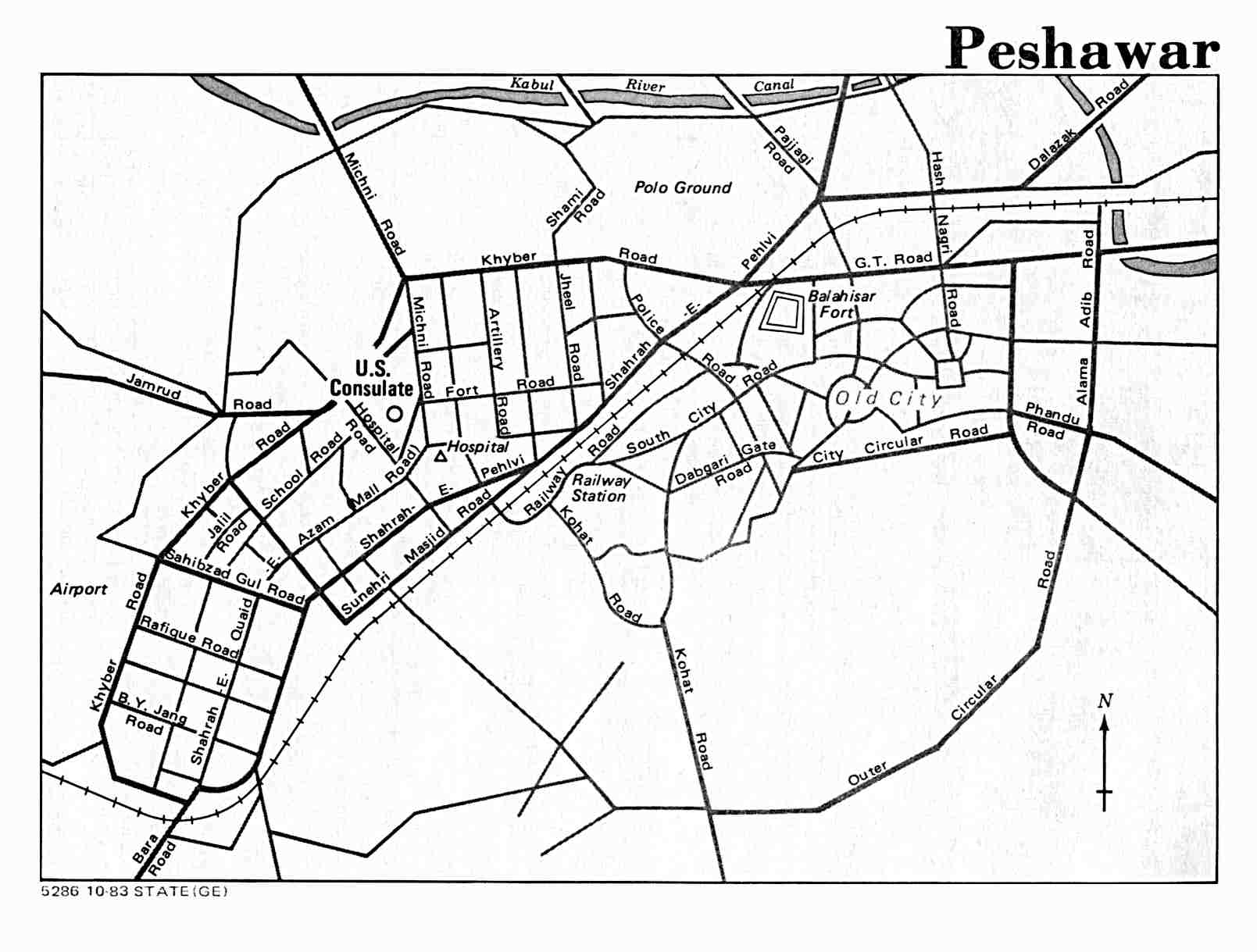
- Peshawar U.S. Department of State 1983 (104K)
- 1:1,000,000 - Operational Navigation Charts U.S. National Imagery and Mapping Agency Not for navigational use. Clickable Index Map
- This series covers all of Pakistan.
- 1:1,000,000 - International Map of the World U.S. Army Map Service. Clickable Index Map
- This series covers all of Pakistan.
- 1:500,000 - Tactical Pilotage Charts U.S. National Imagery and Mapping Agency. Not for navigational use. Clickable Index Map
- This series covers all of Pakistan.
- 1:250,000 - Pakistan - Joint Operations Graphic National Imagery and Mapping Agency. Not for navigational use Clickable Index Map
- This more recent series covers most of Pakistan.
- 1:250,000 - India and Pakistan - Topographic Maps Series U502, 1:250,000, U.S. Army Map Service, 1955- Clickable Index Map
- This historical series covers most of Pakistan.
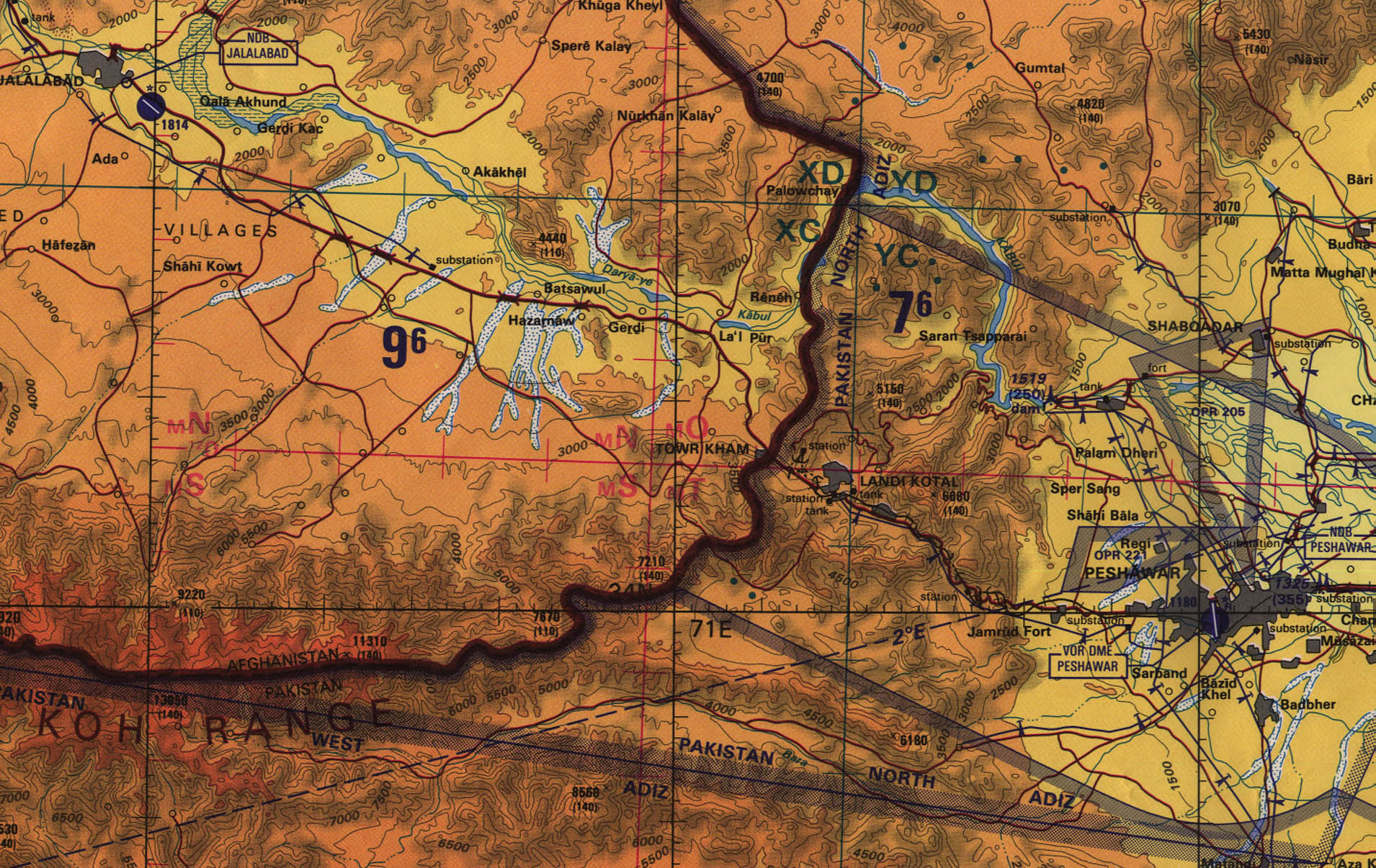
- 1:500,000 - Jalalabad, Afghanistan - Peshawar, Pakistan Region (Detail from Tactical Pilotage Chart) original scale 1:500,000 Portion of TPC G-6C, U.S. Defense Mapping Agency, 1992 (774K) Not for navigational use
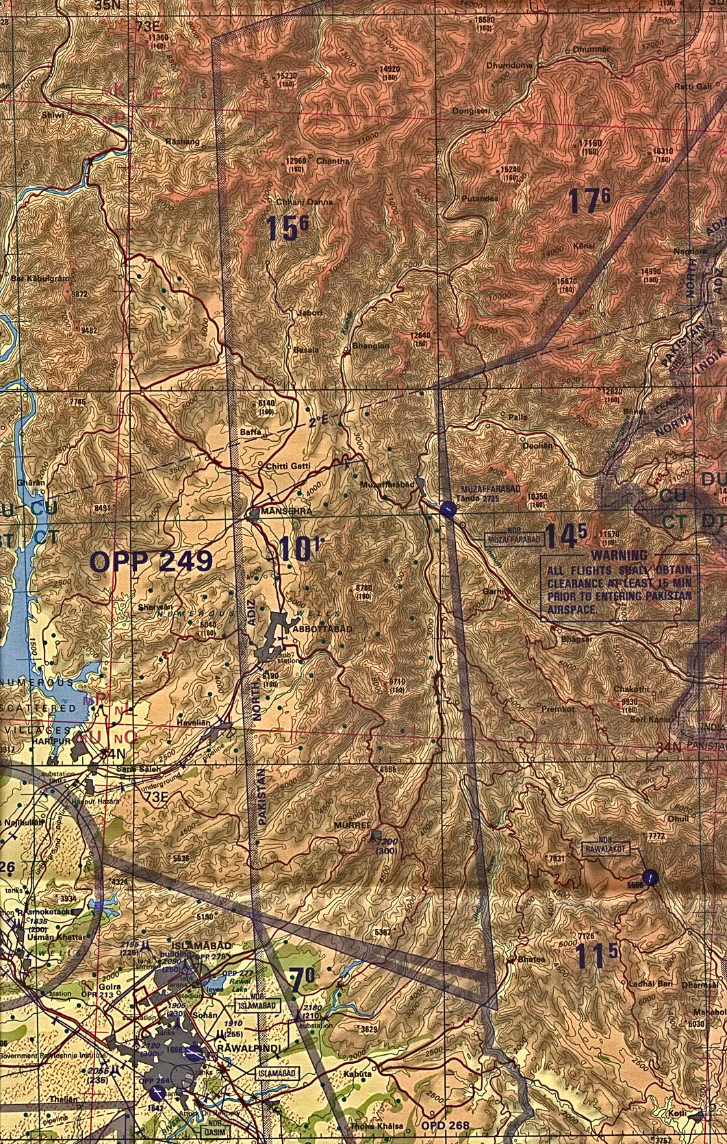
- 1:500,000 - Muzaffarabad Border Region (Detail from Tactical Pilotage Chart) Original scale 1:500,000 Portion of TPC G-6C, U.S. Defense Mapping Agency, 1992 (1.2MB) Not for navigational use
- 1:500,000 - Srinagar Border Region (Detail from Tactical Pilotage Chart) Original scale 1:500,000 Portion of TPC G-7D, U.S. Defense Mapping Agency, 1995 (1.1MB) Not for navigational use
- This series covers all of Pakistan.
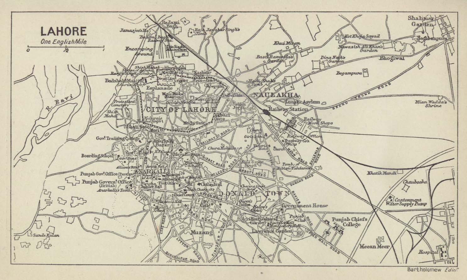
- Lahore (City Plan) From A Literary and Historical Atlas of Asia by J.G. Bartholomew. J.M. Dent and Sons, Ltd. 1912 (188K)
- India and Pakistan - Topographic Maps Series U502, 1:250,000, U.S. Army Map Service, 1955-
- This map series covers parts of Pakistan. Besides the complete sheets, portions of several maps from this series are listed below.
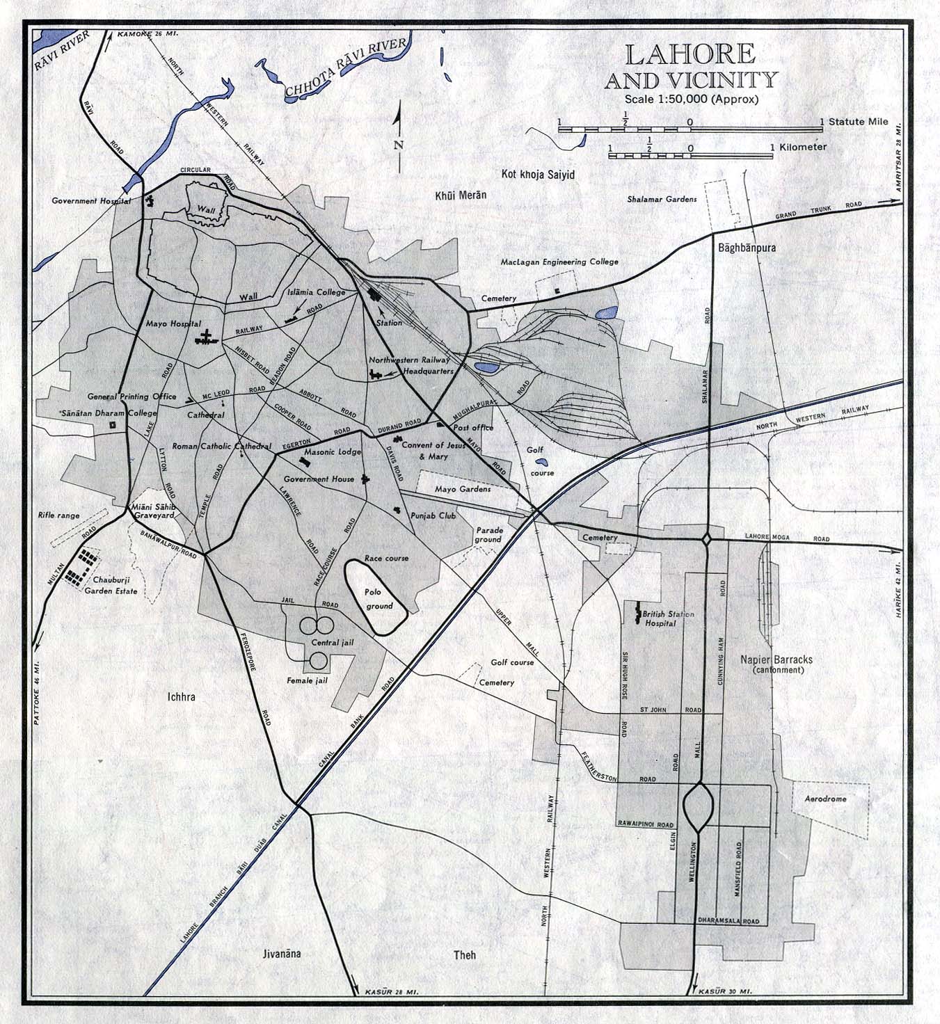
- Lahore and Vicinity (City Plan) original scale 1:50,000. From Sheet NH 43-2, Series U502, U.S. Army Map Service, 1963 (333K)
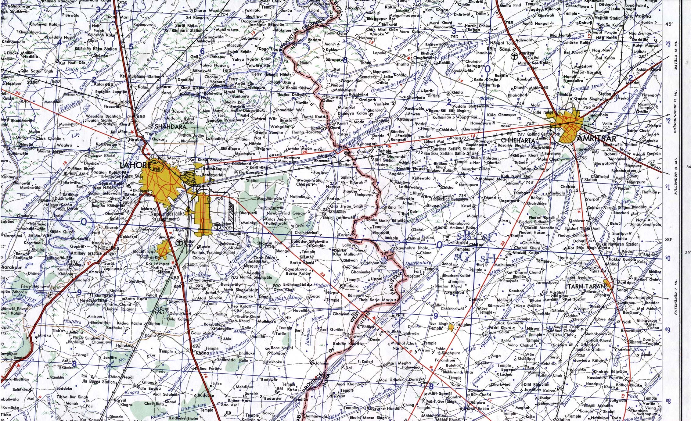
- Lahore (including Amritsar, India) (Topographic Map) original scale 1:250,000. Portion of Sheet NH43-2, Series U502, U.S. Army Map Service, 1963 (947 K)
- Multan (City Plan) original scale 1:20,000. Portion of Sheet NH 42-8, Series U502, U.S. Army Map Service, 1959 (378K)
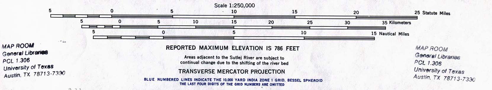
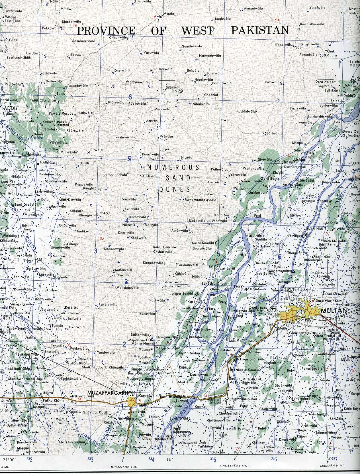
- Multan (Topographic Map) original scale 1:250,000. Portion of Sheet NH 42-8, Series U502, U.S. Army Map Service, 1959 (741 K)
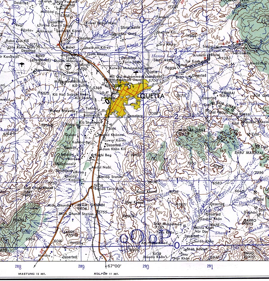
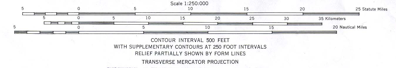
- Quetta (Topographic Map) original scale 1:250,000. From Sheet NH 42-5, Series U502, U.S. Army Map Service, 1959 (445K)
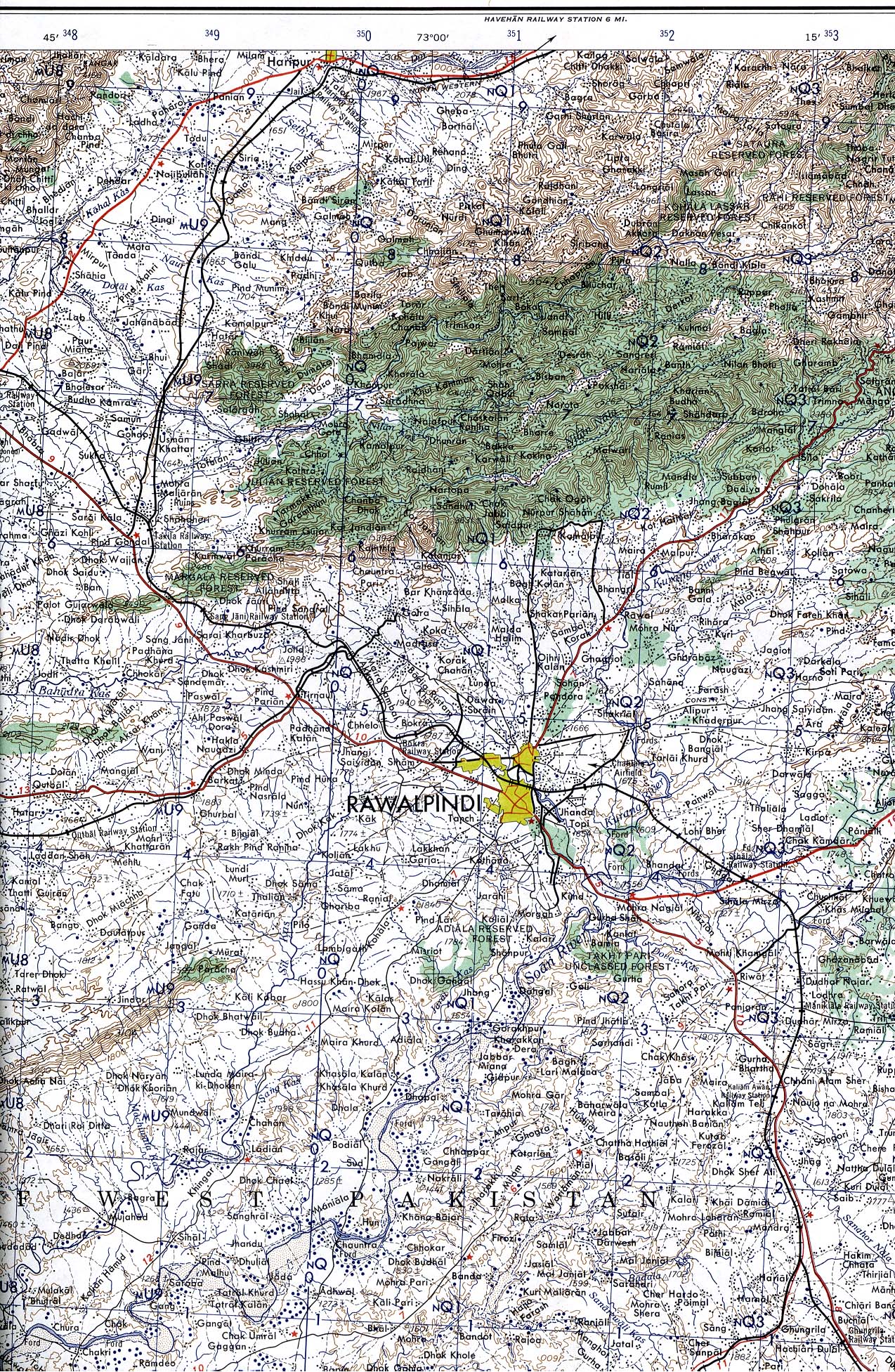
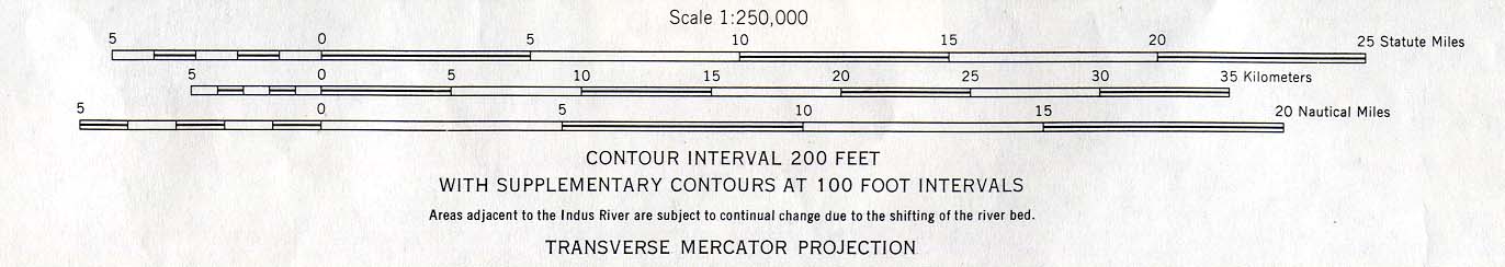
- Rawalpindi (Topographic Map) original scale 1:250,000. Portion of Sheet NI 43-9 , Series U502, U.S. Army Map Service, 1959 (1.2MB)
- More Asia Historical Maps
- This map series covers parts of Pakistan. Besides the complete sheets, portions of several maps from this series are listed below.
- Pakistan (Major Ethnic Groups) 1980 (170K)
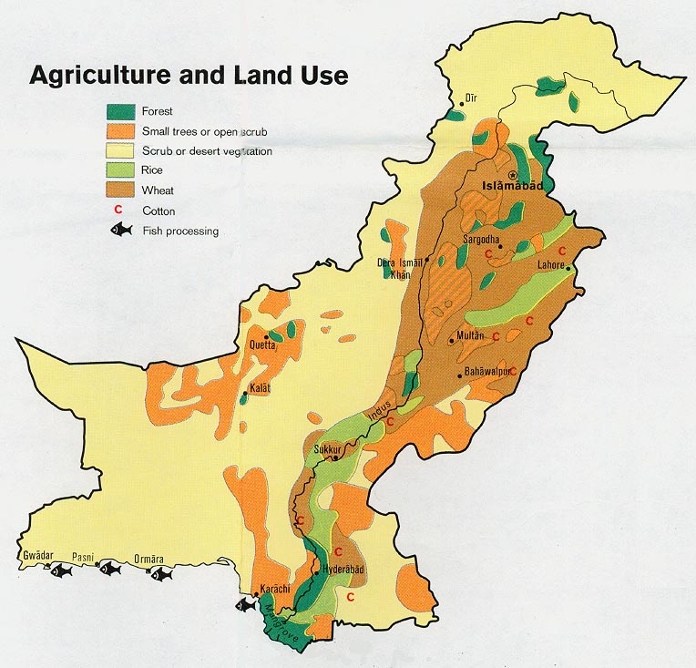
- Pakistan - Agriculture and Land Use from Map No. 501383 1973 (134K)
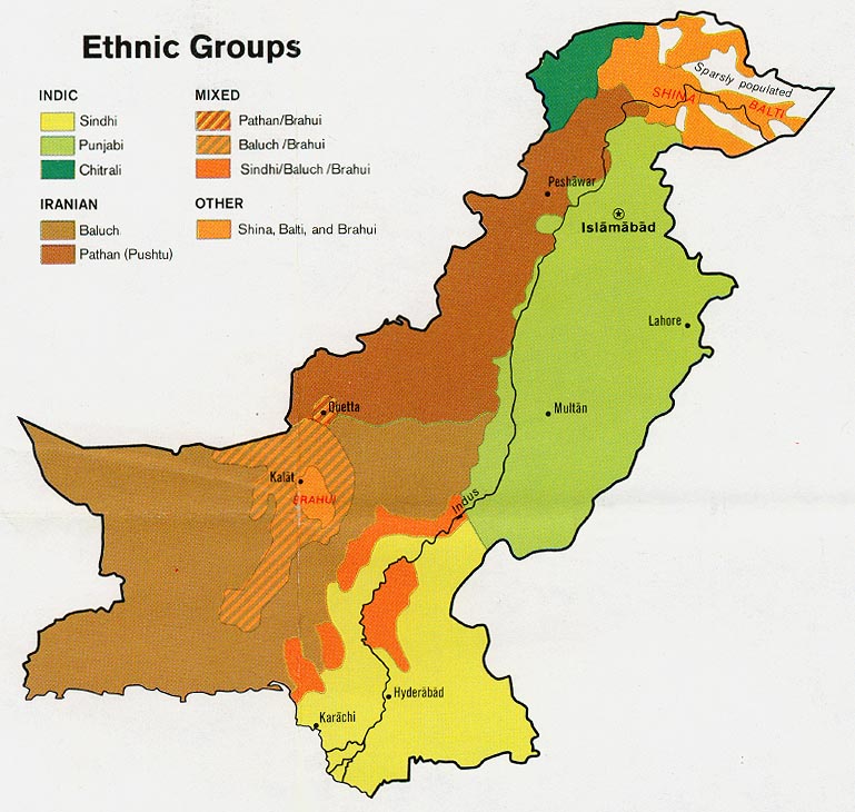
- Pakistan - Ethnic Groups from Map No. 501383 1973 (129K)
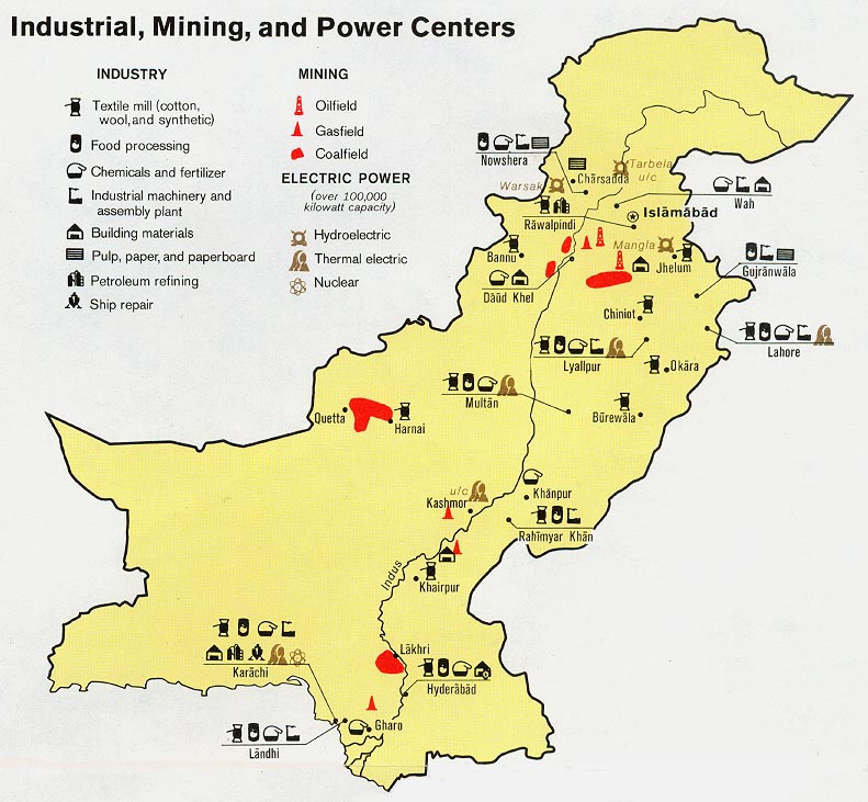
- Pakistan - Industry, Mining, Power Centers from Map No. 501383 1973 (137K)
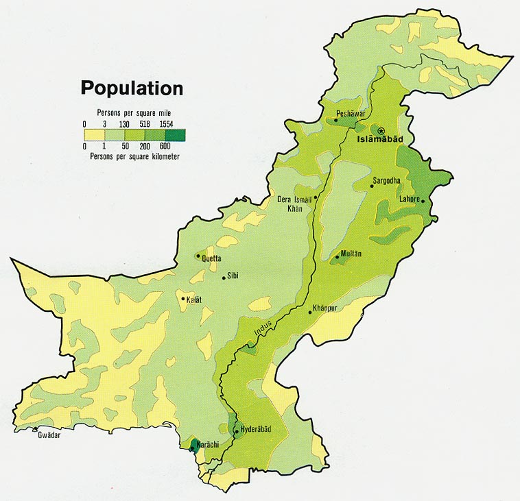
- Pakistan - Population from Map No. 501383 1973 (112K)
Maps on Other Web Sites
- City Maps
- Country Maps
- Abottabad, Pakistan City Map (John Callanan)
- Abottabad Detail from Aeronautical Chart (PCL Map Collection)
- Bin Laden's Compound (BBC News)
- The Assault on Bin Laden's Compound (New York Times)
- Finding Bin Laden's Mansion (Ogle Earth)
- Osama bin Laden's Mansion in Google Earth (Google Earth Blog)