Perry-Castañeda Library
Map Collection
Costa Rica Maps
The following maps were produced by the U.S. Central Intelligence Agency, unless otherwise indicated.
Country Maps- Costa Rica (Political) 1987 (197K) and pdf format (200K)
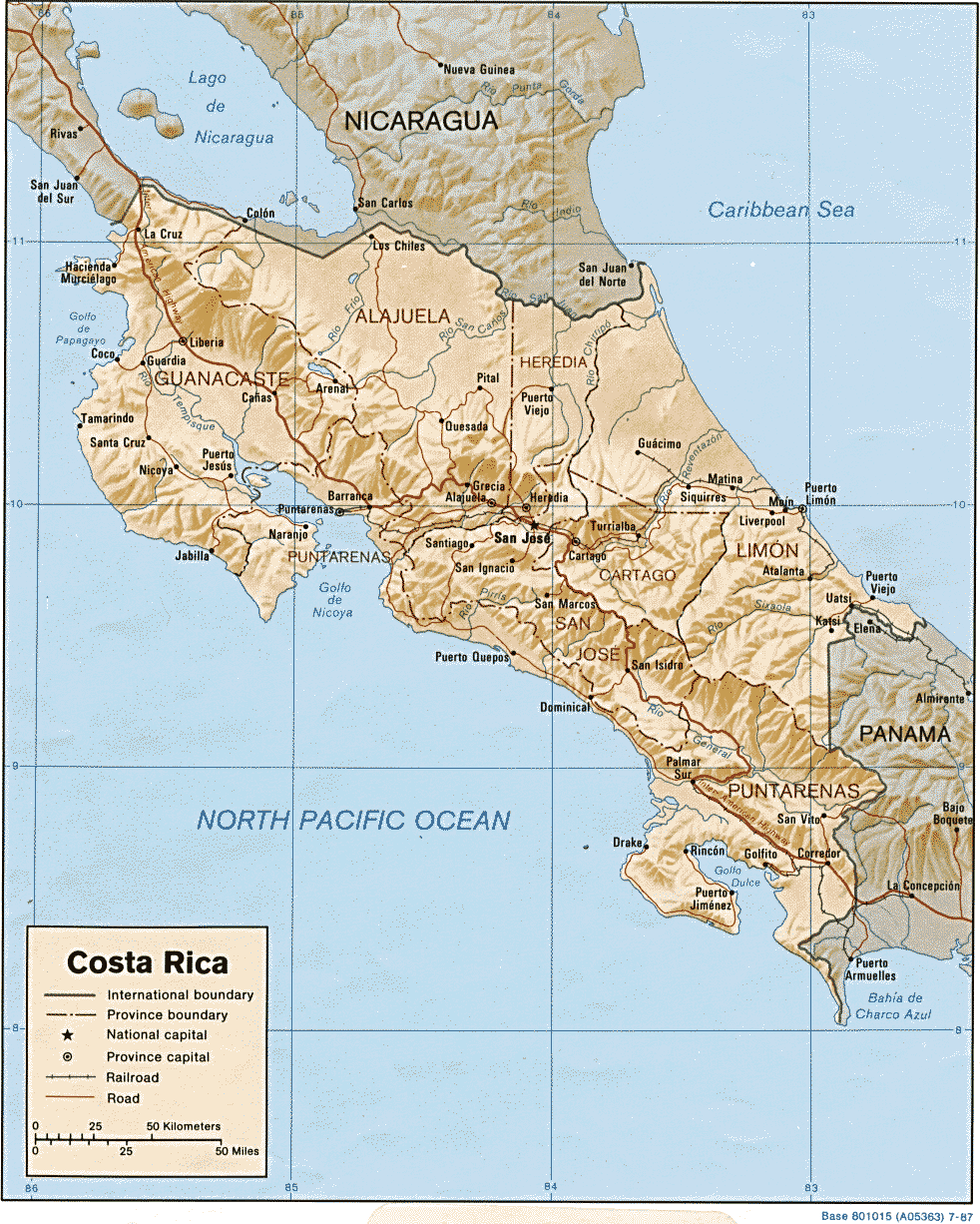
- Costa Rica (Shaded Relief) 1987 (295K)
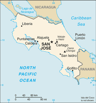
- Costa Rica (Small Map) 2016 (15.4K)
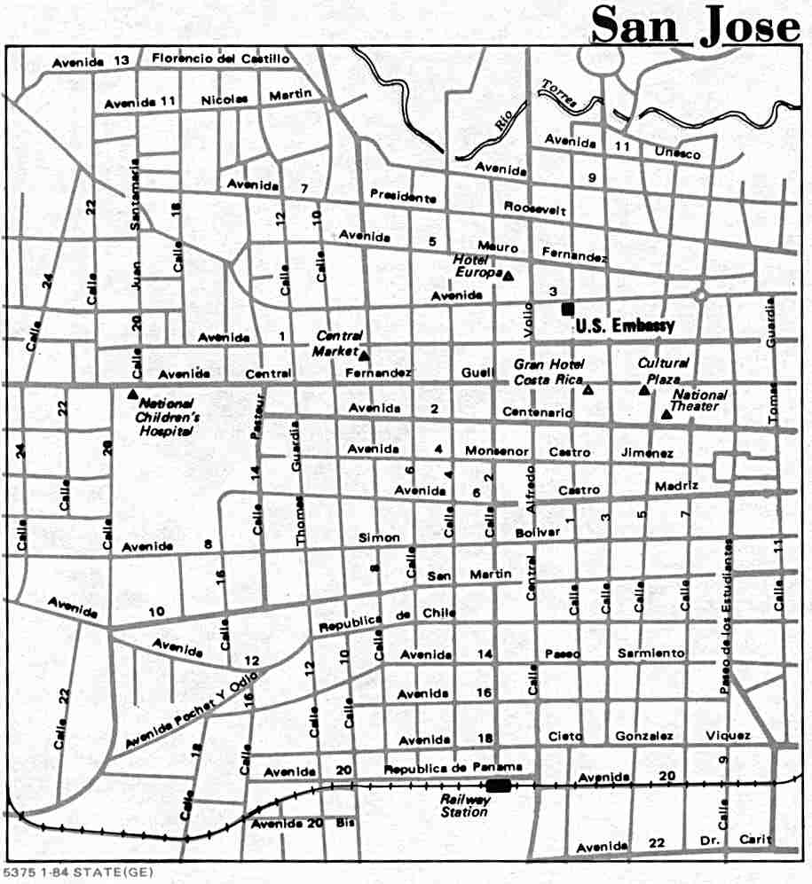
- San Jose U.S. Dept. of State 1984 (69K)
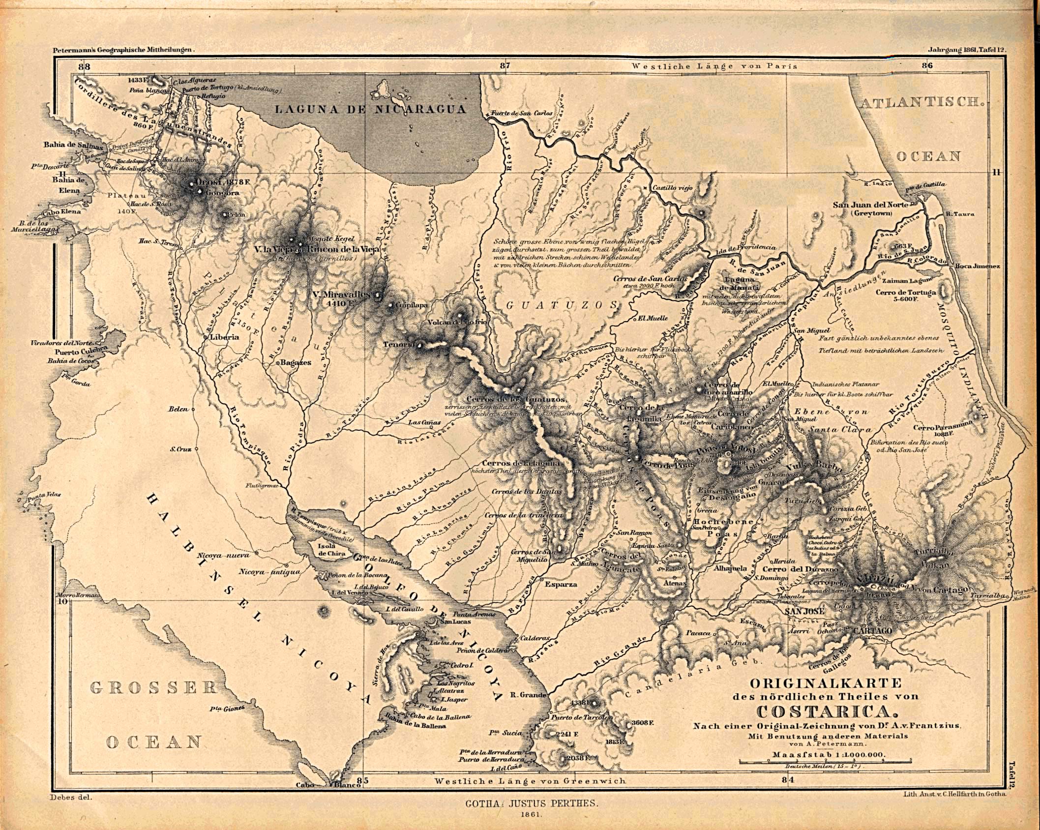
- Costa Rica 1861 (792K)
- "Originalkarte des nordlichen Theiles von Costarica" from Mittheilungen aus Justus Perthes' Geographischer Anstalt uber Wichtige Neue Erforschungen auf dem Gesammtgebiete der Geographie von Dr. A. Petermann. Volume 7, 1861.
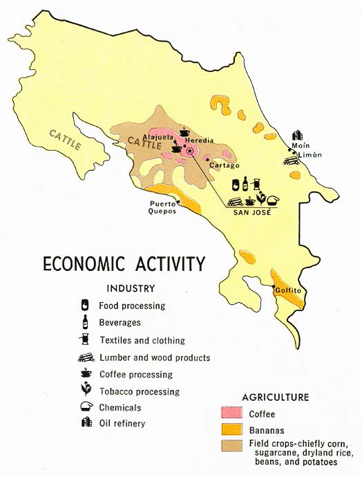
- Costa Rica - Economic Activity from Map No. 73665 1970 (148K)
- Costa Rica - Land Utilization from Map No. 73665 1970 (78K)
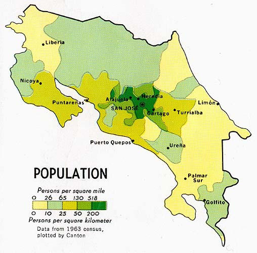
- Costa Rica - Population from Map No. 73665 1970 (73K)
- 1:1,000,000 - Latin America (aeronautical charts) Operational Navigation Chart Series, U.S. Defense Mapping Agency (dates vary) clickable index map for this series Not for navigational use
- Sheet K-25 covers all of Costa Rica
- 1:500,000 - Tactical Pilotage Charts U.S. National Imagery and Mapping Agency. Not for navigational use
- This series covers Costa Rica
- 1:250,000 - Latin America (aeronautical charts) Joint Operations Graphic, U.S. National Imagery and Mapping Agency (dates vary) Not for navigational use
- This series covers all of Costa Rica
Maps at Other Web Sites - Sheet K-25 covers all of Costa Rica