Perry-Castañeda Library
Map Collection
Croatia Maps
The following maps were produced by the U.S. Central Intelligence Agency, unless otherwise indicated.
Croatia Maps- Croatia (Physiography) 2001 (2.1MB) and pdf format (2MB)
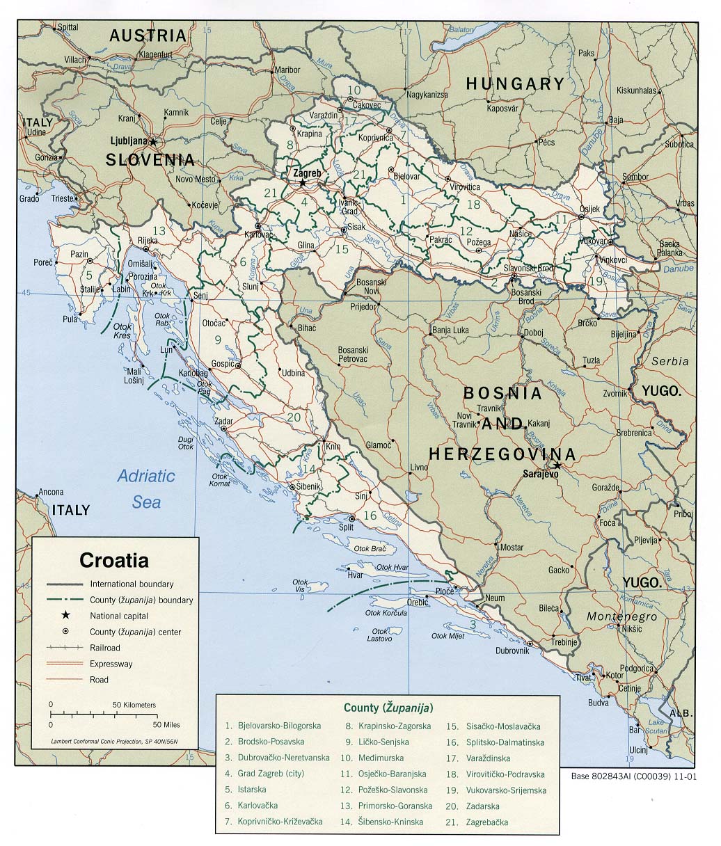
- Croatia (Political) 2001 (313K) and pdf format (2.4MB)
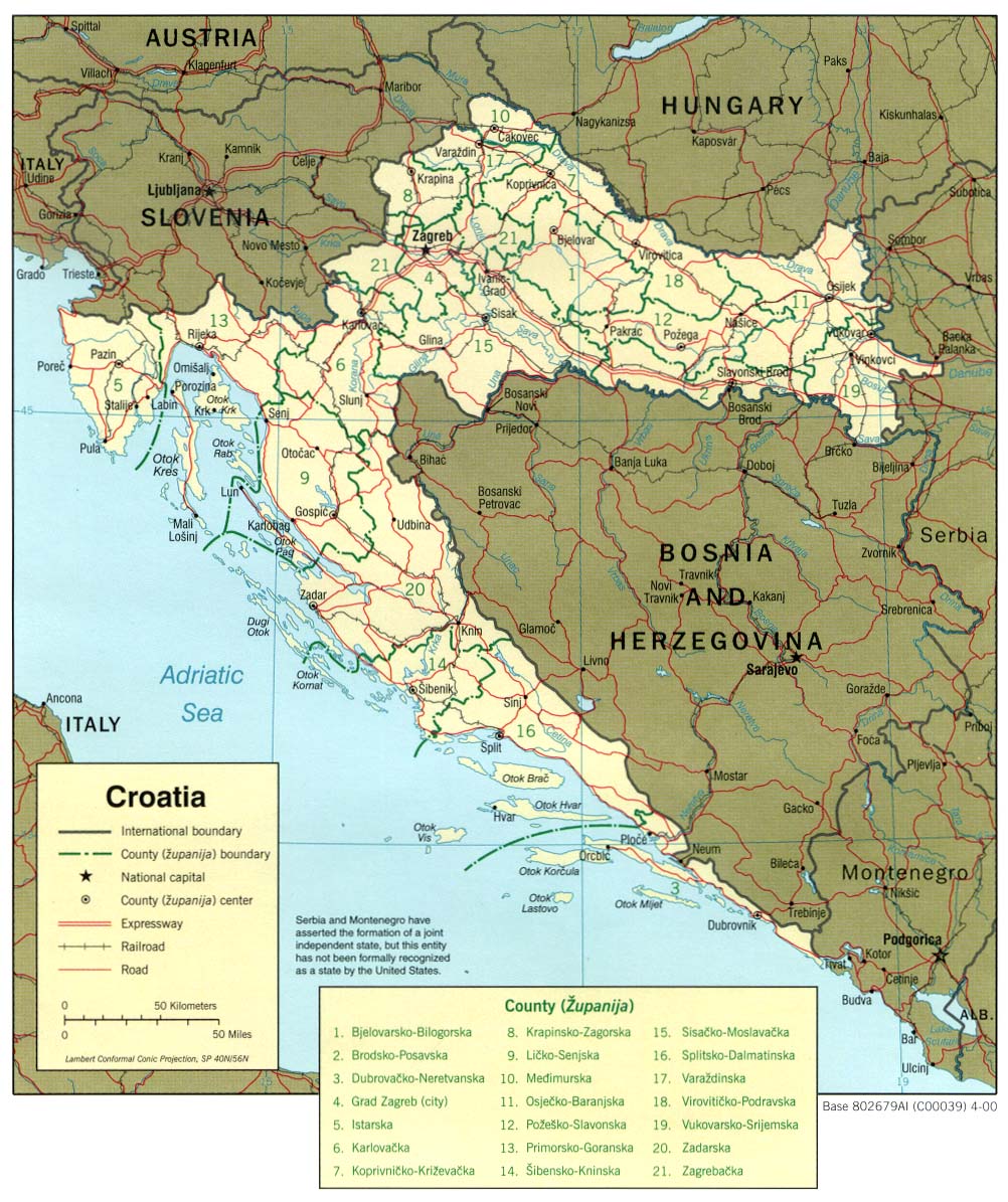
- Croatia (Political) 2000 (264K) and pdf format (284K)
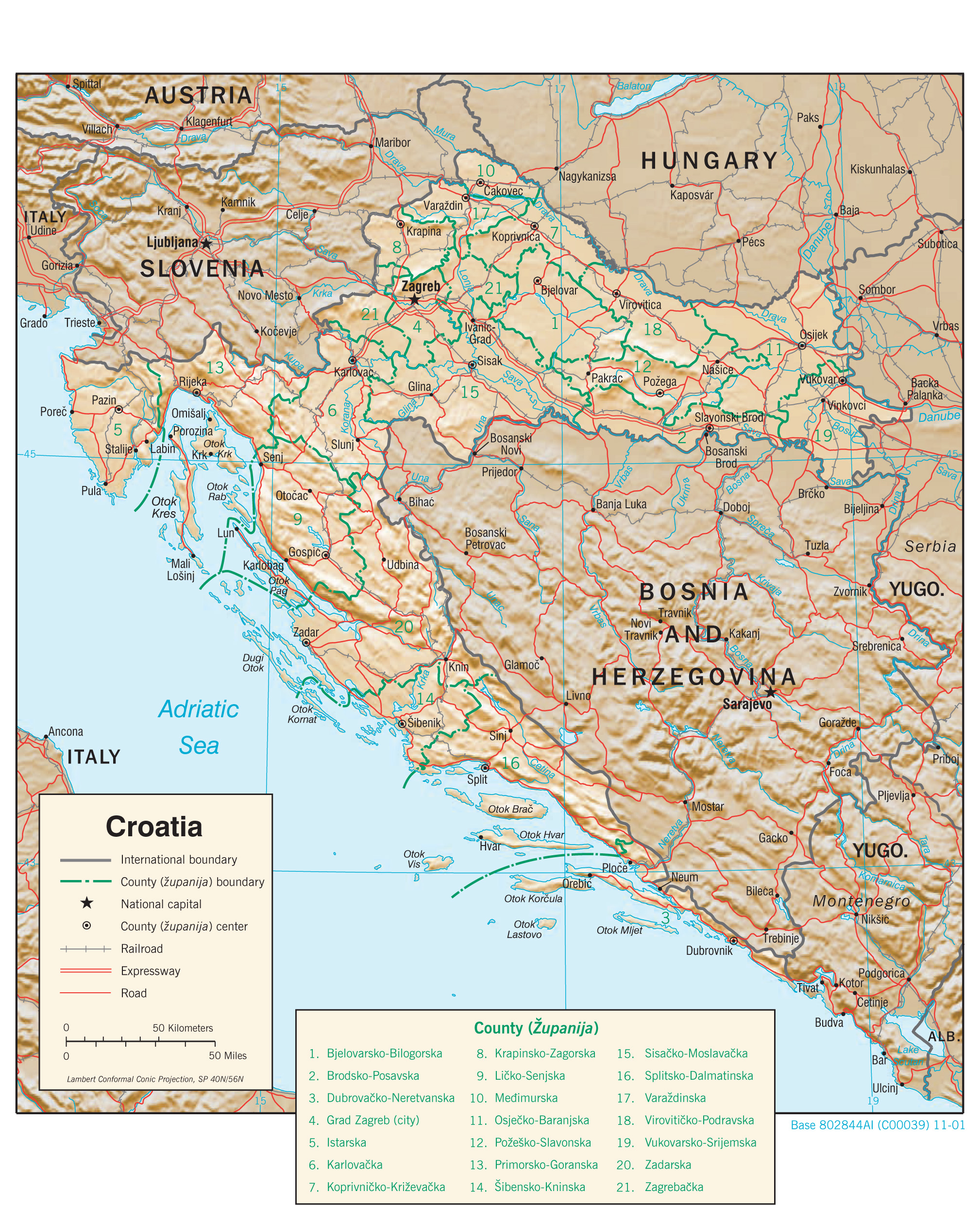
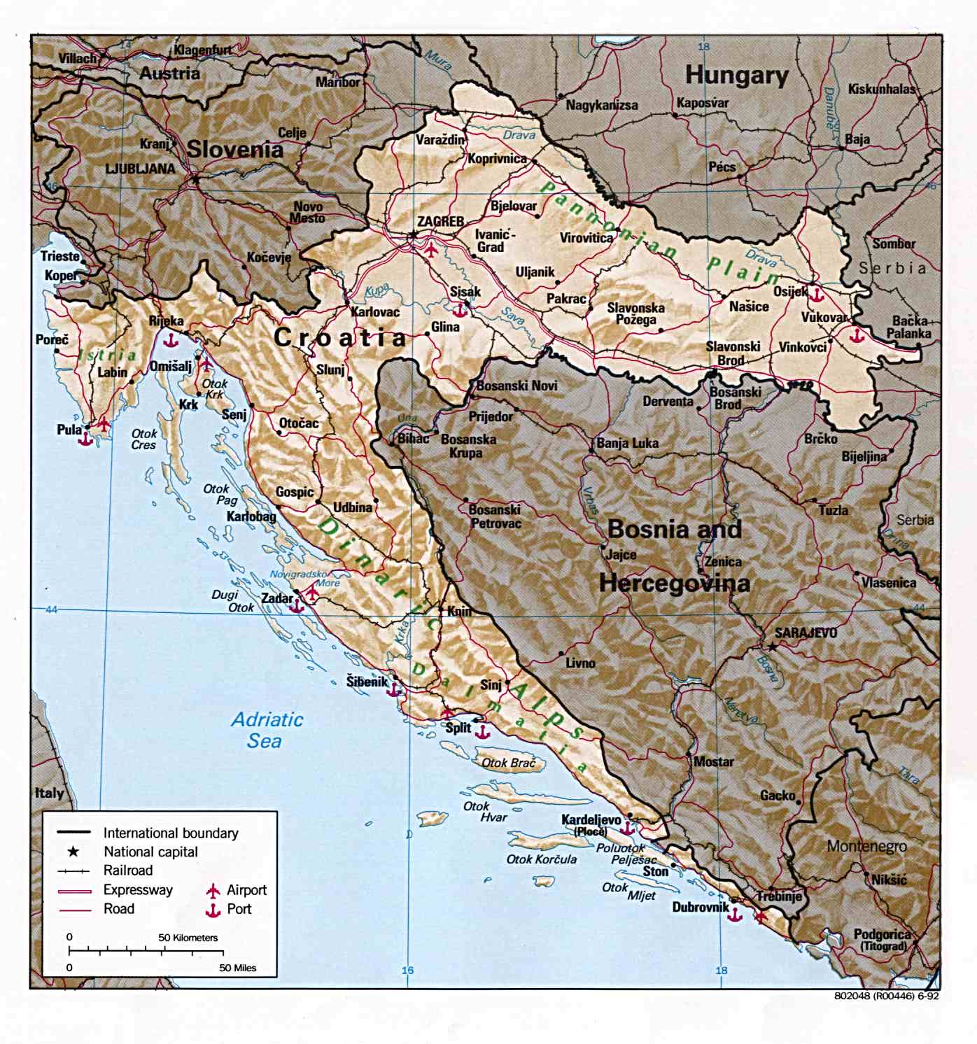
- Croatia (Shaded Relief) 2001 (355K) and pdf format (2.0MB)
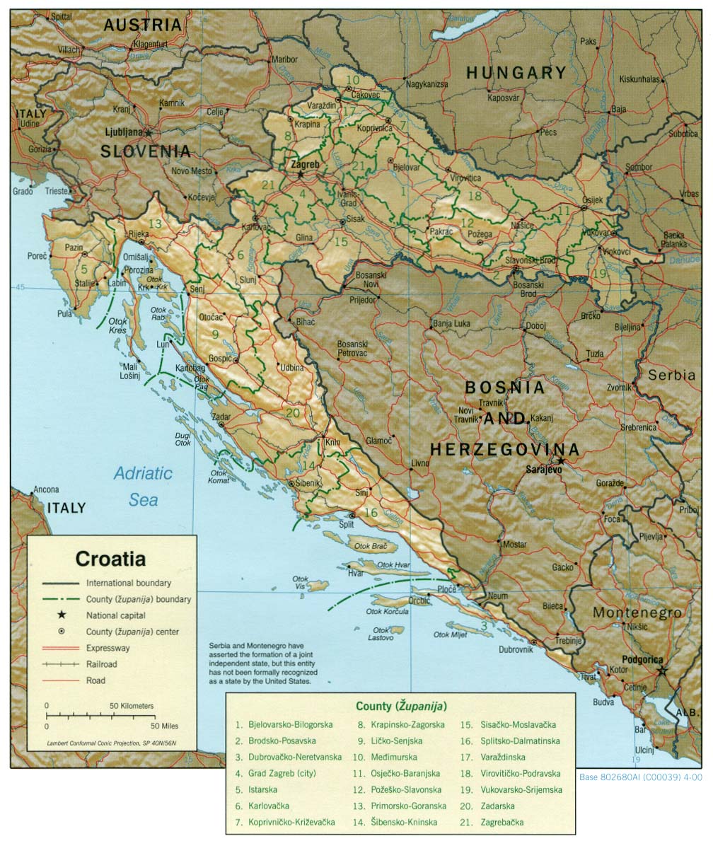
- Croatia (Shaded Relief) 2000 (259K) and pdf format (267K)
- Croatia (Shaded Relief) 1992 (224K) and pdf format (227K)
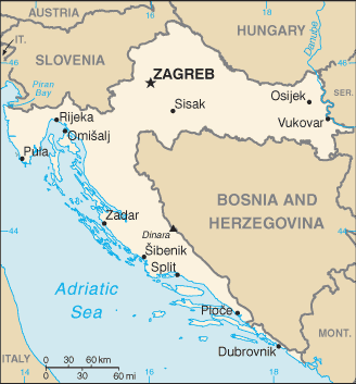
- Croatia (Small Map) 2016 (15.7K)
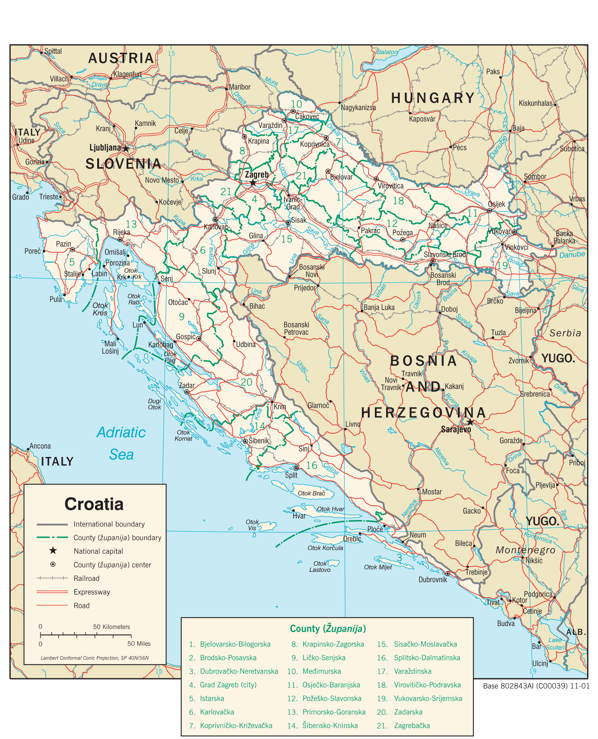
- Croatia (Transportation) 2001 (1.9MB) and pdf format (2.5MB)
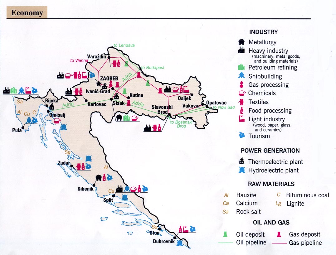
- Croatia - Economy From Former Yugoslavia: A Map Folio 1992 (145K)
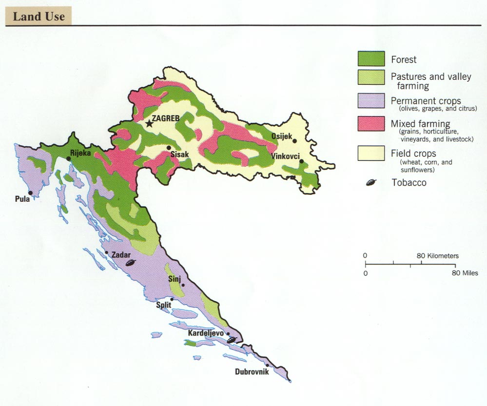
- Croatia - Land Use From Former Yugoslavia: A Map Folio 1992 (92K)
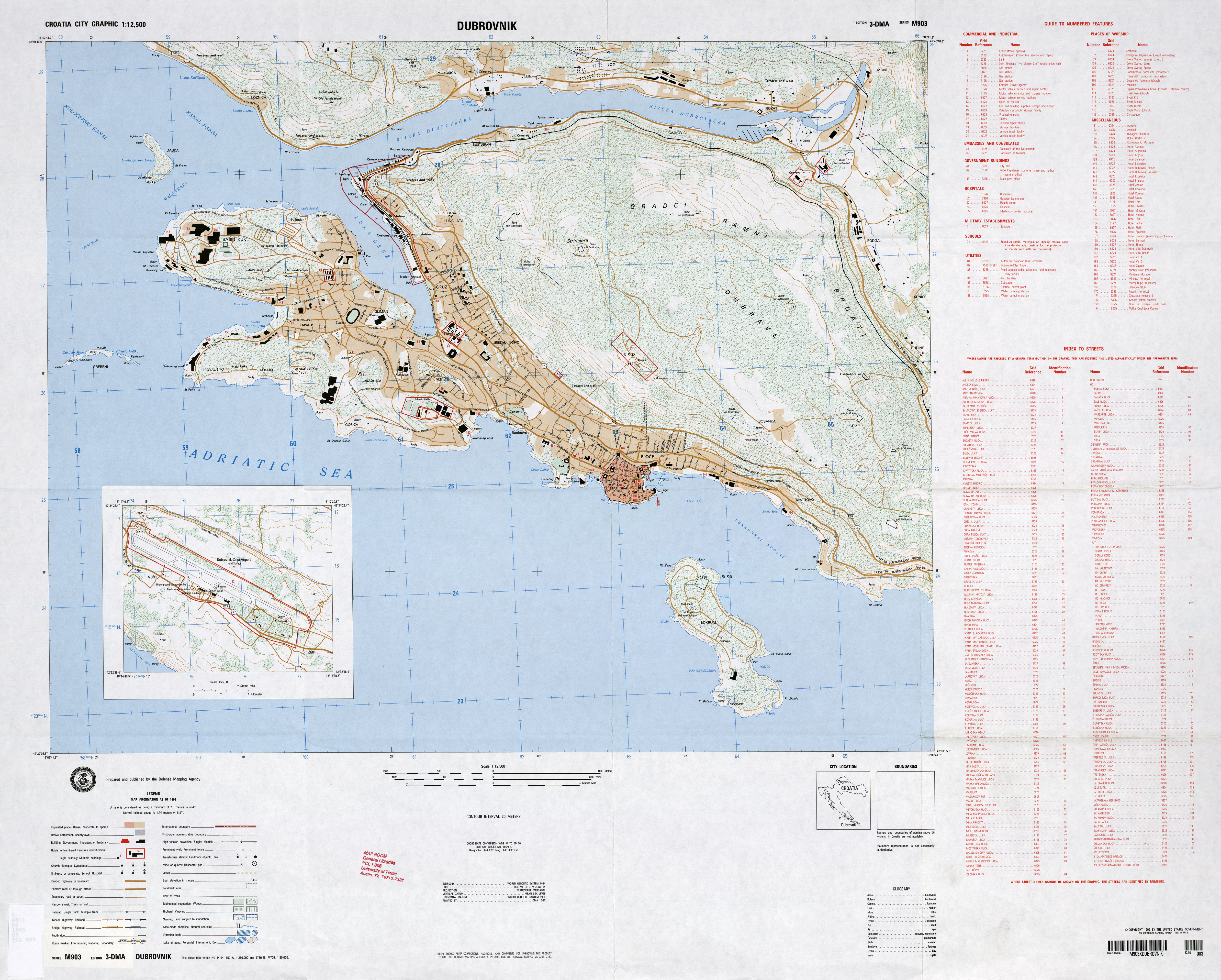
- Dubrovnik 1:12,500, Edition 3-DMA, Series M903. U.S. Defense Mapping Agency, 1993 (4.6MB)
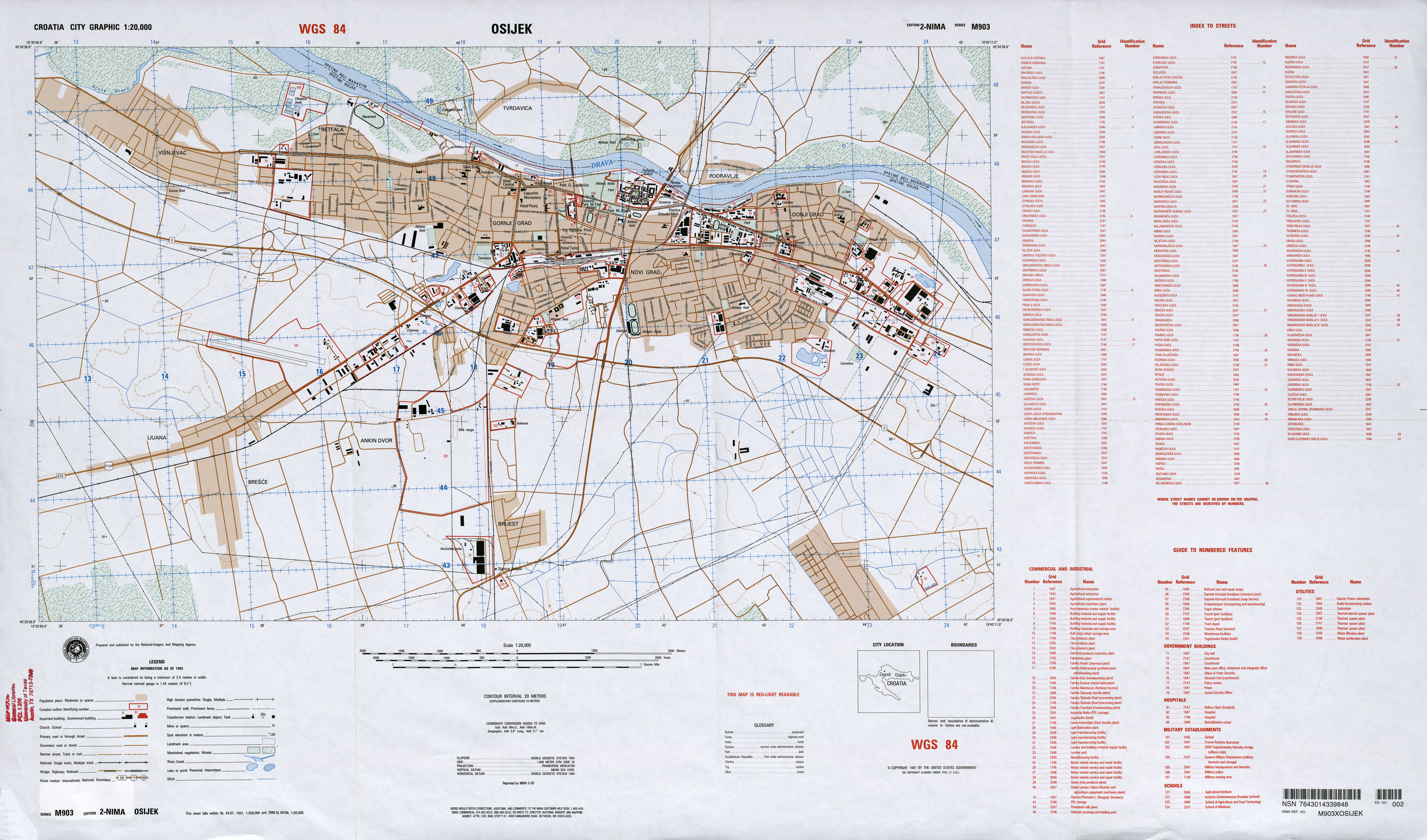
- Osijek 1:20,000, Edition 2-NIMA, Series M903, National Imagery and Mapping Agency, 1993 (3.4MB)
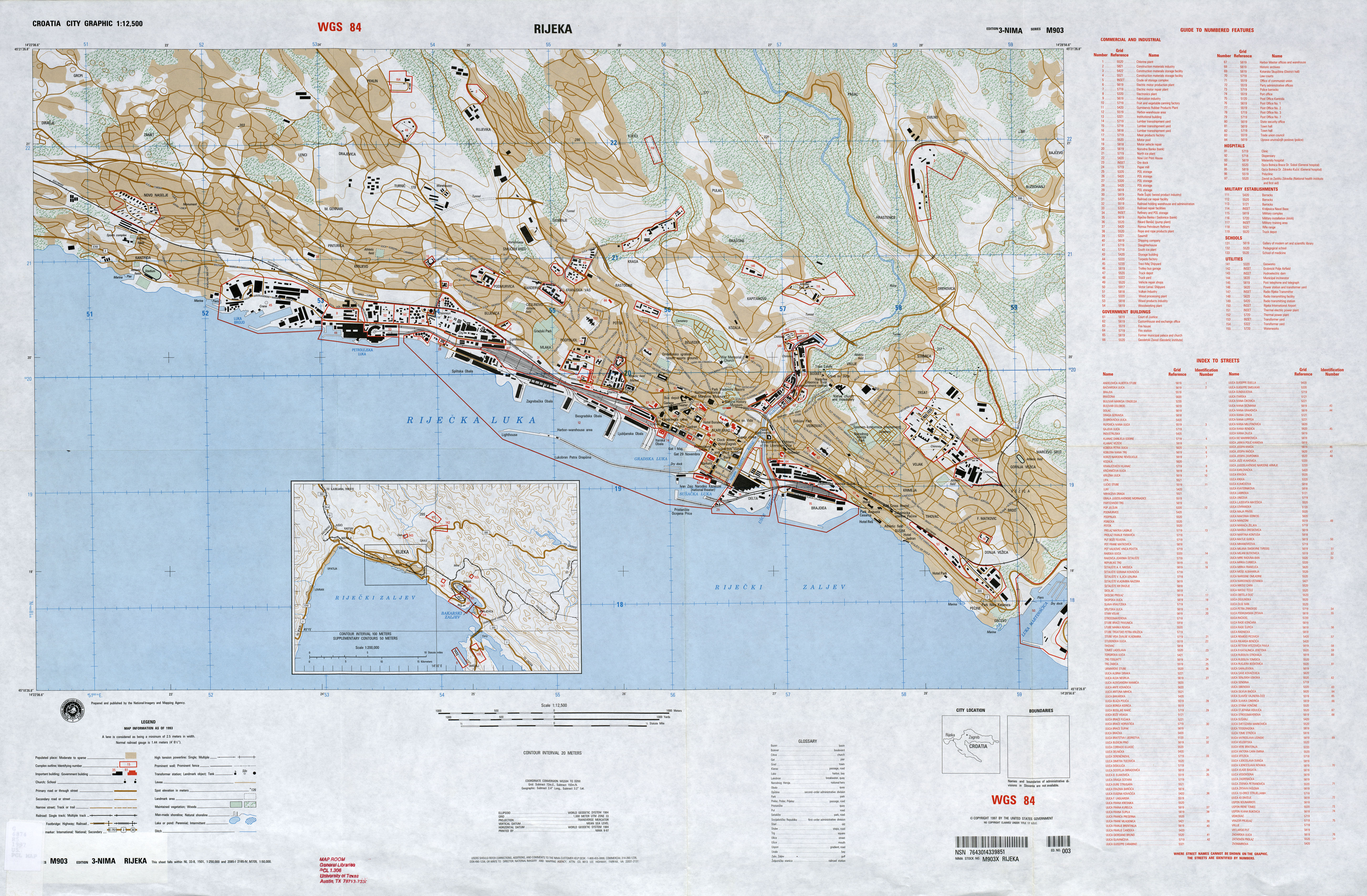
- Rijeka 1:12,500, Edition 3-NIMA, Series M903. U.S. National Imagery and Mapping Agency, 1993 (4.6MB)
- Slavonski Brod 1:12,500, Edition 1-NIMA, Series M903. U.S. National Imagery and Mapping Agency, 1995 (4.7MB)
- Split 1:12,500, Edition 4-DMA, Series M903. U.S. Defense Mapping Agency, 1993 [small] (7.8MB)
- Split 1:12,500, Edition 4-DMA, Series M903. U.S. Defense Mapping Agency, 1993 [large] (26MB)
- Zagreb 1:25,000, Edition 4-DMA, Series M903. U.S. Defense Mapping Agency, 1995 (7.1MB)
- Zagreb [verso] Edition 4-DMA, Series M903. U.S. Defense Mapping Agency, 1995 (4.4MB)
![Zagreb [verso]](world_cities/txu-oclc-41946672-zagreb-1995-a.jpg)
- Croatia - Economic Activity from Map No. 802345 1996 (134K)
- Croatia - Historical Control from Map No. 802345 1996 (261K)
- Croatia - Land Use from Map No. 802345 1996 (107K)
- Croatia - Population Density from Map No. 802345 1996 (107K)
- Croatia - Population Structure [chart] from Map No. 802345 1996 (47K)
- 1:1,000,000 - Operational Navigation Chart ONC F-2 [Aeronautical Chart] Albania; Austria; Czechoslovakia; Federal Republic of Germany; France; Hungary; Italy; Liechtenstein; Monaco; San Marino; Spain; Switzerland; Yugoslavia. U.S. Defense Mapping Agency Aerospace Center, compiled 1964, revised 1981 Not for navigational use (21.8MB)
- 1:500,000 - Tactical Pilotage Charts U.S. National Imagery and Mapping Agency. Not for navigational use
- This series covers Croatia
- 1:250,000 - Western Europe Series M501, U.S. Army Map Service, 1959-
- This series includes most of Croatia
- 1:250,000 - Joint Operations Graphic U.S. National Imagery and Mapping Agency. Not for navigational use
- This series covers most of Croatia
- 1:50,000 - Former Yugoslavia Topographic Maps Series M709, U.S. Defense Mapping Agency
- This series includes parts of Croatia
- This series covers Croatia
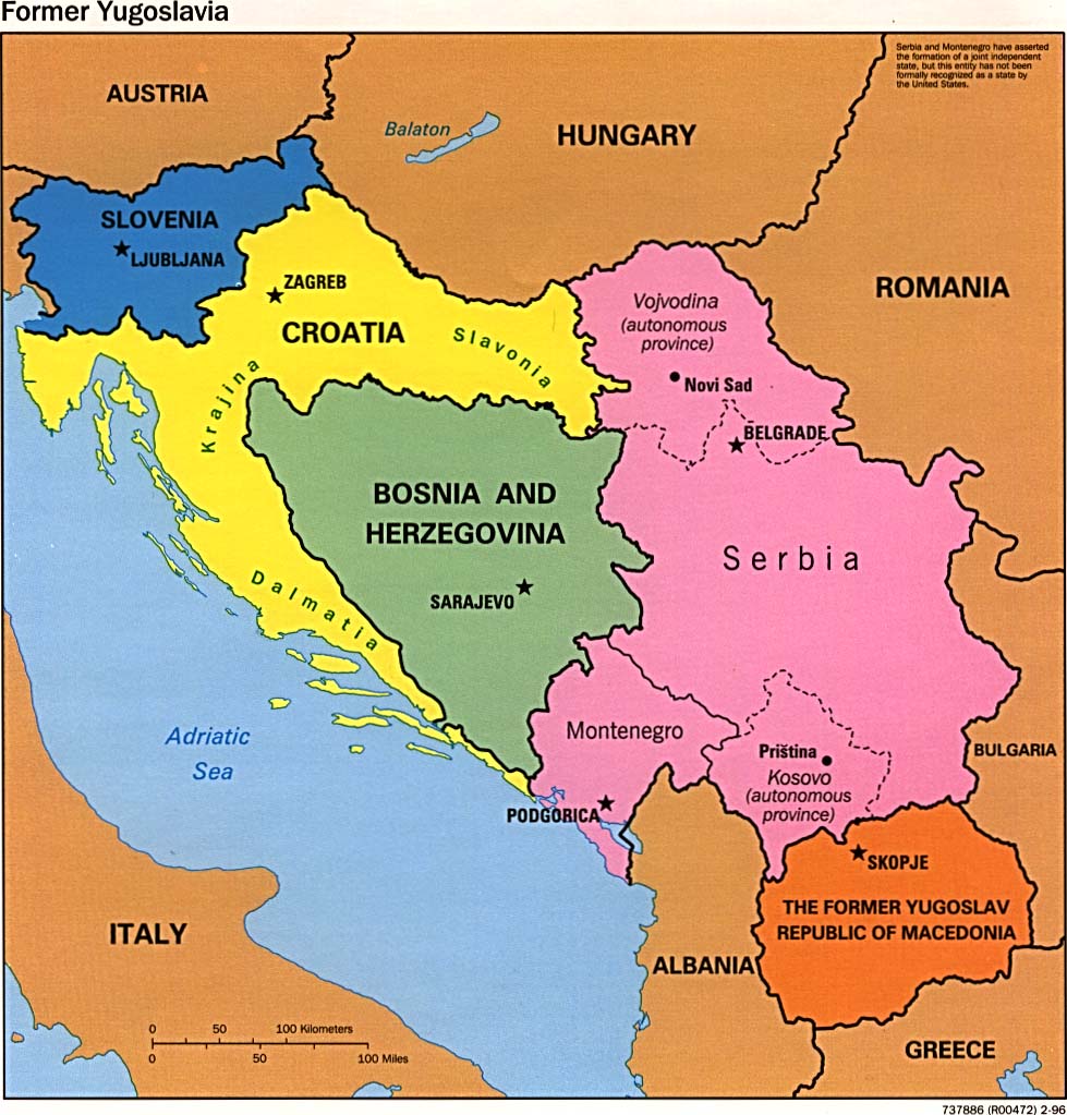
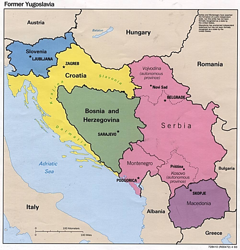
- Former Yugoslavia (Political) 1996 (162K)
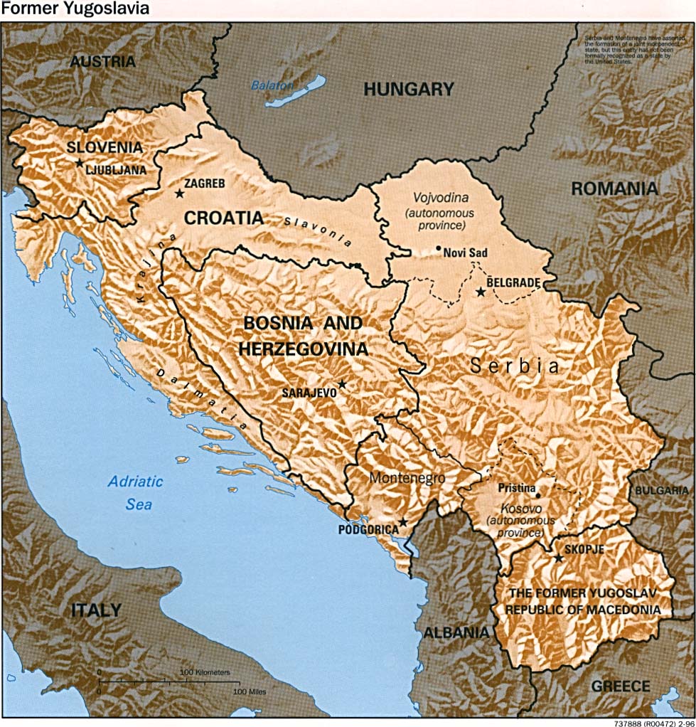
- Former Yugoslavia (Shaded Relief) 1996 (1237K)
- Former Yugoslavia (Political) 1995 (131K)
- Former Yugoslavia (Political) 1993 (146K)
- Former Yugoslavia: A Map Folio
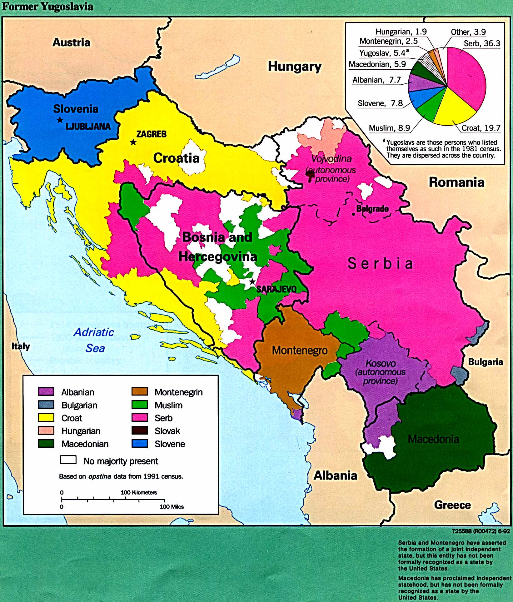
- Former Yugoslavia - Ethnic Majorities From Former Yugoslavia: A Map Folio, 1992 (412K)
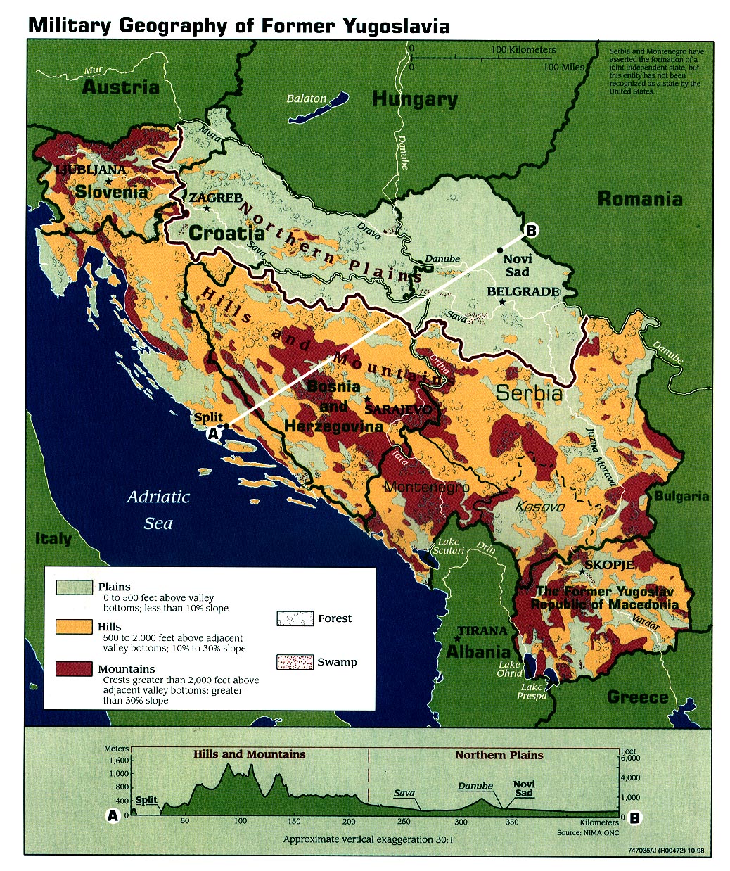
- Former Yugoslavia - Military Geography 1998 (581K)
- Historical Maps of the Balkans
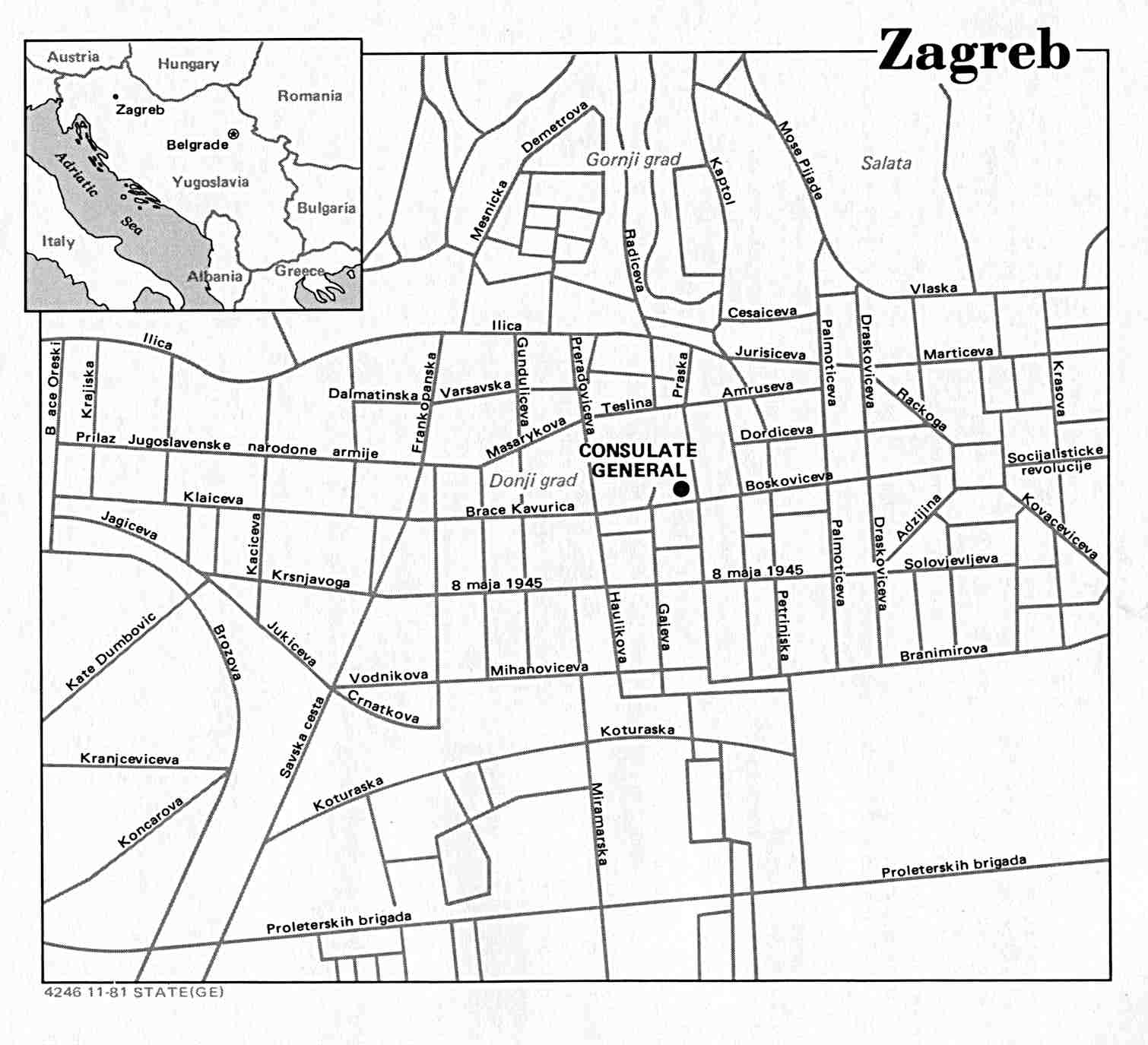
- Zagreb U.S. Dept. of State 1981 (103K)
Maps on Other Web Sites