Perry-Castañeda Library
Map Collection
Iran Maps
The following maps were produced by the U.S. Central Intelligence Agency unless otherwise indicated.
Country Maps
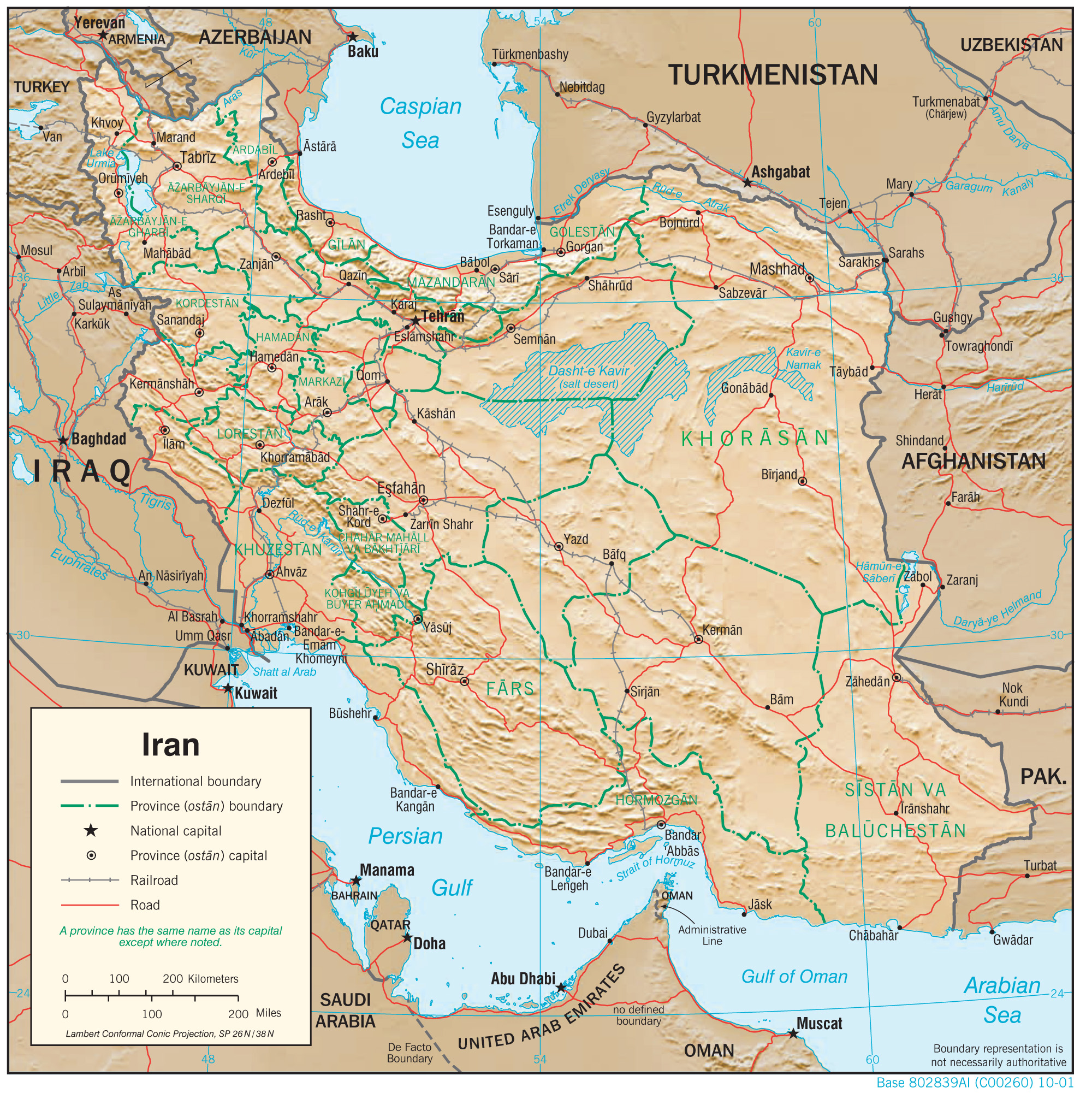
- Iran (Physiography) 2001 (1.8MB) and pdf format (1.1MB)
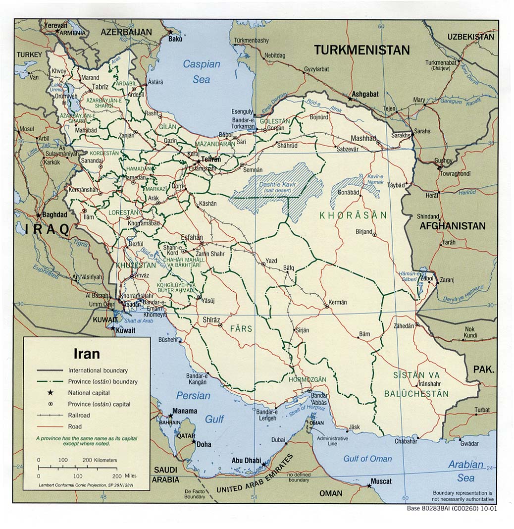
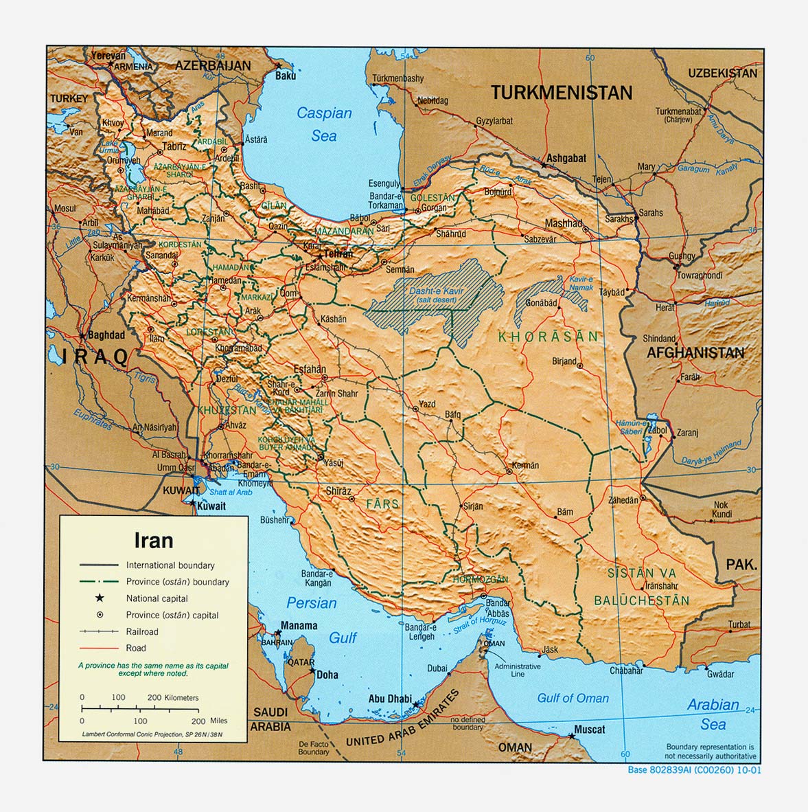
- Iran (Political) 2001 (247K) and pdf format (263K)
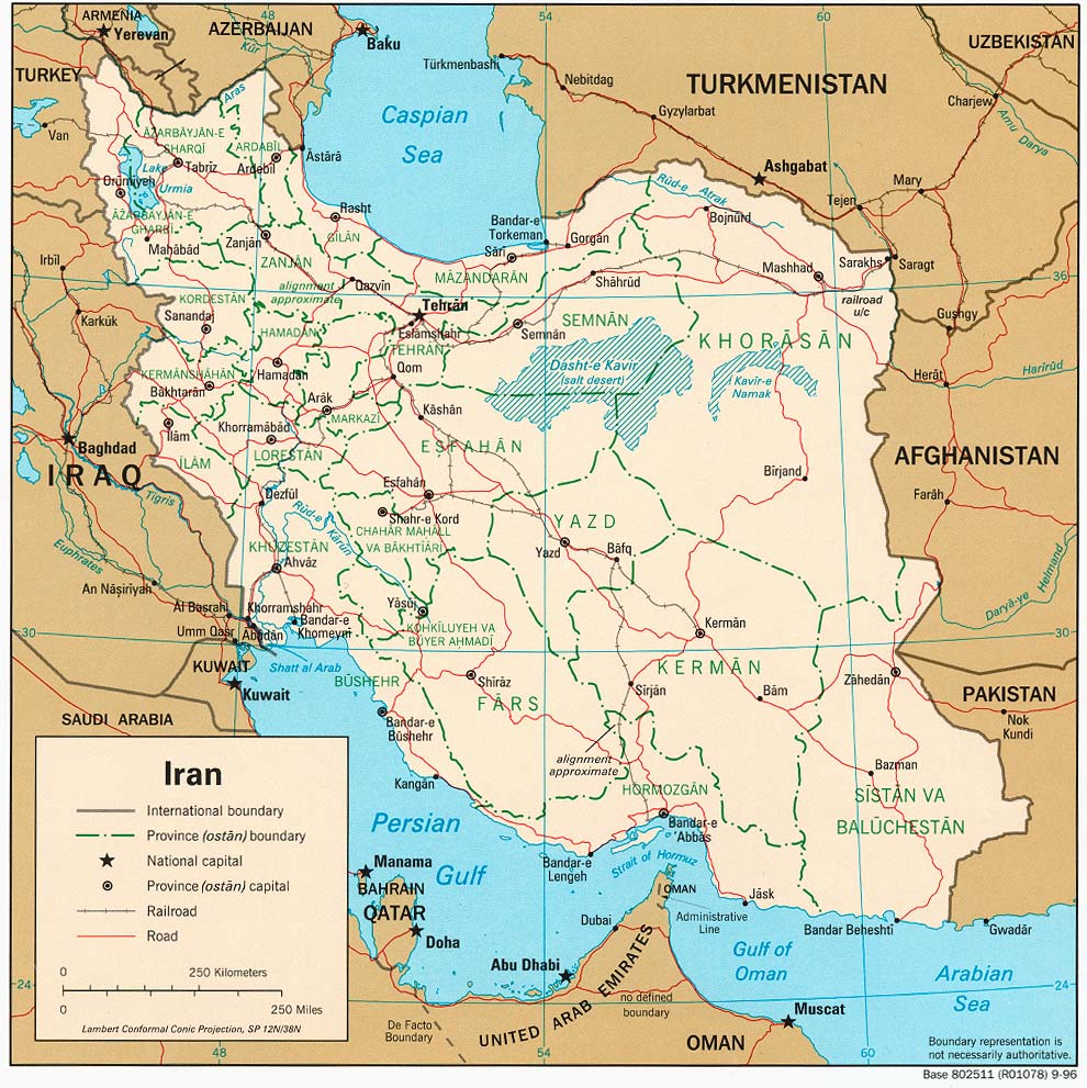
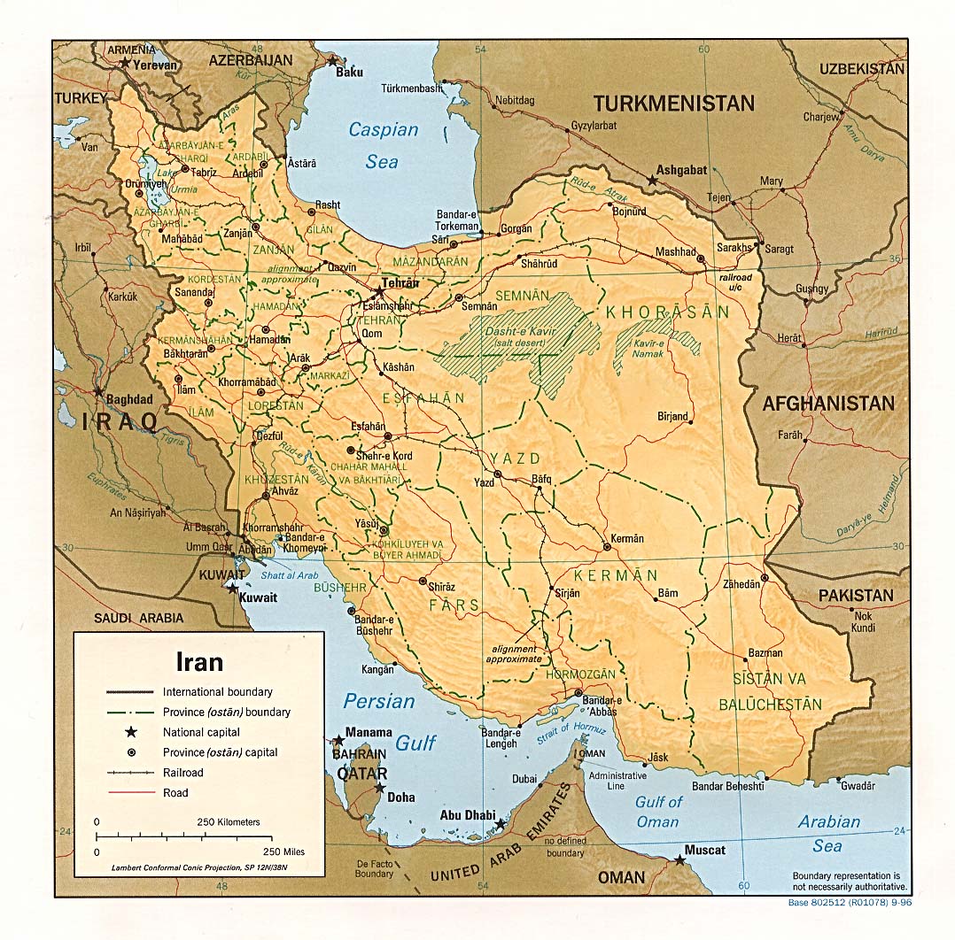
- Iran (Political) 1996 (262K) and pdf format (271K)
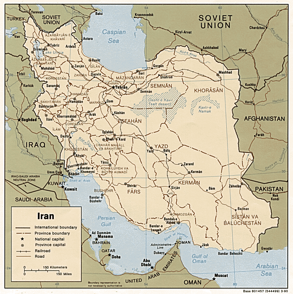
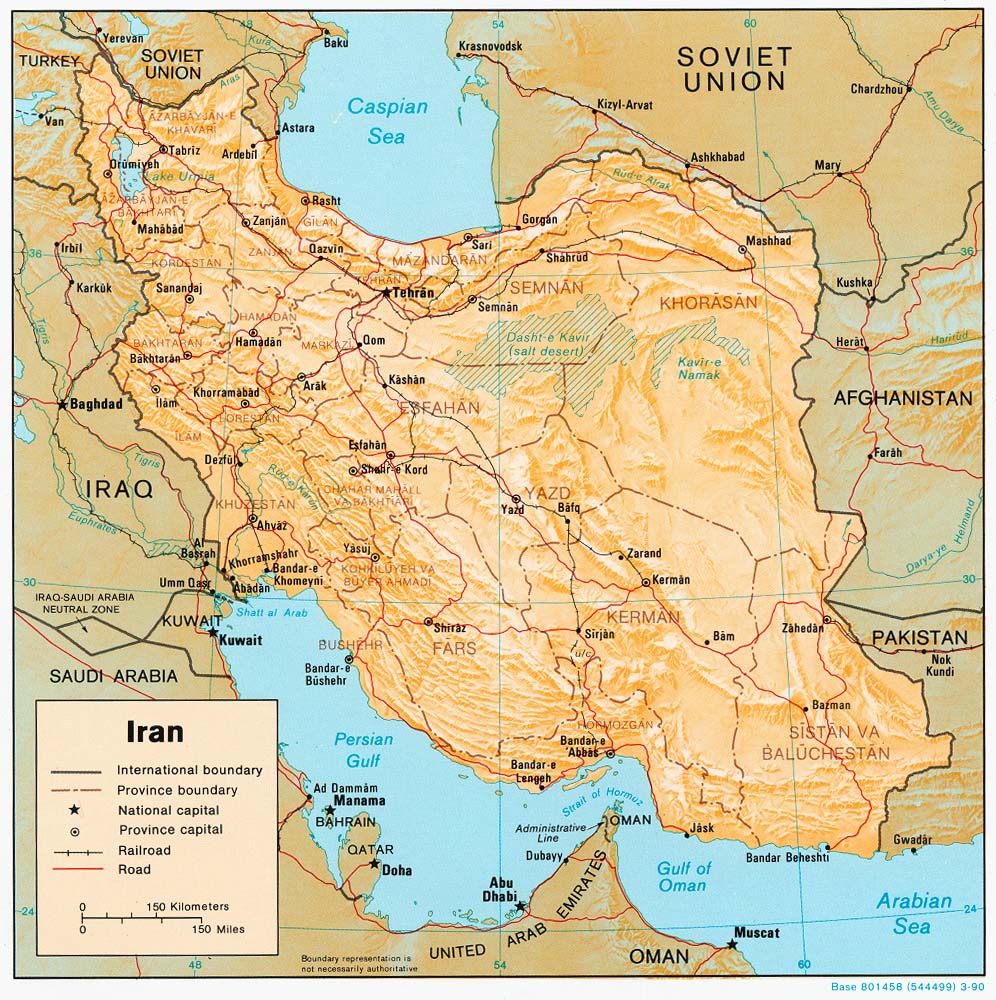
- Iran (Political) 1990 (306K) and pdf format (317K)
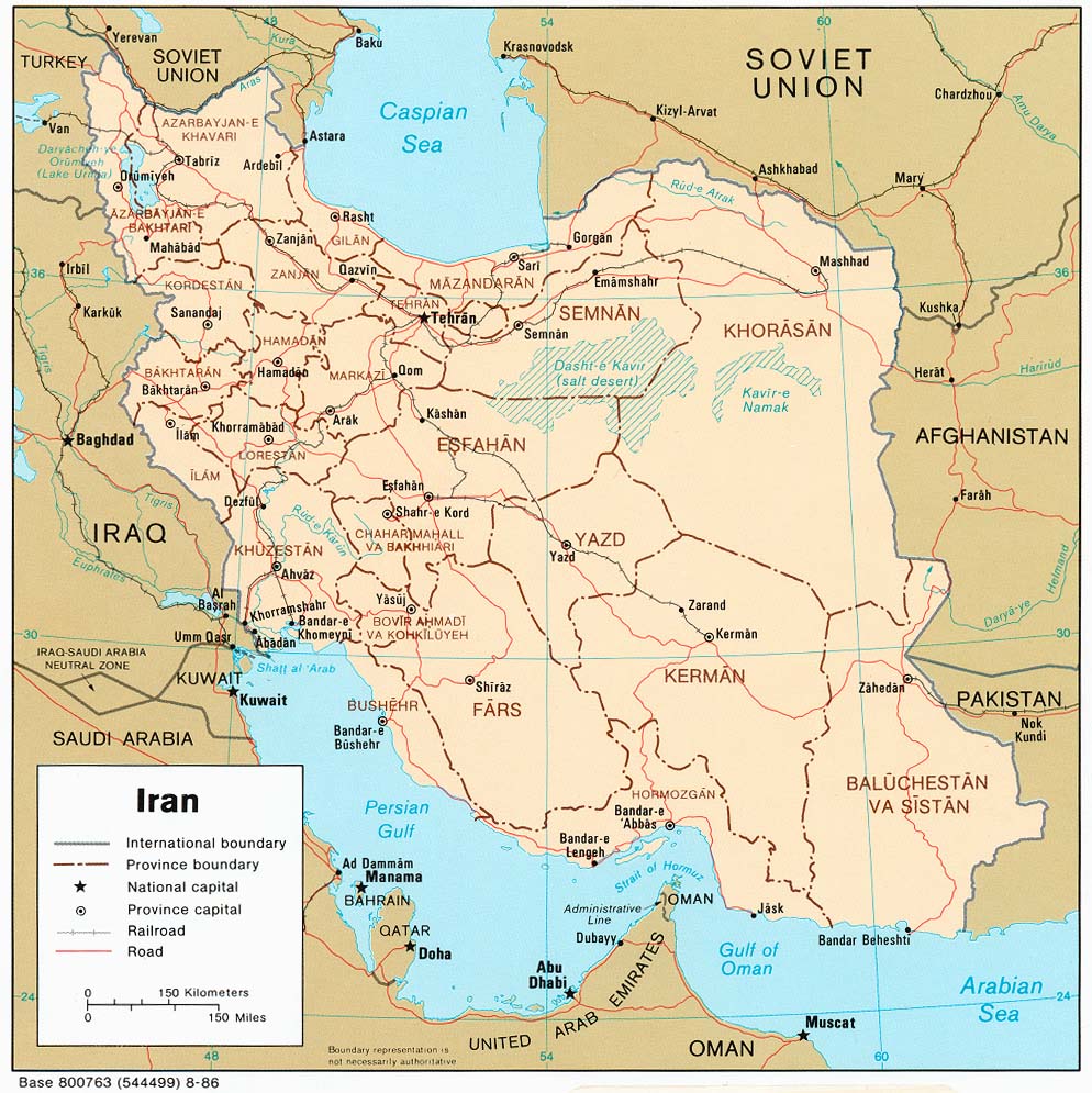
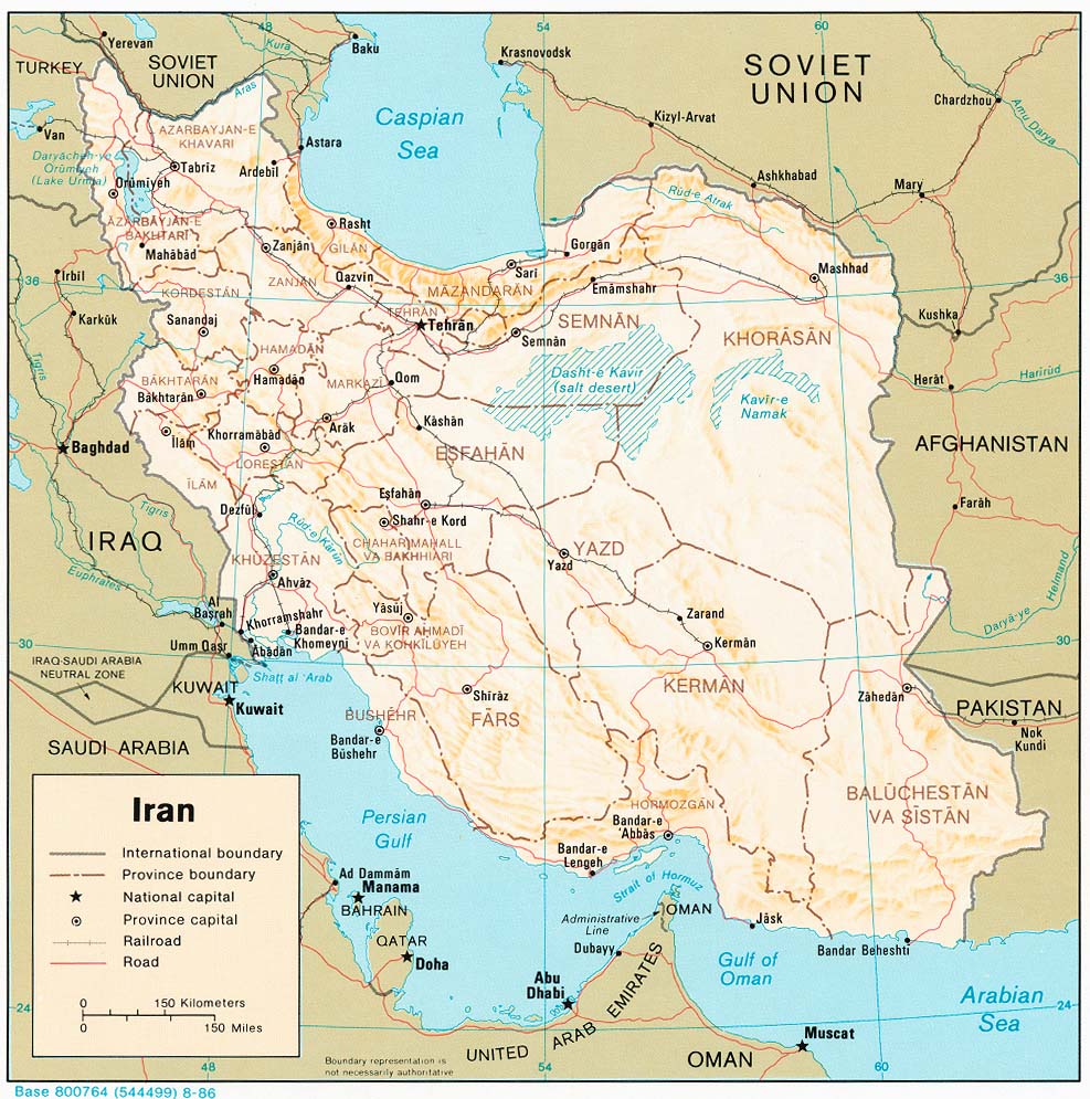
- Iran (Political) 1986 (228K) and pdf format (236K)
- Iran (Shaded Relief) 2001 (321K) and pdf format (294K)
- Iran (Shaded Relief) 1996 (312K) and pdf format (292K)
- Iran (Shaded Relief) 1990 (277K) and pdf format (283K)
- Iran (Shaded Relief) 1986 (235K) and pdf format (246K)
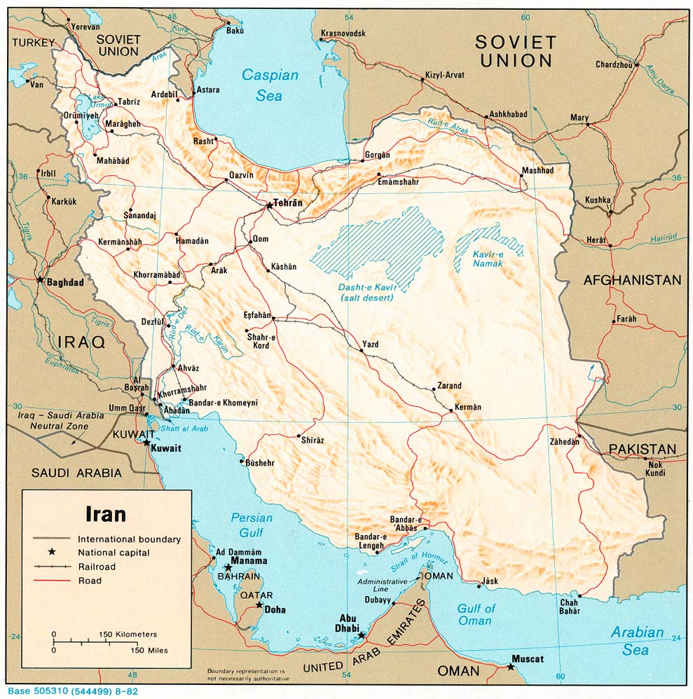
- Iran (Shaded Relief) 1982 (239K) and pdf format (247K)
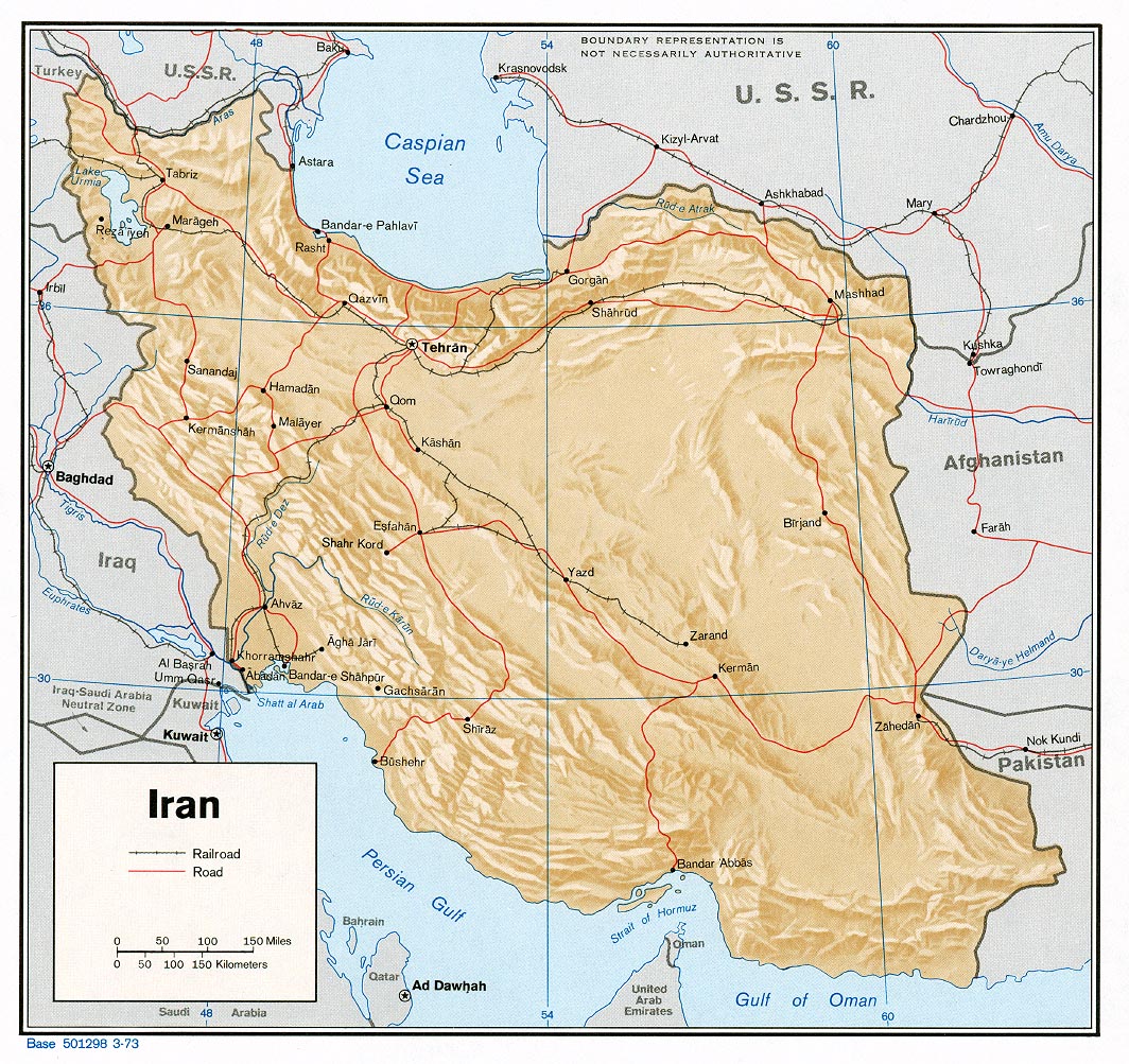
- Iran (Shaded Relief) 1973 (398K) and pdf format (410K)
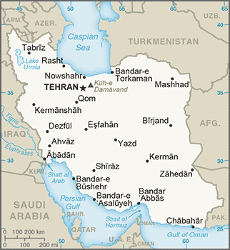
- Iran (Small Map) 2016 (27K)
- Iran (Transportation) 2001 (1.5MB) and pdf format (1.3MB)
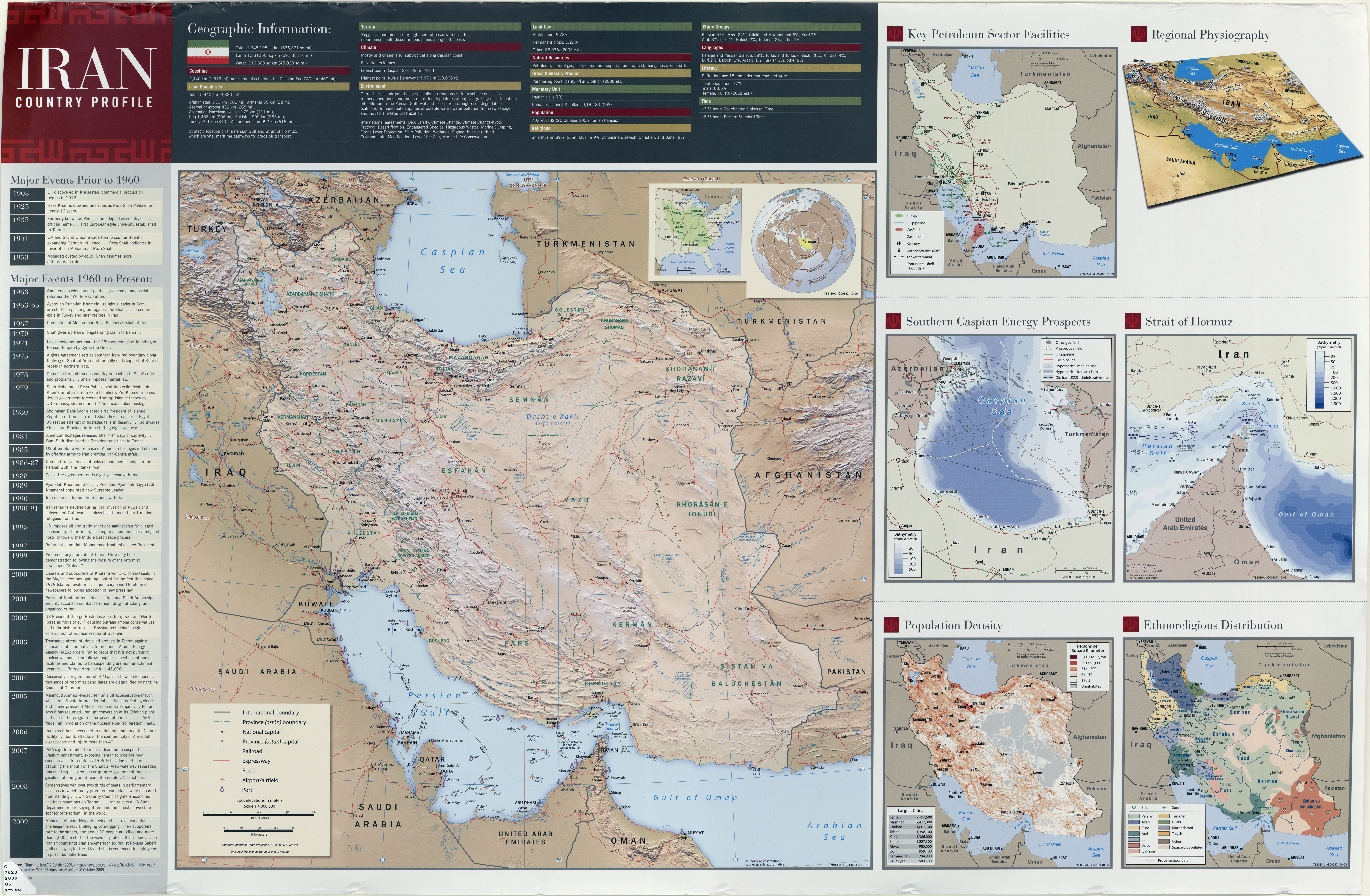
- Iran (Wall Map) 2009 "Iran Country Profile" Iran map with insets: Population Density, Ethnoreligious Distribution, Key Petroleum Sector Facilities, Southern Caspian Energy Prospects and Strait Of Hormuz (6MB)
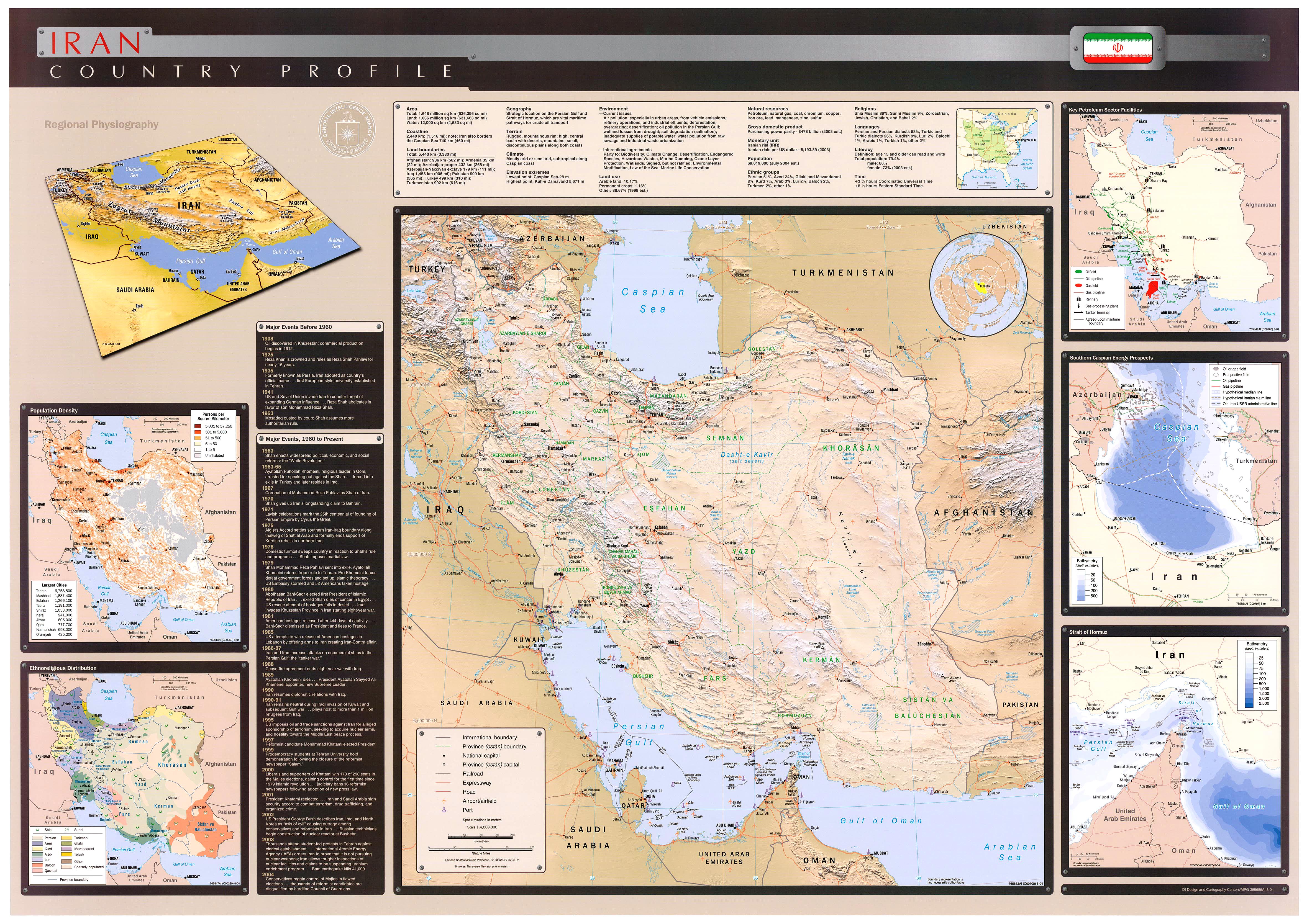
- Iran (Wall Map) 2004 "Iran Country Profile" Iran map with insets: Population Density, Ethnoreligious Distribution, Key Petroleum Sector Facilities, Southern Caspian Energy Prospects and Strait Of Hormuz (2.5MB)
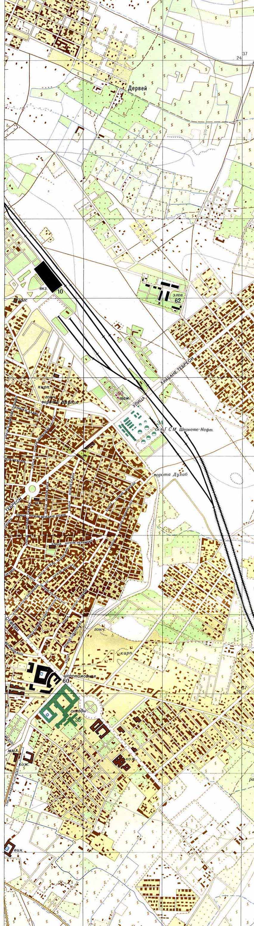
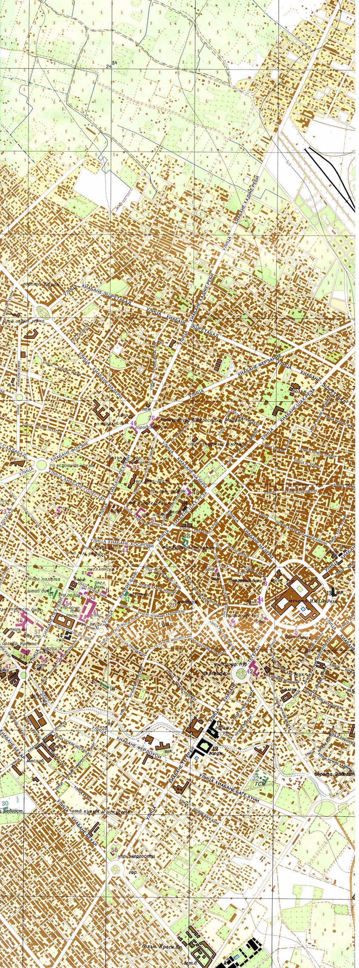
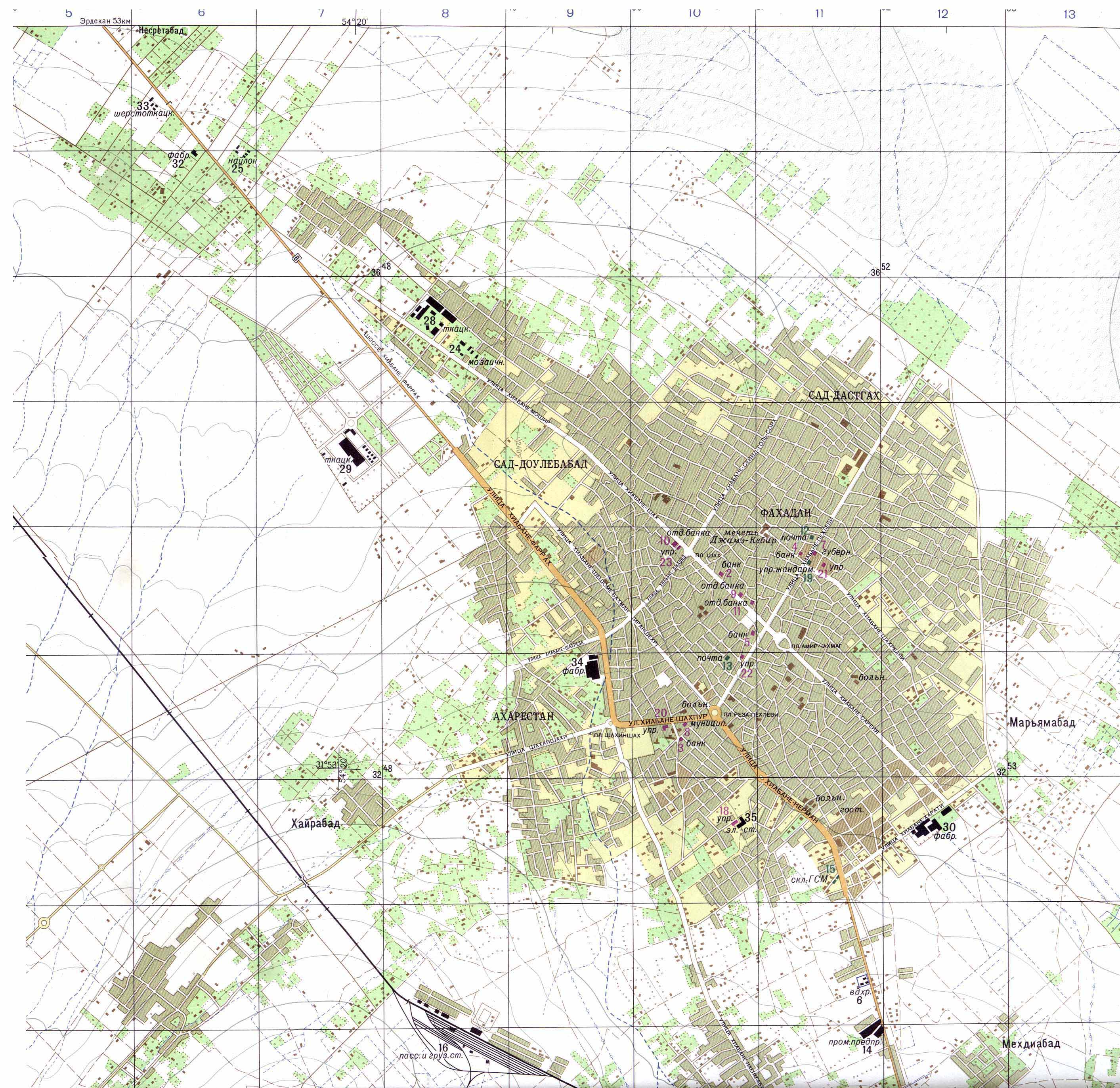
- Mashhad - East (446K) and Mashhad - West (764K) (topographic maps in Russian) original scale 1:10,000 Portions of Soviet General Staff maps J-40-144 1 and 2 1971
- Yazd (topographic map in Russian) original scale 1:25,000 Portion of Soviet General Staff map H-40-1 1978 (1MB)
- 1:1,000,000 - International Map of the World U.S. Army Map Service
- This series covers all of Iran.
- 1:1,000,000 - Operational Navigation Charts U.S. National Imagery and Mapping Agency [Not for navigational use]
- This series covers all of Iran.
- 1:500,000 - Tactical Pilotage Charts U.S. National Imagery and Mapping Agency [Not for navigational use]
- This series covers all of Iran.
- 1:500,000 - World Series 1404, Great Britain. War Office and Air Ministry. 1958-
- This series covers parts of Iran
- 1:250,000 - Iran - Joint Operations Graphic (Air), Series 1501, 1:250,000 [Not for navigational use] U.S. National Imagery and Mapping Agency. Earlier sheets were produced by the U.S. Defense Mapping Agency.
- This series covers most of Iran.
- 1:250,000 - Southwestern Asia Series K502, U.S. Army Map Service, 1953-
- This series includes parts of northern Iran.
- This series covers all of Iran.
- Middle East Maps
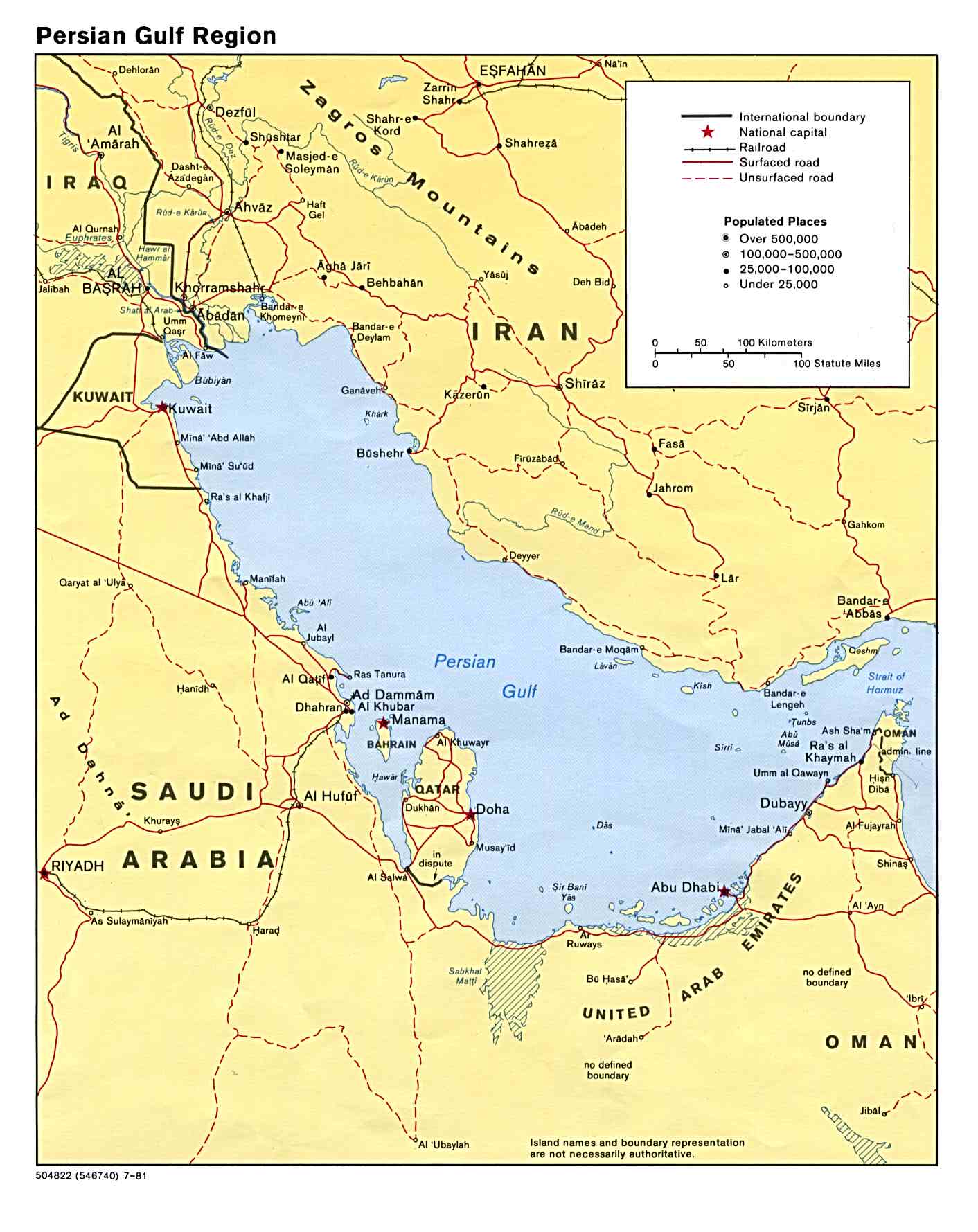
- Persian Gulf Region (Political) 1981 (187K)
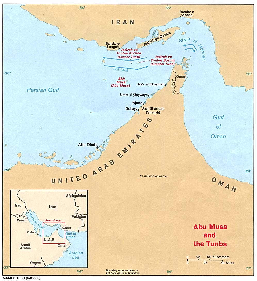
- Strait of Hormuz (Political) 1980 (149K)
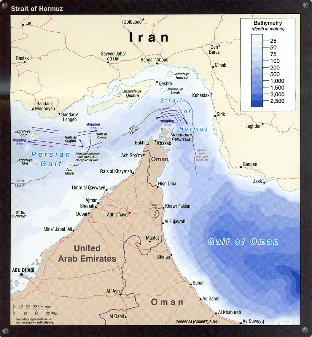
- Strait of Hormuz portion of Iran Country Profile 2004 (311K)
- Caspian Region Oil Pipelines (633K) April 2002 [pdf format]
- [Caspian Region] Oil and Gas Infrastructure in the Caspian Sea Region 2012 (6.9MB)
- [Caspian Region] Oil and Gas Infrastructure in the Caspian Sea Region 2001 (2.5 MB)
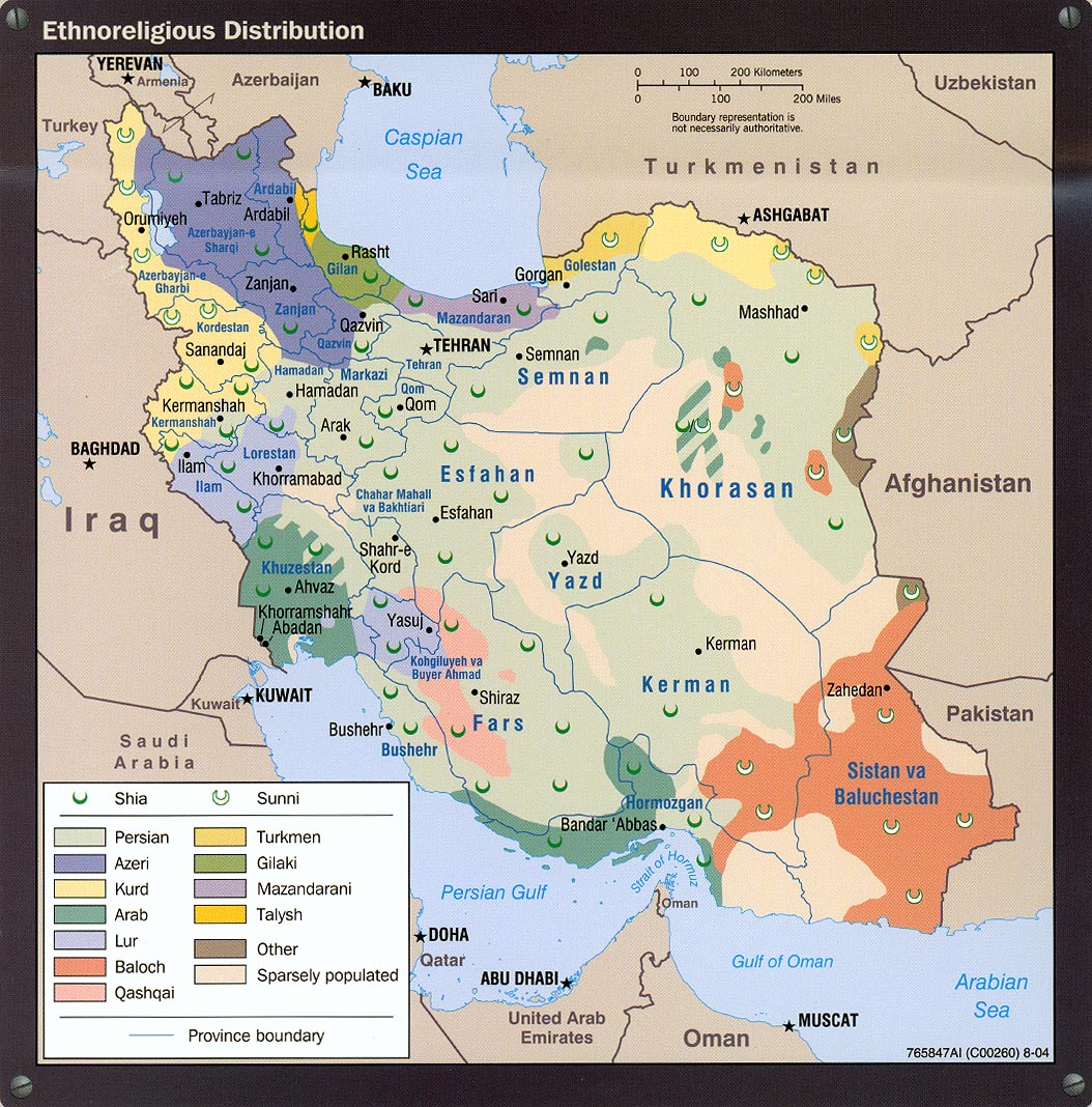
- Ethnoreligious Distribution portion of Iran Country Profile 2004 (373K)
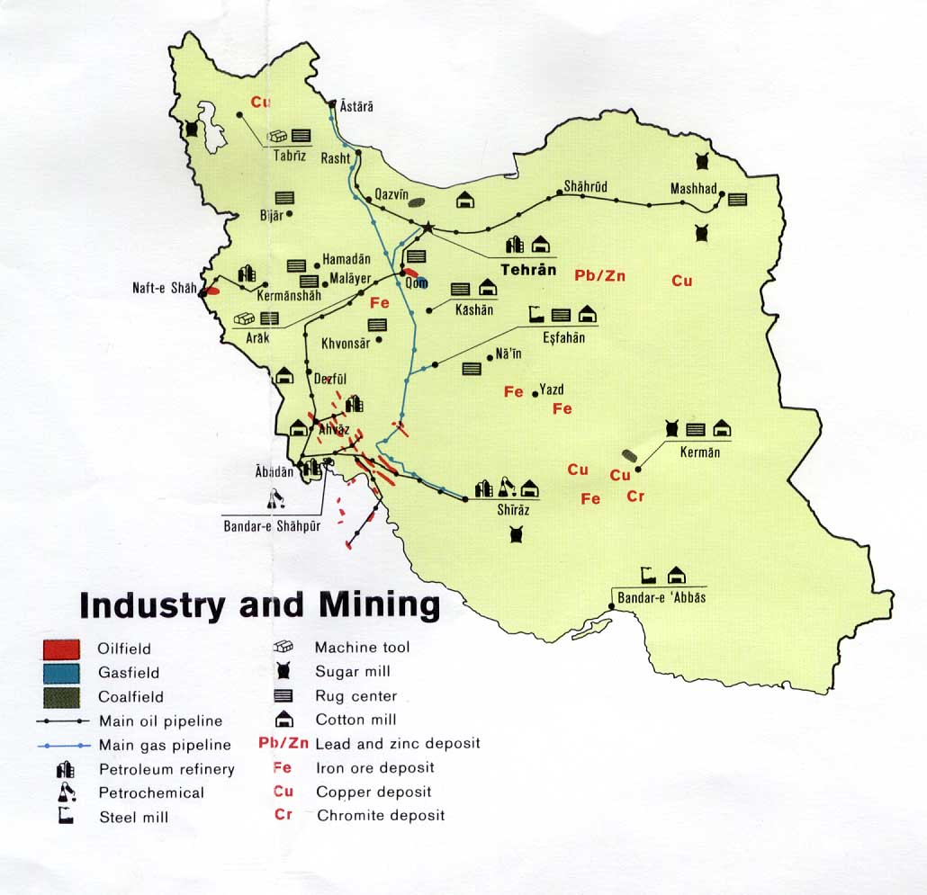
- Industry and Mining from U.S. Central Intelligence Agency map of Iran 1978 (108K)
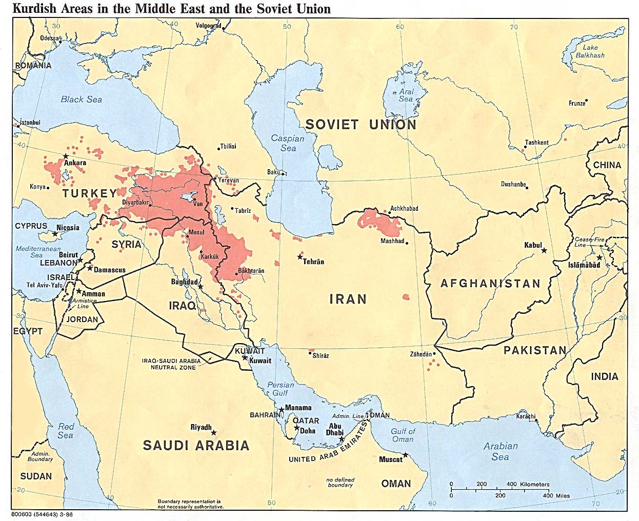
- Kurdish Areas in the Middle East and the Soviet Union 1986 (254K)
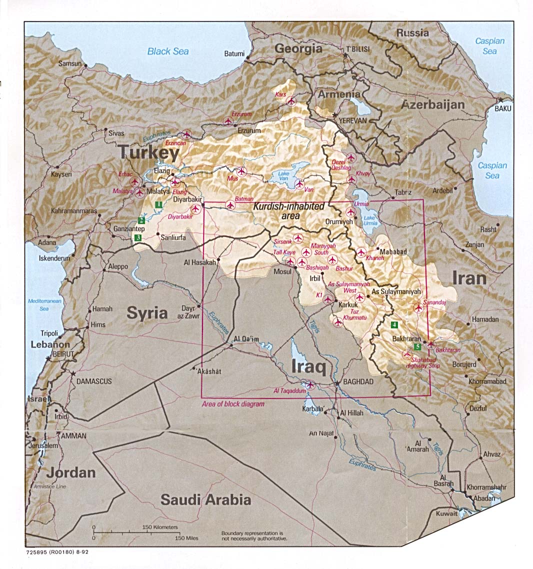
- Kurdish Lands (location map) 1992 (235K)
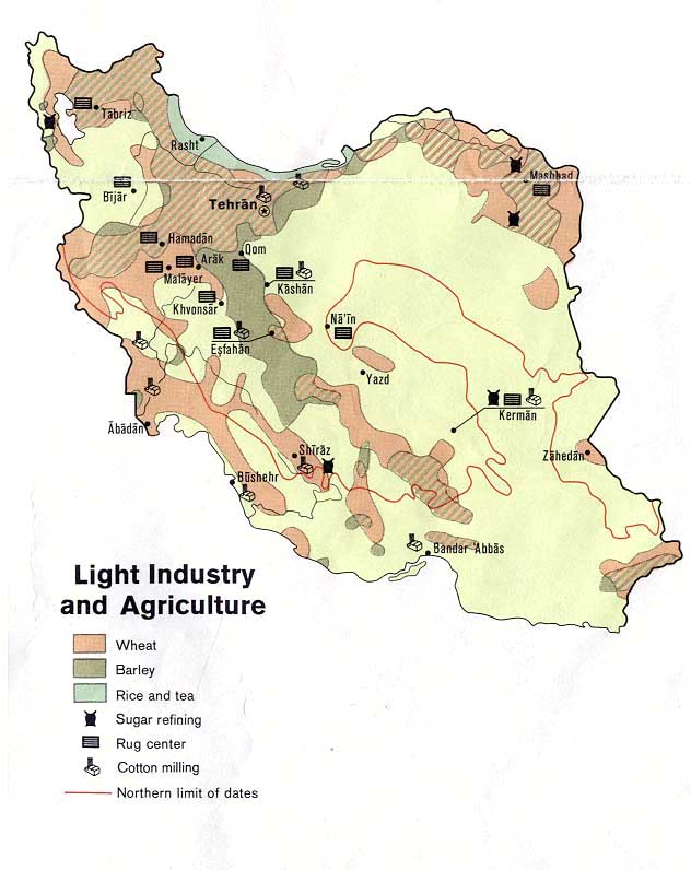
- Light Industry and Agriculture from U.S. Central Intelligence Agency map of Iran 1973 (84K)
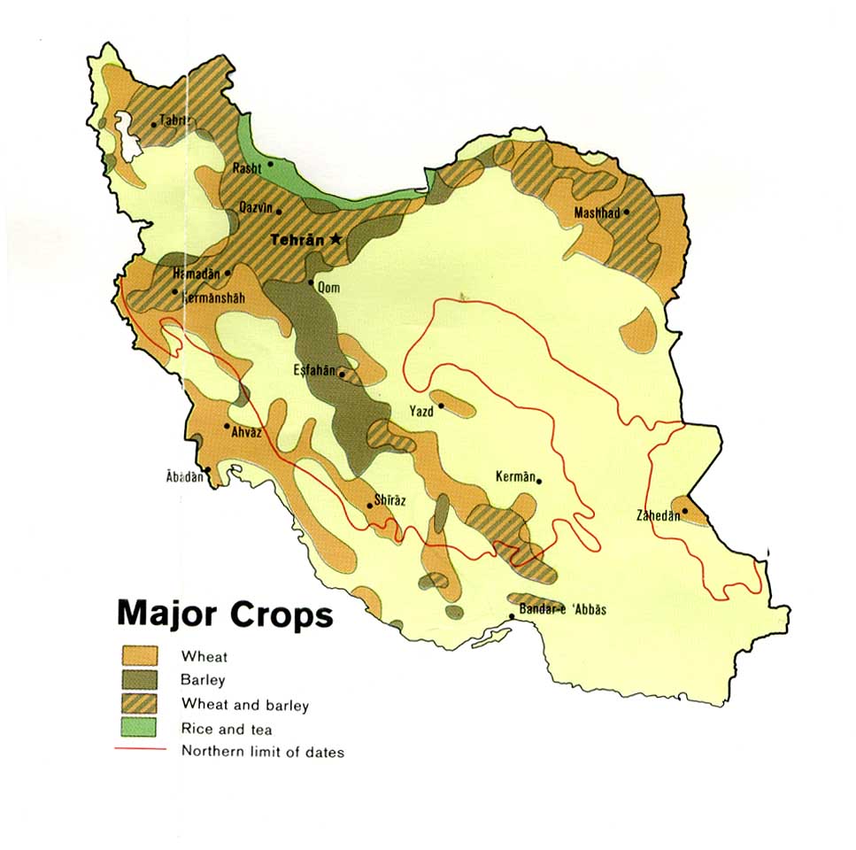
- Major Crops from U.S. Central Intelligence Agency map of Iran 1978 (96K)
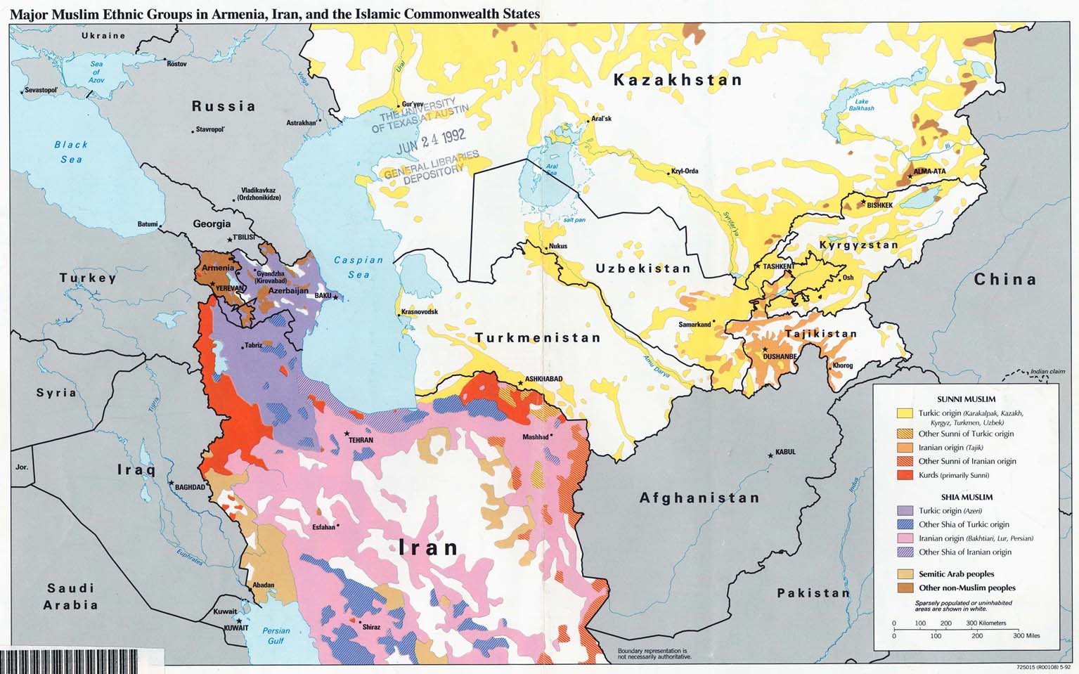
- Major Muslim Ethnic Groups in Armenia, Iran, and the Islamic Commonwealth States 1992 (203K)
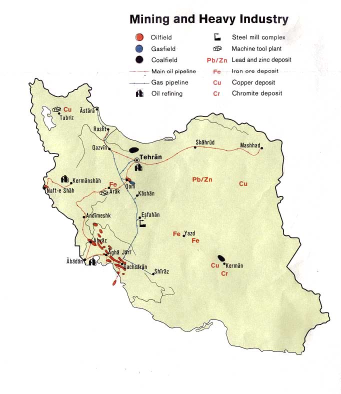
- Mining and Heavy Industry from U.S. Central Intelligence Agency map of Iran 1973 (80K)
- Peoples of Iran [Ethnolinguistic Groups] 1982 (490K)
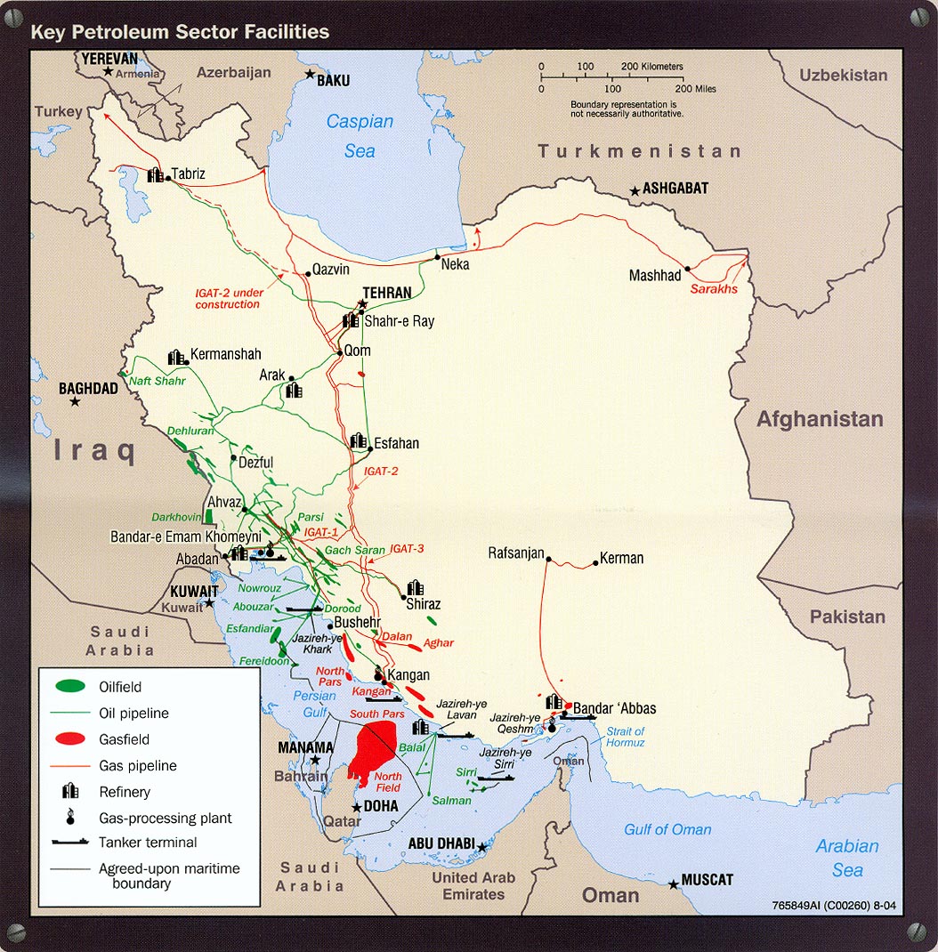
- Petroleum - Key Petroleum Sector Facilites portion of Iran Country Profile 2004 (318K)
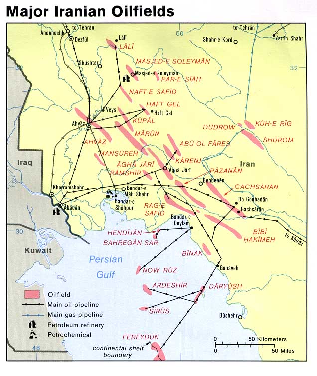
- Petroleum - Major Iranian Oilfields from U.S. Central Intelligence Agency map of Iran 1978 (108K)
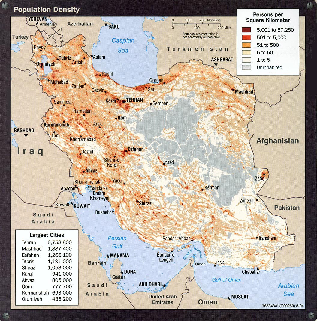
- Population Density portion of Iran Country Profile 2004 (413K)
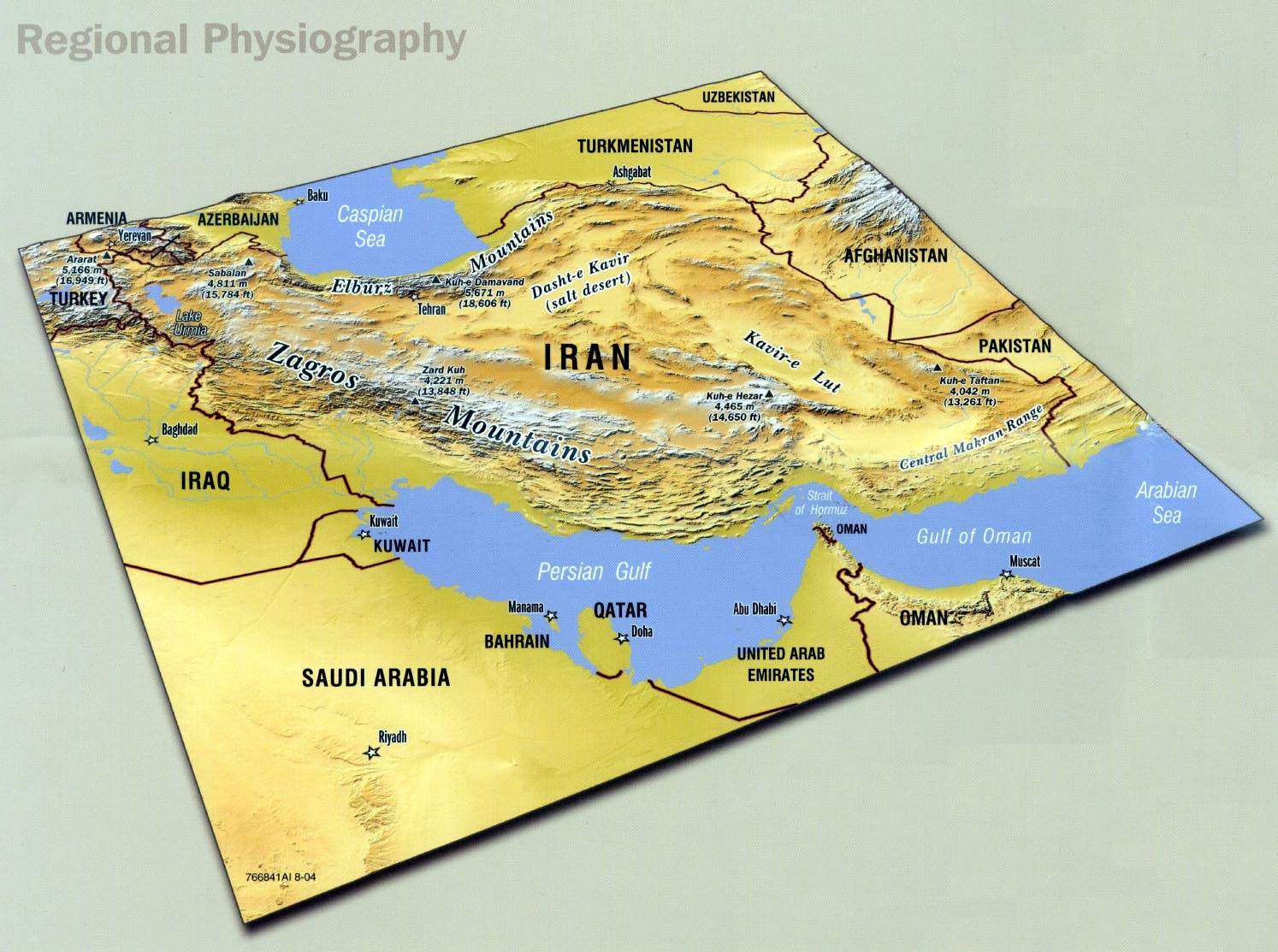
- Regional Physiography portion of Iran Country Profile 2004 (285K)
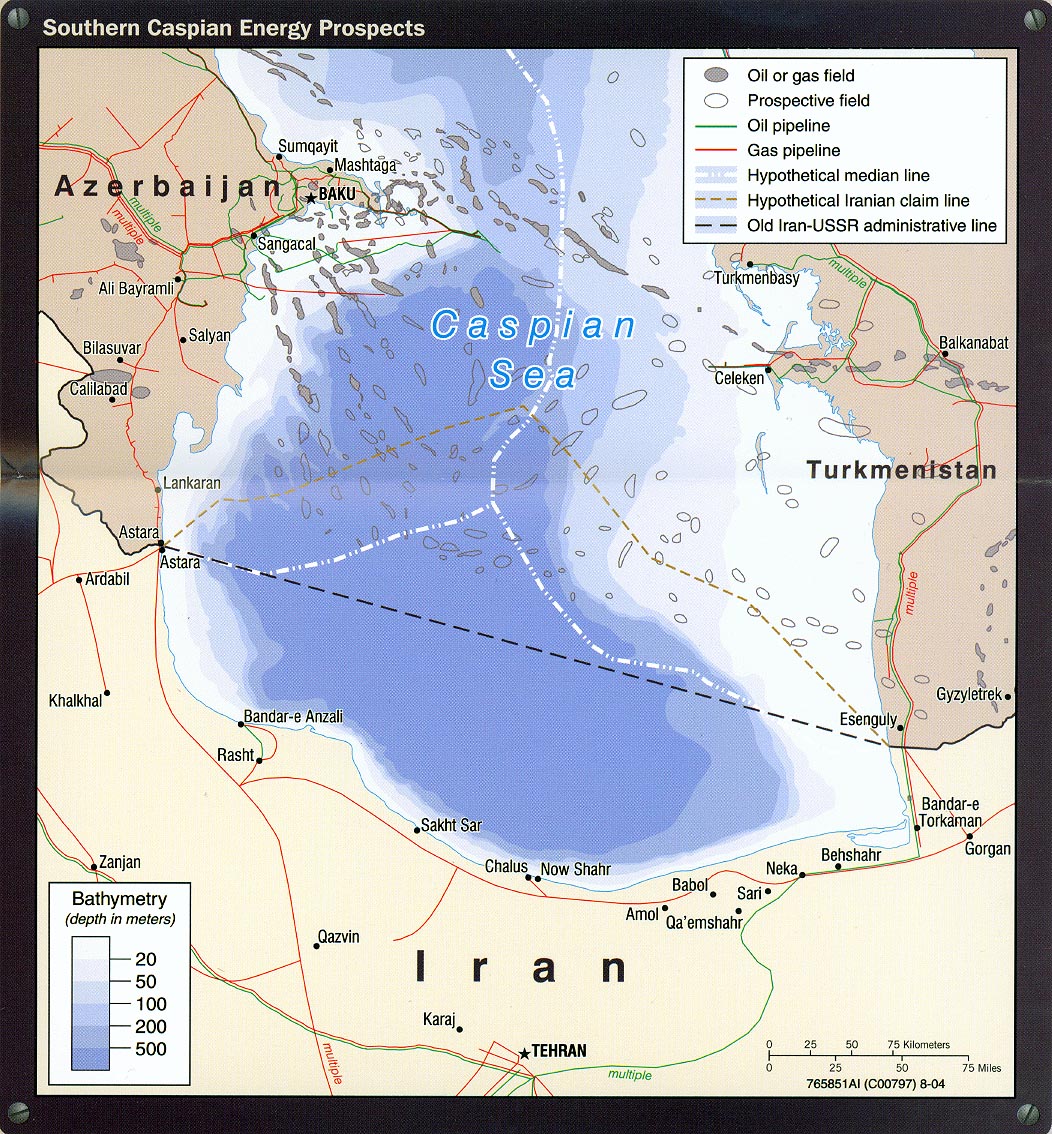
- Southern Caspian Energy Prospects portion of Iran Country Profile 2004 (394K)
- Strait of Hormuz portion of Iran Country Profile 2004 (311K)
![[Caspian Region] Oil and Gas Infrastructure in the Caspian Sea Region](middle_east_and_asia/txu-pclmaps-oclc-785323952-caspian_sea_oil_and_gas.jpg)
![[Caspian Region] Oil and Gas Infrastructure in the Caspian Sea Region](middle_east_and_asia/caspian_sea_oil_gas-2001.jpg)
![Peoples of Iran [Ethnolinguistic Groups]](middle_east_and_asia/iran_peoples_82.jpg)
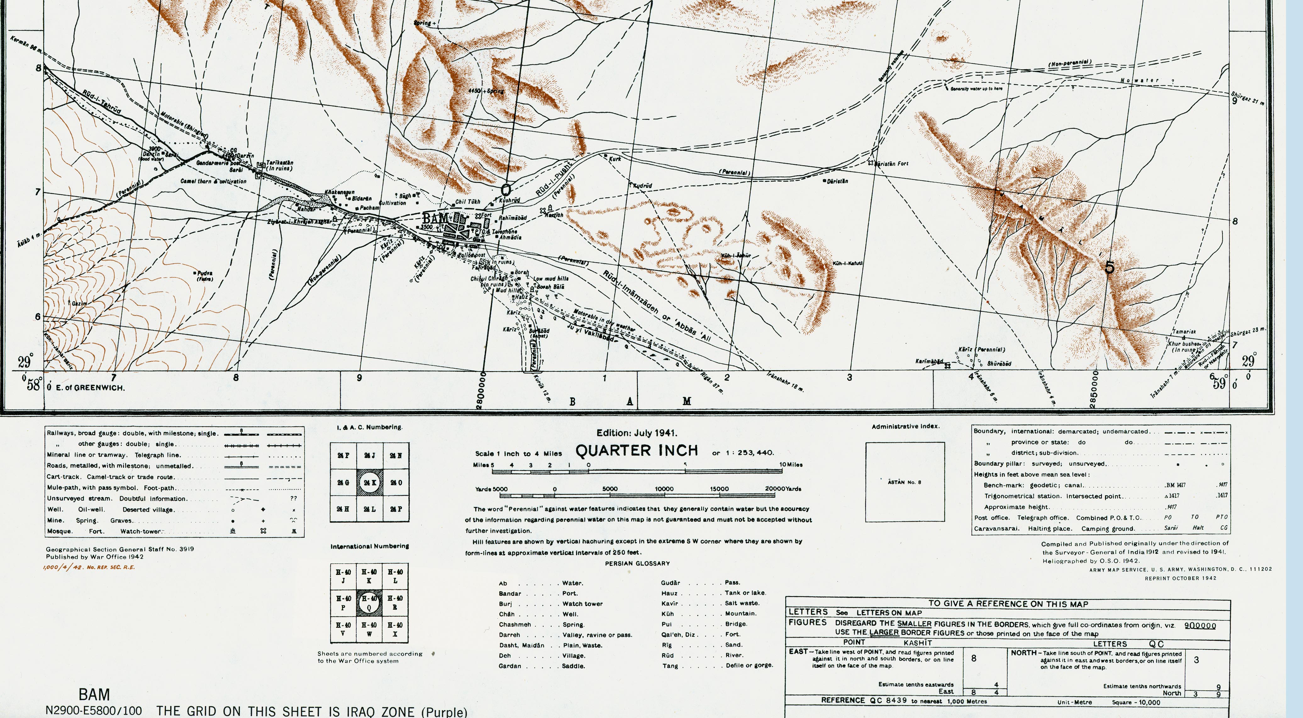
- Bam Area (1,520K)
- Portion of sheet H-40 Q Bam. Edition July 1941. Original scale 1:253,440 Compiled and Published originally under the direction of the Surveyor-General of India 1912 and revised to 1941. Published by the War Office, 1942 and reprinted by the U.S. Army Map Service October 1942.
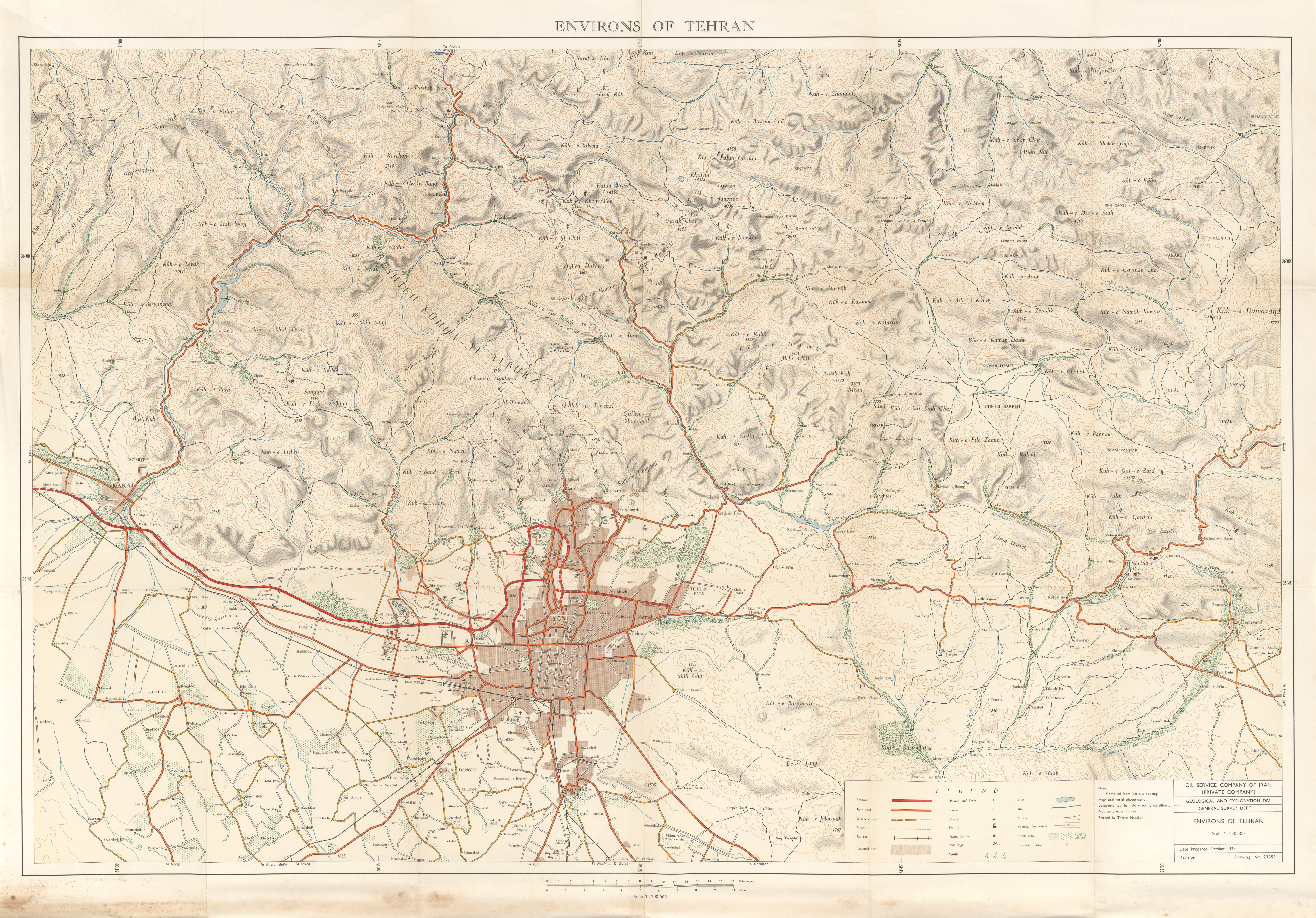
- Environs of Tehran 1974 (9.7MB)
- Original scale 1:100,000. Published by the Oil Service Company of Iran, October 1974.
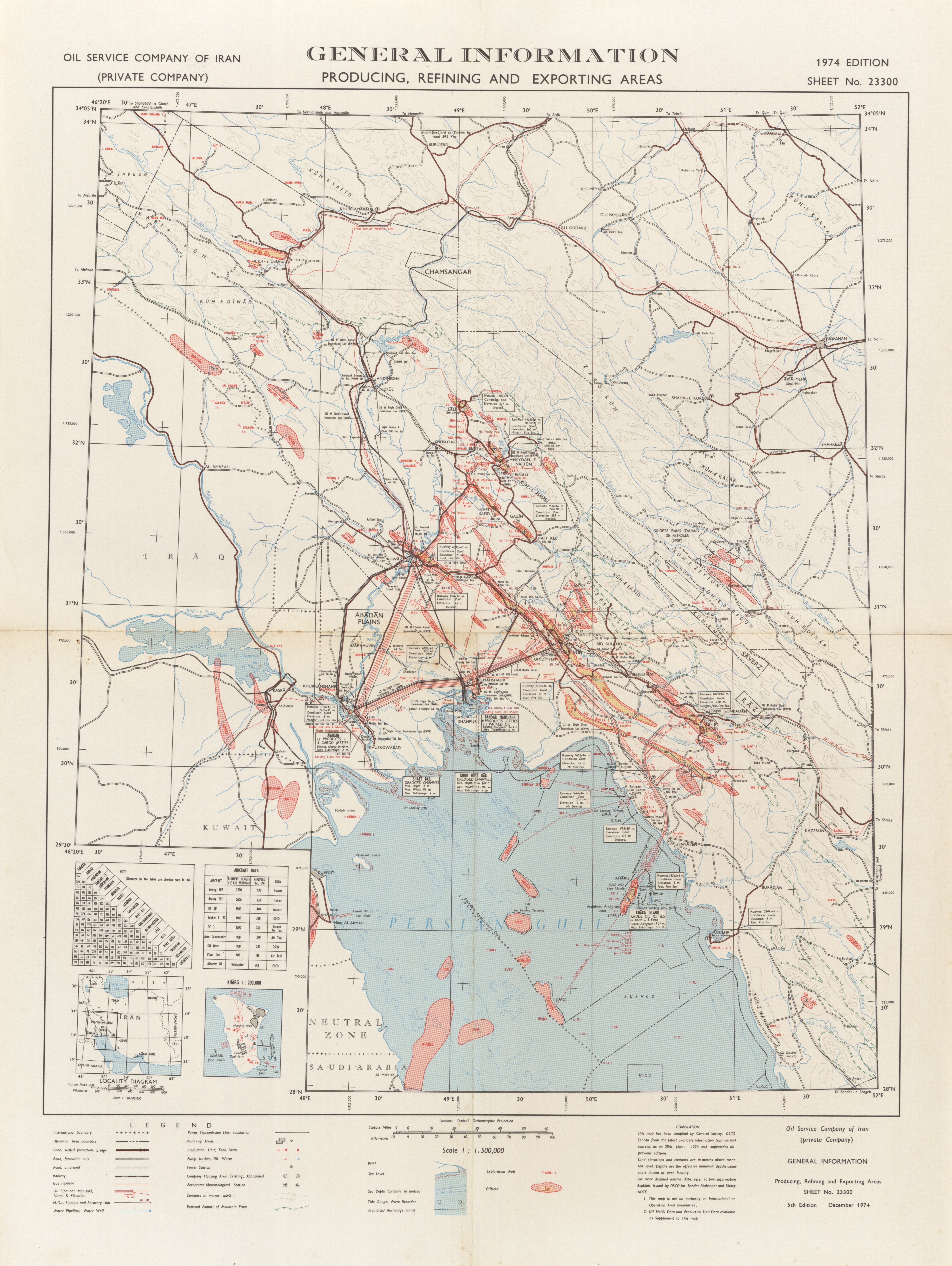
- General Information: Producing, Refining, and Exporting Areas 1974 (8.8MB)
- Original scale 1:1,500,000. Published by the Oil Service Company of Iran, December 1974.
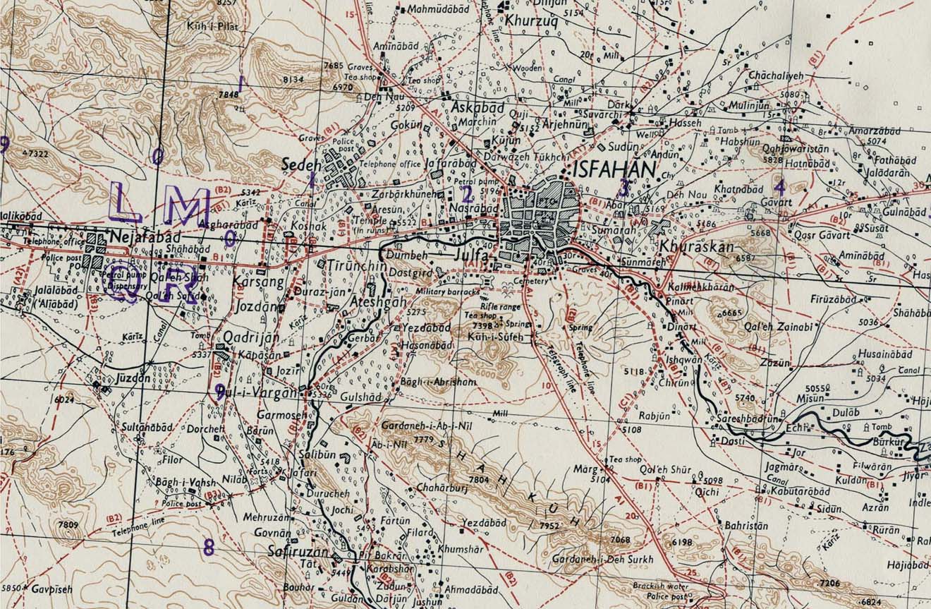
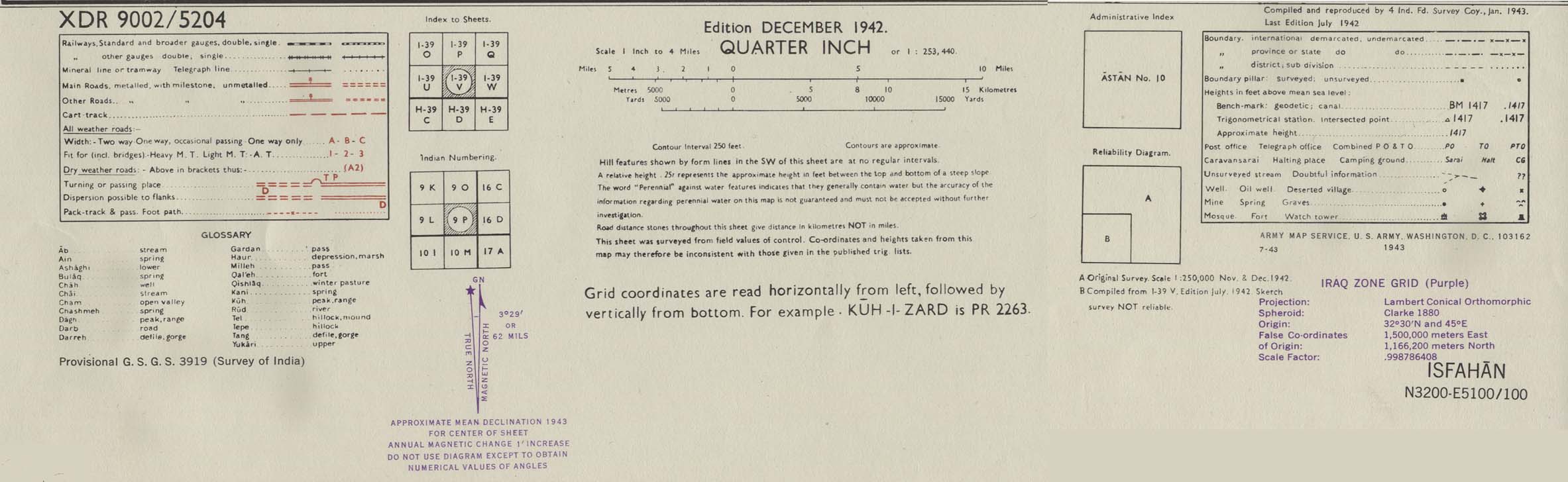
- Isfahan Area 1942 (314K) map key and scale (168K)
- Portion of sheet I-39 V Isfahan. Edition December 1942. Original scale 1:253,440 Compiled and Reproduced by India Field Survey Company, January 1943. Published by the U.S. Army Map Service, July 1943.
- Iraq and Iran Series K501, 1:253,440, U.S. Army Map Service, 1931-
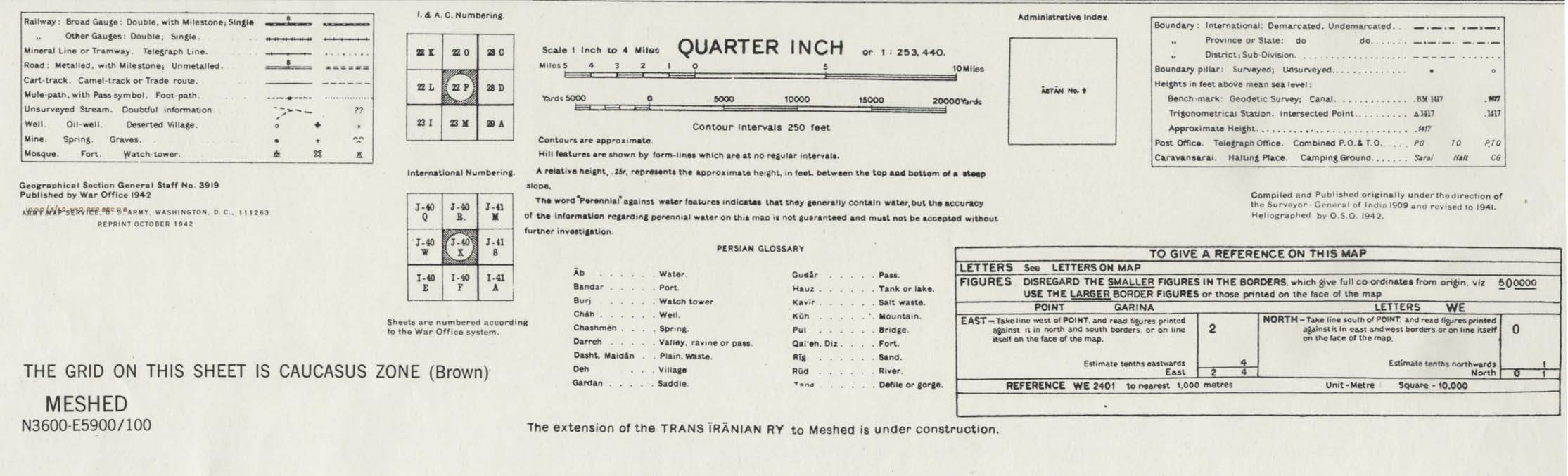
- Meshed [Mashhad] Area 1942 (538K) map key and scale (146K)
- Portion of sheet J-40 X Iran. Original scale 1:253,440 Compiled and published originally under the direction of the Surveyor-General of India 1909 and Revised to 1941. Published by the War Office, 1942 and reprinted by the U.S. Army Map Service October 1942.
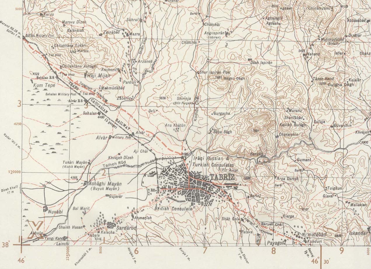
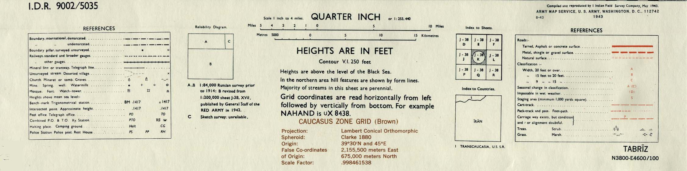
- Tabriz Area 1943 (244K) map key and scale (149K)
- Portion of sheet J-38 K Tabriz. Original scale 1:253,440 Compiled and Reproduced by India Field Survey Company, May 1943. Published by the U.S. Army Map Service, August 1943.
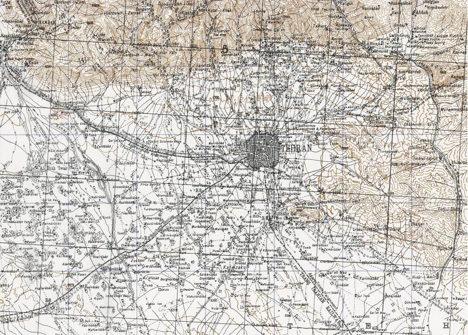
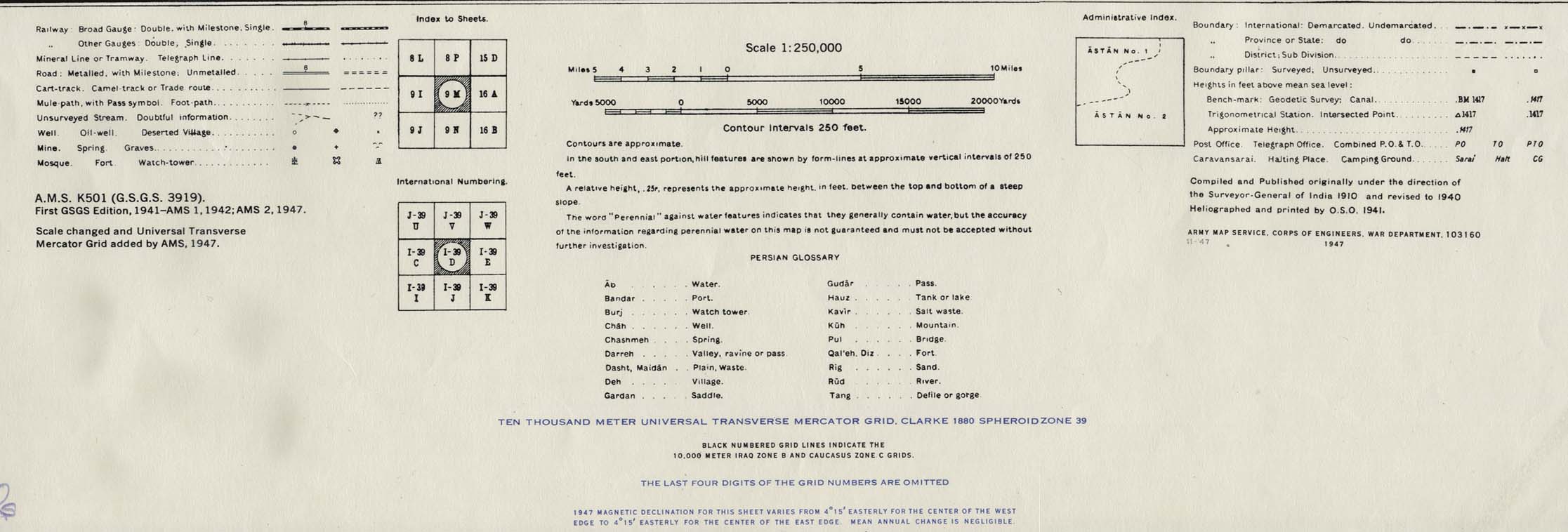
- Tehran Area 1947 (538K) map key and scale (146K)
- Portion of sheet I-39 D Iran. Original scale 1:250,000 Compiled and published originally under the direction of the Surveyor-General of India 1910 and Revised to 1940. Published by the U.S. Army Map Service November, 1947.
- Portion of sheet H-40 Q Bam. Edition July 1941. Original scale 1:253,440 Compiled and Published originally under the direction of the Surveyor-General of India 1912 and revised to 1941. Published by the War Office, 1942 and reprinted by the U.S. Army Map Service October 1942.
![Meshed [Mashhad] Area 1942](historical/meshed_iran_1942.jpg)
- Iran (8 maps and charts) Published by the CIA January, 1993
Maps on Other Web Sites
- Iran (Lonely Planet)
- Iran (United Nations) [pdf format]
- Iran - Atlas, 1998 (IranCarto)
- Iran - How Israel Can Strike Iran (Limes)
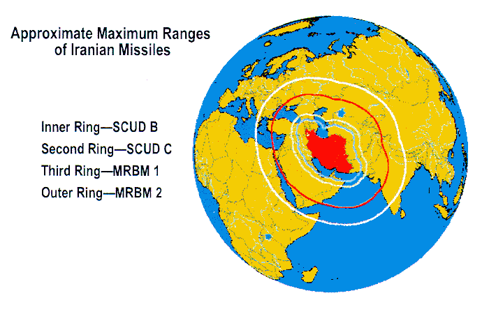
- Iran - Iranian Missiles, Ranges (Federation of American Scientists)
- Iran in Maps (BBC News)
- Iran - Maps (IranCarto)
- Iran - Key Nuclear Sites [March 2015] (BBC News)
- Iran - Nuclear Enrichment Facility Reports with Imagery (ISIS)
- Iran - Nuclear Facilities (Google Maps)
- Iran - Nuclear Facilities Maps (NTI)
- Iran - Nuclear Sites [April 2015] (Stratfor)
- Iran - Provinces (Iransaga)
- Iran - Qom Facility (GlobalSecurity.org)
- Iran - Railway Maps (IRIRW/Internet Archive)
- Iran - Railways (MSEDV)
- Iran - Special Weapons Facilities Maps (Federation of American Scientists)
- Iran - Special Weapons Facilities (GlobalSecurity.org)
- Bam(Federation of American Scientists)
- Esfahan/Isfahan (Iran Traveling Center)
- Esfahan (Lonely Planet)
- Mashhad (Mashhad Tourism)
- Mashhad - Satellite Image (Google Maps)
- Shiraz (Lonely Planet)
- Tabriz (Anobanini)
- Tehran (Iran Traveling Center)
- Tehran (Lonely Planet)
- Tehran(Tehranshake)
- Tehran - Clickable Map in English (Sahneh)
- Tehran - Map in Persian and English (Iranmap) [PDF]
- Tehran - Metro System