Perry-Castañeda Library
Map Collection
Historical Maps of Europe
- Le Alpi [The Alps] (1,917K)
- From Atlante Mondiale Hoepli di Geografia Moderna Fisica e Politica. Giovanni Roncagli, 1899.
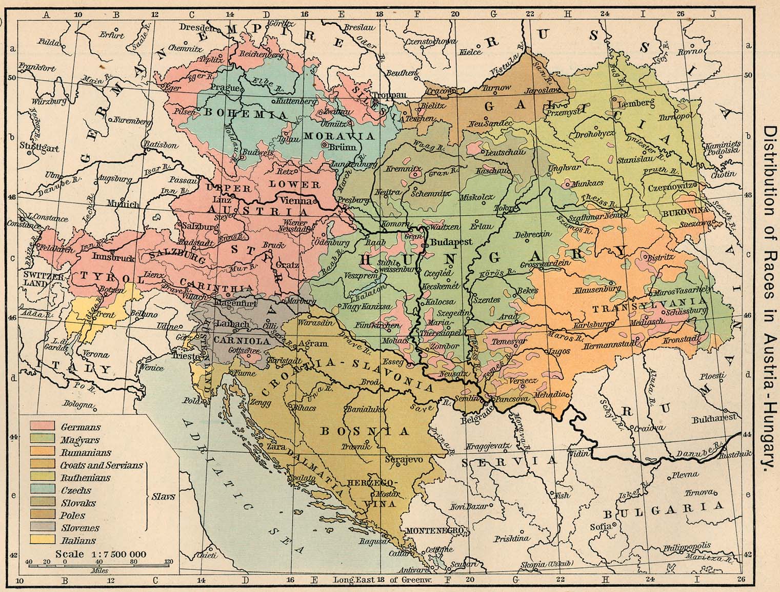
- Austria and Hungary 1911 (425K)
- "Distribution of Races in Austria-Hungary" From The Historical Atlas by William R. Shepherd, 1911.
- Balkans Historical Maps
- Baltic Lands Circa 1000 A.D. - 1809 A.D. (12 Maps)
- From the Atlas to Freeman's Historical Geography, Edited by J.B. Bury, Longmans Green and Co. Third Edition 1903.
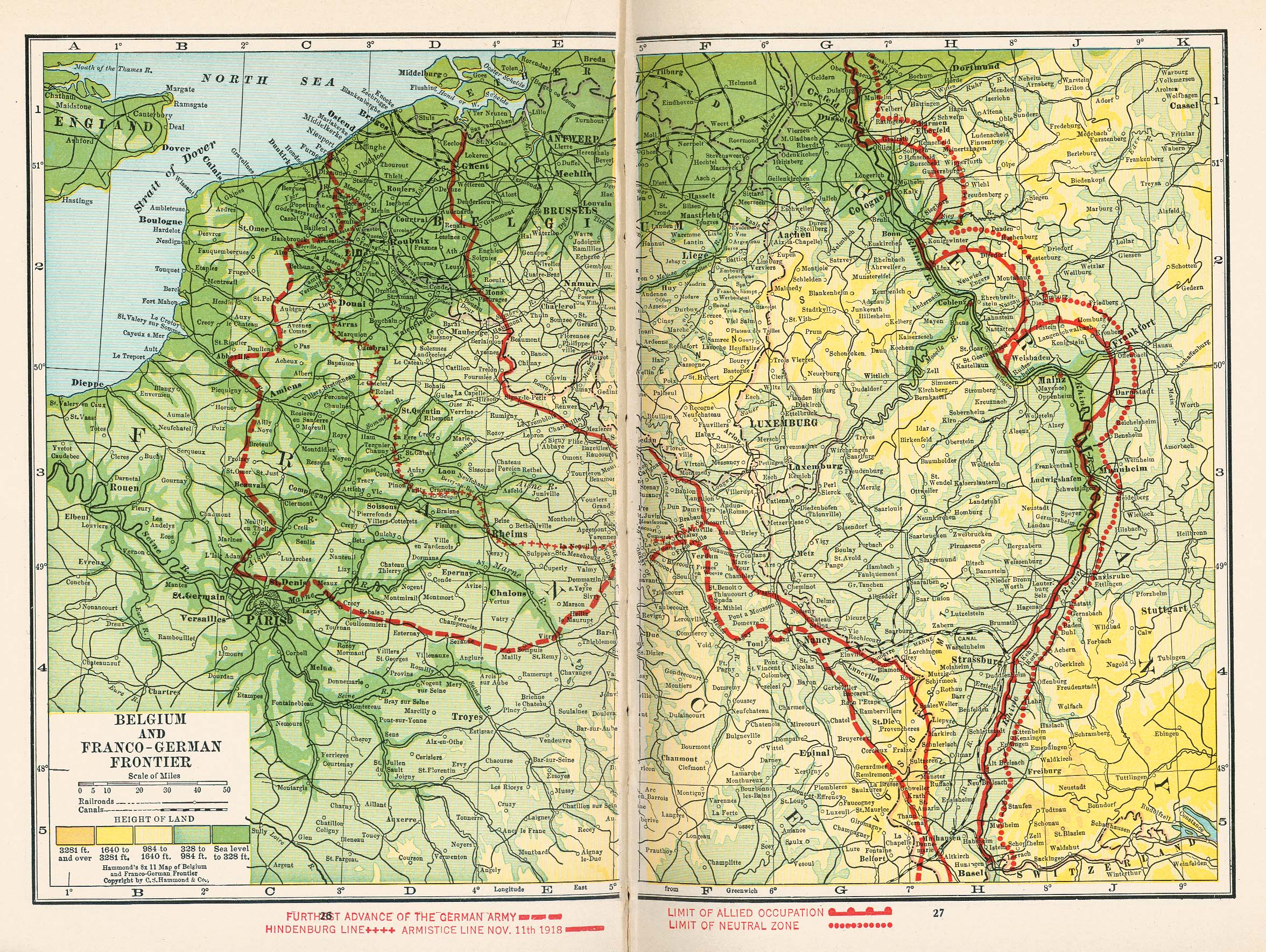
- Belgium and Franco-German Frontier, 1918 (1342K)
- From Putnam's Handy Volume Atlas of the World. Published by G.P. Putnam's Sons, New York and London, 1921.
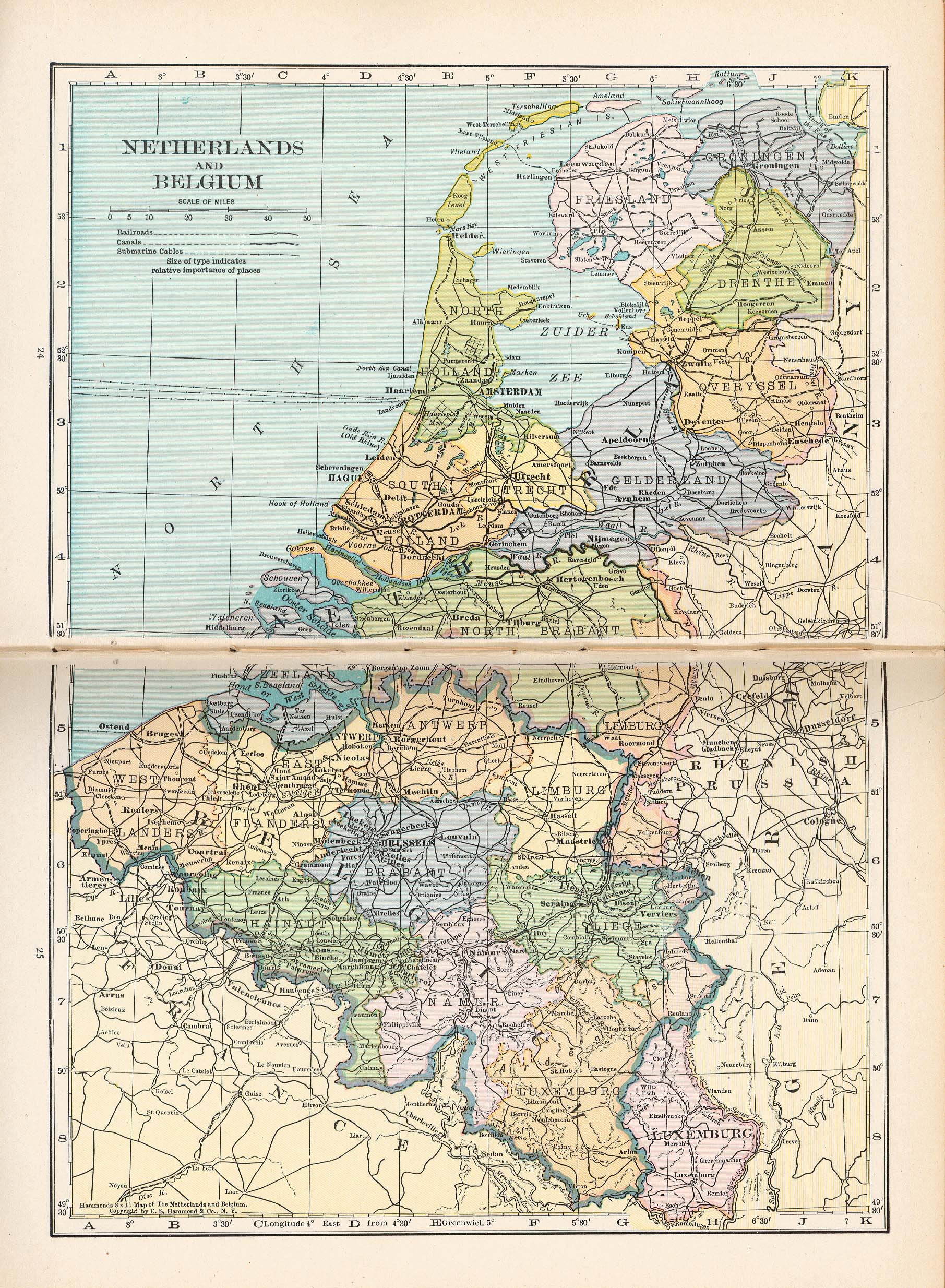
- Belgium (1176K)
- From Putnam's Handy Volume Atlas of the World. Published by G.P. Putnam's Sons, New York and London, 1921.
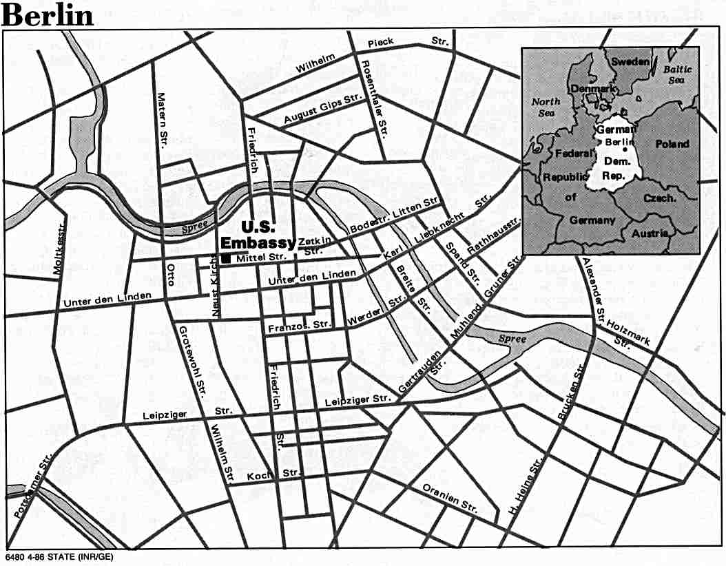
- Berlin (East), Germany 1986 (74K)
- U.S. Department of State.
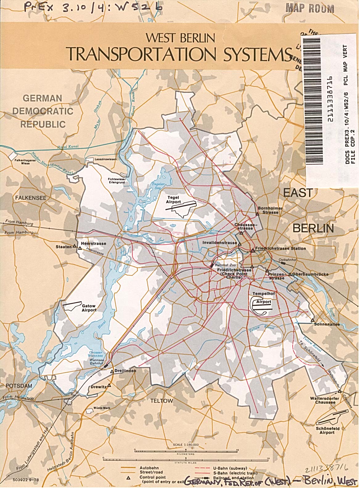
- Berlin (West), Germany, Transportation Systems 1978 (387K)
- U.S. Central Intelligence Agency.
- Britannia [Ancient British Islands] (663K)
- From A Classical Atlas of Ancient Geography by Alexander G. Findlay. New York: Harper and Brothers 1849.
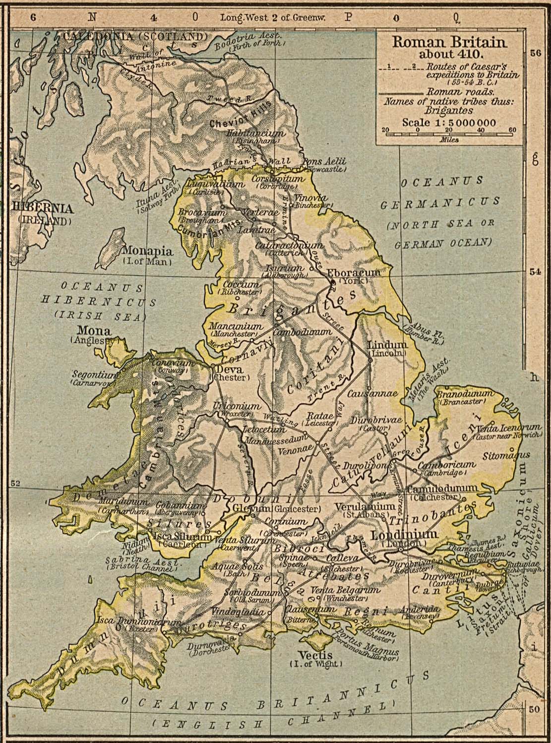
- Britain About 410. (452K)
- From The Historical Atlas by William R. Shepherd, 1926.
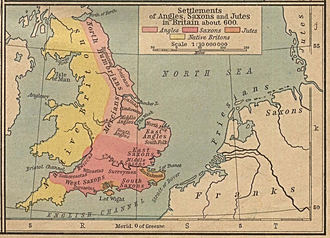
- Britain about 600 - Settlements of Angles, Saxons and Jutes (323K)
- From The Historical Atlas by William R. Shepherd, 1926.
- The British Dominions Year Book 1918
- British Isles 802 (274K)
- From The Historical Atlas by William R. Shepherd, 1926.
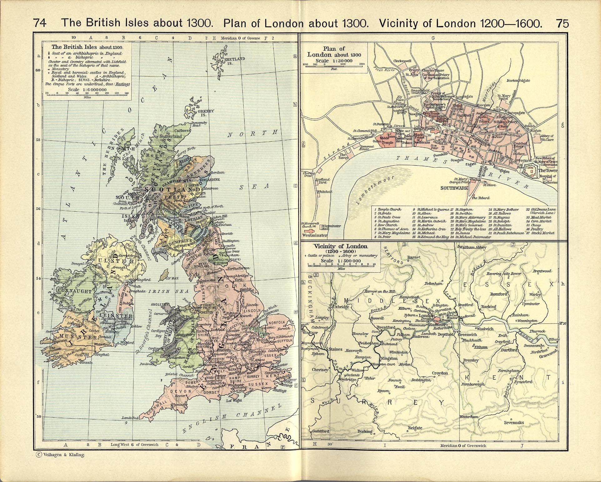
- British Isles 1300 (363K)
- From The Historical Atlas by William R. Shepherd, 1926.
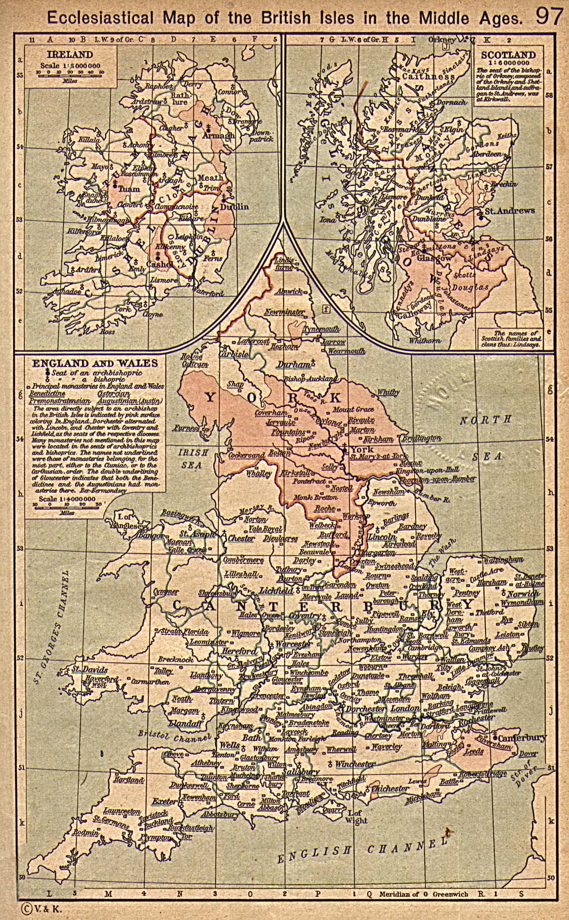
- British Isles Ecclesiastical Map (645K)
- Ecclesiastical Map of the British Isles in the Middle Ages. From The Historical Atlas by William R. Shepherd, 1923.
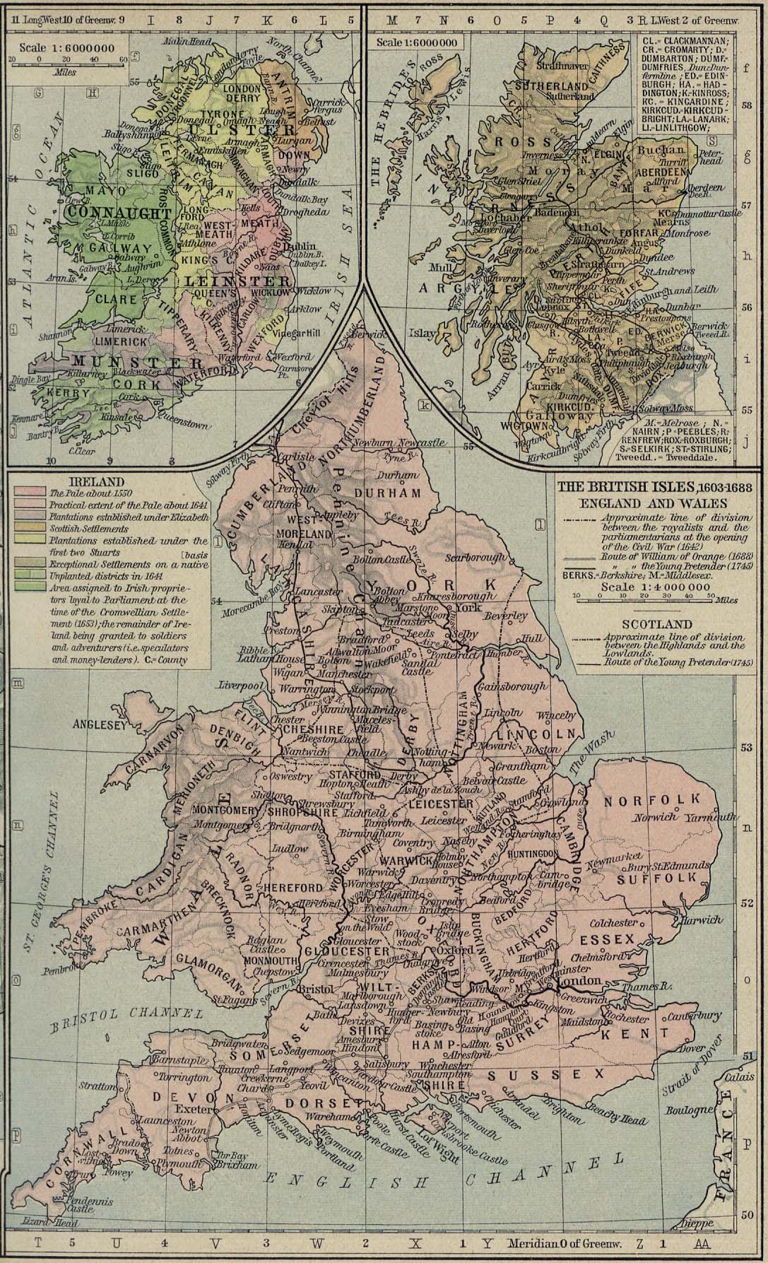
- The British Isles, 1603-1688 (481K)
- From The Historical Atlas by William R. Shepherd, 1926.
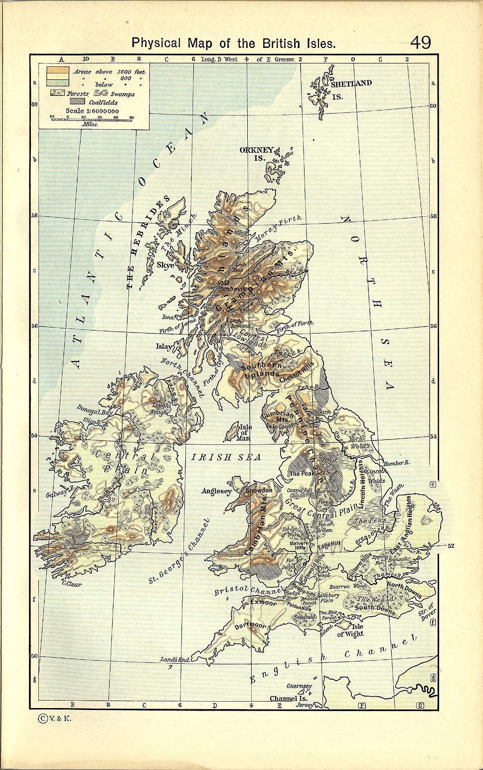
- British Isles Physical Map (416K)
- From The Historical Atlas by William R. Shepherd, 1911.
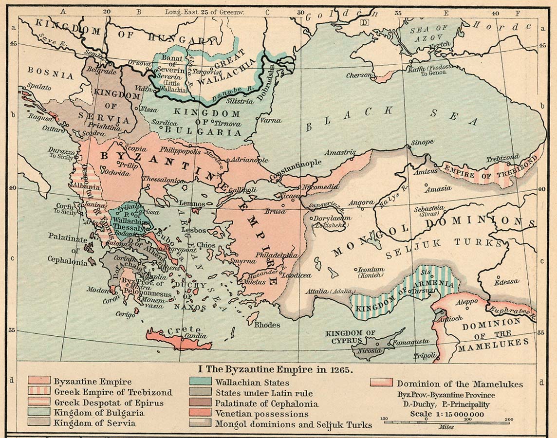
- The Byzantine Empire in 1265 (273K)
- The Byzantine Empire, 1265-1355. From The Historical Atlas by William R. Shepherd, 1911.
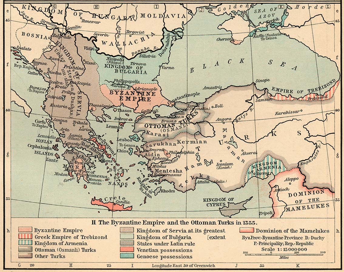
- The Byzantine Empire and the Ottoman Turks in 1355 (269K)
- The Byzantine Empire, 1265-1355. From The Historical Atlas by William R. Shepherd, 1911.
- Central Europe Circa 980 A.D. - 1871 A.D. (13 Maps)
- From the Atlas to Freeman's Historical Geography, Edited by J.B. Bury, Longmans Green and Co. Third Edition 1903.
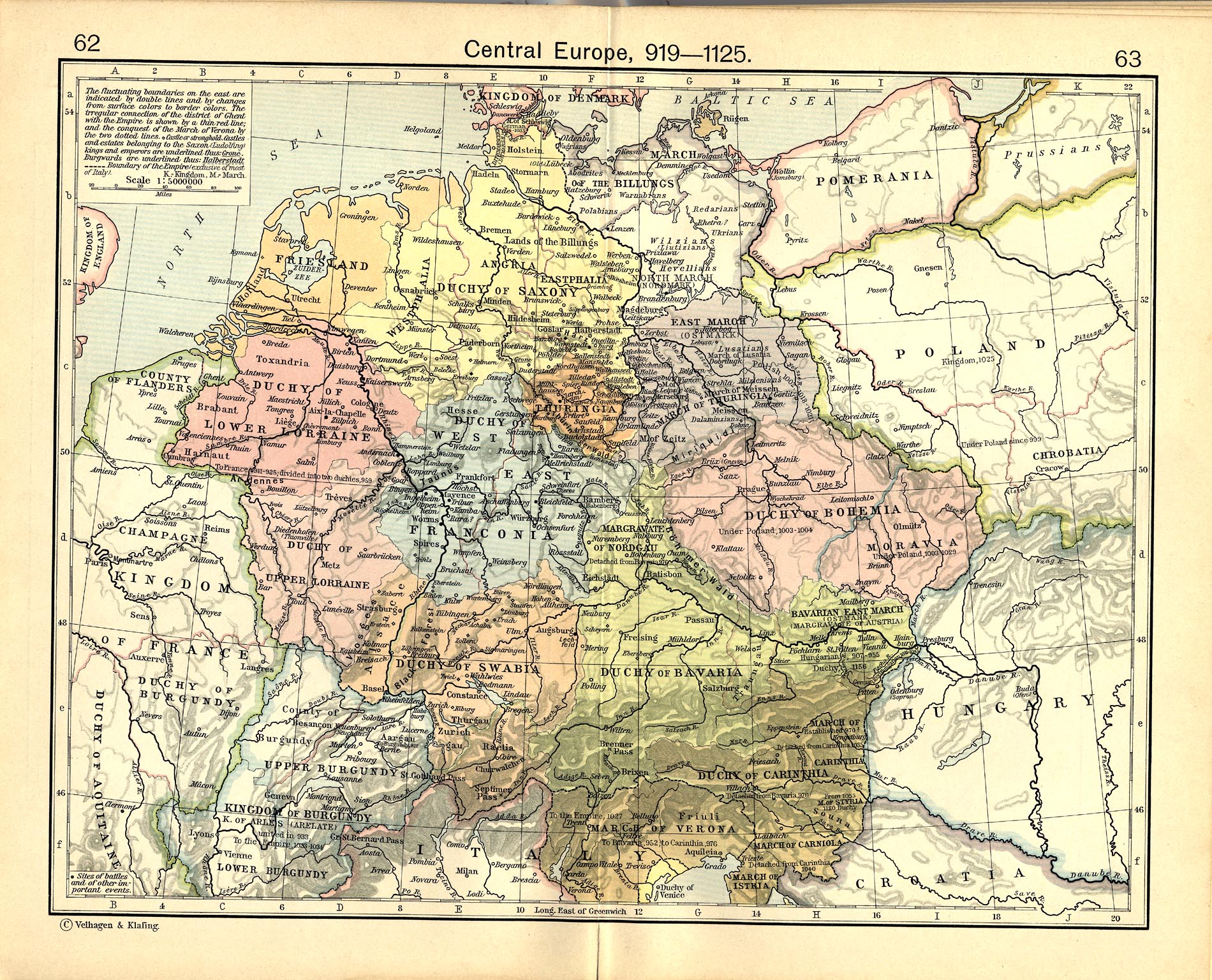
- Central Europe, 919-1125 (843K)
- From The Historical Atlas by William R. Shepherd, 1911.
- Central Europe about 1477 (827K)
- From The Historical Atlas by William R. Shepherd, 1926.
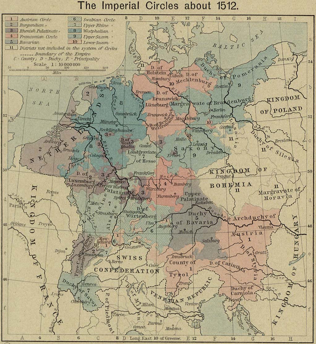
- Central Europe - The Imperial Circles about 1512 (245K)
- From The Historical Atlas by William R. Shepherd, 1926.
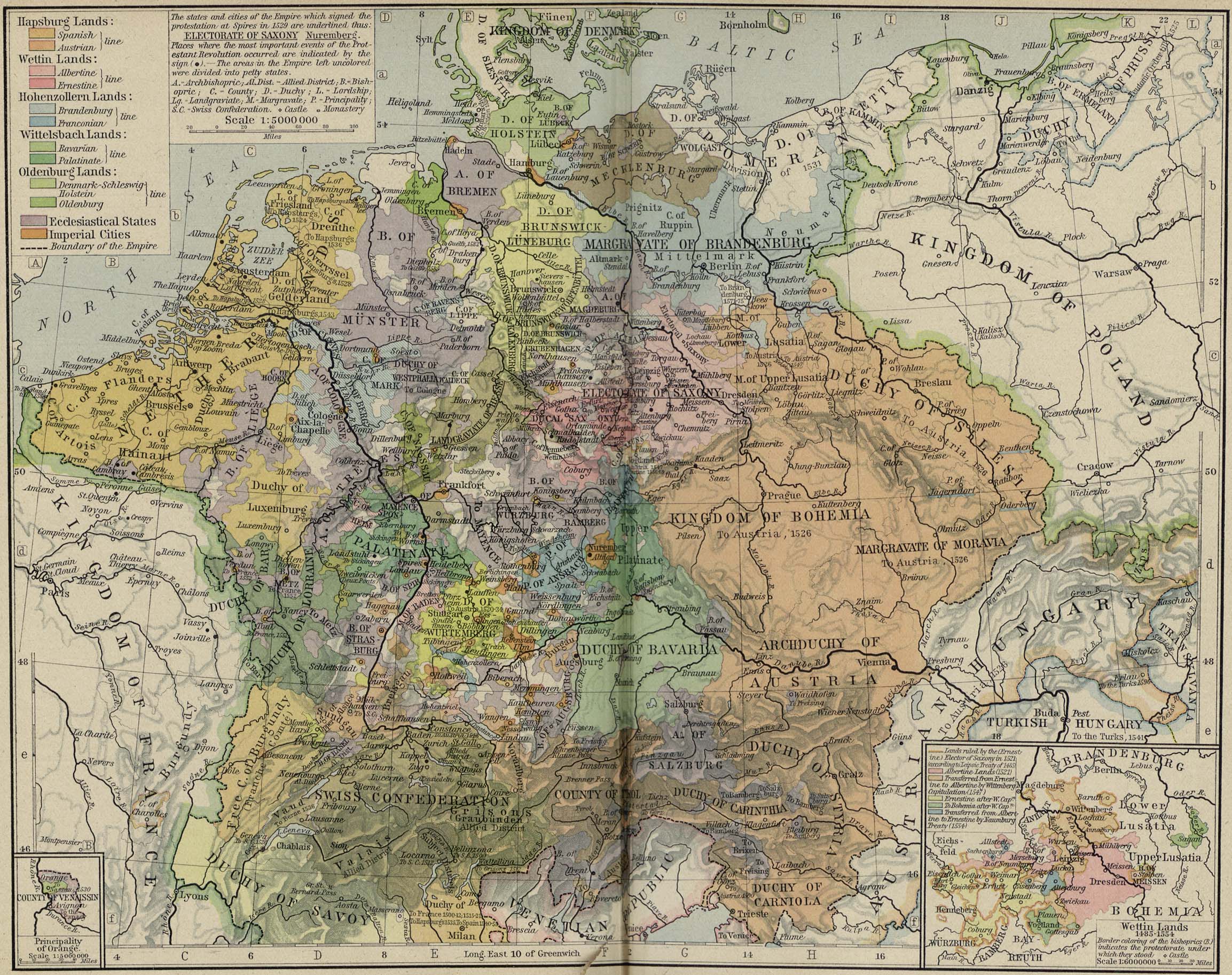
- Central Europe - Central Europe about 1547 (845K)
- From The Historical Atlas by William R. Shepherd, 1926.
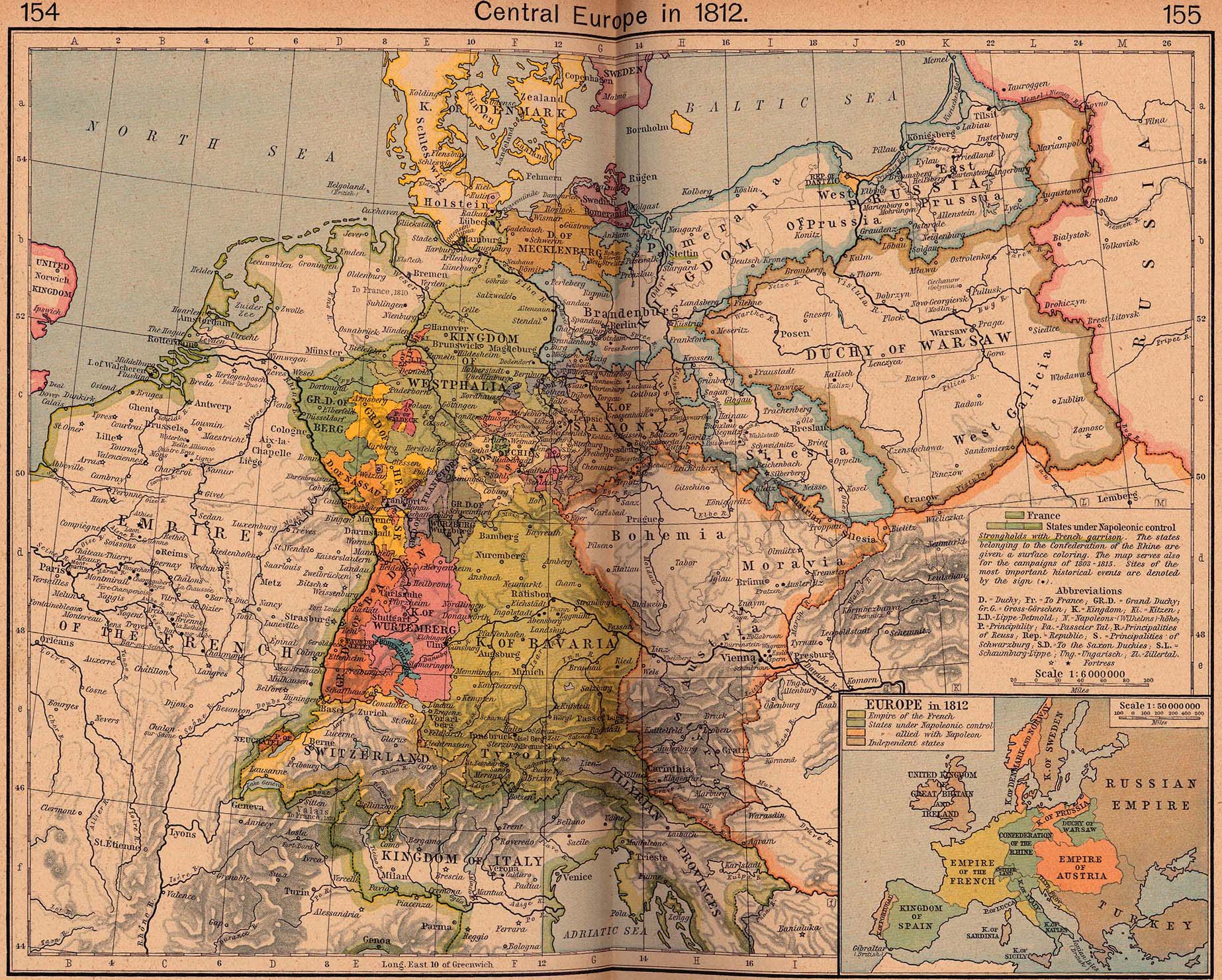
- Central Europe in 1812 (728K)
- From The Historical Atlas by William R. Shepherd, 1926.
- Central Europe Road Maps 1951-1952
- Series M405, 1:300,000, U.S. Army Map Service, 1951-1952.
- Central Italy, with the adjacent countries, from the Peutingerian Tables constructed about 393 A.D. (580K)
- From A Classical Atlas by Alexander G. Findlay. New York: Harper and Brothers 1849.
- Constantinople (157K)
- A Dictionary, Practical, Theoretical, and Historical of Commerce and Commercial Navigation, by J.R. M'Culloch. 1882.
- Constantinople (671K)
- From The Historical Atlas by William R. Shepherd, 1923.
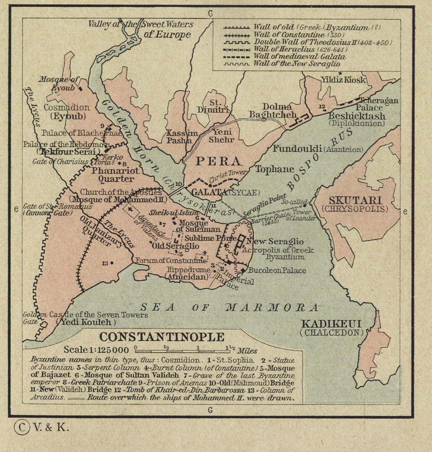
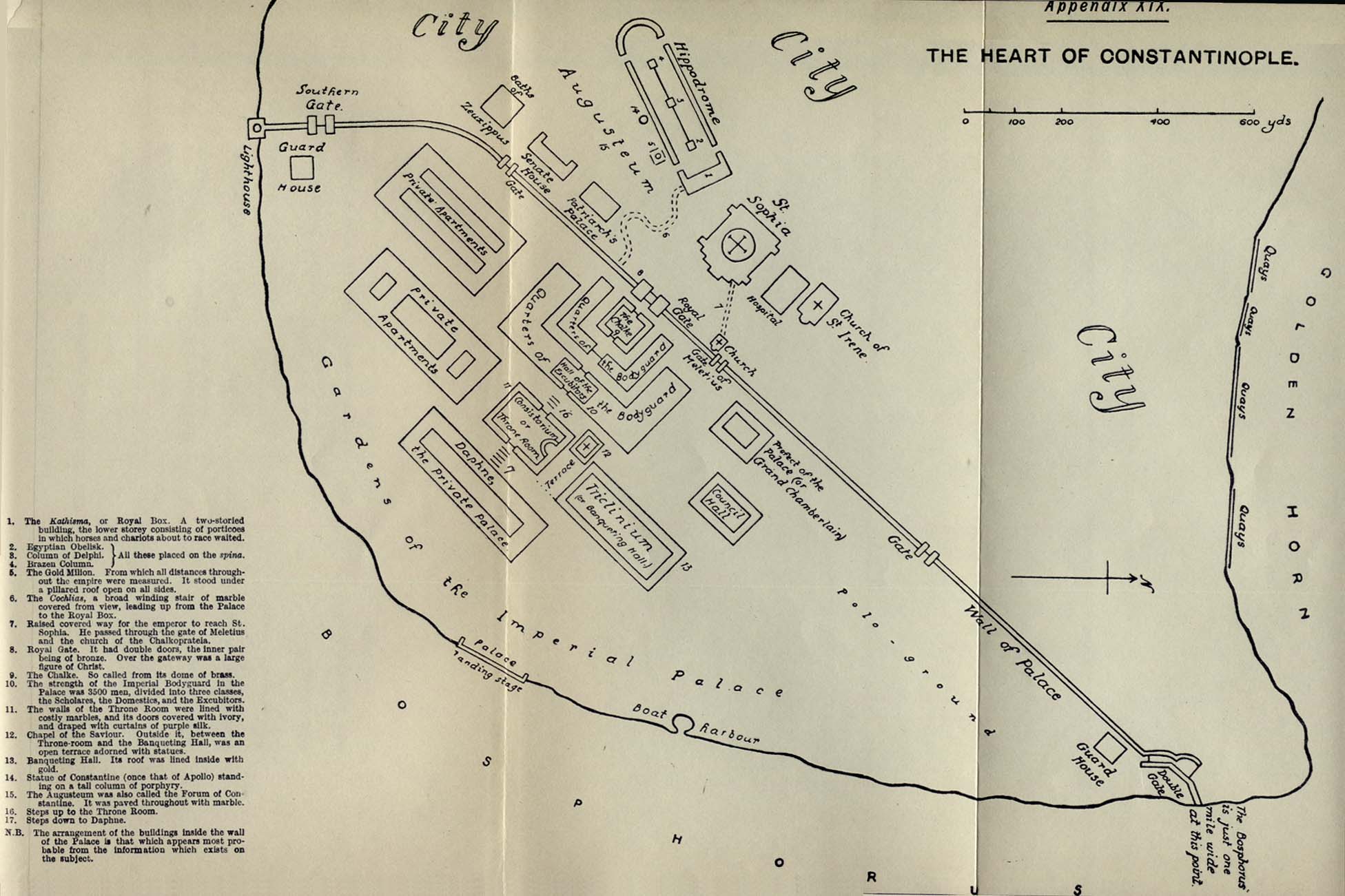
- Constantinople (239K)
- "The Heart of Constantinople" from East and West Though Fifteen Centuries, Volume II, by G. F. Young. Published by Longmans, Green and Co. 1916.
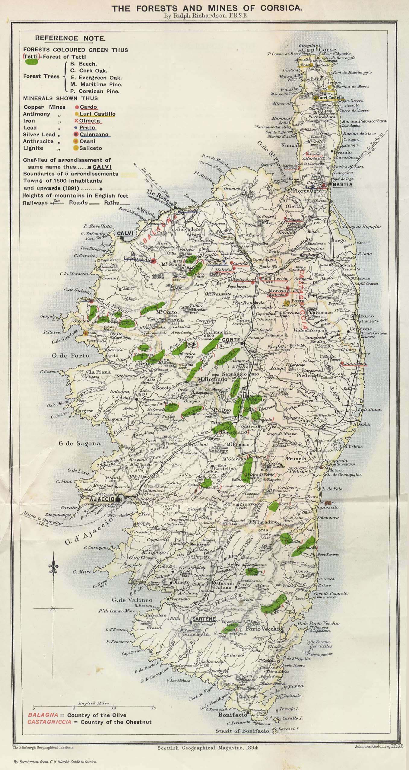
- Corsica 1894 (599K)
- "The Forests and Mines of Corsica" from the Scottish Geographical Magazine. Published by the Royal Scottish Geographical Society and edited by James Geikie and W.A. Taylor. Volume X, 1894.
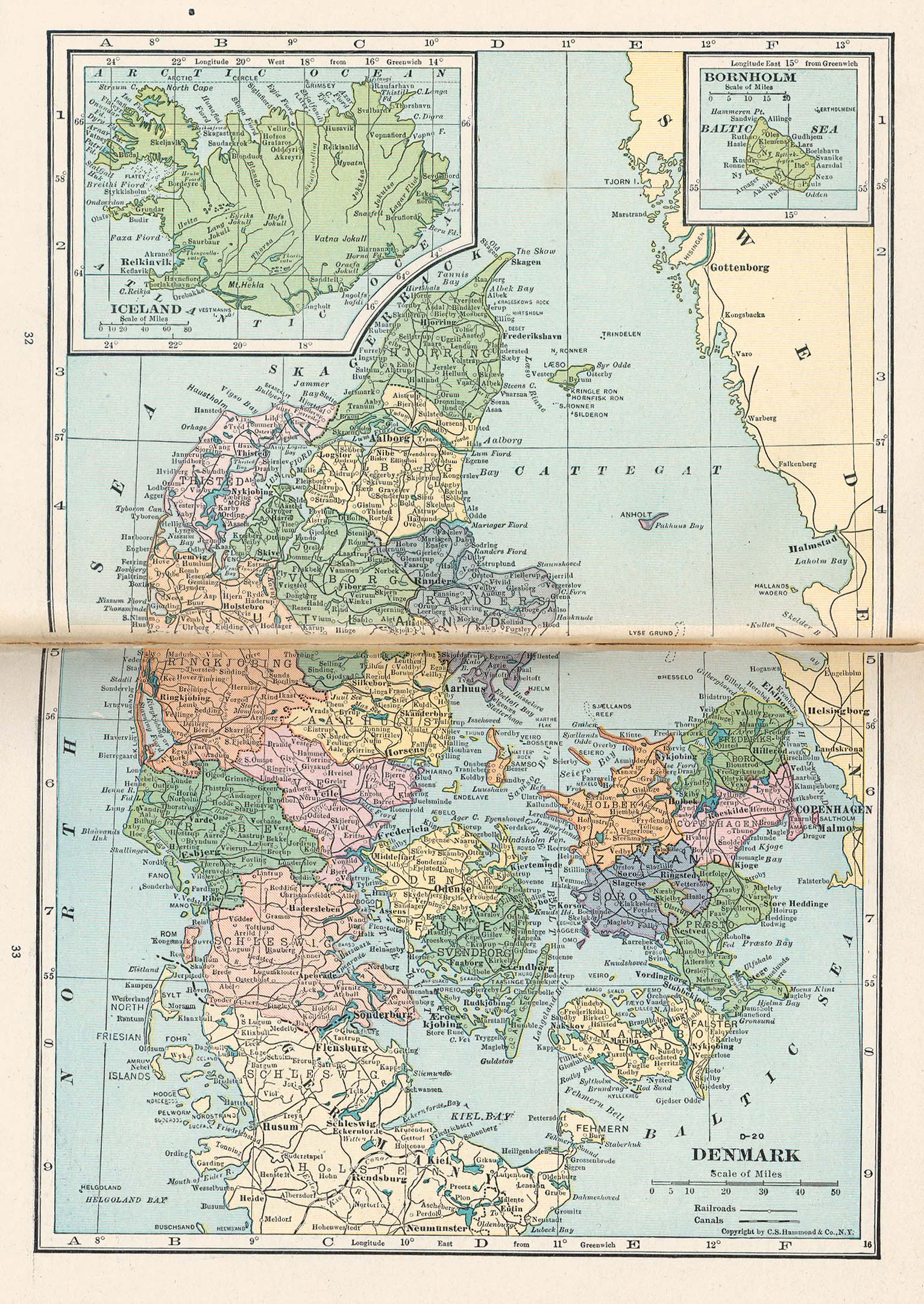
- Denmark (791K)
- From Putnam's Handy Volume Atlas of the World. Published by G.P. Putnam's Sons, New York and London, 1921.
- D-Day Maps 1944
- Secret maps prepared for the June 6, 1944 (D-day) invasion of the European continent through Normandy by Allied forces.
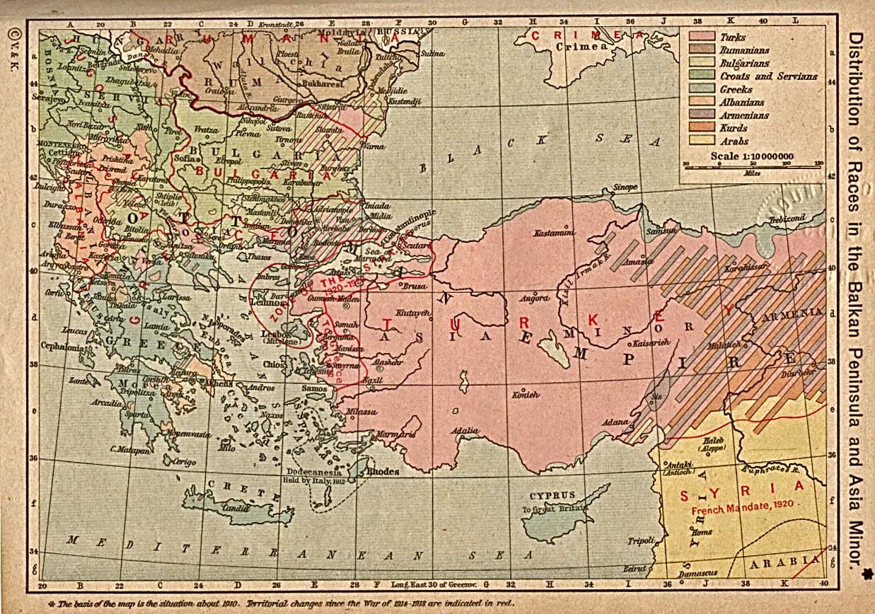
- Distribution of Races in the Balkan Peninsula and Asia Minor (387K)
- From The Historical Atlas by William R. Shepherd, 1923.
- Dr. Butler's Atlas of Ancient Geography by Samuel Butler
- Maps from Dr. Butler's Atlas of Ancient Geography by Samuel Butler, London: Longman, Brown, Green, and Longman, 1851.
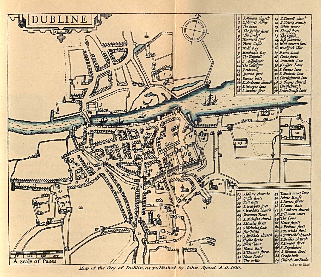
- Dublin 1610 (306K)
- From Dublin Som Norsk by L.J. Vogt, H. Aschehoug and Co. 1896.
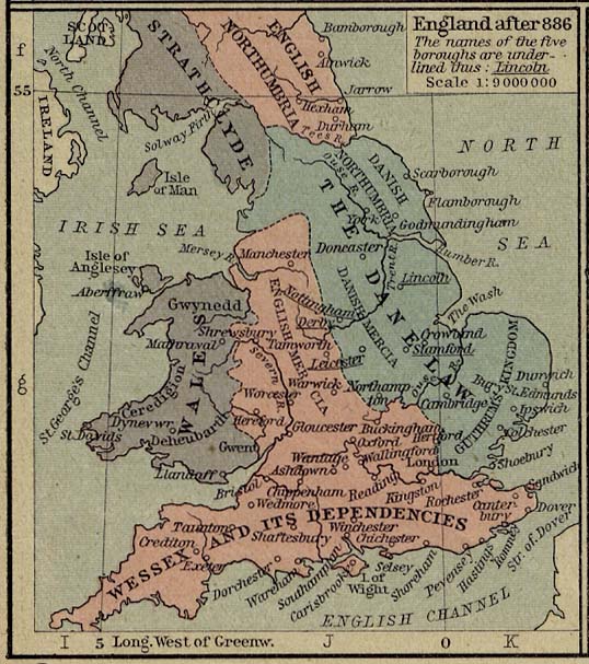
- England after 886 (99K)
- From The Historical Atlas by William R. Shepherd, 1926.
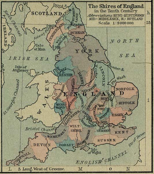
- England in the Tenth Centry (89K)
- The Shires of England in the Tenth Century. From The Historical Atlas by William R. Shepherd, 1926.
- England - Dominions of William the Conqueror about 1087 (249K)
- From The Historical Atlas by William R. Shepherd, 1926.
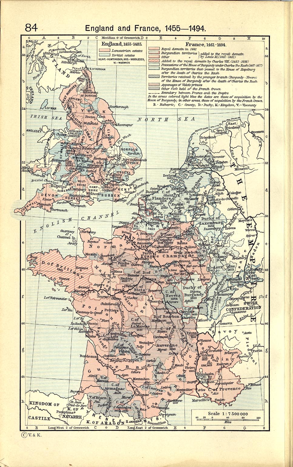
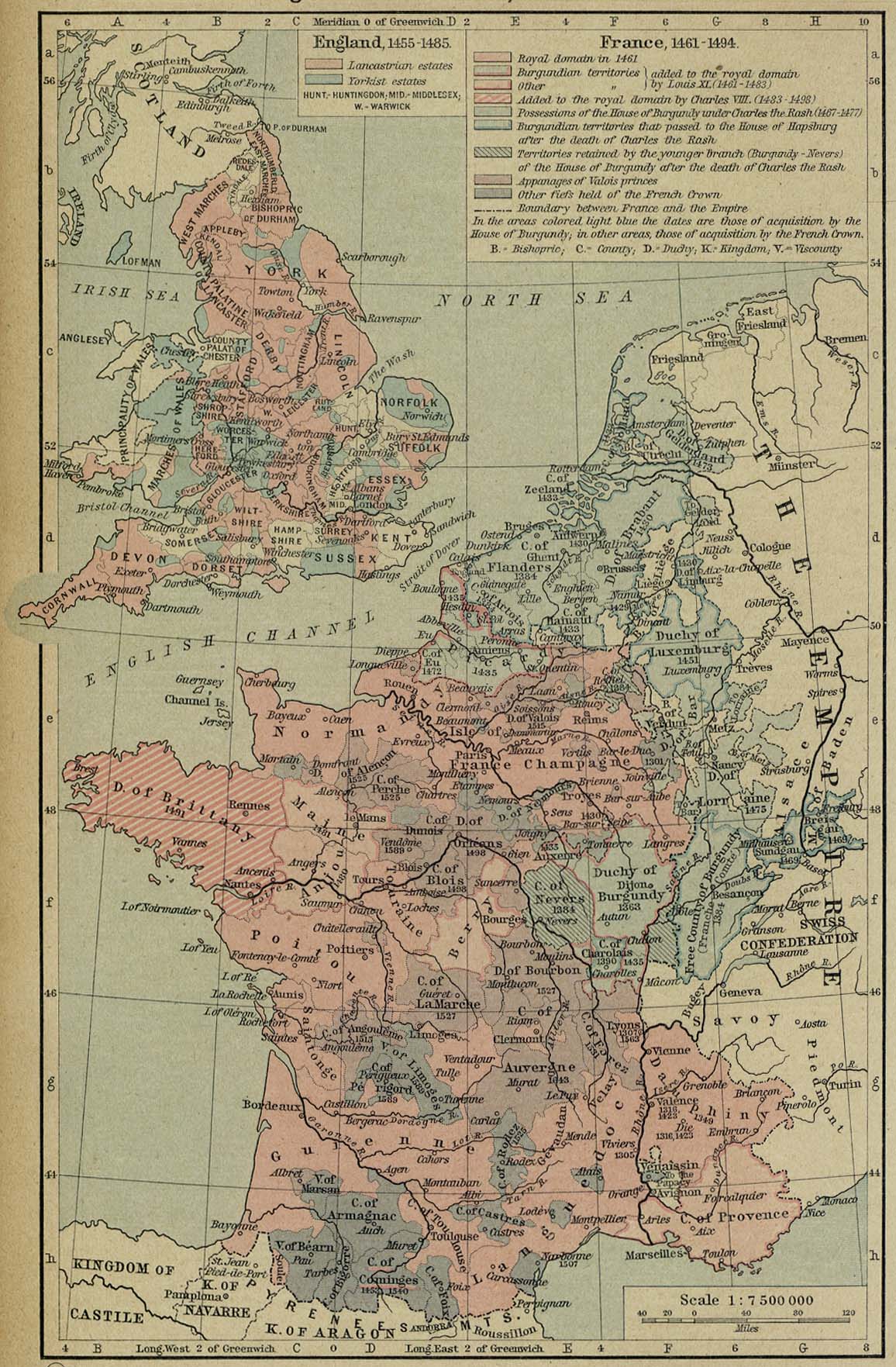
- England and France, 1455-1494 (440K)
- From The Historical Atlas by William R. Shepherd, 19.
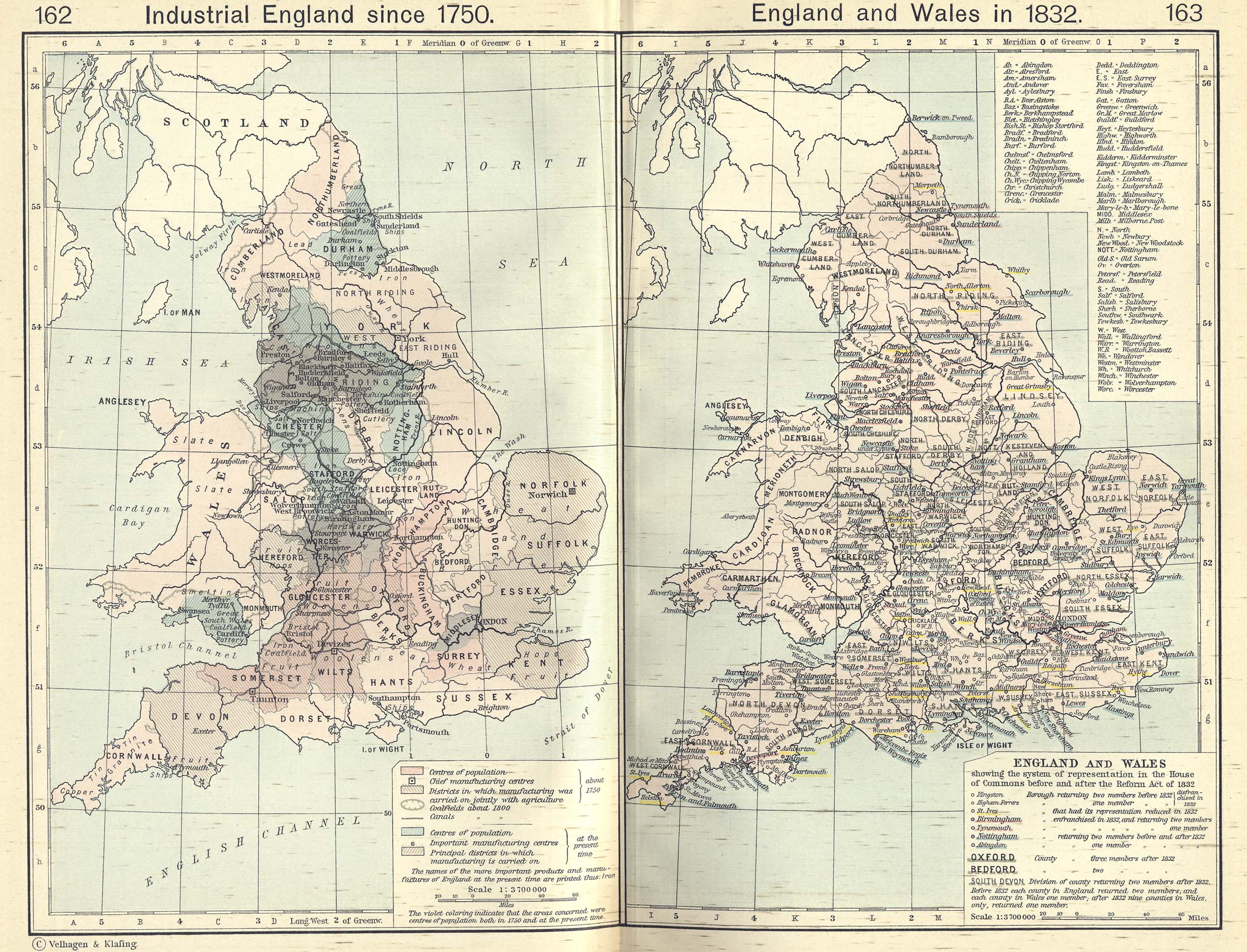
- England and Wales in 1832/Industrial England since 1750 (1.10MB)
- From The Historical Atlas by William R. Shepherd, 1911.
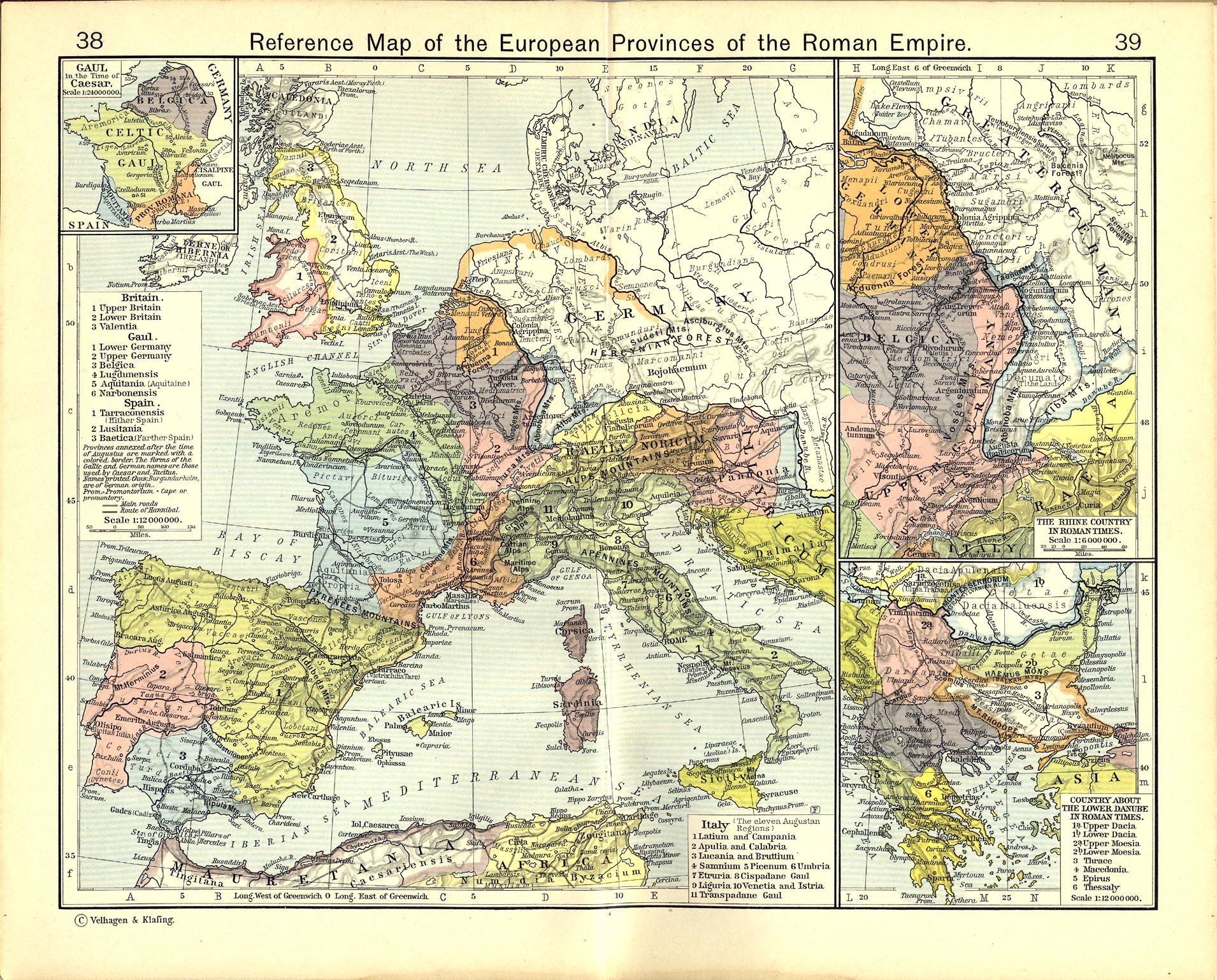
- Reference Map of the European Provinces of the Roman Empire (910K)
- Insets: Gaul in the Time of Caesar. The Rhine Country in Roman Times. Country about the Lower Danube in Roman Times.
From The Historical Atlas by William R. Shepherd, 1911.
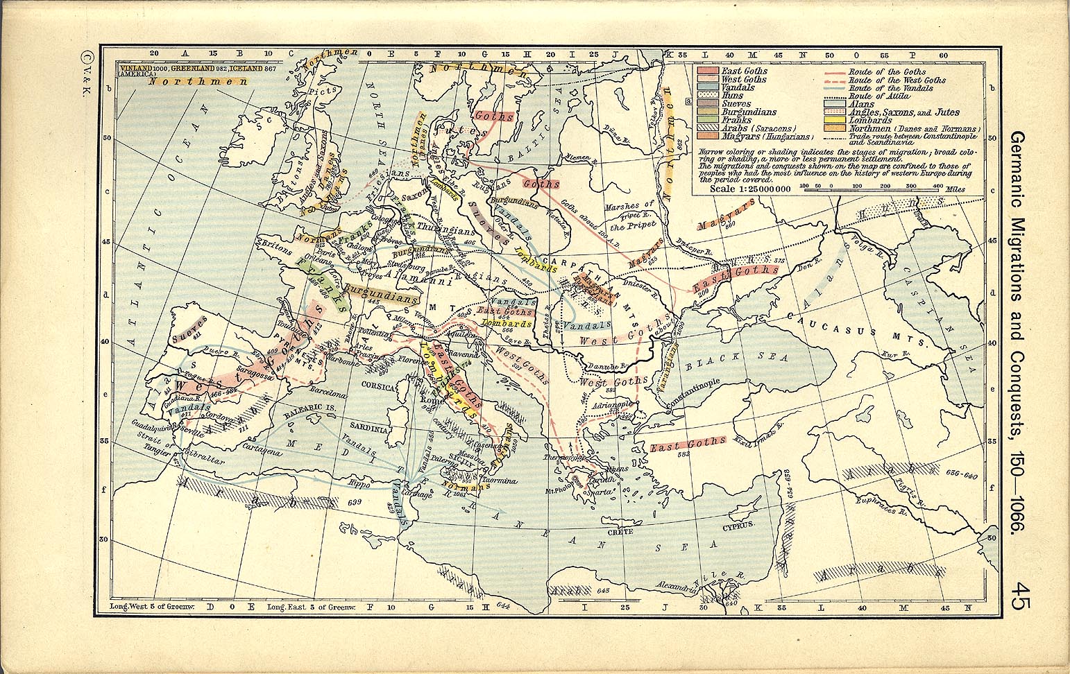
- Germanic Migrations and Conquests, 150-1066 (465K)
- From The Historical Atlas by William R. Shepherd, 1911.
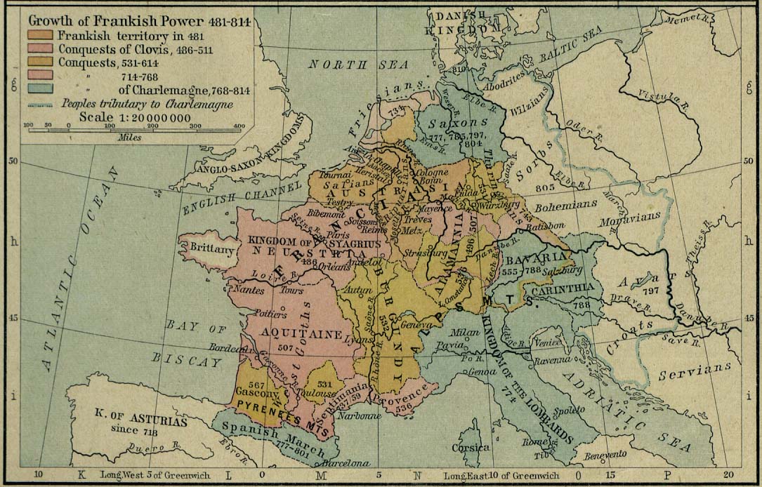
- Europe - Growth of Frankish Power, 481-814 (196K)
- From The Historical Atlas by William R. Shepherd, 1926.
- Europe - Development of Christianity, 590 to 1300 (676K)
- From The Historical Atlas by William R. Shepherd, 1926.
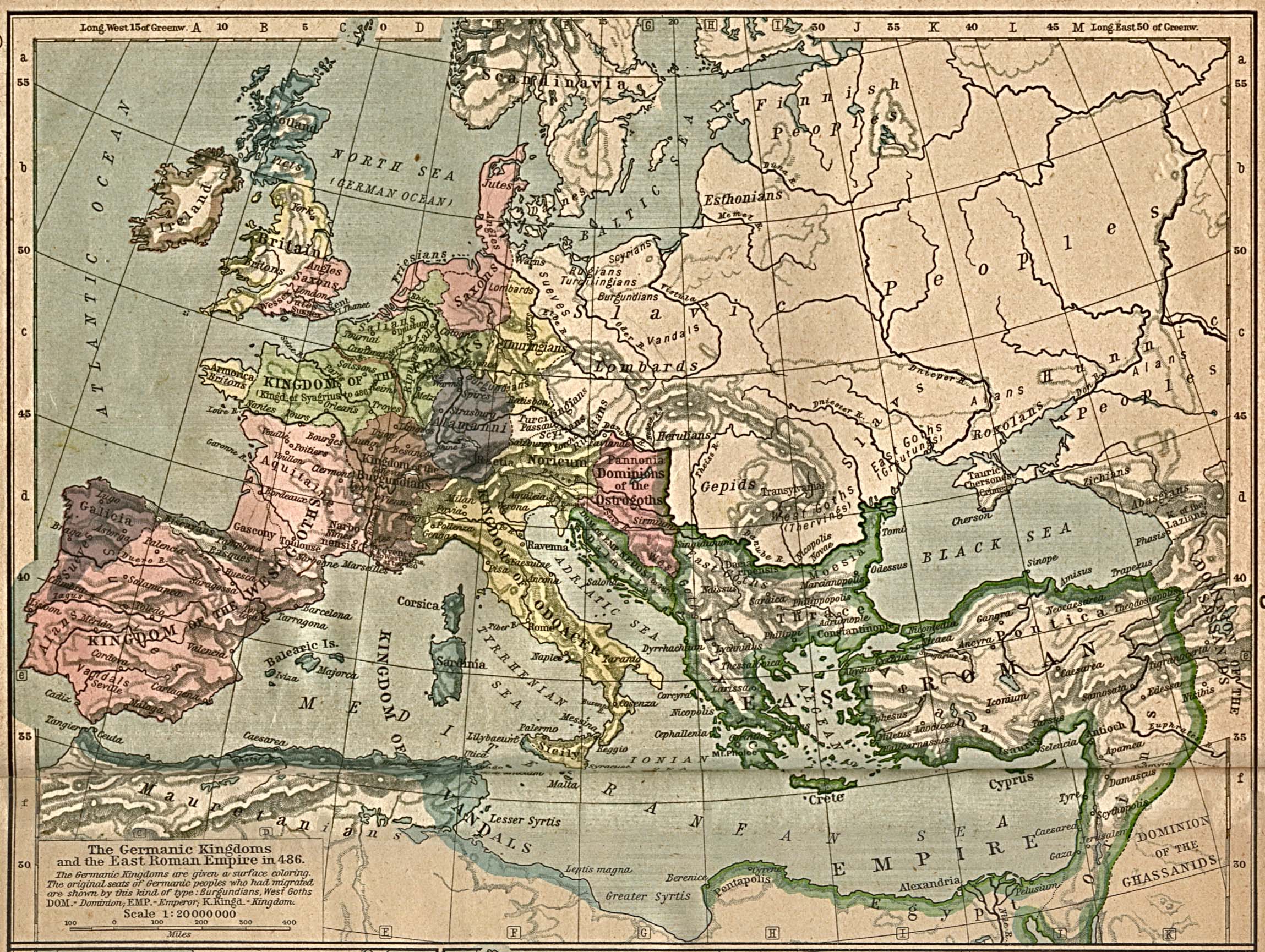
- Europe - The Germanic Kingdoms and the East Roman Empire in 526 (391K)
- From The Historical Atlas by William R. Shepherd, 1911.
- Europe and the East Roman Empire, 533-600 (391K)
- From The Historical Atlas by William R. Shepherd, 1911.
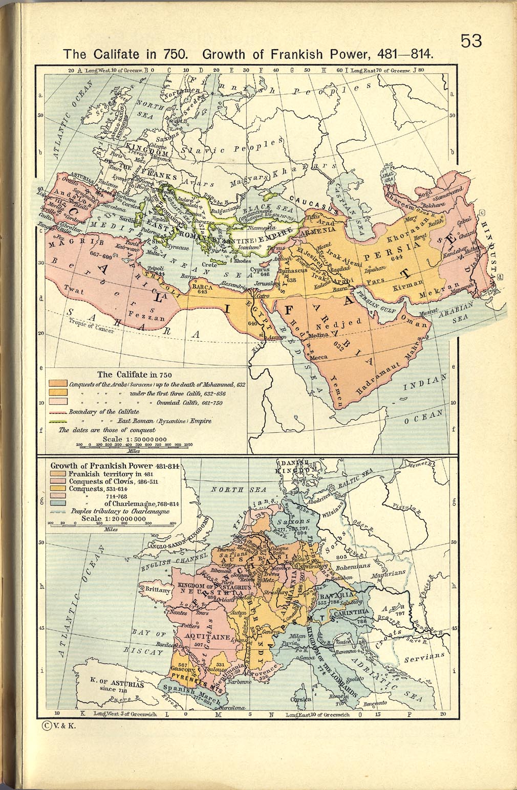
- The Califate in 750 (393K)
- From The Historical Atlas by William R. Shepherd, 1911.
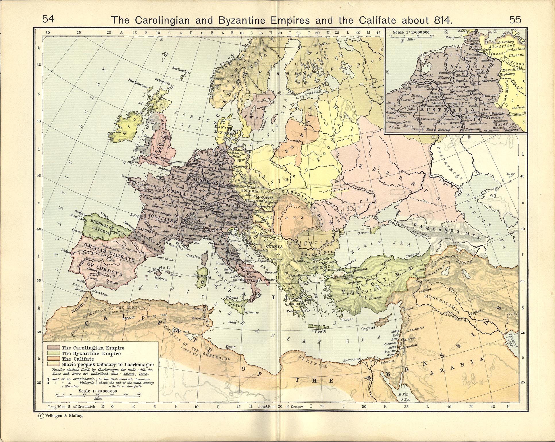
- The Carolingian and Byzantine Empires and the Califate about 814 (674K)
- From The Historical Atlas by William R. Shepherd, 1911.
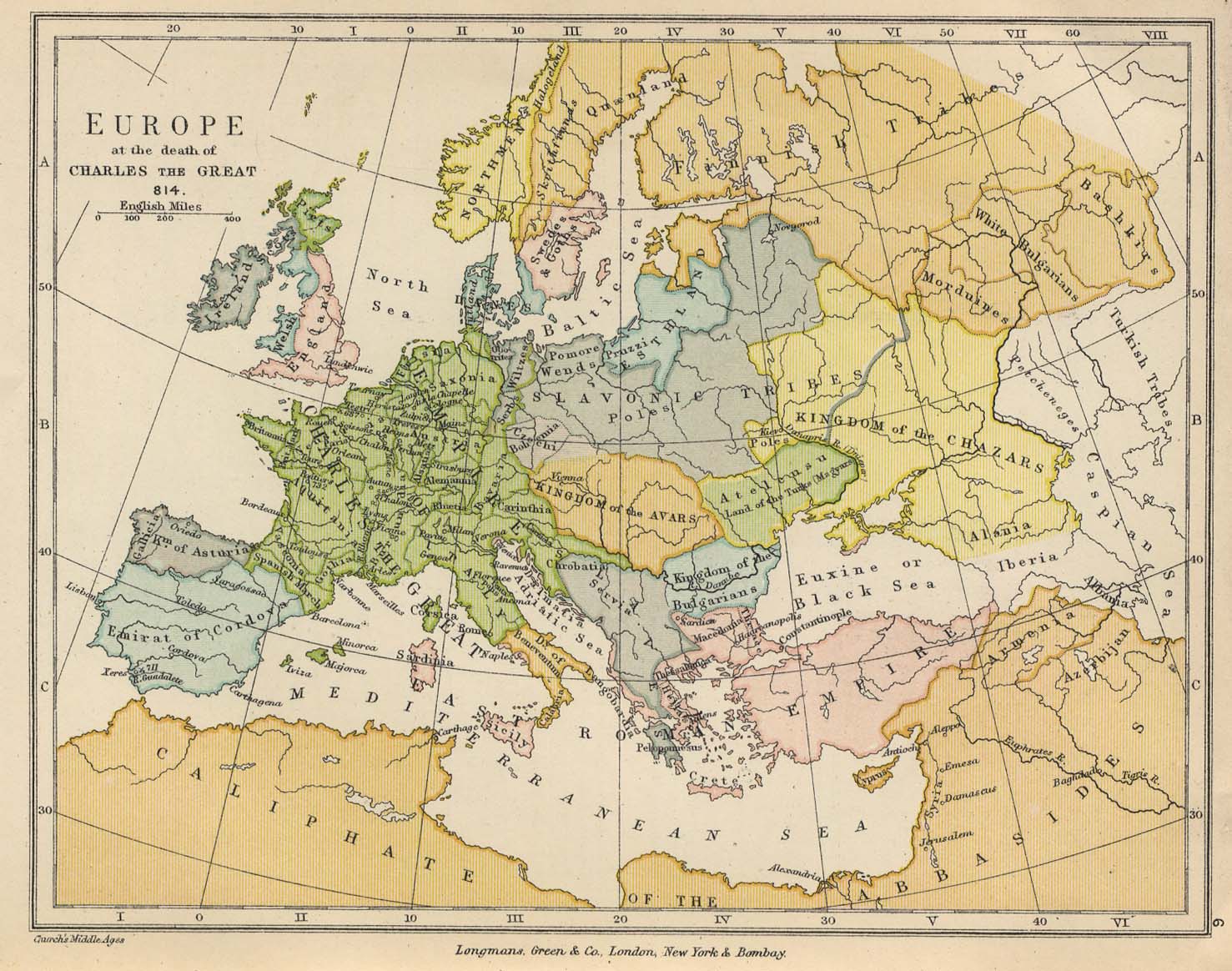
- Europe at the death of Charles the Great 814 (234K)
- From The Public Schools Historical Atlas edited by C. Colbeck, published by Longmans, Green, and Co. 1905.
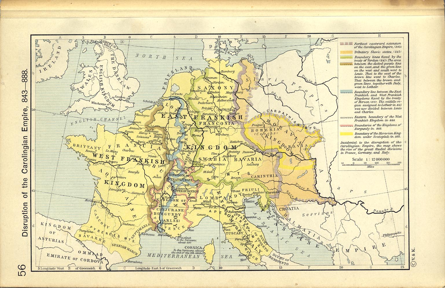
- Disruption of the Carolingian Empire, 843-888 (360K)
- From The Historical Atlas by William R. Shepherd, 1911.
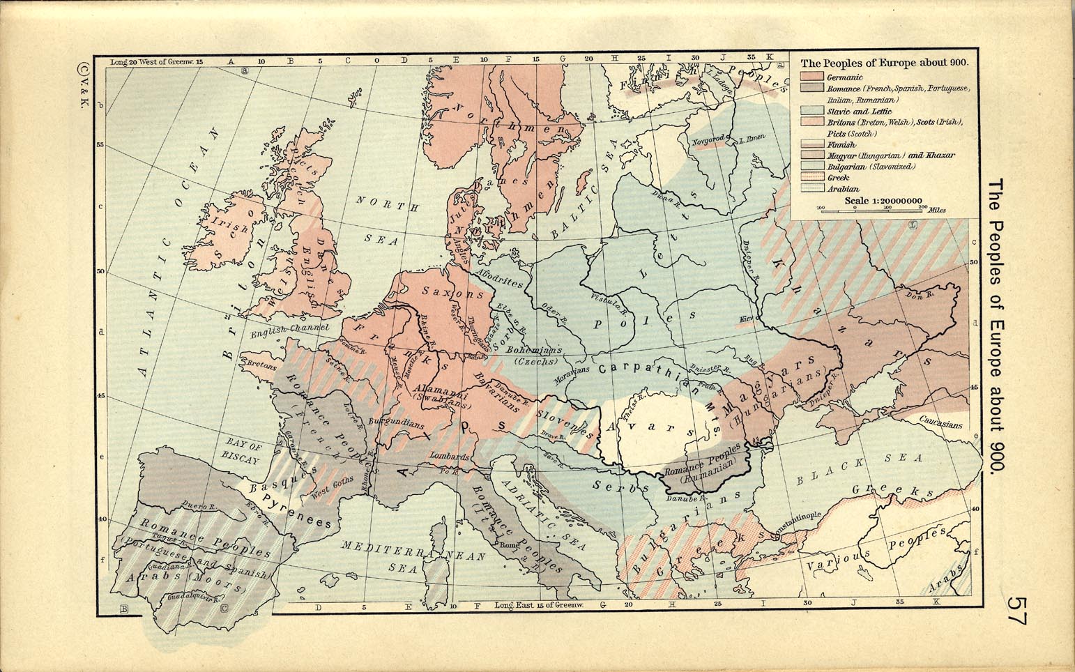
- The Peoples of Europe about 900 (337K)
- From The Historical Atlas by William R. Shepherd, 1911.
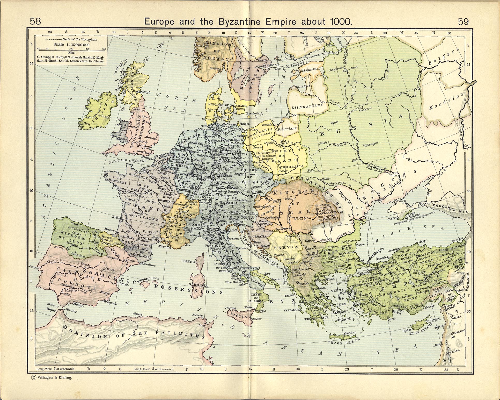
- Europe and the Byzantine Empire about 1000 (689K)
- From The Historical Atlas by William R. Shepherd, 1911.
- Europe and the Mediterranean Lands about 1097 (725K)
- From The Historical Atlas by William R. Shepherd, 1926.
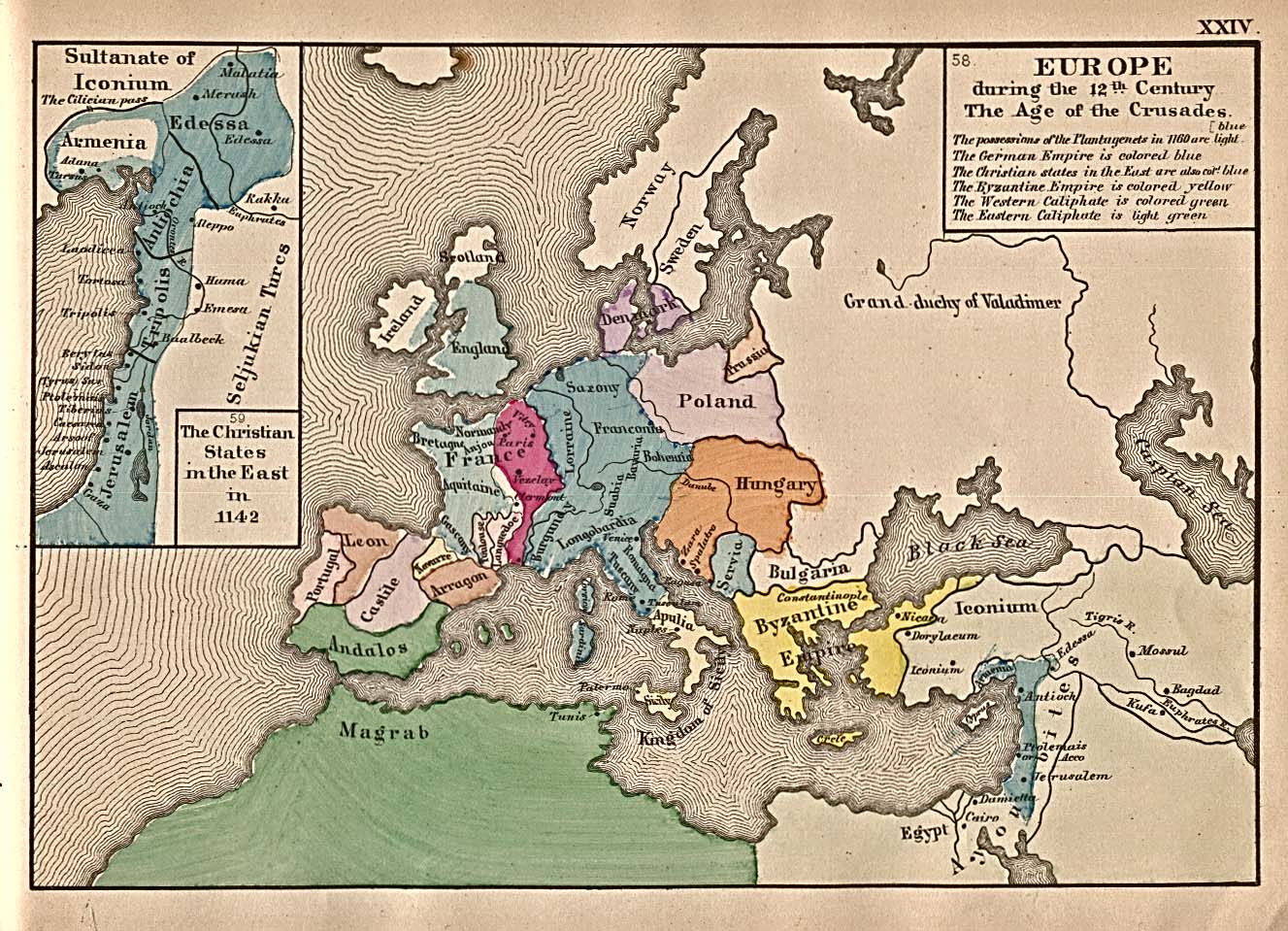
- Europe 12th Century (452K)
- "Europe during the 12th Century The Age of the Crusades" with inset map "The Christian States in the East in 1142" from An Historical Atlas Containing a Chronological Series of One Hundred and Four Maps, at Successive Periods, from the Dawn of History to the Present Day by Robert H. Labberton, sixth edition, 1884.
- Europe and the Mediterranean Lands about 1190 (667K)
- From The Historical Atlas by William R. Shepherd, 1926.
- Europe - The Mediterranean Lands after 1204 (340K)
- From The Historical Atlas by William R. Shepherd, 1926.
- Europe - The Growth of Russia in Europe, 1300-1796 (872K)
- From The Historical Atlas by William R. Shepherd, 1926.
- Europe 1360 (425K)
- Europe about 1360. From The Historical Atlas by William R. Shepherd, 1926.
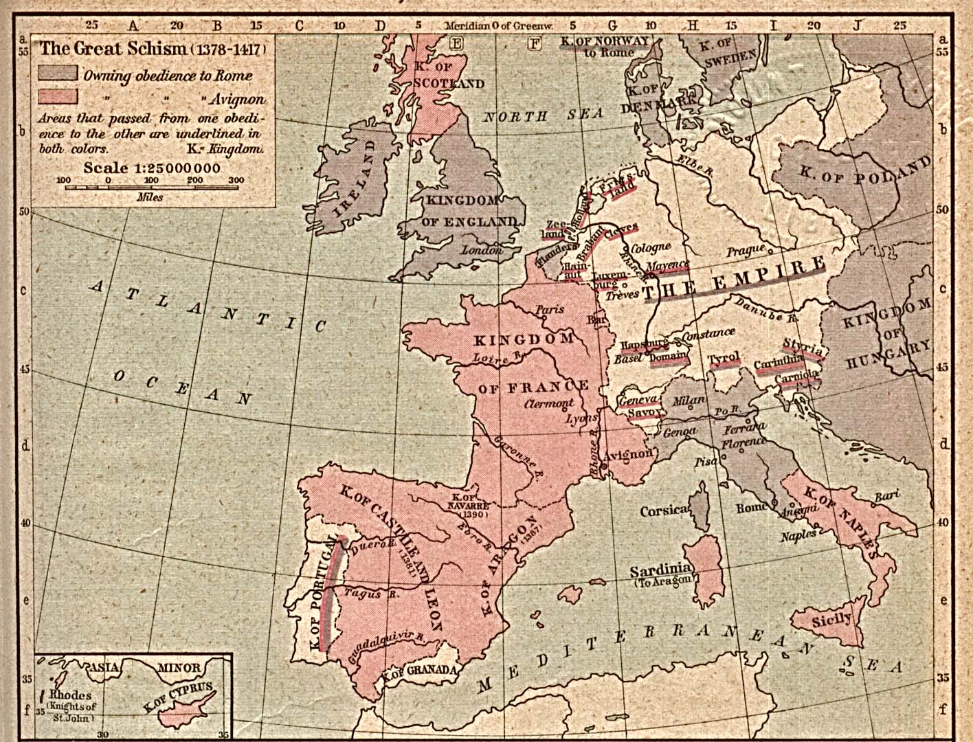
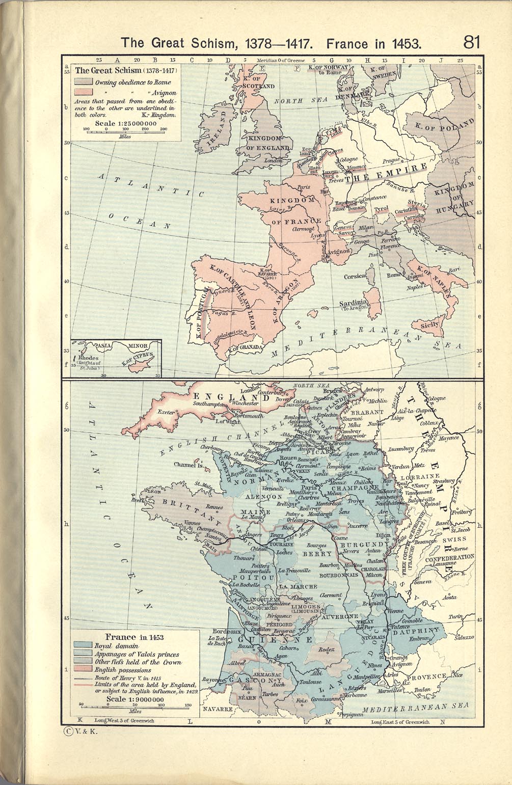
- Europe - The Great Schism 1378-1417 (351K)
- From The Historical Atlas by William R. Shepherd, 1926.
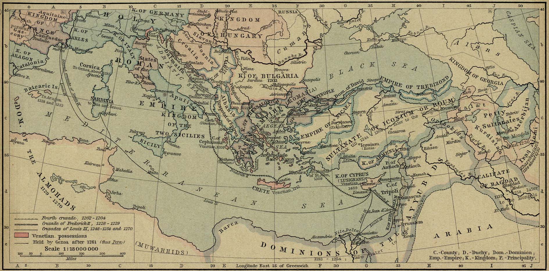
- Europe [Crusades Era] (253K)
- "Era of the Crusades" from The Public Schools Historical Atlas edited by C. Colbeck, published by Longmans, Green, and Co. 1905.
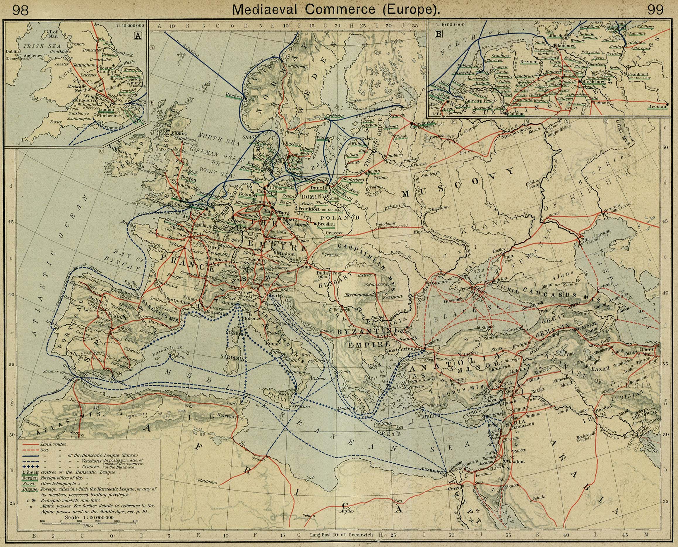
- Europe Medieaval Commerce (846K)
- "Medieaval Commerce (Europe)" [Insets: England; Hanseatic League in Northern Germany]. From The Historical Atlas by William R. Shepherd, 1926.
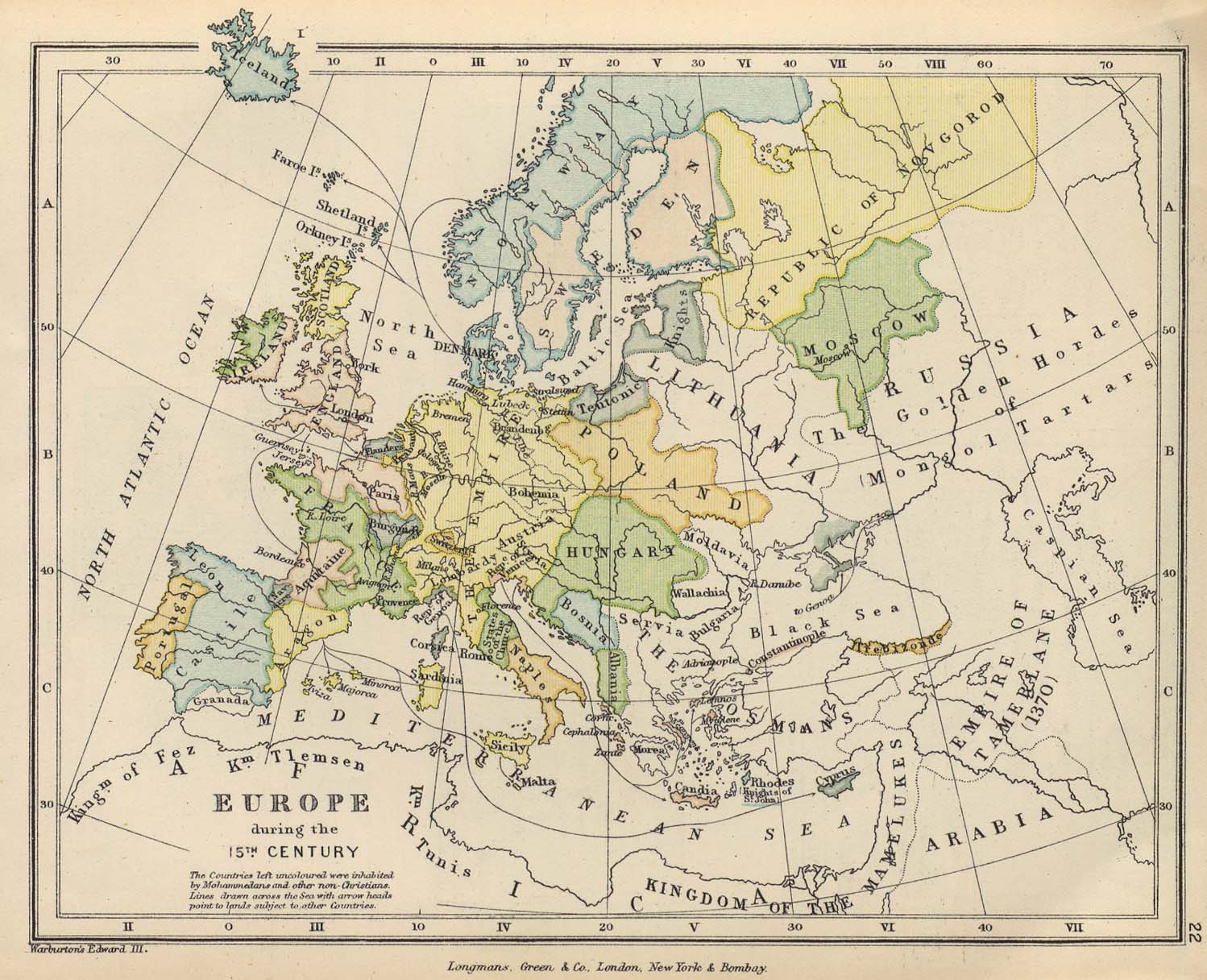
- Europe during the 15th Century (288K)
- From The Public Schools Historical Atlas edited by C. Colbeck, published by Longmans, Green, and Co. 1905.
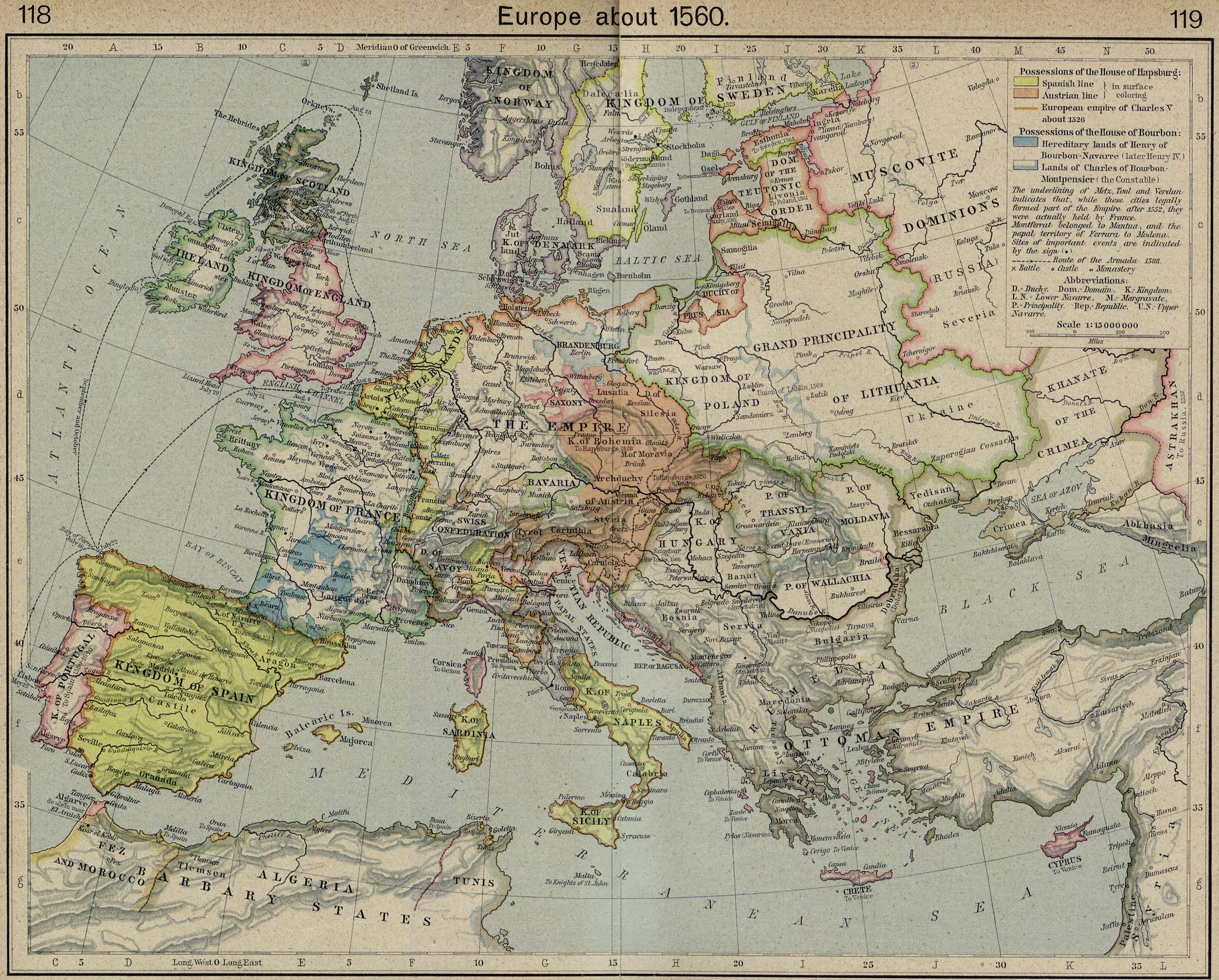
- Europe 1560 (941K)
- Europe about 1560. From The Historical Atlas by William R. Shepherd, 1923.
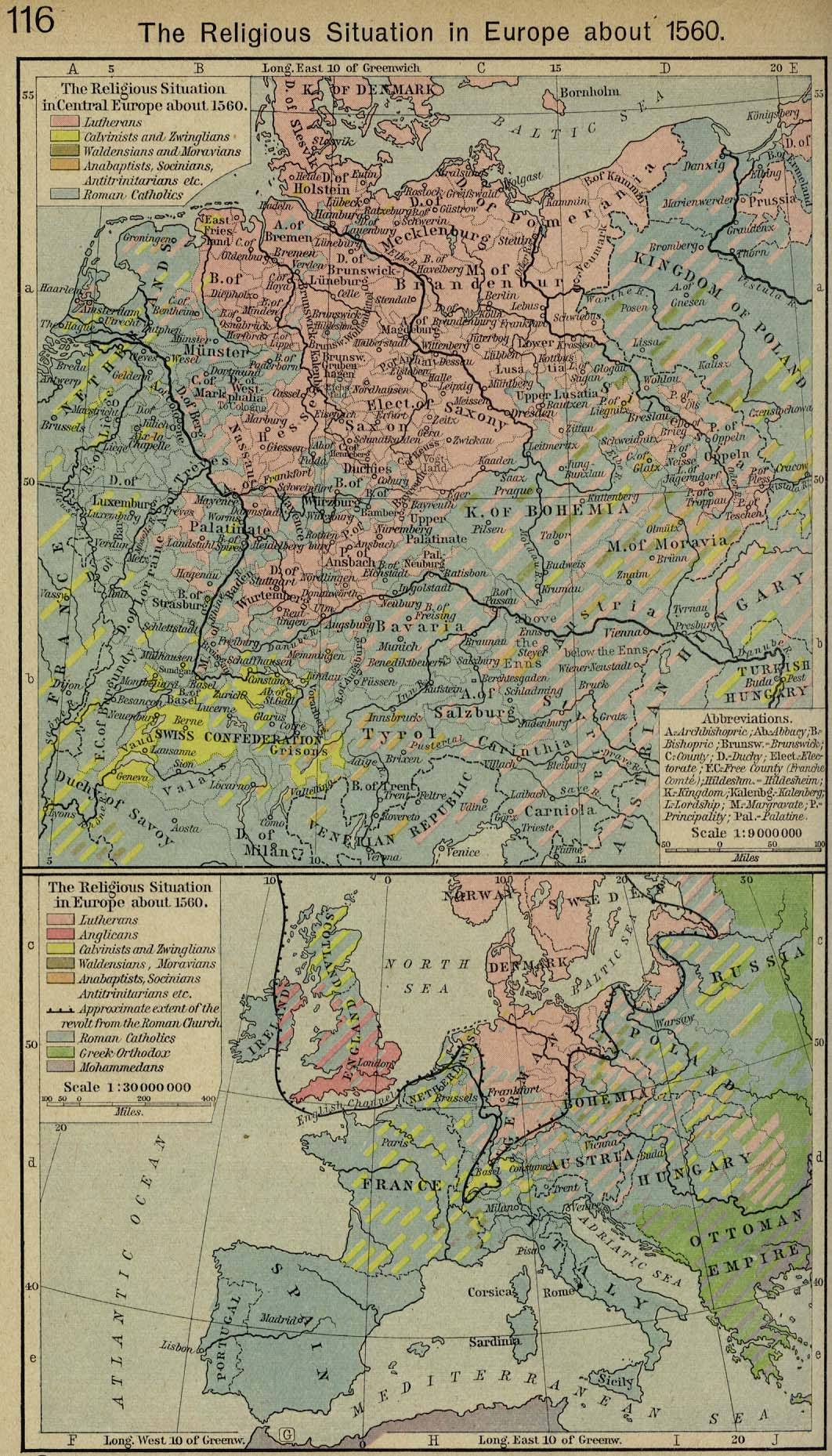
- Europe 1560 (438K)
- The Religious Situation in Europe about 1560. From The Historical Atlas by William R. Shepherd, 1926.
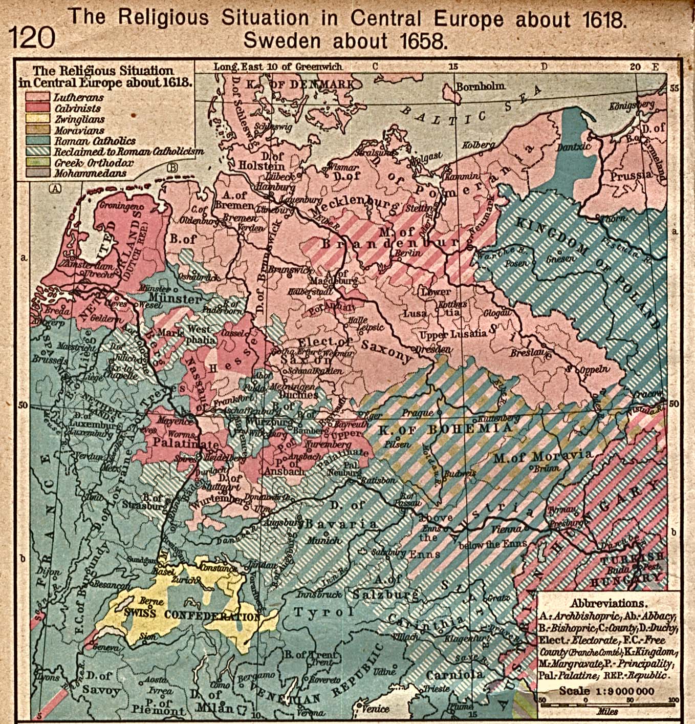
- Europe 1618 (581K)
- The Religious Situation in Central Europe about 1618. From The Historical Atlas by William R. Shepherd, 1923.
- Europe in 1648 - Peace of Westphalia (452K)
- "Europe in 1648.-Peace of Westphalia; showing especially (a,) The Possessions of the two branches of the house of Habsburg at the end of the Thirty Years War (purple). (b,) The possessions of the house of Hohenzollern, (union of Prussia with Brandeburg [blue.]). (c,) The Swedish Empire on both shores of the Baltic and in Northern Germany. (d,) The Danish Monarchy, Denmark, Norway, and Schonen. (e,) The British isles, with the battle-fields of the civil wars. (f,) France, with the battle-fields of the civil wars [red]. (g,) Germany with the battle-fields of the Thirty Years War. (h,) The republic of Poland in its greatest extent. (i,) The Western Boundary of Russia." From "An Historical Atlas Containing a Chronological Series of One Hundred and Four Maps, at Successive Periods, from the Dawn of History to the Present Day." by Robert H. Labberton. Sixth Edition. 1884.
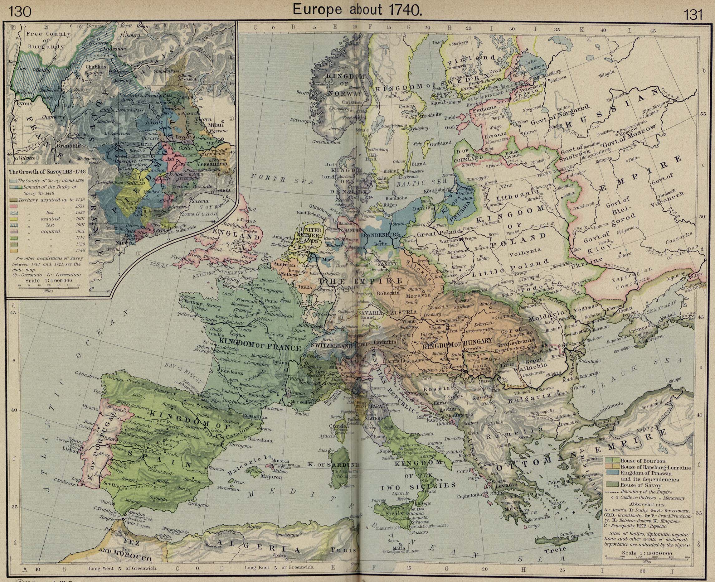
- Europe 1740 (786K)
- From The Historical Atlas by William R. Shepherd, 1926.
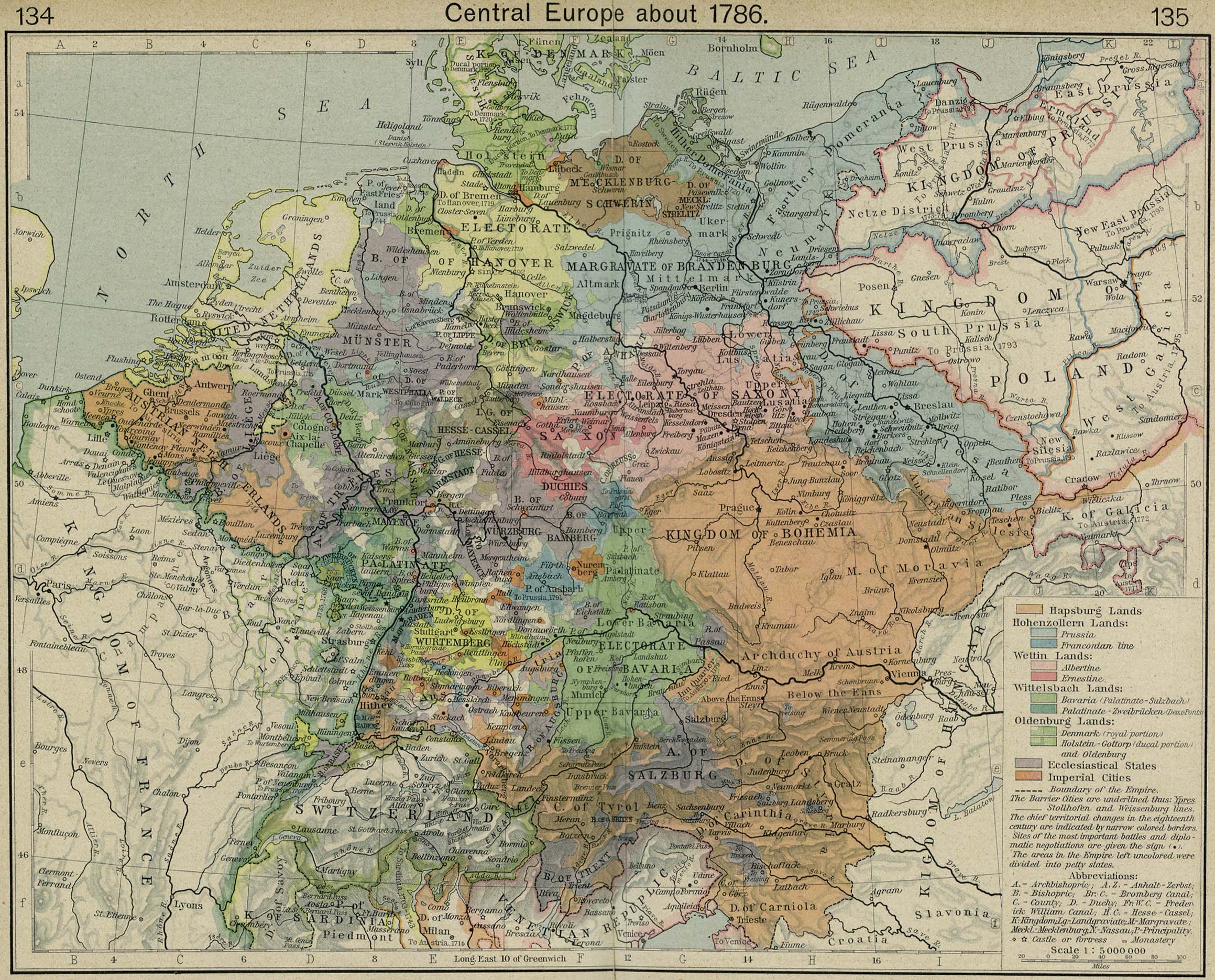
- Europe 1786 (829K)
- From The Historical Atlas by William R. Shepherd, 1926.
- Europe 1808 (516K)
- From The General Gazetteer; or, Compendious Geographical Dictionary. Compiled by R. Brookes, Revised by W. Guthrie and E. Jones. Eighth Edition, Dublin, 1808.
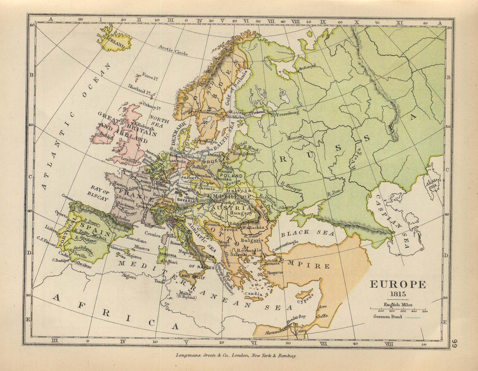
- Europe 1815 (294K)
- From The Public Schools Historical Atlas edited by C. Colbeck, published by Longmans, Green, and Co. 1905.
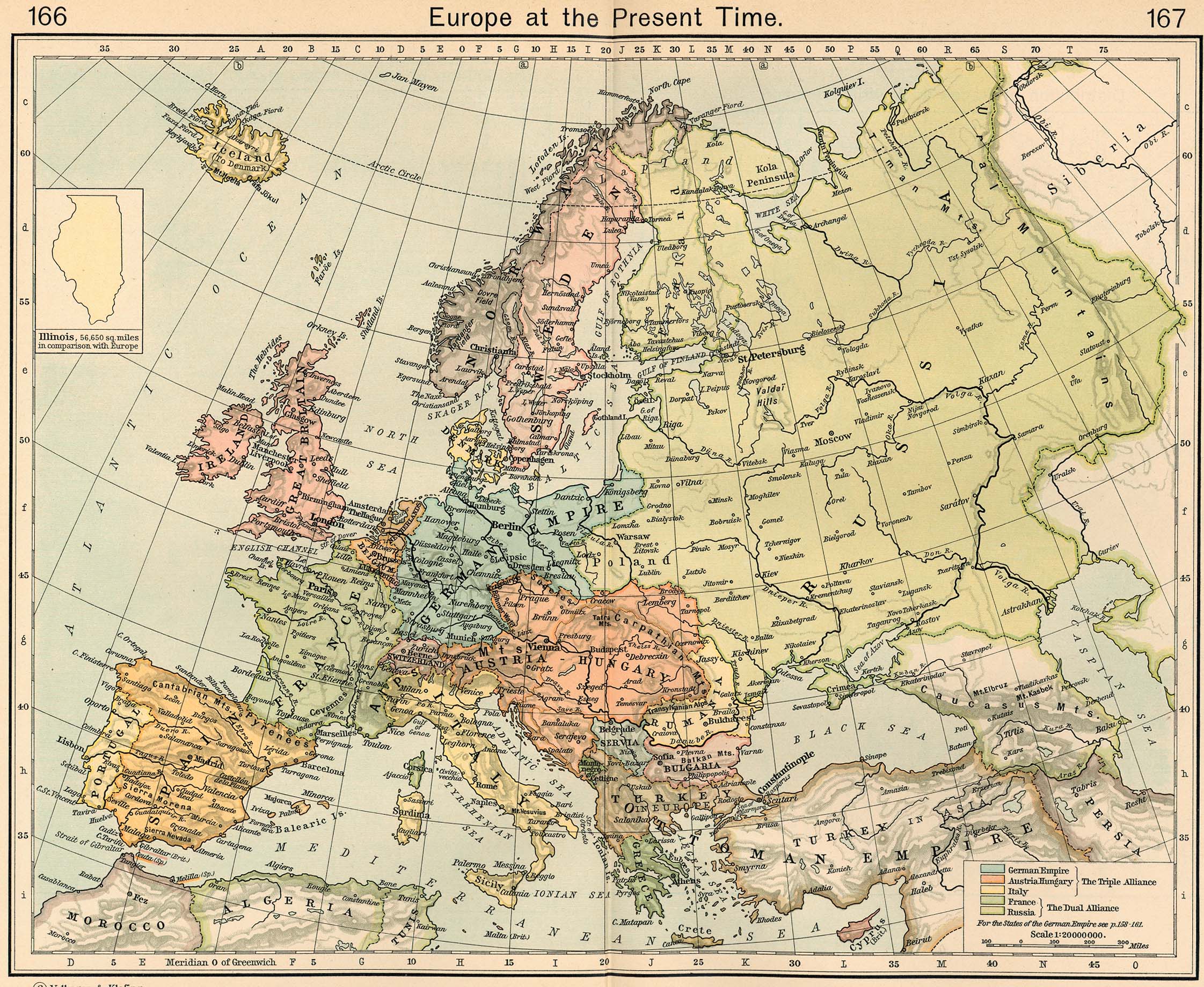
- Europe 1911 (848K)
- "Europe at the Present Time" From The Historical Atlas by William R. Shepherd, 1911.
- [Europe] The Public Schools Historical Atlas by C. Colbeck, 1905
- Firenze [Florence] 1913 (1,037K)
- From Baedeker's Northern Italy Handbook For Travellers by Karl Baedeker, Fourteenth Remodelled Edition 1913.
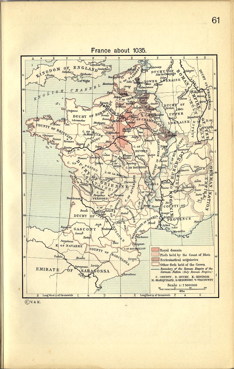
- France about 1035 (329K)
- From The Historical Atlas by William R. Shepherd, 1911.
- France, 1154-1184 (497K)
- From The Historical Atlas by William R. Shepherd, 1911.
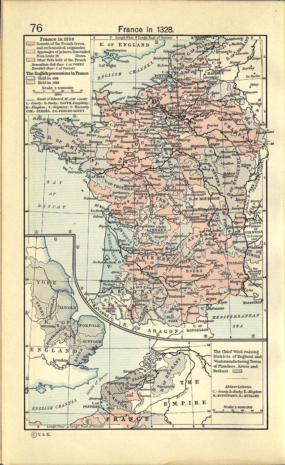
- France in 1328 (446K)
- From The Historical Atlas by William R. Shepherd, 1911.
- France in 1453 (344K)
- From The Historical Atlas by William R. Shepherd, 1911.
- France and England, 1455-1494 (373K)
- From The Historical Atlas by William R. Shepherd, 1926.
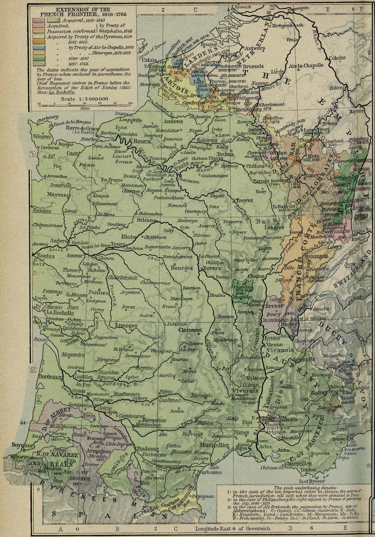
- France - Extension of the French Frontiers, 1601-1766 (477K)
- From The Historical Atlas by William R. Shepherd, 1926.
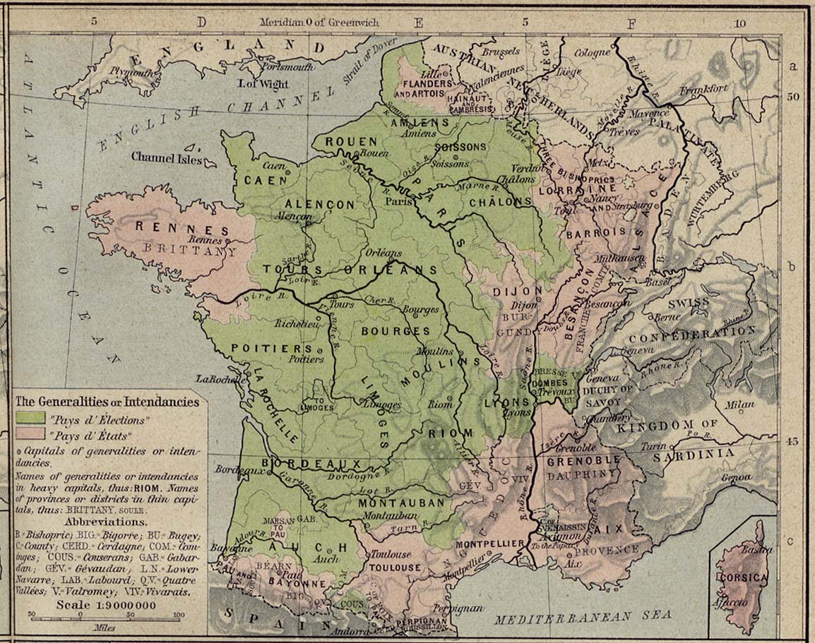
- France 1789 (269K)
- The Generalities or Intendancies. From The Historical Atlas by William R. Shepherd, 1926.
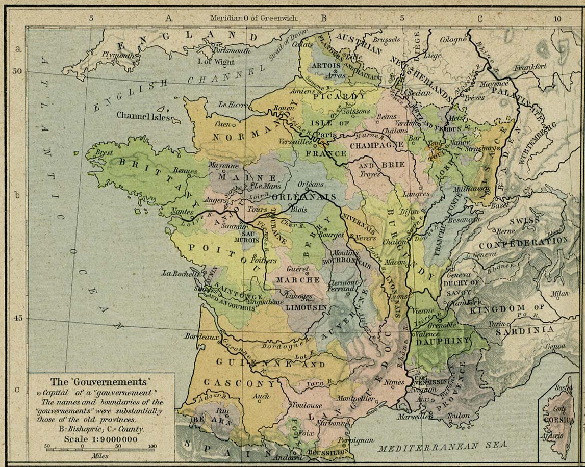
- France 1789 (275K)
- The "Gouvernements". From The Historical Atlas by William R. Shepherd, 1926.
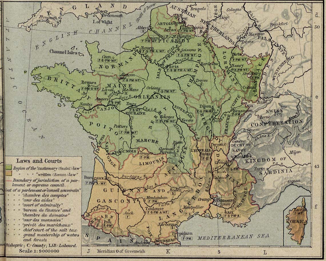
- France 1789(291K)
- Laws and Courts. From The Historical Atlas by William R. Shepherd, 1926.
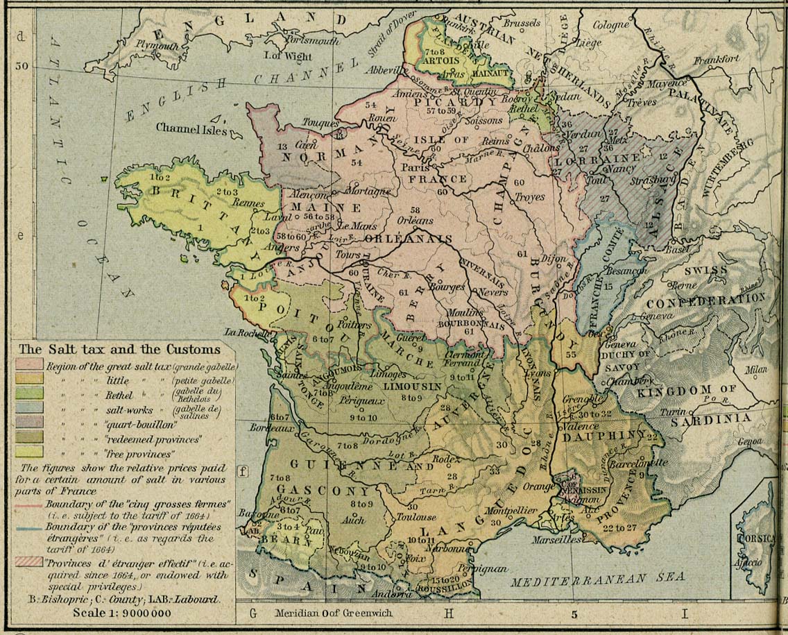
- France 1789 (299K)
- The Salt Tax. From The Historical Atlas by William R. Shepherd, 1926.
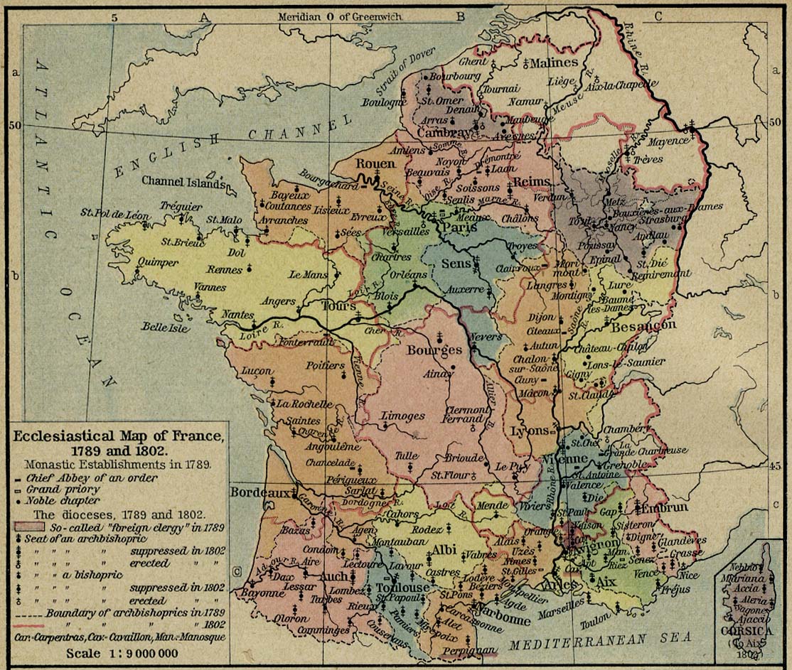
- France 1789 and 1802 (292K)
- Ecclesiastical Map of France, 1789 and 1802. From The Historical Atlas by William R. Shepherd, 1926.
- France 1791 (301K)
- From The Historical Atlas by William R. Shepherd, 1926.
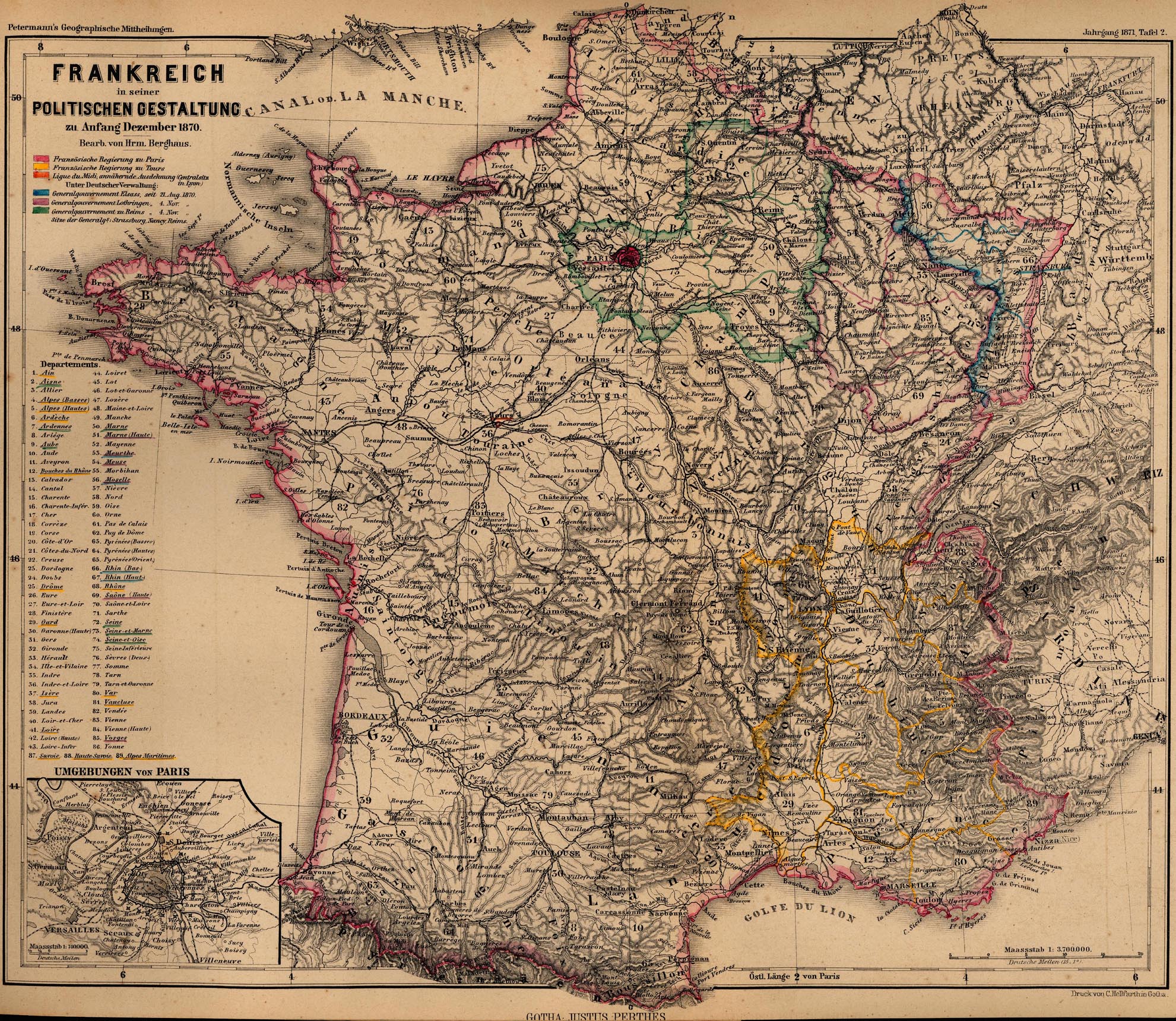
- France 1870 (1,183K)
- "Frankreich in seiner Politischen Gestaltung zu Anfang Dezember 1870" From Mittheilungen aus Justus Perthes' geographischer Anstalt..., by Dr. A Petermann. 1871.
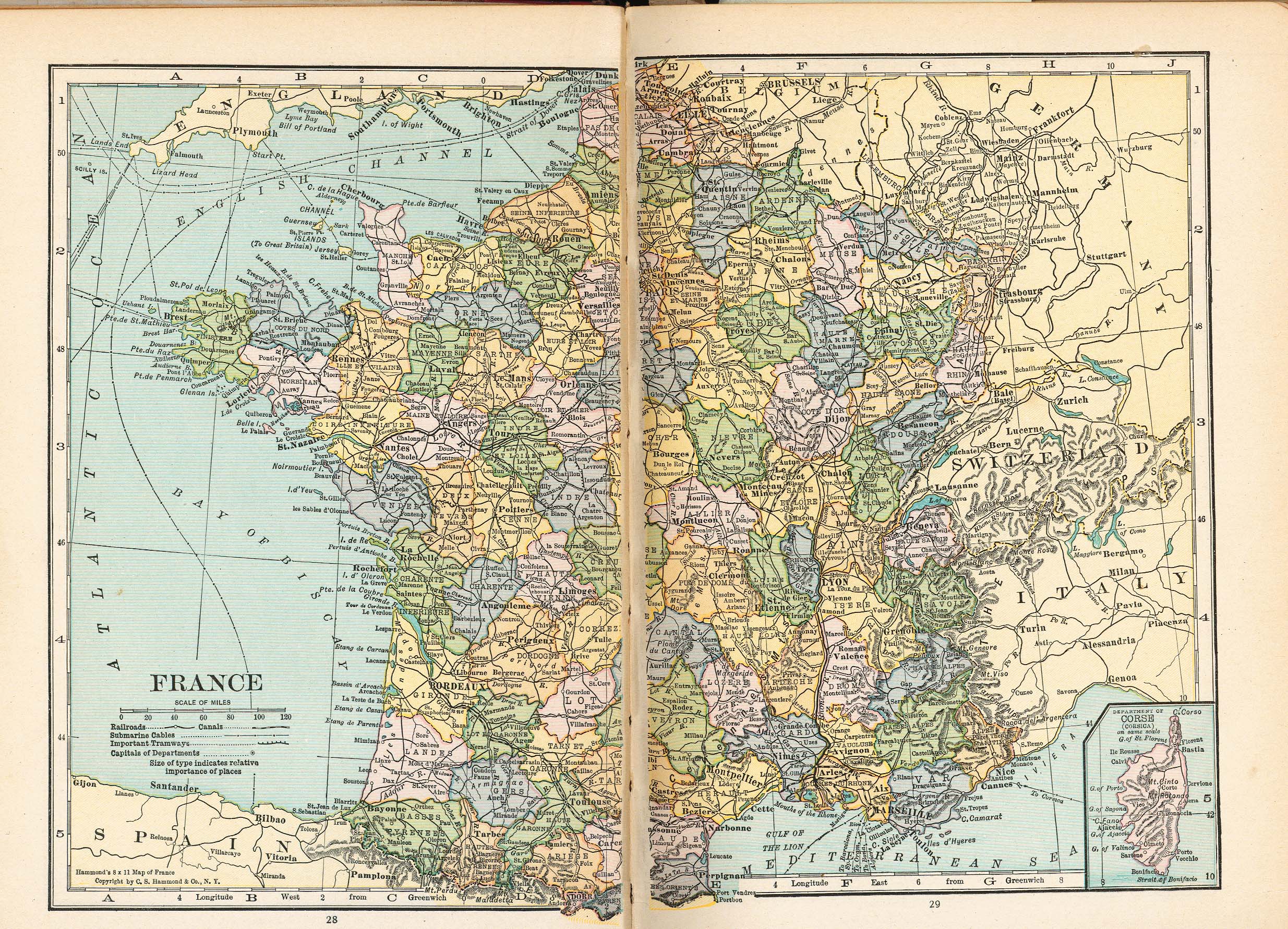
- France (1429K)
- From Putnam's Handy Volume Atlas of the World. Published by G.P. Putnam's Sons, New York and London, 1921.
- [France] Baedeker's Southern France, 1914 (106 Maps)
- Genova [Genoa] 1913 (1,267K)
- From Baedeker's Northern Italy Handbook For Travellers by Karl Baedeker, Fourteenth Remodelled Edition 1913.
- Germania [Ancient Germany] (843K)
- From A Classical Atlas of Ancient Geography by Alexander G. Findlay. New York: Harper and Brothers 1849.
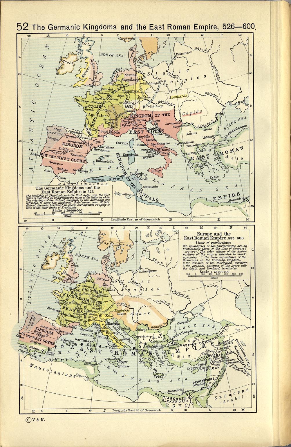
- The Germanic Kingdoms and the East Roman Empire 526-600 (859K)
- The Germanic Kingdoms and the East Roman Empire in 526. Europe and the East Roman Empire, 533-600. From The Historical Atlas by William R. Shepherd, 1923.
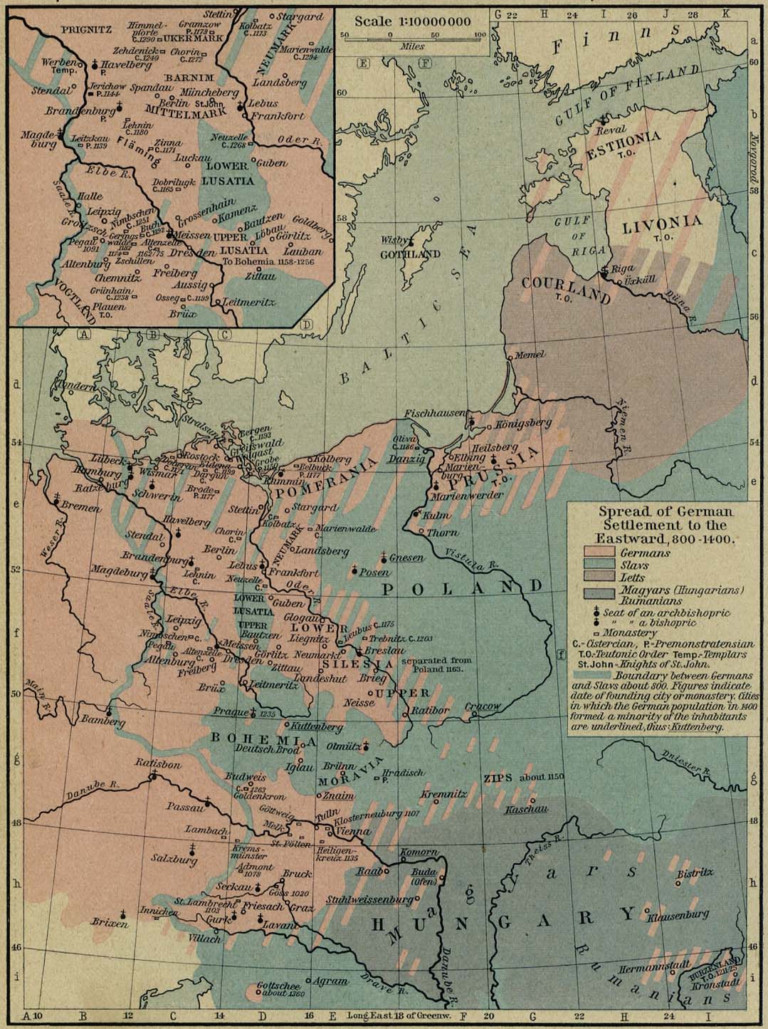
- Germany - Spread of German Settlements to the Eastward, 800-1400 (269K)
- From The Historical Atlas by William R. Shepherd, 1926.
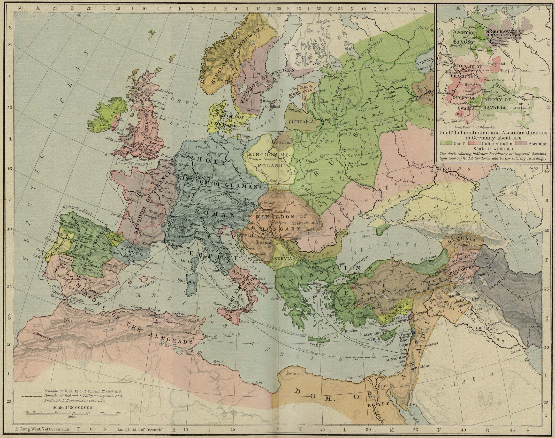
- [Germany] The Holy Roman Empire under the Hohenstaufen, 1138-1254 (458K)
- From The Historical Atlas by William R. Shepherd, 1926.
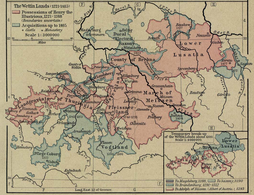
- Germany - The Wettin Lands, 1221-1485 (208K)
- From The Historical Atlas by William R. Shepherd, 1926.
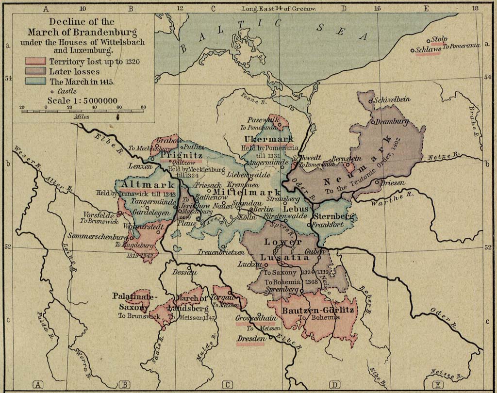
- Germany - Decline of the March of Brandenburg under the Houses of Wittelsbach and Luxemburg, 1320-1415 (269K)
- From The Historical Atlas by William R. Shepherd, 1926.
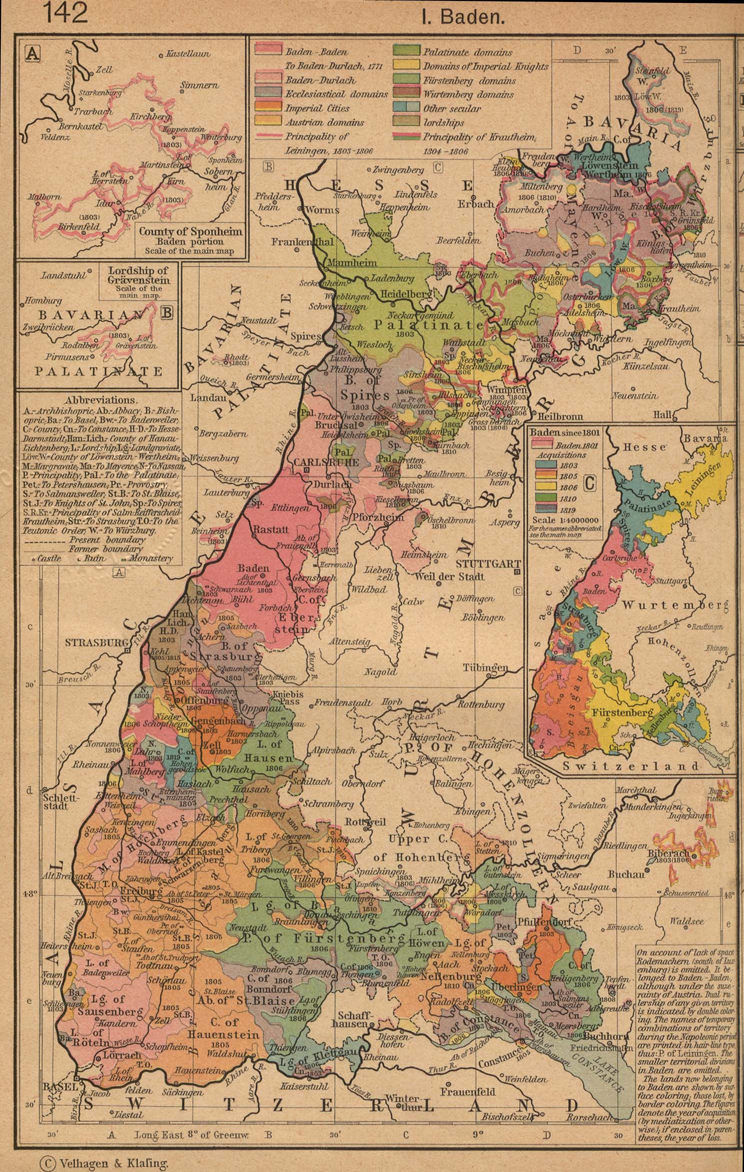
- German States Before and since the French Revolution: I. Baden (598K)
- Insets: The County of Sponheim. Lordship of Gravenstein. Baden since 1801. From The Historical Atlas by William R. Shepherd, 1923.
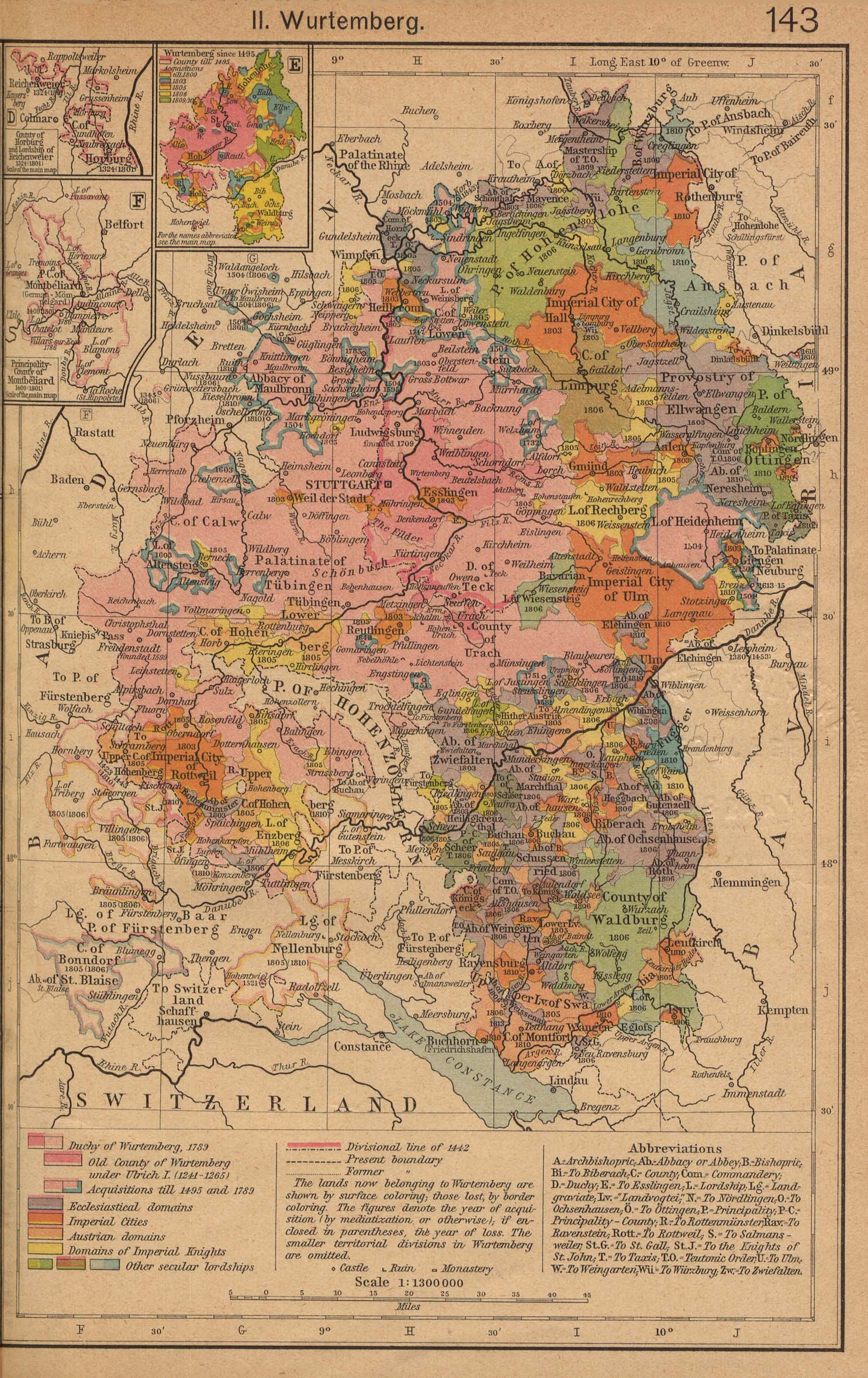
- German States Before and since the French Revolution: II. Wurtemberg (698K)
- Insets: County of Horburg and Lordship of Reichenweier. Principality-County of Montbeliard. Wurtemberg since 1495. From The Historical Atlas by William R. Shepherd, 1923.
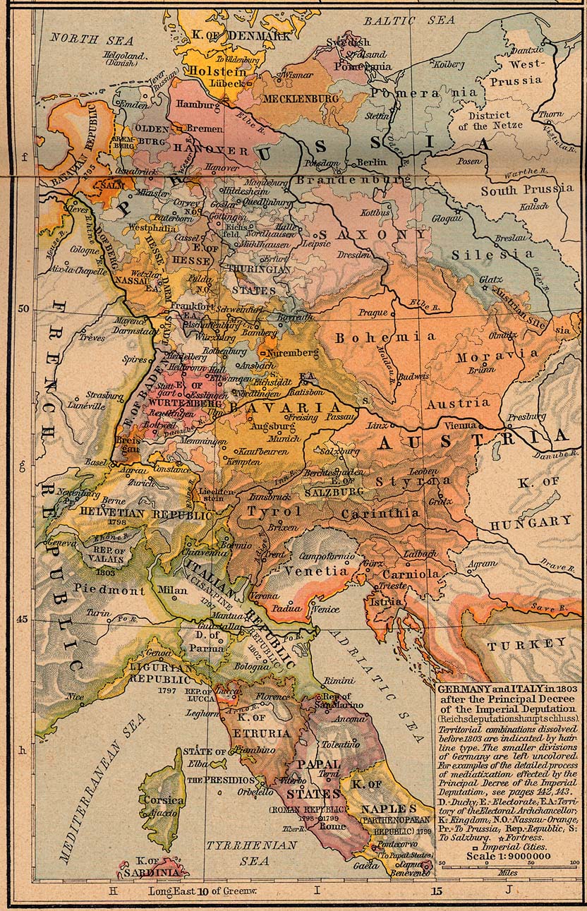
- Germany and Italy 1803 (423K)
- From The Historical Atlas by William R. Shepherd, 1926.
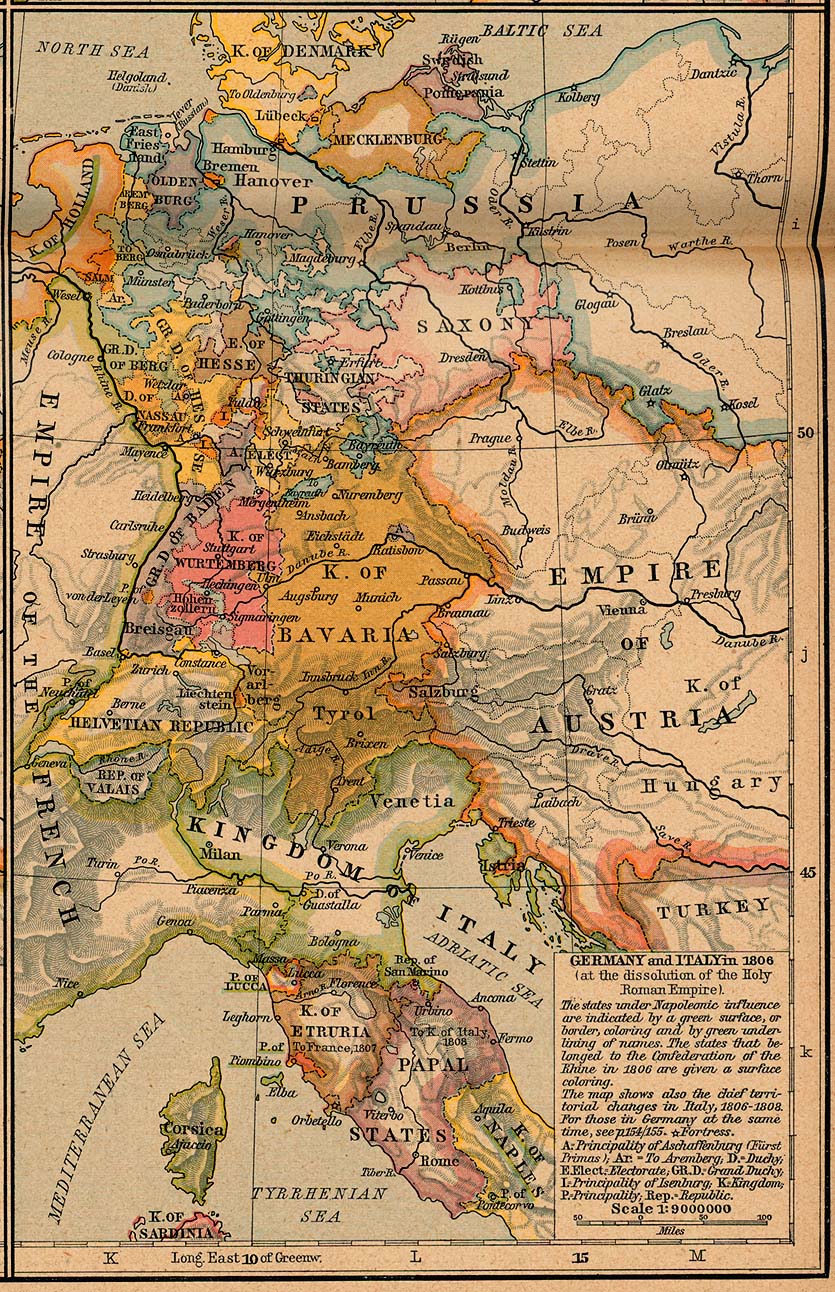
- Germany and Italy 1806 (314K)
- From The Historical Atlas by William R. Shepherd, 1926.
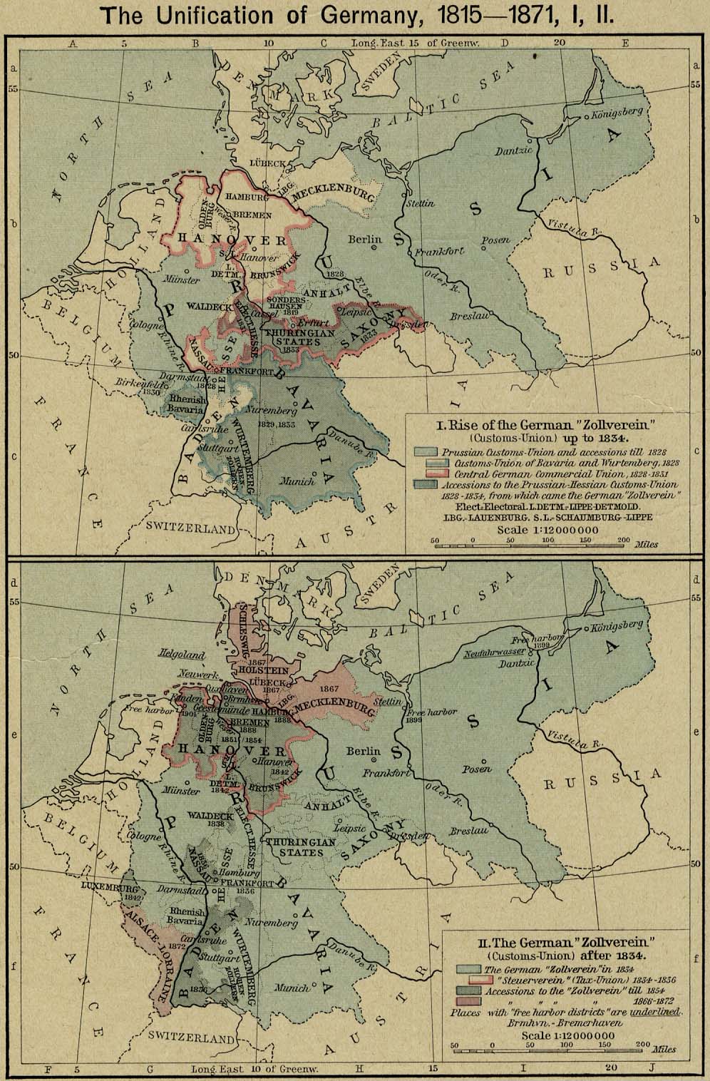
- Germany, 1815-1871 (178K)
- The Unification of Germany. I. Rise of the German "Zollverein" (Customs-Union) up to 1834. II. The German "Zollverein" (Customs-Union) after 1834. From The Historical Atlas by William R. Shepherd, 1926.
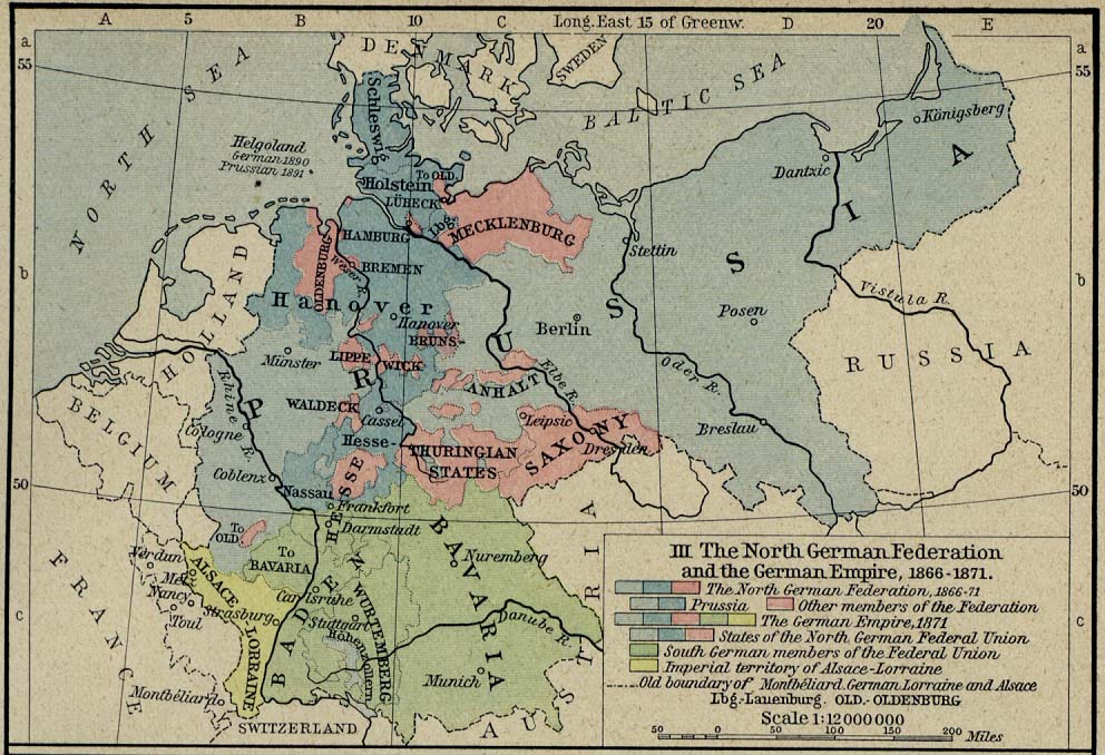
- Germany, 1815-1871 (178K)
- The Unification of Germany. III. The North German Federation and the German Empire 1866-1871. From The Historical Atlas by William R. Shepherd, 1926.
- [Germany] Baedeker's Northern Germany, 1910 (124 Maps)
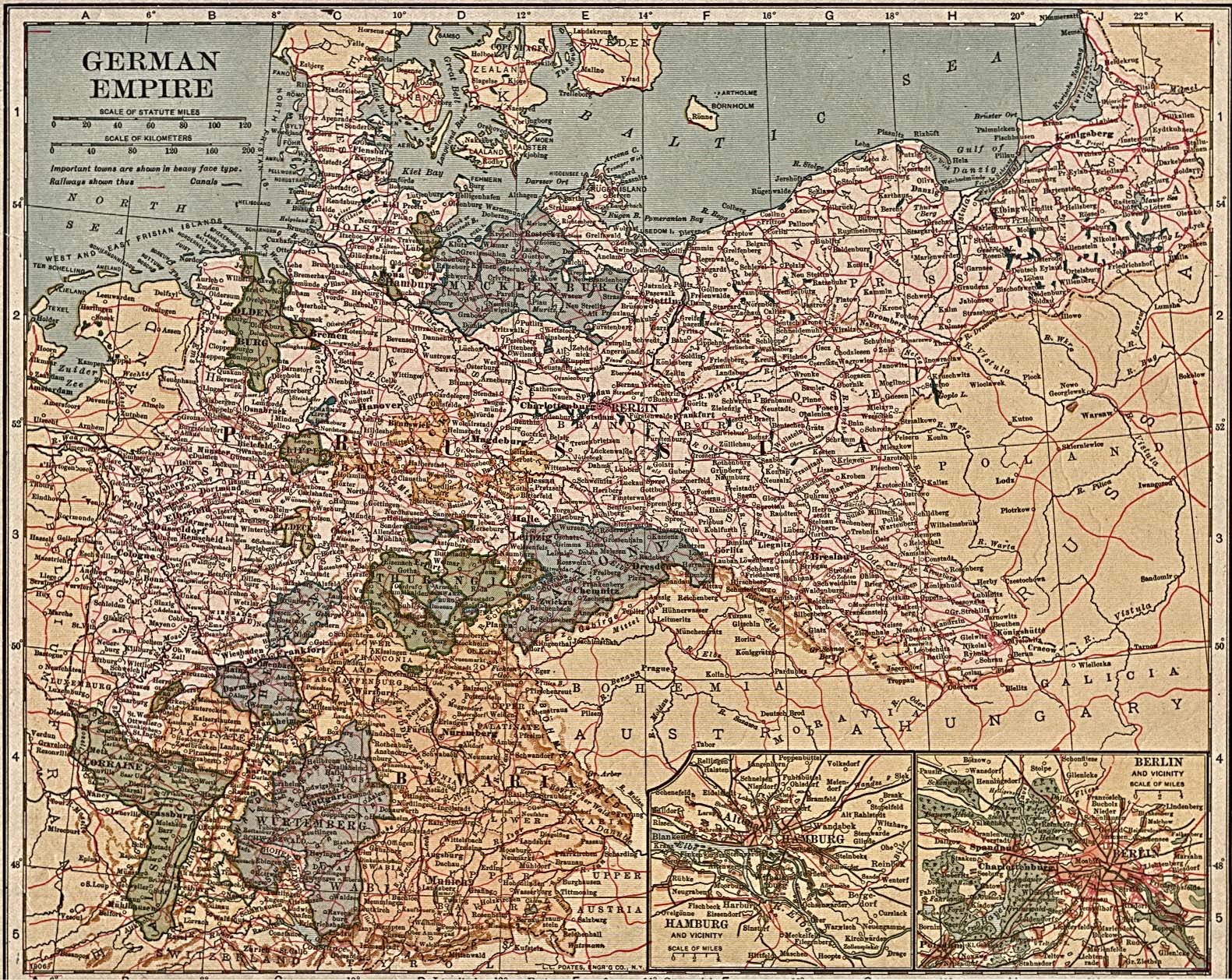
- German Empire 1917(722K)
- From The New Encyclopedic Atlas And Gazetteer Of The World, edited and revised by Francis J. Reynolds, P.F. Collier and Son - Publishers, New York, 1917 Edition.
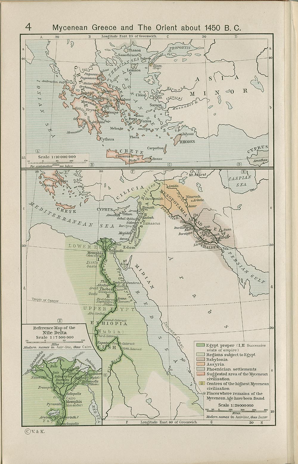
- Mycenean Greece and the Orient about 1450 B.C. (332K)
- From The Historical Atlas by William R. Shepherd, 1911. Inset: Reference Map of the Nile Delta.
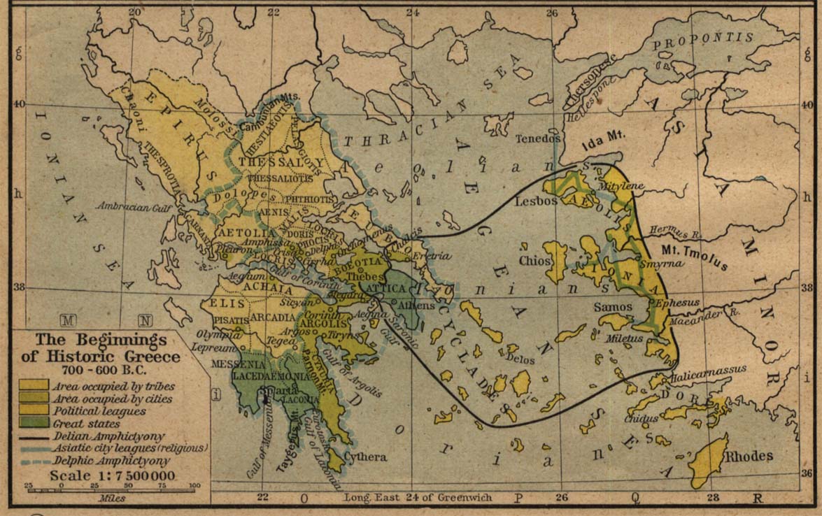
- Greece 700 B.C.-600 B.C. (177K)
- Beginnings of Historic Greece. From The Historical Atlas by William R. Shepherd, 1923.
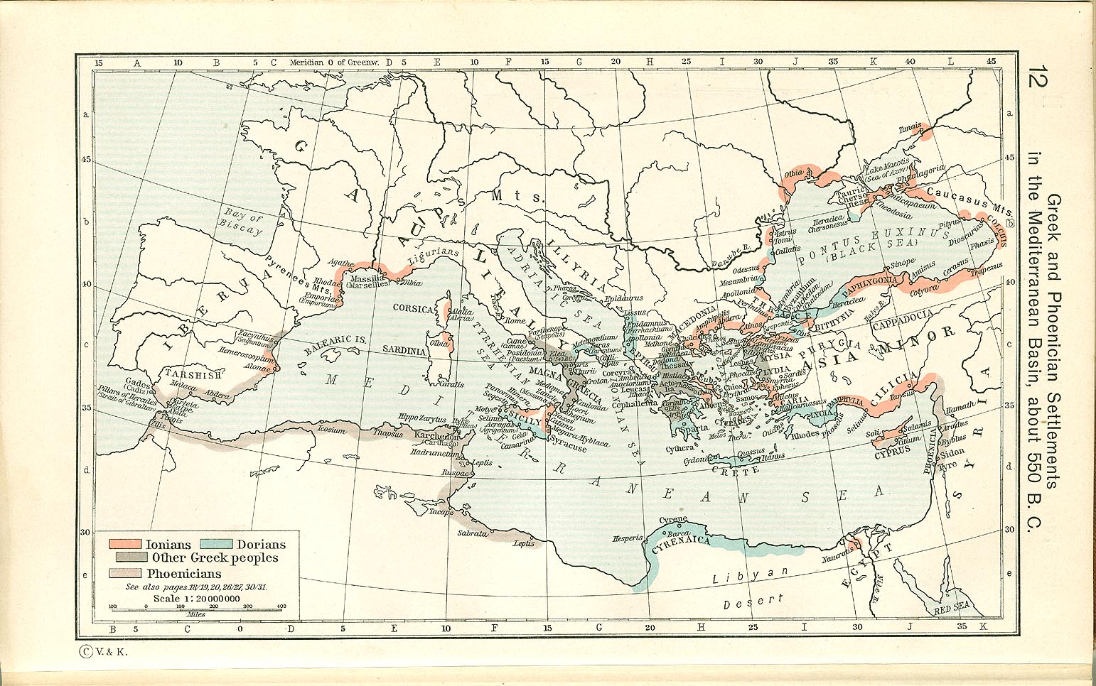
- Greece - Greek and Phoenician Settlements in the Mediterranean Basin, about 550 B.C. (366K)
- From The Historical Atlas by William R. Shepherd, 1923.
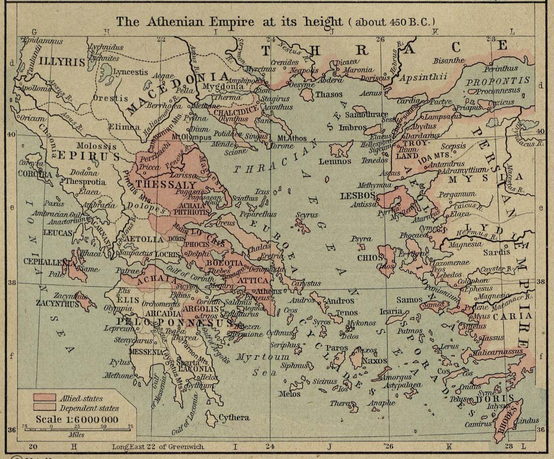
- Greece - The Athenian Empire at its Height (about 450 B.C.). (268K)
- From The Historical Atlas by William R. Shepherd, 1923.
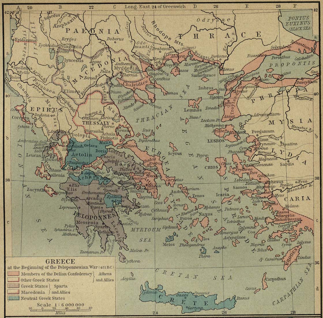
- Greece at the Beginning of the Peloponnesian War (431 B.C.). (307K)
- From The Historical Atlas by William R. Shepherd, 1923.
- Greece under Theban Headship (362 B.C.). (175K)
- From The Historical Atlas by William R. Shepherd, 1923.
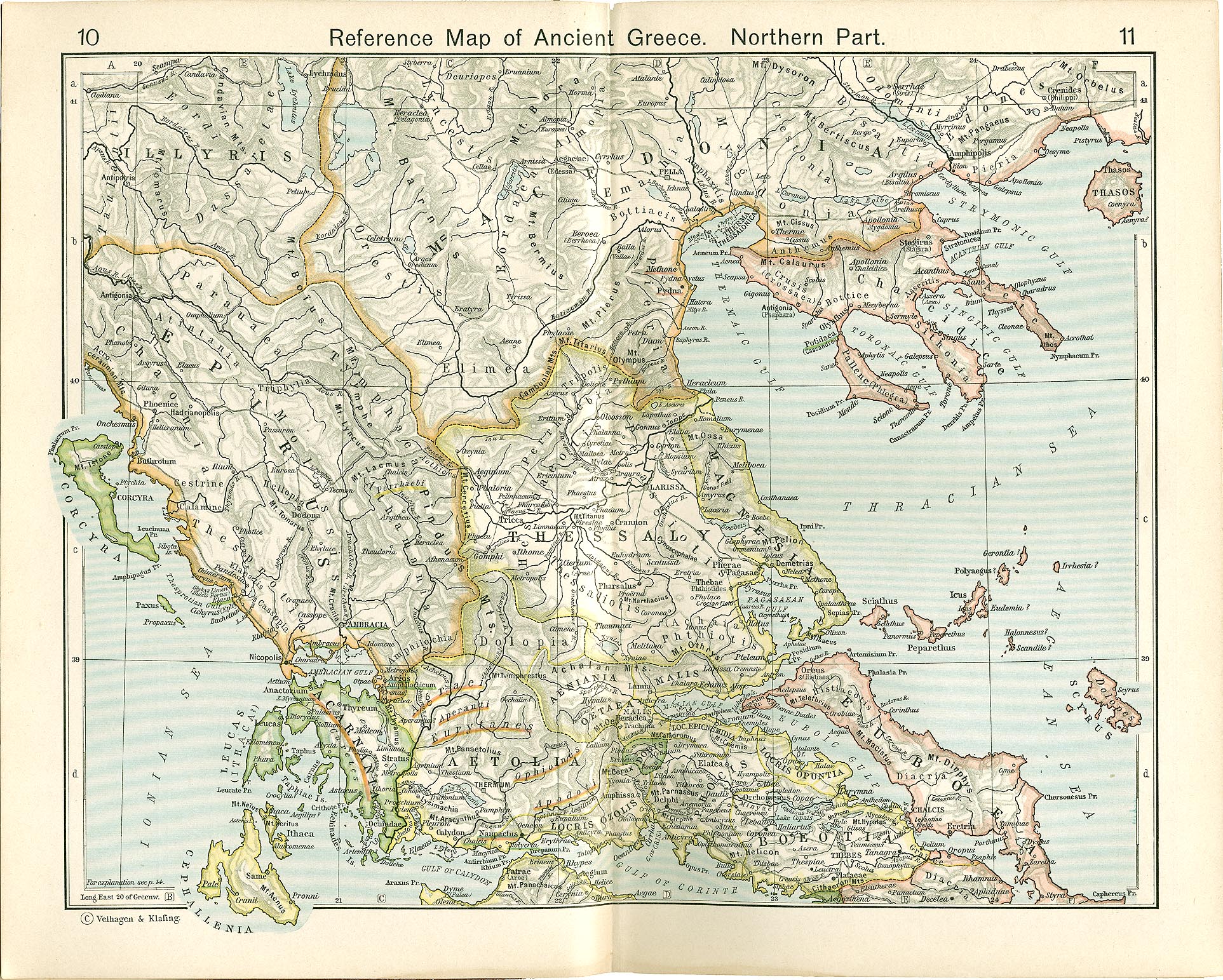
- Greece - Reference Map of Ancient Greece. Northern Part (1MB)
- From The Historical Atlas by William R. Shepherd, 1911.
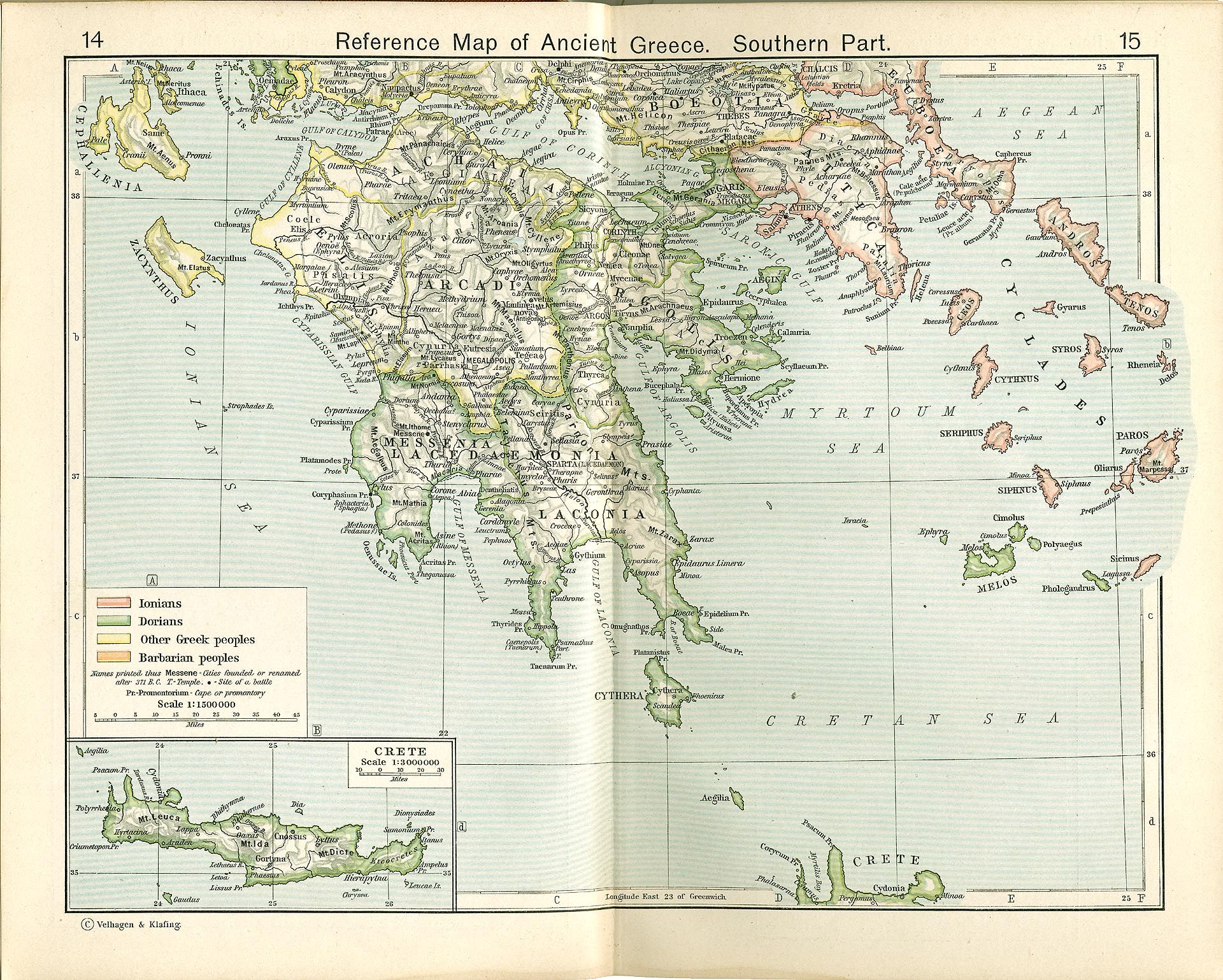
- Greece - Reference Map of Ancient Greece, Southern Part (825K)
- From The Historical Atlas by William R. Shepherd, 1911.
- [Greece] Hellas and Peloponneseus (452K)
- "Hellas and Peloponneseus; showing (a,) The subdivisions of Hellas and Peloponneseus. (b,) The historical places and battle-fields." From "An Historical Atlas Containing a Chronological Series of One Hundred and Four Maps, at Successive Periods, from the Dawn of History to the Present Day." by Robert H. Labberton. Sixth Edition. 1884.
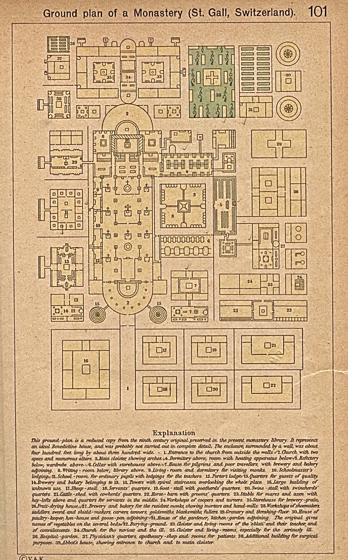
- Ground Plan of a Monastery (St.Gall, Switzerland) (516K)
- From The Historical Atlas by William R. Shepherd, 1923.
- Hispania [Ancient Spain] (612K)
- From A Classical Atlas of Ancient Geography by Alexander G. Findlay. New York: Harper and Brothers 1849.
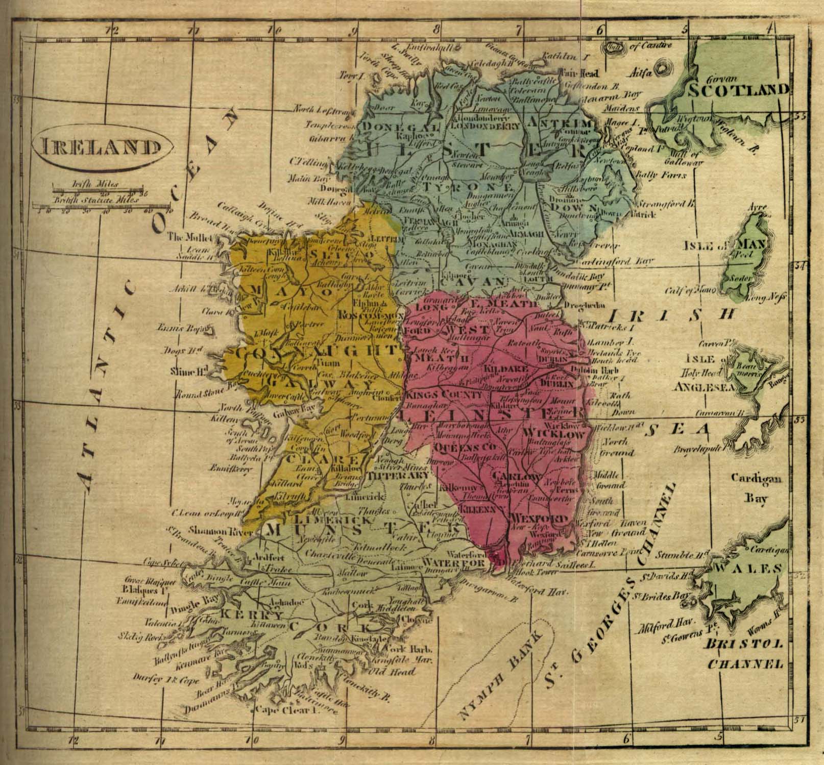
- Ireland 1808 (452K)
- From The General Gazetteer; or, Compendious Geographical Dictionary. Compiled by R. Brookes, Revised by W. Guthrie and E. Jones. Eighth Edition, Dublin, 1808.
- Ischl [Bad Ischl, Austria] 1911 (774K)
- From Karl Baedeker's Autriche-Hongrie, 13th Edition, Paris 1911.
- Italia [Ancient Italy] (645K)
- From "A Classical Atlas, to Illustrate Ancient Geography; Comprised in Twenty-Five maps, Showing the Various Divisions of the World as Known to the Ancients; Composed from the Most Authentic Sources." by Alexander G. Findlay, F.R.G.S. 1849.
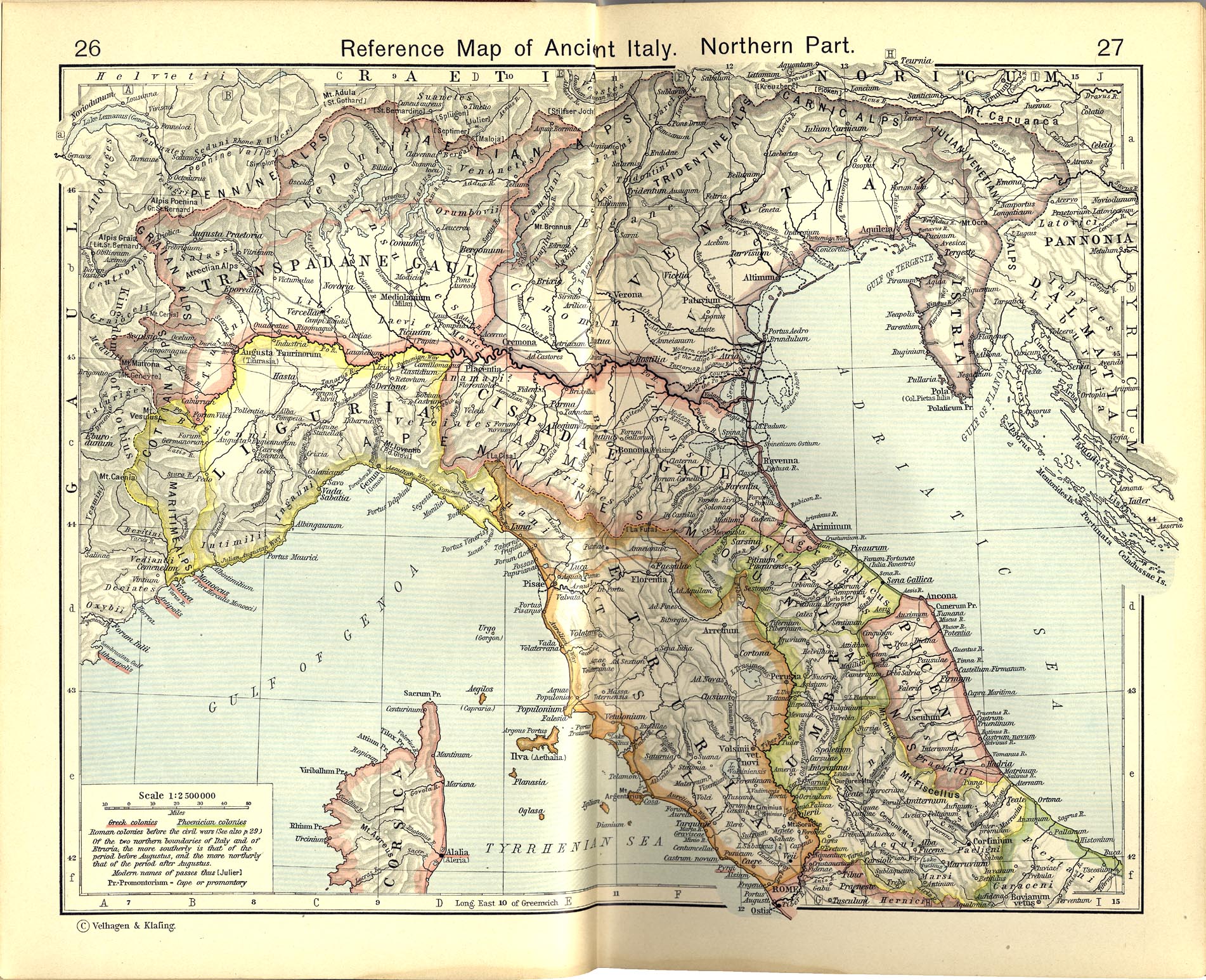
- Reference Map of Ancient Italy, Northern Part (831K)
- From The Historical Atlas by William R. Shepherd, 1911.
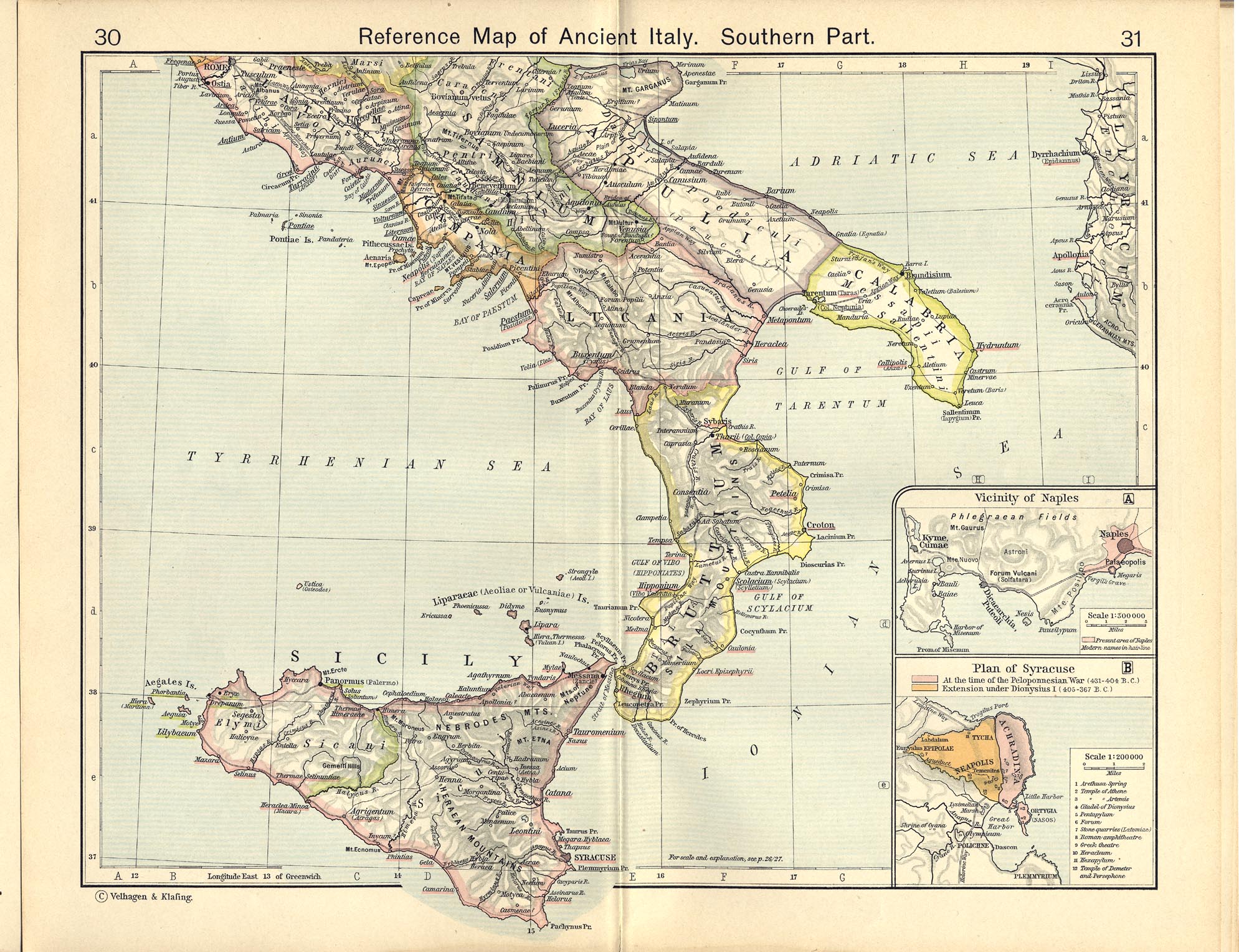
- Italy - Reference Map of Ancient Italy, Southern Part (629K)
- From The Historical Atlas by William R. Shepherd, 1911.
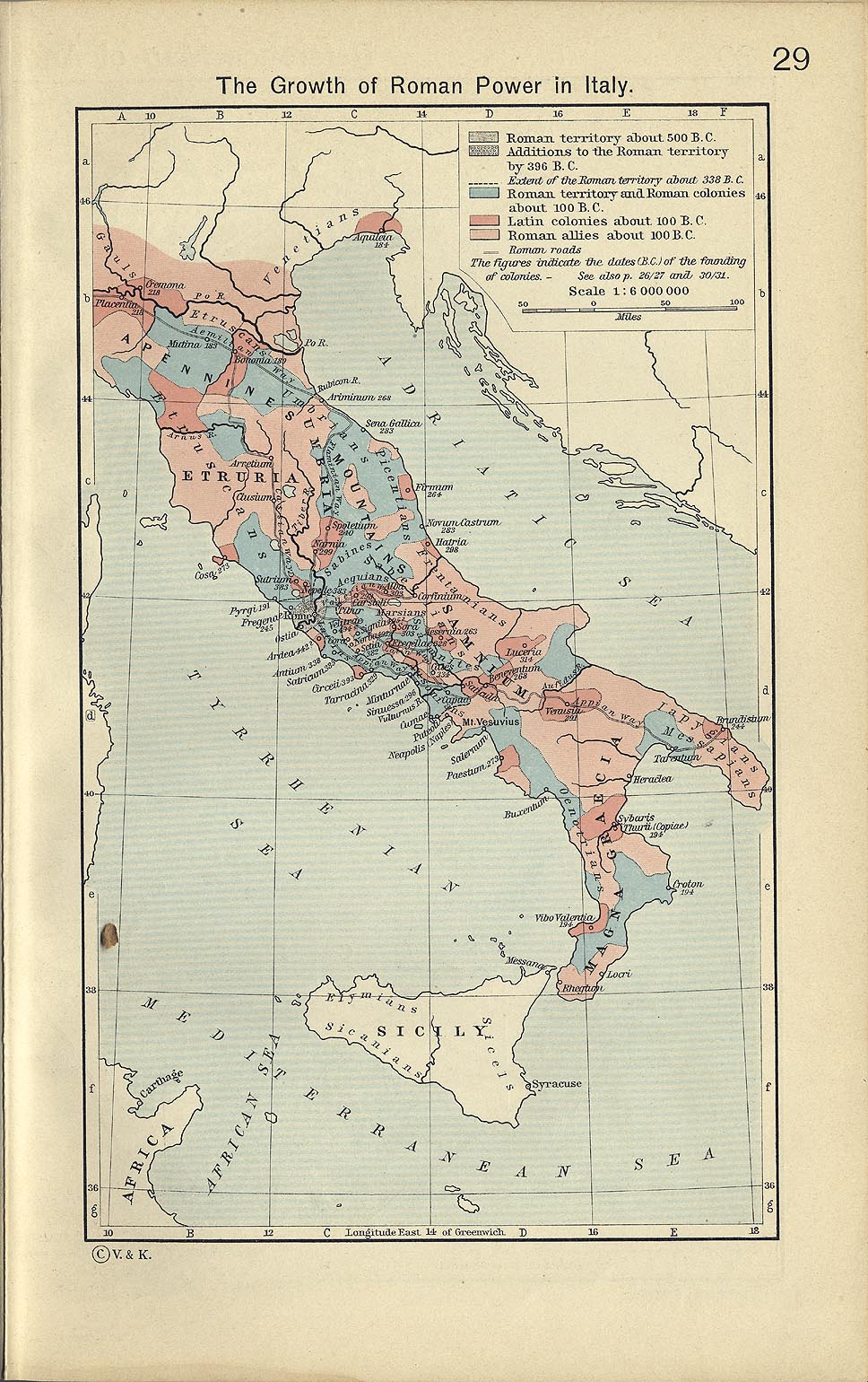
- Italy - The Growth of Roman Power in Italy (337K)
- From The Historical Atlas by William R. Shepherd, 1911.
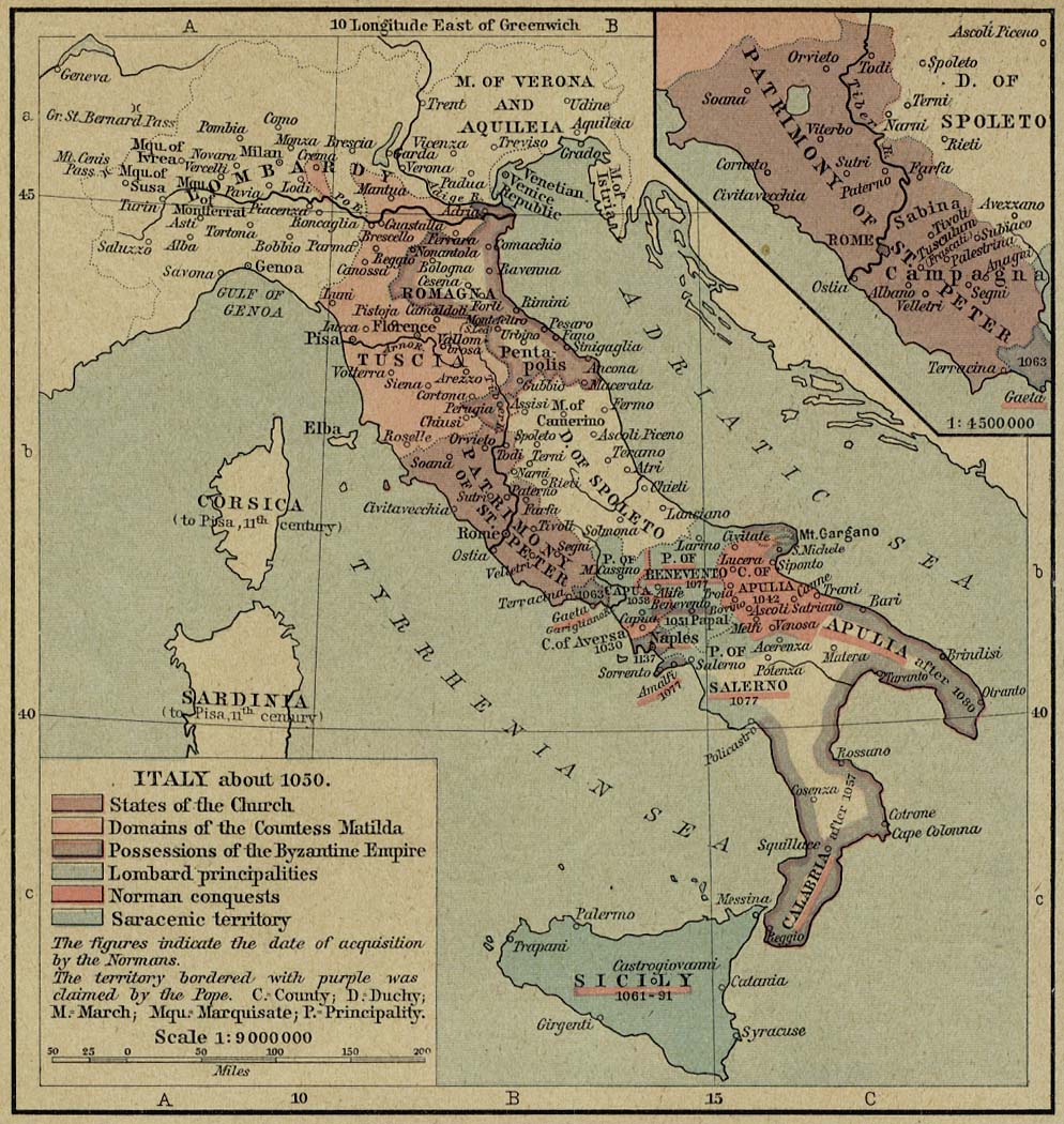
- Italy - Italy about 1050 (247K)
- From The Historical Atlas by William R. Shepherd, 1923.
- [Italy] The Holy Roman Empire under the Hohenstaufen, 1138-1254 (458K)
- From The Historical Atlas by William R. Shepherd, 1926.
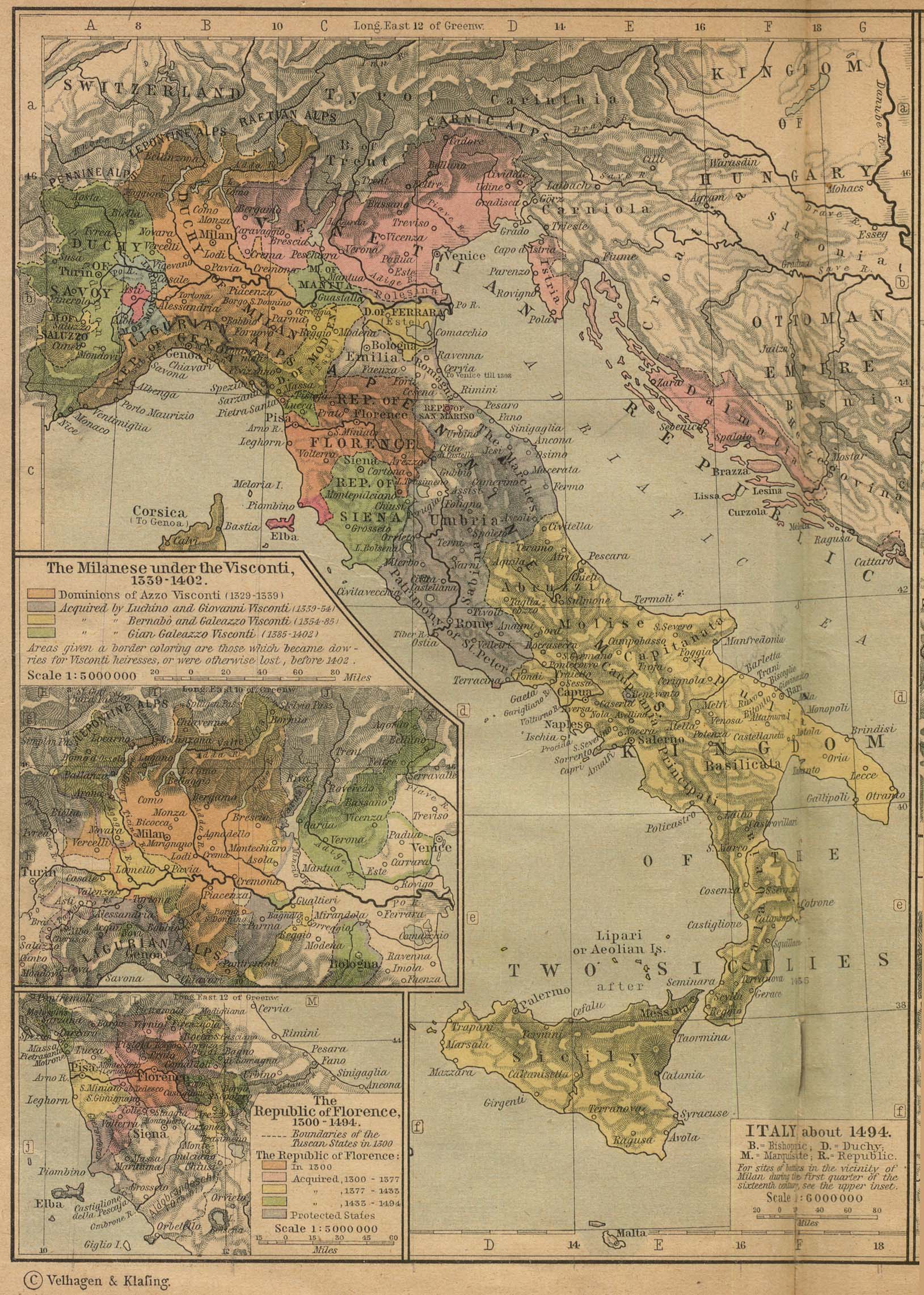
- Italy about 1494 (774K)
- Insets: The Milanese under the Visconti, 1339-1402. The Republic of Florence, 1300-1494. From The Historical Atlas by William R. Shepherd, 1923.
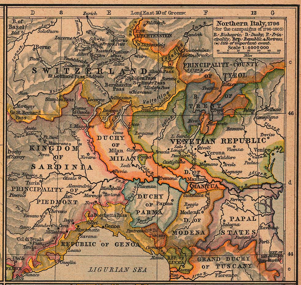
- Northern Italy, 1796 (for the campaigns of 1796-1805) (389K)
- From The Historical Atlas by William R. Shepherd, 1926.
- Italy and Germany 1803 (423K)
- From The Historical Atlas by William R. Shepherd, 1926.
- Italy and Germany 1806 (314K)
- From The Historical Atlas by William R. Shepherd, 1926.
- Italy 1882 (968K)
- From W. & A.K. Johnston's "The World an Atlas" 1882.
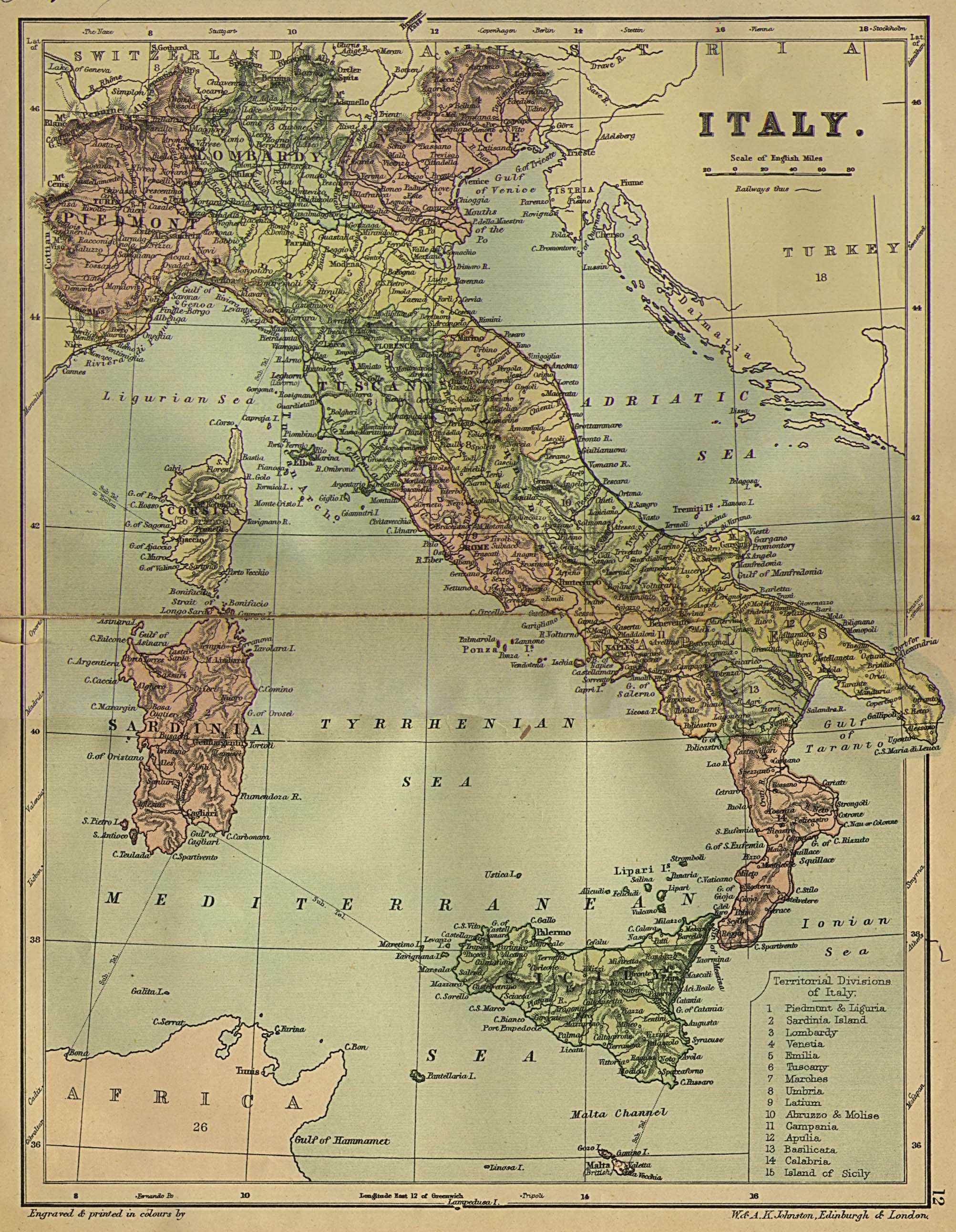
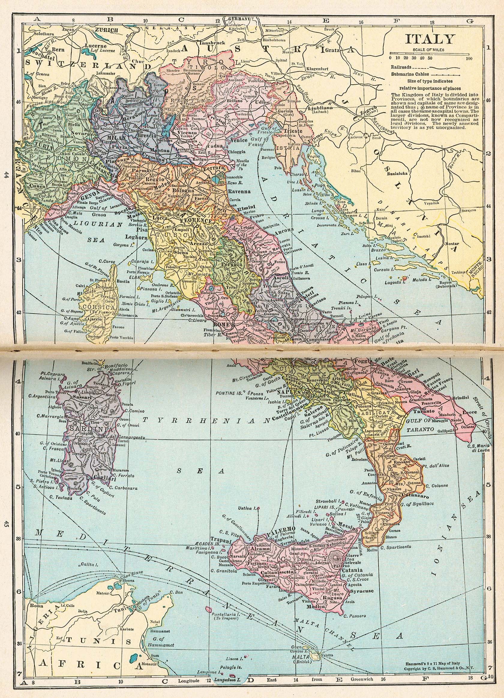
- Italy (981K)
- From Putnam's Handy Volume Atlas of the World. Published by G.P. Putnam's Sons, New York and London, 1921.
- Localities in Western Europe connected with American History (519K)
- From The Historical Atlas by William R. Shepherd, 1923.
- London 1200-1600 (248K)
- London Vicinity. From The Historical Atlas by William R. Shepherd, 1911.
- London 1300 (237K)
- Plan of London. From The Historical Atlas by William R. Shepherd, 1926.
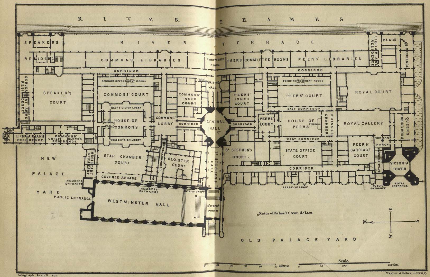
- London - Houses of Parliment 1894 (225K)
- "Old Palace Yard" from Baedeker, Karl. Baedeker's London and Its Environs. Ninth Revised Edition. Leipsic, 1894.
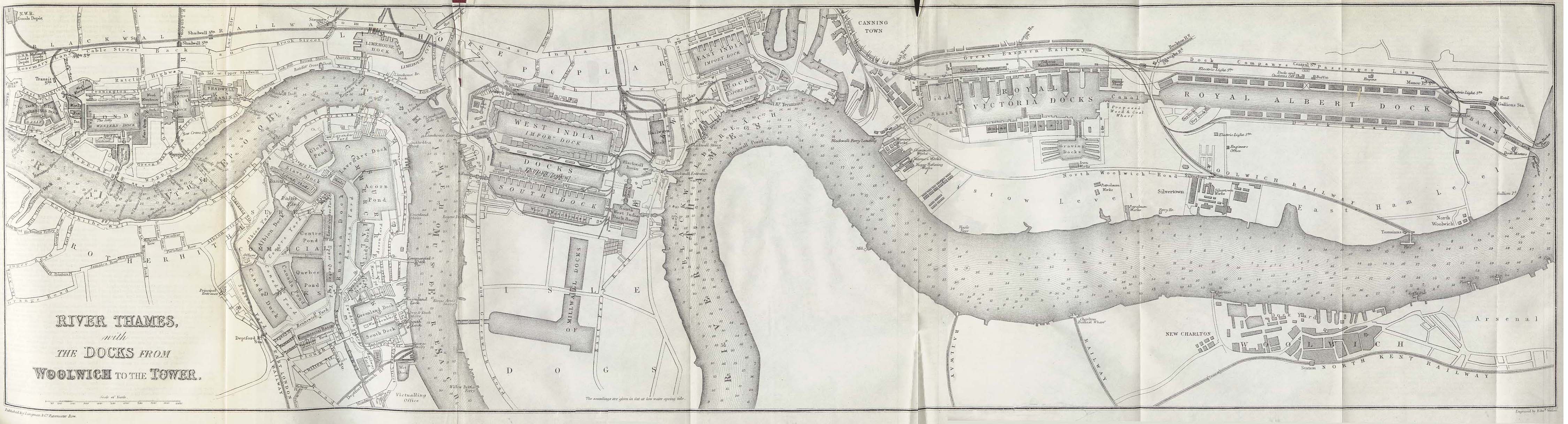
- London - Thames River 1882 (982K)
- "River Thames with the Docks from Woolwich to the Tower" from A Dictionary Practical, Theoretical, and Historical of Commerce and Commercial Navigation by J.R. M'Culloch. Longmans, Green and Co. London, 1882.
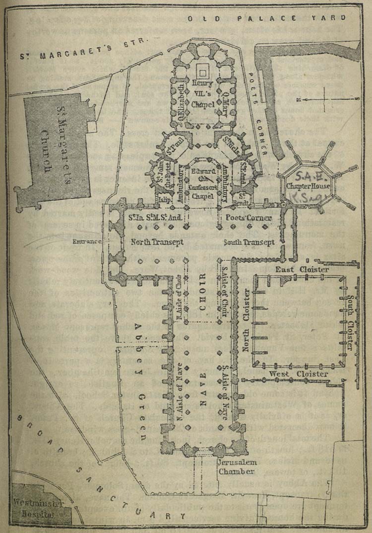
- London - Westminster Abbey 1894 (341K)
- "Westminster Abbey" from Baedeker, Karl. Baedeker's London and Its Environs. Ninth Revised Edition. Leipsic, 1894.
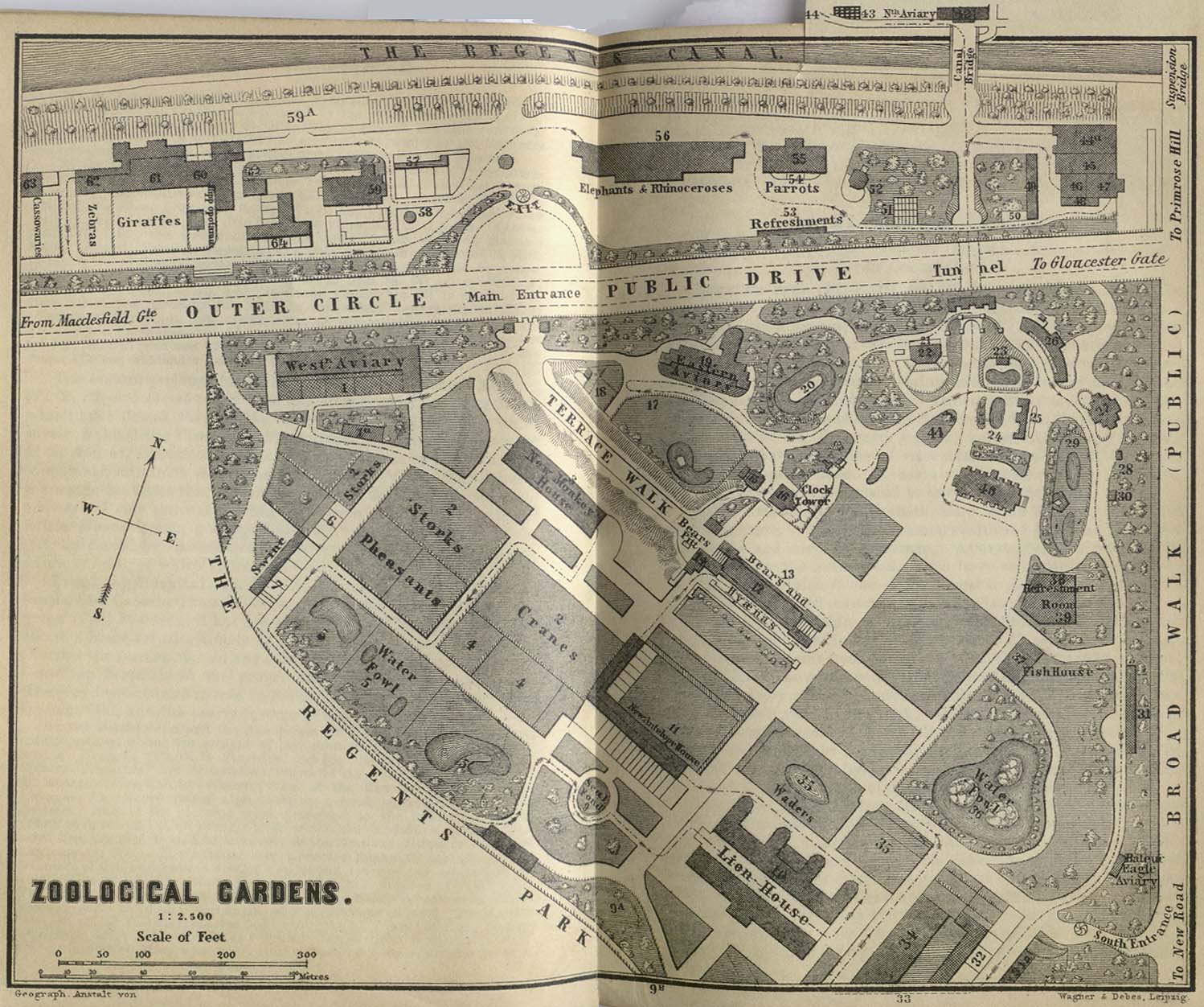
- London - Zoological Gardens 1894 (309K)
- "Zoological Gardens" from Baedeker, Karl. Baedeker's London and Its Environs. Ninth Revised Edition. Leipsic, 1894.
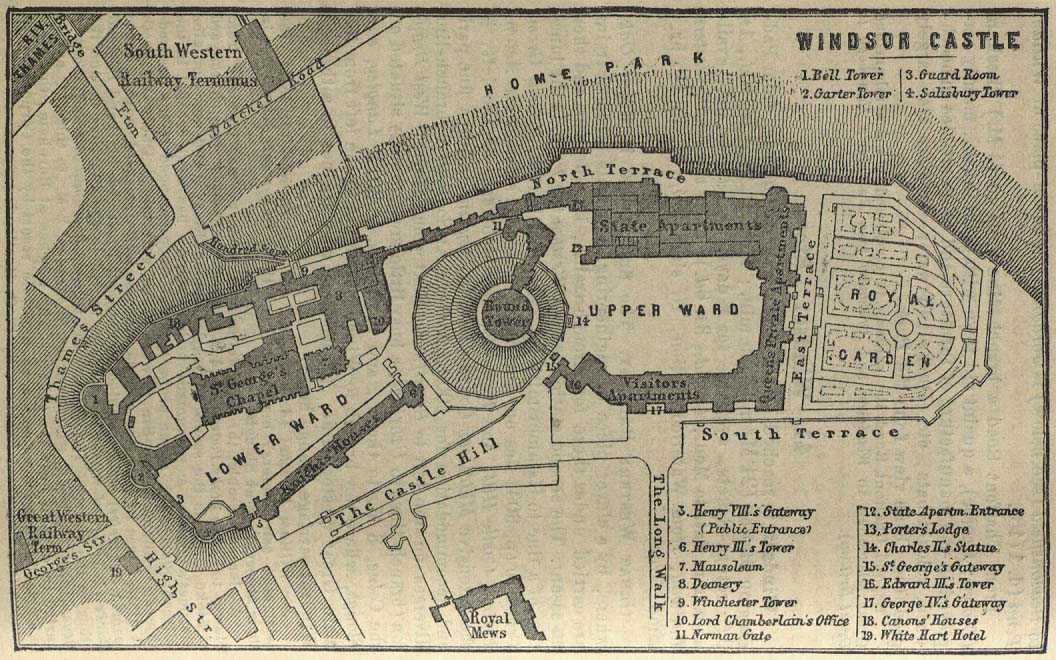
- London Area - Windsor Castle 1894 (203K)
- "Windsor Castle" from Baedeker, Karl. Baedeker's London and Its Environs. Ninth Revised Edition. Leipsic, 1894.
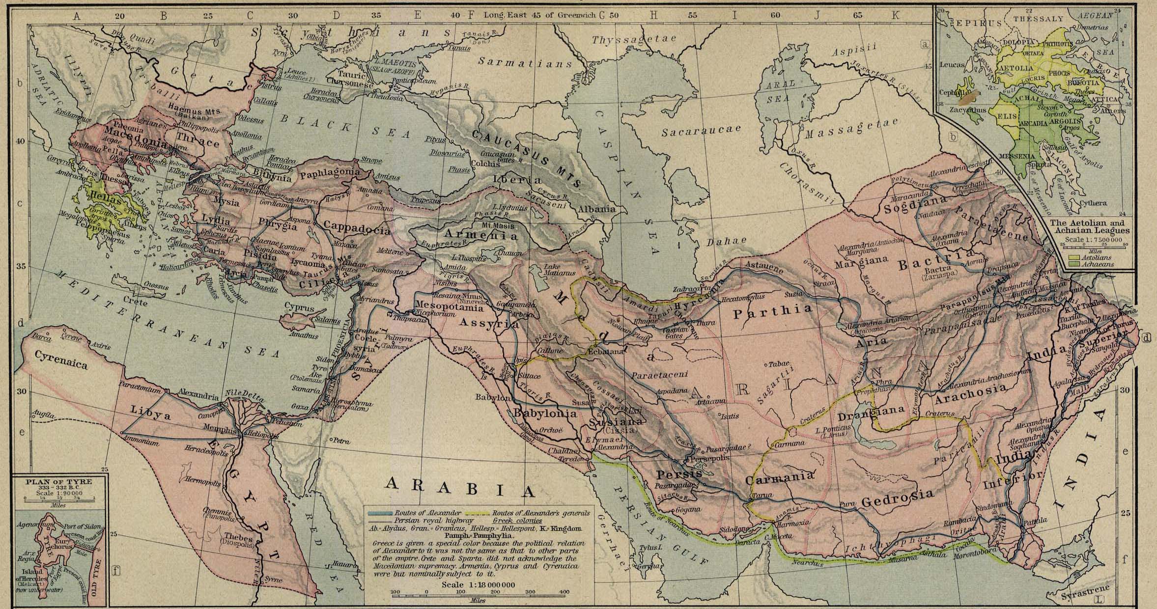
- The Macedonian Empire, 336-323 B.C. (560K)
- From The Historical Atlas by William R. Shepherd, 1923. Insets: The Aetolian and Achaian Leagues. Plan of Tyre.
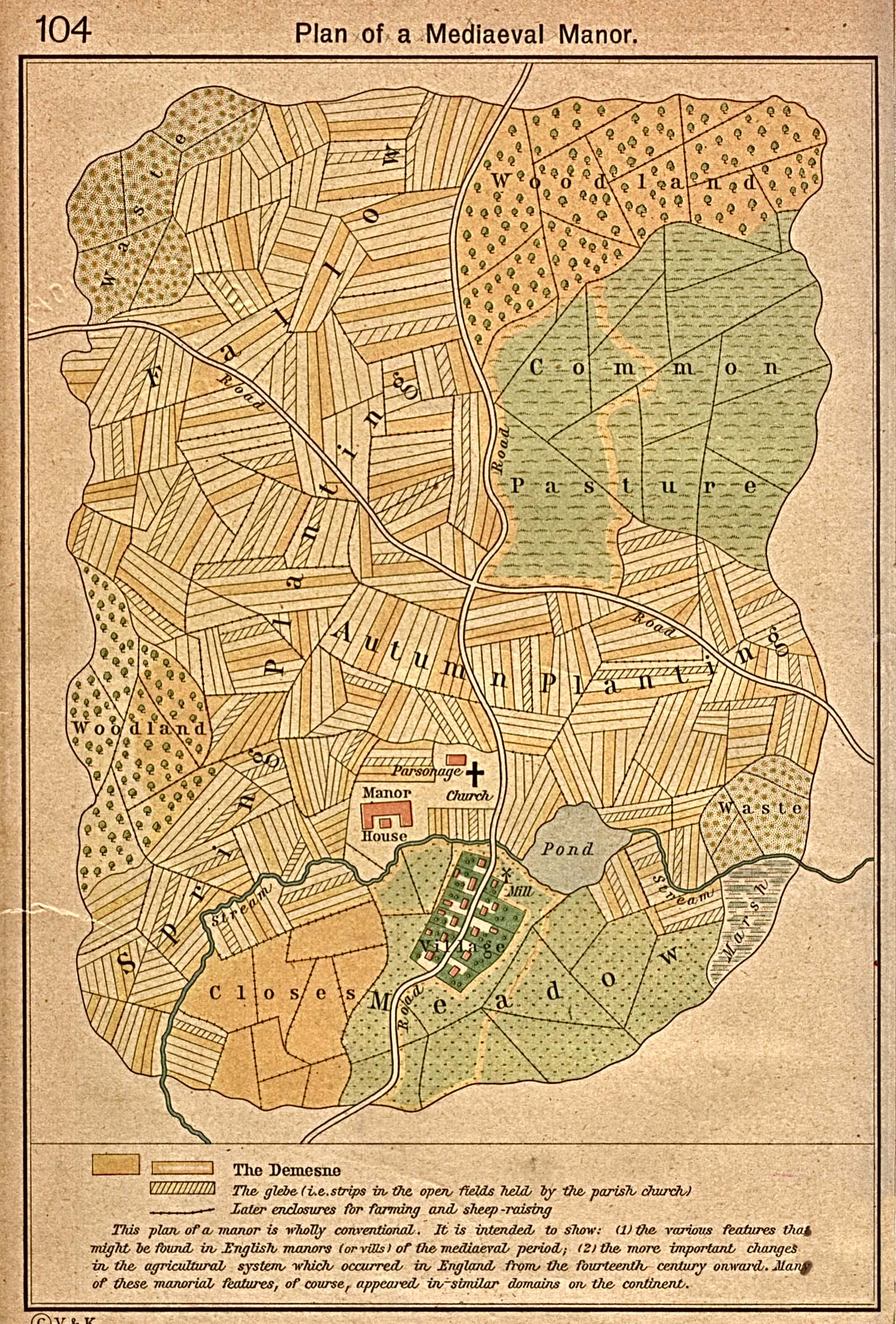
- Medieval Manor (710K)
- "Mediaeval Manor" From The Historical Atlas by William R. Shepherd, 1923.
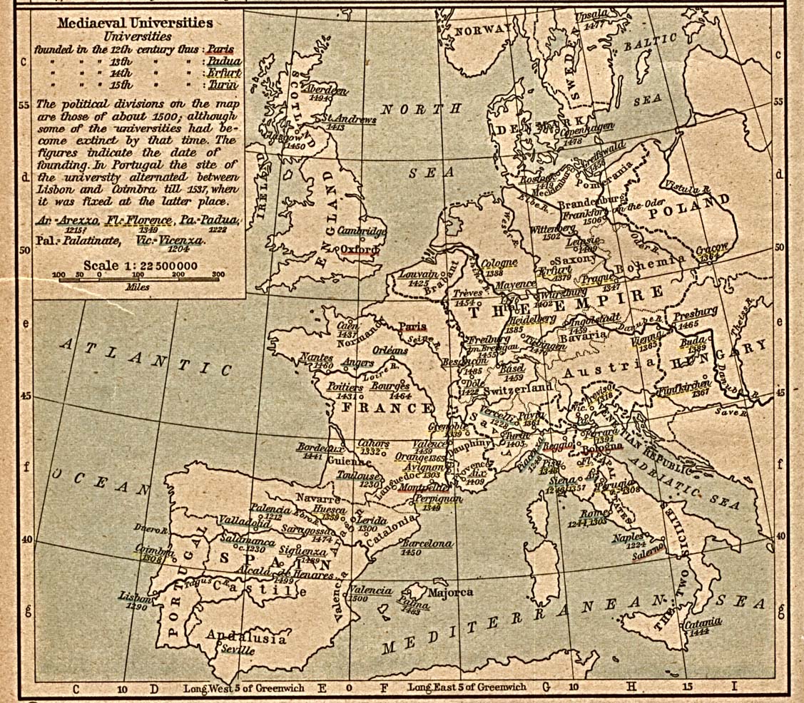
- Medieval Universities (452K)
- From The Historical Atlas by William R. Shepherd, 1923.
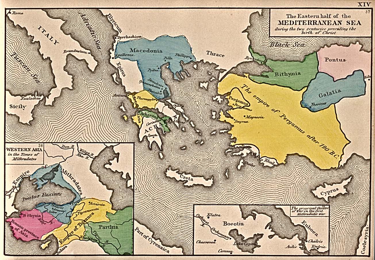
- Mediterranean Sea (387K)
- "The Eastern half of the Mediterranean Sea during the two centuries preceding the birth of Christ" from An Historical Atlas Containing a Chronological Series of One Hundred and Four Maps, at Successive Periods, from the Dawn of History to the Present Day" by Robert H. Labberton. Sixth Edition. 1884.
- Milano [Milan] 1913 (782K)
- From Baedeker's Northern Italy Handbook For Travellers by Karl Baedeker, Fourteenth Remodelled Edition 1913.
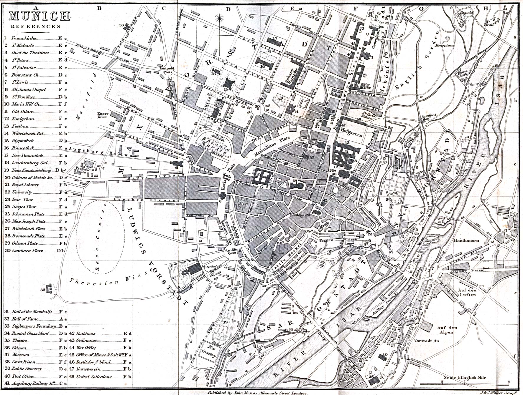
- Munich 1858 (676K)
- From A Handbook for Travellers in Southern Germany, Eighth Edition. London: John Murray. 1858.
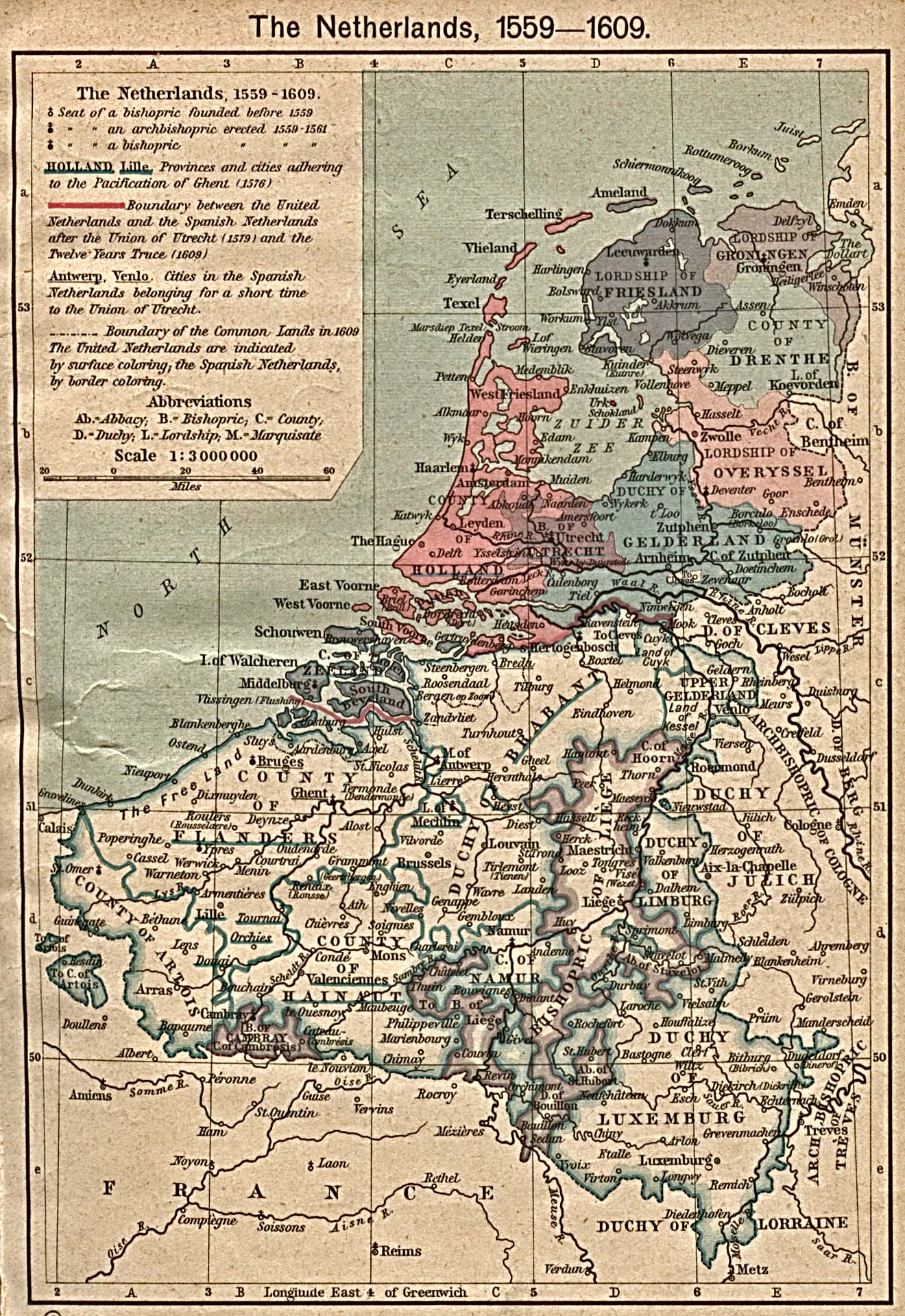
- The Netherlands 1559-1609 (645K)
- From The Historical Atlas by William R. Shepherd, 1923.
- Nuremberg 1858 (764K)
- From A Handbook for Travellers in Southern Germany, Eighth Edition. London: John Murray. 1858.
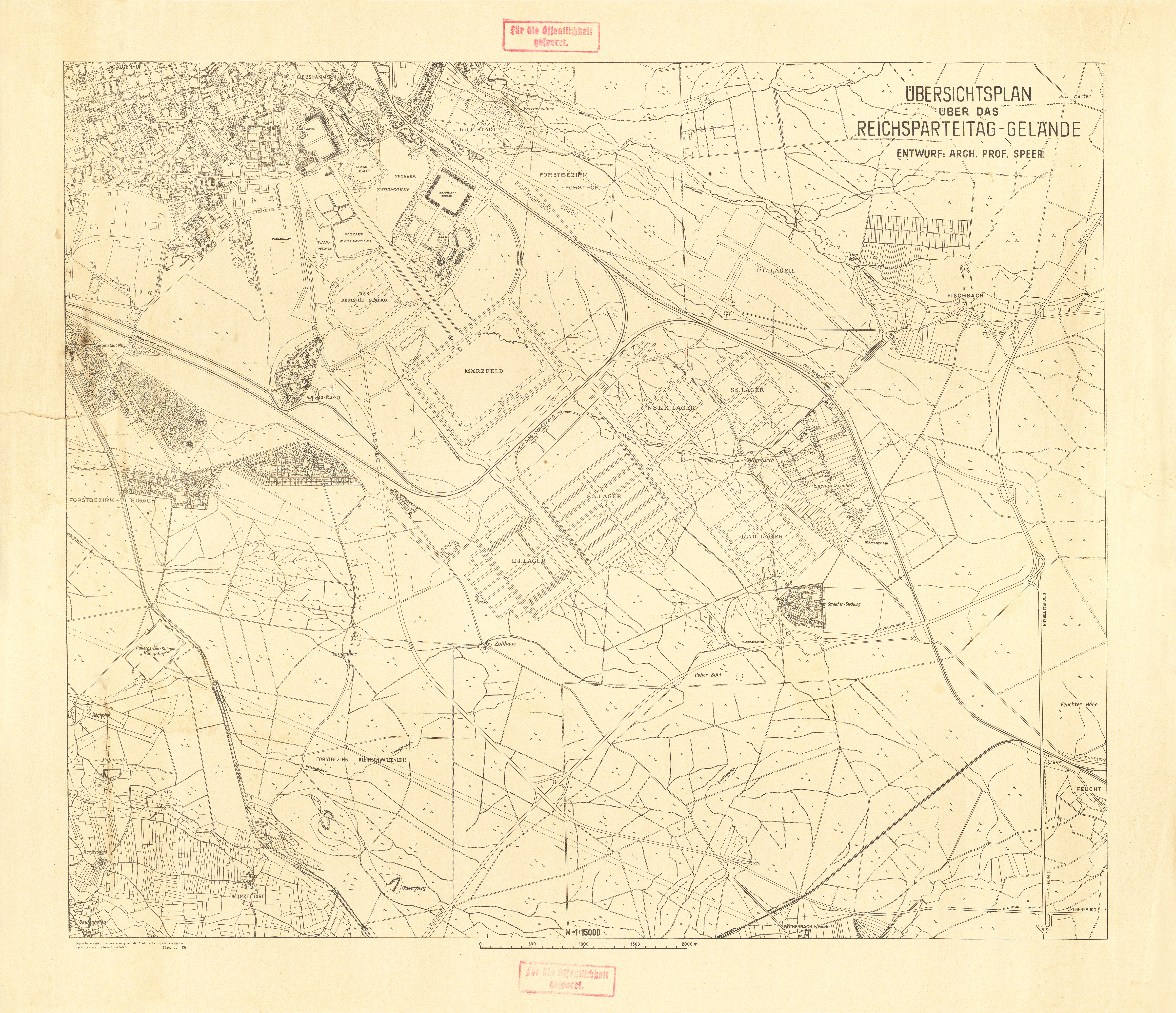
- Nuremberg 1939 (15MB)
- "Ubersichtsplan uber das Reichsparteitag-Geland" [Reich Party Congress Grounds / Nazi Party Rally Grounds] 1:15,000, July 1939.
- The Ottoman Turks 1355 (269K)
- "The Byzantine Empire and the Ottoman Turks in 1355" The Byzantine Empire, 1265-1355. From The Historical Atlas by William R. Shepherd, 1911.
- The Ottoman Empire, 1451-1481. Constantinople (671K)
- From The Historical Atlas by William R. Shepherd, 1923.
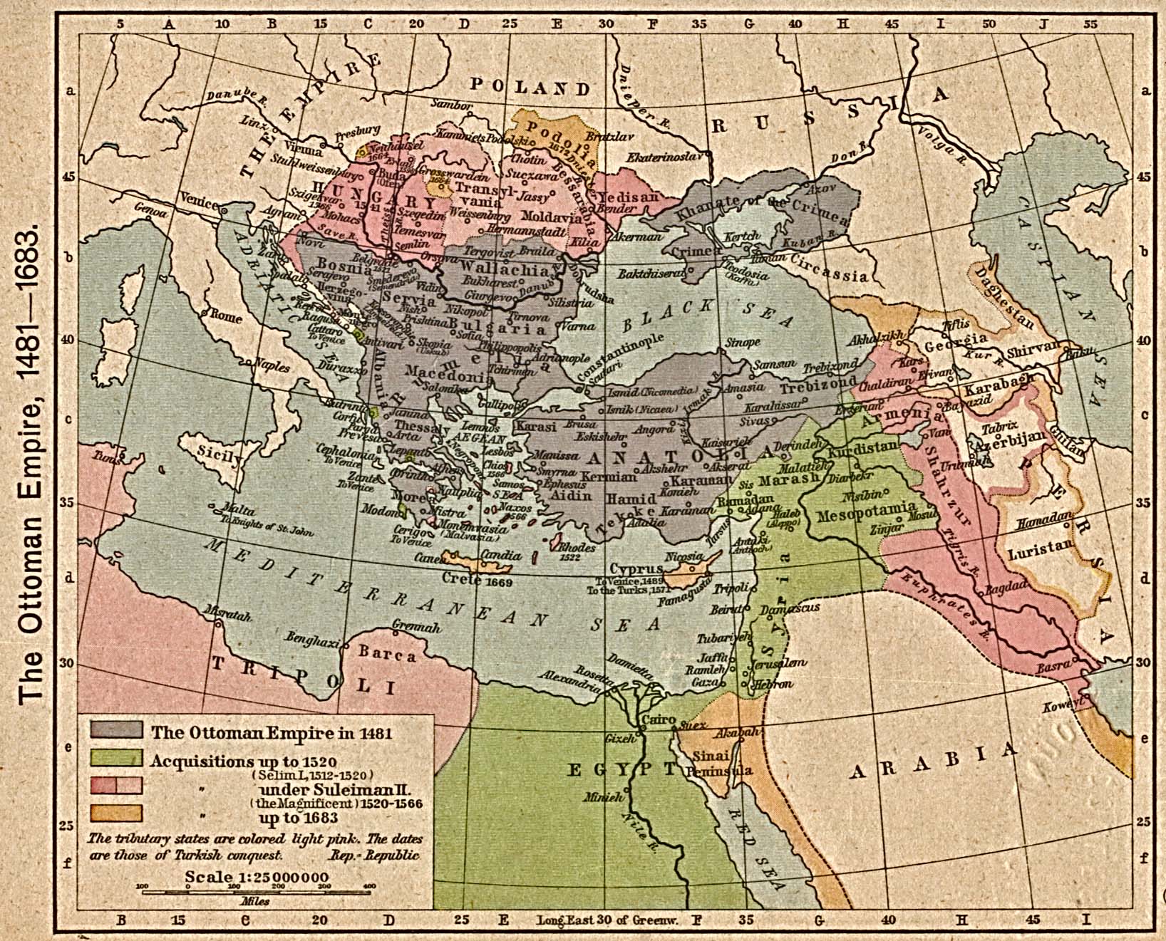
- The Ottoman Empire, 1481-1683 (581K)
- From The Historical Atlas by William R. Shepherd, 1923.
- Ottoman Empire [1683-1923] (649K)
- From The Historical Atlas by William R. Shepherd, 1923.
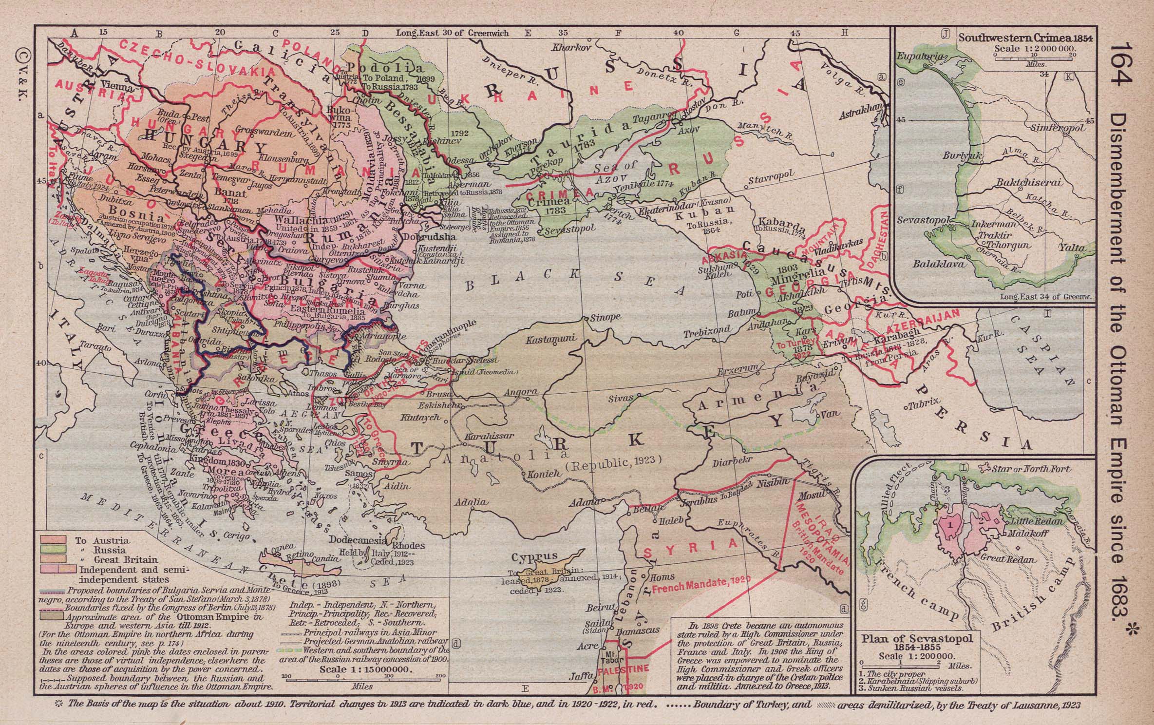
- Ottoman Empire since 1683 (387K)
- Insets: Southwestern Crimea, 1854. Plan of Sevastopol, 1854-1855. From The Historical Atlas by William R. Shepherd, 1923.
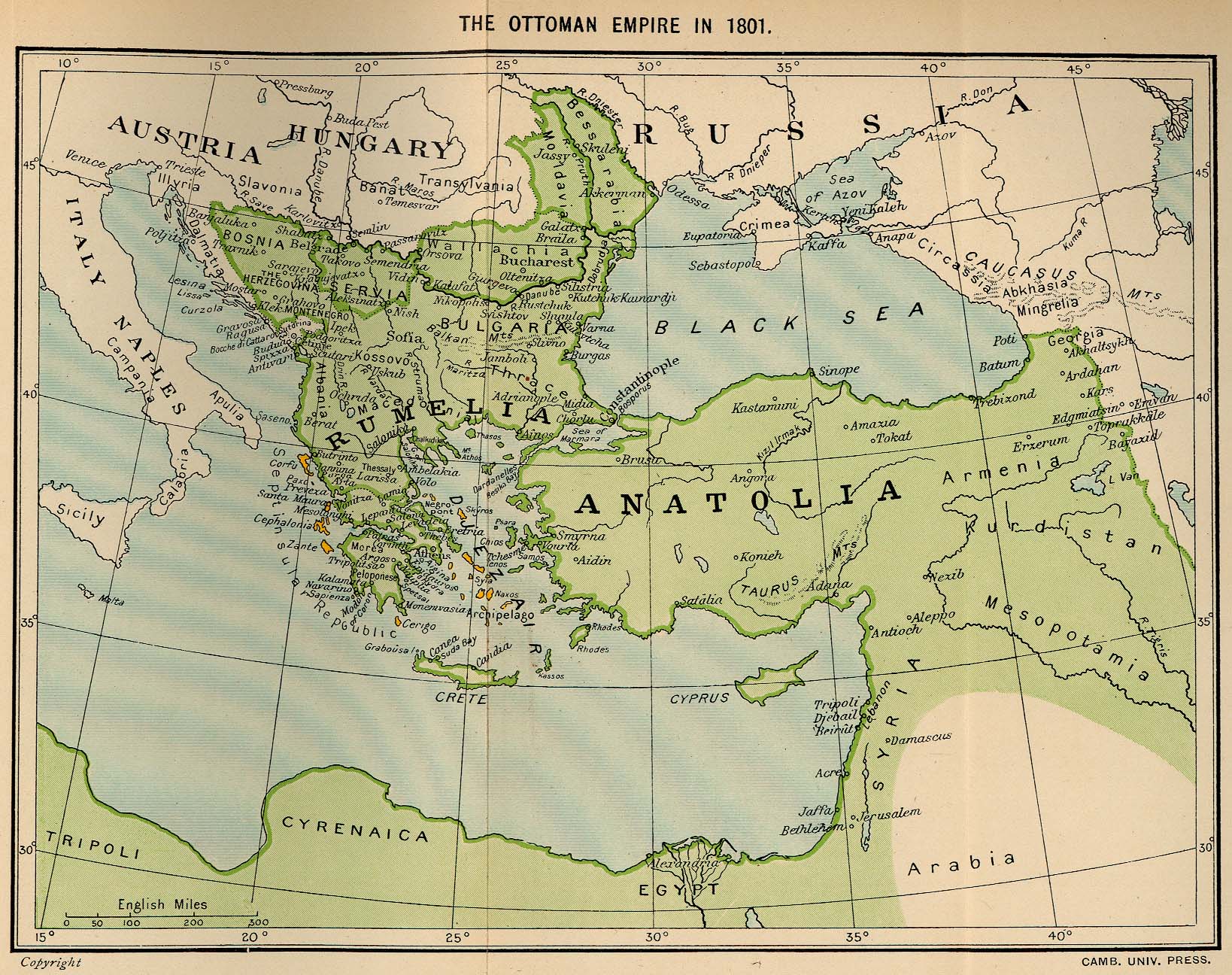
- Ottoman Empire in 1801 (548K)
- From The Ottoman Empire, 1801-1913 by William Miller. Published by Cambridge University Press, 1913.
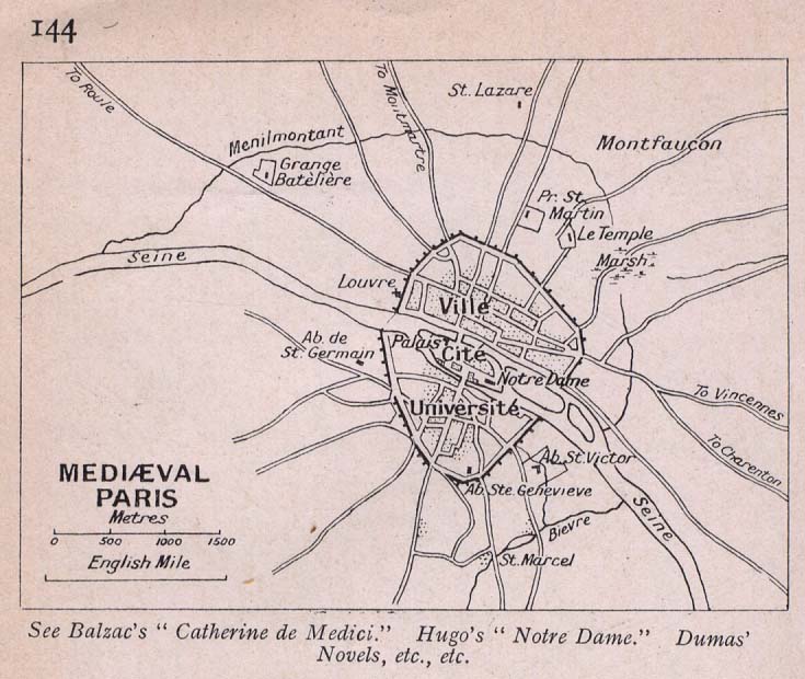
- Paris, Mediaeval (88K)
- "Mediaeval Paris" From Literary and Historical Atlas of Europe, by J.G. Bartholomew, 1912.
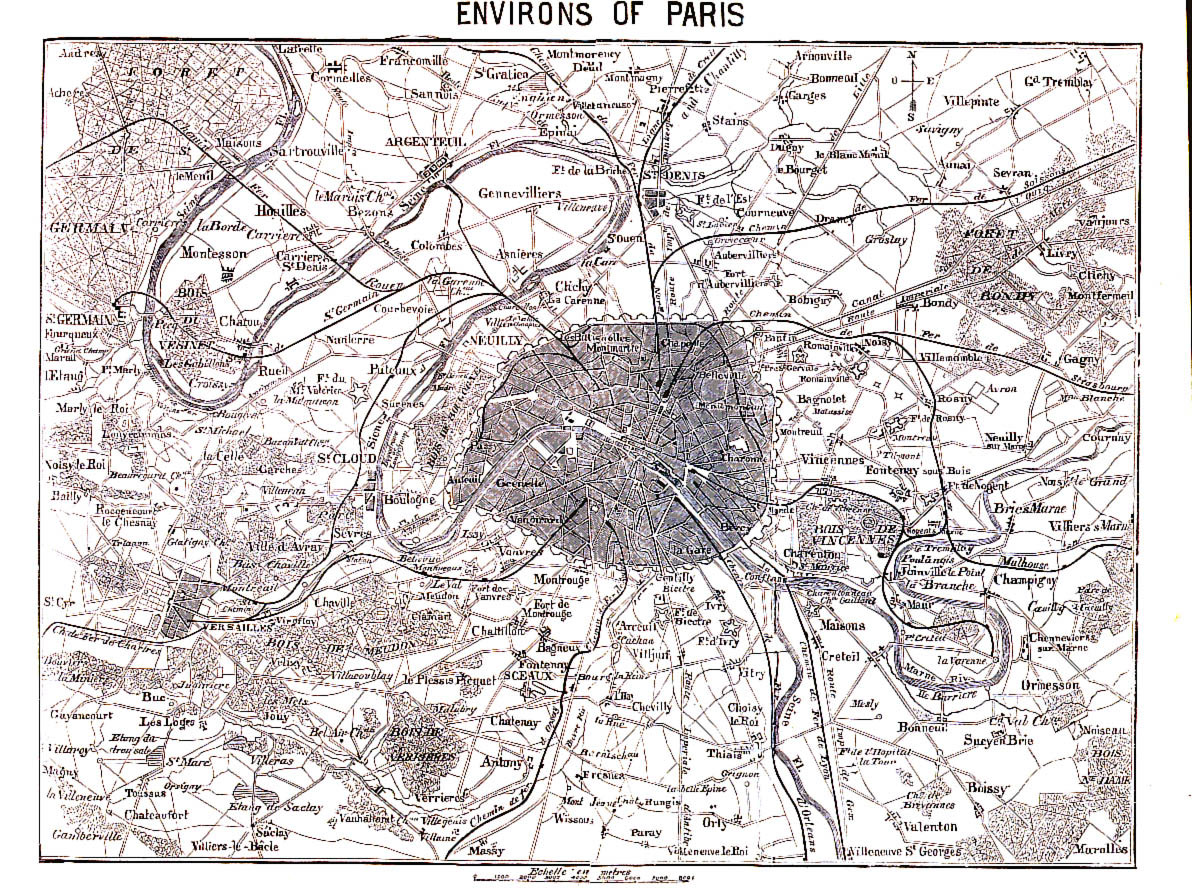
- Paris, Environs of 1866 (645K)
- From A Handbook For Visitors To Paris, Second Edition. London: John Murray. 1866.
- Paris, 1871 (784K)
- "Paris und Umgebung" From Mittheilungen aus Justus Perthes' geographischer Anstalt..., by Dr. A Petermann. 1871.
- Polish and Lithuanian Boundaries, 1937 and Present (233K)
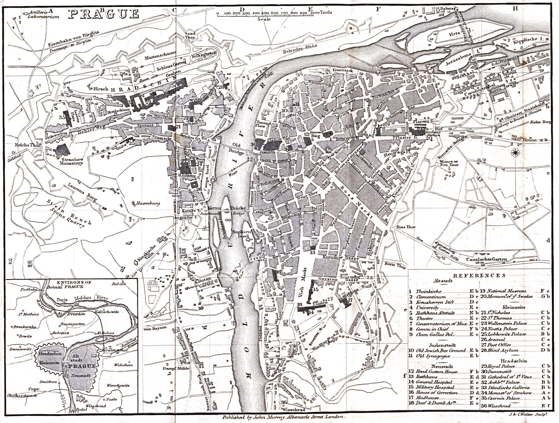
- Prague 1858 (719K)
- From A Handbook for Travellers in Southern Germany, Eighth Edition. London: John Murray. 1858.
- Principal Seats of War in Europe, I. 1618-1660 (581K)
- From The Historical Atlas by William R. Shepherd, 1923.
- The Public Schools Historical Atlas by C. Colbeck, 1905
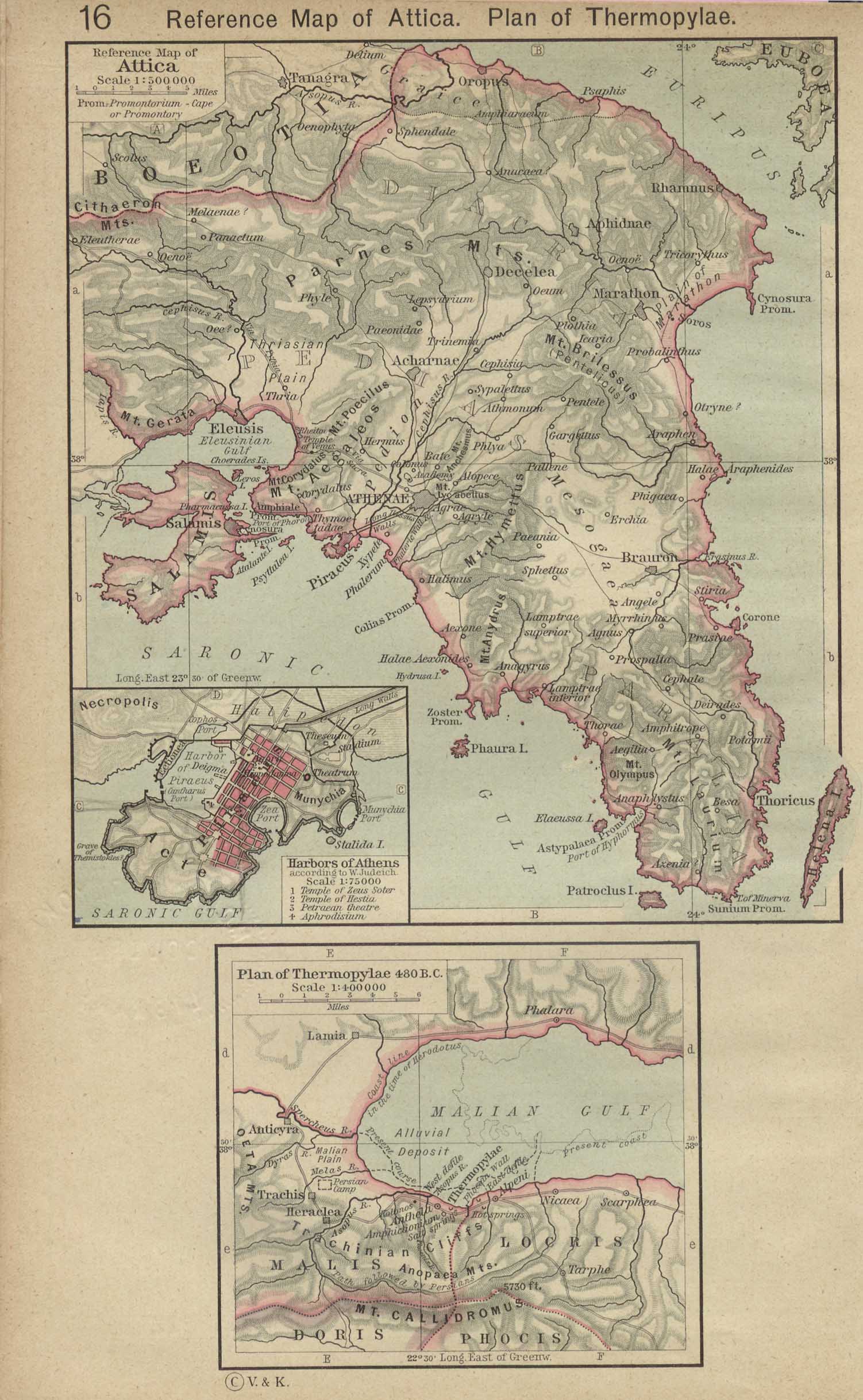
- Reference Map of Attica. Plan of Thermopylae, 480 B.C. (500K)
- Inset: Harbors of Athens. From The Historical Atlas by William R. Shepherd, 1923.
- Roman Britain About 410. (452K)
- From The Historical Atlas by William R. Shepherd, 1923.
- Roman Empire 1st Century A.D. (387K)
- "The Roman Ascendency during the first Century A.D." from An Historical Atlas Containing a Chronological Series of One Hundred and Four Maps, at Successive Periods, from the Dawn of History to the Present Day by Robert H. Labberton, sixth edition, 1884.
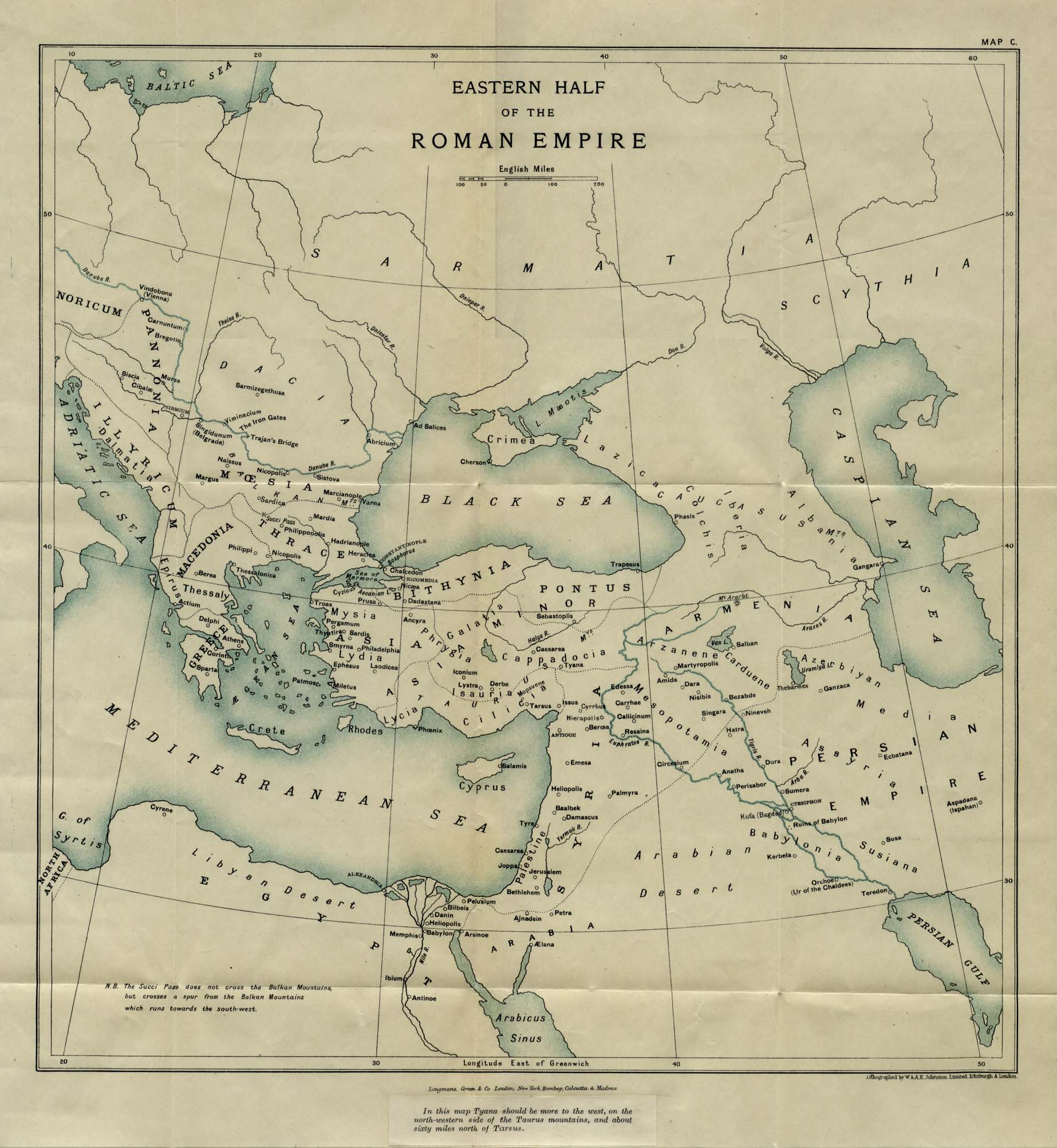
- Roman Empire - Eastern (353K)
- "Eastern Half of the Roman Empire" from East and West Though Fifteen Centuries, Volume II, by G. F. Young. Published by Longmans, Green and Co. 1916.
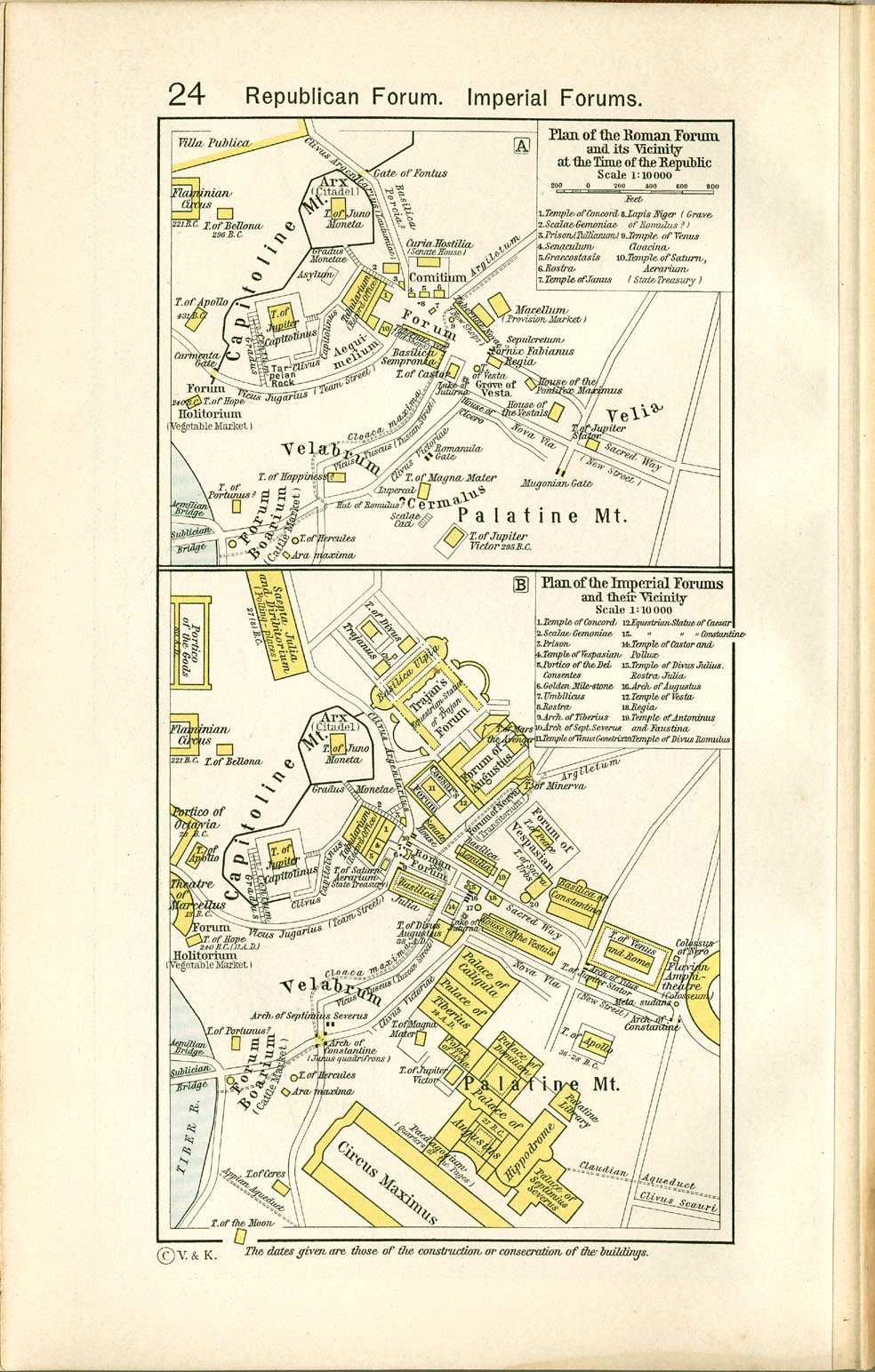
- Plan of the Roman Forum and its Vicinity at the Time of the Republic and Plan of the Imperial Forums and their Vicinity (321K)
- From The Historical Atlas by William R. Shepherd, 1911.
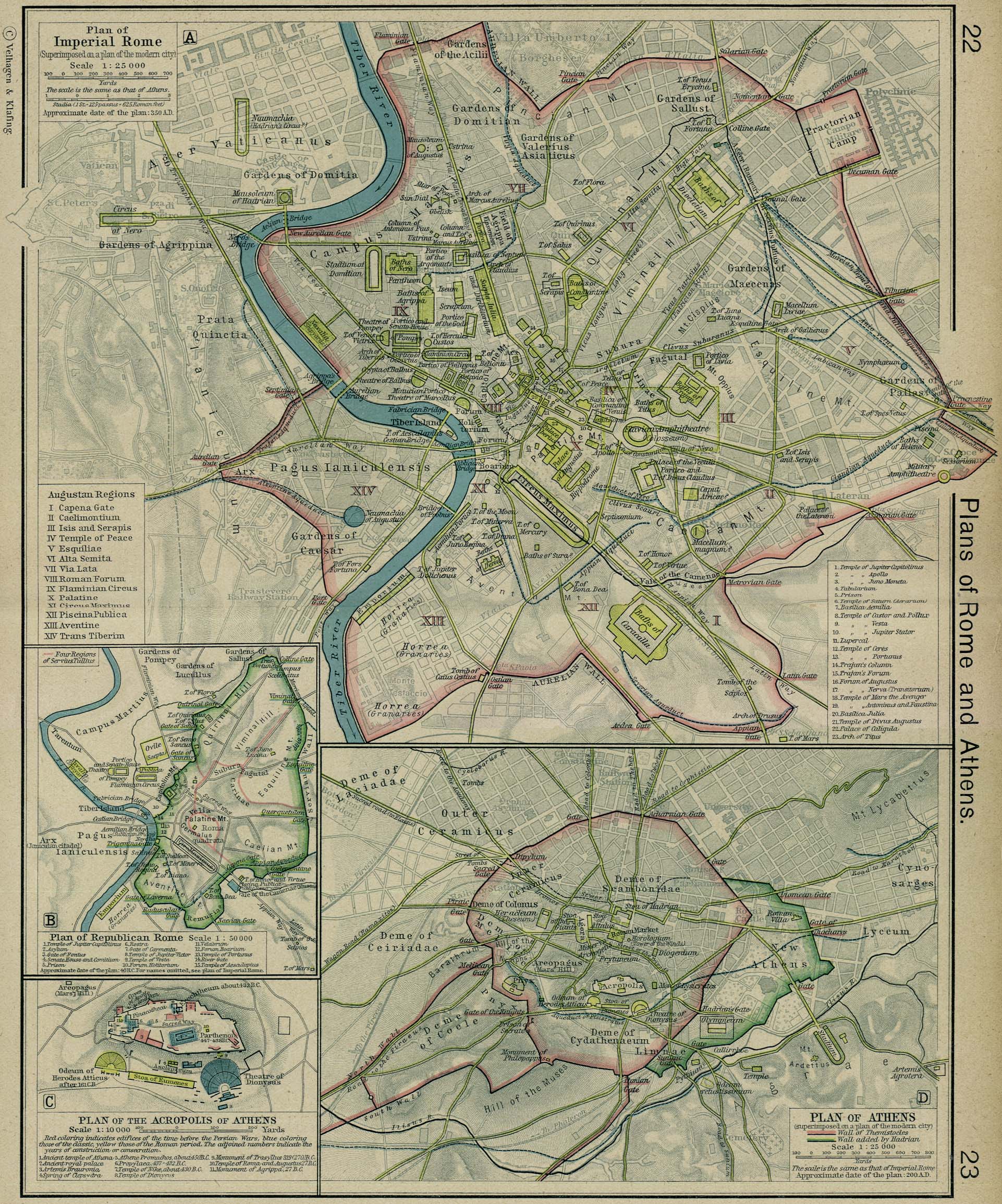
- Rome - Plans of Imperial and Republican Rome (991K)
- From The Historical Atlas by William R. Shepherd, 1923. Includes Plan of Athens.
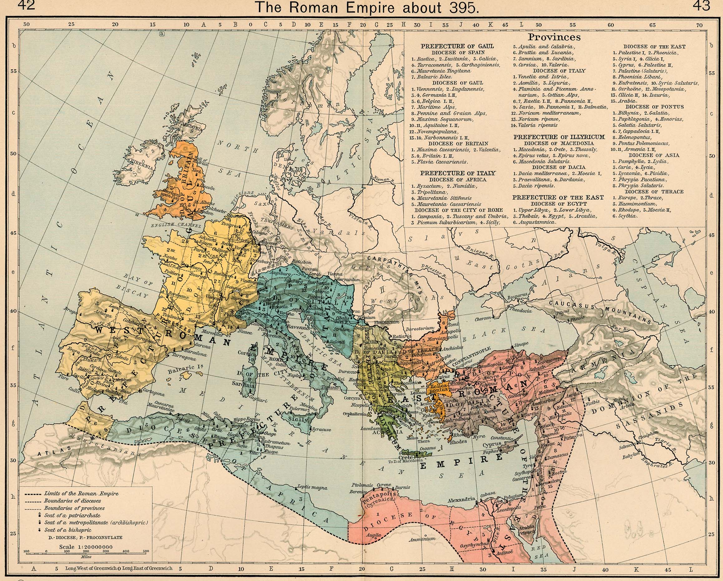
- The Roman Empire about 395 (827K)
- From The Historical Atlas by William R. Shepherd, 1911.
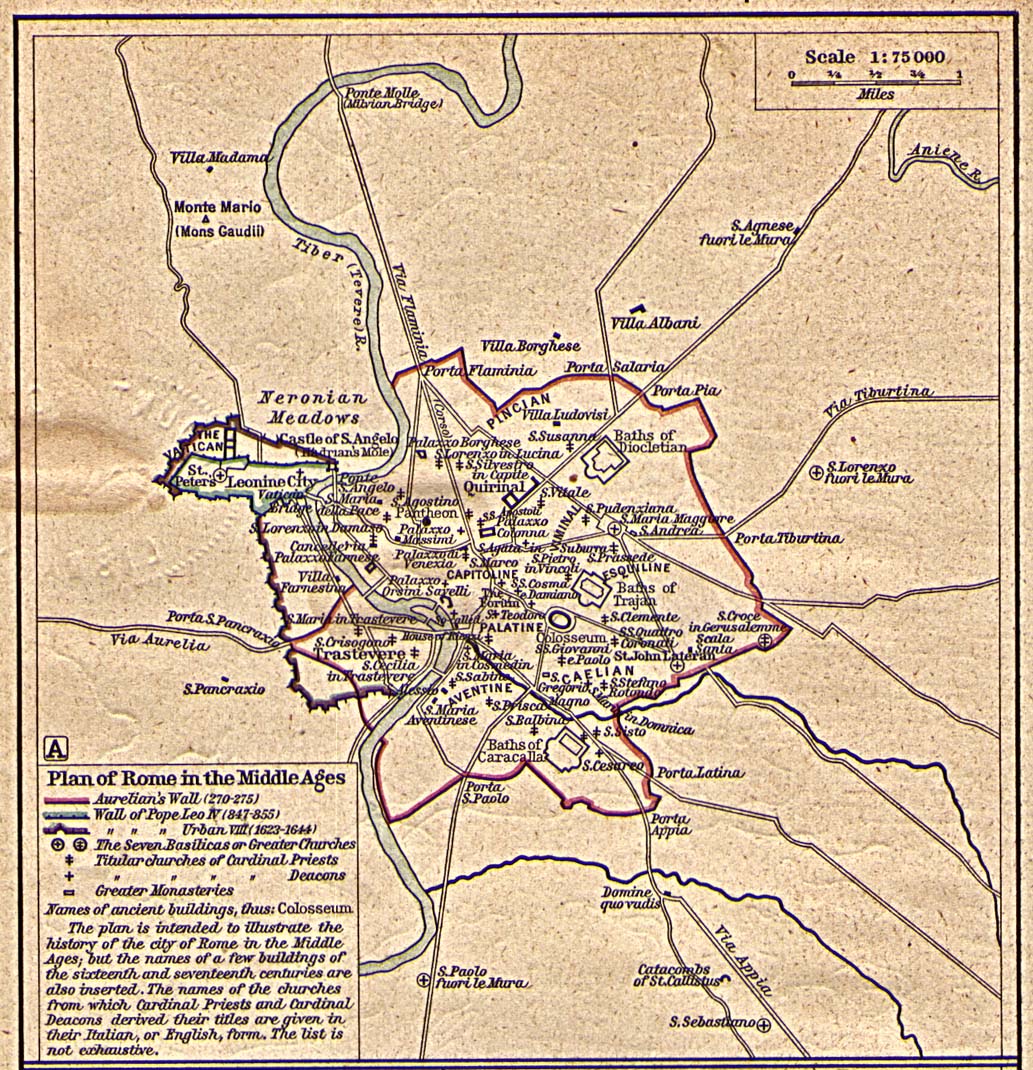
- Rome in the Middle Ages (452K)
- From The Historical Atlas by William R. Shepherd, 1923.
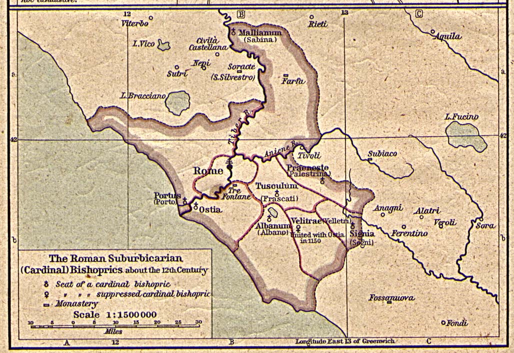
- Roman Suburbicarian (Cardinal) Bishoprics about the 12th Century (323K)
- From The Historical Atlas by William R. Shepherd, 1923.
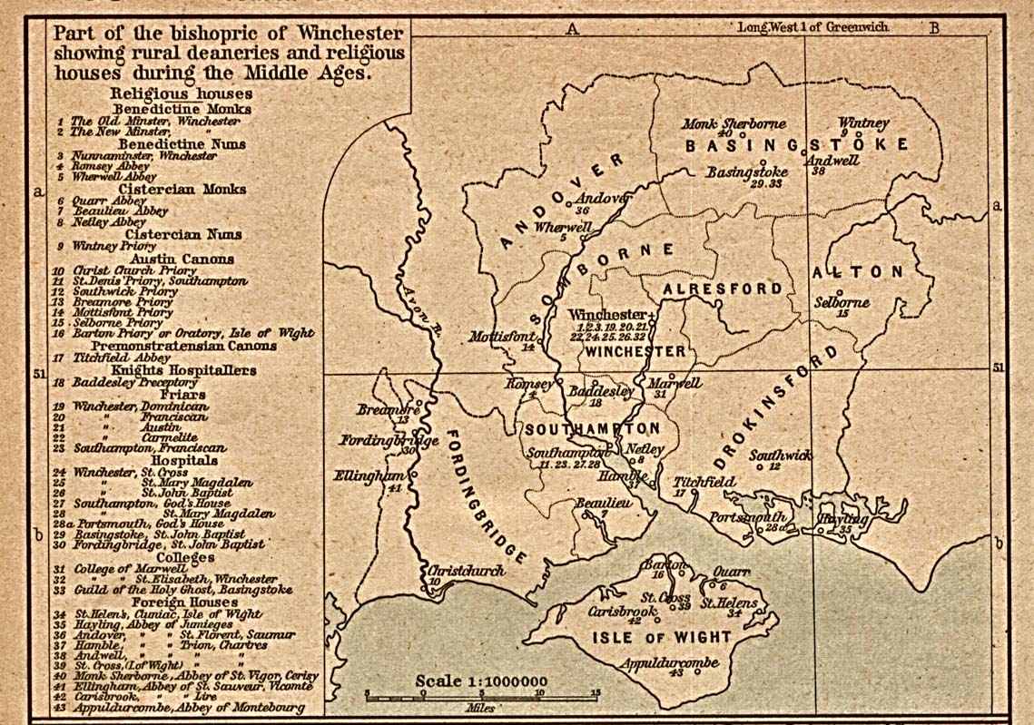
- Rural Deaneries (387K)
- Part of the bishopric of Winchester showing rural deaneries and religious houses during the Middle Ages. From Historical Atlas by William R. Shepherd, 1923.
- Santorin Island [Greece] 1848 (1.63MB)
- "Santorin Island Ancient Thera Surveyed by Captain Thomas Graves F.R.G.S. H.M.S. Volage 1848" from The Journal of the Royal Geographical Society, Volume 20, 1850 to accompany "Some Account of the Volcanic Group of Santorin or Thera, once called Calliste, or the Most Beautiful. By Lieut. E. M. Leycester, R.N."
- Settlements of Angles, Saxons and Jutes in Britain about 600 (323K)
- From The Historical Atlas by William R. Shepherd, 1923.
- Scotland 1808 (582K)
- From The General Gazetteer; or, Compendious Geographical Dictionary. Compiled by R. Brookes, Revised by W. Guthrie and E. Jones. Eighth Edition, Dublin, 1808.
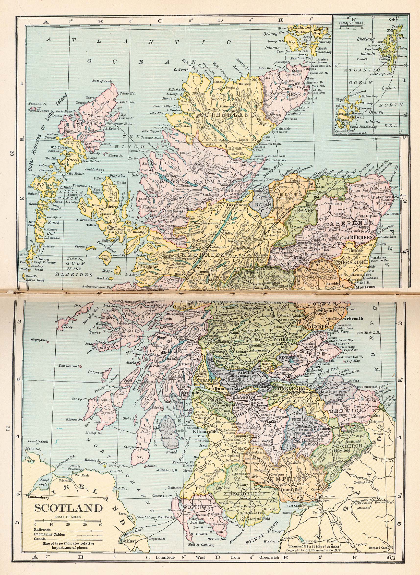
- Scotland (1067K)
- From Putnam's Handy Volume Atlas of the World. Published by G.P. Putnam's Sons, New York and London, 1921.
- Scottish Geographical Magazine
- Maps from the Scottish Geographical Magazine, Edinburgh University Press, Oxfordshire, UK: Routledge Taylor & Francis Group.
- [Spain] Hispania (612K)
- From A Classical Atlas of Ancient Geography by Alexander G. Findlay. New York: Harper and Brothers 1849.
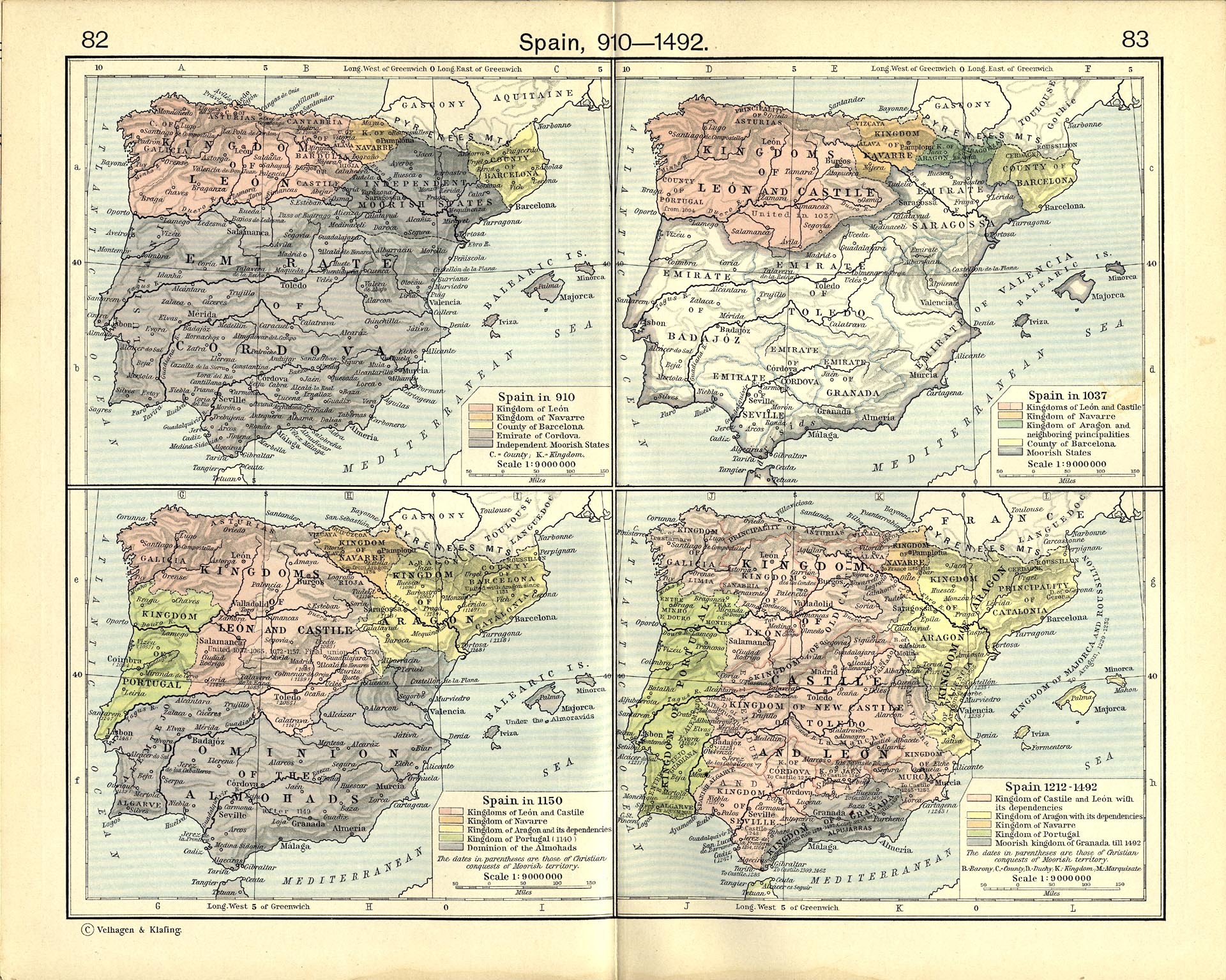
- Spain, 910-1492 (832K)
- Spain in 910. Spain in 1037. Spain in 1150. Spain 1212-1492.
- From The Historical Atlas by William R. Shepherd, 1926.
- From The Historical Atlas by William R. Shepherd, 1926.
- Spanish Kingdoms Circa 980 A.D. - 1556 A.D. (8 Maps)
- From the Atlas to Freeman's Historical Geography, Edited by J.B. Bury, Longmans Green and Co. Third Edition 1903.
- Spain and Portugal 1917 (855K)
- From The New Encyclopedic Atlas & Gazetteer of the World, Edited & Revised by Frances J. Reynolds.
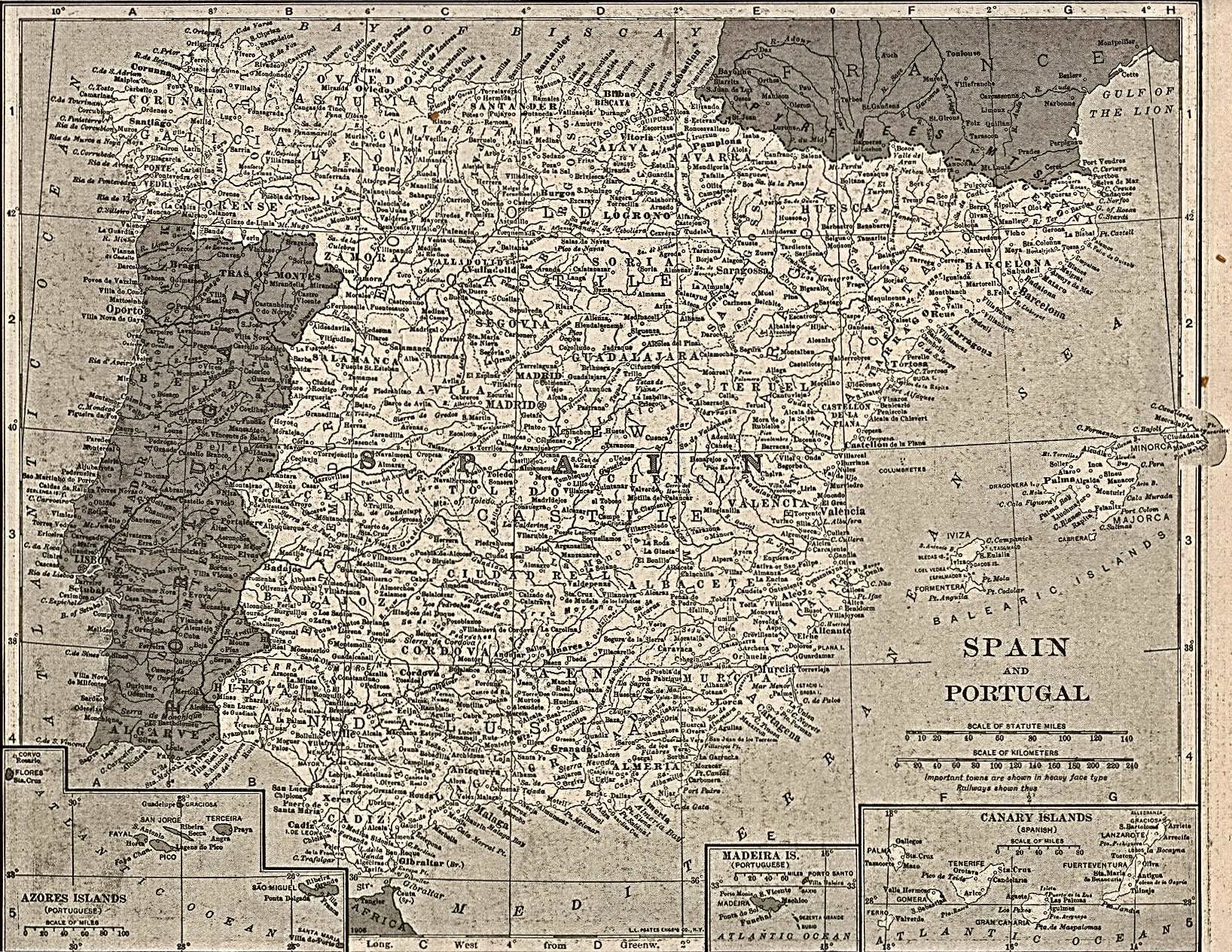
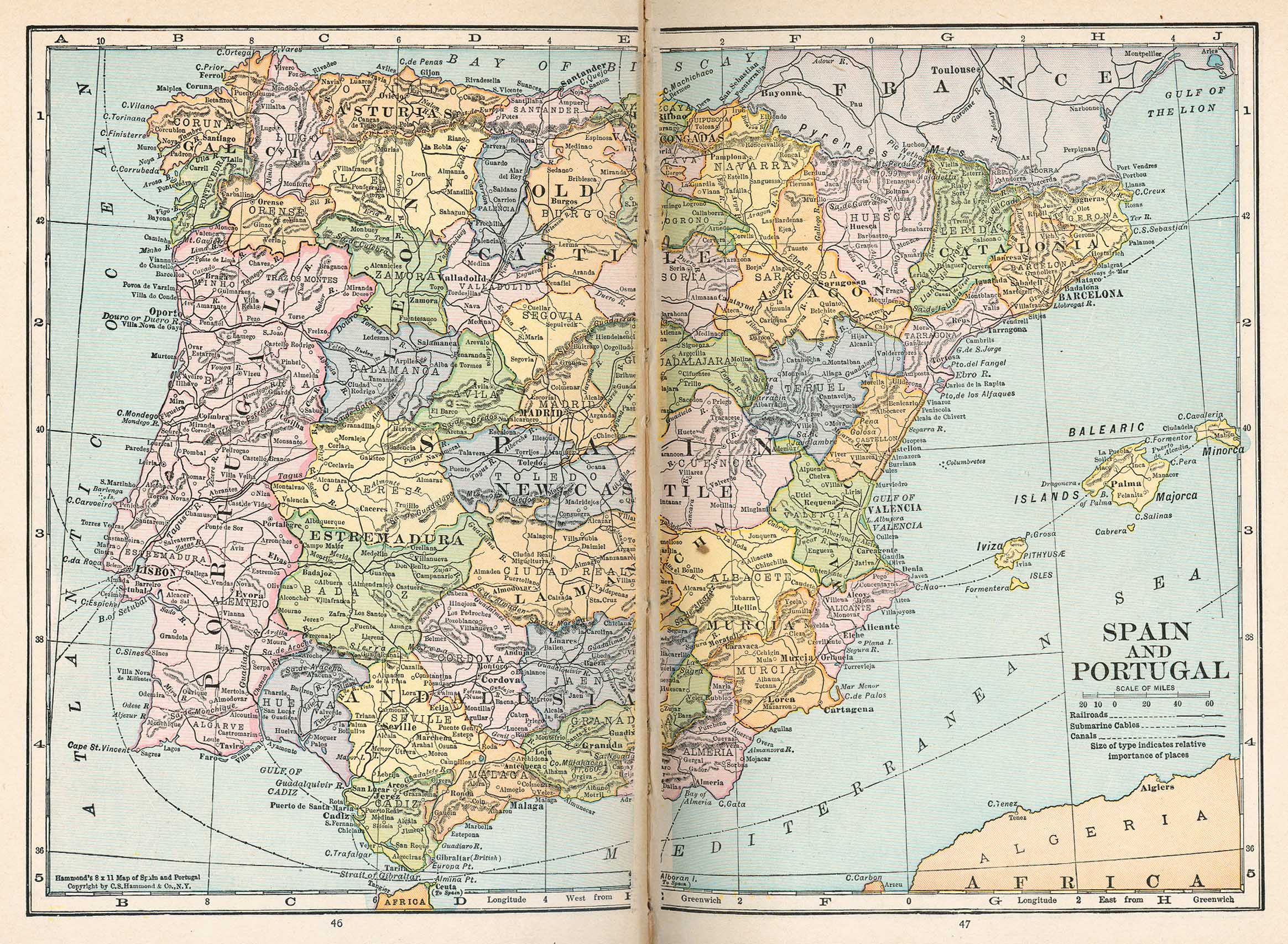
- Spain and Portugal (833K)
- From Putnam's Handy Volume Atlas of the World. Published by G.P. Putnam's Sons, New York and London, 1921.
- South East Europe Circa 900 A.D. - 1888 A.D. (16 Maps)
- From the Atlas to Freeman's Historical Geography, Edited by J.B. Bury, Longmans Green and Co. Third Edition 1903.
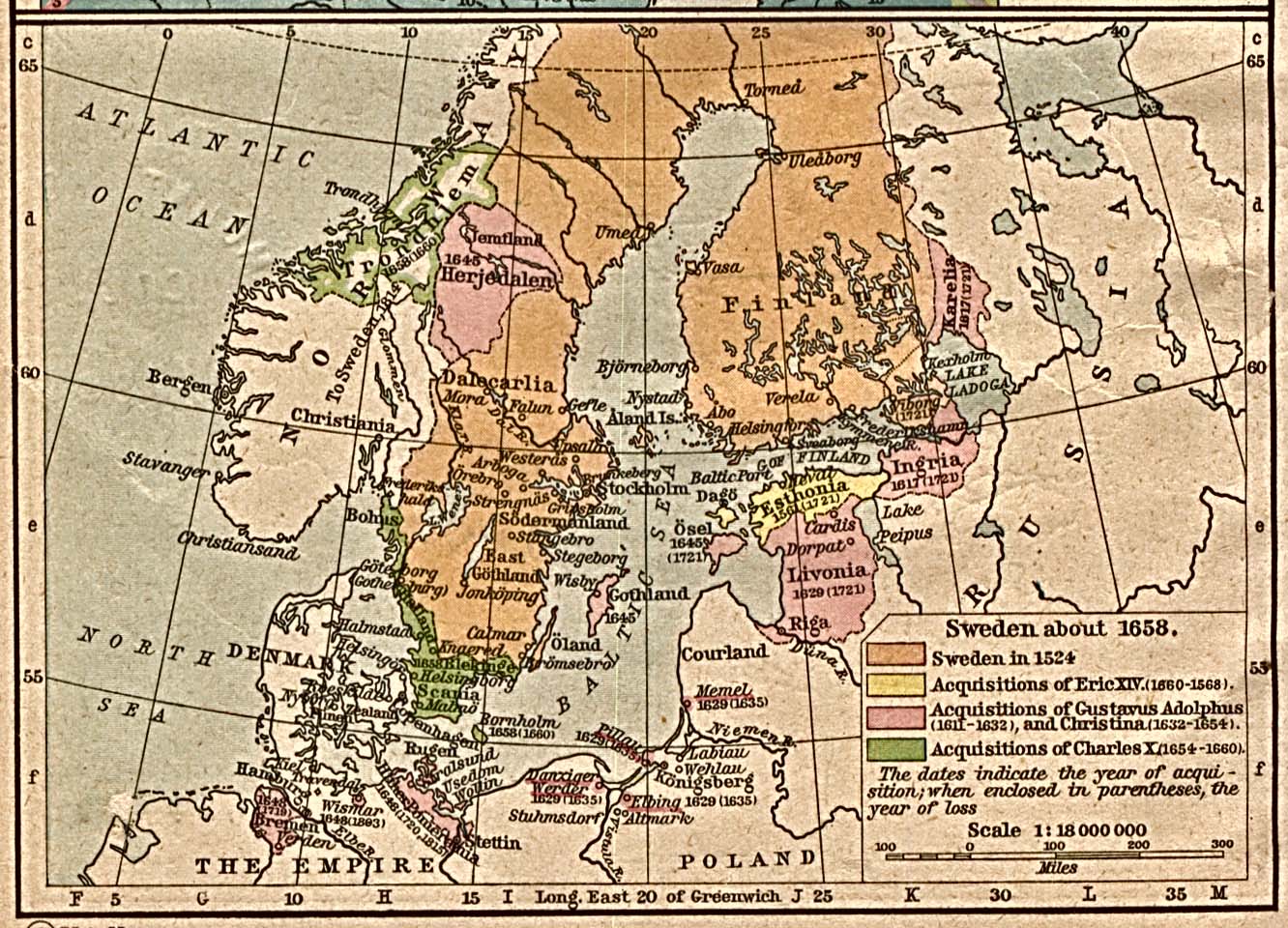
- Sweden about 1658 (387K)
- From The Historical Atlas by William R. Shepherd, 1923.
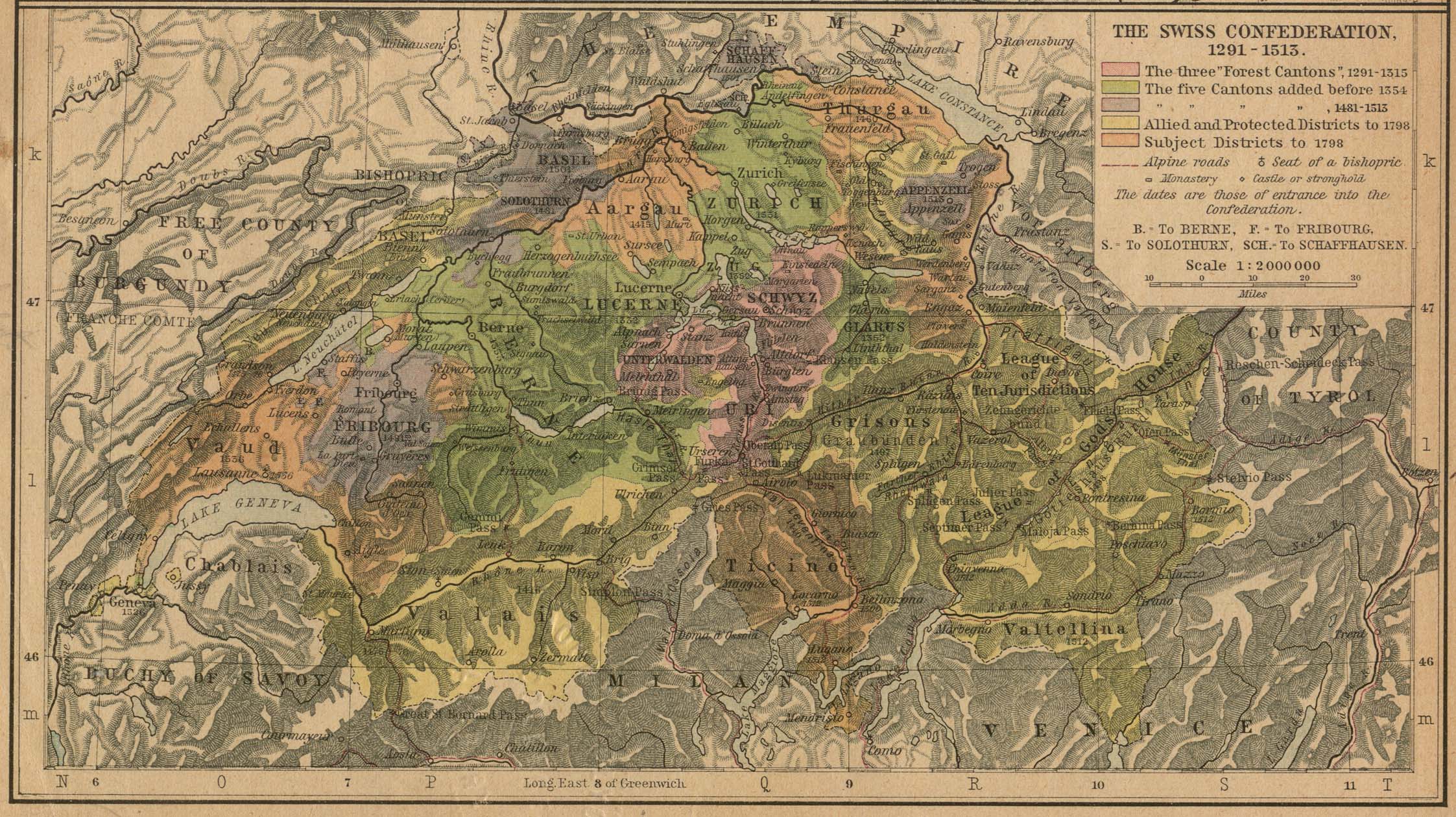
- The Swiss Confederation, 1291-1513 (710K)
- From The Historical Atlas by William R. Shepherd, 1923.
- Thames River 1882 (982K)
- "River Thames with the Docks from Woolwich to the Tower" from A Dictionary Practical, Theoretical, and Historical of Commerce and Commercial Navigation by J.R. M'Culloch. Longmans, Green and Co. London, 1882.
- Torino [Turin] 1913 (765K)
- From Baedeker's Northern Italy Handbook For Travellers by Karl Baedeker, Fourteenth Remodelled Edition 1913.
- Treaty Adjustments, 1814,1815 (516K)
- Inset: Fortresses along the French Frontier. From The Historical Atlas by William R. Shepherd, 1923.
- Treaty of the Pyrenees 1659 (194K)
- Treaty Adjustments, 1648-1660. Treaty of Pyrenees, 1659; Peace of Roeskilde-Oliva, 1658,1660. From The Historical Atlas by William R. Shepherd, 1923.
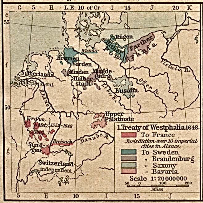
- Treaty of Westphalia 1648 (258K)
- Treaty Adjustments, 1648-1660. Treaty of Westphalia 1648. From The Historical Atlas by William R. Shepherd, 1923.
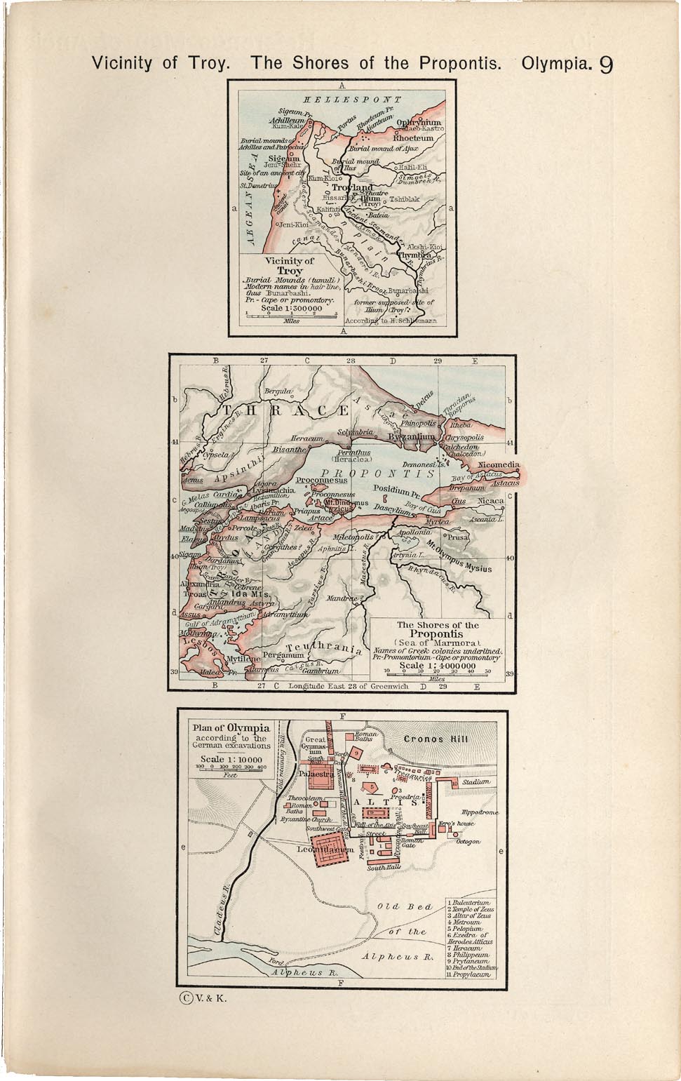
- Vicinity of Troy. The Shores of the Propontis. Plan of Olympia (240K)
- From The Historical Atlas by William R. Shepherd, 1911.
- Venetian Republic (619K)
- "Carte des Etats de la Republique de Venise" from Histoire de la Republique de Venise by P. Daru. Chez Firmin Didot, 1819.
- Venetian Republic (575K)
- "Carte de L'Ancienne Venetie" from Histoire de la Republique de Venise by P. Daru. Chez Firmin Didot, 1819.
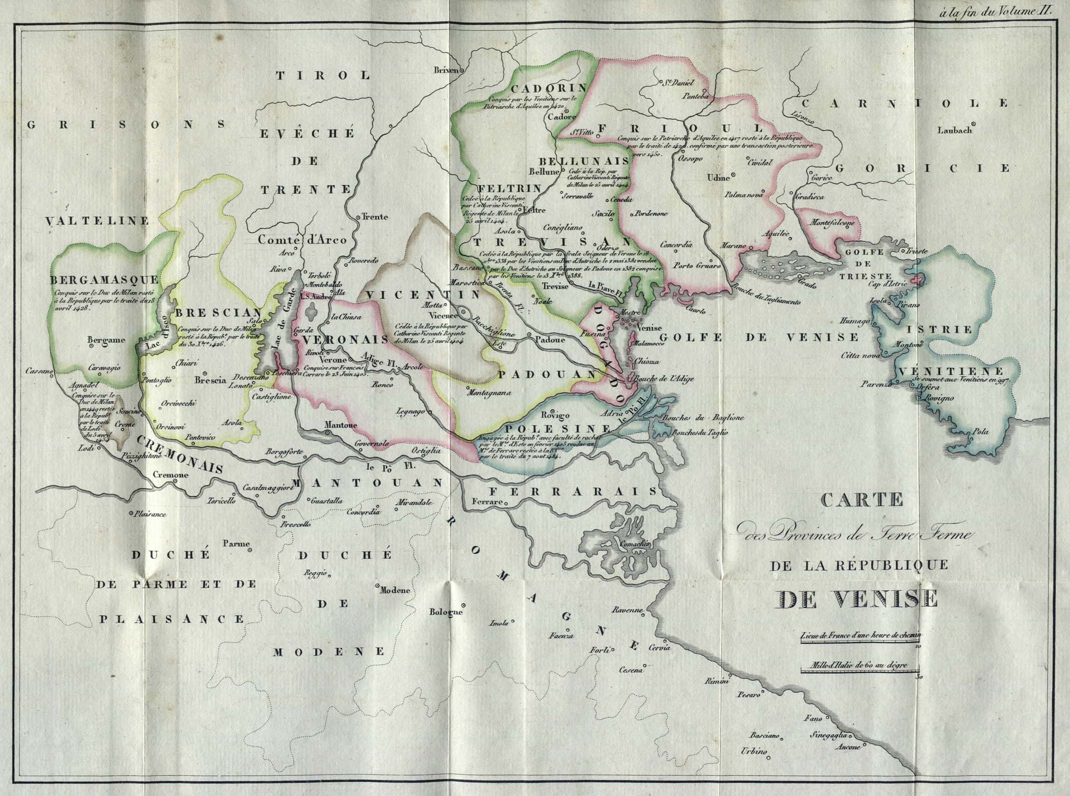
- Venetian Republic (404K)
- "Carte des Provinces de Terre Ferme de la Republique de Venise" from Histoire de la Republique de Venise by P. Daru. Chez Firmin Didot, 1819.
- Venezia [Venice] 1913 (808K)
- From Baedeker's Northern Italy Handbook For Travellers by Karl Baedeker, Fourteenth Remodelled Edition 1913.
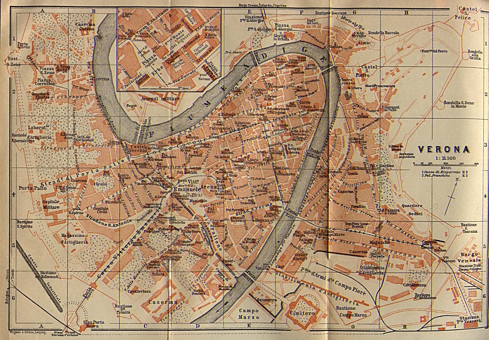
- Verona 1913 (612K)
- From Baedeker's Northern Italy Handbook For Travellers by Karl Baedeker, Fourteenth Remodelled Edition 1913.
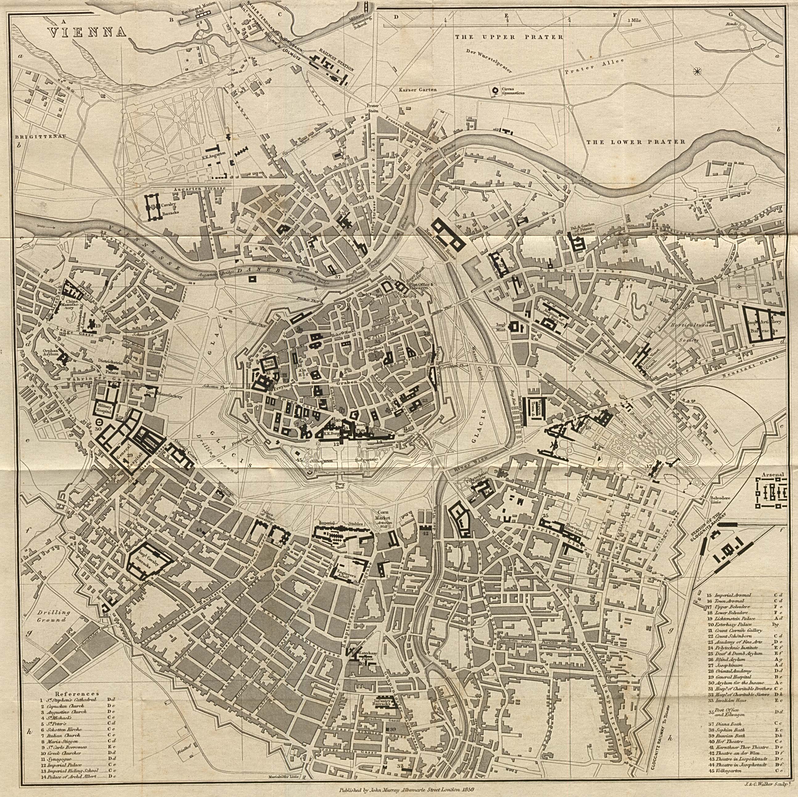
- Vienna 1858 (1.74MB)
- From A Handbook for Travellers in Southern Germany, Eighth Edition. London: John Murray. 1858.
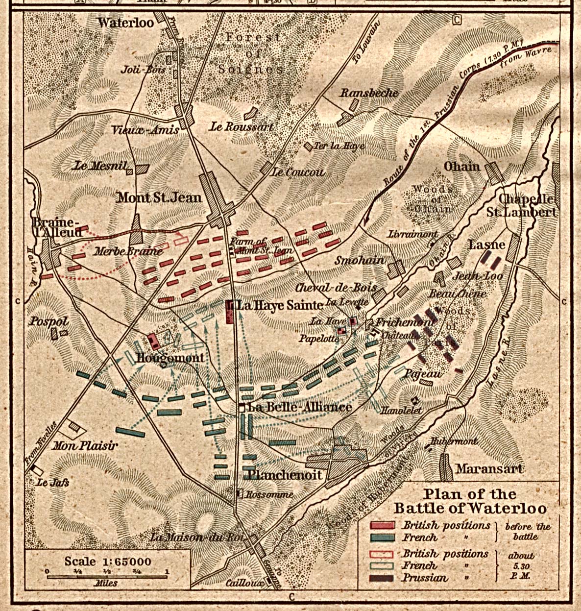
- Waterloo, Battle Plan (581K)
- From The Historical Atlas by William R. Shepherd, 1923.
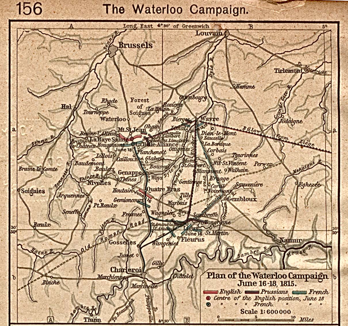
- Waterloo Campaign, June 16-18, 1815 (516K)
- From The Historical Atlas by William R. Shepherd, 1923.
- War in Maps, 1939-1940
- Selected maps from "The War in Maps", Edited by Giselher Wirsing, New York, German Library of Information, 1941.
- Western Empire Circa 843 A.D. - 887 A.D. (3 Maps)
- From the Atlas to Freeman's Historical Geography, Edited by J.B. Bury, Longmans Green and Co. Third Edition 1903.
- World War I - Summary of Operations in the World War - Maps (92 Maps)
- American Battle Monuments Commission, 1944
- World War II Maps of the European Theater (20 Maps)
A, B, C, D, E, F, G, H, I, J, K, L, M, N, O, P, Q, R, S, T, U, V, W, X, Y, Z
![Le Alpi [The Alps]](le_alpi_1899.jpg)
![Britannia [Ancient British Islands]](ancient_britannia_1852.jpg)
![Europe [Crusades Era]](crusades_1905.jpg)
![Firenze [Florence] 1913](firenze_italy_1913.jpg)
![Genova [Genoa] 1913](genova_italy_1913.jpg)
![Germania [Ancient Germany]](ancient_germania.jpg)
![[Germany] The Holy Roman Empire under the Hohenstaufen, 1138-1254](shepherd/roman_empire_1138_1254.jpg)
![[Greece] Hellas and Peloponneseus](hellas_peloponneseus_1884.jpg)
![Hispania [Ancient Spain]](ancient_hispania_1849.jpg)
![Ischl [Bad Ischl, Austria] 1911](ischl_1911.jpg)
![Italia [Ancient Italy]](italia_1849.jpg)
![Milano [Milan] 1913](milano_1913.jpg)
![Ottoman Empire [1683-1923]](shepherd/ottoman1683_shepherd.jpg)
![Santorin Island [Greece] 1848](santorin_island_1848.jpg)
![Torino [Turin] 1913](torino_1913.jpg)
![Venezia [Venice] 1913](venezia_italy_1913.jpg)