Perry-Castañeda Library
Map Collection
The Public Schools Historical Atlas by C. Colbeck
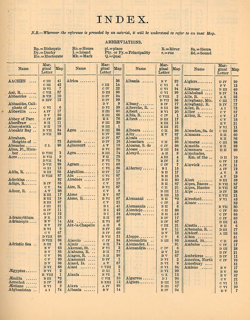
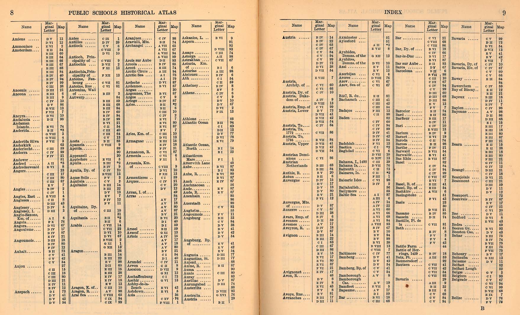
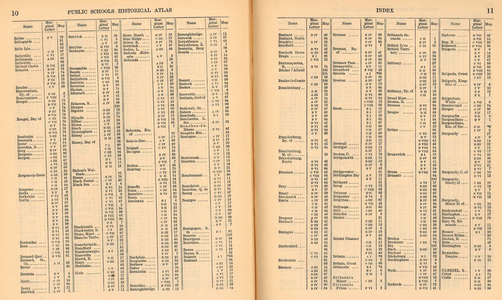
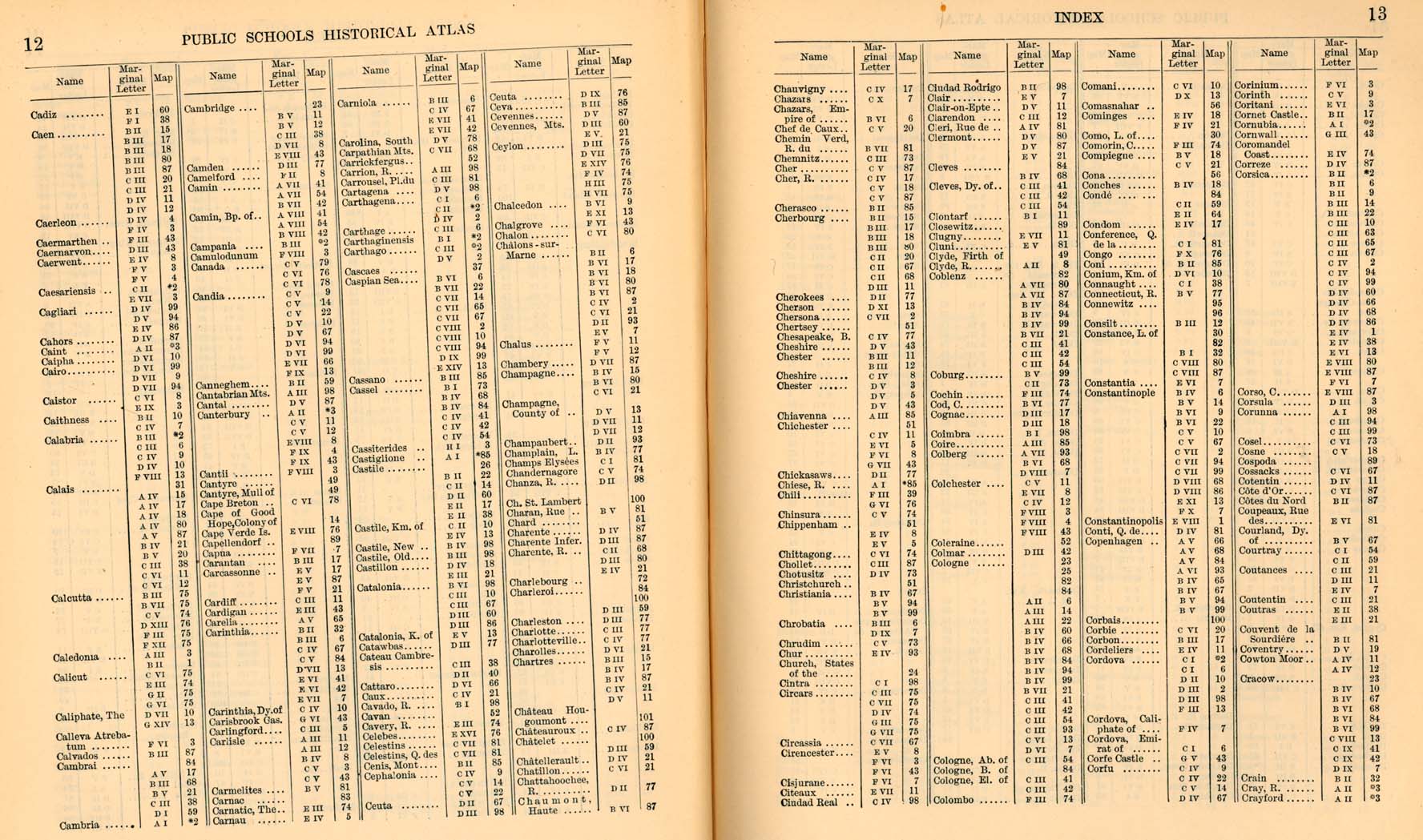
The following maps are from "The Public Schools Historical Atlas" by Charles Colbeck. Longmans, Green; New York; London; Bombay. 1905. Users can access the index to locate place names within the atlas.
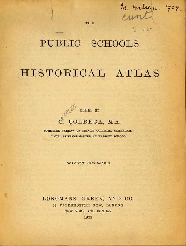
- Title Page (620K) p.1
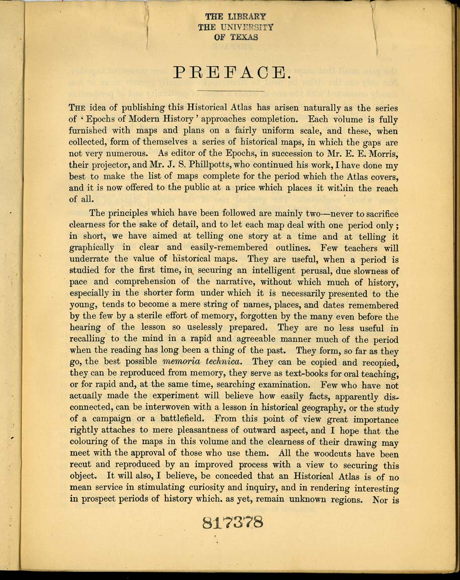
- Preface (248K) p.3
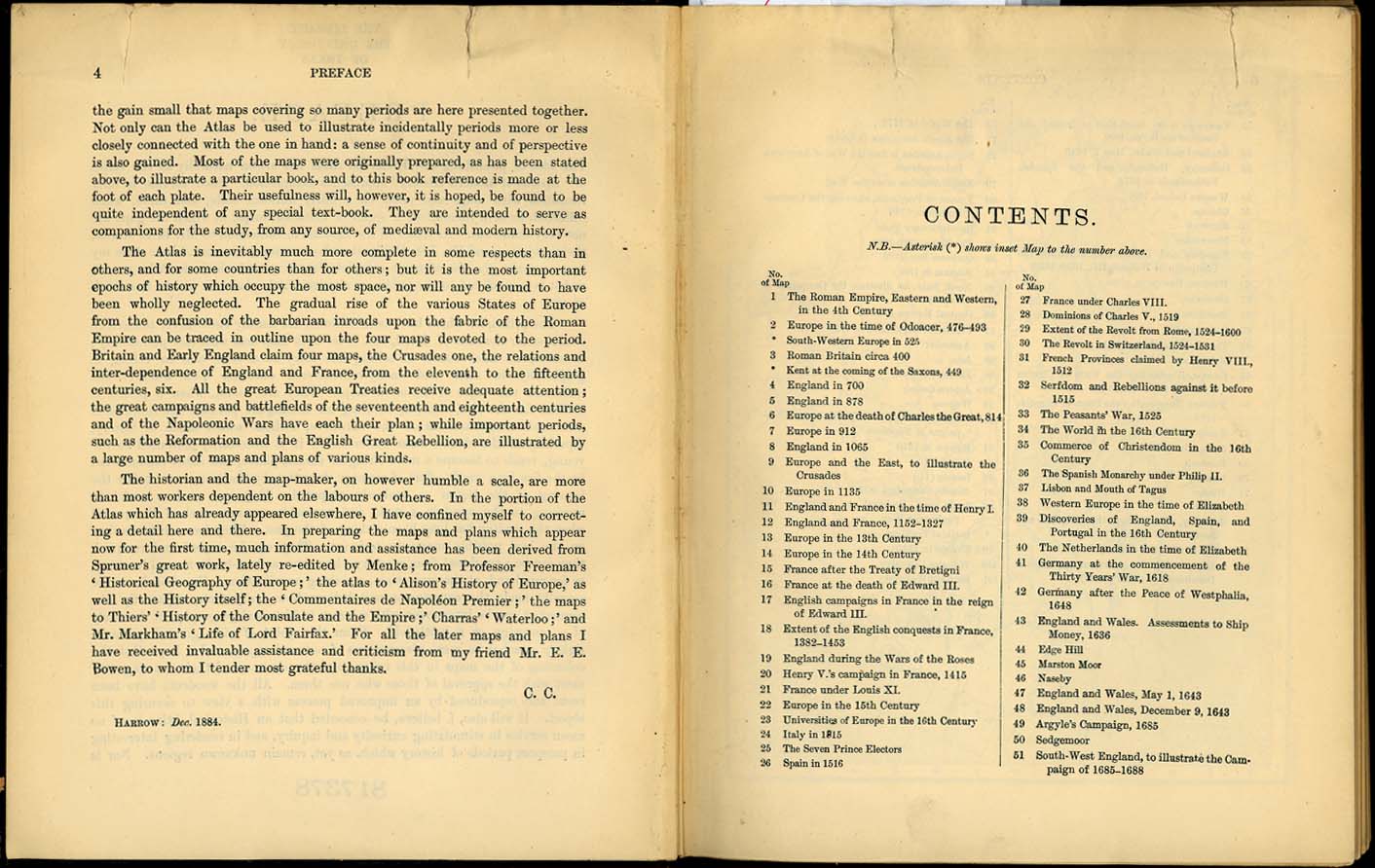
- Preface and Table of Contents (211K) p.4-5
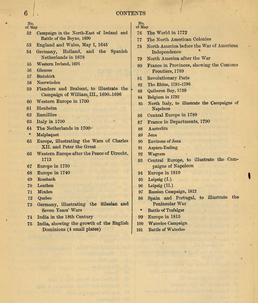
- Table of Contents (154K) p.6
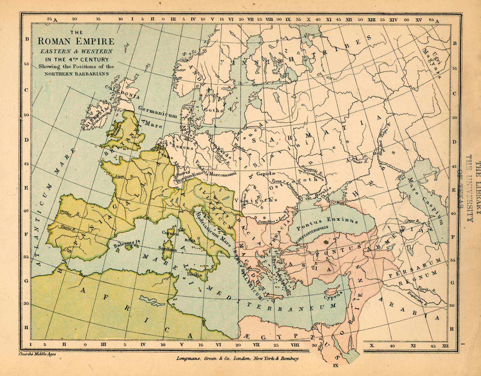
- The Roman Empire, Eastern and Western, in the 4th Century (368K) Map 1
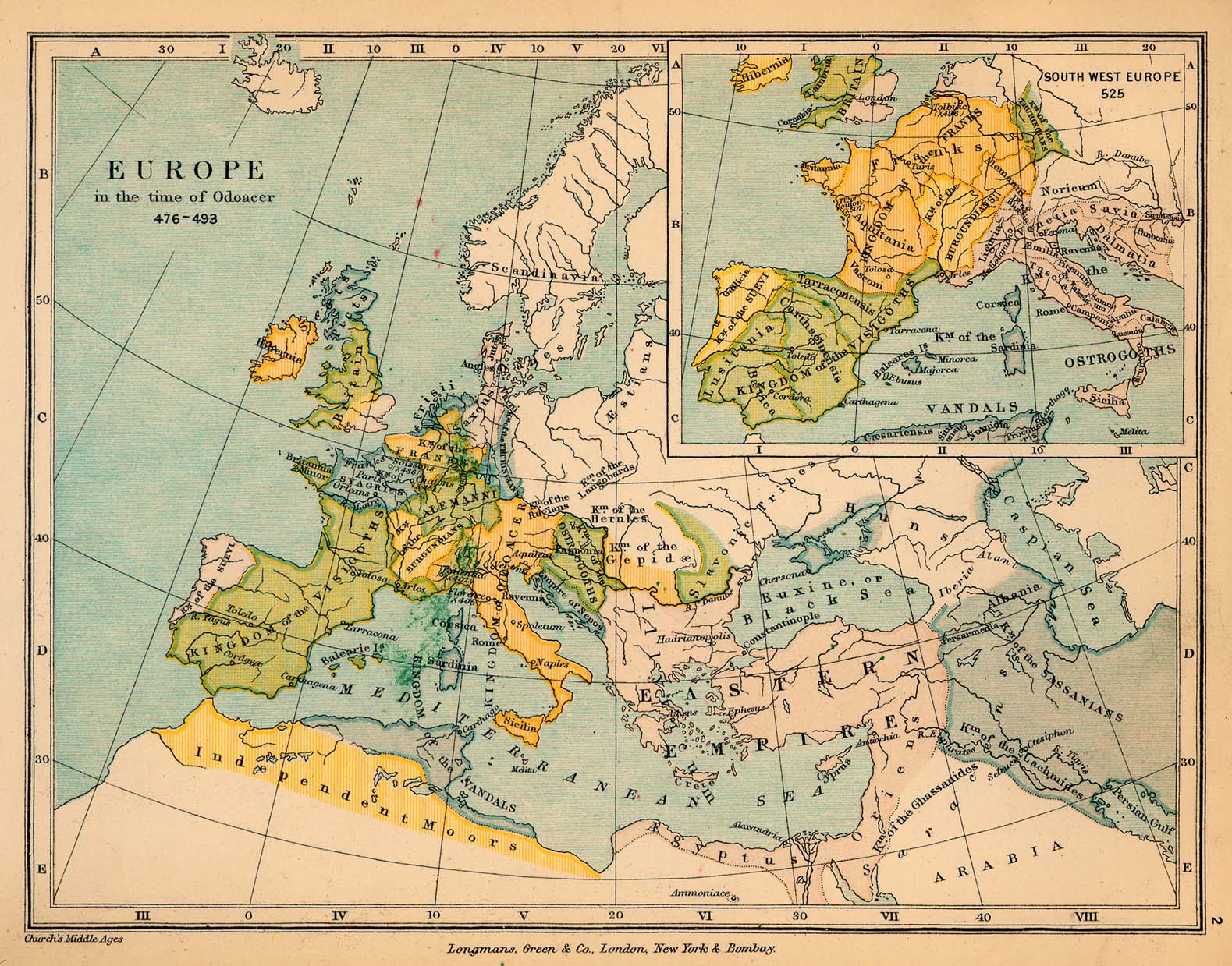
- Europe in the time of Odoacer, 476-493 (454K) Map 2
- Inset: South-Western Europe in 525
- Roman Britain Circa 400 (307K) Map 3
- Inset: Kent at the coming of the Saxons in 525
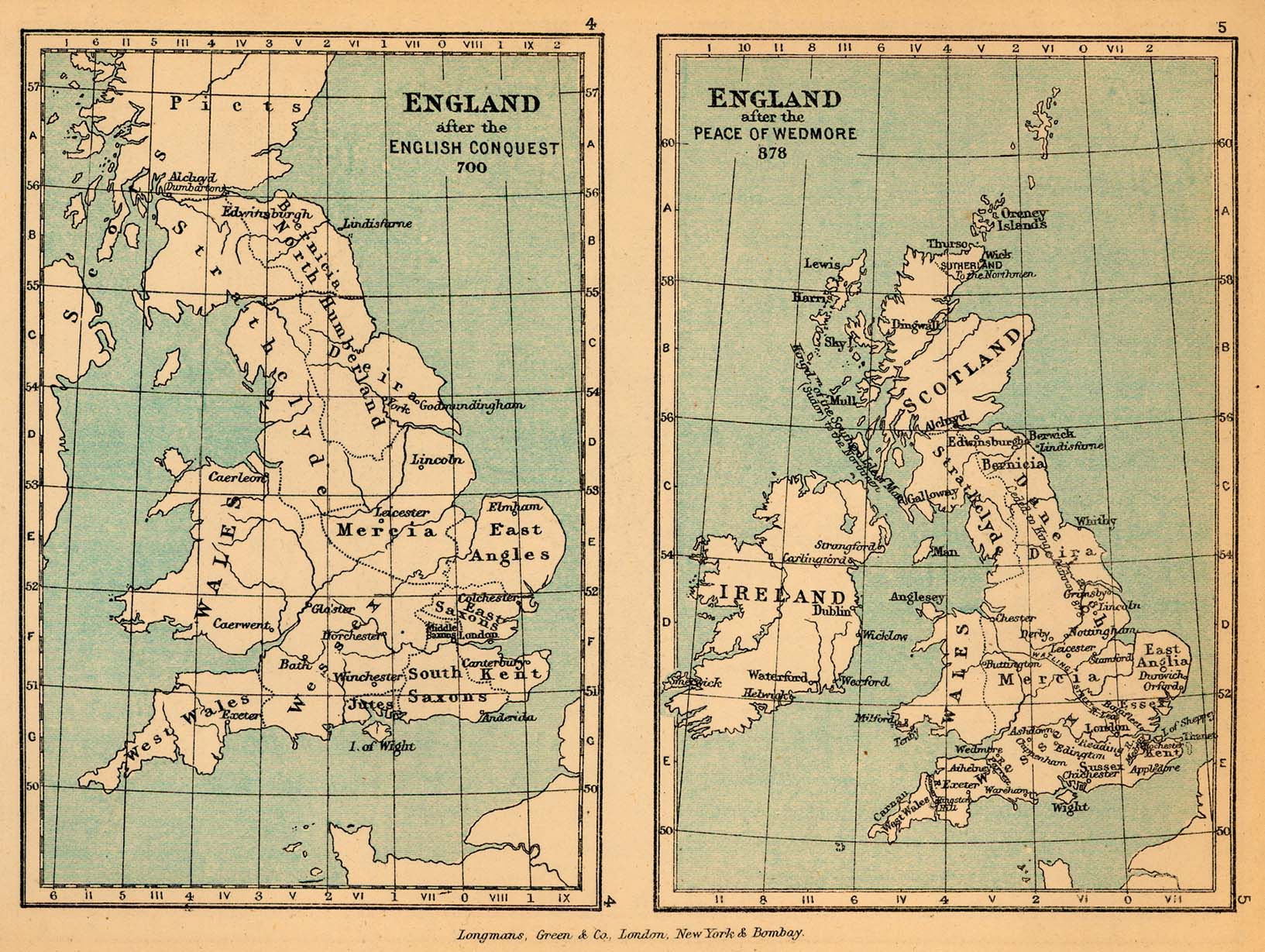
- England in 700 and 878 (409K) Maps 4-5
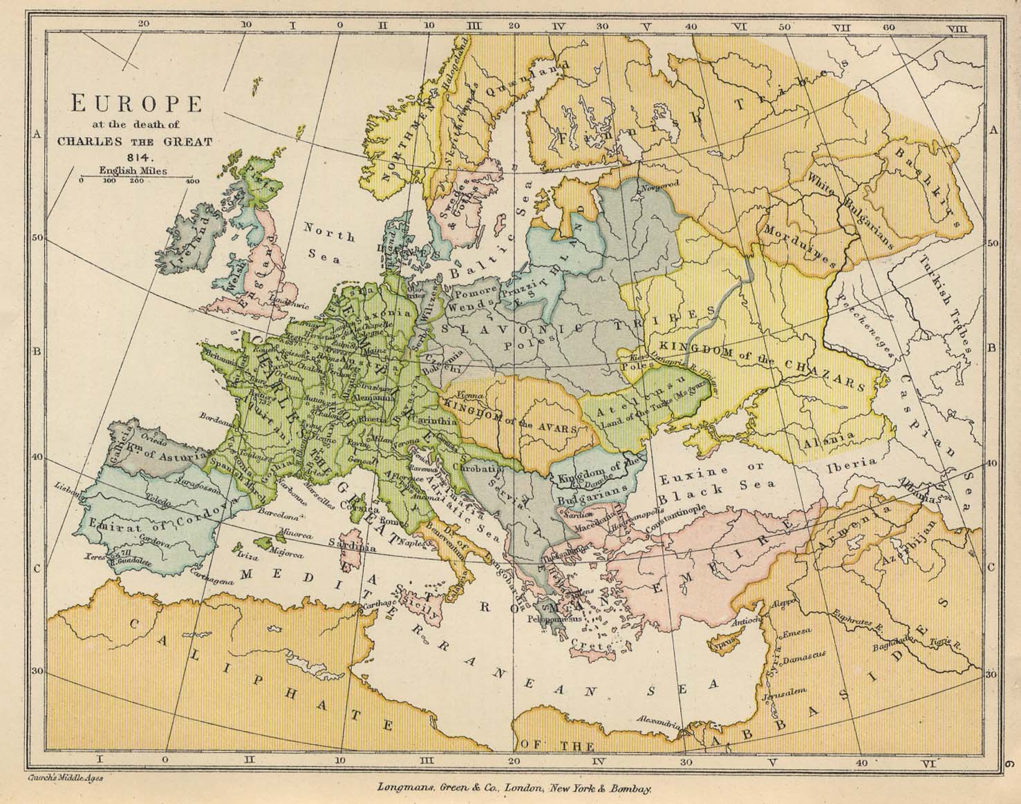
- Europe at the death of Charles the Great, 814 (302K) Map 6
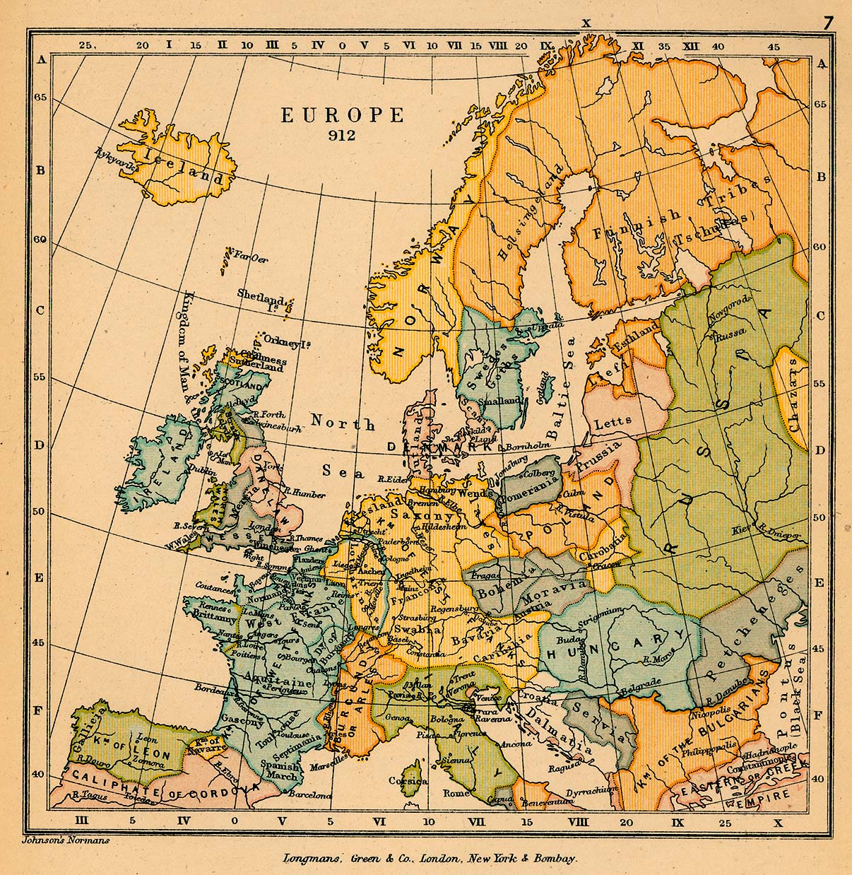
- Europe in 912 (529K) Map 7
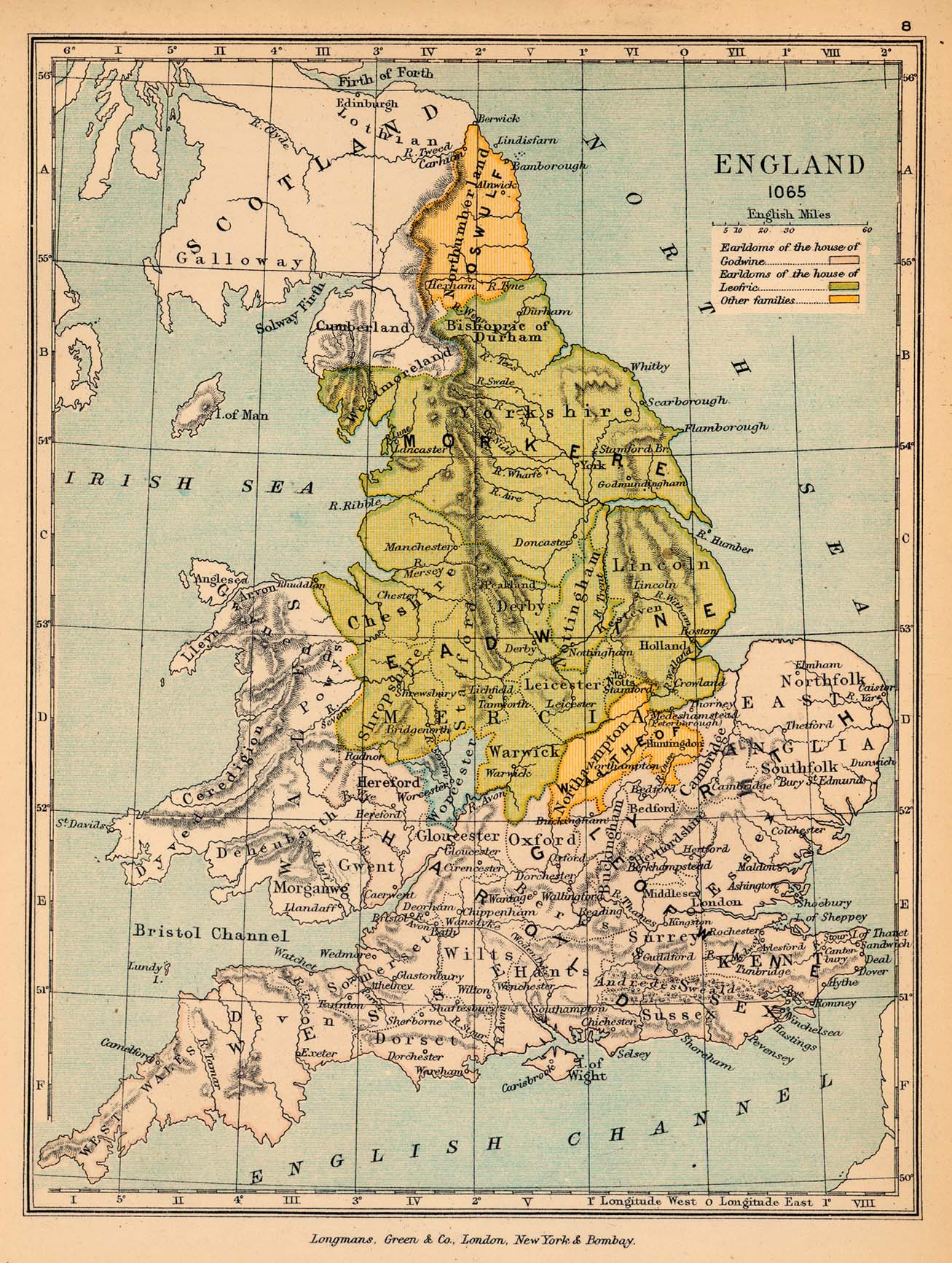
- England in 1065 (513K) Map 8
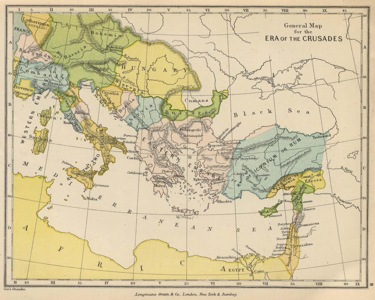
- Europe and the East, to Illustrate the Crusades (253K) Map 9
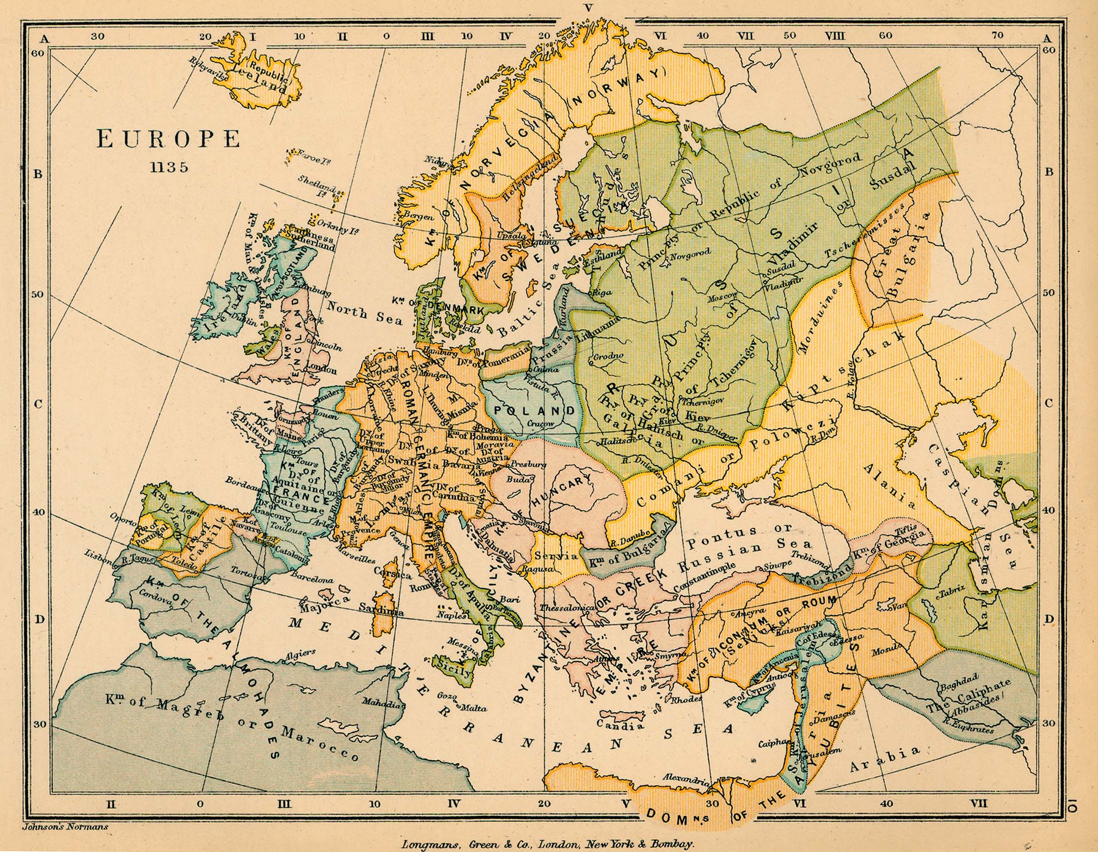
- Europe in 1135 (724K) Map 10
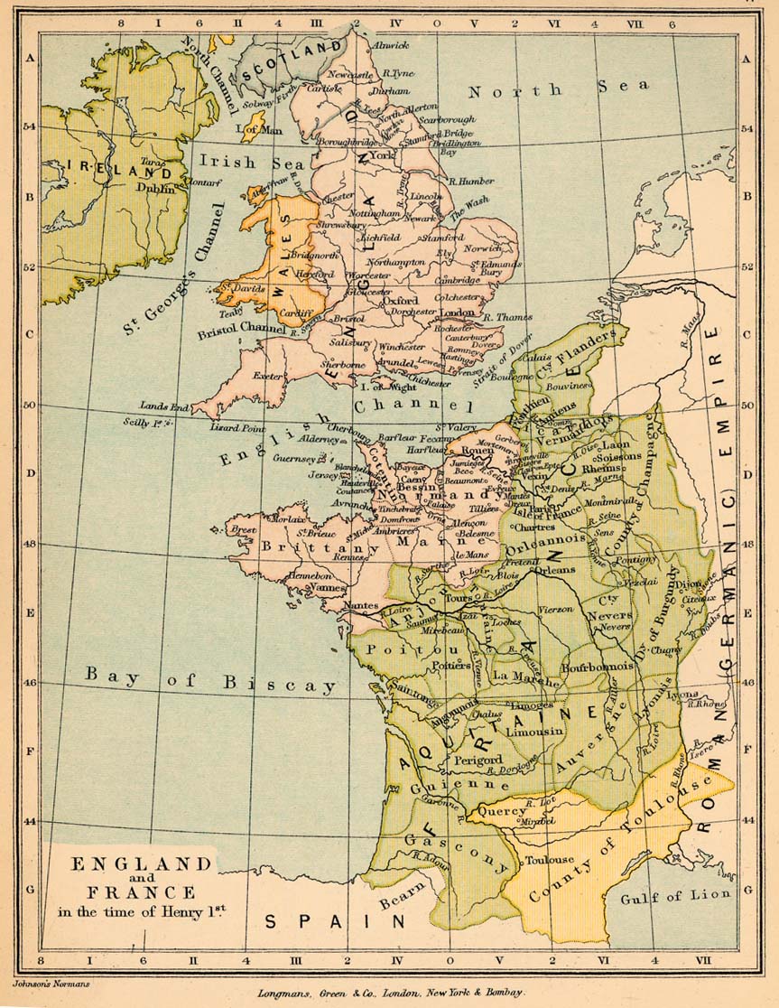
- England and France in the time of Henry I (257K) Map 11
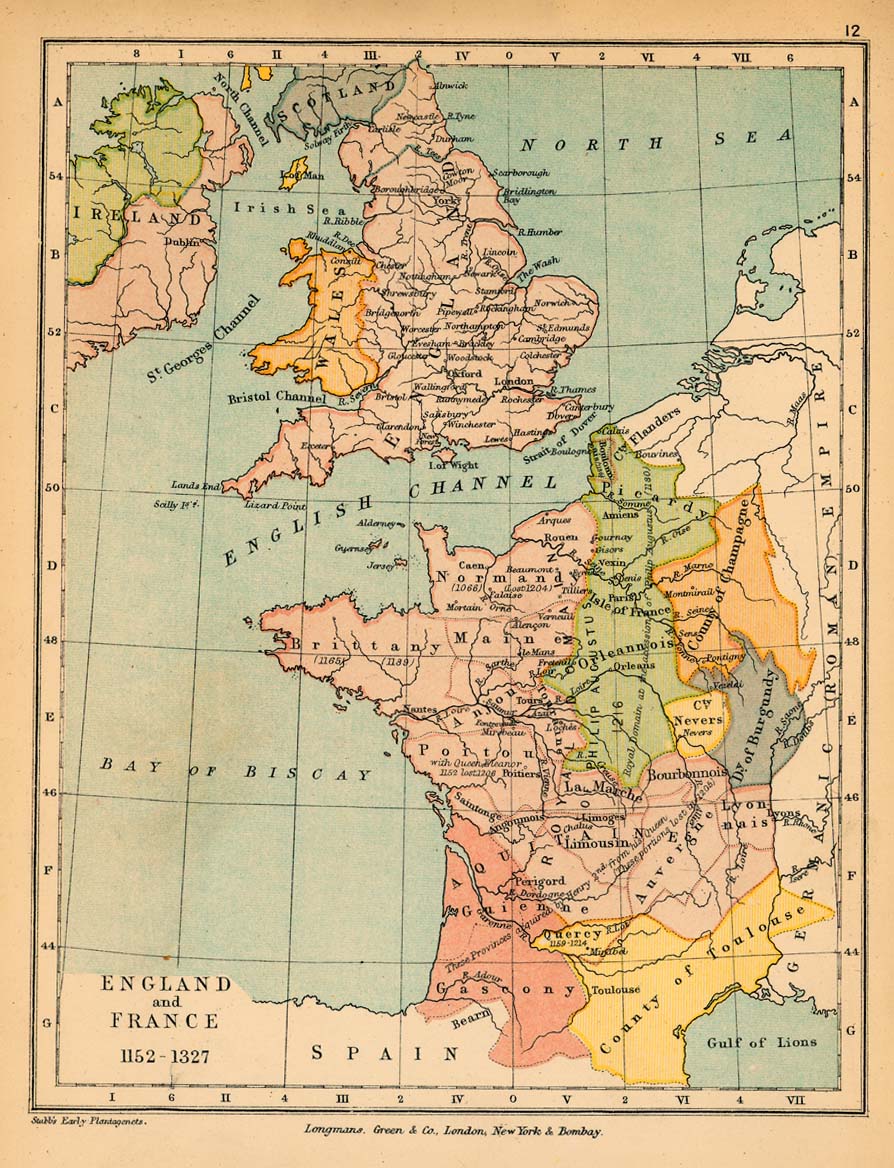
- England and France, 1152-1327 (264K) Map 12
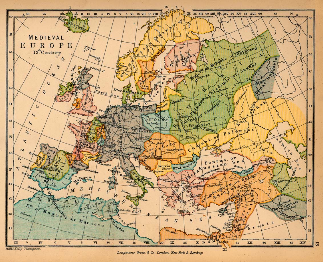
- Medieval Europe in the 13th Century (328K) Map 13
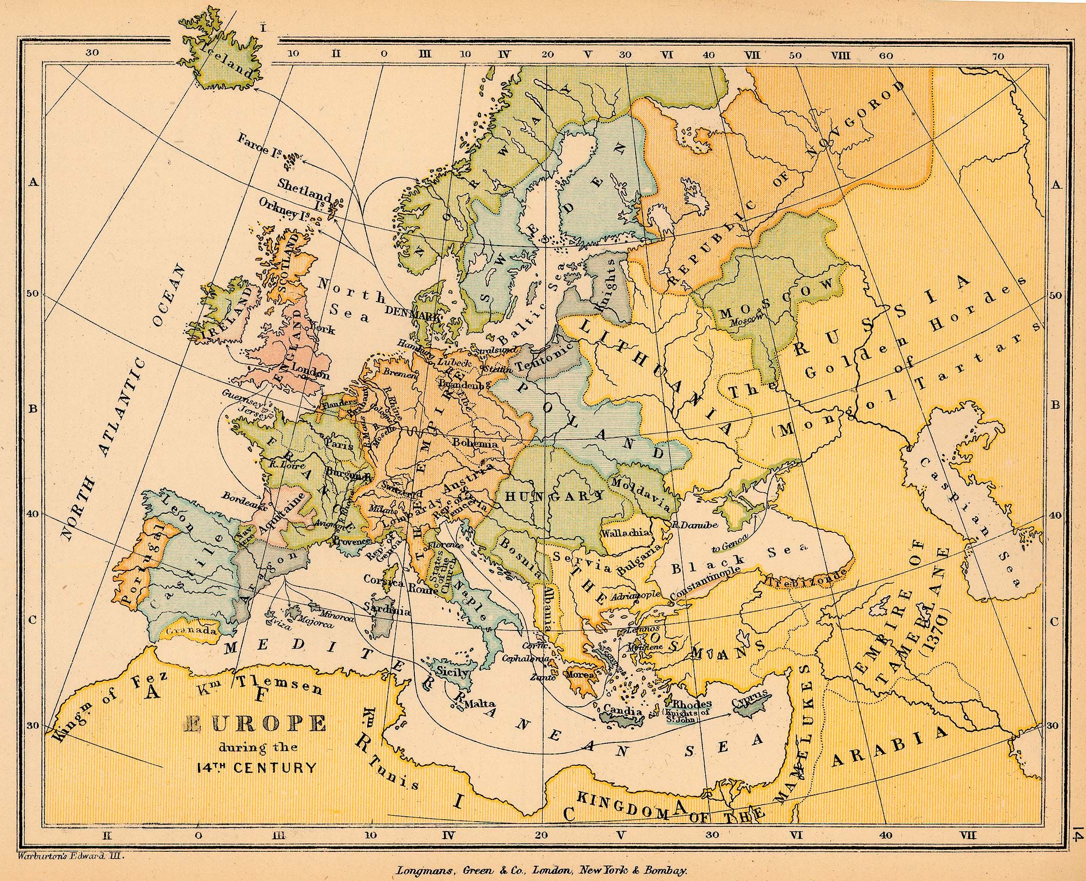
- Europe in the 14th Century (1,020K) Map 14
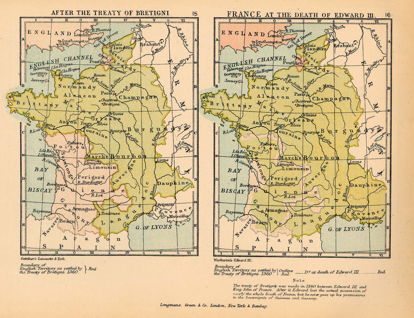
- France after the Treaty of Bretigni, and France at the Death of Edward III (417K) Maps 15-16
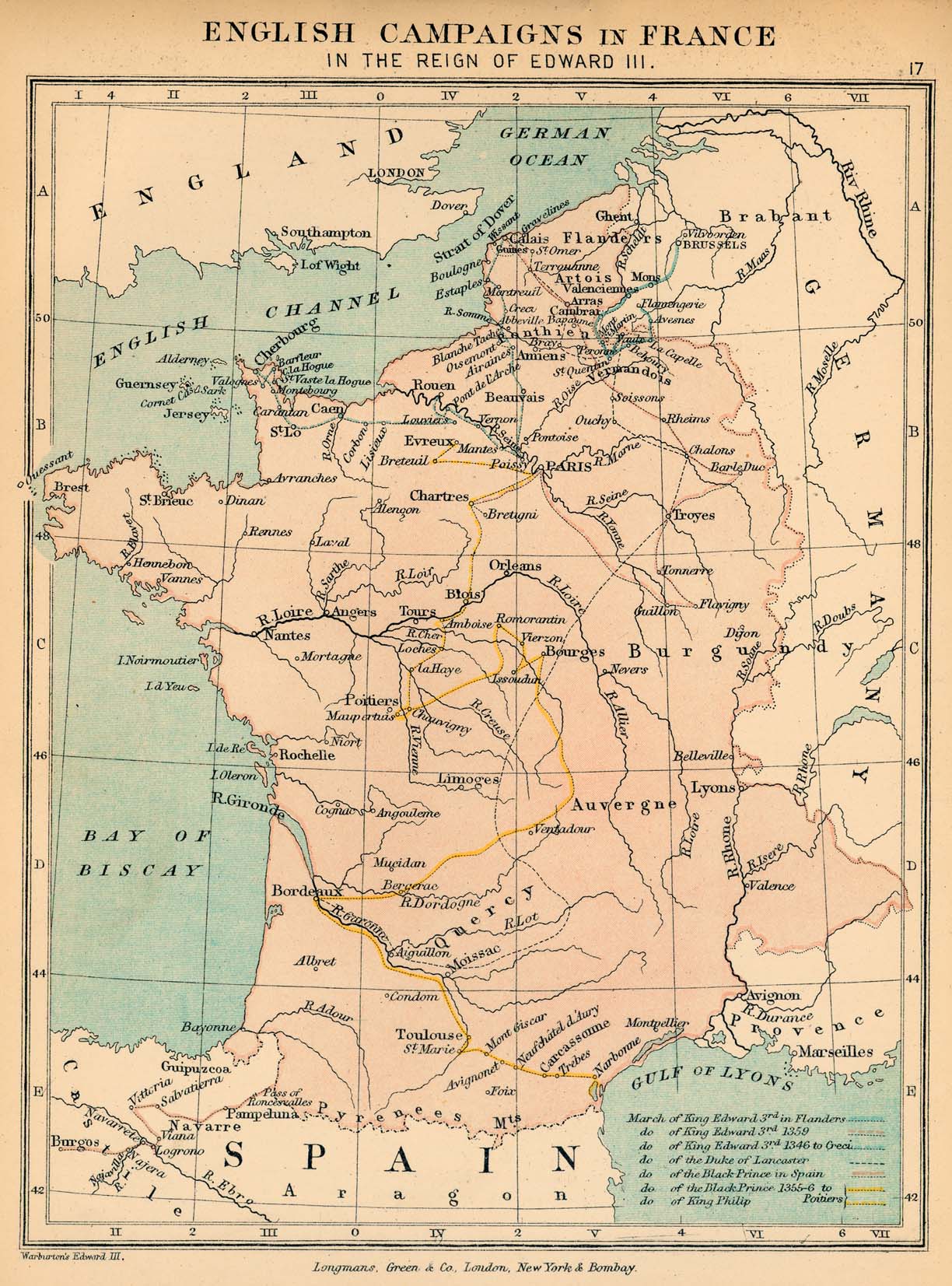
- English Campaigns in France in the Reign of Edward III (398K) Map 17
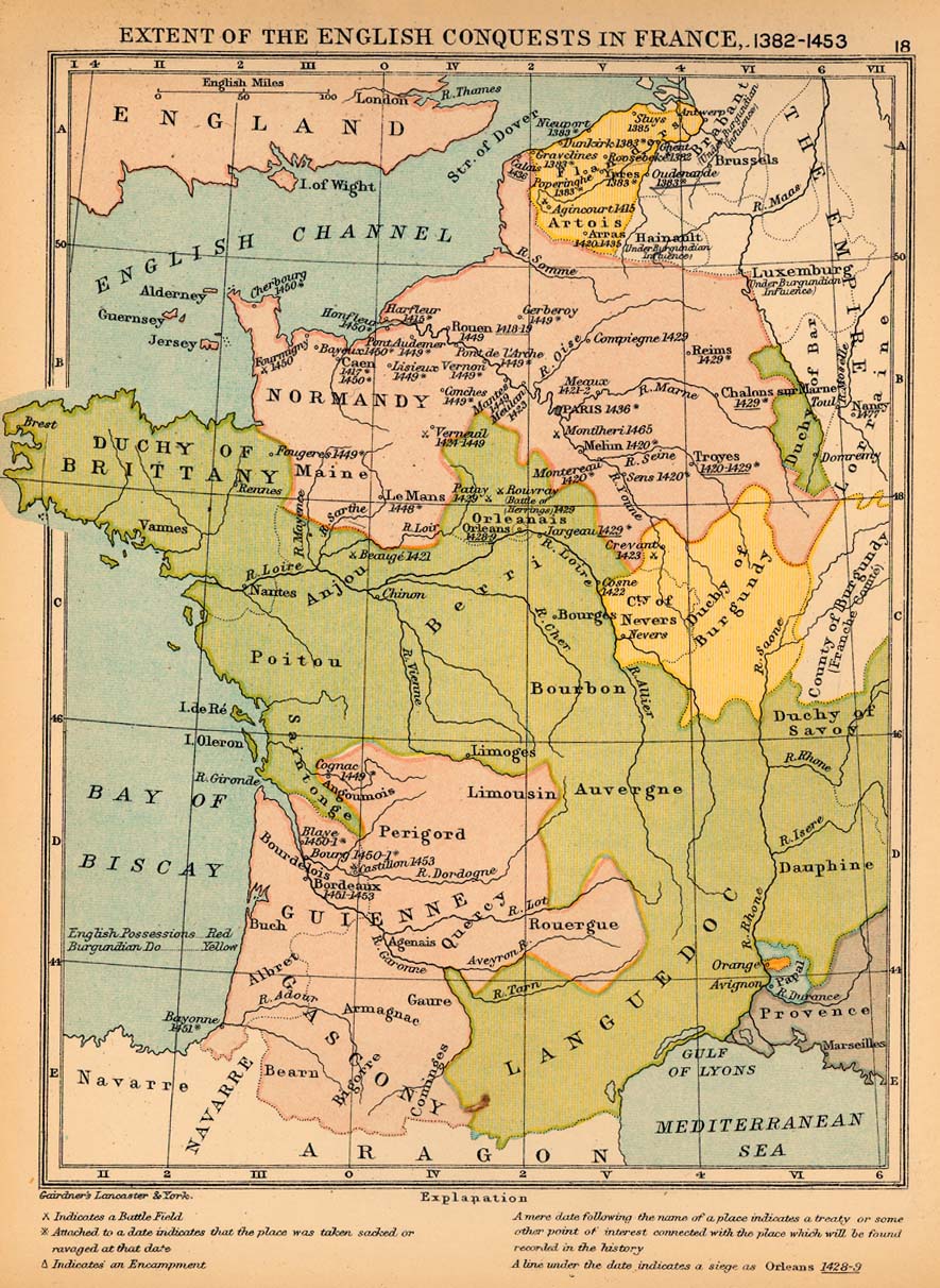
- Extent of the English Conquests in France, 1382-1453 (295K) Map 18
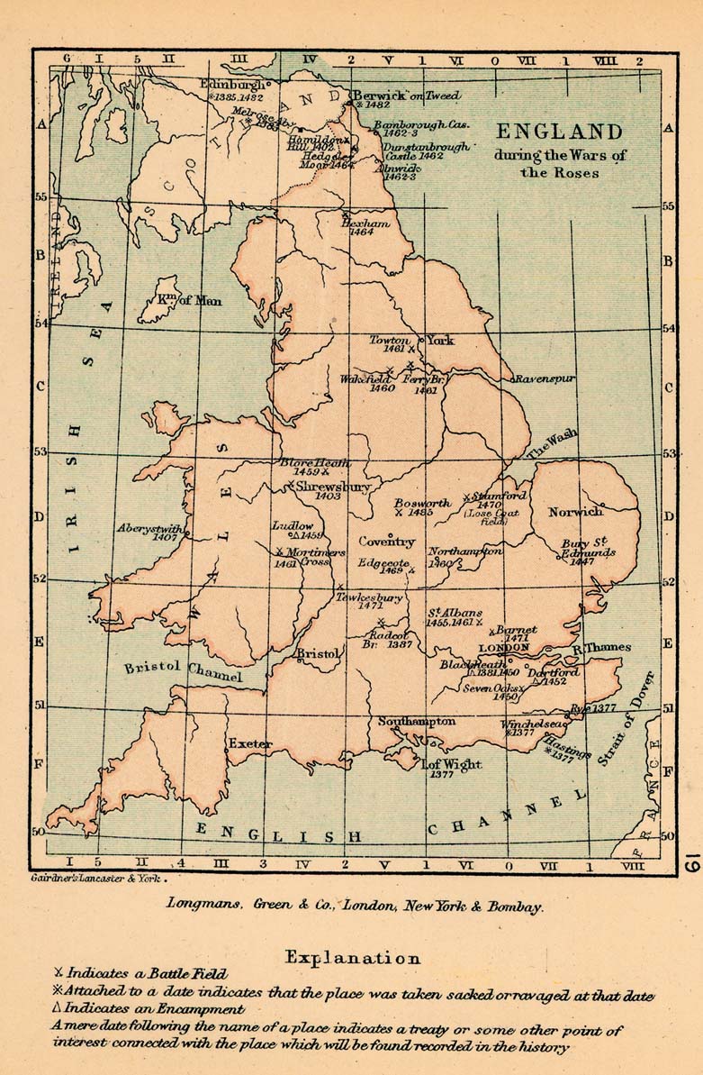
- England during the Wars of the Roses (246K) Map 19
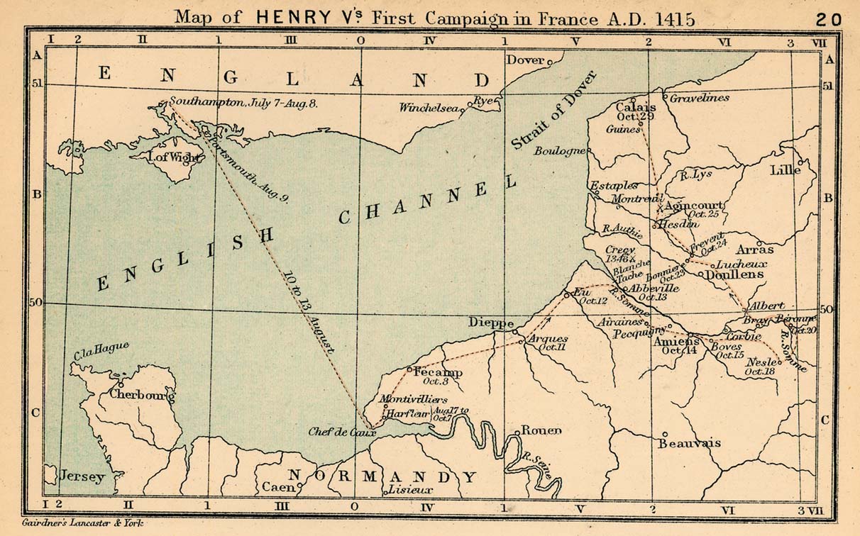
- Henry V's First Campaign in France, 1415 (219K) Map 20
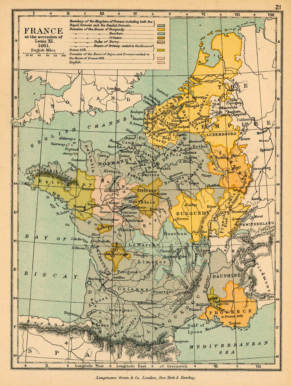
- France under Louis XI (465K) Map 21
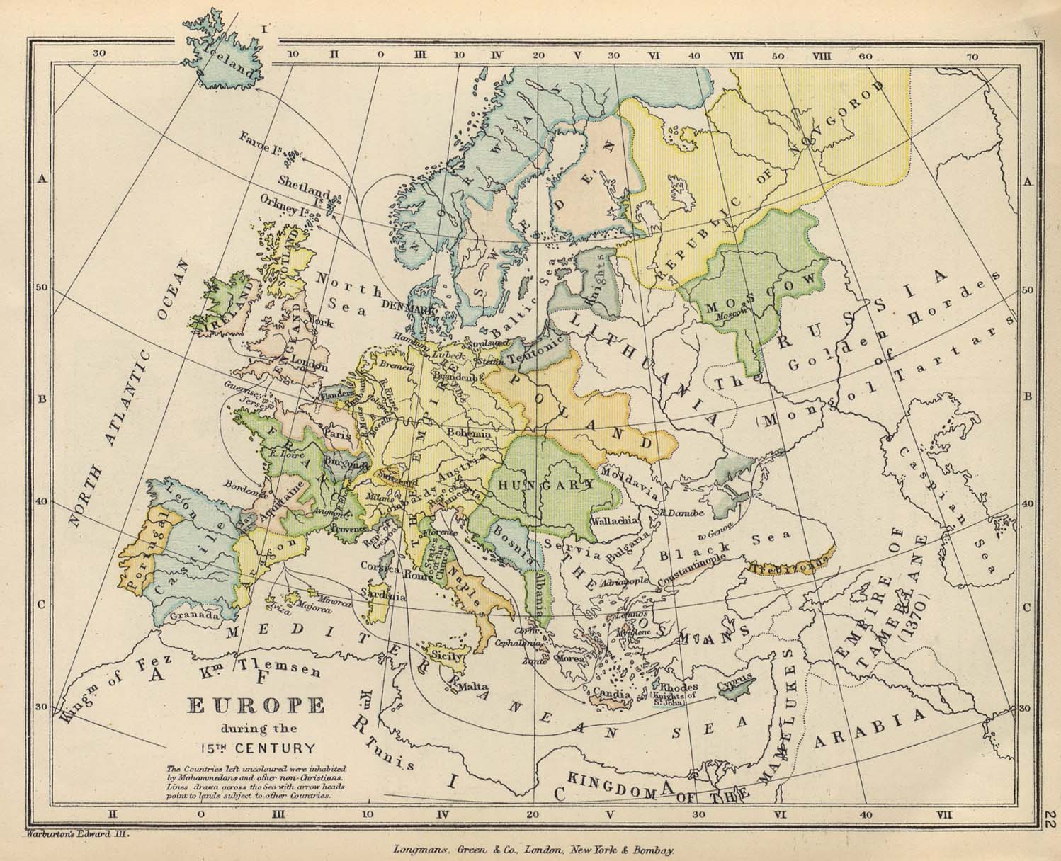
- Europe in the 15th Century (288K) Map 22
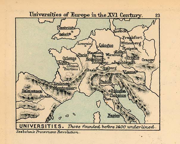
- Universities of Europe in the 16th Century (105K) Map 23
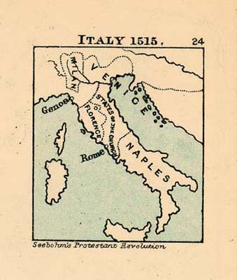
- Italy in 1515 (51K) Map 24
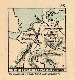
- The Seven Prince Electors (58K) Map 25
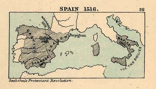
- Spain in 1516 (61K) Map 26
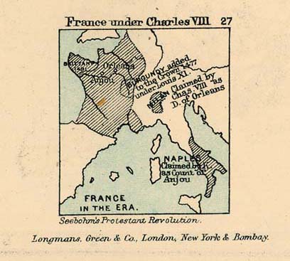
- France under Charles VIII (59K) Map 27
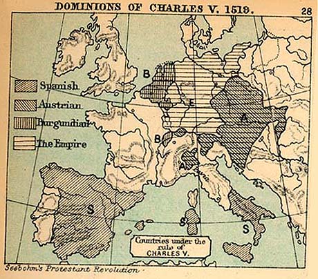
- Dominions of Charles V., 1519 (106K) Map 28
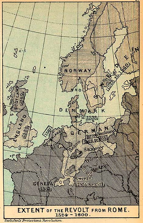
- Extent of the Revolt from Rome, 1524-1600 (175K) Map 29
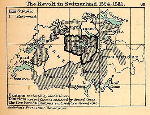
- The Revolt in Switzerland, 1524-1531 (95K) Map 30
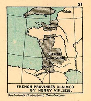
- French Provinces claimed by Henry III., 1512 (55K) Map 31
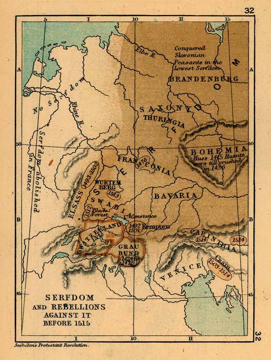
- Serfdom and Rebellions against it before 1515 (128K) Map 32
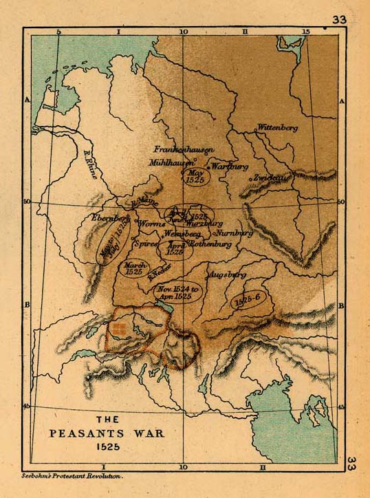
- The Peasants War, 1525 (124K) Map 33
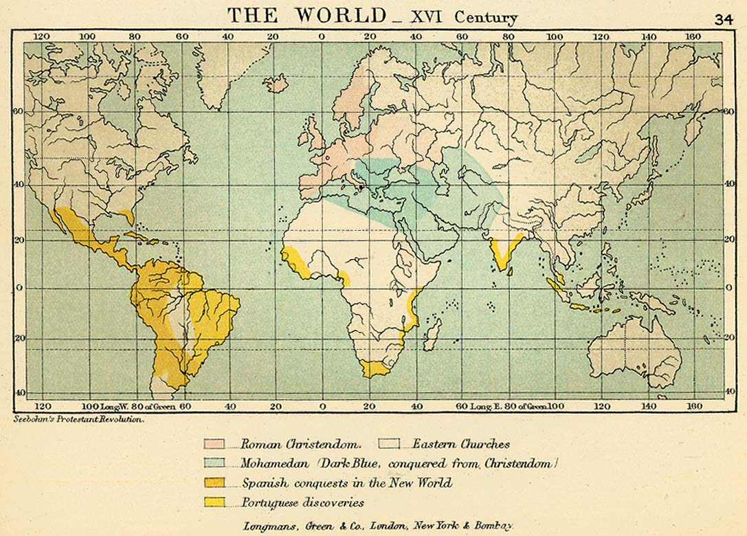
- The World in the 16th Century Map 34 (215K)
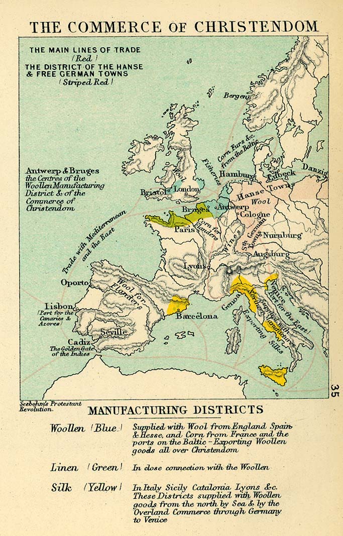
- Commerce of Christendom in the 16th Century (221K) Map 35
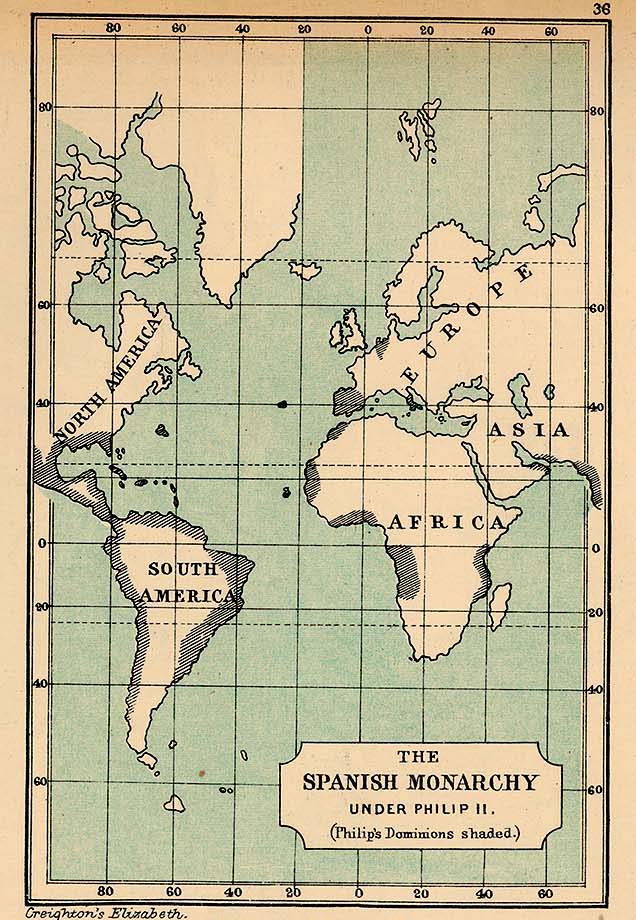
- The Spanish Monarchy under Phillip II (166K) Map 36
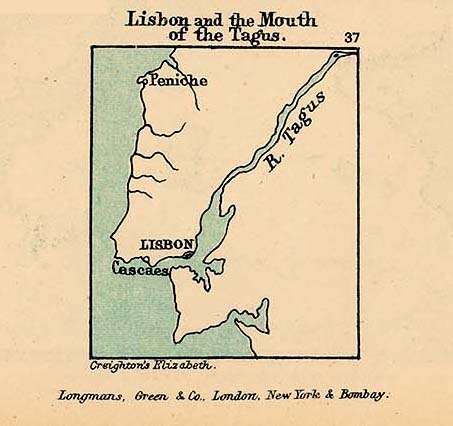
- Lisbon and the Mouth of Tagus (55K) Map 37
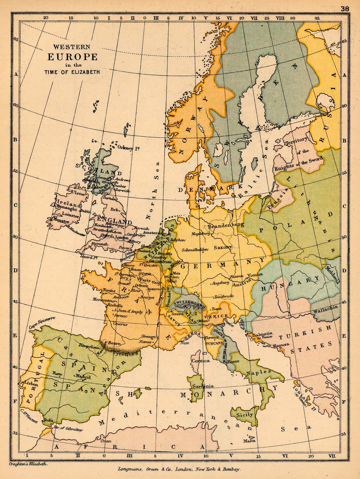
- Western Europe in the time of Elizabeth (412K) Map 38
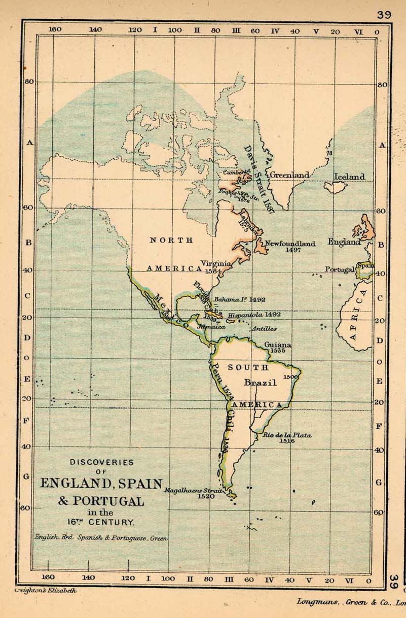
- Discoveries of England, Spain, and Portugal in the 16th Century Map 39 (204K)
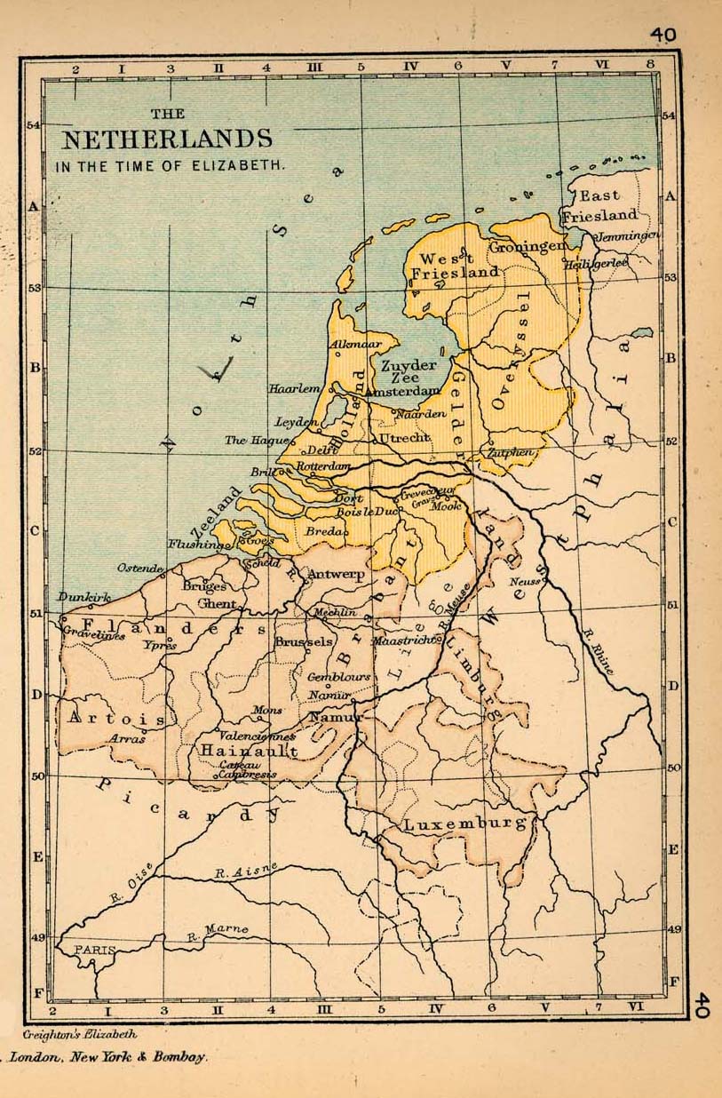
- The Netherlands in the time of Elizabeth Map 40 (247K)
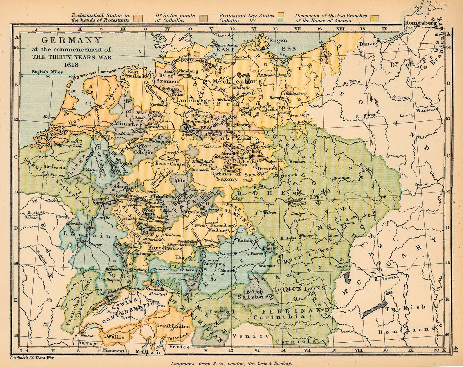
- Germany at the commencement of the Thirty Years War, 1618 (526K) Map 41
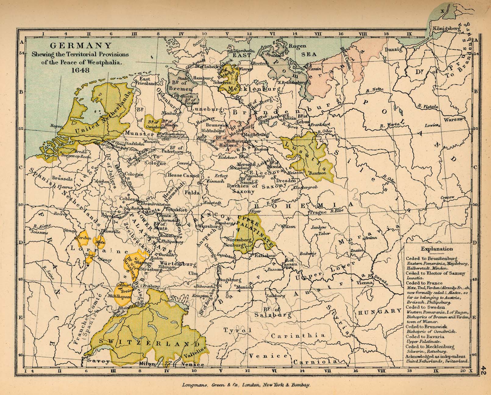
- Germany after the Peace of Westphalia, 1648 (481K) Map 42
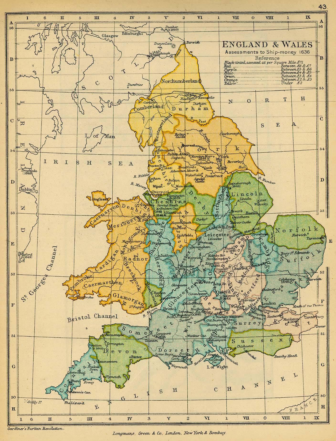
- England and Wales. Assessments to Ship-money, 1636 (514K) Map 43
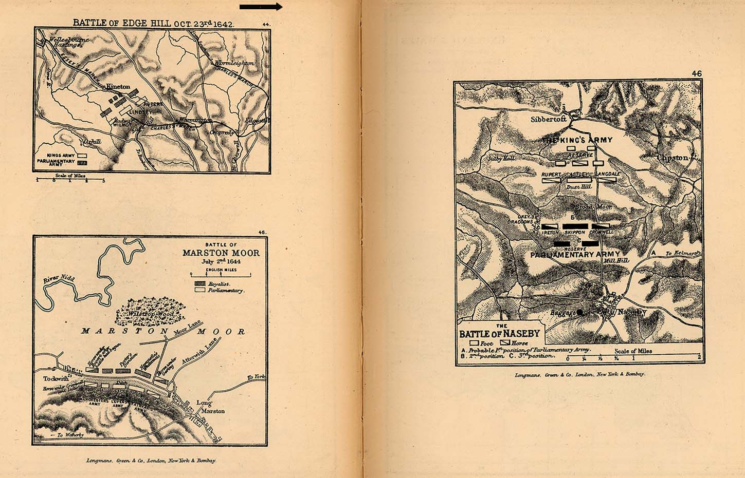
- Battles of Edge Hill, Marston Moor, Naseby (254K) Maps 44-46
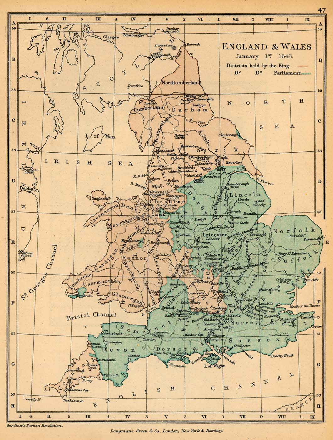
- England and Wales, January 1, 1643 (254K) Map 47
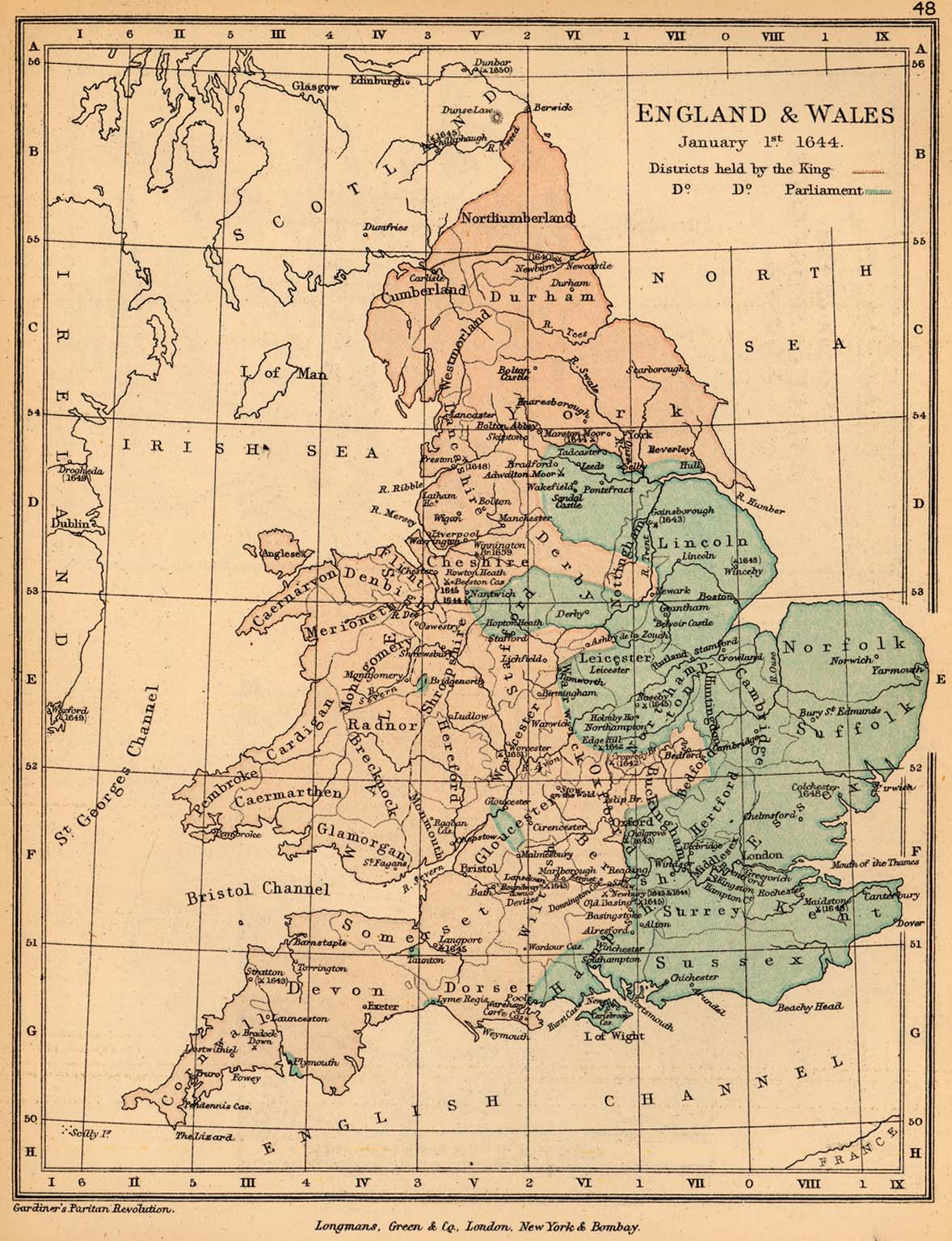
- England and Wales, January 1, 1644 (328K) Map 48
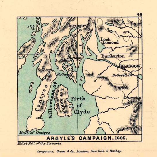
- Argyle's Campaign, 1685 (102K) Map 49
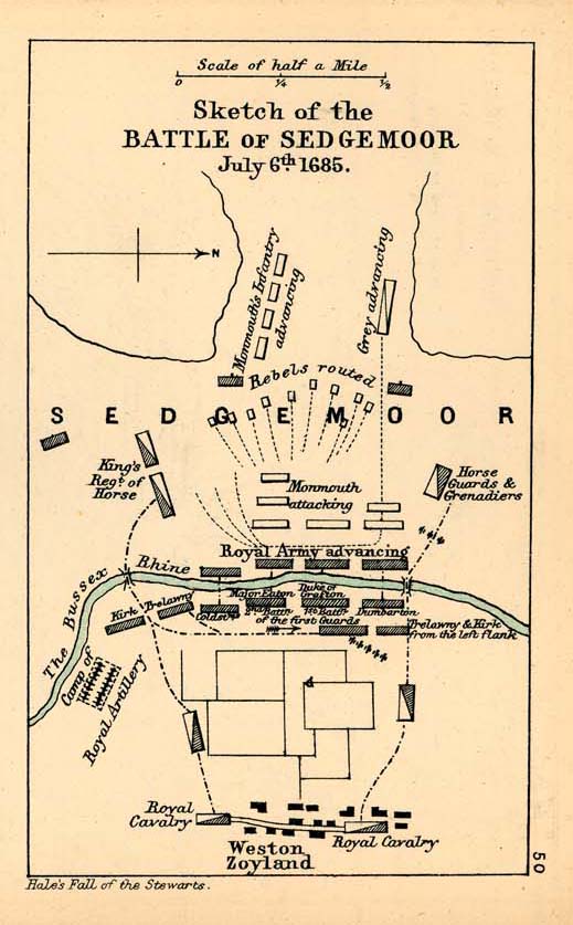
- Sedgemoor (98K) Map 50
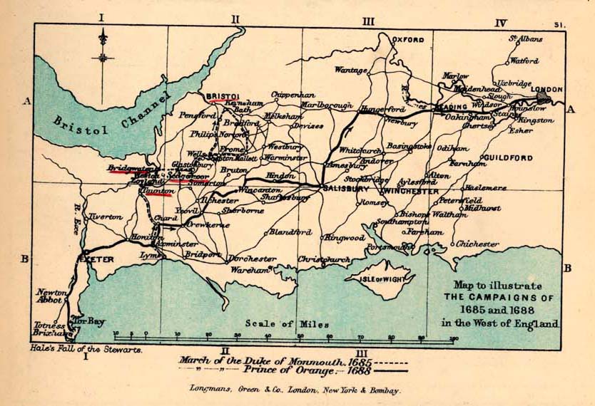
- South-West England, to illustrate the Campaign of 1685-1688 (131K) Map 51
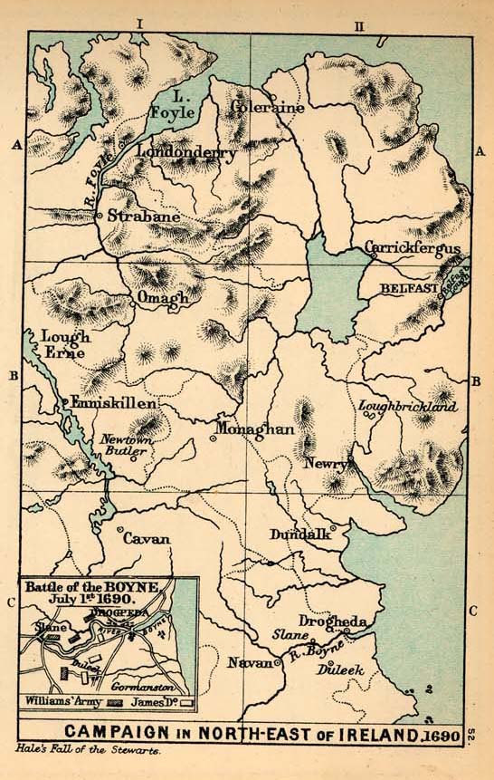
- Campaign in the North-East of Ireland and Battle of the Boyne, 1690 (157K) Map 52
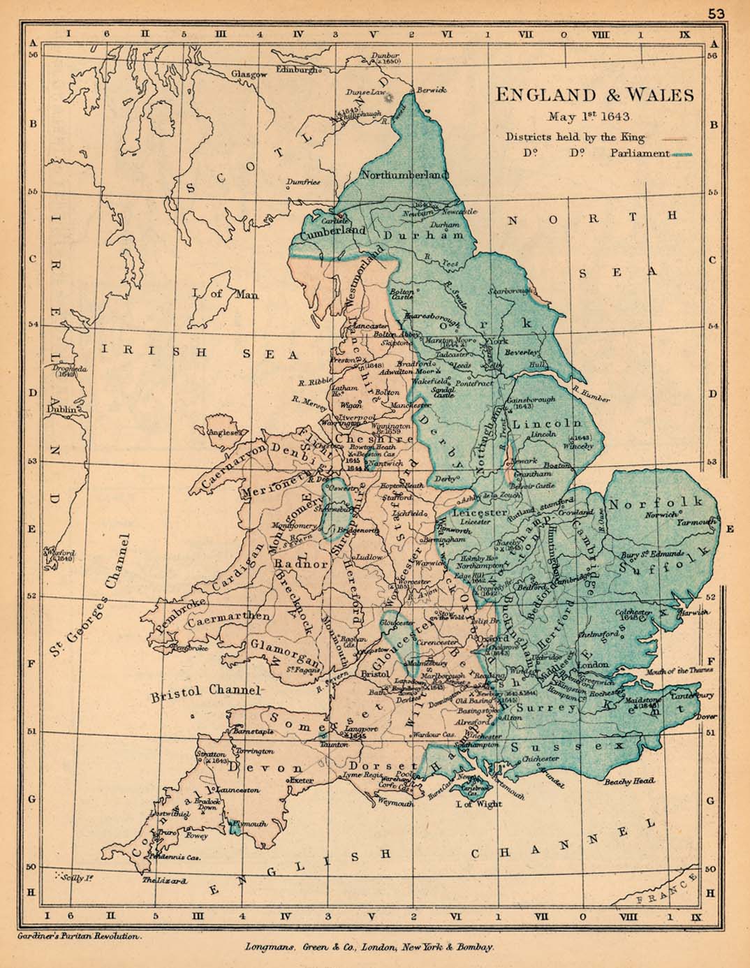
- England and Wales, May 1, 1643 (254K) Map 53
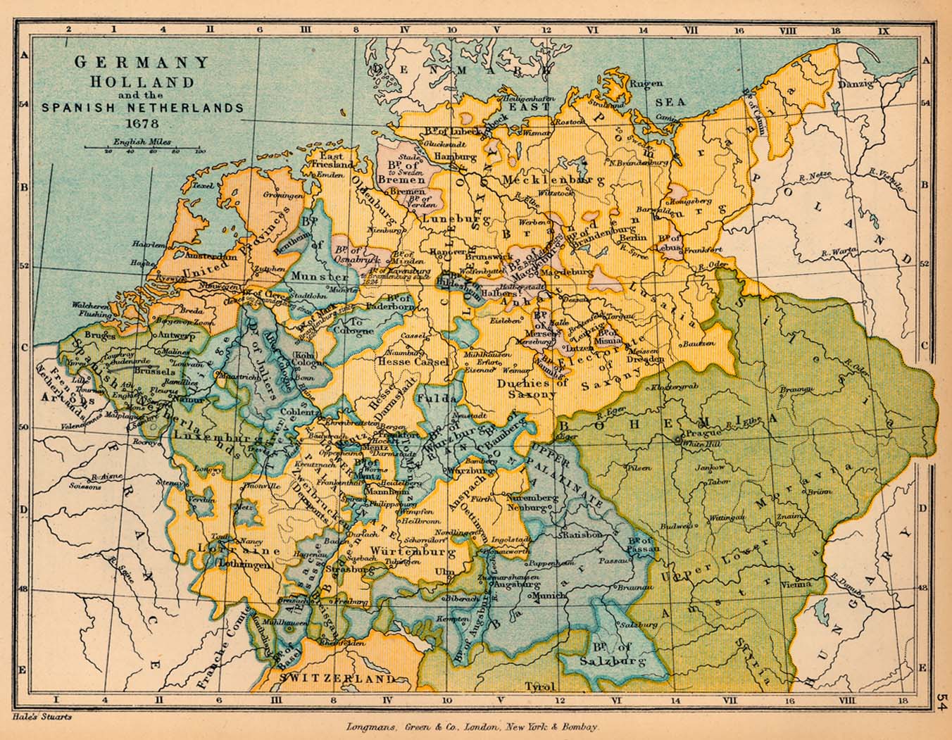
- Germany, Holland, and the Spanish Netherlands in 1678 (339K) Map 54
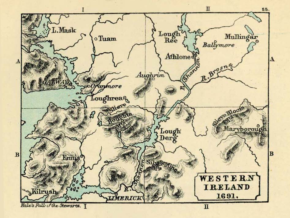
- Western Ireland, 1691 (168K) Map 55
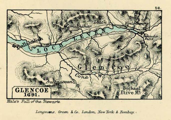
- Glencoe (118K) Map 56
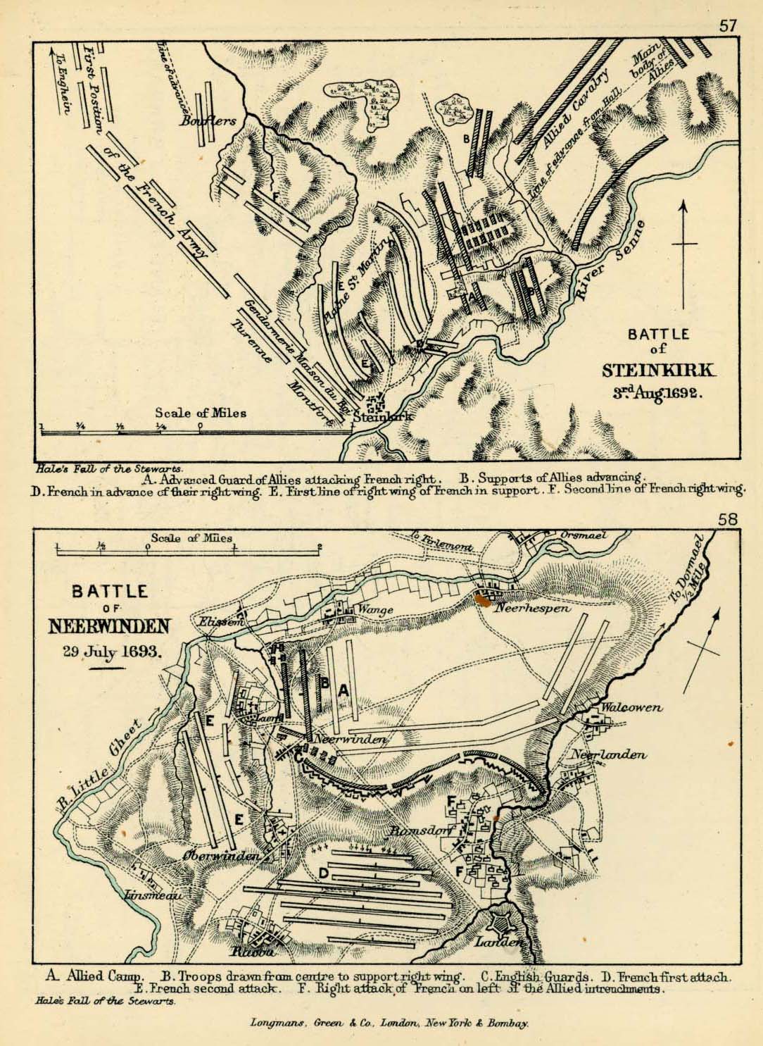
- Battles of Steinkirk and Neerwinden (322K) Maps 57-58
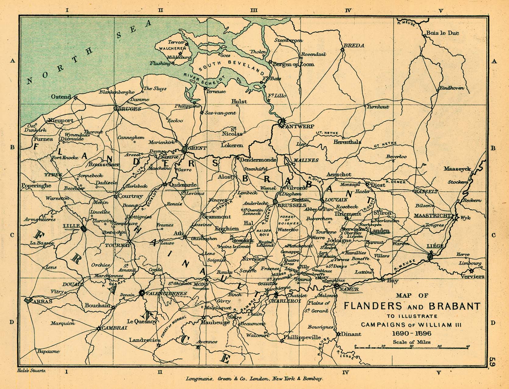
- Flanders and Brabant, to illustrate the Campaign of William III, 1690-1696 (415K) Map 59
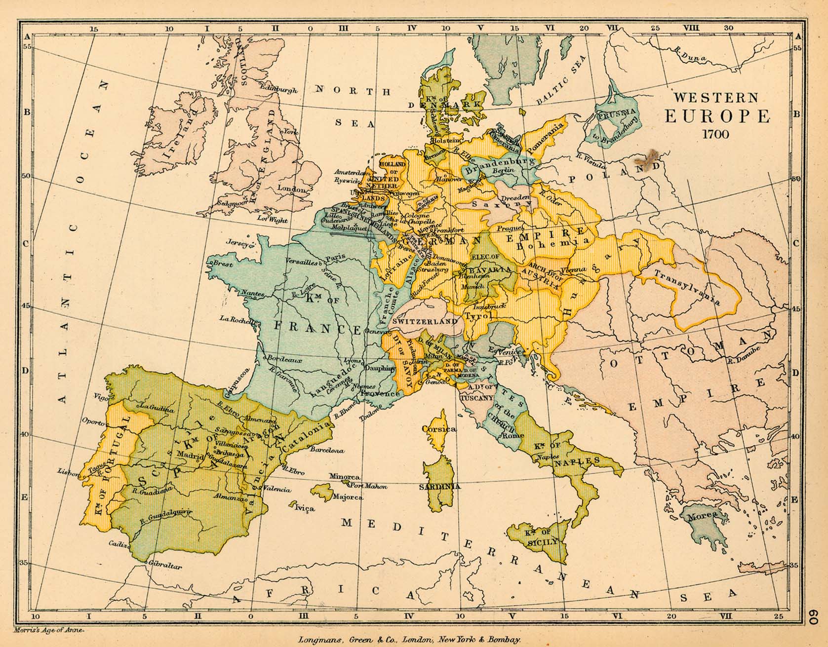
- Western Europe in 1700 (384K) Map 60
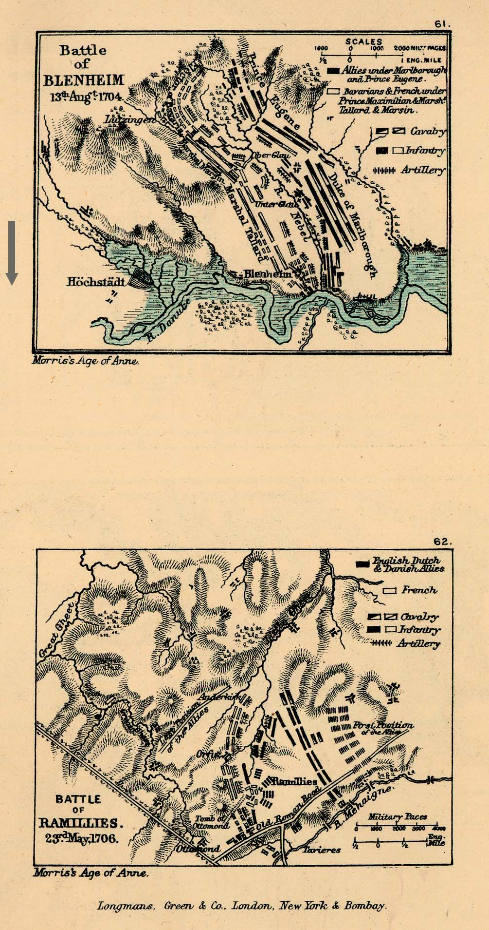
- Battles of Blenheim and Ramilies (389K) Maps 61-62
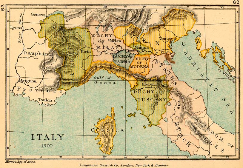
- Italy in 1700 (165K) Map 63
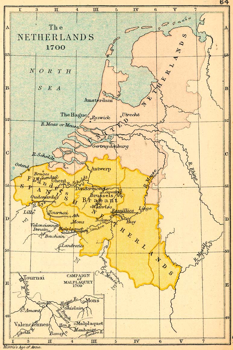
- The Netherlands in 1700 (242K) Map 64
- Inset: Malplaquet
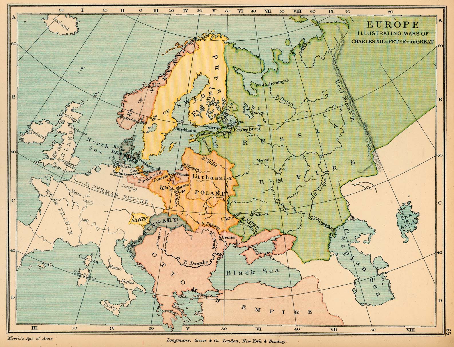
- Europe, illustrating the wars of Charles XII and Peter the Great (412K) Map 65
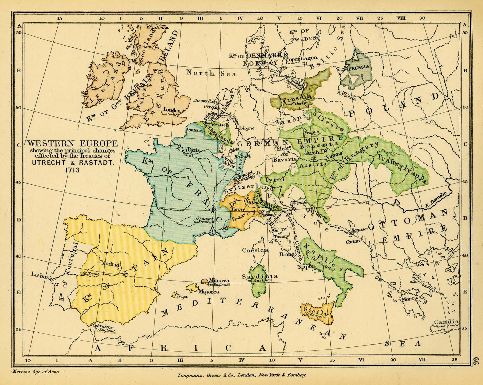
- Western Europe after the Peace of Utrecht, 1713 (388K) Map 66
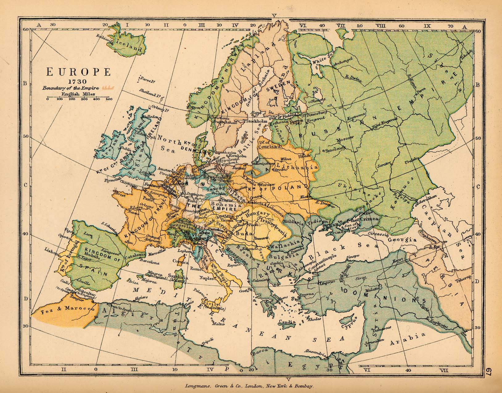
- Europe in 1730 (446K) Map 67
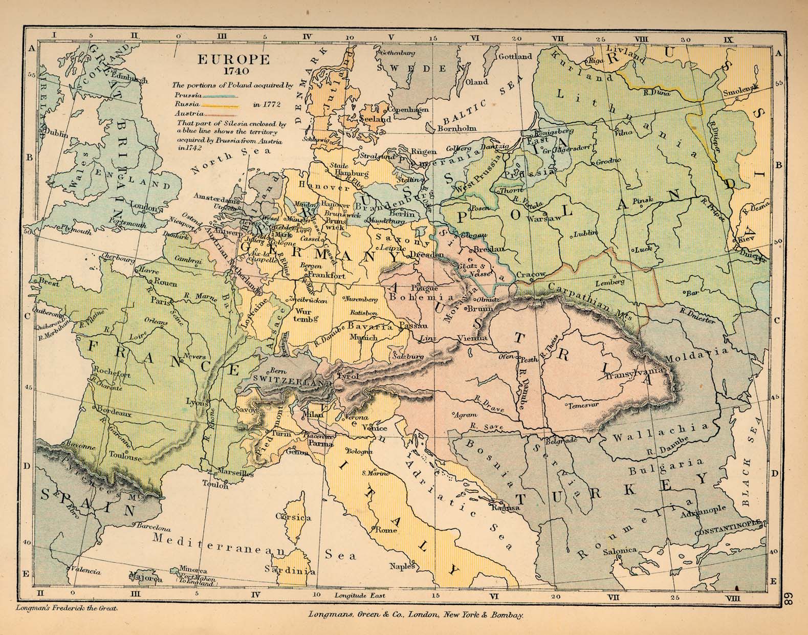
- Europe in 1740 (441K) Map 68
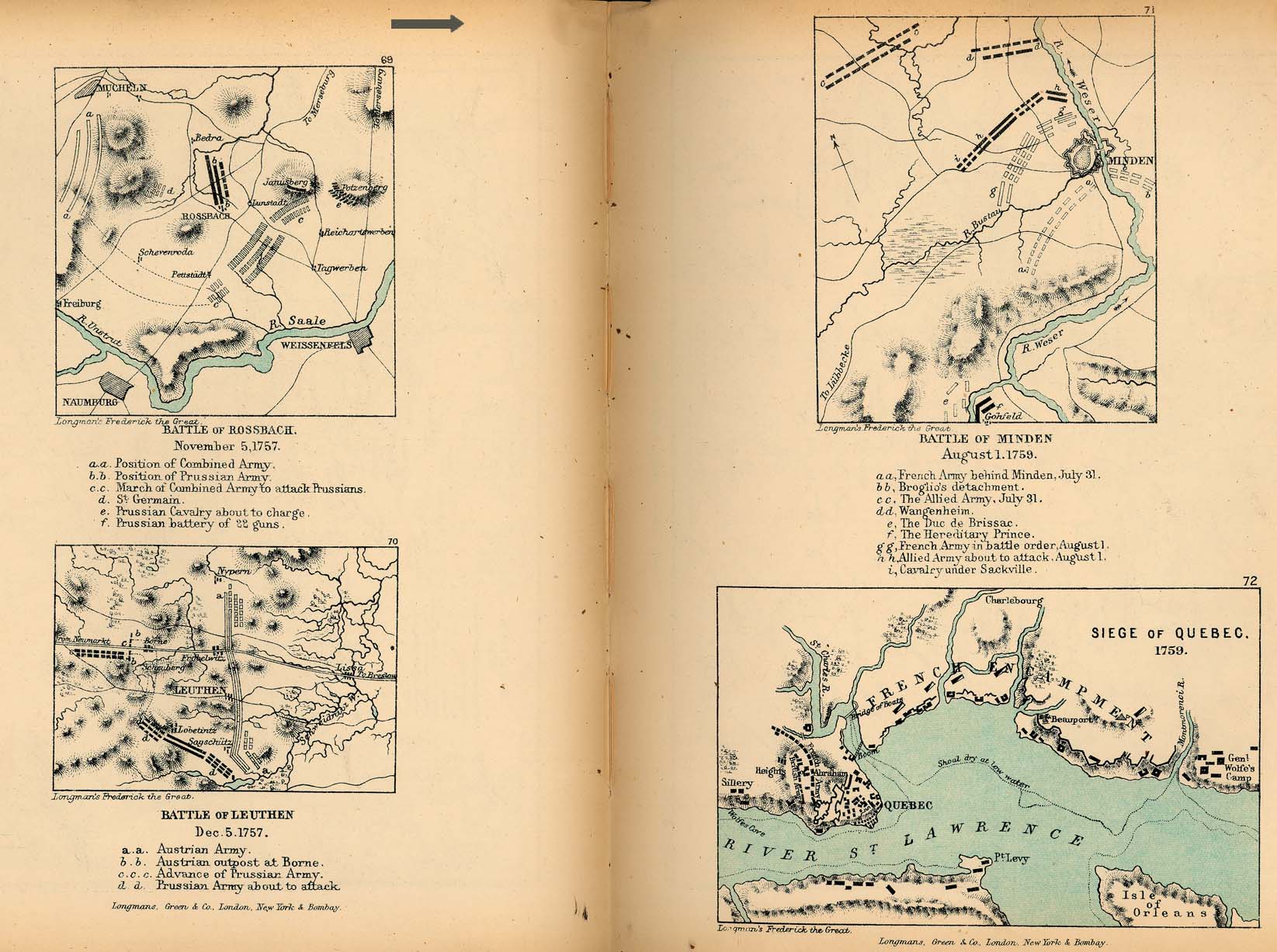
- Rossbach, Leuthen, Minden and Quebec(330K) Maps 69-72
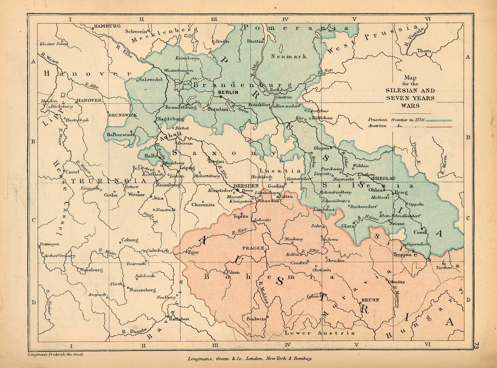
- Germany, illustrating the Silesian and Seven Years' Wars (339K) Map 73
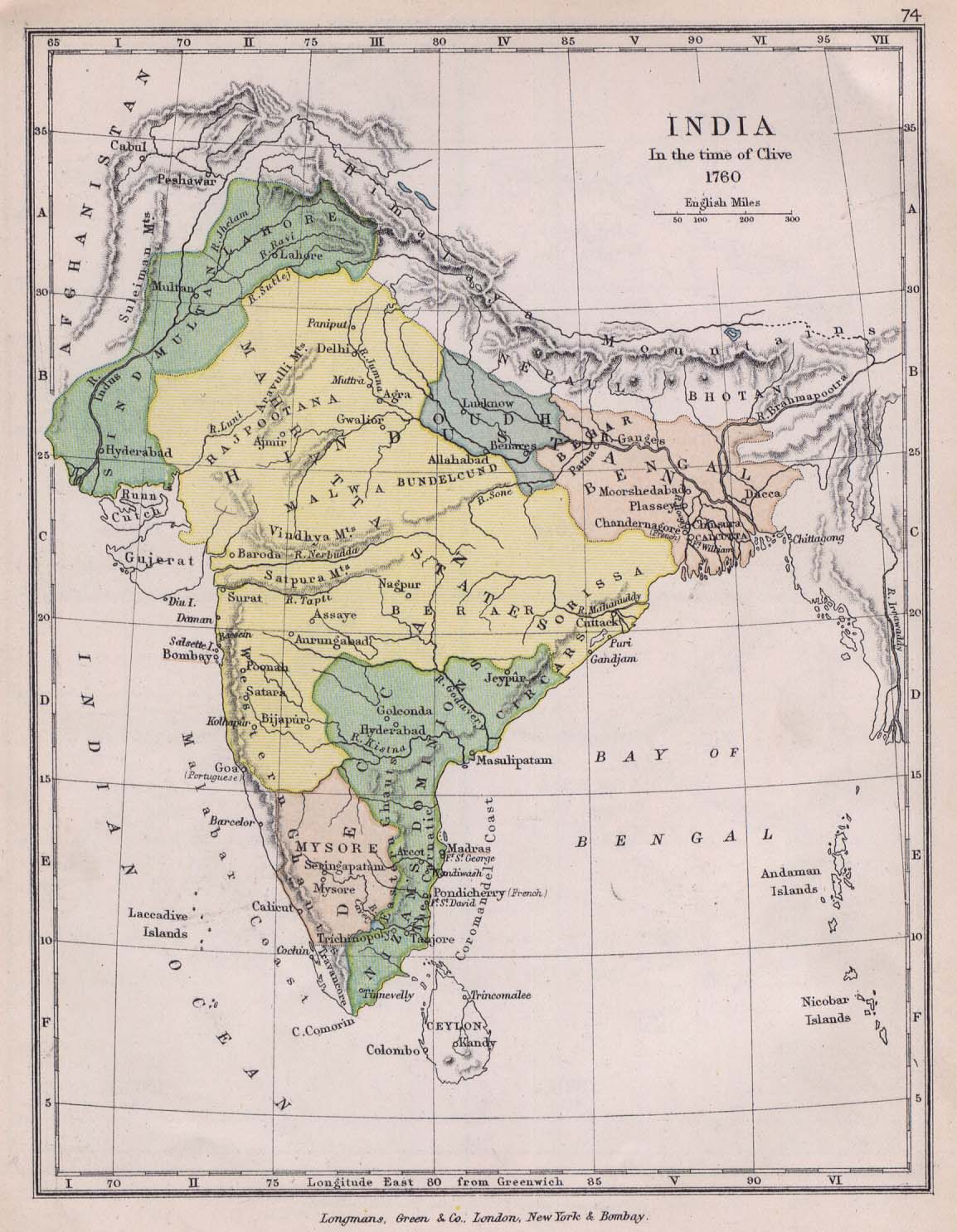
- India in the 18th Century(223K) Map 74
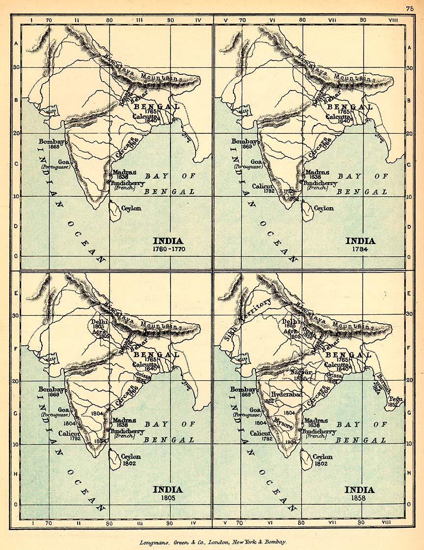
- India, showing the growth of the English Dominions (318 K) Map 75
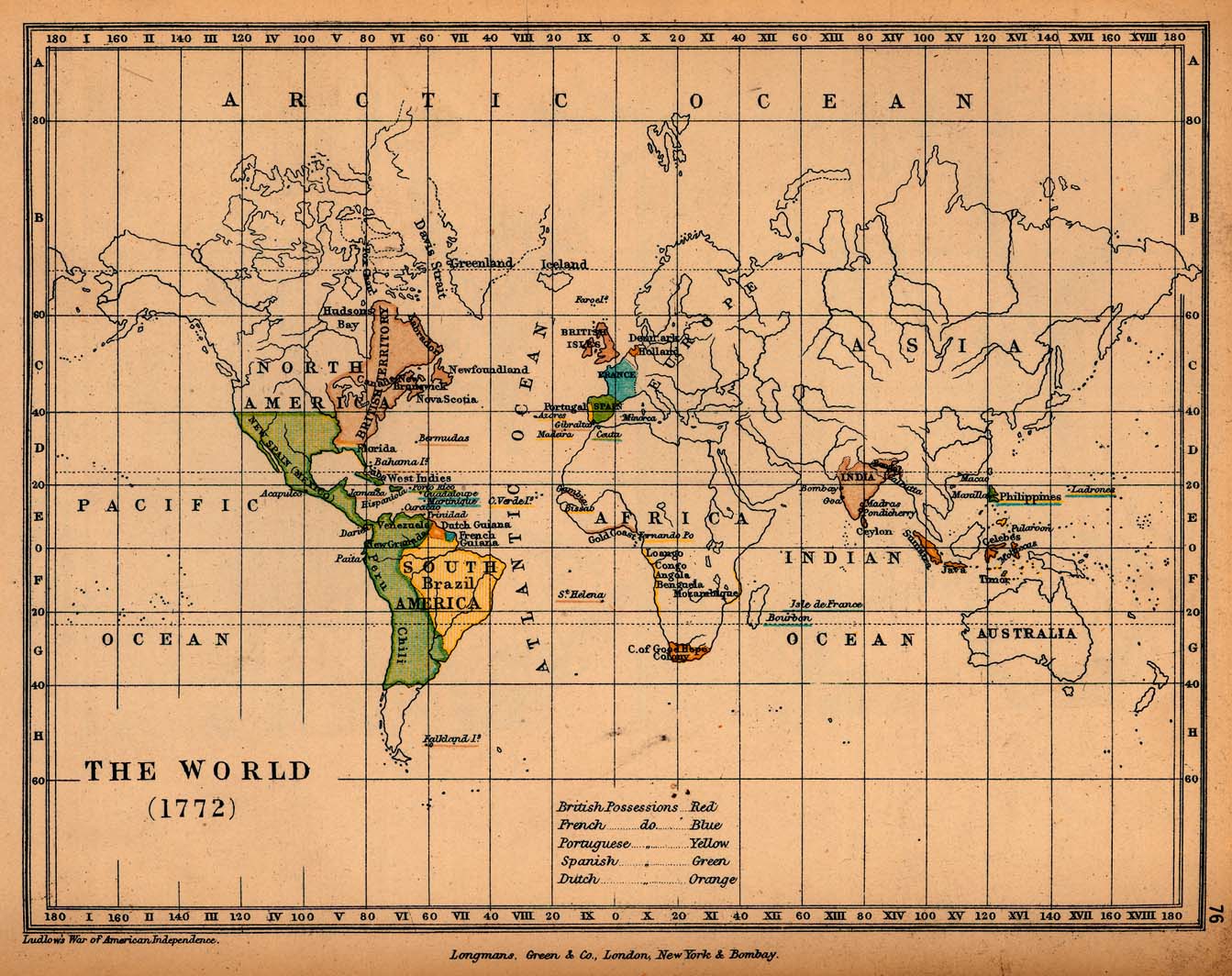
- The World 1772 (290K) Map 76
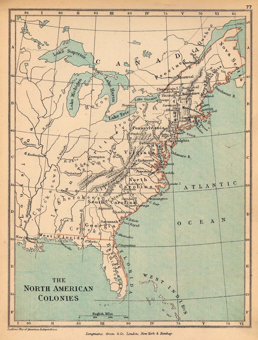
- The North American Colonies (251K) Map 77
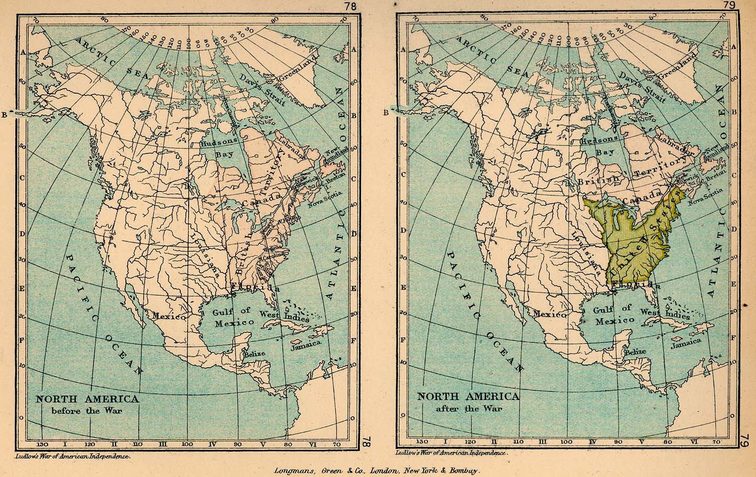
- North America before the War of American Independence and North America After the War (423K) Maps 78-79
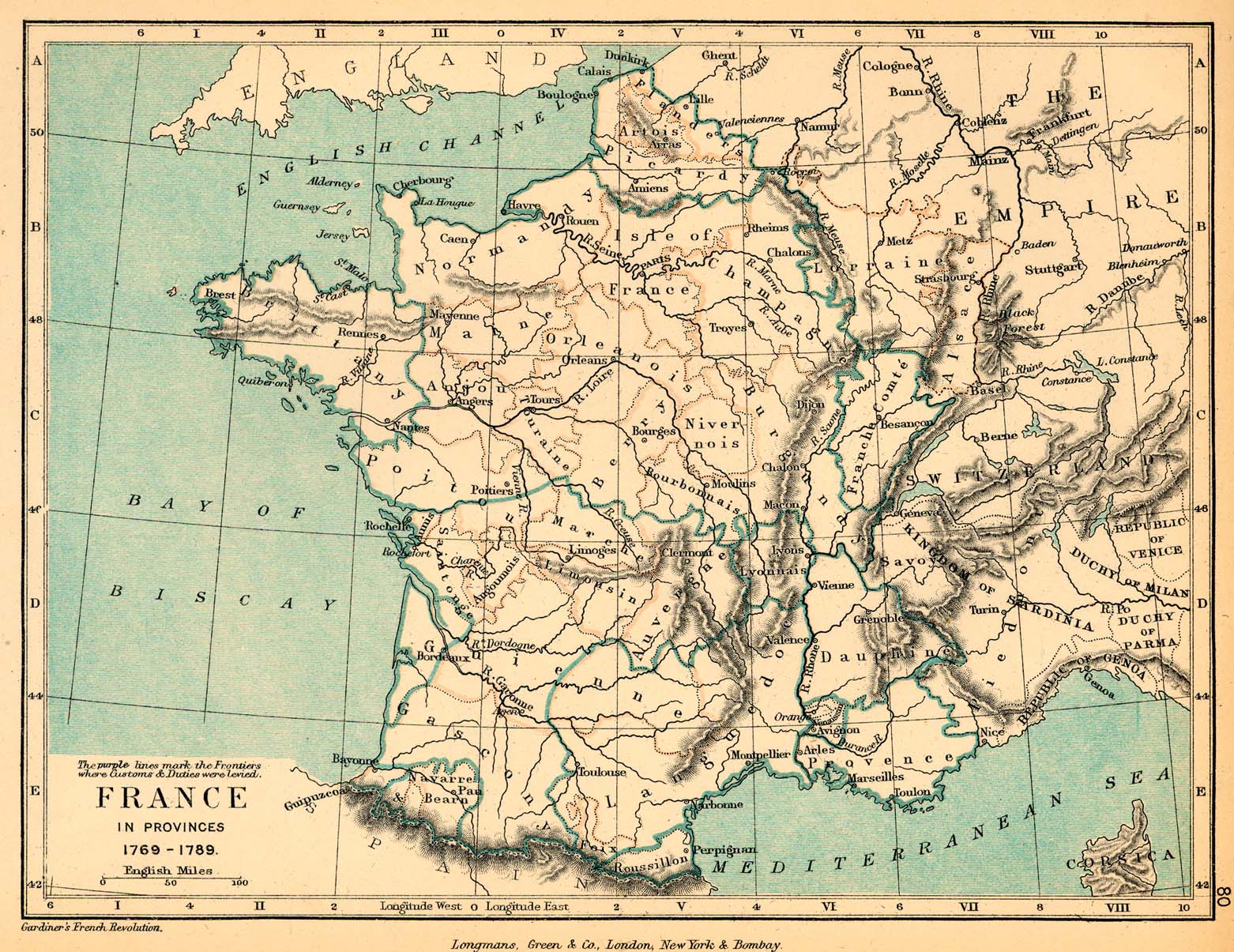
- France in Provinces, showing the Customs Frontiers, 1789 (473K) Map 80
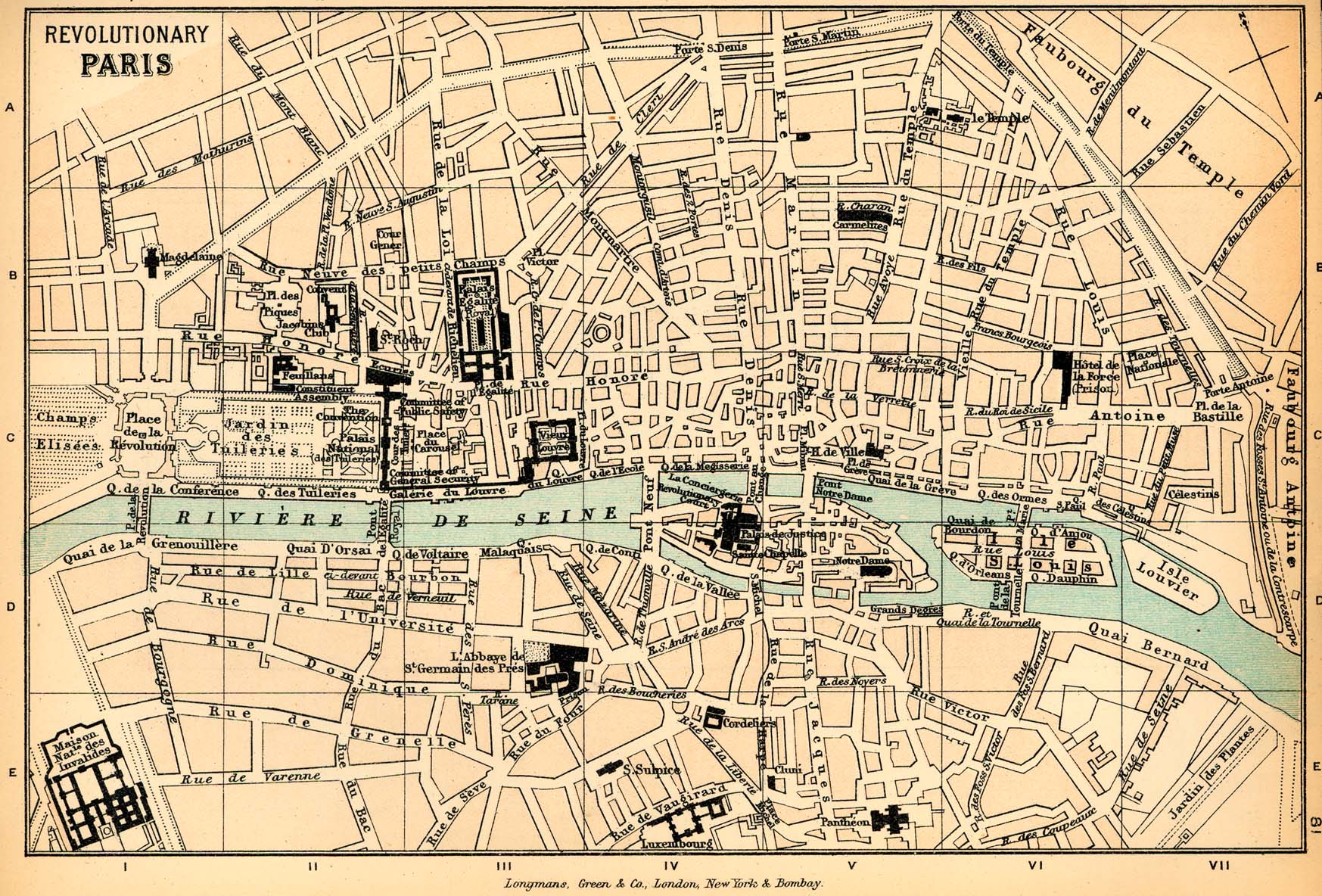
- Revolutionary Paris Map 81 (558K)
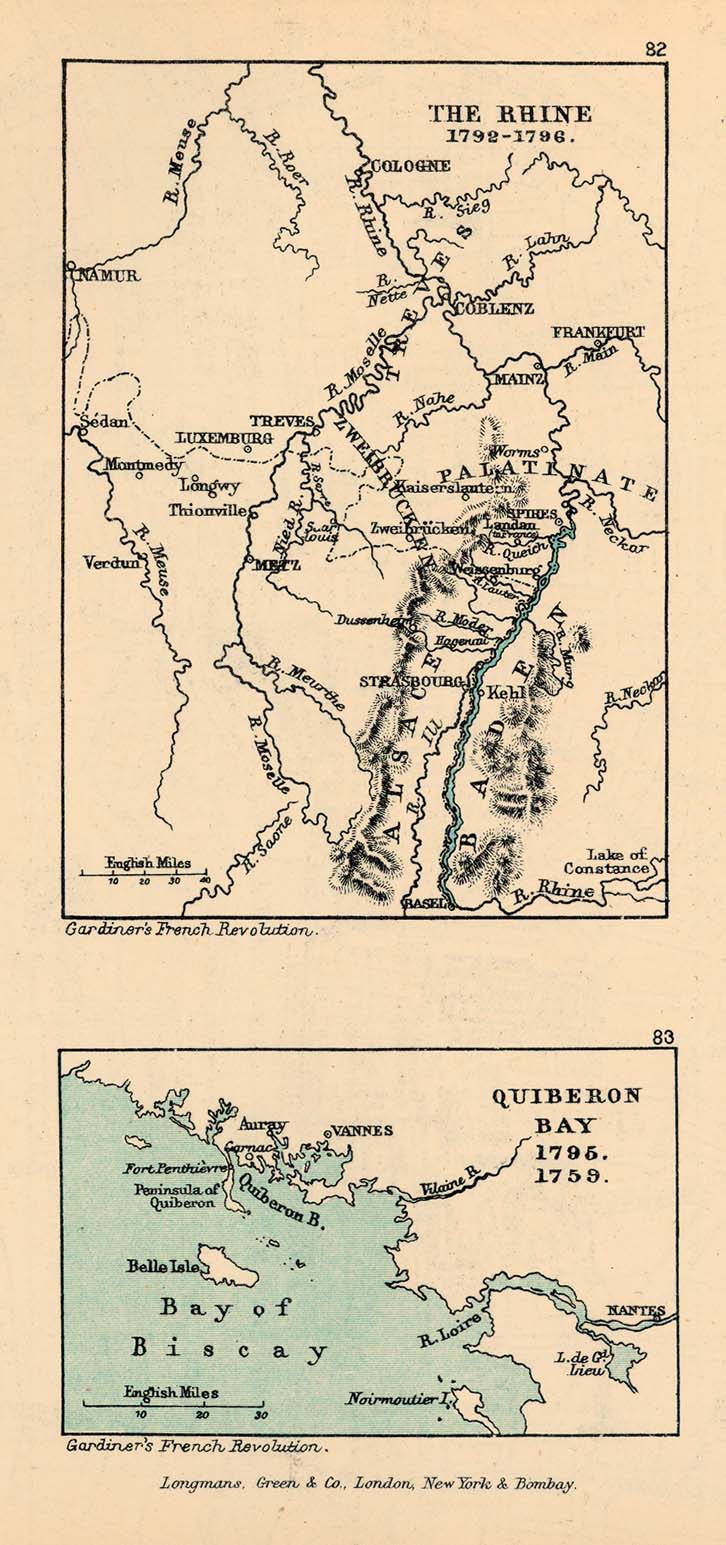
- The Rhine, 1792-1796 and Quiberon Bay, 1795 (179K) Maps 82-83
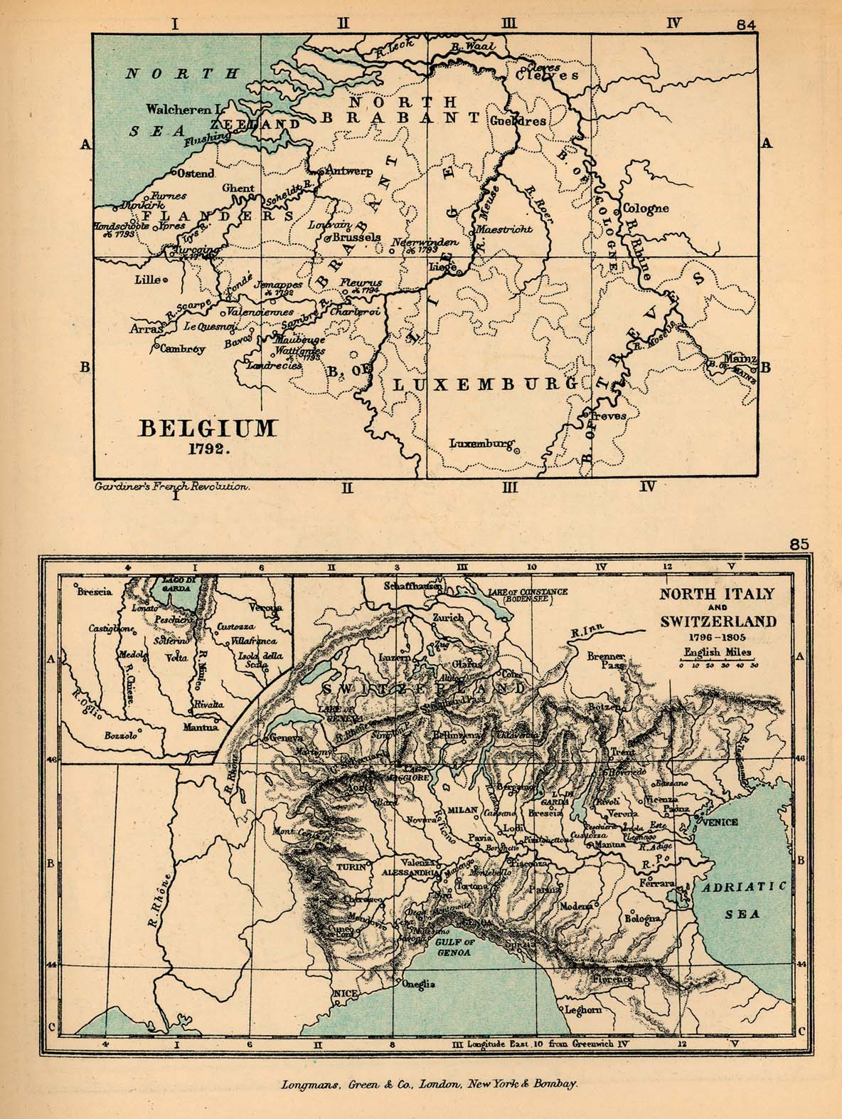
- Belgium in 1792 and North Italy, to illustrate the Campaigns of Napoleon (380K) Maps 84-85
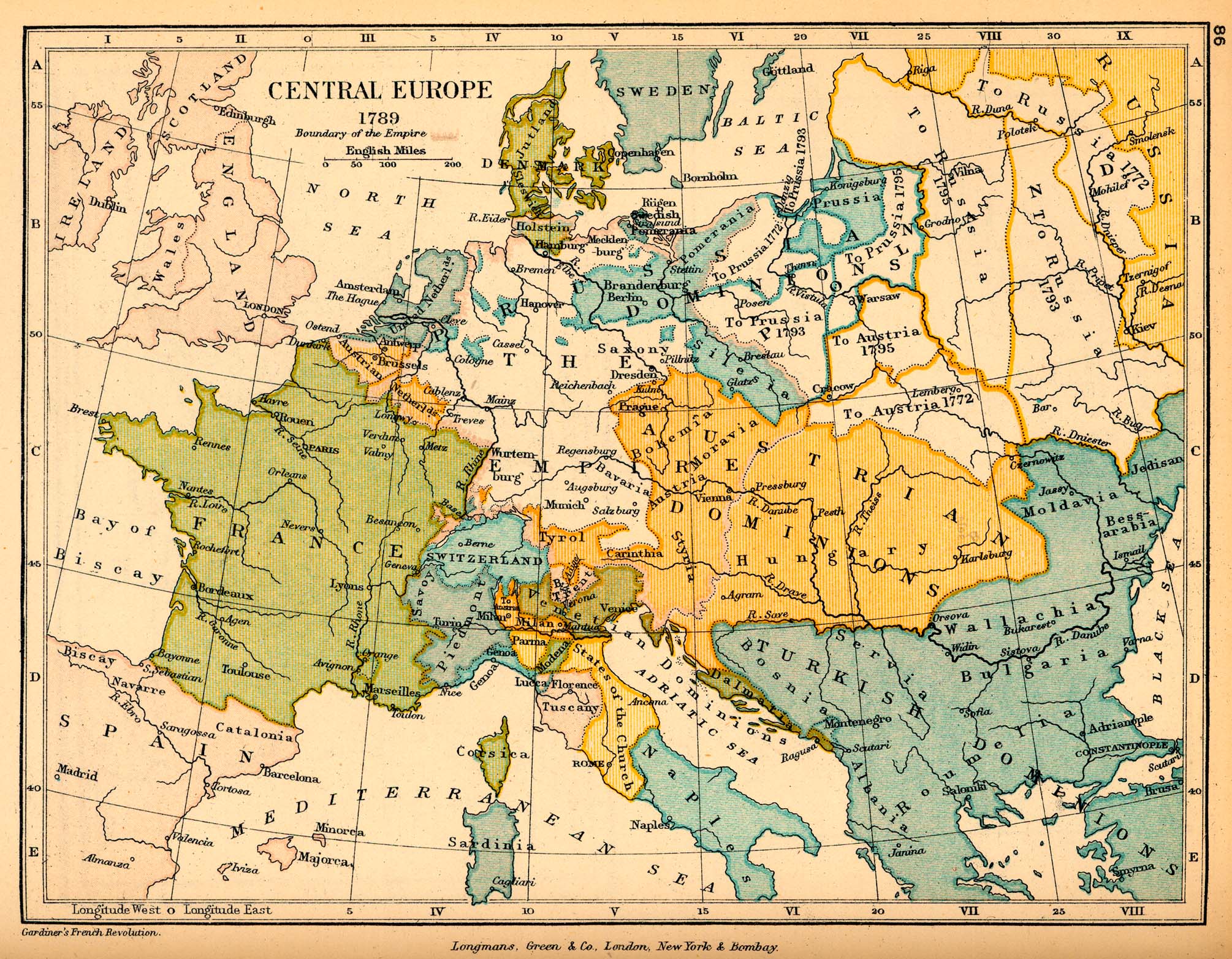
- Central Europe in 1789 (700K) Map 86
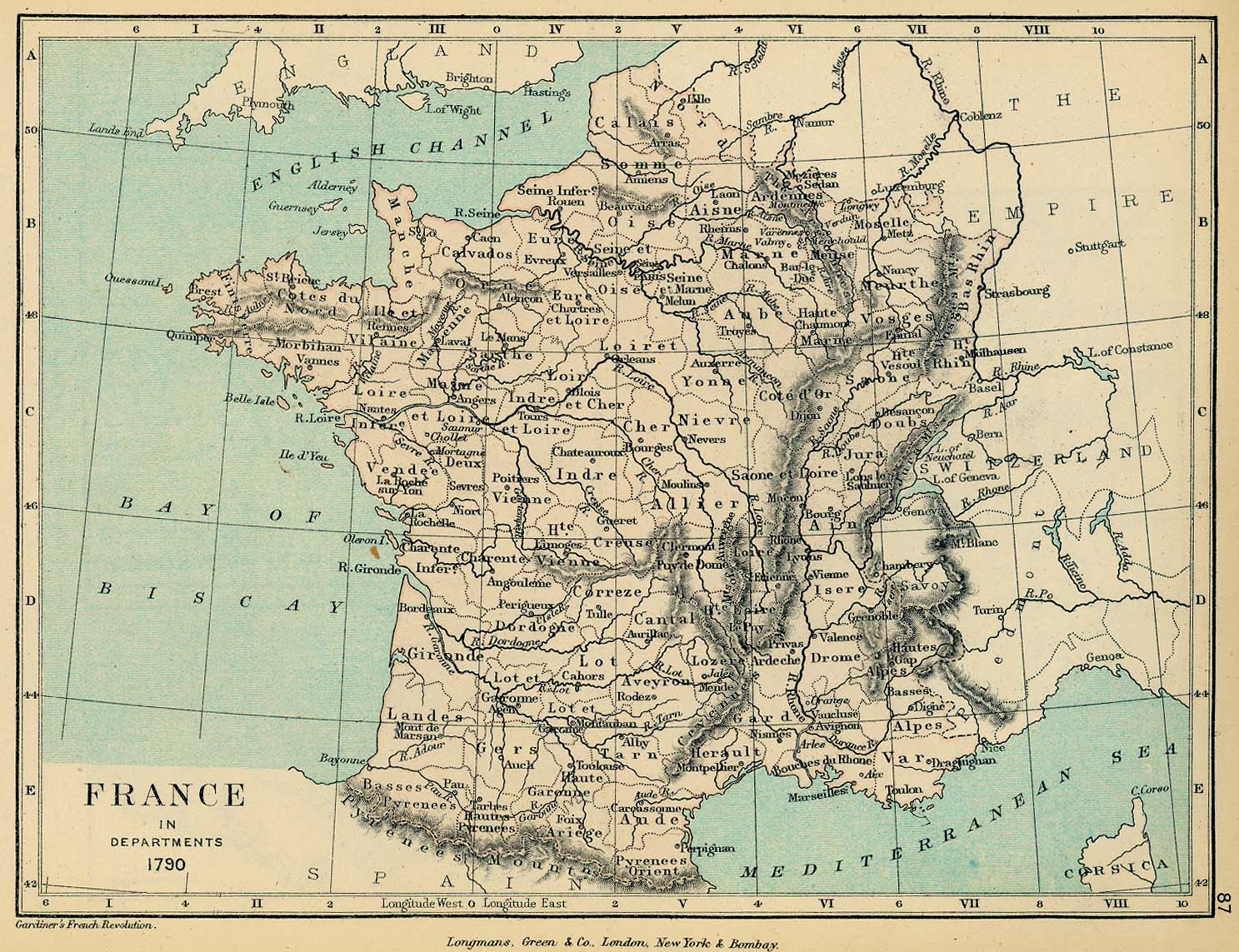
- France in Departments, 1790 (415K) Map 87
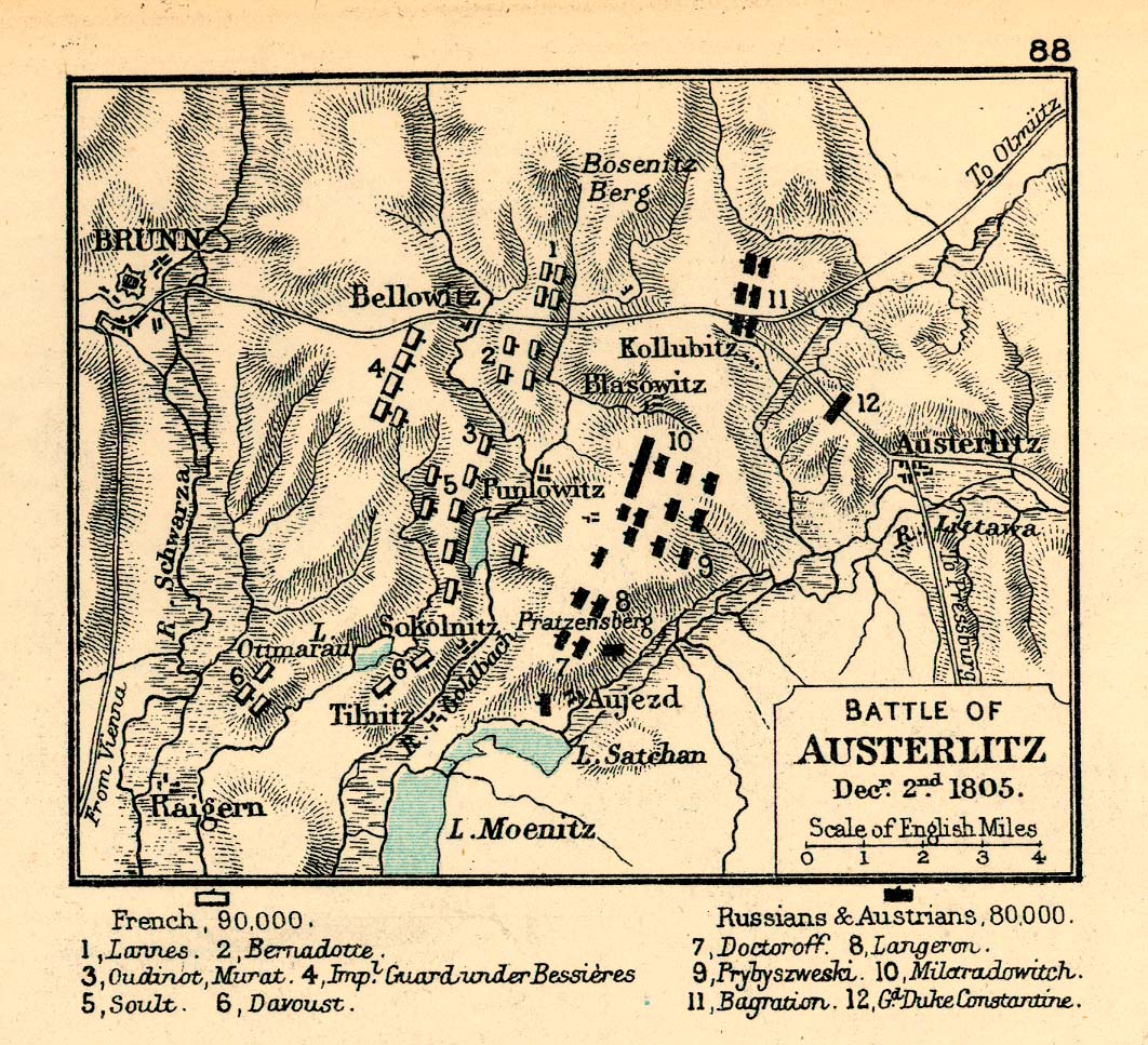
- Austerlitz 1805 (367K) Map 88
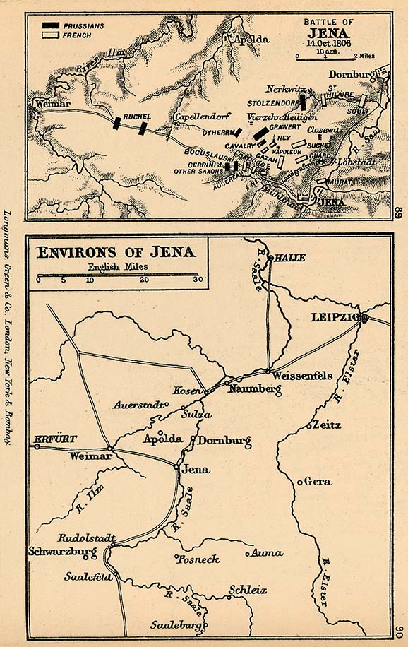
- Battles of Jena and Environs of Jena 1806 (168K) Maps 89-90
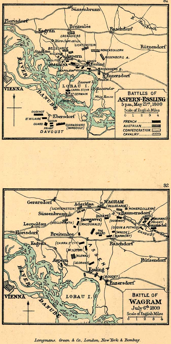
- Aspern-Essling and Wagram (229K) Maps 91-92
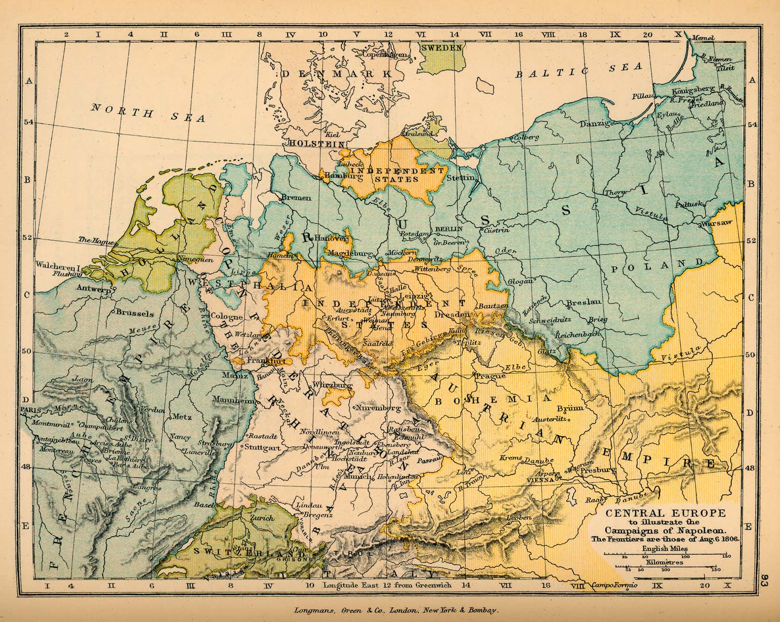
- Central Europe, to illustrate Campaigns of Napoleon (492K) Map 93
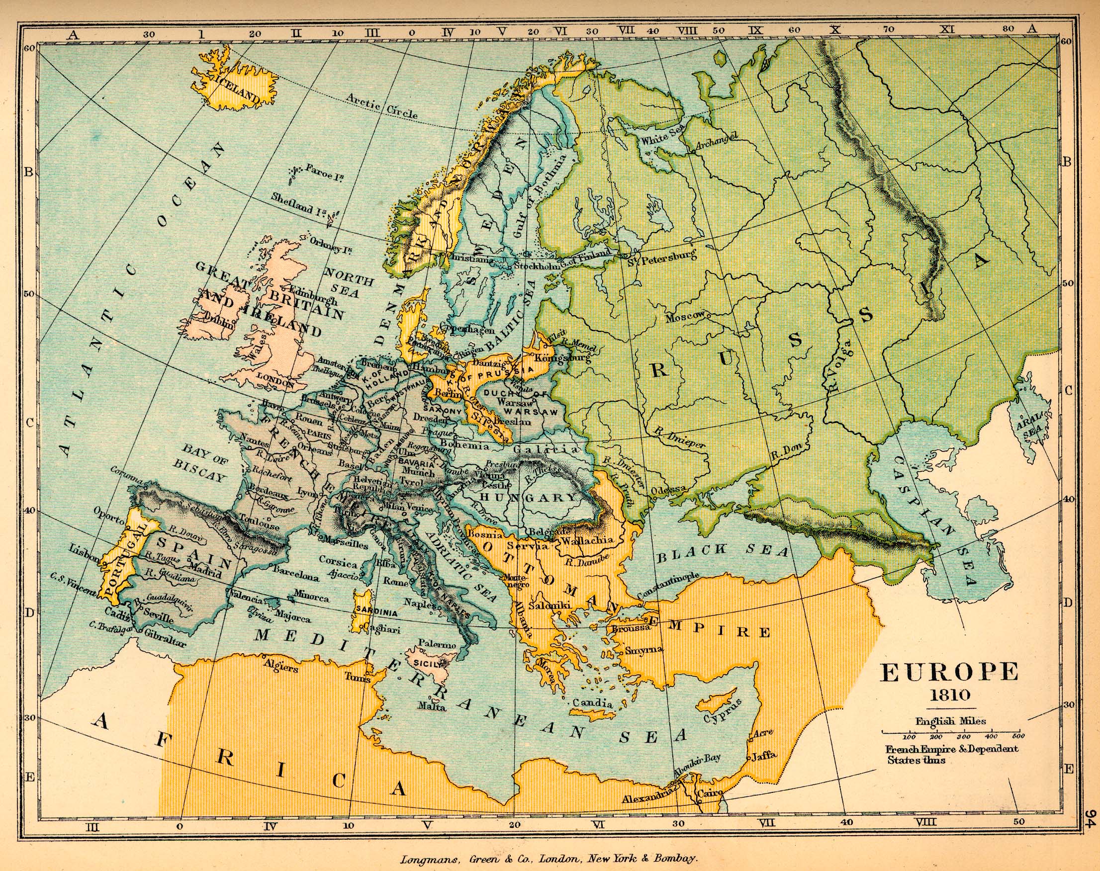
- Europe in 1810 Map 94 (969K)
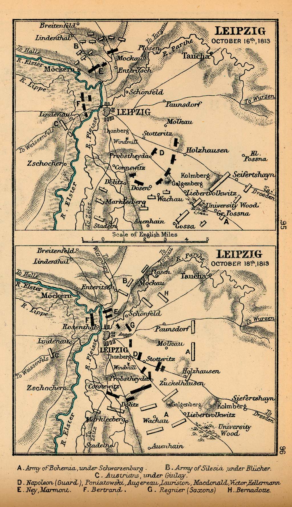
- Leipzig October 16th and October 18th, 1813 (409K) Maps 95-96
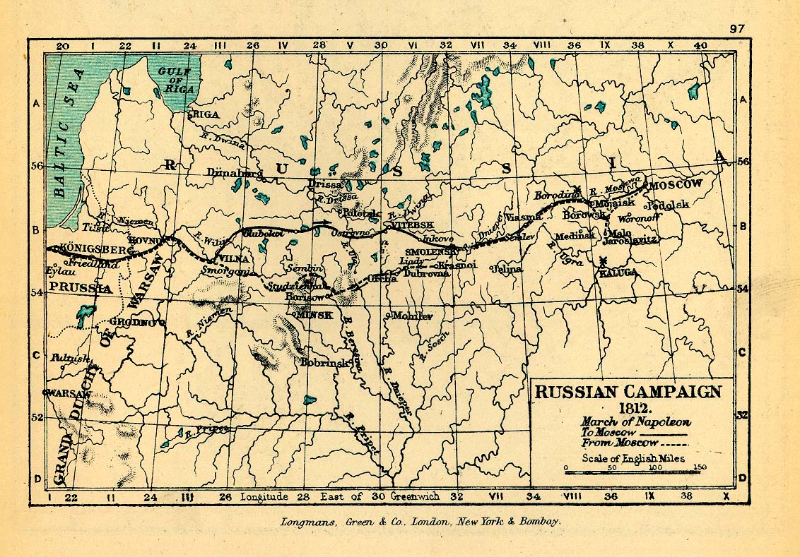
- Russian Campaign, 1812 (325K) Map 97
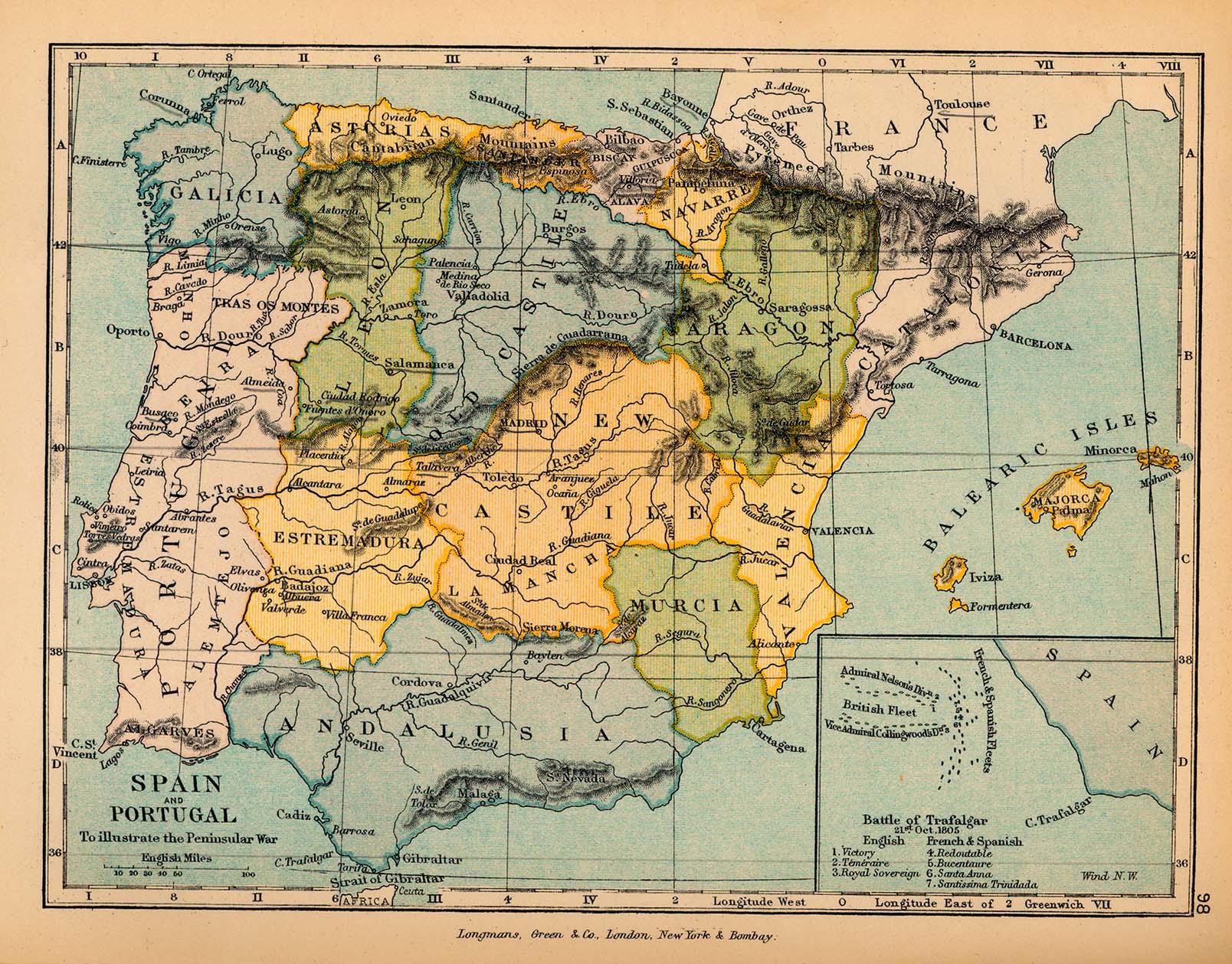
- Spain and Portugal, to illustrate the Penninsular War (476K) Map 98
- Inset: Battle of Trafalgar
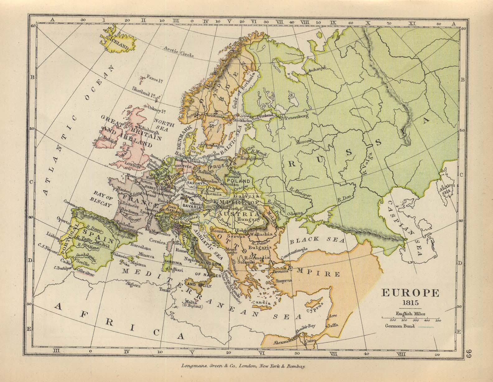
- Europe in 1815 (294K) Map 99
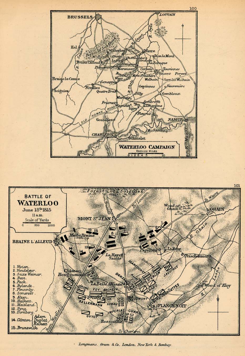
- Waterloo Campaign and Battle of Waterloo (279K) Map 100-101
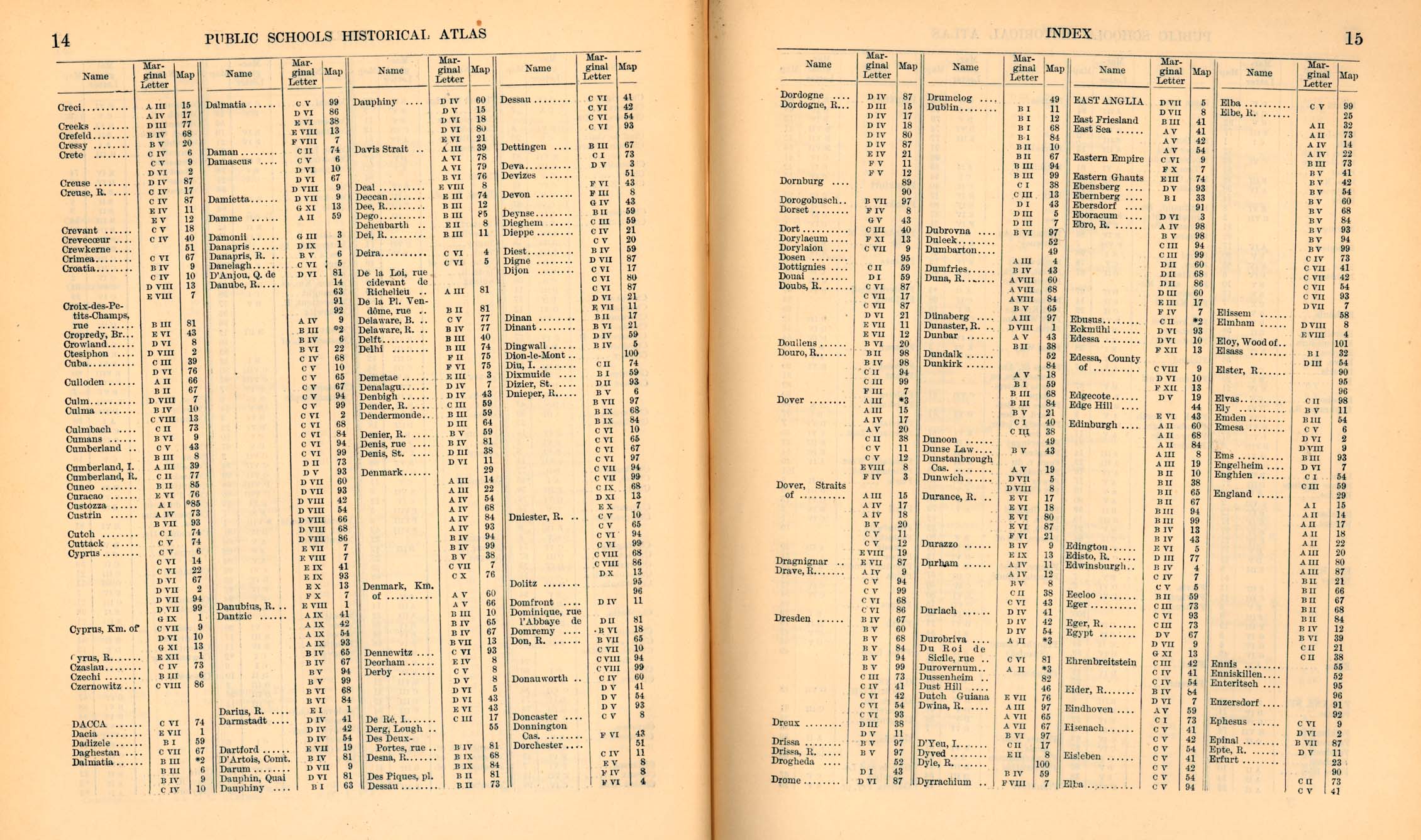
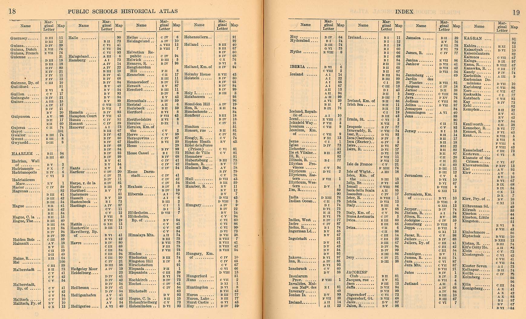
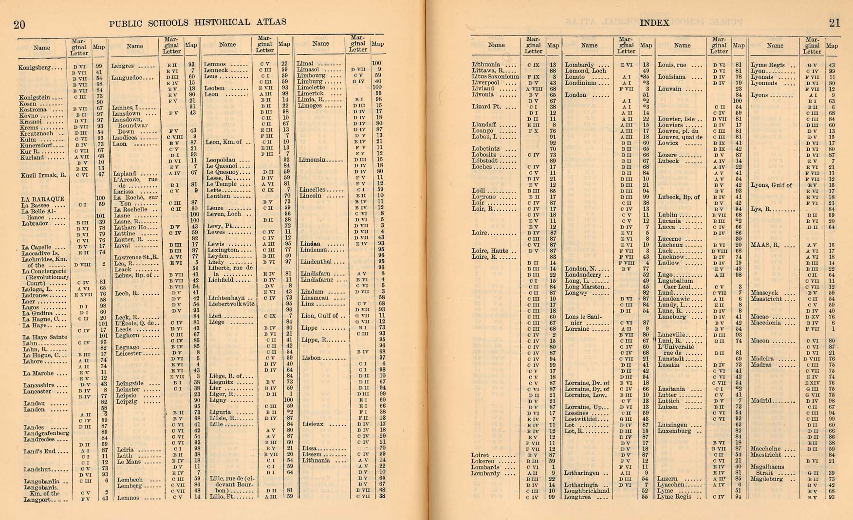
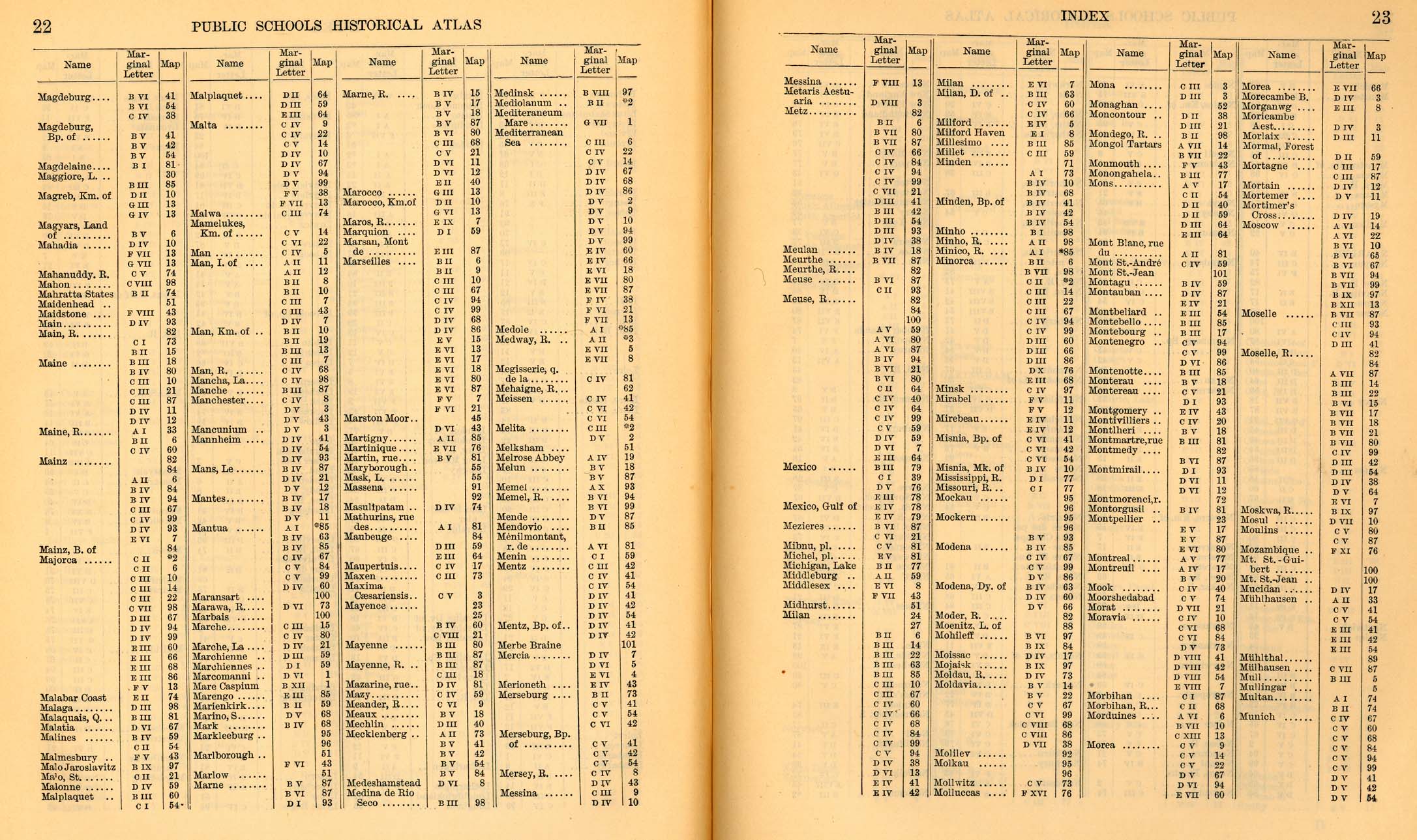
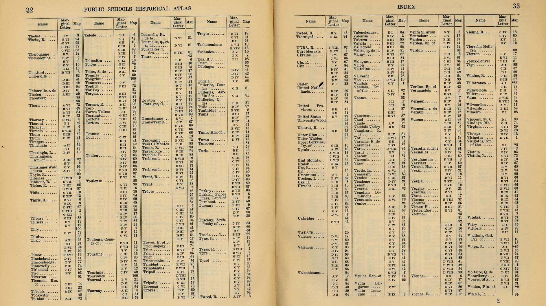
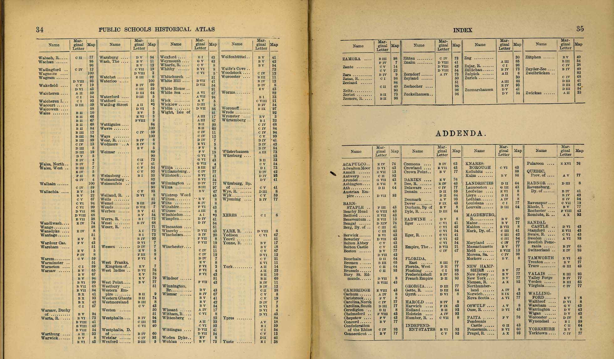
Index
|