Skip to Content
Libraries Home
|
My Account
|
Renew Items
|
Sitemap
|
Help
SEARCH:
choose an area to search
Library Web Site
Library Catalog
How Do I...?
Web
About the Libraries
Libraries, Centers, and Museums
Hours
Library Map
Jobs
Library and Staff Directory
About the Collections
Computing Facilities
Information for Users with Disabilities
Library Administration
Support Your Libraries
Research Tools
Library Catalog
Find Articles using Databases
Find Articles using CrossSearch
Find a Journal
Find a Book
Find a Map
News and Newspapers
Government Information
Research by Subject
Reference Sites
Library Widgets
Library Services
Borrowing
Ask a Librarian
Reserves
Interlibrary Services
Copying/Printing
Study Spaces
Instruction
Media Services
Request a Purchase
UT Digital Repository
Digital Services
Resources for You
Undergraduates
Graduate Students
Faculty
Staff
Distance Learners
Alumni
Visitors
Ask a Map Question
Home
>
Finding Information
>
PCL Map Collection
> Hurricane Rita
Share
Comment
Print
Maps
Maps FAQ
Map Room Guide
World
Africa
Americas
Asia
Australia/Pacific
Europe
Middle East
Polar/Oceans
Russia/Republics
U.S.
Texas
Historical
Thematic
Topographic
Other Map Sites
Map Sites
Map Dealers
Cartographic Reference
City Map Sites
Country Map Sites
Historical Map Sites
Outline Map Sites
Route Planning Sites
State Map Sites
Weather Map Sites
Topical Map Sites
Avian Influenza
Oil and Gas Maps
More Topical Maps
Perry-Castañeda Library
Map Collection
Hurricane Rita Maps
Updated 7/2/09
Hurricane Rita - Texas Maps
Hurricane Rita - Louisiana Maps
Hurricane Rita - Gulf of Mexico Maps
Hurricane Rita - Aerial Images (NOAA)
and
Index Map
Hurricane Rita - Counties Hardest Hit by Rita (ePodunk)
Hurricane Rita - EnviroMapper (EPA)
Hurricane Rita - Google Earth Overlays of NOAA Aerial Images [updated] (Global Connection/CMU/NASA)
Hurricane Rita Maps (New York Times)
Hurricane Rita - Satellite Images - 3D Images Inside the Hurricane (NASA)
Hurricane Rita - Satellite Images and Movies (NASA/GOES)
Hurricane Rita - Track with Interactive Images (MSNBC/Virtual Earth)
Hurricane Rita - Virtually There (MSNBC/Virtual Earth)
More Hurricane Rita Maps (Map Room Weblog)
Louisiana:
Katrina and Rita Damage (State Library of Louisiana)
Southwest Louisiana Coast - Evacuation Maps (NOAA)
including
Cameron Parish
Louisiana - Parish Map (Bureau of the Census)
Louisiana Road Closures (Louisiana State Police)
Louisiana and New Orleans Maps and Images - Katrina
More Louisiana Maps
Texas:
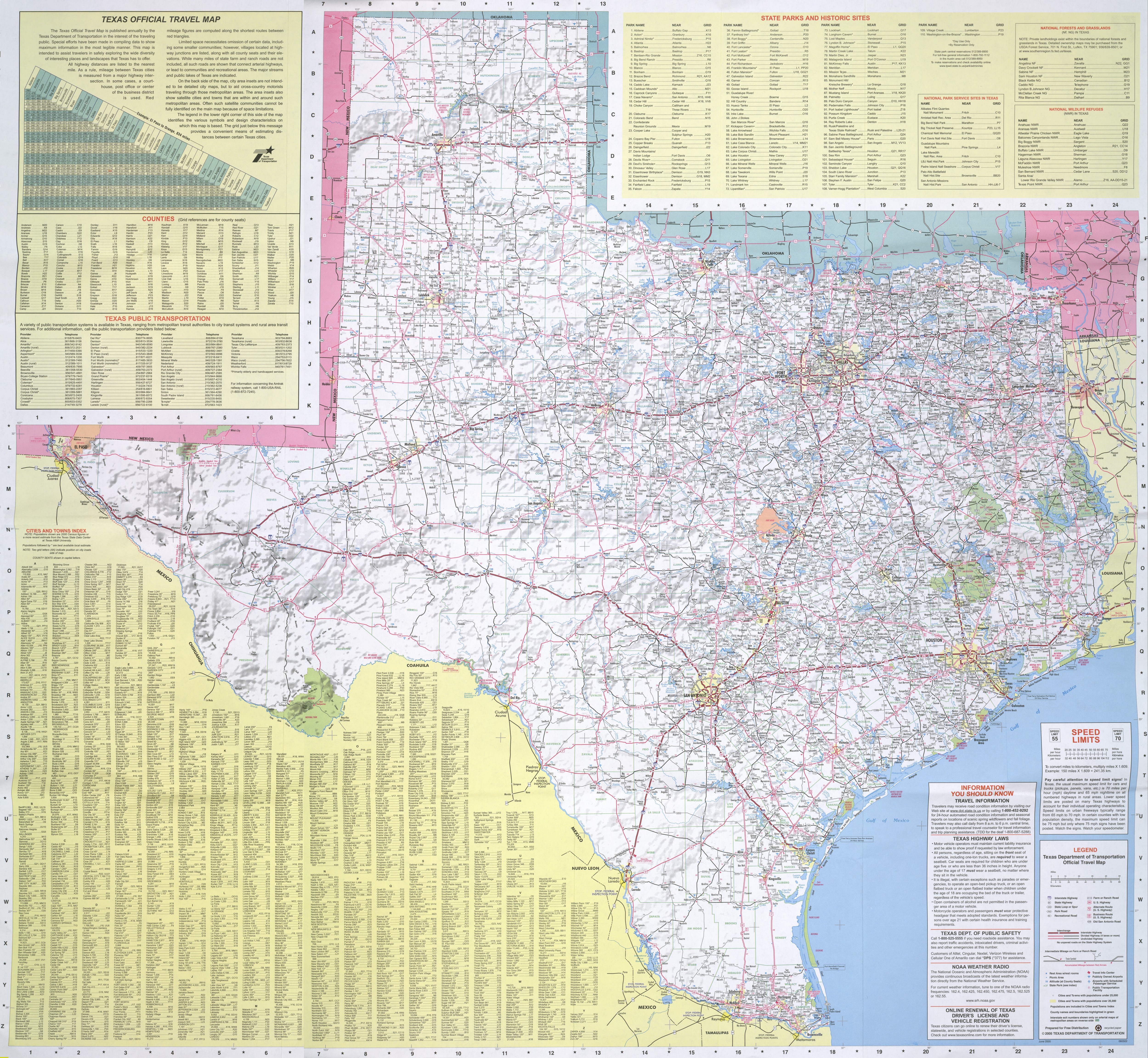
New:Detailed Texas Highway Map - 2005 (TxDOT/University of Texas)
(8.5MB)
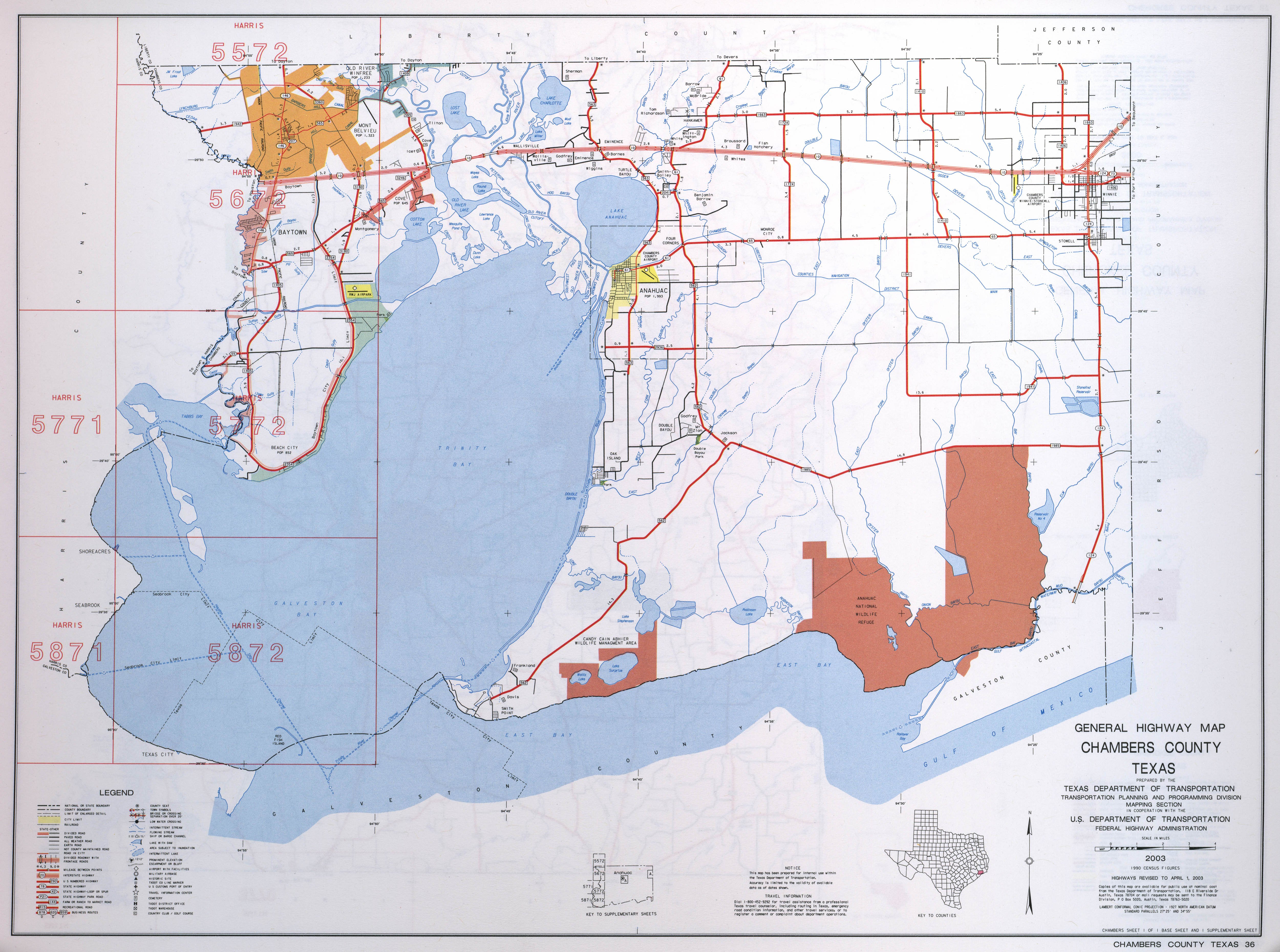
Chambers County - Highway Map (TxDOT/University of Texas)
(2.3MB)
Houston - Real-Time Traffic Map (Houston Transtar)
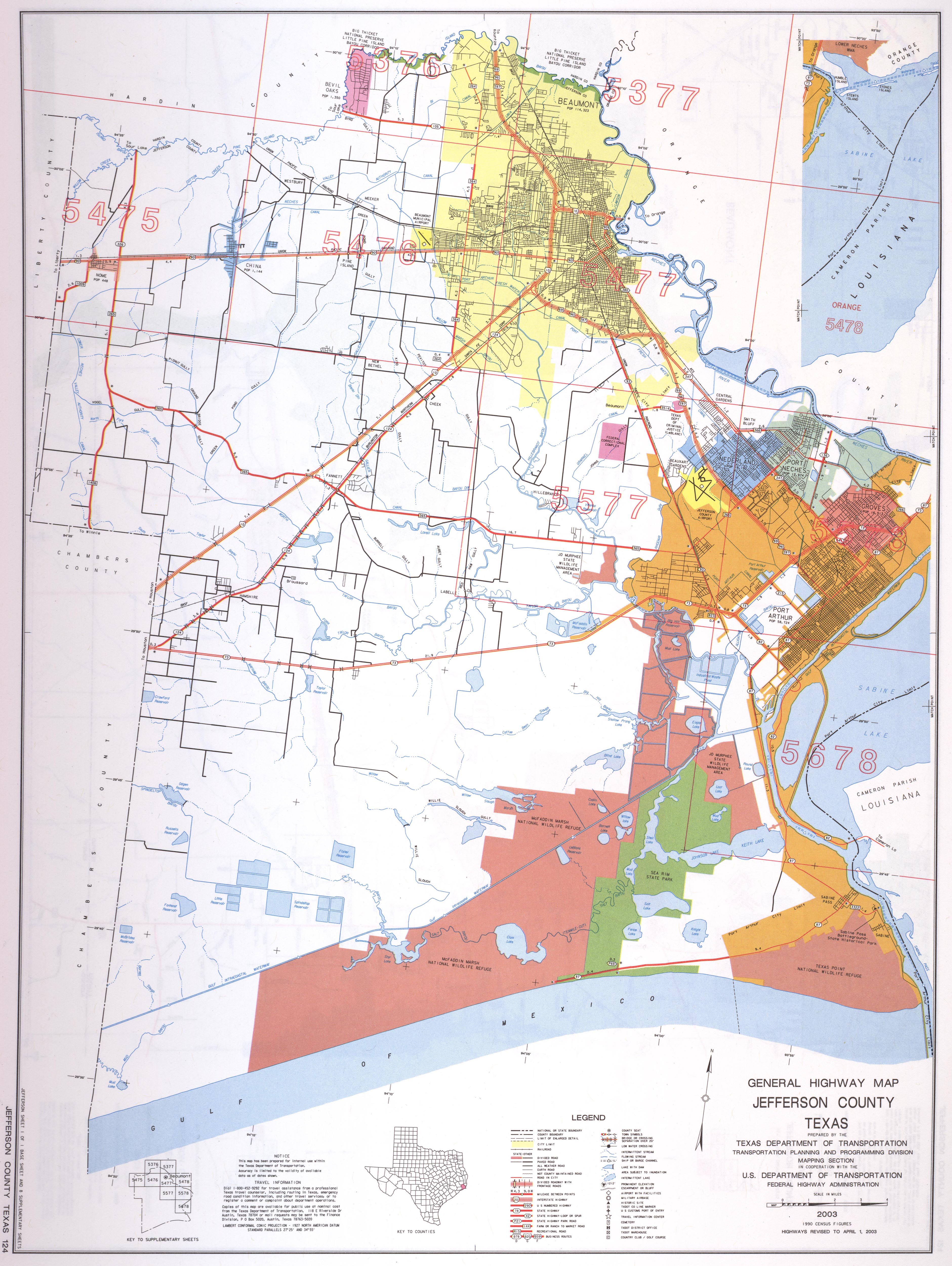
Jefferson County - Highway Map (TxDOT/University of Texas)
(2.7MB)
Texas City Maps
Texas Coast - Aerial View of the Damage [registration required] (KHOU)
[Windows Media]
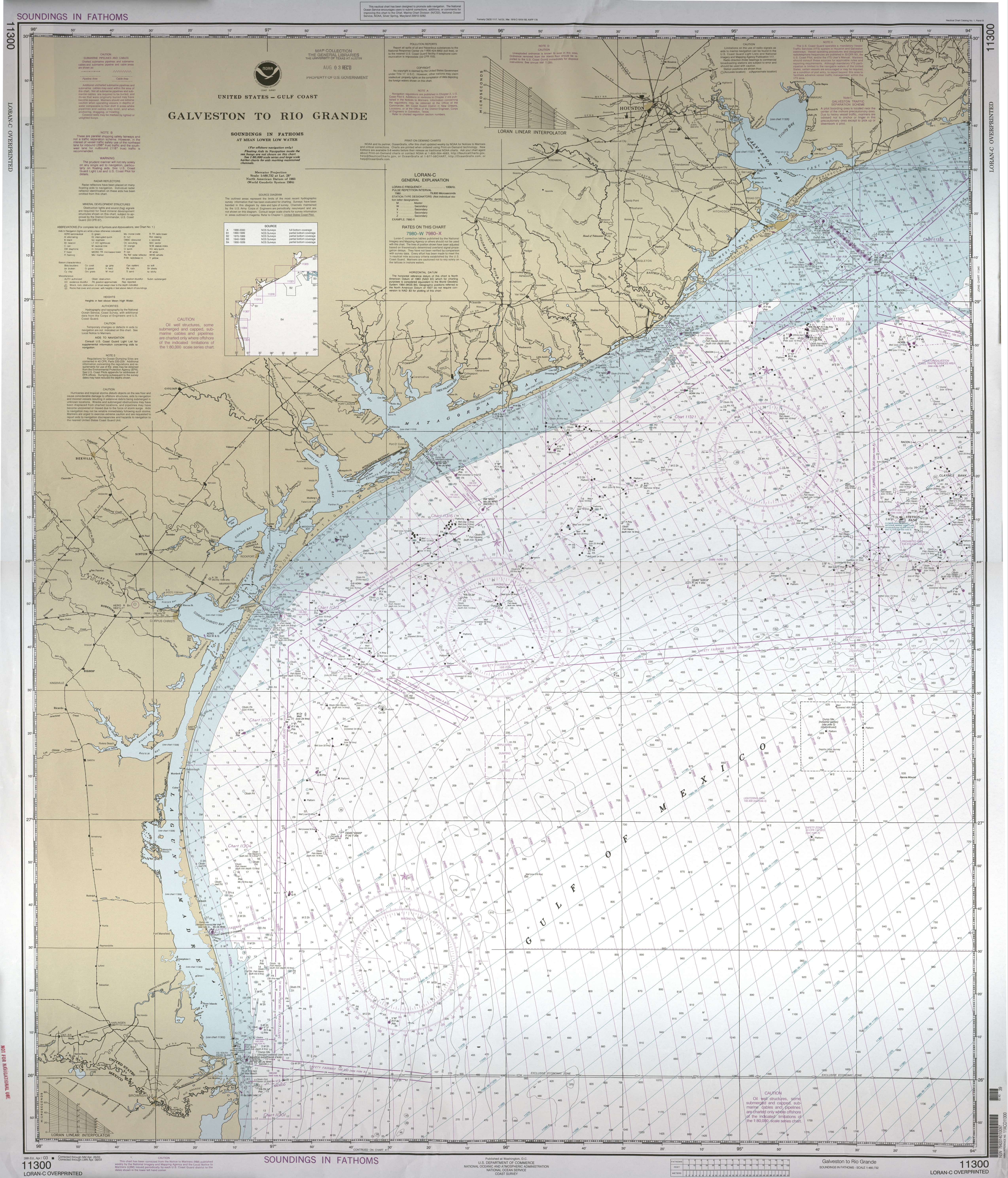
Texas Coast - Nautical Chart - Rio Grande to High Island (NOAA/NOS)
Not for Navigational Use
(8.1MB)
Texas County Highway Maps (TxDOT/University of Texas)
Texas Map Showing County Names and Boundaries (Bureau of the Census)
Texas Highway Map - 2005 (TxDOT)
(8.5MB)
Texas Road Map - Small (World Sites Atlas)
Texas Evacuation and Storm Surge Prediction Maps:
Galveston - Potential Impact of a Category 4 Hurricane on the Galveston Study Area (SpaceRef)
[PowerPoint]
Houston - Storm Surge Risk Zones Map [by Zip Code] (City of Houston)
Houston, East - Storm Surge Risk Zones Map [by Zip Code] - Houston (KHOU)
Jefferson County - Potential Hurricane Impact Report (PC Weather Products)
Evacuation - Maps (TxDOT/Web Archive)
Evacuation and Hurricane Risk Maps for the Upper Texas Coast (NOAA)
Evacuation Map - Corpus Christi, Texas (Caller.com)
More Texas Maps (PCL Map Collection)
Gulf of Mexico:
Gulf Coast - Oil and Chemical Plants in the Region (ePodunk)
Gulf Coast Oil Refineries/Path of Rita (CNN/Money)
Gulf of Mexico - Ship Locations (Sailwx.info)
Gulf of Mexico - Temperature Map (NOAA/OSDPD)