Perry-Castañeda Library
Map Collection
Historical Maps of the Middle East
- Aleppo [Alep] 1912 (400K)
- From Palestine and Syria...Handbook for Travellers by Karl Baedeker, 5th Edition, 1912.
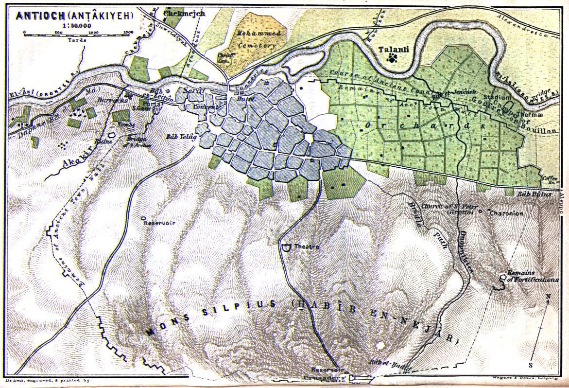
- Antioch 1912 (352K)
- From Palestine and Syria...Handbook for Travellers by Karl Baedeker, 5th Edition, 1912.
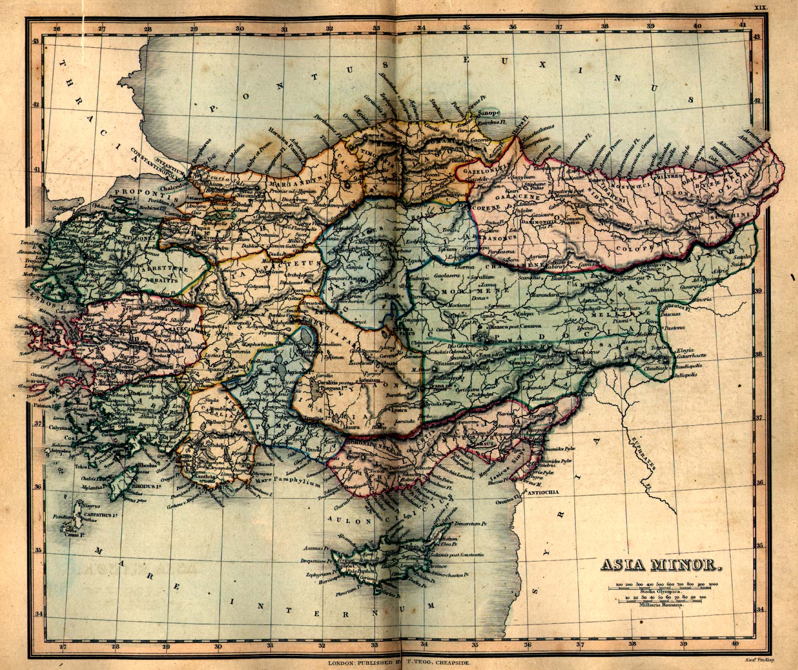
- Asia Minor - Ancient (638K)
- From a Classical Atlas of Ancient Geography by Alexander G. Findlay, 1849.
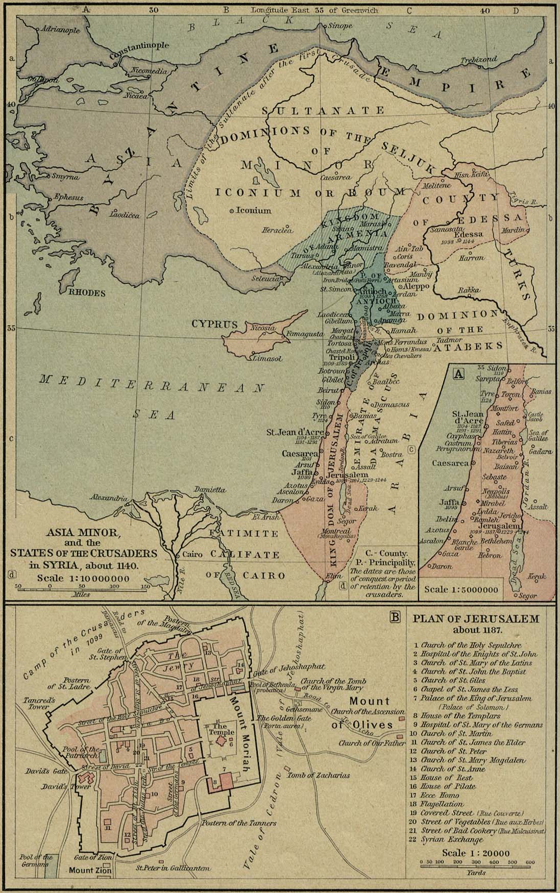
- Asia Minor and the States of the Crusaders in Syria, about 1140 (329K)
- From a Classical Atlas of Ancient Geography by Alexander G. Findlay, 1849.
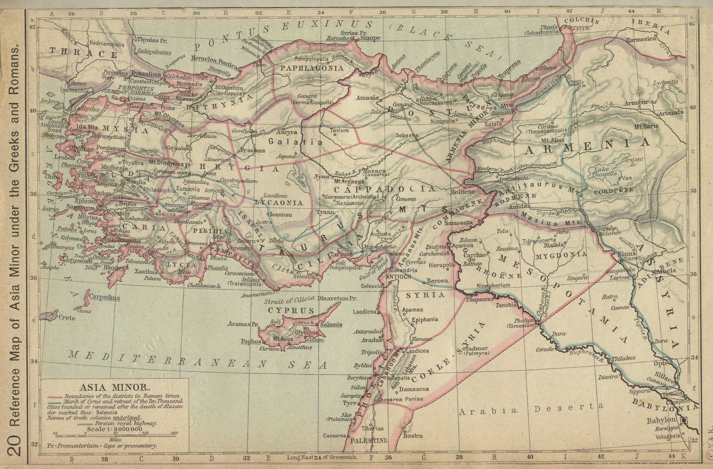
- Asia Minor under the Greeks and Romans (360K)
- From The Historical Atlas by William R. Shepherd, 1923.
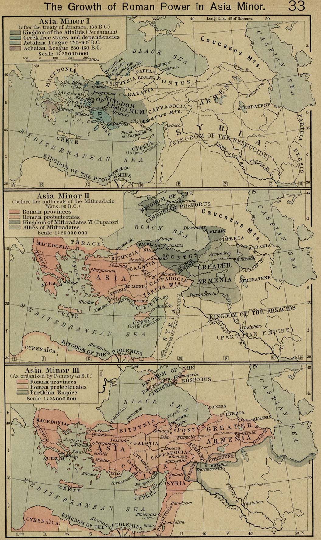
- Asia Minor - Growth of Roman Power (337K)
- "The Growth of Roman Power in Asia Minor." From The Historical Atlas by William R. Shepherd, 1923.
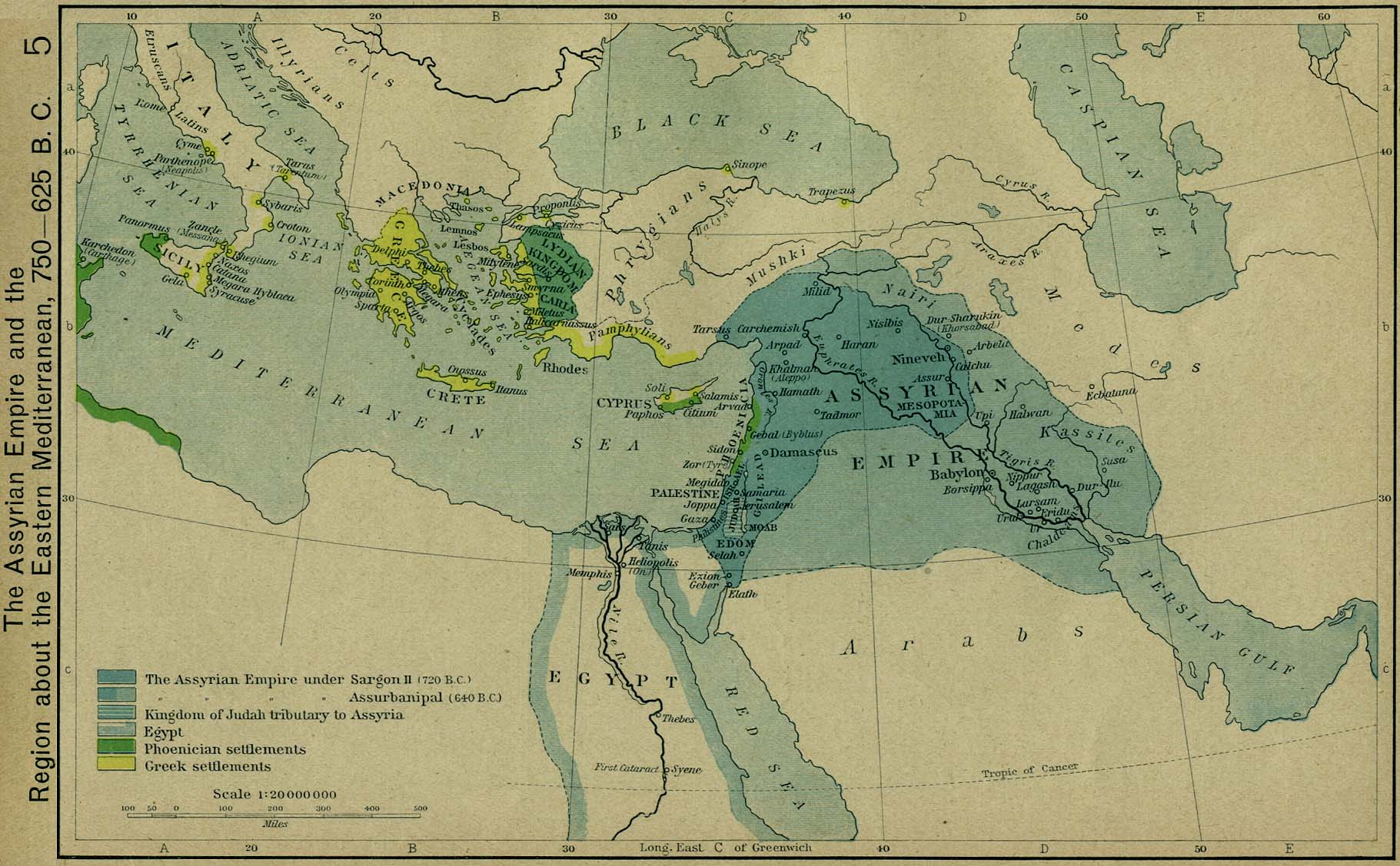
- The Assyrian Empire and the Region about the Eastern Mediterranean, 750-625 B.C. (294K)
- From The Historical Atlas by William R. Shepherd, 1923.
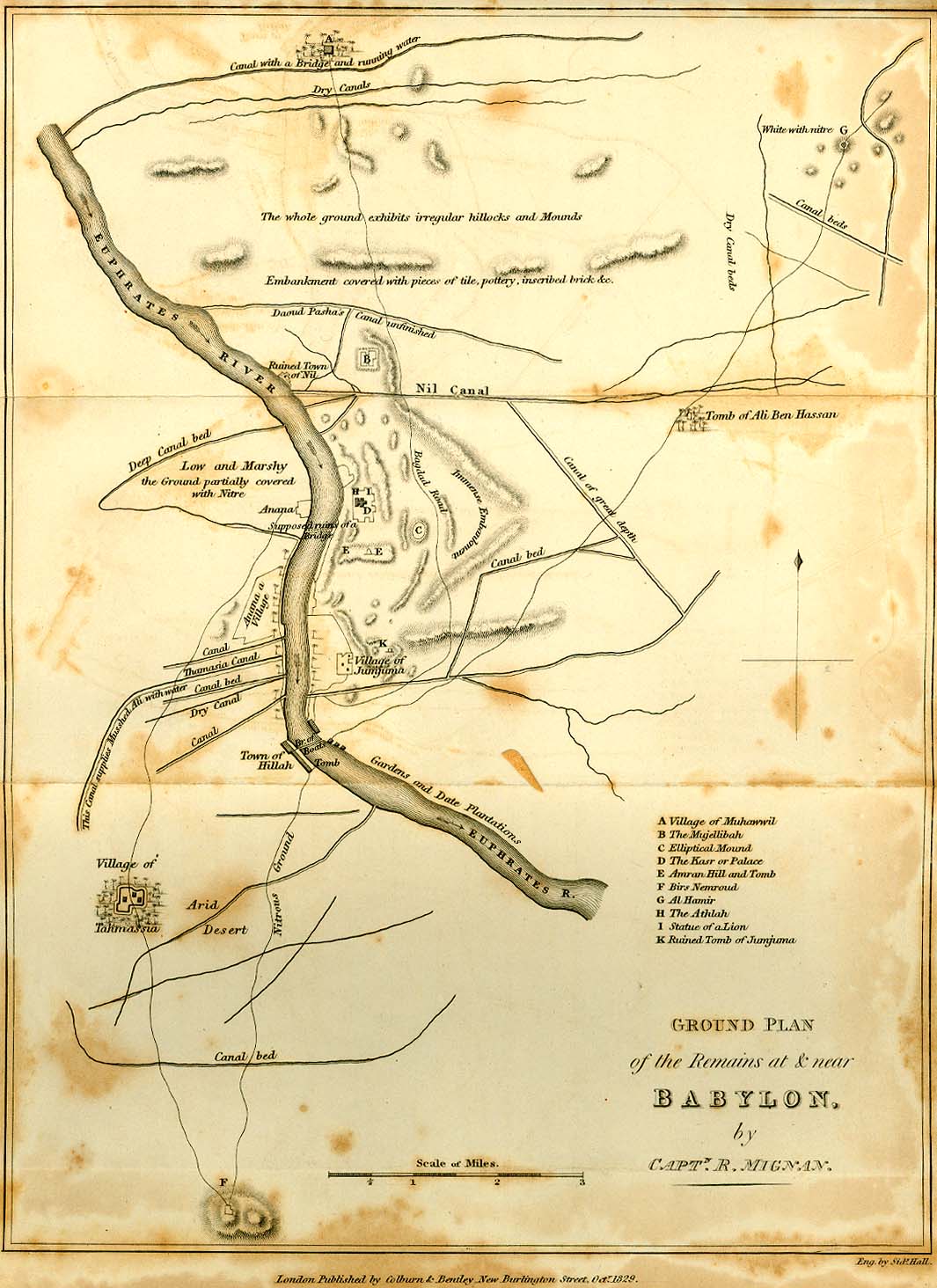
- Babylon 1829 (229K)
- From Travels in Chaldaea, including a journey from Bussorah to Bagdad, Hillah, and Babylon, performed on foot in 1827, published by Henry Colburn and Richard Bentley, London, 1829.
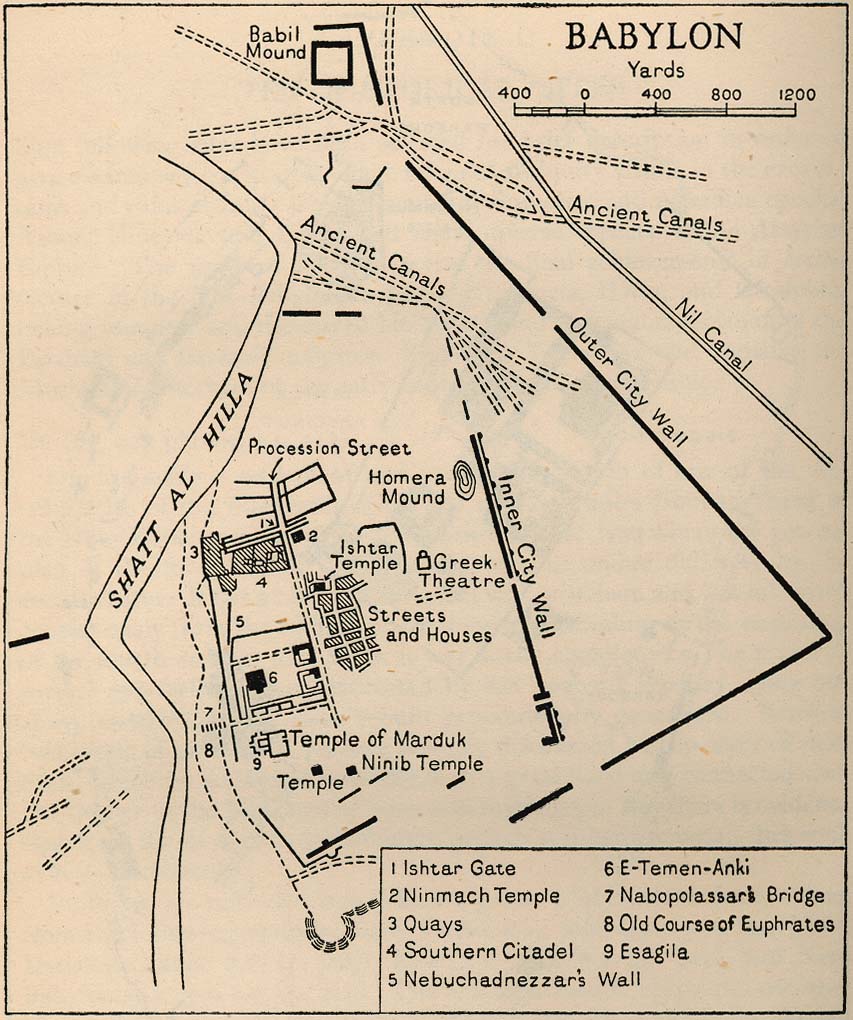
- Babylon 1944 (173K)
- From Iraq and the Persian Gulf, Great Britain. Naval Intelligence Division, 1944.
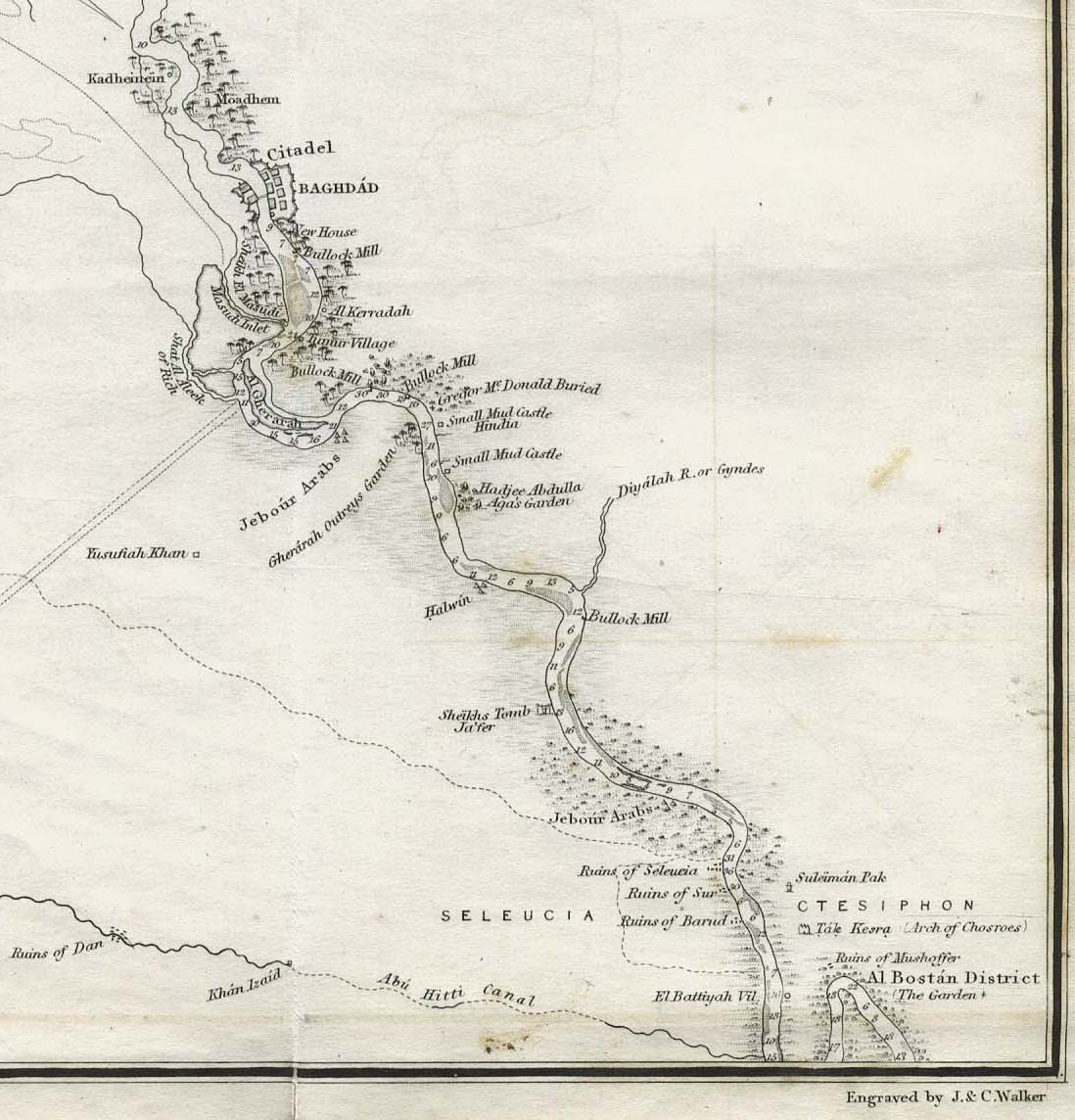
- Baghdad 1849 (176K)
- This is a portion of "The River Euphrates From Hit to the Kuthah River and The River Tigris from Sammara to the Abu Hitti Canal..."
from Maps volume, sheet VII of The Expedition for the Survey of the Rivers Euphrates and Tigris, Carried on by Order of the British Government in the years 1835, 1836, and 1837...
by Francis Rawdon Chesney. London, Longman, Brown, Green, and Longmans, 1850.
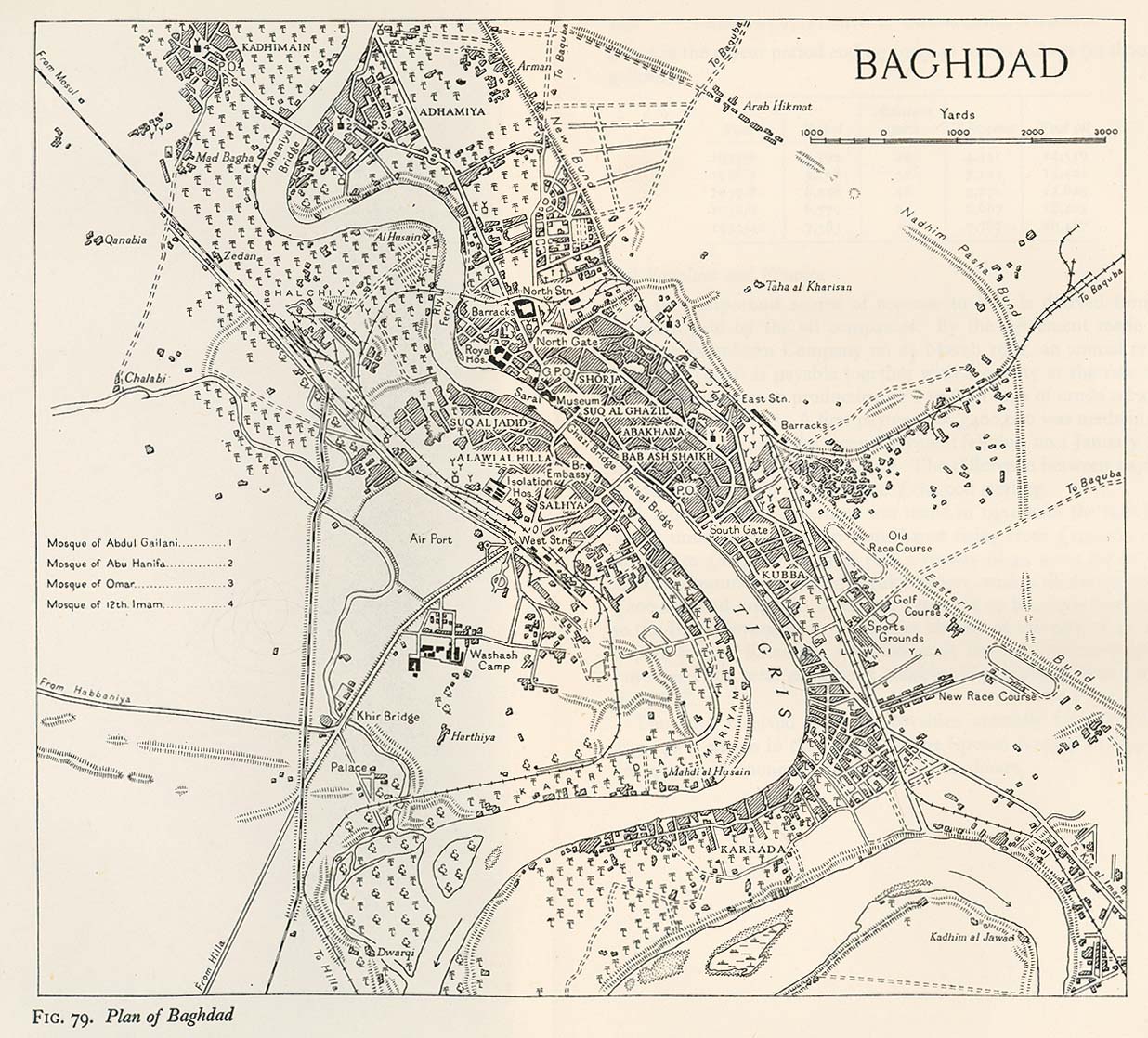
- Baghdad 1944 (346K)
- From Iraq and the Persian Gulf, Great Britain. Naval Intelligence Division, 1944.
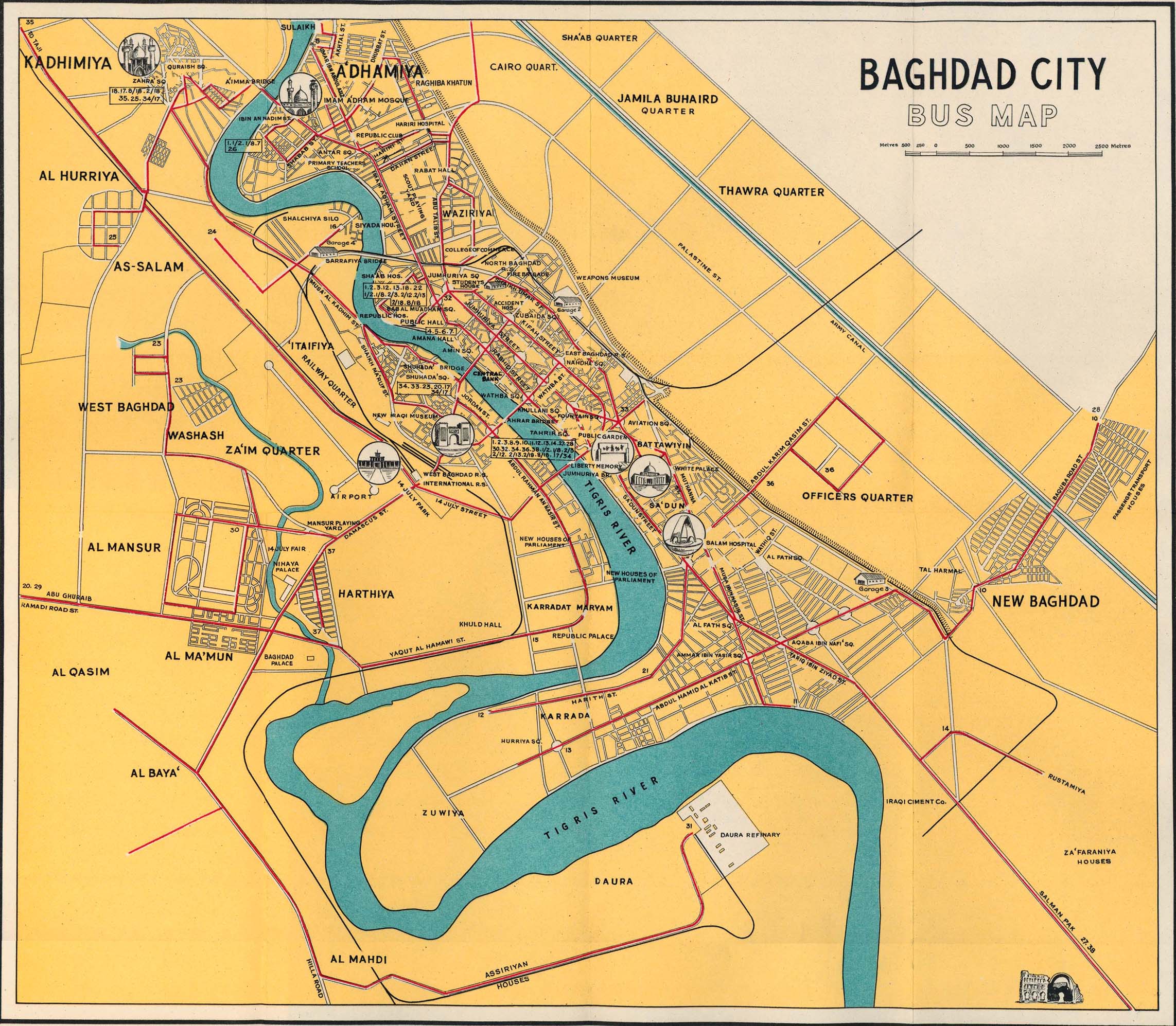
- Baghdad 1961 (708K)
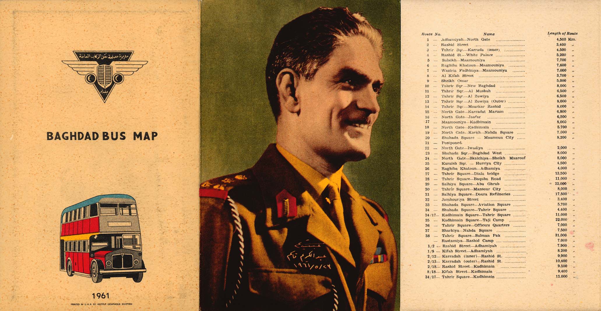
- Baghdad Bus Map and map cover and route information (291K)
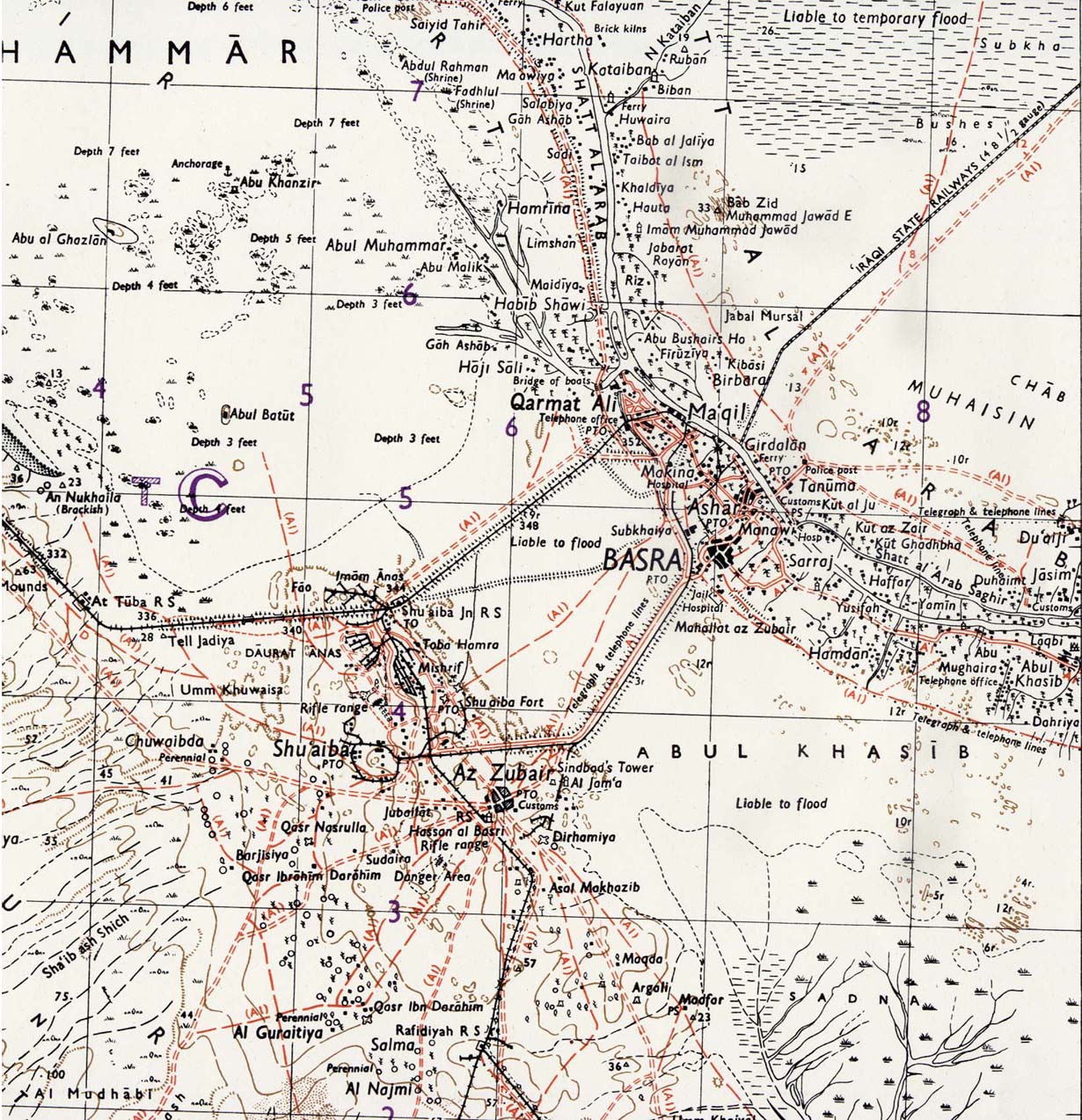
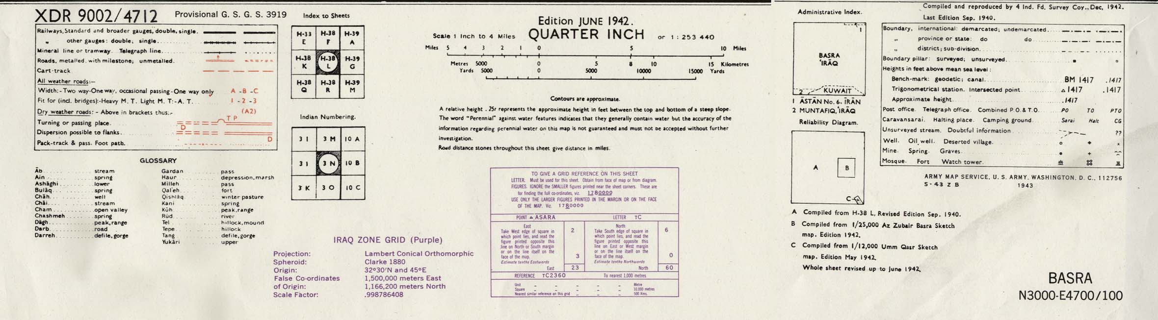
- Basra Area 1942 (423K)
- Portion of sheet H-38 L Basra. Edition June 1942. Original scale 1:253,440 Compiled and Reproduced by India Field Survey Company, December 1942.
Published by the U.S. Army Map Service, May 1943. map key and scale (185K)
- Beirut [Beyrout] 1912 (737K)
- From Palestine and Syria...Handbook for Travellers by Karl Baedeker, 5th Edition, 1912.
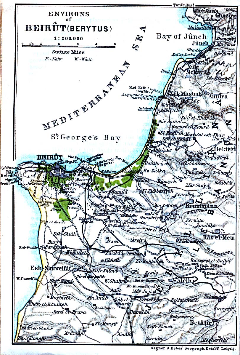
- Beirut Environs 1912 (346K)
- From Palestine and Syria...Handbook for Travellers by Karl Baedeker, 5th Edition, 1912.
- Bethlehem [Bethleem/Beit Lahm] 1912 (392K)
- From Palestine and Syria...Handbook for Travellers by Karl Baedeker, 5th Edition, 1912.
- Damascus [Damas] Central 1912 (374K)
- From Palestine and Syria...Handbook for Travellers by Karl Baedeker, 5th Edition, 1912.
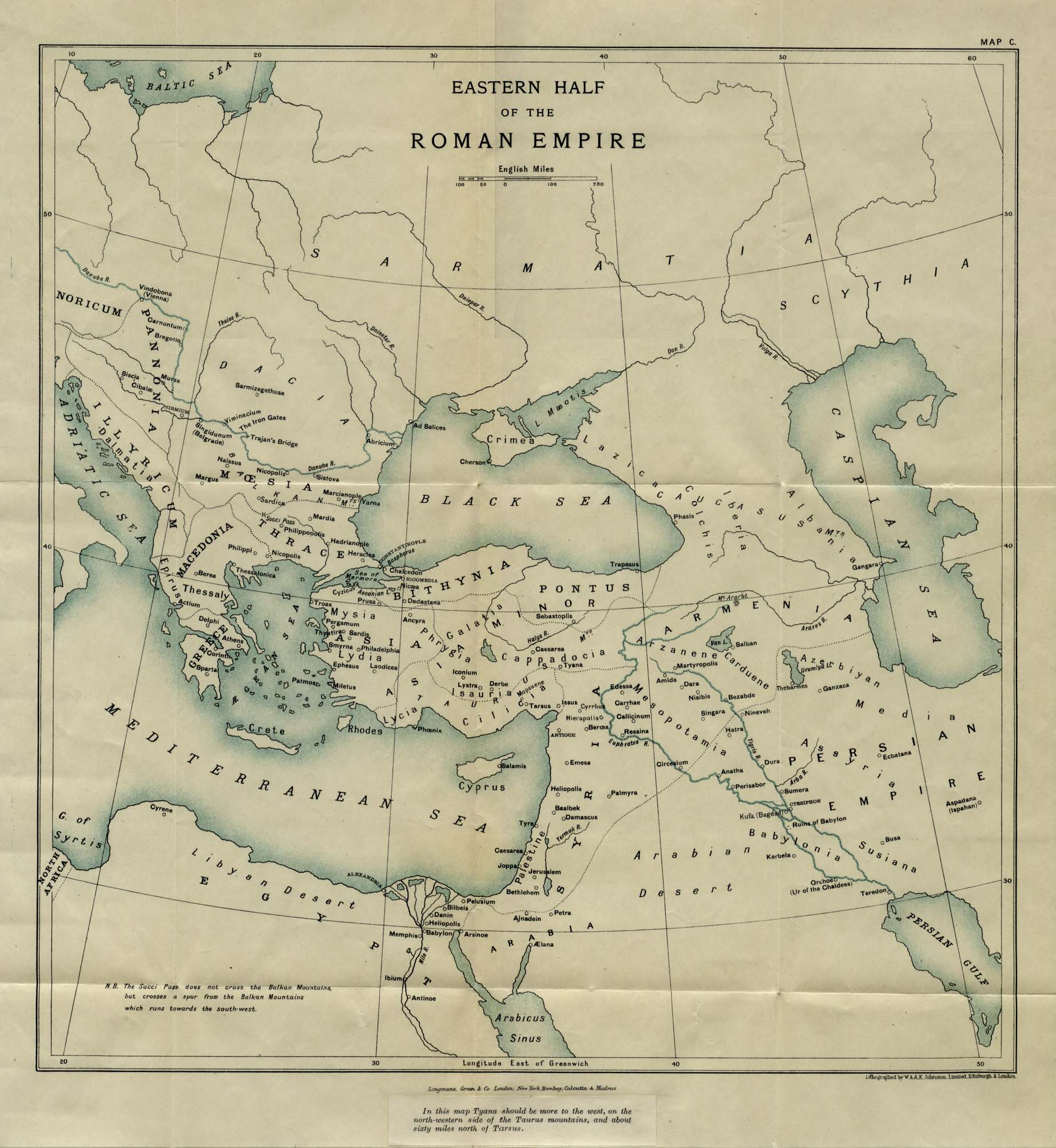
- Eastern Half of the Roman Empire (353K)
- From East and West Though Fifteen Centuries, Volume II, by G. F. Young. Published by Longmans, Green and Co. 1916.
- Egypt - Napoleon's Campaign, 1798 (241K)
- From The Historical Atlas by William R. Shepherd, 1926.
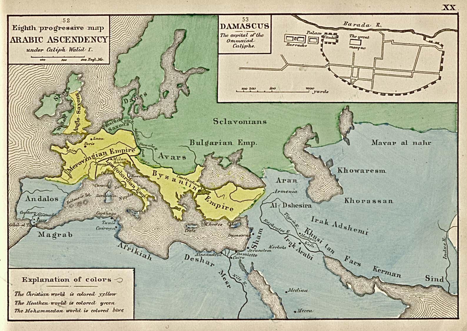
- The Eighth Progressive Map - Arabic Acendency (387K)
- "The Eighth Progressive Map - Arabic Acendency; showing (a,)The Arabic Empire in its greatest extent. (b,) The world at the beginning of the eighth century (Christianity on the point of being crushed by the Moslems.). (c,)The four Christian empires (Byzantine, Longobardian, Merovingian, and Anglo-Saxon.)." From "An Historical Atlas Containing a Chronological Series of One Hundred and Four Maps, at Successive Periods, from the Dawn of History to the Present Day." by Robert H. Labberton. Sixth Edition. 1884.
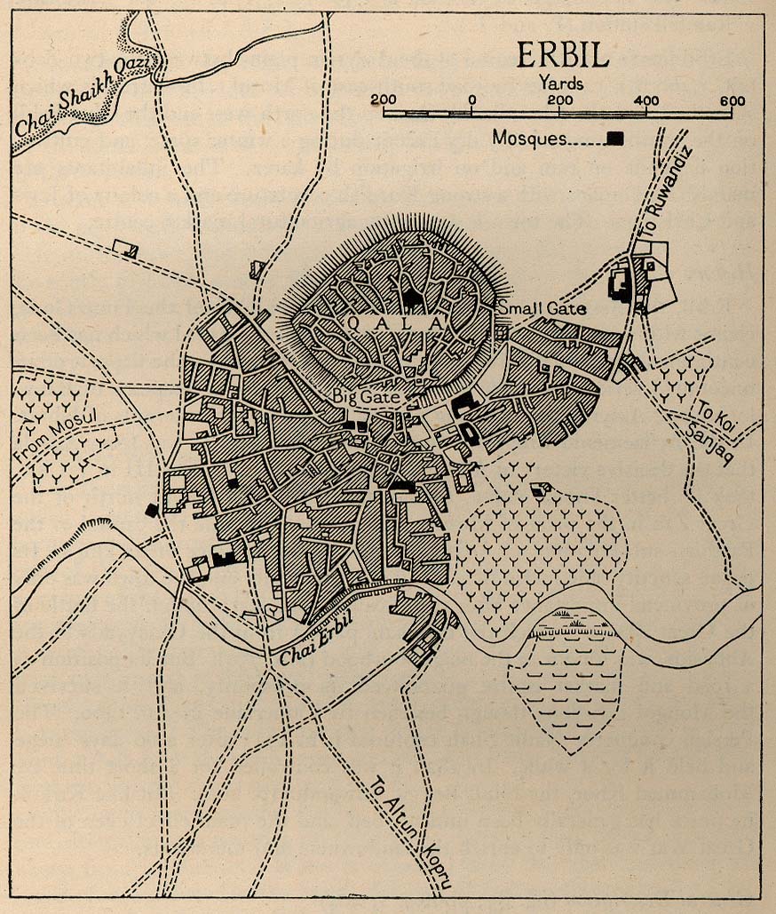
- Erbil 1944 (238K)
- From Iraq and the Persian Gulf, Great Britain. Naval Intelligence Division, 1944.
- Hebron [El-Khalil] 1912 (319K)
- From Palestine and Syria. Handbook for Travellers by Karl Baedeker, 5th Edition, 1912.
- Iraq Historical Maps
- Historical maps on our Iraq Maps page
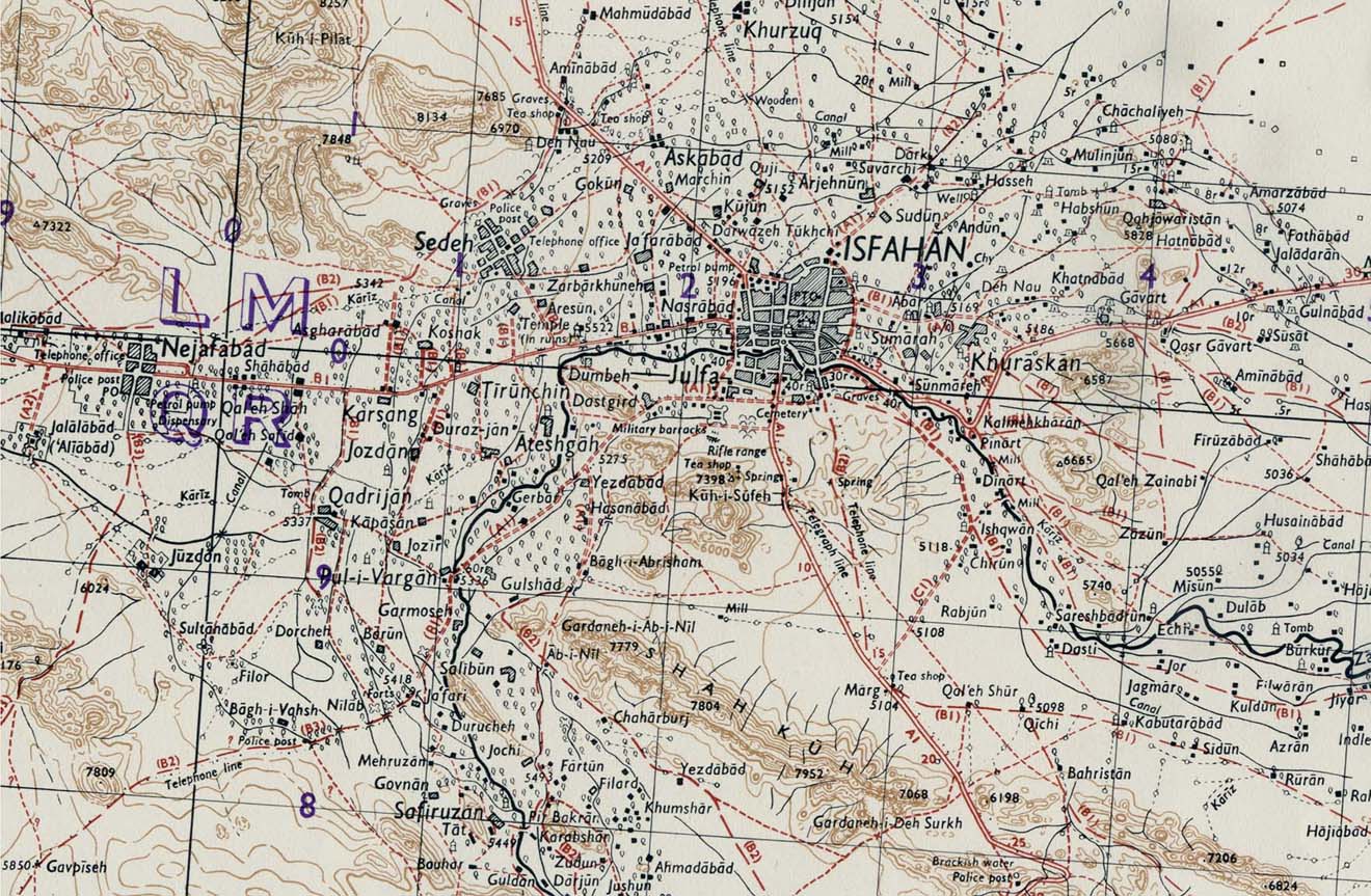
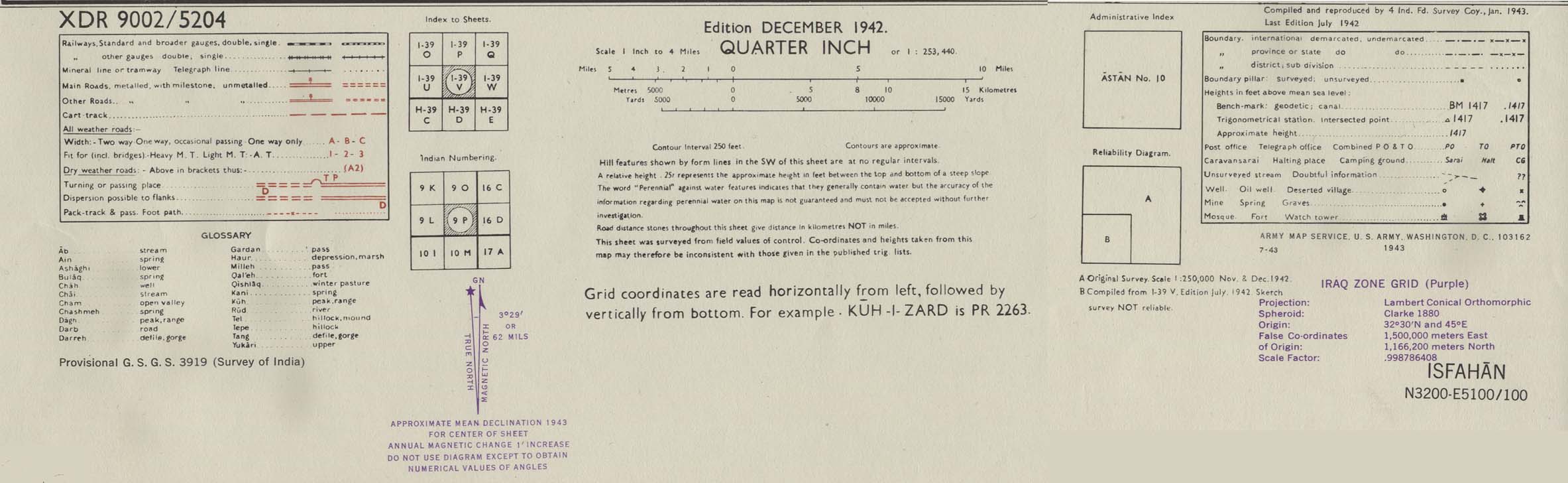
- Isfahan Area 1942 (314K)
- Portion of sheet I-39 V Isfahan. Edition December 1942. Original scale 1:253,440 Compiled and Reproduced by India Field Survey Company, January 1943. Published by the U.S. Army Map Service, July 1943. map key and scale (168K)
- Israel [Historical Maps] (211K)
- From Issues in the Middle East, Atlas, U.S. Central Intelligence Agency, 1973. Six small maps: Israel in Biblical Times (David's Kingdom c.970 B.C., Solomon's Kingdom c.930 B.C.),
Israel in Biblical Times (Hasmonaean Kingdom under the Maccabees 167-142 B.C.), Palestine British Mandate 1920-1948, Palestine U.N. Partition Plan 1947, Israel 1949-1967 and Israel and Occupied Territory since June 10, 1967
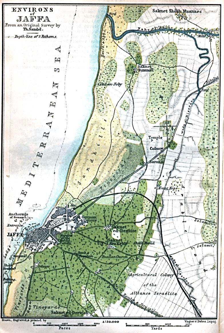
- Jaffa Environs 1912 (260K)
- From Palestine and Syria. Handbook for Travellers by Karl Baedeker, 5th Edition, 1912.
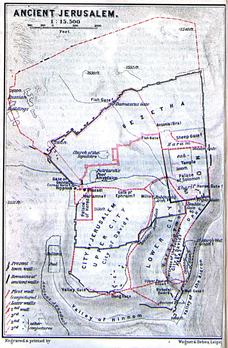
- Jerusalem - Ancient (356K)
- From Palestine and Syria. Handbook for Travellers by Karl Baedeker, 5th Edition, 1912.
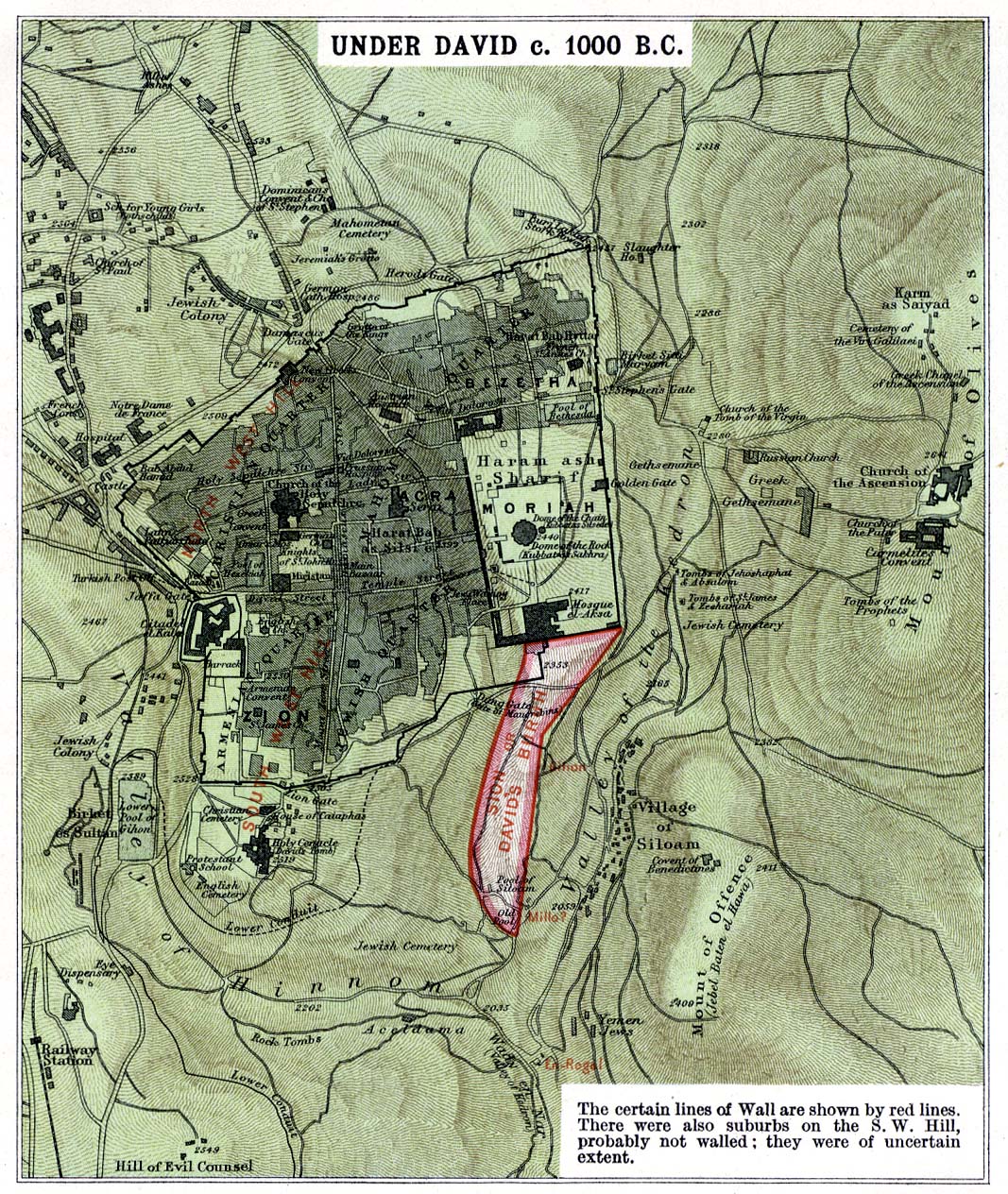
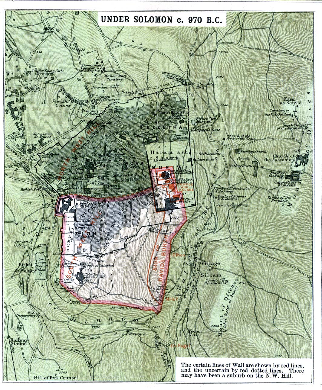
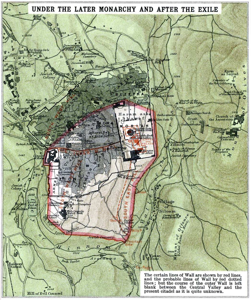
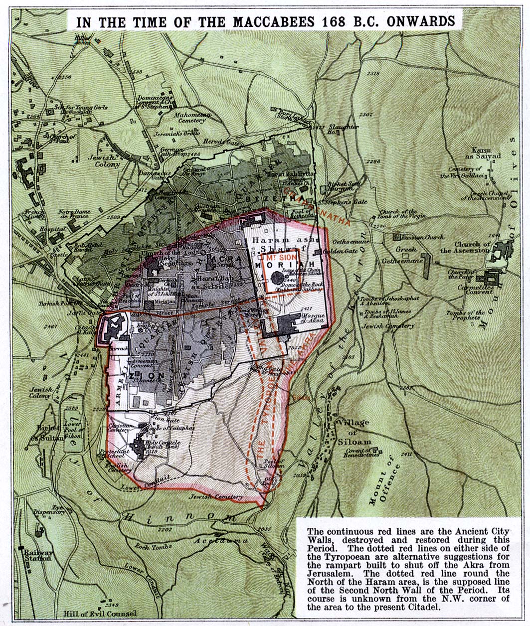
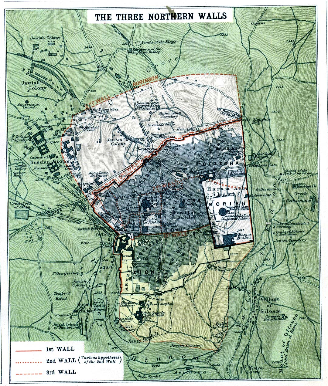
- Jerusalem at Different Periods:
- Under David c. 1000 B.C. (512K)
- Under Solomon c. 970 B.C. (544K)
- Under the Later Monarchy and after the Exile (492K)
- In the Time of the Macabees 168 B.C. Onwards (476K)
- In the Herodian Period (504K)
- The Three Northern Walls (576K)
- From Atlas of the Historical Geography of the Holy Land. Designed and edited by George Adam Smith and prepared under the direction of J.G. Bartholomew. London, Hodder and Stoughton, 1915.
- Under Solomon c. 970 B.C. (544K)
- Jerusalem 1884 (774K)
- From Hardesty's Historical and Geographical Encyclopedia Illustrated, H.H. Hardesty & Company, 1884.
- Jerusalem 1912 (754K)
- From Palestine and Syria. Handbook for Travellers by Karl Baedeker, 5th Edition, 1912.
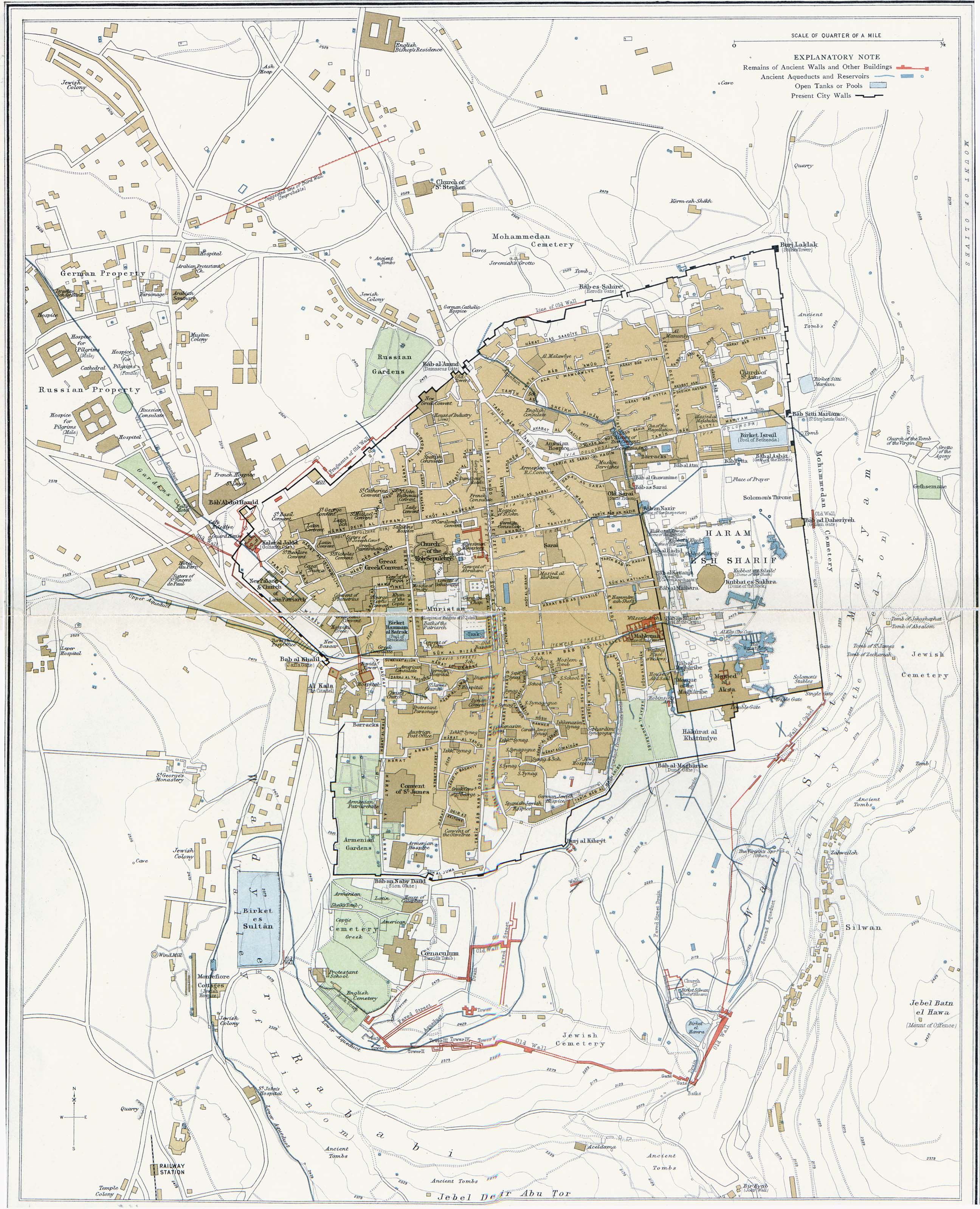
- Jerusalem 1915 (1MB)
- "Modern Jerusalem Illustrating Recent Discoveries." From Atlas of the Historical Geography of the Holy Land. Designed and edited by George Adam Smith and prepared under the direction of J.G. Bartholomew. London, Hodder and Stoughton, 1915.
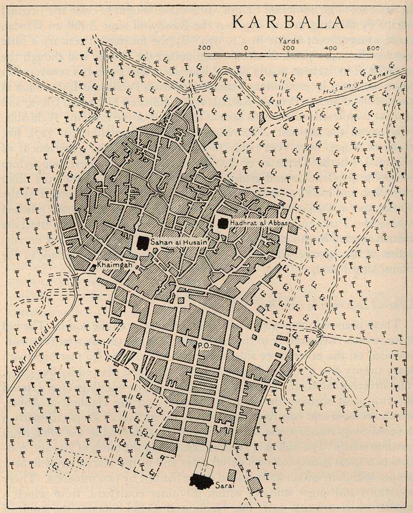
- Karbala 1944 (243K)
- From Iraq and the Persian Gulf, Great Britain. Naval Intelligence Division, 1944.
- Kuwait Historical Maps 1987-1991
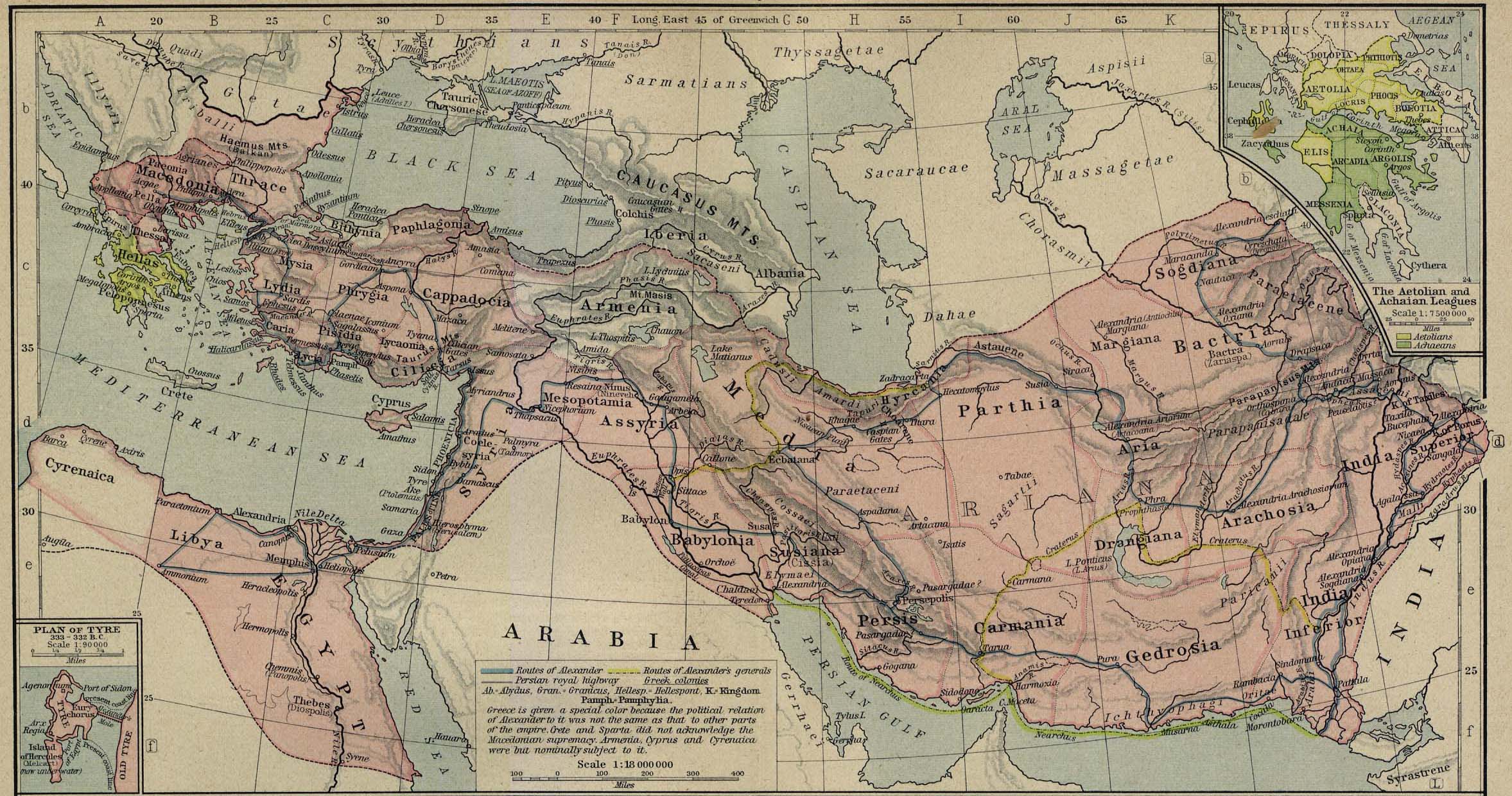
- The Macedonian Empire, 336-323 B.C. (560K)
- From The Historical Atlas by William R. Shepherd, 1923. Insets: The Aetolian and Achaian Leagues. Plan of Tyre.
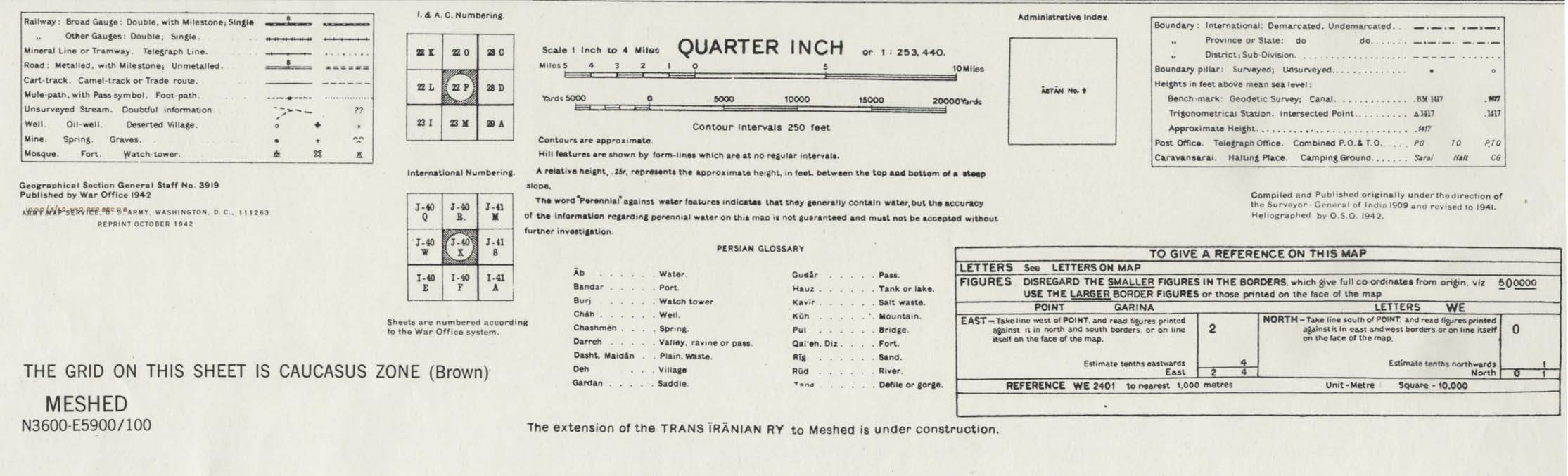
- Meshed [Mashad] Area 1942 (538K)
- Portion of sheet J-40 X Iran. Original scale 1:253,440 Compiled and published originally under the direction of the Surveyor-General of India 1909 and Revised to 1941. Published by the War Office, 1942 and reprinted by the U.S. Army Map Service October 1942. map key and scale (146K)
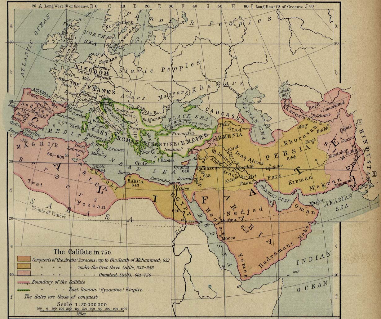
- Middle East and Europe - The Caliphate in 750 (293K)
- "The Califate in 750." From The Historical Atlas by William R. Shepherd, 1926.
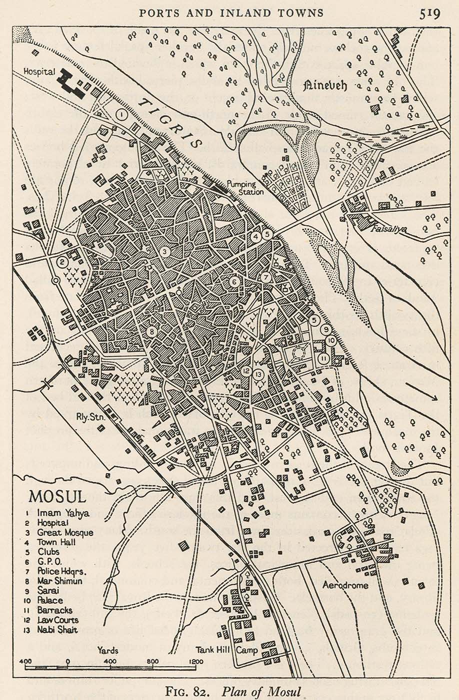
- Mosul 1944 (317K)
- From Iraq and the Persian Gulf, Great Britain. Naval Intelligence Division, 1944.
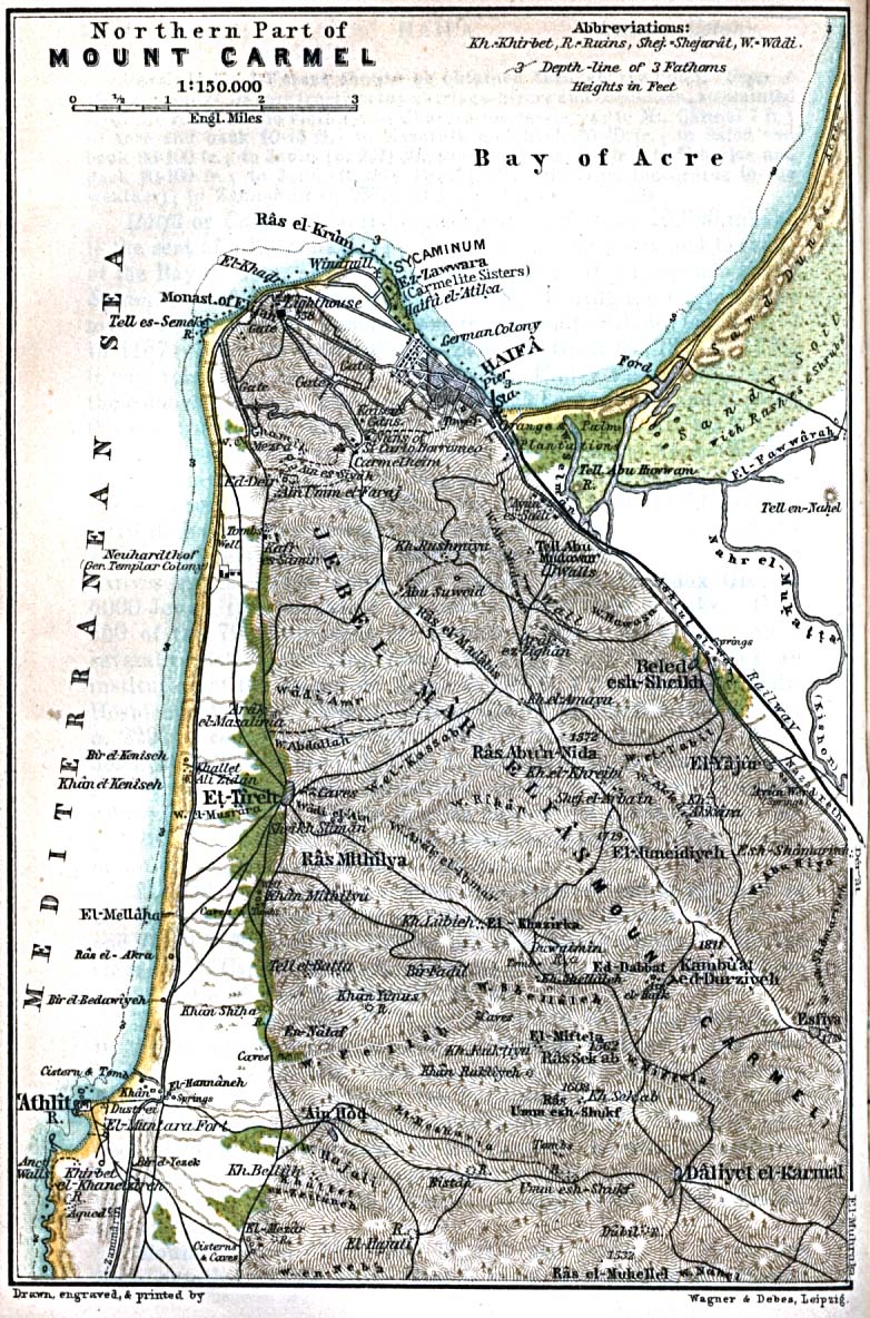
- Mt. Carmel - Northern Part 1912 (309K)
- From Palestine and Syria. Handbook for Travellers by Karl Baedeker, 5th Edition, 1912.
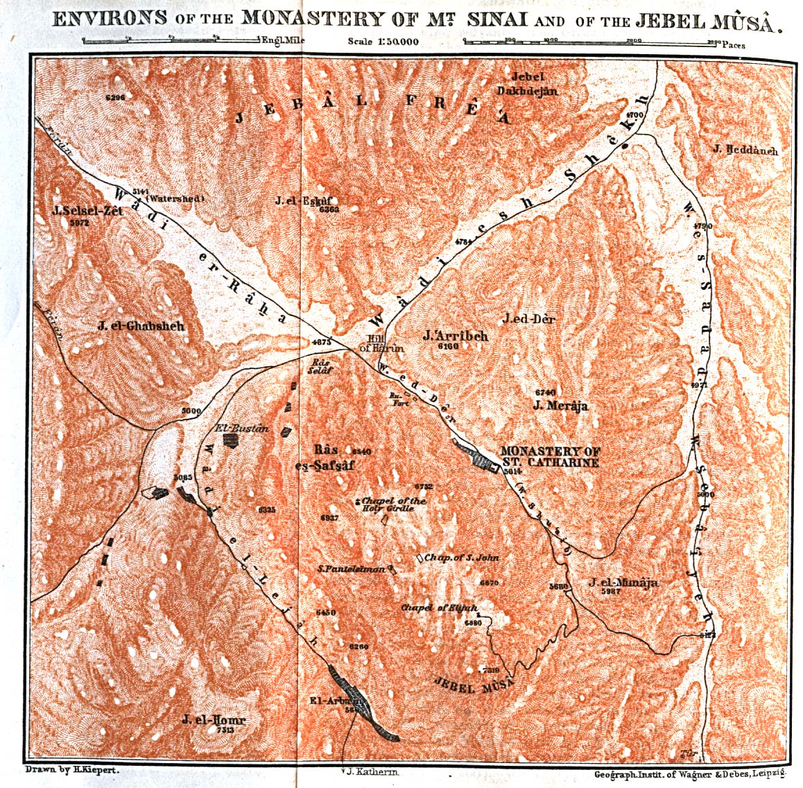
- Mt. Sinai - Environs of the Monastery 1912 (521K)
- From Palestine and Syria. Handbook for Travellers by Karl Baedeker, 5th Edition, 1912.
- Nazareth [En-Nasira] 1912 (351K)
- From Palestine and Syria. Handbook for Travellers by Karl Baedeker, 5th Edition, 1912.
- The Oriental Empires about 600 B.C (146K)
- From The Historical Atlas by William R. Shepherd, 1923.
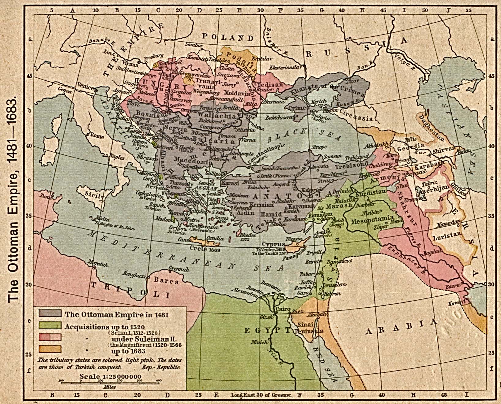
- Ottoman Empire, 1481-1683 (581K)
- From The Historical Atlas by William R. Shepherd, 1923.
- The Ottoman Empire, [1683-1923] (649K)
- From The Historical Atlas by William R. Shepherd, 1923.
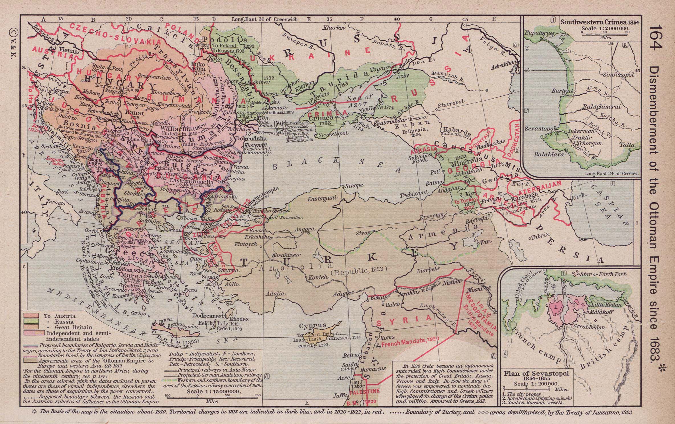
- Ottoman Empire since 1683 (387K)
- Insets: Southwestern Crimea, 1854. Plan of Sevastopol, 1854-1855. From The Historical Atlas by William R. Shepherd, 1923.
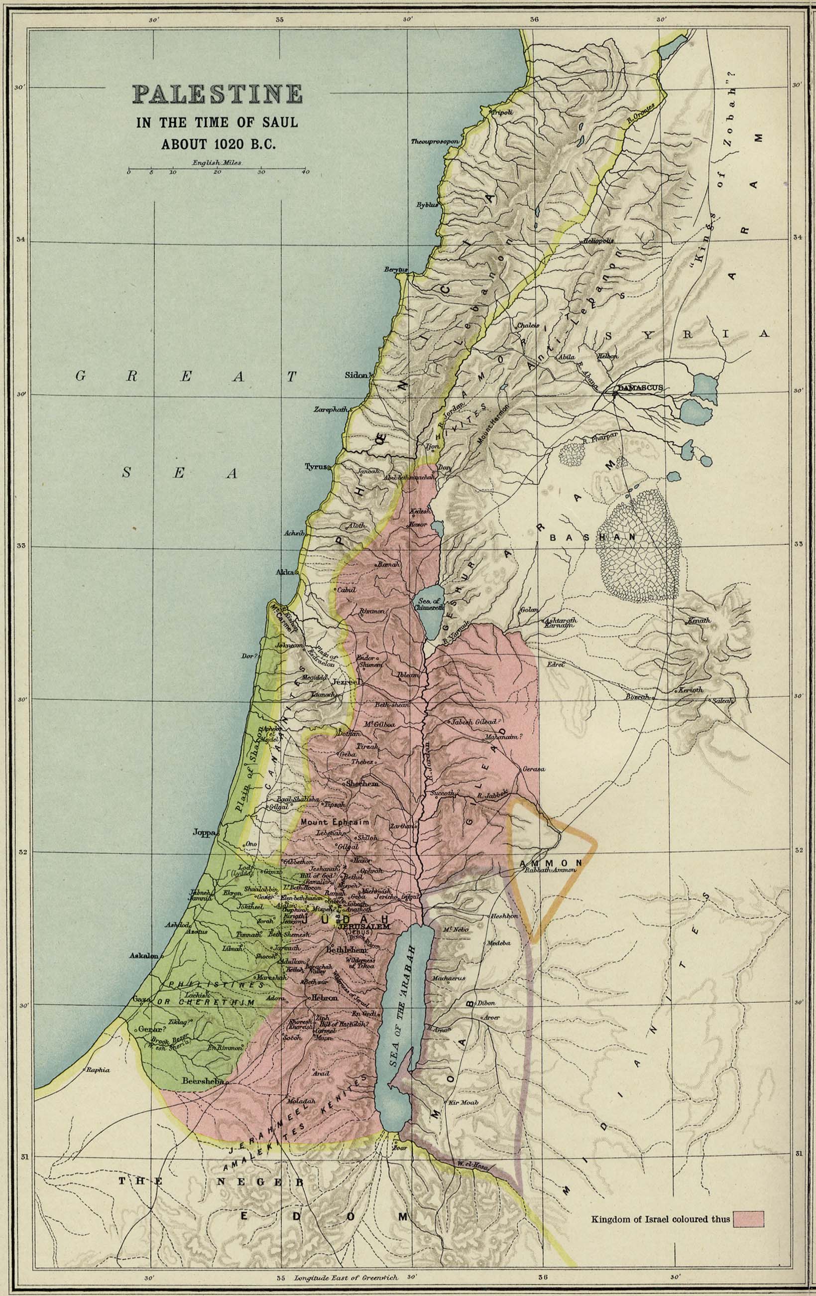
- Palestine 1020 B.C.
- "Palestine in the time of Saul." From Atlas of the Historical Geography of the Holy Land. Smith, George Adam. London, 1915.
- [Palestine, Ancient] Palaestina (507K)
- From "A Classical Atlas, to Illustrate Ancient Geography; Comprised in Twenty-Five maps, Showing the Various Divisions of the World as Known to the Ancients; Composed from the Most Authentic Sources." by Alexander G. Findlay, F.R.G.S. 1849.
- Reference Map of Ancient Palestine (785K)
- From The Historical Atlas by William R. Shepherd, 1923.
- Persian Empire about 500 B.C. (134K)
- From The Historical Atlas by William R. Shepherd, 1923.
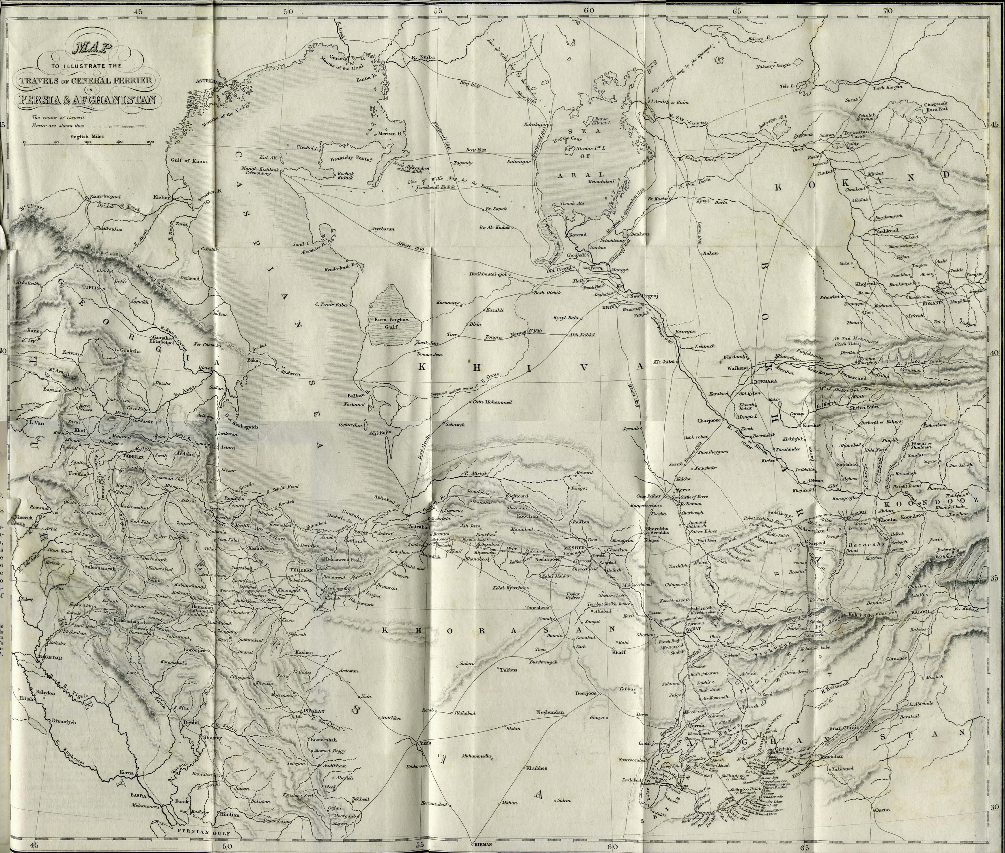
- Persia and Afghanistan 1856 (1.4MB)
- "Map to Illustrate the Travels of General Ferrier in Persia and Afghanistan" from Caravan Journeys and Wanderings in Persia, Afghanistan, Turkistan, and Beloochistan; with Historical Notices of the Countries Lying Between Russia and India by Joseph Pierre Ferrier. Second Edition 1857.
- Persia, Afghanistan and Beluchistan 1902 (14.8MB)
- "Persia, Afghanistan and Beluchistan Showing Lord Ronaldshay's Route" from Sport and Politics Under an Eastern Sky by The Earl of Ronaldshay, William Blackwood and Sons, 1902.
- Petra 1912 (431K)
- From Palestine and Syria. Handbook for Travellers by Karl Baedeker, 5th Edition, 1912.
- Red Sea 1860 (1MB)
- "Das Rothe Meer und die Wichtigsten Hafen Seiner Westhalfte" [Includes plans of Rothen Meere Politischen u. Commerciellen, Scherm Schaab, Sauakin (Sudan), Bucht von Aqiq und Insel Eiro (Sudan), Massaua (Massawa, Eritrea), Bai von Adulis (Eritrea), Nokeri od. Nechesia, Insel Majun od. Perim, Alt und Neu Qosseir, Mocha od. Moka (Yemen)]. From Mittheilungen aus Justus Perthes' Geographischer Anstalt uber Wichtige Neue Erforschungen auf dem Gesammtgebiete der Geographie von Dr. A. Petermann. Volume 6, 1860.
- Saida [Sidon] Environs 1912 (290K)
- From Palestine and Syria. Handbook for Travellers by Karl Baedeker, 5th Edition, 1912.
- Socotra 1886 (118K)
- "Island of Socotra" from the Scottish Geographical Magazine. Published by the Scottish Geographical Society and edited by Hugh A. Webster and Arthur Silva White. Volume II, 1886.
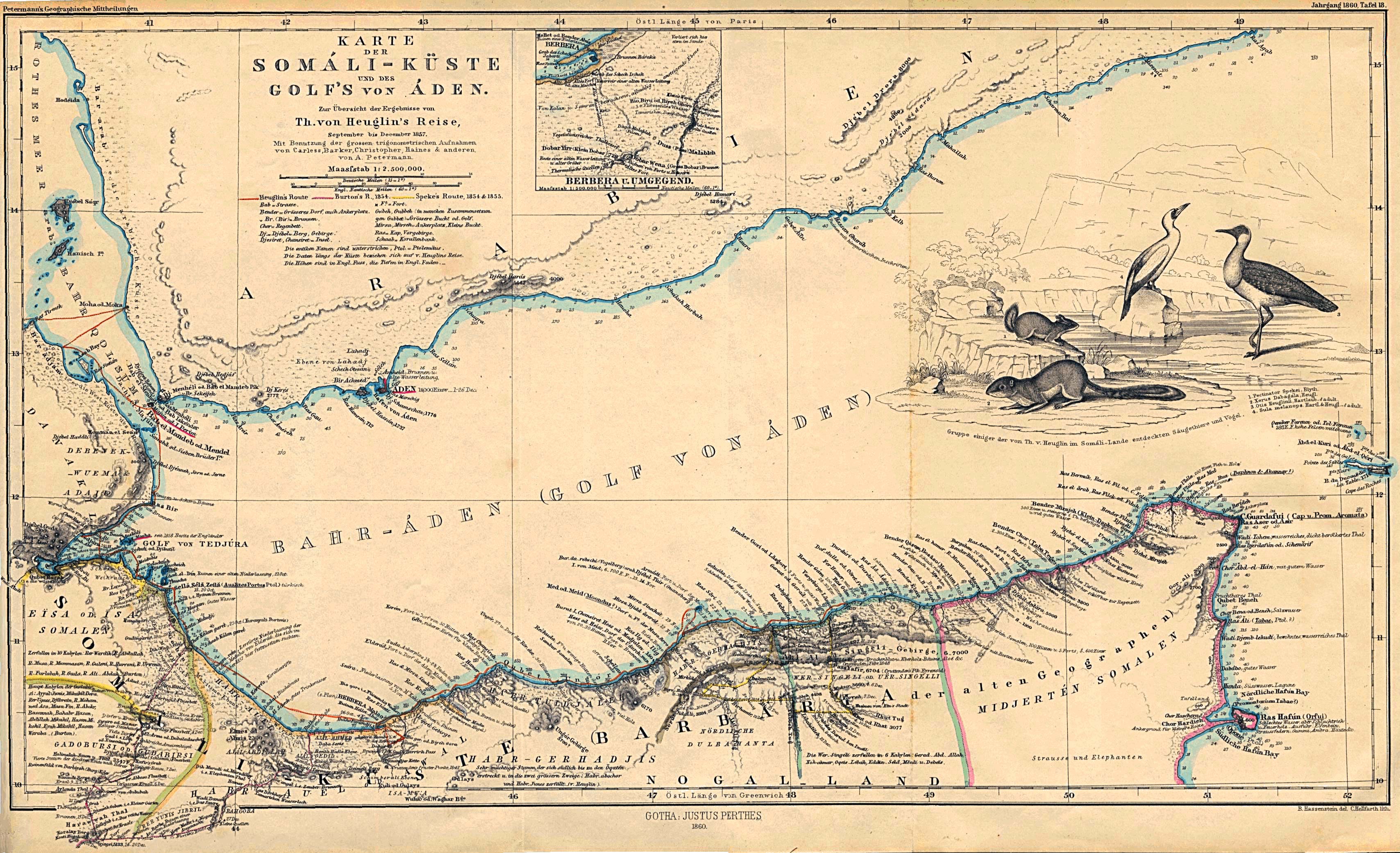
- Somali Coast and Aden Gulf 1860 (1MB)
- "Karte der Somali-Kuste und des Golf's von Aden" From Mittheilungen aus Justus Perthes' Geographischer Anstalt uber Wichtige Neue Erforschungen auf dem Gesammtgebiete der Geographie von Dr. A. Petermann. Volume 6, 1860.
- Smyrna [Izmir], Turkey 1882 (182K)
- "Smyrna Harbour" from A Dictionary Practical, Theoretical, and Historical of Commerce and Commercial Navigation by J.R. M'Culloch. Longmans, Green and Co. London, 1882.
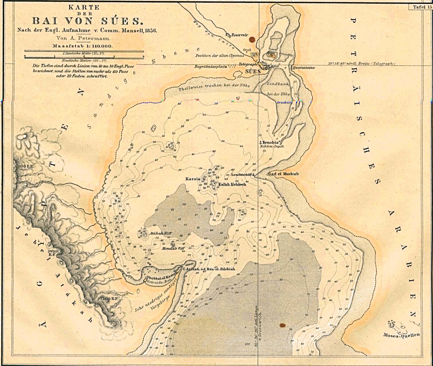
- Suez Bay, Egypt 1856 (351K)
- "Karte der Bai von Sues" From Mittheilungen aus Justus Perthes' Geographischer Anstalt uber Wichtige Neue Erforschungen auf dem Gesammtgebiete der Geographie von Dr. A. Petermann. Volume 7, 1861.
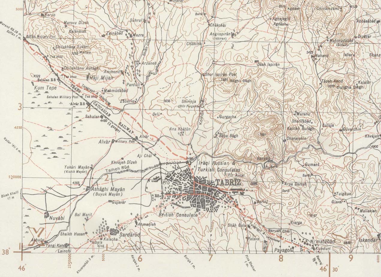
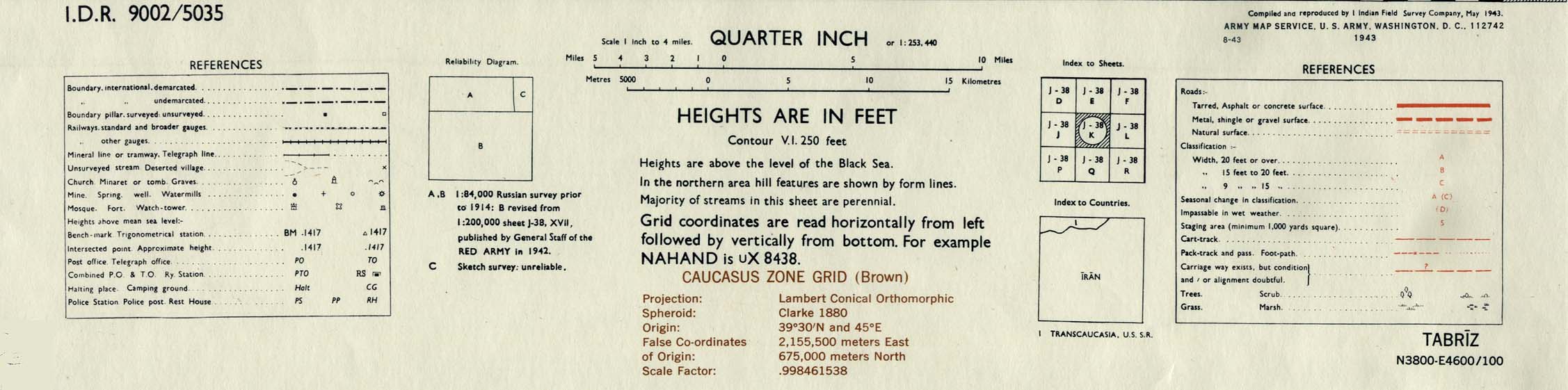
- Tabriz Area 1943 (244K)
- Portion of sheet J-38 K Tabriz. Original scale 1:253,440 Compiled and Reproduced by India Field Survey Company, May 1943. Published by the U.S. Army Map Service, August 1943. map key and scale (149K)
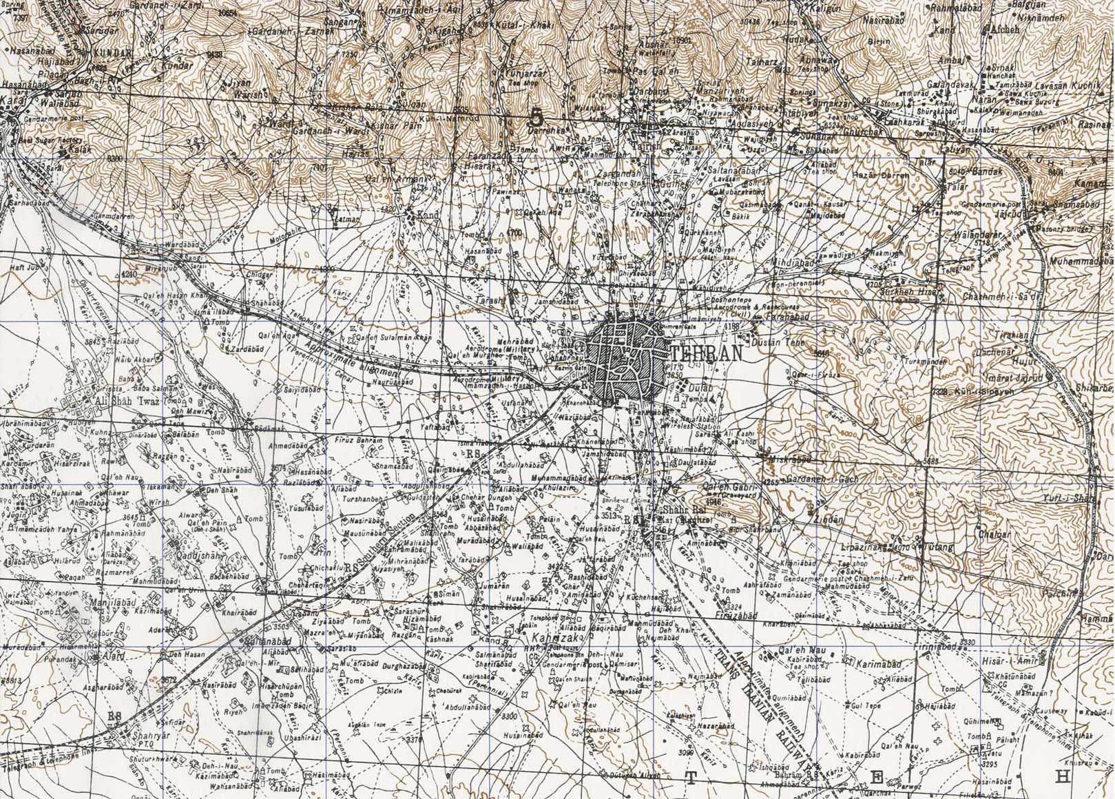
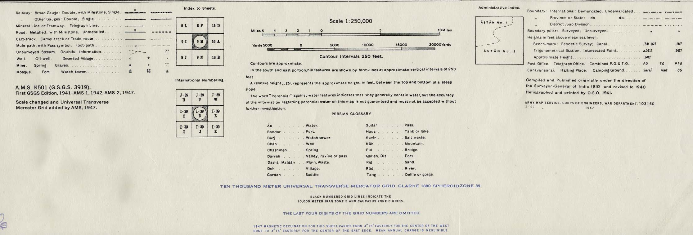
- Tehran Area 1947 (538K)
- Portion of sheet I-39 D Iran. Original scale 1:250,000 Compiled and published originally under the direction of the Surveyor-General of India 1910 and Revised to 1940. Published by the U.S. Army Map Service November, 1947. map key and scale (146K)
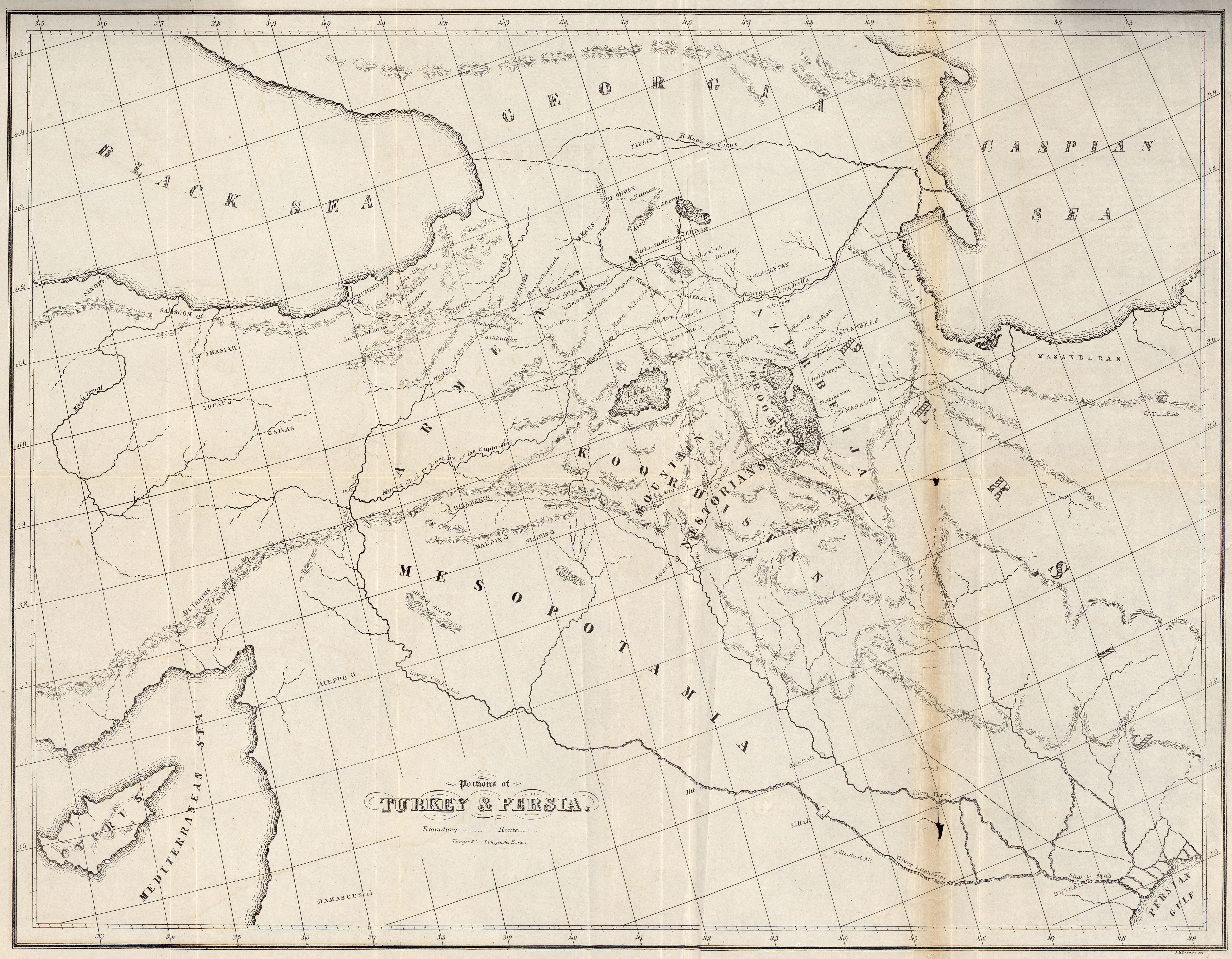
- Turkey and Persia 1843 (3.5MB)
- "Portions of Turkey and Persia" from A Residence of Eight Years in Persia, Among the Nestorians; with Notices of the Muhammedans by Rev. Justin Perkins. Allen, Morrill and Wardwell. Andover, 1843.
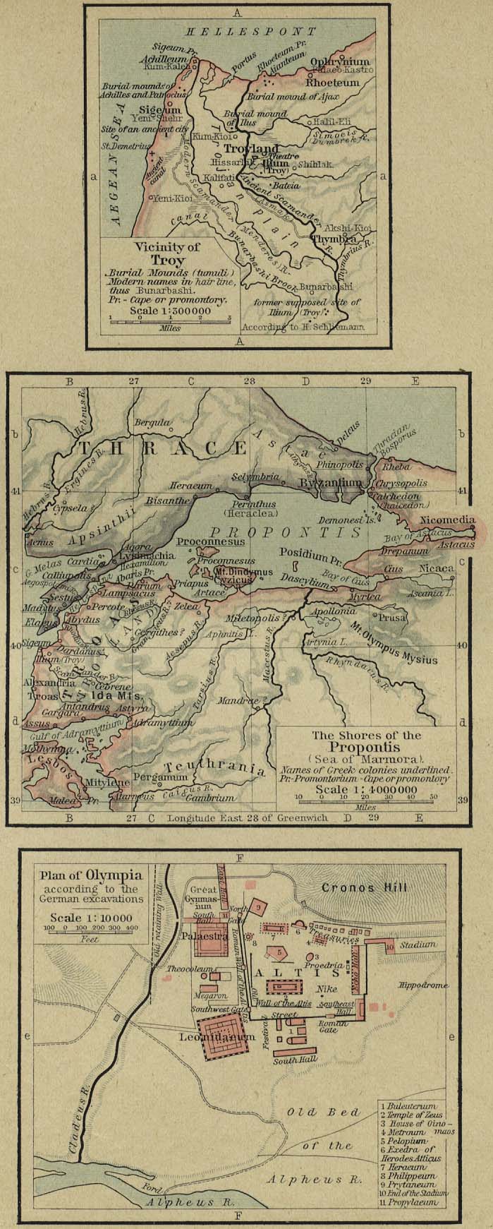
- Vicinity of Troy. The Shores of the Propontis. Plan of Olympia (214K)
- From The Historical Atlas by William R. Shepherd, 1923.
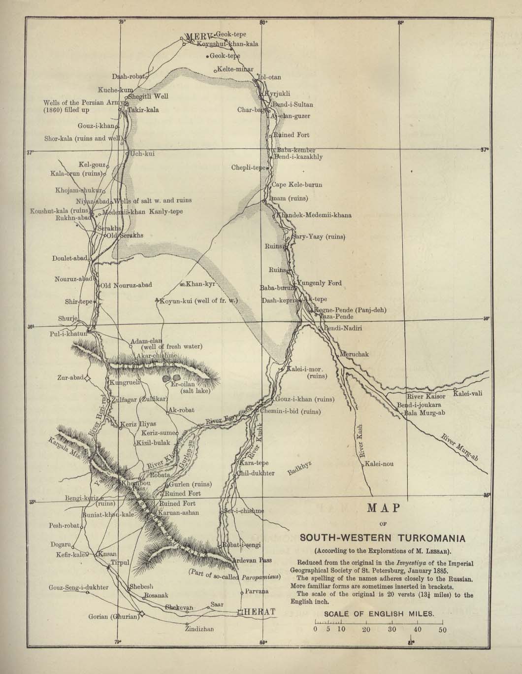
- Turkomania 1887 (154K)
- "Map of South Western Turkomania" from the Scottish Geographical Magazine. Published by the Scottish Geographical Society and edited by Arthur Silva White. Volume III, 1887.
- Tyre [Sur] Environs 1912 (240K)
- From Palestine and Syria. Handbook for Travellers by Karl Baedeker, 5th Edition, 1912.
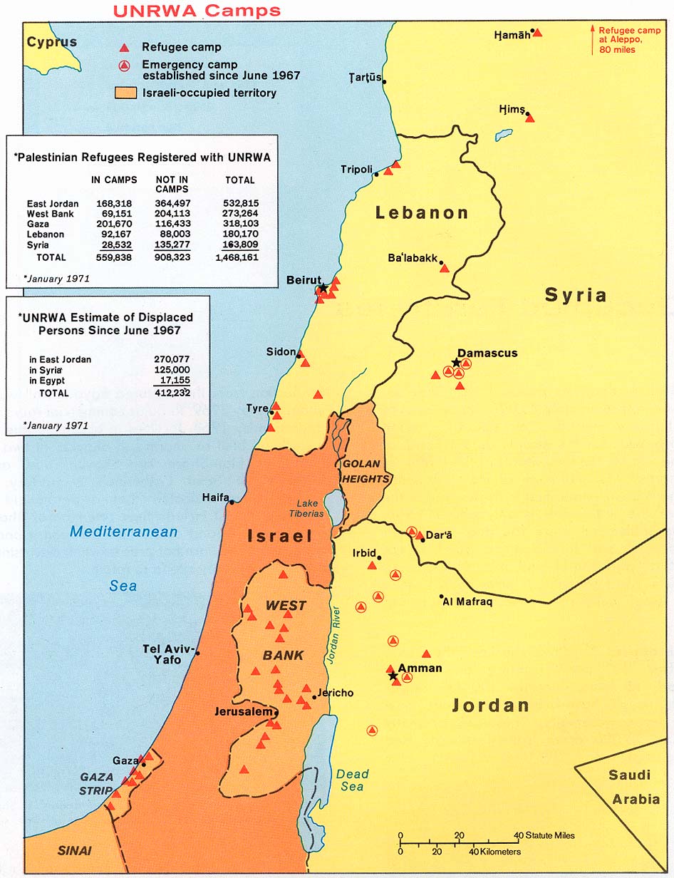
- UNRWA Camps 1973
- From Issues in the Middle East, Atlas, U.S. Central Intelligence Agency, 1973. Shows Palestinian refugee camps
in Gaza, West Bank, Jordan, Lebanon and Syria
![Aleppo [Alep] 1912](aleppo_1912.jpg)
![Beirut [Beyrout] 1912](beirut2_1912.jpg)
![Bethlehem [Bethleem/Beit Lahm] 1912](bethlehem_1912.jpg)
![Damascus [Damas] Central 1912](damascus2_1912.jpg)
![Hebron [El-Khalil] 1912](hebron_1912.jpg)
![Israel [Historical Maps]](israel_hist_1973.jpg)
![Meshed [Mashad] Area 1942](meshed_iran_1942.jpg)
![Nazareth [En-Nasira] 1912](nazareth_1912.jpg)
![The Ottoman Empire, [1683-1923]](ottoman1683_shepherd.jpg)
![[Palestine, Ancient] Palaestina](palaestina_1849.jpg)
![Saida [Sidon] Environs 1912](sidon_1912.jpg)
![Smyrna [Izmir], Turkey 1882](smyrna_harbour_1882.jpg)
![Tyre [Sur] Environs 1912](tyre_1912.jpg)