Perry-Castañeda Library
Map Collection
Wyoming Maps
State Maps
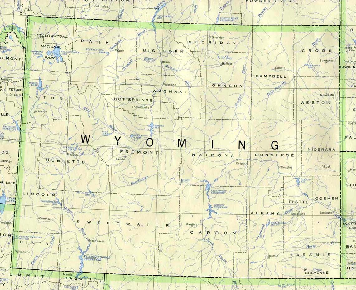
- Wyoming (base map) JPEG format (223K) County boundaries and names, county seats, rivers. Original scale 1:2,500,000 U.S. Geological Survey, 1972 limited update 1990
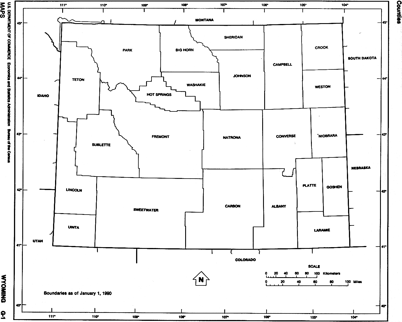
- Wyoming (outline map) JPEG format (65K) County boundaries and names. U.S. Bureau of the Census, 1990
- Wyoming (reference map) JPEG format (263K) Shaded relief map with state boundaries, forest cover, place names, major highways. Portion of "The National Atlas of the United States of America. General Reference", compiled by U.S. Geological Survey 2001, printed 2002
- Wyoming (reference map) PDF format (265K) Shaded relief map with state boundaries, forest cover, place names, major highways. Portion of "The National Atlas of the United States of America. General Reference", compiled by U.S. Geological Survey 2001, printed 2002
- Wyoming - Federal Lands and Indian Reservations PDF format (1.19MB) The National Atlas of the United States of America, U.S. Geological Survey, 2003
City Maps
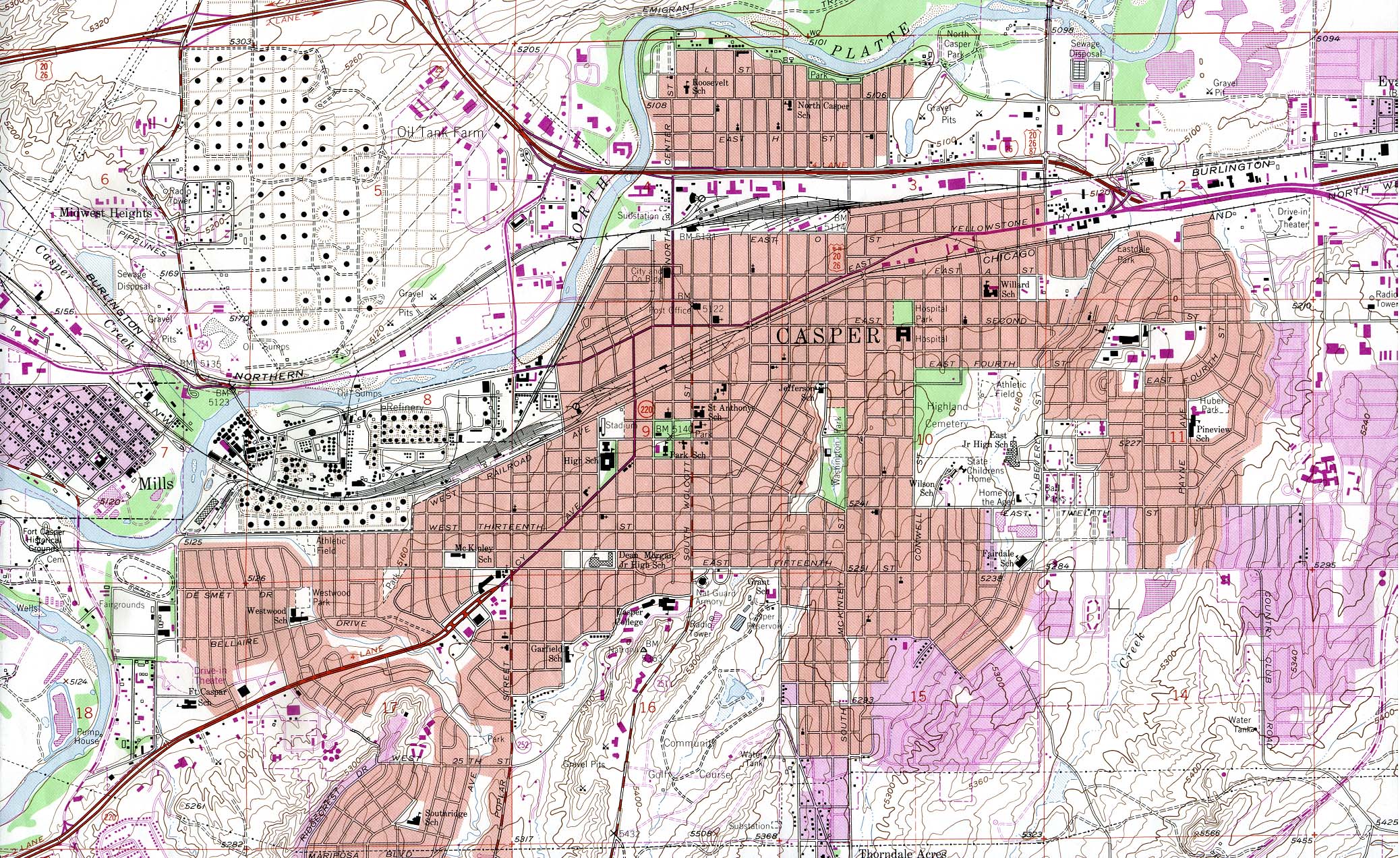
- Casper (topographic) original scale 1:24,000 U.S.G.S. 1961, photorevised 1984 (932K)
Historical Topographic Maps
- Wyoming Historical Topographic Maps (U.S. Geological Survey)
- Pre-1945 maps, scales 1:62,500, 1:90,000, 1:125,000
Maps of National Parks, Monuments, and Historic Sites
The following maps were produced by the U.S. National Park Service unless otherwise noted.
- Bighorn Canyon National Recreation Area [Montana / Wyoming] (Area Map) 1997 (65K) (PDF Format)
- Bighorn Canyon National Recreation Area [Montana / Wyoming] (Park Map) 1997 (258K) (PDF Format)
- Devil's Tower National Monument (Shaded Relief Map) 1:4,800 U.S.G.S. 1949 (230K)
- Devil's Tower National Monument (Park Map) 1998 (129K) (PDF Format)
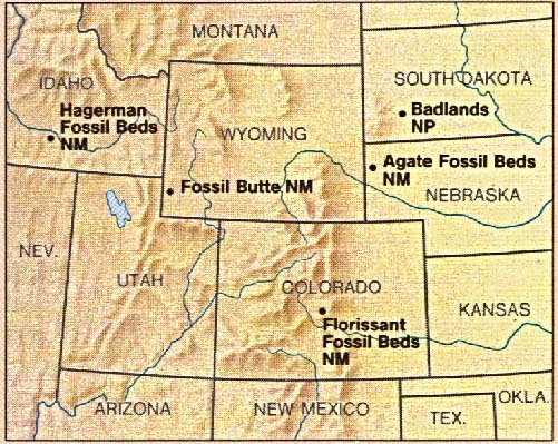
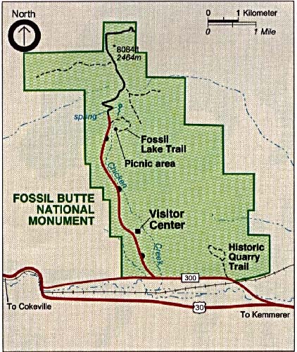
- Fossil Butte National Monument (Area Map) 1993 (94K)
- Fossil Butte National Monument (Park Map) 1993 (102K)
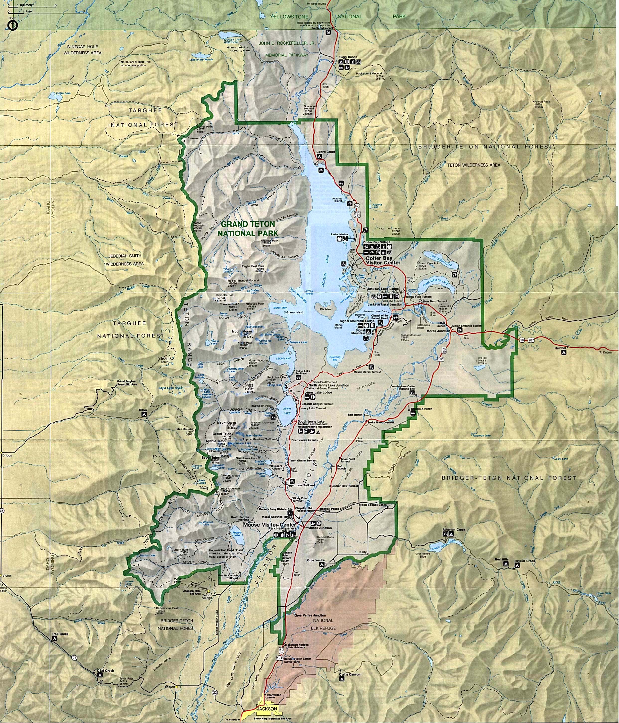
- Grand Teton National Park (Park Map / Shaded Relief) 1994 (1.4MB)
- Grand Teton National Park (Park Map) 1998 (645K) (PDF Format)
- Grand Teton National Park (Day Hikes) 2000 (269K)
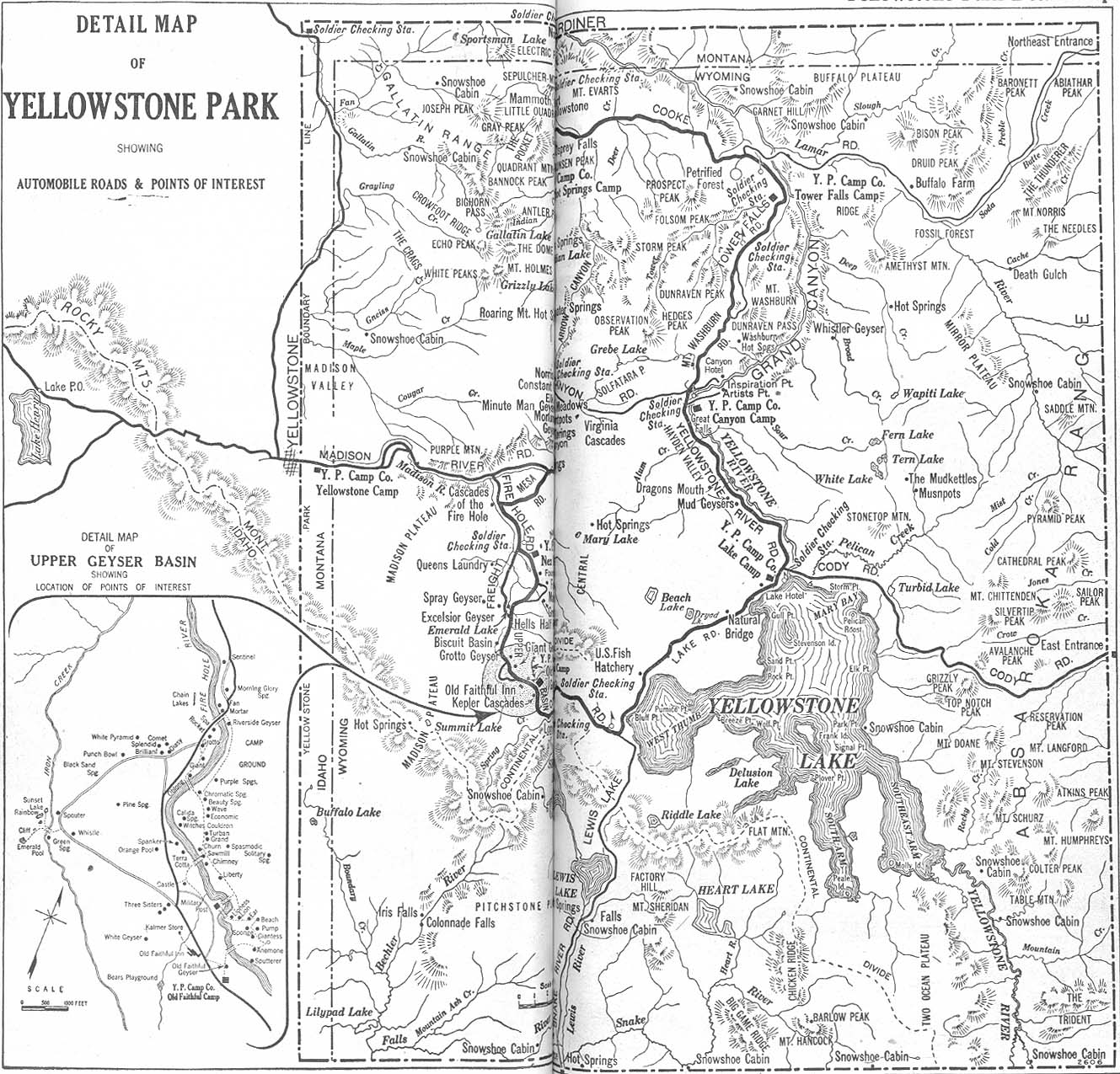
- Yellowstone National Park Automobile Blue Book 1917 Vol. 8, Section 2 (589K)
- Yellowstone National Park [Wyoming / Montana / Idaho] (Park Map) (1MB)
- Yellowstone National Park [Wyoming / Montana / Idaho] (Park and Detail Maps) 1998 (1MB) (PDF Format)
- Yellowstone National Park - Canyon Village [Wyoming / Montana / Idaho] (Detail Map) (39K)
- Yellowstone National Park - Fishing Bridge, Lake Village and Bridge Bay [Wyoming / Montana / Idaho] (Detail Map) (43K)
- Yellowstone National Park - Madison Plateau [Wyoming / Montana / Idaho] (Shaded Relief Map) 1:125,000, U.S. Geological Survey 1974 (425K)
- Yellowstone National Park - Mammoth Hot Spring [Wyoming / Montana / Idaho] (Detail Map) (45K)
- Yellowstone National Park - Old Faithful [Wyoming / Montana / Idaho] (Detail Map) (39K)
- Yellowstone National Park - West Thumb and Grant Village [Wyoming / Montana / Idaho] (Detail Map) (31K)
![Yellowstone National Park [Wyoming / Montana / Idaho]](national_parks/yellowstone_map.jpg)
![Yellowstone National Park - Canyon Village [Wyoming / Montana / Idaho]](national_parks/yellowstone_canyon.jpg)
![Yellowstone National Park - Fishing Bridge, Lake Village and Bridge Bay [Wyoming / Montana / Idaho]](national_parks/yellowstone_fishing_bridge.jpg)
![Yellowstone National Park - Madison Plateau [Wyoming / Montana / Idaho]](national_parks/yellowstone.jpg)
![Yellowstone National Park - Mammoth Hot Spring [Wyoming / Montana / Idaho]](national_parks/yellowstone_mammoth_hot_spr.jpg)
![Yellowstone National Park - Old Faithful [Wyoming / Montana / Idaho]](national_parks/yellowstone_old_faithful.jpg)
![Yellowstone National Park - West Thumb and Grant Village [Wyoming / Montana / Idaho]](national_parks/yellowstone_w._thumb_grant.jpg)
Maps on Other Web Sites