Perry-Castañeda Library
Map Collection
Oklahoma Maps
State Maps
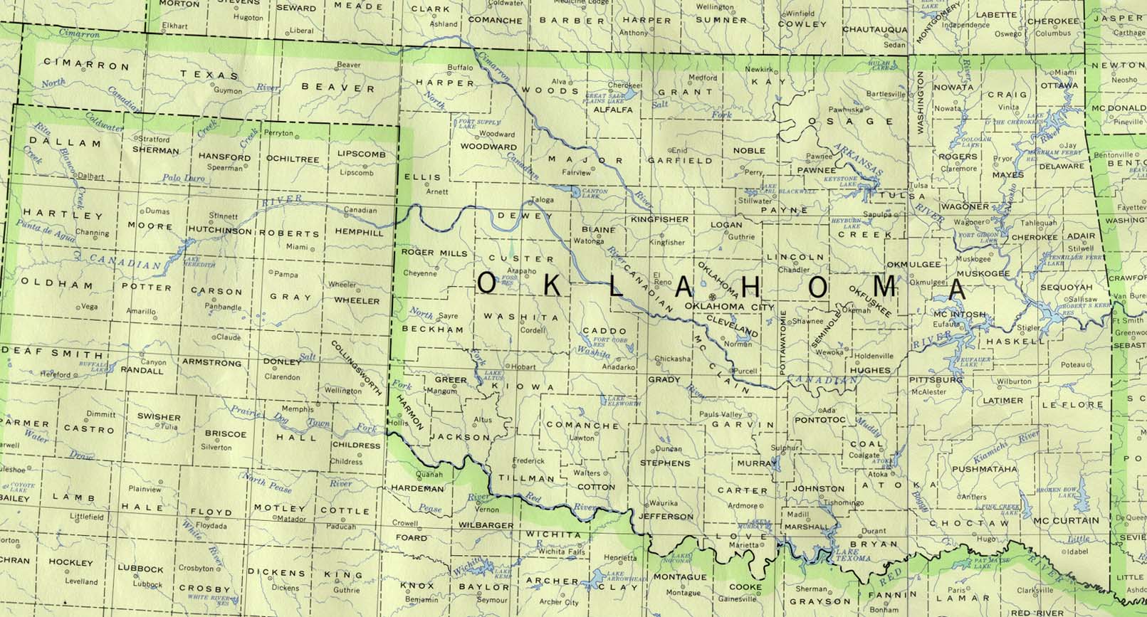
- Oklahoma (base map) JPEG format (257K) County boundaries and names, county seats, rivers. Original scale 1:2,500,000 U.S. Geological Survey, 1972 limited update 1990
- Oklahoma (outline map) JPEG format (71K) County boundaries and names. U.S. Bureau of the Census, 1990
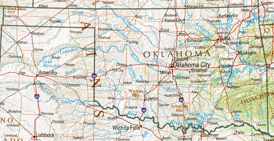
- Oklahoma (reference map) JPEG format (264K) Shaded relief map with state boundaries, forest cover, place names, major highways. Portion of "The National Atlas of the United States of America. General Reference", compiled by U.S. Geological Survey 2001, printed 2002
- Oklahoma (reference map) PDF format (266K) Shaded relief map with state boundaries, forest cover, place names, major highways. Portion of "The National Atlas of the United States of America. General Reference", compiled by U.S. Geological Survey 2001, printed 2002
- Oklahoma - Federal Lands and Indian Reservations PDF format (609K) The National Atlas of the United States of America, U.S. Geological Survey, 2003
City Maps
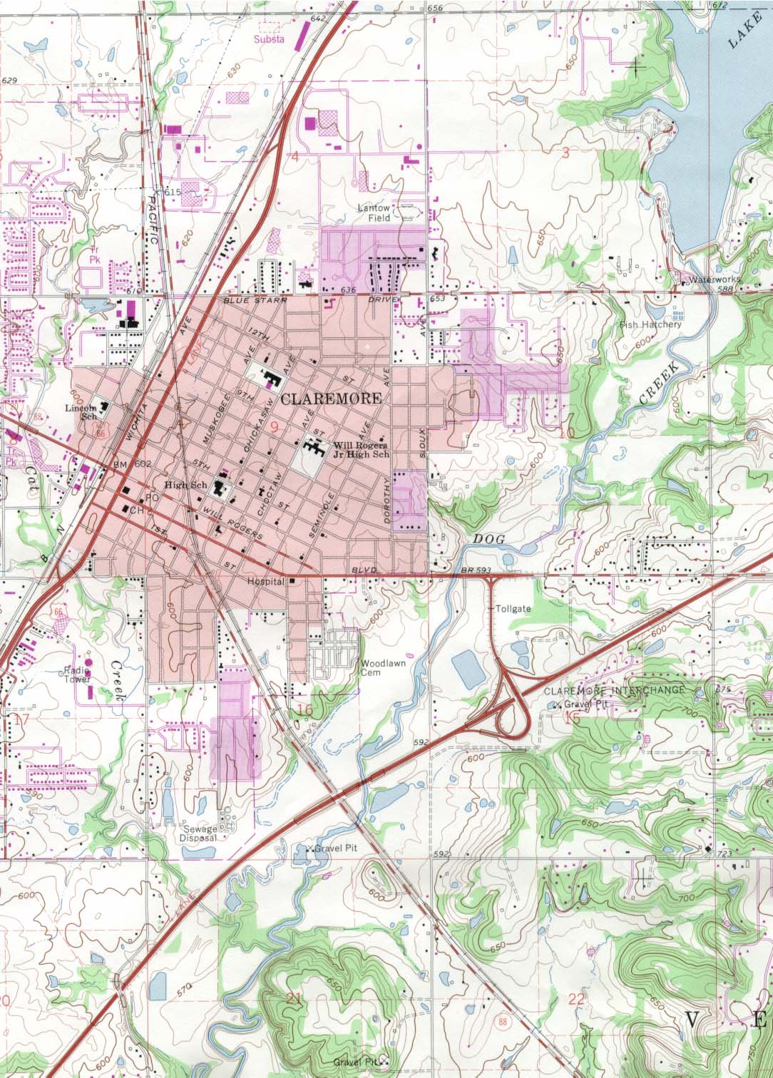
- Claremore (topographic) original scale 1:24,000 U.S.G.S. 1963, photorevised 1982 (304K)
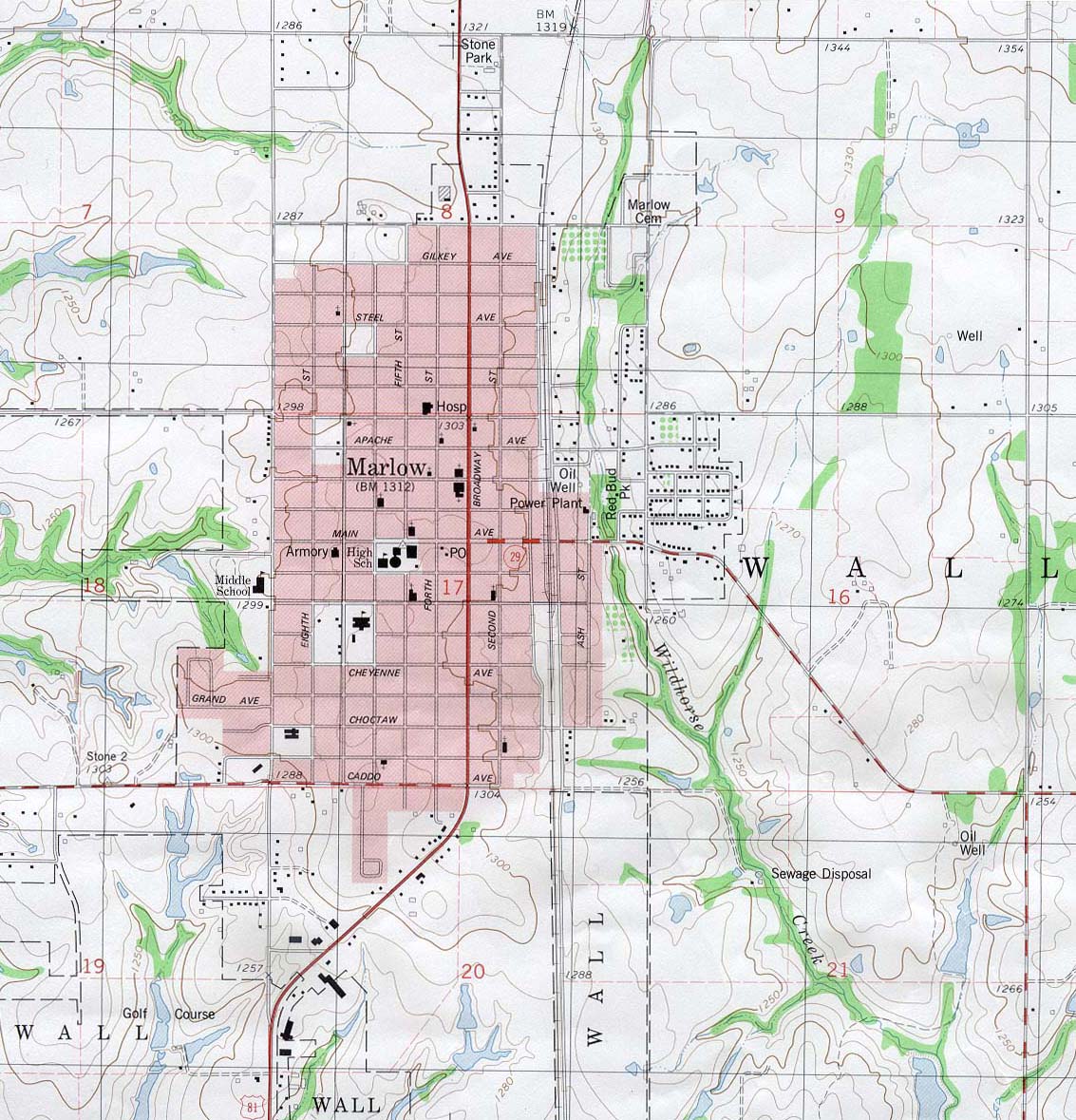
- Marlow (topographic) original scale 1:24,000 U.S.G.S. 1981 (293K)
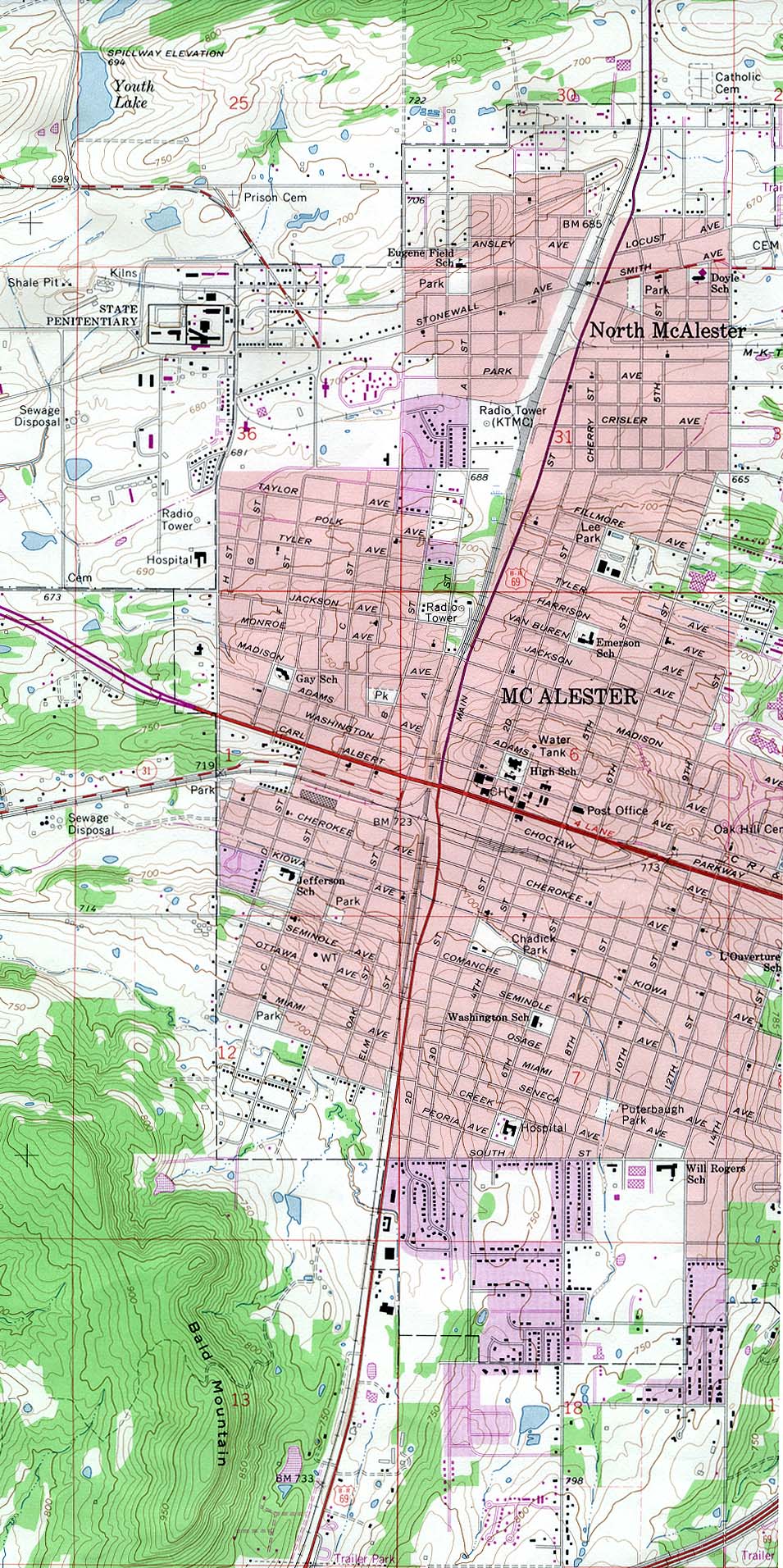
- Mc Alester (topographic) original scale 1:24,000 U.S.G.S. 1967, photorevised 1978 (471K)
Historical City Maps
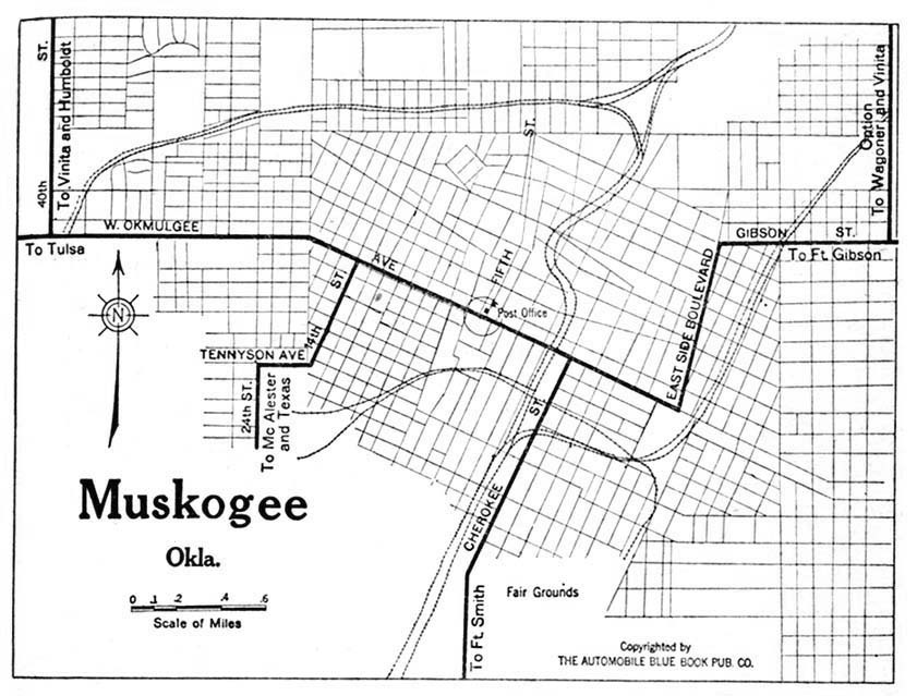
- Muskogee 1920 Automobile Blue Book, 1920, Vol. 7 (131K)
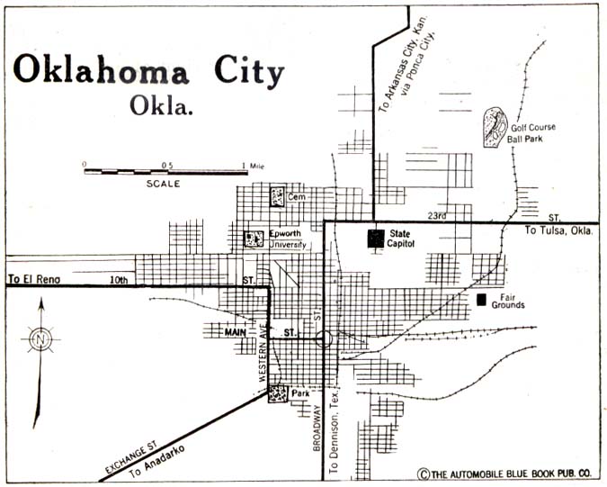
- Oklahoma City 1920 Automobile Blue Book, 1920, Volume 7 (59K)
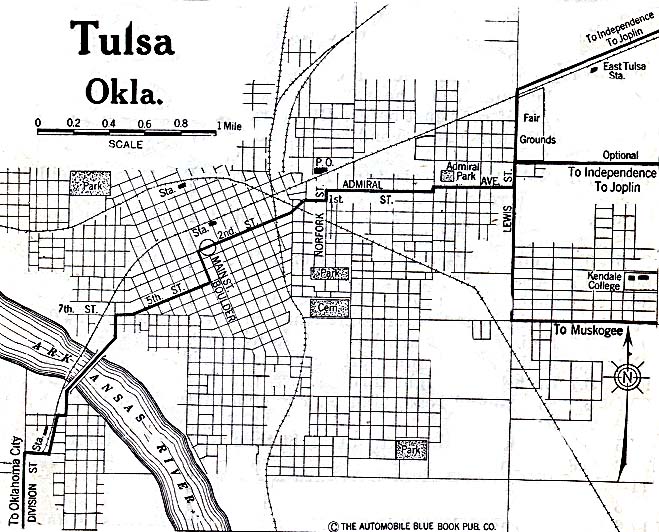
- Tulsa 1920 Automobile Blue Book (137K)
Historical Topographic Maps
- Oklahoma Historical Topographic Maps (U.S. Geological Survey)
- Pre-1945 maps, scales 1:62,500 and 1:125,000
Maps of National Parks, Monuments, and Historic Sites
The following maps were produced by the U.S. National Park Service unless otherwise noted.
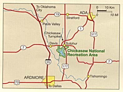
- Chickasaw National Recreation Area (Area Map) 1995 (59K)
- Chickasaw National Recreation Area (Area Map) 1996 (65K) (PDF Format)
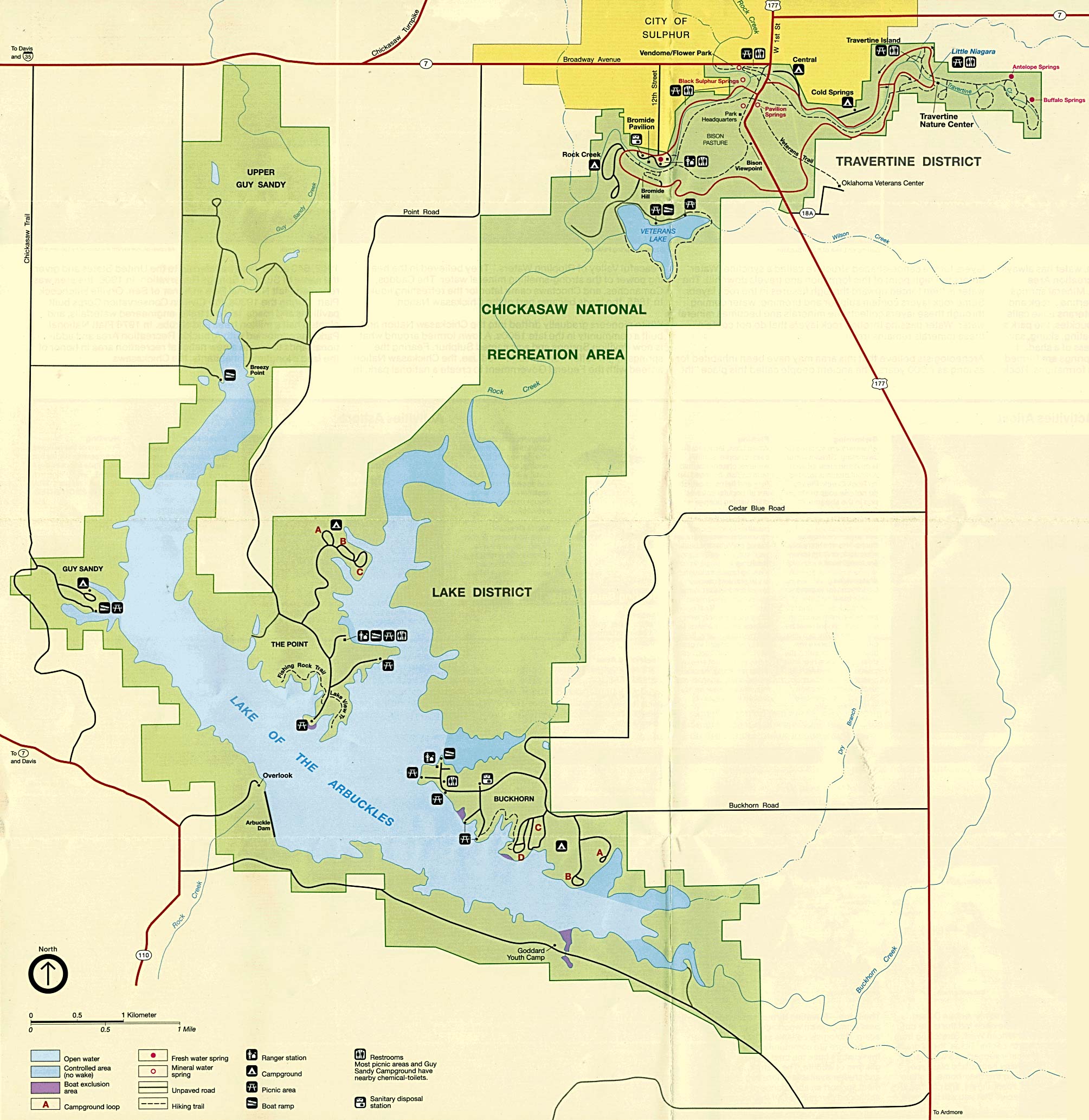
- Chickasaw National Recreation Area (Park Map) 1995 (507K)
- Chickasaw National Recreation Area (Park Map) 2000 (129K) (PDF Format)
Maps on Other Web Sites