Perry-Castañeda Library
Map Collection
Laos Maps
The following maps were produced by the U.S. Central Intelligence Agency, unless otherwise indicated.
Country Maps- Laos (Physiography) 2003 (2.1MB) and pdf format (2.2MB)
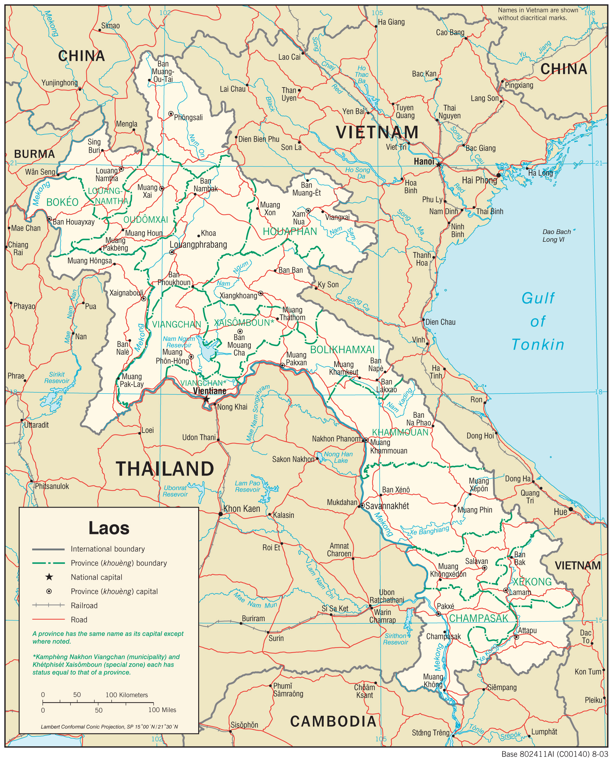
- Laos (Political) 2003 (423K) and pdf format (426K)
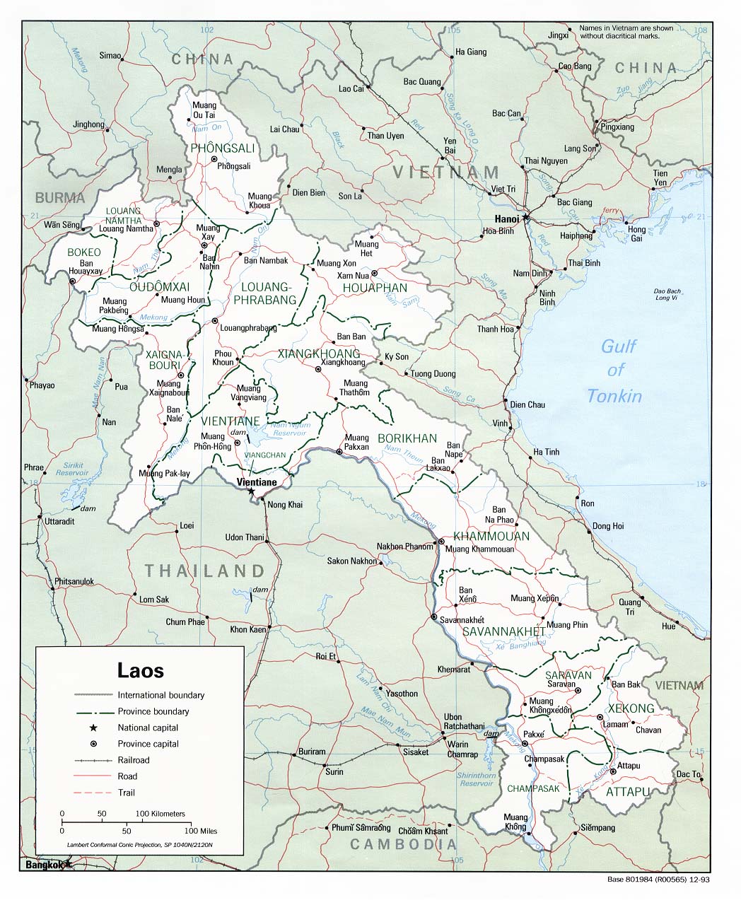
- Laos (Political) 1993 (274K) and pdf format (282K)
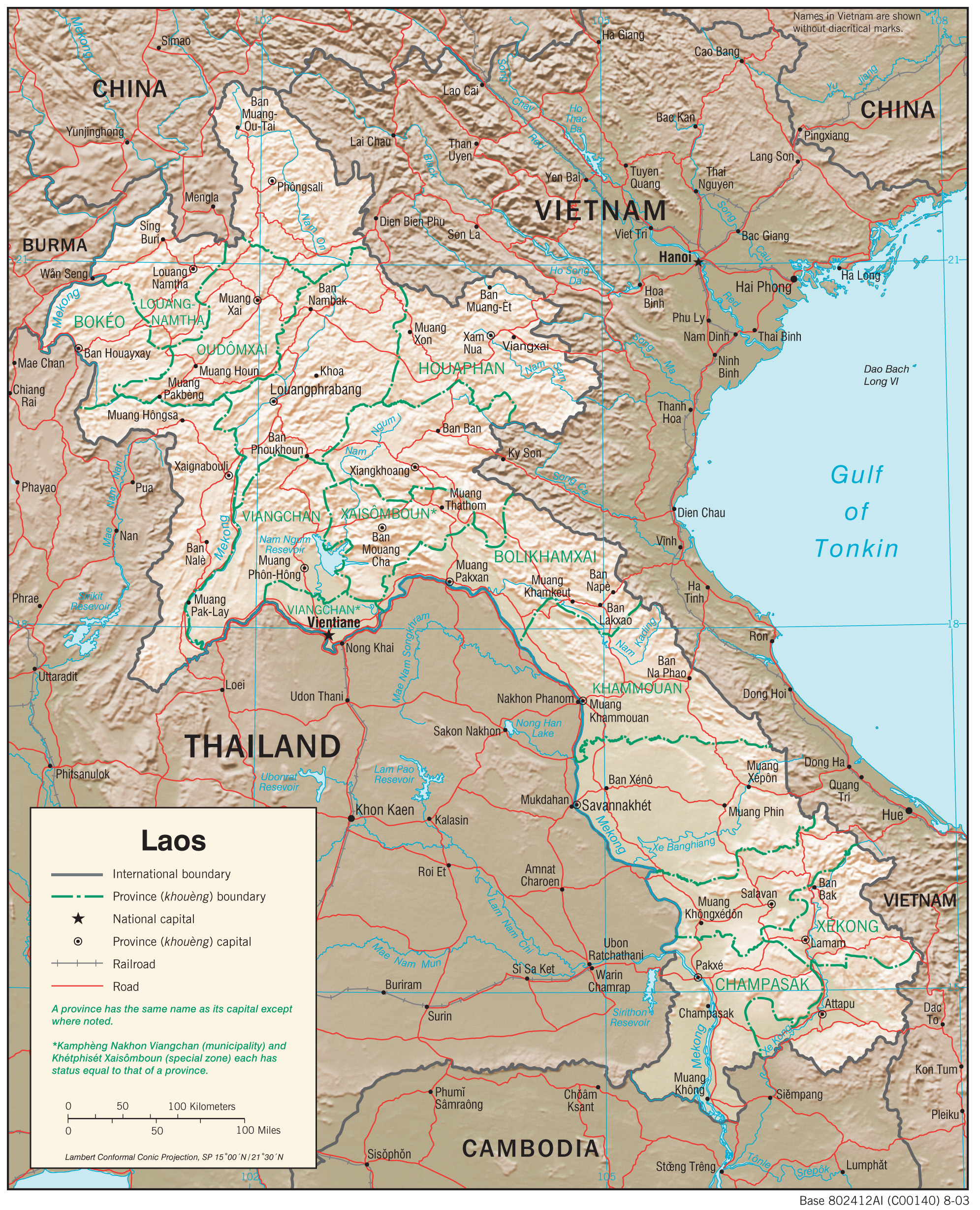
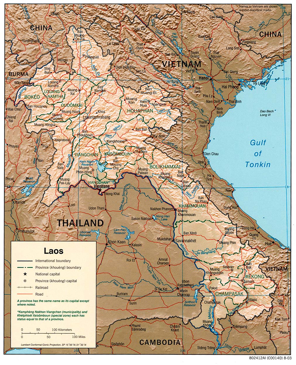
- Laos (Shaded Relief) 2003 (426K) and pdf format (429K)
- Laos (Shaded Relief) 1993 (390K) and pdf format (397K)
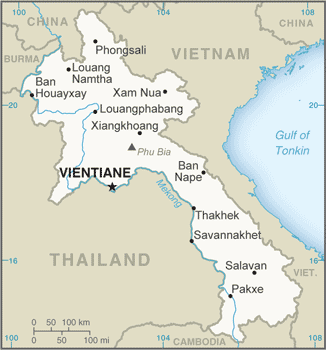
- Laos (Small Map) 2016 (21.5K)
- Laos (Transportation) 2003 (1.8MB) and pdf format (732K)
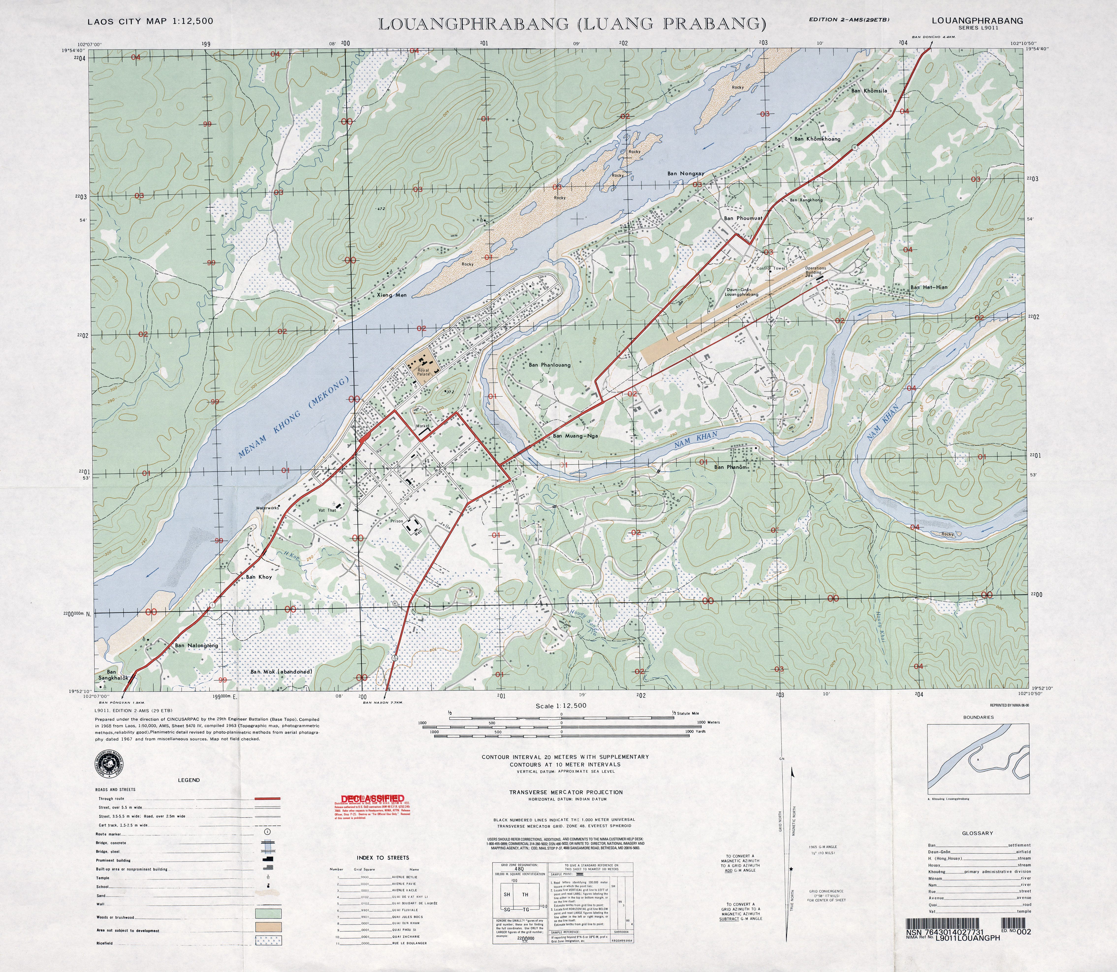
- Louangphrabang (Luang Prabang) original scale 1:12,500, Edition 2-AMS, Series L9011. National Imagery and Mapping Agency, 1967 (4.3MB)
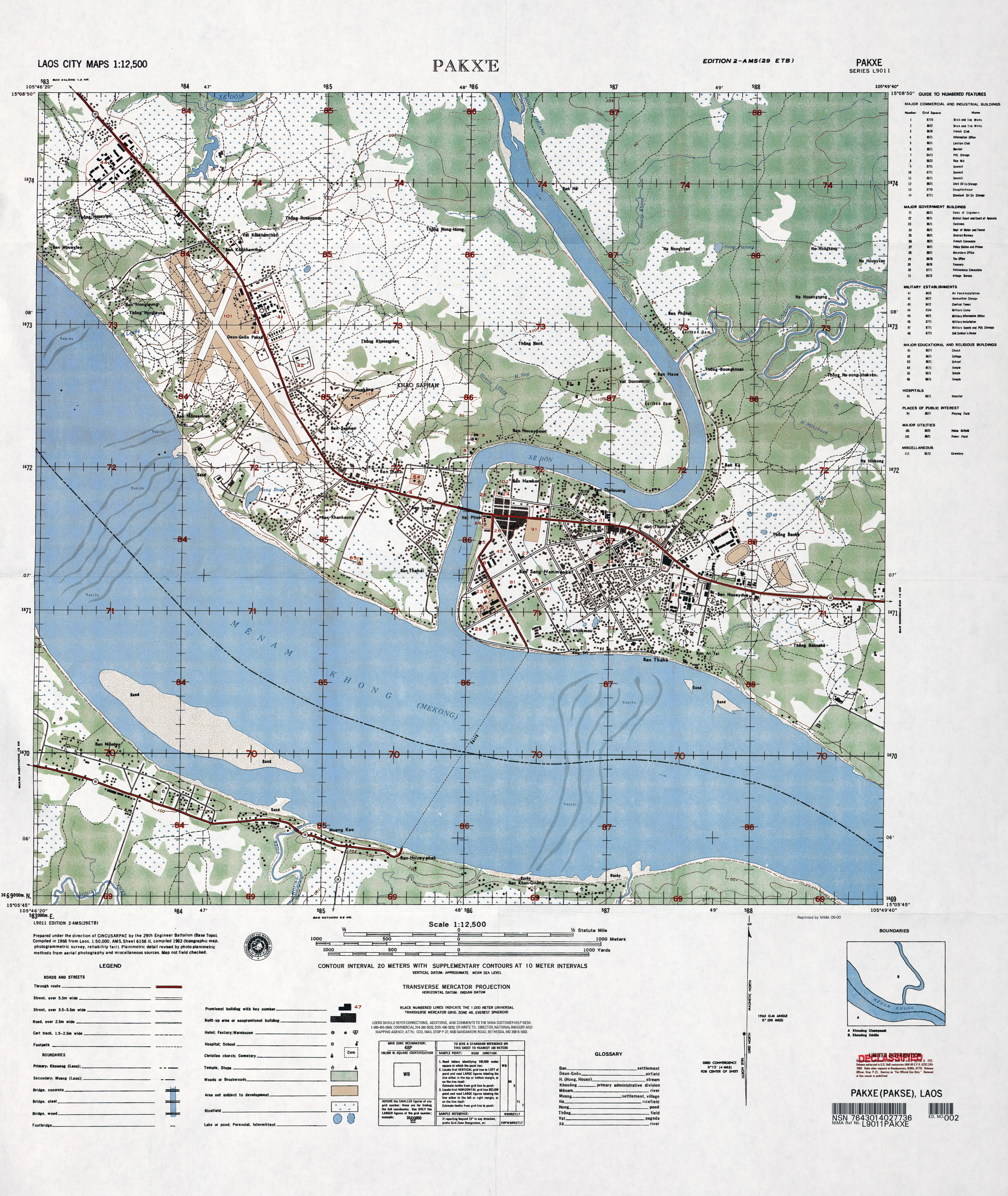
- Pakx'e original scale 1:12,500, Edition 2-AMS, Series L9011. National Imagery and Mapping Agency, 1963 (5.1MB)
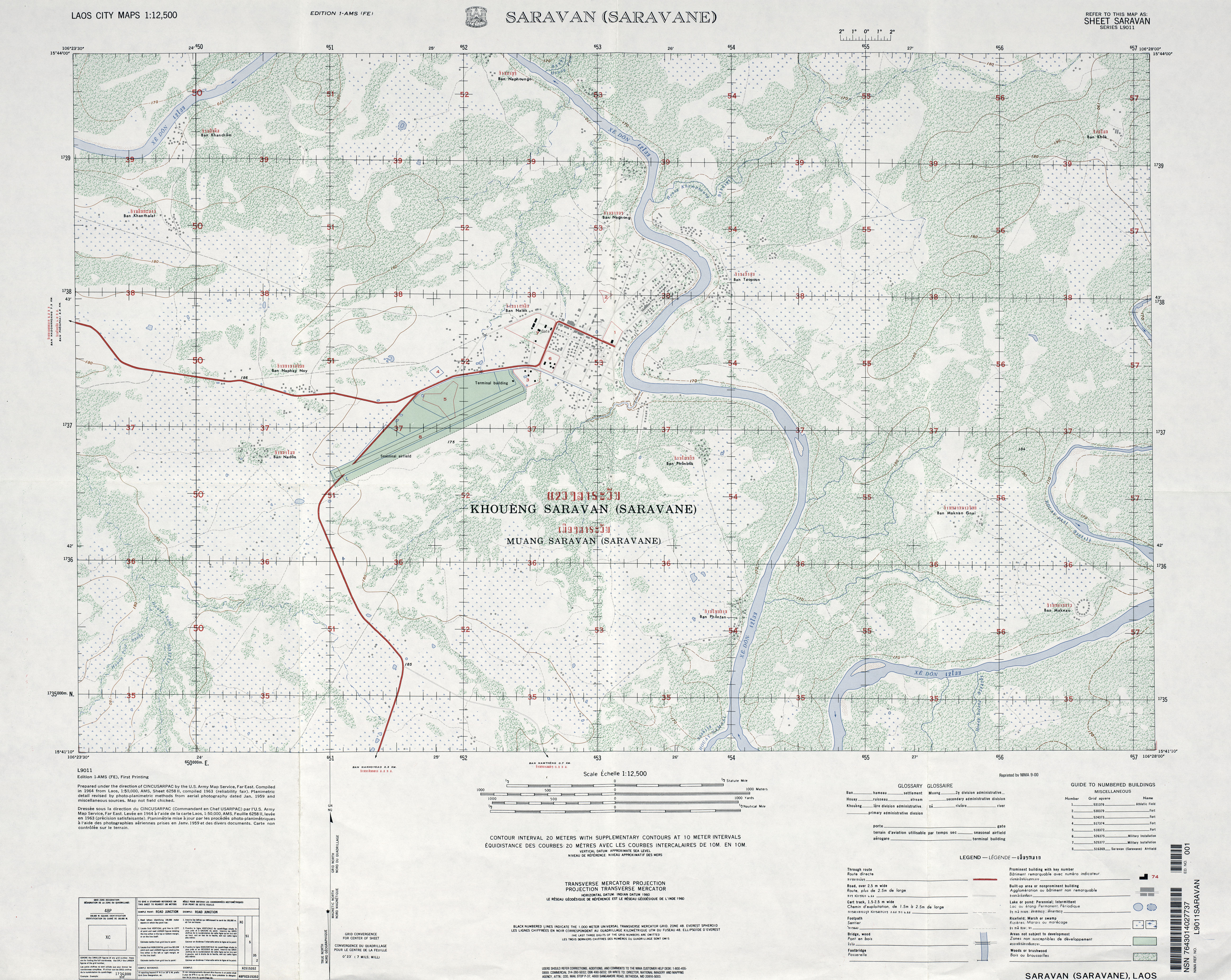
- Saravan (Saravane) original scale 1:12,500, Edition 1-AMS, Series L9011. U.S. Army Map Service, 1963 (5.7MB)
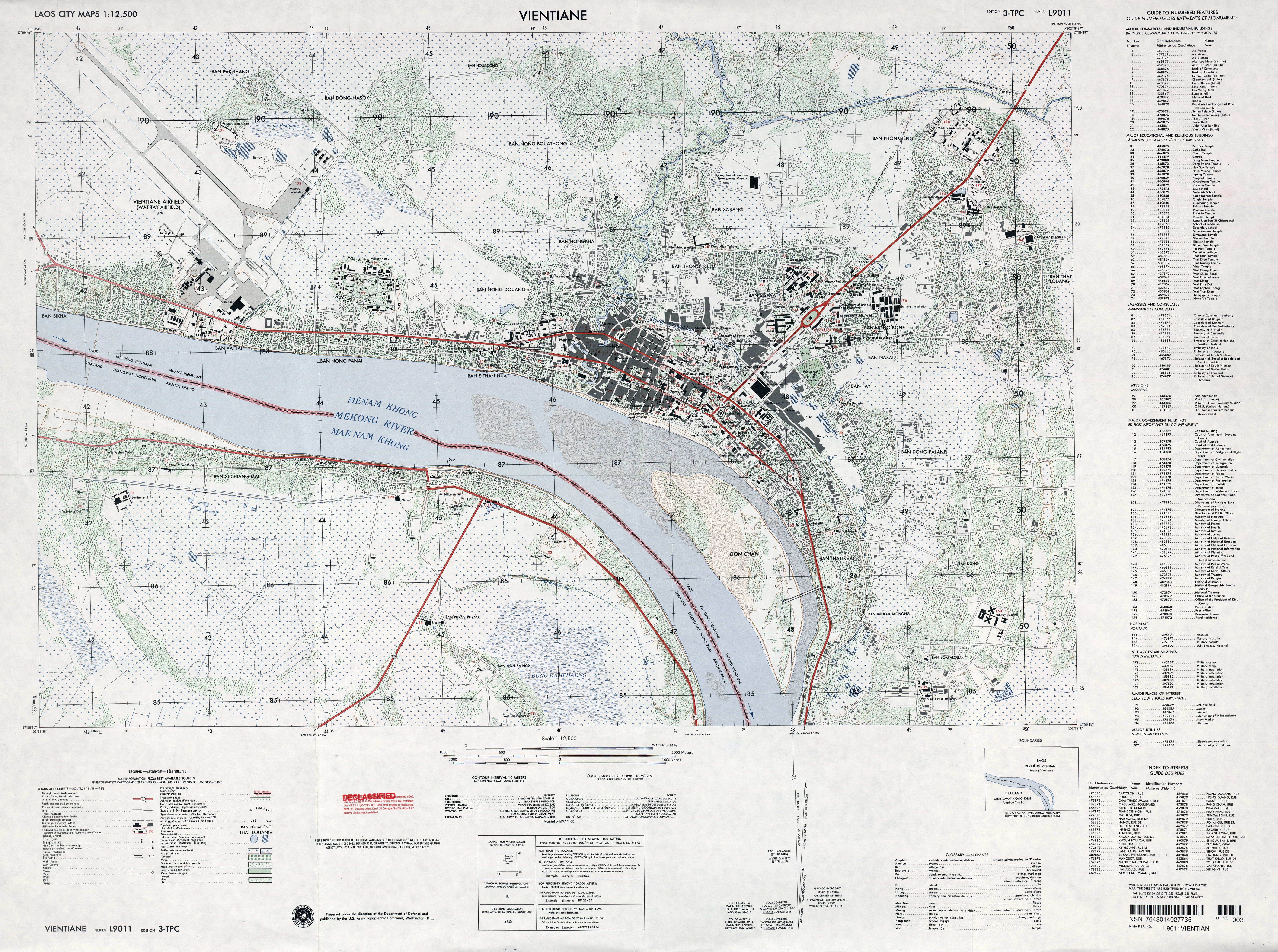
- Vientiane original scale 1:12,500, Edition 3-TPC, Series L9011. U.S. Army Topographic Command, 1963 (6.6MB)
- 1:1,000,000 - International Map of the World U.S. Army Topographic Command
- This series covers all of Laos. Clickable Index Map
- 1:1,000,000 - Operational Navigation Chart Series U.S. Defense Mapping Agency Aerospace Center Not for navigational use
- This series covers all of Laos.
- 1:500,000 - Tactical Pilotage Charts U.S. National Imagery and Mapping Agency. Not for navigational use
- This series covers Laos
- 1:250,000 - Indochina and Thailand, Series L509 (Topographic Maps) U.S. Army Map Service, 1954-
- This series includes all of Laos.
- 1:250,000 - Vietnam, Laos, and Cambodia - Joint Operations Graphic Series (Aeronautical Charts) U.S. Defense Mapping Agency, 1966-1998. [GeoPDF] Not for navigational use
- This series covers all of southern Vietnam and most of northern Vietnam
- 1:50,000 - Laos U.S. Army Map Service, Series L7015, 1965
- This series covers parts of Laos
- This series covers all of Laos. Clickable Index Map
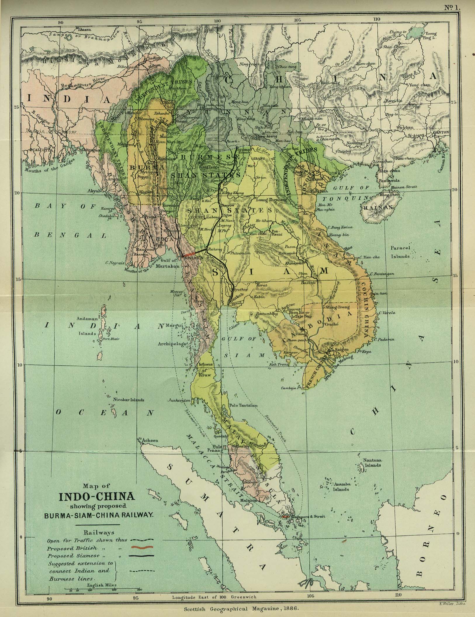
- Indo-China 1886 "Map of Indo-China showing proposed Burma-Siam-China Railway" from the Scottish Geographical Magazine. Published by the Scottish Geographical Society and edited by Hugh A. Webster and Arthur Silva White. Volume II, 1886. (533K)
- Indochina and Thailand, Series L509 (Topographic Maps) 1:250,000, U.S. Army Map Service, 1954-
- Indochina Atlas 1970
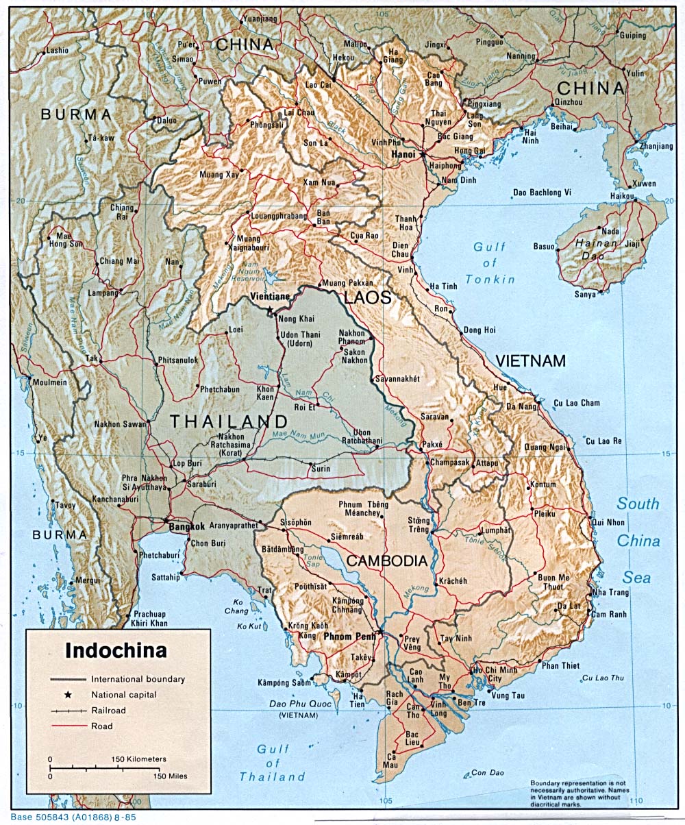
- Indochina (Shaded Relief) 1985 (342K)
- Indochina Atlas 1970
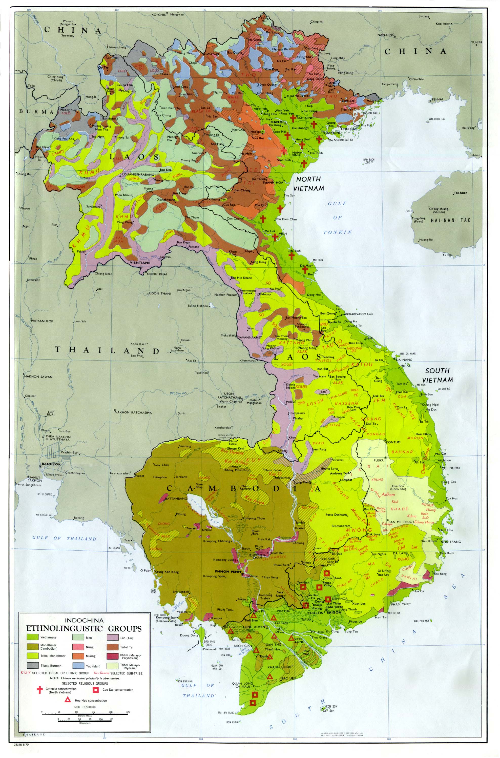
- Indochina Ethnolinguistic Groups from Indochina Atlas, 1970 (654K)
Maps on Other Web Sites