PCL Map Collection
> Indochina Atlas
Perry-Castañeda Library
Map Collection
Indochina Atlas (1970)
"Indochina Atlas", published in October 1970 by the Directorate of Intelligence, Office of Basic and Geographic Intelligence, U.S. Central Intelligence Agency.
Front Cover
(1.6 MB)
Front Cover [verso]
(995 K)
Title Page
(656 K)
Table of Contents
(448 K)
Azimuthal Equidistant Projection Centered on Saigon
( MB)
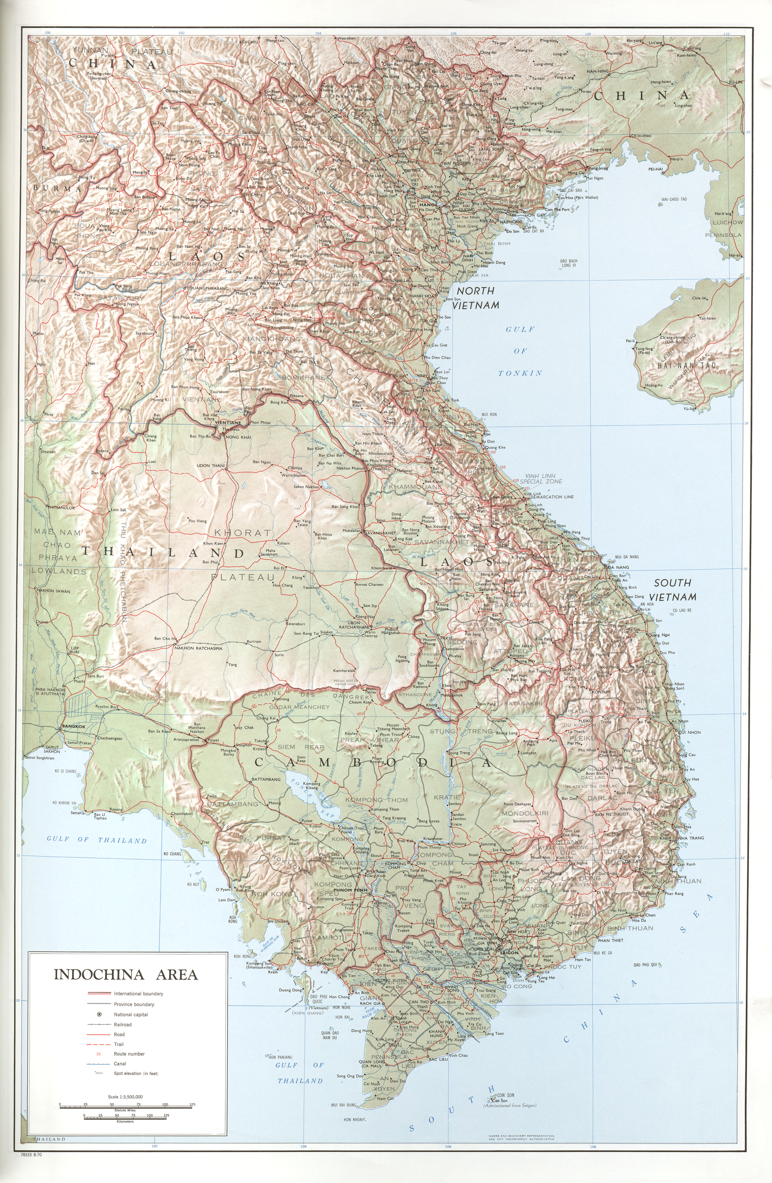
Indochina Area
(1.3 MB)
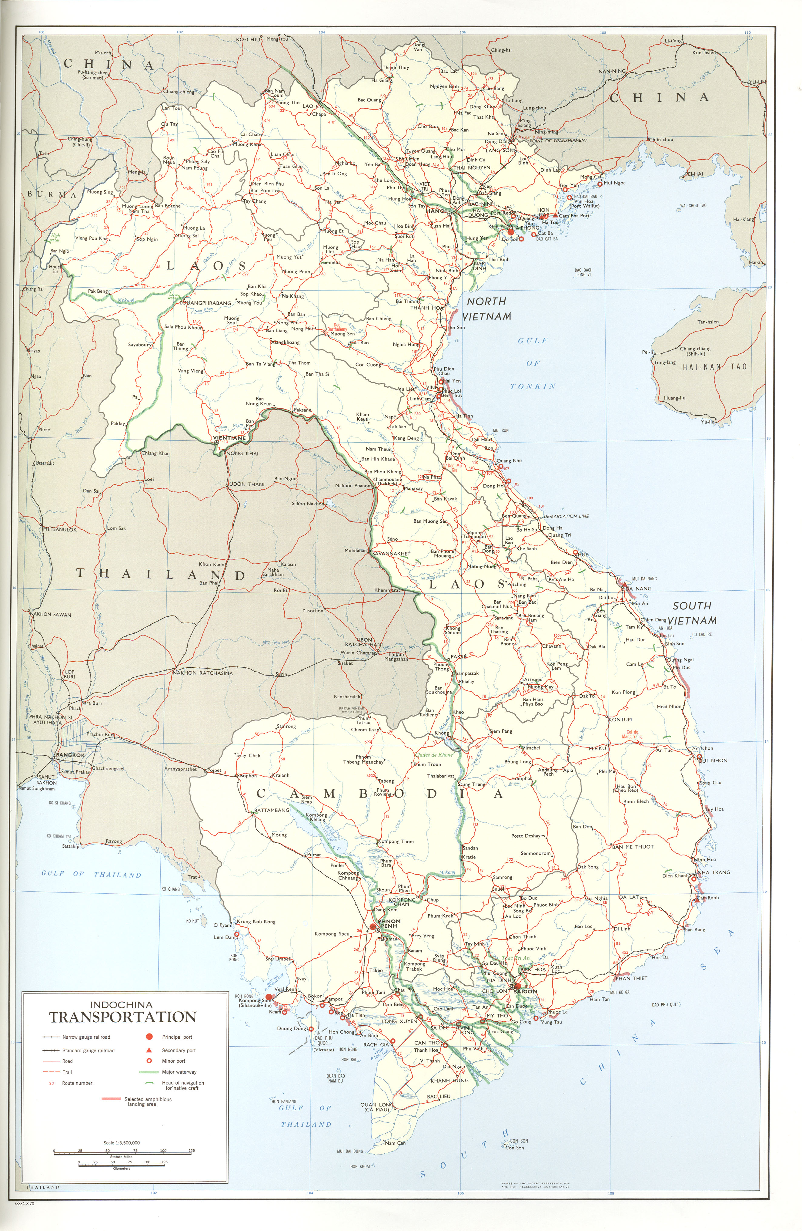
Indochina Transportation
(2.8 MB)
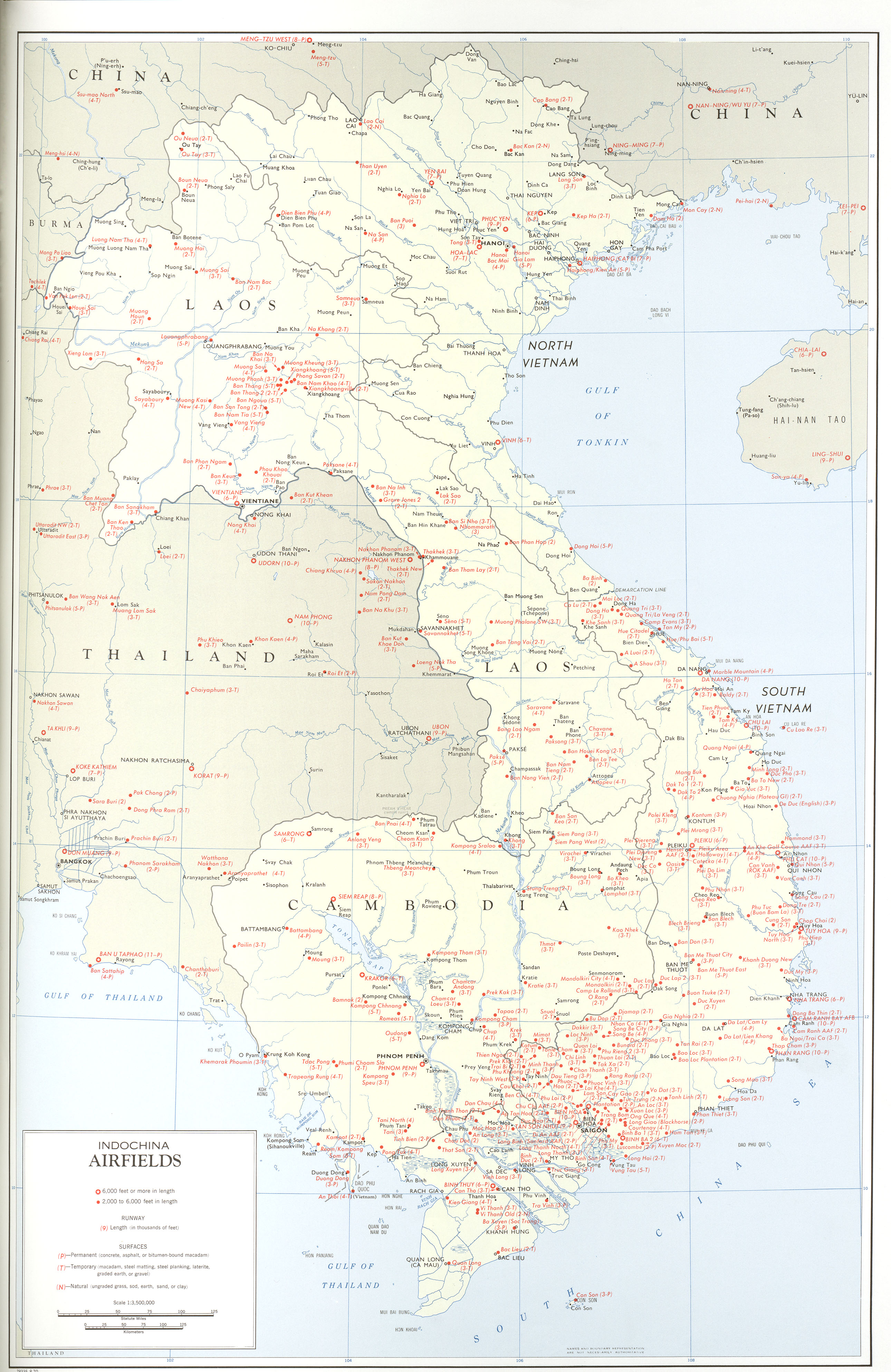
Indochina Airfields
(2.2 MB)
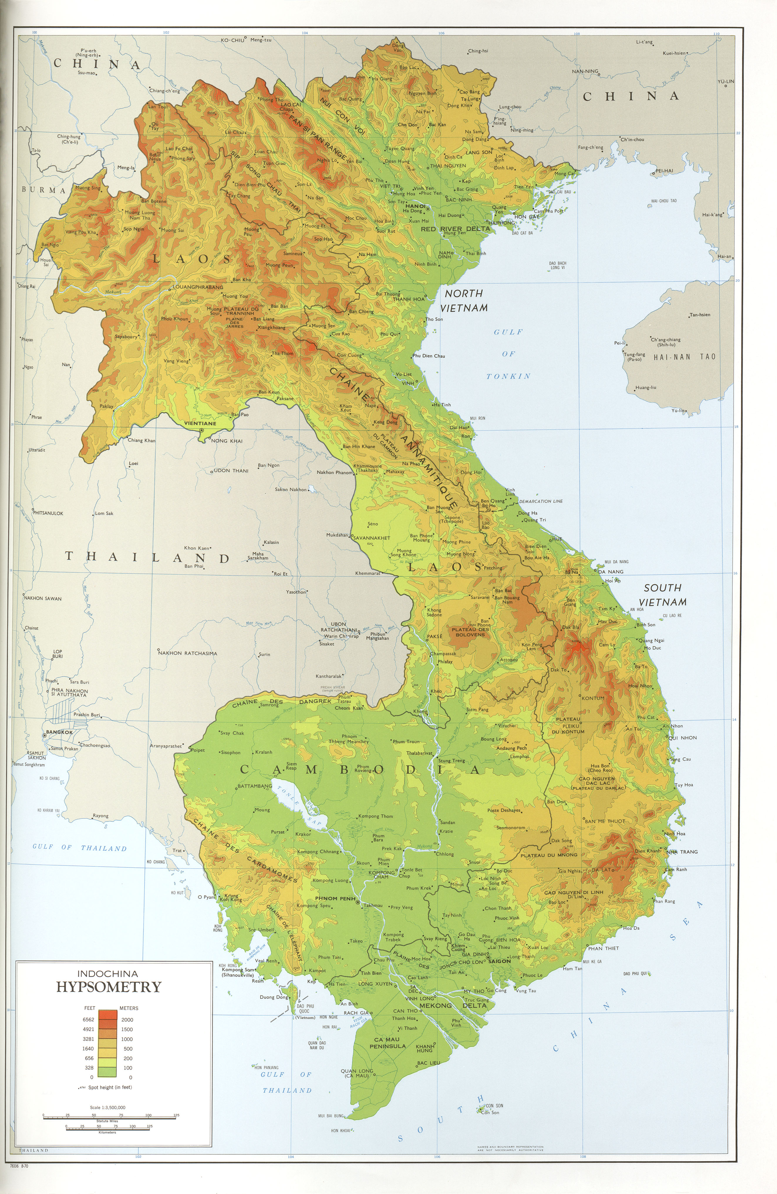
Indochina Hypsometry
(2.1 MB)
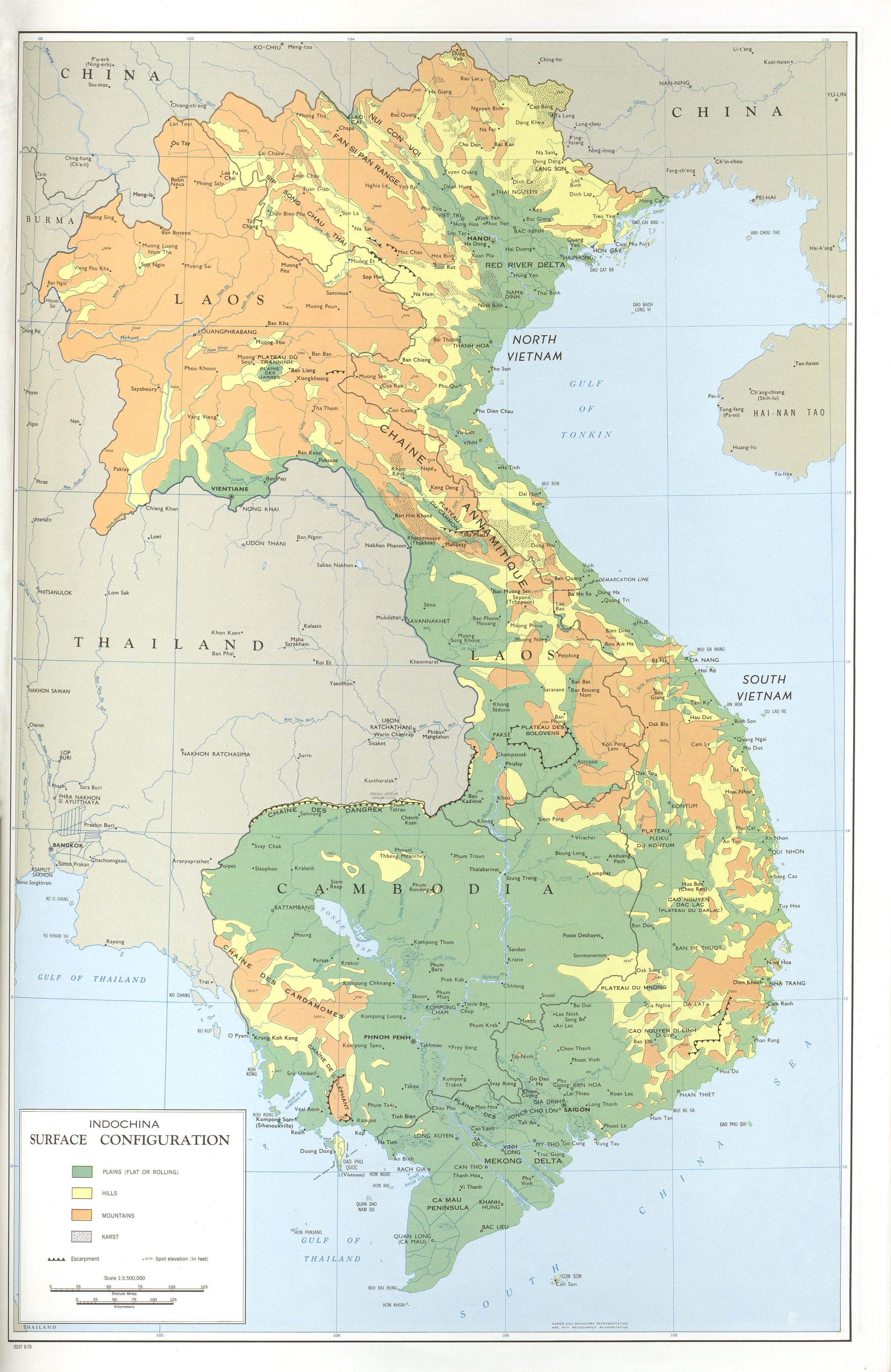
Indochina Surface Configuration
(2.3 MB)
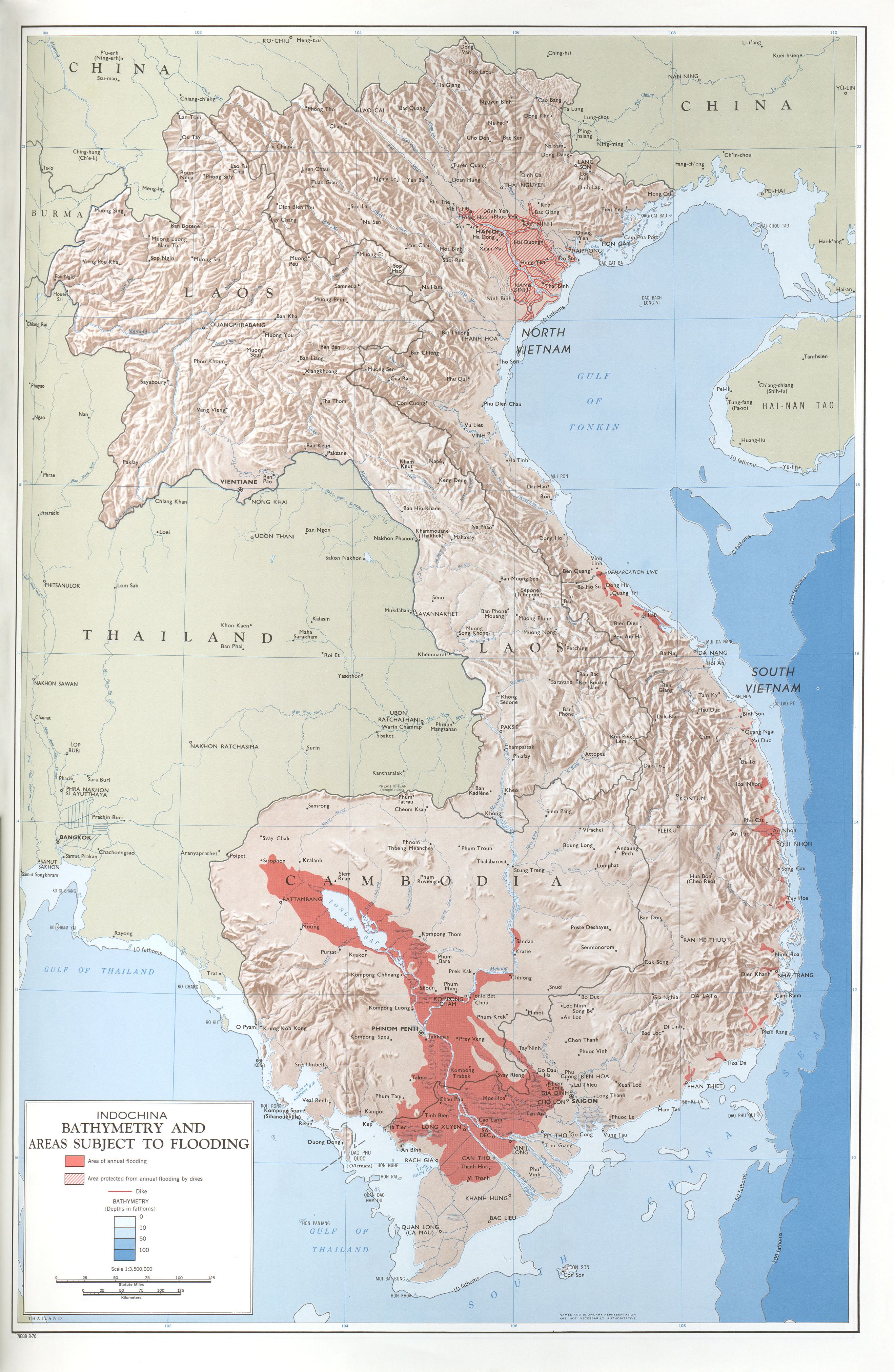
Indochina Bathymetry and Areas Subject to Flooding
(2.0 MB)
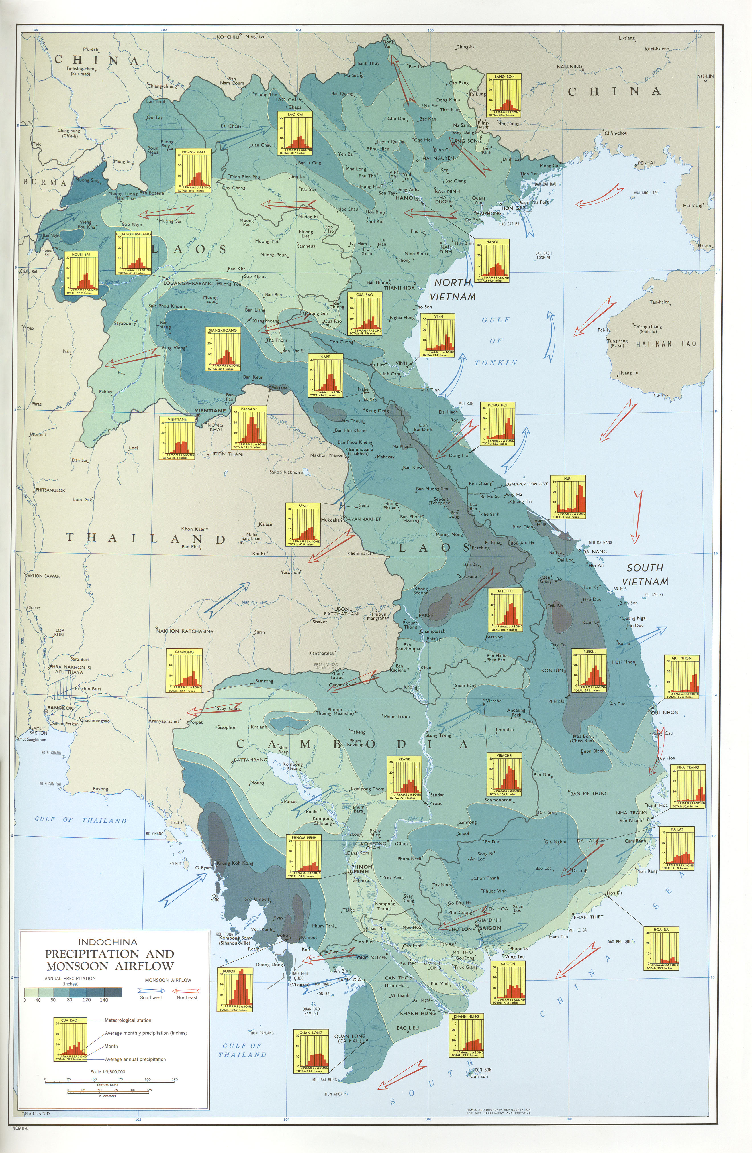
Indochina Precipitation and Monsoon Airflow
(2.2 MB)
Indochina Vegetation
(2.1 MB)
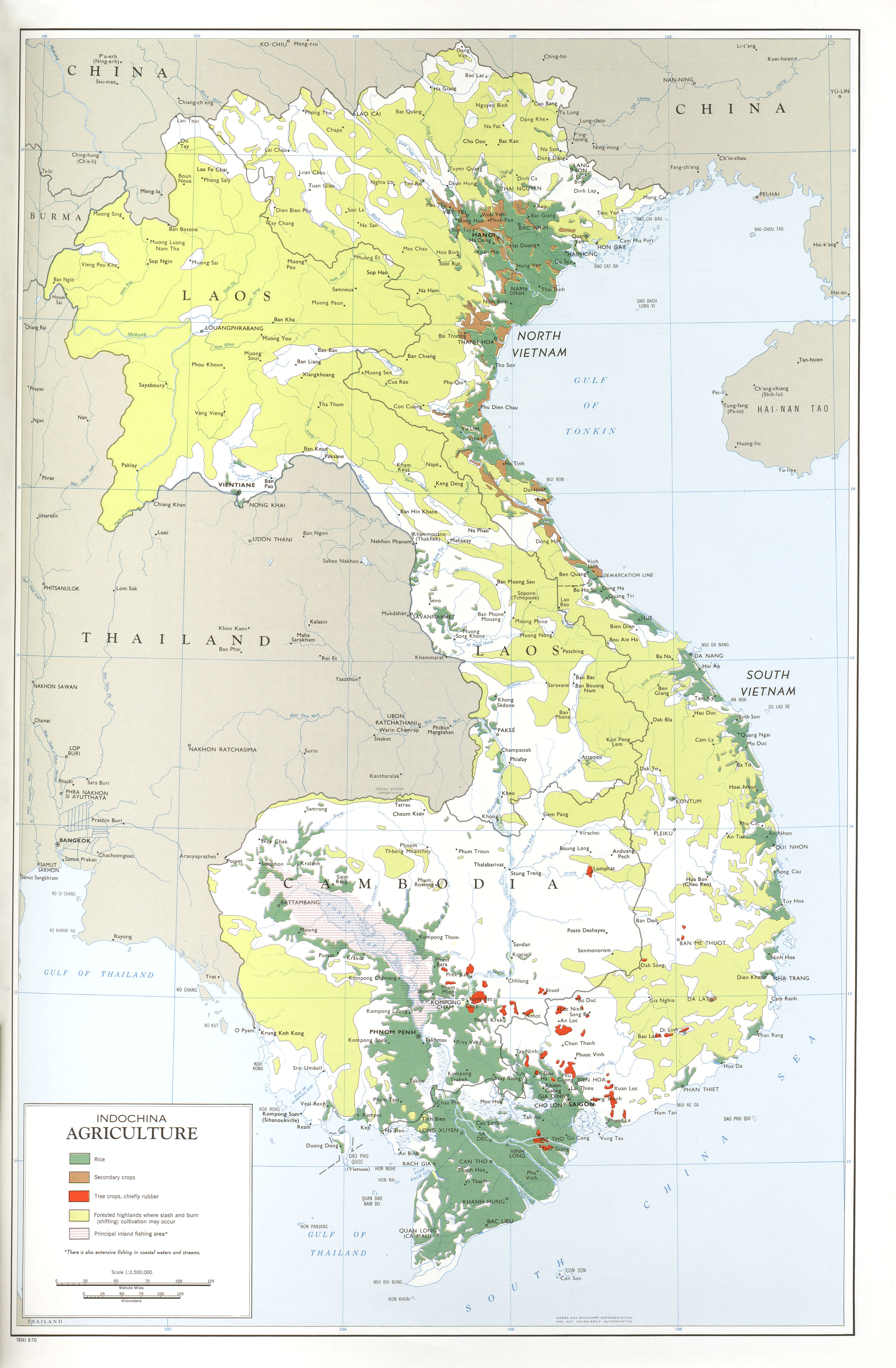
Indochina Agriculture
(1.9 MB)
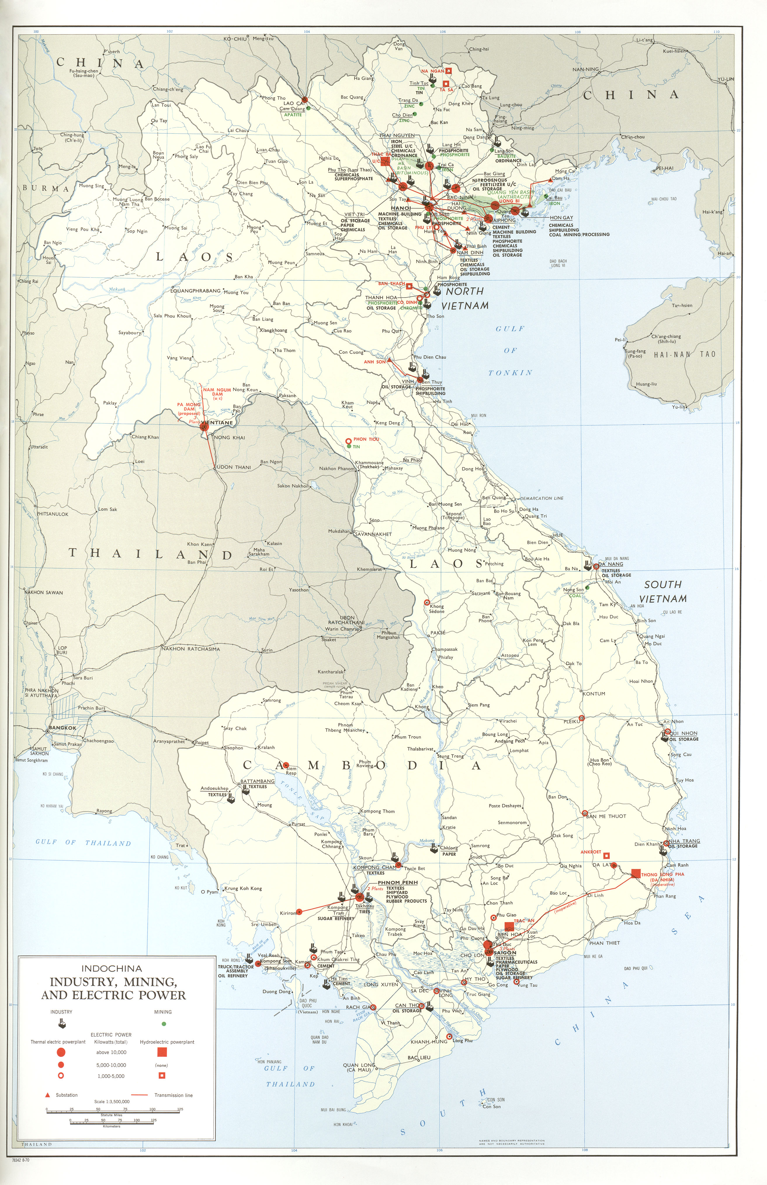
Indochina Industry, Mining, and Electric Power
(1.9 MB)
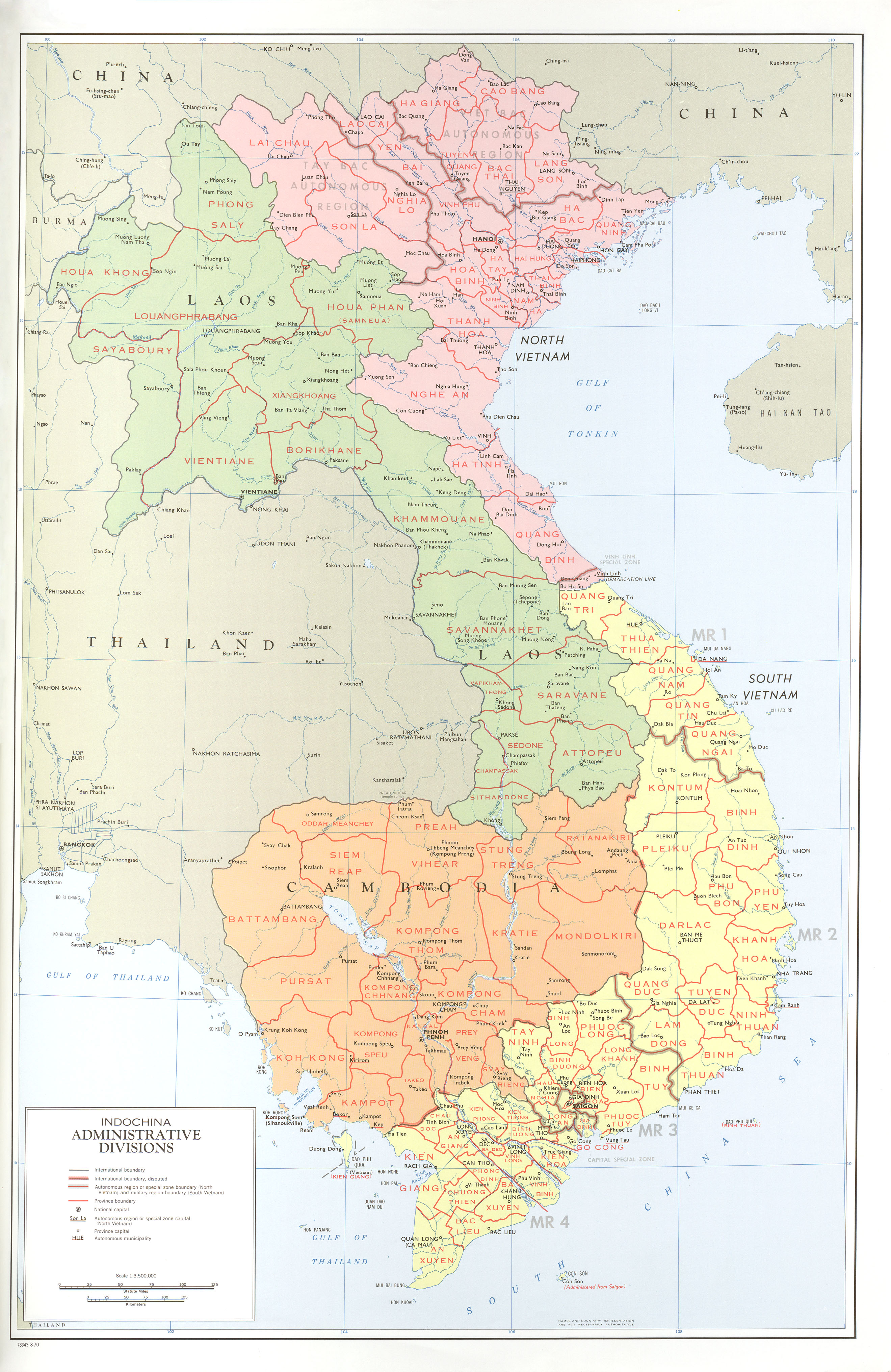
Indochina Administrative Divisions
(2.0 MB)
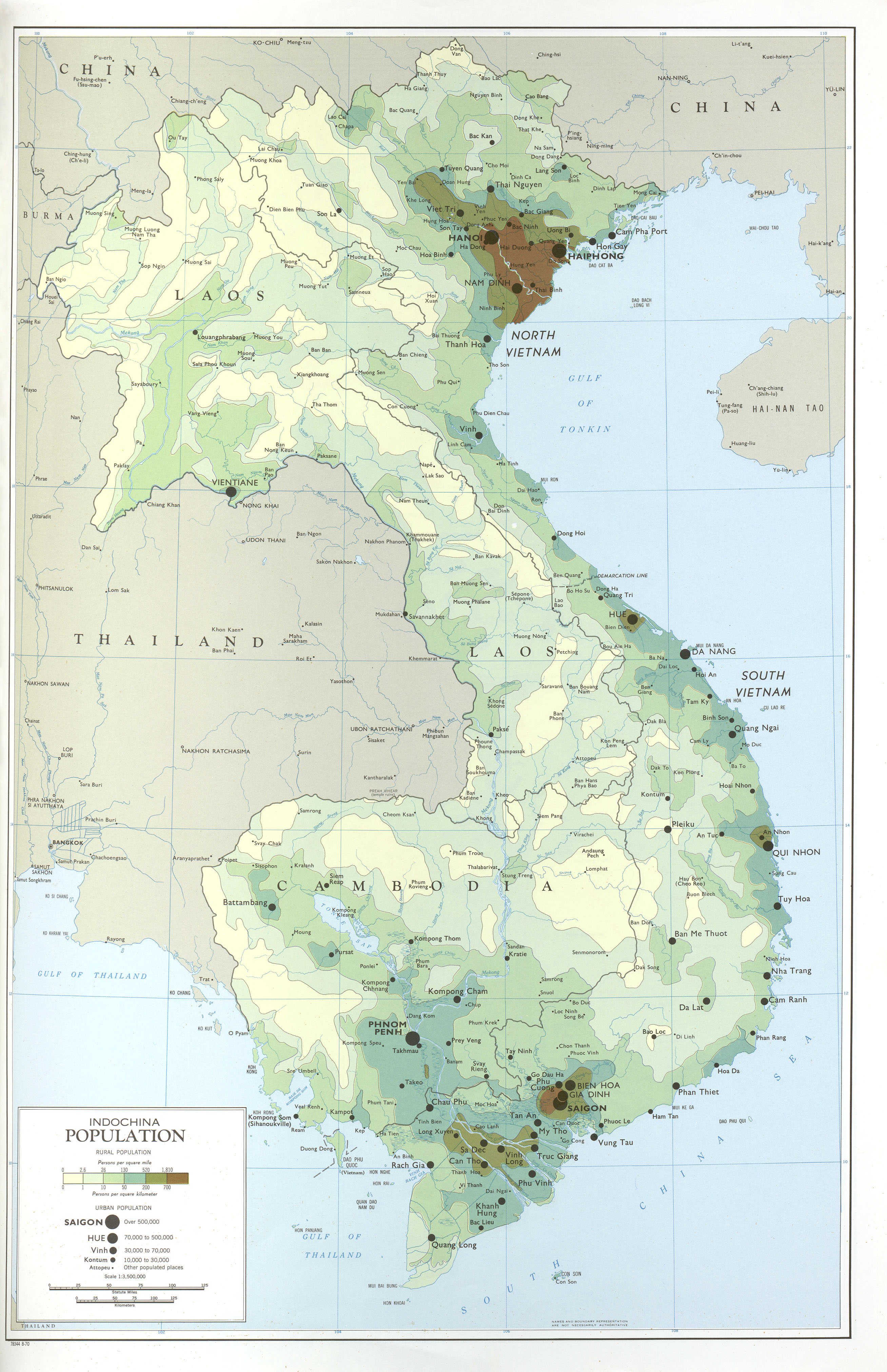
Indochina Population
(1.8 MB)
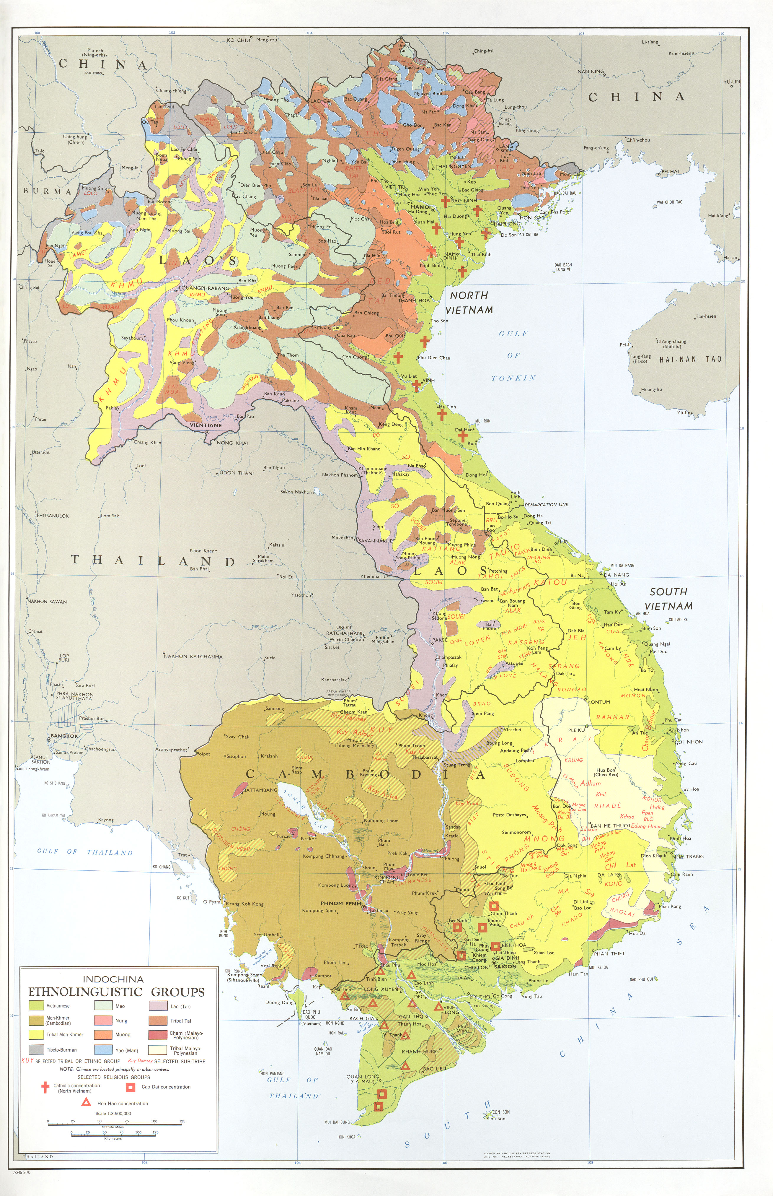
Indochina Ethnolinguistic Groups
(2.2 MB)
![Front Cover [verso]](http://maps.lib.utexas.edu/maps/indochina_atlas/txu-oclc-1092889-00a.jpg)