Perry-Castañeda Library
Map Collection
Selected maps from "The War in Maps", 1939-1940
The following maps are from "The War in Maps" edited by Giselher Wirsing, New York, German Library of Information, 1941.
- The War in Maps [PDF] (42.6MB)
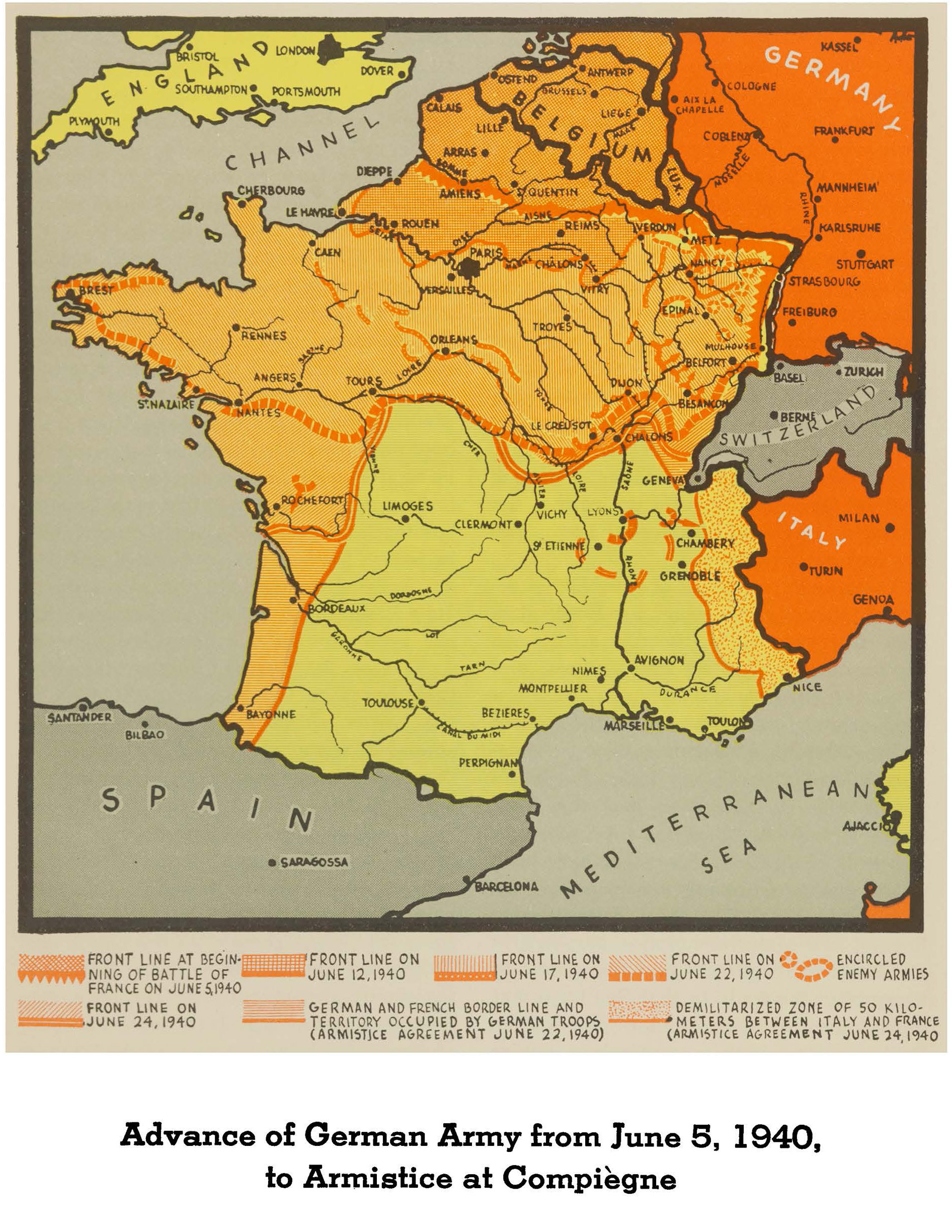
- Advance of Germany Army from June 5, 1940, to Armistice at Compiègne (1.0MB)
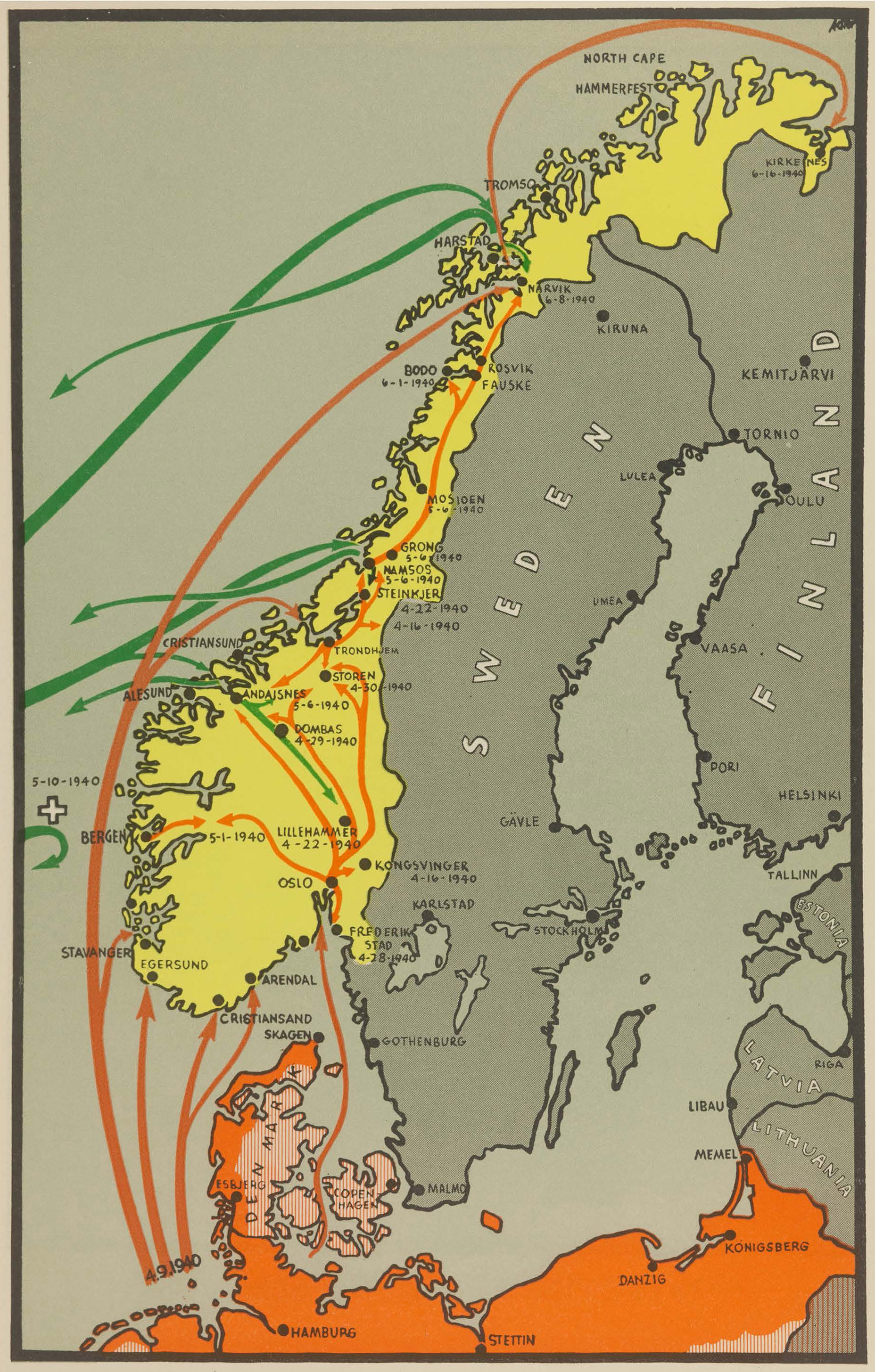
- Norway: Boldest Invasion by Sea in Military History (1.2MB)
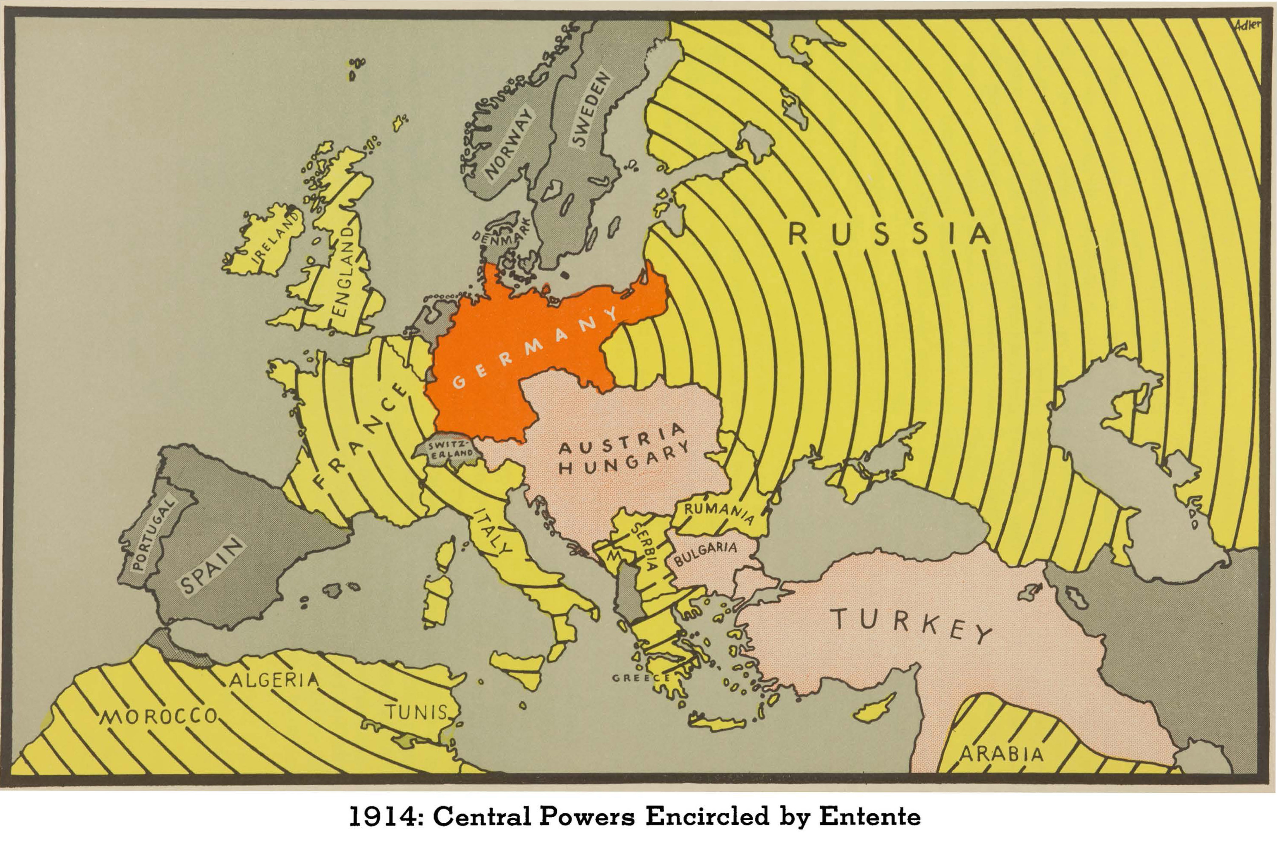
- Central Powers Encircled by Entente, 1914 (1.6MB)
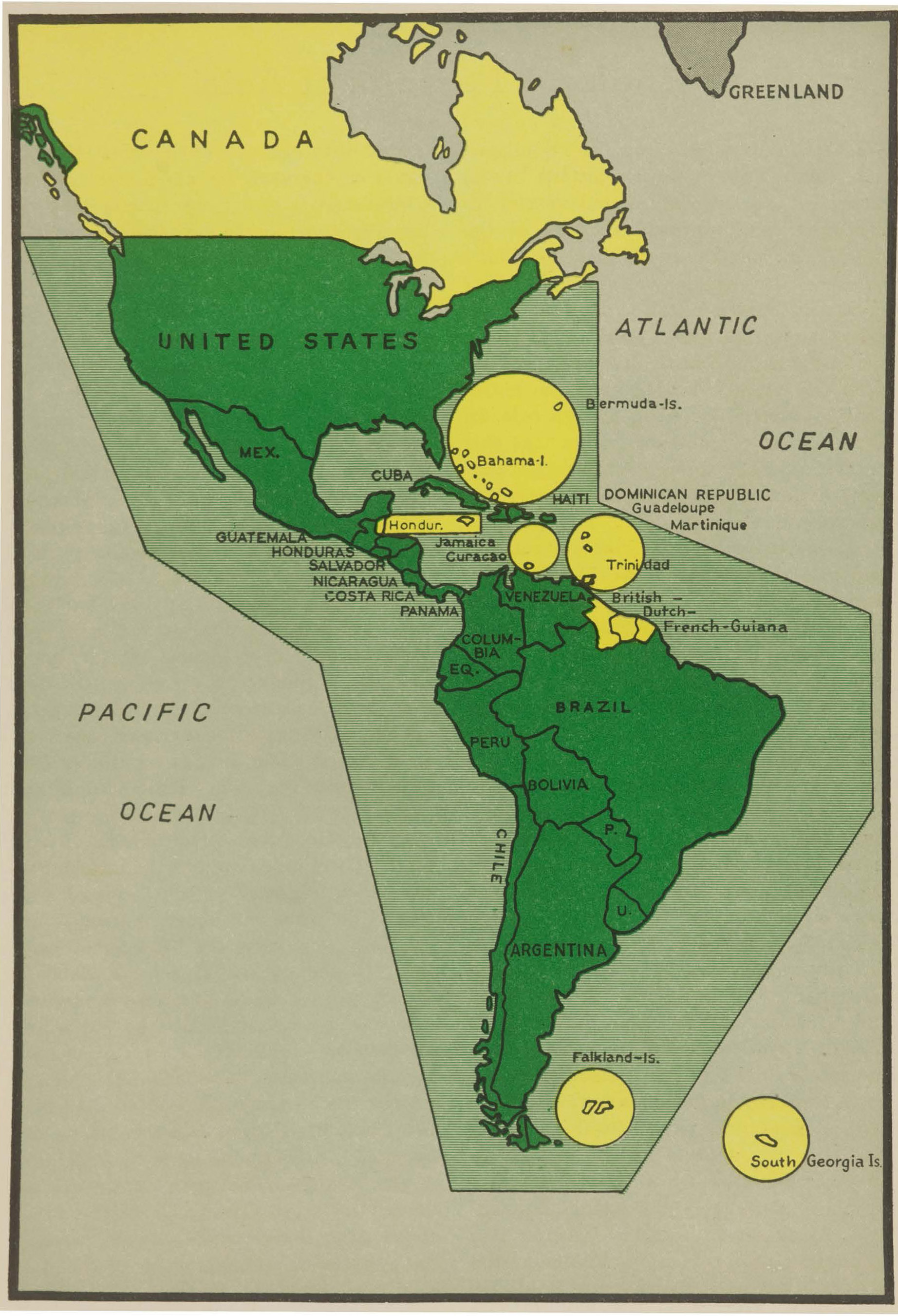
- England a Threat to the Monroe Doctrine (743.1KB)
- England, Intruder in the Mediterranean (1.5MB)
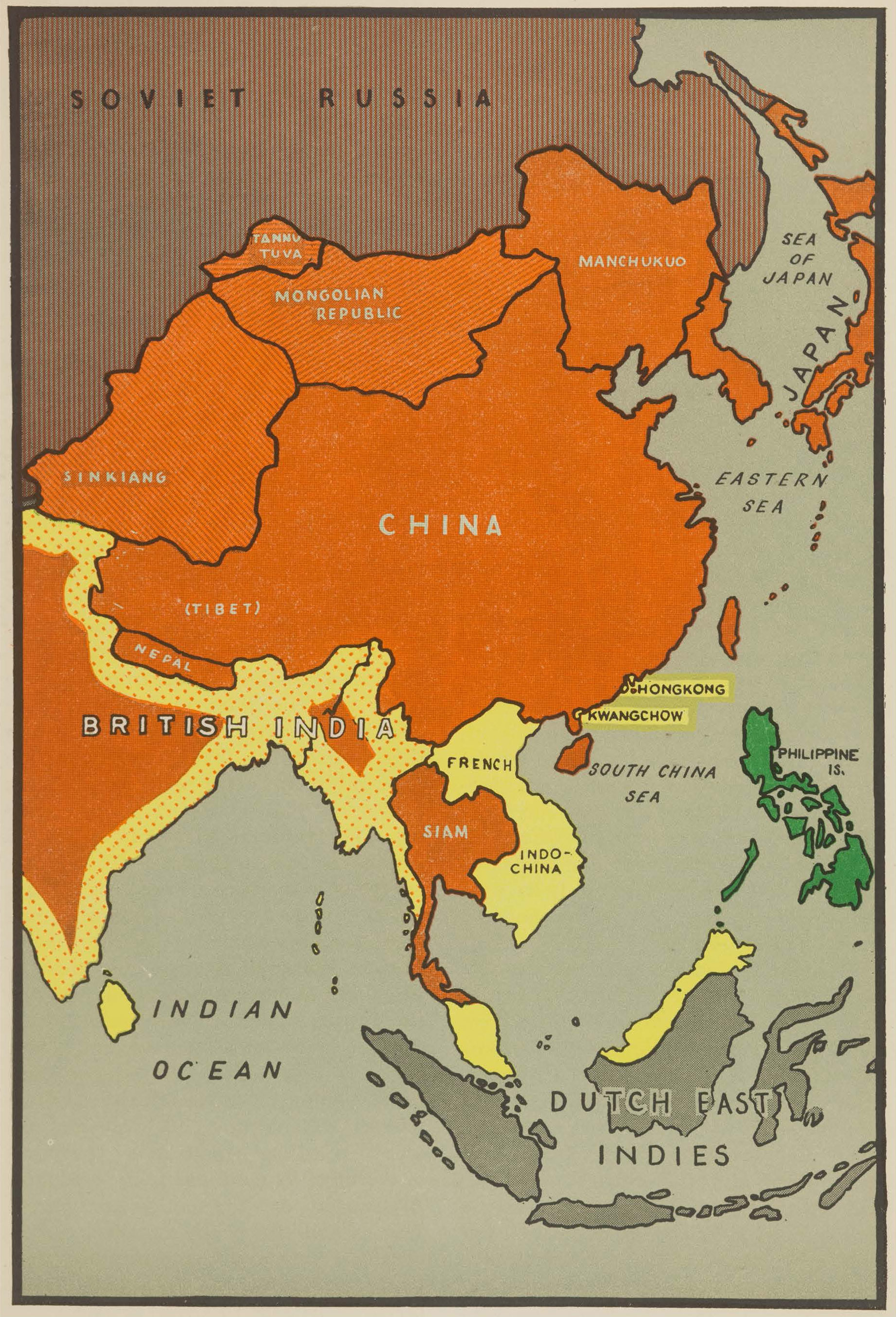
- England, Parasite of Asia (1.2MB)
-
- England's Predatory Campaign in Five Continents, 1605-1940 (1.9MB)
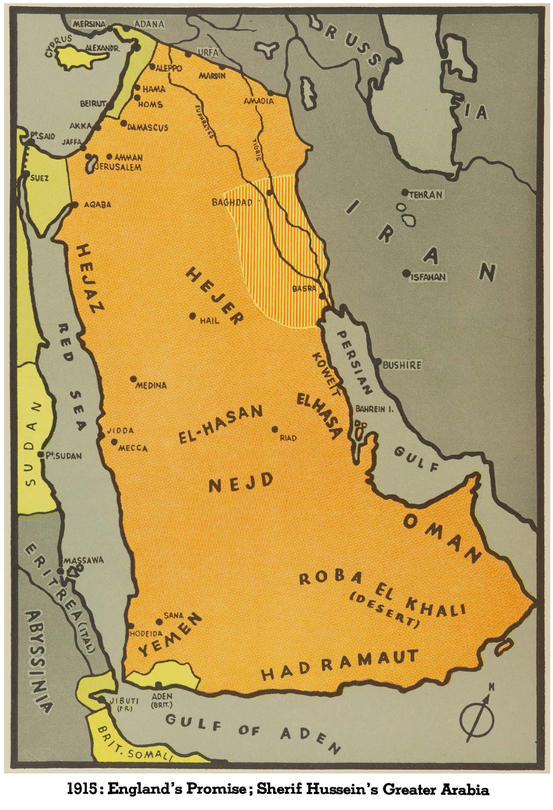
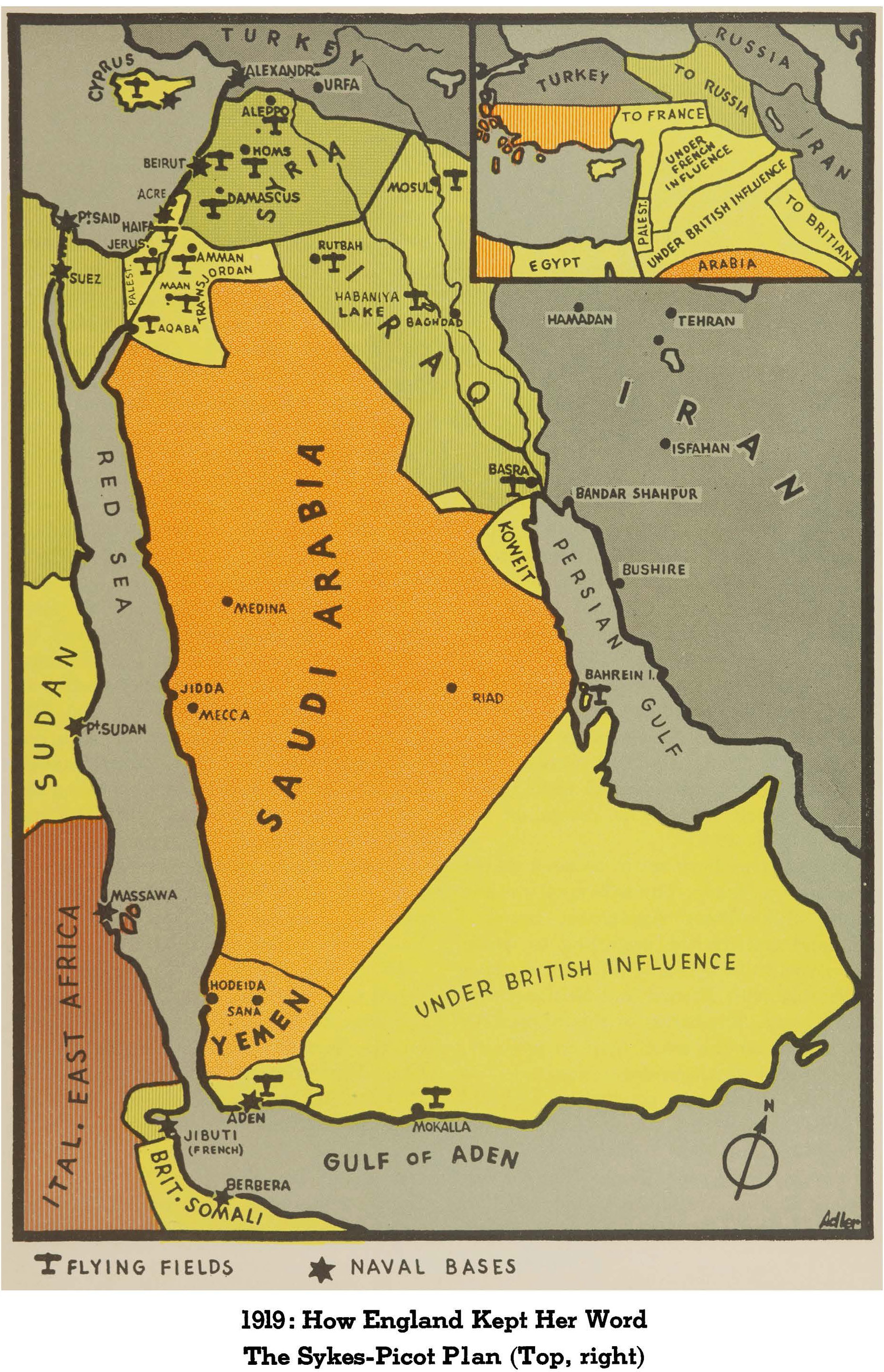
- England's Promise; Sherif Hussein's Greater Arabia (1.5MB)
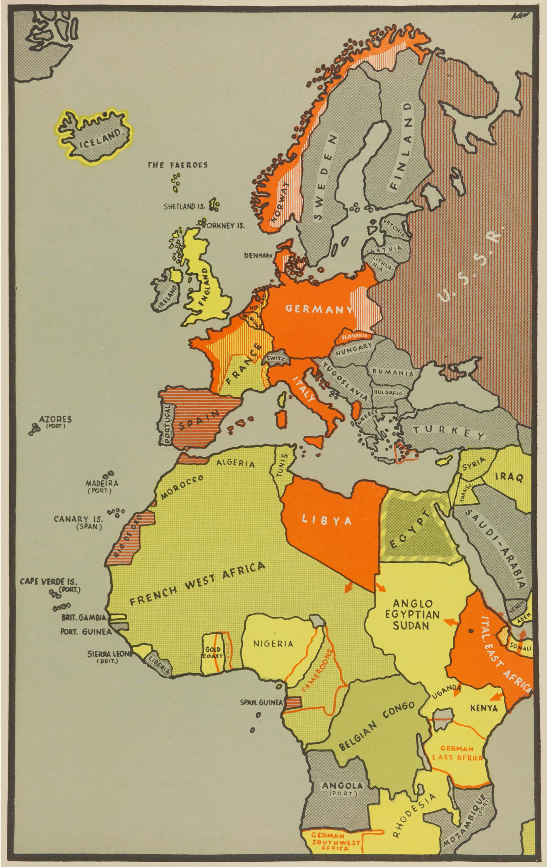
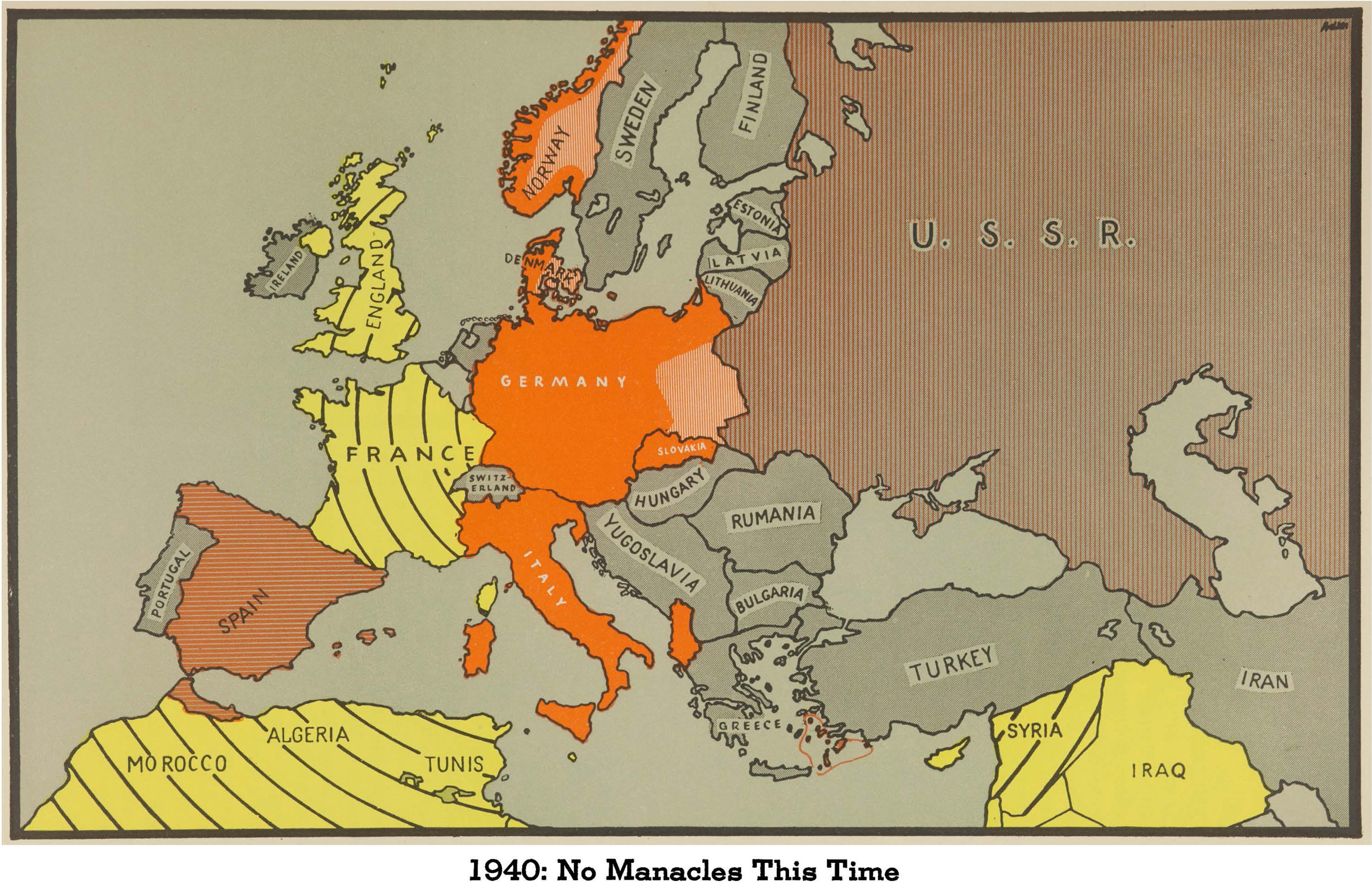
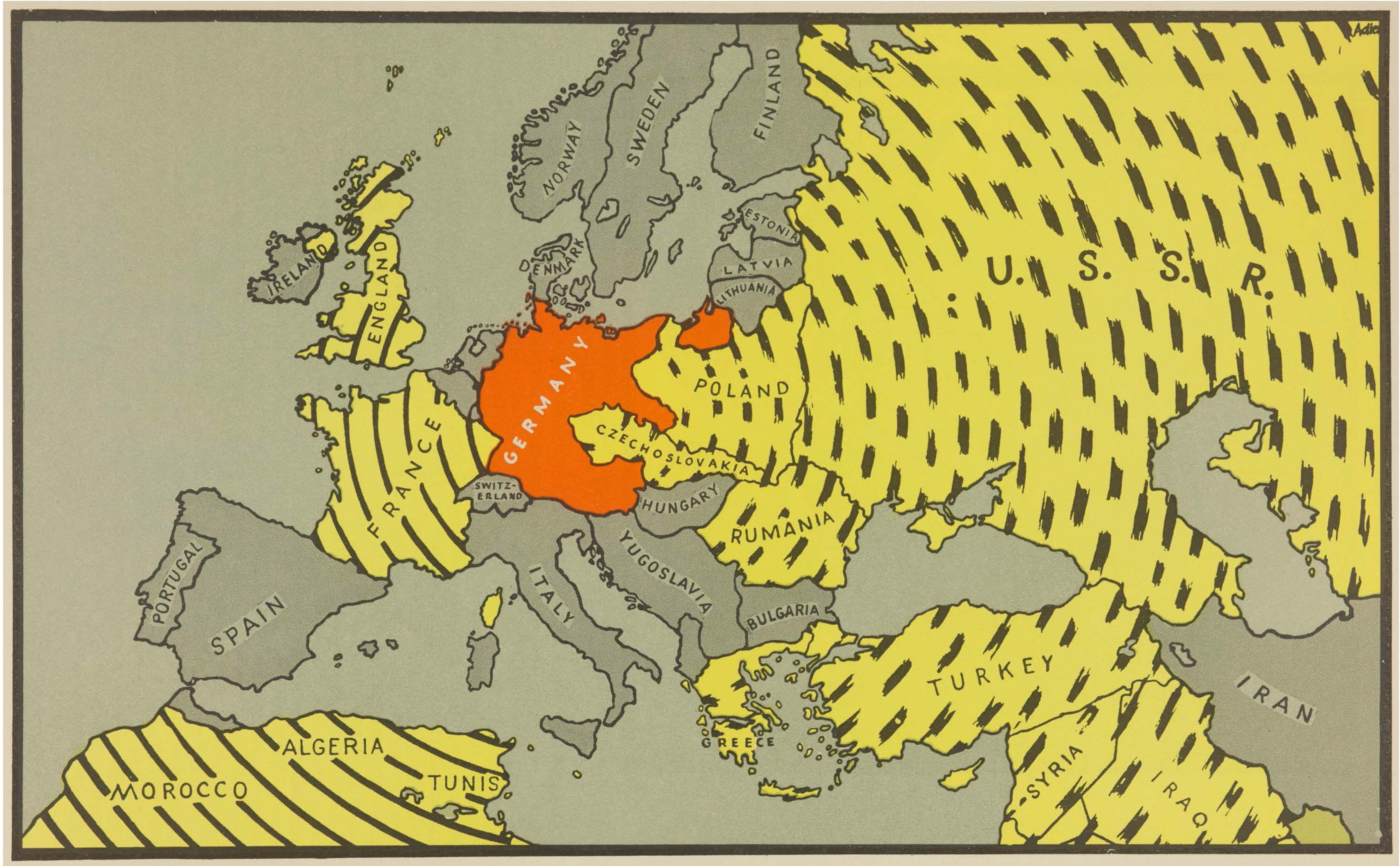
- The Territory under Military Control of the Axis in 1940 (1.1MB)
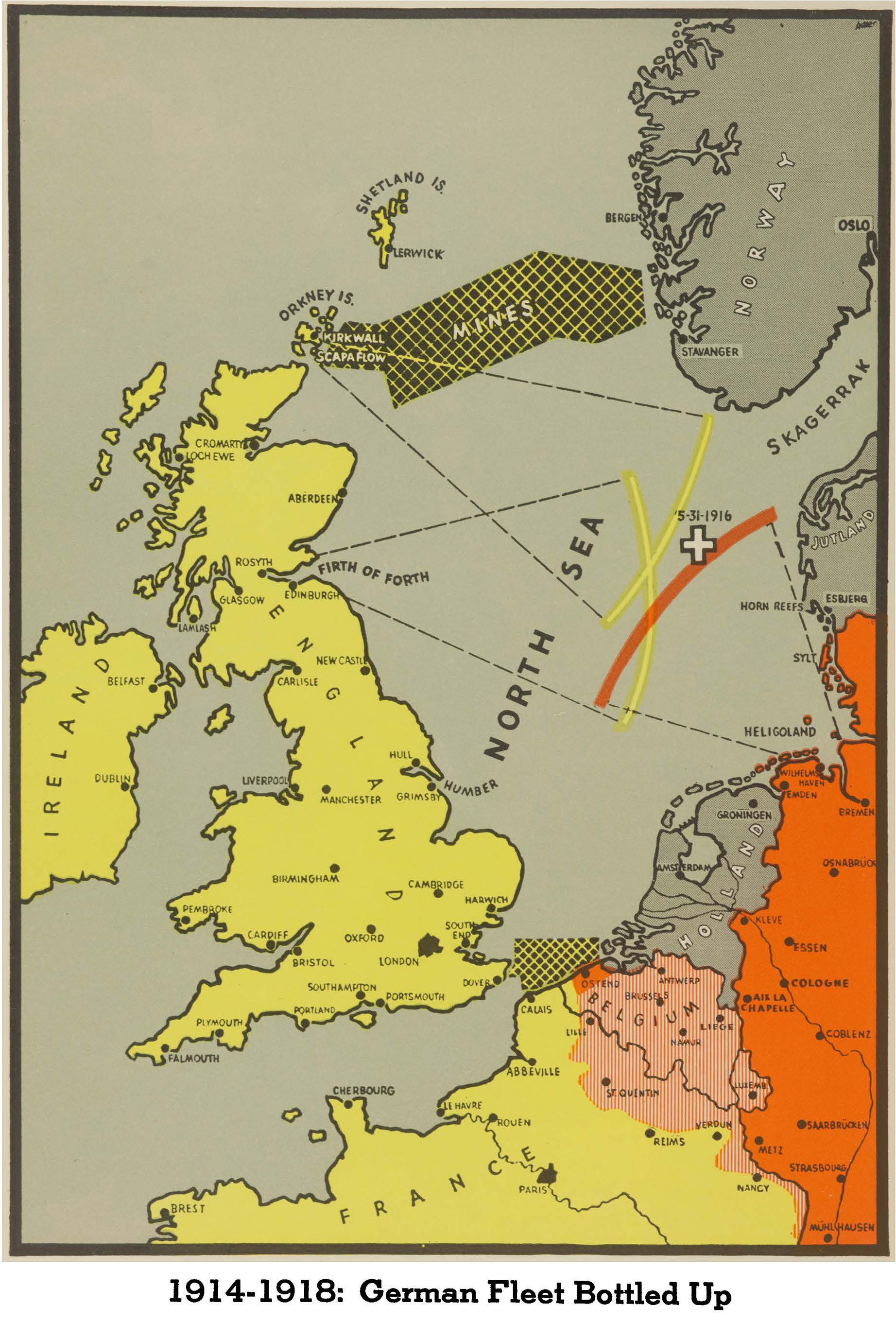
- German Fleet Bottled Up, 1914-1918 (890KB)
- Germany and Southeast Europe, Natural Partners (2.1MB)
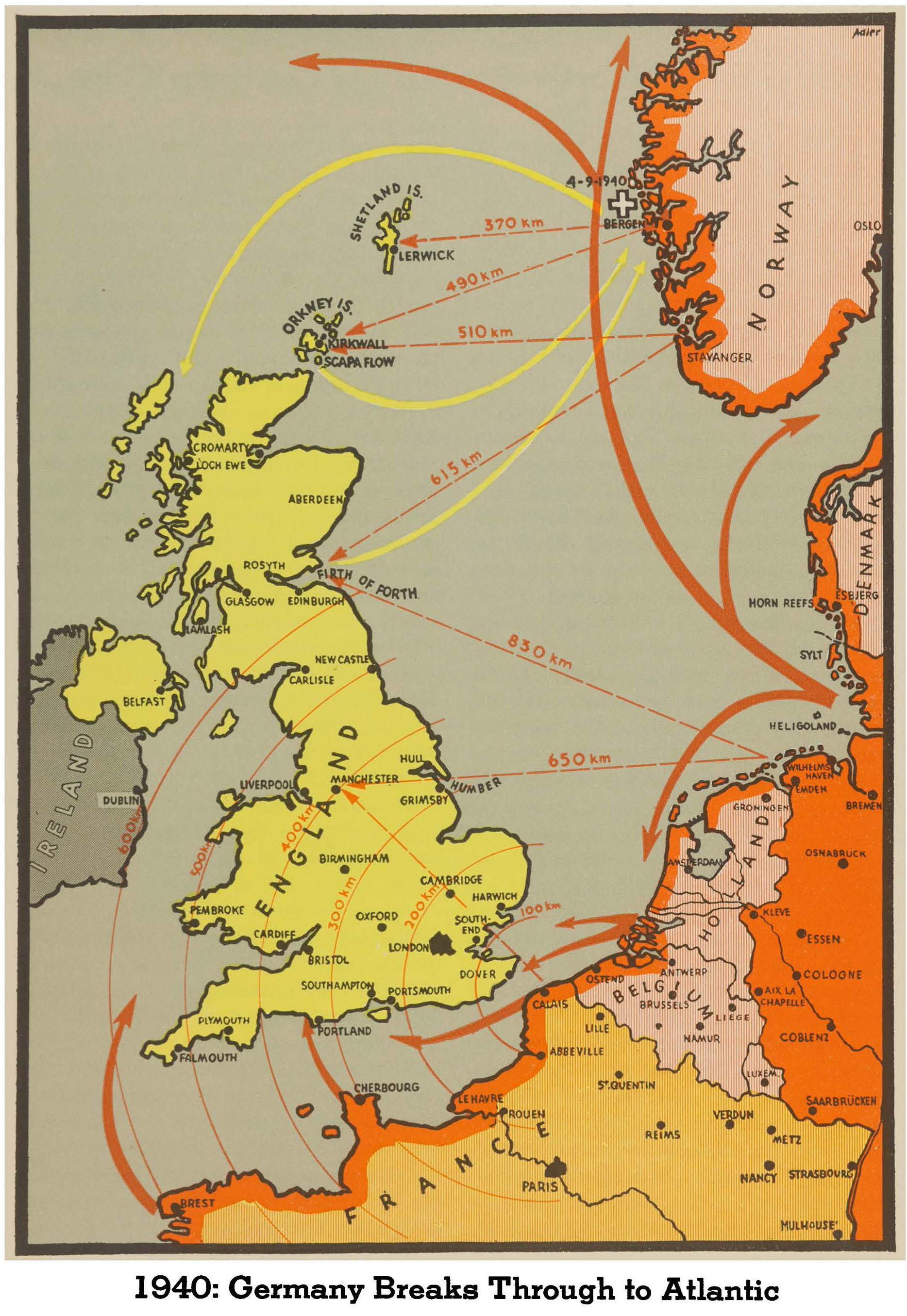
- Germany Breaks Through to Atlantic (1.0MB)
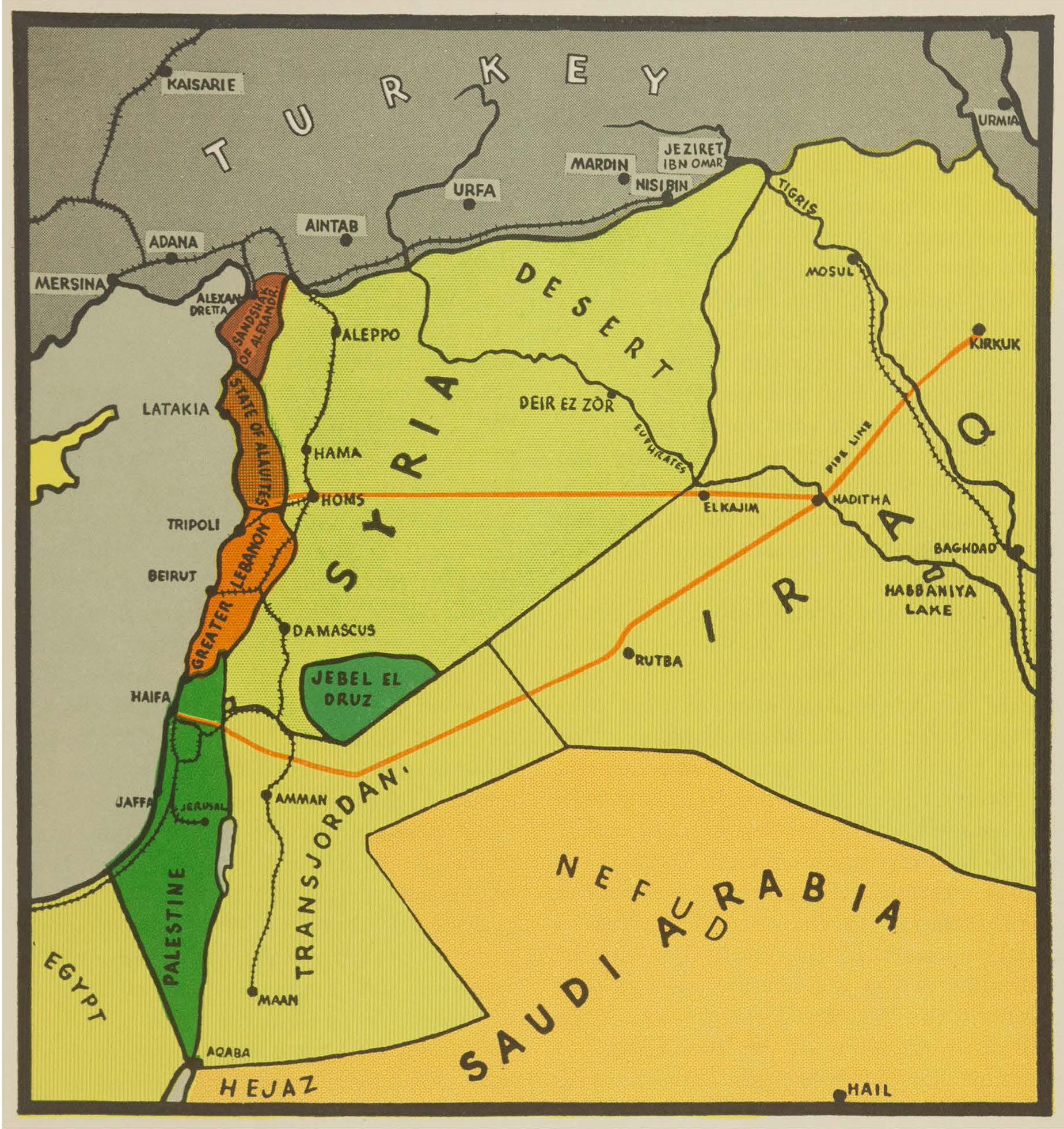
- How England Kept Her Word the Sykes-Picot Plan, 1919 (1.3MB)
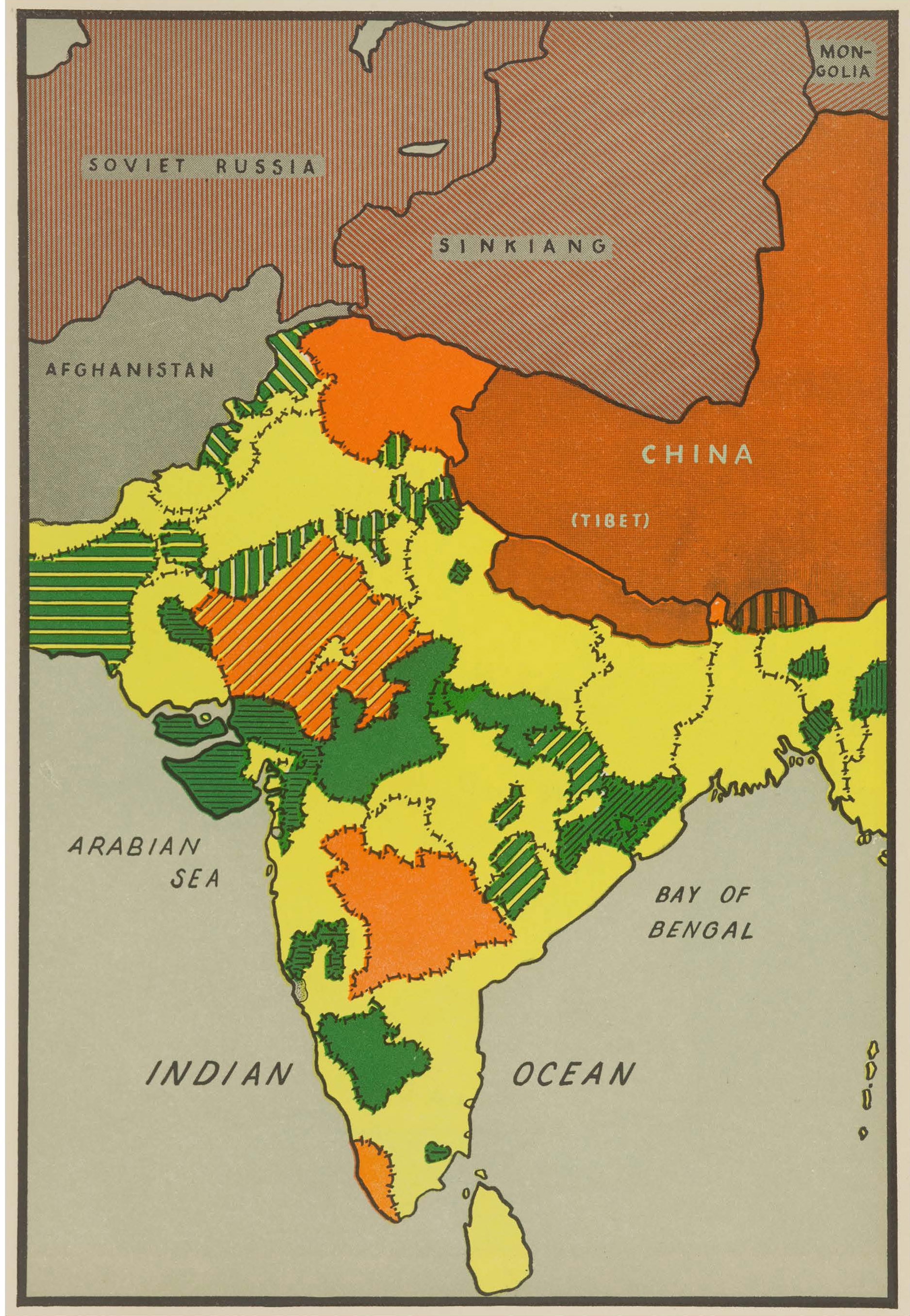
- India: Divide and Rule (1.3MB)
- No Manacles This Time, 1940 (2.3MB)
- Syria Split by France (879.7KB)
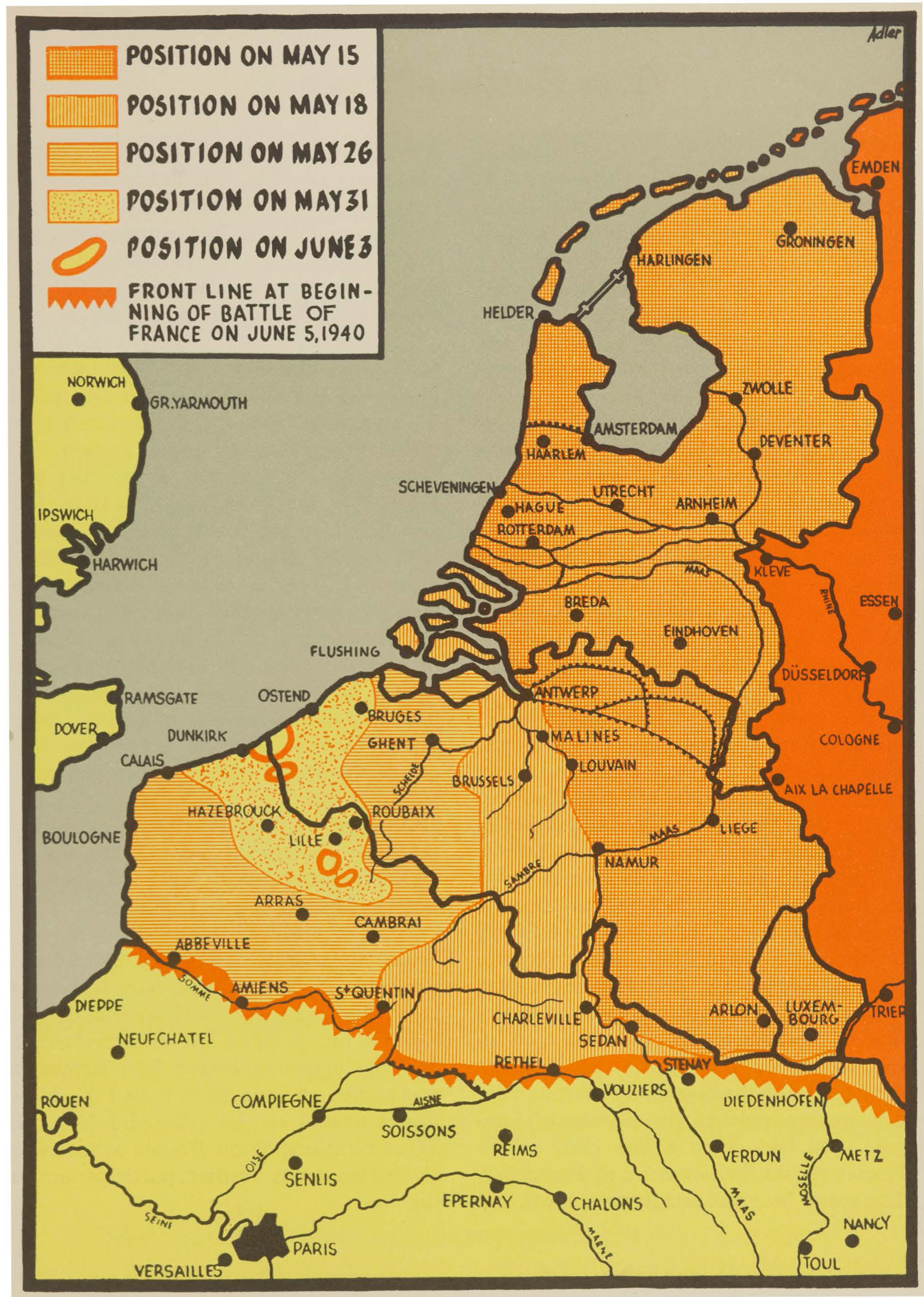
- The Battle of Flanders (1.1MB)
- The Blockaded Blockader (1.0MB)
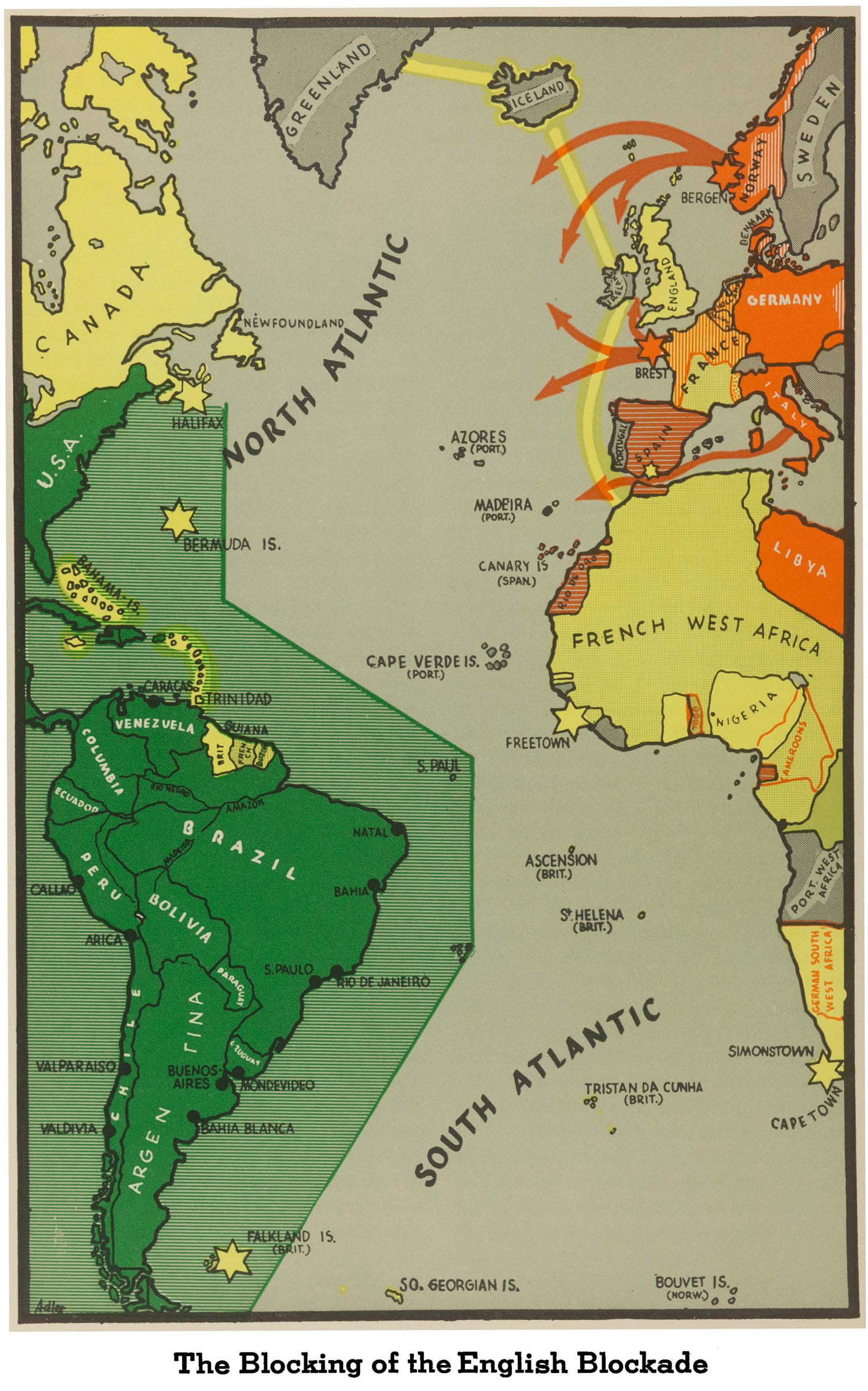
- The Blocking of the English Blockade (1.1MB)
- The Encirclement has Failed (1.7MB)
- The Europe of Hapsburg's Dreams (1.0MB)
- The Hopeless Long-Distance Blockade of Europe (1.0MB)
-
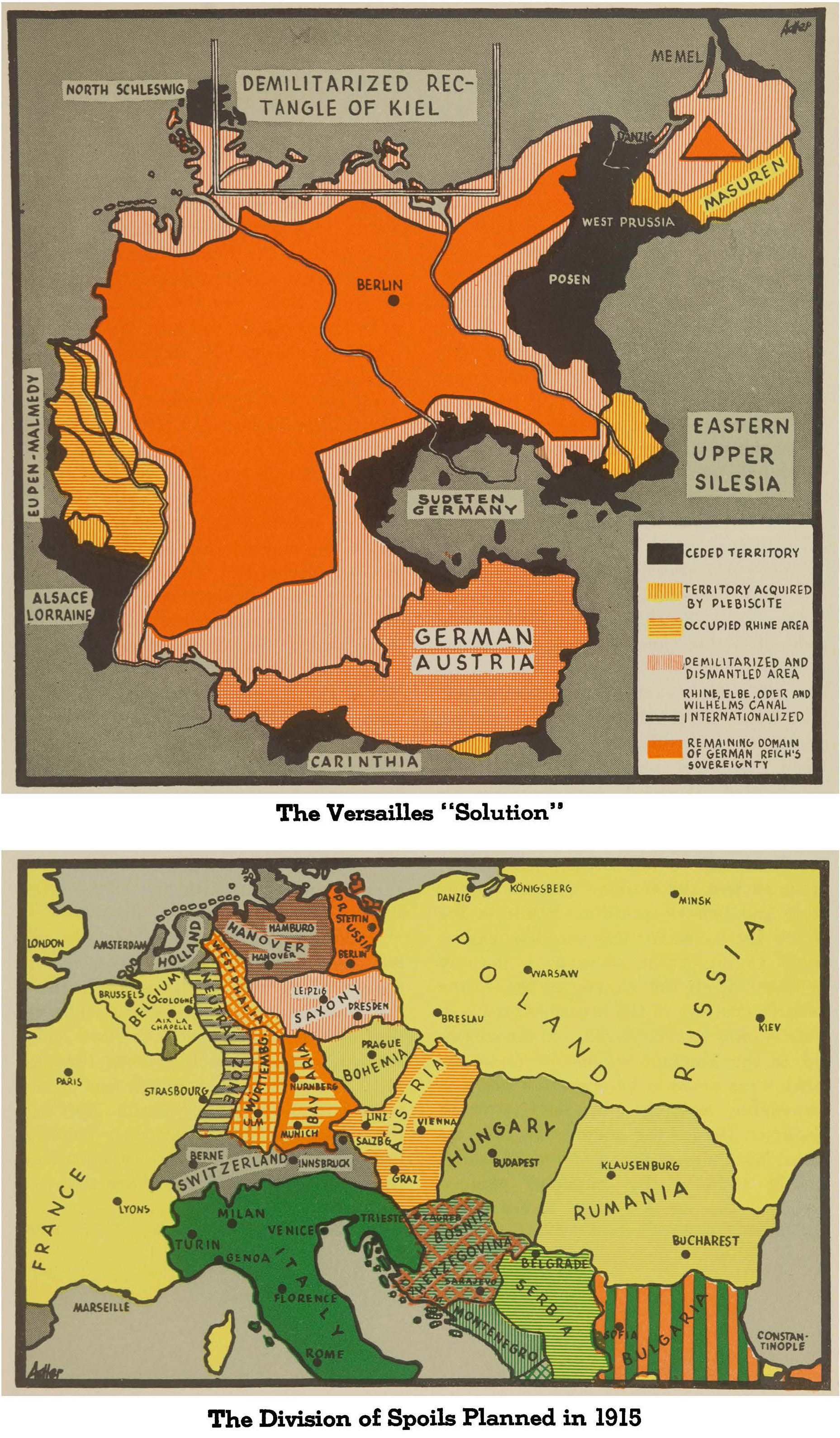
- The Versailles "Solution" and the Division of Spoils Planned in 1915 (1.4MB)