Perry-Castañeda Library
Map Collection
Maps from the Journal of the Royal Geographical Society of London
Volume 2, 1831-1832
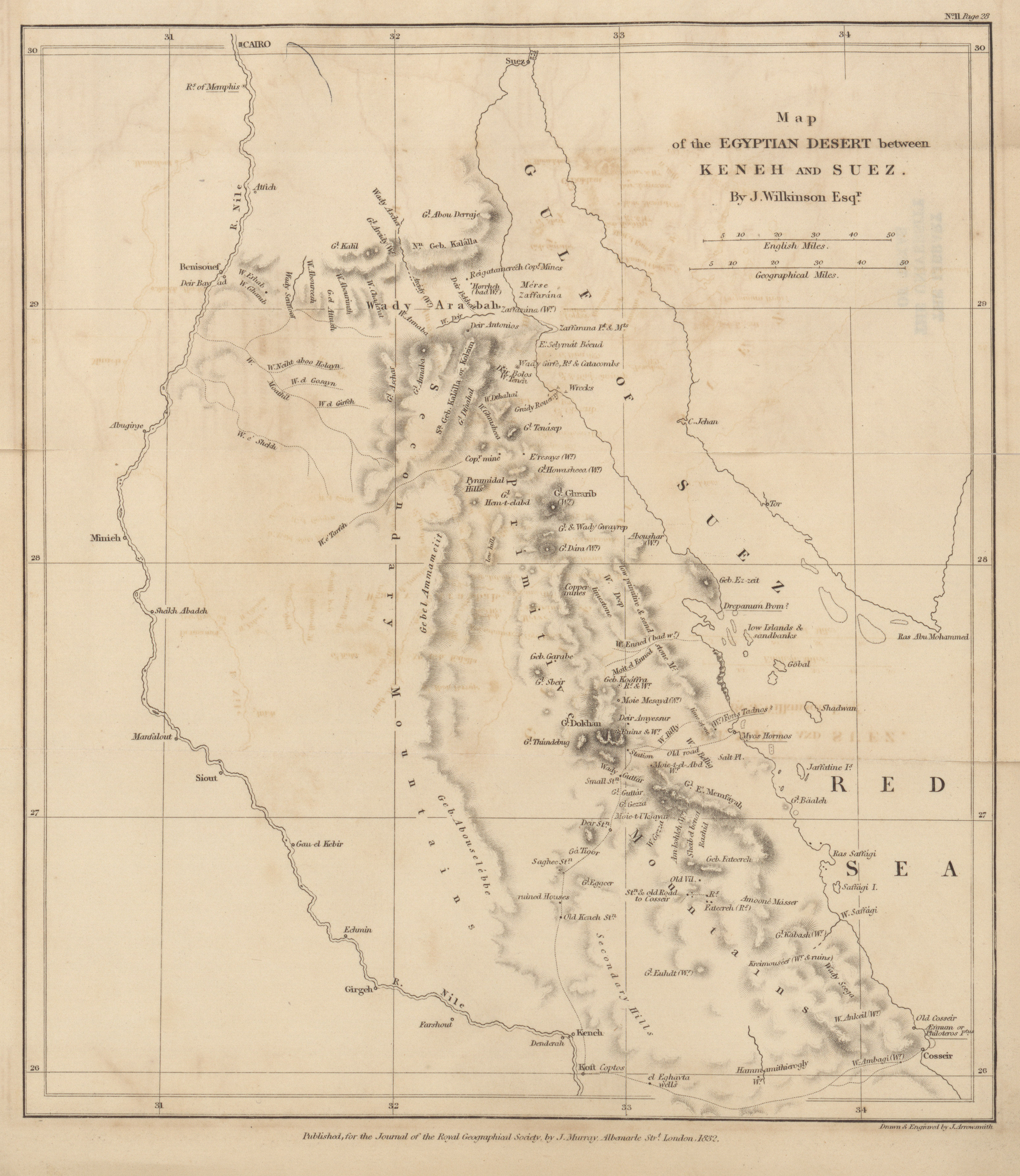
- Egyptian Desert between Keneh and Suez, J. Wilkinson, 1831 (2.3MB) Notes on a part of the Eastern Desert of Upper Egypt, accompanied by a map. Communicated by J. Wilkinson, Esq.
-
- The Maldiva Islands, from Captn. Horsburgh's Chart, 1814 (1.2MB)
Some remarks relative to the geography of the Maldiva islands, and the navigable channels (at present known to Europeans) which separate the atolls from each other. Communicated by James Horsburgh, Esq., hydrographer to the East India company. -
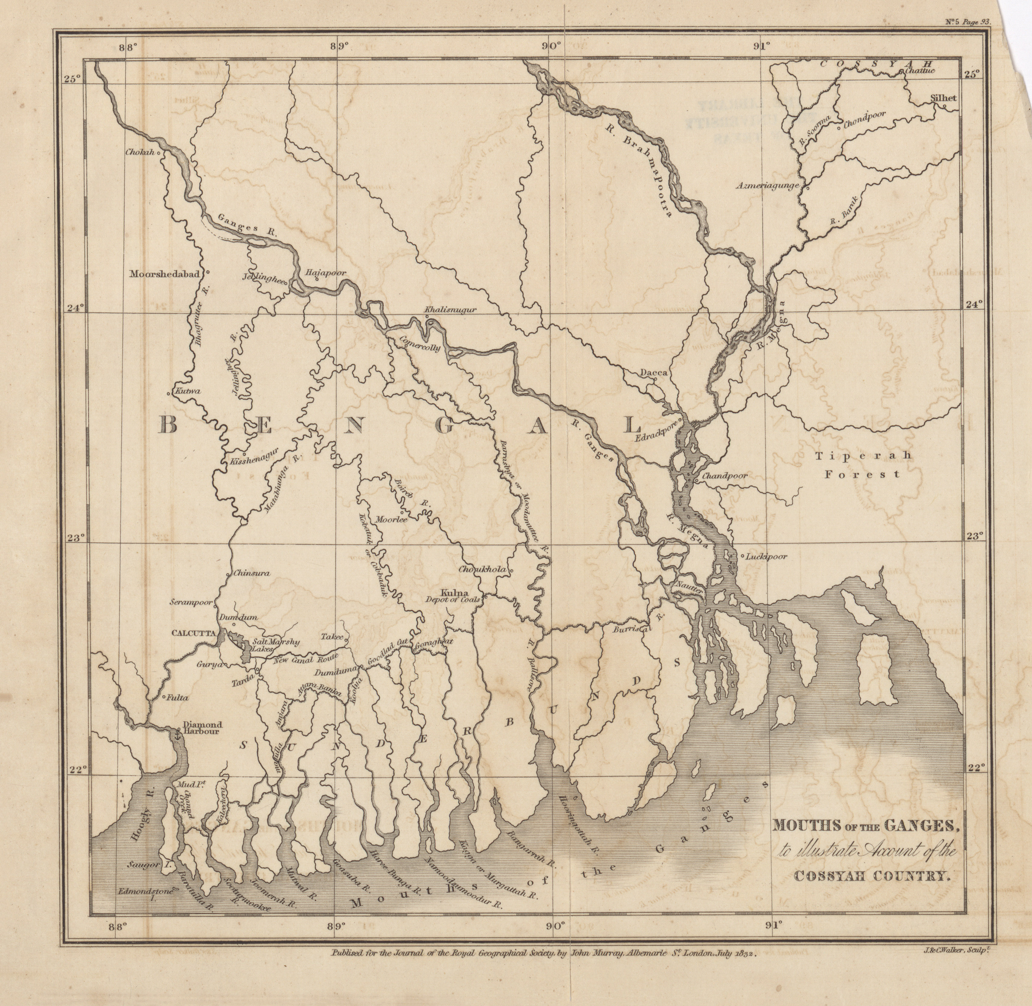
- Mouths of the Ganges, to illustrate account of the Cossyah Country, Lieut. Murphy, 1831 (2.3MB)
Account of the Cossyahs, and of a convalescent depot established in their country, 280 miles N.E. from Calcutta. Extracted from the private letters of an officer quartered there, and communicated by Lieutenant Murphy, R.E. -
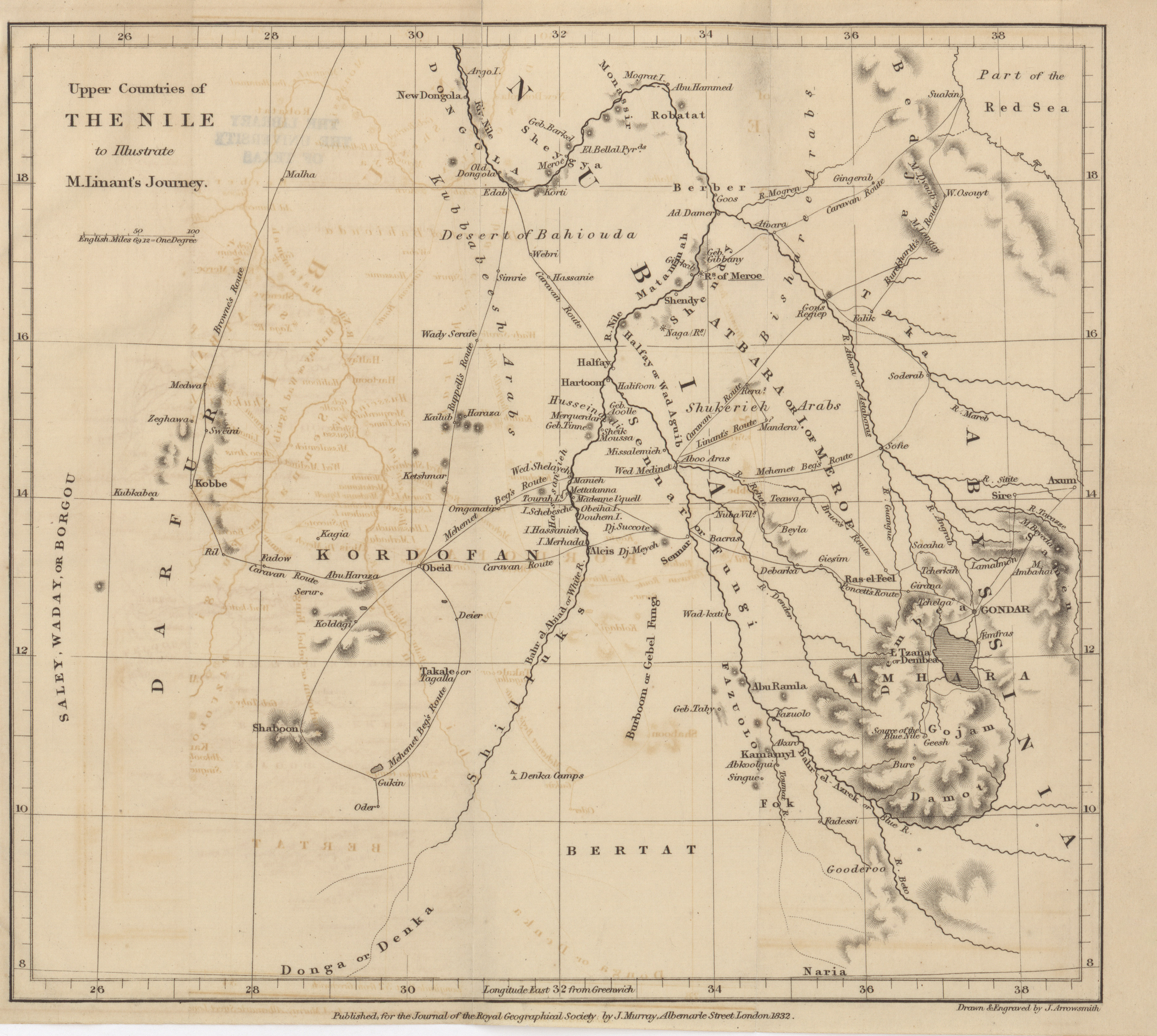
- Upper countries of the Nile to illustrate M. Linant's Journey, 1832 (2.4MB)
Journal of a voyage on the Bahr-Abiad or White Nile, with some general notes on that river, and some remarks on the District of Atbara, made in a tour from Hartoum. Translated and partially abridged from a report addressed by M. Adolphe Linant to W. M. Leake, Esq., Secretary of the Association for promoting the discovery of the interior parts of Africa.
Volume 3, 1833
-
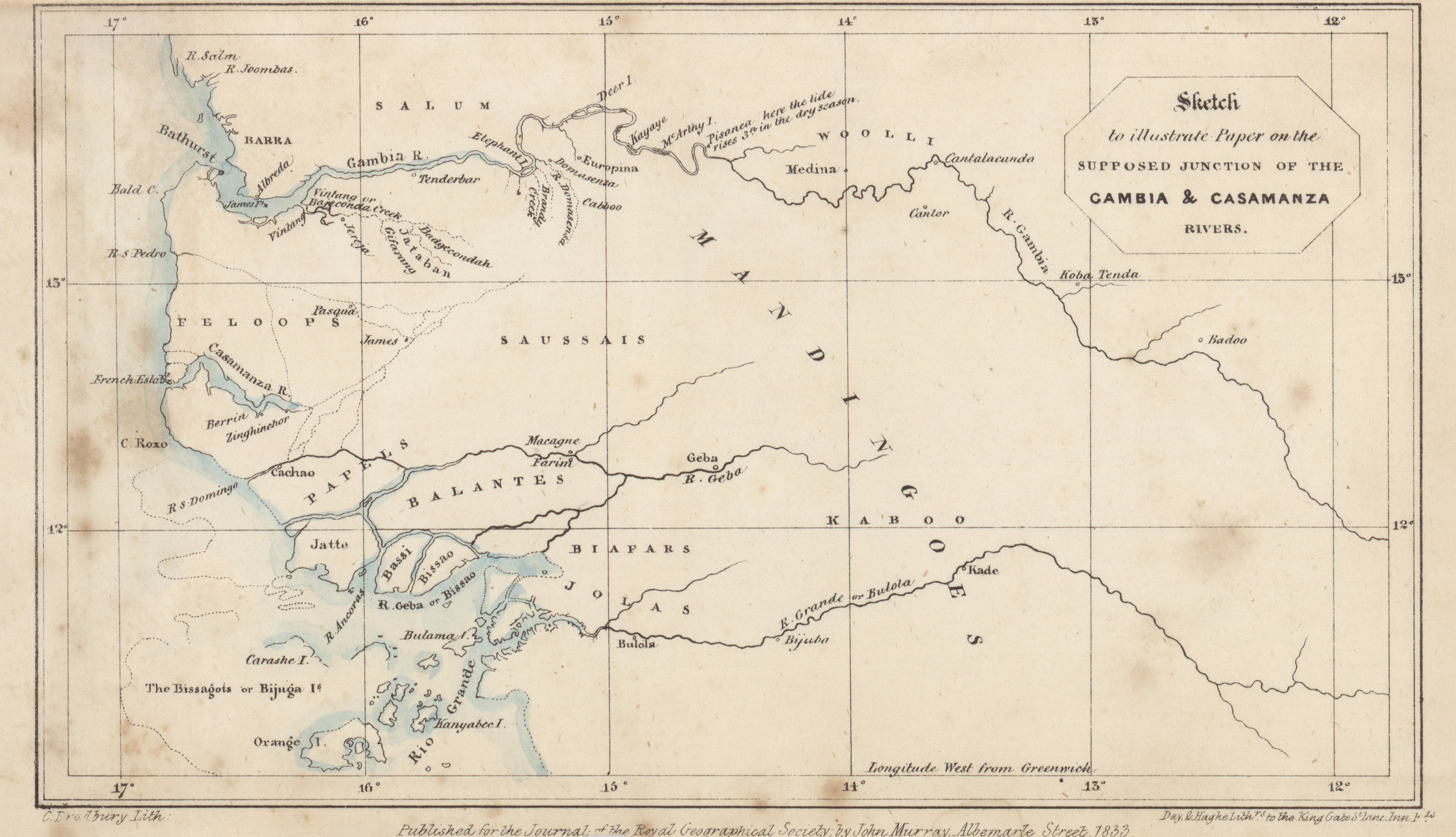
- Sketch to illustrate paper on the supposed junction of the Gambia and Casamanza rivers, R.W. Hay, 1833 (1.0MB)
Supposed junction of the rivers Gambia and Casamanza, on the Western coast of Africa. By R.W. Hay, Esq. -
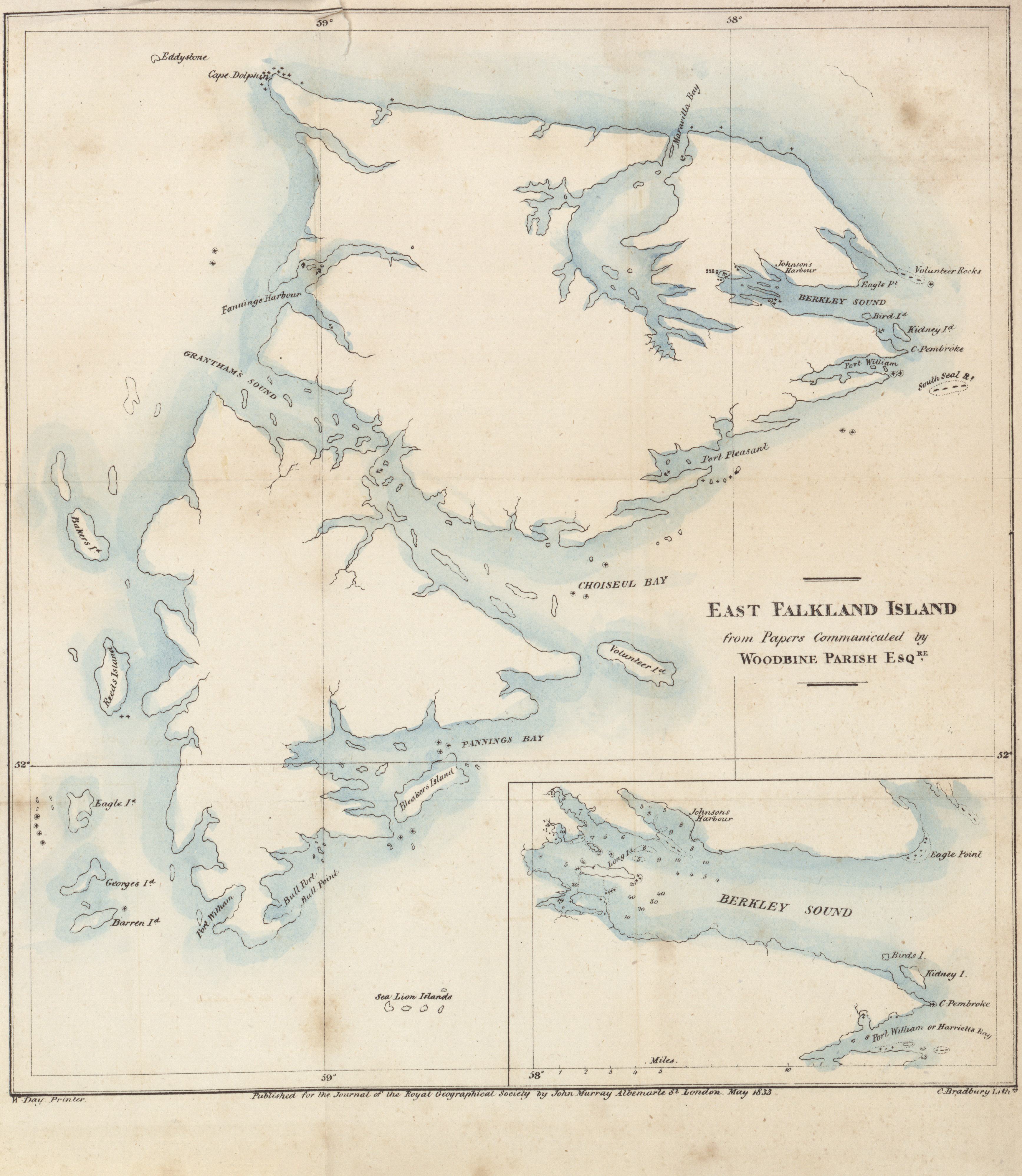
- East Falkland Island from papers communicated by Woodbine Parish Esq, 1833 (2.3MB)
Account of East Falkland Island. By Woodbine Parish, Esq.
Volume 5, 1835
-
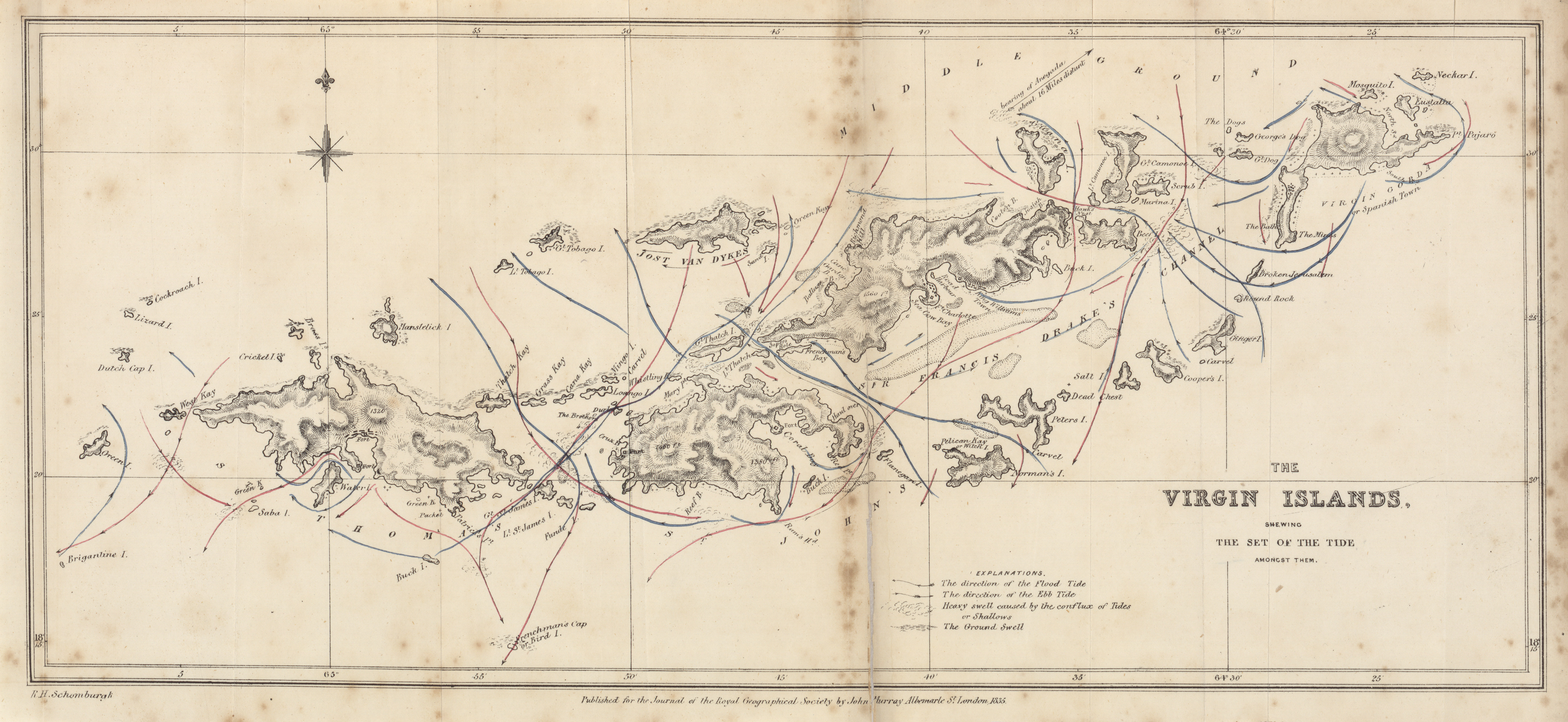
- The Virgin Islands, showing the set of the tide, 1835 (4.2MB)
Remarks on the heavy swell along some of the West India islands, commonly called "Ground" or "North Sea"; and on the set and velocity of the tides, and the effects produced by their transporting power, among the Virgin Islands. -
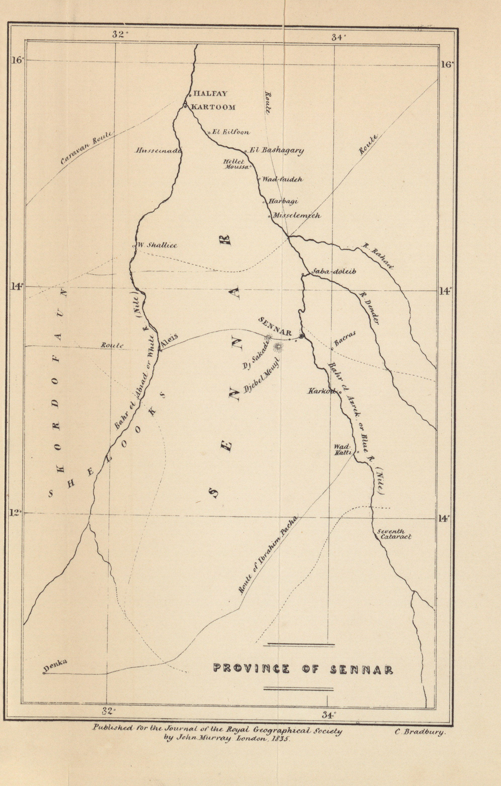
- Province of Sennar, Lord Prudhoe, 1829 (1.0MB)
Extracts from private memoranda kept by Lord Prudhoe on a journey from Cairo to Sennar, in 1829; describing the Peninsula of Sennar.
Volume 6, 1836
-
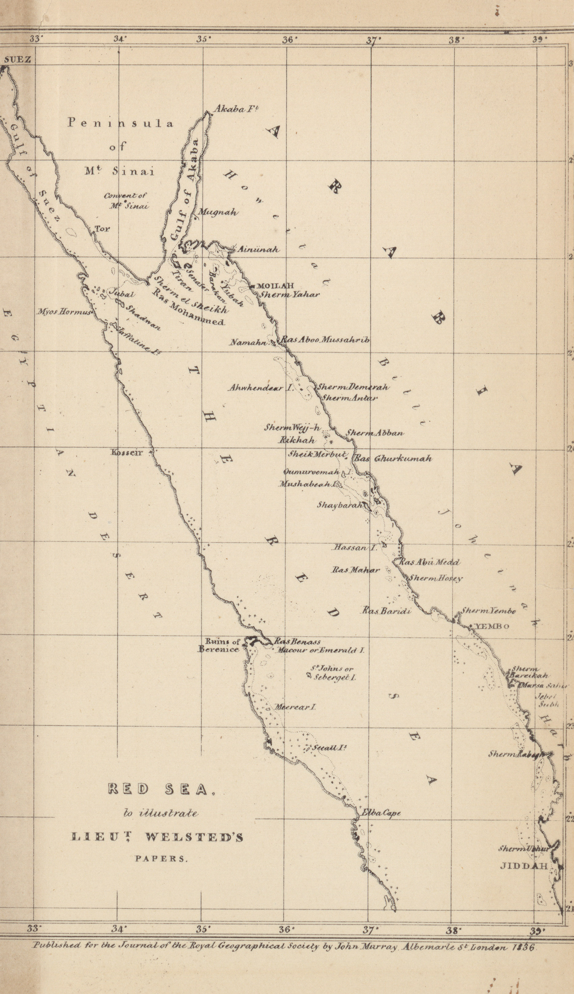
- Red Sea to illustrate Lieut. Welsted's papers, 1836 (1.0MB)
Notice on the Ruins of Berenice. By Lieutenant R. Wellsted, I.N.
Volume 7, 1837
-
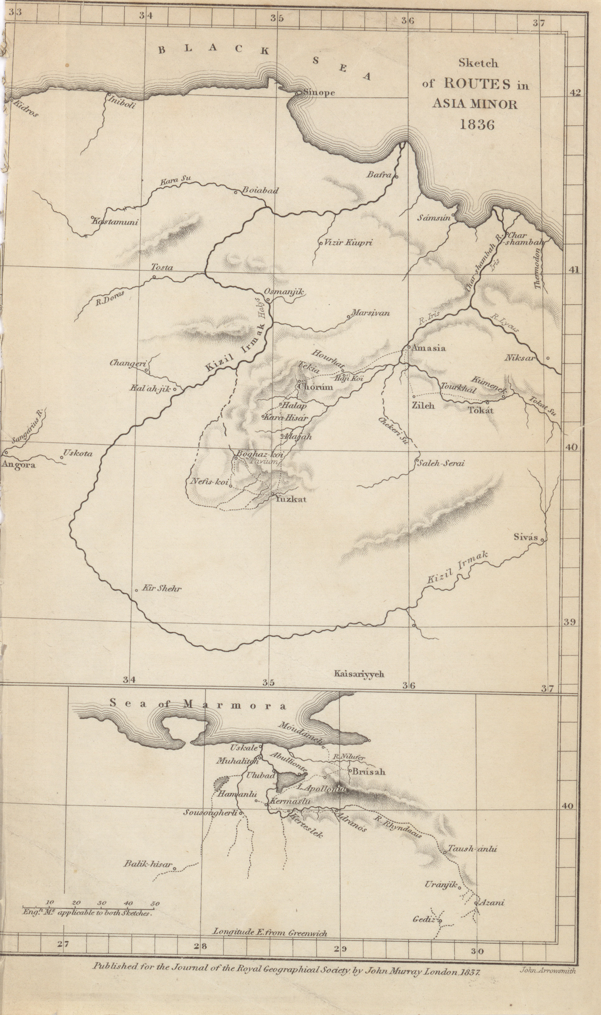
- Sketch of routes in Asia Minor, W.F. Hamilton, 1836 (1.2MB)
Extracts from notes made on a journey in Asia Minor in 1836. By W.F. Hamilton, Esq. -
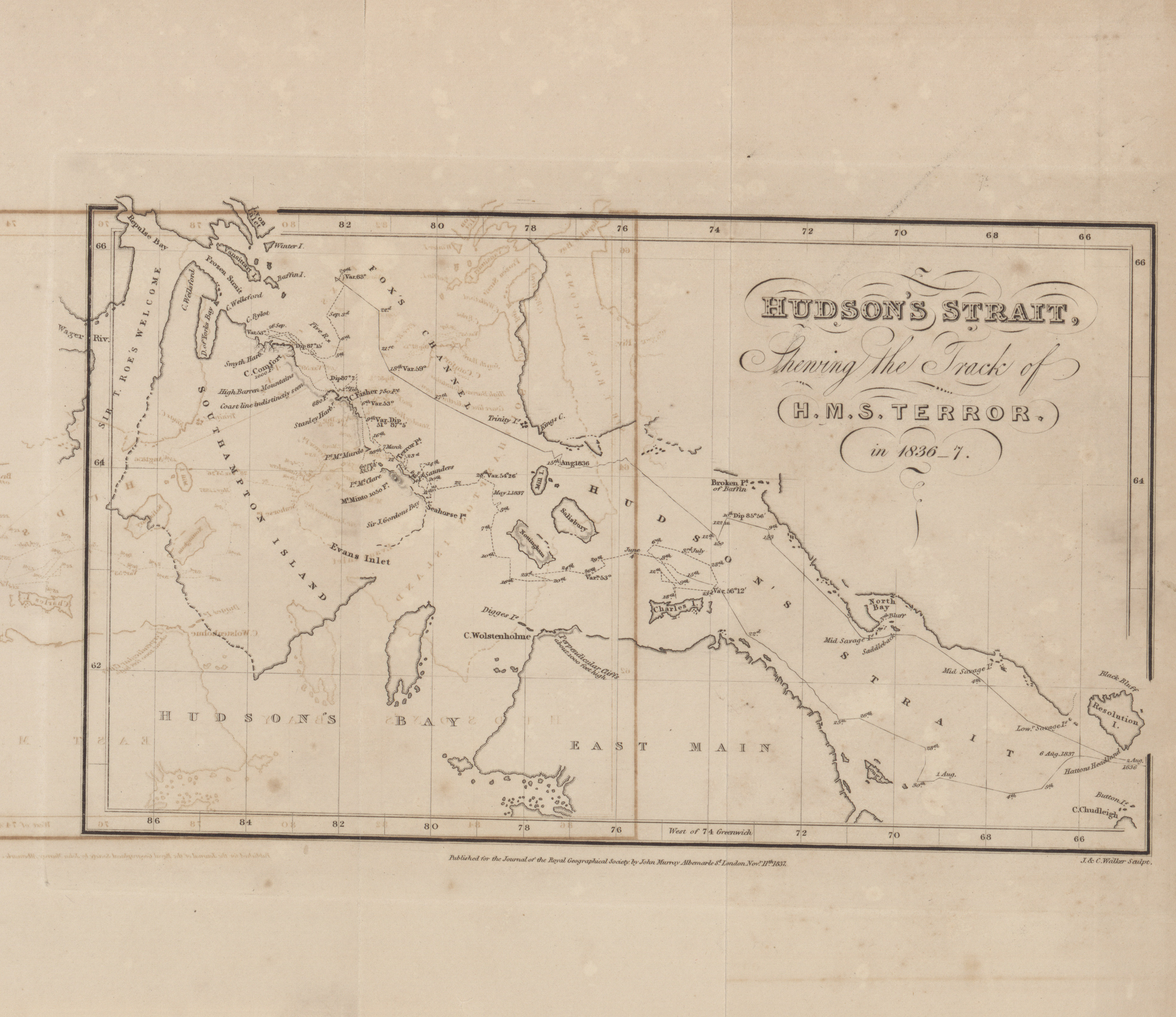
- Hudson's Strait, showing the track of H.M.S. Terror in 1836-1837 (1.9MB)
A brief account of the late voyage of H.M.S. Terror.
Volume 8, 1838
-
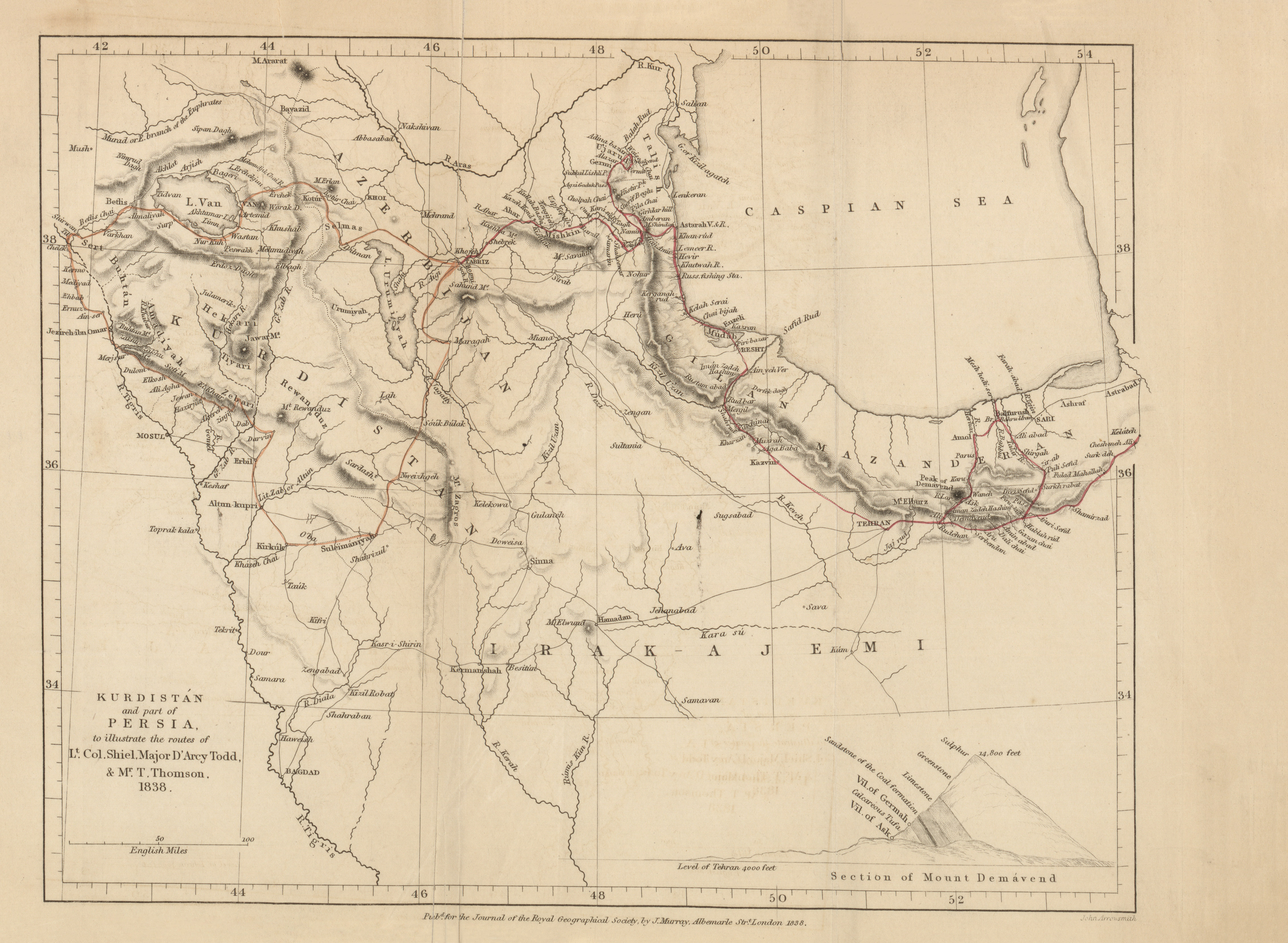
- Kurdistan and part of Persia, Lieut.-Colonel J. Shiel, 1838 (2.8MB)
Notes on a journey from Tabriz, through Kurdistan, via Van, Bitlis, Se'ert, and Erbil, to Suleimaniyeh in July and August, 1836. By Lieutenant-Colonel J. Shiel.
Volume 9, 1839
-
- Province of La Rioja, J.O. French, 1839 (2.2MB)
On the province of La Rioja, in South America, to accompany a map. By J.O. French.
Volume 11, 1841
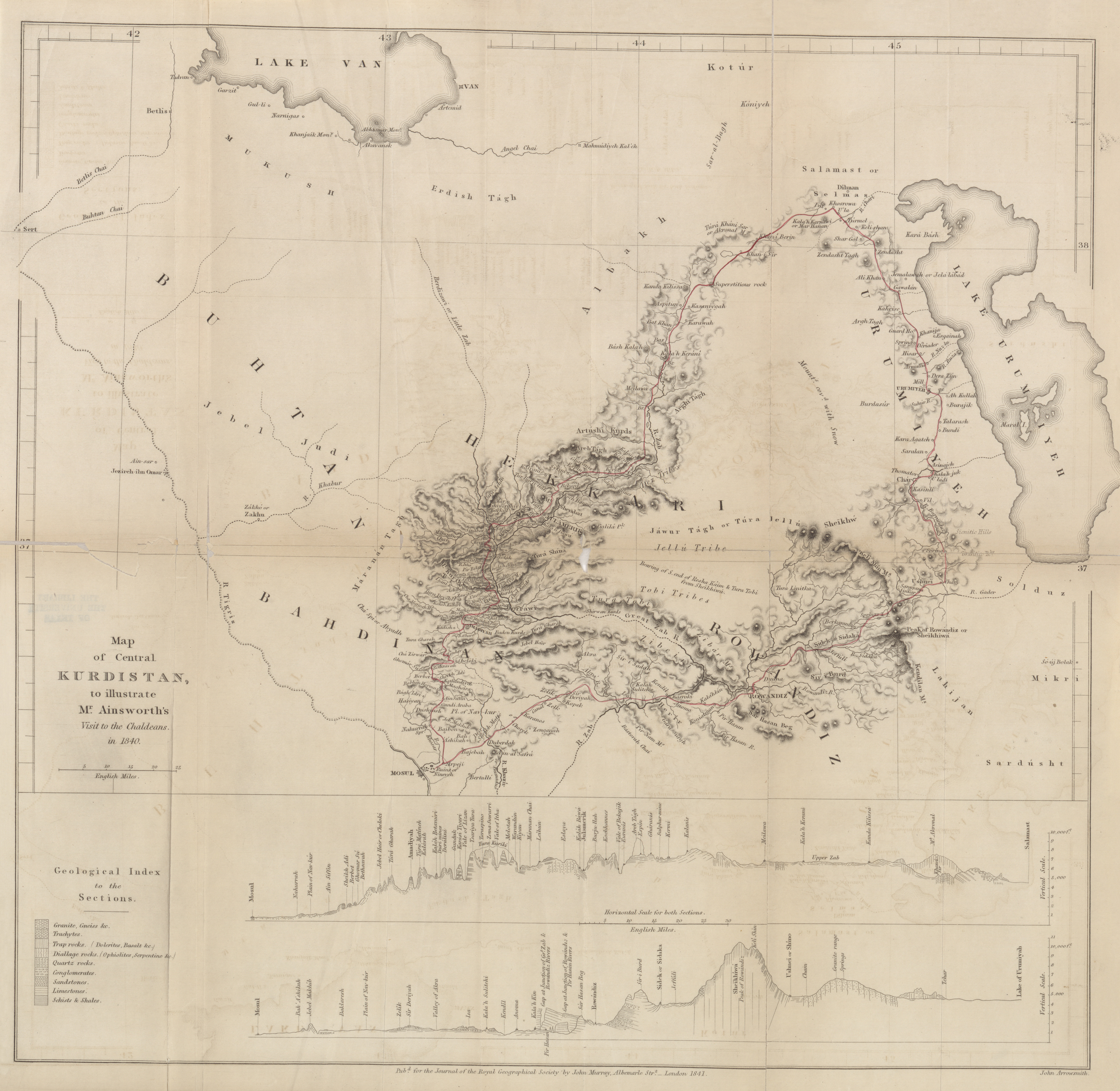
- Central Kurdistan to illustrate Mr. Ainsworth's visit to the Chaldeans, 1840 (6.8MB) An account of a visit to the Chaldeans, inhabiting Central Kurdistan; and of an ascent of the peak of Rowandiz (Tur Sheikhiwa) in the summer of 1840. By William Ainsworth, Esq.
-
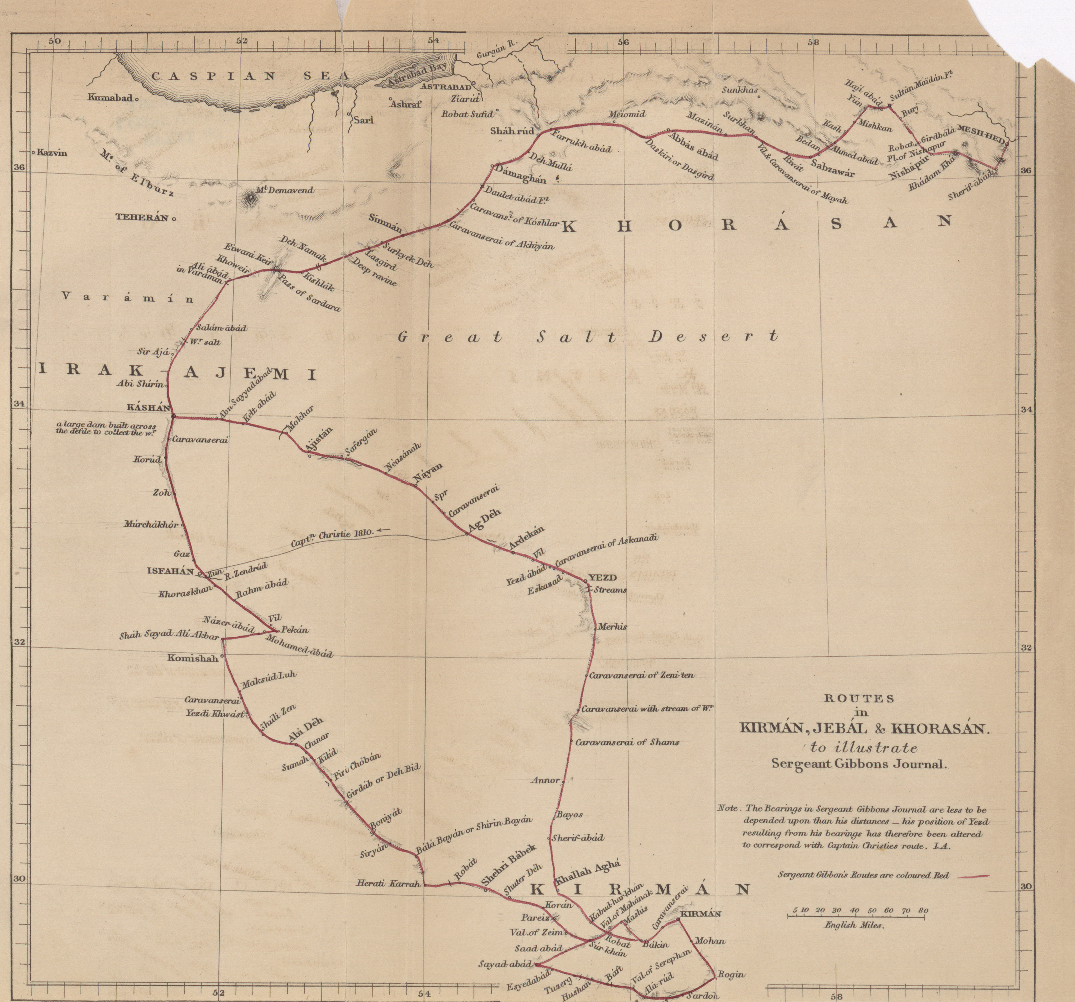
- Routes in Kirman, Jebal, and Khorasan to illustrate Sergeant Gibbons journal, 1841 (1.8MB)
Routes in Kirman, Jebal, and Khorasan, in the years 1831 and 1832. By Richard Gibbons, a sergeant of the British Detachment serving in Persia. -
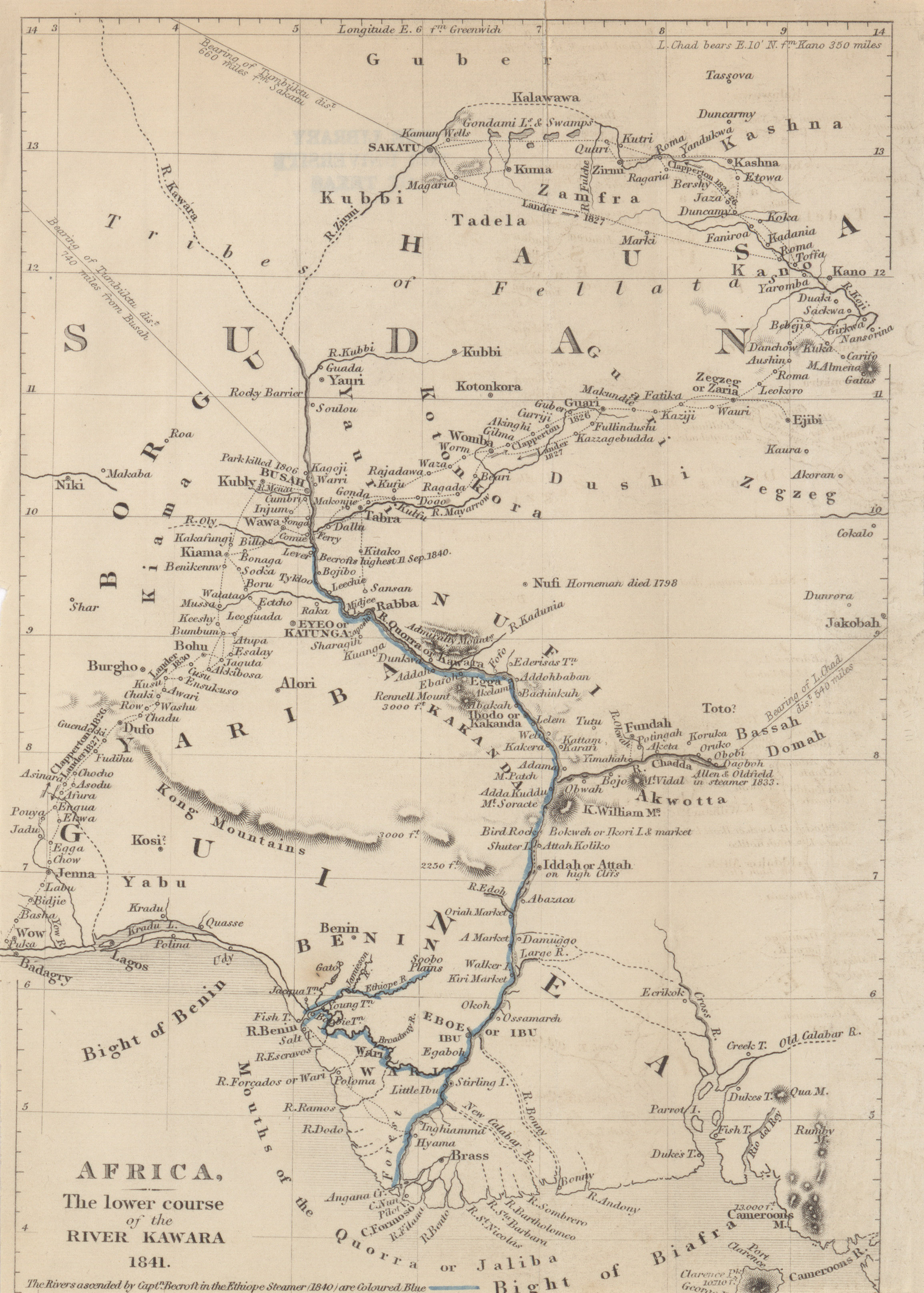
- Africa, the lower course of the River Kawara (Quorra), Capt. Becroft, 1841 (1.5MB)
On Benin and the Upper Course of the River Quorra, or Niger. By Captain Becroft. Communicated by Robert Jamieson, Esq., of Liverpool. -
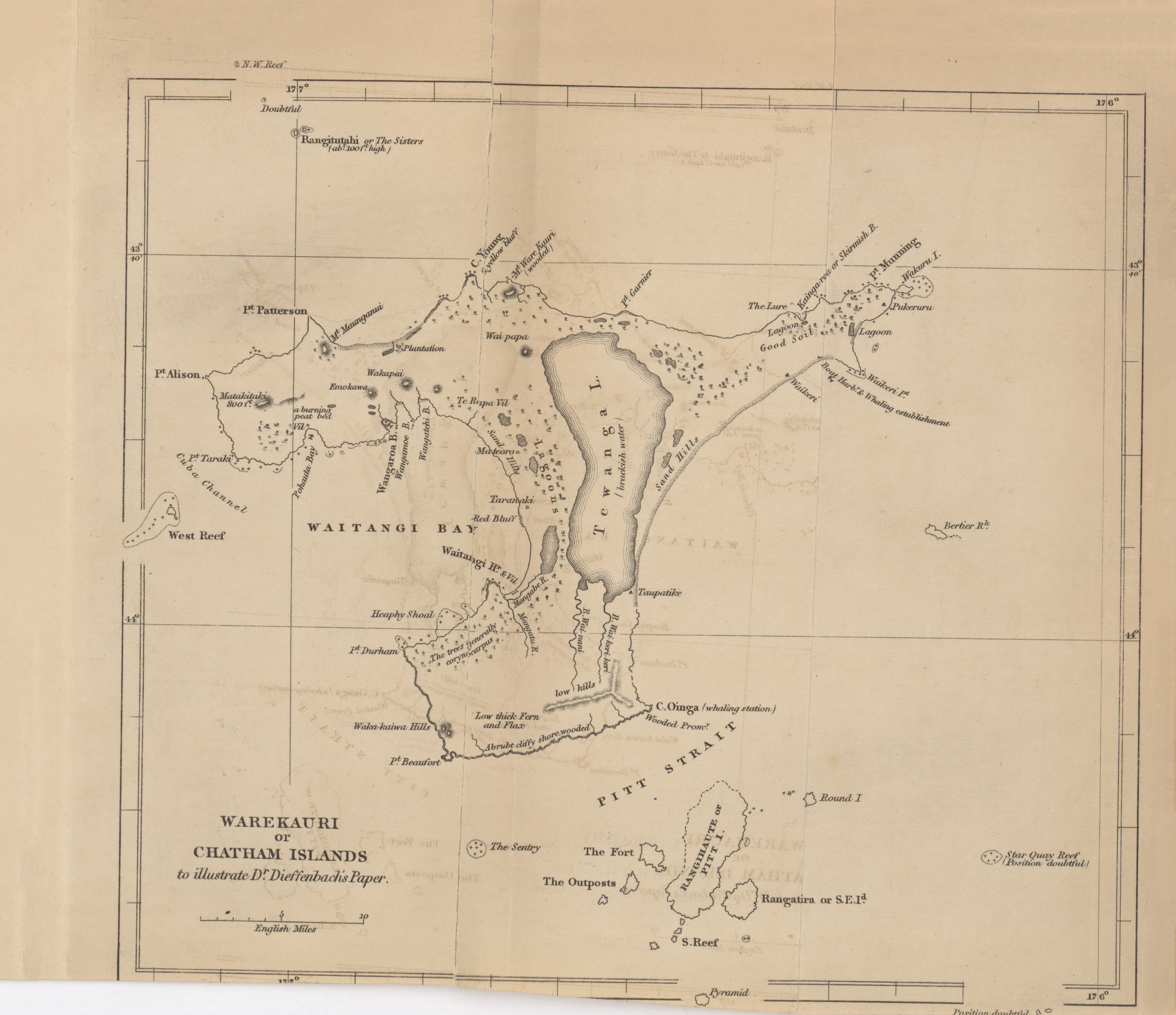
- Warekauri or Chatham Islands to illustrate Dr. Dieffenbach's paper, 1841 (2.1MB)
An account of the Chatham Islands. Communicated by Dr. Ernest Dieffenbach, M.D., Naturalist to the New Zealand company, a printed with its concurrence.
Volume 12, 1842
-
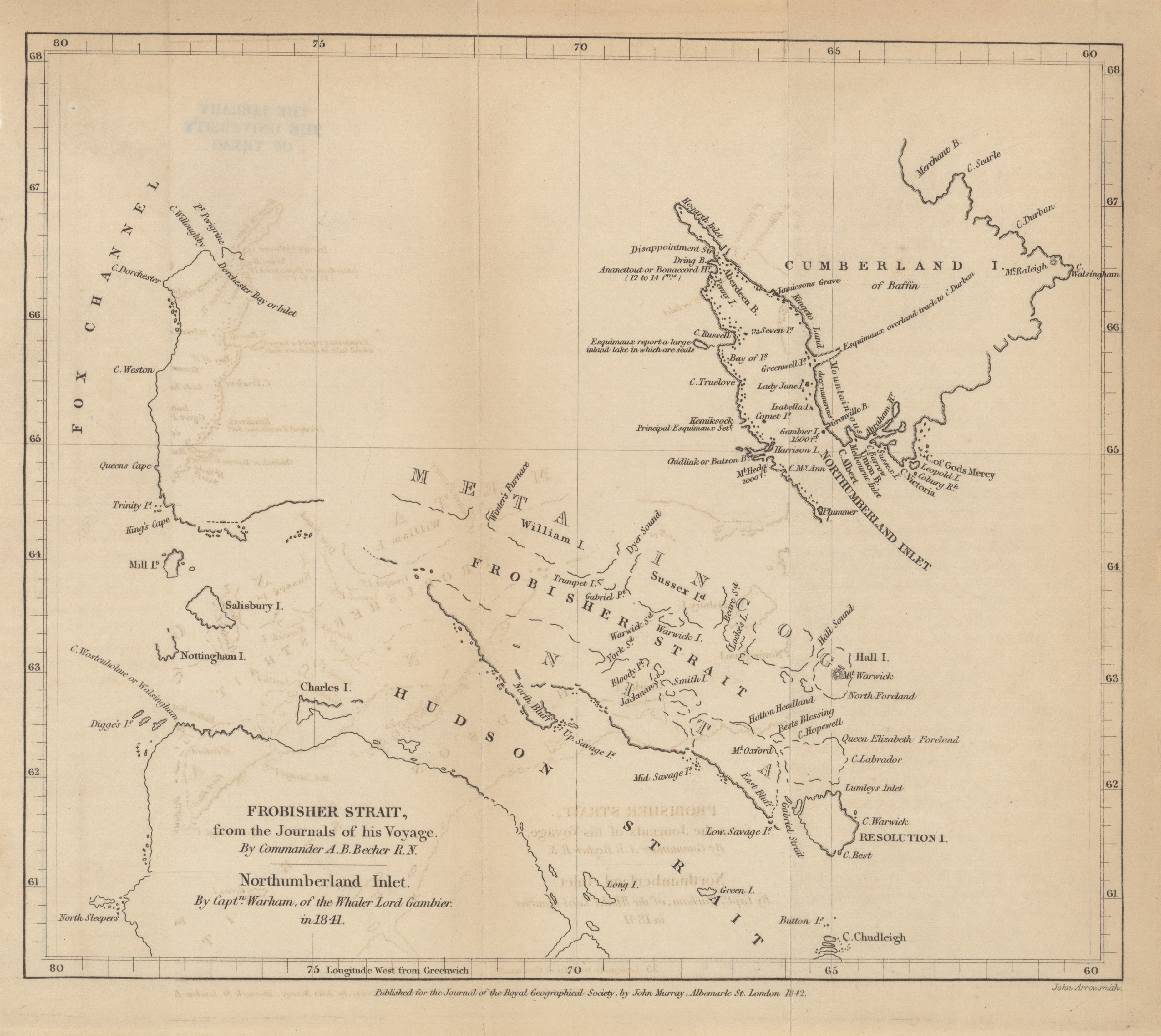
- Frobisher Strait, from the journals of his voyage, Commander A.B. Becher R.N.; Northumberland Inlet, Captain Warham of the Whaler Lord Gambier, 1841 (2.1MB)
The voyages of Martin Frobisher. By A.B. Becher, Commander, R.N., of the Hydrographical Office, Admirality.
Appendix to Captain Becher's Paper.-Northumberland Inlet; an extract from the journal of a Whaling Voyage, by Mr. Wareham, Master of the Lord Gambier, of Hull. -
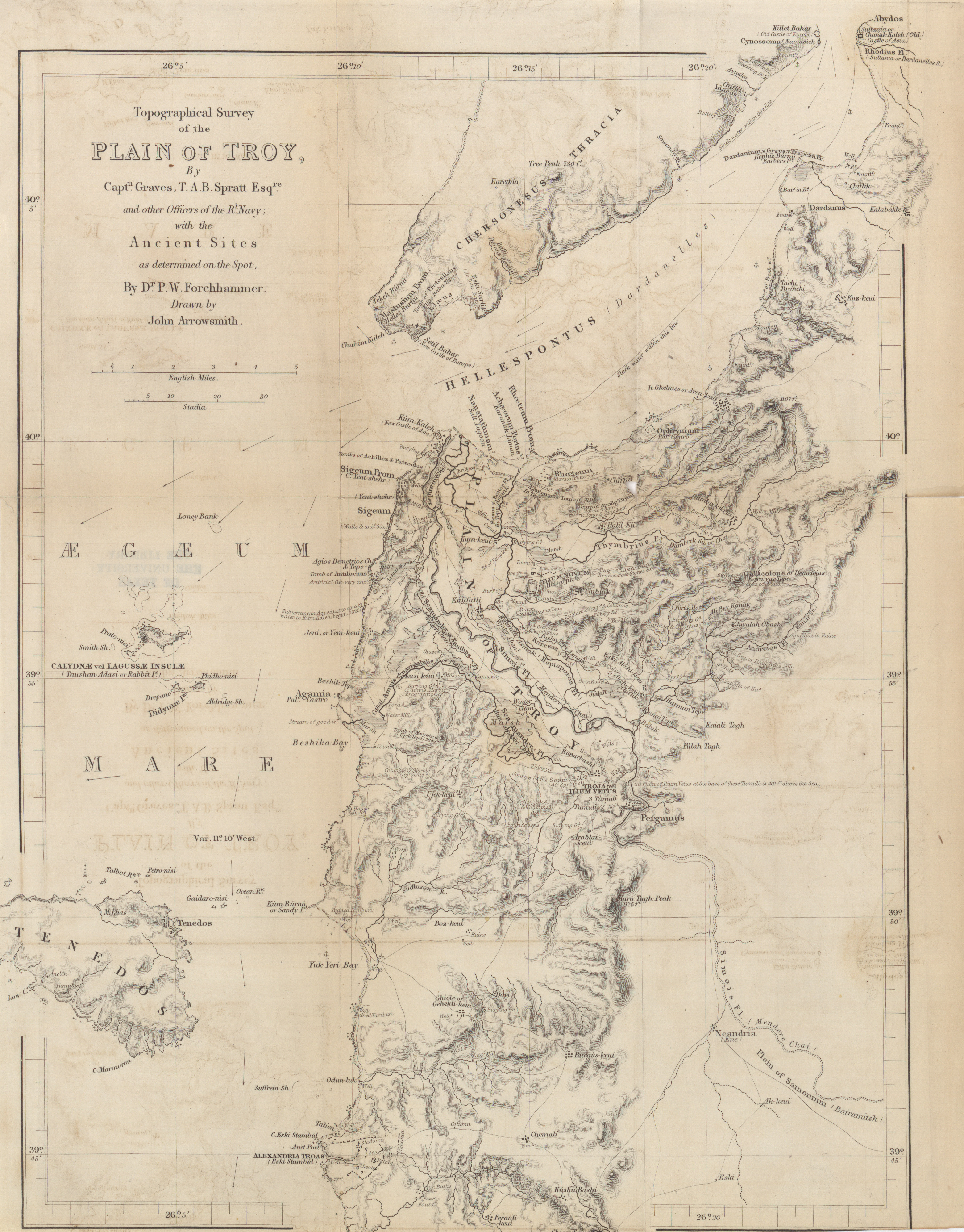
- Topographical survey of the Plain of Troy, Captain Graves and other officers of the Royal Navy; with the Ancient Sites as determined on the spot, Dr. Forchhammer, John Arrowsmith, 1842 (4.6MB)
Observations on the topography of Troy. By Dr. P.W. Forchhammer. -
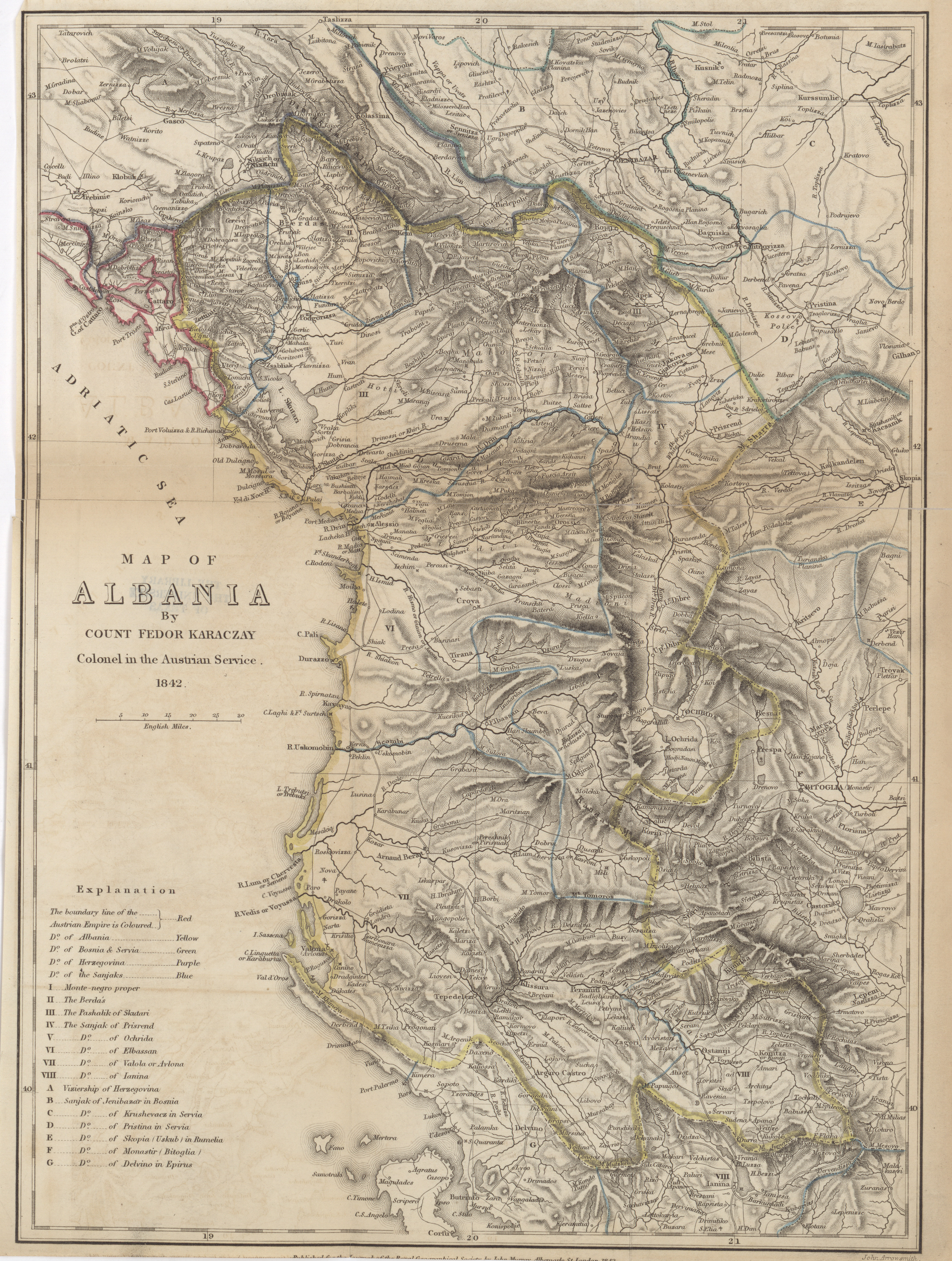
- Albania, Fedor Karaczay, 1842 (7.0MB)
Geographical account of Albania, extracted from a manuscript of Count Karaczay. -
- Part of Caria and Lycia, R. Hoskyn, 1841-1842 (3.4MB)
Remarks on Mr. Hoskyn's paper. By Colonel WM. Martin Leake, F.R.S. -
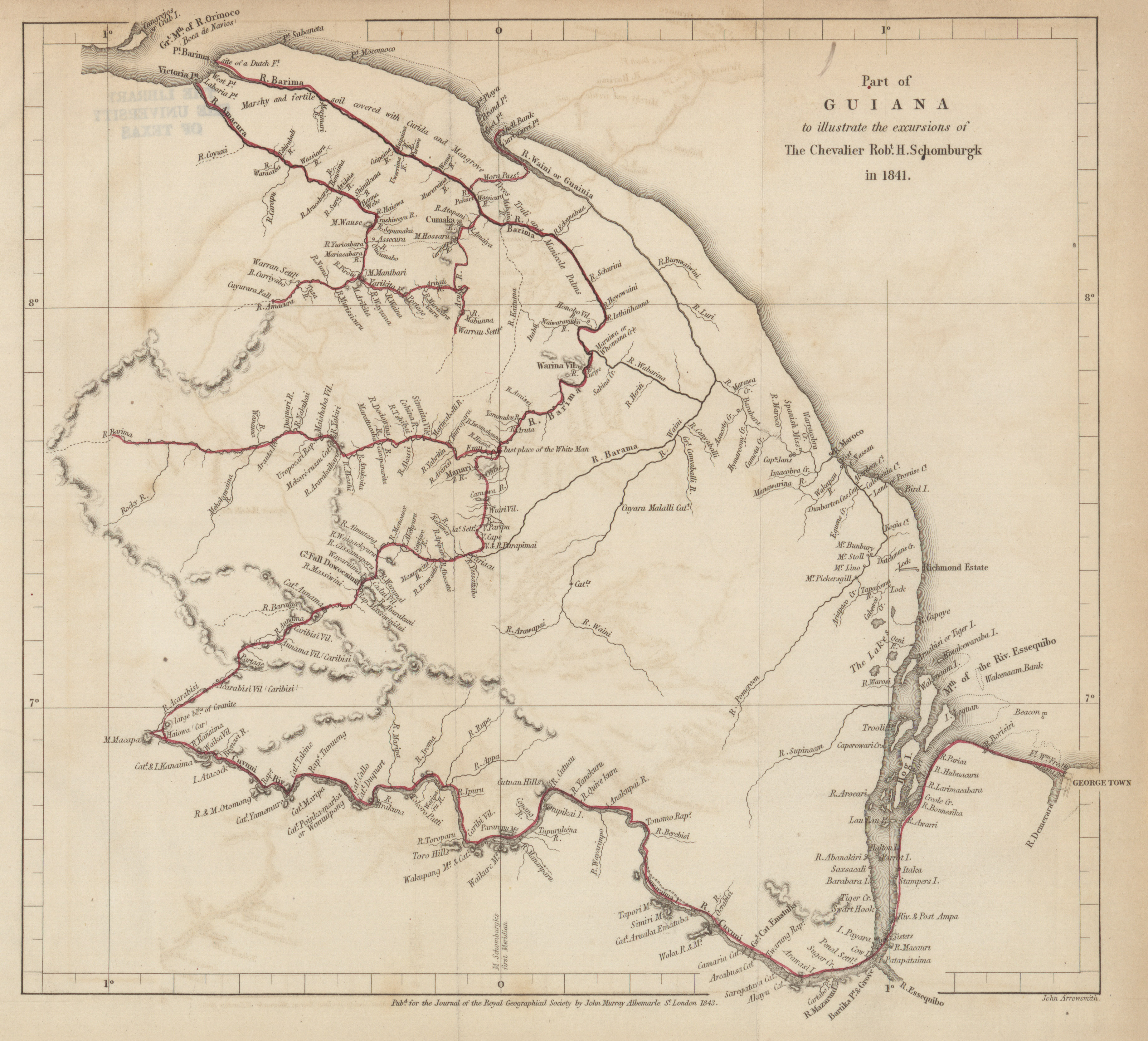
- Part of Guiana to illustrate the excursions of the Chevalier Robert H. Schomburgk, 1841 (2.4MB)
Expedition to the lower parts of the Barima and Guiana Rivers, in British Guiana. By the Chevalier R.H. Schomburgk. Communicated by the Colonial Office.
Volume 13, 1843
-
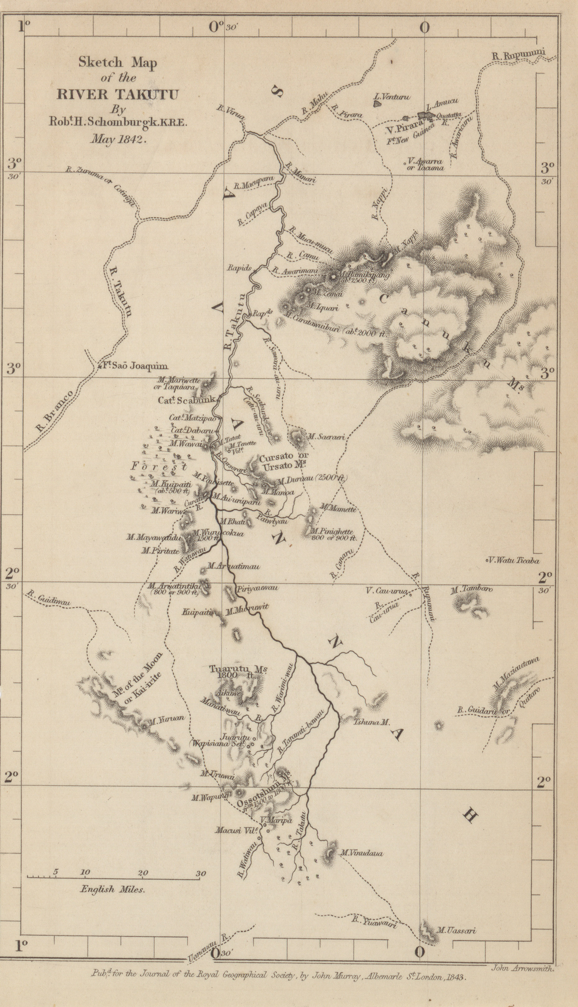
- River Takutu, by Robert H. Schomburgk, K.R.E., May 1842 (1.2MB)
Visit to the sources of the Takutu, in British Guiana, in the year 1842. By Robert Schomburgk, K.R.E. - Baron C.A. de Bode's route from Kazerun to Shushter through the countries Mamaseni, Khogilu and Bakhtiyari tribes, Clement Augustus de Bode 1841 (2.7MB) Extracts from a journal kept while traveling, in January, 1842, through the country of the Mamaseni and Khogilu (Bakhtiyari), situated between Kazerun and Behbehan. By Baron Clement Augustus de Bode.
-
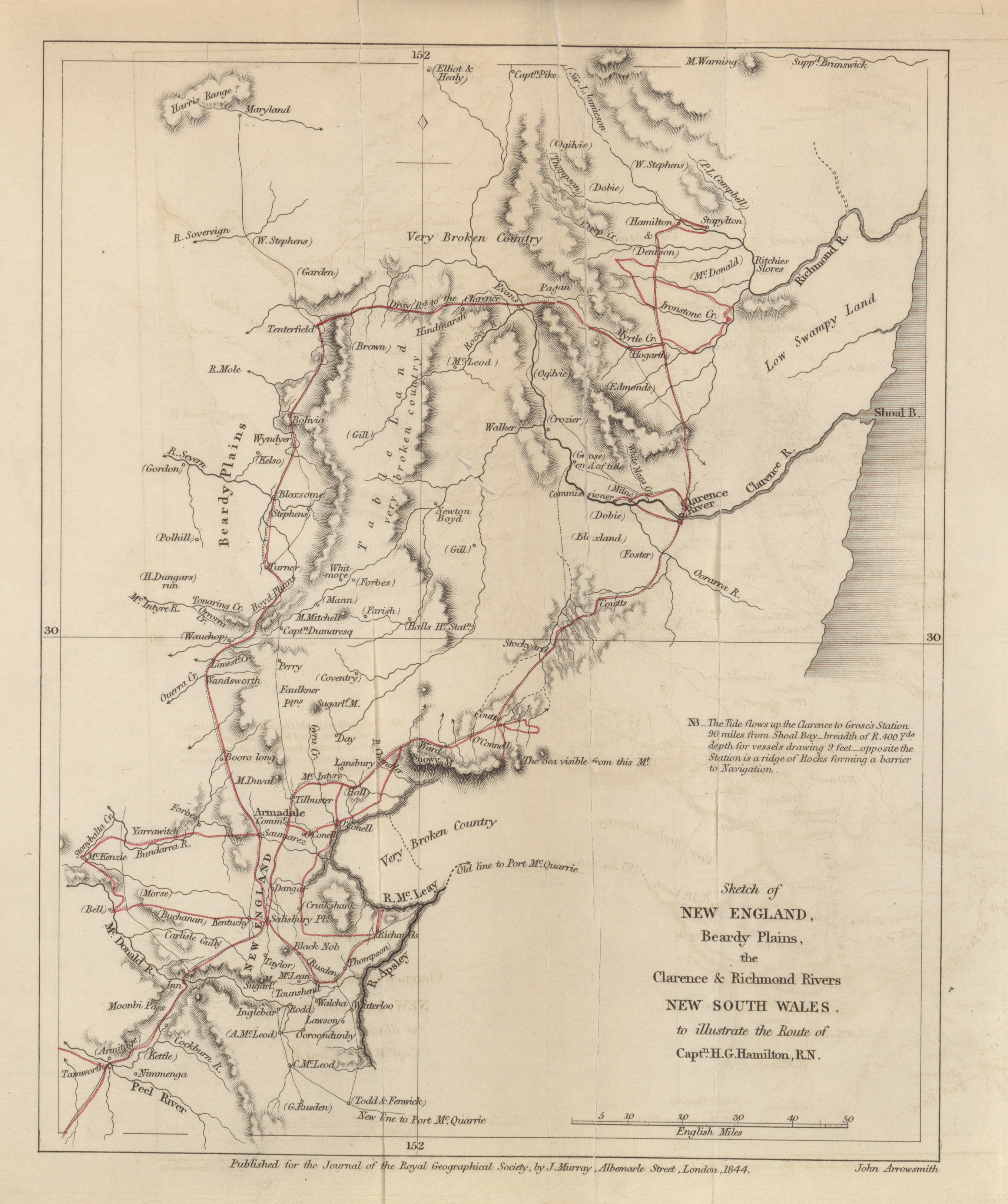
- New England, Beardy Plains, the Clarence and Richmond Rivers, New South Wales, to illustrate the route of Captn. H.G. Hamilton, R.N, 1843 (1.8MB)
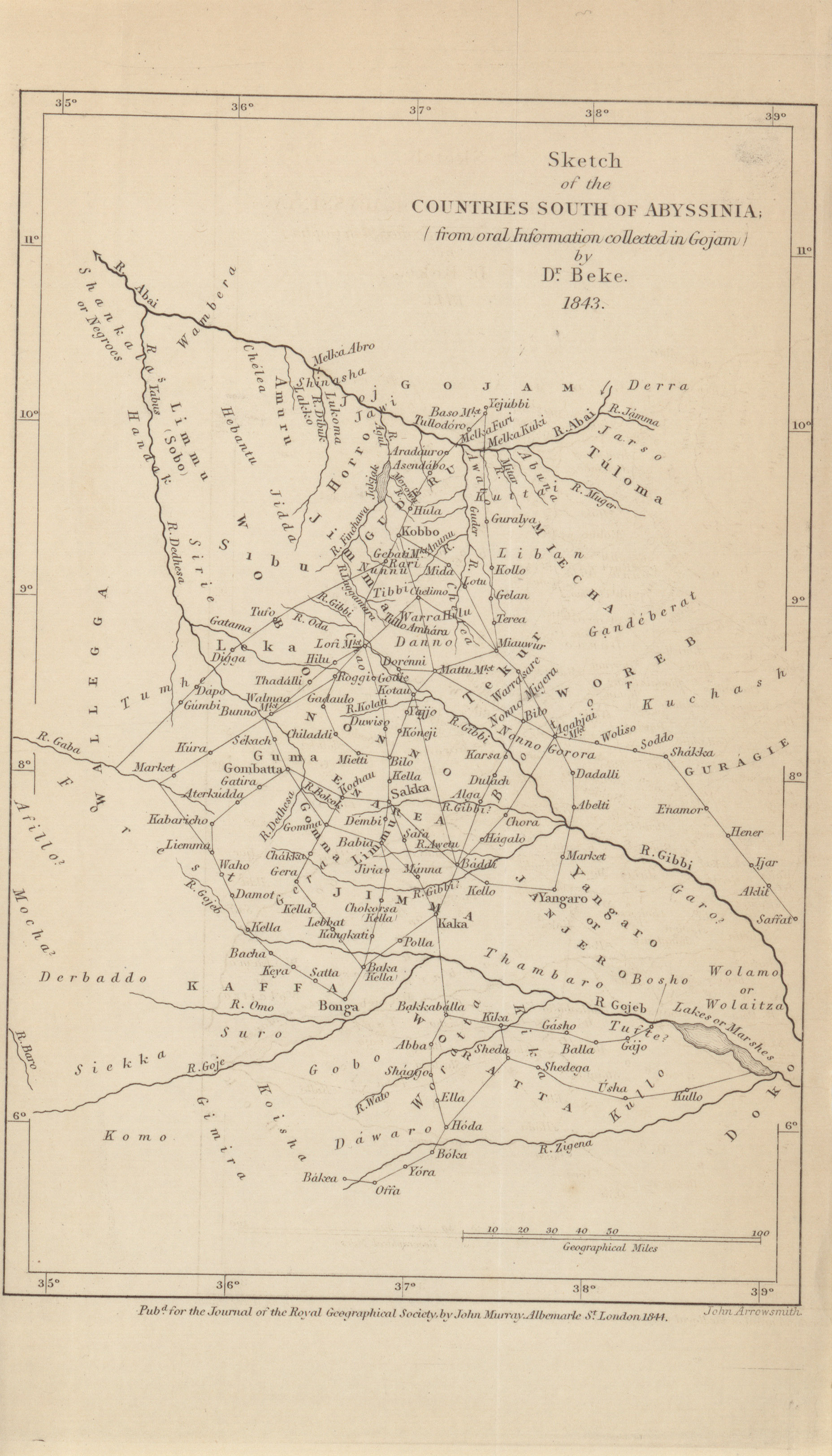
The country between Liverpool plains and Moreton Bay, in New South Wales. Extracts from two letters from Commander H.G. Hamilton, R.N., to W.R. Hamilton, Esq. - Countries South of Abyssinia by Dr. Beke, 1843 (1.1MB) On the countries South of Abyssinia. By Dr. Charles T. Beke.
Volume 15, 1845
-
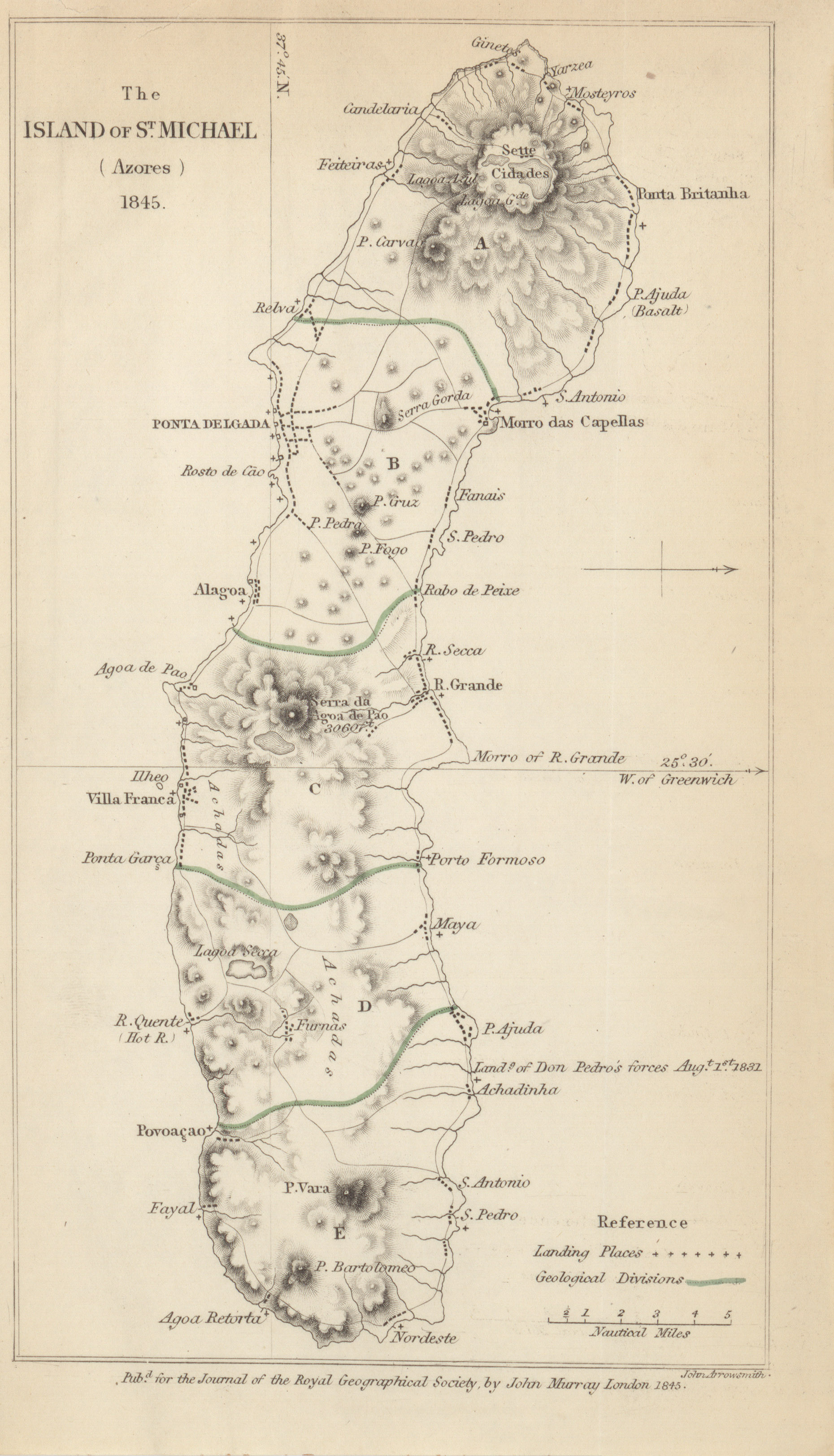
- The Island of St. Michael, Carew Hunt, 1845 (1.1MB)
A description of the Island of St. Michael (Azores). By Mr. Consul Carew Hunt. -
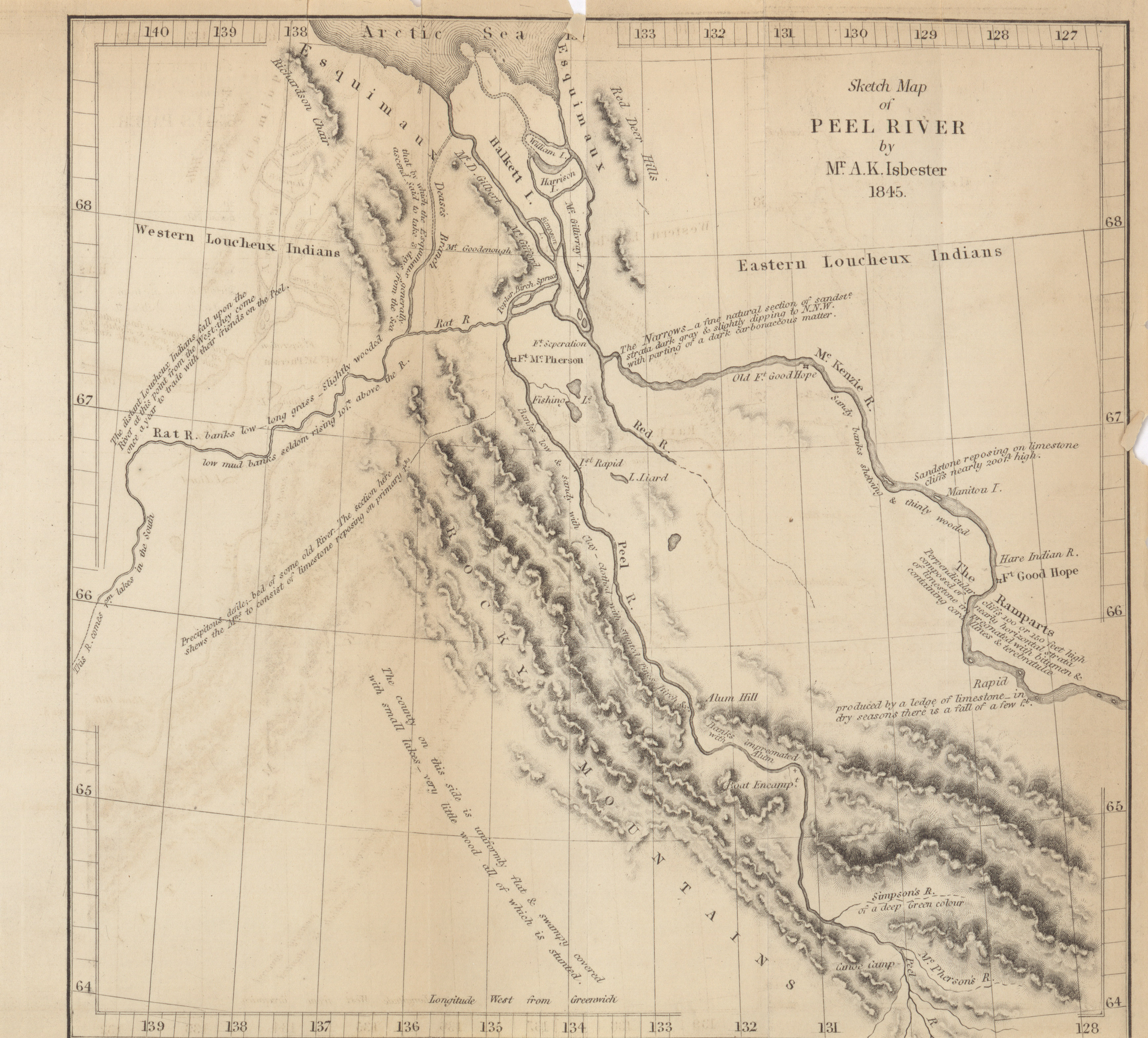
- Peel River, A.K. Isbester, 1845, 1841 (2.3MB)
Some account of Peel River, North America. By Mr. A.K. Isbister, late H.H.B.C.'s Service. Addressed to the Secretary of the Royal Geographical Society.
Volume 16, 1846
-
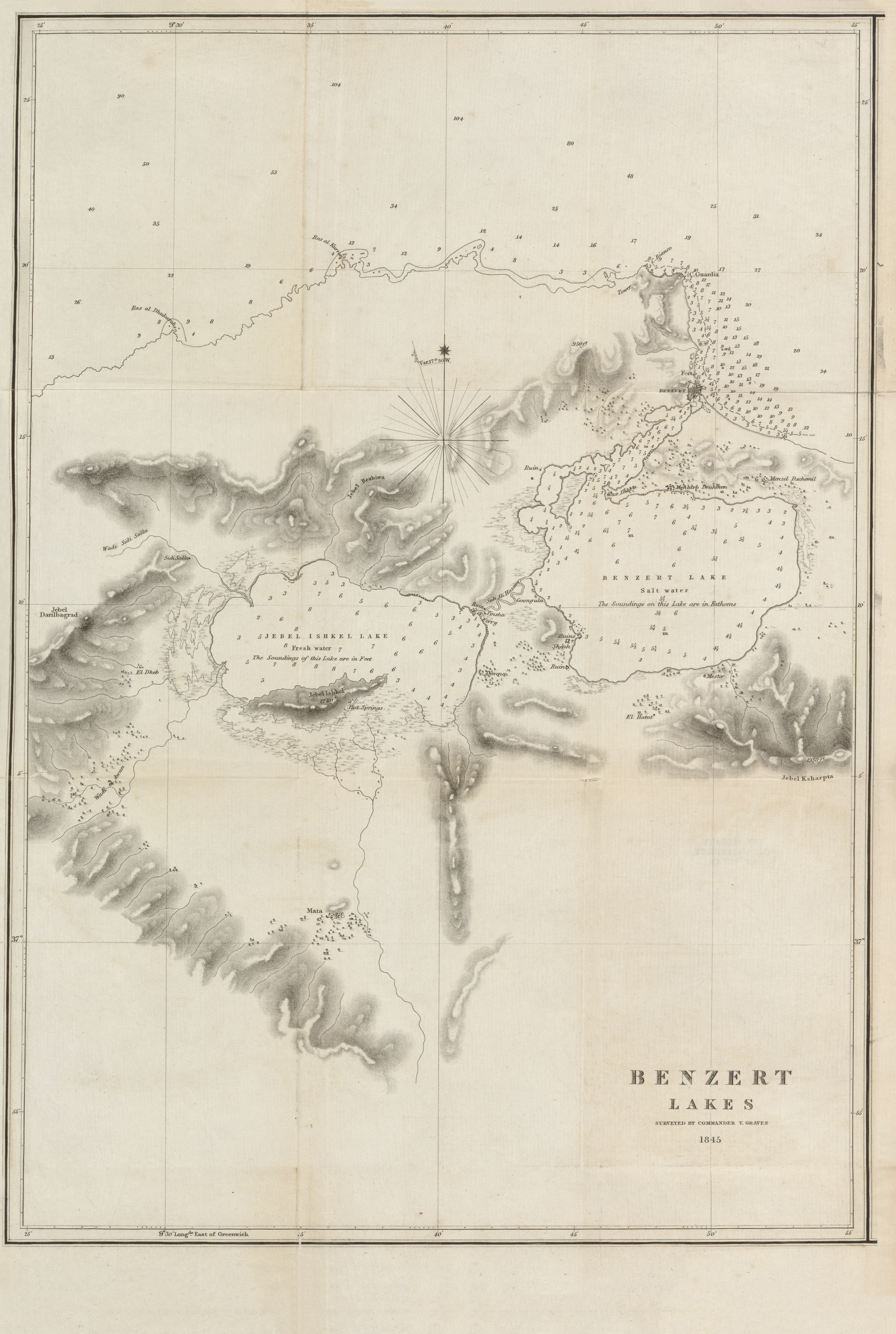
- Benzert Lakes, Commander T. Graves, 1845 (7.6MB)
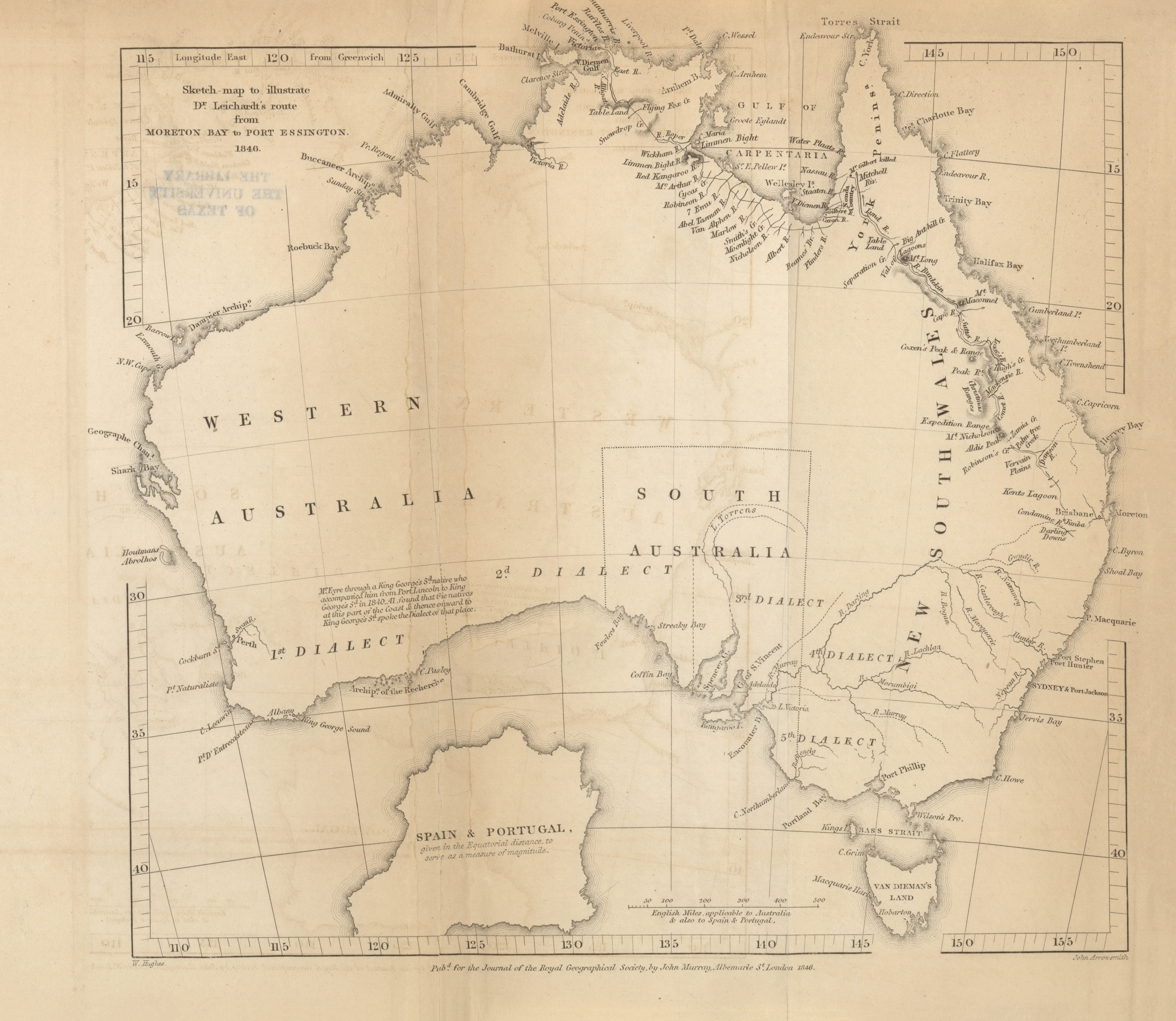
Remarks on the Lakes of Benzerta, in the Regency of Tunis, made in May, 1845, by Lieutenant Spratt, H.M.S. Beacon, F.G.S. Communicated by Commander Graves, F.R.G.S. - Dr. Leichardt's route from Moreton Bay to Port Essington, Ludwig Leichardt, 1846 (2.3MB) Account of Dr. Ludwig Leichardt's expedition from Moreton Bay to Port Essington, Australia.
-
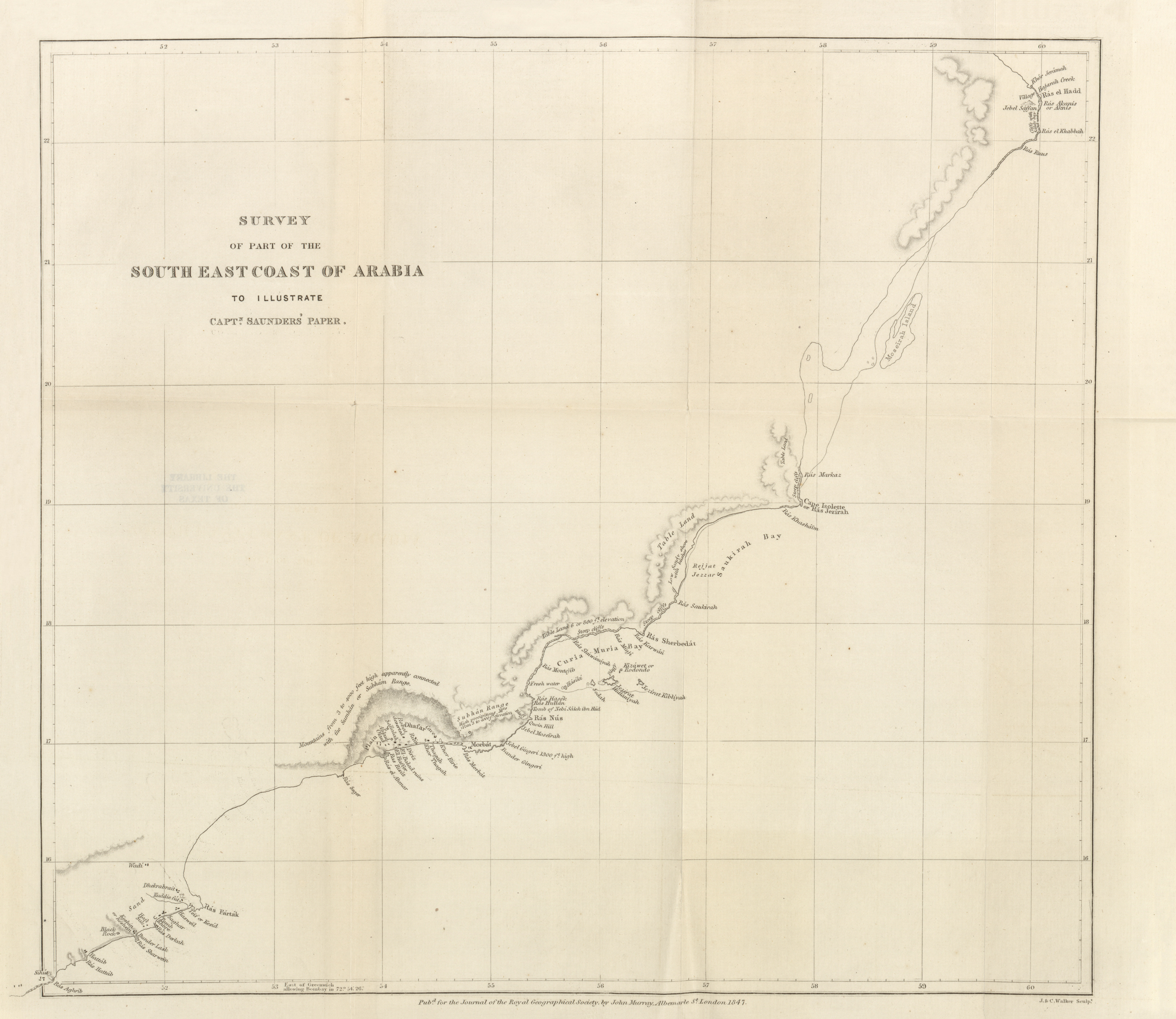
- Survey of part of the South East coast of Arabia to illustrate Captain Saunders' Paper, J.P. Saunders, 1847 (4.6MB)
A short memoir of the proceedings of the honourable company's surveying Brig "Palinurus," during her late examination of the coast between Ras Morbat and Ras Seger, and between Ras Fartak and the ruins of Mesinah. By J.P. Saunders, Commander.
Volume 17, 1847
-
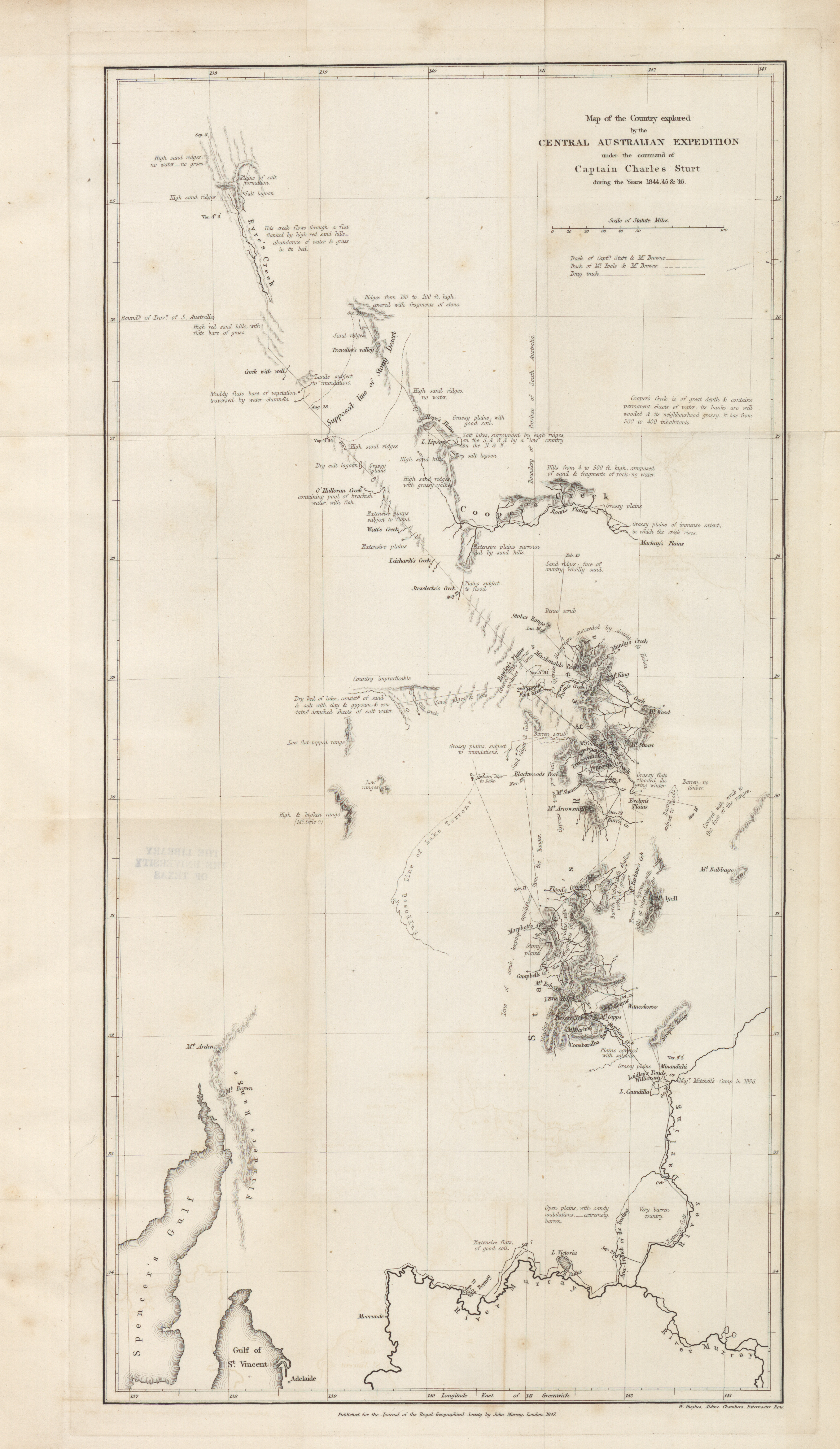
- Country explored by the Central Australian Expedition under the command of Captain Charles Sturt, 1844-1846 (4.6MB)
A condensed account of an exploration in the interior of Australia, by Captain Charles Sturt, in 1844 and 1845. Extracted from his journal, and from papers transmitted to the Right Honorable the Secretary of State for the colonies, and by him communicated to the Royal Geographical Society. Read 8th and 22nd February, 1847. -
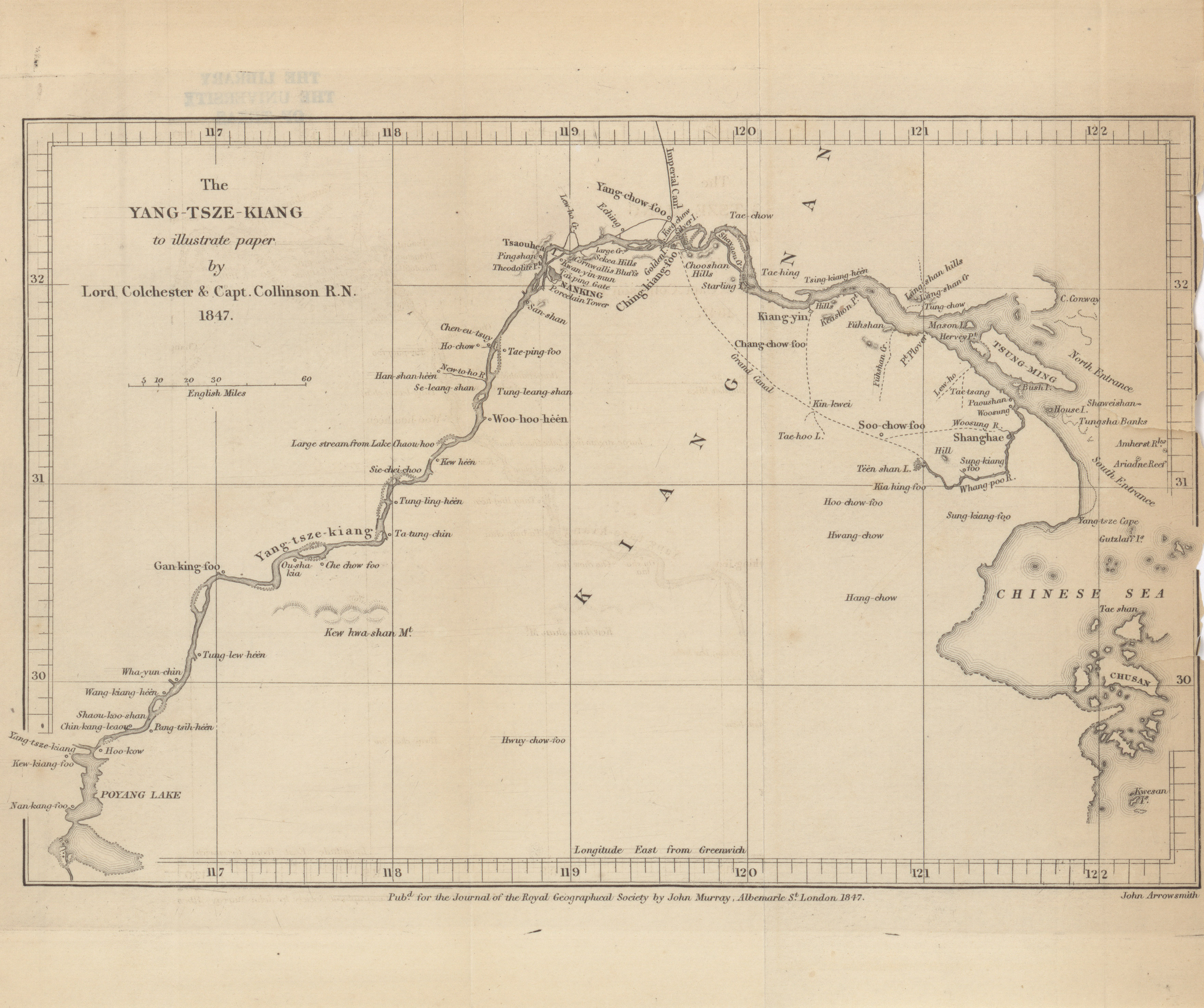
- The Yang-Tsze-Kiang to illustrate paper by Lord Colchester and Captain Collinson R.N., 1847 (1.8MB)
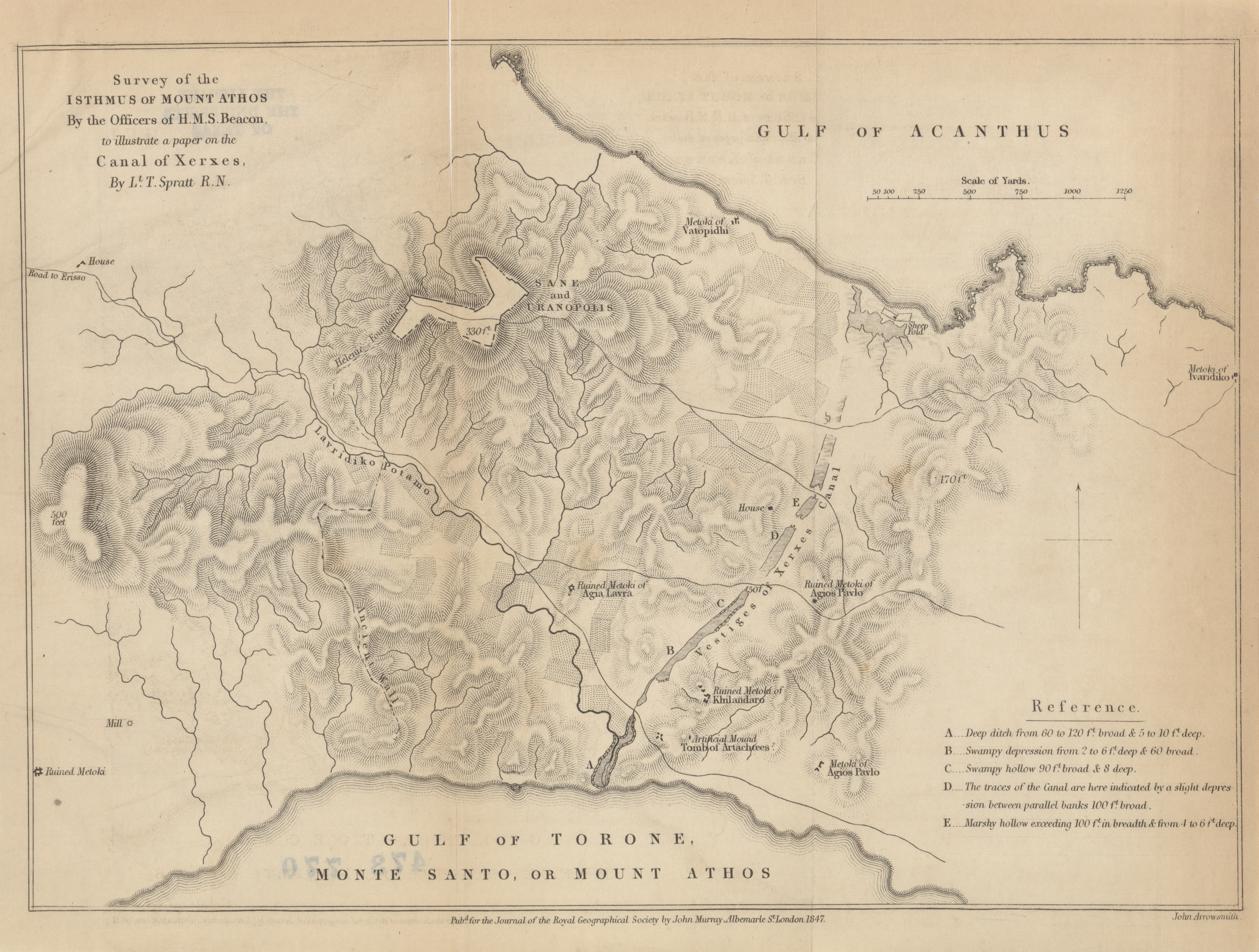
On the Yang-tsze-kiang. By the Right Honorable Lord Colchester and Captain Collinson, R.N. Read March 22nd, 1847. - Isthmus of Mount Athos by the officers of H.M.S. Beacon, to illustrate a paper on the Canal of Xerxes, Lt. Spratt R.N., 1847 (2.9MB) Remarks on the Isthmus of Mount Athos. By Lieut. T. Spratt, of H.M.S. "Beacon." Communicated by Commander Graves, F.G.R.S. Read March 9th, 1846.
Volume 18, 1848
-
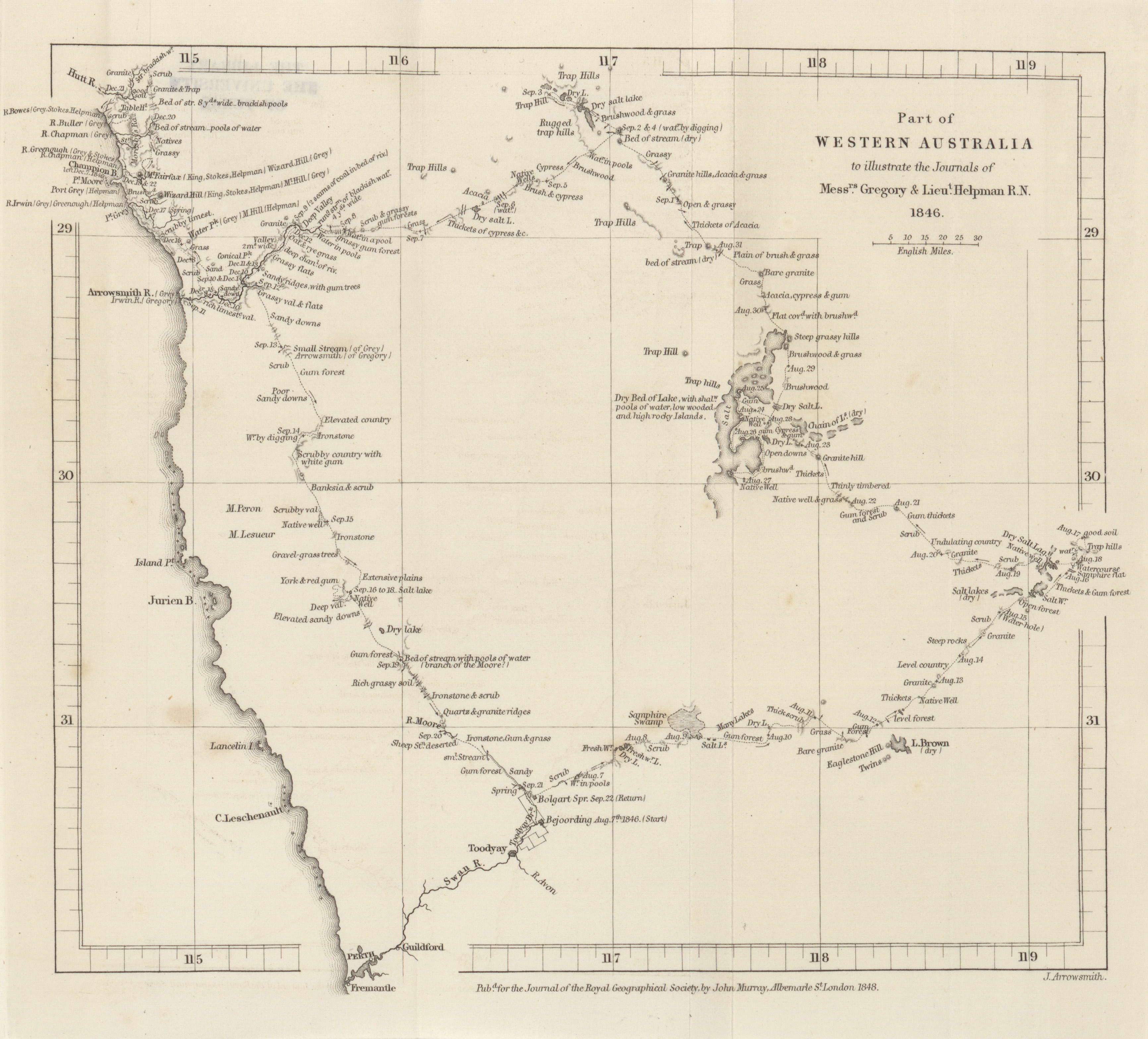
- Part of Western Australia to illustrate the journals of Messrs. Gregory and Lieut. Helpman R.N., 1846 (1.9MB)
Report by Lieutenant Helpman, R.N., Commander of Colonial Schooner Champion, on an expedition to examine coal discovered on the Irwin River.
Volume 19, 1849
-
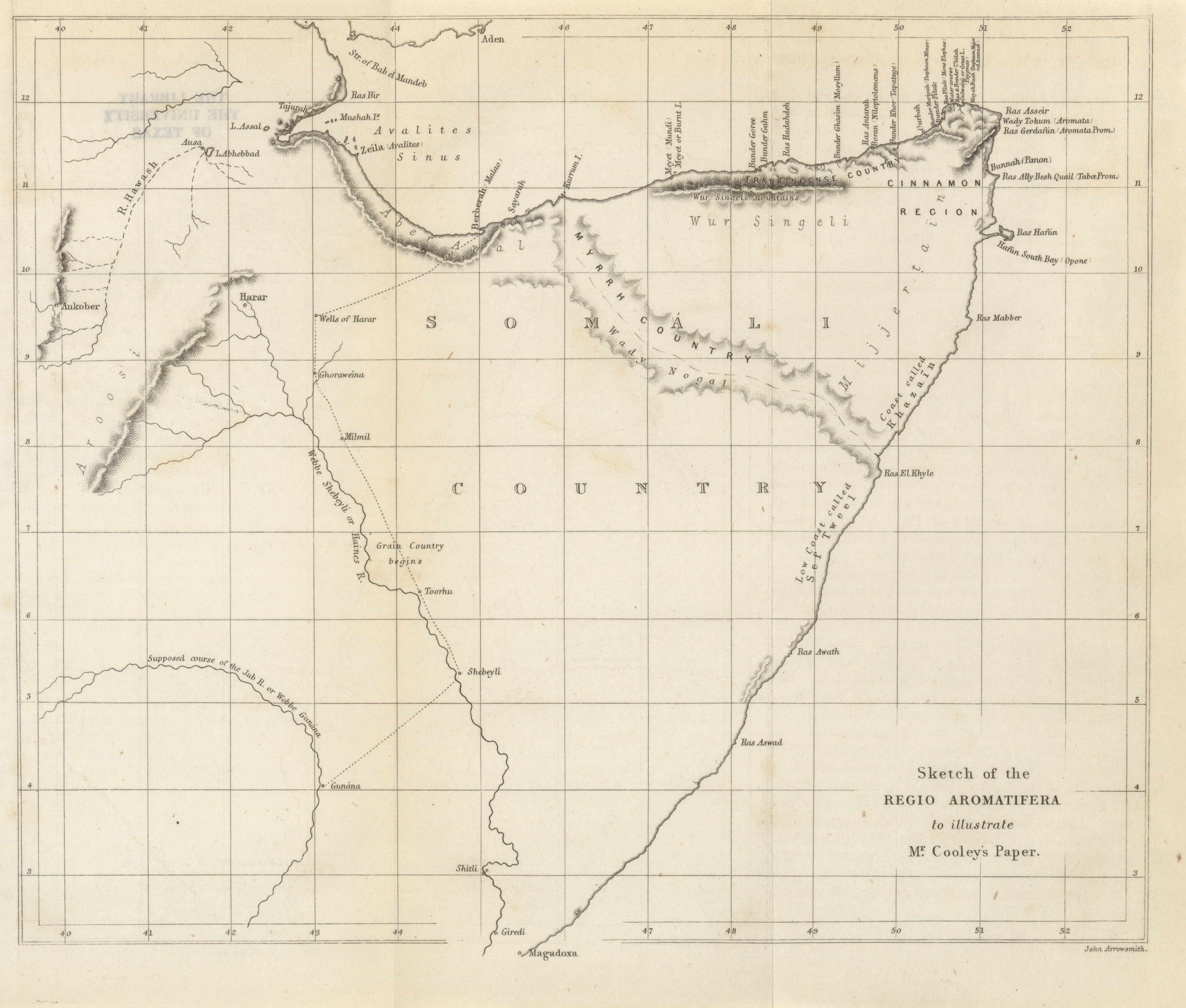
- Regio Aromatifera, W. Desborough Cooley, 1849 (2.1MB)
On the Regio Cinnamomifera of the Ancients. By W. Desborough Cooley. (Communicated by Admiral Beaufort. Read April 23rd, 1849.
Volume 21, 1851
-
- Sketch map to illustrate Professor Abich's paper on the Climatology of the Caucasus, 1851 (1.2MB)
The Climatology of the Caucasus. By Professor Herman Abich.
Volume 22, 1852
-
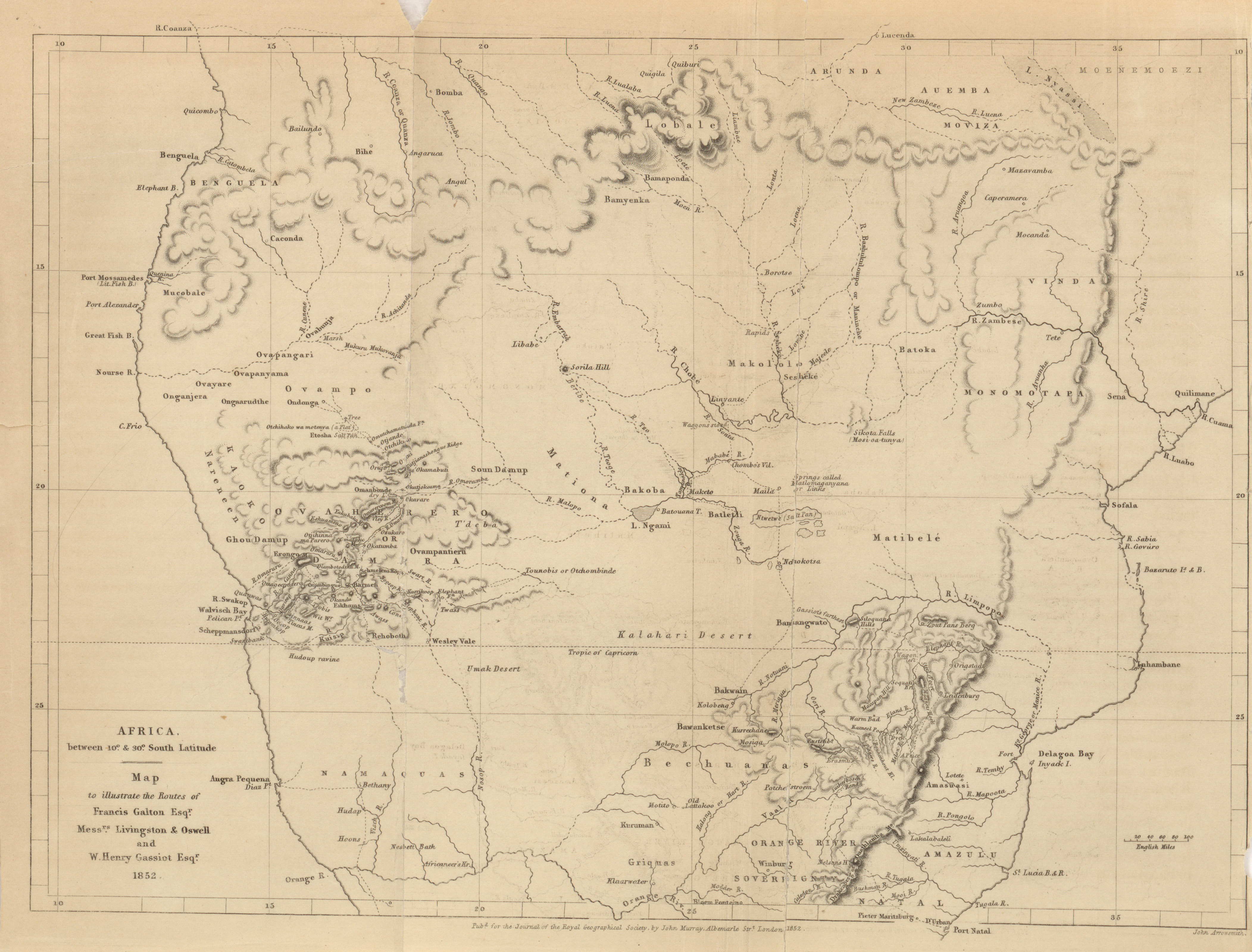
- Africa between 10 and 30 degrees South Latitude; Map to illustrate the routes of Francis Galton Esqr., Messrs. Livingston and Oswell, and W. Henry Gassiot Esqr., 1852 (2.6MB)
Expedition to the interior of S.W. Africa. By Francis Galton, Esq. F.R.G.S.
Volume 23, 1853
-
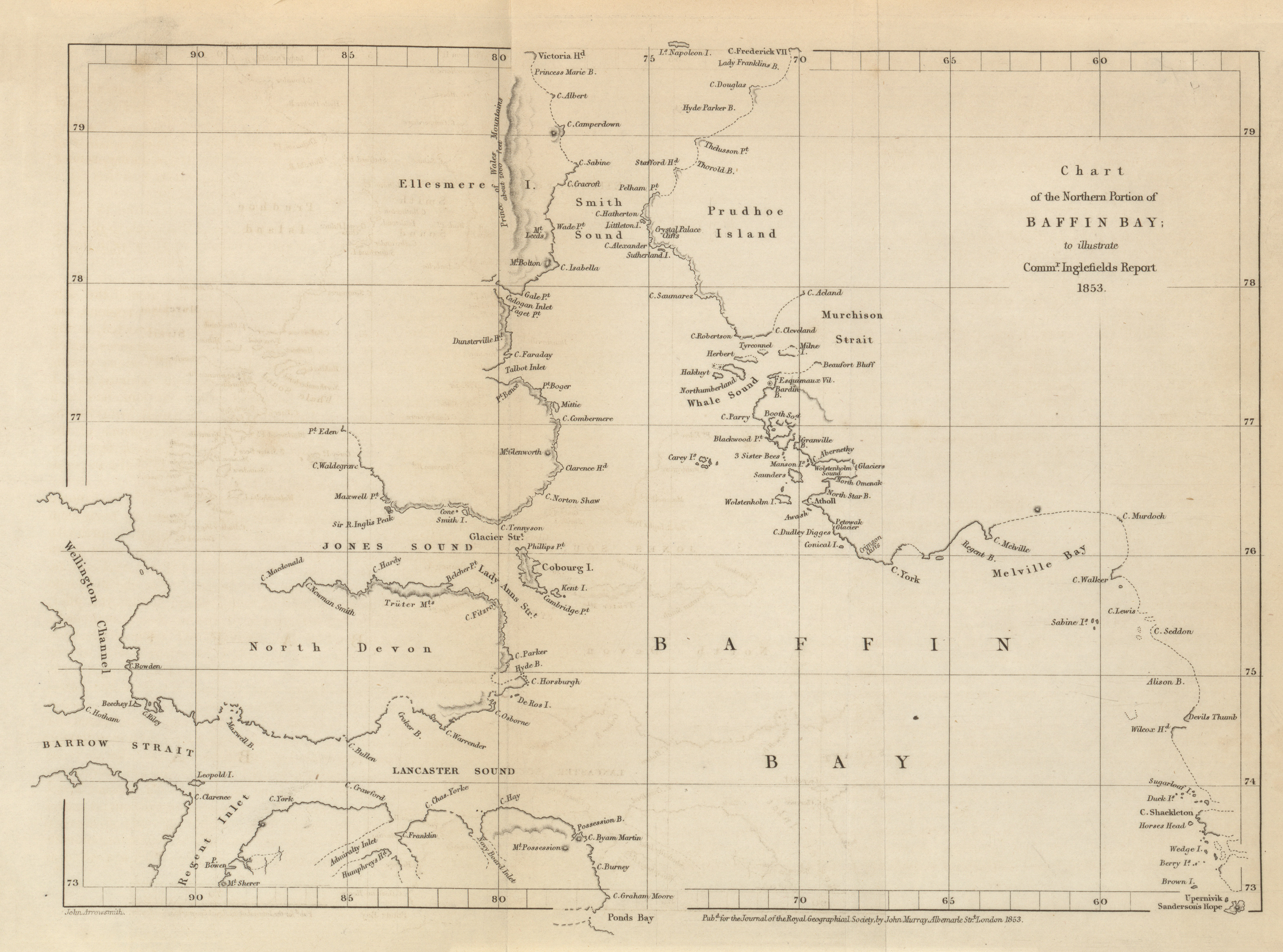
- Chart of the Northern portion of Baffin Bay to illustrate Commander Inglefield's report, 1853 (2.3MB)
Report on the return of Isabel from the Arctic regions. By Commander Ed. A. Inglefield, F.R.G.S. -
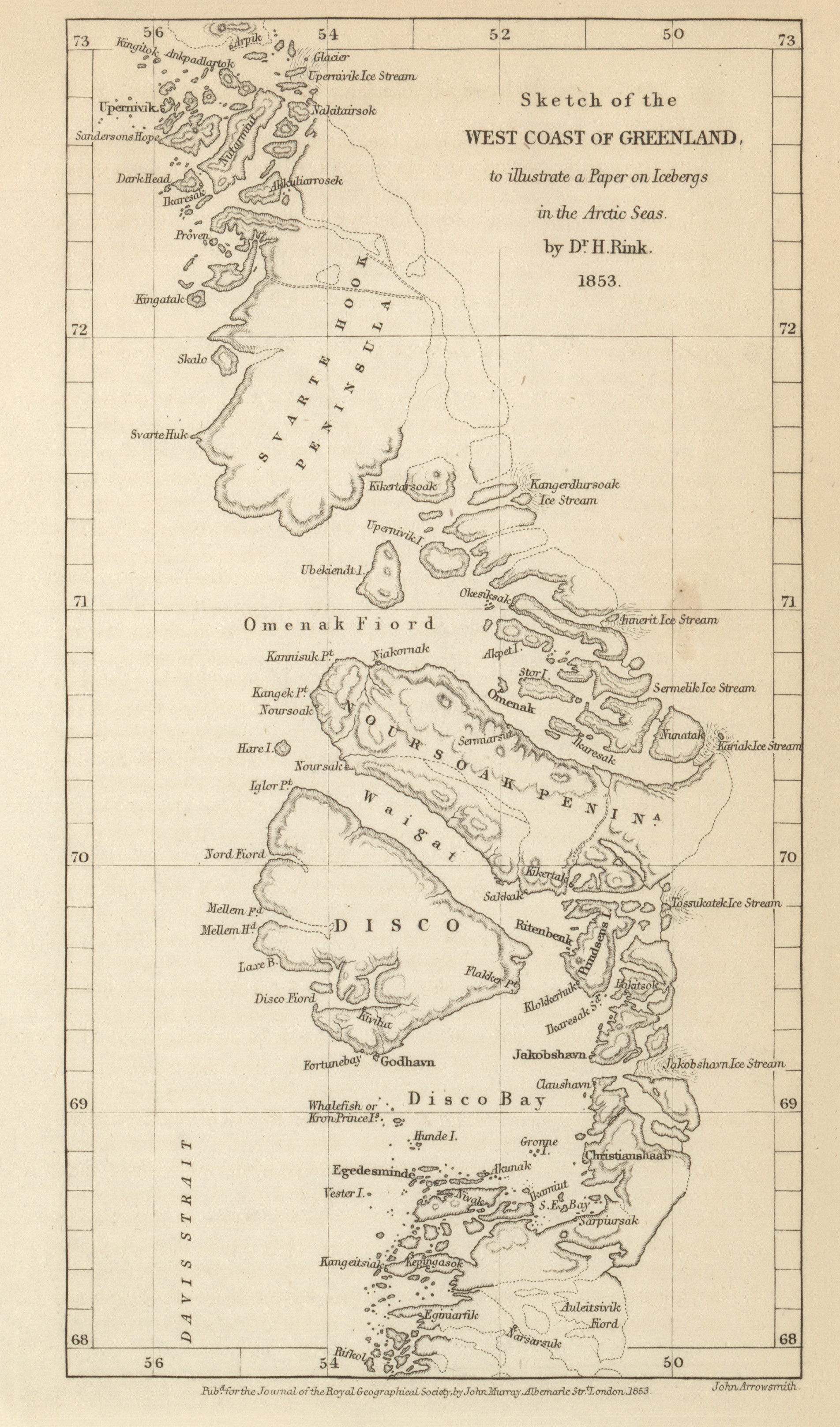
- Sketch of the West Coast of Greenland, to illustrate a Paper on Icebergs in the Arctic Sea, Dr. H. Rink, 1853 (1.2MB)
On the large Continental Ice of Greenland, and the origin of icebergs in the Arctic Seas. By Dr. H. Rink, of Copenhagen. -
- Peninsula and Bay of Samana in the Dominican Republic, Sir Robert. H. Schomburgk, 1853 (2.6MB)
The peninsula and Bay of Samana, in the Dominican Republic. By Sir R. H. Schomburgk, H.B.M. Consul at the Dominican Republic, corresponding F.R.G.S.
Volume 24, 1854
-
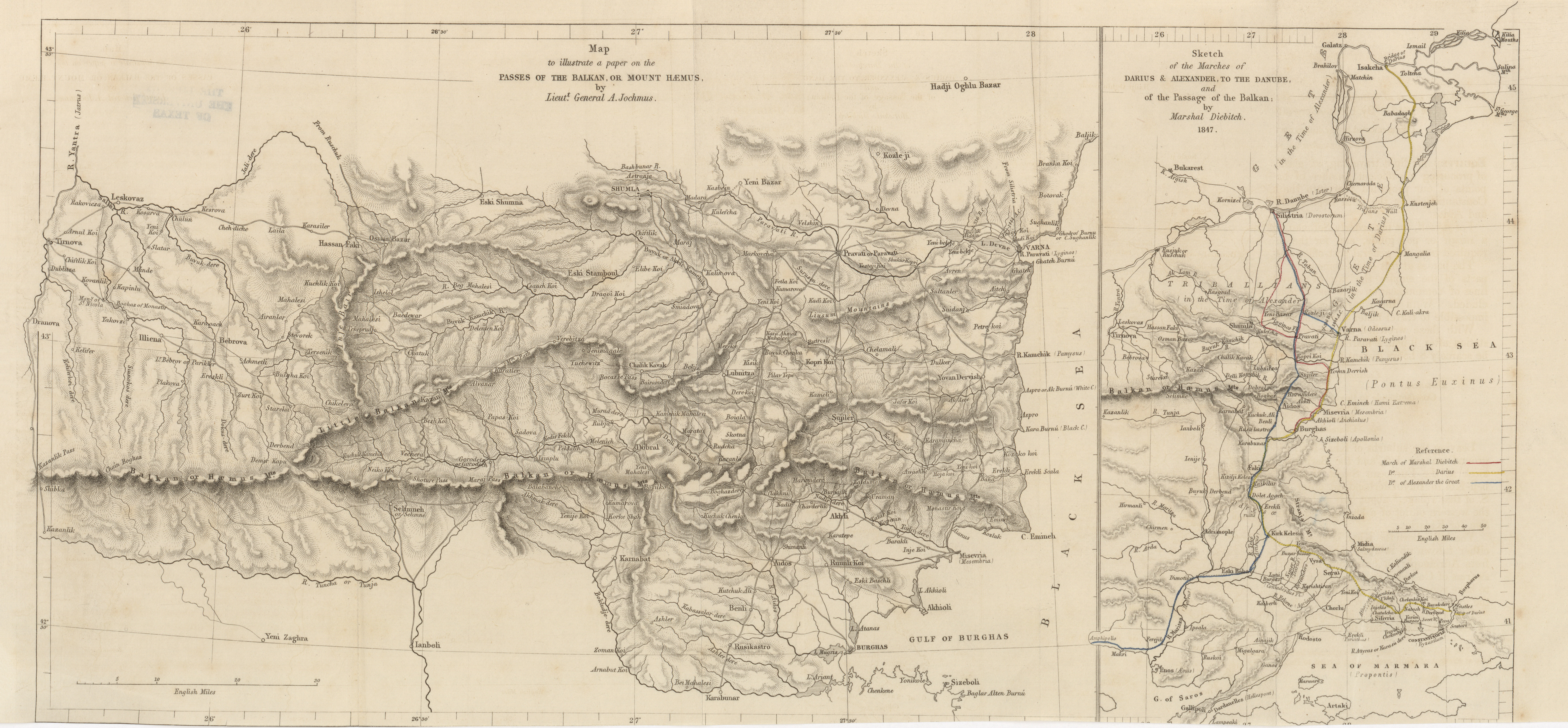
- Map to illustrate a paper on the passes of the Balkans or Mount Haemus, Lieut.-General A. Jochmus, 1854 (5.7MB)
Notes on a journey into the Balkan, or Mount Haemus, in 1847. By Lieutenant-General A. Jochmus. -
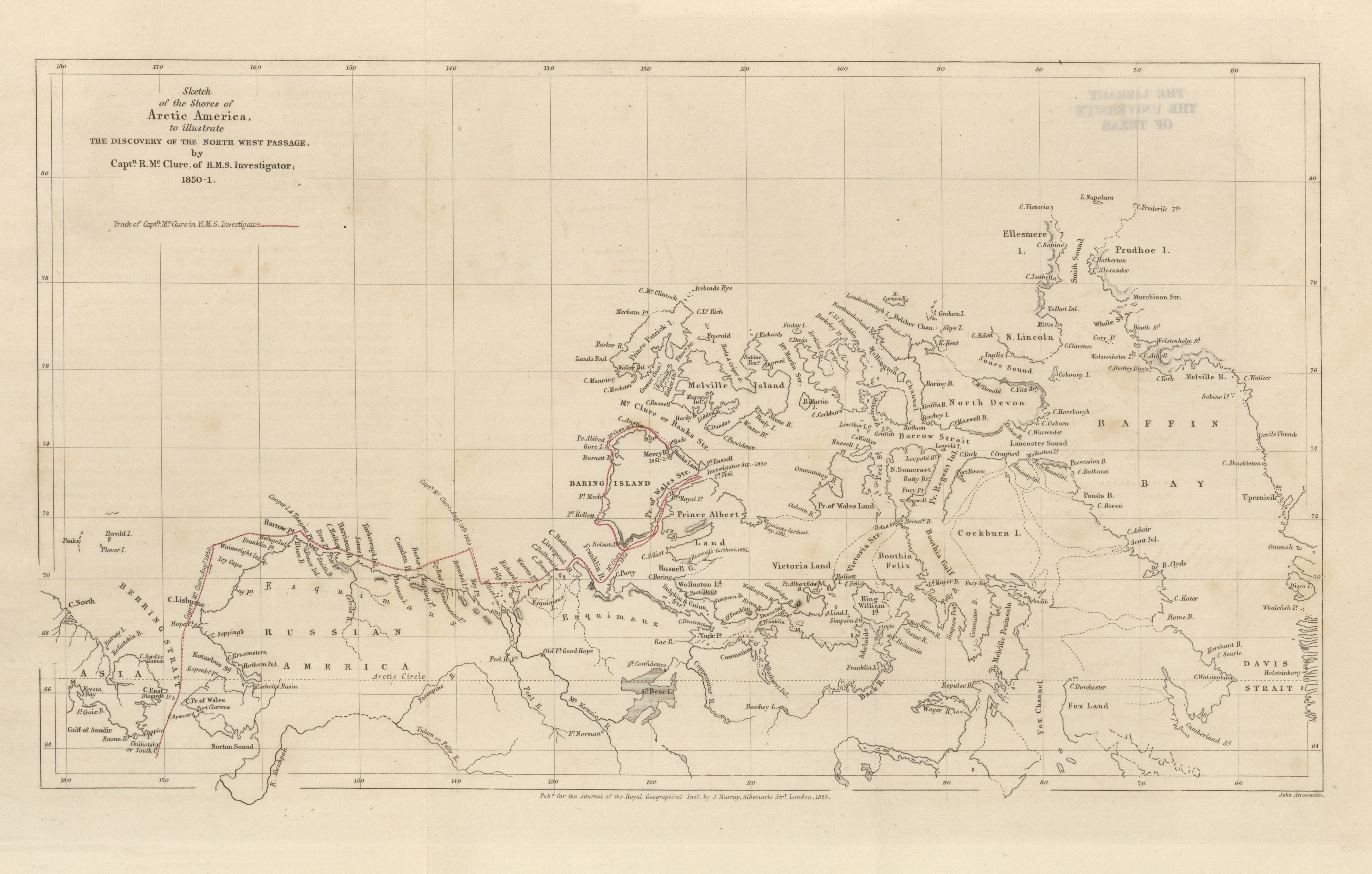
- Sketch of the Shores of Arctic America to illustrate the discovery of the North West Passage, Captn. R. M' Clure of H.M.S. Investigator, 1850-1851 (2.6MB)
Discovery of the North-West Passage. By Commander R. M'Clure, of H.M.S. 'Investigator.' -
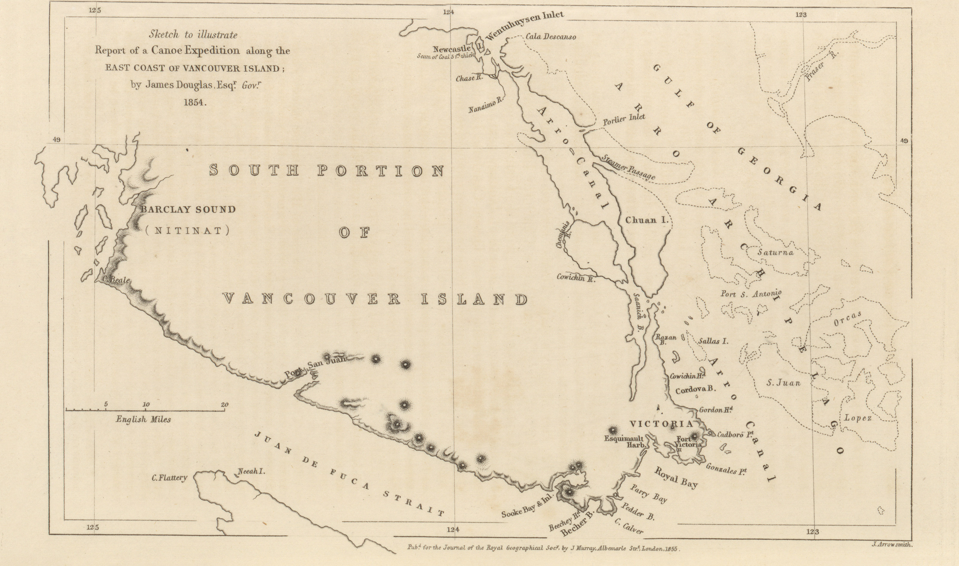
- Sketch to illustrate report of a canoe expedition along the East coast of Vancouver Island, James Douglas (984KB)
Report of a canoe expedition along the East coast of Vancouver Island. By James Douglas, Esq., Governor. -
- Map showing the route of Commander Prevost with sections of the Isthmus, Lionel Gisborne, 1854 (2.4MB)
Official report of the proceedings of the exploring party under Commander J.C. Prevost, of H.M.S. 'Virago,' sent to cross the Isthmus of Darien. -
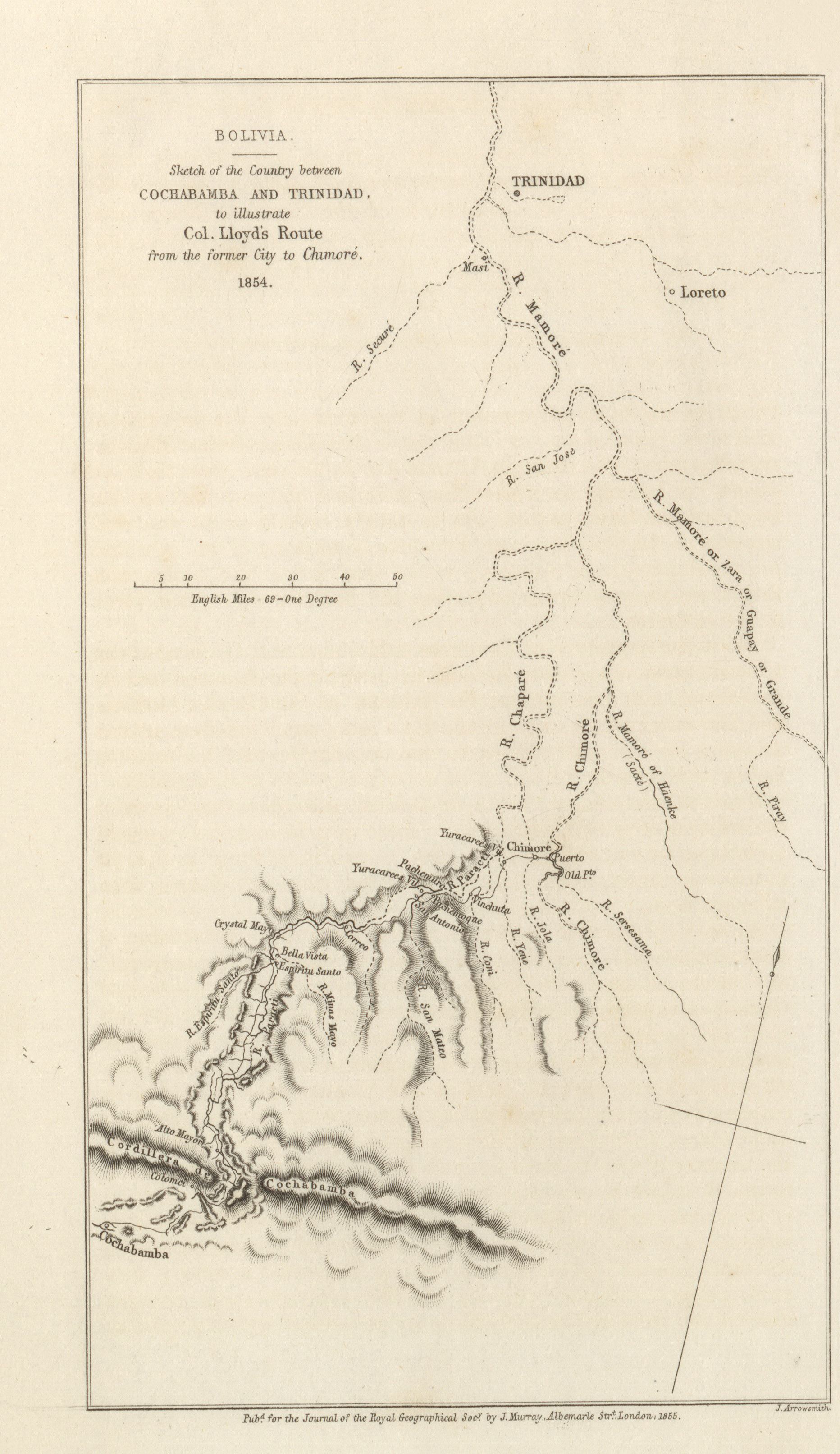
- Sketch of the country between Cochabamba and Trinidad to illustrate Col. Lloyd's Route from the former city to Chimore, J.A. Lloyd, 1854 (1.0MB)
Report of a journey across the Andes, between Cochabamba and Chimore, to the Westward of the Traders' Route, with Remarks on the proposed communication between Bolivia and the Atlantic, via the Amazon. By J.A. Lloyd, Esq., F.R.G.S., H.B.M. Charge d'Affaires in Bolivia. -
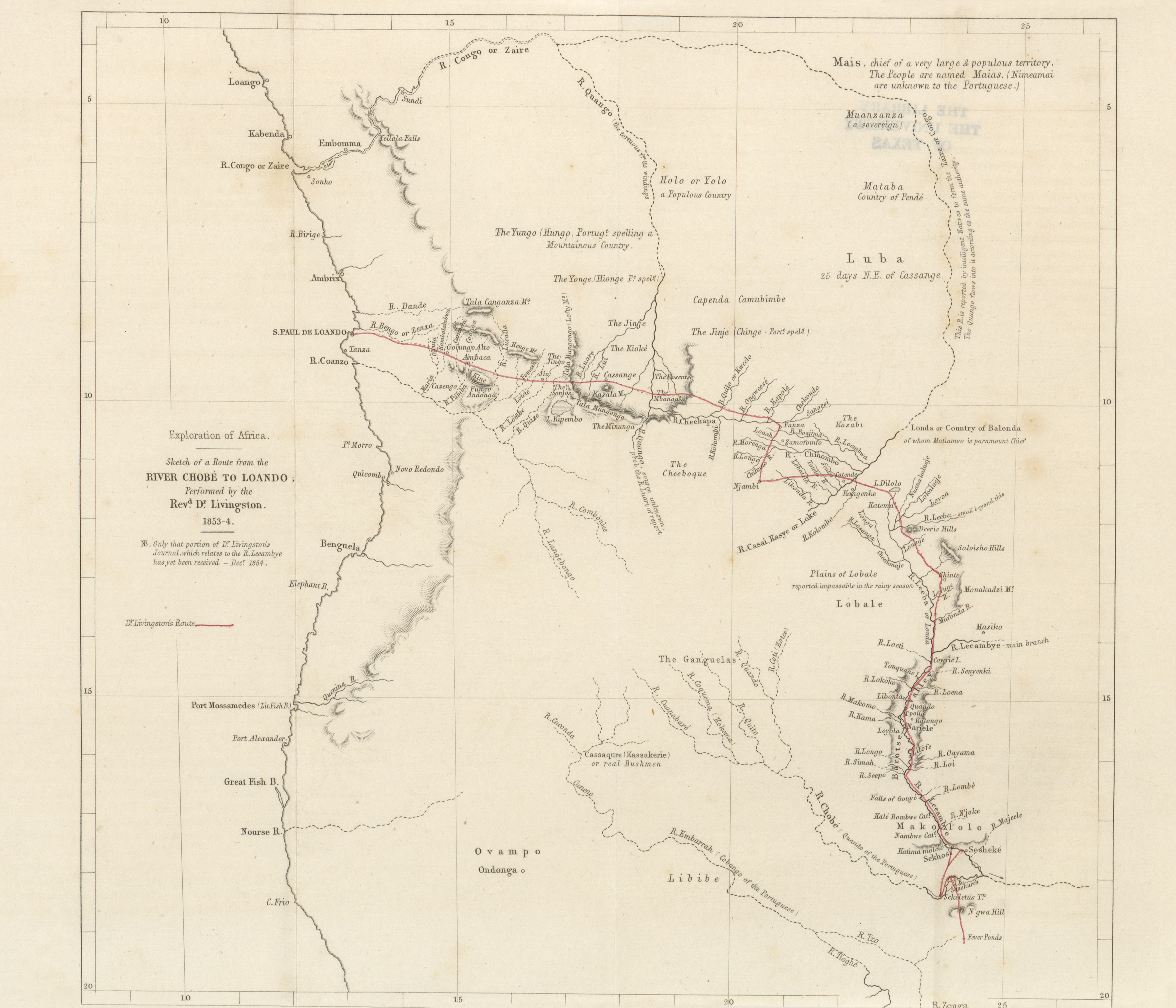
- Sketch of a route from the River Chobe to Loando, Rev. Dr. Livingston, 1853-1854 (1.8MB)
Explorations into the interior of South Africa. By Dr. David Livingston.
Volume 25, 1855
-
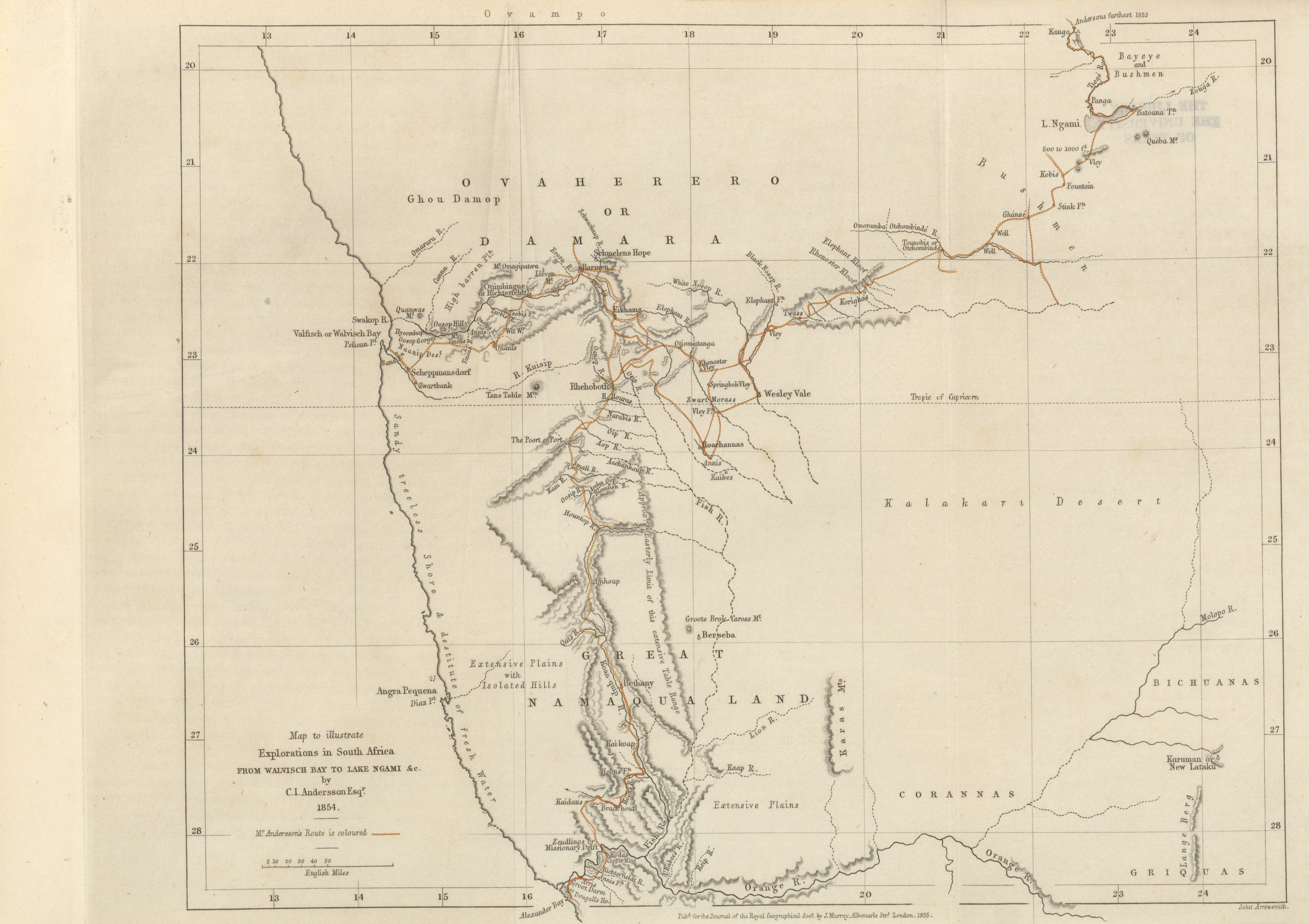
- Map to illustrate explorations in South Africa from Walvisch Bay to Lake Ngami, C.I. Andersson, 1854 (2.7MB)
Explorations in South Africa, with route from Walfisch Bay to Lake Ngami, and ascent of the Tioge River. By Charles J. Andersson, Esq. -
- The Rivers Kwora, Chadda, or Binue from the Nun Mouth of the former to the country of Adamawa on the latter; to illustrate the journal of Dr. William Balfour Baikie, John Arrowsmith, 1855 (2.5MB)
Summary of an exploring trip up the Rivers Kwora and Chadda (or Shadda) in 1854. By W.N. Baikie, M.D., R.N., F.R.G.S. -
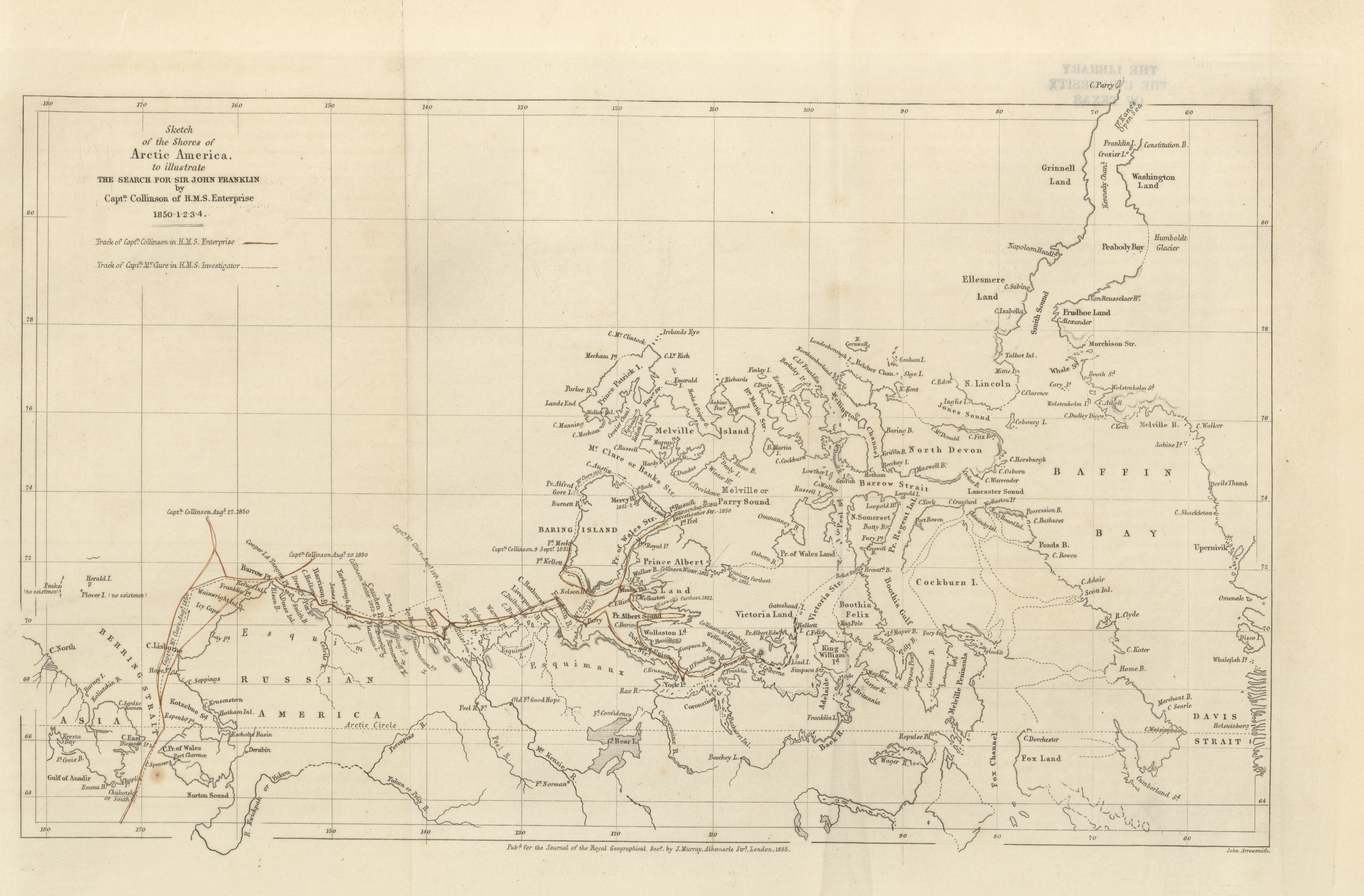
- Sketch of the shores of Arctic America, to illustrate the search for Sir John Franklin, Captain Collinson of H.M.S. Enterprise, 1850-1854 (2.9MB)
Artic explorations, with information respecting Sir John Franklin's missing party. By Dr. John Rae, F.R.G.S. (Gold Medallist) -
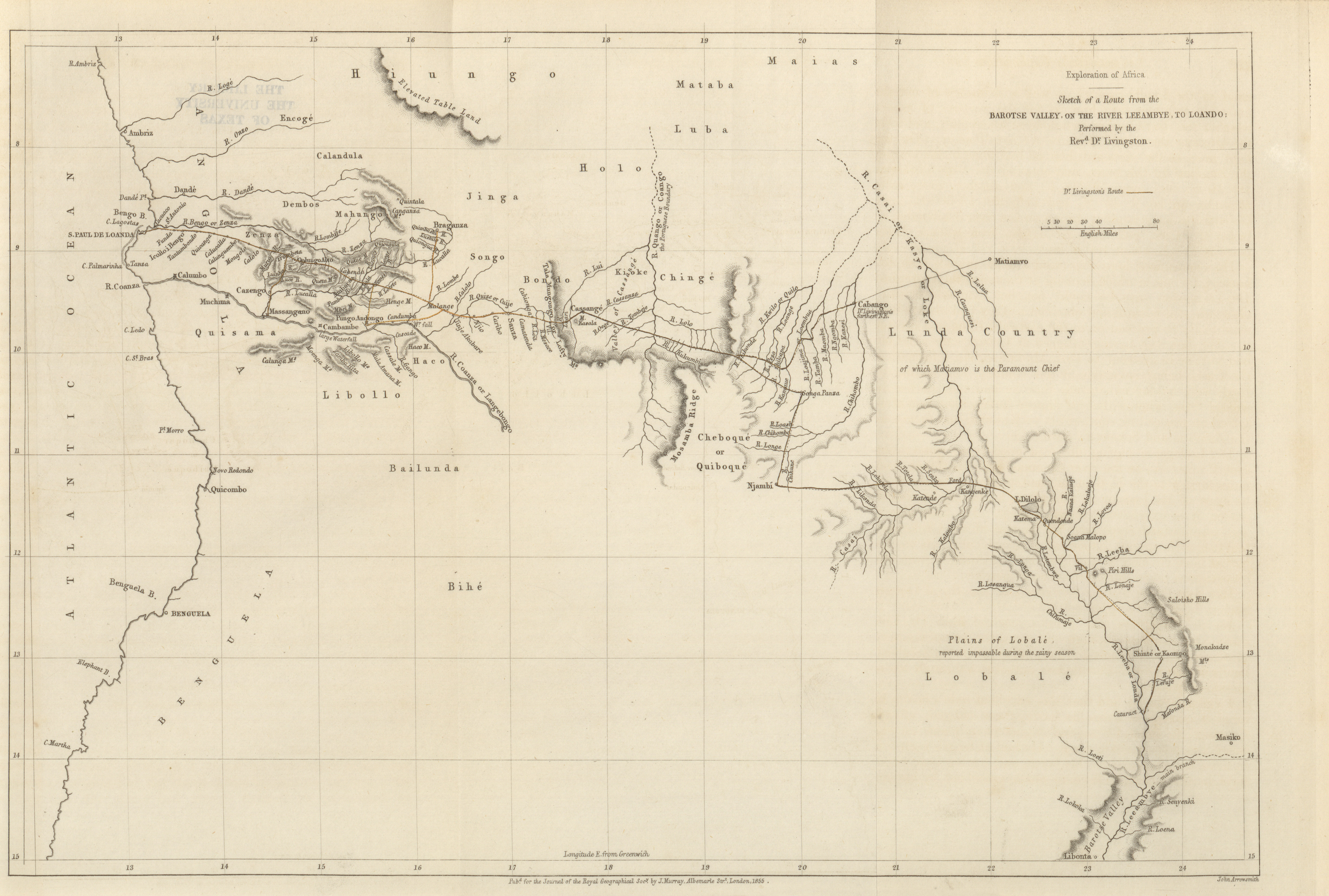
- Sketch of a route from the Barotse Valley, on the River Leeambye, to Loando, Revd. Dr. Livingston, 1855 (2.7MB)
Explorations into the interior of Africa. By the Rev. D. Livingston, LL.D. (Gold Medallist) -
- Mission to Central Africa, The Route from Tripoli to Kuka, Dr. Edward Vogel, 1853-1854 (3.1MB)
Mission to Central Africa. By Ed. Vogel, Phil. Dr.
Volume 26, 1856
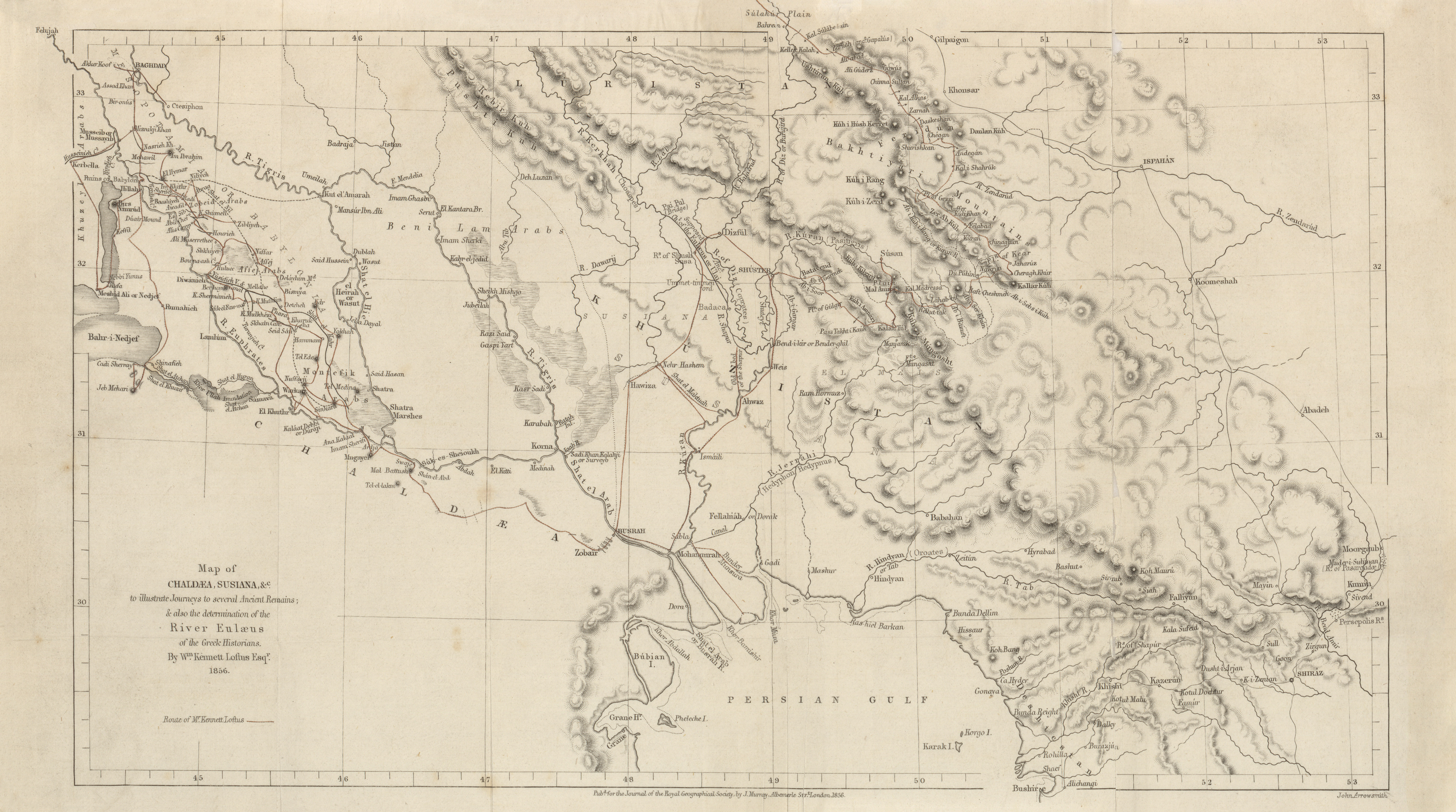
- Chaldea Susiana, Kennett Loftus, 1856 (4.6MB) Notes of a Journey from Baghdad to Busrah, with descriptions of several Chaldean remains. By W. Kennet Loftus.
-
- Sketch of the country between Kustenje and Chernavoda, showing the Kara-su Lakes, Capt. Spratt, 1856 (1.3MB)
Route between Kustenje and the Danube by the Kara-su and Yeni-Keui Valleys, with observations on the navigation of the Kara-su Lakes and their origin; also on the requirements necessary to render the water and land communication practicable; being the result of an examination made during a recent journey with Lieutenant-Colonel Hon. A. Gordon and Lietuenant-Colonel J. Desaint, de l'Etat Major. By Captain Spratt, R.N., C.B., of H.M.S., 'Spitfire.' July, 1854.
Volume 27, 1857
-
- Sketch of the Battle of Marathon, Lieut.-General A. Jochmus, 1857 (1.8MB)
Commentaries on the Battle of Marathon, Lieutenant-General A. Jochmus
Volume 28, 1858
-
- Part of North Australia to illustrate journal of the route of Augustus C. Gregory Esqr., 1858 (6.4MB)
Journal of the North Australian exploring expedition. Under the command of Augustus C. Gregory, Esq. (Gold Medallist R.G.S.); with report by Mr. Elsey on the health of the party. -
- South Africa, map to illustrate route from near Colesberg on the E. to Steinkopf on the W. also return route along the banks of the Orange River towards the Bechuana Country, Robert Moffat Esqr., 1858 (5.2MB)
Journey from Colesberg to Steinkopf in 1854-1855. By Robert Moffat, Esq., F.R.G.S., Government Surveyor at the Cape. -
- New Zealand, South districts of the province of Otago, to illustrate the journal of J. Turnbull Thomson Esqr., 1857 (2.0MB)
Extracts from a journal kept during a Reconnaissance survey of the Southern Districts of the province of Otago, New Zealand. By J. Turnbull Thomson, F.R.G.S., Chief Surveyor. -
- Amur and Adjacent Districts, to illustrate notes by M.M. Peschurof, Shenurin, Vesilief, Radde, Usoltzof, Pargachefski, John Arrowsmith, 1858 (6.7MB)
Notes on the River Amur and the adjacent districts. By MM. Peschurof, Permikin, Shenurin, Vasilief, Radde, Usoltzof, and Pargachefski.
Volume 30, 1860
-
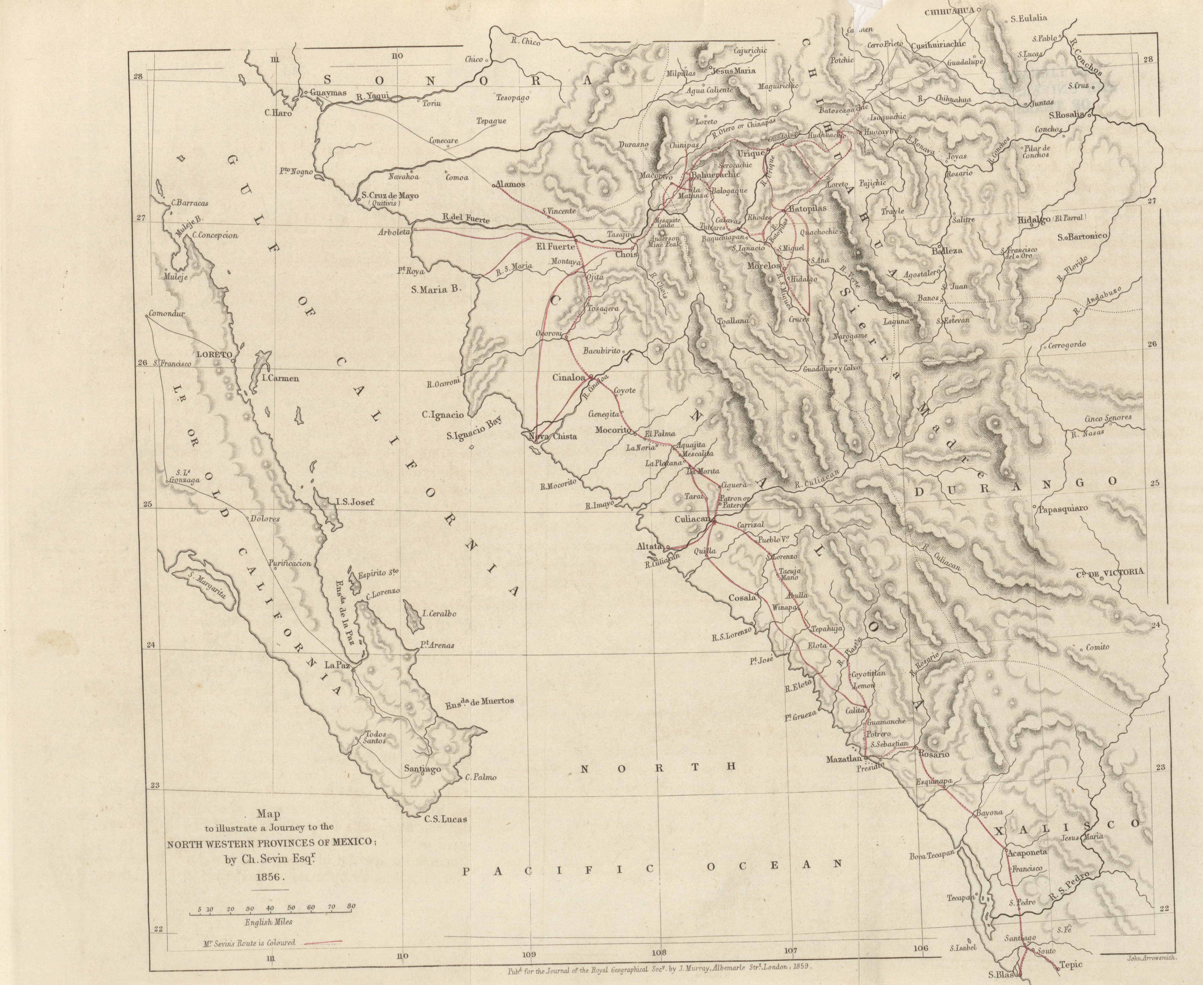
- Map to illustrate a journey to the North Western Provinces of Mexico, Ch. Sevin Esqr., 1856 (3.0MB)
Journey to Mexico. By Ch. Sevin, Esq., F.R.G.S. -
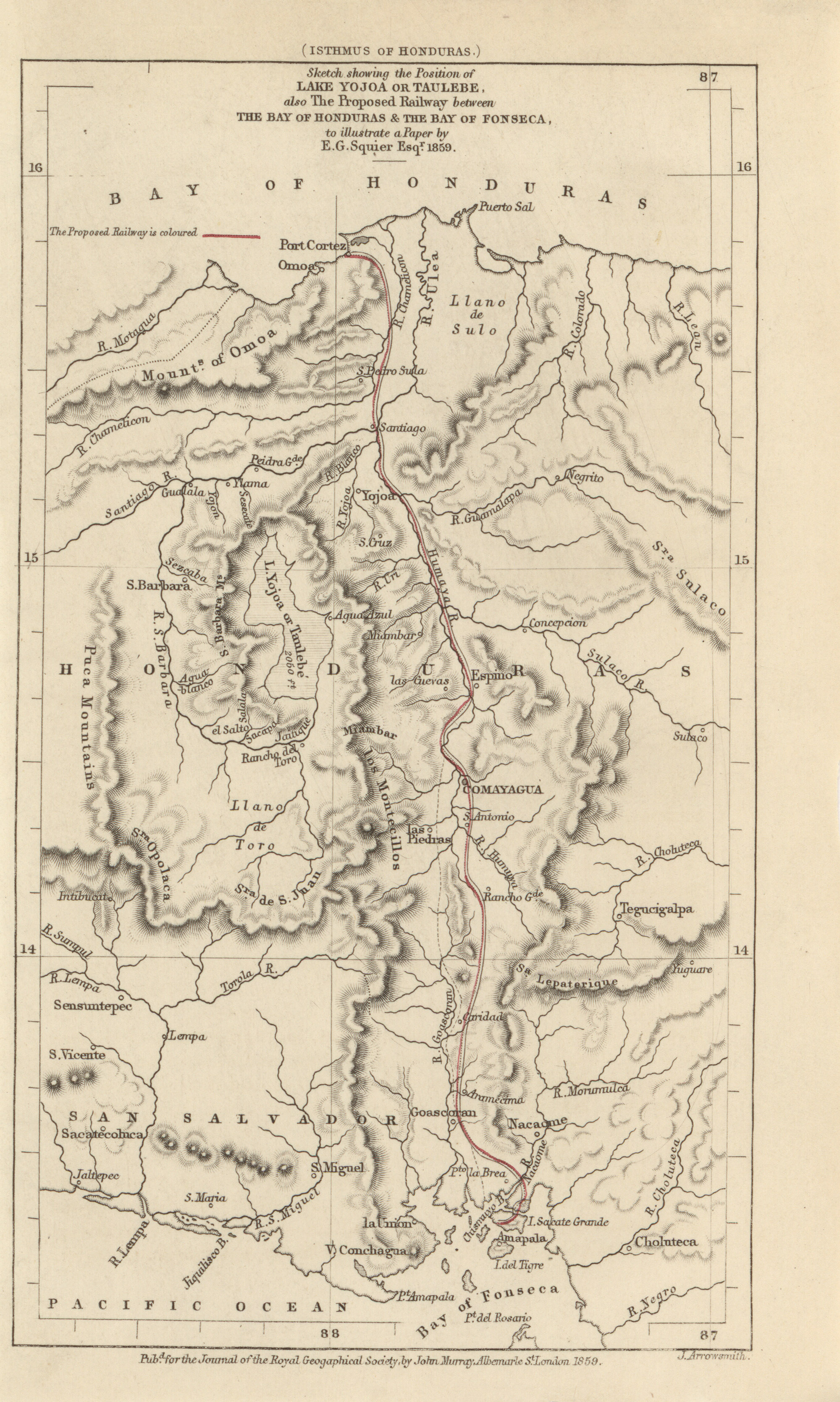
- Sketch showing the position of Lake Yojoa or Taulebe, also the proposed railway between the Bay of Honduras and the Bay of Fonseca, to illustrate a paper by E.G. Squier Esqr., 1850 (1.5MB)
Some account of the Lake of Yojoa or Taulebe, in Honduras, Central America. By E.G. Squier, Esq., of the United States of America. -
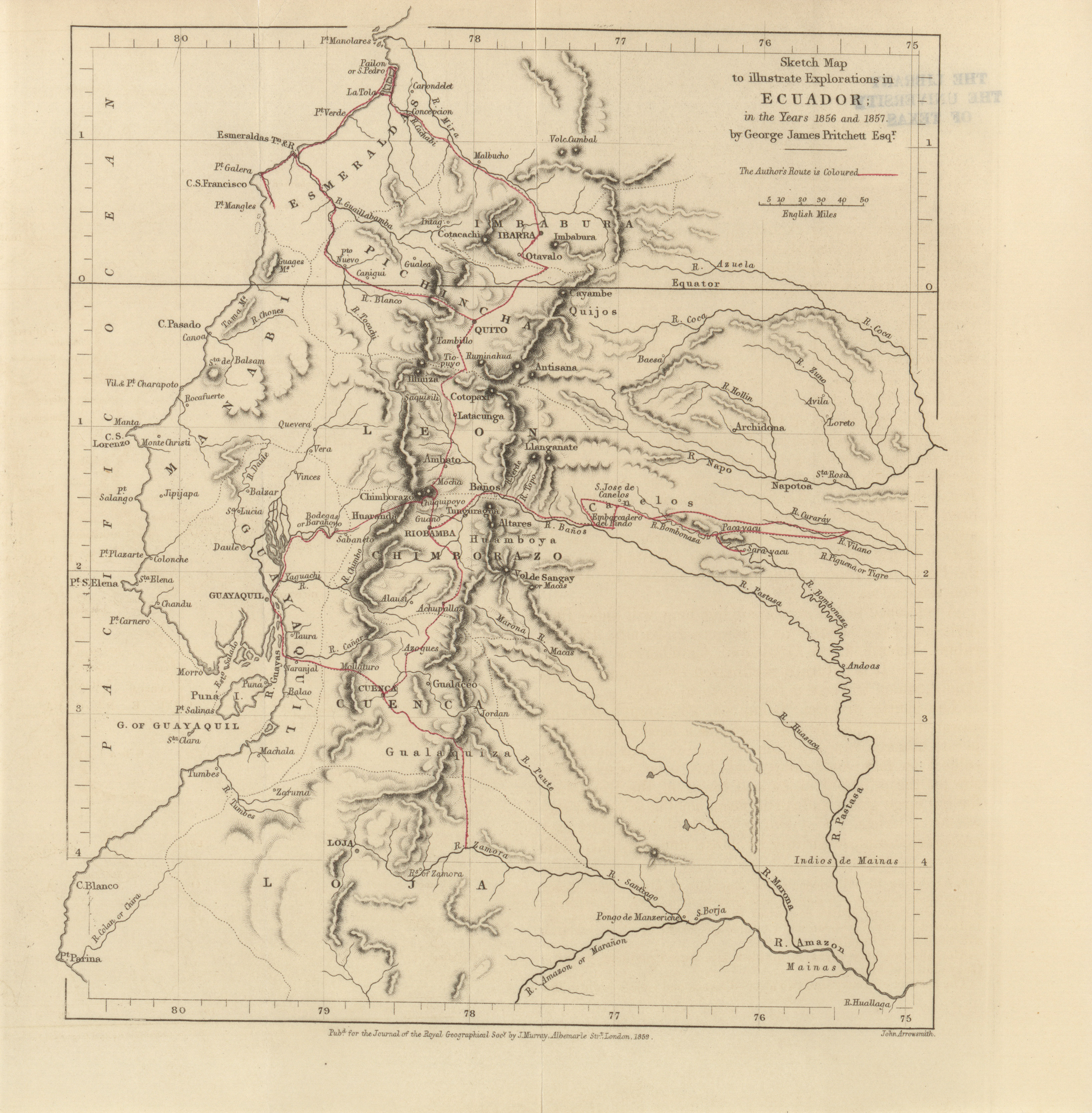
- Sketch map to illustrate explorations in Ecuador; in the years 1856 and 1857 by George James Pritchett Esqr., 1859 (2.2MB)
Explorations in Ecuador in the years 1856 and 1857. By george James Pritchett, Esq. -
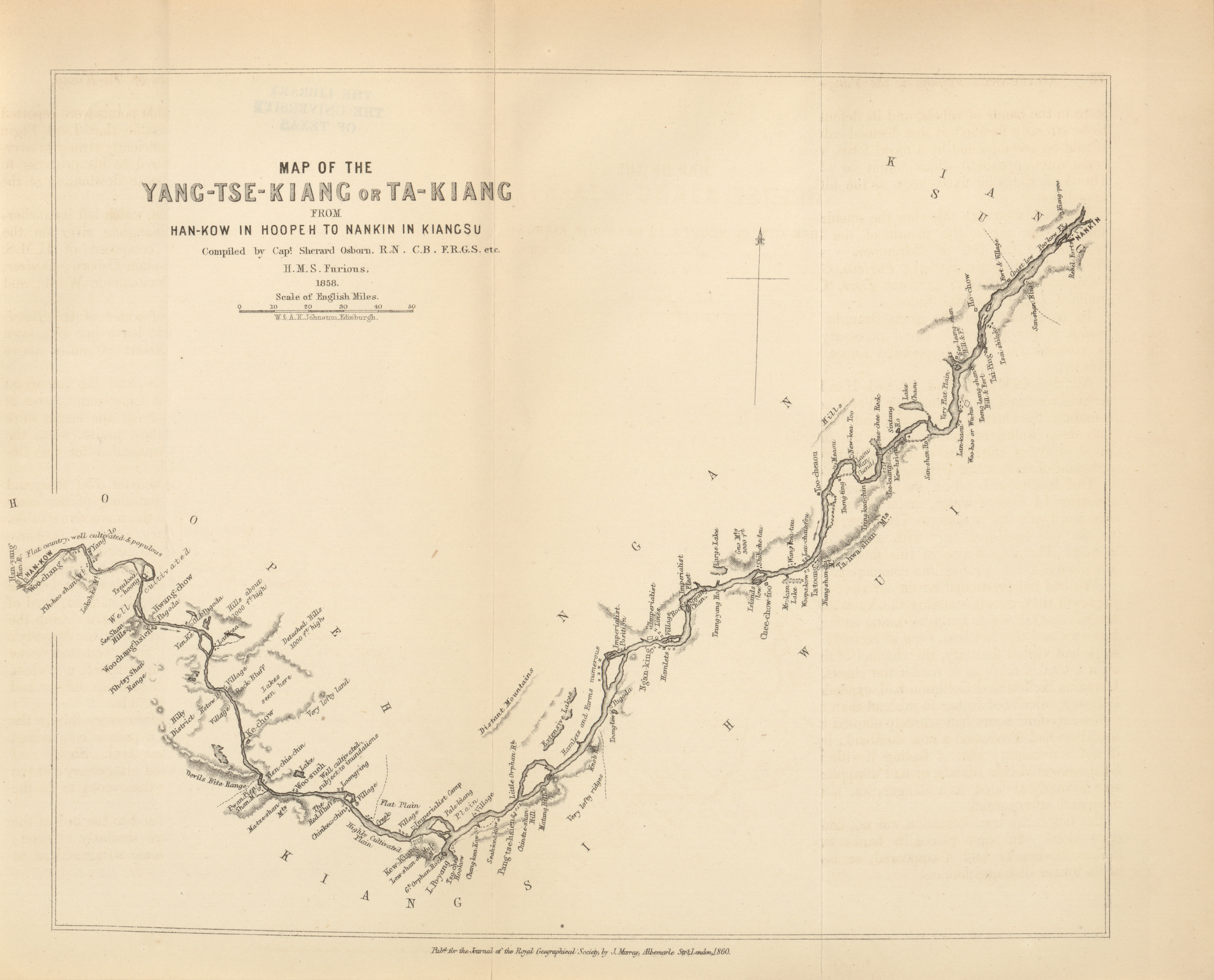
- Yang-Tse-Kiang or Ta-Kiang from Han-Kow in Hooper to Nankin in Kiangsu, Sherard Osborn, 1858 (2.1MB)
Notes of a voyage up the Yang-tze or Ta-Kiang, from Wusung to Han-kow. By Laurence Oliphant, Esq., F.G.R.S.; with chart of the River by Captain Sherard Osborn, R.N., F.R.G.S. -
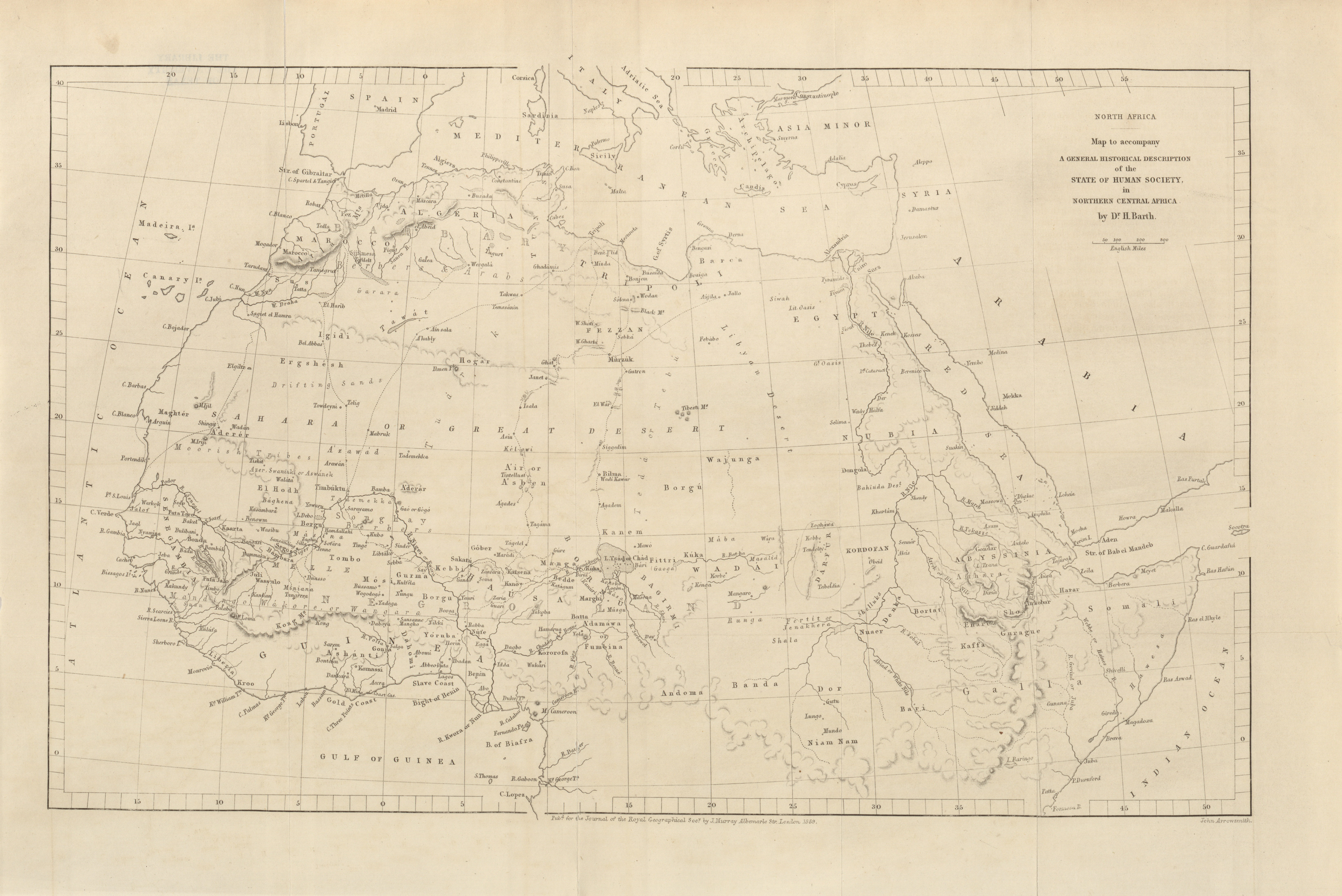
- North Africa, map to accompany a general historical description of the State of Human Society, in Northern Central Africa by Dr. H. Barth, 1860 (4.8MB)
A general historical description of the State of Human Society in Northern Central Africa. By H. Barth, Phil. D. -
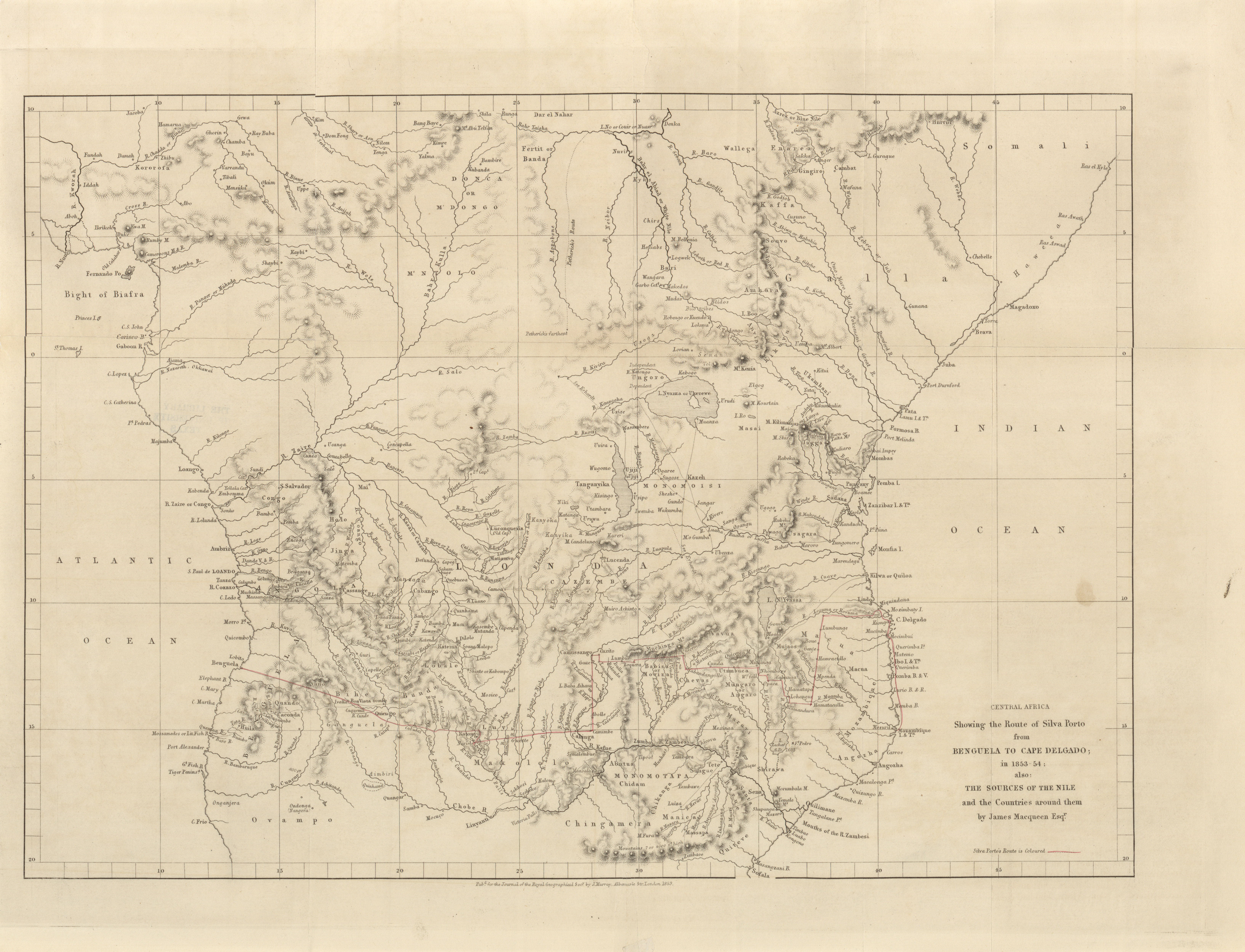
- Central Africa, showing the route of Silva Porto from Benguela to Cape Delgado; also the sources of the Niles and the countries around them by James Macqueen Esqr., 1853-1854 (6.1MB)
Journeys of Silva Porto with the Arabs from Benguela to Ibo and Mozambique through Africa. November 26th, 1852, to January 22nd, 1853, and from June 9th, 1853, to August, 1854. By James Macqueen, Esq. F.R.G.S. -
- Map to accompany notes on the lower course of the Danube, Major J. Stokes R.E., 1859 (1.2MB)
Notes on the Lower Danube. By Major J. Stokes, R.E. -
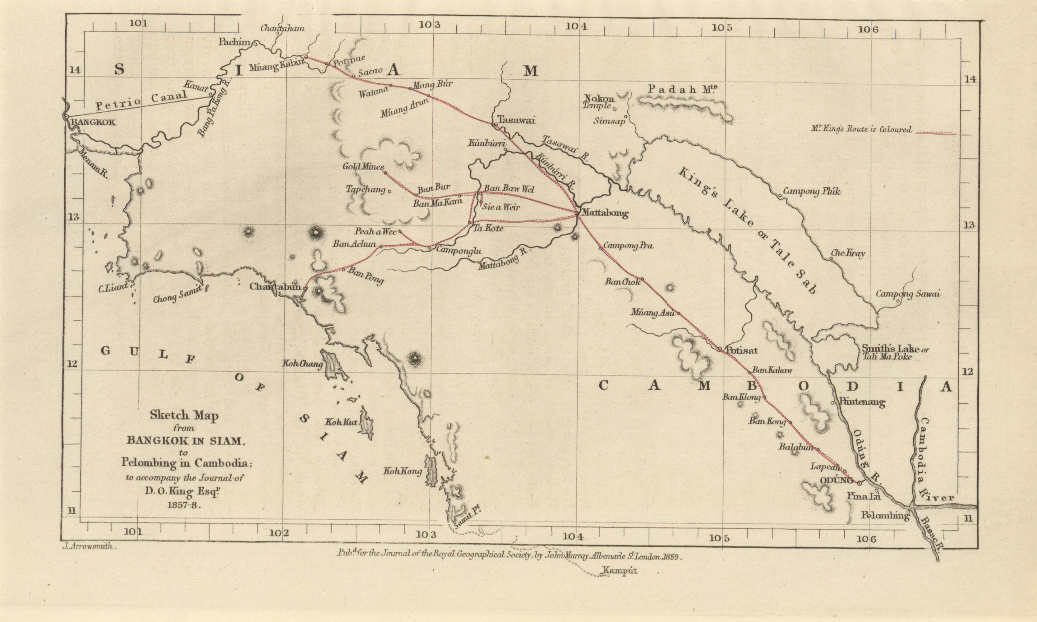
- Sketch map from Bangkok in Siam, to Pelombing in Cambodia; to accompany the journal of D.O. King Esqr., 1857-1858 (1.2MB)
Travels in Siam and Cambodia. By D.O. King, Esq. -
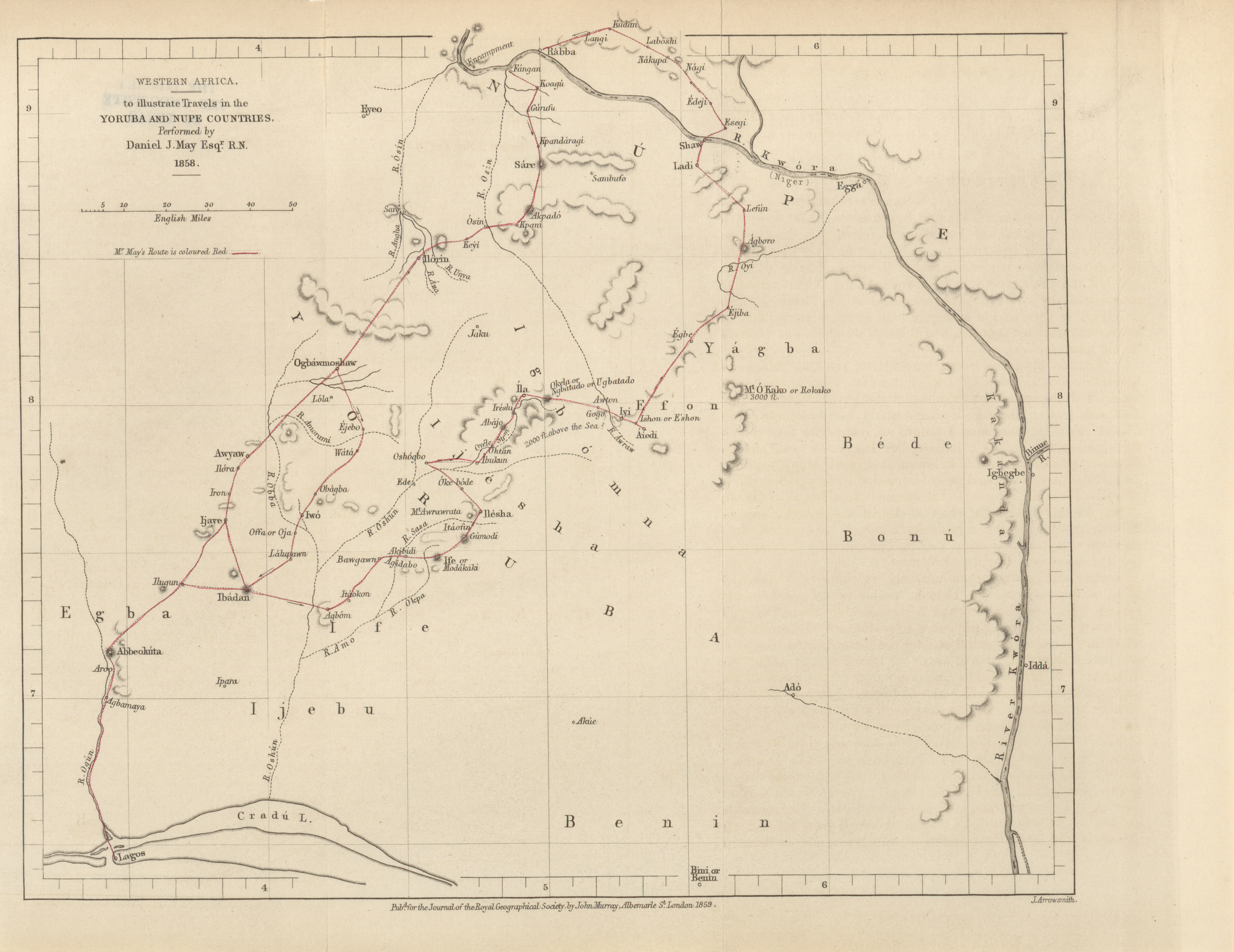
- Western Africa, to illustrate travels in Yoruba and Nupe countries, Daniel J. May Esqr. R.N., 1858 (2.5MB)
Journey in the Yoruba and Nupe countries in 1858. By Daniel J. May, Esq., F.R.G.S., Second Master R.N. -
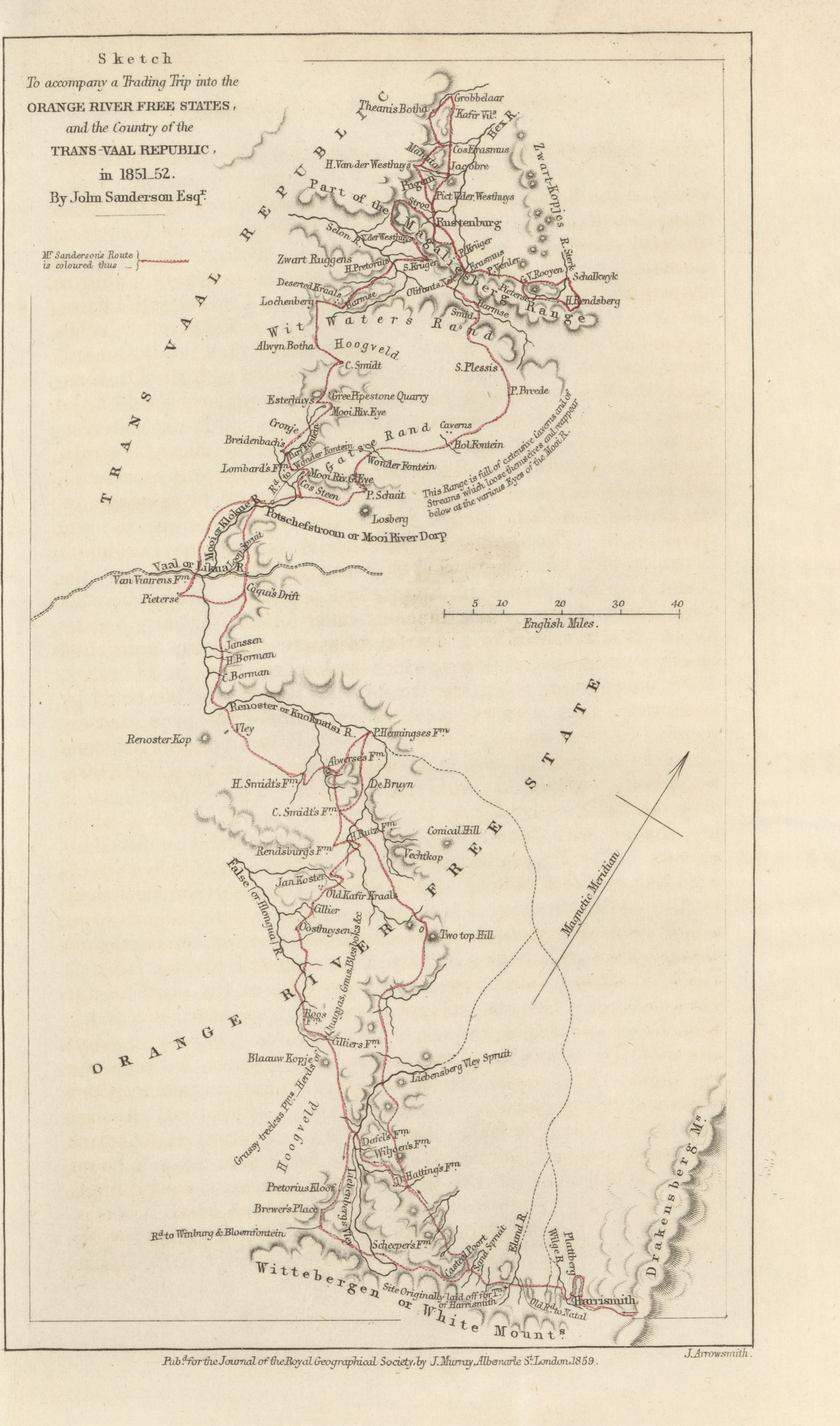
- Sketch to accompany a trading trip into the Orange River free states, and the country of the Trans Vaal Republic, John Sanderson Esqr., 1851-1852 (1.1MB)
Memoranda of a trading trip into the Orange River (sovereignty) free state, and the country of the Transvaal Boers, 1851-1852. By John Sanderson, Esq. -
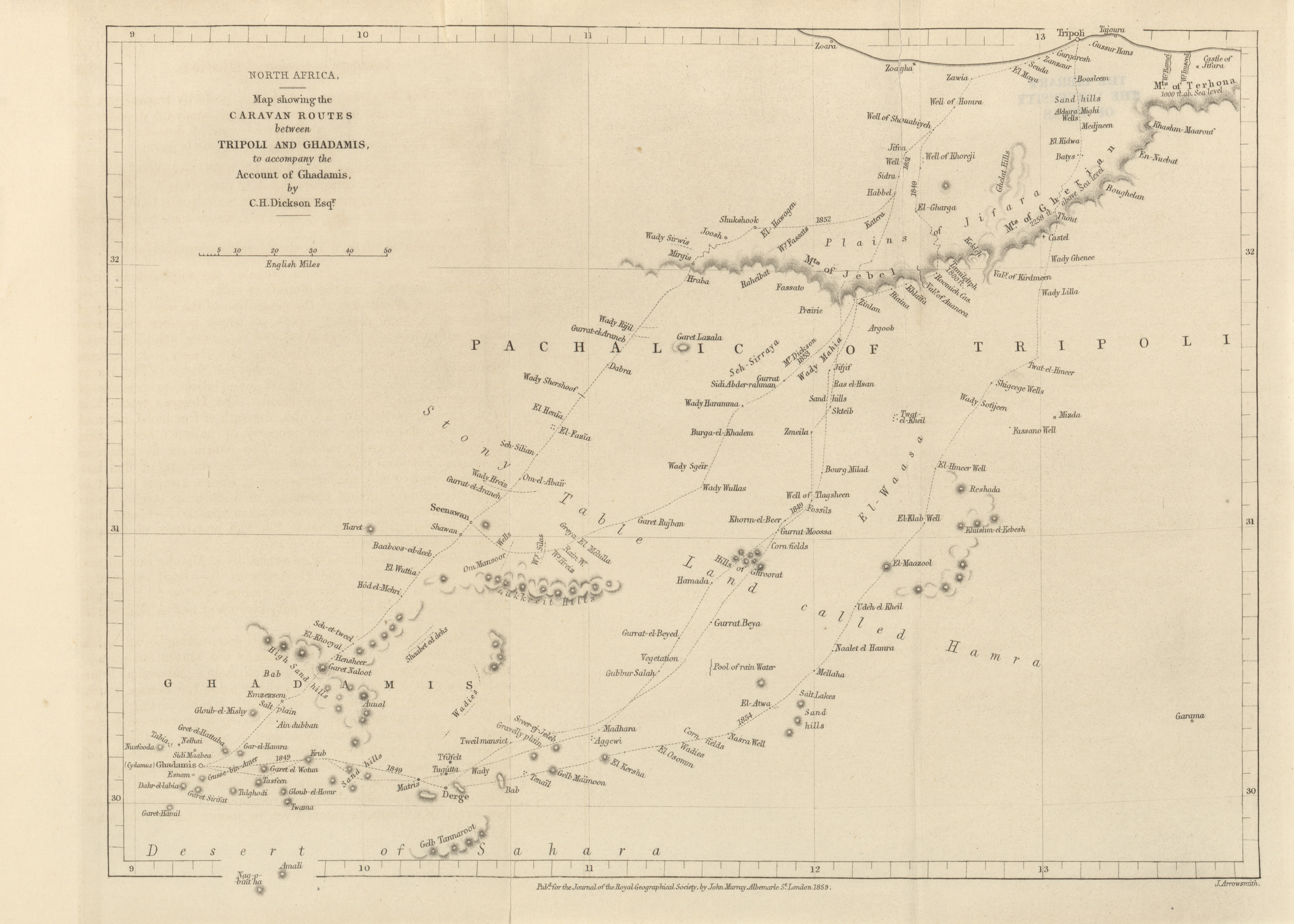
- North Africa, map showing the Caravan routes between Tripoli and Ghadamis to accompany the account of Ghadamis, C.H. Dickens Esqr., 1859 (2.7MB)
Account of Ghadamis. By C.H. Dickson, Esq., F.R.G.S., H.B.M. Consul at Sukum Kale. -
- British North America, map of the country between Lake Superior and Vancouver Island; to illustrate the papers of the exploring expedition under the command of Captain John Palliser, 1857-1860 (6.6MB)
Progress of the British North American exploring expedition. Under the command of Captain John Palliser, F.R.G.S.
Volume 32, 1861
-
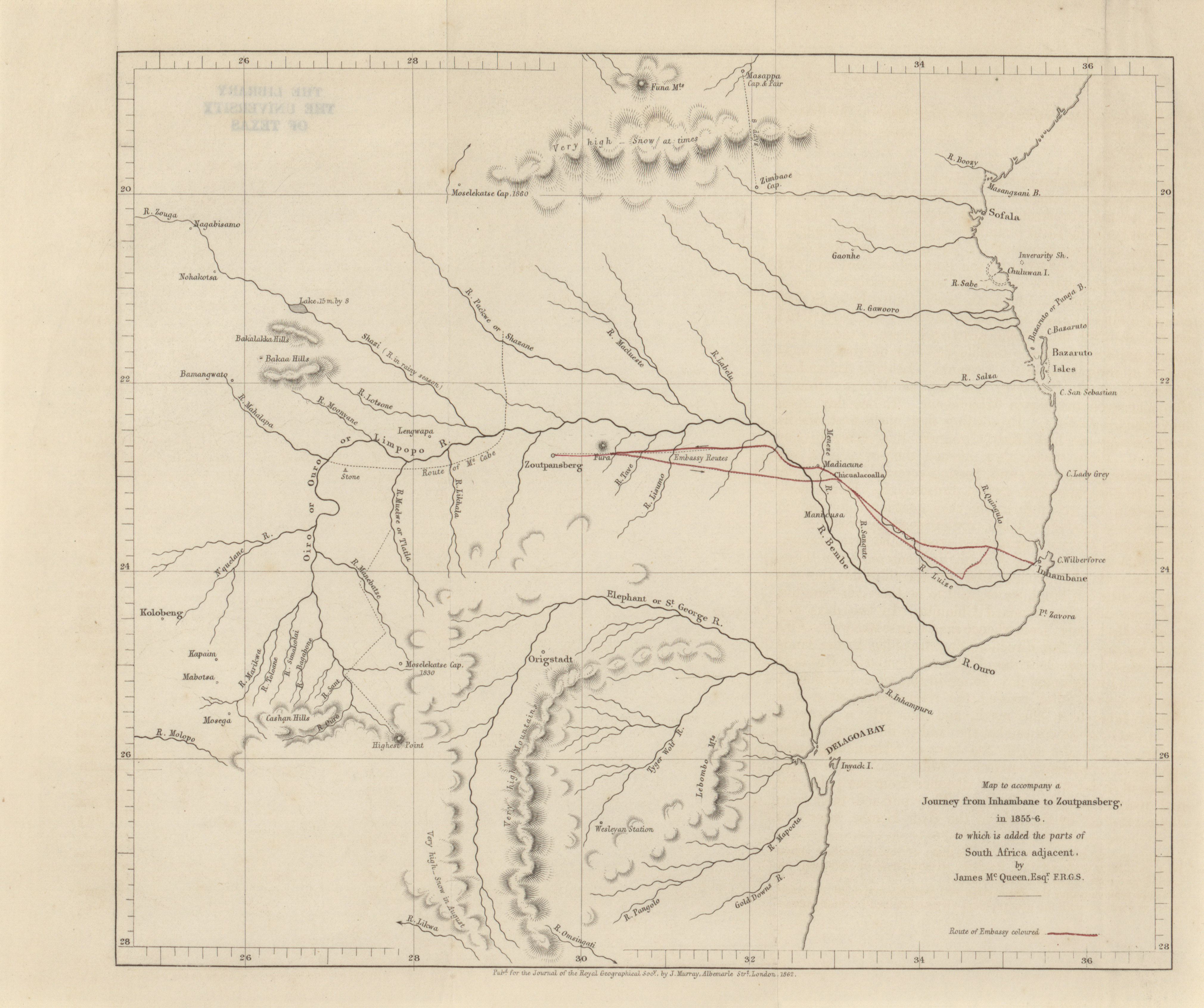
- Map to accompany a journey from Inhambane to Zoutpansberg, to which is added the parts of South Africa adjacent, James McQueen, 1855-1856 (2.2MB)
Journey from Inhambane to Zoutpansberg, by Joaquim de Santa Rita Montanha. By James McQueen, Esq., F.R.G.S. -
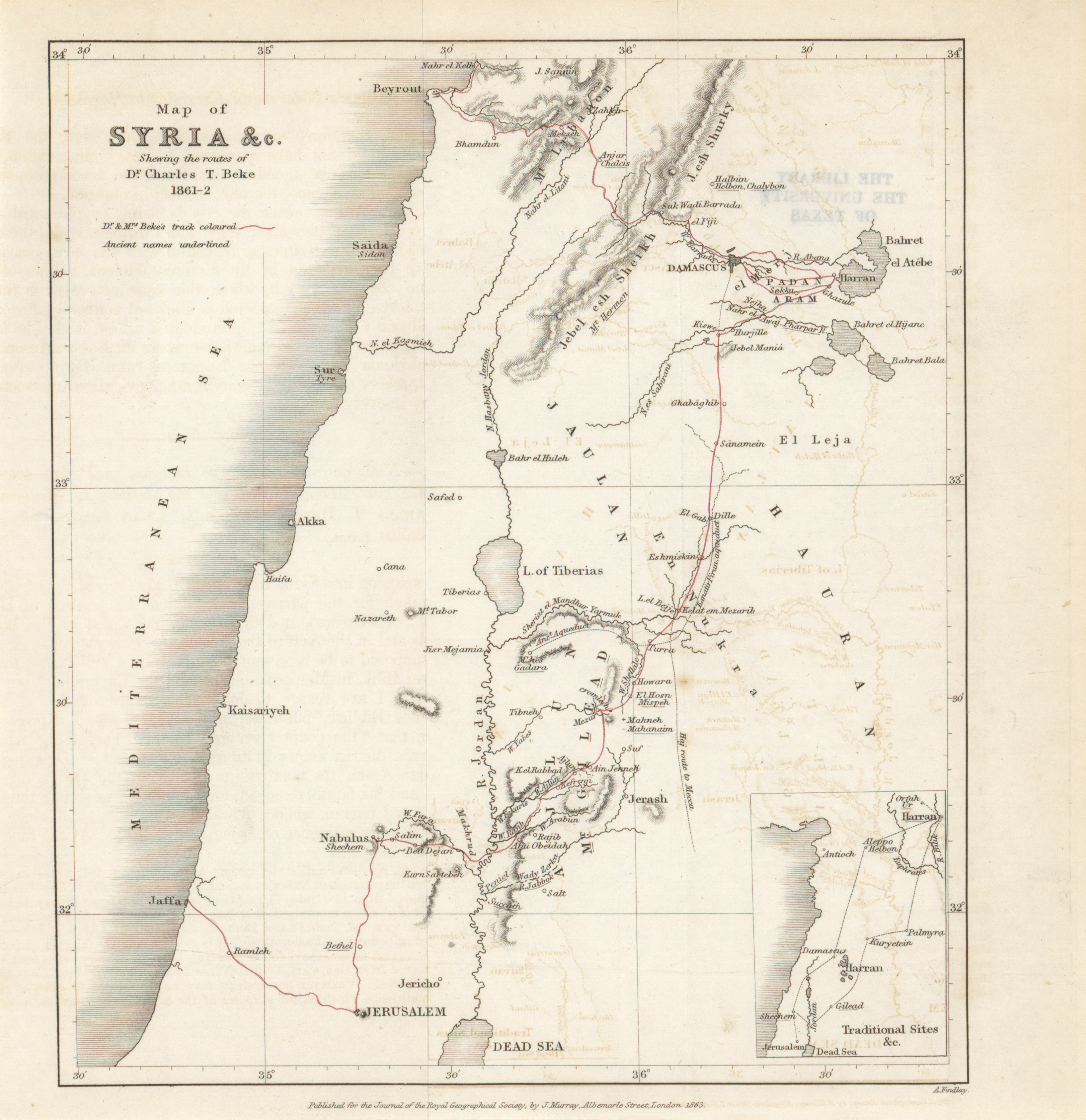
- Syria, showing the routes of Dr. Charles T. Beke, 1861-1862 (1.9MB)
Notes on an excursion to Harran, in Padan Aram, and thence over Mount Gilead and the Jordan, to Shechem. By Charles T. Beke, Esq., PH. DR., F.S.A., F.R.G.S. (Gold Medallist R.G.S.) -
- Cambodia, the Lao Country, to illustrate the route and notes of M. Henri Mouhot, 1859-1861 (3.3MB)
Notes on Cambodia, the Lao Country. By M. Henri Mouhot (translated from the original French, by Dr. Thomas Hodgkin, M.D.). -
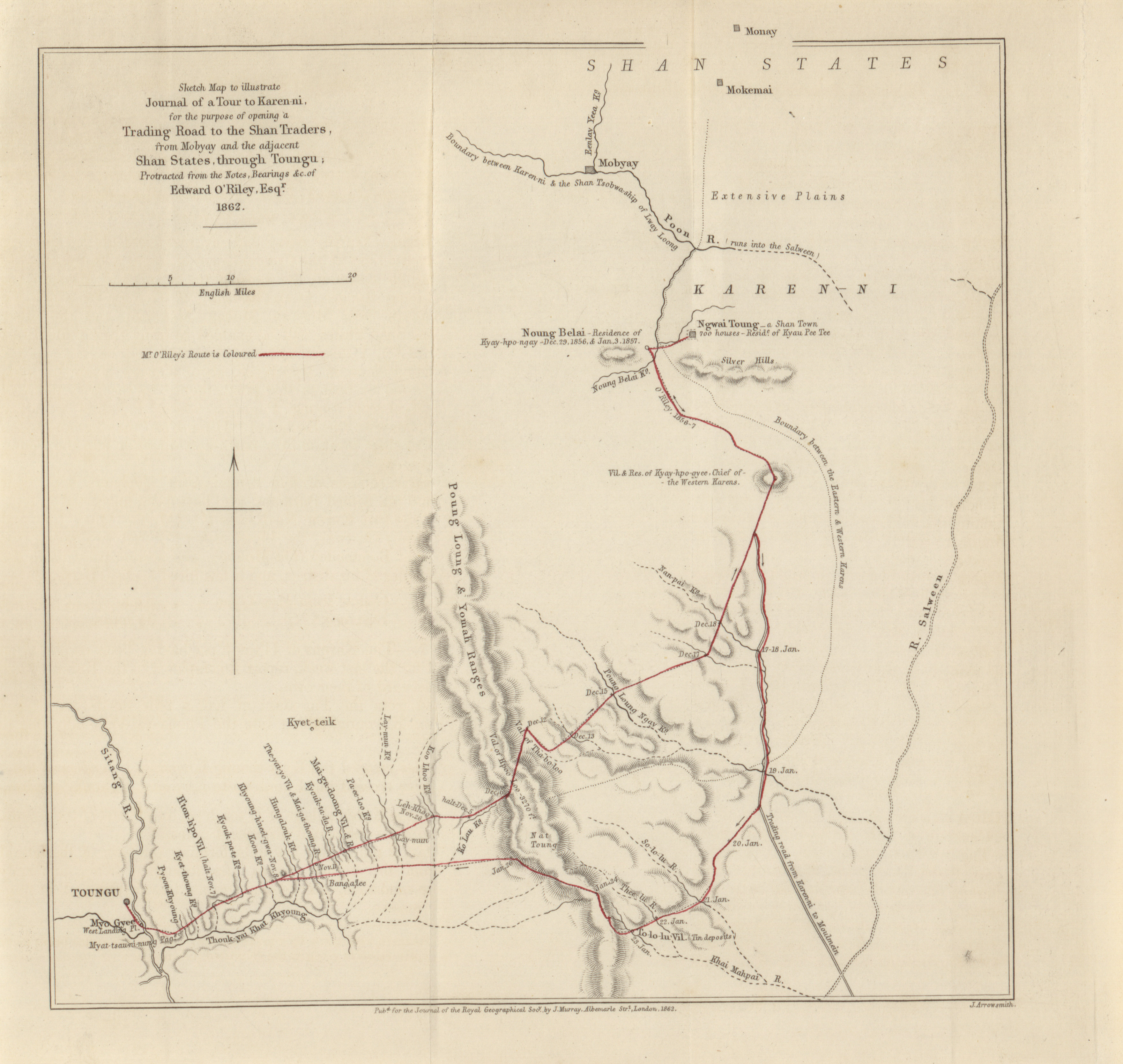
- Sketch map to illustrate journal of a tour to Karen-ni, for the purpose of opening a trading road to the Shan Traders, from Mobyay and the adjacent Shan States through Toungu, Edward O'Riley, 1862 (1.8MB)
Journal of a tour to Karen-ni, for the purpose of opening a trading road to the Shan Traders from Mobyay and the adjacent Shan States, through that territory, direct to Tungu. By Edward O'Riley, Esq., F.G.S. -
- Part of the N.W. coast of Borneo, to illustrate the paper of Spencer St. John, 1863 (2.3MB)
Observations on the North-West coast of Borneo. By Spencer St. John, Esq., F.R.G.S., H.B.M. Consul General for Borneo. -
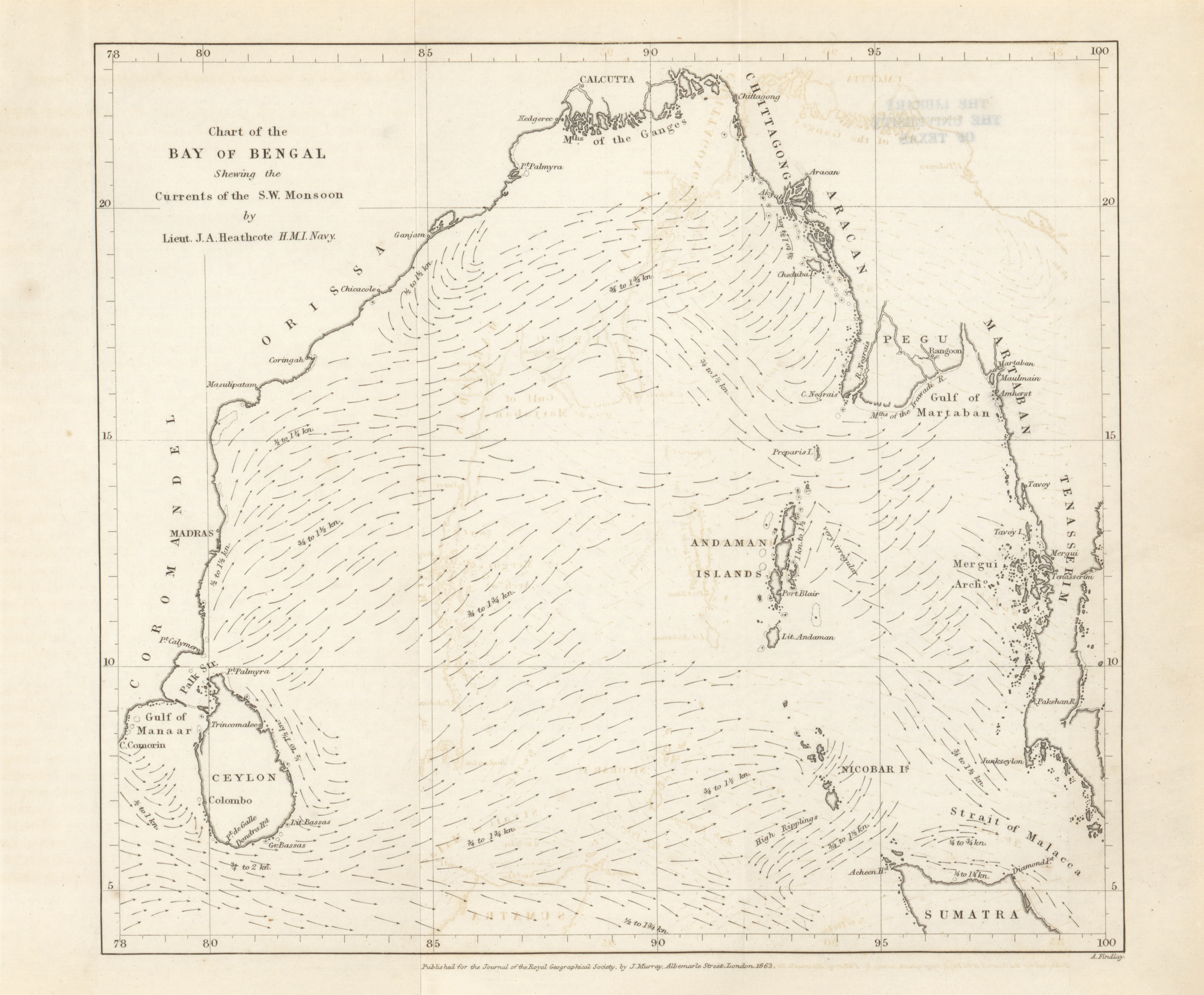
- Chart of the Bay of Bengal showing the currents of the S.W. Monsoon, Lieut. J.A. Heathcote, 1863 (2.2MB)
Surface currents of the Bay of Bengal during the South-West Monsoon. By J.A. Heathcote, Esq., L.N. -
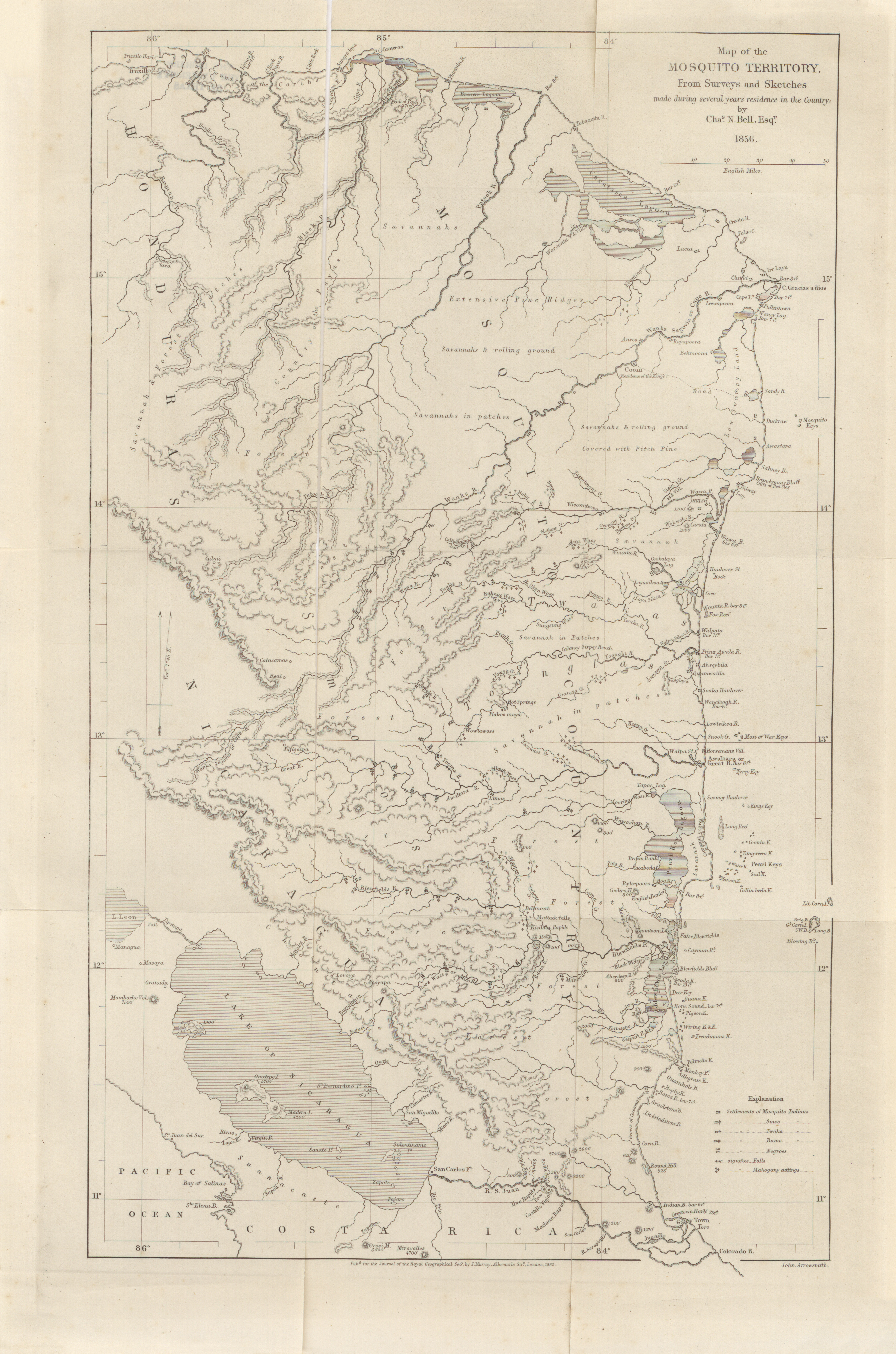
- Mosquito Territory, from surveys and sketches made during several years residence in the country, Chas. N. Bell, 1856 (6.1MB)
Remarks on the Mosquito Territory, its climate, people, productions, with a map. By Charles N. Bell. -
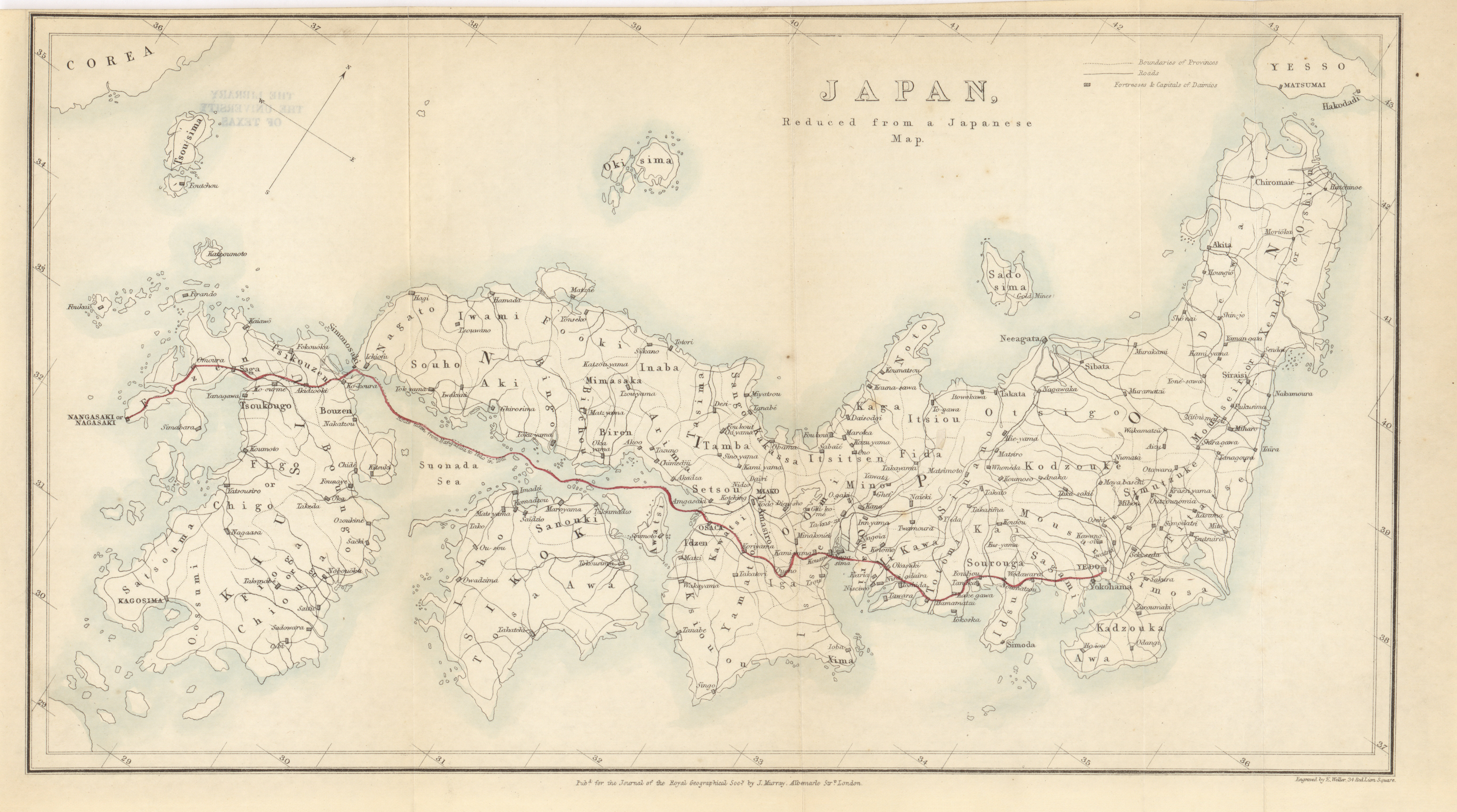
- Japan, reduced from a Japanese map, Sir Rutherford Alcock, 1861 (3.6MB)
Narrative of a journey through the interior of Japan, from Nagasaki to Yeddo, in 1861. By Sir Rutherford Alcock, K.C.B., F.R.G.S. -
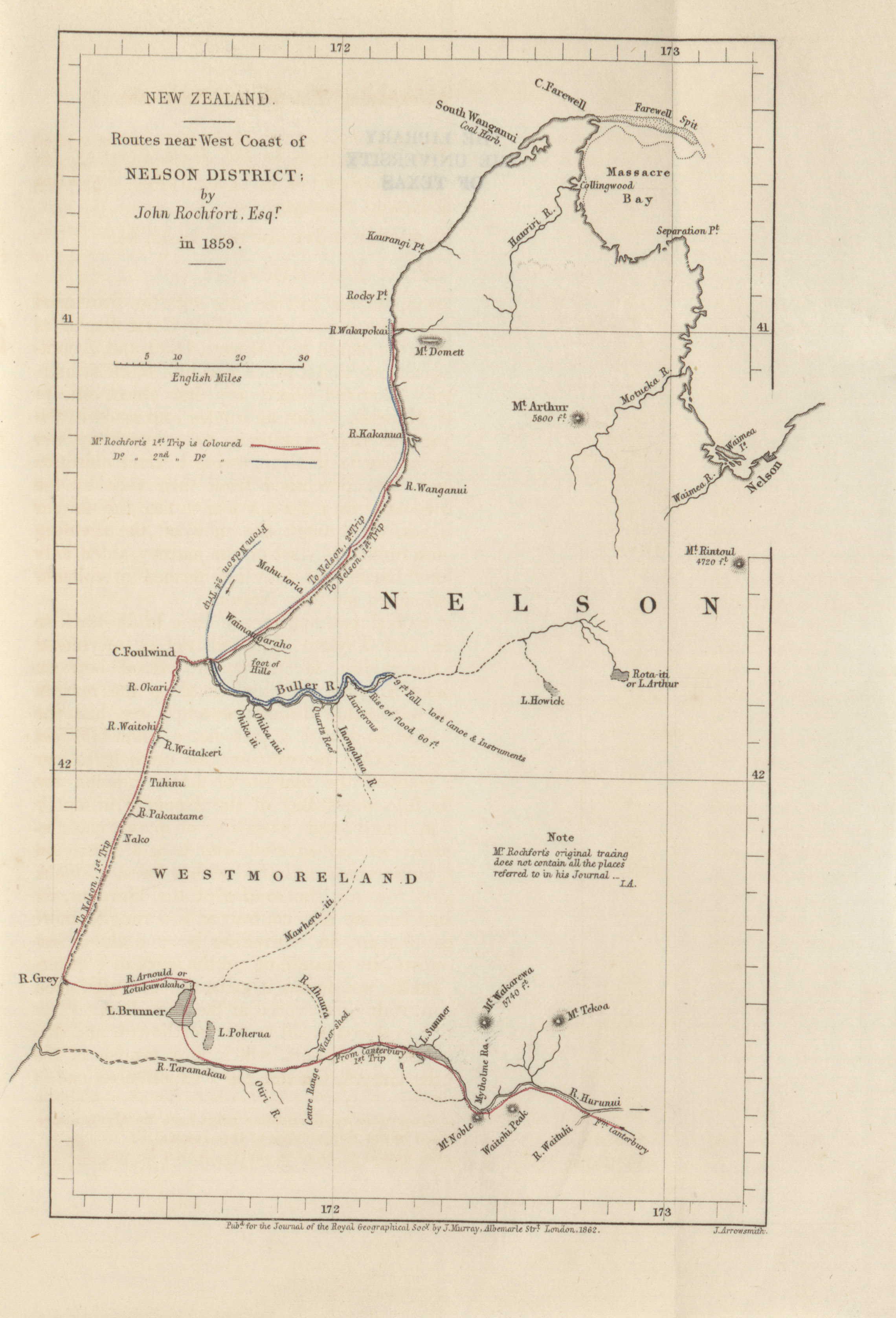
- New Zealand, routes near West coast of Nelson district, John Rochfort, 1859 (1.1MB)
Journal of two expeditions to the West Coast of the Middle Island of New Zealand in the year 1859. By John Rochfort, Esq., of Nelson, Surveyor. -
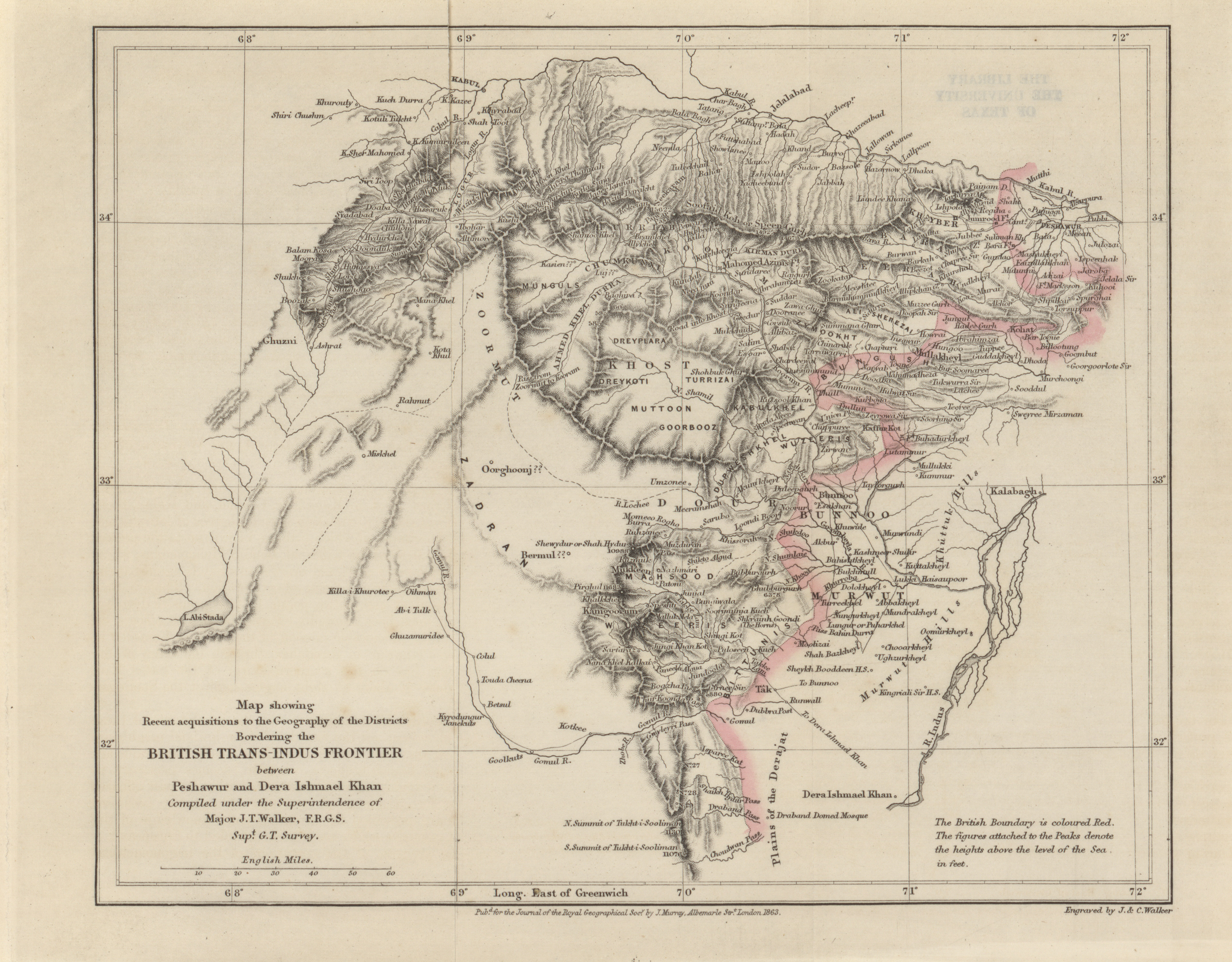
- Map showing recent acquisitions to the geography of the districts bordering the British Trans-Indus Frontier between Peshawur and Dera Ishmael Khan, Major J.T. Walker, 1863 (2.9MB)
On the Highland Region adjacent to the Trans-Indus Frontier of British India. By Major James Walker, of the Boumbay Engineers. -
- South Africa, map of Zulu, Amatonga, Natal, and Kafir Land, from the sketches of Messrs. Sanderson, Paxton, Rider, and Newling, John Sanderson, 1861 (1.9MB)
Notes to accompany sketch-maps of the Zulu and Amatonga countries, and of the country between Aliwal, North, and Natal. By John Sanderson, Esq. -
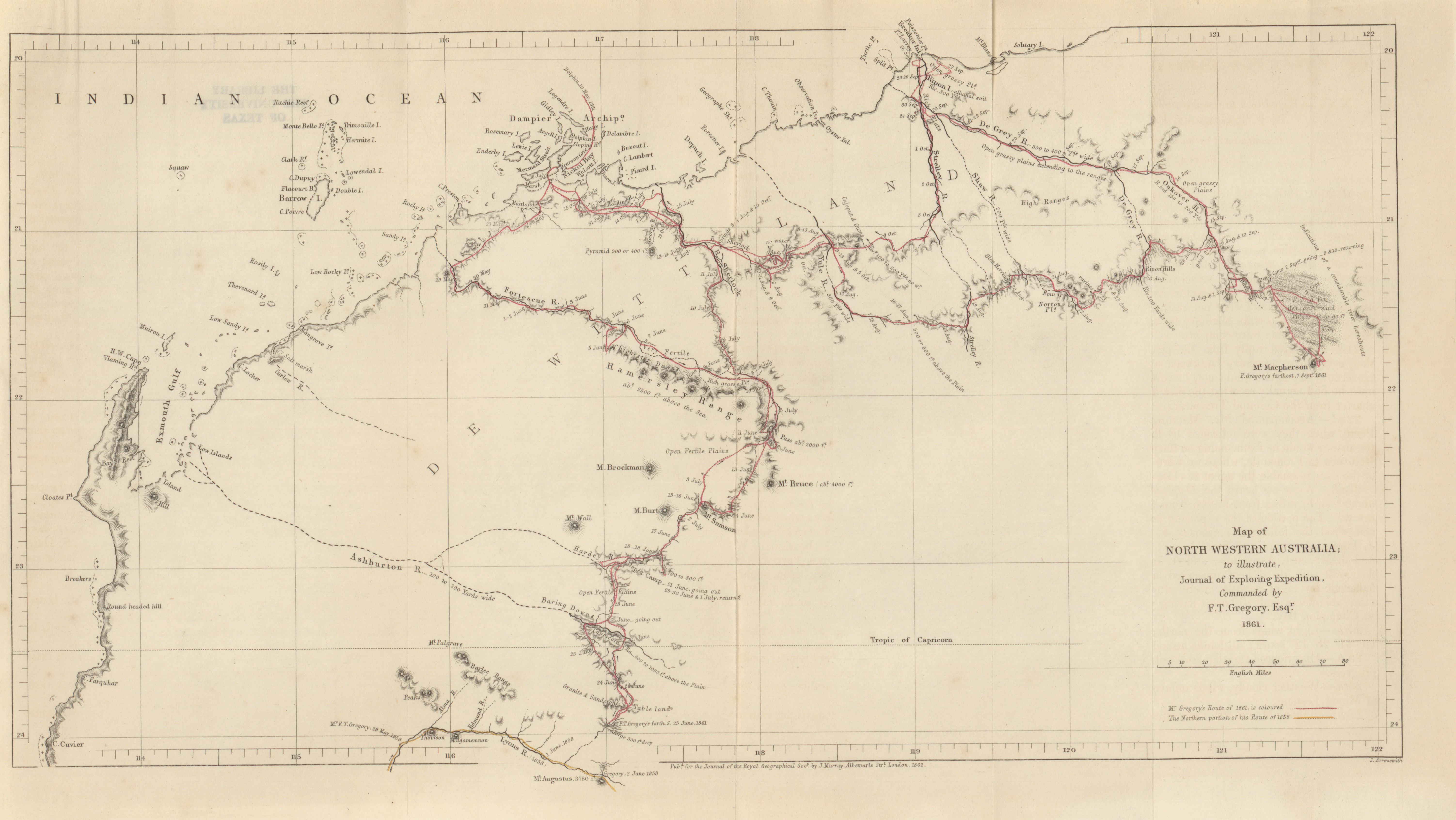
- North Western Australia, to illustrate journal of exploring expedition, F.T. Gregory, 1861 (3.0MB)
Expedition to the North-West coast of Australia. By F.T. Gregory, Esq., F.R.G.S. -
- Australia, map to accompany the diary of Messrs. Burke and Wills, aross Australia to the Gulf of Carpentaria; also Mr. Bowitt's Journal to Cooper Creek, W.I. Wills, 1861 (3.1MB)
Exploring expedition from Victoria to the Gulf of Carpentaria, under the command of Robert O'Hara Burke, Esq. -
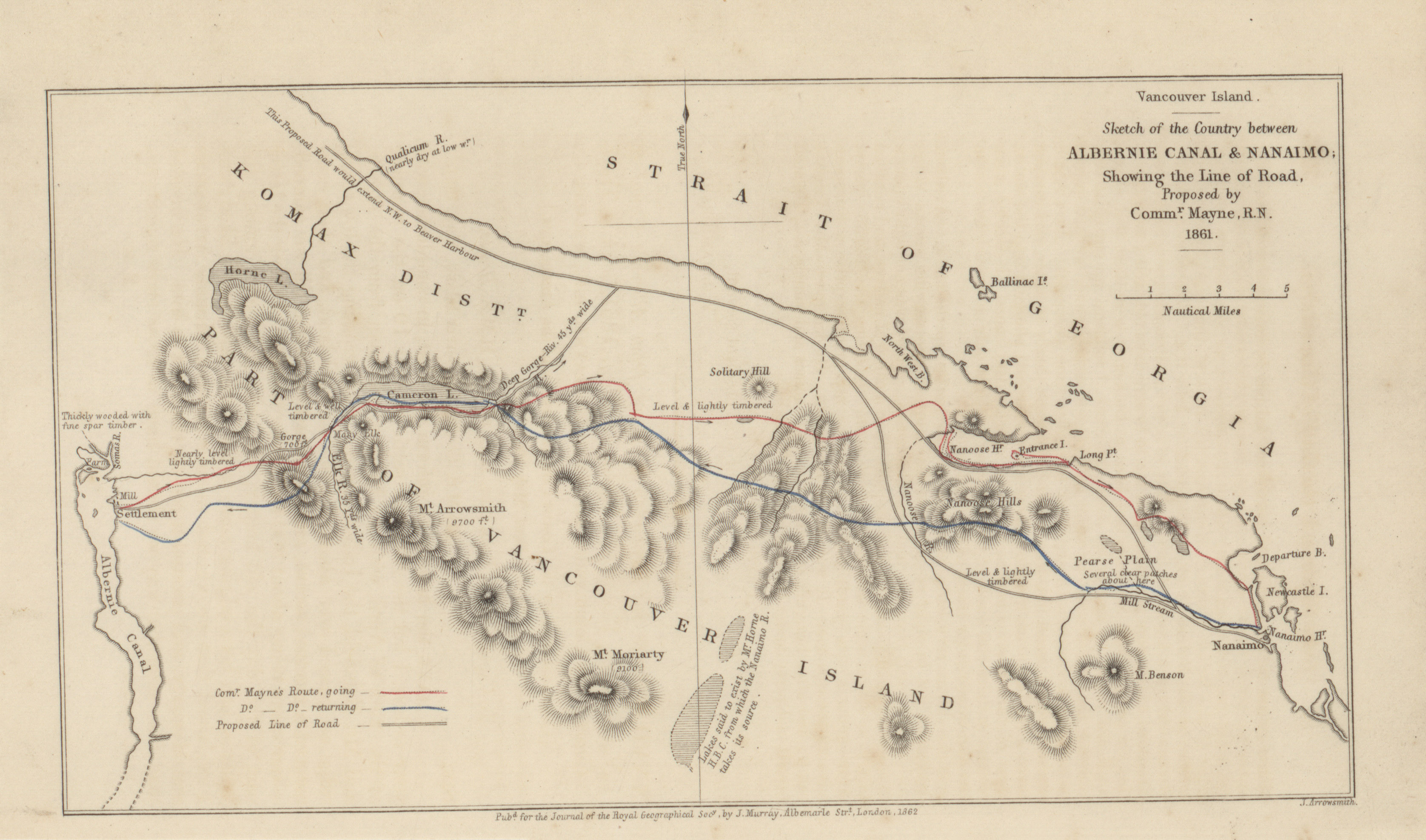
- Vancouver Island, sketch of the country between Albernie Canal and Nanaimo, showing the line of road, Commander Mayne, 1861 (1.2MB)
Route in exploring a road from Albernie Canal to Nanaimo, in Vancouver Island, in May 1861, with a track chart. By Commander Richard C. Mayne, R.N., F.R.G.S.
Volume 33, 1863
- Eastern Australia; on which are delineated, the routes of Messrs. Burke and Wills, McKinlay-Landsborough, and Walker, 1863 (7.2MB) Exploration of the lower course of the River Burdekin, in Queensland, and its identification with the River Wickham. By George Elphinstone Dalrymple, Esq., Commissioner of Crownlands in the Kennedy District of that colony. Preceded by an extract from a despatch to his Grace the Duke of Newcastle, H.M Secretary of State for the colonies, from his excellency Sir George F. Bowen, Governor of queensland, dated "Brisbane, 5th March, 1862".
-
- Map to illustrate the routes of Messrs. Michie and Grant, the former from Tien-tsin to Moukden in Manchuria, the latter from Peking across the desert of Gobi to Kiachta, 1863 (4.0MB)
Narrative of a journey from Tientsin to Moukden in Manchuria in July, 1861. By A. Michie, Esq., F.R.G.S. -
- Coast from Kurrachee to Gwadur, showing the route traversed by Major Goldsmid and Party, 1863 (4.5MB)
Diary of proceedings of the mission into Mekran from political and survey purposes, from the 12th to the 19th December, 1861. By Major F.J. Goldsmind, F.R.G.S. -
- Asiatic or Eastern Archipelago, map to illustrate a paper on the physical geography of the Malay Archipelago, Alfred Russell Wallace, 1863 (2.8MB)
On the physical geography of the Malay Archipelago. By Alfred Russell Wallace, Esq., F.R.G.S. -
- North Australia, map to complete diaries of explorations across Australia (from South to North), John McDouall Stuart, 1851-1862 (1.3MB)
Diary of Mr. John M'Douall Stuart's (Gold Medallist, R.G.S.) explorations from Adelaide across the continent of Australia, 1861-1862. -
- Routes of Eastern Africa between Zanzibar, the Great Lakes and the Nile, J.H. Speke, 1857-1863 (20.0MB)
Upper basin of the Nile, by inspection and information. By Captain J. H. Speke, F.R.G.S.
Volume 34, 1864
-
- Snowy Mountains, Kilima-ndjaro illustrating the paper of Baron C. von der Decken, 1864 (2.4MB)
Geographical notes of an expedition to Mount Kilima-ndjaro in 1862-1863. By the Baron Charles von der Decken, honorary corresponding member R.G.S. -
- Sketch map of the Island of Formosa to illustrate the paper by Mr. Robert Swinhoe (Vice-Consul), 1864 (1.3MB)
Notes on the Island of Formosa. By Robert Swinhoe, F.R.G.S., H.B.M. Vice-Consul at Formosa. -
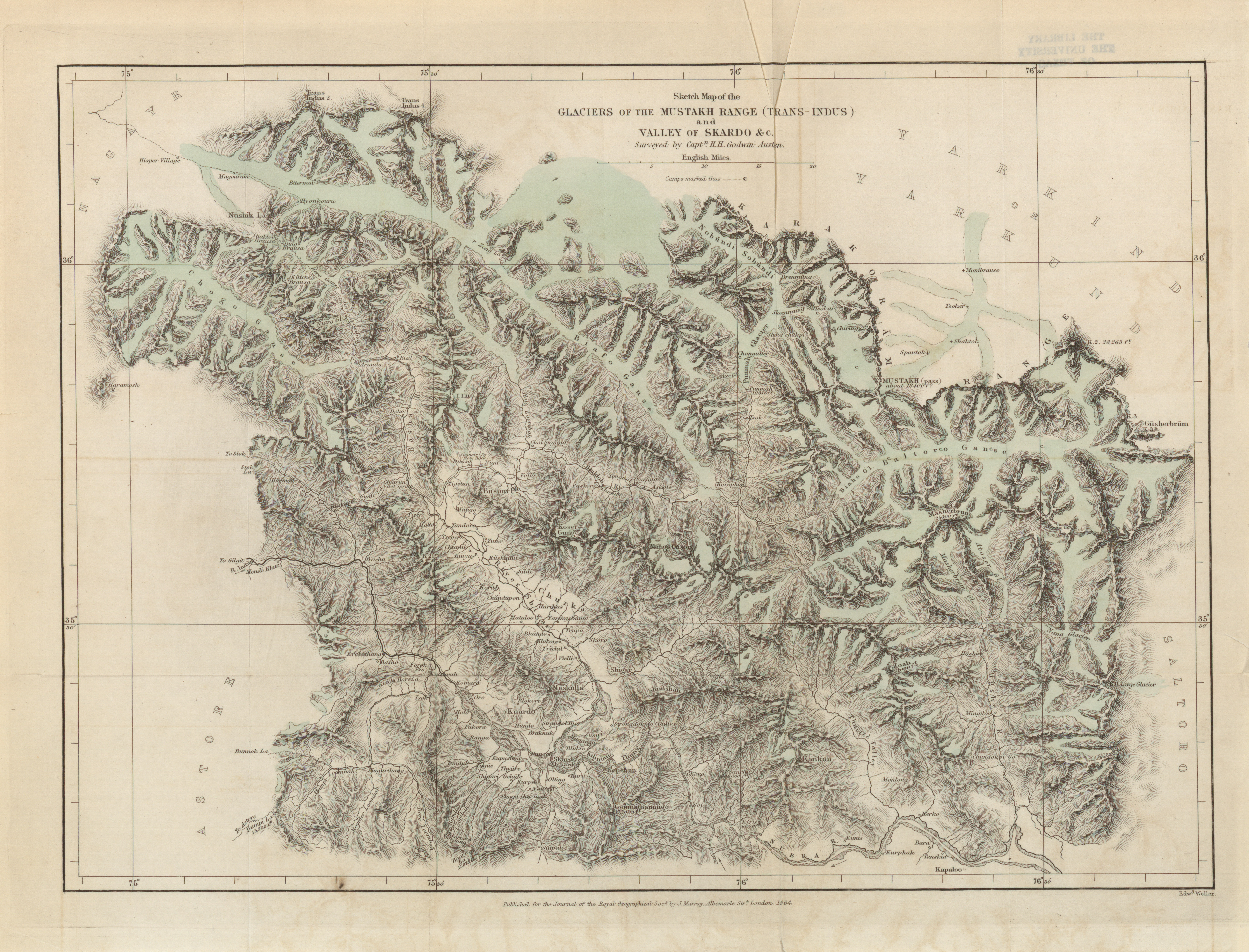
- Sketch map of the Glaciers of the Mustakh Range (Trans-Indus) and Valley of Skardo, Captain H.H. Godwin-Austen, 1864 (6.6MB)
On the Glaciers of the Mustakh Range. By Captain H.H. Godwin-Austen, F.R.G.S., Bengal S.C., late H.M. 24th Regt., assistant in the Great Trigonometrical Survey of India. -
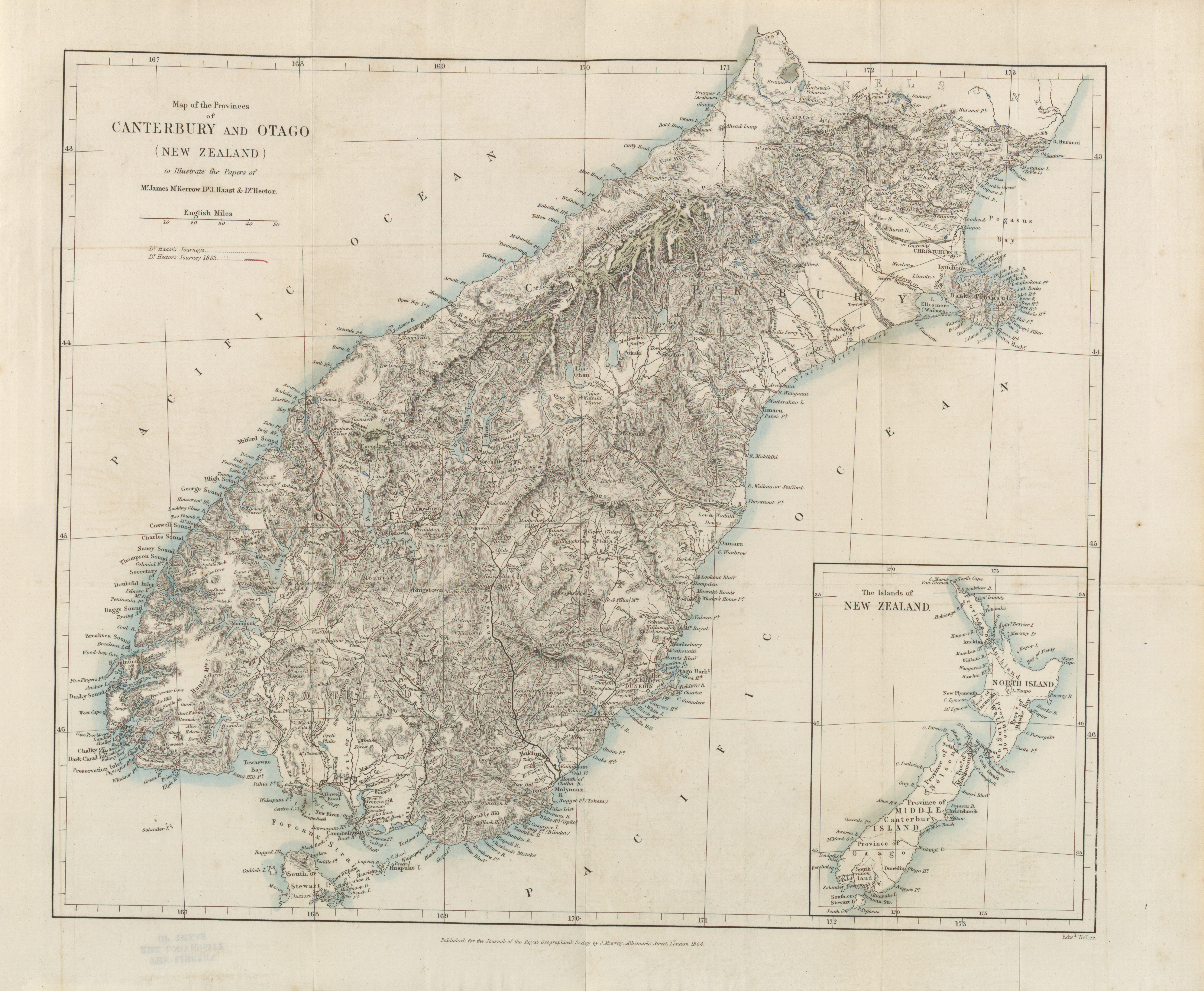
- Provinces of Canterbury and Otago (New Zealand) to illustrate the paper of Mr. James M'Kerrow, Dr. J. Haast and Dr. Hector, 1864 (7.4MB)
Reconnaissance survey of the Lake Districts of Otago and Southland, New Zealand. By James M'Kerrow, Esq. District surveyor to the province of Otago. -
- Labrador showing the canoe route from Seven Islands to Hamilton inlet, 1864 and River Moisie and adjoining country illustrating the paper by Professor H.Y. Hind, 1864 (2.5MB)
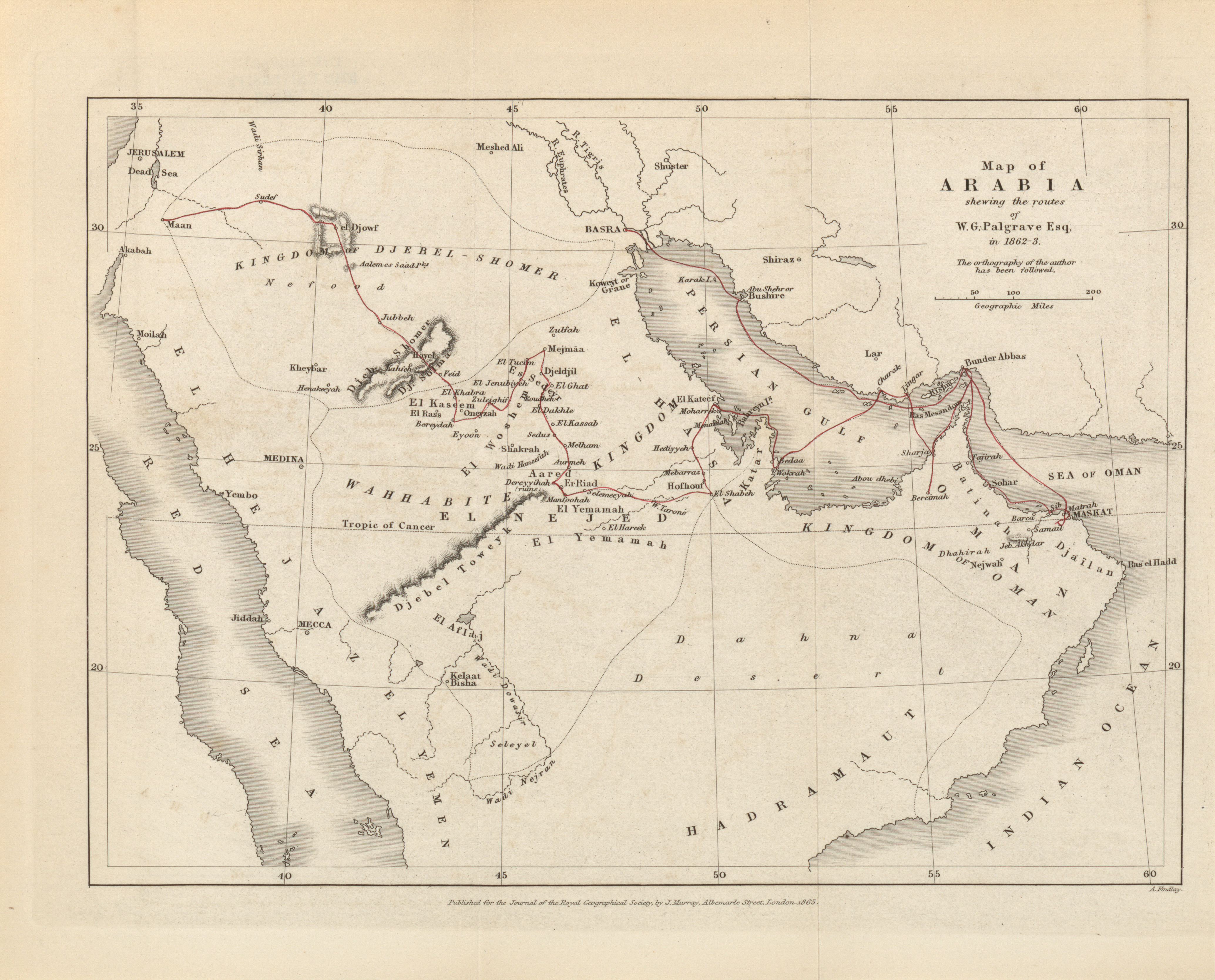
- Arabia showing the routes of W.G. Palgrave Esq., 1862-1863 (2.5MB) Observations made in Central, Eastern, and Southern Arabia during a journey through that country in 1862 and 1863. By W.G. Palgrave, Esq.
-
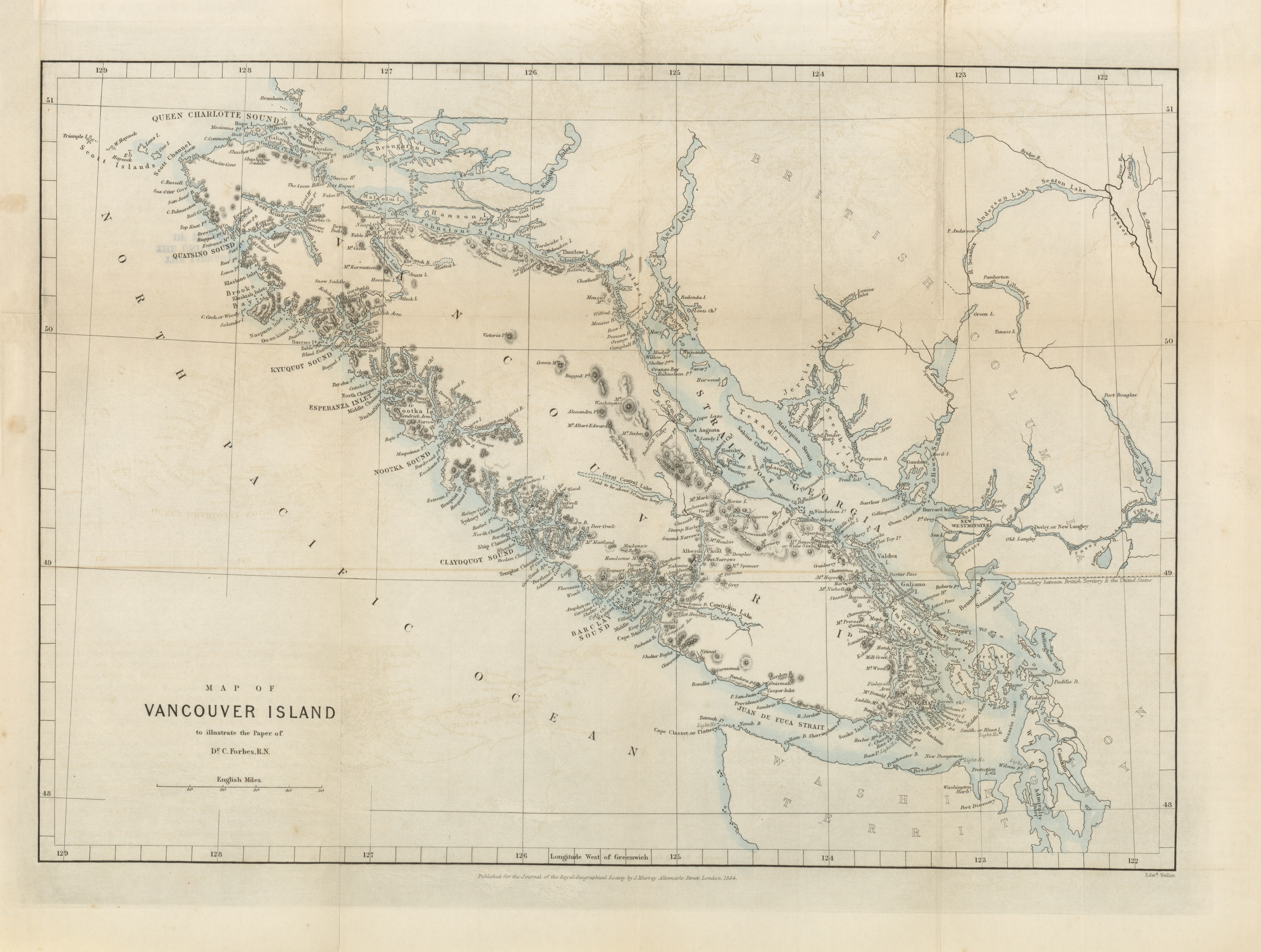
- Vancouver Island to illustrate the paper of Dr. C. Forbes, R.N., 1864 (5.8MB)
Notes on the physical geography of Vancouver Island. By C. Forbes, esq., M.D. -
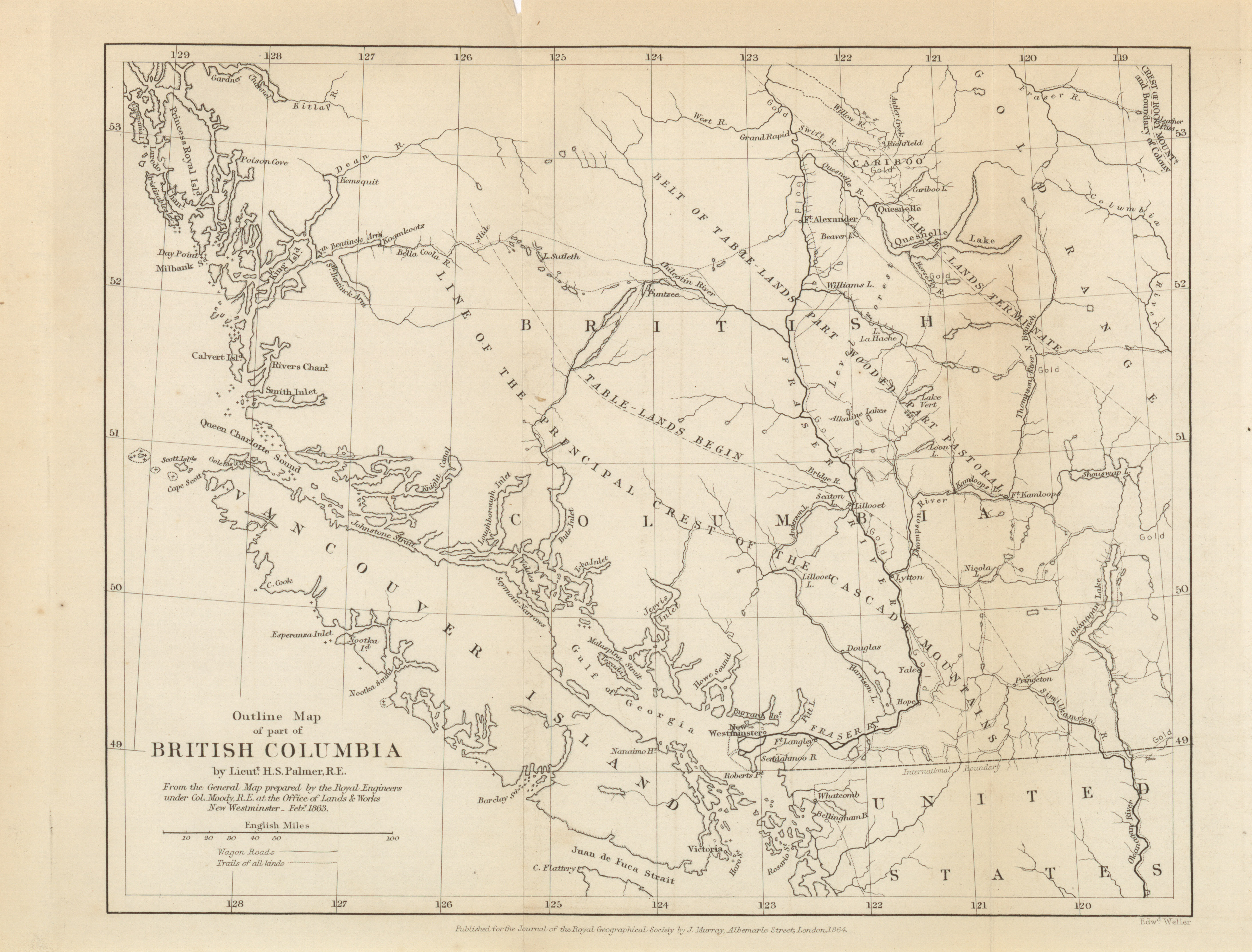
- Outline map as part of British Columbia by Lieut. H.S. Palmer, R.E., 1863 (2.7MB)
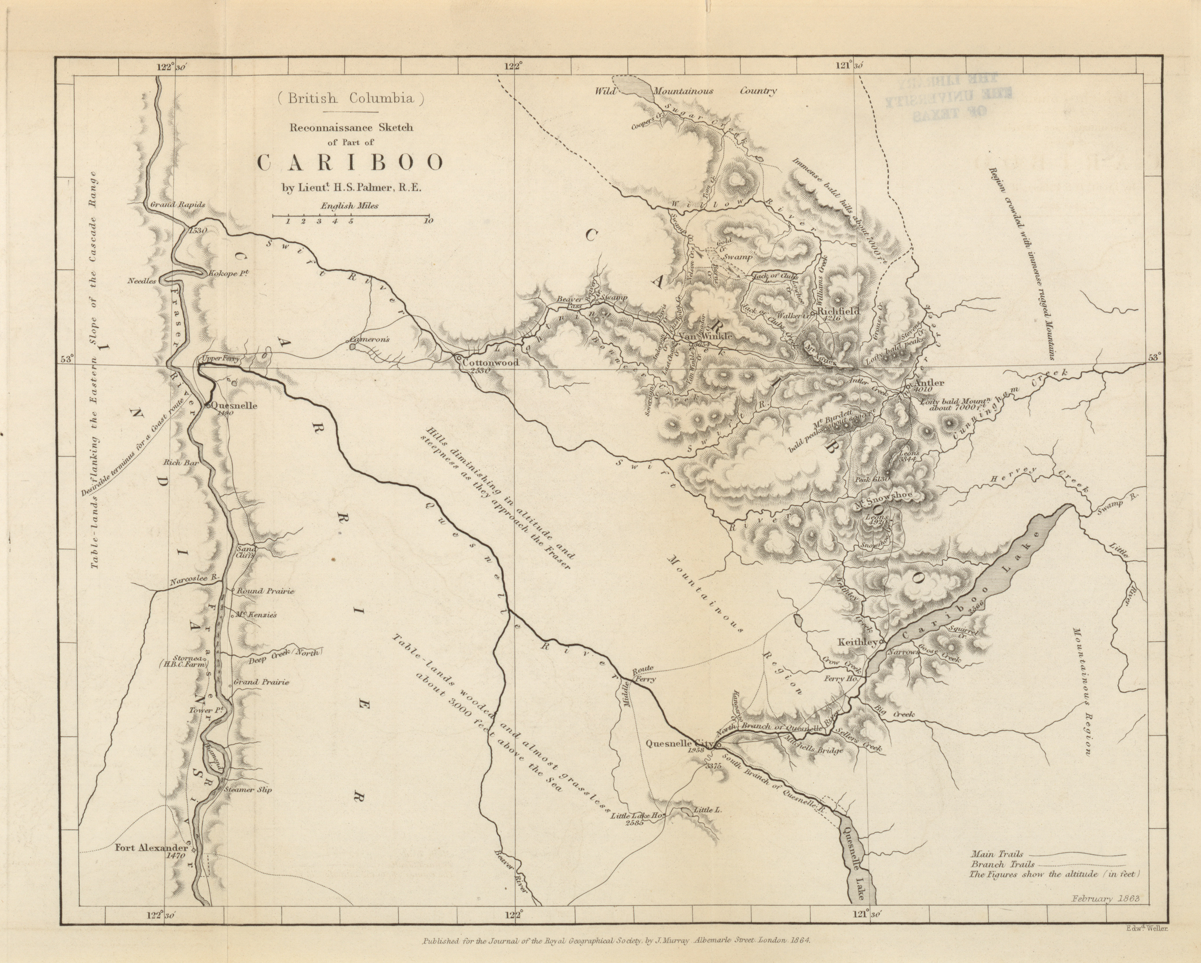
- British Columbia, Reconnaissanee Sketch of part of Cariboo, Lieut. H.S. Palmer, R.E., 1864 (2.6MB)
Remarks upon the geography and natural capabilities of British Columbia, and the condition of its principal Gold-Fields. By Lieutenant H.S. Palmer, R.E. -
- The Andes, map to illustrate extracts from the narrative of a route across the Southern Andes, Don Guillermo Cox; 1862-1863 (2.6MB)
Expedition across the Southern Andes of Chili, with the object of opening a new Line of Communication from the Pacific to the Atlantic Ocean, by the Lake of Nahuel-Huapi and the Rivers Limay and Negro. By Don Guillermo Cox, of Chili. (Translated from the Spanish and communicated by Sir Woodbine Parish, K.C.H., F.R.S.) -
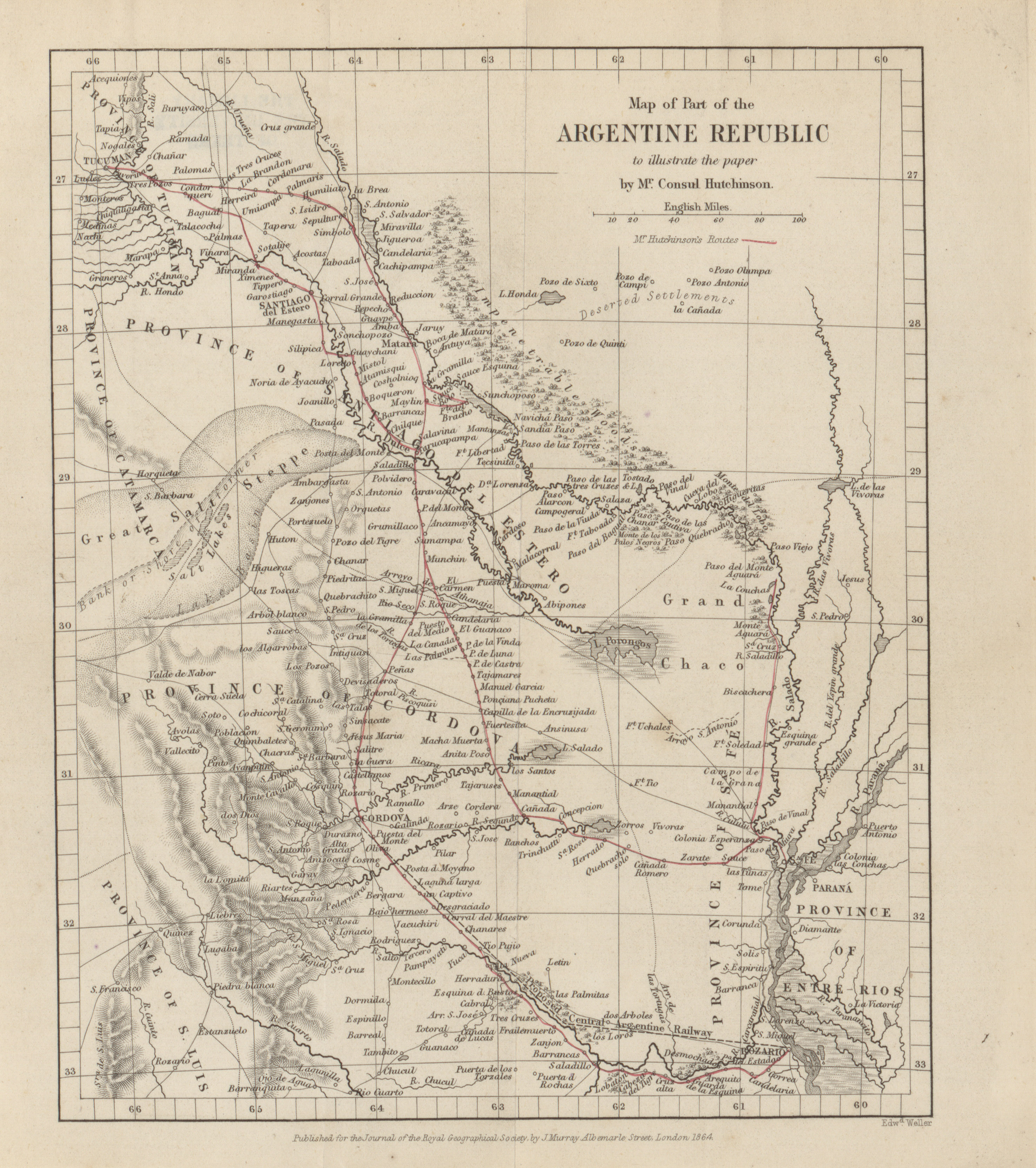
- Map of part of the Argentine Republic to illustrate the paper by Mr. Consul Hutchinson, 1864 (2.2MB)
Details of a journey through part of the Salado Valley, and across some of the Argentine provinces. By Thomas J. Hutchinson, F.R.G.S. -
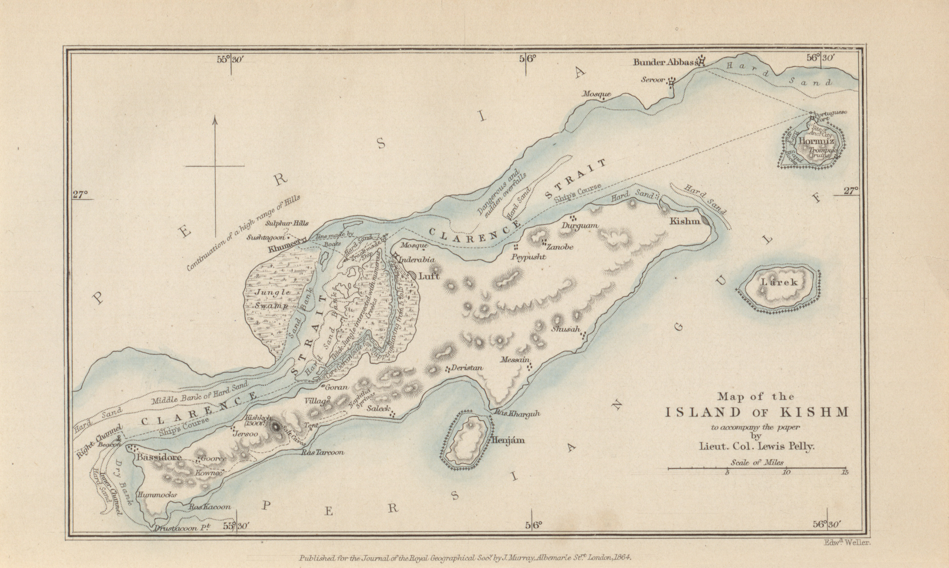
- Island of Kishm to accompany the paper by Lieut. Col. Lewis Pelly, 1864 (1.2MB)
Visit to Lingah, Kishm, and Bunder Abbas. By Lieut.-Col. Lewis Pelly, Acting Political Resident, Persian Gulf. (Communicated by the Secretary to the Government of Bombay) - Newfoundland to accompany the paper by the Rev. J. Moreton, 1864 (3.2MB) Some account of the physical geography of Newfoundland. By Julian Moreton, colonial Chaplain, Labuan.
Volume 35, 1865
-
- South Africa to illustrate the paper by James Fox Wilson and Dr. Livingston's theory of Ancient Lakes, 1865 (2.3MB)
Water supply in the basin of the River Orange, or 'Gariep, South Africa. By James Fox Wilson, Esq. -
- The Isthmus of Panama to illustrate the paper by Laurence Oliphant, 1865 and Mouths of the Bayanos River to accompany Mr. Oliphant's Paper, 1865 (3.6MB)
On the Bayanos River, Isthmus of Panama. By Laurence Oliphant, Esq., Secretary R.G.S. -
- Chart of the currents off the Cape of Good Hope, Captain Toynbee, 1865 (11.2MB)
On the specific gravity, temperature, and currents of the seas passed through during voyages from England to India. By Henry Toynbee. F.R.A.S., and F.R.G.S., Master Mariner. -
- Map of part of Arabia showing the route of Lieut. Col. Pelly, 1865 (2.1MB)
A visit to the Wahabee Capital, Central Arabia. By Lieut.-Colonel Lewis Pelly, H.M. Political Resident, Persian Gulf.
Volume 36, 1866
-
- A Map of the Albert N'Yanza and of the routes leading to its discovery, Samuel White Baker, 1866 (8.4MB)
Account of the discovery of the second Great Lake of the Nile, Albert Nyanza. By Samuel White Baker. -
- Map illustrating M. Du Chaillu's Routes in Equatorial Africa, 1864-1865 (6.1MB)
Second journey into Equatorial Western Africa. By M.P.B. Du Chaillu. -
- River Purus, from near its source to its mouth, W. Chandless, 1866 (13.1MB)
Ascent of the River Purus. By W. Chandless, Esq., MA., Gold Medallist R.G.S. -
- River Aquiry, 1866 (4.3MB)
Notes on the River Aquiry, the principal affluent of the River Purus. By W. Chandless, Esq., M.A., Gold Medallist R.G.S. -
- Summer route from Leh (Ladak) to the city of Yarkund, Captain T.G. Montgomerie, 1866 (1.6MB)
On the geographical position of Yarkund, and some other places in Central Asia. By Captain T.G. Montgomerie, R.E., Astronomical Assistant Great Trigonometrical Survey of India. -
- Map showing the leveling from the Mediterranean to the Dead Sea, Captain Wilson, 1866 (10.6MB)
An account of the levelling from the Mediterranean to the Dead Sea, by Captain C. W. Wilson, R.E., and a party of Royal Engineers from the Ordnance Survey. By Colonel Sir Henry James, R.E., F.R.S. -
- Map of the principal part of Damara Land, based on Prismatic Compass Triangulation checked by observed latitudes, C.J. Andersson, 1866 (5.6MB)
Notes to accompany Mr. C.J. Andersson's map of Damara Land. Thomas Baines, Esq.
Volume 37, 1867
-
- The East African Lakes showing their relation to the source of the Nile, Alex Findlay, 1868 (5.7MB)
On Dr. Livingston's last journey, and the probable ultimate sources of the Nile. By Alex. Geo. Findlay, F.R.G.S. -
- Map of the Province of Canterbury (New Zealand) showing the five routes between the East and West Coast with sections of the routes to accompany the paper by Dr. J. Haast, 1867 (7.1MB)
Altitude sections of the principal routes between the East and West coasts of the province of Canterbury, New Zealand, across the Southern Alps. By Julius Haast, PH. D., F.G.S., F.L.S..
Volume 38, 1868
-
- Map showing the line of March from the coast to Adigerat, 1868 (5.0MB)
- Line of march from Adigerat to the River Takkazye, 1868 (5.0MB)
- Wadela and Dalanta Plateaux and Magdala,1868 (1.8MB)
Geographical results of the Abyssinian expedition. By C.R. Markham, Esq., Secretary, Royal Geographical Society. -
- Yukon or Kwich-Pak River, 1868, Frederick Whymper, 1868 (6.1MB)
A journey from Norton Sound, Behring Sea, to Fort Youkon (Junction of Porcupine and Youkon Rivers). By Frederick Whymper, Esq. -
- Chart of the North-East coast of Labrador, 1868 (4.3MB)
A visit to the North-East coast of Labrador, during the Autumn of 1867, by H.M.S. Gannet, Commander W. Chimmo, R.N. -
- Map illustrating a tour in Armenia, Kurdistan, and Upper Mesopotamia, J.G. Taylor, 1868 (6.1MB)
Journal of a tour in Armenia, Kurdistan, and Upper Mesopotamia, with notes on researches in the Deyrsim Dagh, in 1866. By J.G. Taylor, H.M. Consul for Kurdistan. -
- Map illustrating the climate and physical geography of North East Australia, Dr. Alexander Rattray, 1868 (3.2MB)
Notes on the physical geography, climate, and capabilities of Somerset and the Cape York Peninsula, Australia. By Dr. Alexander Rattray, M.D. (Edin.), R.N.
Volume 39, 1869
-
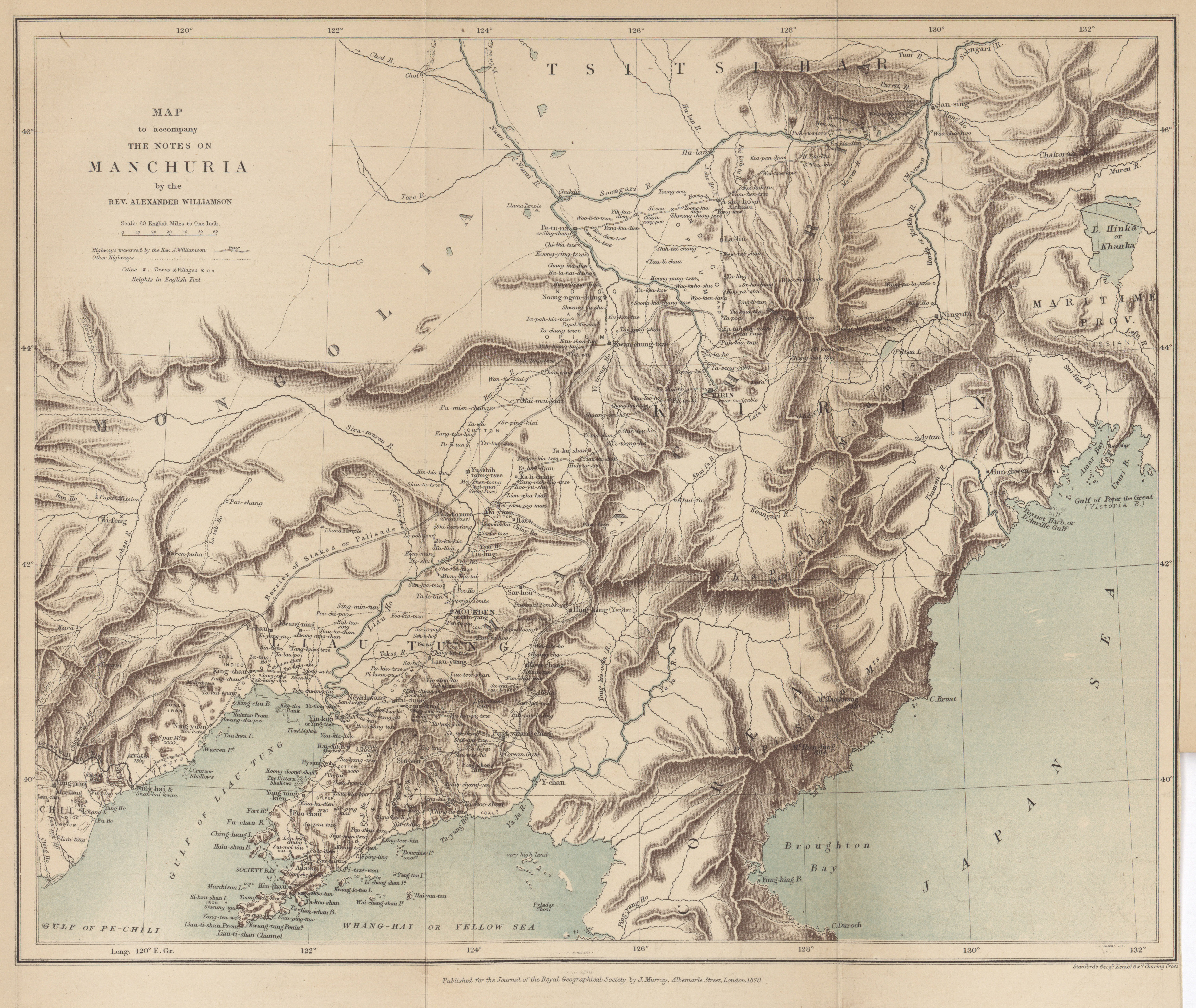
- Map to accompany the notes on Manchuria, Alexander Williamson, 1869 (5.4MB)
Notes on Manchuria. By the Rev. Alexander Williamson, B.A. -
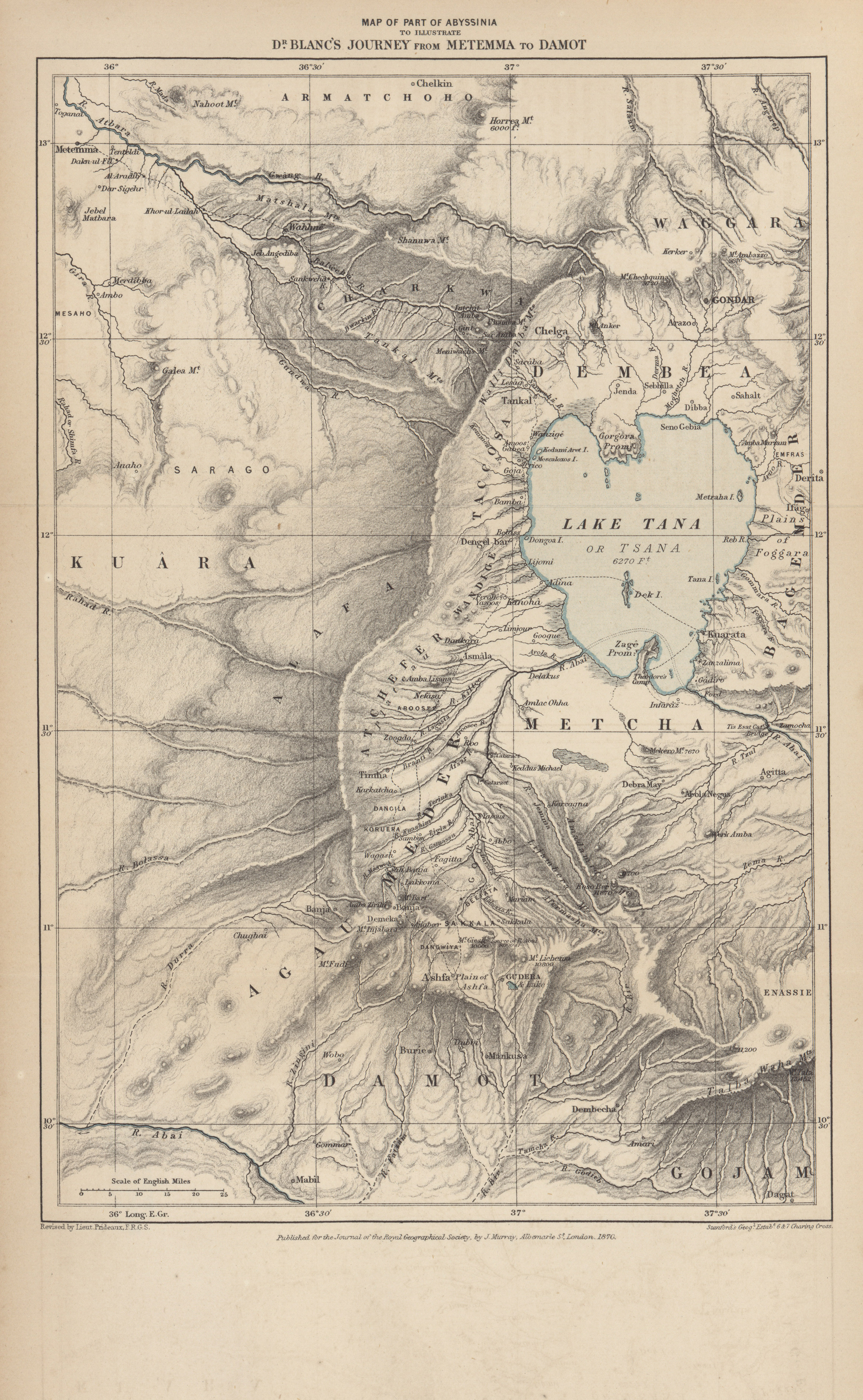
- Part of Abyssinia to illustrate Dr. Blanc's journey from Metemma to Damot, 1870 (4.4MB)
From Metemma to Damot, along the Western Shores of the Tana Sea. By Henry Blanc, M.D., M.R.C.S.E., Staff Assistant Surgeon, H.M. Bombay Medical Staff, lately on special duty in Abyssinia. -
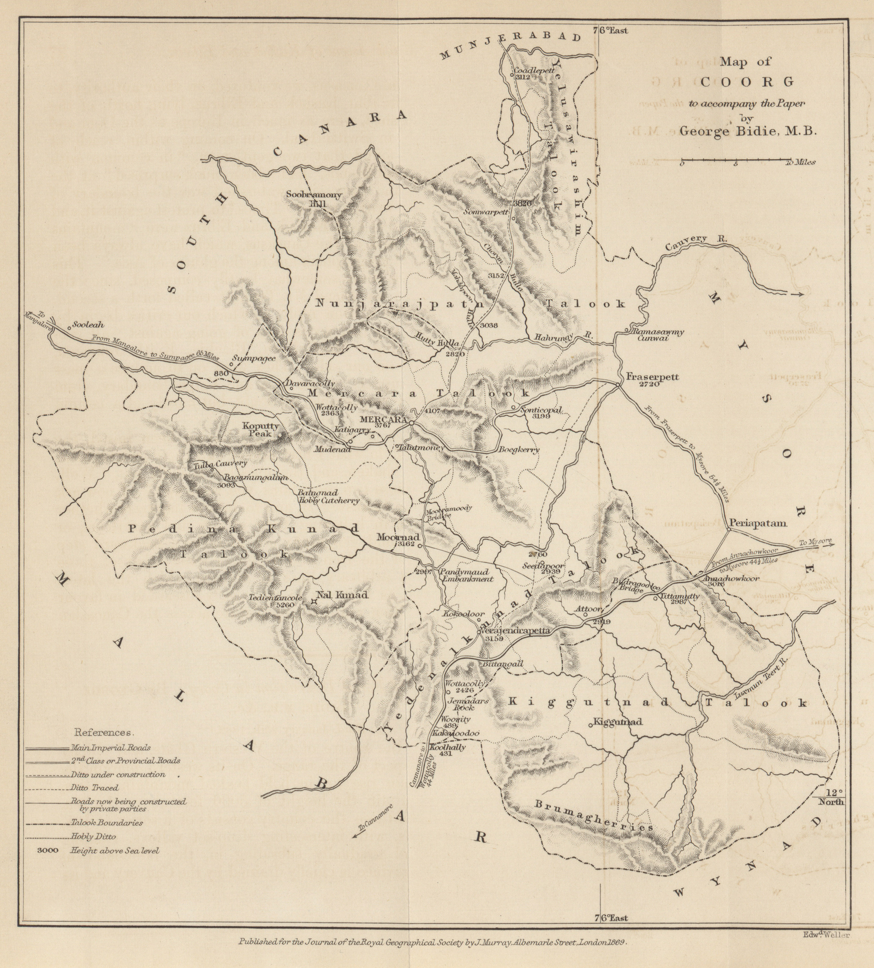
- Coorg to accompany the paper by George Bidie, 1869 (1.8MB)
Effects of forest destruction in Coorg. By George Bidie, M.B. -
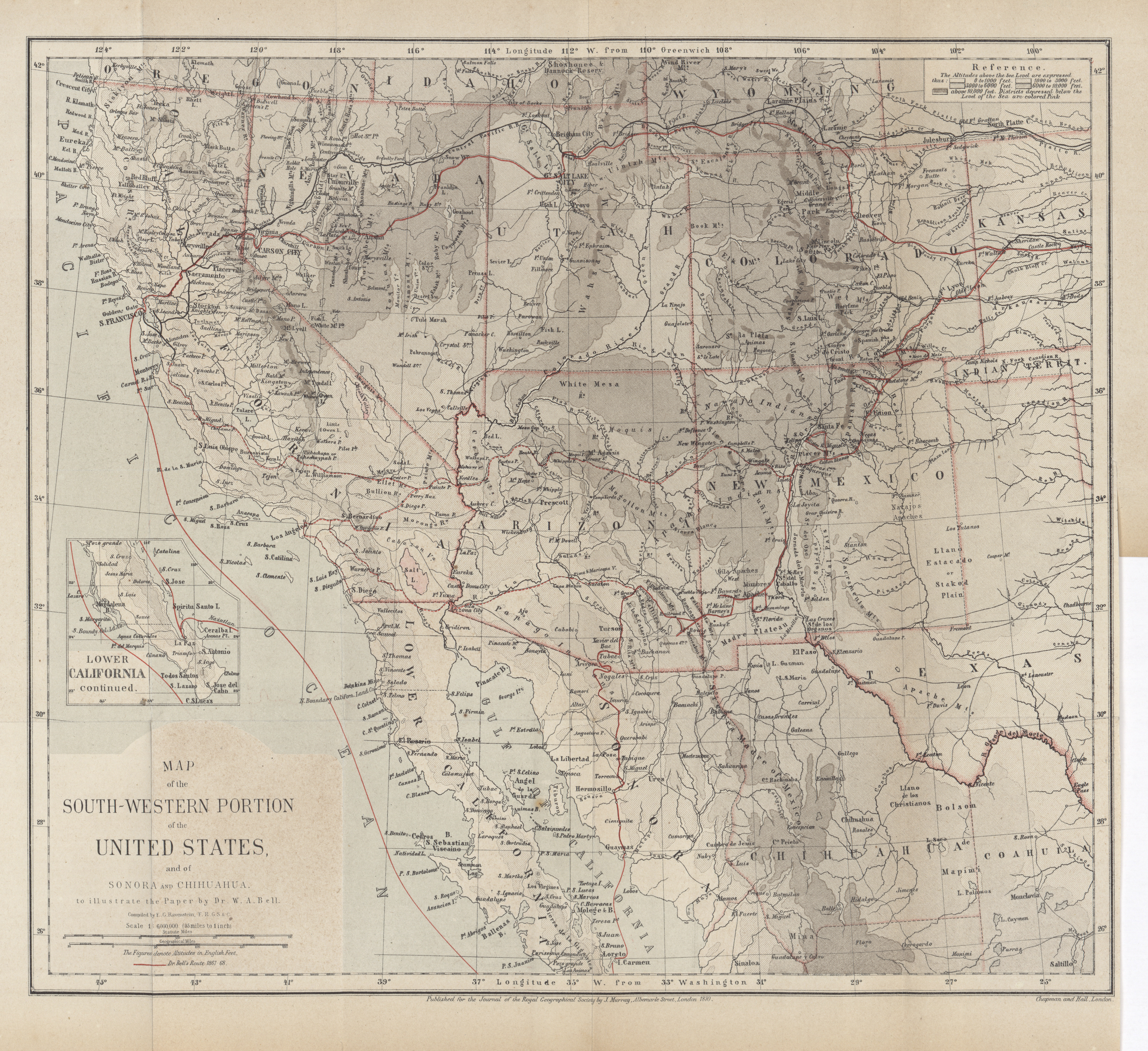
- South-Western portion of the United States and of Sonora and Chihuahua, Dr. W.A. Bell, 1869 (10.4MB)
On the basin of the Colorado and the Great Basin of North america. By W.A. Bell, M.A., M.B. -
- Afar Country, W. Munzinger, 1869 (3.9MB)
Narrative of a journey through the Afar country. By W. Munzinger, Esq. Hon. corresponding member R.G.S. -
- Epirus, Major R. Stuart, 1869 (6.0MB)
On the physical geography and natural resources of Epirus. By Major R. Stuart, H.M. Consul at Yaniua. -
- River Jurua, for an estimated distance of 980 geographical miles from its mouth, W. Chandless, 1869 (11.2MB)
Notes on a journey up the River Jurua. By W. Chandless, Gold Medallist R.G.S. -
- The Peninsula of Mount Sinai, a sketch from observations on the ground, Rev. F. W. Holland, 1868 (10.9MB)
Notes on the map of the Peninsula of Sinai. By Rev. W. Holland.
Volume 40, 1870
-
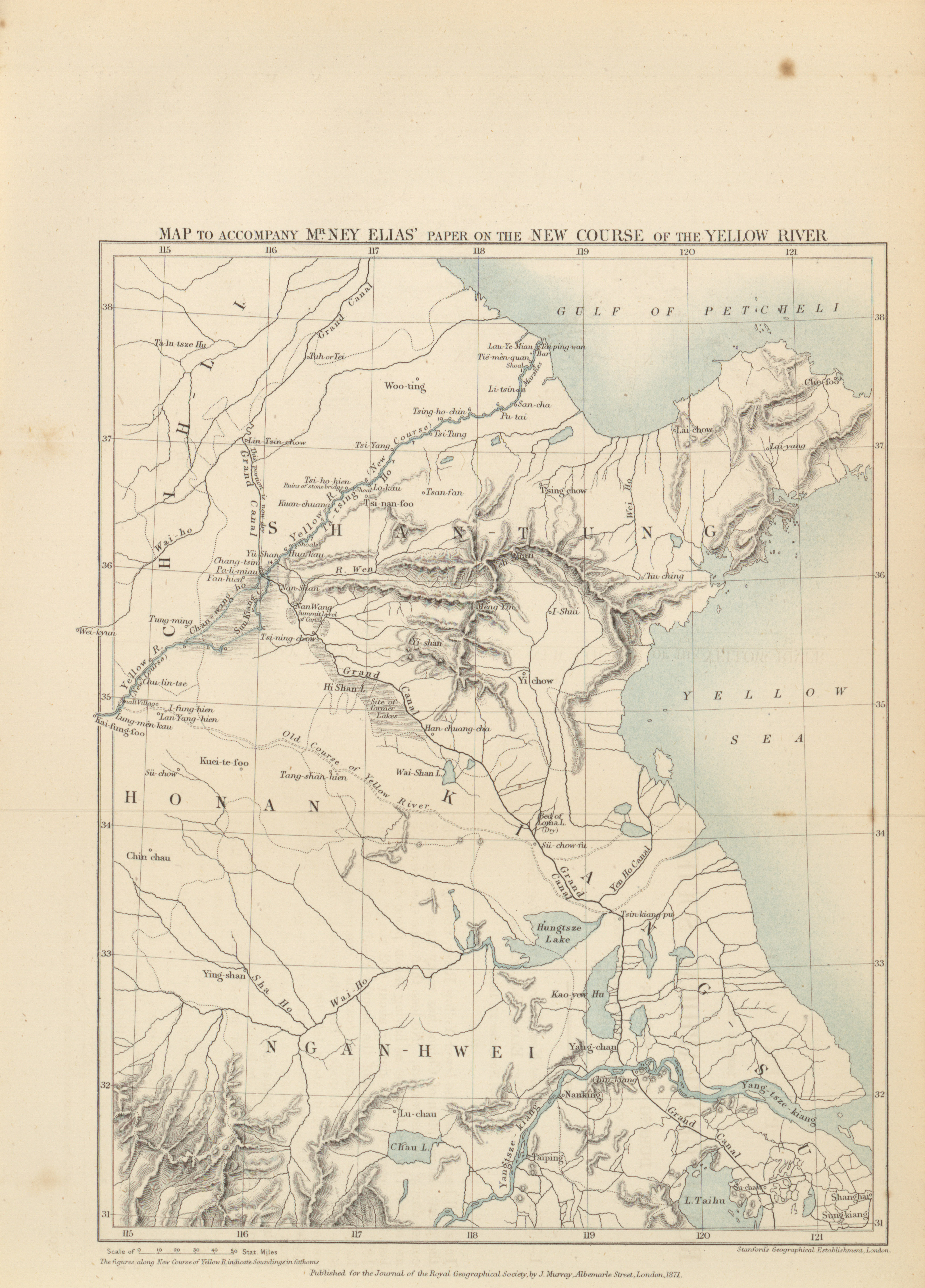
- Map to accompany Mr. Ney Elias' paper on the new course of the Yellow River, 1870 (1.9MB)
Notes of a journey to the new course of the Yellow River, in 1868. By Ney Elias, Esq., F.R.G.S. -
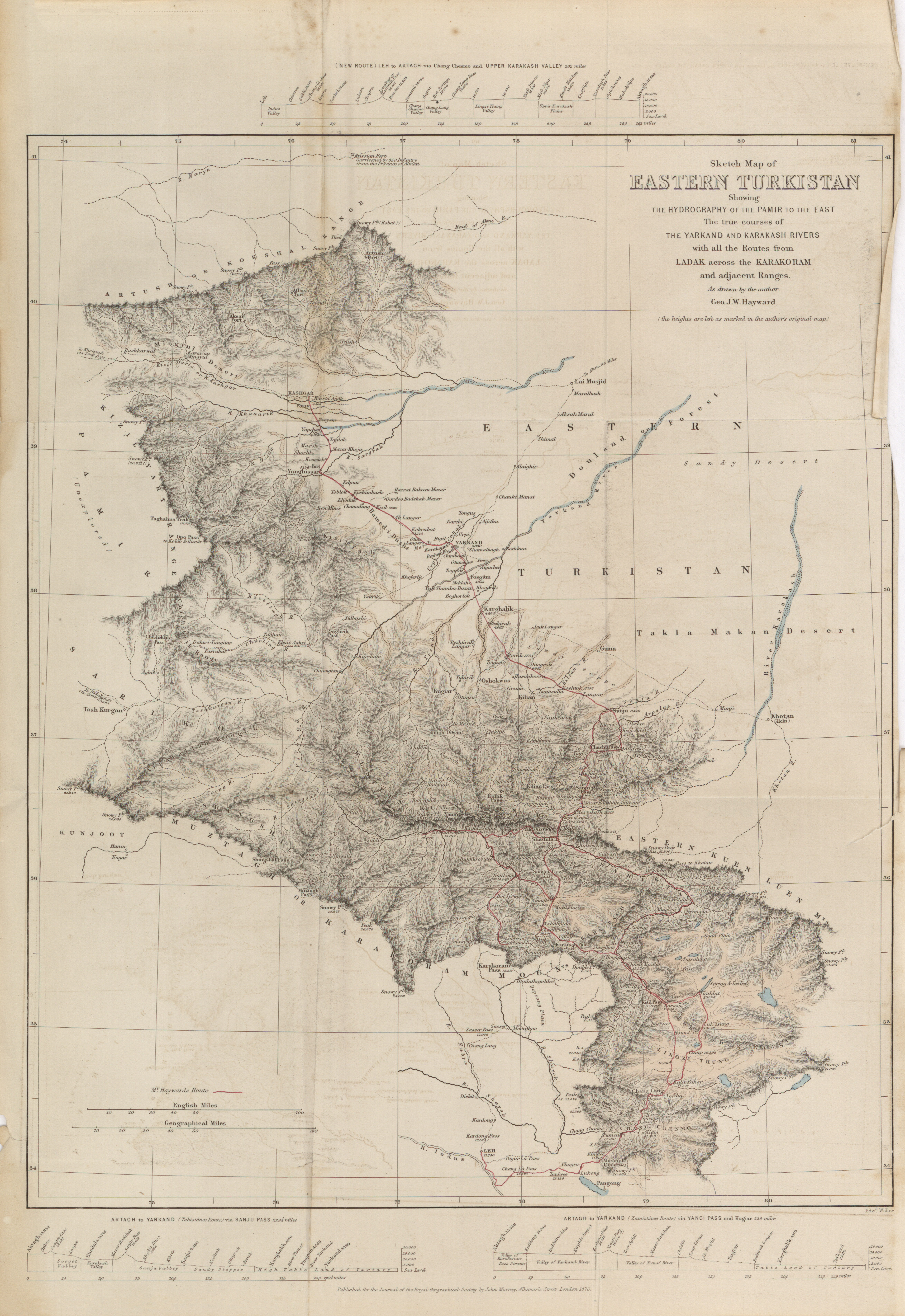
- Sketch map of Eastern Turkistan showing the hydrography of the Pamir to the East; the true courses of the Yarkand and Karakash rivers with all the routes from Ladak across the Karakoram and adjacent ranges, Geo. J.W. Hayward, 1870 (8.2MB)
Journey from Leh to Yarkand and Kashgar, and exploration of the sources of the Yarkand River. By G.W. Hayward. -
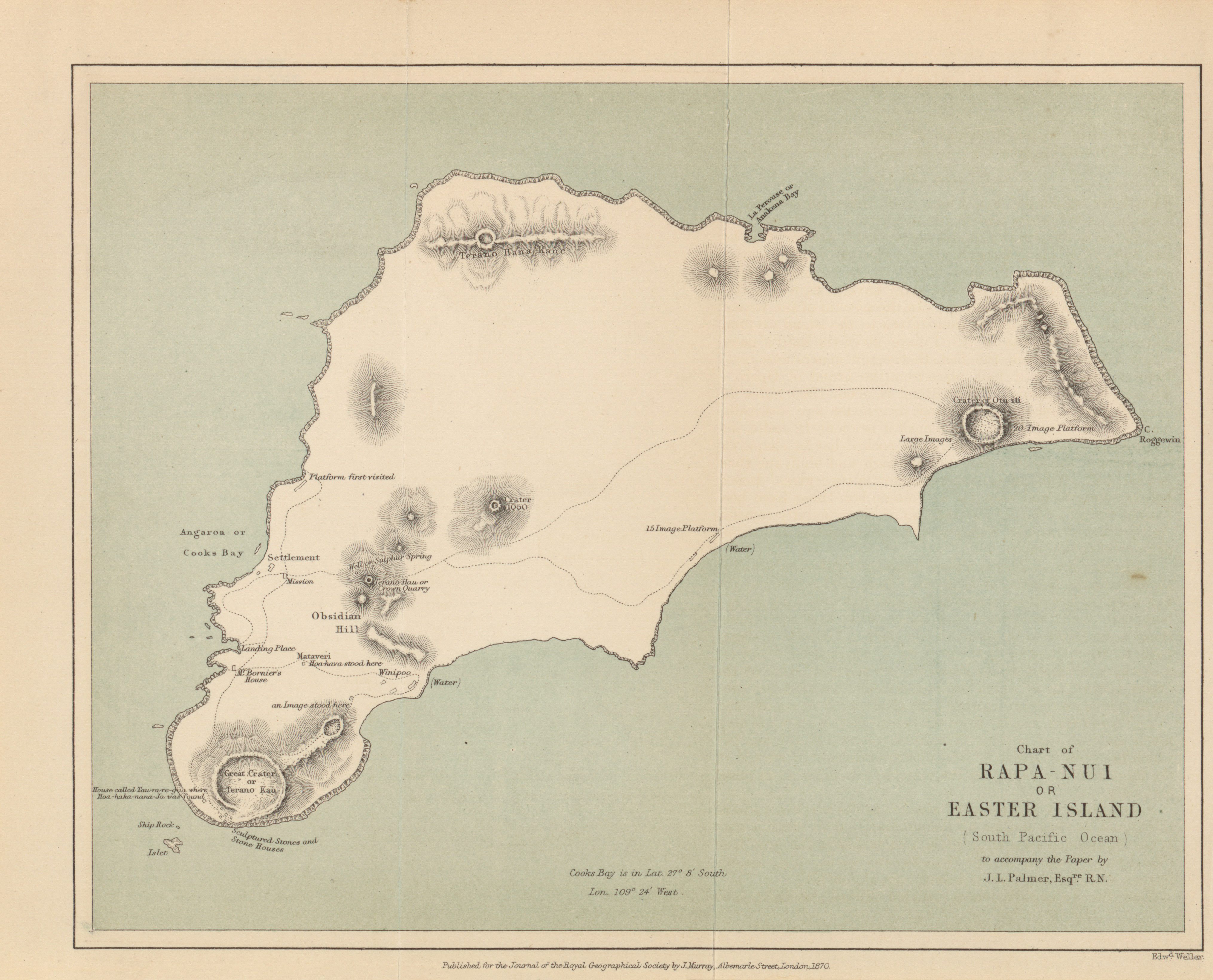
- Chart of Rapa-Nui or Easter Island (South Pacific Ocean) to accompany the paper by J.L. Palmer, 1870 (2.1MB)
A visit to Easter Island, or Rapa Nui, in 1868. By J. Linton Palmer, F.R.C.S., Surgeon of H.M.S. Topaze. -
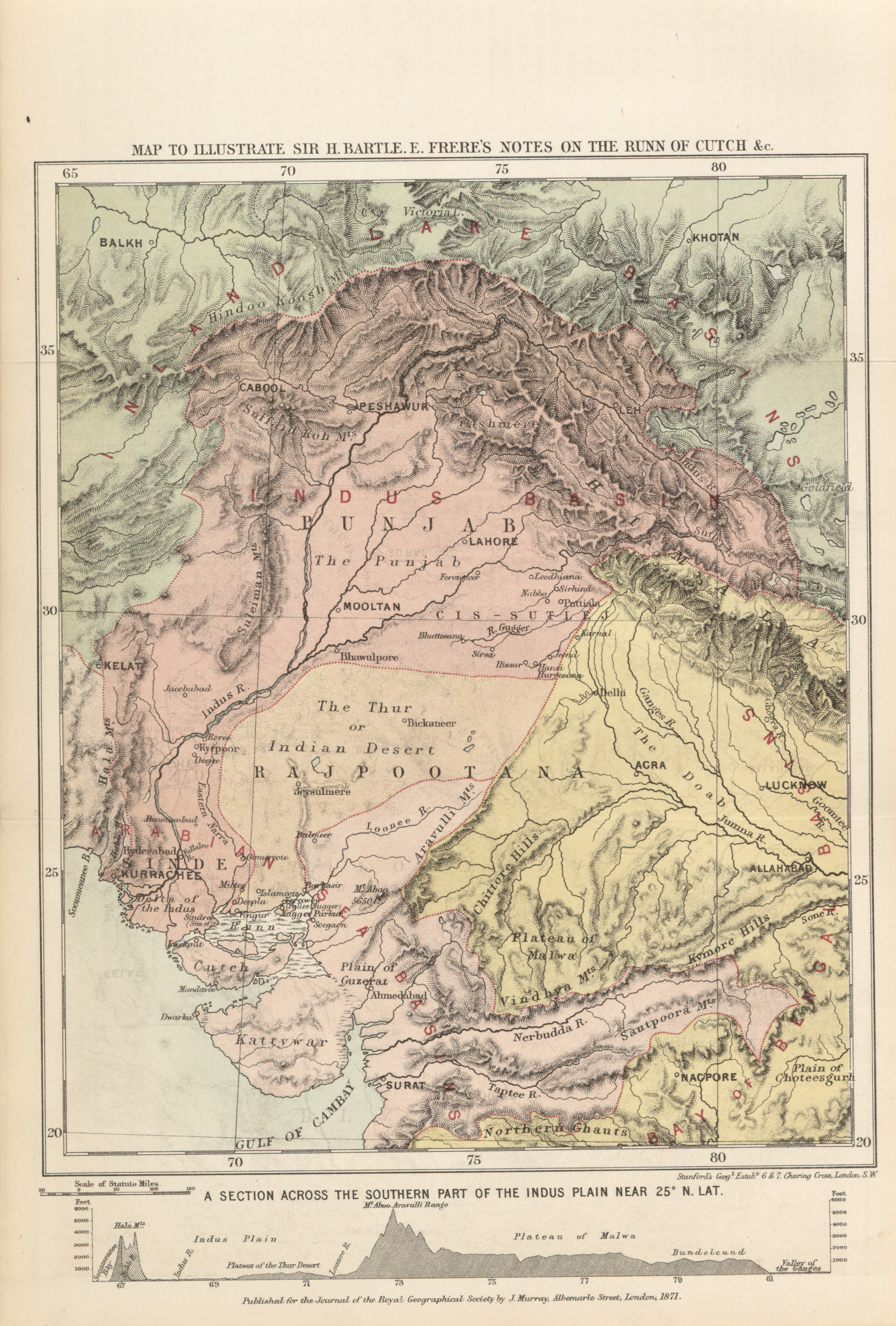
- Map to illustrate Sir H. Bartle E. Frere's notes on the Runn of Cutch, 1871 (4.2MB)
Notes on the Runn of Cutch and neighbouring region. By Sir H. Bartle E. Frere, K.C.B. -
- Sketch map showing the mineral and silk districts of the Province of Shan-Tung (China) to accompany the paper by J. Markham, 1870 (4.5MB)
Notes on a journey through Shantung. By J. Markham. -
- Central Asia, map to illustrate Baron Osten Sacken's route from Vernoe to the Trans-Naryn country, 1870 (1.5MB)
Expedition to the Trans-Naryn country in 1867. By Baron P. R. Osten-Sacken. Translated from Russian, and communicated by E. Delmar Morgan, F.R.G.S. -
- The Yang-Tsze-Kiang from Tung-Ting Lake to Chung-King to accompany the paper by R. Swinhoe, 1870 (6.6MB)
Special mission up the Yang-tsze-kiang. By R. Swinhoe, H.M. Consul. -
- A map showing the routes of some Native Caravans from the coast into the interior of Eastern Africa from information collected by the Revd. T. Wakefield, Missionary at Mombasa also of two personal journeys to the Southern Galla country, 1865-1867 (9.8MB)
Routes of Native Caravans from the coast to the interior of Eastern Africa, chiefly from information given by Sadi Bin Ahedi, a native of a district near Gazi, in Udigo, a little north of Zanzibar. By T. Wakefield, Missionary at Mobasa. -
- Map of part of Nipon Island to accompany Mr. Adam's report on the Central Silk districts of Japan, 1871 (3.3MB)
Report on the Central Silk Districts of Japan. by Mr. Adams, Secretary to H.M. Legation in Japan. -
- Surface temperatures of the North Atlantic between Shetland and Greenland, Admiral Irminger, 1870 (4.7MB)
On surface temperatures in the North Atlantic. By Admiral Irminger, Copenhagen, Corr. Member R.G.S. -
- Central Asia, map to illustrate the expedition of Mr. A. Fedchenko to the Zarafshan Valley, 1869 (2.3MB)
Topographical sketch of the Zarafshan Valley. By Mr. A. Fedchenko, Professor in Moscow University. -
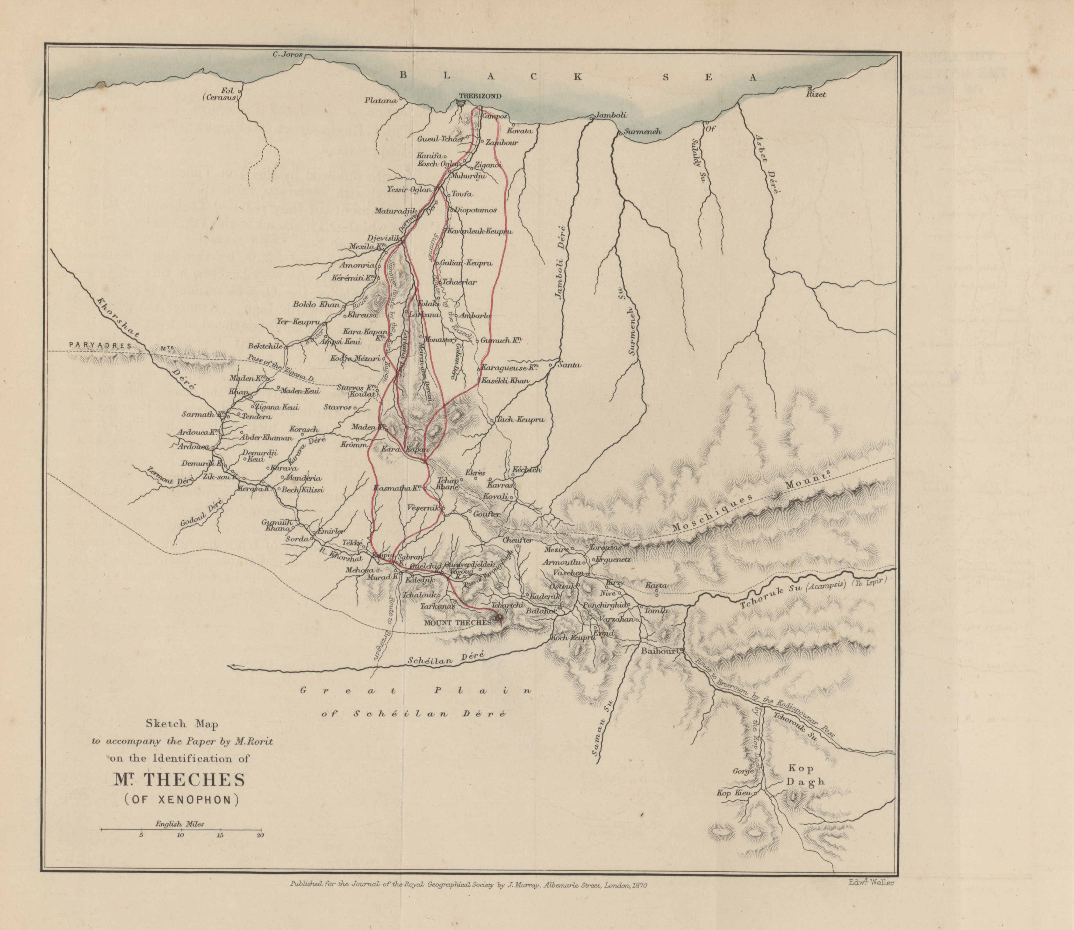
- Sketch map to accompany the paper by M. Rorit on the identification of Mt. Theches (of Xenophon), 1870 (1.9MB)
Identification of the Mount Theches of Xenophon. By M. P. Rorit.
Volume 41, 1871
-
- Trans-Indus Countries including Gilgit, Dilail, Yassin, Geo J.W. Hayward, 1872 (4.2MB)
Letters from Mr. G. W. Hayward, on his expeditions in Gilgit and Yassin. -
- Patagonia to illustrate Captain Muster's Route, 1869-1870 (2.5MB)
A year in Patagonia. By Lieutenant Musters, R.N. -
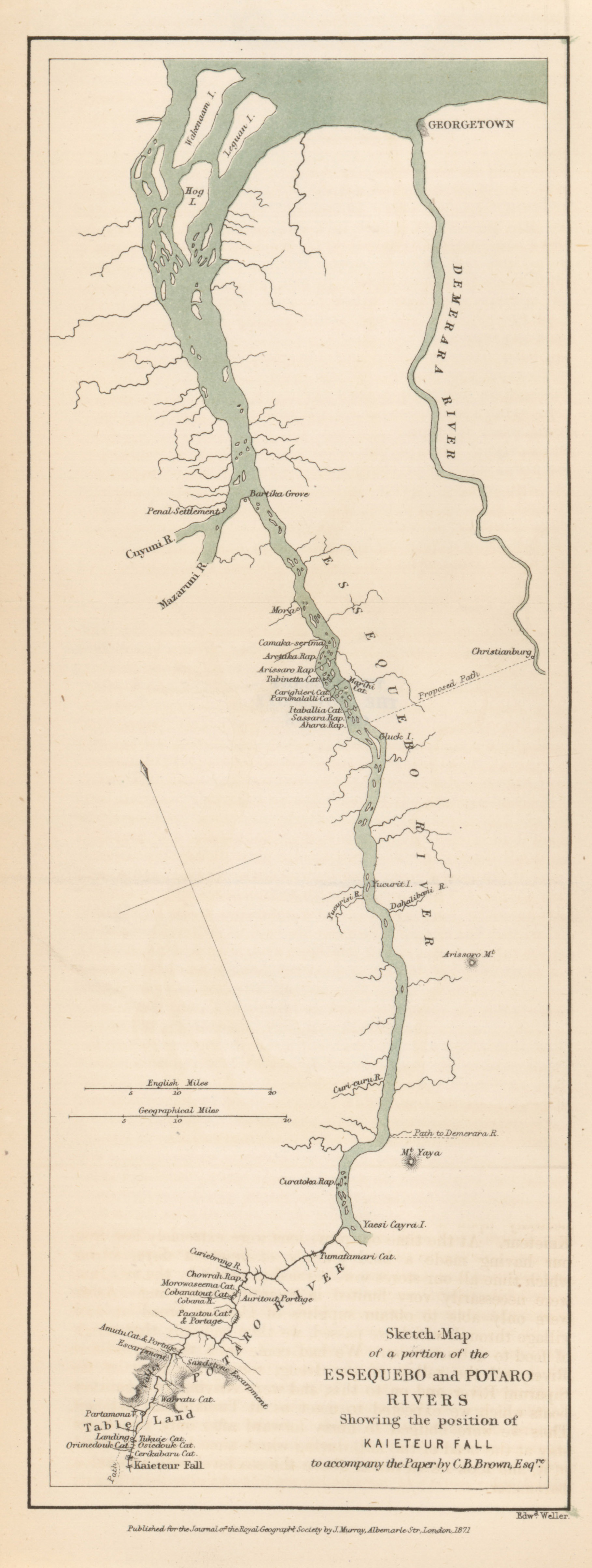
- Essequebo and Potaro Rivers showing the position of Kaieteur Fall to accompany the paper by C.B. Brown, 1871 (940.7KB)
Report on the Kaieteur Waterfall in British guiana. By Charles B. Brown. -
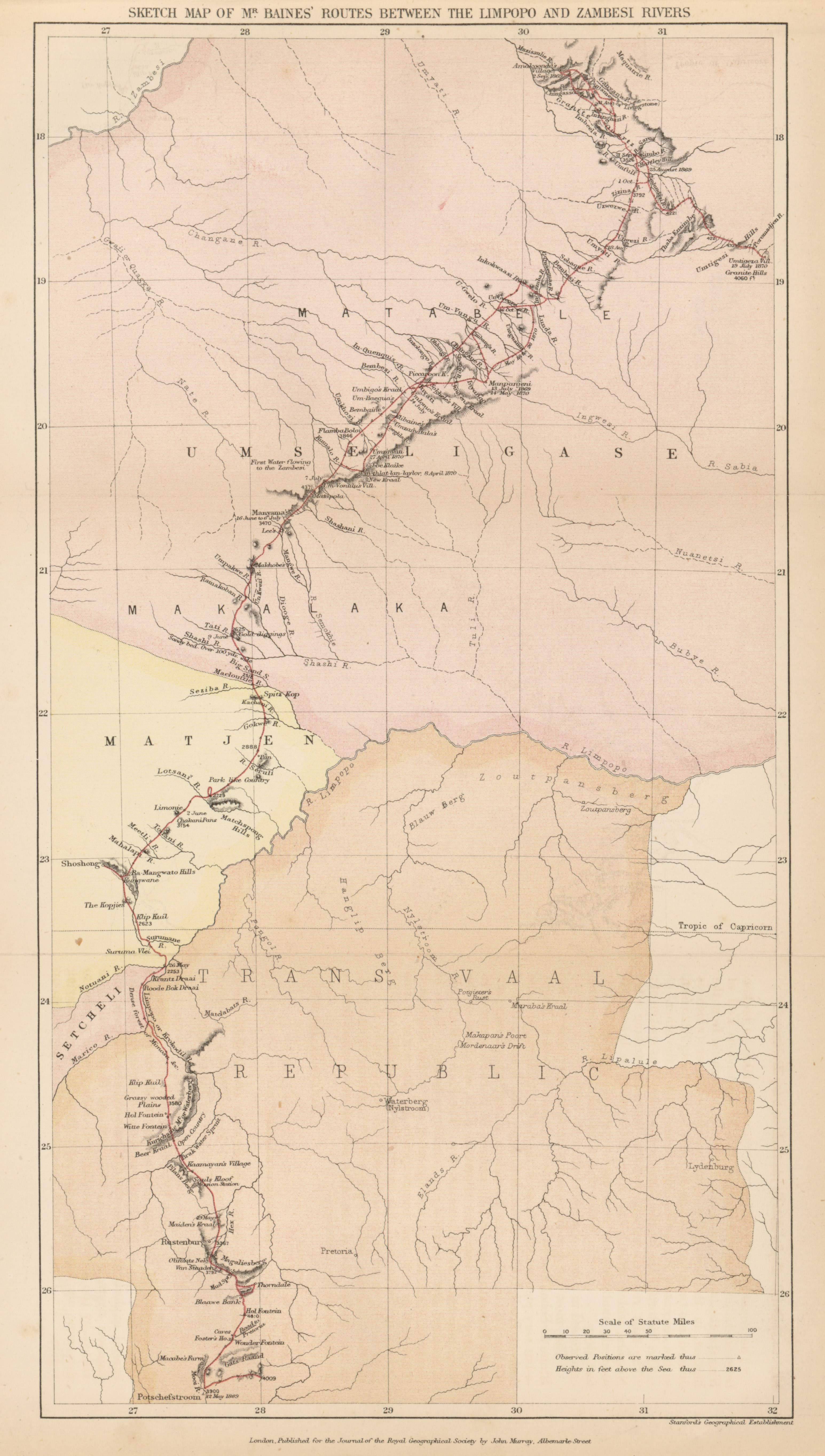
- Baines' Routes between the Limpopo and Zambesi Rivers, 1871 (3.4MB)
Account of Mr. Baines' exploration of the Gold-bearing region between the Limpopo and Zambesi Rivers. Prepared from Mr. Baines' journals, by Robert J. Mann, M.D., F.R.G.S., F.R.A.S. -
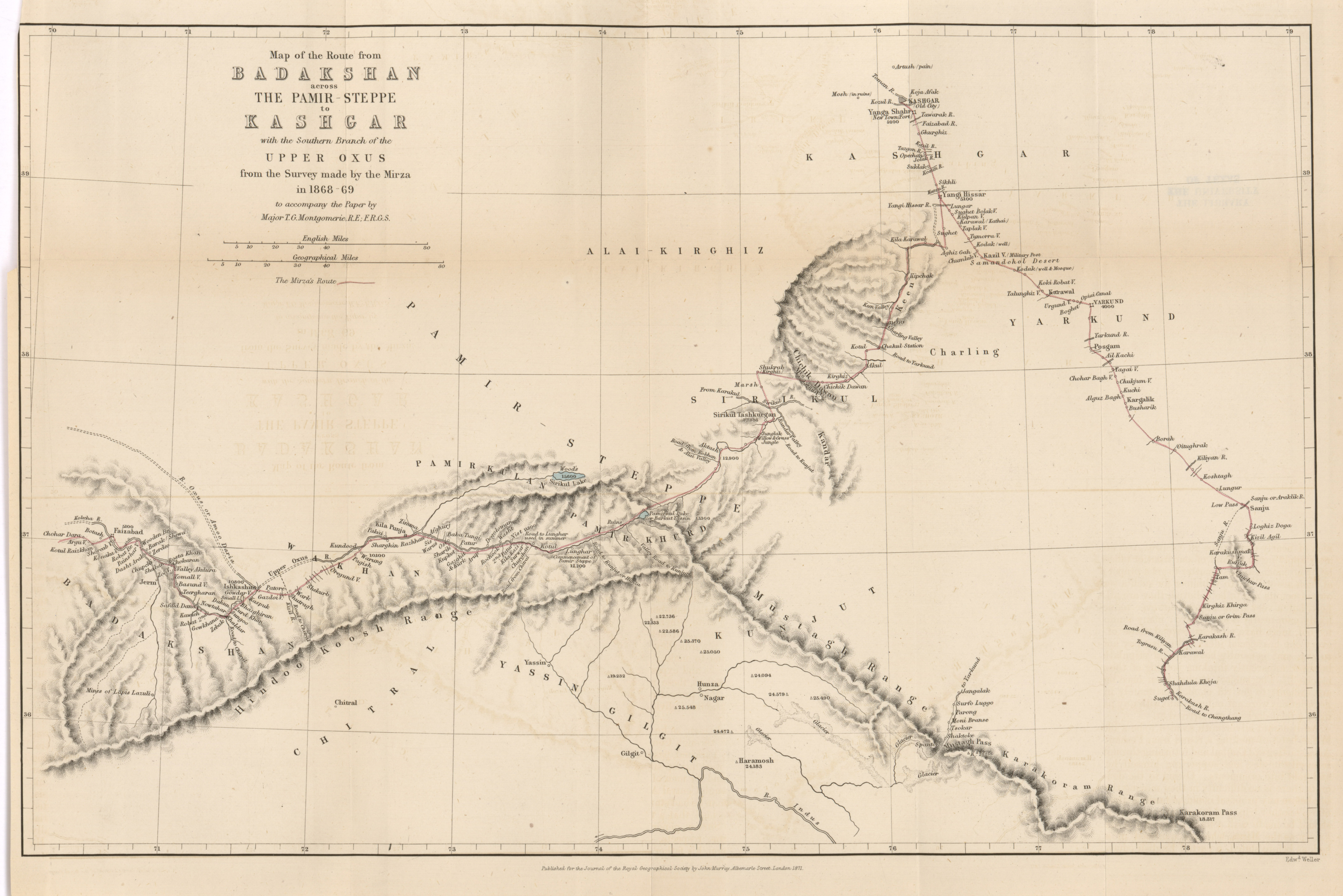
- Route from Badakshan across the Pamir-Steppe to Kashgar with the Southern branch of the Upper Oxus from the survey made by the Mirza, Major T.G. Montgomerie, 1868-1869 (3.3MB)
-
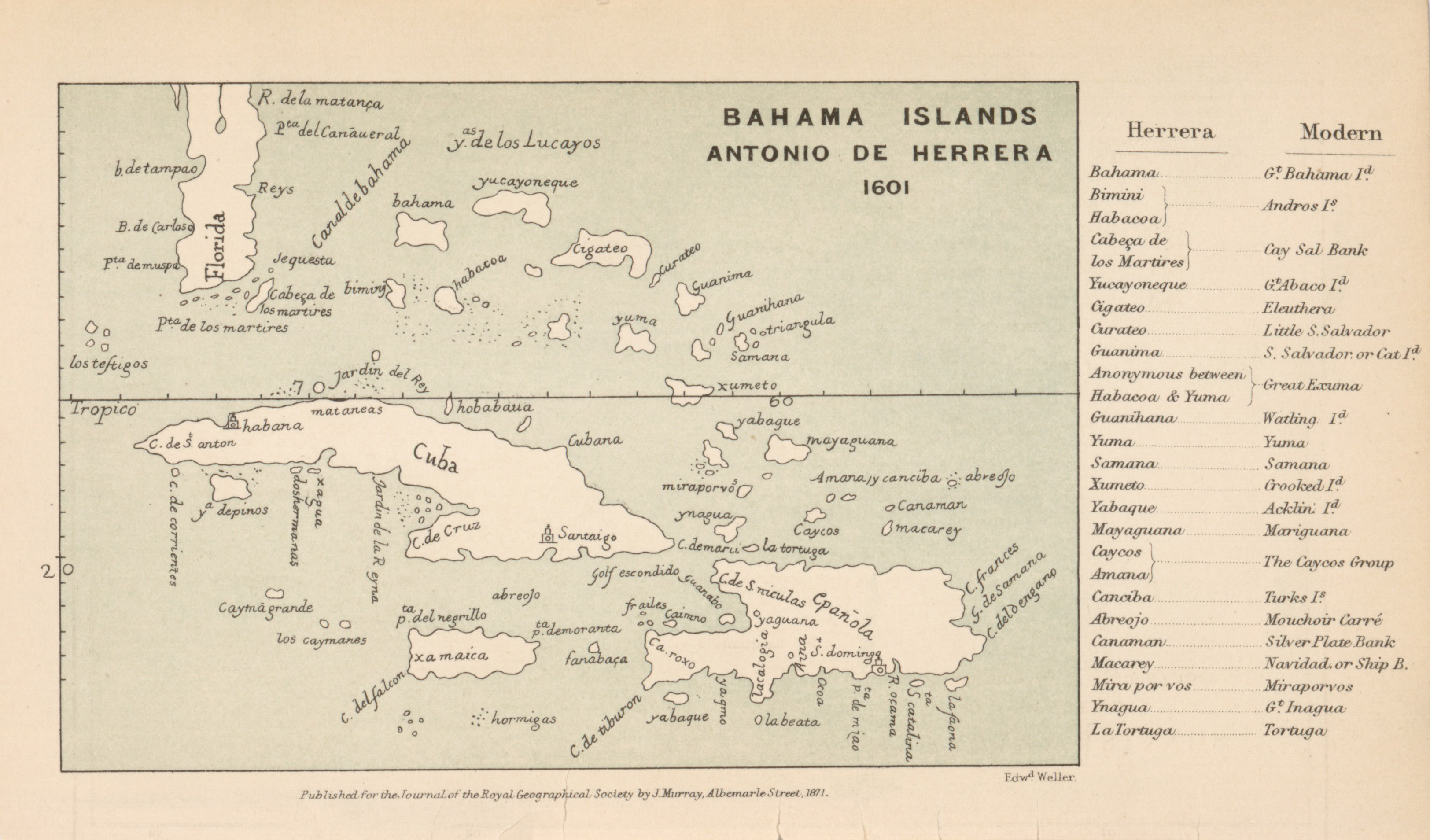
- Bahama Islands, Antonio de Herrera, 1601 (856.6KB)
-
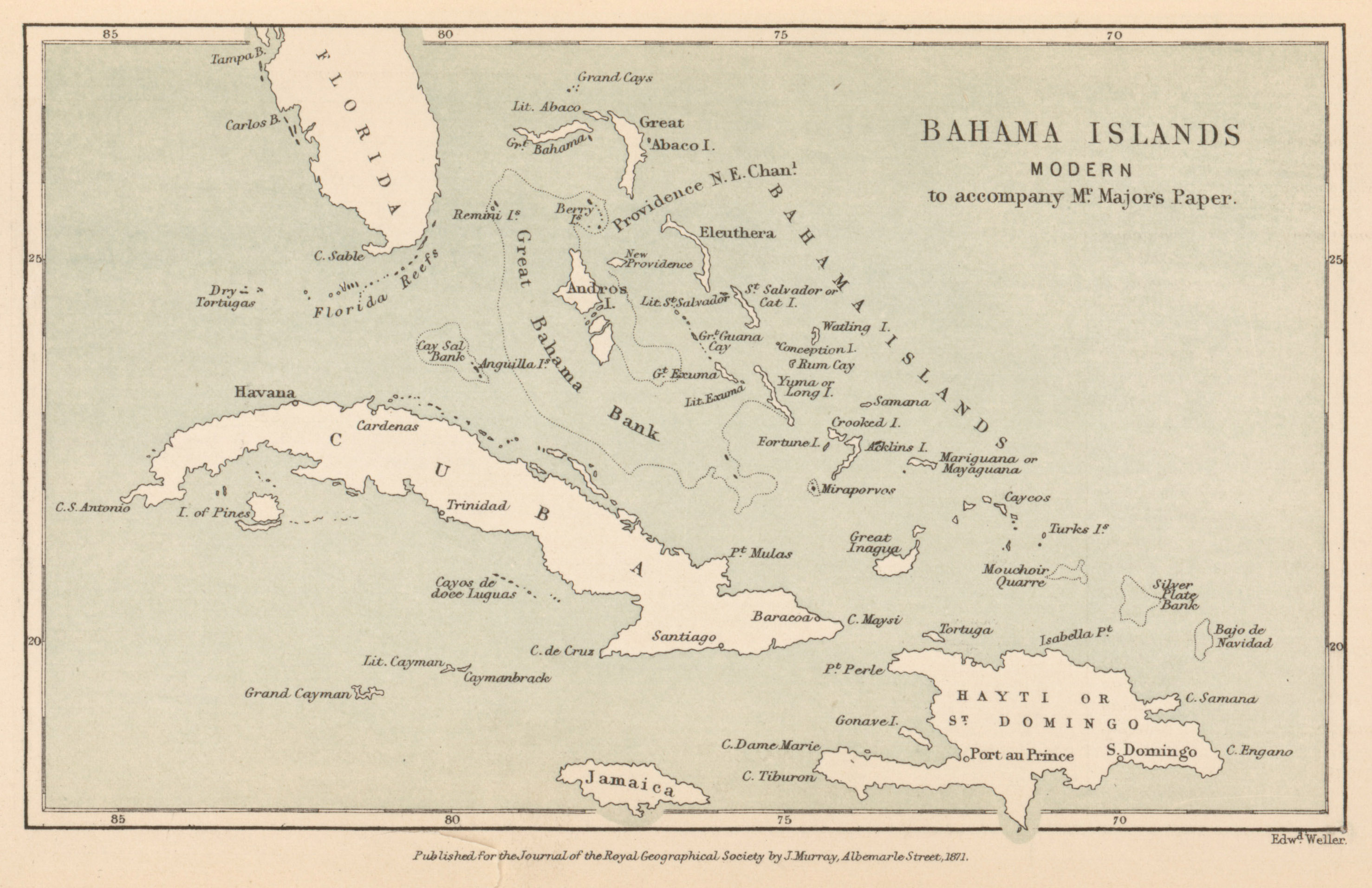
- Bahama Islands, Modern, Mr. Major, 1871 (788.4KB)
Report of "The Mirza's" exploration from Canbul to Kashgar. By Major T.G. Montgomerie, R.E., Gold Medallist R.G.S., Deputy Superintendent Great Trigonometrical Survey of India. -
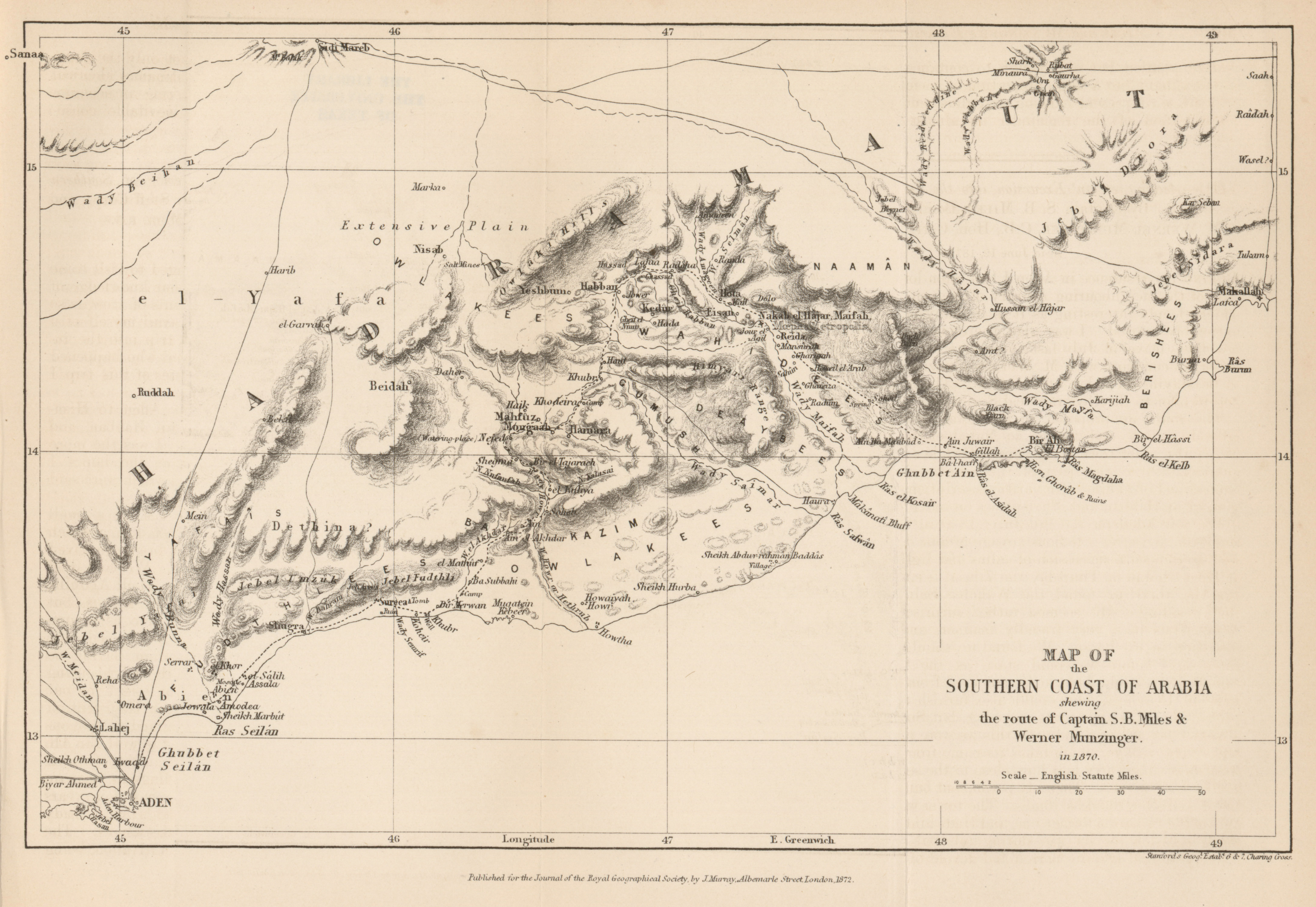
- Southern Coast of Arabia showing the route of Captain S.B. Miles and Werner Munzinger, 1870 (1.9MB)
Account of an excursion into the interior of Southern Arabia. By Captain S.B. Miles, Bombay Staff Corps, F.R.G.S. -
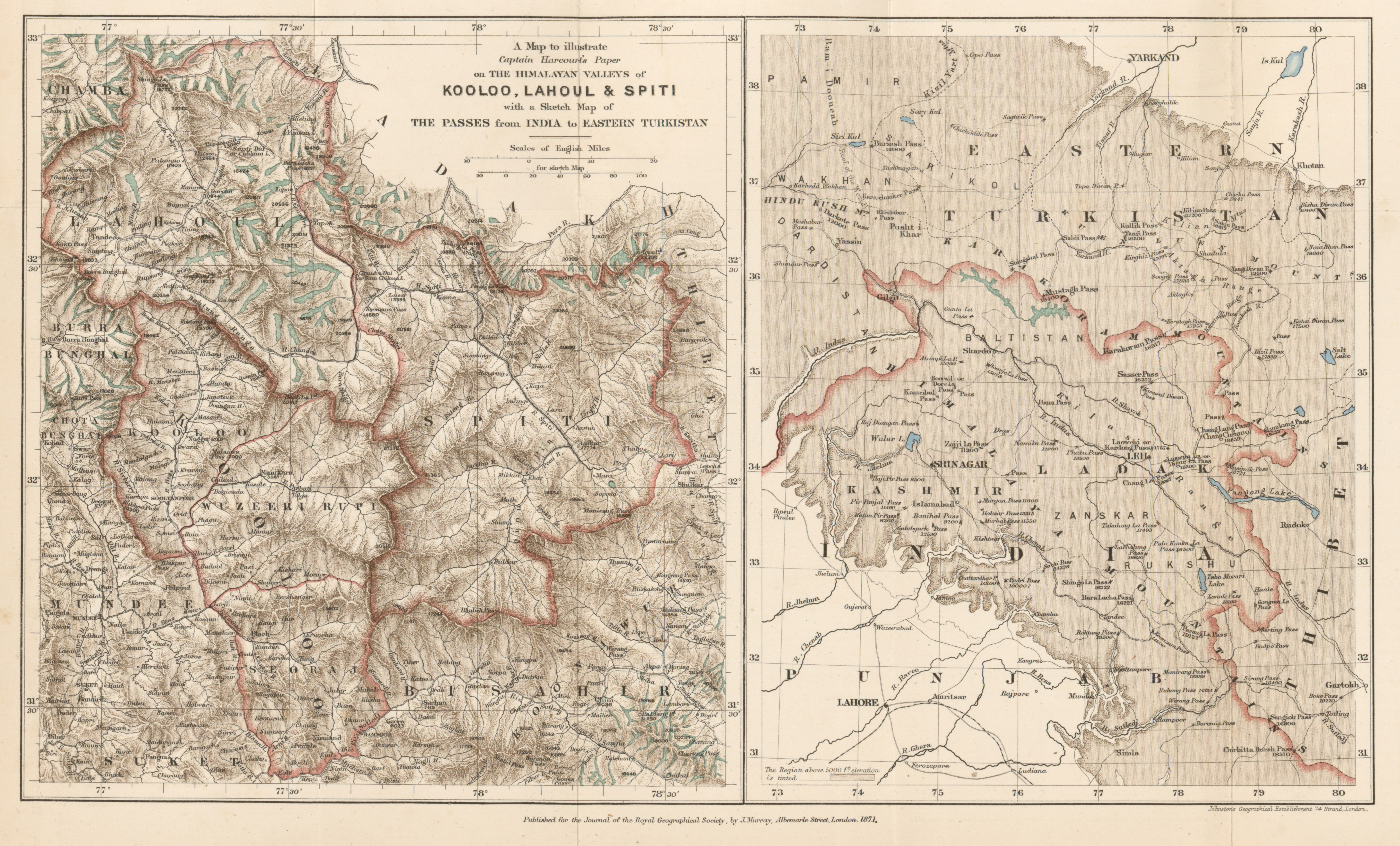
- A map to illustrate Captain Harcourt's paper on the Himalayan Valleys of Kooloo, Lahoul, and Spiti with a sketch map of the Passes from India to Eastern Turkistan, 1871 (4.8MB)
On the Himalayan Valleys: Kooloo, Lahoul, and Spiti. By Captain A.F.P. Harcourt, Bengal Staff Corps, F.R.G.S. -
- Country between Bhamo and Momein showing the route of the expedition under the command of Major E.B. Sladen, 1872 (3.5MB)
Exploration via the Irrawaddy and Bhamo to South-Western China. By Major E.B. Sladen, F.R.G.S. -
- A Plan of Cuzco, Ancient and Modern, 1871 (2.7MB)
On the geographical positions of the tribes which formed the Empires of the Yncas, with an appendix on the name "Aymara." By Clements R. Markham, C.B., Secretary R.G.S. -
- Overland tracks from Perth to Eucla and Adelaide, John Forrest, 1870 (4.4MB)
Journal of an expedition to explore the country from West Australia to Port Eucla, and thence to Adelaide, South Australia. By John Forrest, Government Surveyor.
Volume 42, 1872
-
- Map of route from the Tati Settlement to Delagoa Bay to illustrate the paper by Captain F. Elton, 1872 (4.9MB)
Journal of an expedition of the Limpopo River. By Captain Frederick Elton. -
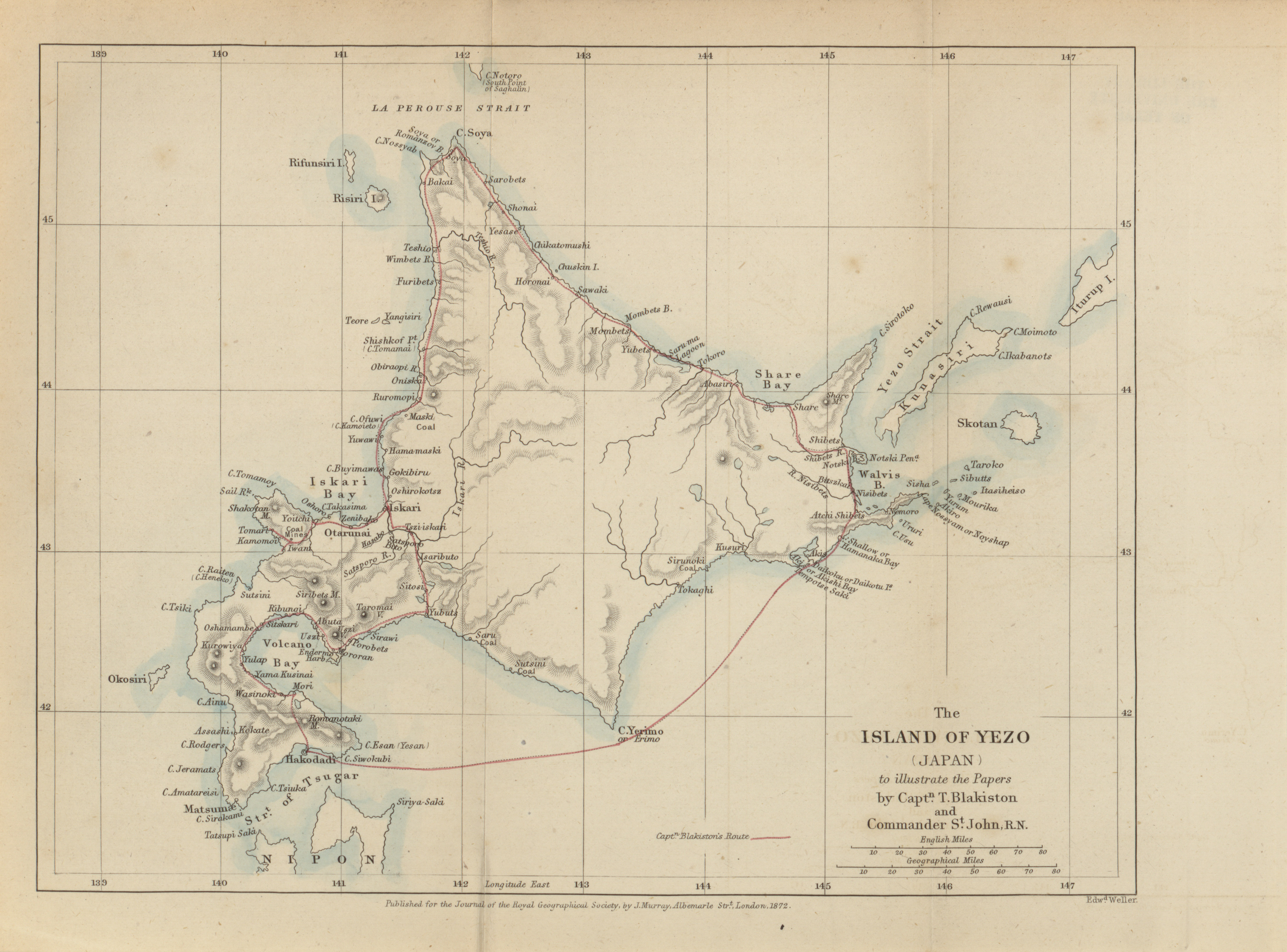
- The Island of Yezo (Japan) to illustrate the papers by Captain T. Blakiston and Commander St. John, 1872 (2.3MB)
A journey in Yezo. By Captain T. Blakiston, F.R.G.S. -
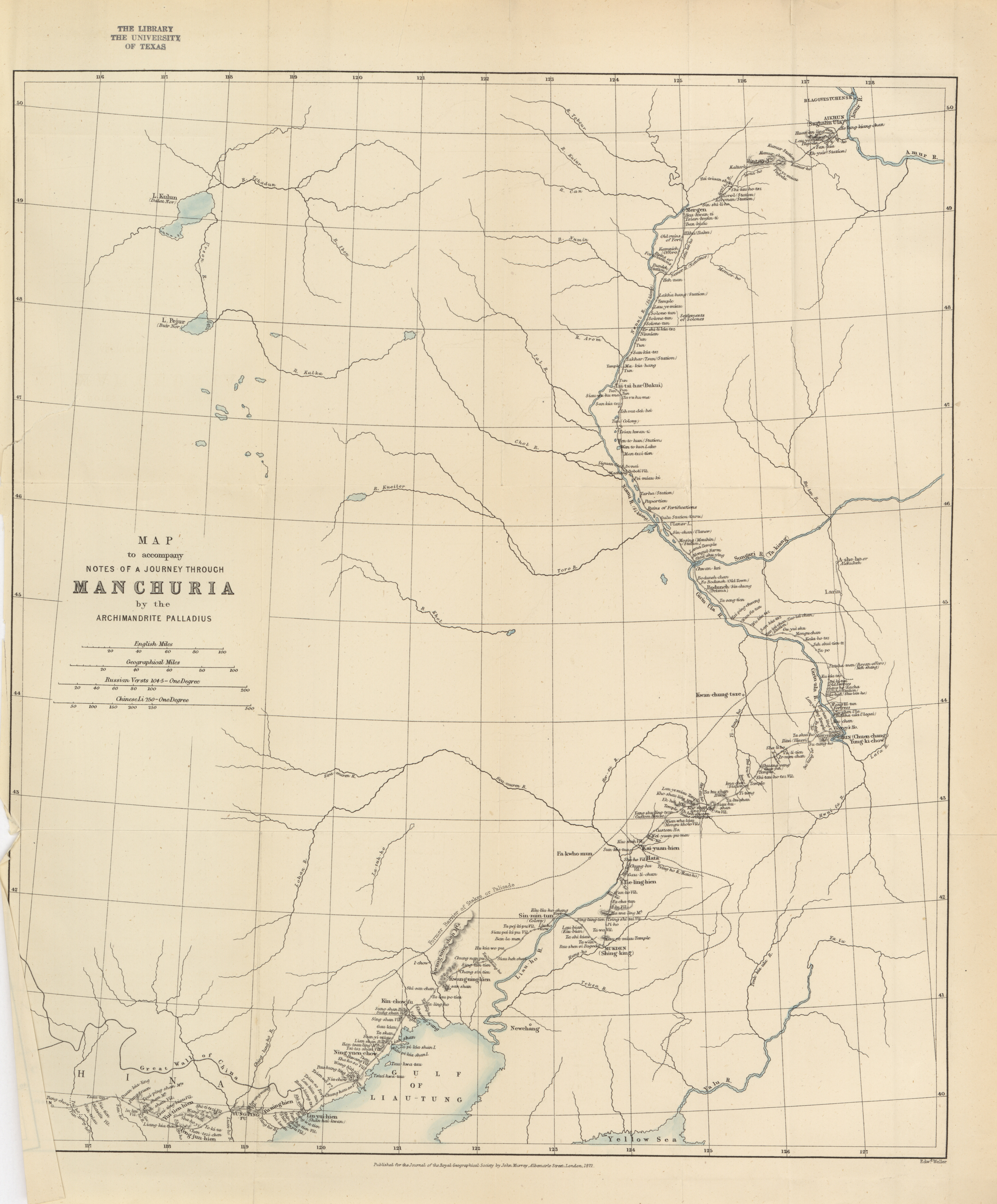
- Map to accompany notes of a journey through Manchuria by the Archimandrite Palladius, 1872 (7.1MB)
An expedition through Manchuria, from Pekin to Blagovetchensk, in 1870. By the Archimadrite Palladius, Chief of the Russo-Greek Church Mission at Pekin. Compiled from the journal of the Archimandrite, and translated by E. Delmar Morgan, F.R.G.S. -
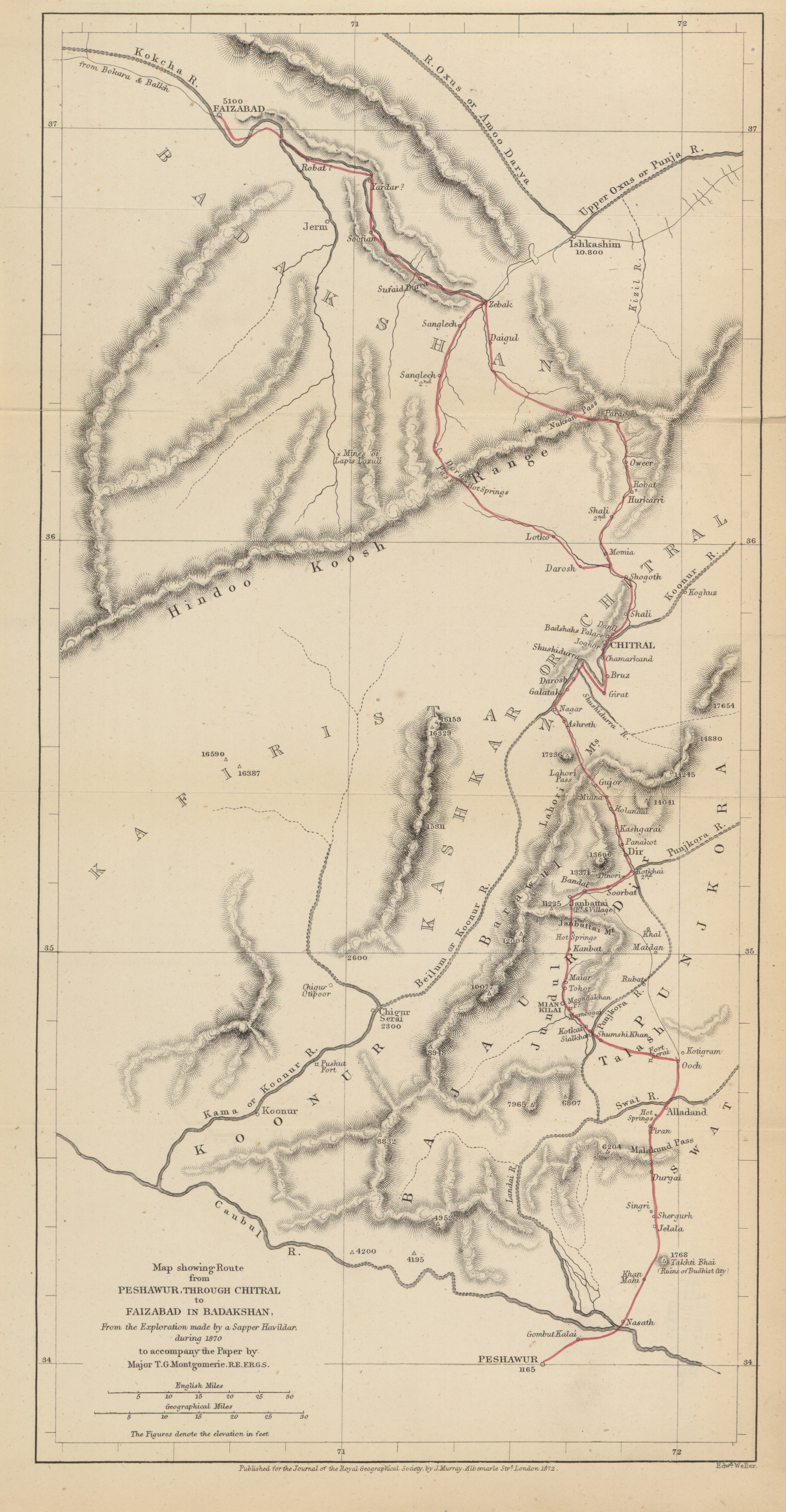
- Map showing route from Peshawur through Chitral to Faizabad in Badakshan, from the exploration made by a Sapper Havildar, during 1870 to accompany the paper by Major T.G. Montgomerie, 1872 (3.9MB)
A Havildar's journey through Chitral to Faizabad, in 1870. By Major T.G. Montgomerie, R.E., F.R.G.S., officiating superintendent G.T. survey of India, in charge of the Trans-Himalayan exploring parties. -
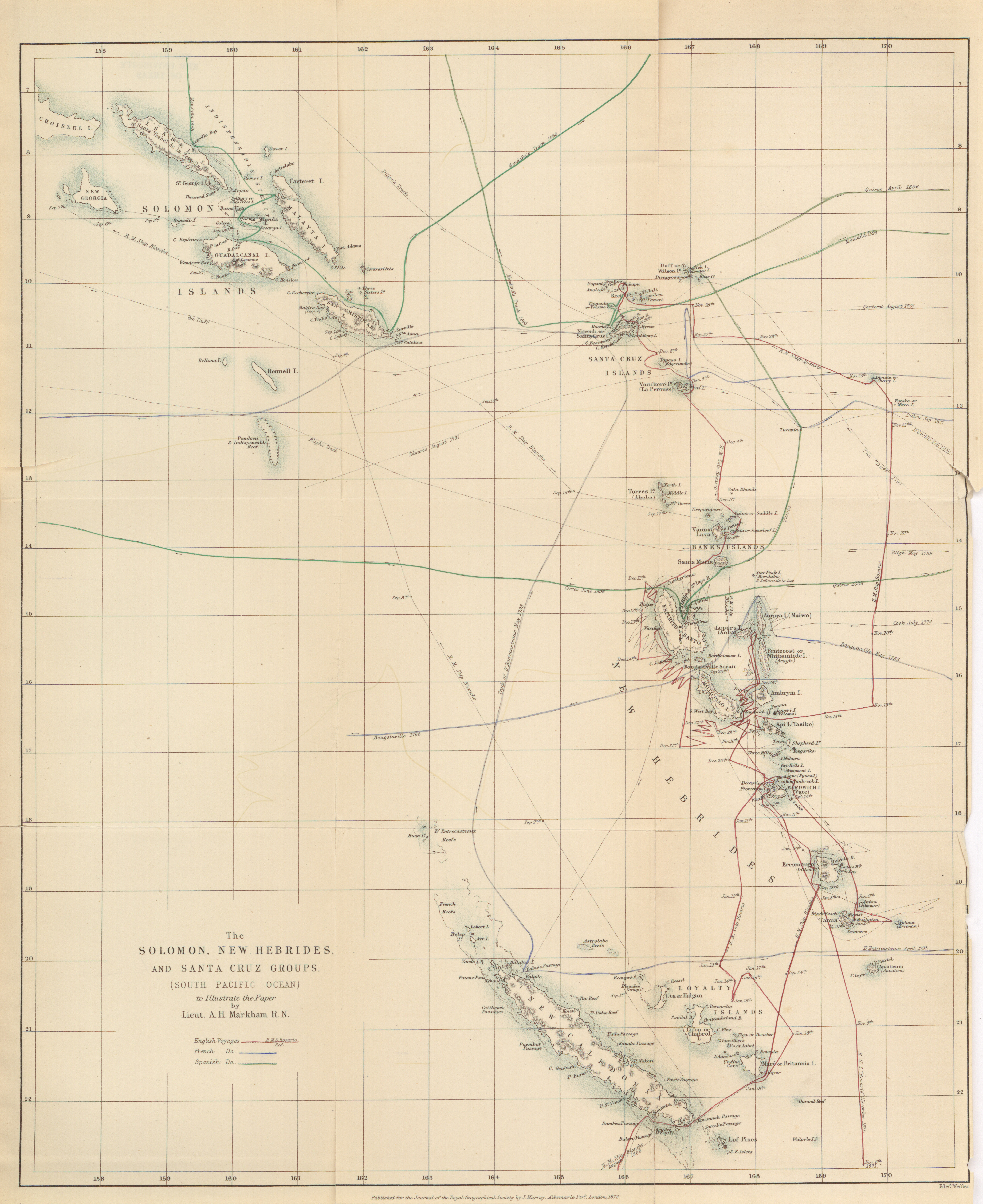
- The Solomon, New Hebrides, and Santa Cruz Groups (South Pacific Ocean) to illustrate the paper by Lieut. A.H. Markham, 1872 (6.2MB)
The New Hebrides and Santa Cruz groups. By Lieutenant A.H. Markham, R.N. -
- The Island of Saghalin from Russian Authorities to accompany the paper by Colonel Veniukof, 1872 (1.7MB)
On the island of Saghalin. By Colonel Veniukof. Translated from the Russian "Voyenni Sbornik." By Captain Spalding, 104th Regiment. -
- Map of the Bhawulpore State (Punjab) to accompany the paper by J.W. Barns, 1872 (5.4MB)
Notes on the physical geography of the Bhawulpore State. By J.W. Barns, F.R.G.S., Superintendent of Irrigation, 1872. -
- Sketch map of the Anti-Libanus from observations taken in 1871, C.F. Tyrwhitte-Drake, 1872 (4.5MB)
Notes of a reconnaissance of the Anti-Libanus. By Richard F. Burton, F.R.G.S., and Charles F. Tyrwhitt Drake, F.R.G.S. -
- Map to illustrate Mr. Troup's Tour, 1872 (938.2KB)
Journal of a tour through parts of the provinces of Echigo, Echiu, Kaga, and Noto, Japan. 1871. By J. Troup, Esq. -
- Photographic reduction of a Chinese Map of the Upper Oxus Region with autograph transcriptions, Julius Klaproth, 1872 (7.8MB)
Monograph on the Oxus. By Sir H.C. Rawlinson, K.C.B., D.C.L., F.R.S.,
Volume 43, 1873
-
- Map showing the projected railway route from Buenos Ayres to Chile to accompany the paper R. Crawford, 1873 (4.8MB)
On a projected railway route over the Andes, from the Argentine Rpublic. By r. Crawford, M.A., C.E. -
- Van Keulens chart of Spitzbergen, C.R. Markham, 1707 (5.9MB)
On discoveries East of Spitzbergen and approaches toward the North Pole on the Spitzbergen Meridian. By C.R. Markham, Esq., C.B., F.R.S., Secretary R.G.S. -
- Southern Formosa, J. Thomson, 1873 (2.5MB)
Notes on a journey in Southern Formosa. By J. Thomson, F.R.G.S. -
- Sketch map of the countries referred to in the Zeno Narrative, 1873 (2.0MB)
- Carta da Navegar de Nicolo et Antonio Zeni Furono III Tramonta Lano, 1865 (6.4MB)
-
- Faeroe Islands to illustrate the route of Nicolo Zeno, 1873 (2.2MB)
-
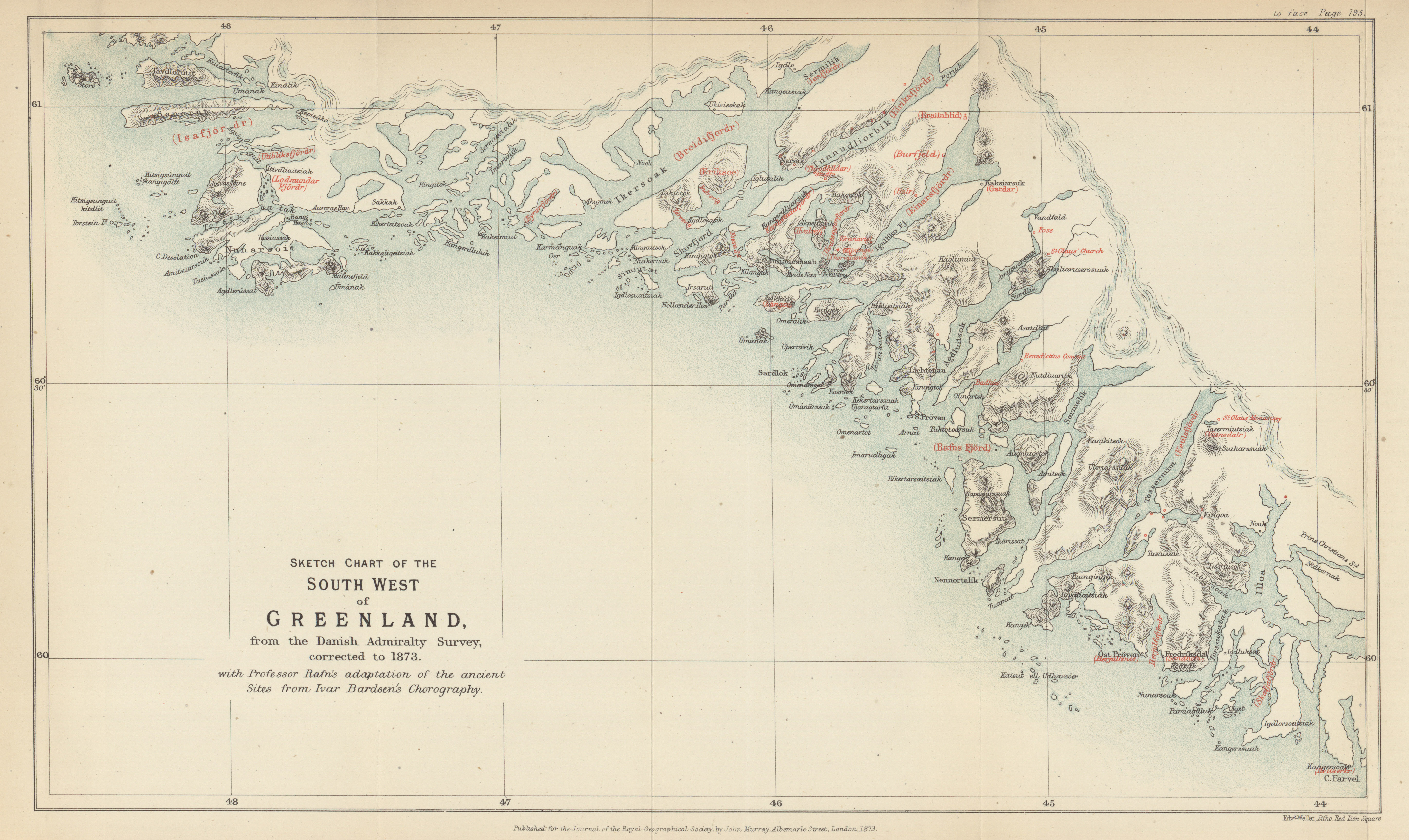
- Southwest of Greenland from the Danish Admiralty Survey, 1873 (3.4MB)
The site of the lost Colony of Greenland determined, and Pre-Columbian discoveries of America confirmed from 14th Century Documents. By R.H. Major, F.S.A., Secretary R.G.S. -
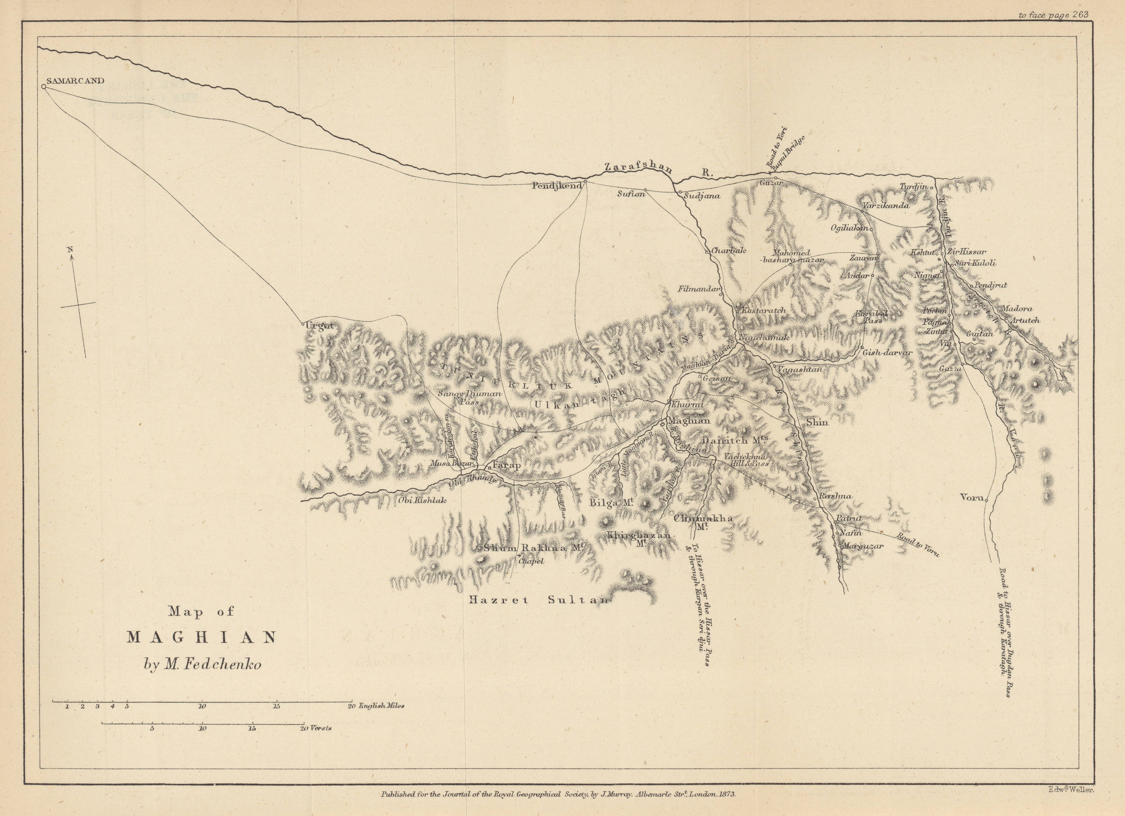
- Maghian, M. Fedchenko, 1873 (2.5MB)
Notes on M. Fedchenko's map of Maghian. By R. Michell, Esq. -
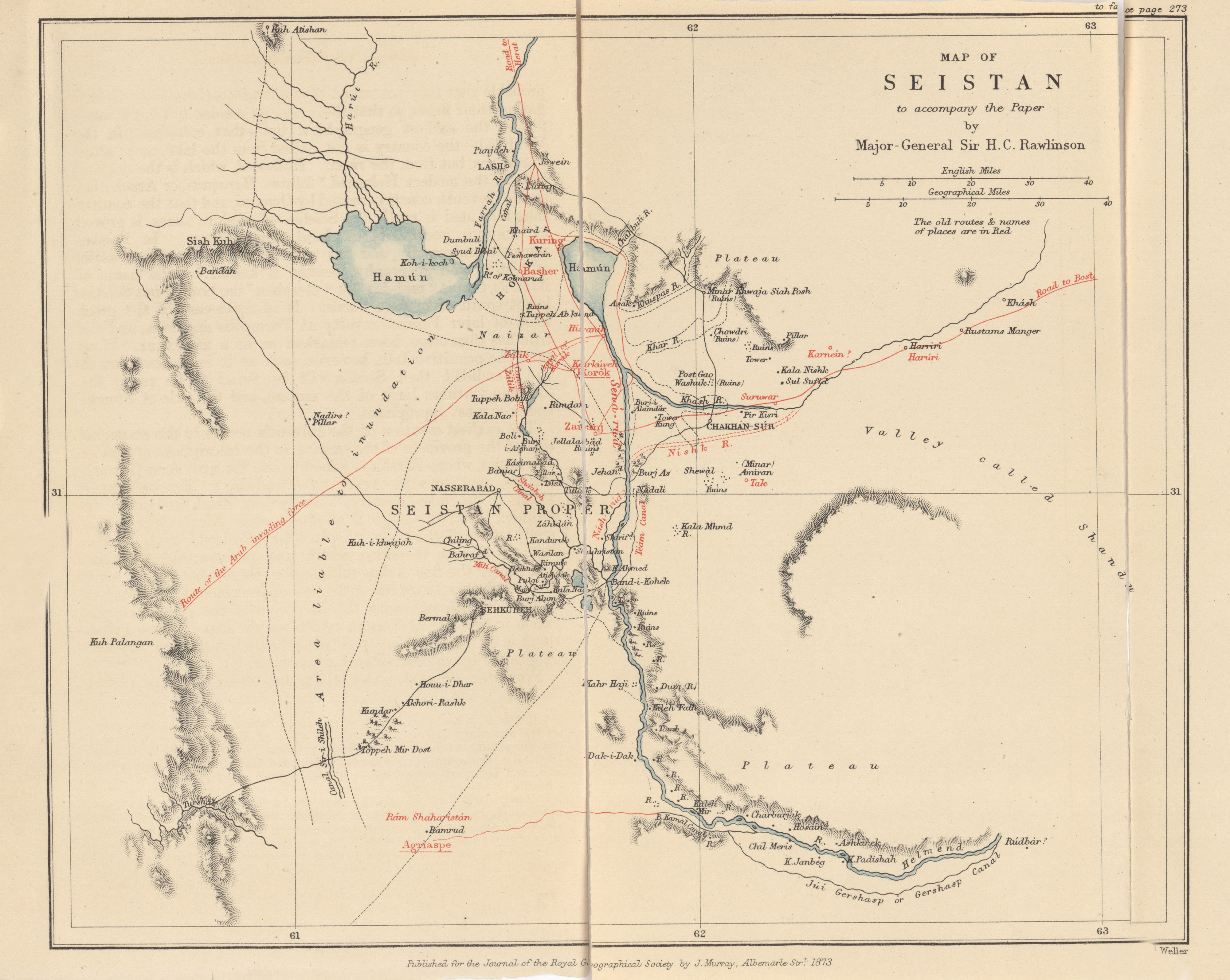
- Seistan to accompany the paper by Major-General Sir H.C. Rawlinson, 1873 (2.2MB)
Notes on Seistan. By Major-General Sir H.C. Rawlinson, K.C.B., President R.G.S. -
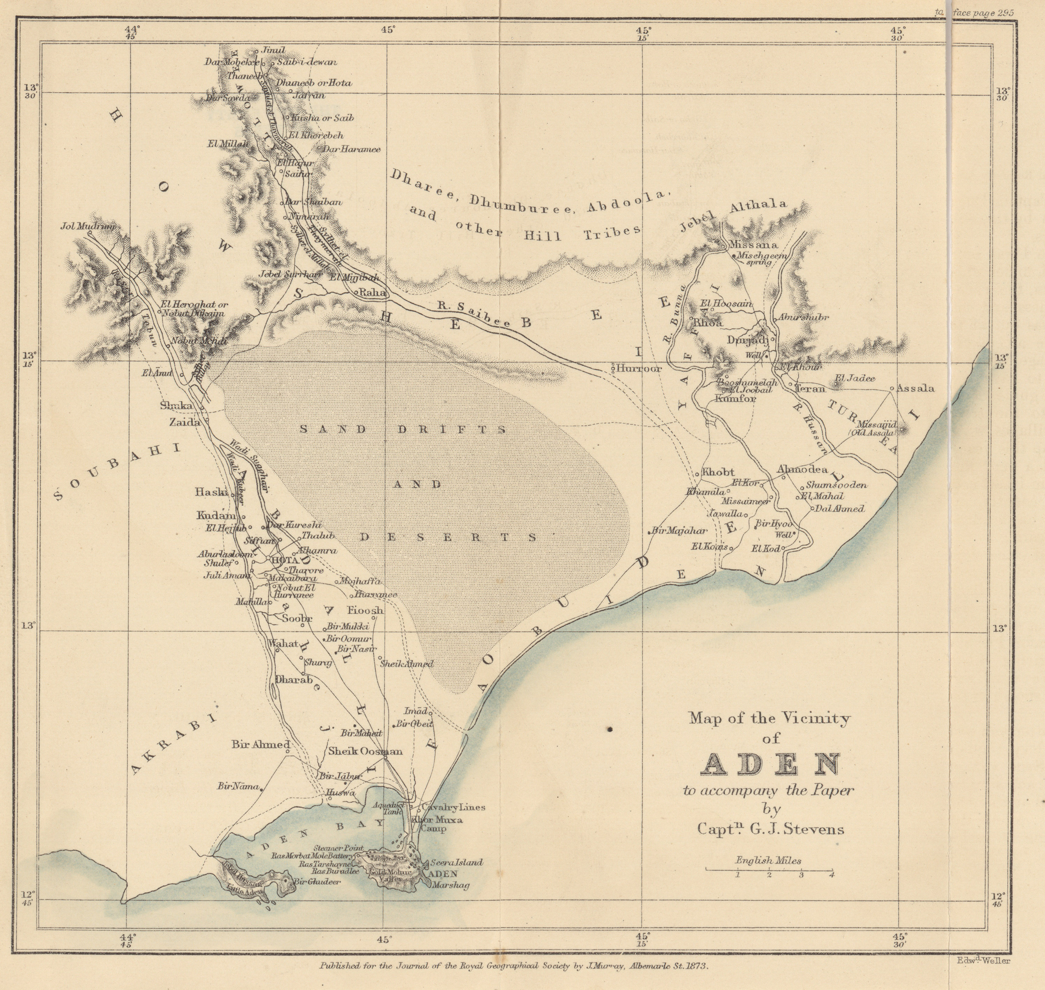
- Vicinity of Aden to accompany the paper, Captain G.J. Stevens, 1873 (2.3MB)
Report on the country around Aden. By Captain G.J. Stevens.
Volume 44, 1874
-
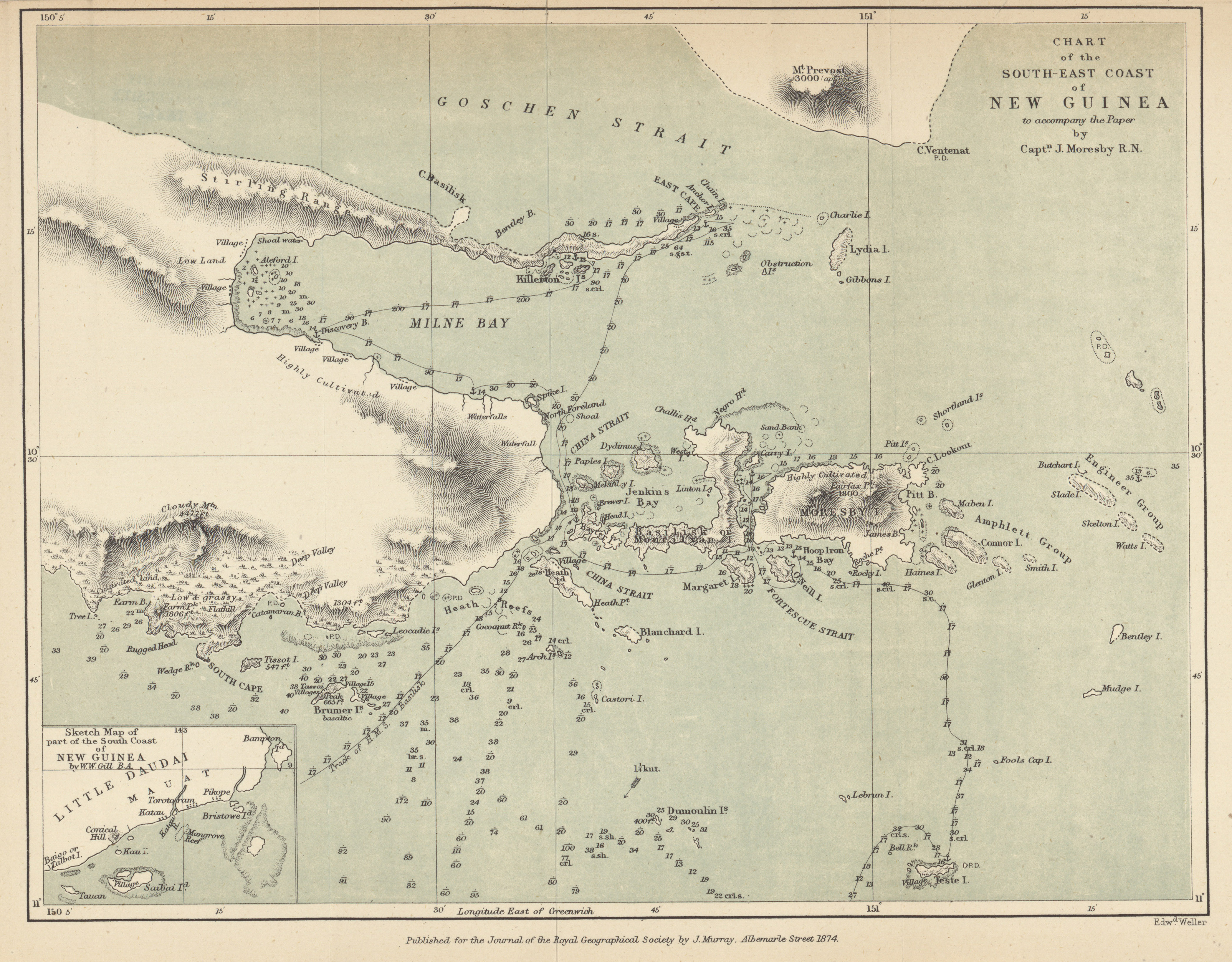
- Chart of the South-East Coast of New Guinea to accompany the paper by Captain J. Moresby R.N., 1874 (2.8MB)
Recent discoveries at the Eastern End of New Guinea. By Captain J. Moresby, R.N. -
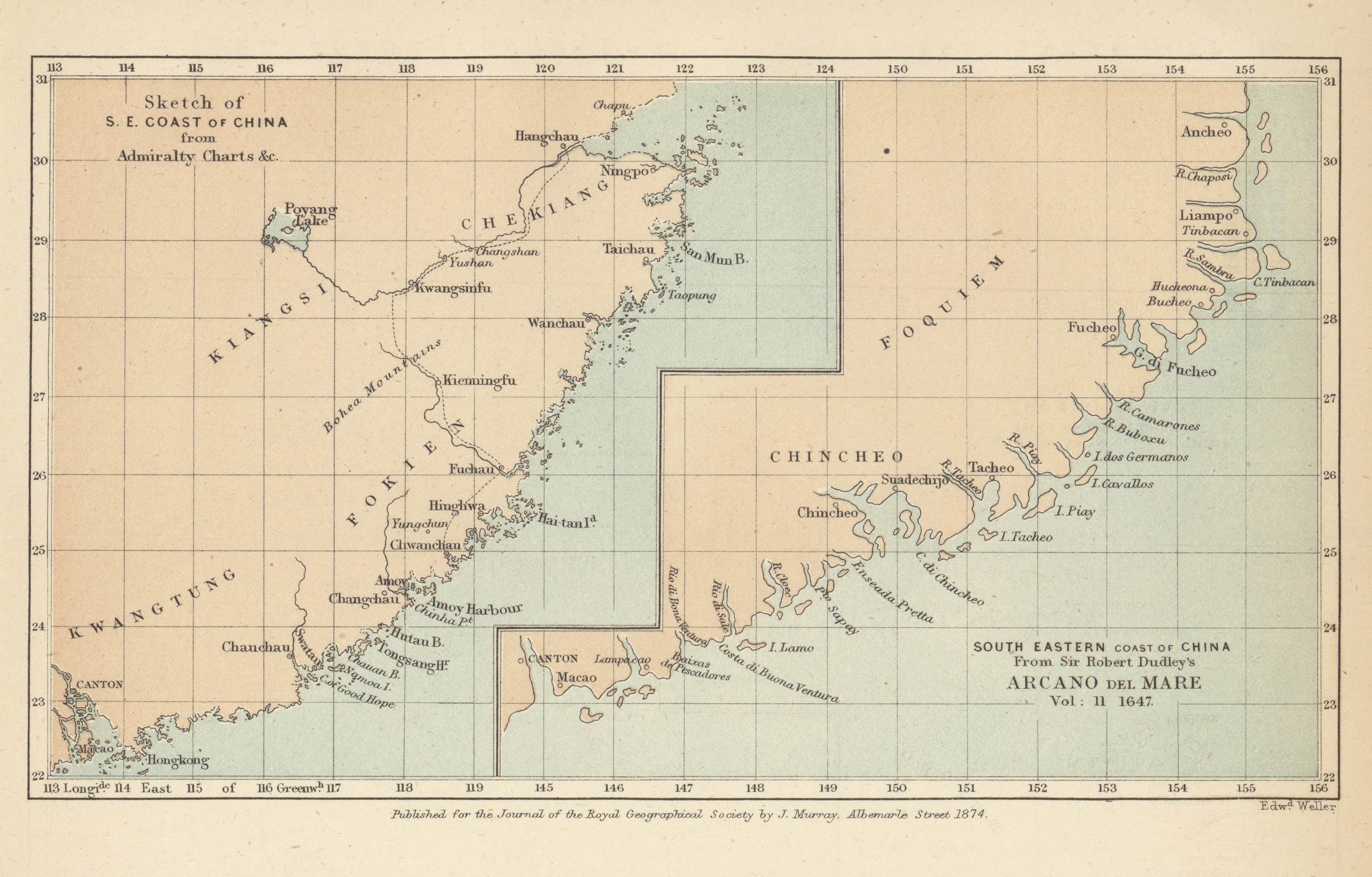
- South Eastern Coast of China from Sir Robert Dudley's Arcano del Mare, 1647 (1.3MB)
Notes on Southern Mangi. By George Phillips, H.M. Consular Service, China. With notes and remarks by Colonel Henry Yule, C.B. -
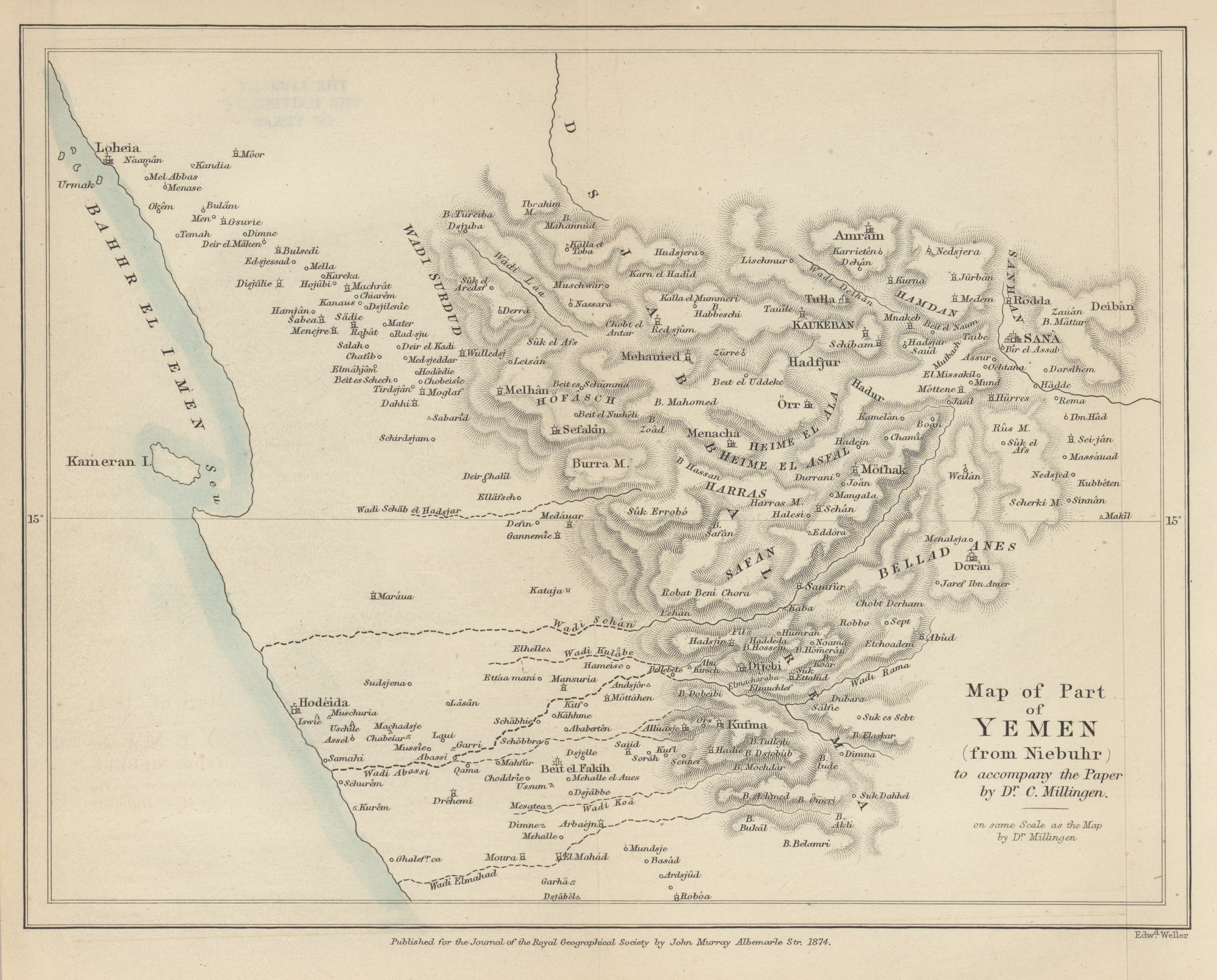
- Part of Yemen (from Niebuhr), Dr. C. Millingen, 1874 (2.4MB)
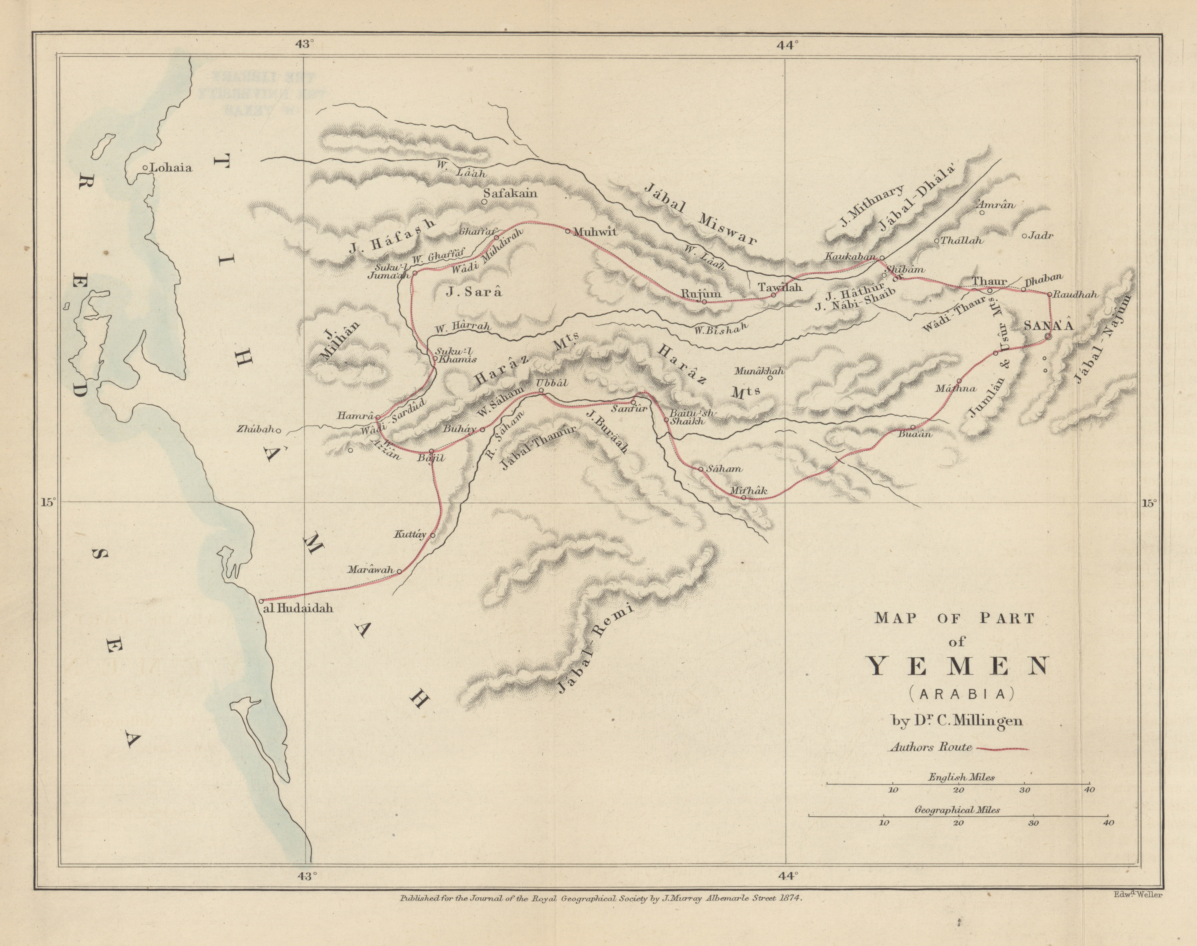
- Part of Yemen (Arabia), Dr. C. Millingen, 1874 (2.1MB)
Notes on a journey in Yemen. By Charles Millingen, M.D. Edinburgh. -
- East Coast of Africa, the Slave Caravan route from Dar-Es-Salam to Kilwa, Captain F. Elton, 1874 (3.9MB)
On the coast country of East Africa South of Zanzibar. By Captain Elton.
Volume 45, 1875
-
- North Polar Regions to illustrate general Hauslab's Paper, 1875 (2.4MB)
Inference applied to geography, with special reference to ocean currents and the Arctic regions. By General Hauslab, Vienna, Honorary Corresponding Member R.G.S. -
- The Central Provinces of Madagascar, Joseph Mullens, 1875 (13.3MB)
On the central provinces of Madagascar. By Joseph Mullens, D.D., Foreign Secretary of the London Missionary Society. -
- Lake Tanganyika from Ujiji to its Southern extremity, Lovett Cameron, 1875 (4.6MB)
Examination of the Southern half of Lake Tanganyika. By Lieut. V.L. Cameron, R.N.; compiled chiefly from Lieut. Cameron's Diary, by C.R. Markham, Esq., C.B., F.R.S., Secretary R.G.S. -
- Proposed overland trade routes from India and British Burmah to China, J. Coryton, 1875 (5.7MB)
Trade routes between British Burmah and Western China. By J. Coryton. -
- West Australian Exploring Expedition through the centre of Australia, from Champion Bay on the West Coast to the overland telegraph line between Adelaide and Port Darwin, John Forrest, 1874 (4.8MB)
Journal of the Western Australian exploring expedition through the centre of Australia, from Champion Bay to the Overland Telegraph Line between Adelaide and Port Darwin. By John Forrest, F.R.G.S. -
- Track and soundings of Steam Cutter up the Rufiji River, Captain Sulivan, assisted by Sub Lieut. F.J. Grassie, R.N., 1875 (683.8KB)
Survey of the lower course of the Rufiji River. By Captain G.L. Sullivan, R.N. Communicated by the Lords Commissioners of the Admiralty. -
- Central Asia, constructed from the latest English and Russian documents, adapted to recent astronomical observatons, John Arrowsmith, 1872 (10.9MB)
Note to Arrowsmith's map of Central Asia.
Volume 46, 1876
-
- Sketch Map of Eastern Turkistan to illustrate the paper by R.B. Shaw, 1876 (3.1MB)
A Prince of Kashghar on the geography of Eastern Turkistan. By R.B. Shaw. -
- Chart of Creeks and Rivers between Bonny and Brass Rivers, R.D. Boler and R. Knight, 1874 (2.1MB)
Notes accompanying a chart of a portion of the Niger Delta. By Richard Doubleday Boler and Robert Knight. -
- A traverse survey of the White Nile from Khartum to Rigaf, Lieut. Watson and Chippendall, 1876 (4.7MB)
Meteorological observations taken on the White Nile, between Khartum and Rigaf, 1874. By Lieut. Watson, R.E. -
- West Africa, reduction of Lieut. Grandy's Map of his route from Ambriz to the River Congo, W.J. Turner, 1873-1874 (5.6MB)
Note on Lieut. Grandy's map of his journey from Ambriz to San Salvador and the Congo. By W.J. Turner, assistant map curator R.G.S. -
- Map of the White Nile from Lardo to Urondogani, Colonel Gordon, 1875-1876 (2.4MB)
Notes to accompany a survey of the White Nile, from Lardo to Nyamyungo. By Col. C.G. Gordon, R.E., C.B.
Volume 47, 1877
-
- Map illustrating the journey of the Pundit Nain Singh through Great Tibet from Ladakh to Assam, Captain H. Trotter, 1877 (13.7MB)
Account of the Pundit's journey in Great Tibet from Lef in Ladakh to Lhasa, and of his return to India via Assam. By Captain H. Trotter, R.E. -
- Map of part of Bolivia from the surveys of J.B.Minchin to illustrate the paper by G.C. Musters, 1877 (9.6MB)
Notes on Bolivia, to accompany original maps. By George Chaworth Musters, retired commander, R.N. -
- Map of Transvaal and the surrounding territories, F. Jeppe, 1877 (13.1MB)
Notes on some of the physical and geological features of the Transvaal, to accompany his new map of the Transvaal and surrounding territories. By Frederick Jeppe, F.R.G.S. -
- Map of part of the desert of Atacama (Bolivia), Josiah Harding, 1877 (2.5MB)
The Desert of Atacama (Bolivia). By Josiah Harding, A.I.C.E. -
- Map of the Rufu or Kingani River (Eastern Africa) to accompany the paper by Frederick Holmwood, 1877 (2.3MB)
The Kingani River, East Africa. By Frederick Holmwood, Assistant-Political Agent, Zanzibar. -
- Map of New Foundland to accompany the paper by Alexander Murray, 1877 (3.9MB)
Geography and resources of Newfoundland. By Alexander Murray. -
- Map of part of the Island of Newfoundland to illustrate the paper by Staff-Commander G. Robinson, 1877 (4.4MB)
Report on a journey across the Island of Newfoundland, undertaken at the instance of his excellency Sir J. H. Glover, from the southwest arm of Green Bay, via Gold Cove in White Bay, to the east arm of Bonne Bay. By Staff-Commander George Robinson, R.N.
Volume 48, 1878
-
- Central Asia to accompany the paper by Captain H. Trotter on the geographical results of Sir T.D. Forsyth's Mission to Kashghar, 1873-1874 (15.1MB)
On the geographical results of the mission to Kashghar, under Sir T. Douglas Forsyth in 1873-1874. By Captain H. Trotter, R.E. -
- Routes Map of A.C. Bailie's Journey from Barkly to Gubuluwayo, 1878 (1.9MB)
Report on the general features of the interior of South Africa, between Barkly and Gubuluwayo; to accompany map of the route. By Alex C. Bailie, Government Land Surveyor.
Volume 49, 1879
-
- Map of the Land of Midian, constructed from reconnaissances and surveys made by officers of the Egyptian general staff under the command of Captain R.F. Burton, 1878 (9.5MB)
Itineraries of the Second Khedivial Expedition: Memoir explaining the new map of Midian made by the Egyptian staff officers. By Richard F. Burton. -
- Sketch map of a portion of the march of the Tal-Chotiali Field-Force from Kandahar to India, 1879 (11.5MB)
An account of the country traversed by the second column of the Tal-Cho'tia'li Field Force in the Spring of 1879. By Lieut. R.C. Temple, F.R.G.S., M.R.A.S., Bengal Staff Corps; lately attached to the 1st Goorkha Light Infantry. -
- Map of routes in Kordofan and Darfur constructed from the reconnaissances made by Officers of the Egyptian General Staff, W.J. Turner, 1875-1876 (6.6MB)
Notes upon some astronomical observations made in Kordofan and Darfur. By Major H.G. Prout, Corps of Engineers, Egyptian General Staff.
Volume 50, 1880
-
- Map of part of China to accompany the paper by E. Fitzgerald Creagh, 1880 (2.5MB)
A journey overland from Amoy to Hankow in 1879. By E. Fitzgerald Creagh.