Perry-Castañeda Library
Map Collection
France Maps
The following maps were produced by the U.S. Central Intelligence Agency, unless otherwise indicated.
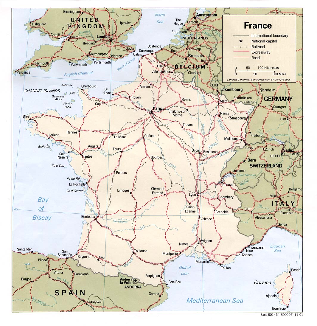
Country Maps- France (Political) 1991 (227K) and pdf format (264K)
- France (Shaded Relief) 1991 (309K) and pdf format (321K)
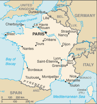
- France (Small Map) 2016 (15.9K)
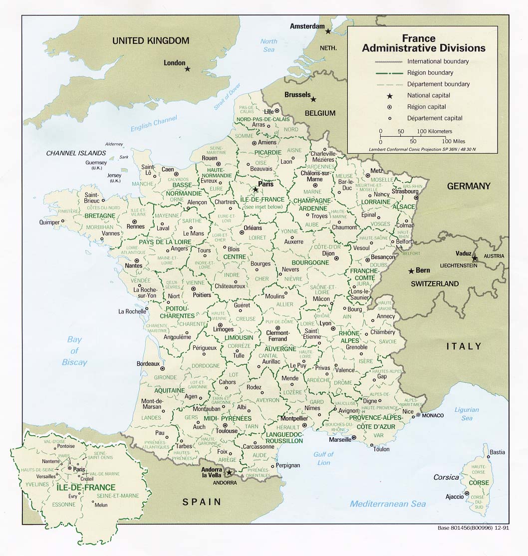
- France: Administrative Divisions (Political) 1991 (211K)
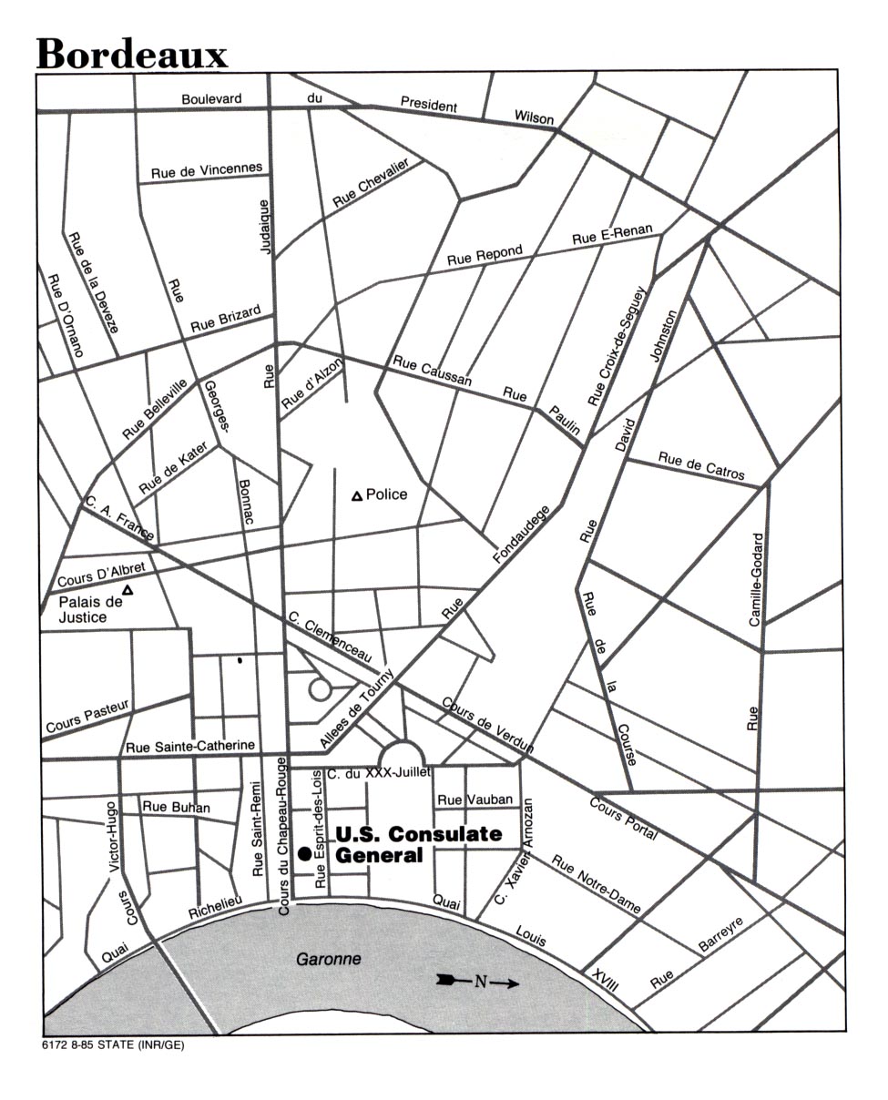
- Bordeaux (Note: Consulate Closed 1996) U.S. Dept. of State 1985 (285K)
- Marseille U.S. Naval Forces Europe 1999 (45K)
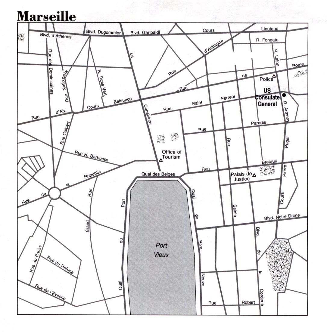
- Marseille U.S. Dept. of State 1993 (258K)
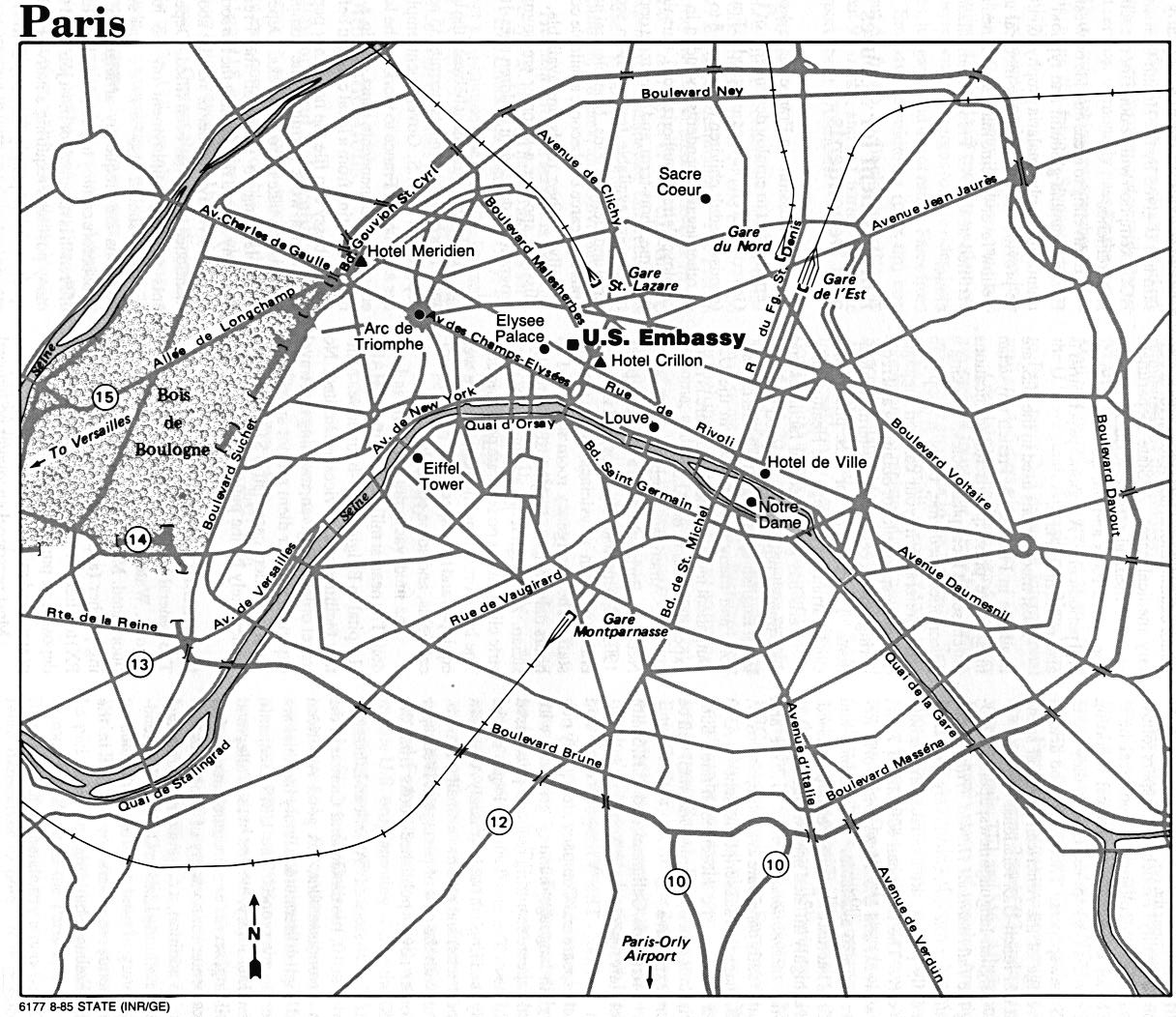
- Paris U.S. Dept. of State 1985 (266K)
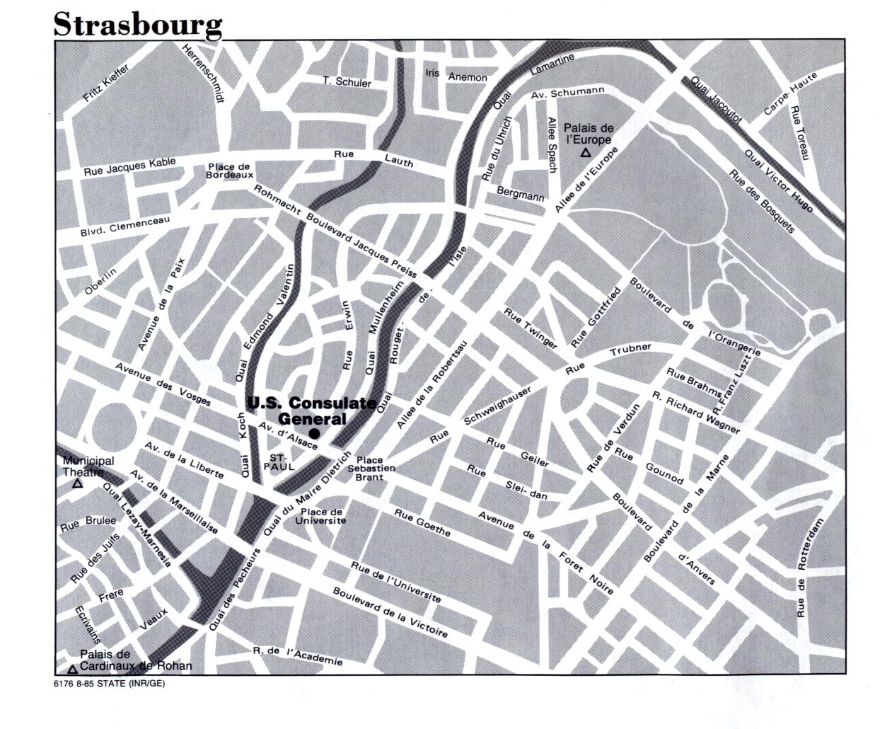
- Strasbourg U.S. Dept. of State 1985 (387K)
- Toulon U.S. Naval Forces Europe 1999 (45K)
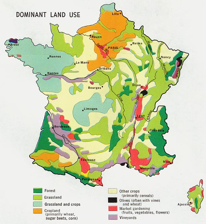
- France - Dominant Land Use from Map No. 500197 1972 (155K)
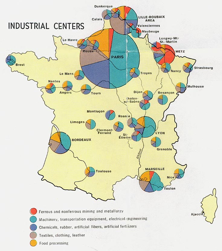
- France - Industrial Centers from Map No. 500197 1972 (132K)
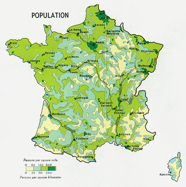
- France - Population from Map No. 500197 1972 (164K)
- France - Resources and Processing from Map No. 500197 1972 (119K)
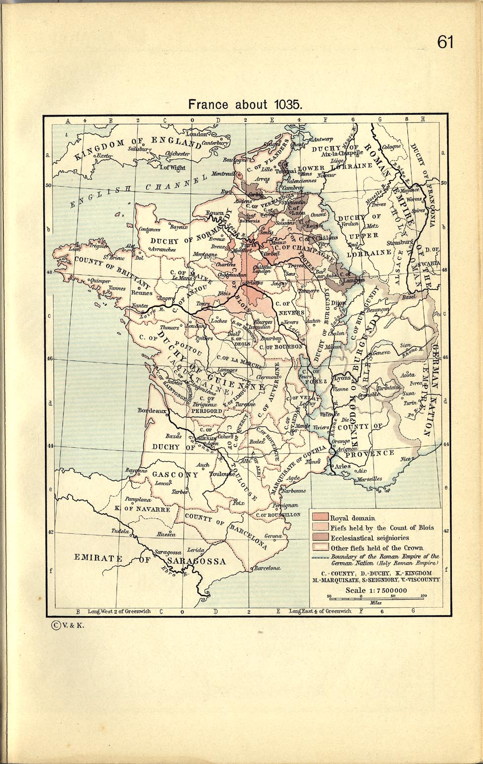
- France about 1035 From The Historical Atlas by William R. Shepherd, 1911. (329K)
- France 1154-1184 From The Historical Atlas by William R. Shepherd, 1911. (497K)
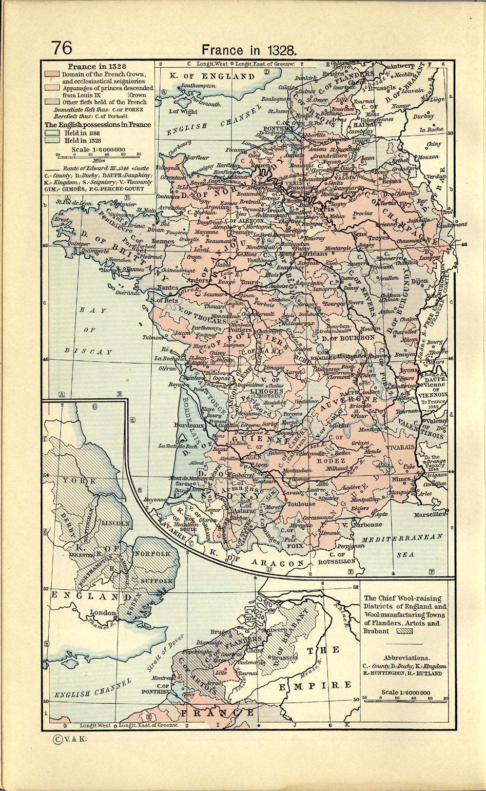
- France 1328 From The Historical Atlas by William R. Shepherd, 1911. (446K)
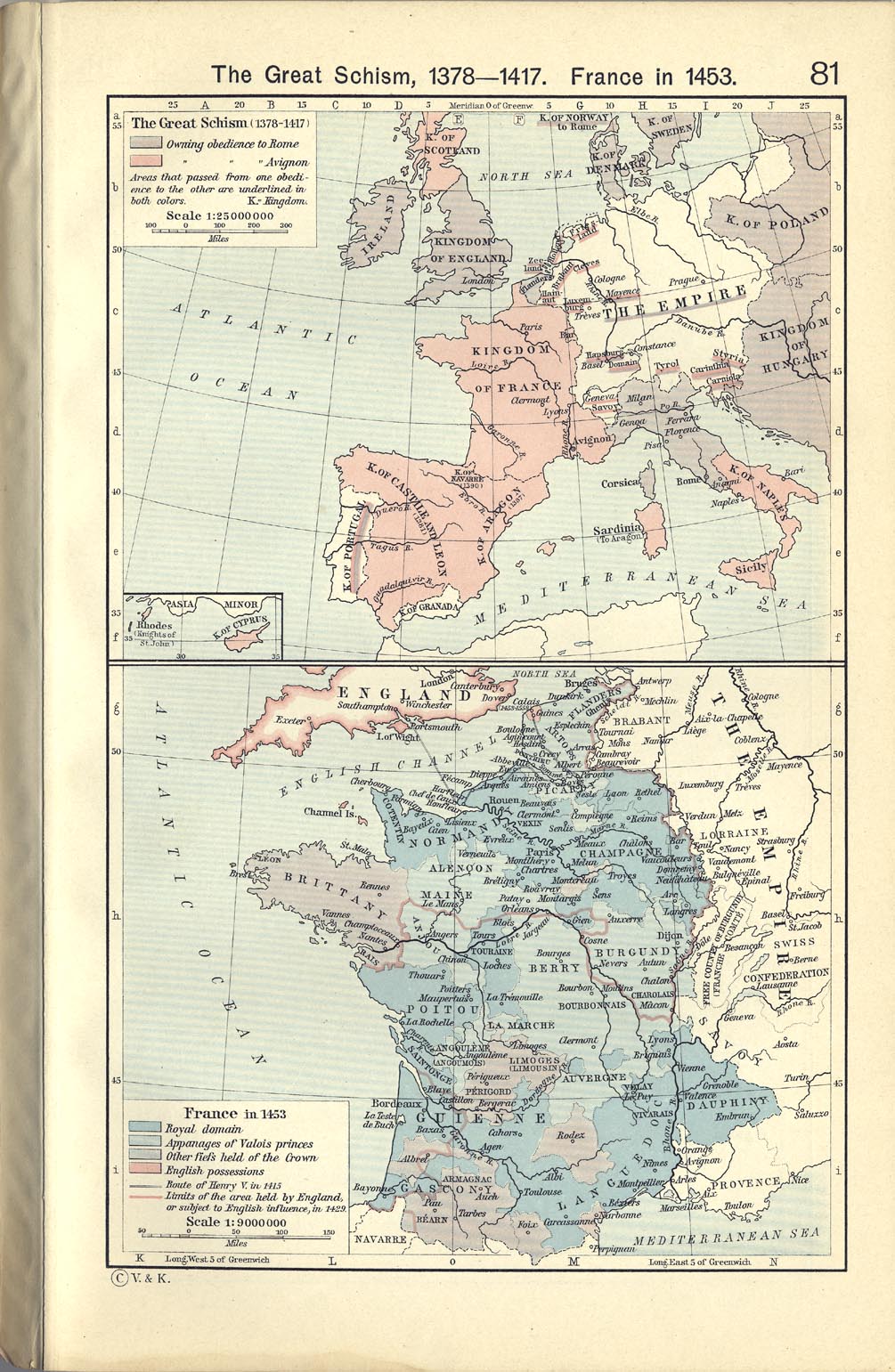
- France 1453 From The Historical Atlas by William R. Shepherd, 1911. (344K)
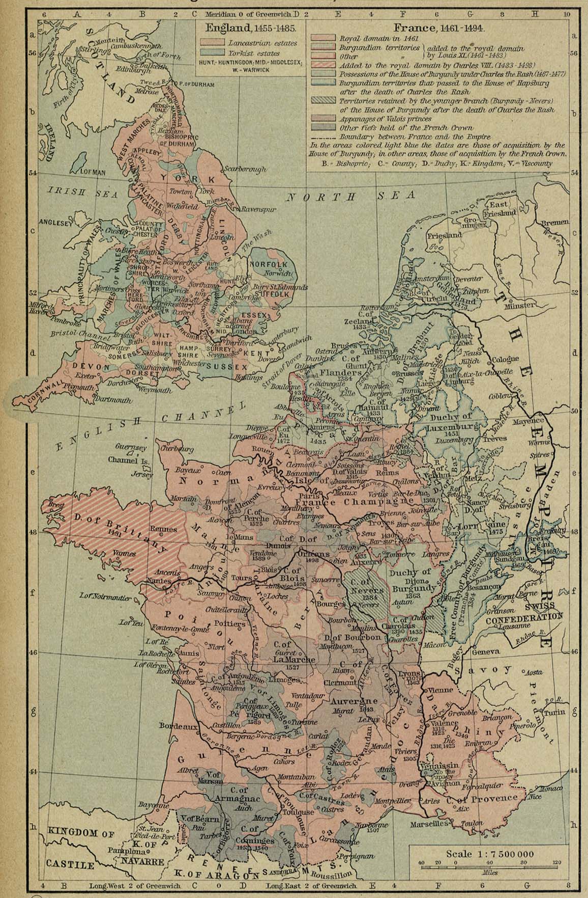
- France 1461-1494 From The Historical Atlas by William R. Shepherd, 1926. (373K)
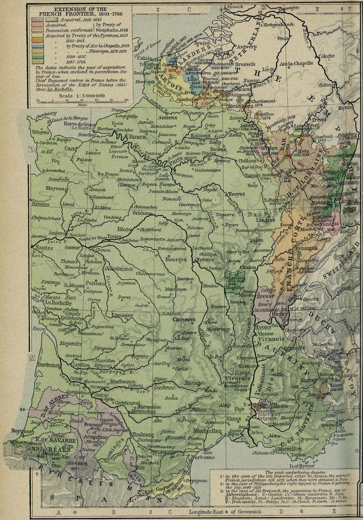
- France - Extension of the French Frontier 1601-1766 From The Historical Atlas by William R. Shepherd, 1926. (477K)
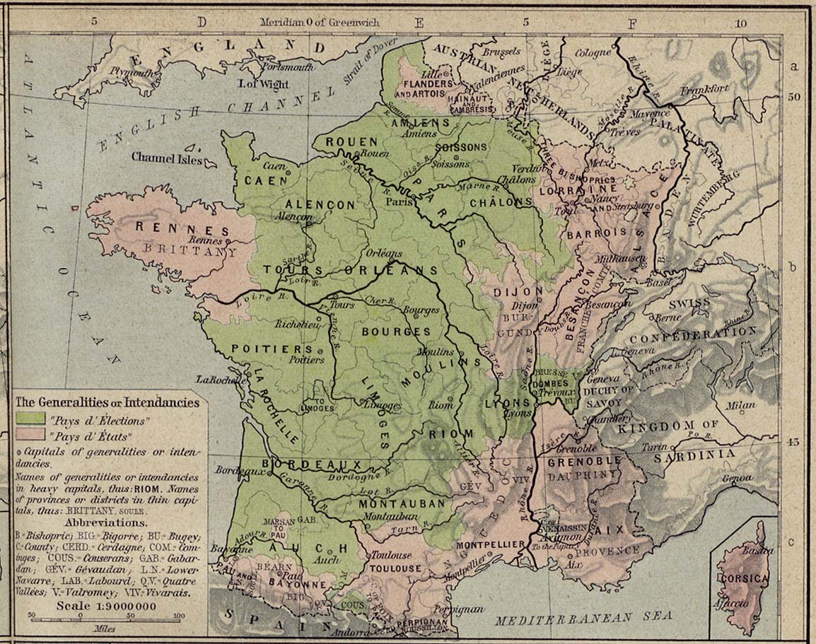
- France 1789 The Generalities or Intendancies. From The Historical Atlas by William R. Shepherd, 1926. (269K)
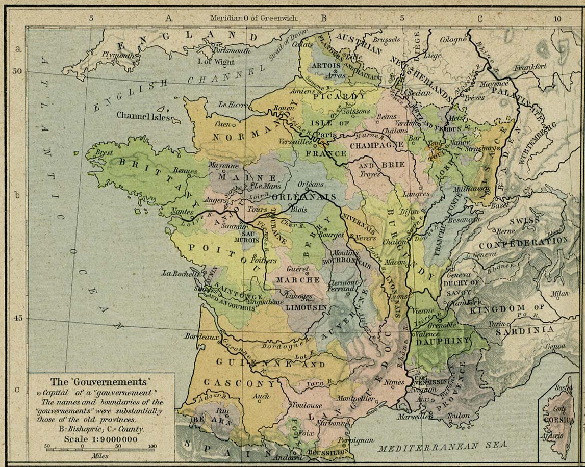
- France 1789 The "Gouvernements". From The Historical Atlas by William R. Shepherd, 1926. (275K)
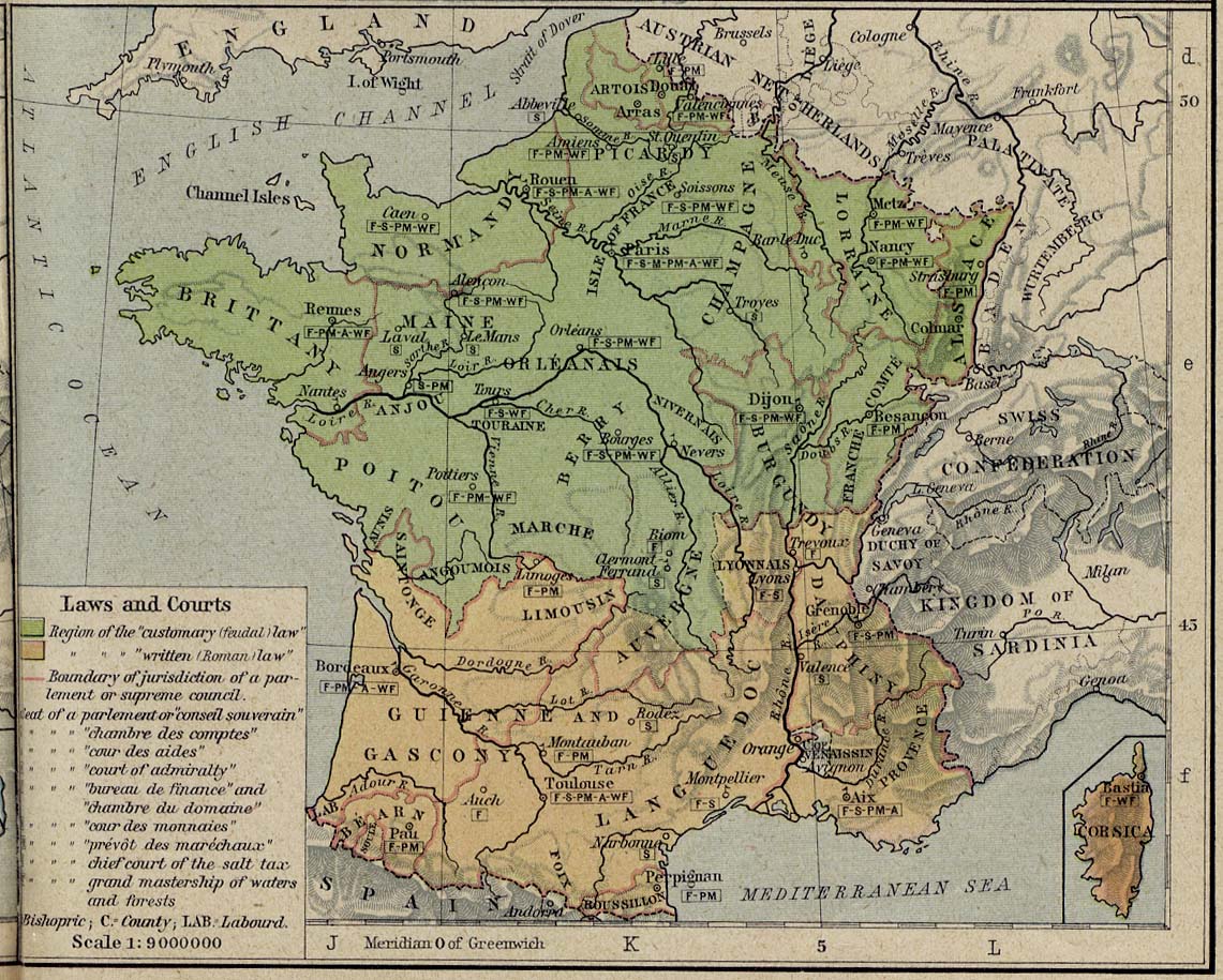
- France 1789 Laws and Courts. From The Historical Atlas by William R. Shepherd, 1926. (291K)
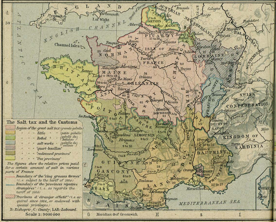
- France 1789 The Salt Tax and the Customs. From The Historical Atlas by William R. Shepherd, 1926. (299K)
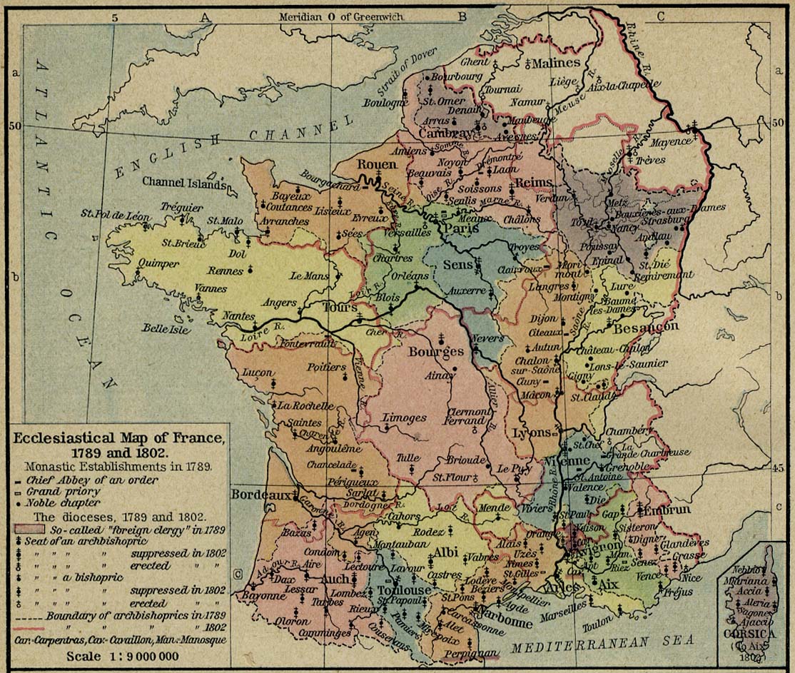
- France 1789 and 1802 Ecclesiastical Map of France, 1789 and 1802. From The Historical Atlas by William R. Shepherd, 1926. (292K)
- France 1791 From The Historical Atlas by William R. Shepherd, 1926. (301K)
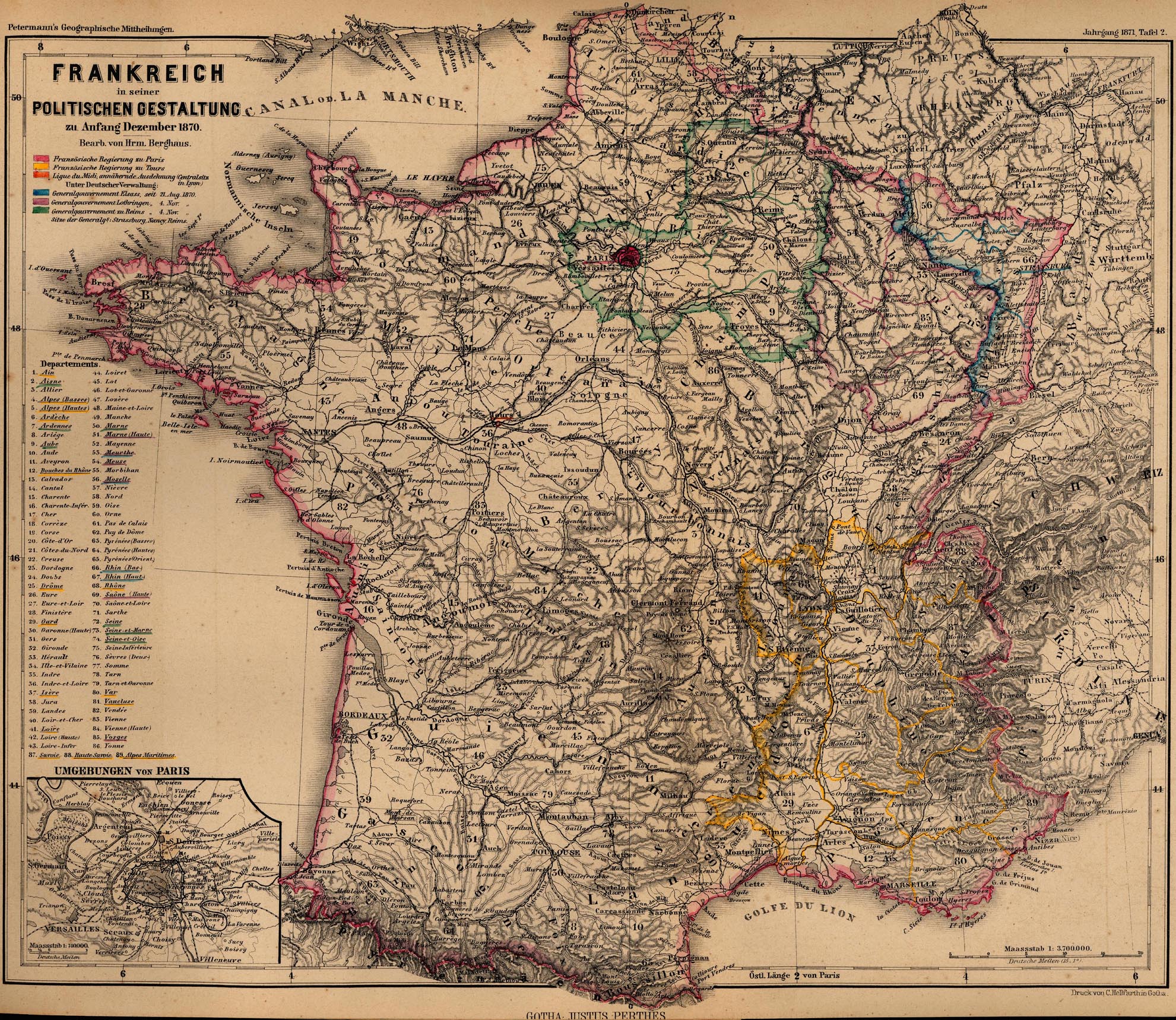
- France 1870 "Frankreich in seiner Politischen Gestaltung zu Anfang Dezember 1870" From Mittheilungen aus Justus Perthes' geographischer Anstalt..., by Dr. A Petermann. 1871. (1.1MB)
- [France] Baedeker's Southern France 1914 (106 Maps)
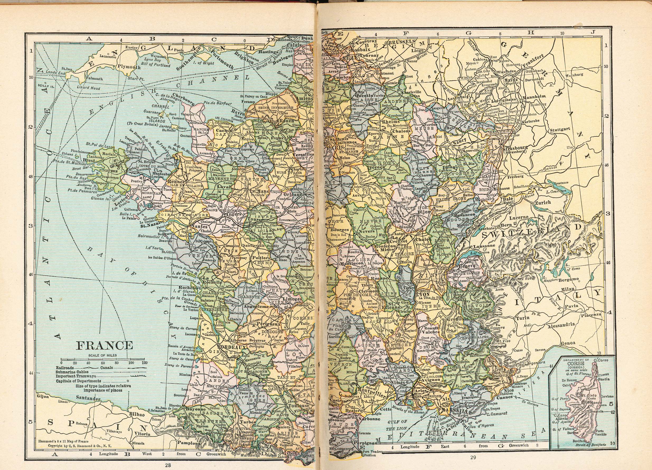
- France 1921 From Putnam's Handy Volume Atlas of the World. Published by G.P. Putnam's Sons, New York and London, 1921. (1.4MB)
- France, 1954- [Topographic Maps] Series M562, 1:250,000, U.S. Army Map Service
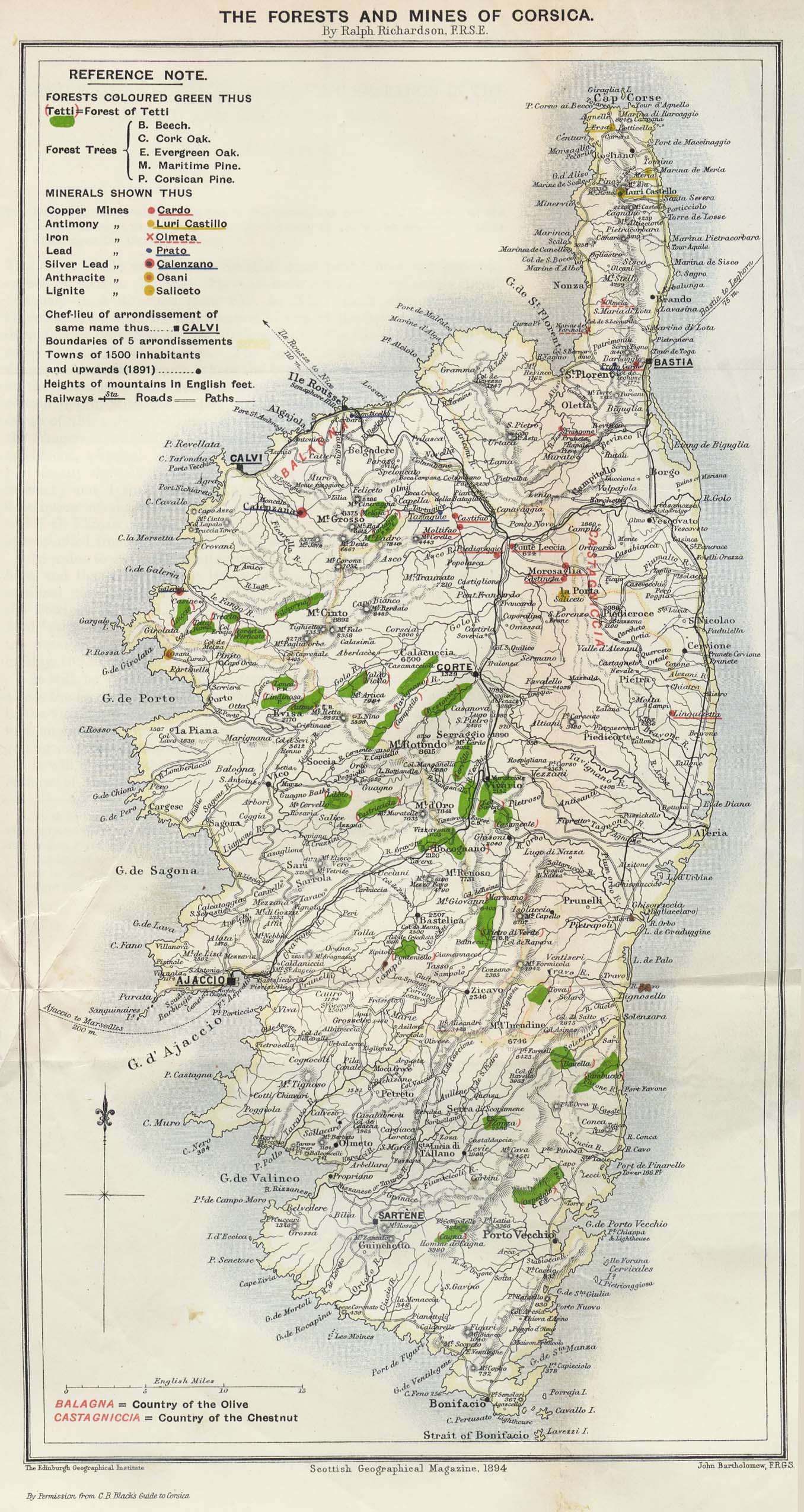
- Corsica 1894 from the Scottish Geographical Magazine. Published by the Royal Scottish Geographical Society and edited by James Geikie and W.A. Taylor. Volume X, 1894. (599K)
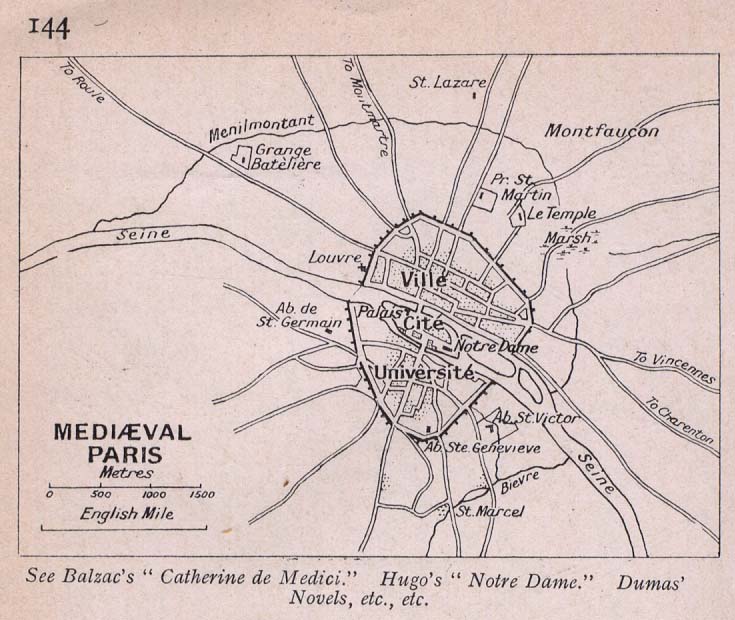
- Paris, Medieval "Mediaeval Paris" From Literary and Historical Atlas of Europe, by J.G. Bartholomew, 1912. (88K)
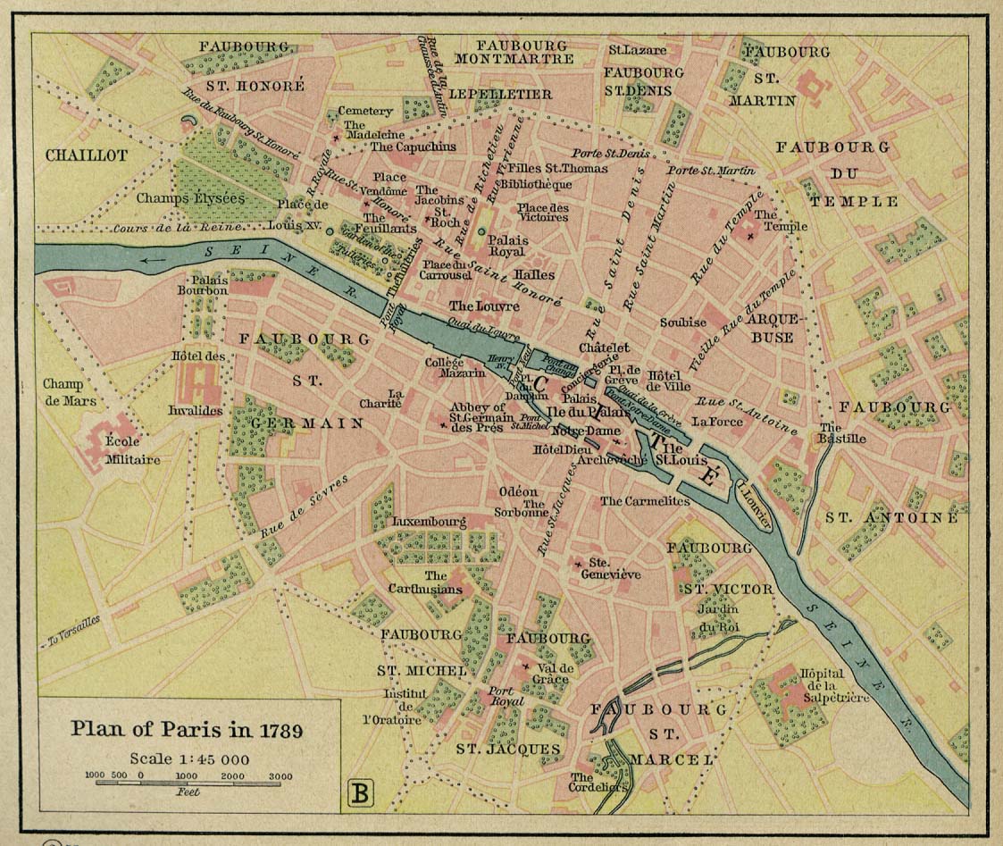
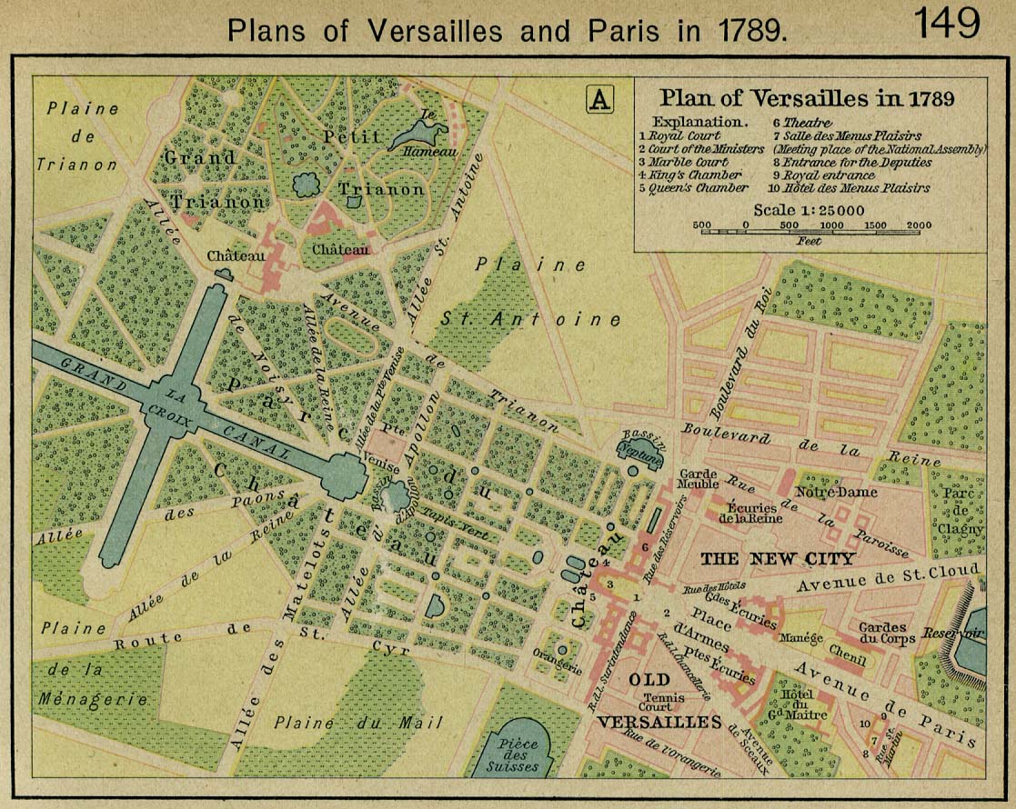
- Plans of Paris (251K) and Versailles 1789. From The Historical Atlas by William R. Shepherd, 1926. (262K)
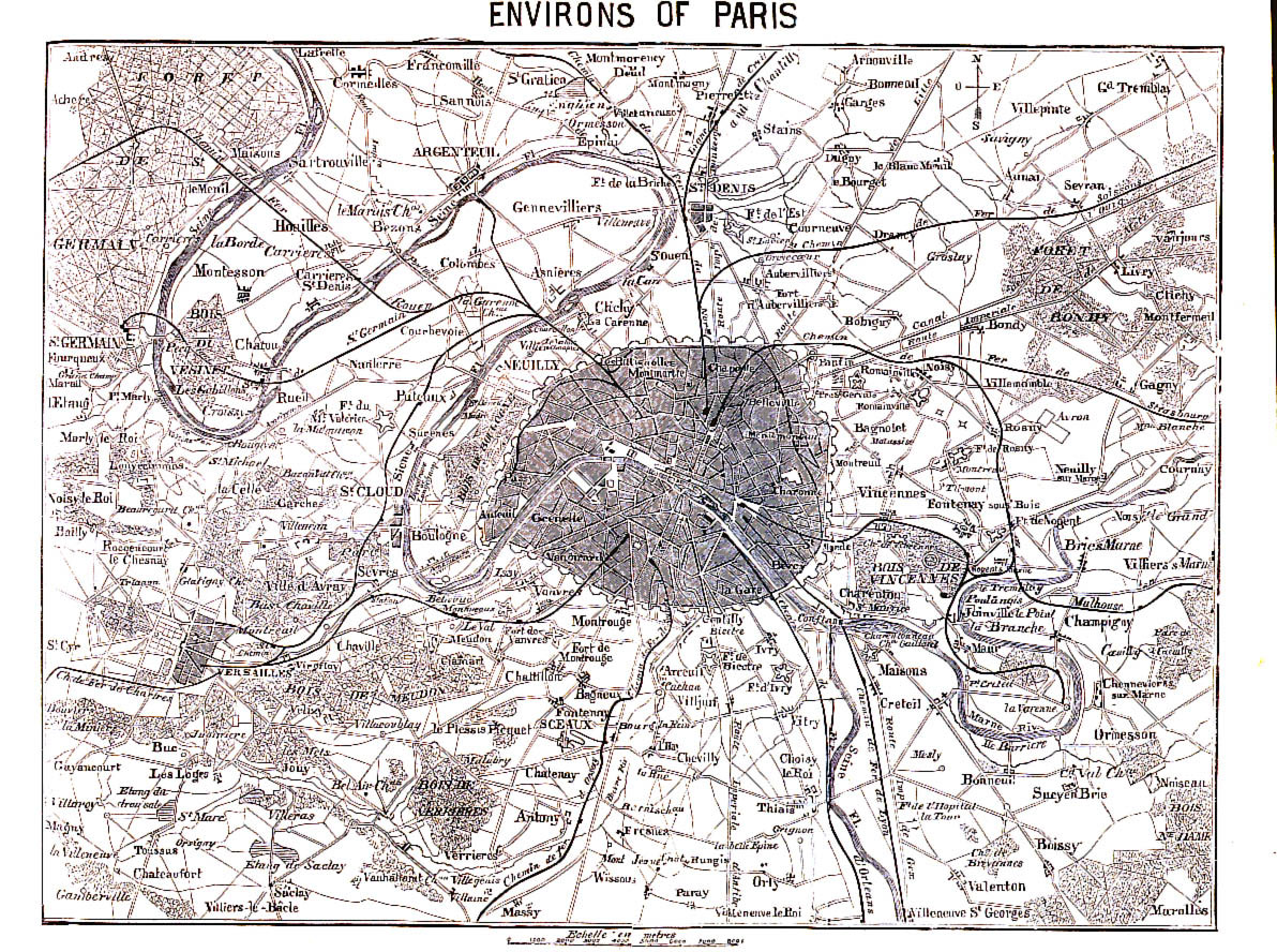
- Paris, Environs of 1866 From A Handbook For Visitors To Paris, Second Edition. London: John Murray. 1866. (645K)
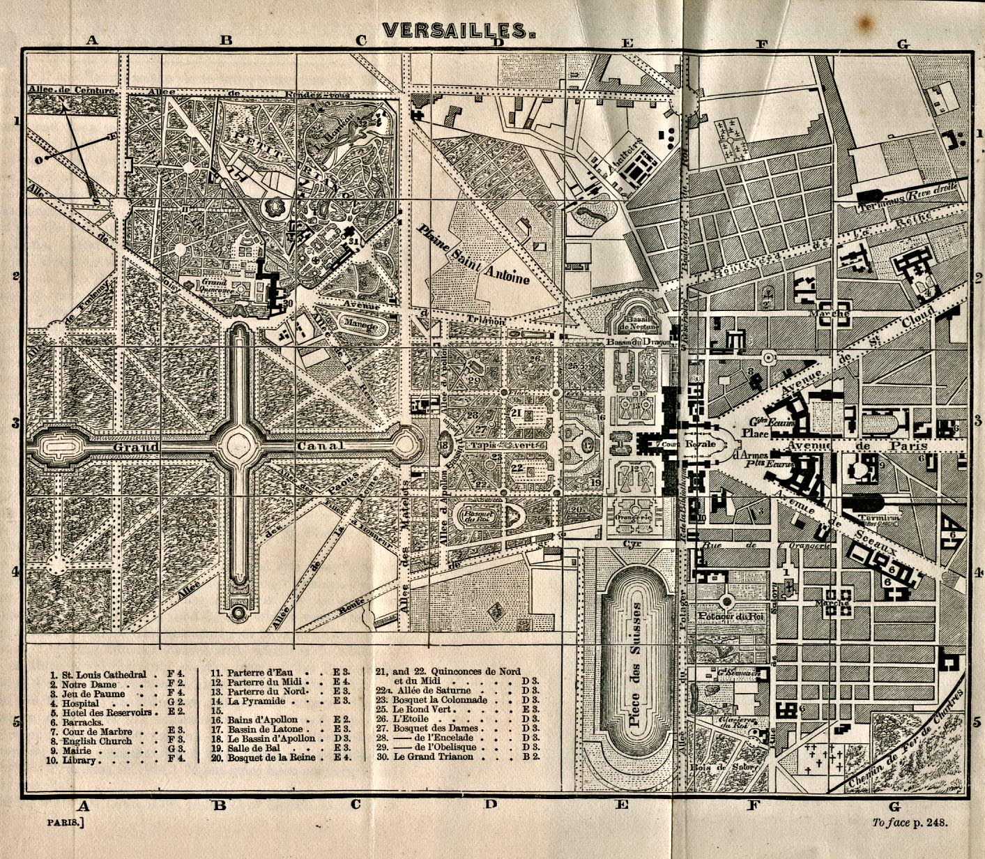
- Versailles 1866 From A Handbook For Visitors To Paris, Second Edition. London: John Murray. 1866. (774K)
- Paris 1871 "Paris und Umgebung" From Mittheilungen aus Justus Perthes' geographischer Anstalt..., by Dr. A Petermann. 1871. (784K)
- France City Plans 1942-1944 U.S. Army Map Service
- 1:2,000,000 - Europe Series 4464, Great Britain War Office, 1965
- This series covers France
- 1:1,000,000 - International Map of the World
- This series includes most of France. Clickable map
- 1:1,000,000 - Operational Navigation Charts Series U.S. Defense Mapping Agency Aerospace Center Not for navigational use
- This series includes all of France on sheets E-1, E-2, F-1 and F-2
- 1:500,000 - Europe Series M406 (4798), Great Britain War Office, 1942-
- This series includes all of France (except Corsica)
- 1:250,000 - France Topographic Maps Series M561, U.S. Army Map Service, 1943-
- This series covers all of France
- 1:250,000 - France Topographic Maps Series M562, U.S. Army Map Service, 1954-
- This series includes most of France
- 1:250,000 - Western Europe Topographic Maps Series M501, U.S. Army Map Service, 1959-
- This series includes most of France
- 1:500,000 - Europe Road Maps for Allied Forces Series M406 (GSGS 4798), Great Britain War Office, 1942-
- This series covers France
- 1:500,000 - Europe Series M404 (4072), Great Britain War Office, 1942-
- This series covers most of France
- 1:500,000 - Tactical Pilotage Charts U.S. National Imagery and Mapping Agency. Not for navigational use
- This series covers France
- 1:500,000 - World Series 1404, Great Britain. War Office and Air Ministry. 1958-
- This series covers parts of France
- 1:250,000 - Northwest Europe Series M503 (4042), Great Britain War Office, 1937-
- This series covers parts of northern France
- 1:200,000 - Europe Road Maps Series M505 (GSGS 4238), U.S. Army Map Service, 1941-
- This series covers most of France
- 1:100,000 - France Series M661 (GSGS 4249), U.S. Army Map Service, 1943-
- This series covers most of France
- 1:50,000 - France Series M761, U.S. Army Map Service, 1942-
- 1:50,000 - Corsica Series M763 (4398), U.S. Army Map Service, 1943
- 1:50,000 - France and Belgium Series M703 (GSGS 4040), U.S. Army Map Service, 1937
- This series covers parts of northern France
- This series covers France
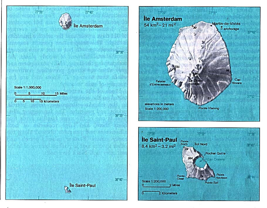
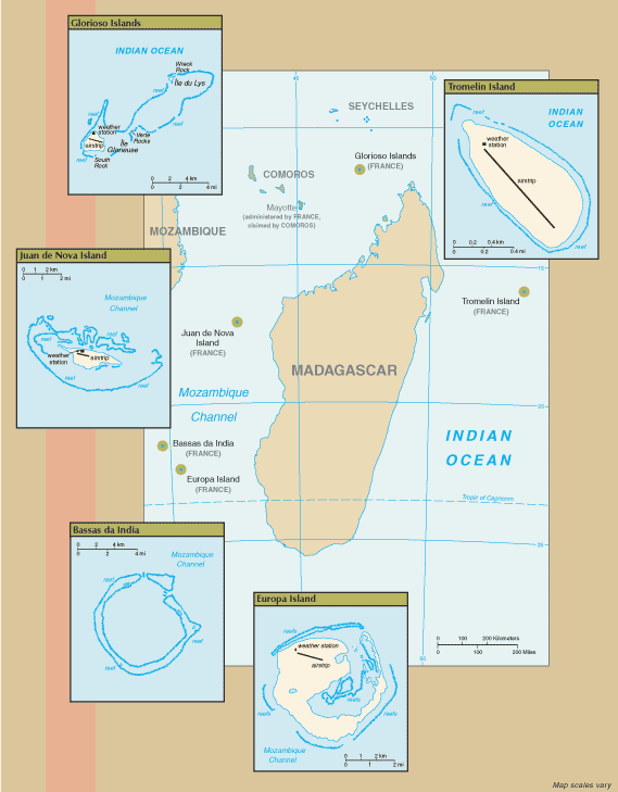
- Amsterdam Island and Saint-Paul Island (Indian Ocean) 1976 (141K)
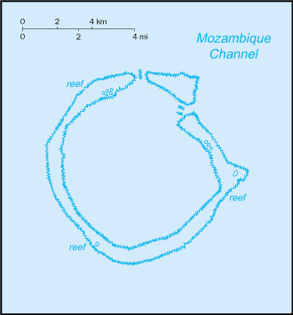
- Bassas da India (Indian Ocean) 1976 (116K)
- Bassas da India (Indian Ocean) (Small Map) 2006 (6K)
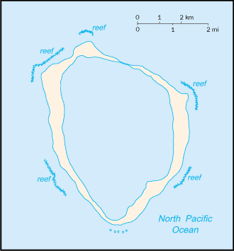
- Clipperton Island (Pacific Ocean) (Small Map) 2016 (5.8K)
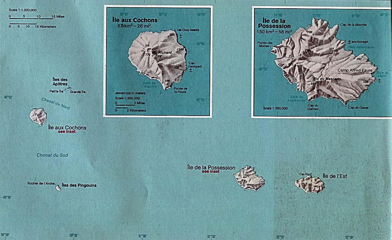
- Crozet Islands (Indian Ocean) 1976 (206K)
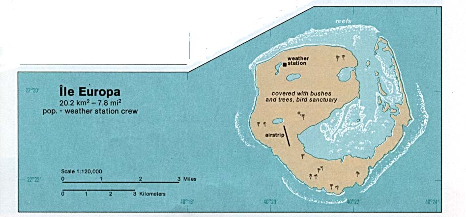
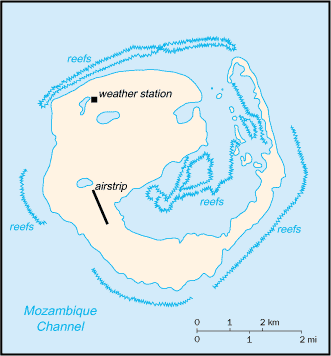
- Europa Island (Indian Ocean) 1976 (64K)
- Europa Island (Indian Ocean) (Small Map) 2006 (10K)
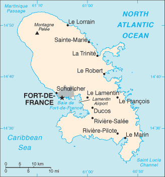
- Fort de France, Martinique [City Map] U.S. Dept. of State 1984 (121K)
- French Guiana Maps (South America)
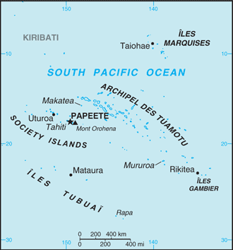
- French Polynesia (Pacific Ocean) (Political) 1989 (190K)
- French Polynesia (Pacific Ocean) (Small Map) 2016 (17.1K)
- French Southern and Antarctic Lands (Small Map) 2014 (59.8K)
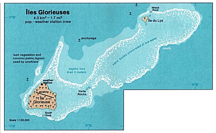
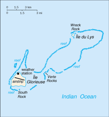
- Glorioso Islands - Iles Glorieuses (Indian Ocean) 1976 (103K)
- Glorioso Islands - Iles Glorieuses (Indian Ocean) (Small Map) 2006 (7K)
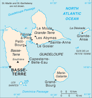
- Guadeloupe (Caribbean Sea) (Small Map) 2006 (11K)
- Iles Eparses (Indian Ocean) (Small Map) 2007 (35K)
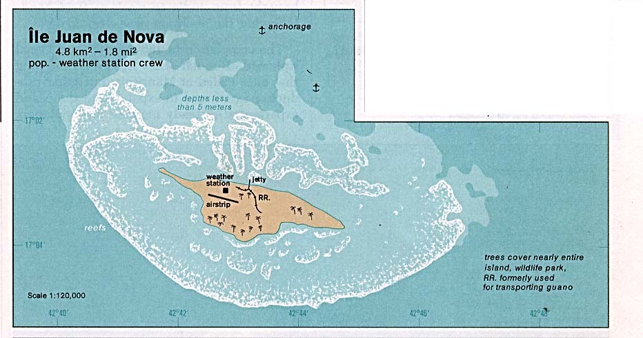
- Juan de Nova Island (Indian Ocean) 1976 (80K)
- Juan de Nova Island (Indian Ocean) (Small Map) 2006 (7K)
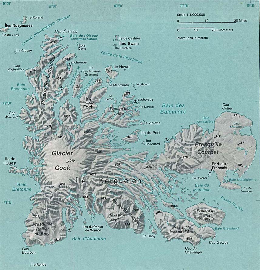
- Kerguelen Islands (Indian Ocean) 1976 (171K)
- Martinique (Caribbean Sea) (Small Map) 2006 (11K)
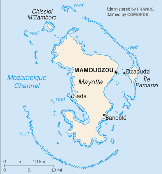
- Mayotte (Indian Ocean) (Small Map) 2010 (11K)
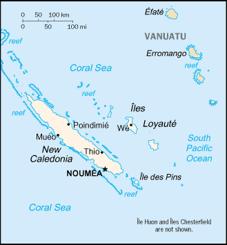
- New Caledonia (Pacific Ocean) (Shaded Relief) 1985 (217K)
- New Caledonia (Pacific Ocean) (Small Map) 2016 (8.9K)
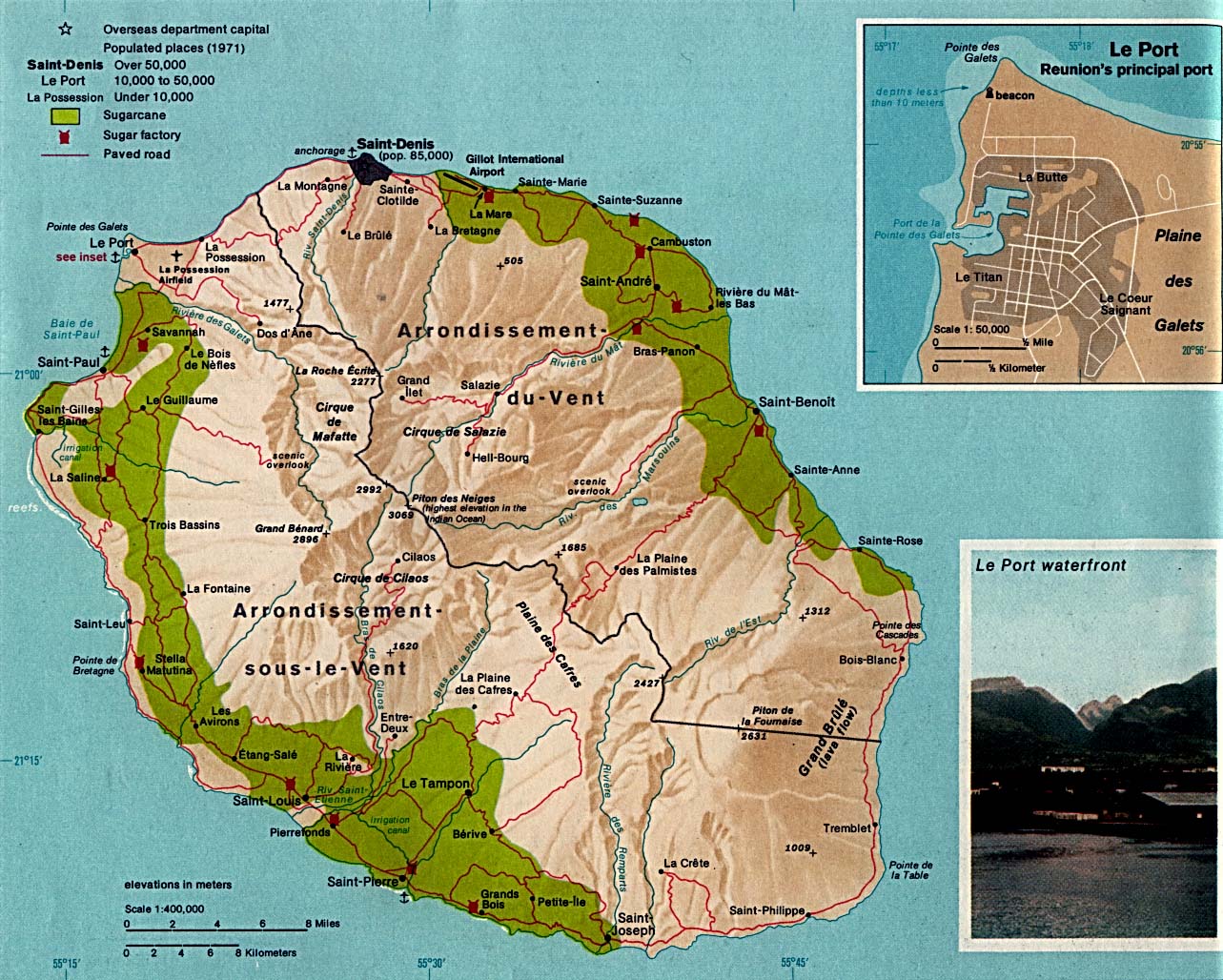
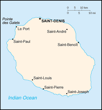
- Reunion (Indian Ocean) 1976 (309K)
- Reunion (Indian Ocean) (Small Map) 2006 (6K)
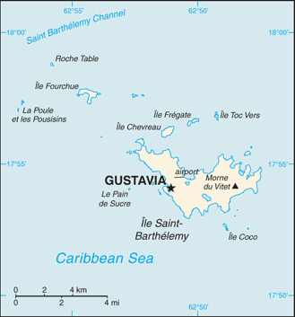
- Saint Barthelemy (Caribbean Sea) (Small Map) 2016 (11.7K)
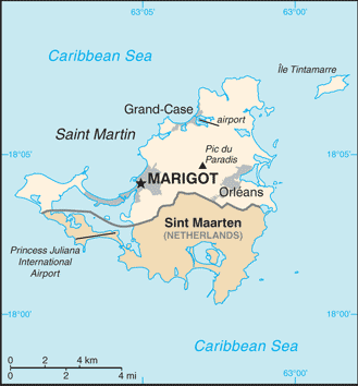
- Saint Martin (Caribbean Sea) (Small Map) 2016 (17.5K)
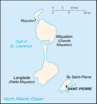
- Saint Pierre and Miquelon (North America) (Small Map) 2016 (6.6K)
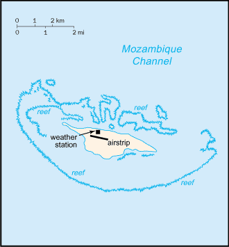
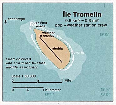
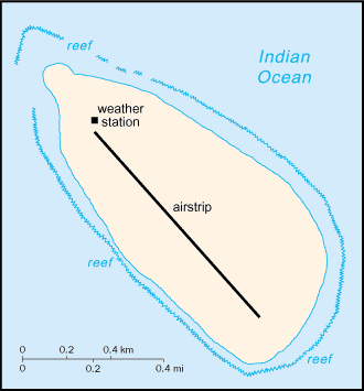
- Tromelin Island (Indian Ocean) 1976 (29K)
- Tromelin Island (Indian Ocean) (Small Map) 2006 (7K)
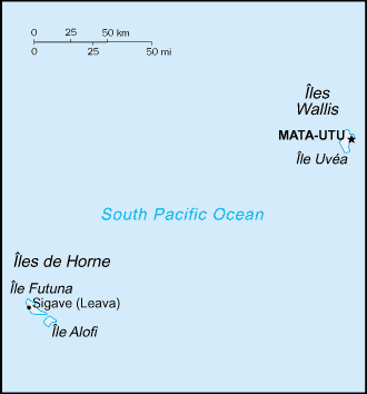
- Wallis and Futuna Islands (Pacific Ocean) (Small Map) 2016 (4K)
![Fort de France, Martinique [City Map]](world_cities/fortdefrance.jpg)
Maps on Other Web Sites