Perry-Castañeda Library
Map Collection
West Virginia Maps
State Maps
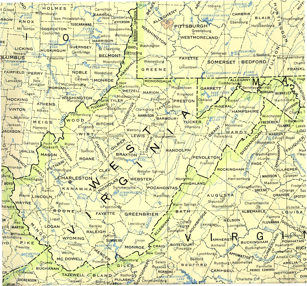
- West Virginia (base map) JPEG format (485K) County boundaries and names, county seats, rivers. Original scale 1:2,500,000 U.S. Geological Survey, 1972 limited update 1990
- West Virginia (outline map) JPEG format (76K) County boundaries and names. U.S. Bureau of the Census, 1990
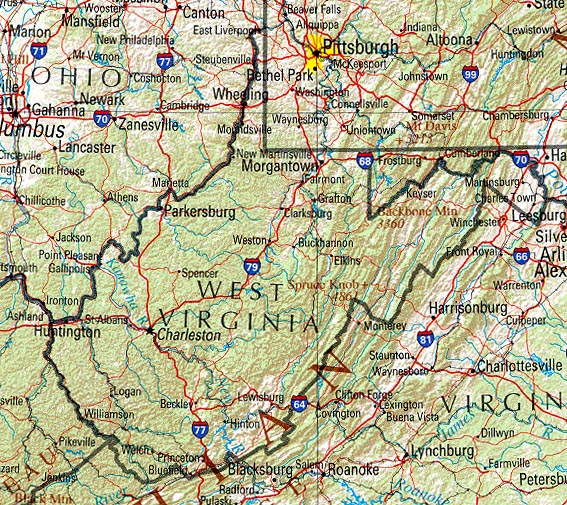
- West Virginia (reference map) JPEG format (219K) Shaded relief map with state boundaries, forest cover, place names, major highways. Portion of "The National Atlas of the United States of America. General Reference", compiled by U.S. Geological Survey 2001, printed 2002
- West Virginia (reference map) PDF format (221K) Shaded relief map with state boundaries, forest cover, place names, major highways. Portion of "The National Atlas of the United States of America. General Reference", compiled by U.S. Geological Survey 2001, printed 2002
- West Virginia - Federal Lands and Indian Reservations PDF format (451K) The National Atlas of the United States of America, U.S. Geological Survey, 2003
City Maps
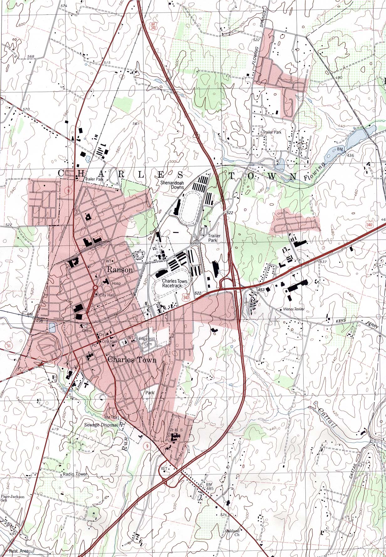
- Charles Town (topographic) original scale 1:24,000 U.S.G.S. 1997 (569K)
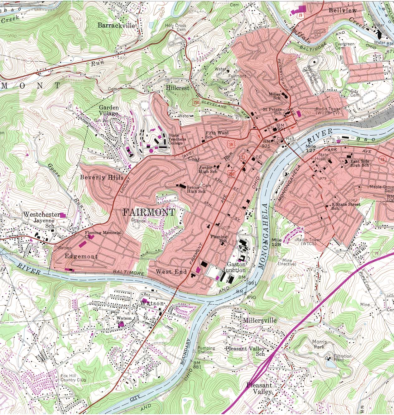
- Fairmont (topographic) original scale 1:24,000 U.S.G.S. 1958, photorevised 1976 (584K)
Historical City Maps
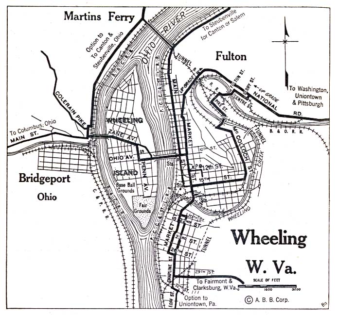
- Wheeling 1920 Automobile Blue Book (156K)
Historical Topographic Maps
- West Virginia Historical Topographic Maps (U.S. Geological Survey)
- Pre-1945 Maps, Scales 1:62,500, 1:125,000 (U.S. Geological Survey)
Maps of National Parks, Monuments, and Historic Sites
The following maps were produced by the U.S. National Park Service unless otherwise noted.
- Bluestone National Scenic River (Park Map) 1999 (452K) (PDF Format)
- Chesapeake and Ohio Canal National Historic Park [Washington, DC / Maryland / West Virginia] (Area Map) 1996 (273K)
- Chesapeake and Ohio Canal National Historic Park [Washington, DC / Maryland / West Virginia] (Detail Map) 1999 (258) (PDF Format)
- Chesapeake and Ohio Canal National Historic Park [Washington, DC / Maryland / West Virginia] (Park Map) 1996 (936K)
- Harpers Ferry National Historical Park (Detail Map) 1997 (65K) (PDF Format)
- Harpers Ferry National Historical Park (Park Map) 1997 (65K) (PDF Format)
- New River Gorge National River (Park Map) 1999 (452K) (PDF Format)
![Chesapeake and Ohio Canal National Historic Park [Washington, DC / Maryland / West Virginia]](national_parks/ches_loc96.jpg)
![Chesapeake and Ohio Canal National Historic Park [Washington, DC / Maryland / West Virginia]](national_parks/ches_96.jpg)
Maps on Other Web Sites