Perry-Castañeda Library
Map Collection
Utah Maps
State Maps
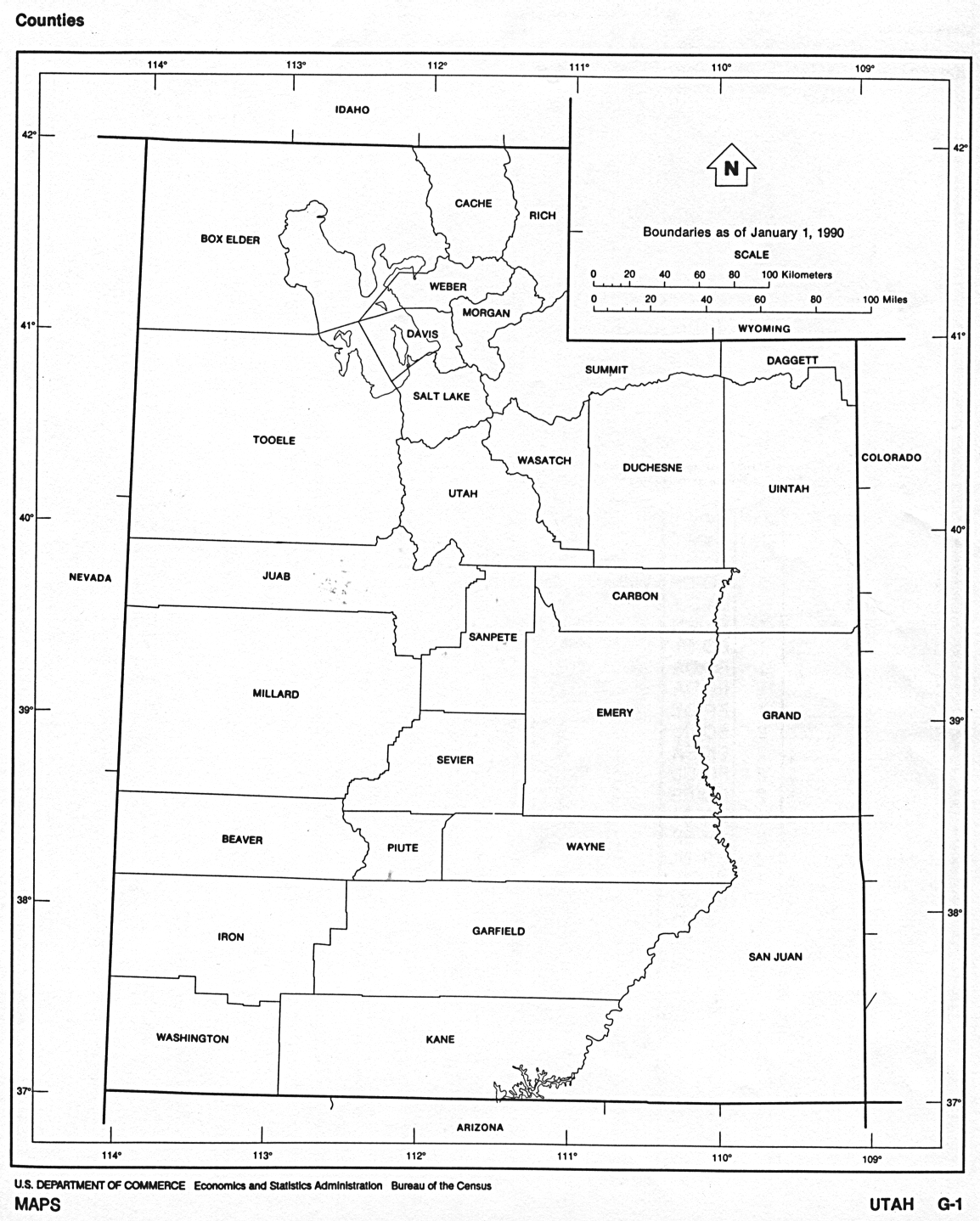
- Utah (base map) JPEG format (166K) County boundaries and names, county seats, rivers. Original scale 1:2,500,000 U.S. Geological Survey, 1972 limited update 1990
- Utah (outline map) JPEG format (193K) County boundaries and names. U.S. Bureau of the Census, 1990
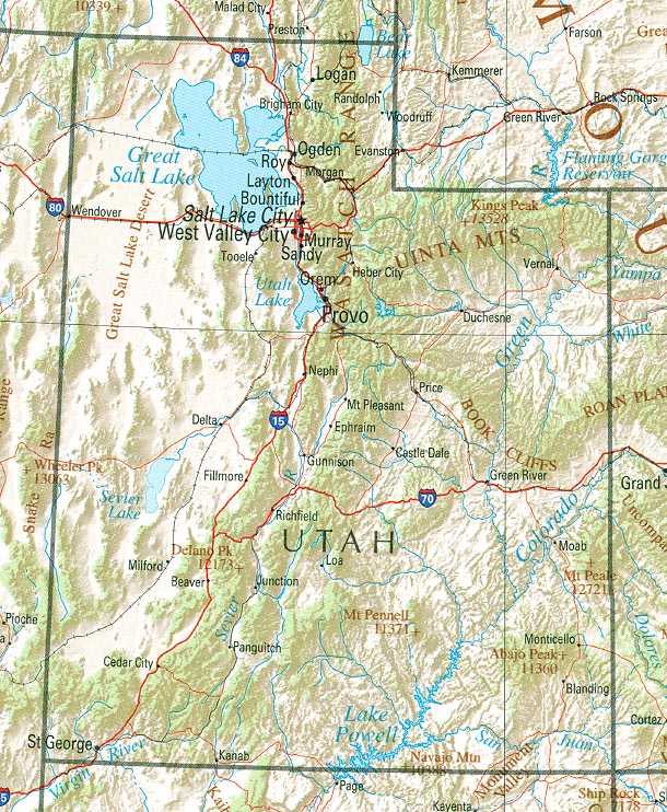
- Utah (reference map) JPEG format (259K) Shaded relief map with state boundaries, forest cover, place names, major highways. Portion of "The National Atlas of the United States of America. General Reference", compiled by U.S. Geological Survey 2001, printed 2002
- Utah (reference map) PDF format (262K) Shaded relief map with state boundaries, forest cover, place names, major highways. Portion of "The National Atlas of the United States of America. General Reference", compiled by U.S. Geological Survey 2001, printed 2002
- Utah - Federal Lands and Indian Reservations PDF format (1.18MB) The National Atlas of the United States of America, U.S. Geological Survey, 2003
Historical Topographic Maps
- Utah Historical Topographic Maps (U.S. Geological Survey)
- Pre-1945 historical maps, scales include 1:250,000, 1:125,000, 1:62,500
City Maps
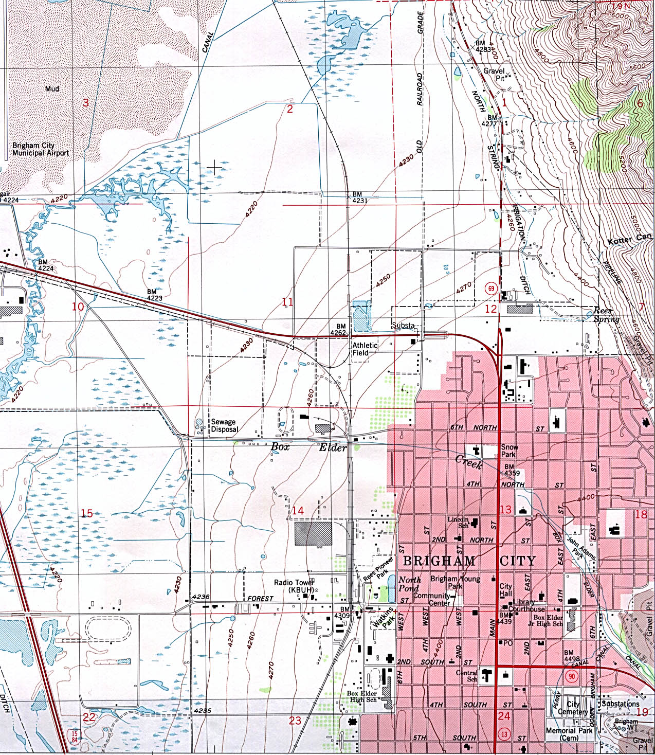
- Brigham City (topographic) original scale 1:24,000 U.S.G.S. 1988 (578K)
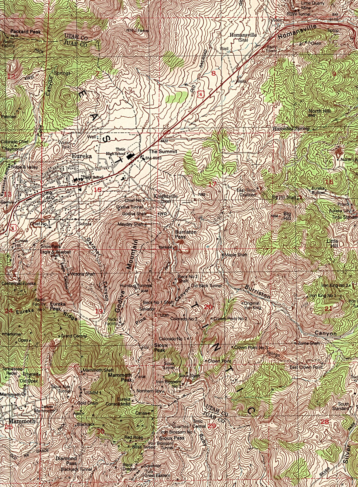
- Eureka (topographic) original scale 1:24,000 U.S.G.S. 1992 (1MB)
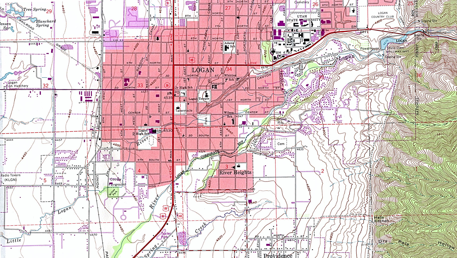
- Logan (topographic) original scale 1:24,000 U.S.G.S. 1961 photorevised 1986 (672K)
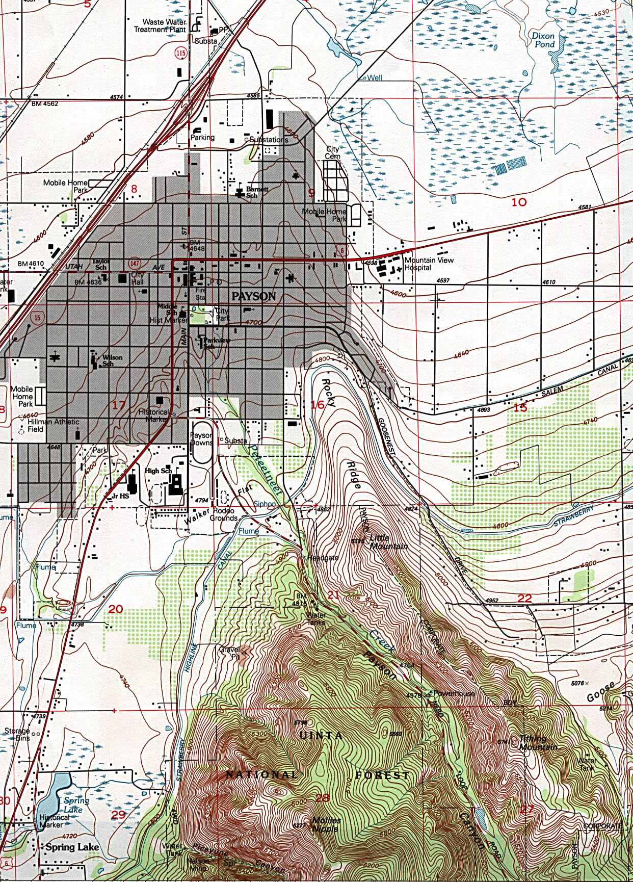
- Payson (topographic) original scale original scale 1:24,000 U.S.G.S. 1994 (791K)
- Price (topographic) original scale 1:24,000 U.S.G.S. 1982 (663K)
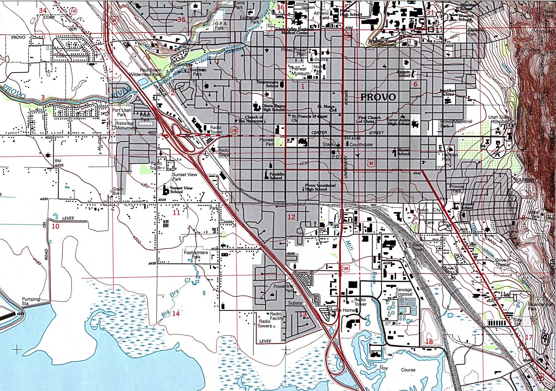
- Provo (topographic) original scale 1:24,000 U.S.G.S. 1993 (774K)
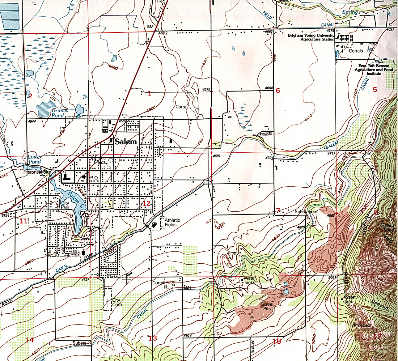
- Salem (topographic) original scale 1:24,000 U.S.G.S. 1994 (536K)
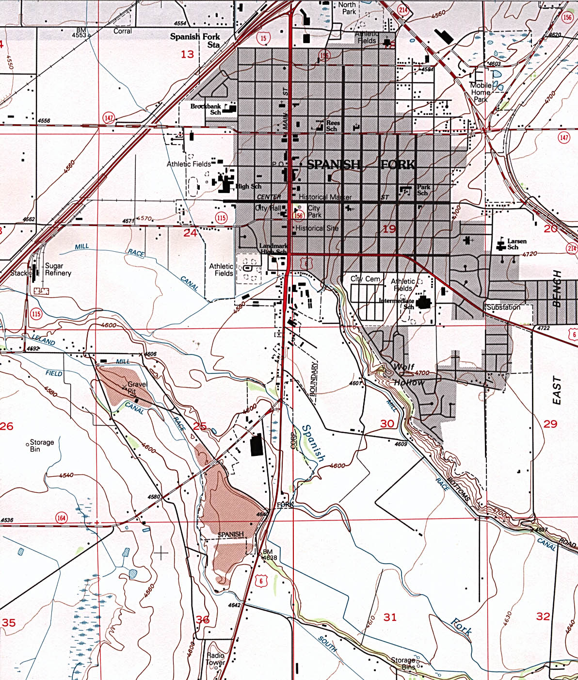
- Spanish Fork (topographic) original scale 1:24,000 U.S.G.S. 1994 (459K)
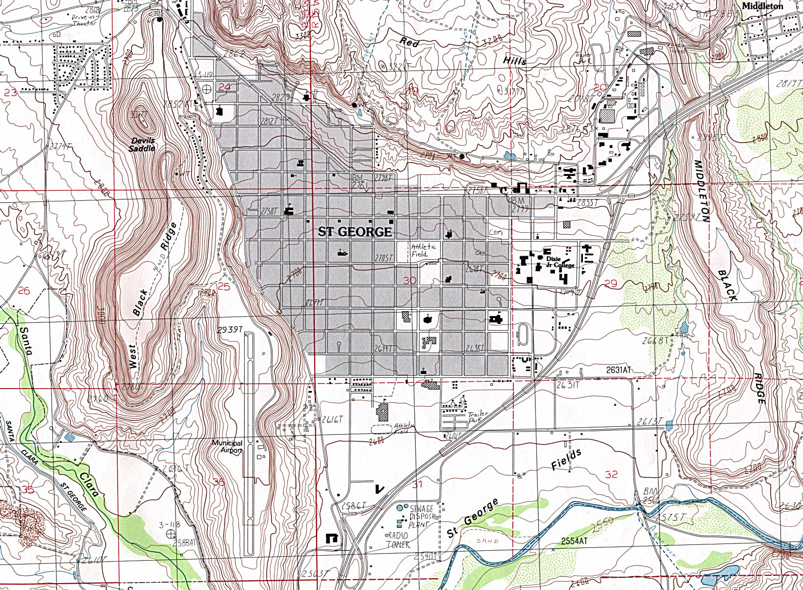
- St. George (topographic) original scale 1:24,000 U.S.G.S. provisional edition 1986 (731K)
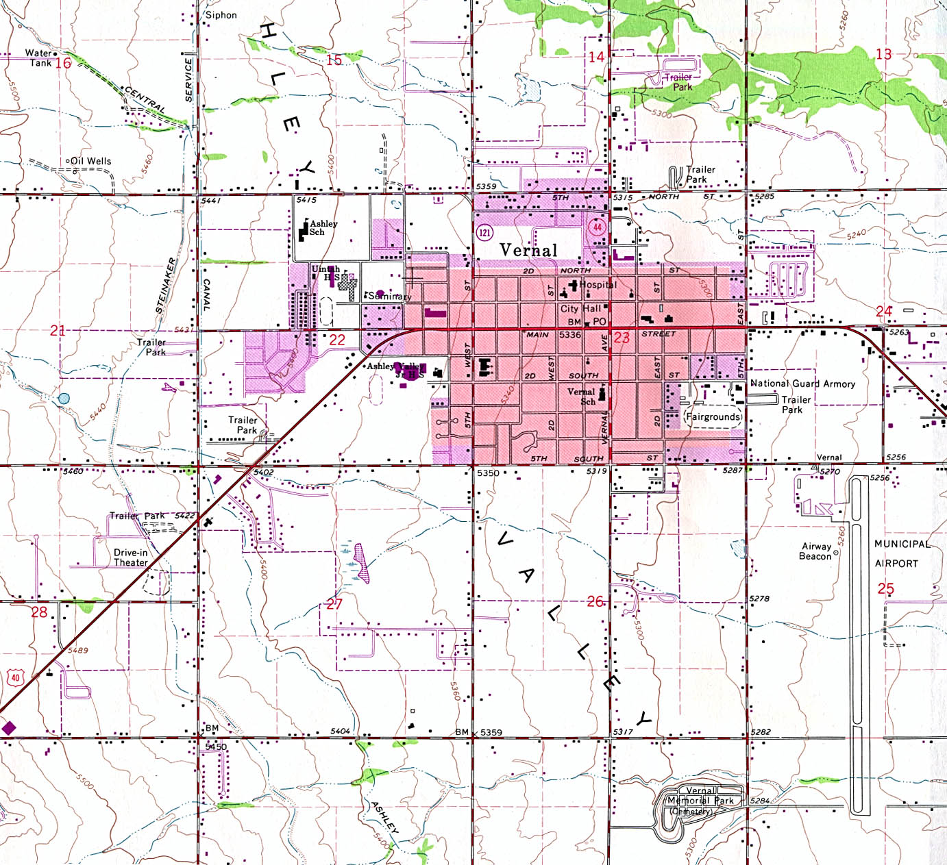
- Vernal (topographic) original scale 1:24,000 U.S.G.S. 1964 photorevised 1979 (400K)
Historical City Maps
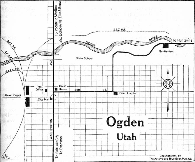
- Ogden 1917 Automobile Blue Book 1917 Vol. 8, Section 2 (99K)
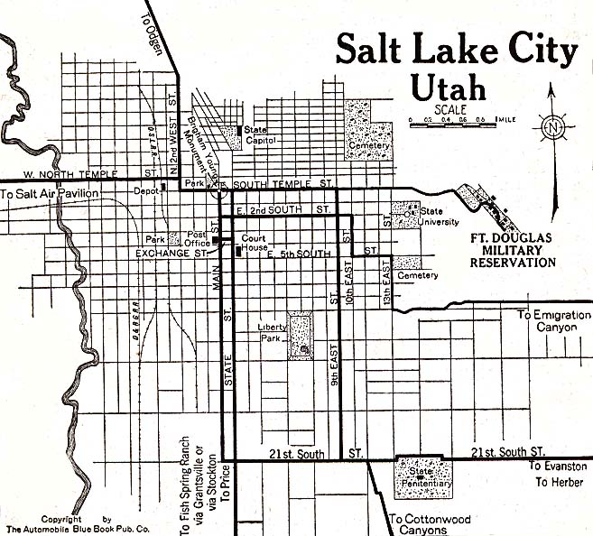
- Salt Lake City 1920 Automobile Blue Book (137K)
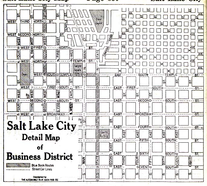
- Salt Lake City - Business District 1920 Automobile Blue Book 1920, Volume 8 (168K)
Maps of National and State Parks, Monuments, and Historic Sites
The following maps were produced by the U.S. National Park Service unless otherwise noted.
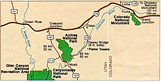
- Arches National Park (Area Map) (40K)
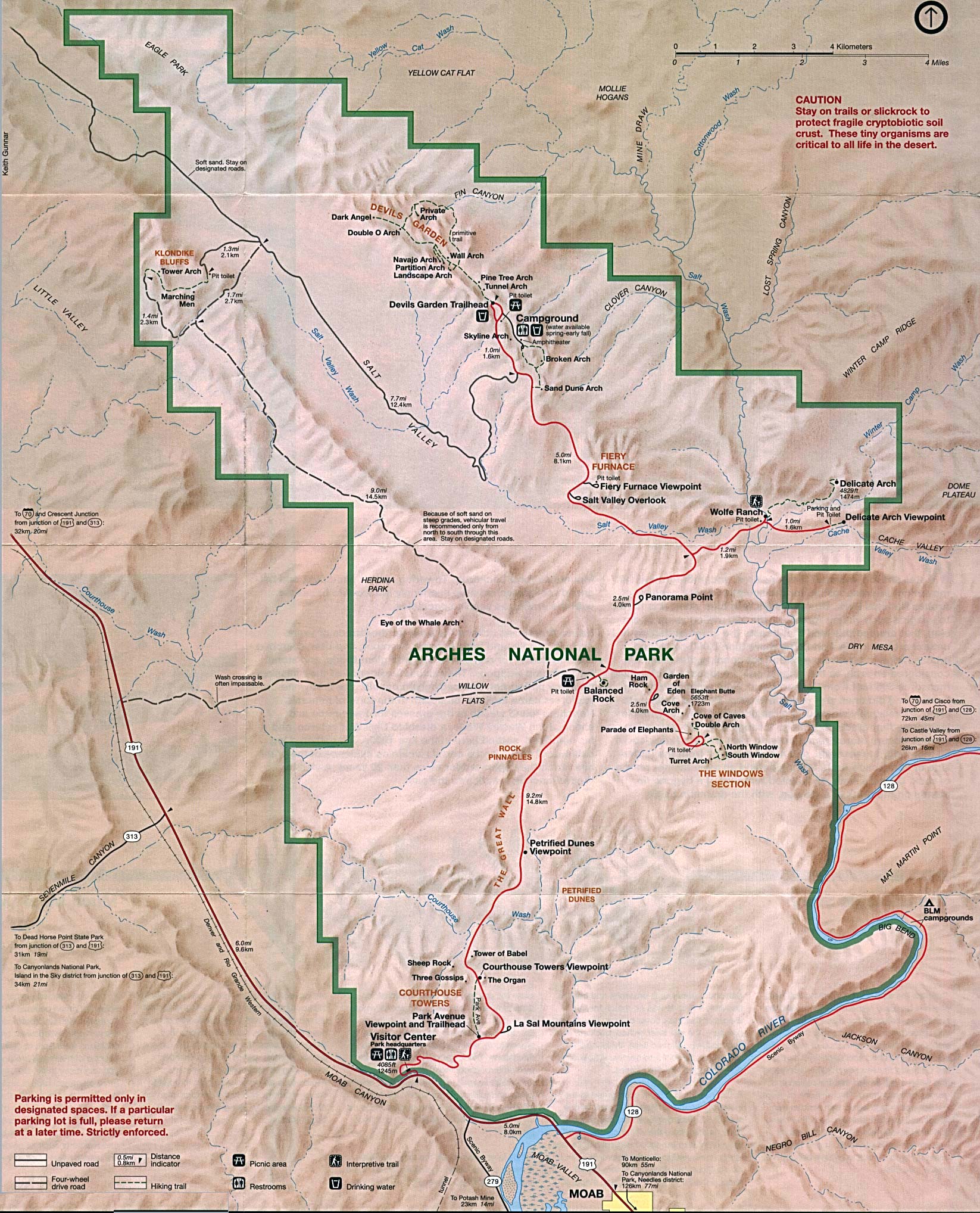
- Arches National Park (Park Map) 1995 (647K)
- Arches National Park (Park Map) 1998 (452K) (PDF Format)
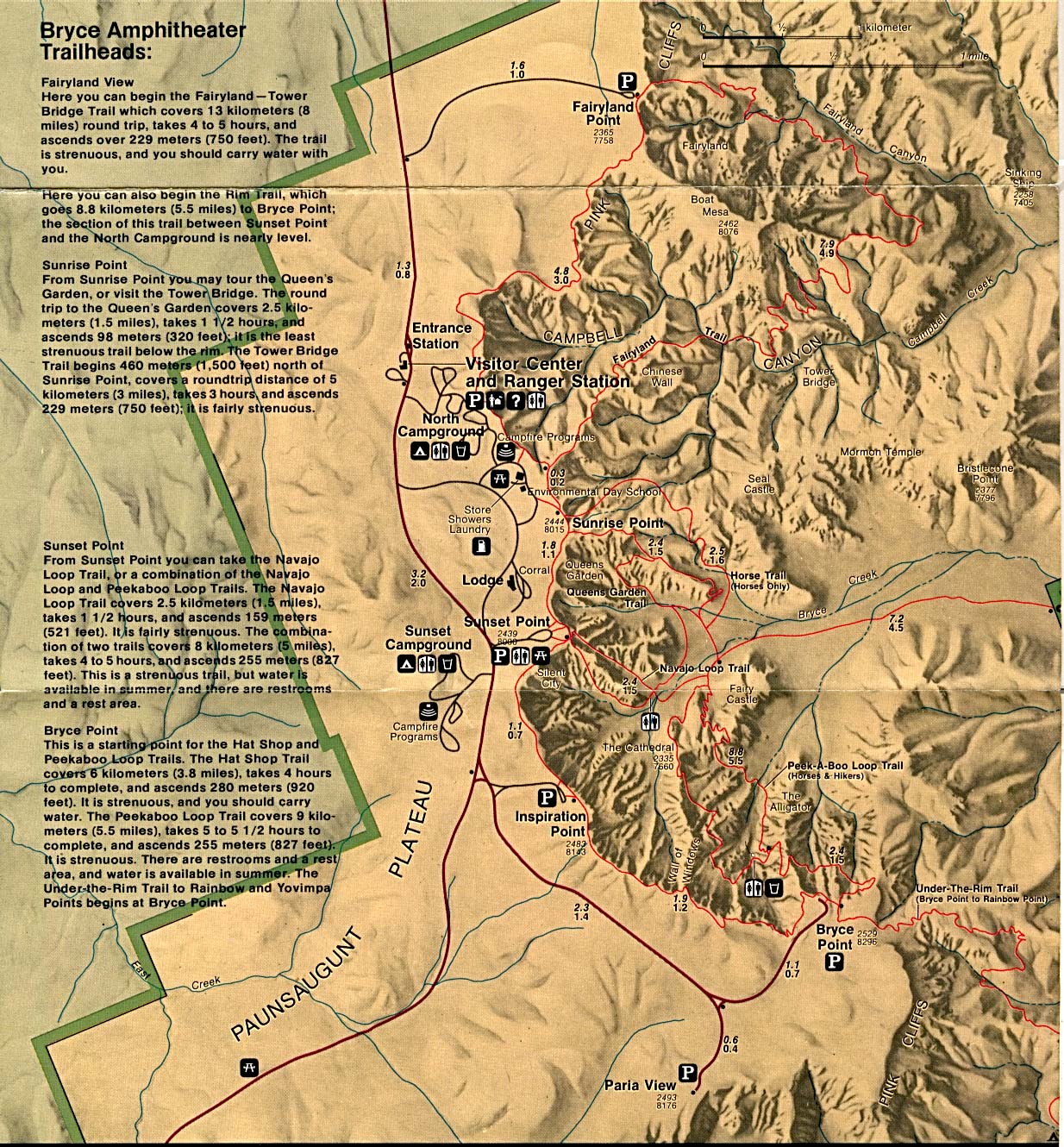
- Bryce Canyon National Park (Park Map) 1994 (802K)
- Bryce Canyon National Park (Park Map) (494K)
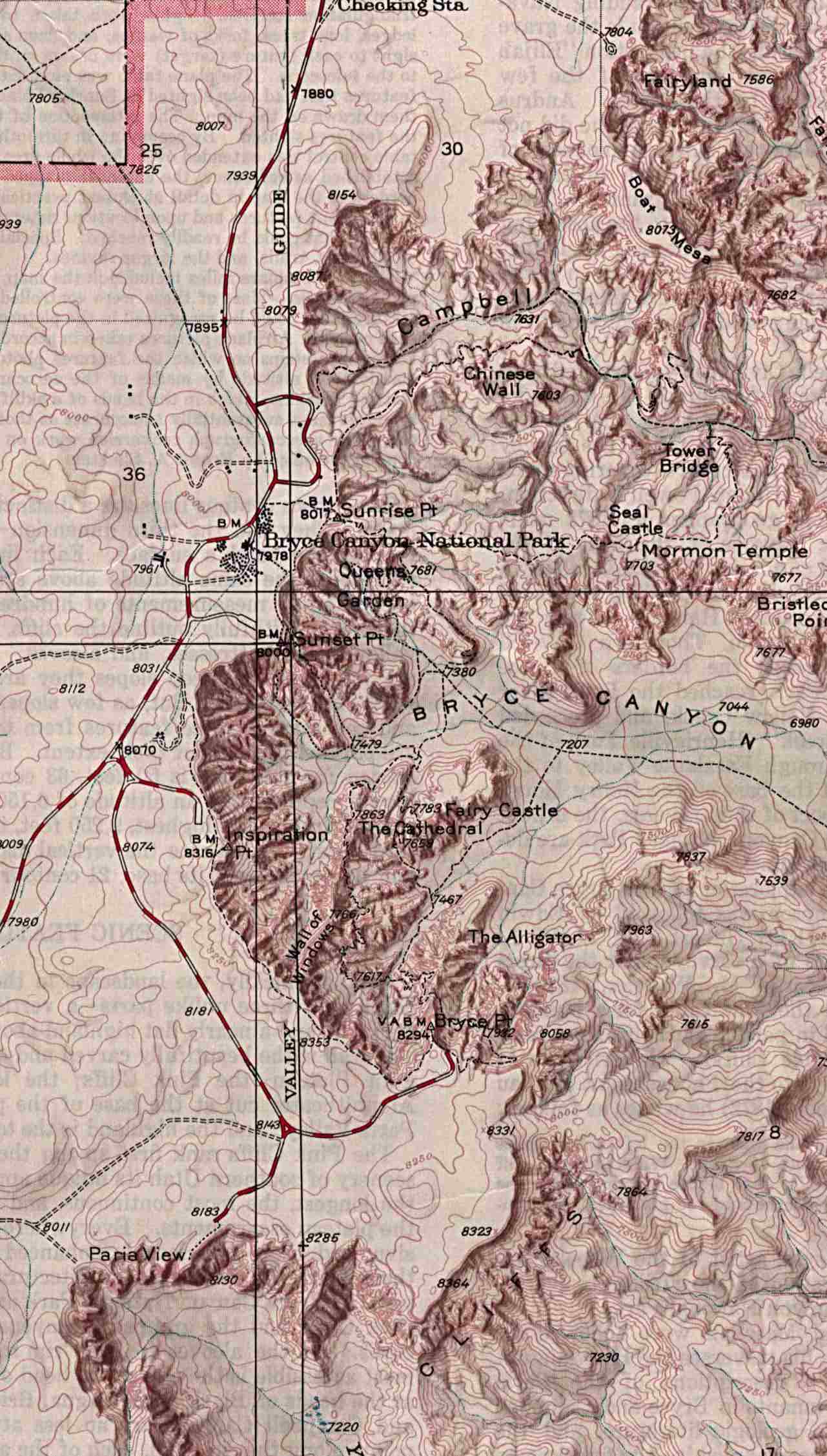
- Bryce Canyon National Park (Shaded Relief Map) 1:31,680 U.S.G.S. 1972 (247K)
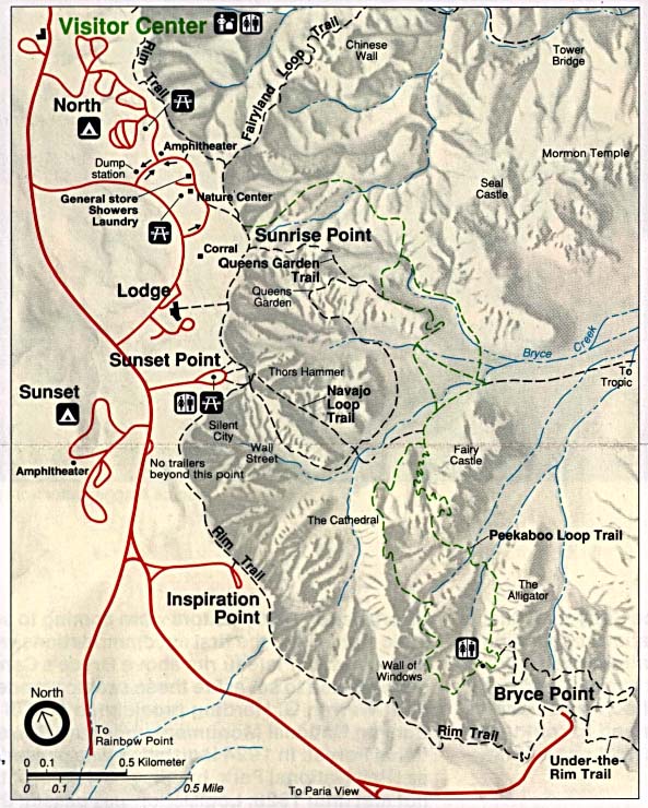
- Bryce Canyon National Park (Trail Map) (145K)
- Canyonlands National Park (Shaded Relief Map) scale 1:62:500 U.S.G.S. 1968 (349K)
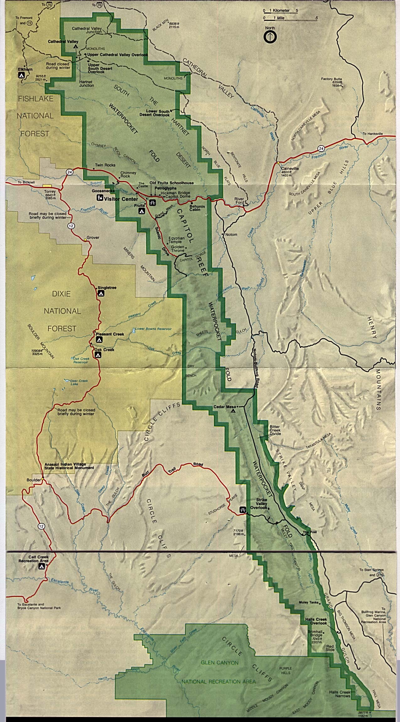
- Capitol Reef National Park (Park Map) 1995 (559K)
- Capitol Reef National Park (Park Map) 1997 (194K) (PDF Format)
- Dinosaur National Monument [Colorado / Utah] (Area Map) 1999 (65K) (PDF Format)
- Dinosaur National Monument [Colorado / Utah] (Park Map) 1999 (258K) (PDF Format)
- Glen Canyon National Recreation Area [Arizona / Utah] (Park Map / Shaded Relief) 1995 (1.8MB)
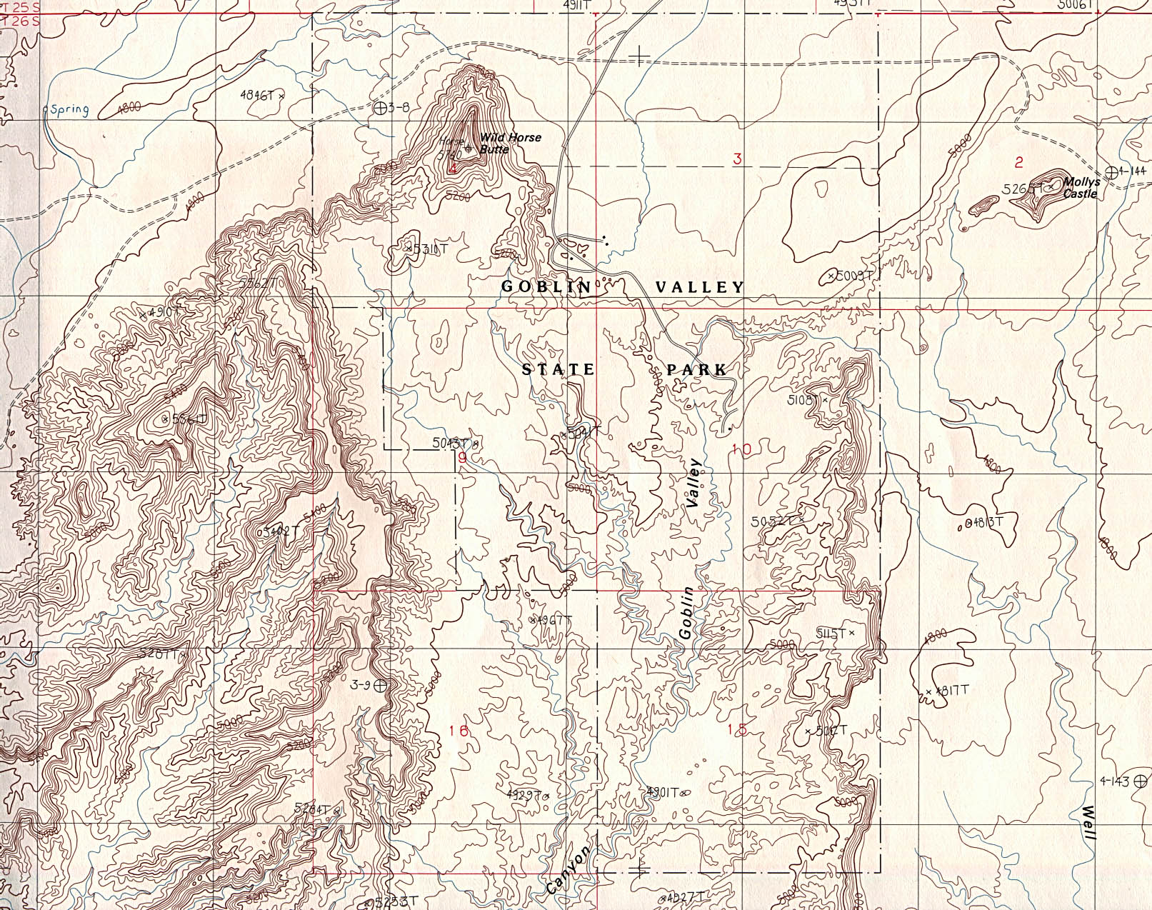
- Goblin Valley State Park (topographic) original scale 1:24,000 U.S.G.S. provisional edition 1988 (663K)
- Golden Spike National Historic Site (Park Map) 1995 (322K)
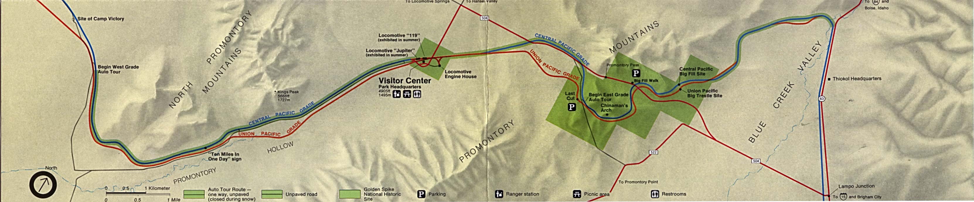
- Golden Spike National Historic Site - Central Pacific Railroad [Western US] (Route Map) 1995 (474K)
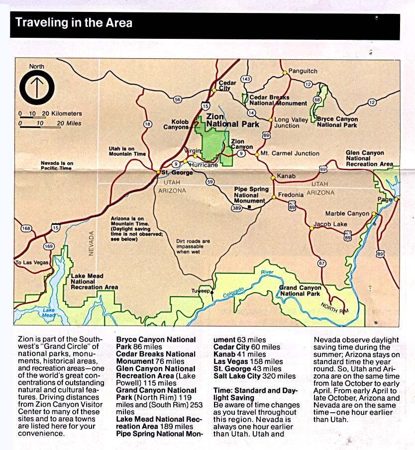
- Zion National Park (Area Map) 1994 (234K)
- Zion National Park (Area Map) 2000 (129K) (PDF Format)
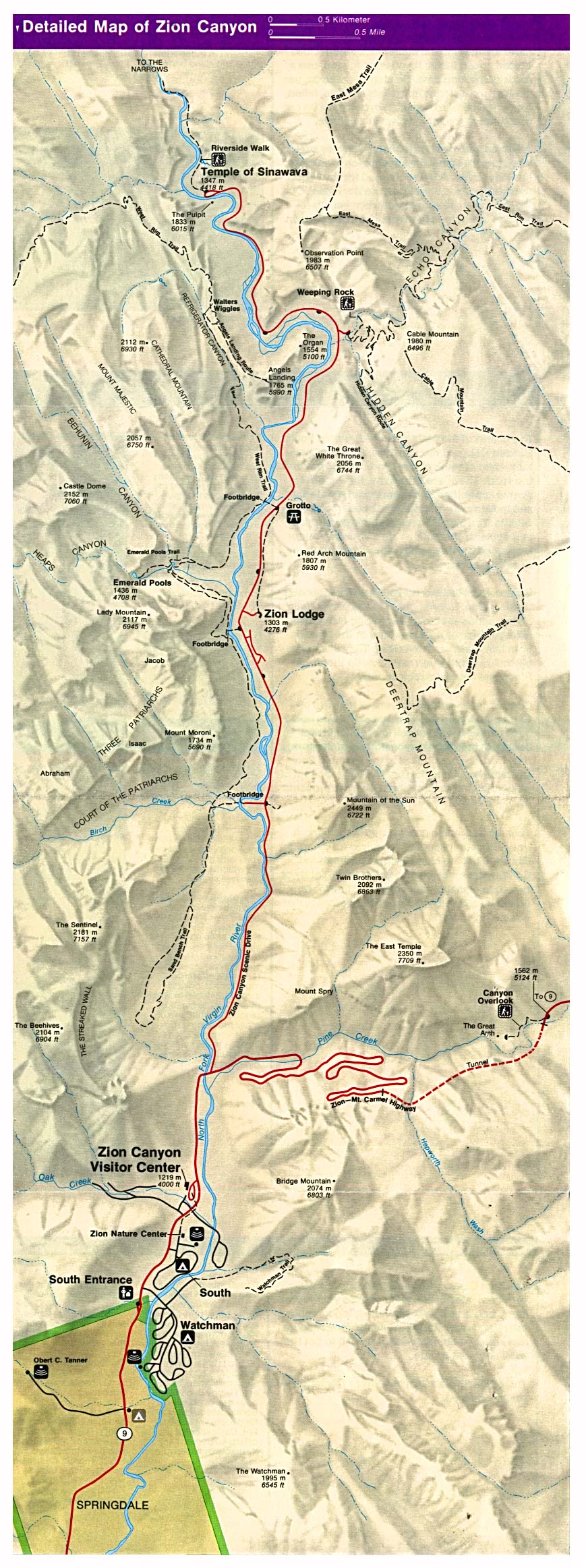
- Zion National Park (Detail Map) 1994 (449K)
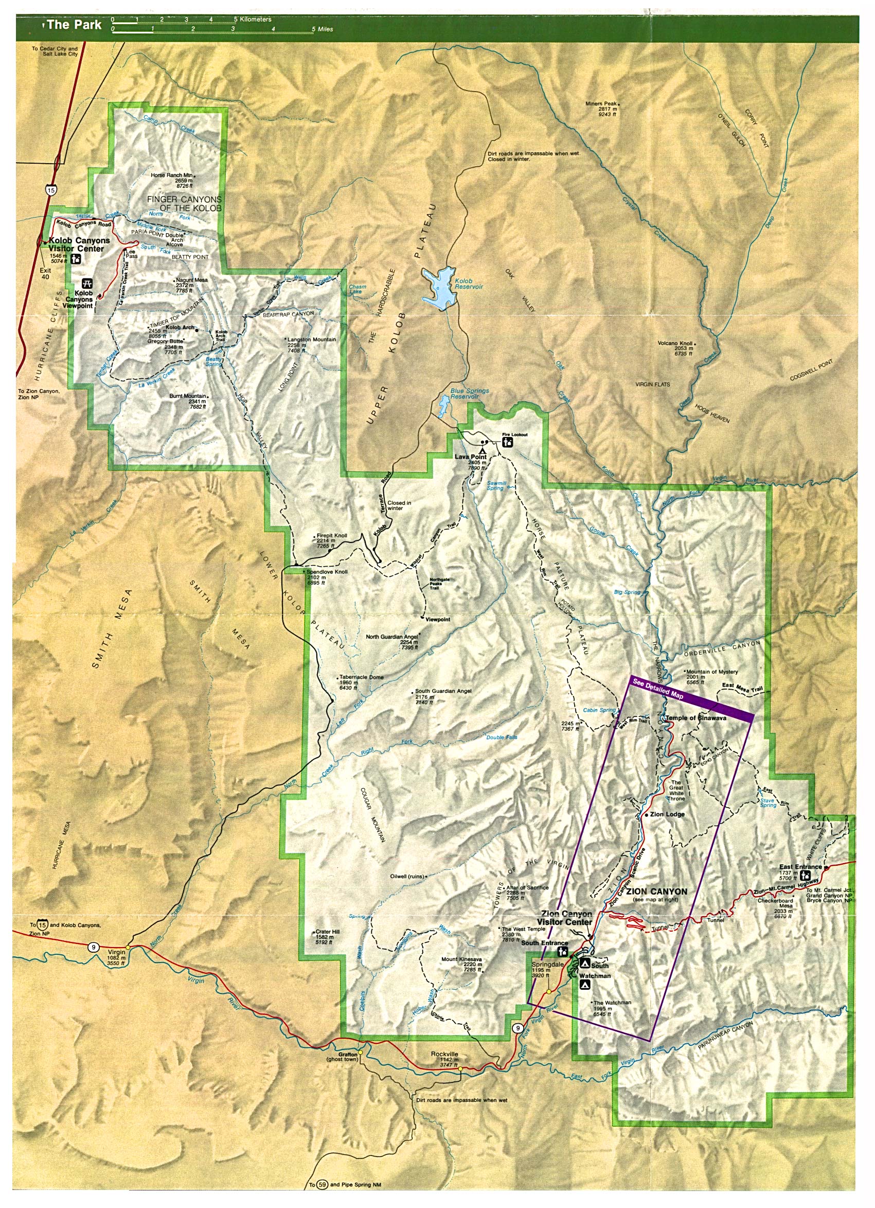
- Zion National Park (Park Map) 1994 (878K)
- Zion National Park (Park Map) 2000 (323K) (PDF Format)
![Glen Canyon National Recreation Area [Arizona / Utah]](national_parks/glen95.jpg)
![Golden Spike National Historic Site - Central Pacific Railroad [Western US]](national_parks/cpup95.jpg)
Maps on Other Web Sites