Perry-Castañeda Library
Map Collection
Indiana Historical Topographic Maps
All maps on this page were published by the U.S. Geological Survey and are in the public domain. The date given for each map is the date of latest survey. More information about these maps is available on the Topographic Maps Home Page.
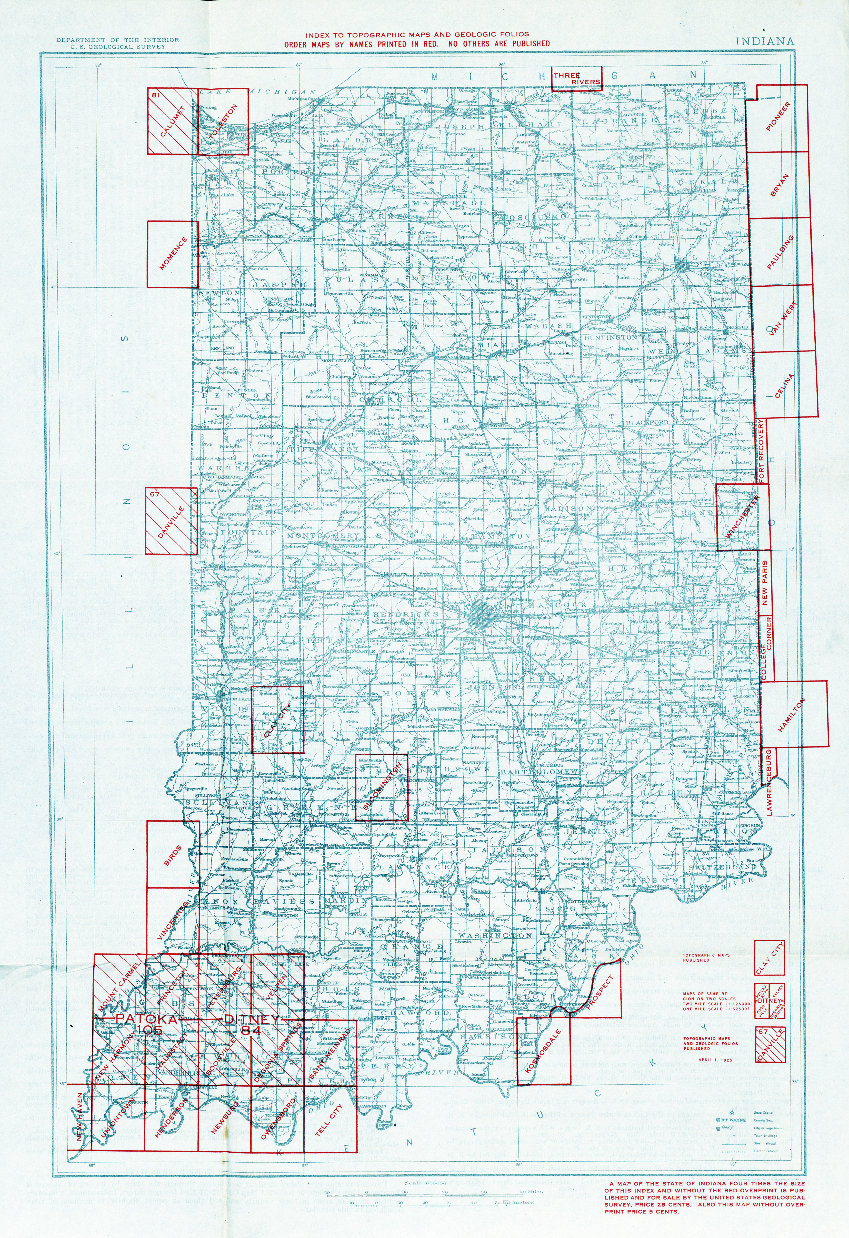
- Indiana - Topographic Map Index 1925 (6.4MB)
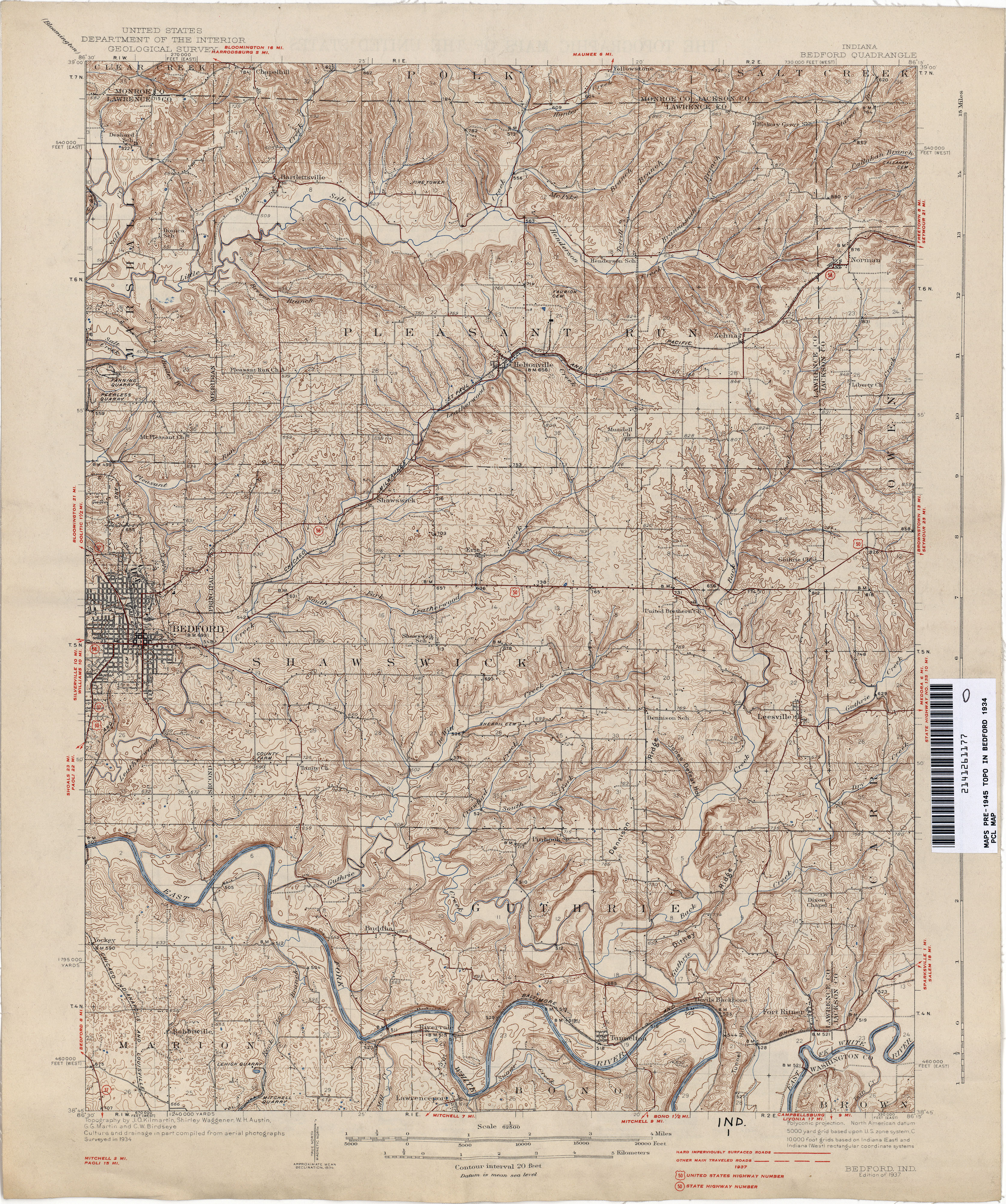
- Bedford 1934 1:62,500 (5.2MB)
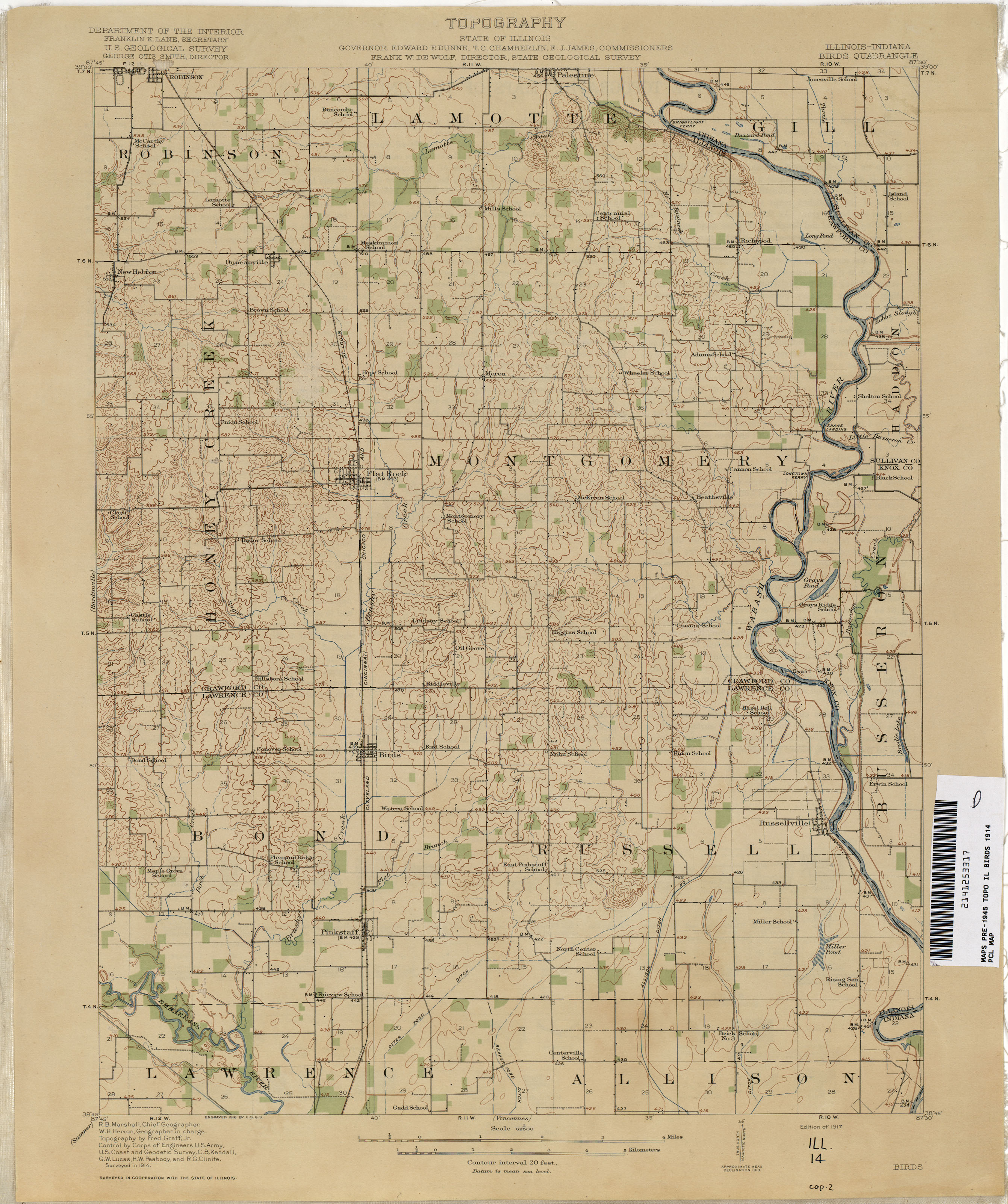
- Birds [Illinois, Indiana] 1914 1:62,500 (2.1MB)
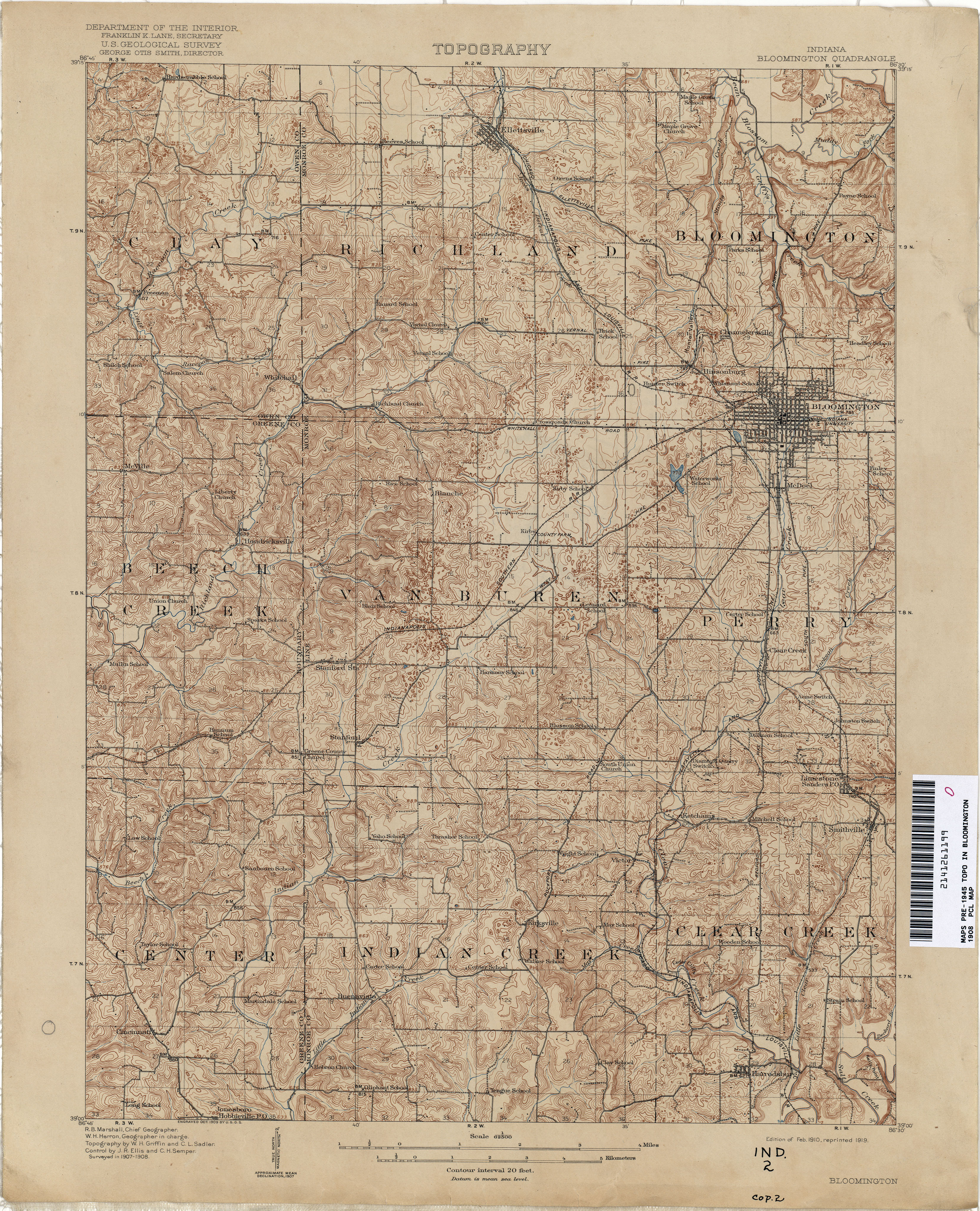
- Bloomington 1908 1:62,500 (4.8MB)
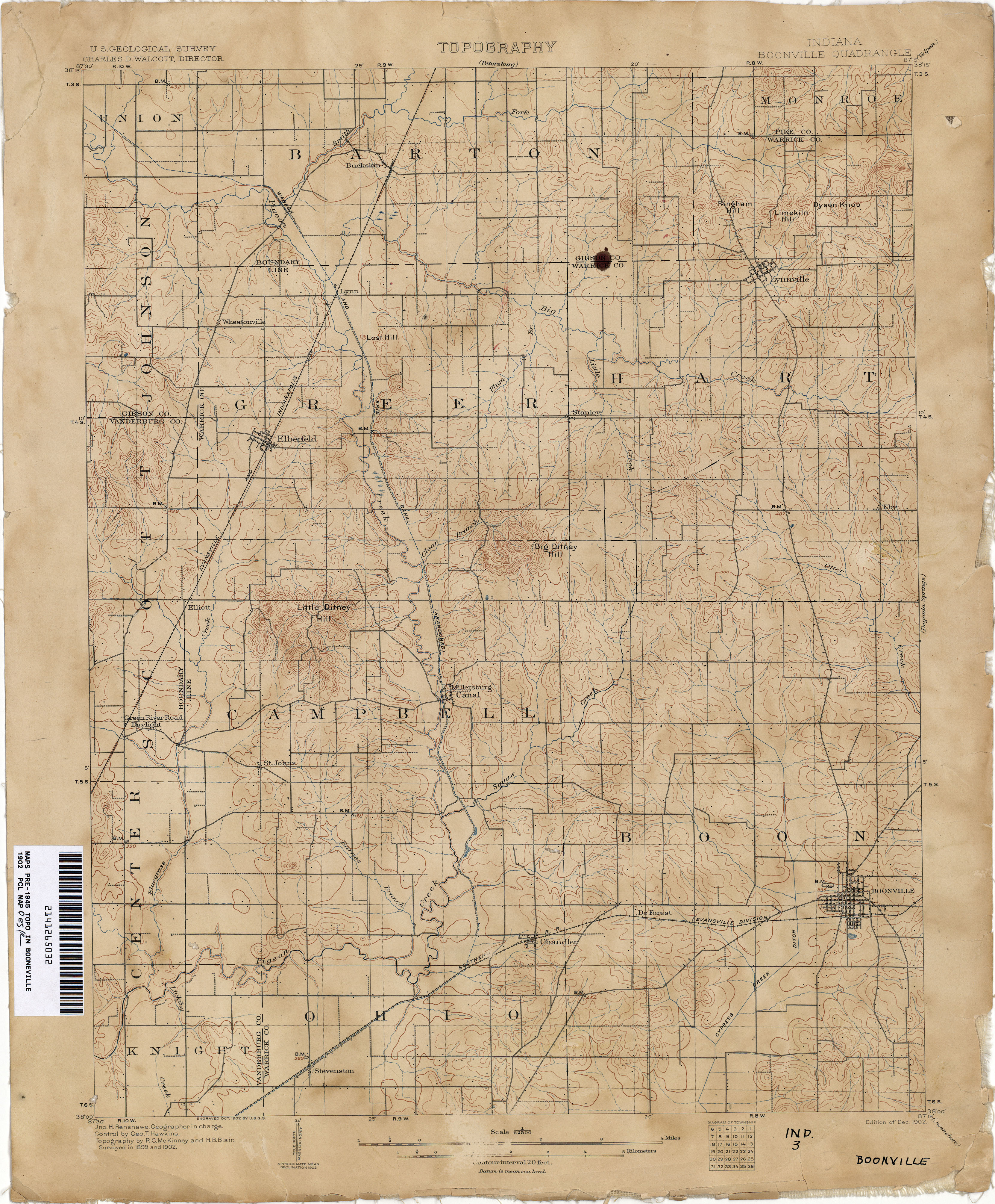
- Booneville 1902 1:62,500 (3.5MB)
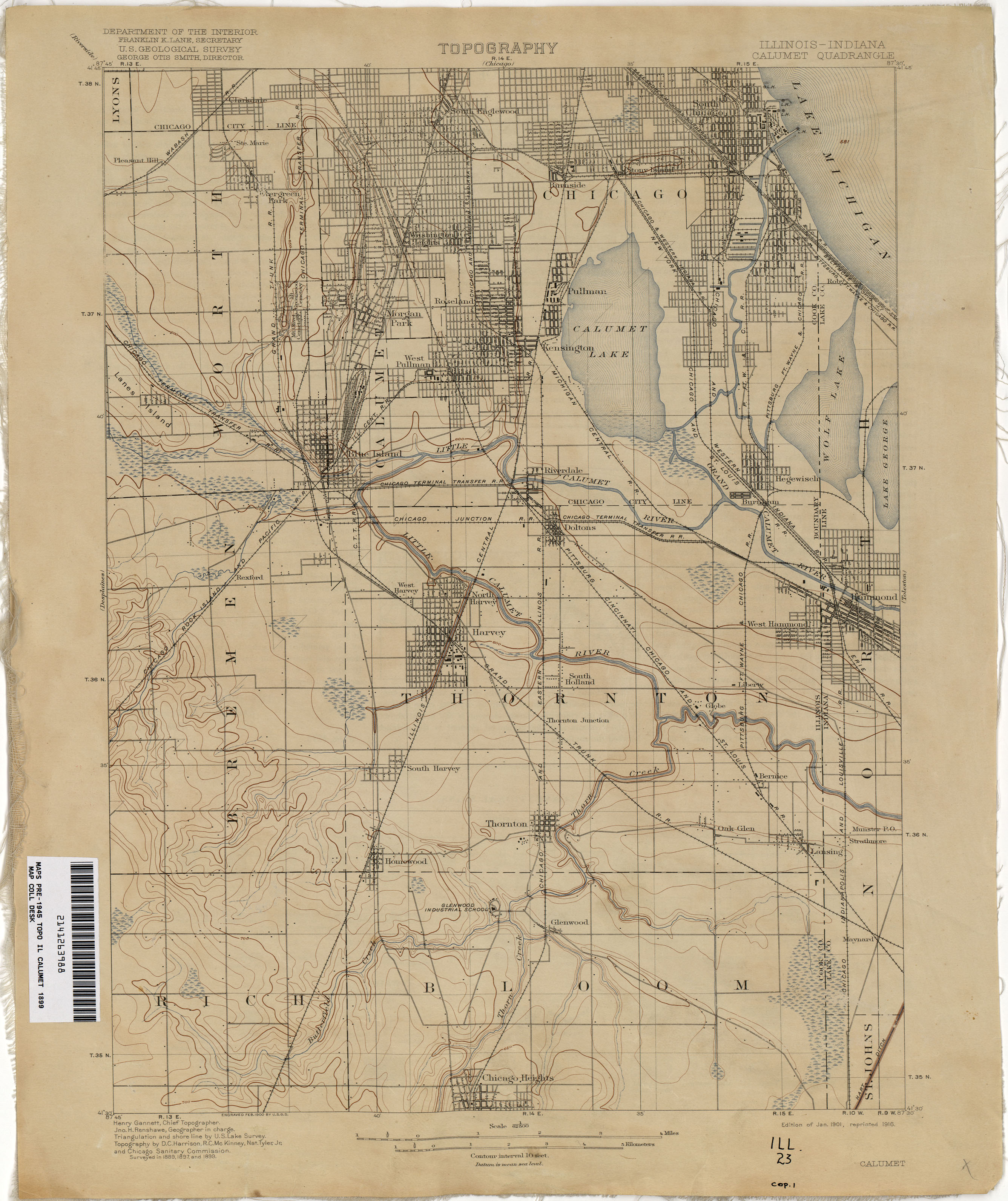
- Calumet [Illinois, Indiana] 1899 1:62,500 (1.9MB)
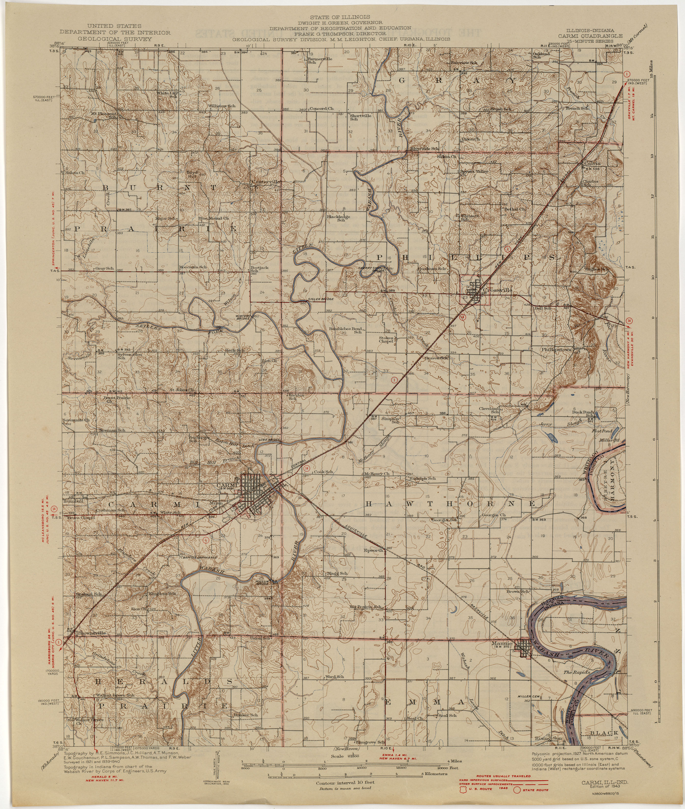
- Carmi [Illinois, Indiana] 1940 1:62,500 (2.6MB)
- Clay City 1908 1:62,500 (3.2MB)
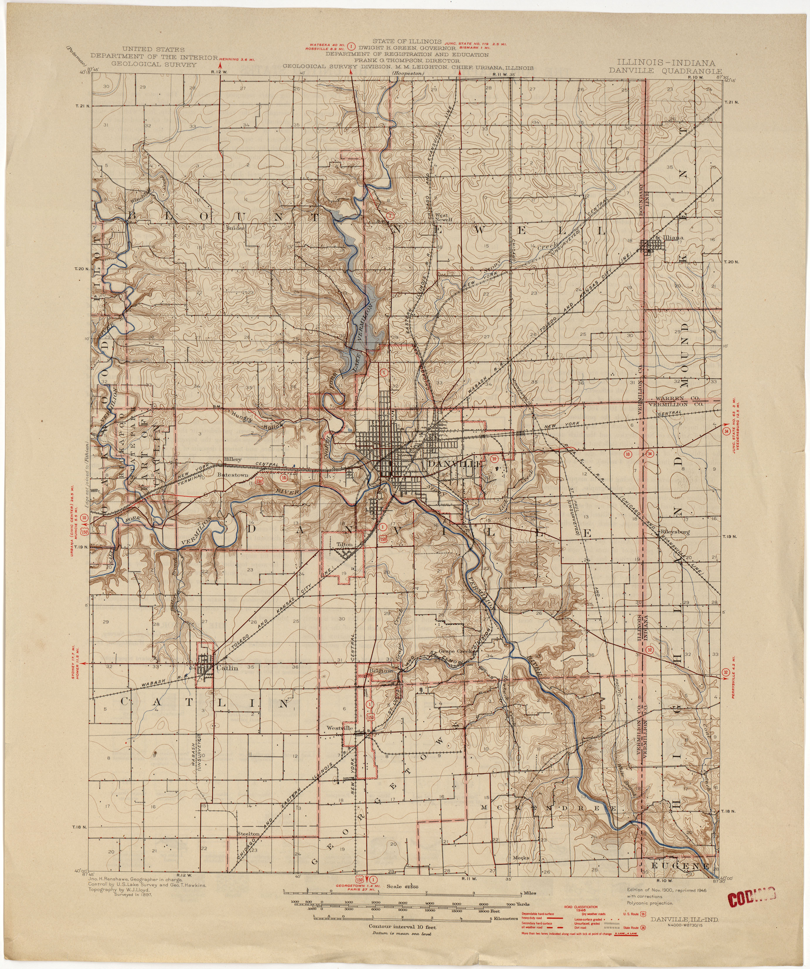
- Danville [Illinois, Indiana] 1897 1:62,500 (2.6MB)
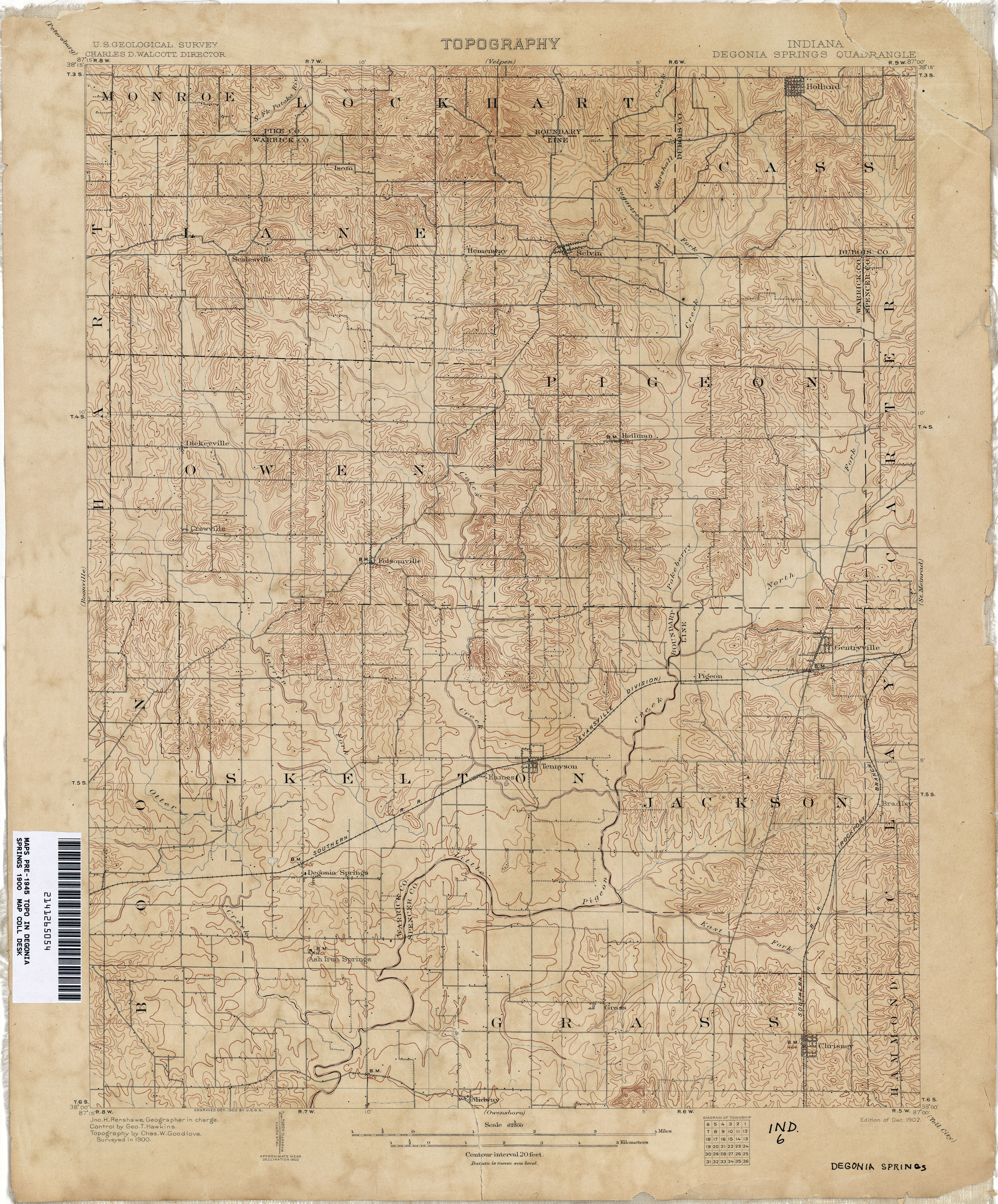
- Degonia Springs 1900 1:62,500 (3.9MB)
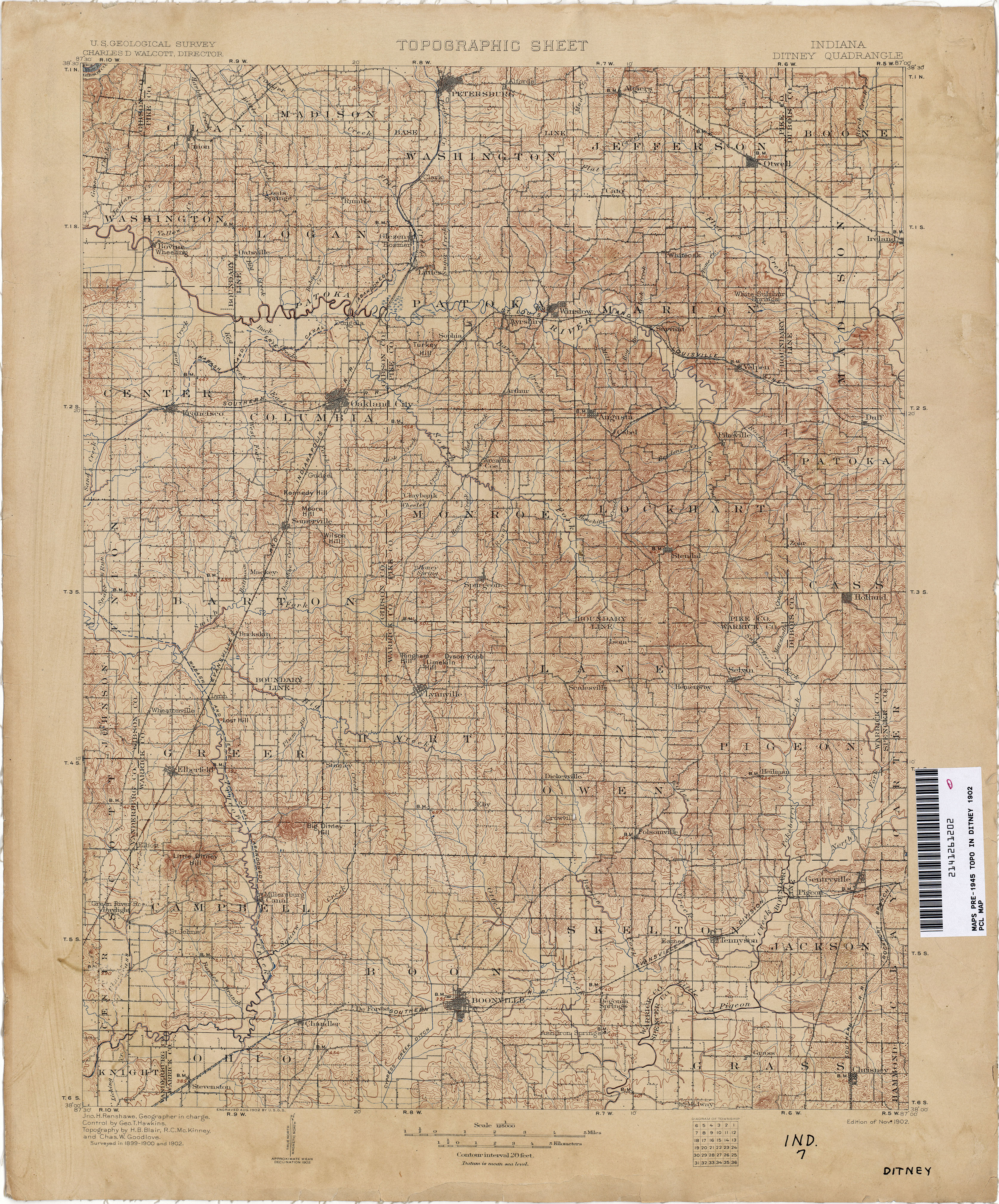
- Ditney 1902 1:125,000 (5.0MB)
- Harvard [Illinois, Wisconsin] 1932 1:62,500 (2.8MB)
- Haubstadt 1901 1:62,500 (3.9MB)
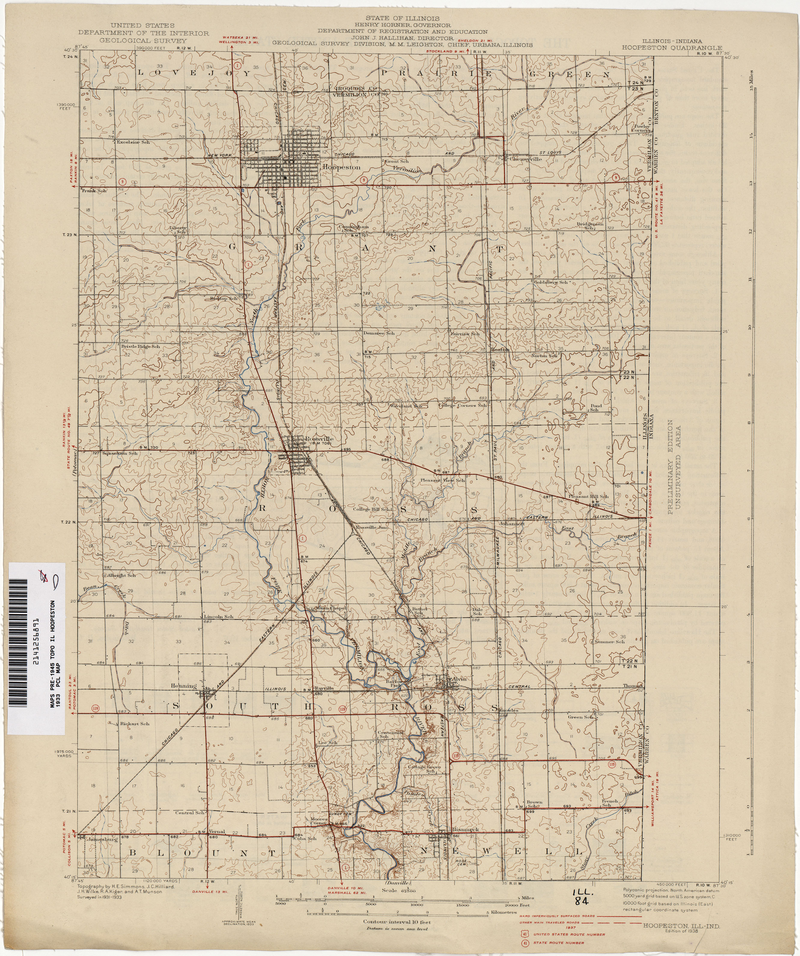
- Hoopeston [Illinois, Indiana] 1933 1:62,500 (2.1MB)
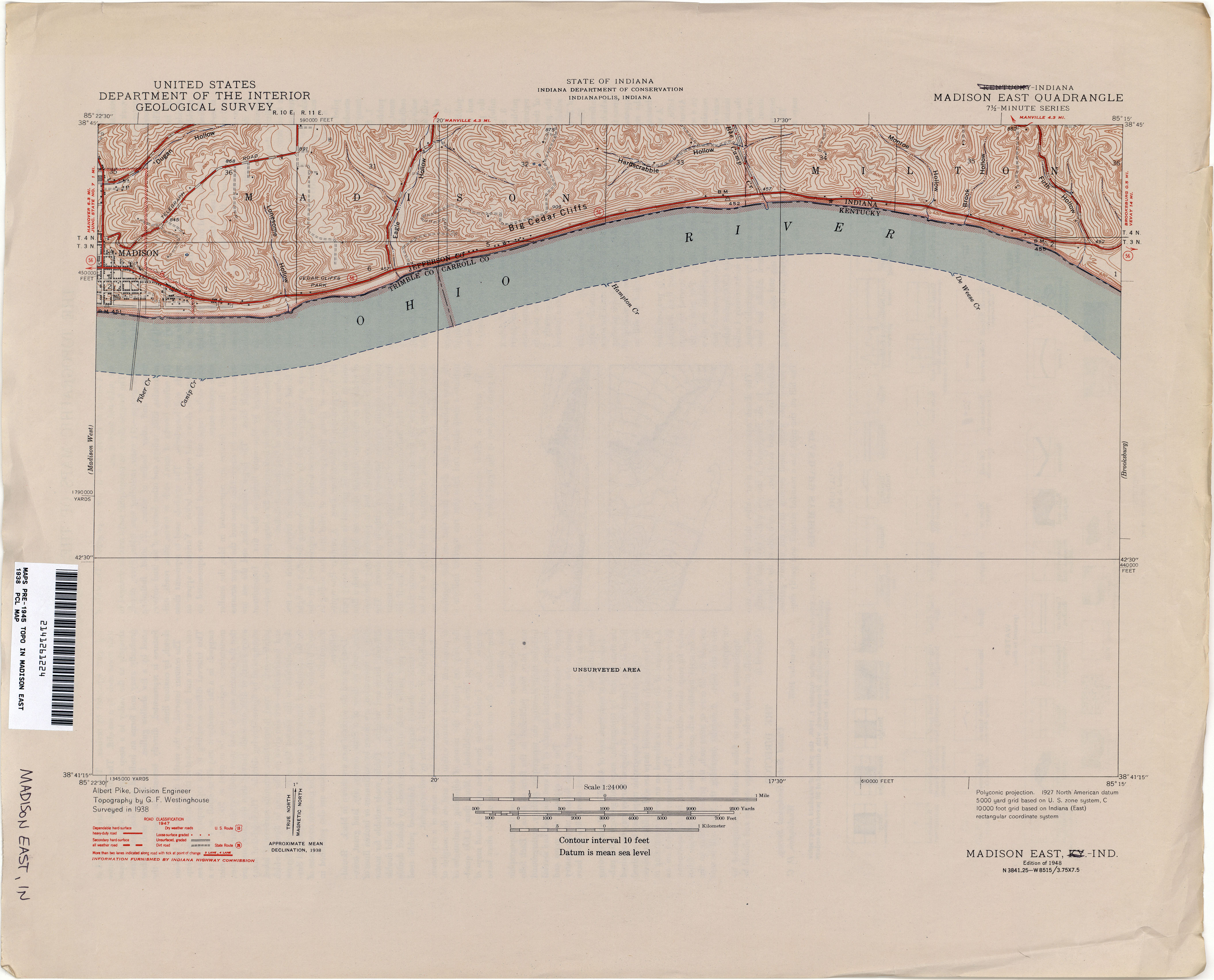
- Madison East 1938 1:24,000 (2.0MB)
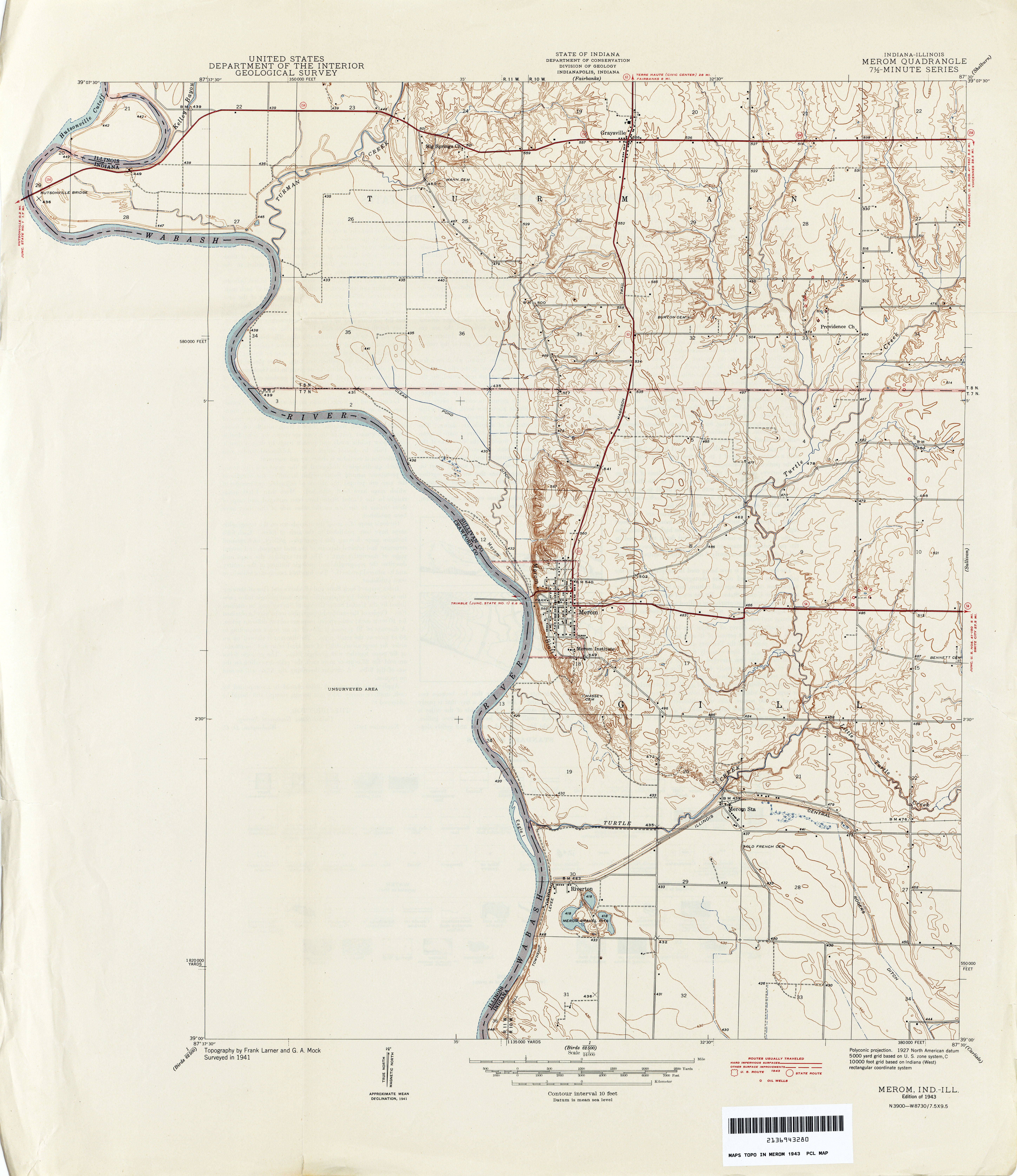
- Merom 1941 1:62,500 (7.0MB)
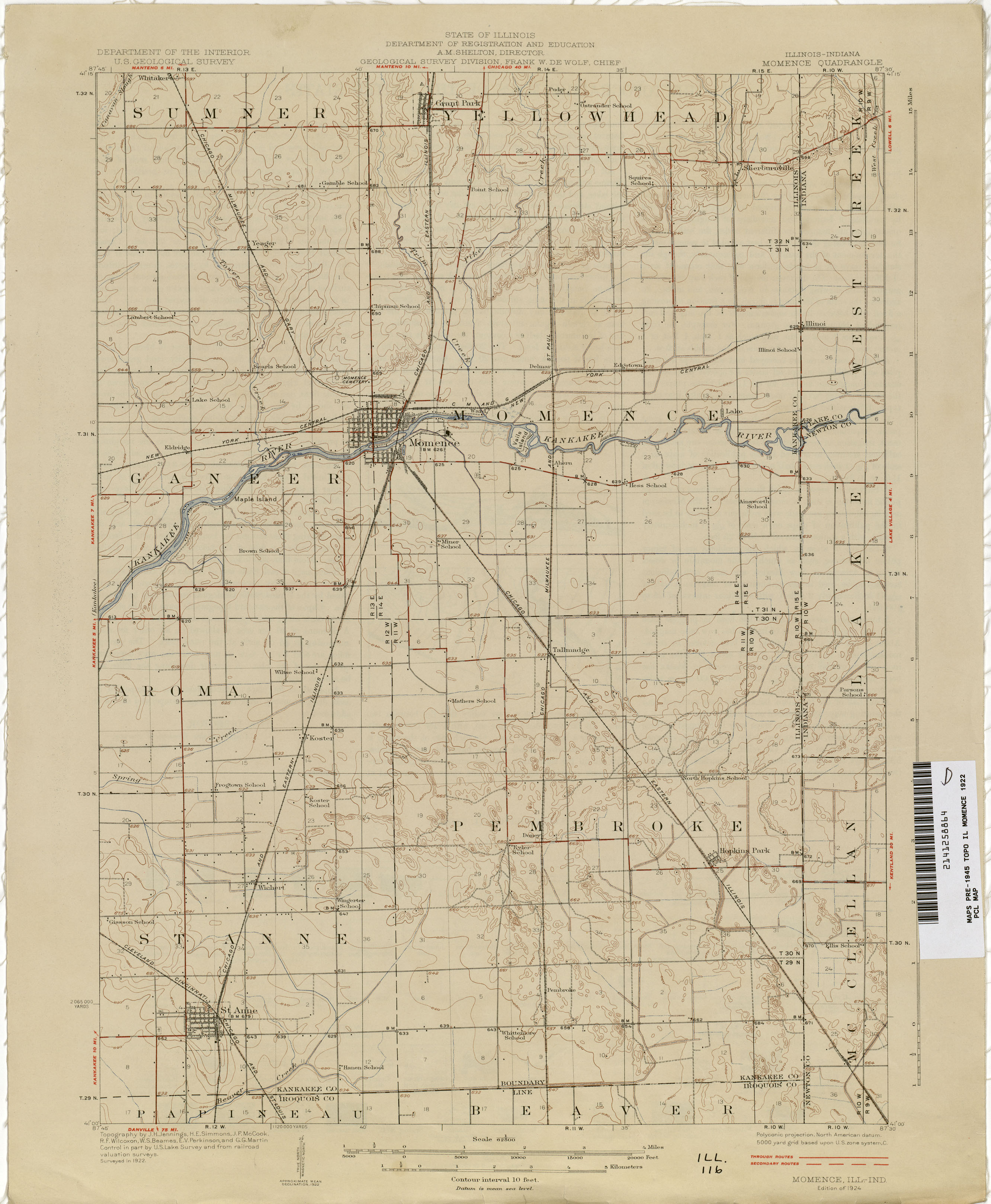
- Momence [Illinois, Indiana] 1922 1:62,500 (1.7MB)
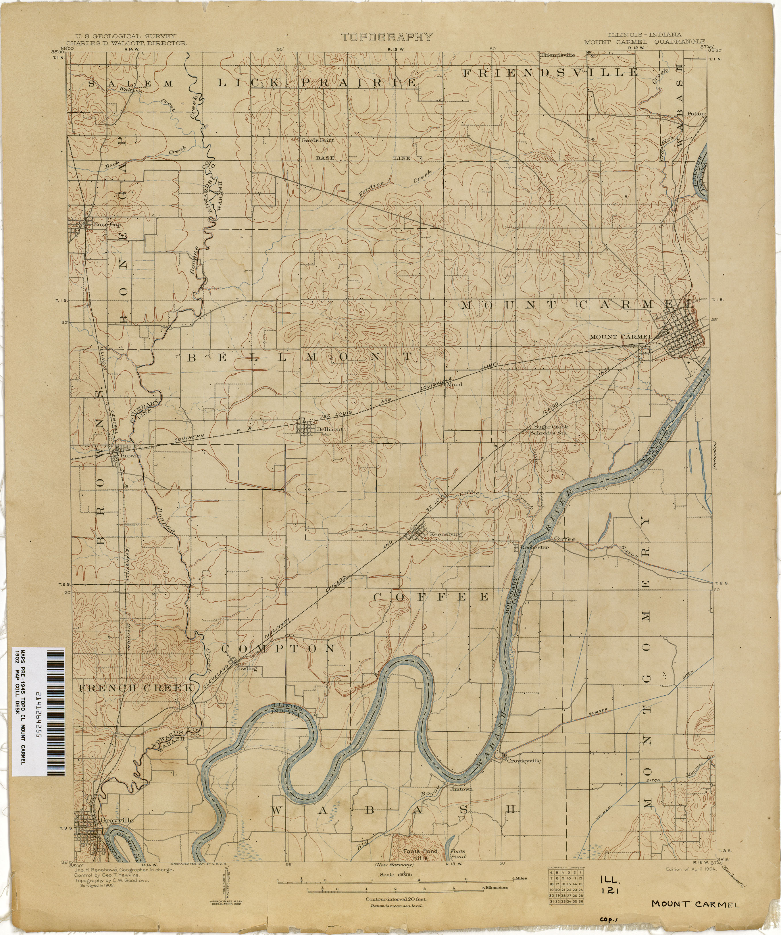
- Mount Carmel [Illinois, Indiana] 1902 1:62,500 (1.9MB)
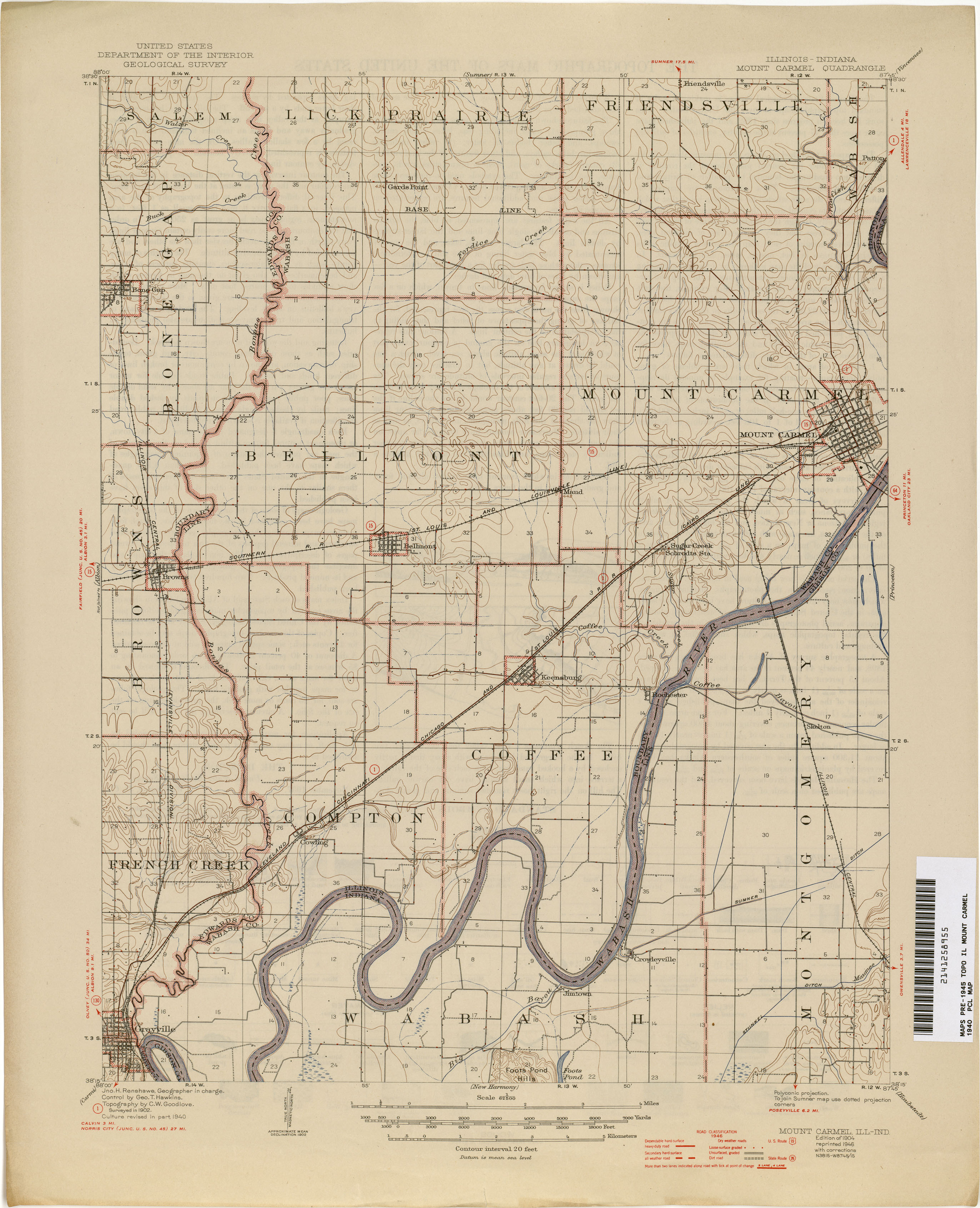
- Mount Carmel [Illinois, Indiana] 1940 1:62,500 (2.1MB)
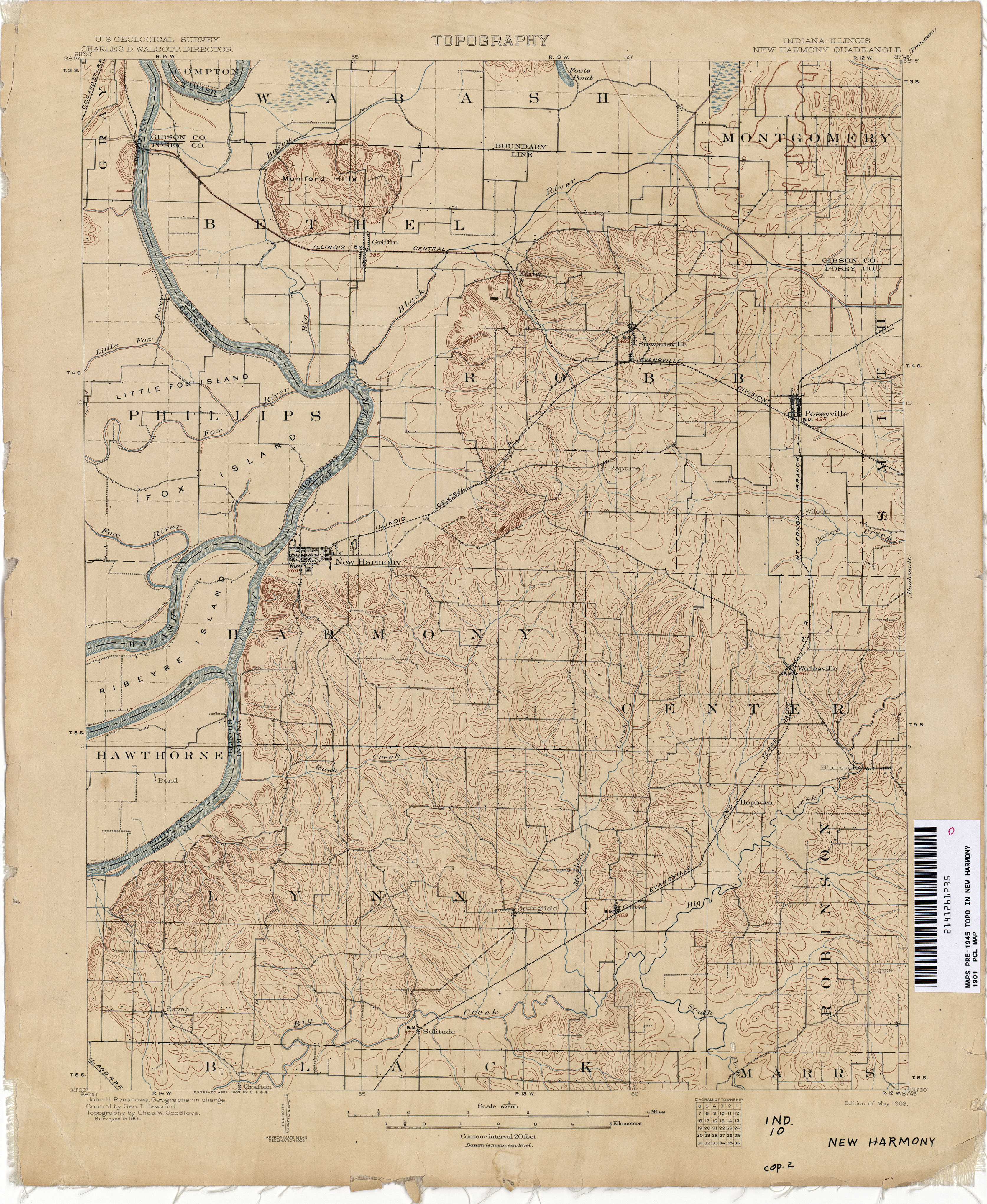
- New Harmony [Indiana, Illinois] 1901 1:62,500 (3.6MB)
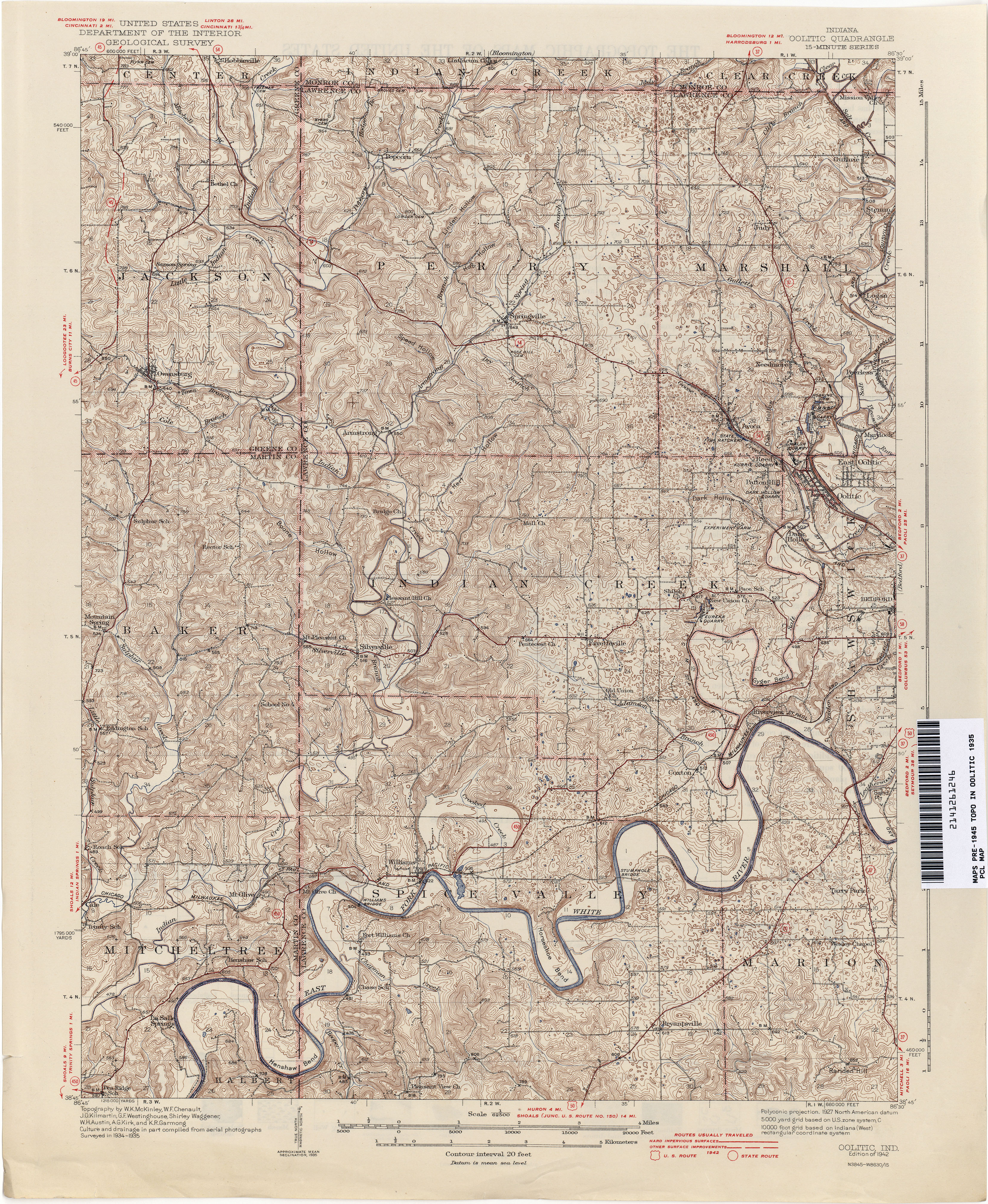
- Oolitic 1935 1:62,500 (5.4MB)
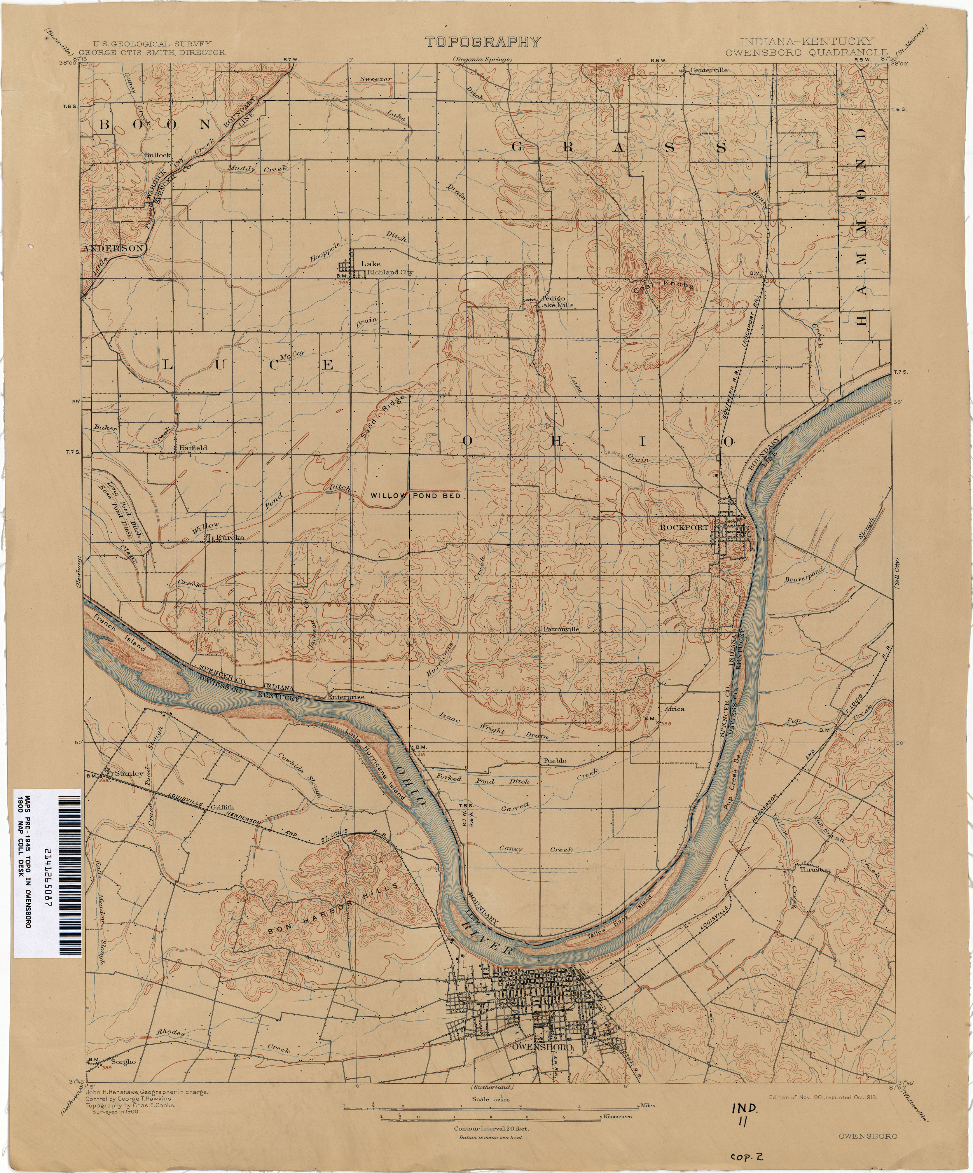
- Owensboro [Indiana, Kentucky] 1900 1:62,500 (3.0MB)
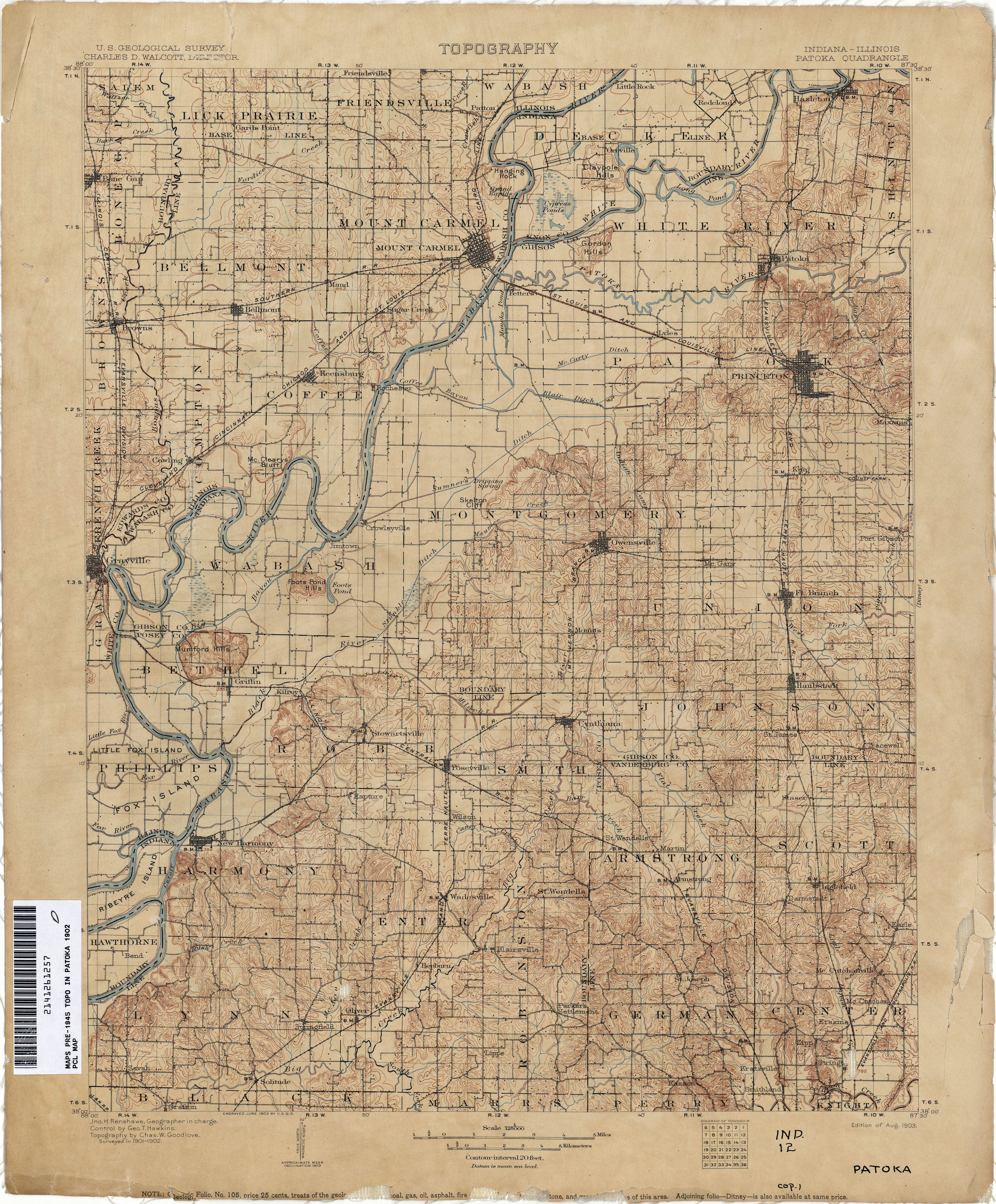
- Patoka [Indiana, Illinois] 1902 1:125,000 (4.3MB)
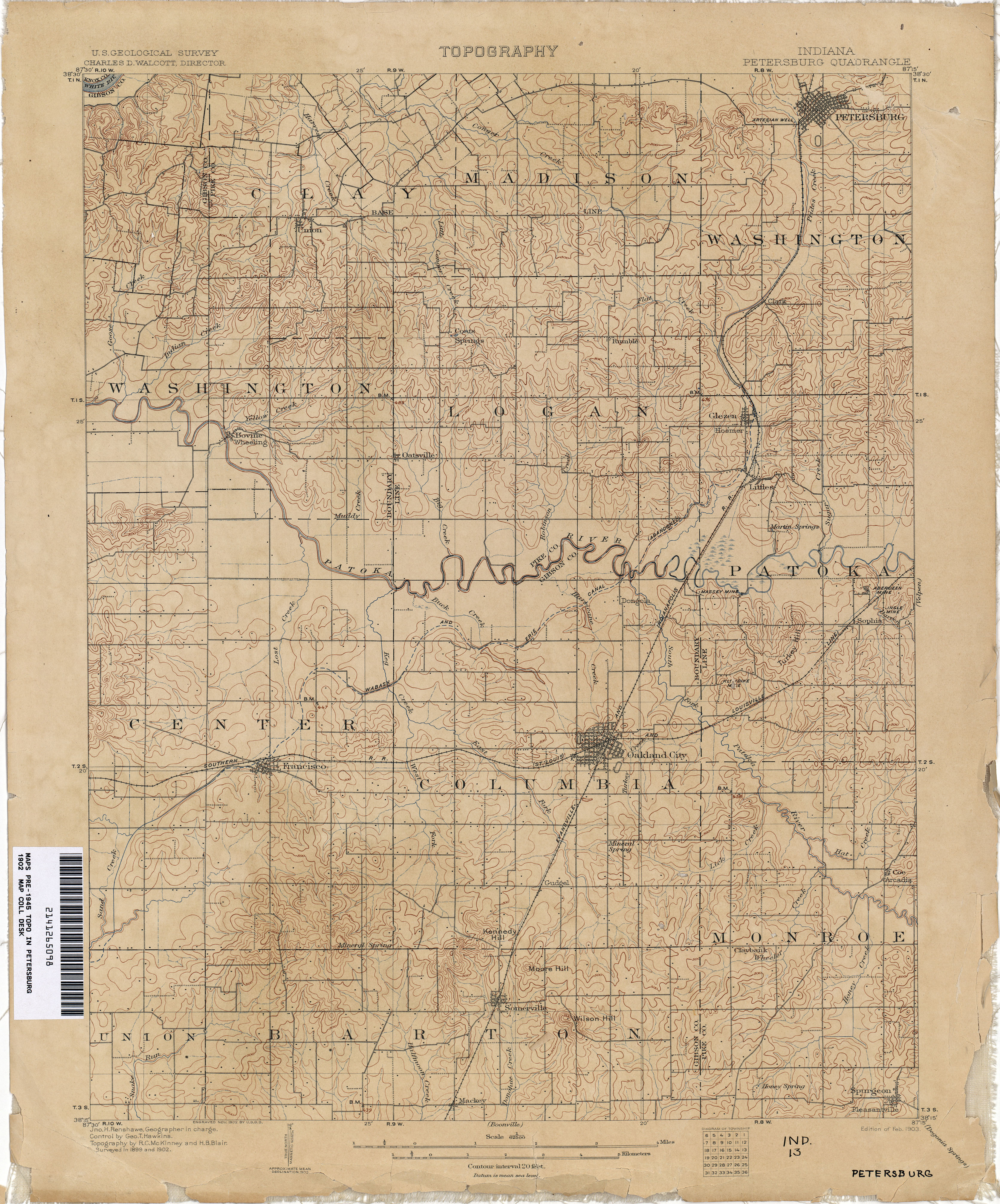
- Petersburg 1902 1:62,500 (3.7MB)
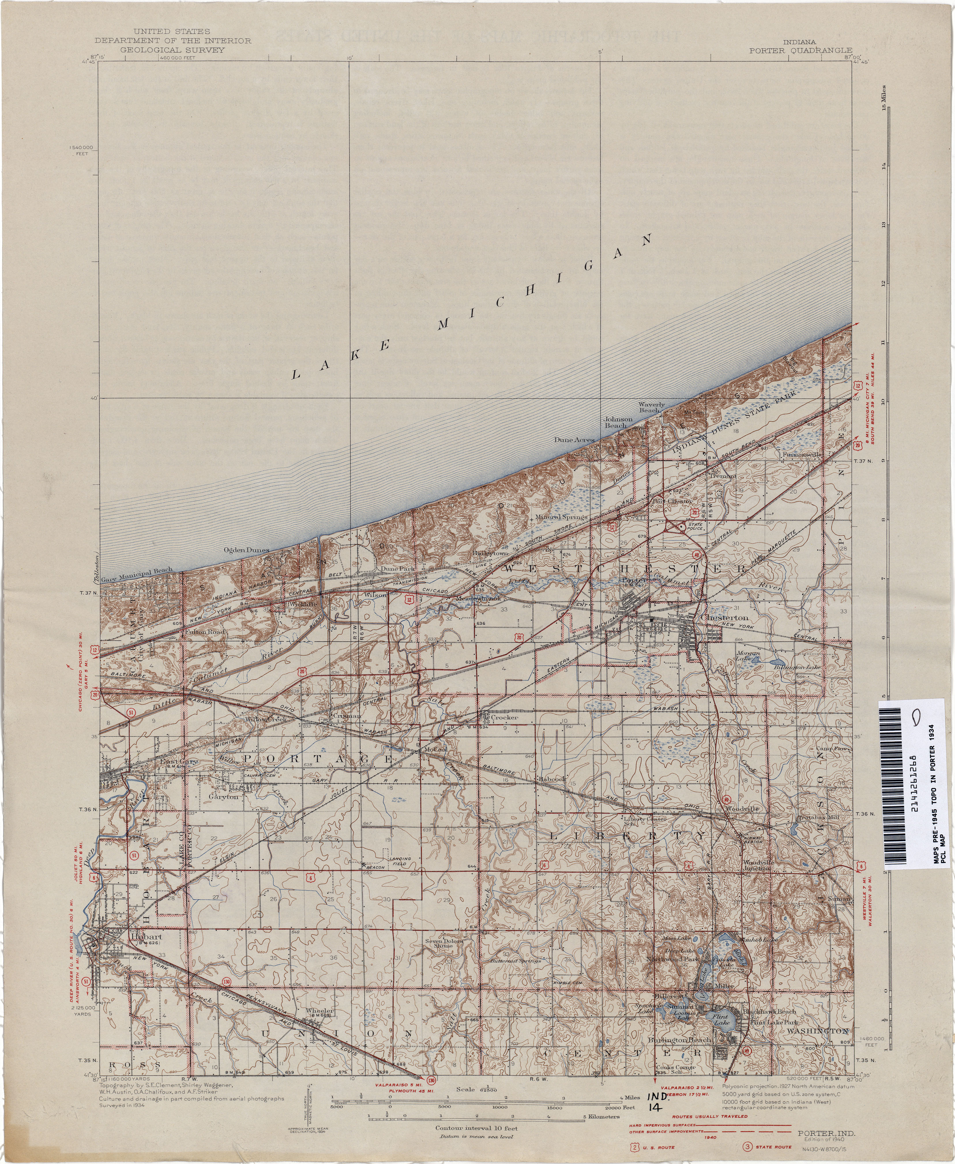
- Porter 1934 1:62,500 (3.3MB)
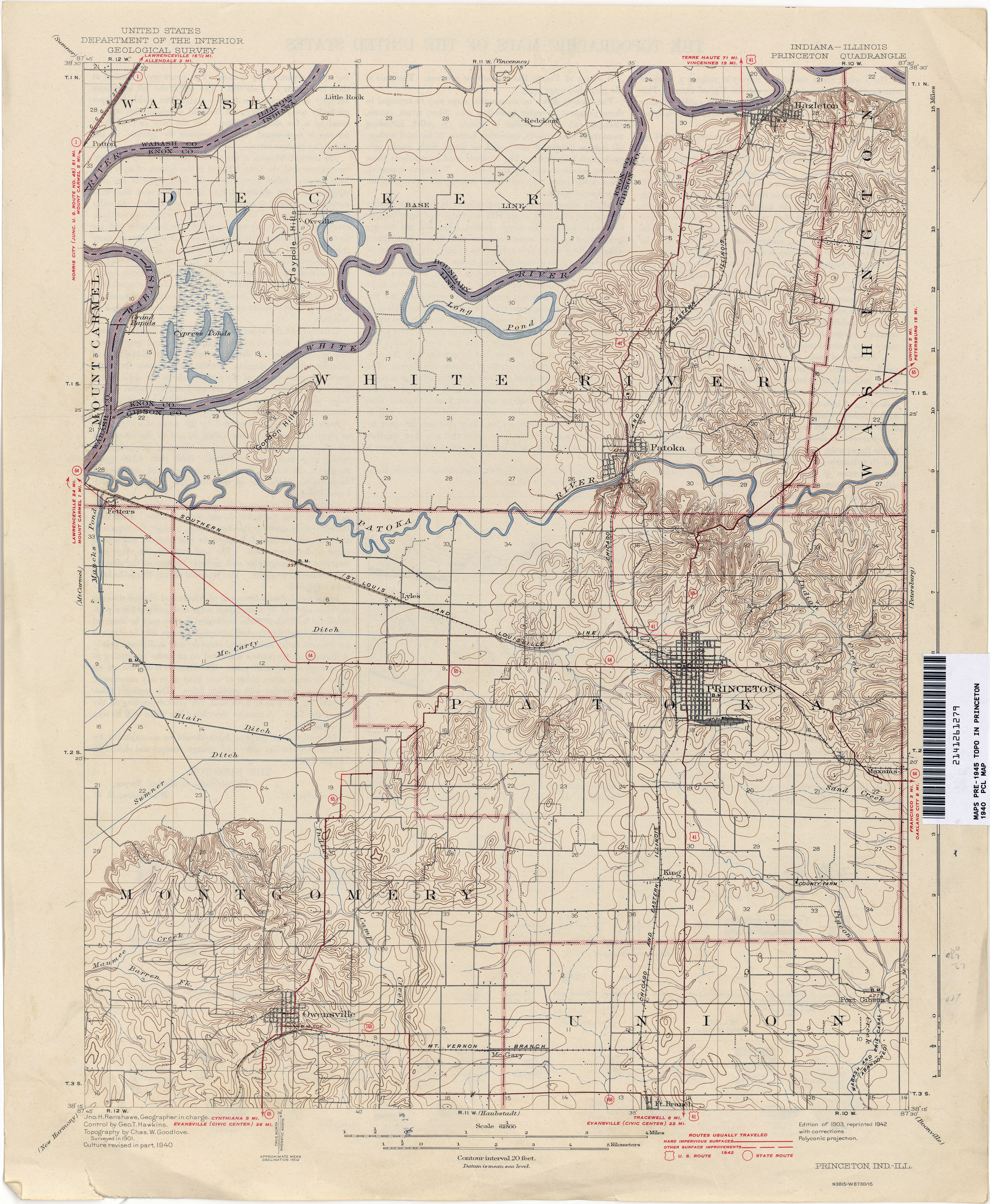
- Princeton [Indiana, Illinois] 1940 1:62,500 (3.7MB)
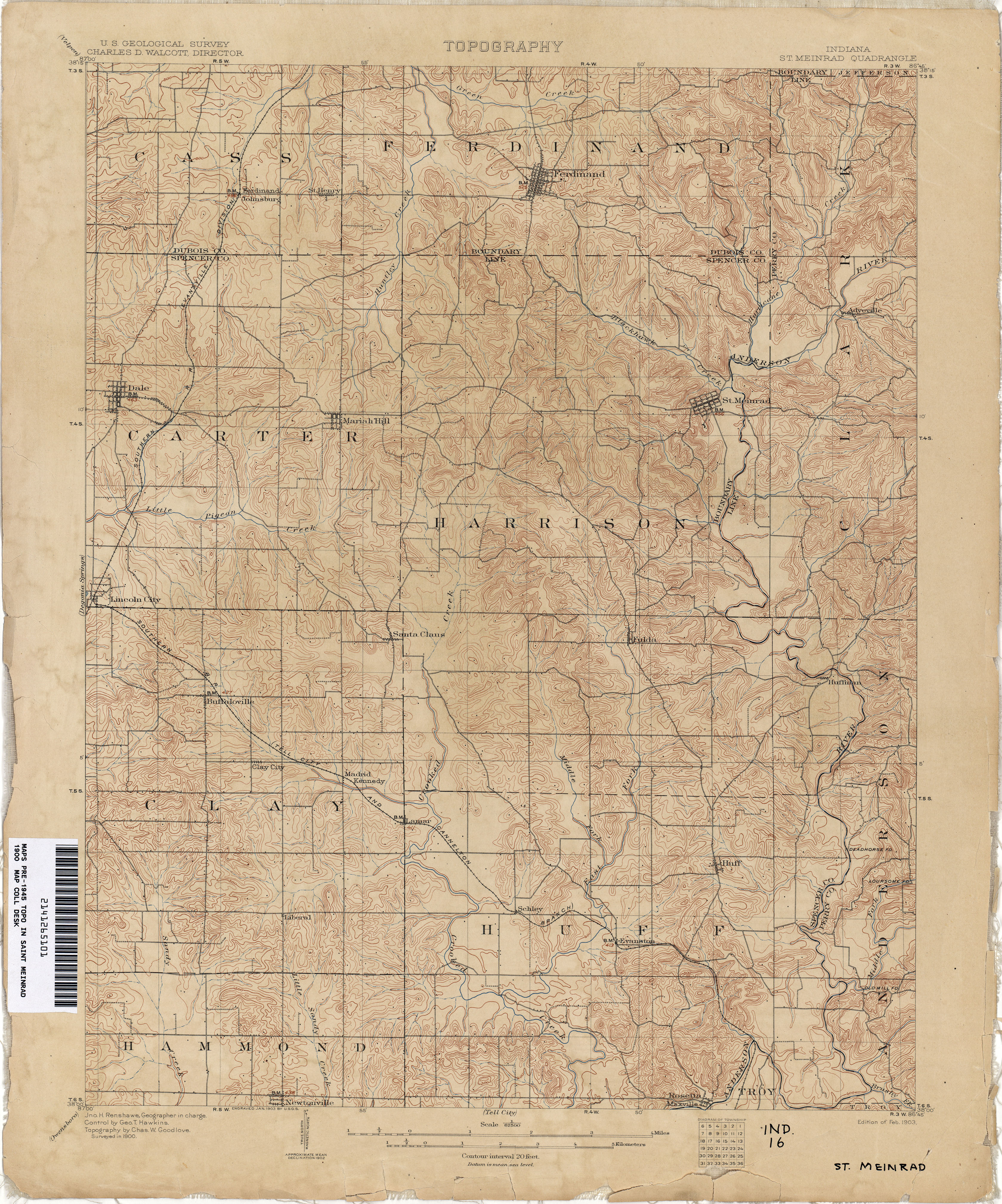
- Saint Meinrad 1900 1:62,500 (4.3MB)
- Toleston 1897 1:62,500 (2.1MB)
- Velpen 1900 1:62,500 (3.7MB)
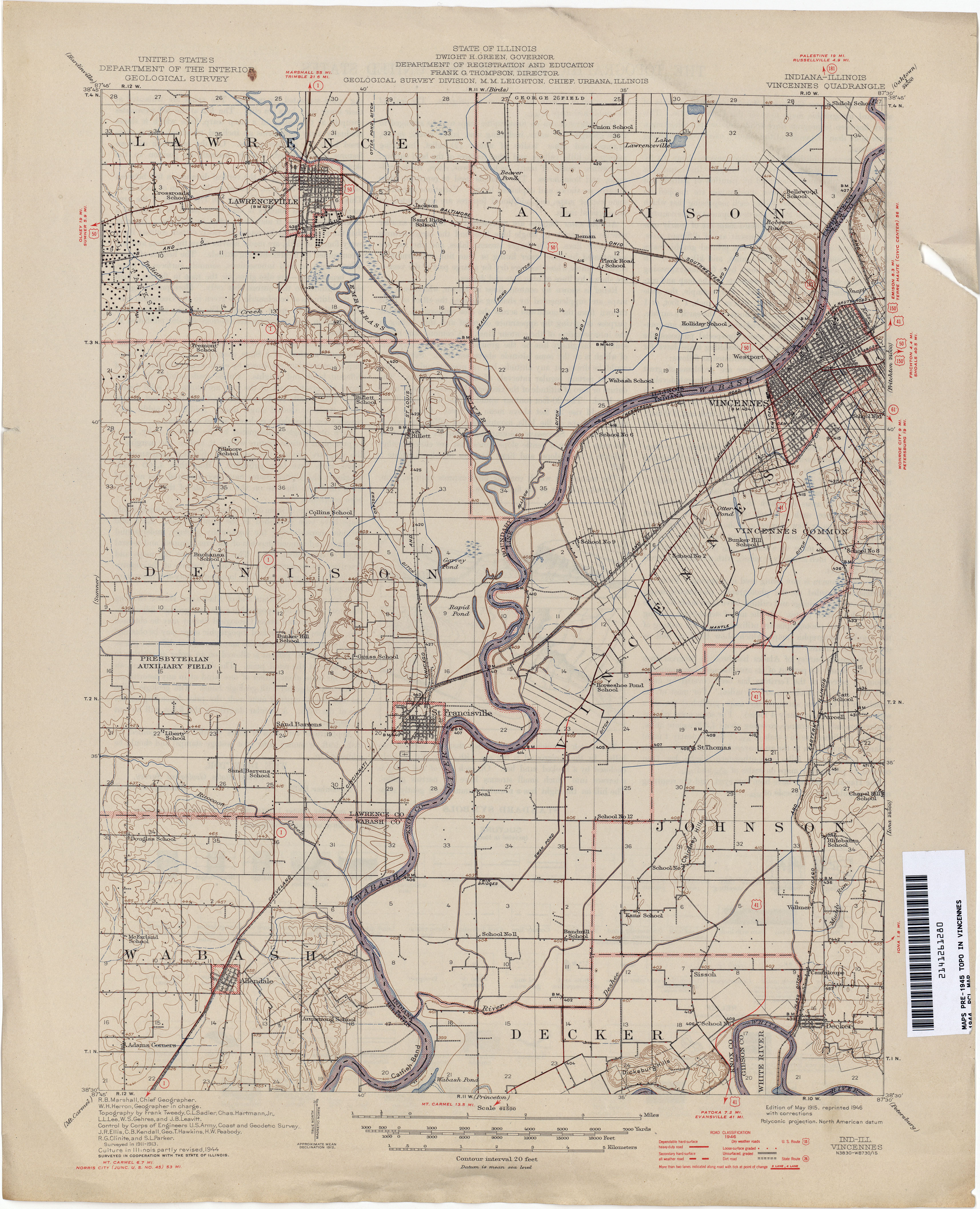
- Vincennes [Indiana, Illinois] 1944 1:62,500 (3.5MB)
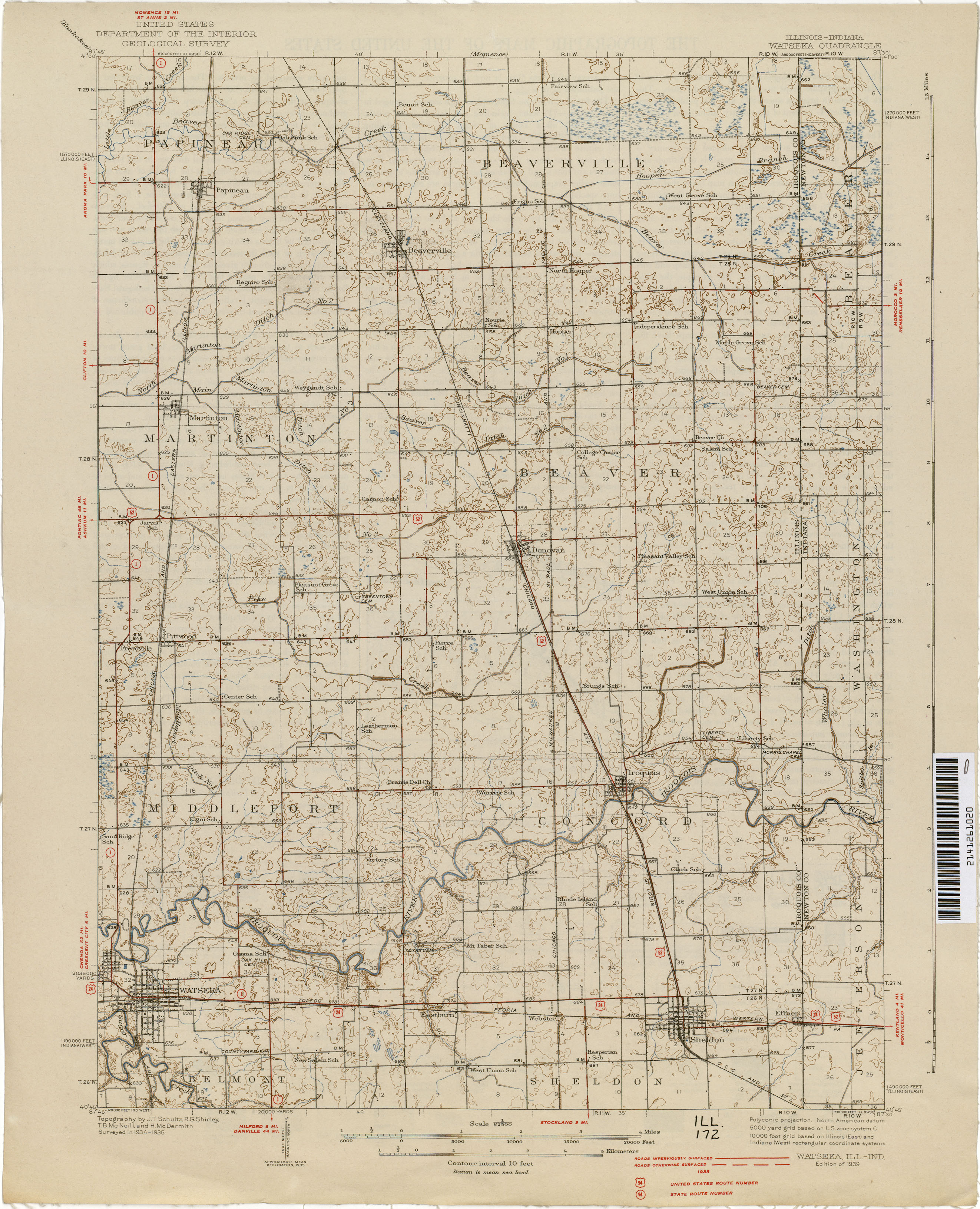
- Watseka [Illinois, Indiana] 1935 1:62,500 (2.2MB)
Return to the top