Perry-Castañeda Library
Map Collection
Tennessee Maps
State Maps
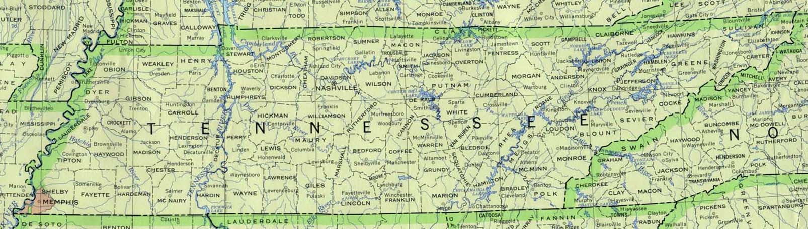
- Tennessee (base map) JPEG format (166K) County boundaries and names, county seats, rivers. Original scale 1:2,500,000 U.S. Geological Survey, 1972 limited update 1990
- Tennessee (outline map) JPEG format (193K) County boundaries and names. U.S. Bureau of the Census, 1990
- Tennessee (reference map) JPEG format (156K) Shaded relief map with state boundaries, forest cover, place names, major highways. Portion of "The National Atlas of the United States of America. General Reference", compiled by U.S. Geological Survey 2001, printed 2002
- Tennessee (reference map) PDF format (116K) Shaded relief map with state boundaries, forest cover, place names, major highways. Portion of "The National Atlas of the United States of America. General Reference", compiled by U.S. Geological Survey 2001, printed 2002
- Tennessee - Federal Lands and Indian Reservations PDF format (635K) The National Atlas of the United States of America, U.S. Geological Survey, 2003
City Maps
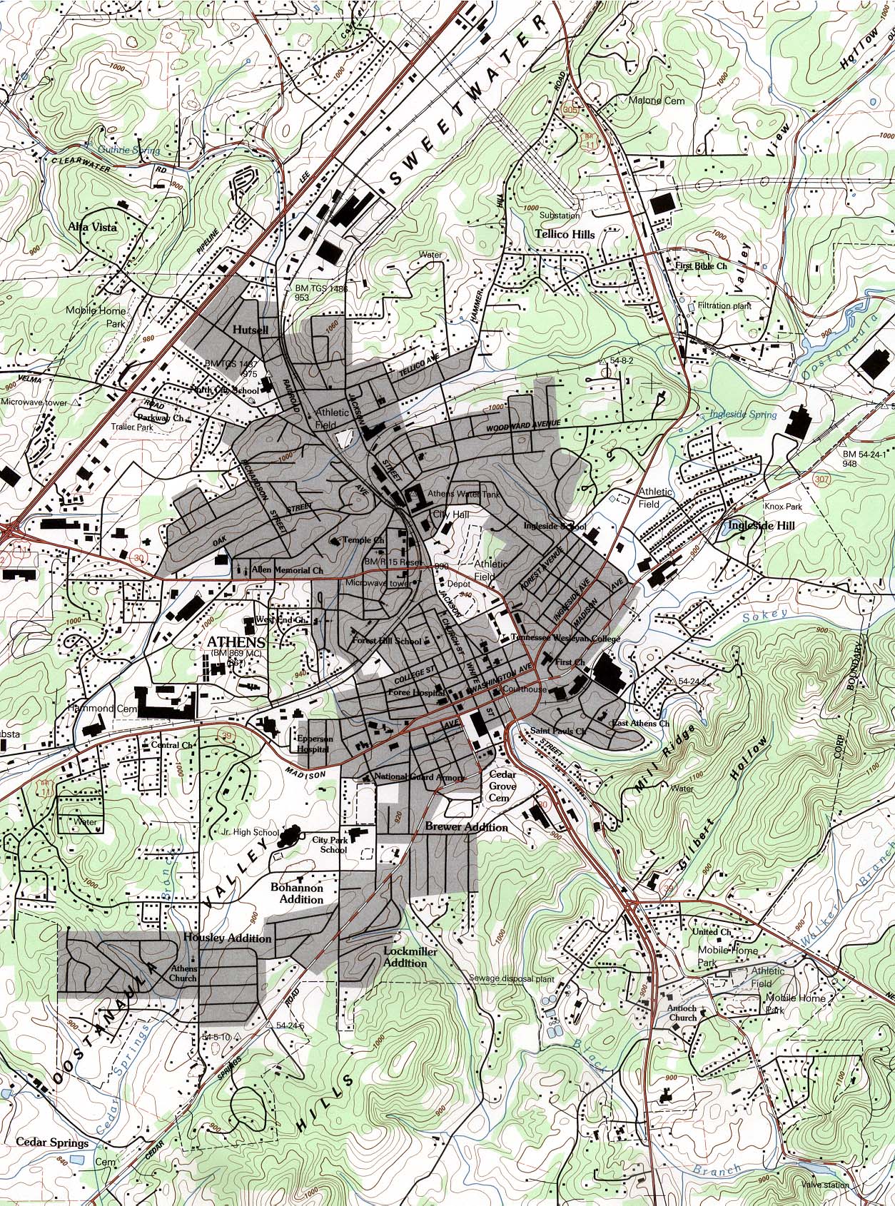
- Athens (topographic) original scale 1:24,000 U.S.G.S. 1964, limited update 1990 (725K)
- Fayetteville (topographic) original scale 1:24,000 U.S.G.S. 1966, photorevised 1982 (626K)
Historical City Maps
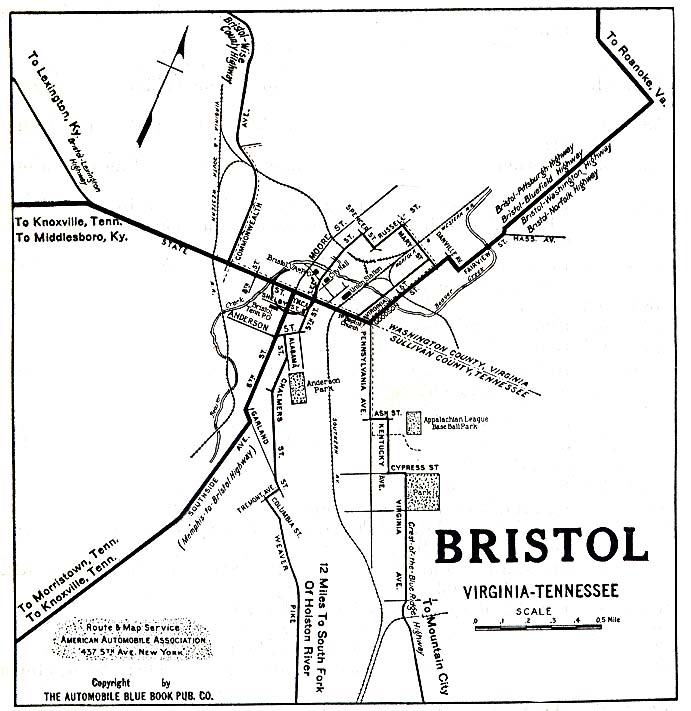
- Bristol (Virginia,Tennessee) 1919 Automobile Blue Book (117K)
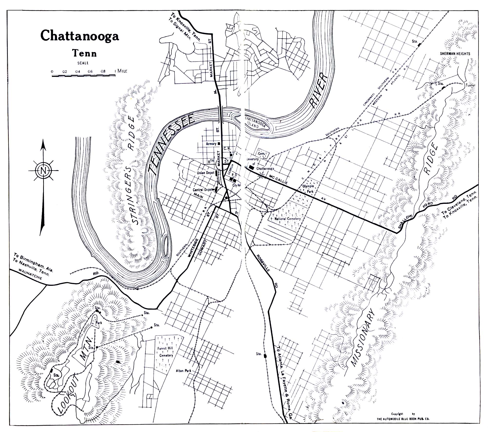
- Chattanooga 1919 Automobile Blue Book (645K)
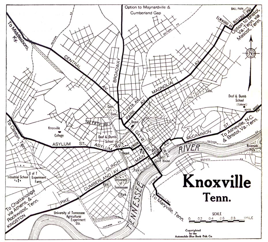
- Knoxville 1919 Automobile Blue Book (323K)
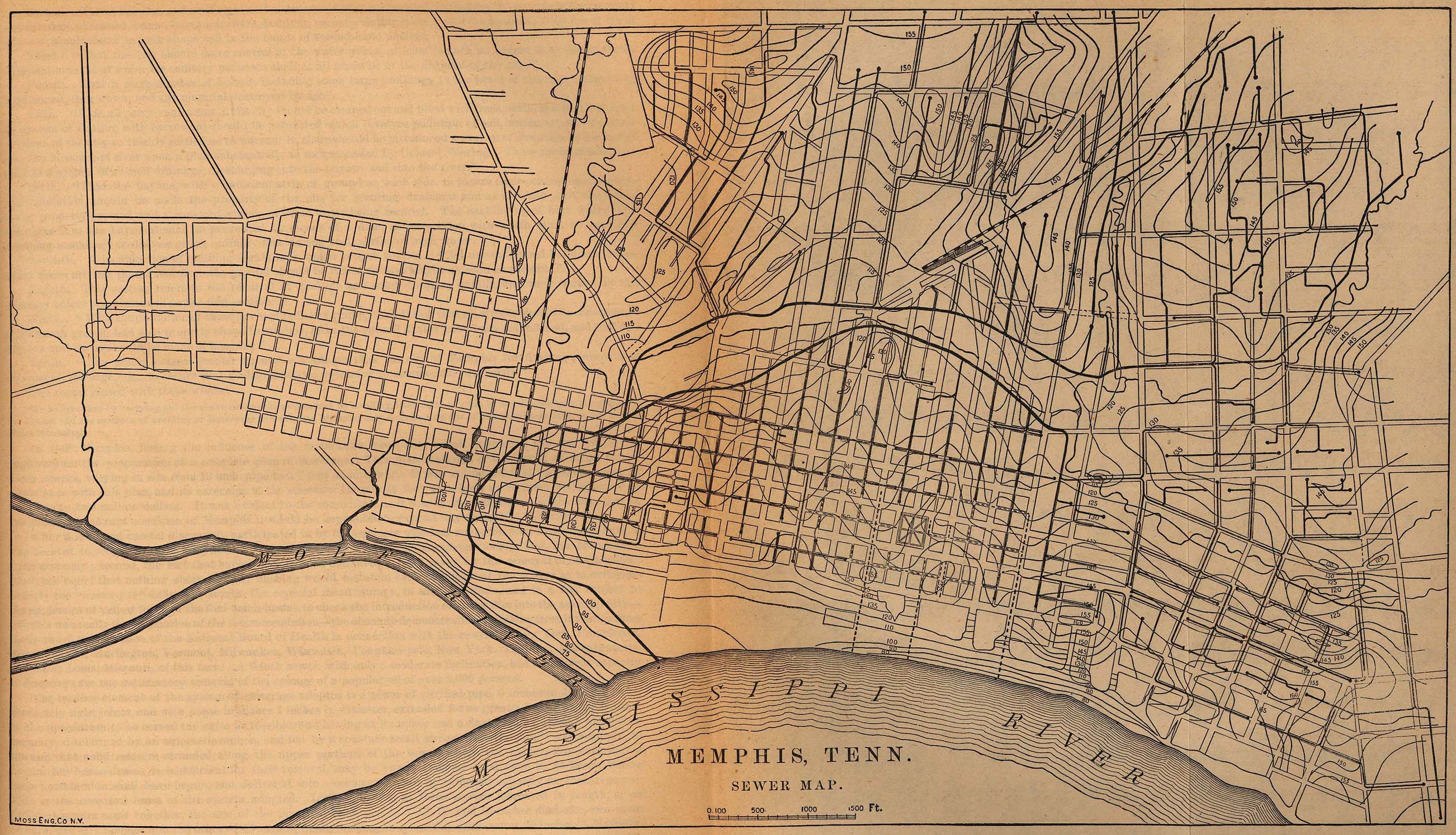
- Memphis 1880 "Memphis, Tenn. Sewer Map." From Report on the Social Statistics of Cities, Compiled by George E. Waring, Jr., United States. Census Office, Part II, 1886. (849K)
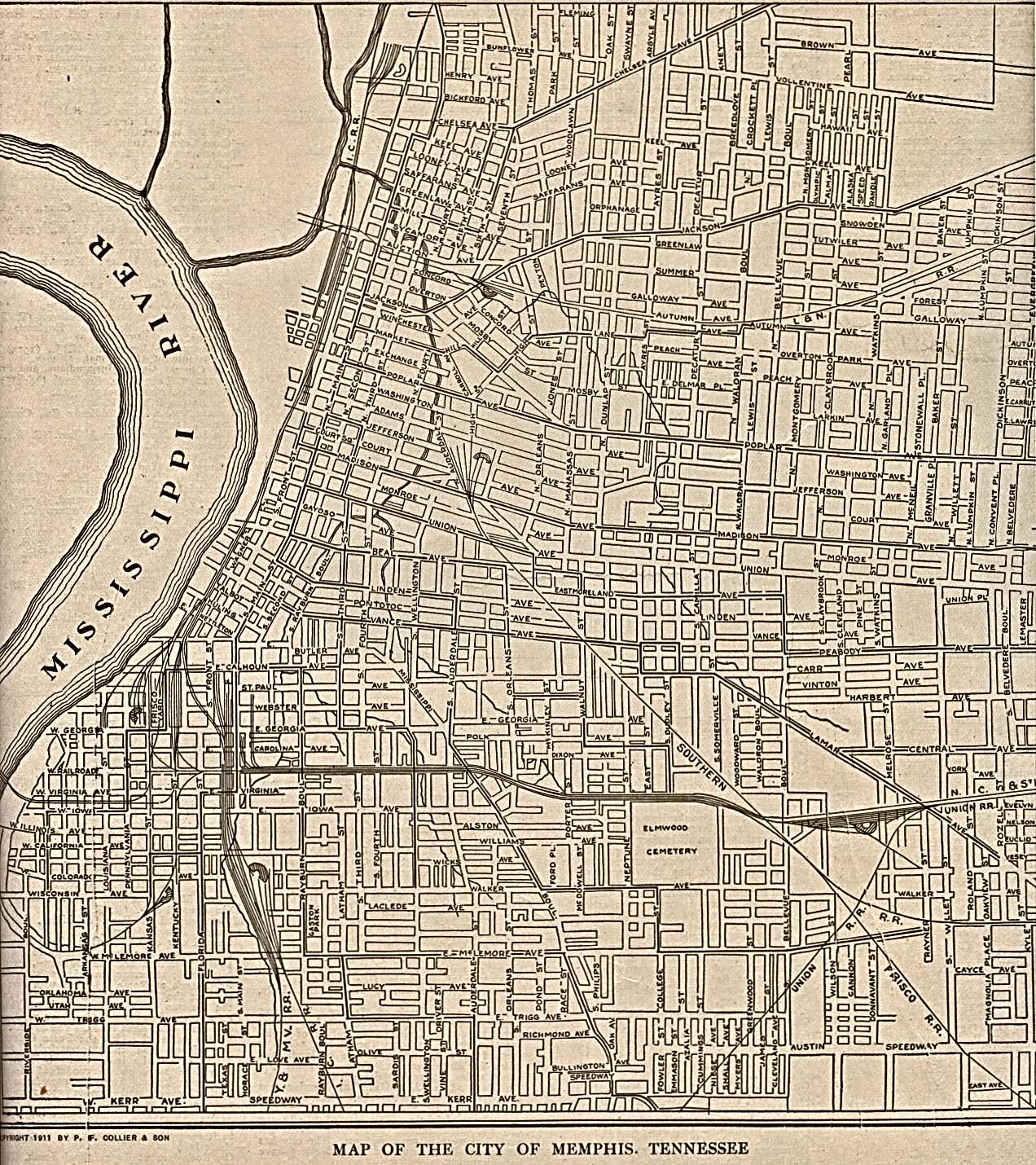
- Memphis 1911 The New Encyclopedic Atlas and Gazetteer of the World. New York: P.F. Collier & Son. 1917 (645K)
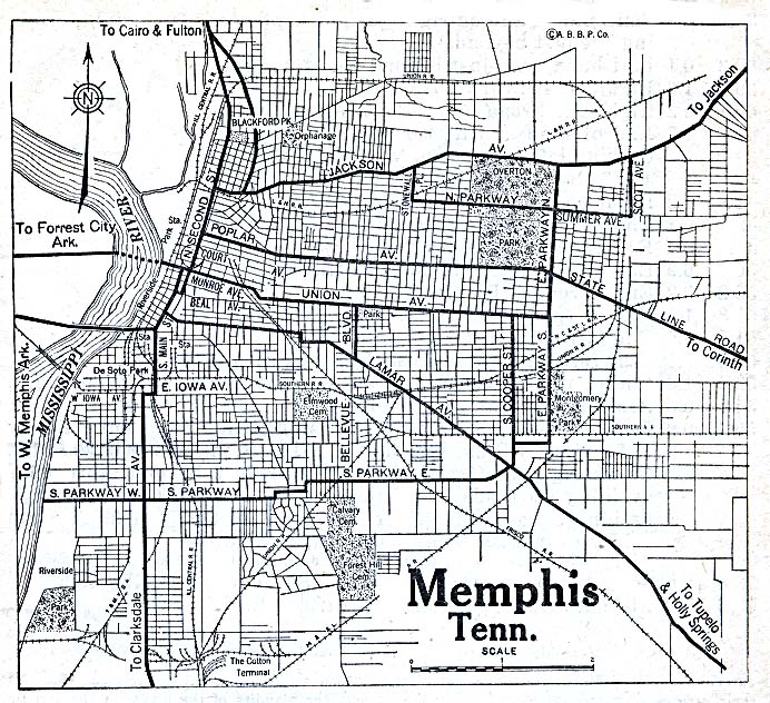
- Memphis 1920 Automobile Blue Book (204K)
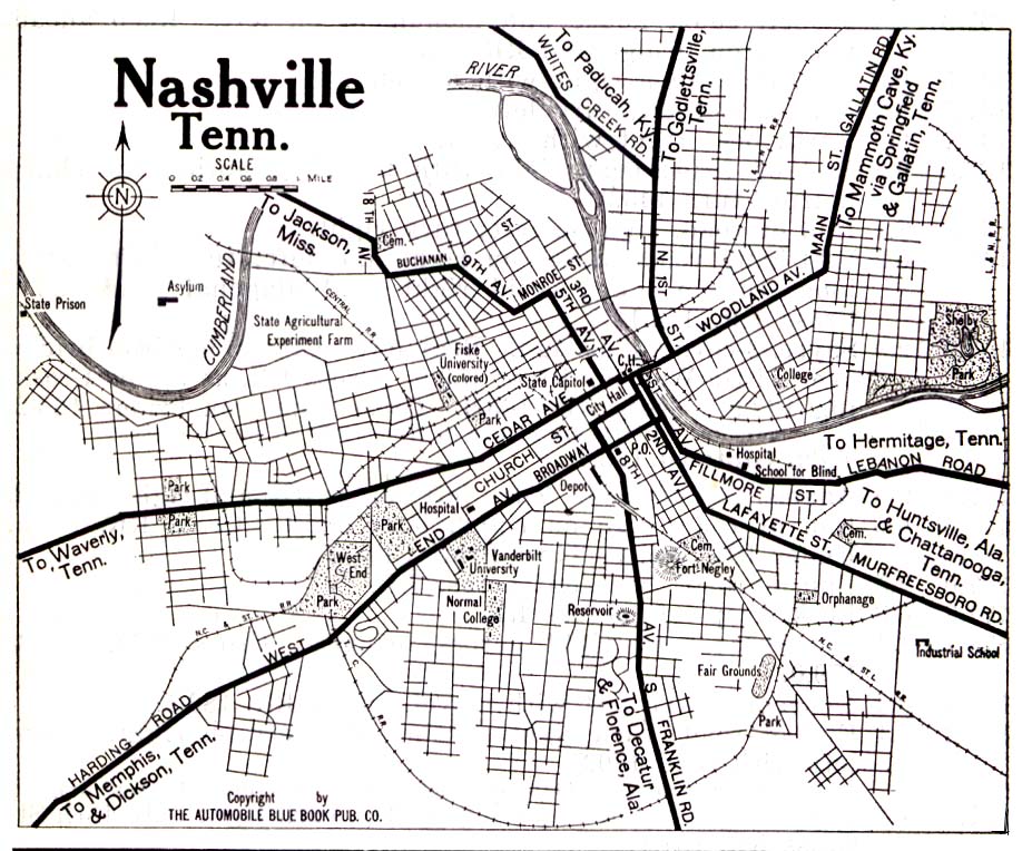
- Nashville 1919 Automobile Blue Book (323K)
Historical Topographic Maps
- Tennessee Historical Topographic Maps (U.S. Geological Survey and U.S. Army Corps of Engineers)
- Pre-1945 maps, scale 1:62,500 and 1:125,000
Maps of National Parks, Monuments, and Historic Sites
The following maps were produced by the U.S. National Park Service unless otherwise noted.
- Andrew Johnson National Historic Site (Location Map) 1995 (58K)
- Big South Fork National River and Recreation Area [Tennessee / Kentucky] (Park Map) 1997 (581K) (PDF Format)
- Cumberland Gap National Historical Park [Tennessee / Kentucky / Virginia] (Park Map) 1999 (323K) (PDF Format)
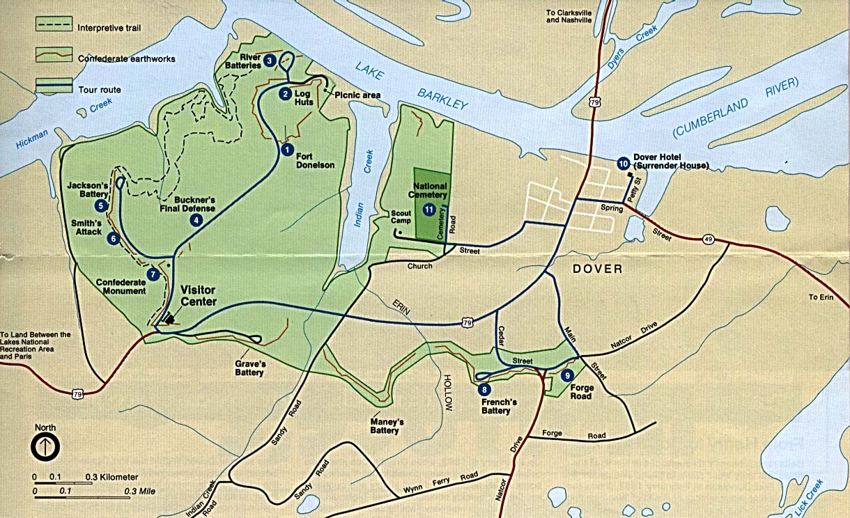
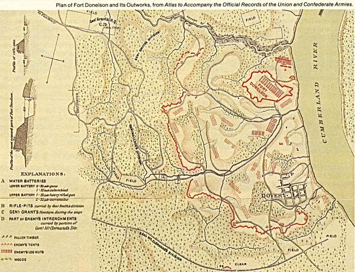
- Fort Donelson National Battlefield (Park Map) (260K)
- Fort Donelson National Battlefield (Schematic Map) (145K)
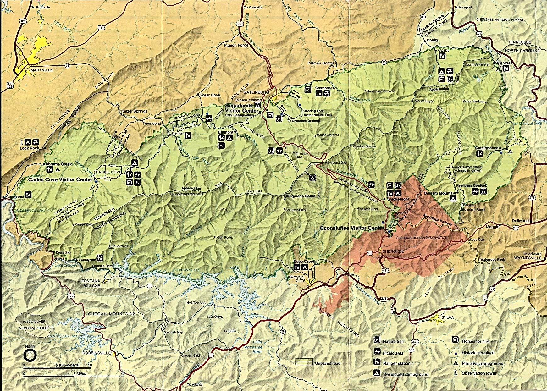
- Great Smoky Mountains National Park (Park Map / Shaded Relief) 1995 (546K)
- Great Smoky Mountains National Park (Park Map) 1999 (645K) (PDF Format)
- Great Smoky Mountains National Park (Trail Map) 1999 (774K) (PDF Format)
- Natchez Trace Parkway National Scenic Trail [Mississippi, Alabama, and Tennessee] (Area Map) 1999 (65K) (PDF Format)
- Natchez Trace Parkway National Scenic Trail [Mississippi, Alabama, and Tennessee] (Park Map) 1999 (516K) (PDF Format)
- Natchez Trace Parkway National Scenic Trail [Mississippi, Alabama, and Tennessee] (Natchez to Jackson, Mississippi) 1997 (387K)
- Natchez Trace Parkway National Scenic Trail [Mississippi, Alabama, and Tennessee] (Jackson to Dancy, Mississippi) 1997 (323K)
- Natchez Trace Parkway National Scenic Trail [Mississippi, Alabama, and Tennessee] (Dancy, Mississippi to Rock Spring, Alabama) 1997 (387K)
- Natchez Trace Parkway National Scenic Trail [Mississippi, Alabama, and Tennessee] (Rock Spring, Alabama to Nashville, Tennessee) 1997 (452K)
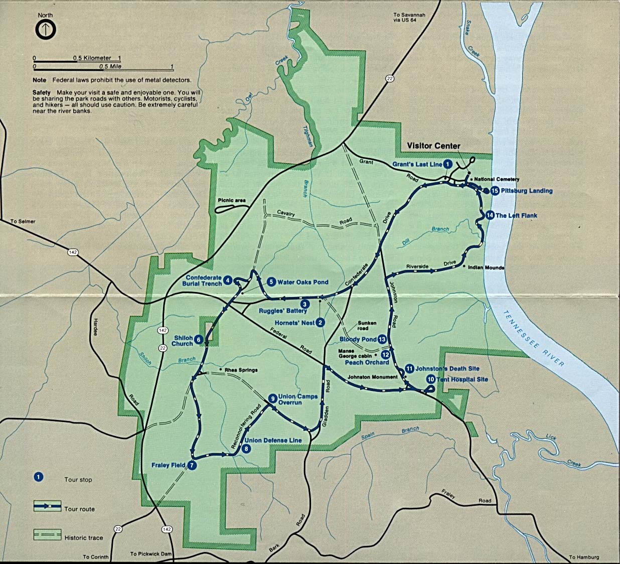
- Shiloh National Military Park (Park Map) (284K)
- Shiloh National Military Park (Park Map) 1997 (129K) (PDF Format)
- Shiloh National Military Park (Tour Map) 1997 (129K) (PDF Format)
- Stones River National Cemetery (Battle Map of 1862) 1997 (194K) (PDF Format)
- Stones River National Cemetery (Battle Map of 1863) 1997 (194K) (PDF Format)
- Stones River National Cemetery (Park Map) 1997 (129K) (PDF Format)
Maps on Other Web Sites - Pre-1945 maps, scale 1:62,500 and 1:125,000
![Natchez Trace Parkway National Scenic Trail [Mississippi, Alabama, and Tennessee]](national_parks/traceparkway4_97.jpg)
![Natchez Trace Parkway National Scenic Trail [Mississippi, Alabama, and Tennessee]](national_parks/traceparkway3_97.jpg)
![Natchez Trace Parkway National Scenic Trail [Mississippi, Alabama, and Tennessee]](national_parks/traceparkway2_97.jpg)
![Natchez Trace Parkway National Scenic Trail [Mississippi, Alabama, and Tennessee]](national_parks/traceparkway1_97.jpg)