Perry-Castañeda Library
Map Collection
South Carolina Maps
State Maps
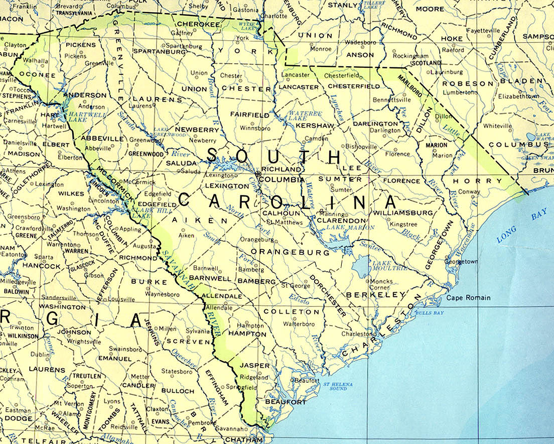
- South Carolina (base map) JPEG format (357K) County boundaries and names, county seats, rivers. Original scale 1:2,500,000 U.S. Geological Survey, 1972 limited update 1990
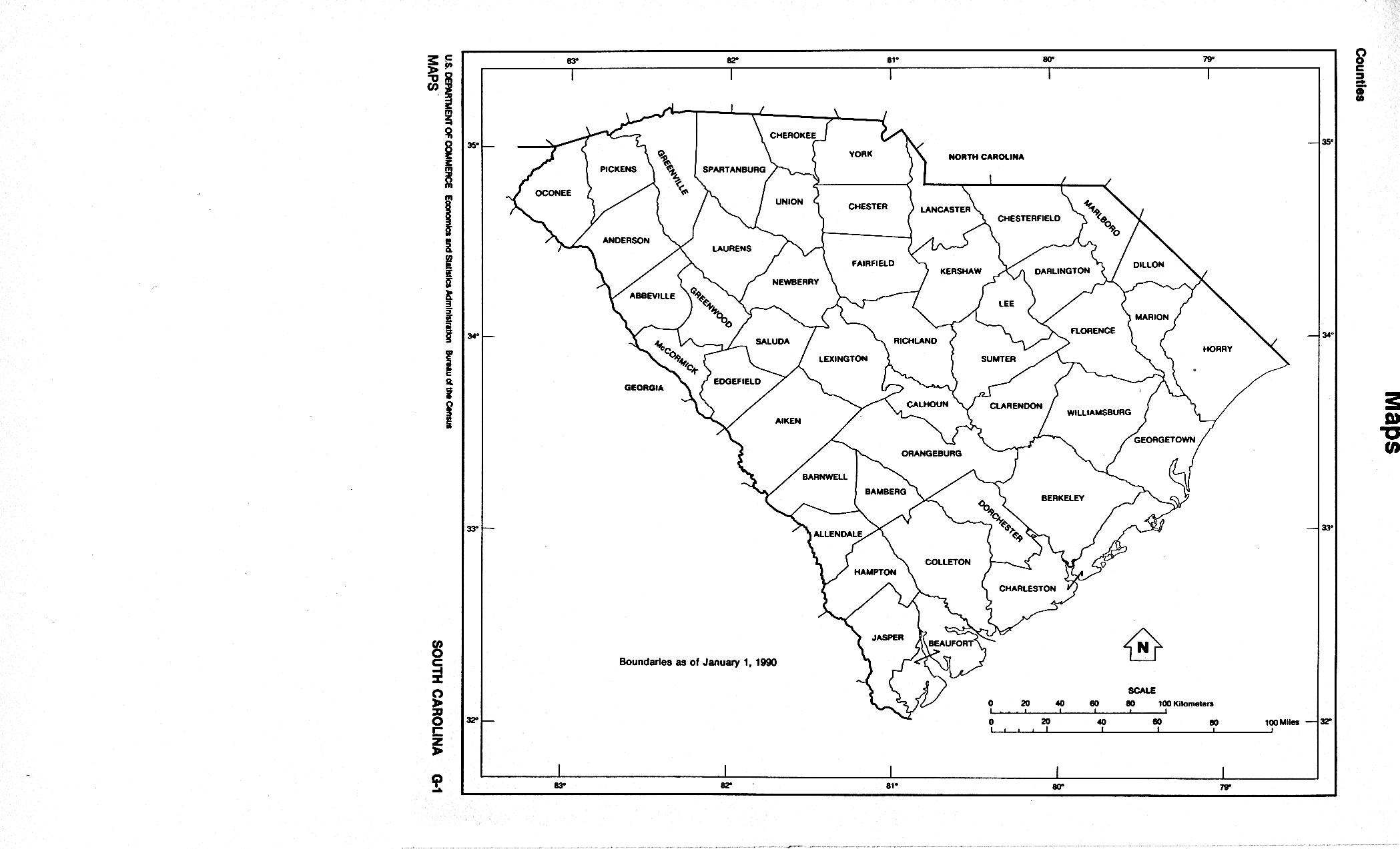
- South Carolina (outline map) JPEG format (116K) County boundaries and names. U.S. Bureau of the Census, 1990
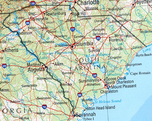
- South Carolina (reference map) JPEG format (252K) Shaded relief map with state boundaries, forest cover, place names, major highways. Portion of "The National Atlas of the United States of America. General Reference", compiled by U.S. Geological Survey 2001, printed 2002
- South Carolina (reference map) PDF format (192K) Shaded relief map with state boundaries, forest cover, place names, major highways. Portion of "The National Atlas of the United States of America. General Reference", compiled by U.S. Geological Survey 2001, printed 2002
- South Carolina - Federal Lands and Indian Reservations PDF format (565K) The National Atlas of the United States of America, U.S. Geological Survey, 2003
Historical City Maps
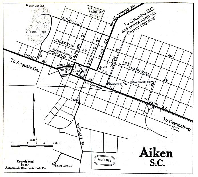
- Aiken 1919 Automobile Blue Book (137K)
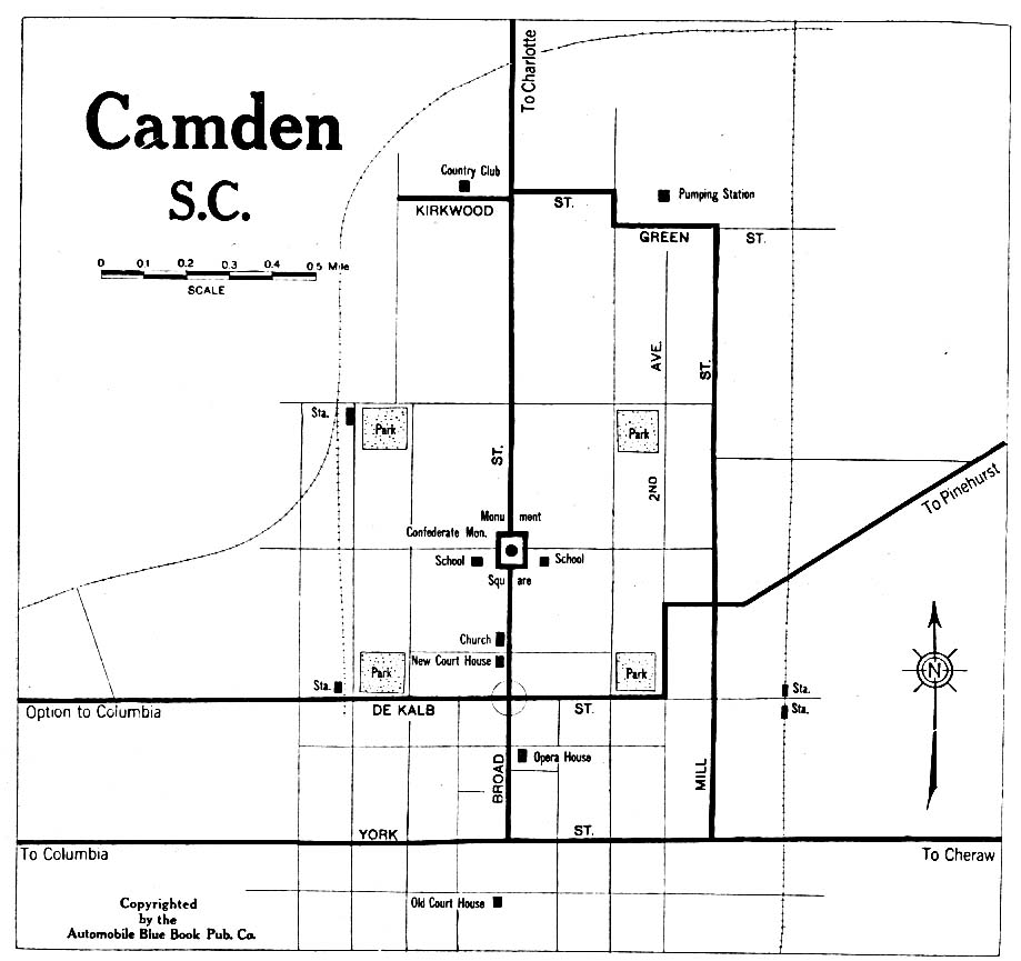
- Camden 1919 Automobile Blue Book (117K)
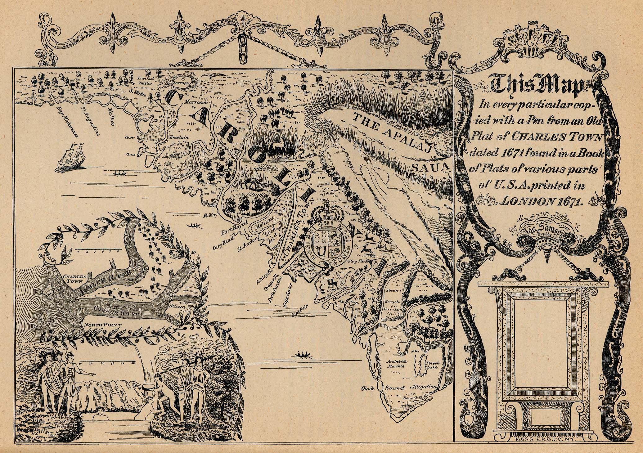
- Charleston 1671 From Report on the Social Statistics of Cities, Compiled by George E. Waring, Jr., United States. Census Office, Part II, 1887. (855K)
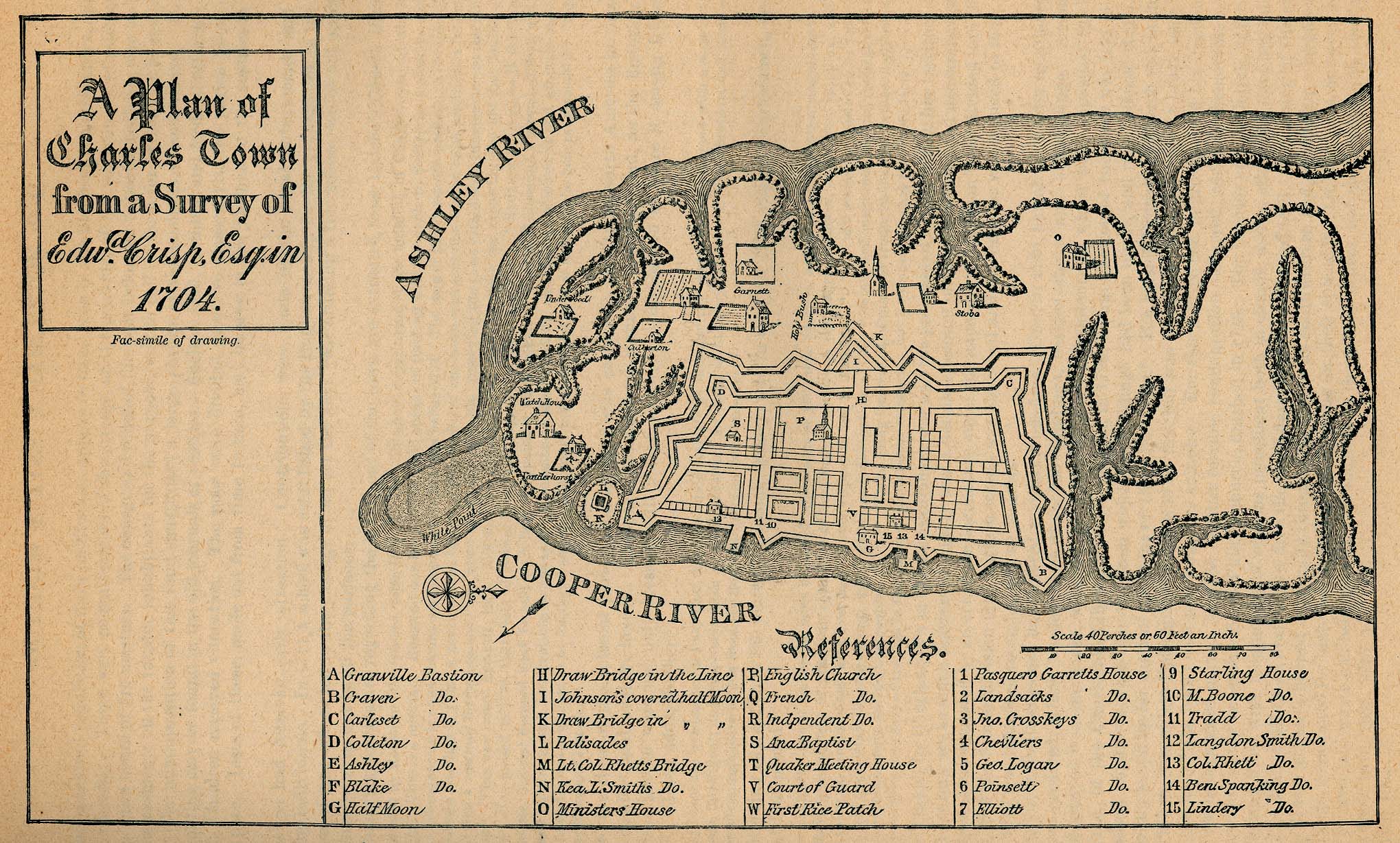
- Charleston 1704 "Plan of Charles Town" From Report on the Social Statistics of Cities, Compiled by George E. Waring, Jr., United States. Census Office, Part II, 1887. (593K)
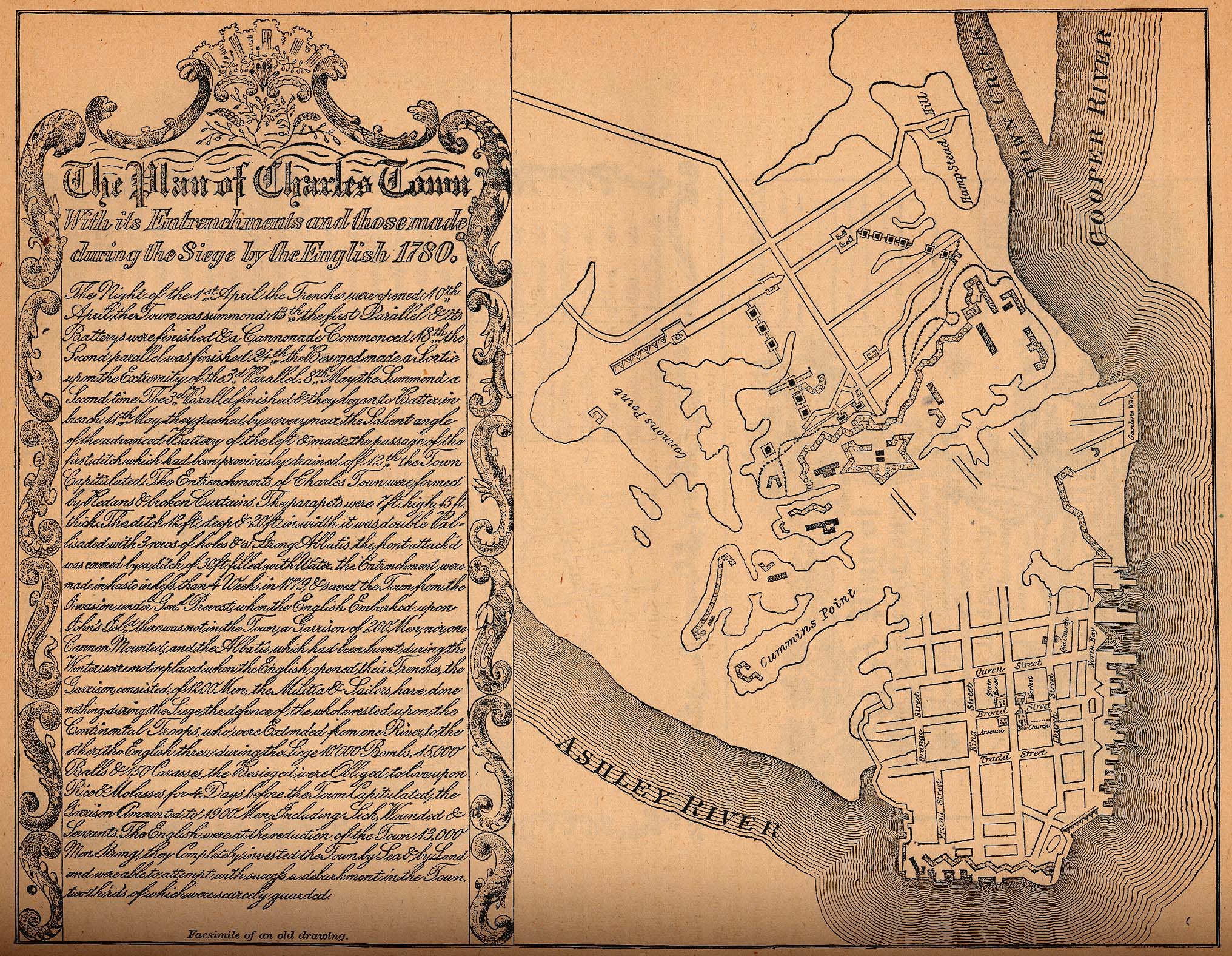
- Charleston 1780 "A Plan of Charles Town with its Entrenchments and those made during the Siege by the English 1780" From Report on the Social Statistics of Cities, Compiled by George E. Waring, Jr., United States. Census Office, Part II, 1887. (983K)
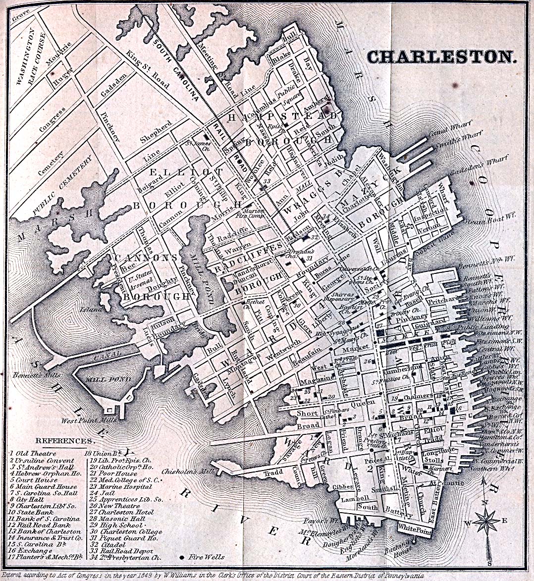
- Charleston 1849 Appletons' Hand-Book of American Travel. New York: D. Appleton and Company, 1869 (629K)
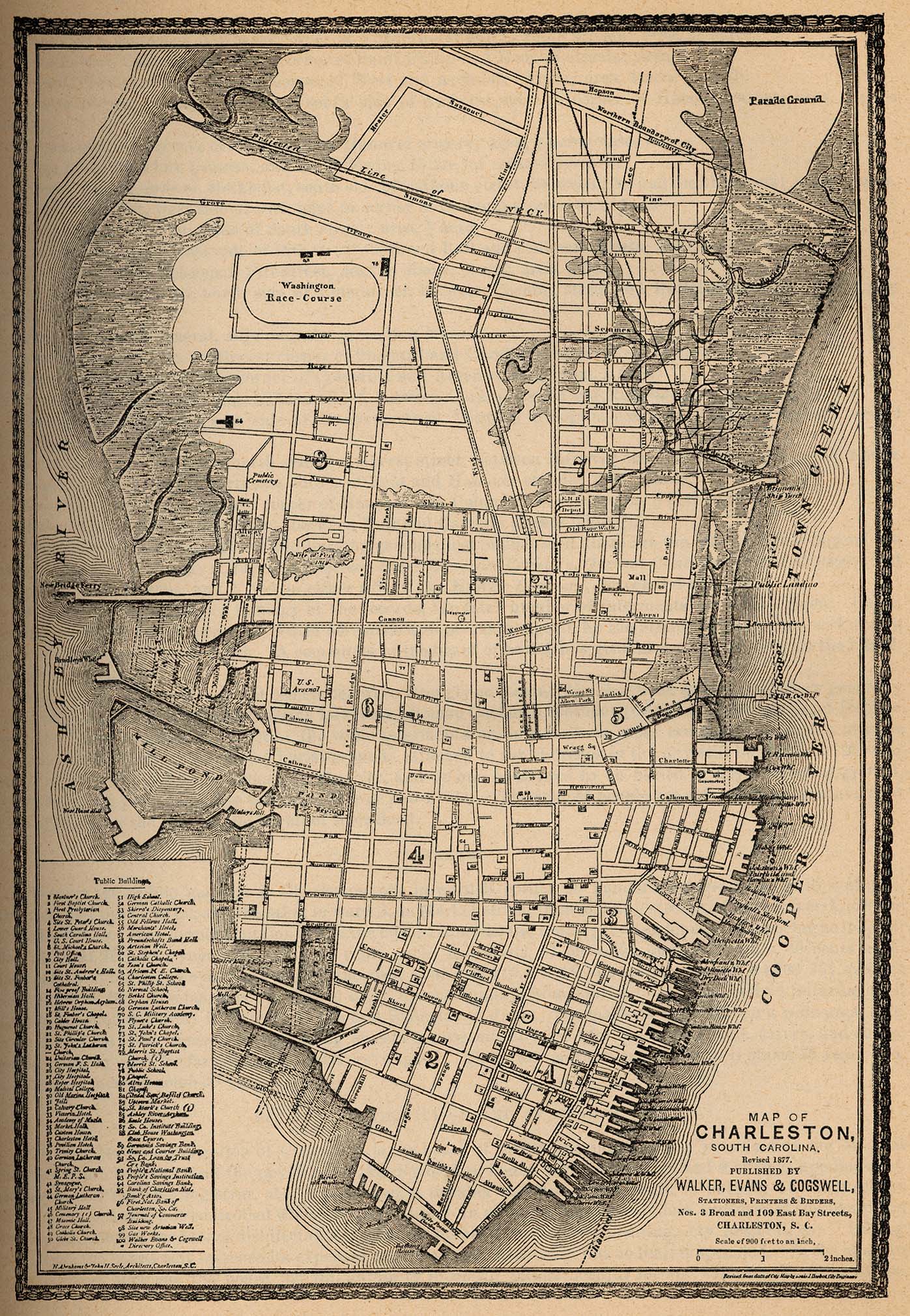
- Charleston 1877 From Report on the Social Statistics of Cities, Compiled by George E. Waring, Jr., United States. Census Office, Part II, 1887. (777K)
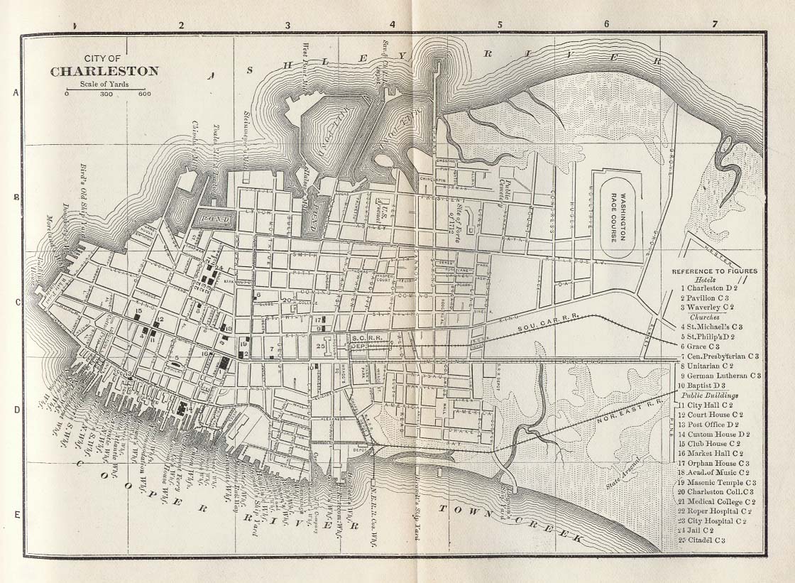
- Charleston 1885 Appletons' General Guide to the United States and Canada. Part II. Western and Southern States. New York: D. Appleton and Company. 1885 (249K)
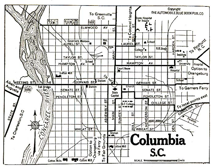
- Columbia 1920 Automobile Blue Book (156K)
Historical Topographic Maps
- South Carolina Historical Topographic Maps (U.S. Geological Survey and U.S. Army Corps of Engineers)
- Pre-1945 maps, scales 1:21,120, 1:24,000, 1:62,500 and 1:125,000
Maps of National Parks, Monuments, and Historic Sites
The following maps were produced by the U.S. National Park Service unless otherwise noted.
- Charles Pinckney National Historic Site (Park Map) 1998 (65K) (PDF Format)
- Congaree Swamp National Monument (Park Map) 1997 (129K) (PDF Format)
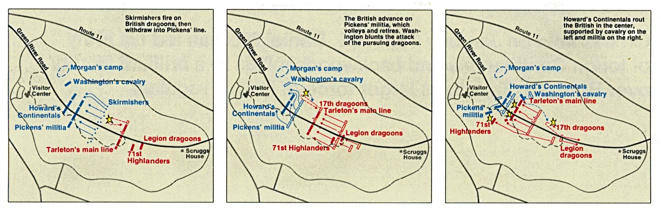
- Cowpens National Battlefield (Battle Map) 1995 (156K)
- Cowpens National Battlefield (Park Map) 1995 (293K)
- Cowpens National Battlefield (Park Map) 1997 (65K) (PDF Format)
- Kings Mountain National Military Park (Battle Map) 1999 (129K) (PDF Format)
- Kings Mountain National Military Park (Campaign Map) 1999 (129K) (PDF Format)
- Kings Mountain National Military Park (Park Map) 1999 (129K) (PDF Format)
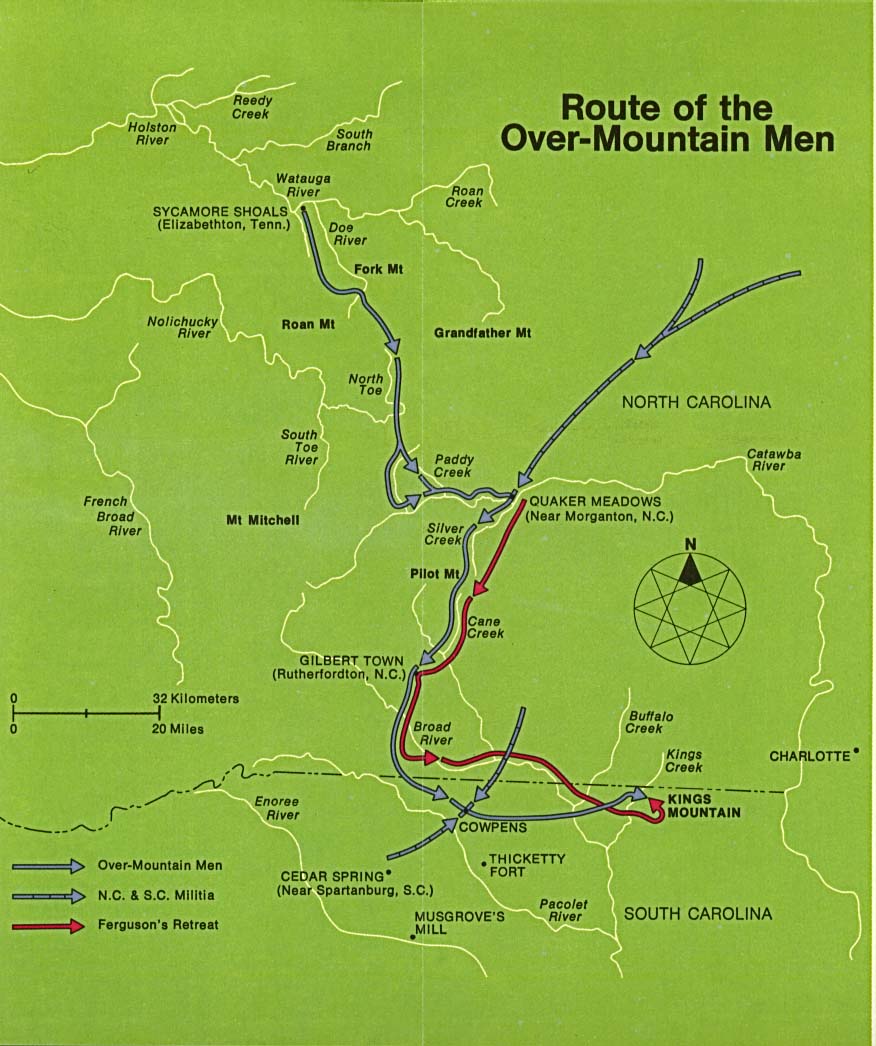
- Kings Mountain National Military Park (Route of the Over-Mountain Men) (119K)
Maps on Other Web Sites