Perry-Castañeda Library
Map Collection
Pennsylvania Maps
State Maps
- Pennsylvania (base map) JPEG format (408K) County boundaries and names, county seats, rivers. Original scale 1:2,500,000 U.S. Geological Survey, 1972 limited update 1990
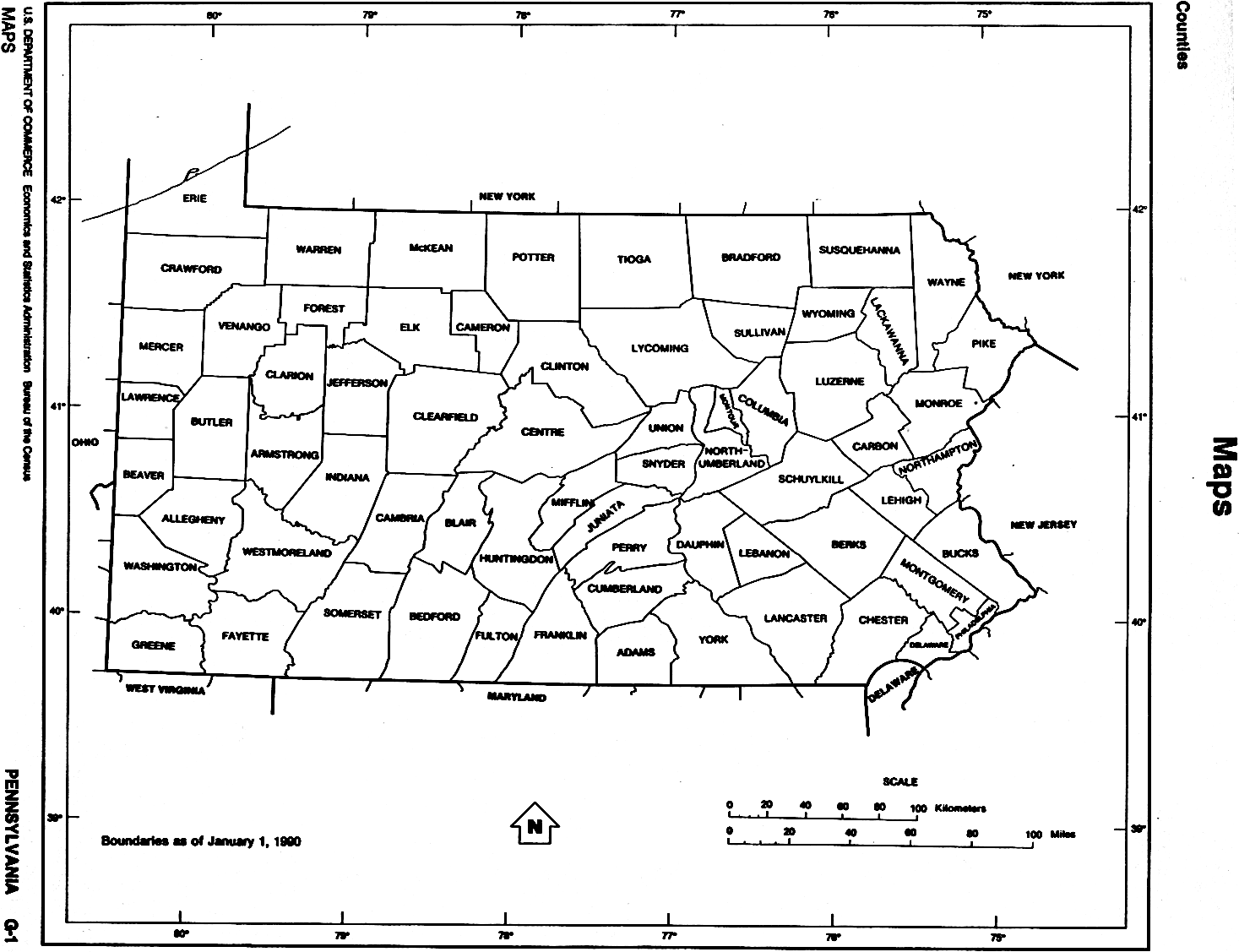
- Pennsylvania (outline map) JPEG format (83K) County boundaries and names. U.S. Bureau of the Census, 1990
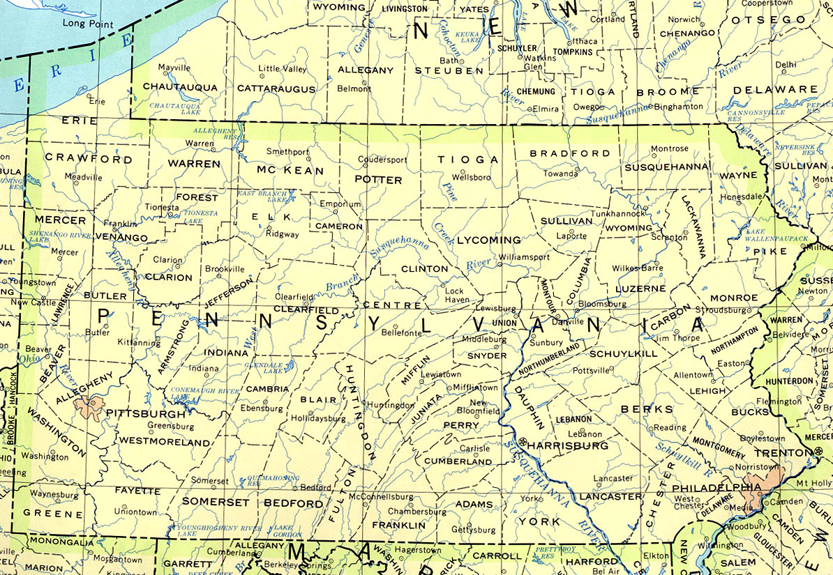
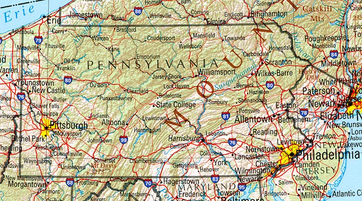
- Pennsylvania (reference map) JPEG format (201K) Shaded relief map with state boundaries, forest cover, place names, major highways. Portion of "The National Atlas of the United States of America. General Reference", compiled by U.S. Geological Survey 2001, printed 2002
- Pennsylvania (reference map) PDF format (204K) Shaded relief map with state boundaries, forest cover, place names, major highways. Portion of "The National Atlas of the United States of America. General Reference", compiled by U.S. Geological Survey 2001, printed 2002
- Pennsylvania - Federal Lands and Indian Reservations PDF format (500K) The National Atlas of the United States of America, U.S. Geological Survey, 2003
City Maps
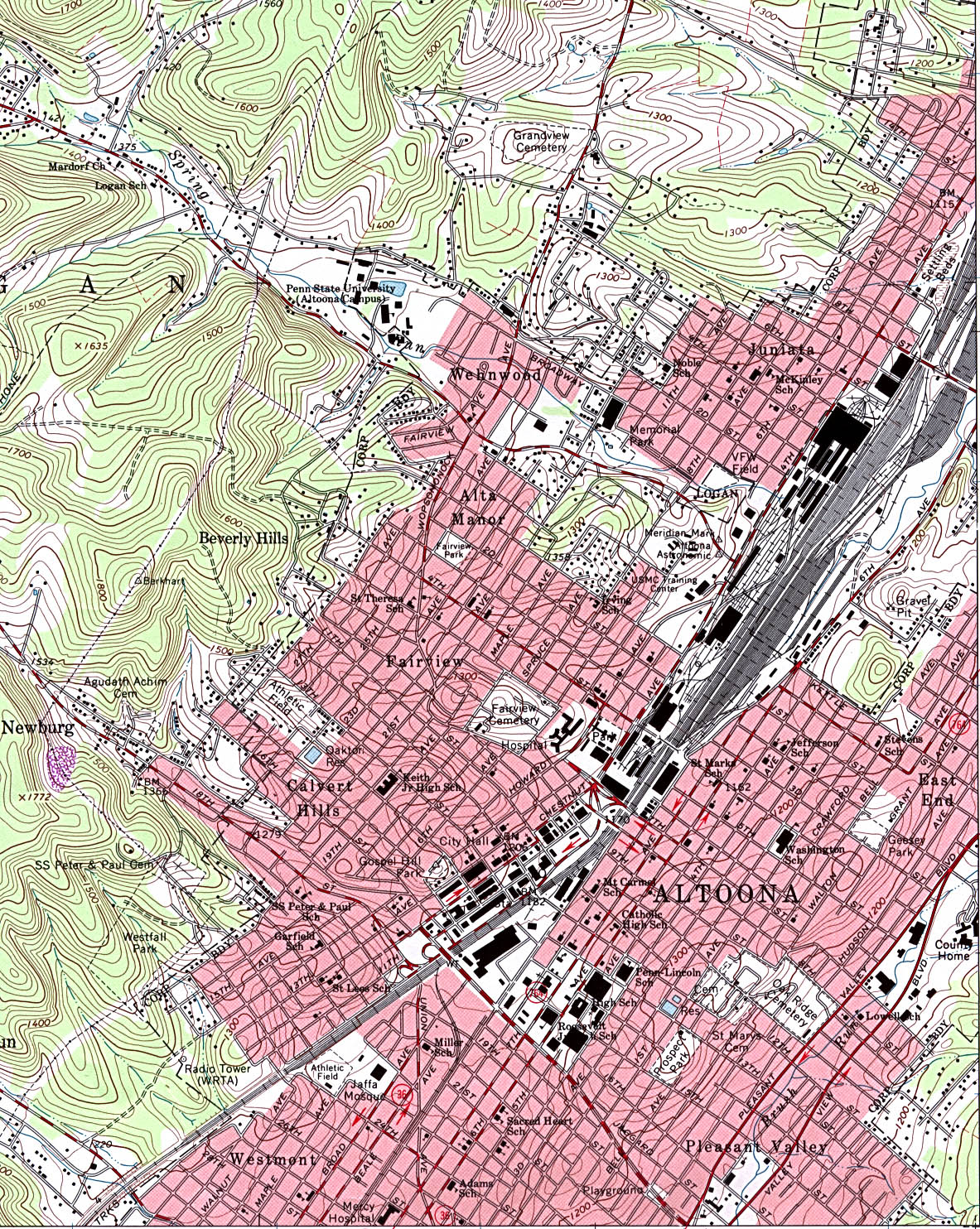
- Altoona (topographic) original scale 1:24,000 U.S.G.S. 1963, revised 1993 (884K)
- Ambridge (topographic) original scale 1:24,000 U.S.G.S. 1960, photorevised 1990 (808K)
- Barnesboro (topographic) original scale 1:24,000 U.S.G.S. 1961, photorevised 1981, photoinspected 1984 (740K)
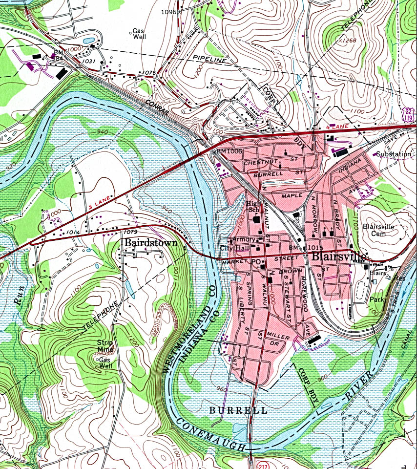
- Blairsville (topographic) original scale 1:24,000 U.S.G.S. 1964, photorevised 1981 (434K)
- Chambersburg (topographic) original scale 1:24,000 U.S.G.S. 1990 (842K)
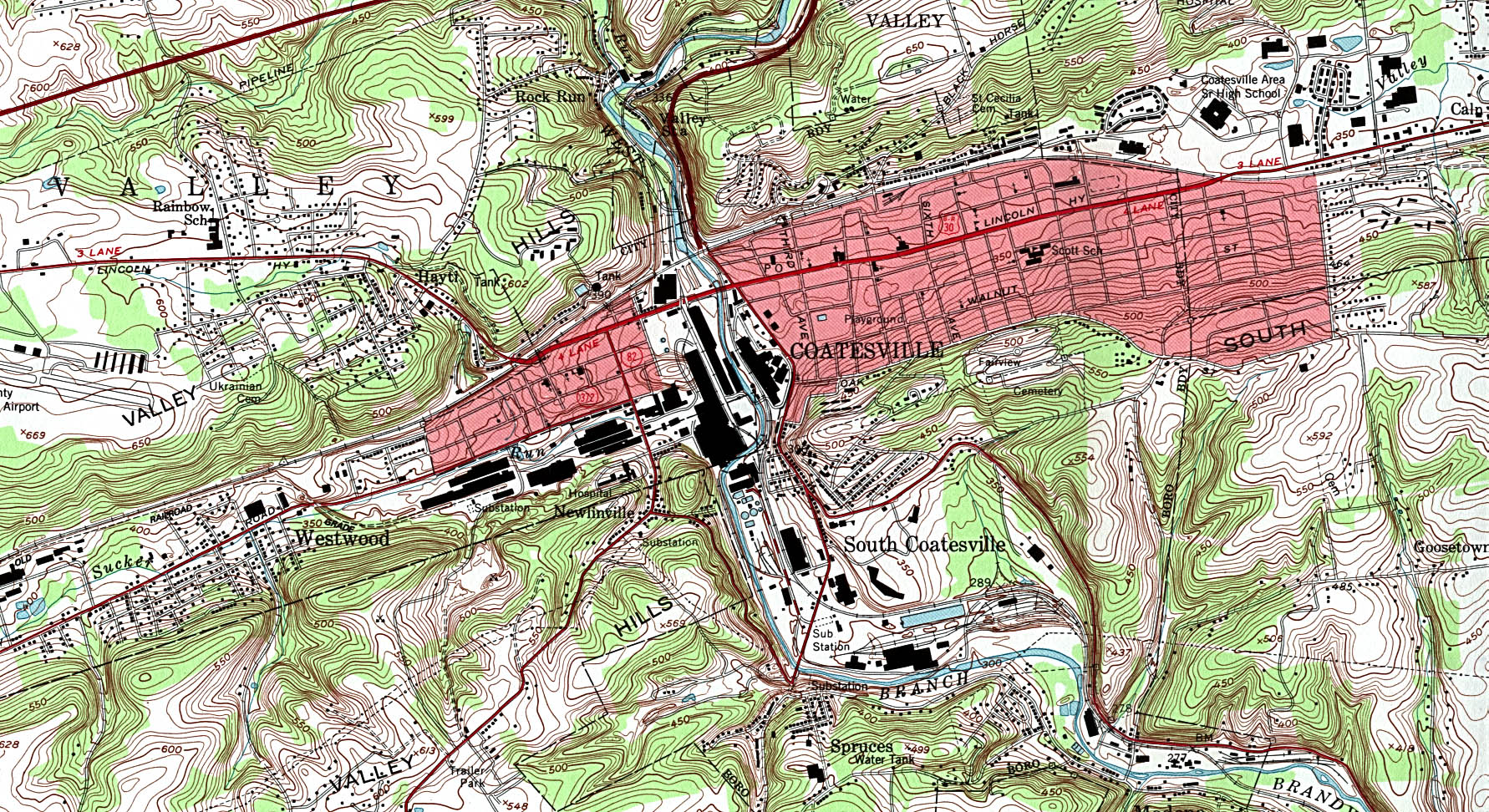
- Coatesville (topographic) original scale 1:24,000 U.S.G.S. 1953, revised 1992 (876K)
- Coraopolis (topographic) original scale 1:24,000 U.S.G.S. 1960, photorevised 1990 (544K)
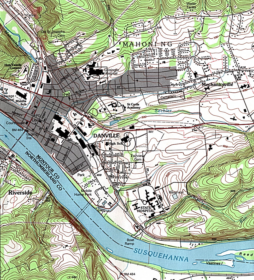
- Danville (topographic) original scale 1:24,000 U.S.G.S. 1994 (595K)
- Donora (topographic) original scale 1:24,000 U.S.G.S. 1993 (366K)
- Du Bois (topographic) original scale 1:24,000 U.S.G.S. 1966, revised 1994 (332K)
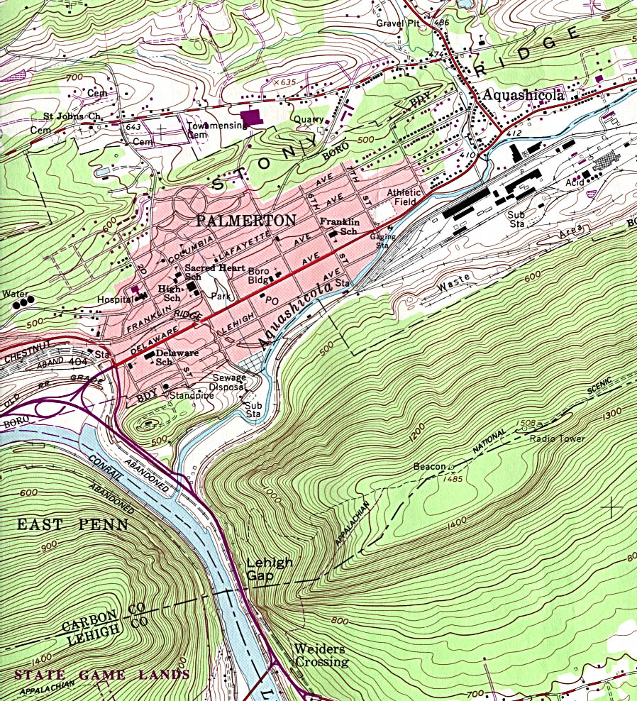
- Palmerton (topographic) original scale 1:24,000 U.S.G.S. 1960, photorevised 1984 (485K)
- Palmyra (topographic) original scale 1:24,000 U.S.G.S. 1969, photorevised 1990 (536K)
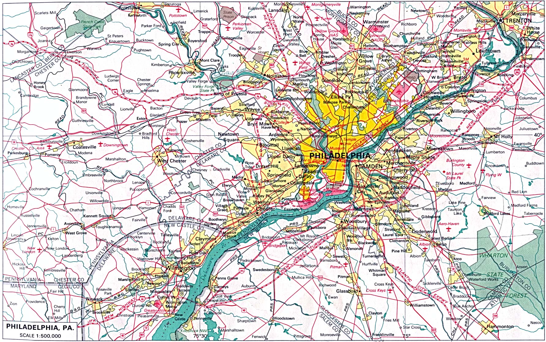
- Philadelphia original scale 1:500,000 U.S. National Atlas 1970 (514K)
- Philadelphia [Downtown] (topographic) original scale 1:24,000 U.S.G.S. 1967, revised 1994 (1.1MB)
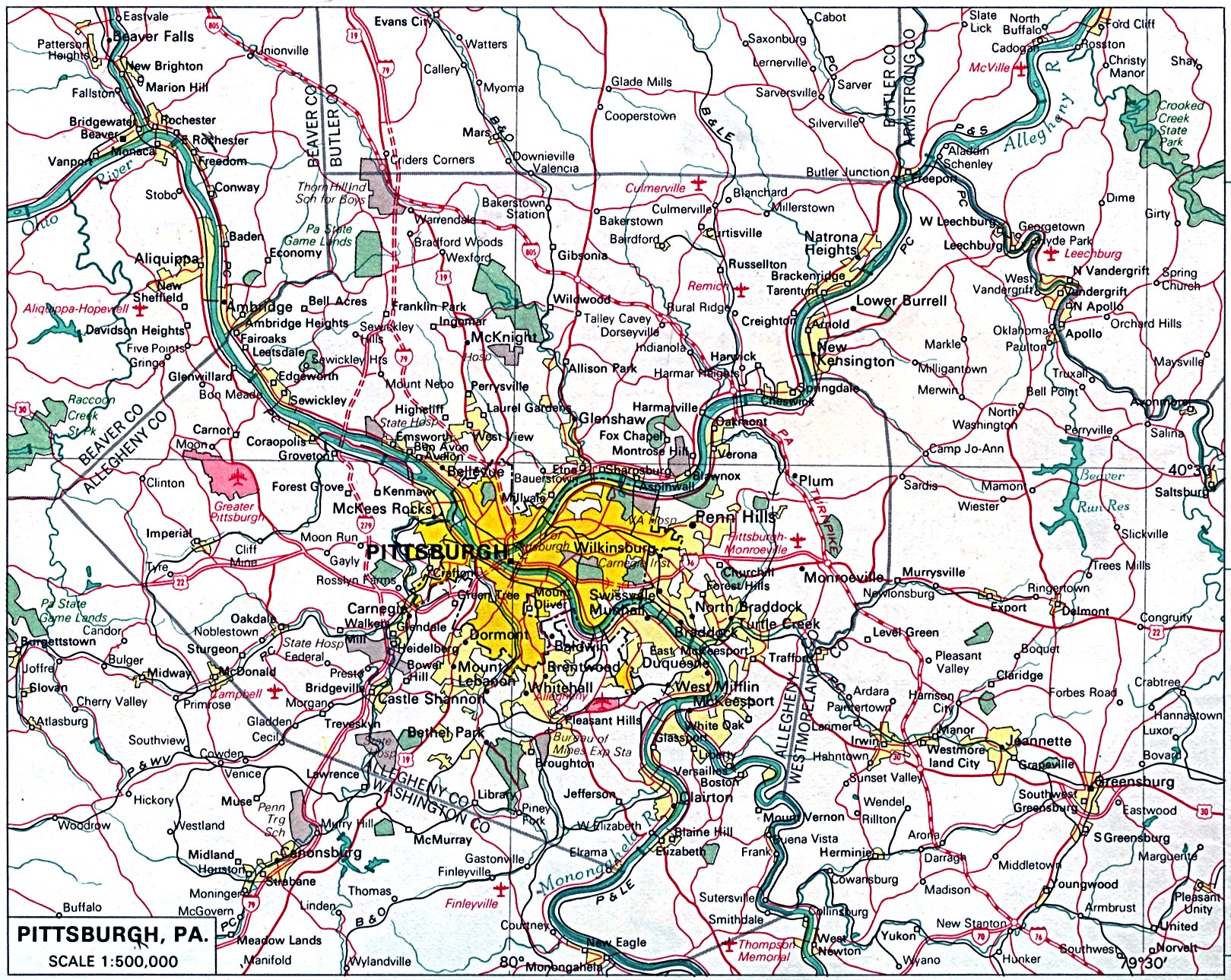
- Pittsburgh original scale 1:500,000 U.S. National Atlas 1970 (747K)
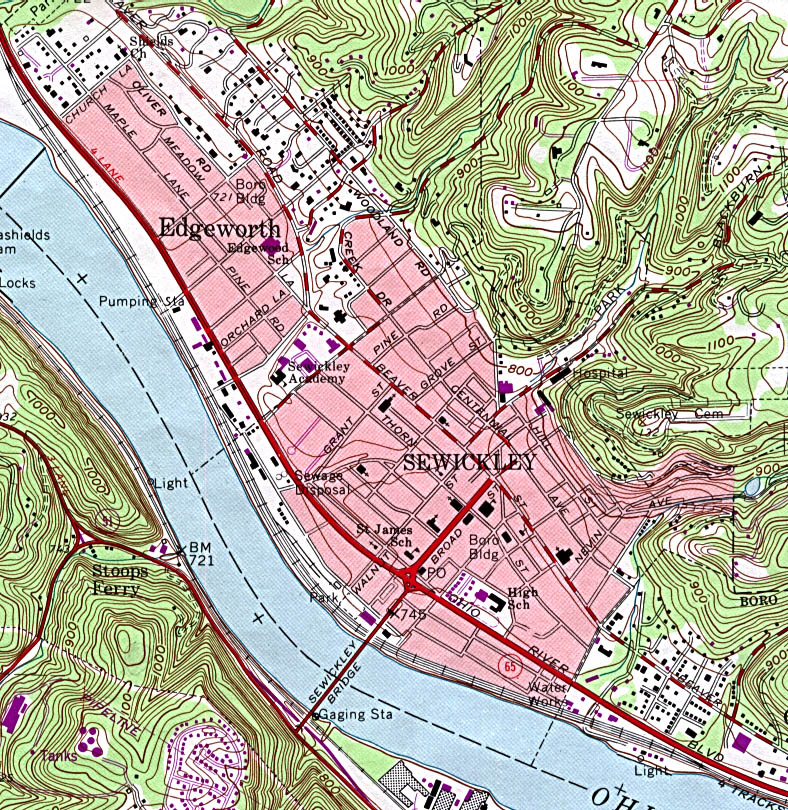
- Sewickley (topographic) original scale 1:24,000 U.S.G.S. 1960, photorevised 1990 (391K)
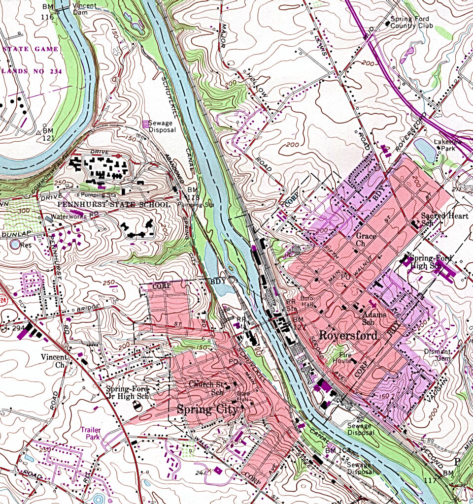
- Spring City - Royersford (topographic) original scale 1:24,000 U.S.G.S. 1955, photorevised 1983 (519K)
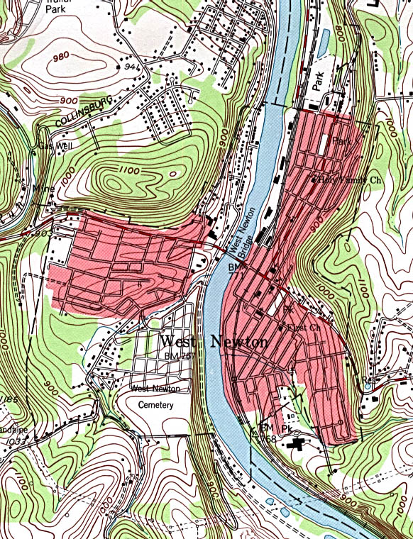
- West Newton (topographic) original scale 1:24,000 U.S.G.S. 1993 (246K)
![Philadelphia [Downtown] (topographic)](united_states/philadelphia_pa_94.jpg)
Historical City Maps
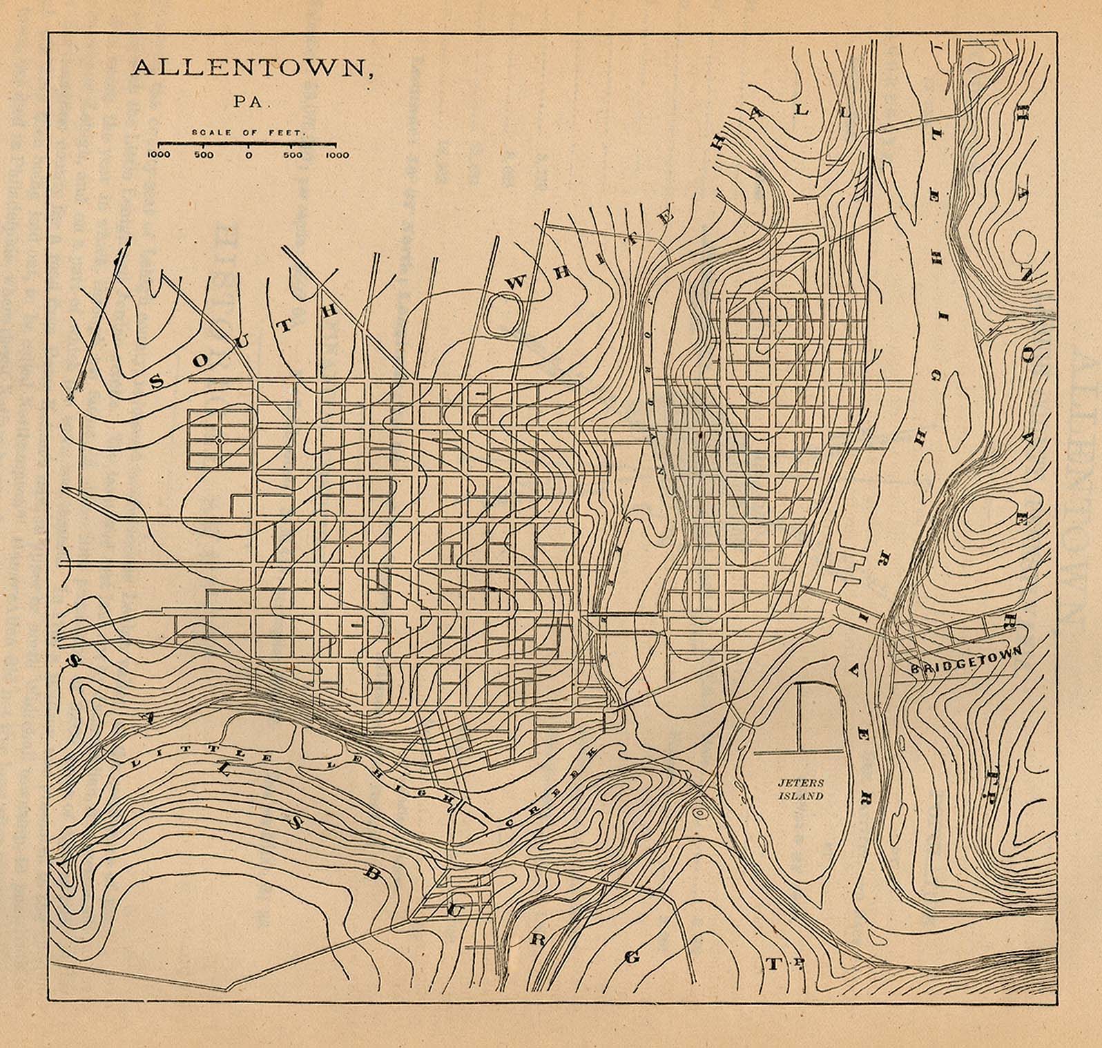
- Allentown 1880 From Report on the Social Statistics of Cities, Compiled by George E. Waring, Jr., United States. Census Office, Part I, 1886. (459K)
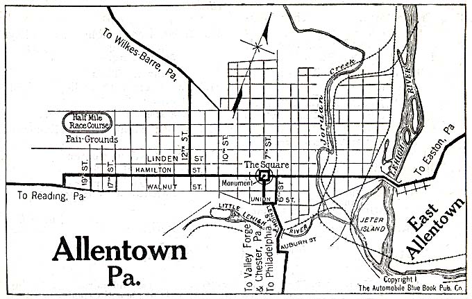
- Allentown 1920 Automobile Blue Book (117K)
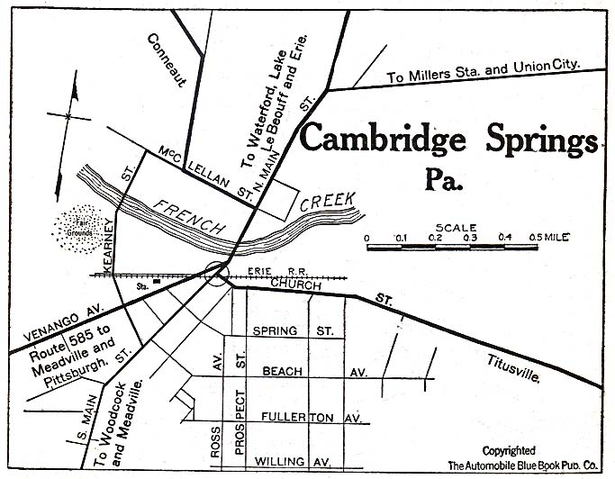
- Cambridge Springs 1920 Automobile Blue Book (117K)
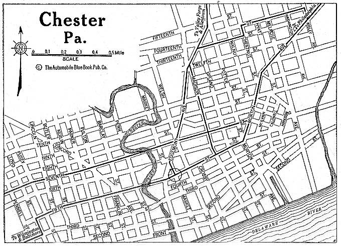
- Chester 1920 Automobile Blue Book (176K)
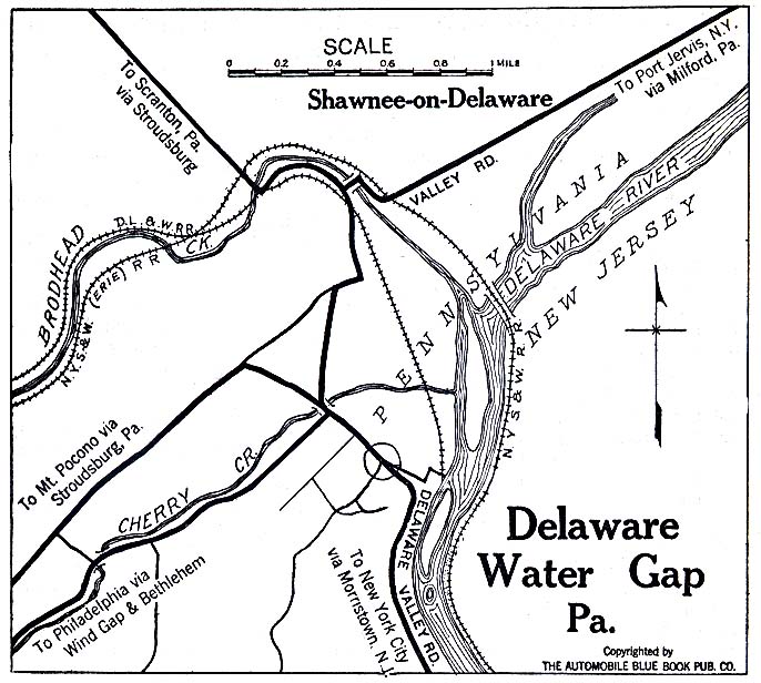
- Delaware Water Gap 1920 Automobile Blue Book (137K)
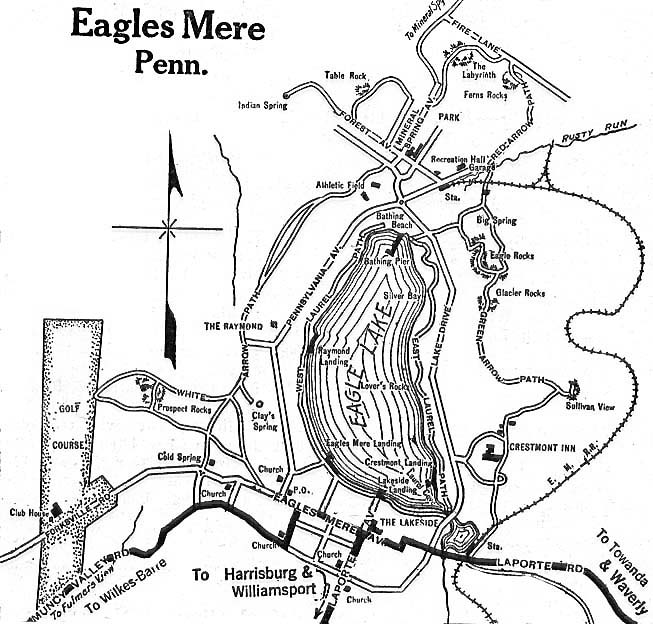
- Eagles Mere 1920 Automobile Blue Book (137K)
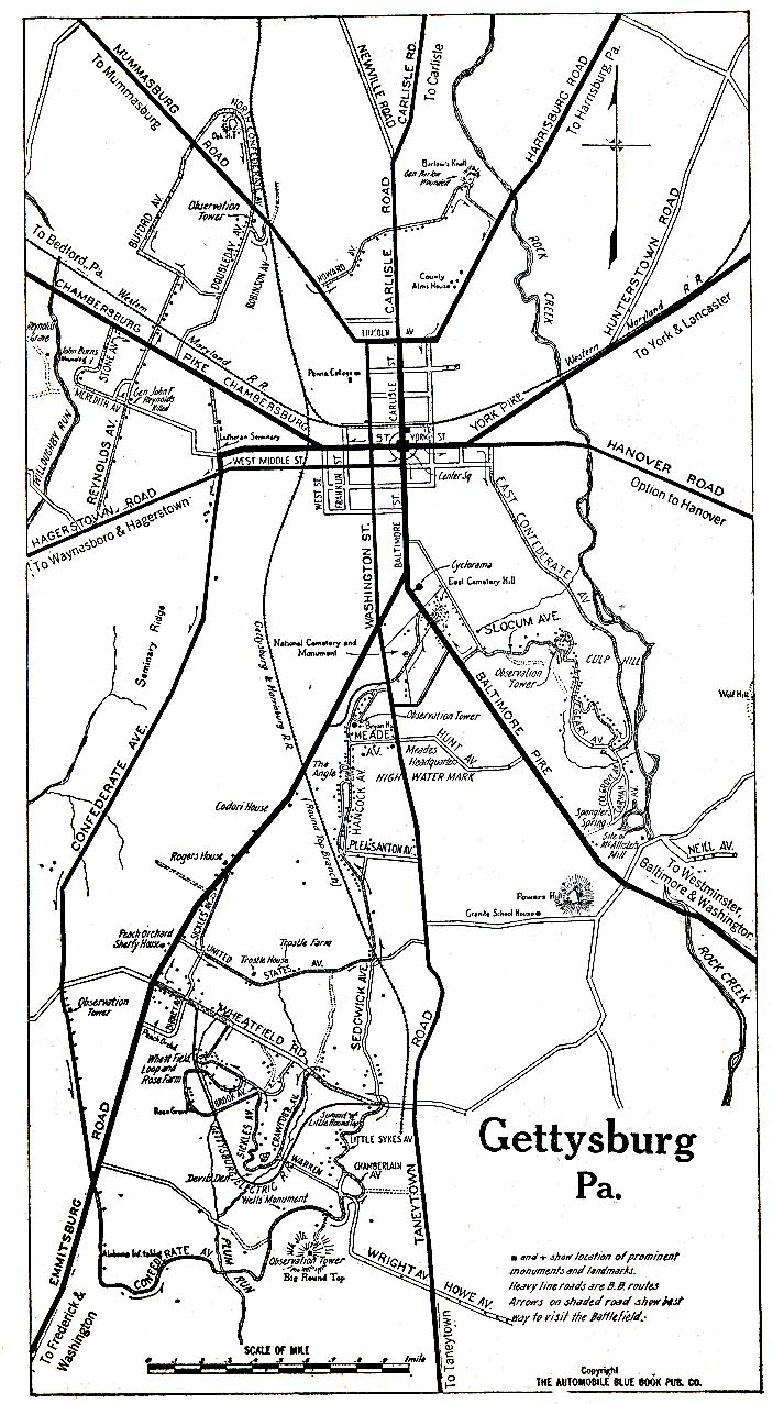
- Gettysburg 1920 Automobile Blue Book (273K)
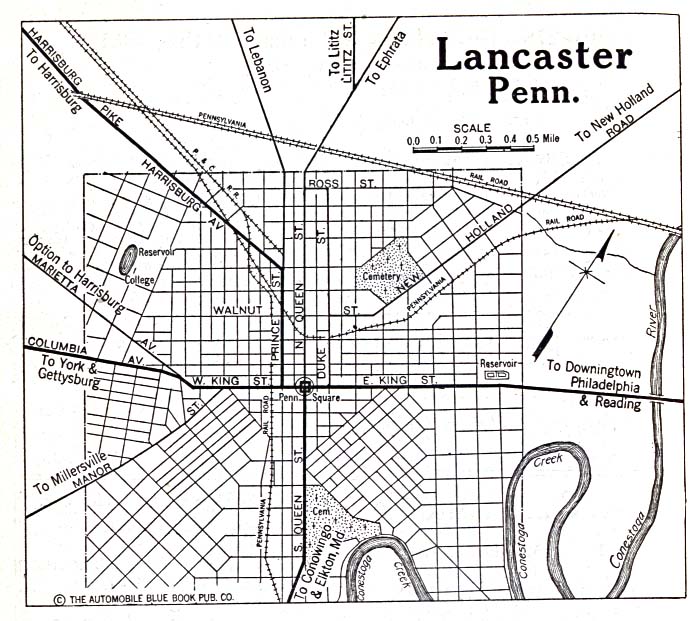
- Lancaster 1920 Automobile Blue Book (156K)
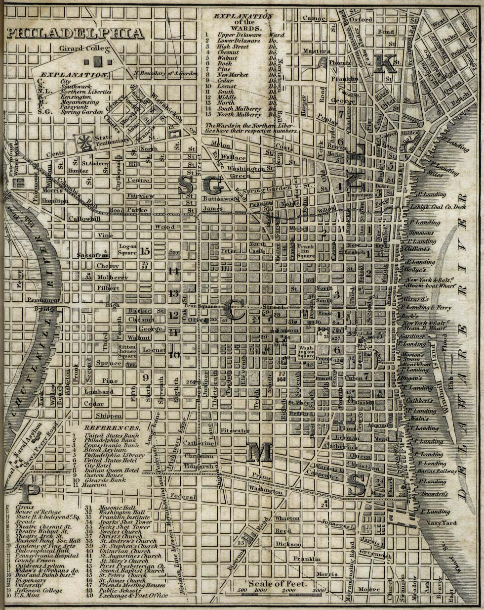
- Philadelphia 1842 "Philadelphia" from Tanner, H.S. The American Traveller; or Guide Through the United States. Eighth Edition. New York, 1842. (341K)
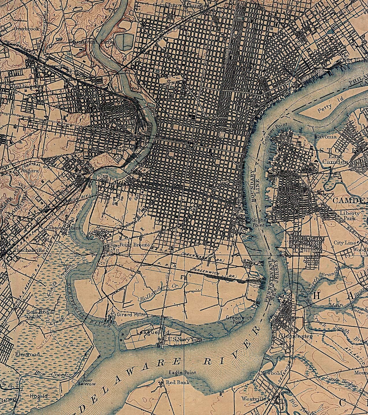
- Philadelphia 1898 U.S. Geological Survey (1,029K)
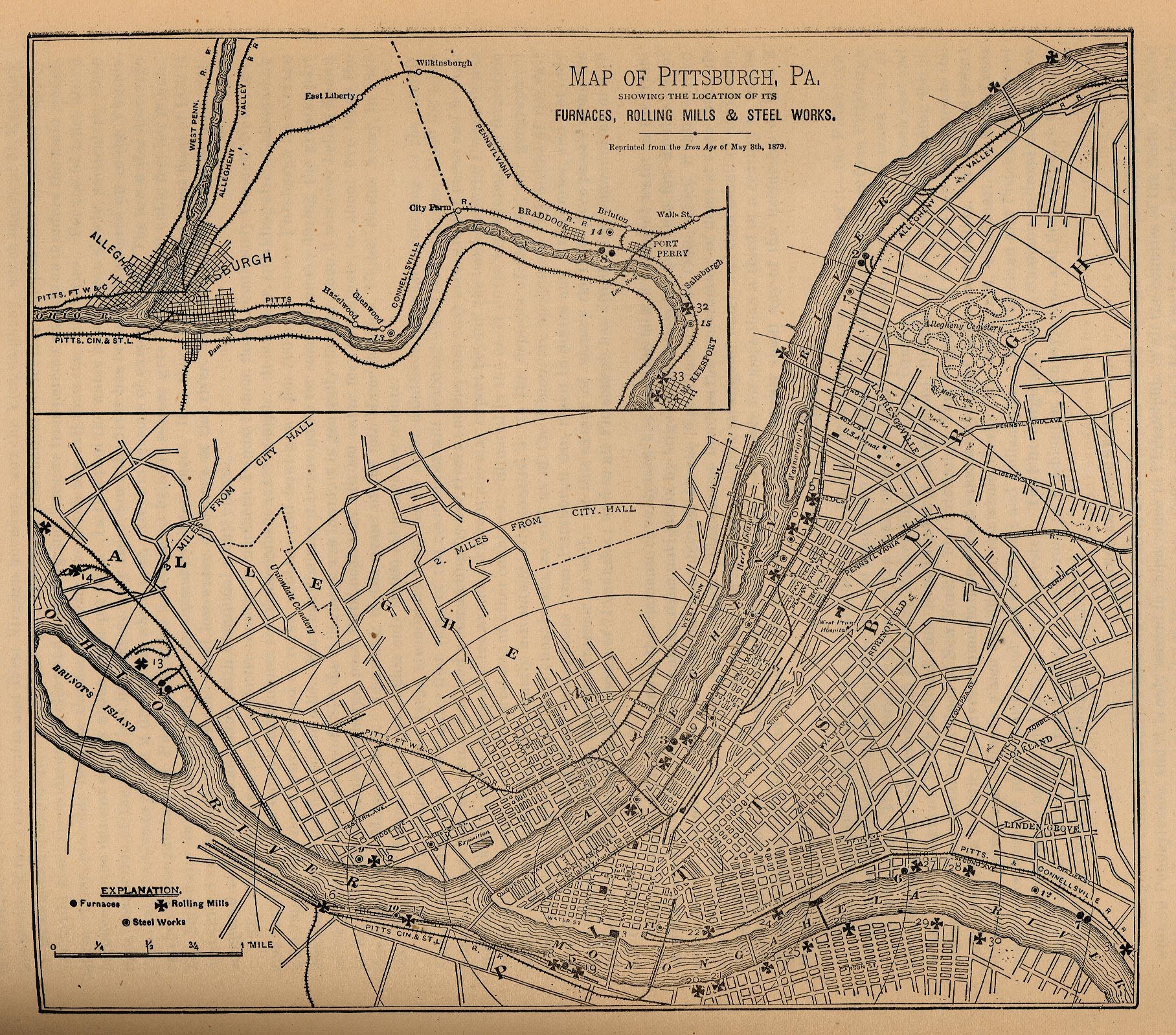
- Pittsburgh 1879 "Map of Pittsburgh, Pa. Showing the Location of its Furnaces, Rolling Mills and Steel Works. Reprinted from the Iron Age of May 8th, 1879." From Report on the Social Statistics of Cities, Compiled by George E. Waring, Jr., United States. Census Office, Part II, 1887. (433K)
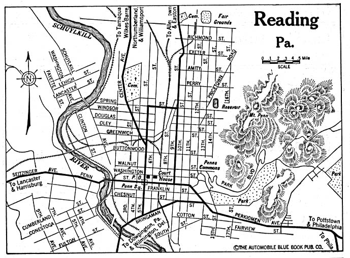
- Reading 1920 Automobile Blue Book (156K)
- Scranton 1920 Automobile Blue Book (176K)
- State College 1920 Automobile Blue Book 1920, Volume 3 (56K)
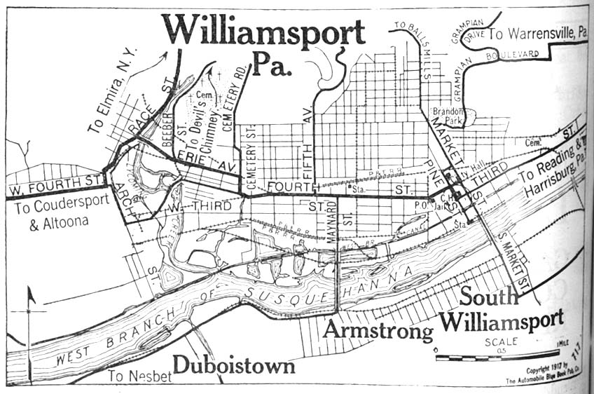
- Williamsport 1917 Automobile Blue Book 1917, Vol. 3 (140K)
Historical Maps
- Pennsylvania Historical Topographic Maps (U.S. Geological Survey)
- Pre-1945 historical maps, scale 1:62,500
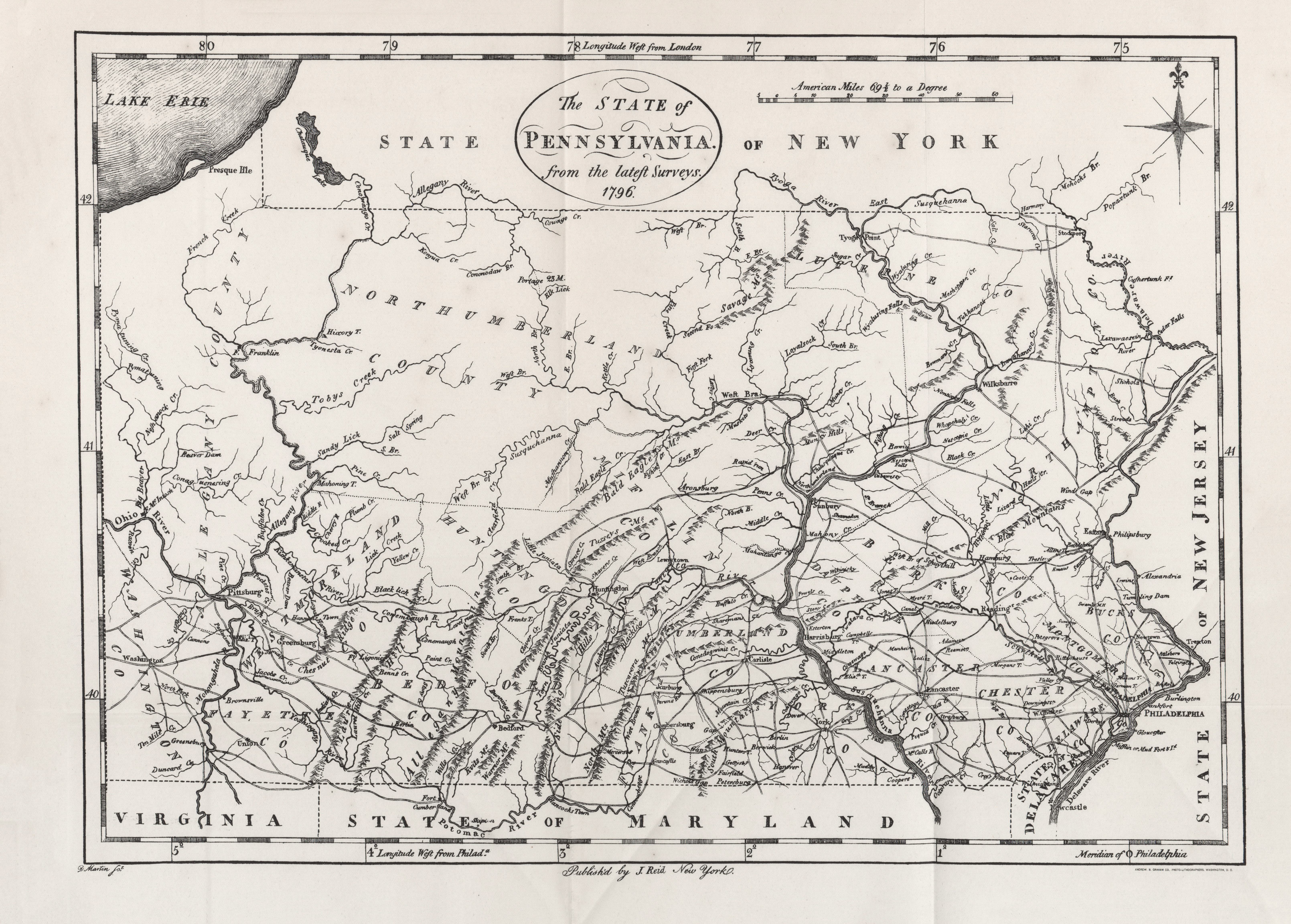
- Pennsylvania 1796 (5.7MB)
- "The State of Pennsylvania" from Heads of Families First Census of the United States - State of Pennsylvania, 1908.
- Pre-1945 historical maps, scale 1:62,500
Maps of National Parks, Monuments, and Historic Sites
The following maps were produced by the U.S. National Park Service unless otherwise noted.
- Allegheny Portage Railroad National Historic Site (Park Map) 1997 (65K) (PDF Format)
- Delaware Water Gap National Recreation Area [Pennsylvania / New Jersey] (Park Map) 1998 (516K) (PDF Format)
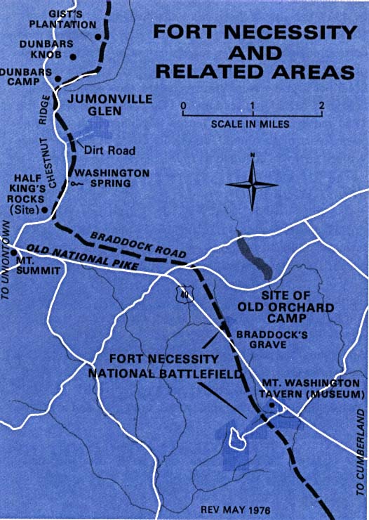
- Fort Necessity National Battlefield (Area Map) 1976 (85K)
- Fort Necessity National Battlefield (Park Map) 1976 (46K)
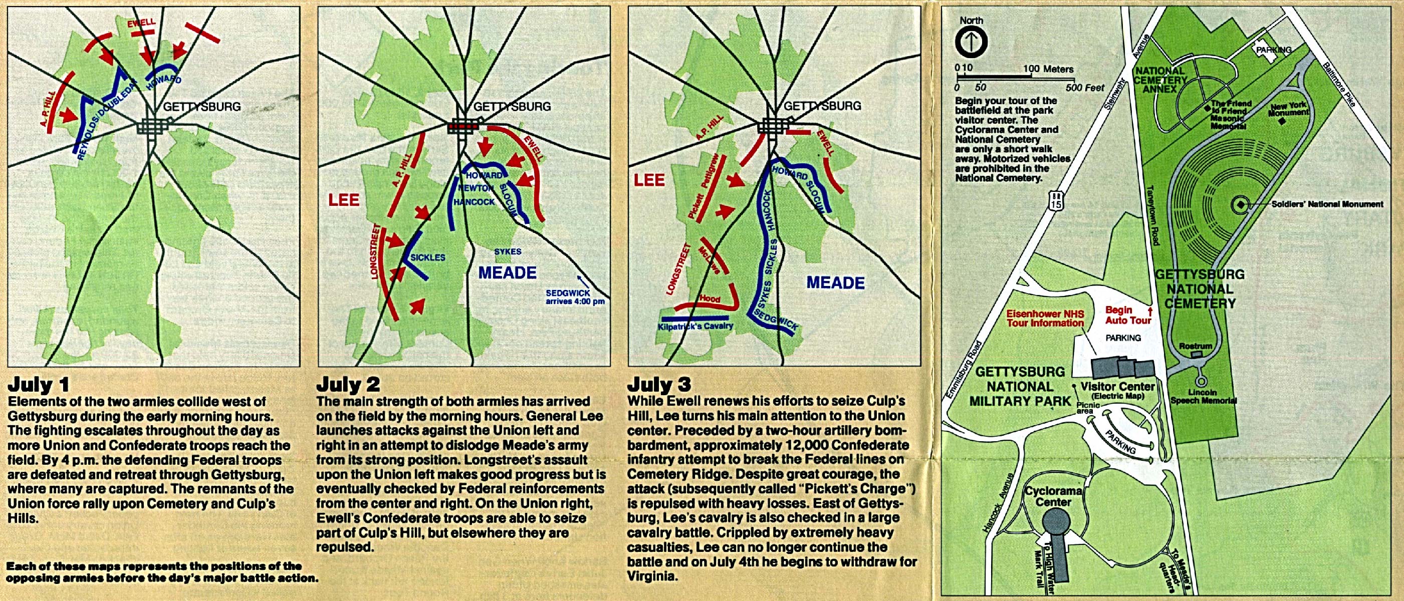
- Gettysburg National Military Park (Battle Maps with Park Map) 1995 (970K)
- Gettysburg National Military Park (Battle Map of July 1,1863) 1998 (65K) (PDF Format)
- Gettysburg National Military Park (Battle Map of July 2,1863) 1998 (65K) (PDF Format)
- Gettysburg National Military Park (Battle Map of July 3,1863) 1998 (65K) (PDF Format)
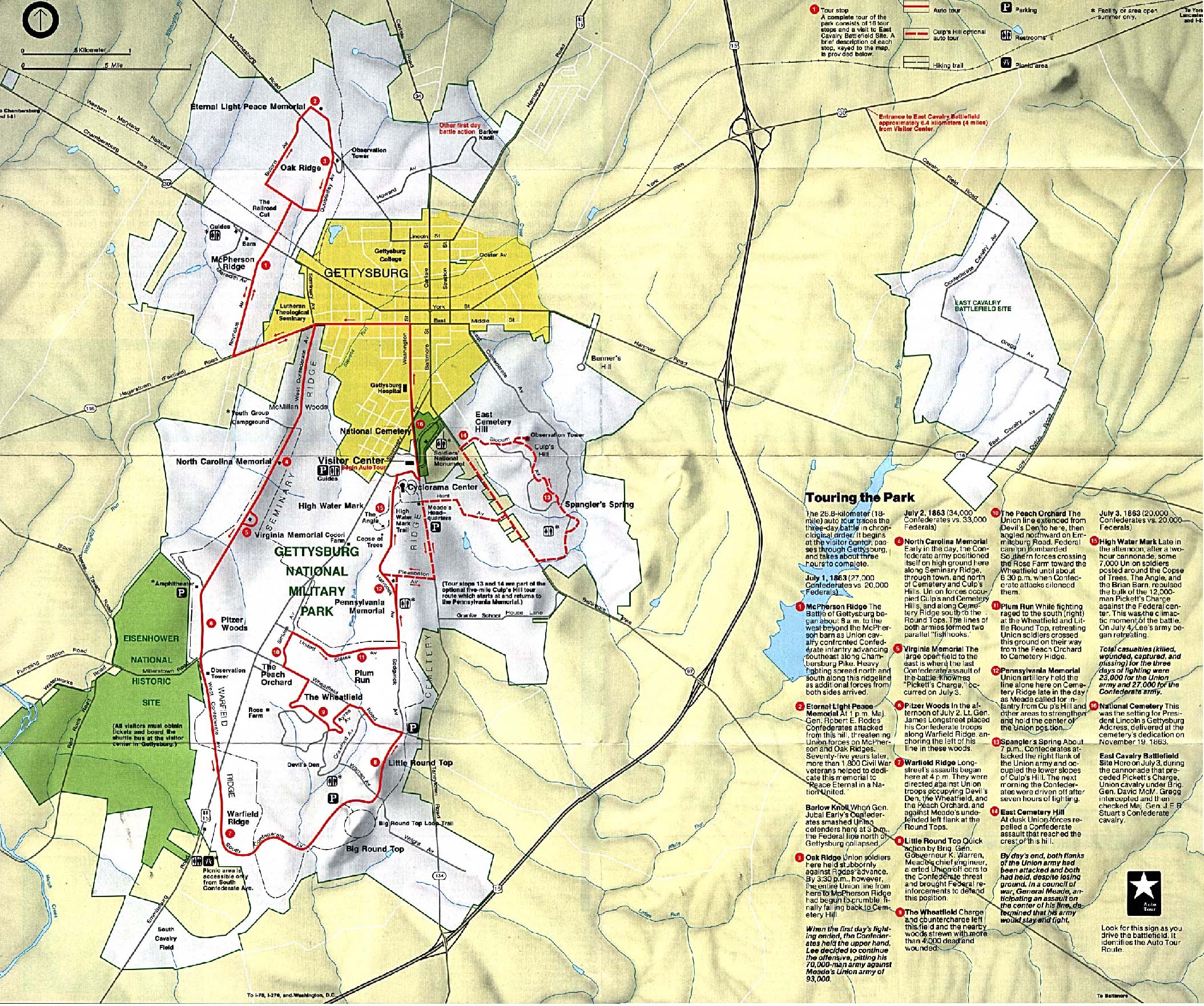
- Gettysburg National Military Park (Park Map) (148K)
- Gettysburg National Military Park (Park Map) 1998 (323K) (PDF Format)
- Gettysburg National Military Park (Park Map / Shaded Relief) 1995 (995K)
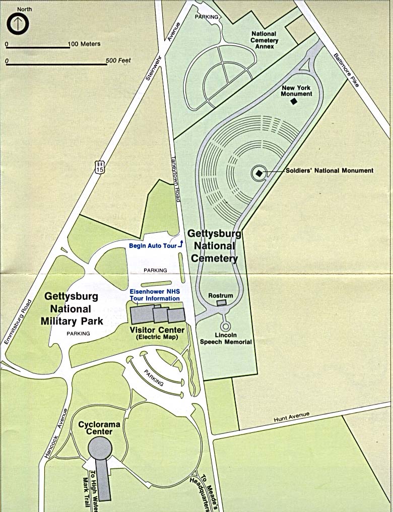
- Gettysburg National Military Park - Visitor Center and National Cemetery (Detail Map) (65K) (PDF Format)
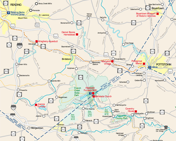
- Hopewell Furnace National Historic Site (Location Map) 2006 (249K)
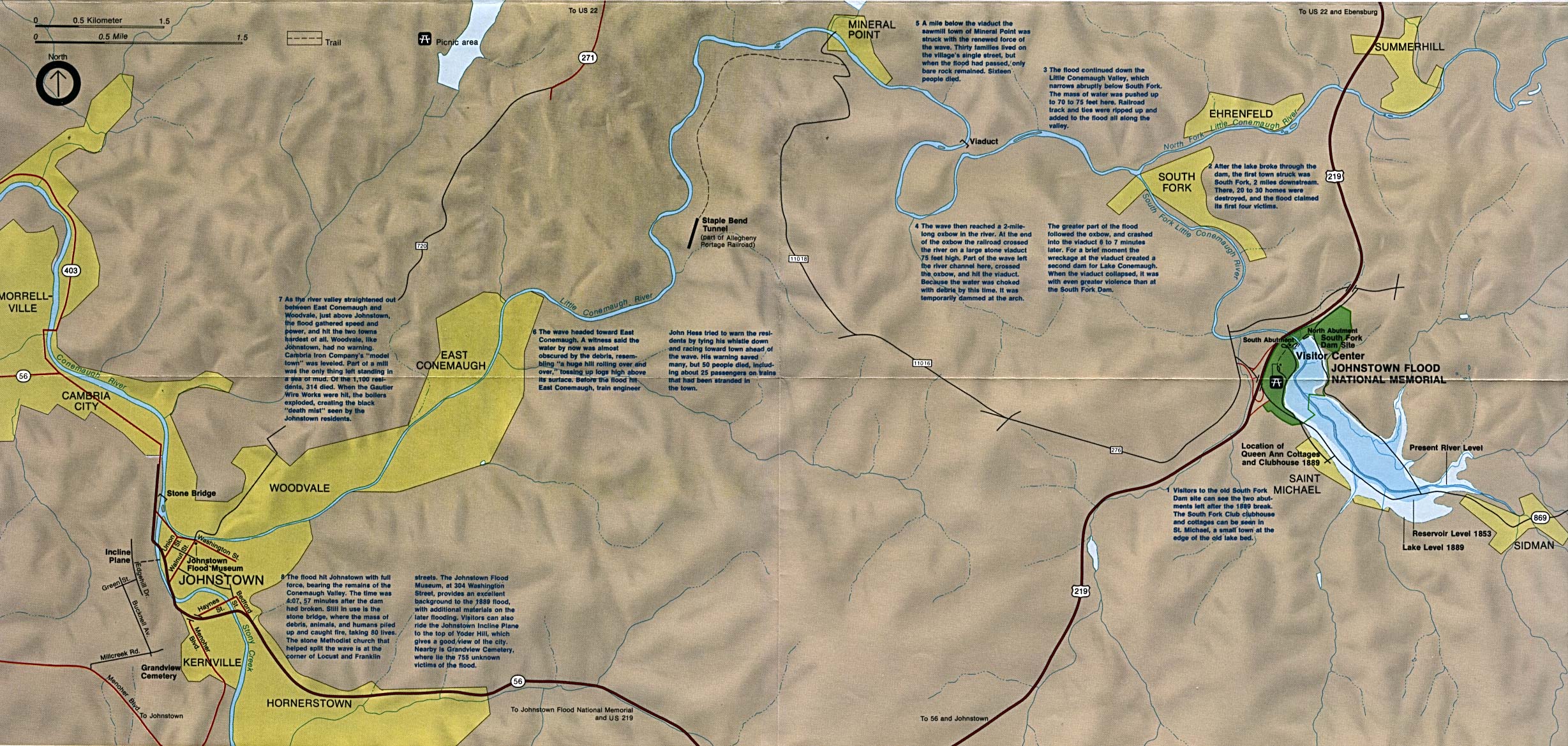
- Johnstown Flood National Memorial (Flood Path Map) (32K)
- Johnstown Flood National Memorial (Location Map) (586K)
- Upper Delaware Scenic & Recreation River [Pennsylvania / New York] (Area Map) 1998 (65K) (PDF Format)
- Upper Delaware Scenic & Recreation River [Pennsylvania / New York] (Park Map) 1998 (710K) (PDF Format)
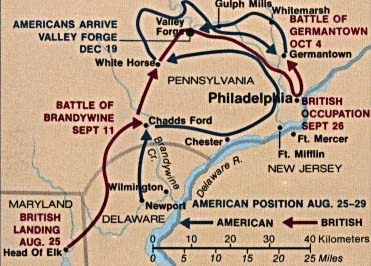
- Valley Forge National Historical Park (Battle Map) (31K)
- Valley Forge National Historical Park (Battle Map) 1997 (65K) (PDF Format)
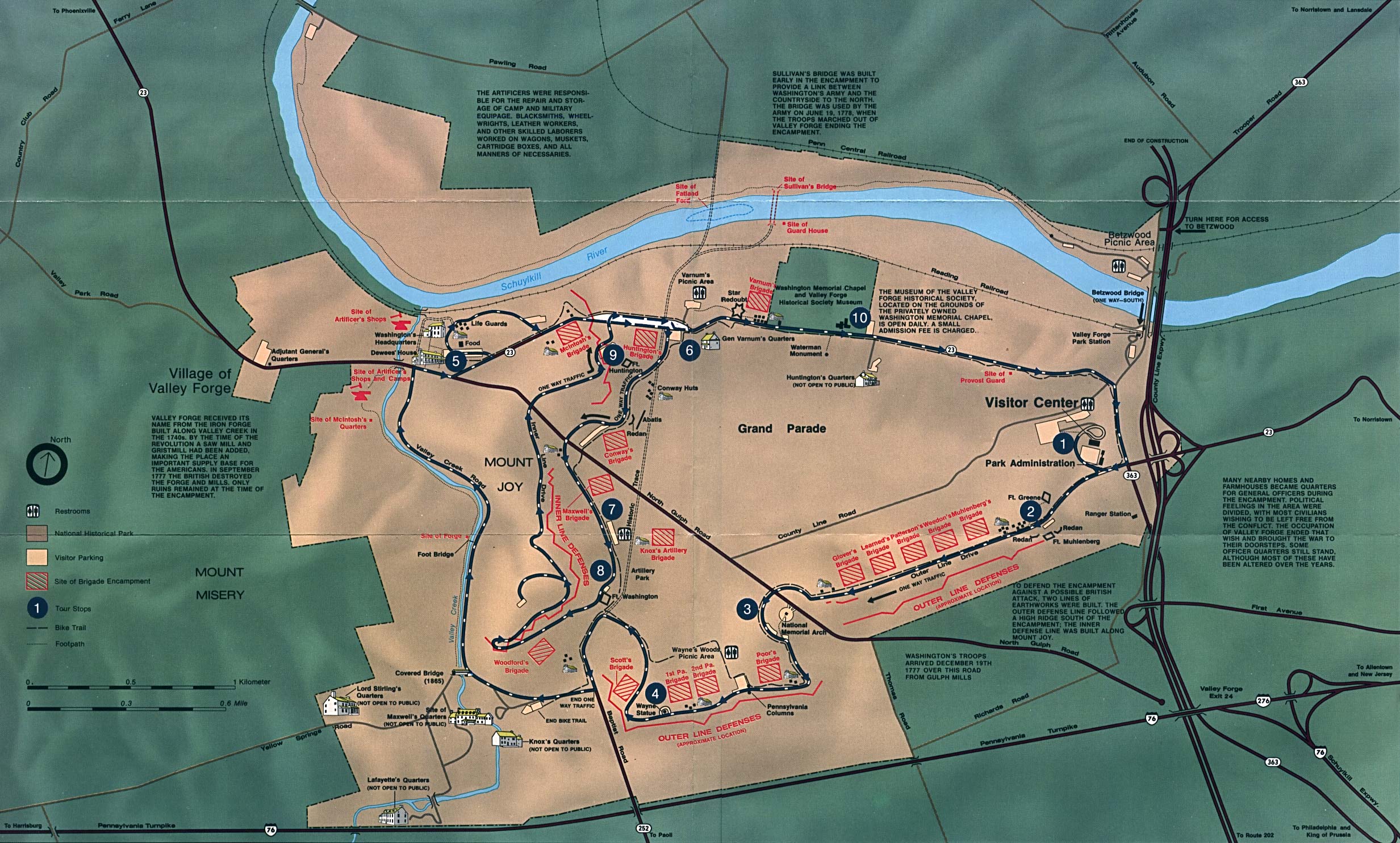
- Valley Forge National Historical Park (Park Map) (625K)
- Valley Forge National Historical Park (Park Map) 1997 (129K) (PDF Format)
Maps on Other Web Sites