Perry-Castañeda Library
Map Collection
North Carolina Maps
State Maps
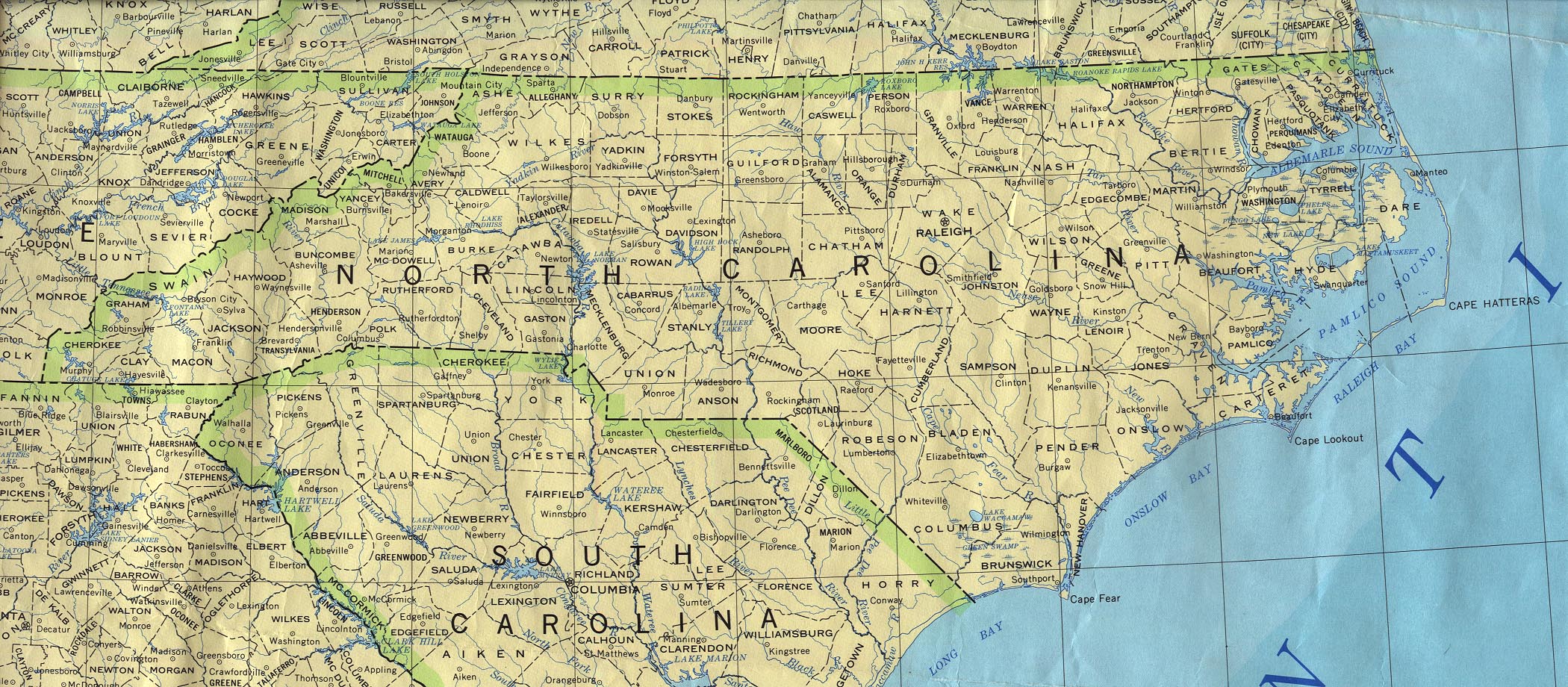
- North Carolina (base map) JPEG format (774K) County boundaries and names, county seats, rivers. Original scale 1:2,500,000 U.S. Geological Survey, 1972 limited update 1990
- North Carolina (outline map) JPEG format (92K) County boundaries and names. U.S. Bureau of the Census, 1990
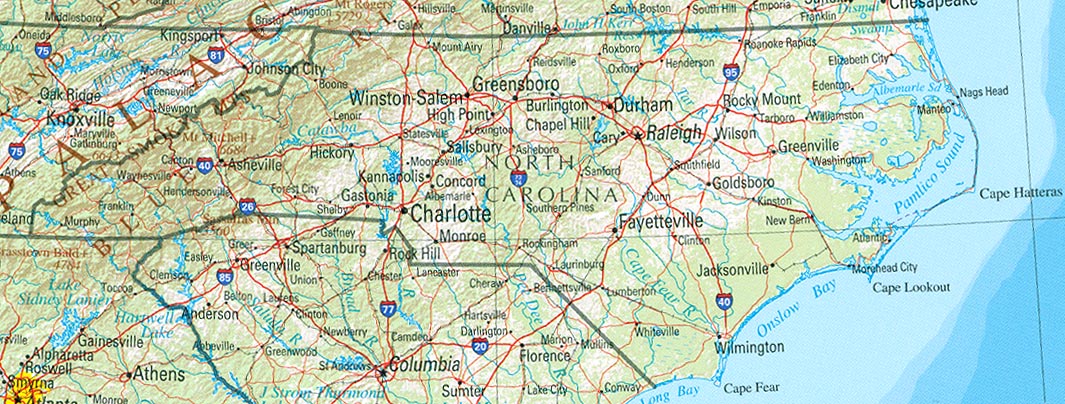
- North Carolina (reference map) JPEG format (220K) Shaded relief map with state boundaries, forest cover, place names, major highways. Portion of "The National Atlas of the United States of America. General Reference", compiled by U.S. Geological Survey 2001, printed 2002
- North Carolina (reference map) PDF format (223K) Shaded relief map with state boundaries, forest cover, place names, major highways. Portion of "The National Atlas of the United States of America. General Reference", compiled by U.S. Geological Survey 2001, printed 2002
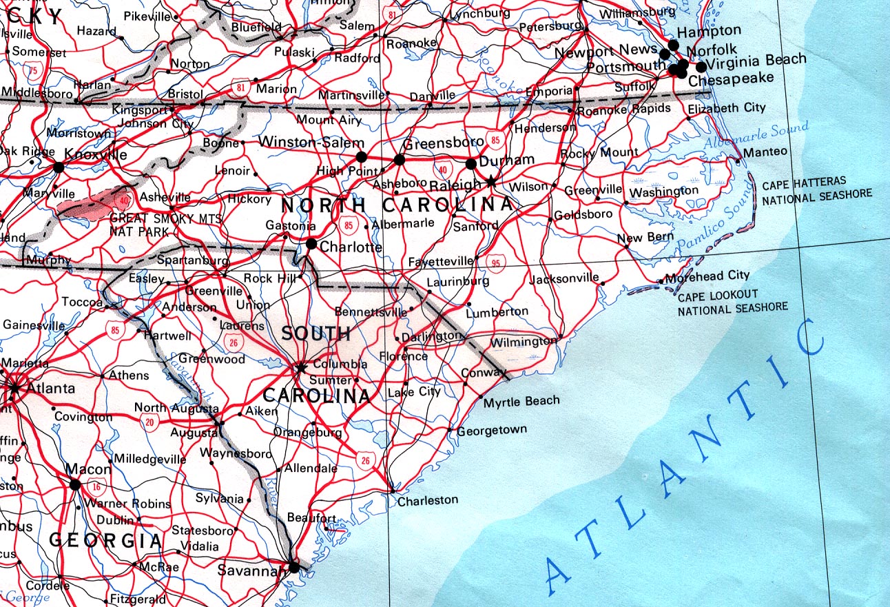
- North Carolina (road map) JPEG format (587K) original scale 1:6,000,000 U.S.Geological Survey, 1975
- North Carolina - Federal Lands and Indian Reservations PDF format (1MB) The National Atlas of the United States of America, U.S. Geological Survey, 2003
City Maps
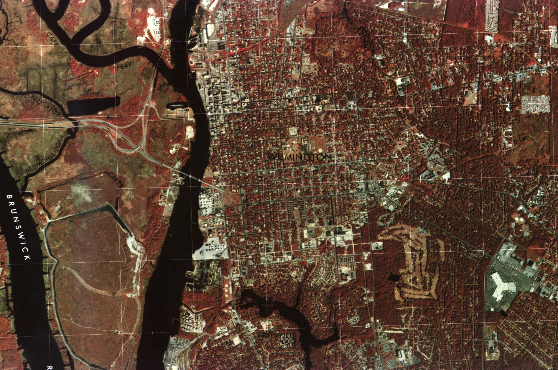
- Wilmington Color Orthophotoquad - original scale 1:24,000 U.S.G.S. 1980 (581K)
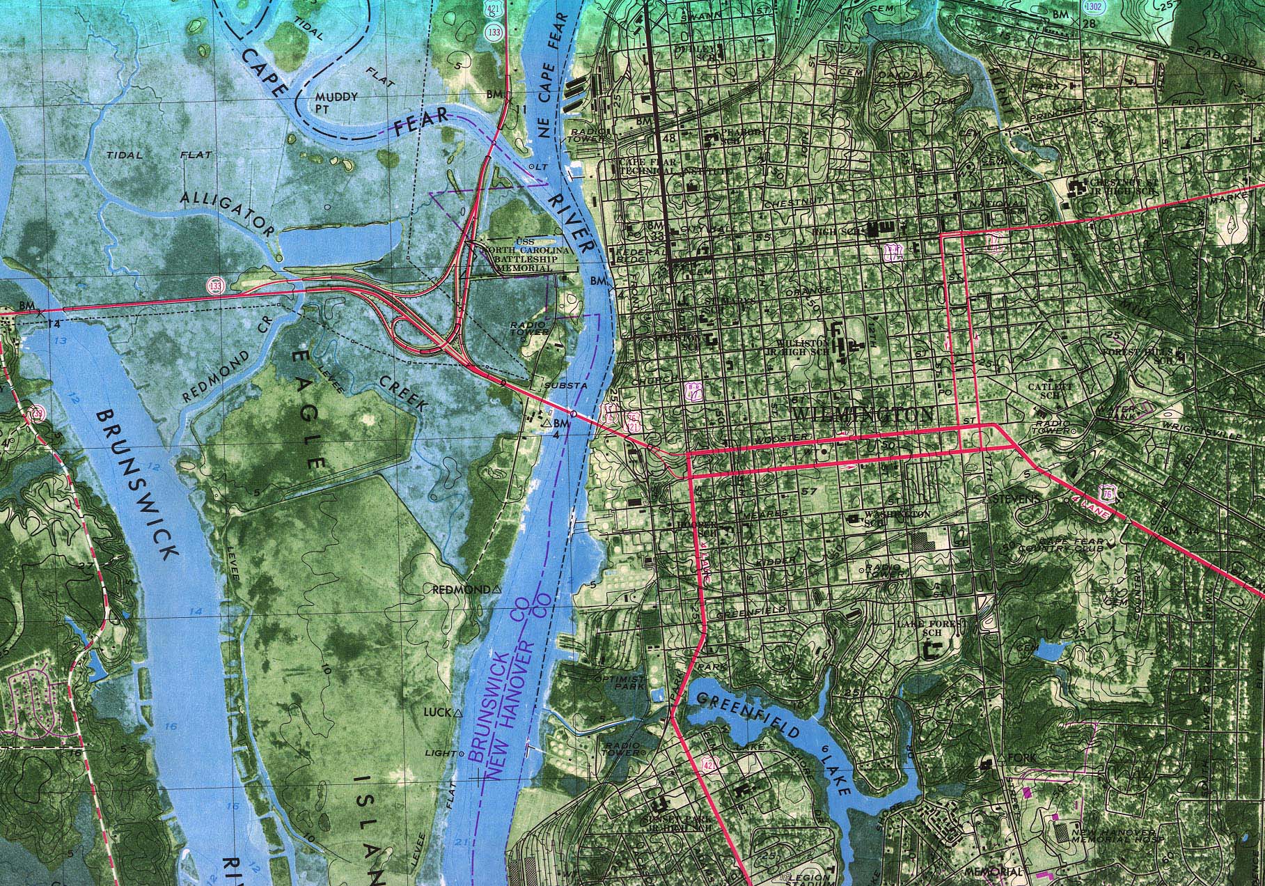
- Wilmington OrthophotoMap (Topographic) [includes major street names] - original scale 1:24,000 U.S.G.S. 1970, photorevised 1979 (839K)
Historical City Maps
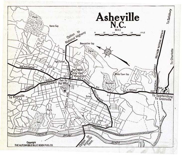
- Asheville 1919 Automobile Blue Book, Volume 6, 1919 (109K)
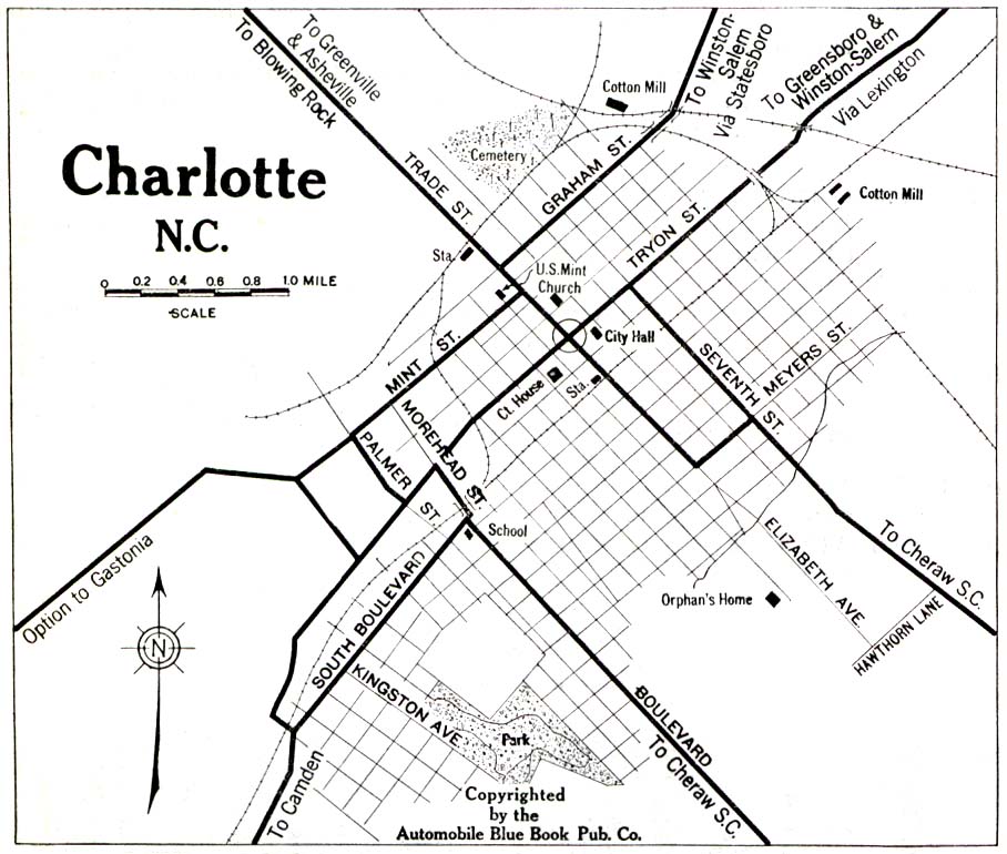
- Charlotte 1919 Automobile Blue Book (258K)
- Durham 1919 Automobile Blue Book (194K)
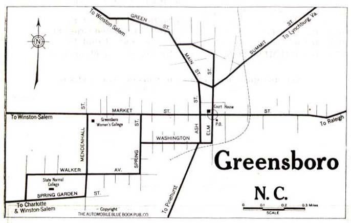
- Greensboro 1919 Automobile Blue Book, Volume 6, 1919 (44K)
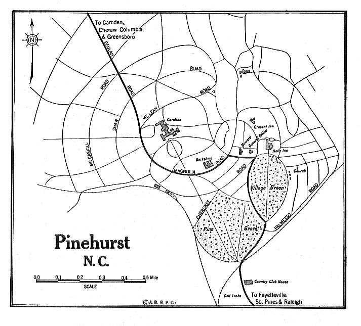
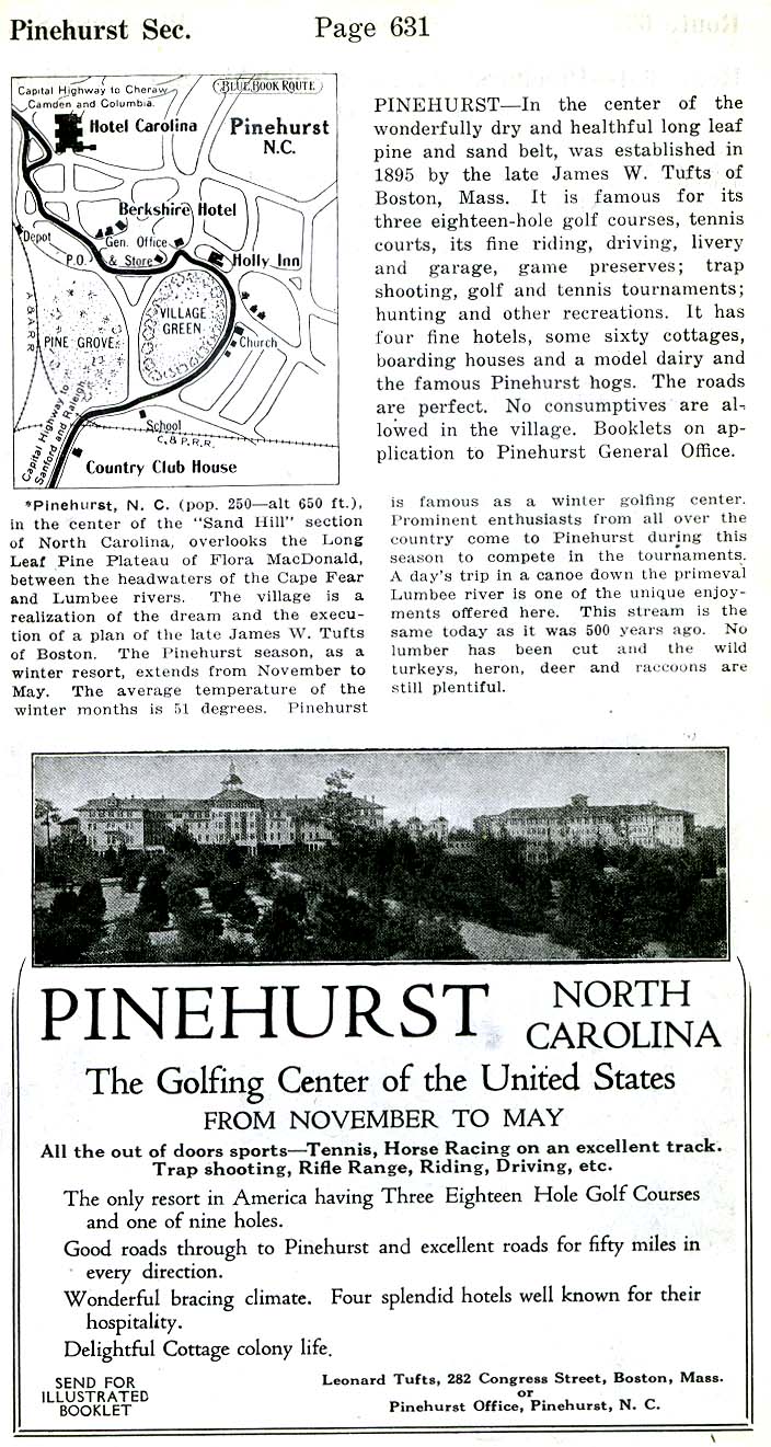
- Pinehurst 1920 Automobile Blue Book (117K)
- Pinehurst - Detail 1919 Automobile Blue Book 1919, Volume 6 (216K)
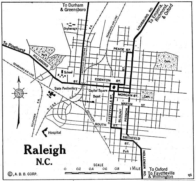
- Raleigh 1920 Automobile Blue Book (137K)
- Raleigh 1951 original scale 1:62,500 U.S. Geological Survey 1951 (839K)
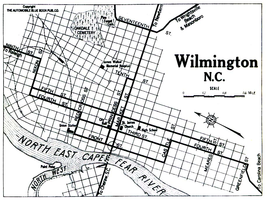
- Wilmington 1919 Automobile Blue Book (258K)
- Winston-Salem 1919 Automobile Blue Book (194K)
Historical Maps
- Blue Ridge Parkway 1963 (5.5 MB) U.S. National Park Service
- North Carolina Historical Topographic Maps (U.S. Geological Survey)
- Pre-1945 maps, scales 1:31,680, 1:62,500 and 1:125,000
- North Carolina 1796 (4.8MB)
- "The State of North Carolina" from Heads of Families First Census of the United States - State of North Carolina, 1908.
- Pre-1945 maps, scales 1:31,680, 1:62,500 and 1:125,000
Maps of National Parks, Monuments, and Historic Sites
The following maps were produced by the U.S. National Park Service unless otherwise noted.
- Blue Ridge Parkway [North Carolina / Virginia] (Park Map) 1998 (968K) (PDF Format)
- Blue Ridge Parkway - Northern Section [North Carolina / Virginia] (Park Map) 1995 (901K)
- Blue Ridge Parkway - Southern Section [North Carolina / Virginia] (Park Map) 1995 (764K)
- Cape Hatteras National Seashore (Area Map) 1993 (347K)
- Cape Hatteras National Seashore (Park Map) 1998 (1.8MB) (PDF Format)
- Carl Sandburg Home National Historic Site (Schematic Map) 1997 (323K) (PDF Format)
- Carl Sandburg Home National Historic Site (Schematic Tour Map) 1996 (194K)
- Guilford Courthouse National Military Park (Regional Map) (46K)
- Guilford Courthouse National Military Park (Park Map) (165K)
- Guilford Courthouse National Military Park (Park Map) (65K) (PDF Format)
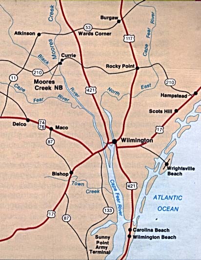
- Moores Creek National Battlefield (Area Map) (53K)
- Moores Creek National Battlefield (Area Map) 1997 (65K) (PDF Format)
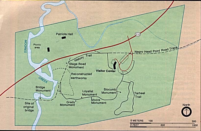
- Moores Creek National Battlefield (Park Map) (80K)
- Moores Creek National Battlefield (Park Map) 1997 (65K) (PDF Format)
- Wright Brothers National Memorial (Site Illustration) 1995 (351K)
![Blue Ridge Parkway - Northern Section [North Carolina / Virginia]](national_parks/blue_n95.jpg)
![Blue Ridge Parkway - Southern Section [North Carolina / Virginia]](national_parks/blue_s95.jpg)
Maps on Other Web Sites