Perry-Castañeda Library
Map Collection
New Hampshire Maps
State and Regional Maps
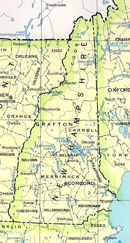
- New Hampshire (base map) JPEG format (179K) County boundaries and names, county seats, rivers. Original scale 1:2,500,000 U.S. Geological Survey, 1972 limited update 1990
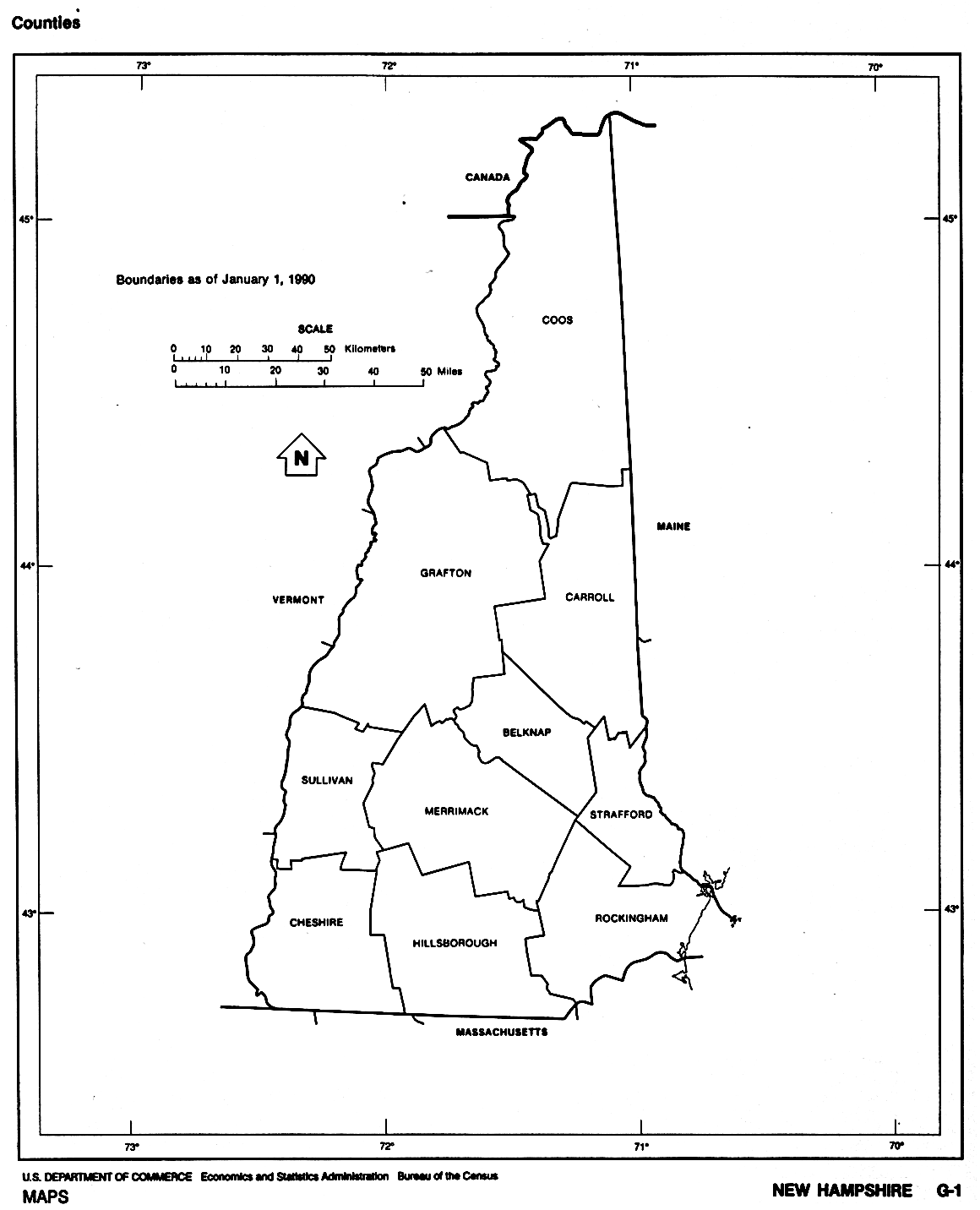
- New Hampshire (outline map) JPEG format (55K) County boundaries and names. U.S. Bureau of the Census, 1990
- New Hampshire - Federal Lands and Indian Reservations PDF format (414K) The National Atlas of the United States of America, U.S. Geological Survey, 2003
- New England (reference map) JPEG format (385K) Shaded relief map with state boundaries, forest cover, place names, major highways. Portion of "The National Atlas of the United States of America. General Reference", compiled by U.S. Geological Survey 2001, printed 2002
- New England (reference map) PDF format (388K) Shaded relief map with state boundaries, forest cover, place names, major highways. Portion of "The National Atlas of the United States of America. General Reference", compiled by U.S. Geological Survey 2001, printed 2002
City Maps
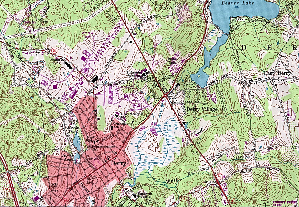
- Derry (topographic) original scale 1:24,000 U.S.G.S. 1968, Photorevised 1985 (595K)
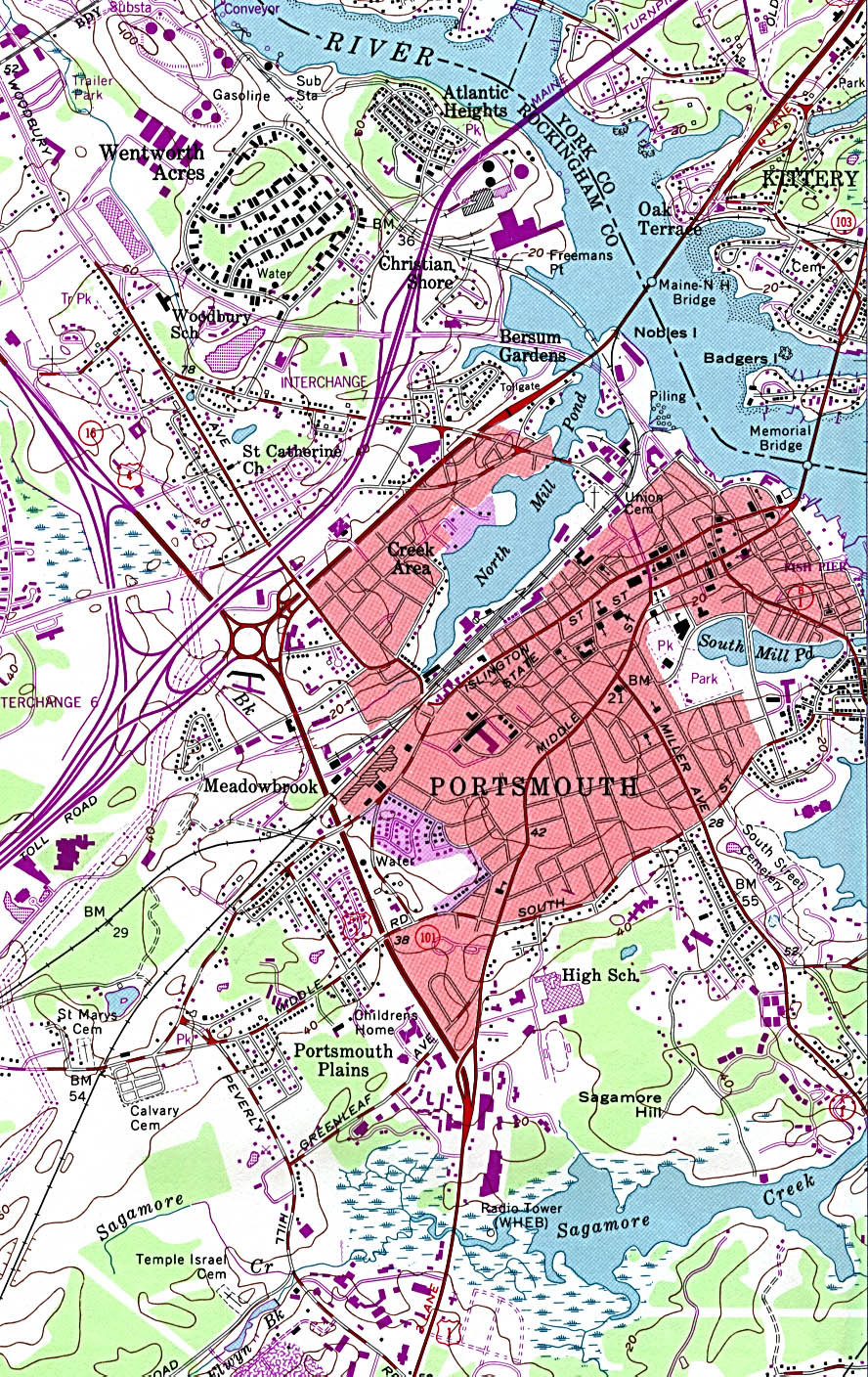
- Portsmouth (topographic) original scale 1:24,000 U.S.G.S. 1956, revised 1993 (587K)
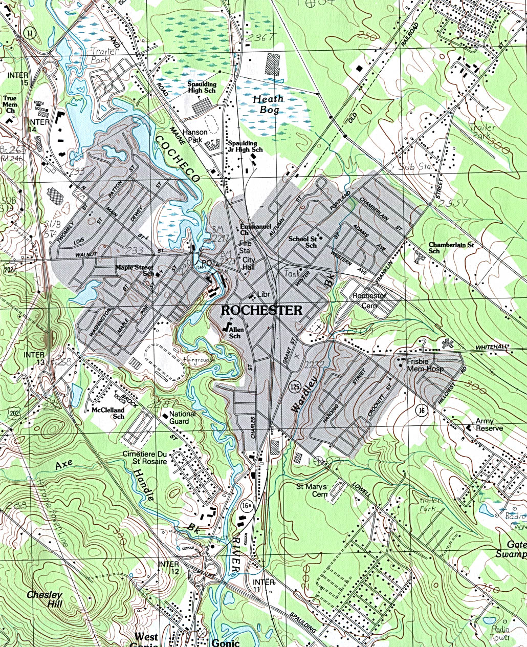
- Rochester (topographic) original scale 1:24,000 U.S.G.S. 1983 (612K)
Historical Maps
- New Hampshire Historical Topographic Maps (U.S. Geological Survey)
- Pre-1945 historical maps, scales 1:125,000 and 1:62,500
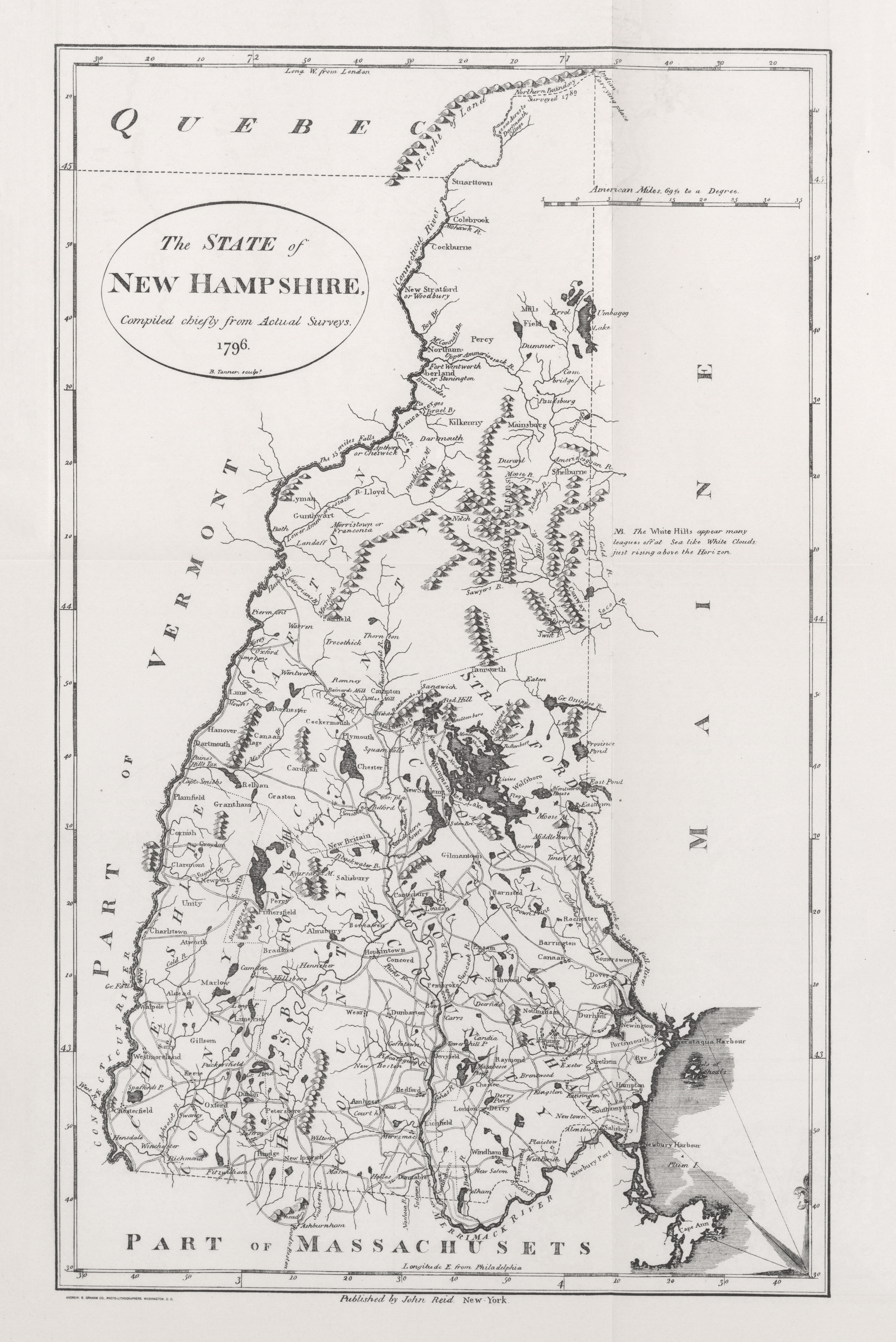
- New Hampshire 1796 (5.9MB)
- "The State of New Hampshire" from Heads of Families First Census of the United States - State of New Hampshire, 1908.
- Pre-1945 historical maps, scales 1:125,000 and 1:62,500
Maps of National Parks, Monuments, and Historic Sites
- Saint-Gaudens National Historic Site (Area Map) U.S. National Park Service 1996 (65K) (PDF Format)
Maps on Other Web Sites